LiDAR in Iowa!!!
LiDAR in Iowa!!!
LiDAR in Iowa!!!

Create successful ePaper yourself
Turn your PDF publications into a flip-book with our unique Google optimized e-Paper software.
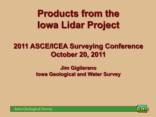
Products from the<br />
<strong>Iowa</strong> Lidar Project<br />
2011 ASCE/ICEA Survey<strong>in</strong>g Conference<br />
October 20, 2011<br />
Jim Giglierano<br />
<strong>Iowa</strong> Geological and Water Survey<br />
<strong>Iowa</strong> Geological Survey
This is your bra<strong>in</strong> on NED…..<br />
<strong>Iowa</strong> Geological Survey
This is your bra<strong>in</strong> on Lidar….!<br />
<strong>Iowa</strong> Geological Survey
<strong>LiDAR</strong> <strong>in</strong> <strong>Iowa</strong>!!!<br />
• USGS 2005 CSC-2 contract with Sanborn<br />
– Productized <strong>LiDAR</strong><br />
– FEMA and Standard Product Specs:<br />
• 1.4 m post<strong>in</strong>gs<br />
• 18.5 cm RMS @ 95% confidence<br />
• 37 cm RMS <strong>in</strong> vegetation<br />
• 1 m horizontal RMS @ 95% confidence<br />
• 95% of vegetation: FEMA product; (90% - Standard product)<br />
• 90% artifacts: FEMA; (89% - Standard)<br />
• 95% outliers: FEMA; (90% - Standard)<br />
• 98% of build<strong>in</strong>gs removed: FEMA Product; (95% - Standard)<br />
– Deliverables: ASCII x,y,z,i text files; LAS all return<br />
b<strong>in</strong>ary files<br />
<strong>Iowa</strong> Geological Survey
Fund<strong>in</strong>g <strong>LiDAR</strong> <strong>in</strong> <strong>Iowa</strong>?!?<br />
<strong>Iowa</strong> Dept. of Transportation - $1.5M<br />
<strong>Iowa</strong> Dept. of Agriculture and Land<br />
Stewardship - $.57M<br />
<strong>Iowa</strong> State Office of USDA NRCS - $1M<br />
<strong>Iowa</strong> Dept. of Natural Resources - $1.23M*<br />
Total $4.3 M<br />
*Used State Revolv<strong>in</strong>g Loan Fund for Water<br />
Quality to make payments over 20 years**<br />
**Actually paid off after 5 years<br />
Probably another $500,000 of <strong>in</strong>ternal funds<br />
spent on process<strong>in</strong>g<br />
<strong>Iowa</strong> Geological Survey
Standard Product<br />
FEMA Compliant Product<br />
<strong>Iowa</strong> Geological Survey
<strong>LiDAR</strong> Products for <strong>Iowa</strong><br />
• Product delivered as 2 x 2 km tiles<br />
(36,424 tiles <strong>in</strong> state!)<br />
• Each tile will have around 1.5 million<br />
data po<strong>in</strong>ts<br />
• Deliverable 1: ASCII text files with<br />
BARE EARTH x,y,z,i ~ 2 TB total<br />
• Deliverable 2: b<strong>in</strong>ary LAS format files<br />
with all data and returns (first, last, bare<br />
earth, <strong>in</strong>tensities, classifications) ~ 3 TB<br />
<strong>Iowa</strong> Geological Survey
<strong>LiDAR</strong> USERS <strong>in</strong> <strong>Iowa</strong><br />
• Most users want X,Y,Z data for CAD<br />
– IDOT and County eng<strong>in</strong>eers<br />
– NRCS and IDALS conservation technicians<br />
– IDNR land acquisition and eng<strong>in</strong>eer<strong>in</strong>g<br />
Put XYZ data on public server (2x2 km tiles)<br />
http://www.geotree.uni.edu/lidarProject.aspx<br />
• GIS users want various products: DEMs,<br />
contours, slopes, shaded relief, structures<br />
and vegetation<br />
<strong>Iowa</strong> Geological Survey
Autocad Users<br />
• Jim Krivachek (Fayette Co Eng<strong>in</strong>eer’s Office)<br />
ftp.igsb.uiowa.edu/lidar_ftp/Presentations/KrivacekLidar.pdf<br />
1. Acquire data from Geotree xyz ascii or LAS<br />
b<strong>in</strong>ary http://www.geotree.uni.edu/lidarProject.aspx<br />
2. Use free software to look at and extract bare<br />
earth from LAS files<br />
3. Use Corpscon to convert coord<strong>in</strong>ate system from<br />
UTM to state plane<br />
4. Import <strong>in</strong>to Autocad<br />
<strong>Iowa</strong> Geological Survey
GIS - 1 st Generation Derivatives<br />
• 200 2x2 km tiles per block<br />
• 1 meter bare earth DEM and hillshade<br />
• 1 meter first return DEM and hillshade<br />
• 1 meter last return DEM and hillshade<br />
• 1 meter <strong>in</strong>tensity image<br />
• All 7 grids = 15-20 Gigabytes per block<br />
• http://www.igsb.uiowa.edu/webapps/nrgislibx/<br />
<strong>Iowa</strong> Geological Survey
Bare Earth<br />
Bare Earth<br />
First Return<br />
Last Return<br />
Intensity<br />
<strong>Iowa</strong> Geological Survey
<strong>Iowa</strong> Geological Survey<br />
Bare Earth DEM
<strong>Iowa</strong> Geological Survey<br />
Bare Earth Hill Shade
<strong>Iowa</strong> Geological Survey<br />
First Return Hill Shade
<strong>Iowa</strong> Geological Survey<br />
Intensity of all returns
Statewide Estimate: Derived<br />
GIS products ~ 20 TB<br />
<strong>Iowa</strong> Geological Survey
Here’s the orig<strong>in</strong>al TIN and po<strong>in</strong>t density<br />
and a profile across a small creek<br />
<strong>Iowa</strong> Geological Survey
Here’s the 1 meter grid derived<br />
from the orig<strong>in</strong>al TIN<br />
<strong>Iowa</strong> Geological Survey
Now a 3 meter grid from the<br />
orig<strong>in</strong>al TIN<br />
<strong>Iowa</strong> Geological Survey
10 meter grid – notice the poor<br />
profile<br />
<strong>Iowa</strong> Geological Survey
Compare that to the 30 NED from<br />
USGS<br />
<strong>Iowa</strong> Geological Survey
Contours derived from 1m (red)<br />
and 3m (green) DEMs<br />
<strong>Iowa</strong> Geological Survey
2 nd Generation Derivatives<br />
• 3 meter DEM (mean of 3x3 1m grid cells) –<br />
height <strong>in</strong> cm – each cell stored as 16 bit<br />
<strong>in</strong>teger<br />
• 1 meter hillshade – <strong>in</strong> JPEG2000 format<br />
• 2’ contours – derived from 3 m DEM<br />
• Typical county – 436 MB + 301 MB + 403MB<br />
= 1.14 GB<br />
• It took us most of two years to figure this out<br />
• Also available with SDE and web services<br />
<strong>Iowa</strong> Geological Survey
Lidar Elevation – 3 m DEM<br />
<strong>Iowa</strong> Geological Survey
<strong>Iowa</strong> Geological Survey<br />
Lidar 1 m Hill Shade
<strong>Iowa</strong> Geological Survey<br />
Lidar 2 ft. Contours
Lidar 2ft. Contours on DEM<br />
<strong>Iowa</strong> Geological Survey
Lidar 2 ft. Contours on NAIP Airphoto<br />
<strong>Iowa</strong> Geological Survey
2’ contours over 1m hill shade<br />
<strong>Iowa</strong> Geological Survey
<strong>Iowa</strong> Geological Survey<br />
Lidar Accuracy
Where to get lidar GIS<br />
derivatives for counties <strong>in</strong> <strong>Iowa</strong><br />
• ftp.igsb.uiowa.edu/GIS_Library/Counties/countyname<br />
• http://www.igsb.uiowa.edu/webapps/nrgislibx/<br />
• DEM_3m_I_xx.img (get all plus zip) where xx is the county number<br />
• Contours_2ft_xx.shp (just get zip)<br />
• Hillshade_1M_xx.jp2 (get all plus zip)<br />
• These are all <strong>in</strong> UTM NAD83 meters<br />
<strong>Iowa</strong> Geological Survey
Some Applications of <strong>Iowa</strong>’s<br />
Lidar Data<br />
• IDNR Approximate Floodpla<strong>in</strong> Mapp<strong>in</strong>g<br />
- $15M over 5-7 years to complete<br />
statewide coverage<br />
• IDOT Bridge Design and Flood<br />
Model<strong>in</strong>g<br />
• IDNR Watershed Assessments –<br />
RUSLE2 models<br />
• IDNR S<strong>in</strong>khole mapp<strong>in</strong>g<br />
• OSA – Locat<strong>in</strong>g archaeological sites<br />
<strong>Iowa</strong> Geological Survey
Approximate Floodpla<strong>in</strong> Mapp<strong>in</strong>g Priorities<br />
4<br />
3<br />
1 2<br />
3<br />
4<br />
<strong>Iowa</strong> Geological Survey
IDOT <strong>LiDAR</strong> Examples –<br />
Bridge Design/Flood Model<br />
• Who – David Claman<br />
• What – Elevation and flow distribution<br />
2008 flood<br />
• Where - US 65 bypass<br />
• How<br />
– FESWMS (F<strong>in</strong>ite Element Surface Water<br />
Model<strong>in</strong>g System)<br />
• Why – Compare predicted to actual<br />
flood data<br />
<strong>Iowa</strong> Geological Survey
<strong>LiDAR</strong> Example – Flood Model<br />
<strong>Iowa</strong> Geological Survey
<strong>Iowa</strong> Geological Survey
S<strong>in</strong>khole Mapp<strong>in</strong>g - NED 10 meter<br />
Depression features from soil survey data <strong>in</strong> yellow<br />
<strong>Iowa</strong> Geological Survey
S<strong>in</strong>khole Mapp<strong>in</strong>g with Lidar –<br />
now that’s better<br />
<strong>Iowa</strong> Geological Survey
Mormon Trail remnants – Union County, <strong>Iowa</strong><br />
<strong>Iowa</strong> Geological Survey
<strong>LiDAR</strong> and Lodges<br />
Office of State Archaeologist<br />
Shaded Relief <strong>LiDAR</strong> Image of<br />
Newly Discovered Earthlodges near Glenwood<br />
<strong>Iowa</strong> Geological Survey<br />
Lodge depression
Flood Pla<strong>in</strong> Mapp<strong>in</strong>g <strong>in</strong> <strong>Iowa</strong><br />
<strong>Iowa</strong> Geological Survey
Response to 2008 Floods<br />
– <strong>Iowa</strong> Department of Economic<br />
Development disburses $15 million <strong>in</strong><br />
CDBG disaster recovery funds for the<br />
purpose of develop<strong>in</strong>g new floodpla<strong>in</strong><br />
maps and updat<strong>in</strong>g and improv<strong>in</strong>g exist<strong>in</strong>g<br />
floodpla<strong>in</strong> maps <strong>in</strong> the 85 Presidentially-<br />
Declared Disaster counties due to the<br />
Flood of 2008. ($150k / County)<br />
<strong>Iowa</strong> Geological Survey
Where can the money be spent?<br />
• $15M HUD CDBG grant<br />
• Adm<strong>in</strong>istered by <strong>Iowa</strong> DED<br />
and DNR<br />
• Supports floodpla<strong>in</strong> mapp<strong>in</strong>g<br />
<strong>in</strong> the 85 counties declared<br />
federal disaster areas<br />
• “…to produce floodpla<strong>in</strong><br />
maps that meet FEMA<br />
technical standards and can<br />
be published as Digital Flood<br />
Insurance Rate Maps<br />
(DFIRMs).”<br />
<strong>Iowa</strong> Geological Survey
Mapp<strong>in</strong>g Sequenc<strong>in</strong>g by calendar year<br />
2014<br />
2013<br />
2013<br />
2012<br />
2011<br />
2014<br />
<strong>Iowa</strong> Geological Survey
• Calculate annual recurrence<br />
stream discharges<br />
• Calculations are based upon DNR<br />
statewide <strong>LiDAR</strong> dataset<br />
• <strong>LiDAR</strong> data are used to create a 3-<br />
meter-resolution digital elevation<br />
model (DEM)<br />
• DEM is processed to determ<strong>in</strong>e<br />
flow direction and accumulation on<br />
the land surface<br />
• Discharge Calculations<br />
– 2-, 5-, 10-, 25-, 50-, 100-, 200-,<br />
and 500-year flows<br />
– Based upon stream gage<br />
statistical analyses & s<strong>in</strong>gleparameter<br />
USGS regional<br />
regression equations<br />
Hydrologic Analysis<br />
<strong>Iowa</strong> Geological Survey
Hydraulic Analysis<br />
• Calculate water surface<br />
elevations for flows determ<strong>in</strong>ed<br />
from hydrologic analysis<br />
• Based upon capacity of the<br />
channel and floodpla<strong>in</strong> to convey<br />
flood waters<br />
• HEC-RAS Hydraulic model<br />
– Developed us<strong>in</strong>g HEC-GeoRAS<br />
tools <strong>in</strong> ArcGIS software<br />
– 1-meter resolution DEM is used<br />
to more accurately depict<br />
channel and floodpla<strong>in</strong> features<br />
measured by <strong>LiDAR</strong><br />
<strong>Iowa</strong> Geological Survey
Floodpla<strong>in</strong> Mapp<strong>in</strong>g<br />
• Hydraulic model results are<br />
<strong>in</strong>tersected with the 1-meter<br />
DEM to calculate flood<br />
depths and <strong>in</strong>undation<br />
extents<br />
• Work maps are created <strong>in</strong><br />
ArcGIS for submission to<br />
FEMA<br />
<strong>Iowa</strong> Geological Survey
Where to get Lidar for <strong>Iowa</strong><br />
• For derivative GIS data<br />
• ftp.igsb.uiowa.edu/GIS_Library/Counties/countyname<br />
• http://www.igsb.uiowa.edu/webapps/nrgislibx/<br />
• For raw po<strong>in</strong>t data<br />
• http://www.geotree.uni.edu/lidarProject.aspx<br />
<strong>Iowa</strong> Geological Survey
Questions?<br />
Answers…..<br />
Jim Giglierano<br />
(319)335-1594 james.giglierano@dnr.iowa.gov<br />
<strong>Iowa</strong> Geological Survey