Admiralty Notices to Mariners - United Kingdom Hydrographic Office
Admiralty Notices to Mariners - United Kingdom Hydrographic Office
Admiralty Notices to Mariners - United Kingdom Hydrographic Office
You also want an ePaper? Increase the reach of your titles
YUMPU automatically turns print PDFs into web optimized ePapers that Google loves.
II<br />
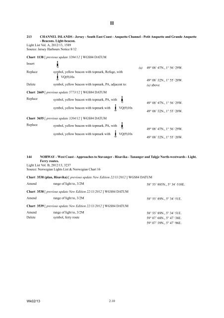
213 CHANNEL ISLANDS - Jersey - South East Coast - Anquette Channel - Petit Anquette and Grande Anquette<br />
- Beacons. Light-beacon.<br />
Light List Vol. A, 2012/13, 1589<br />
Source: Jersey Harbours Notice 8/12<br />
Chart 1138 [ previous update 3204/12 ] WGS84 DATUM<br />
Insert<br />
K=x<br />
(a) 49° 08´·47N., 1° 56´·29W.<br />
Replace symbol, yellow beacon with <strong>to</strong>pmark, Refuge, with<br />
T?z VQ(9)10s<br />
49° 08´·32N., 1° 55´·20W.<br />
Delete symbol, yellow beacon with <strong>to</strong>pmark, PA, adjacent <strong>to</strong>: (a) above<br />
Chart 2669 [ previous update 5773/12 ] WGS84 DATUM<br />
Replace symbol, yellow beacon with <strong>to</strong>pmark, PA, with K=x<br />
49° 08´·47N., 1° 56´·29W.<br />
symbol, yellow beacon with <strong>to</strong>pmark with T?z<br />
VQ(9)10s<br />
49° 08´·32N., 1° 55´·20W.<br />
Chart 3655 [ previous update 3204/12 ] WGS84 DATUM<br />
Replace symbol, yellow beacon with <strong>to</strong>pmark, PA, with K=x<br />
49° 08´·47N., 1° 56´·29W.<br />
symbol, yellow beacon with <strong>to</strong>pmark with T?z<br />
VQ(9)10s<br />
49° 08´·32N., 1° 55´·20W.<br />
144 NORWAY - West Coast - Approaches <strong>to</strong> Stavanger - Risavika - Tananger and Talgje North-westwards - Light.<br />
Ferry routes.<br />
Light List Vol. B, 2012/13, 3237<br />
Source: Norwegian Lights List & Norwegian Chart 16<br />
Chart 3538 (plan, Risavika) [ previous update New Edition 22/11/2012 ] WGS84 DATUM<br />
Amend range of light <strong>to</strong>, 3/2M 58° 55´·885N., 5° 34´·510E.<br />
Chart 3538 [ previous update New Edition 22/11/2012 ] WGS84 DATUM<br />
Amend range of light <strong>to</strong>, 3/2M 58° 55´·89N., 5° 34´·51E.<br />
Chart 3539 [ previous update New Edition 22/11/2012 ] WGS84 DATUM<br />
Amend range of light <strong>to</strong>, 3/2M 58° 55´·89N., 5° 34´·51E.<br />
Delete symbol, ferry route 59° 07´·68N., 5° 47´·38E.<br />
59° 07´·39N., 5° 47´·96E.<br />
Wk02/13<br />
2.10


