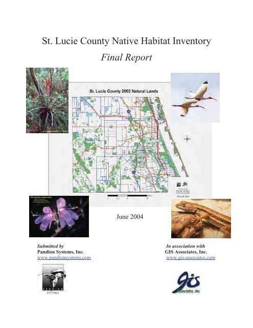
Native Habitat Inventory Final Report 2004 - St. Lucie County
Native Habitat Inventory Final Report 2004 - St. Lucie County
Native Habitat Inventory Final Report 2004 - St. Lucie County

You also want an ePaper? Increase the reach of your titles
YUMPU automatically turns print PDFs into web optimized ePapers that Google loves.
<strong>St</strong>. <strong>Lucie</strong> <strong>County</strong> <strong>Native</strong> <strong>Habitat</strong> <strong>Inventory</strong><br />
<strong>Final</strong> <strong>Report</strong><br />
June <strong>2004</strong><br />
Submitted by<br />
Pandion Systems, Inc.<br />
www.pandionsystems.com<br />
In association with<br />
GIS Associates, Inc.<br />
www.gis-associates.com
<strong>St</strong>. <strong>Lucie</strong> <strong>County</strong> <strong>Native</strong> <strong>Habitat</strong> <strong>Inventory</strong><br />
Submitted to<br />
<strong>St</strong>. <strong>Lucie</strong> <strong>County</strong><br />
6120 Glades Cutoff Road<br />
Ft. Pierce, FL 34981<br />
by<br />
Pandion Systems, Inc.<br />
5200 NW 43 rd <strong>St</strong>.<br />
Suite 102-314<br />
Gainesville, FL 32606-4482<br />
(352) 372-4747 phone<br />
(352) 372-4714 fax<br />
www.pandionsystems.com<br />
In association with<br />
GIS Associates, Inc.<br />
2158 NW 5 th Ave.<br />
Gainesville, FL 32603<br />
(352) 384-1465 phone<br />
(352) 384-1467 fax<br />
www.gis-associates.com<br />
June <strong>2004</strong>
Table of Contents<br />
Acknowledgements ............................................................................................................ i<br />
Acronyms and Abbreviations .......................................................................................... ii<br />
Glossary ............................................................................................................................ iii<br />
Executive Summary .......................................................................................................... v<br />
Introduction ....................................................................................................................... 1<br />
Project Overview ............................................................................................................ 1<br />
Natural Communities of <strong>St</strong>. <strong>Lucie</strong> <strong>County</strong> – Landscape and Geographical Setting ....... 2<br />
<strong>County</strong>wide Overview ................................................................................................ 4<br />
<strong>Native</strong> <strong>Habitat</strong> Lost and Preserved 1992-2002 ....................................................... 4<br />
Site Data Summaries ............................................................................................... 5<br />
Conversion of FLUCCS to FNAI ......................................................................... 14<br />
Methods and Results ....................................................................................................... 16<br />
Overview ....................................................................................................................... 16<br />
<strong>Native</strong> <strong>Habitat</strong> Lost and Preserved Between 1992 and 2002 ....................................... 16<br />
Summary of GIS Methods: Creation of 1992 and 2002 Land Cover GIS Layers .... 16<br />
GIS Database Development; ................................................................................. 16<br />
GIS Analysis, <strong>St</strong>atistical Calculations, and Modeling for Ecological Decision-<br />
Support .................................................................................................................. 17<br />
Comparison of Current Techniques to the 1992 <strong>Inventory</strong> .................................. 22<br />
<strong>Inventory</strong> of Existing <strong>Native</strong> Upland and Wetland Communities ............................ 26<br />
Quantitative Assessment of the Areas of Existing <strong>Native</strong> and Wetland<br />
Communities in the <strong>County</strong> and the Amount of Loss of <strong>Habitat</strong> Since 1992....... 26<br />
Identification of Lands Preserved Since 1992 and the Acres and Types of Natural<br />
Communities in Each Preserve ............................................................................. 31<br />
Site Data Summaries ..................................................................................................... 41<br />
Overview ................................................................................................................... 41<br />
Collect Existing Inventories ...................................................................................... 41<br />
Identify Potential Sites for Surveying and Recommendations for Site Selection .... 41<br />
Requesting Landowner Permission........................................................................... 41<br />
Field Data Collection ................................................................................................ 44<br />
Field Data Management and Analysis ...................................................................... 45<br />
Conversion of FLUCCS to FNAI .................................................................................. 47<br />
Site Inventories and Reclassification ........................................................................ 47<br />
Intersection with FLUCCS ....................................................................................... 47<br />
Discussion ................................................................................................................. 48
Site Data Summaries and Ranks ................................................................................... 57<br />
A Ranked Sites ............................................................................................................... 57<br />
Site Number: 4 ......................................................................................................... 57<br />
Site Number: 9 ......................................................................................................... 64<br />
Site Number: 24 ....................................................................................................... 68<br />
Site Number: 25 ....................................................................................................... 75<br />
Site Number: 41 ....................................................................................................... 81<br />
Site Number: 42 ....................................................................................................... 87<br />
Site Number: 43 ....................................................................................................... 94<br />
Site Number: 44 ....................................................................................................... 98<br />
Site Number: 50 ..................................................................................................... 102<br />
Site Number: 51 ..................................................................................................... 108<br />
B Ranked Sites ............................................................................................................. 114<br />
Site Number: 3 ....................................................................................................... 114<br />
Site Number: 7 ....................................................................................................... 119<br />
Site Number: 11 ..................................................................................................... 125<br />
Site Number: 13 ..................................................................................................... 132<br />
Site Number: 14 ..................................................................................................... 138<br />
Site Number: 15 ..................................................................................................... 144<br />
Site Number: 18 ..................................................................................................... 150<br />
Site Number: 20 ..................................................................................................... 156<br />
Site Number: 28 ..................................................................................................... 162<br />
Site Number: 30 ..................................................................................................... 168<br />
C Ranked Sites ............................................................................................................ 174<br />
Site Number: 12 ..................................................................................................... 174<br />
Site Number: 16 ..................................................................................................... 178<br />
Site Number: 17 ..................................................................................................... 183<br />
Site Number: 19 ..................................................................................................... 188<br />
Site Number: 26 ..................................................................................................... 193<br />
Site Number: 27 ..................................................................................................... 199<br />
Site Number: 31 ..................................................................................................... 205<br />
Site Number: 32 ..................................................................................................... 211<br />
Site Number: 34 ..................................................................................................... 217<br />
Site Number: 48 ..................................................................................................... 223<br />
Conclusions .................................................................................................................... 229<br />
Bibliography .................................................................................................................. 231<br />
Appendices ..................................................................................................................... 235<br />
Appendix A. Explanation of Species and Natural Community Ranks ......................... 235<br />
Appendix B. Rare Species Observed ........................................................................... 239<br />
Appendix C. Invasive Exotic Plants Observed ............................................................ 240<br />
Appendix D. Natural Communities Observed in the <strong>County</strong>. ..................................... 241<br />
b
Appendix E. List of Rare Species that Potentially Occur within <strong>St</strong>. <strong>Lucie</strong> <strong>County</strong> ..... 242<br />
Appendix F. List of Natural Communities that Potentially Occur within <strong>St</strong>. <strong>Lucie</strong><br />
<strong>County</strong>. ........................................................................................................................ 252<br />
Appendix G. Copy of Site Permission Letter .............................................................. 254<br />
Appendix H. Mapping Discussion............................................................................... 257<br />
Appendix I. Conversion of FLUCCS Categorized to FNAI Natural Communities -<br />
Tables and Histograms ............................................................................................... 259<br />
c
List of Tables<br />
Table 1. Population Demographics for <strong>St</strong>. <strong>Lucie</strong> <strong>County</strong>. ................................................. 3<br />
Table 2. Comparison of Area Preserved by <strong>County</strong> as of December 2003 ....................... 5<br />
Table 3. Ecological Summaries of Sites. ........................................................................... 7<br />
Table 4. Site Ranking Criteria – <strong>County</strong> Uplands <strong>Inventory</strong>. .......................................... 11<br />
Table 5. Site Quality Ranks. ............................................................................................ 14<br />
Table 6. Estimated Acreages of FNAI Natural Communities in <strong>St</strong>. <strong>Lucie</strong> <strong>County</strong> in 1991<br />
Compared to 1996 (1992 KBN <strong>Report</strong>, Table 2-3). ................................................. 24<br />
Table 7. Percent Loss of <strong>St</strong>. <strong>Lucie</strong> <strong>County</strong> Natural Communities Between 1986 and<br />
1991........................................................................................................................... 25<br />
Table 8. Acres Lost in Natural Areas Between 1992 and 2002 by FLUCCS Type. ....... 27<br />
Table 9. 2002 Natural Land by Polygon Acreage. ........................................................... 30<br />
Table 10. Summary of FLUCCS Types and Acreage Present in Each Conservation Area.<br />
................................................................................................................................... 32<br />
Table 11. Comparison of the Amount of Each FLUCCS Type Conserved as Compared to<br />
All Natural Lands Available in 2002. ....................................................................... 38<br />
Table 12. Example of Calculation of Overall Ecological Value for a single site ............ 46<br />
Table 13. Community Conversion from FLUCCS to FNAI for Potentially Natural<br />
FLUCCS Categories. ................................................................................................ 49<br />
Table 14. Community Conversion from FLUCCS to FNAI for Natural FLUCCS<br />
Categories. ................................................................................................................ 52<br />
List of Figures<br />
Figure 1. Locations of the A, B and C Ranked Sites. ........................................................ 9<br />
Figure 2. <strong>St</strong>. <strong>Lucie</strong> <strong>County</strong> 1992 Natural Lands. ............................................................. 19<br />
Figure 3. <strong>St</strong>. <strong>Lucie</strong> <strong>County</strong> 2002 Natural Lands. ............................................................. 20<br />
Figure 4. <strong>St</strong>. <strong>Lucie</strong> <strong>County</strong> Natural Lands Lost Between 1992 and 2002. ...................... 21<br />
Figure 5. 2002 <strong>County</strong>wide Non-Public Natural Areas. .................................................. 30<br />
Figure 6. Florida Natural Area <strong>Inventory</strong>’s Areas of Conservation Interest as the Initial 51<br />
Sites Considered for <strong>Inventory</strong>. ................................................................................ 42<br />
Figure 7. Locations of Inventoried Sites ........................................................................... 43<br />
d
Acknowledgements<br />
Pandion Systems would like to thank Vanessa Bessey, the Environmental Resource<br />
Manager and the <strong>St</strong>. <strong>Lucie</strong> <strong>County</strong> project manager, for her guidance and input on the<br />
project. Thanks are also given to Dennis Murphy, <strong>St</strong>eve Fousek, and Diana Waite of the<br />
Public Works Department; and Paul Williams and Cheryl Friend of the City of Fort<br />
Pierce. Thanks also to Ed Blaine and Janet Merkt of Community Development and<br />
Growth Management Division Works Department for providing GIS information on the<br />
sites. The team would like to thank the landowners for their cooperation in the study.<br />
i
Acronyms and Abbreviations<br />
ACI – Area of Conservation Interest<br />
CAT # – Category number, see Category I and Category II in the glossary<br />
ESL – Environmentally Sensitive Lands<br />
ESRI – Environmental Systems Research Institute, Inc.<br />
FDOR – Florida Department of Revenue<br />
FLEPPC – Florida Exotic Pest Plant Council<br />
FLEPPC rankings: Category # – See Category I and Category II in the glossary<br />
FLUCCS – Florida Land Use Cover Classification System<br />
FNAI – Florida Natural Areas <strong>Inventory</strong><br />
FNAI ranking: G# and S# – See the glossary<br />
FWC – Florida Fish and Wildlife Conservation Commission (formerly GFC)<br />
G# - See the glossary and Appendix A<br />
GFC – Florida Game and Freshwater Fish Commission (renamed FWC in July 2001)<br />
GIS – Geographic Information System<br />
LC – Land Cover<br />
LU – Land Use<br />
PNA – Potential Natural Areas<br />
S# – See the glossary and Appendix A<br />
SFWMD – South Florida Water Management District<br />
TNC – The Nature Conservancy<br />
ii
Glossary<br />
ACI – Area of Conservation Interest as designated by Florida Natural Areas <strong>Inventory</strong>.<br />
Areas of Conservation Interest (ACIs) are sites that support currently unprotected<br />
examples of important natural resources. These sites have not been field-verified. Sites<br />
ranked C were felt to have a lower potential ecological quality than those ranked B based<br />
on the quality, size, and rarity of their natural communities.<br />
Category I – Defined by FLEPPC as, “Invasive exotics that are altering native plant<br />
communities by displacing native species, changing community structures or ecological<br />
functions, or hybridizing with natives.” This definition does not rely on the economic<br />
severity or geographic range of the problem, but on the documented ecological damage<br />
caused.<br />
Category II – Defined by FLEPPC as, “Invasive exotics that have increased in<br />
abundance or frequency but have not yet altered Florida plant communities to the extent<br />
shown by Category I species.” These species may become ranked Category I if<br />
ecological damage is demonstrated.<br />
Developed – Areas no longer supporting natural vegetation. Examples would be<br />
buildings and roads.<br />
FWC – Florida Fish and Wildlife Conservation Commission.<br />
FLEPPC – Florida Exotic Pest Plant Council. A non-profit non-governmental<br />
organization that works toward building public awareness about the serious threat<br />
invasive plants pose to native ecosystems, securing funding and support for control and<br />
management of exotic plants, and developing integrated management and control<br />
methods to prevent the spread of exotic pest plants throughout the United <strong>St</strong>ates.<br />
FLUCCS – Florida Land Use Cover Classification System. Developed by Florida<br />
Department of Transportation.<br />
FNAI – Florida Natural Areas <strong>Inventory</strong>. This non-profit organization is administered by<br />
Florida <strong>St</strong>ate University. They gather, interpret, and disseminate information critical to<br />
the conservation of Florida's biological diversity.<br />
G# – FNAIs global rank. Based on an element's worldwide status. See Appendix A for<br />
more details.<br />
Herb – A plant with no persistent woody stem above ground.<br />
Mesic – Applied to an environment that is neither extremely wet or extremely dry.<br />
Natural lands – Those areas that retain significant elements of the original natural<br />
system. These elements are composition, structure, and function.<br />
iii
S# – FNAIs state rank. Based on the status of the element in Florida. See Appendix A for<br />
more details.<br />
Semi-natural lands – Vegetation altered by human influence or management in the past<br />
but retaining much of the elements of a natural community. However, they are missing at<br />
least one significant element of the original natural system. These elements are<br />
composition, structure, and function.<br />
Site – The 30 discrete areas selected for surveying during this project.<br />
Species Area Relationship – The number of species in an area will increase with the size<br />
of the area. Originally derived from studies of oceanic islands, but this concept also<br />
applies to habitat islands. (Definition from Instant Notes in Ecology, p.189)<br />
Xeric – Applied to a dry environment, as opposed to a wet or intermediate environment.<br />
Definitions from Florida Geographic Digital Library, The Concise Oxford Dictionary of<br />
Ecology, Instant Notes in Ecology, FWC’s Closing the Gaps in Florida’s Wildlife <strong>Habitat</strong><br />
Conservation System.<br />
iv
Executive Summary<br />
The overall objective of this project is “to meet the <strong>St</strong>. <strong>Lucie</strong> <strong>County</strong> Comprehensive Plan<br />
requirements that certain inventories and evaluations of the <strong>County</strong>’s existing natural<br />
conditions be conducted to implement programs that are intended to preserve and protect<br />
those resources. To assist the <strong>County</strong> in meeting its goals for the preservation of native<br />
upland and wetland habitat, the full range of these natural communities within <strong>St</strong>. <strong>Lucie</strong><br />
<strong>County</strong> must be identified. This study will be utilized to evaluate the success of the<br />
<strong>County</strong>’s environmental programs and policies and to assist the <strong>County</strong>’s Land<br />
Acquisition Selection Committee in selecting the highest priority sites for preservation.”<br />
This county-wide native habitat inventory updates the 1992 inventory (KBN 1992) and<br />
identifies changes in native habitat. It will be used to assist the <strong>County</strong>’s Land<br />
Acquisition Selection Committee in selecting the highest priority sites for preservation<br />
via the Environmentally Sensitive Lands (ESL) Program.<br />
The <strong>St</strong>. <strong>Lucie</strong> <strong>County</strong> ESL Program was established in 1991 pursuant to <strong>County</strong><br />
Comprehensive Plan directives requiring an increase in the acreage of native upland<br />
habitat preserved in <strong>St</strong>. <strong>Lucie</strong> <strong>County</strong>. The ESL Program was designed to further several<br />
policies related to the protection of the <strong>County</strong>'s natural resources while fulfilling the<br />
following habitat preservation requirements set forth in the Conservation Element of the<br />
<strong>County</strong>'s Comprehensive Plan. The goals of the Environmentally Significant Lands<br />
Program are:<br />
• Preservation of native upland habitat<br />
• Preserve unique ecological communities<br />
• Protect endangered and threatened species<br />
• Safeguard drinking water quality<br />
• Enhance natural flood protection<br />
• Improve passive resource-based recreation opportunities<br />
The first three goals are addressed in this project.<br />
The <strong>County</strong>’s Comprehensive Plan has specific targets for natural area protection, for<br />
example, by 1995 increase native habitat preservation by at least ten (10%) percent. The<br />
long-term goal is to preserve 25% of the 1991 native upland habitat acreage, or about an<br />
additional 12,500 acres.<br />
The specific objectives of this study are:<br />
• To evaluate and quantify losses in native habitat since 1992.<br />
• To identify publicly-owned conservation lands within the county, and inventory<br />
and quantify the natural communities on these properties.<br />
• To identify and prioritize lands for preservation through on-site inventories and a<br />
geographic information systems (GIS) based analysis. On-site inventories will<br />
quantify, map, classify, and qualitatively assess the natural communities present.<br />
v
The GIS analysis will assess landscape-level variables such as connectivity, patch<br />
size, and other measures of ecological integrity.<br />
Pandion Systems, Inc. in association with GIS Associates, Inc. initiated this study in<br />
January 2003. An interim technical report (<strong>St</strong>. <strong>Lucie</strong> <strong>Native</strong> <strong>Habitat</strong> <strong>Inventory</strong> <strong>Final</strong><br />
Technical <strong>Report</strong>) was completed in April 2003. This report evaluated the losses in<br />
native habitat since 1992 and identified the type and amount of natural areas (as of 2002)<br />
protected through public or private conservation ownership or easements. During the<br />
period of June to August 2003, on-site inventories were made of natural lands considered<br />
suitable for preservation.<br />
The <strong>County</strong> ESL Program goal is to increase the acreage of native habitat preserved as<br />
well as preserve unique communities and species. As of 2002, there were 19,417 acres of<br />
public conservation land within the <strong>County</strong> (<strong>St</strong>. <strong>Lucie</strong> <strong>County</strong> ESL020303 shapefile).<br />
Some key protected areas are interspersed with areas under intensive development<br />
pressure such as the coastal and island areas, the high ancient dunes along US 1, as well<br />
as the <strong>St</strong>. <strong>Lucie</strong> River and its tributaries. A minimum of 3,052 acres of natural areas was<br />
lost between 1992 and 2002.<br />
In addition to the direct loss of acres of native habitat, there is increased fragmentation of<br />
the remaining natural lands outside of public ownership. Only about half (52%) of the<br />
natural lands left are greater than 100 acres in size. The small areas cost more per acre to<br />
acquire and manage, often have a greater percentage of undesirable edge, fewer species, a<br />
reduced likelihood of long-term persistence, and reduced management options due to<br />
external constraints (e.g., fire and residential areas).<br />
The quantitative assessment of the acres of natural area lost and conserved indicated there<br />
were 93,385 acres of potential natural area within the county. An initial subset was<br />
selected that included all areas designated as Areas of Conservation Interest or Potential<br />
Natural Areas by FNAI (51 sites and 44,031 acres). This list was further reduced to 35<br />
sites with the assistance of the <strong>St</strong>eering Committee and their knowledge of the county.<br />
Several more sites were eliminated due to lack of landowner-permitted access. In the end,<br />
30 sites (40,142 acres) were surveyed representing different vegetative communities and<br />
locations in the <strong>County</strong>. The vegetative communities of the sites ranged from coastal<br />
uplands to wet flatlands. The sites ranged in size from 1 acre to 28,789 acres. A<br />
summary of the ecological characteristics including content and context for all the sites is<br />
provided.<br />
A series of 5 quality measures (Vulnerability, Rarity, Connectedness, Completeness, and<br />
Manageability) is given for each FNAI vegetative community type on the site. Each is<br />
ranked from 1 to 5. The 30 sites surveyed were evenly split among A, B, and C quality<br />
sites.<br />
vi
The Site Data Summaries and Ranks section presents summaries of the conditions of the<br />
natural communities at each of the 30 sites surveyed. Each summary provides:<br />
• Site Rank<br />
• Site Size<br />
• Acres of Edge<br />
• Percent of Edge to Core<br />
• Ecological Core by Natural Community<br />
• Key Features<br />
• Importance to the <strong>County</strong> Ecological Integrity<br />
• Connectivity to Other Natural Areas<br />
• Proximity to Non-Natural Features<br />
• Hydrology<br />
• Natural Community Rankings<br />
• Site History/<strong>Habitat</strong> Disturbance<br />
• List of Rare Plants and/or Animals Observed<br />
• List of Invasive Exotic Species Observed<br />
• Ownership Information<br />
• Notes<br />
• Recommendations/Management Requirements<br />
• Natural Community Map<br />
• Rare Species Map<br />
• Invasive Exotic Species Map<br />
The anticipated uses of the results of this survey and countywide natural community map<br />
include:<br />
• Project reviews<br />
• Assessments of the vegetative and wildlife resources within the <strong>County</strong><br />
• Determination of mitigation necessary during future land development<br />
• Identification of priority land acquisition areas<br />
• Identification of future wetland mitigation sites<br />
• Identification future wildlife corridors<br />
• Identification of future blueways and greenways<br />
• Identification of a wide range of protective conservation strategies<br />
This project provides the <strong>County</strong> with a comprehensive ecological survey that identifies<br />
and characterizes the vegetative communities and also assesses the ecological integrity of<br />
these vegetative resources in the <strong>County</strong>.<br />
vii
Introduction<br />
Project Overview<br />
The overall objective of this project is “to meet the <strong>St</strong>. <strong>Lucie</strong> <strong>County</strong> Comprehensive Plan<br />
requirements that certain inventories and evaluations of the <strong>County</strong>’s existing natural<br />
conditions be conducted to implement programs that are intended to preserve and protect<br />
those resources. To assist the <strong>County</strong> in meeting its goals for the preservation of native<br />
upland and wetland habitat, the full range of these natural communities within <strong>St</strong>. <strong>Lucie</strong><br />
<strong>County</strong> must be identified. This study will be utilized to evaluate the success of the<br />
<strong>County</strong>’s environmental programs and policies and to assist the <strong>County</strong>’s Land<br />
Acquisition Selection Committee in selecting the highest priority sites for preservation.”<br />
This county-wide native habitat inventory updates the 1992 inventory (KBN 1992) and<br />
identifies changes in native habitat. It will be used to assist the <strong>County</strong>’s Land<br />
Acquisition Selection Committee in selecting the highest priority sites for preservation<br />
via the Environmentally Sensitive Lands (ESL) Program.<br />
The <strong>St</strong>. <strong>Lucie</strong> <strong>County</strong> ESL Program was established in 1991 pursuant to <strong>County</strong><br />
Comprehensive Plan directives requiring an increase in the acreage of native upland<br />
habitat preserved in <strong>St</strong>. <strong>Lucie</strong> <strong>County</strong>. The ESL Program was designed to further several<br />
policies related to the protection of the <strong>County</strong>'s natural resources while fulfilling the<br />
following habitat preservation requirements set forth in the Conservation Element of the<br />
<strong>County</strong>'s Comprehensive Plan. The goals of the Environmentally Significant Lands<br />
Program are:<br />
• Preservation of native upland habitat<br />
• Preserve unique ecological communities<br />
• Protect endangered and threatened species<br />
• Safeguard drinking water quality<br />
• Enhance natural flood protection<br />
• Improve passive resource-based recreation opportunities<br />
The first three goals addressed in this project.<br />
The <strong>County</strong>’s Comprehensive Plan has specific targets for natural area protection, for<br />
example, by 1995 increase native habitat preservation by at least ten (10%) percent. The<br />
long-term goal is to preserve 25% of the 1991 native upland habitat acreage, or about an<br />
additional 12,500 acres.<br />
The specific objectives of this study are:<br />
• To evaluate and quantify losses in native habitat since 1992.<br />
• To identify publicly-owned conservation lands within the county, and inventory<br />
and quantify the natural communities on these properties.<br />
1
• To identify and prioritize lands for preservation through on-site inventories and a<br />
geographic information systems (GIS) based analysis. On-site inventories will<br />
quantify, map, classify, and qualitatively assess the natural communities present.<br />
The GIS analysis will assess landscape-level variables such as connectivity, patch<br />
size, and other measures of ecological integrity.<br />
The anticipated uses of the results of this survey and countywide natural community map<br />
include:<br />
• Project reviews<br />
• Assessments of the vegetative and wildlife resources within the <strong>County</strong><br />
• Determination of mitigation necessary during future land development<br />
• Identification of priority land acquisition areas<br />
• Identification of future wetland mitigation sites<br />
• Identification future wildlife corridors<br />
• Identification of future blueways and greenways<br />
• Identification of a wide range of protective conservation strategies<br />
This project provides the <strong>County</strong> with a comprehensive ecological survey that identifies<br />
and characterizes the vegetative communities and also assesses the ecological integrity of<br />
these vegetative resources in the <strong>County</strong>.<br />
Pandion Systems, Inc. in association with GIS Associates, Inc. initiated this study in<br />
January 2003. An interim technical report (<strong>St</strong>. <strong>Lucie</strong> <strong>Native</strong> <strong>Habitat</strong> <strong>Inventory</strong> <strong>Final</strong><br />
Technical <strong>Report</strong>) was completed in April 2003. This report evaluated the losses in<br />
native habitat since 1992 and identified the type and amount of natural areas (as of 2002)<br />
protected through public or private conservation ownership or easements. During the<br />
period of June to August 2003, on-site inventories were made of natural lands considered<br />
suitable for preservation.<br />
This report describes the methodology utilized in the study. It identifies the type and<br />
acreage of habitat lost since 1992 and identifies the type and acreage of habitat in existing<br />
conservation lands (state, county, and private). Priority sites for preservation are<br />
identified and descriptions with detailed natural community classification maps for each<br />
site are provided.<br />
Natural Communities of <strong>St</strong>. <strong>Lucie</strong> <strong>County</strong> – Landscape and<br />
Geographical Setting<br />
<strong>St</strong>. <strong>Lucie</strong> <strong>County</strong> is located on the southeast coast of Florida. It is bounded on the north<br />
by Indian River <strong>County</strong> and on the south by Martin <strong>County</strong> and to the west by<br />
Okeechobee <strong>County</strong>. The <strong>County</strong>’s east coast is comprised of a series of barrier islands<br />
separated from the mainland by the Indian River Lagoon.<br />
2
The population of <strong>St</strong>. <strong>Lucie</strong> <strong>County</strong> has increased nearly 400% in 30 years (Table 1).<br />
This has resulted in a loss of native habitat. KBN (1992) reported a loss of 19,267 acres<br />
of natural lands between 1986 and 1991. Between 1992 and 2002 there were an<br />
additional 3,052 acres of natural areas lost. For a total of 22,319 acres lost (22.4%) over<br />
only 16 years. There has been an effort to preserve some of the pieces through<br />
acquisition or conservation easements. This has resulted in 19,417 acres being<br />
conserved. The conservation of additional lands is sought through the Environmentally<br />
Sensitive Lands program. The priority sites described in this report will aid in<br />
determining future potential land acquisitions.<br />
Table 1. Population Demographics for <strong>St</strong>. <strong>Lucie</strong> <strong>County</strong>.<br />
Data from the <strong>St</strong>. <strong>Lucie</strong> <strong>County</strong> Chamber of Commerce web site (Lenze 2002)<br />
Pop.<br />
1970<br />
Percent<br />
Increase<br />
Pop.<br />
1980<br />
Percent<br />
Increase<br />
Pop.<br />
1990<br />
Percent<br />
Increase<br />
Pop.<br />
2000<br />
Percent<br />
Projected<br />
to Increase<br />
2010<br />
Population<br />
Projection<br />
50,836 72% 87,182 72% 150,171 29% 194,100 23% 238,000<br />
The natural communities of these priority sites are described and qualitatively assessed in<br />
the Site Data Summaries and Ranks section. Natural Communities are defined as “a<br />
distinct and reoccurring assemblage of plants, animals, fungi, and microorganisms<br />
naturally associated within each other and their physical environment” (FNAI 1990, p 1).<br />
The physical environment includes soils, water regimes, fire patterns, and topography.<br />
Natural Communities are influenced by human activities such as alteration of flooding<br />
and fire patterns and intensive land management.<br />
The natural resources present within <strong>St</strong>. <strong>Lucie</strong> <strong>County</strong> are the remnants of a much larger<br />
system. The continued persistence of these resources is, in large part, a function of area.<br />
Generally, the number of species in a given area will increase with increasing area<br />
(Mackenzie et al. 1998, p 189). Thus, planning and managing for the long term<br />
persistence of a biological element (e.g., a species or natural community) requires the<br />
knowledge of what is in existence (e.g., inventory) and their minimum biological<br />
requirements.<br />
This report provides some of this information through the site data summaries and GIS<br />
data and analysis. However, even with this information, for nearly all species and natural<br />
communities, there is uncertainty about their minimum biological requirements for longterm<br />
persistence. Thus, long-range planning to protect biological diversity is often done<br />
by making inferences of what is present, or likely present, and using some general<br />
principles (such as the species-area relationship described above) to build a framework on<br />
which to plan sustained existence of these ecological elements. This is the rationale<br />
behind much of the geographic analysis done (i.e., Florida ecological greenways and<br />
Florida Fish and Wildlife Conservation Commission’s strategic habitat conservation<br />
areas) for large-scale ecological planning.<br />
3
The species-area relationship does not mean that only large areas should be valued or<br />
protected. There are many instances where small areas can be of very high ecological<br />
value and even without landscape scale connectivity should be protected. This is<br />
especially true where there is a very rare species or a unique habitat (i.e., endemics).<br />
<strong>County</strong>wide Overview<br />
<strong>Native</strong> <strong>Habitat</strong> Lost and Preserved 1992-2002<br />
The <strong>County</strong> ESL Program goal is to increase the acreage of native habitat preserved as<br />
well as preserve unique communities and species. As of 2002, there were 19,417 acres of<br />
public conservation land within the <strong>County</strong> (<strong>St</strong>. <strong>Lucie</strong> <strong>County</strong> ESL020303 shapefile).<br />
Some key protected areas are interspersed with areas under intensive development<br />
pressure such as the coastal and island areas, the high ancient dunes along US 1, as well<br />
as the <strong>St</strong>. <strong>Lucie</strong> River and its tributaries.<br />
An indicator of development is the number of parcels per unit area. In the eastern third of<br />
the county (roughly east of the western boundary of Port <strong>St</strong>. <strong>Lucie</strong>) there are 129,000<br />
parcels. This is 98% of all of the parcels in the entire county. This suggests there is<br />
intensive development of the entire eastern third of the county. A subset of this area, the<br />
southeastern corner, as framed by the northern and western extents of Port <strong>St</strong>. <strong>Lucie</strong>,<br />
contains 71% of the parcels (94,000) within less than 20% of the county. However,<br />
within this portion of the county there are several large natural areas remaining (e.g.,<br />
Savannas Reserve – nearly 500 acres and the series of conservation lands stretching south<br />
from Bear Point – over 800 acres).<br />
The western two-thirds is less developed. The land is used for intensive agriculture such<br />
as cattle grazing and citrus groves. However, within this landscape are large patches<br />
(>500 acres) of natural to semi-natural habitat, mainly in unimproved cattle pasture and<br />
wetlands. These large areas are central elements to the proposed Florida ecological<br />
greenway network (Florida 1999-2001) within the Treasure Coast region.<br />
The intensive development pressure in the eastern third of the county accounts for most<br />
of the 3,052 acres of natural areas lost between 1992 and 2002. Most of this was within<br />
or immediately adjacent to urban areas, especially Port <strong>St</strong>. <strong>Lucie</strong>.<br />
In addition to the direct loss of acres of native habitat there is increased fragmentation of<br />
the remaining natural lands outside of public ownership. Only about half (52%) of the<br />
natural lands left are greater than 100 acres in size. The small areas cost more per acre to<br />
acquire and manage, often have a greater percentage of undesirable edge, fewer species, a<br />
reduced likelihood of long-term persistence, and reduced management options due to<br />
external constraints (e.g., fire and residential areas).<br />
To calculate areas of native habitat lost and conserved between 1992 and 2002 two GIS<br />
coverages were created. An approximate historic landcover of the county in 1992 was<br />
4
first created. Then a current 2002 land cover was created. For each coverage, all<br />
polygons (more than 132,000) were classified as natural or non-natural. The difference<br />
between these two coverages provided the acres of natural habitat lost and the number of<br />
acres conserved over the time period.<br />
By 2002, 19,417 acres of land had been conserved. However, in comparison to the<br />
surrounding counties this is quite low (Table 2). Also, the natural areas that remain are<br />
highly fragmented.<br />
Table 2. Comparison of Area Preserved by <strong>County</strong> as of December 2003<br />
Source: FNAI Managed Areas shapefile December 2003<br />
<strong>County</strong> Total Acres within<br />
the <strong>County</strong><br />
Total Acres<br />
Conserved<br />
Percent of the<br />
<strong>County</strong> Conserved<br />
<strong>St</strong>. <strong>Lucie</strong> 391,700 19,417 5<br />
Indian River 318,080 >100,000 31<br />
Okeechobee 493,440 >75,000 15<br />
Martin 355,200 >66,000 19<br />
Site Data Summaries<br />
The <strong>County</strong> ESL Program goals of increasing acreage of native habitat preserved as well<br />
as preservation of unique communities and species requires the use of both countywide<br />
and more site-specific, localized ecological information to make wise land-use and land<br />
planning decisions. This need for site-specific information was the basis for conducting<br />
this inventory.<br />
The 30 sites (40,142 acres) that were surveyed represented different vegetative<br />
communities and locations in the <strong>County</strong>. The vegetative communities of the sites<br />
ranged from coastal uplands to wet flatlands. The sites ranged in size from 1 acre to<br />
28,789 acres. Table 3 provides a summary of the ecological characteristics including<br />
content and context for all the sites. Figure 1 provides a map of the A, B, and C-ranked<br />
sites.<br />
Four sites (4, 9, 43, and 44) were not accessible by ground due to constraints of owner<br />
access (31,499 acres). They were assessed via helicopter by county staff. All four of these<br />
sites are expected to be of high quality based on other data sources (e.g., Fernauld 1989,<br />
Johnson and Muller 1990, KBN 1992) and the aerial reconnaissance.<br />
In the eastern third of the county the natural resources on a site were most affected by<br />
development, whereas, in the western two-thirds of the county they were influenced by<br />
intensive agriculture (e.g., cattle grazing and citrus groves). This is true for both uplands<br />
and wetlands. Agricultural activities directly impact an area by replacing or removing the<br />
overstory, removing small scale topographic variation, collapsing the original<br />
multilayered vegetation structure into fewer layers, altering species richness and<br />
5
composition through selective grazing and an artificial fire regime (usually fire<br />
suppression). However, in some cases these agricultural uses, such as cattle grazing,<br />
have also benefited the site by maintaining the open treeless condition typical of prairies.<br />
Since the site surveys were conducted for only a short period of time and during only one<br />
season, observations of the occurrence of Federally and/or <strong>St</strong>ate Listed plants and<br />
animals on these sites were limited. In spite of the limitations, 17 species of rare plants<br />
and animals were observed on 18 sites. There were also 31 invasive exotic plant species<br />
observed on 25 sites.<br />
Seventeen (17) of these sites are contiguous or in close proximity to public conservation<br />
lands (Table 3). The contribution of these lands and their ability to provide linkages and<br />
act as buffers for existing conservation lands should be given should be given<br />
consideration due to the degree of fragmentation of natural lands in the county.<br />
There is a network of ecological greenways (Florida 1999-2001) proposed for the entire<br />
state of Florida. Several portions flow through <strong>St</strong>. <strong>Lucie</strong> <strong>County</strong>. Along the western<br />
county boundary is a large proposed greenway that starts in the Everglades and runs<br />
north. One hundred and eighty-two thousand (182,000) acres of the proximate portions of<br />
this greenway are already in public ownership (Allapattah Flats, the Dupuis<br />
Reserve/Corbett Wildlife Management Area, Bluefield Ranch, Fort Drum Marsh/Blue<br />
Cypress Conservation Areas) and could be connected through the conservation of all or<br />
portions of sites 9 and 4. There is another proposed greenway along the <strong>St</strong>. <strong>Lucie</strong> River<br />
that includes portion of sites 20 and 50.<br />
6
Table 3. Ecological Summaries of Sites.<br />
Maximum Overall Ecological Value is 1. Generally A sites had an ecological value>0.5. No data on rare or exotic species was<br />
collected for helicopter sites (na).<br />
Site<br />
No<br />
Site<br />
Rank<br />
Overall<br />
Ecological<br />
Value<br />
(RCC)<br />
Total<br />
Acres<br />
Acres<br />
of Edge<br />
<strong>Habitat</strong><br />
Percent<br />
of<br />
Total<br />
as<br />
Edge<br />
Proximity to<br />
Existing<br />
Conservation<br />
Lands<br />
Number<br />
of Rare<br />
Species<br />
Observed<br />
Number of<br />
Invasive<br />
Exotic<br />
Species<br />
Observed Outstanding Natural Communties<br />
3 B 0.61 345.0 107.0 31.0 2640' 5 7 Bottomland Forest<br />
12 C 0.53 360.0 153.0 42.0 >2640' 0 0<br />
13 B 0.44 2275.0 417.0 18.0 >2640' 0 2<br />
14 B 0.52 1325.0 285.0 22.0 >2640' 0 6<br />
15 B 0.44 169.0 106.0 63.0 >2640' 1 2<br />
16 C 0.20 161.0 101.0 63.0 >2640' 0 3<br />
17 C 0.40 123.0 54.0 44.0 >2640' 0 2<br />
18 B 0.43 659.0 284.0 43.0 >2640' 1 1<br />
19 C 0.57 157.0 93.0 59.0 2640' 3 5<br />
7
Site<br />
No<br />
Site<br />
Rank<br />
Overall<br />
Ecological<br />
Value<br />
(RCC)<br />
Total<br />
Acres<br />
Acres<br />
of Edge<br />
<strong>Habitat</strong><br />
Percent<br />
of<br />
Total<br />
as<br />
Edge<br />
Proximity to<br />
Existing<br />
Conservation<br />
Lands<br />
Number<br />
of Rare<br />
Species<br />
Observed<br />
Number of<br />
Invasive<br />
Exotic<br />
Species<br />
Observed Outstanding Natural Communties<br />
41 A 0.75 134.0 103.0 77.0
Figure 1. Locations of the A, B and C Ranked Sites.<br />
3<br />
4<br />
19<br />
18<br />
7<br />
15<br />
14<br />
12<br />
13<br />
9<br />
11<br />
24 25<br />
26<br />
27<br />
28<br />
30<br />
31<br />
32<br />
20<br />
17<br />
16<br />
34<br />
41<br />
42<br />
48<br />
51<br />
50<br />
43<br />
44<br />
Legend<br />
A ranked sites<br />
B ranked sites<br />
C ranked sites<br />
*<br />
9
The Site Data Summaries and Ranks section presents summaries of the conditions of the<br />
natural communities at each of the 30 sites surveyed. Each summary provides:<br />
• Site Rank<br />
• Site Size<br />
• Acres of Edge<br />
• Percent of Edge to Core<br />
• Ecological Score By Natural Community<br />
• Key Features<br />
• Importance to the <strong>County</strong> Ecological Integrity<br />
• Connectivity to Other Natural Areas<br />
• Proximity to Non-Natural Features<br />
• Hydrology<br />
• Natural Community Rankings<br />
• Site History/<strong>Habitat</strong> Disturbance<br />
• List of Rare Plants and/or Animals Observed<br />
• List of Invasive Exotic Species Observed<br />
• Ownership Information<br />
• Notes<br />
• Recommendations/Management Requirements<br />
• Natural Community Map<br />
• Rare Species Map<br />
• Invasive Exotic Species Map<br />
Field surveys occurred in June through August 2003. The survey effort for a given site<br />
ranged from a few hours to several days, depending upon the acreage of the site and<br />
complexity. The rare species lists are comprehensive but should not be considered<br />
exhaustive due to the single season of sampling and the field time constraints.<br />
Additionally, the information presented should be viewed as a snapshot describing that<br />
natural community at one-point-in-time. Natural communities are dynamic and are<br />
affected by long and short-term climactic changes (i.e., drought), natural processes (e.g.,<br />
fire), and time, as a consequence the plants and animals present within the natural<br />
community may shift over time.<br />
A series of 5 quality measures (Vulnerability, Rarity, Connectedness, Completeness, and<br />
Manageability) is given for each FNAI vegetative community type on the site. Each is<br />
ranked from 1 to 5 (Table 4). These criteria were divided into 2 subsets. The Rarity,<br />
Connectivity, and Completeness (RCC) values are measures of the content value of the<br />
site. The Vulnerability and Manageability (VM) values area measure of human-induced<br />
risk to the site and the likelihood of restoring and maintaining the site.<br />
10
Table 4. Site Ranking Criteria – <strong>County</strong> Uplands <strong>Inventory</strong>.<br />
1) Vulnerability<br />
This criteria addresses the likelihood of events which might degrade or destroy the site.<br />
2) Rarity<br />
This criteria incorporates the rarity of each of the site's community types, the rarity of the<br />
species it provides habitat for, and the uniqueness of the site's special features, such as<br />
geological formations or champion trees. Rarity must be viewed at several scales: county,<br />
state, and global.<br />
3) Connectedness<br />
This criteria concerns how the site links to related elements of the landscape. Does it lie<br />
within or constitute a link between segments of an actual or potential wildlife corridor, a<br />
green space zone, or a trail system? Is it an inholding or a buffer for another natural area?<br />
How do the habitats relate to those nearby?<br />
4) Completeness<br />
This is basically an index of the site's ecological quality. Are the ecological communities<br />
representative examples with a full complement of species? How diverse are the habitats?<br />
The flora? The fauna? Has the site been degraded? To what degree? Are the "missing"<br />
species gone forever or is the basic integrity of the system still intact enough that there is<br />
realistic potential for reintroductions?<br />
5) Manageability<br />
This is an assessment of long-term viability. Is the site big enough? Would its reservation<br />
and the maintenance of its species be compatible with present and future neighboring<br />
land uses? Are degraded habitats in restorable condition? Would it be practical to do<br />
prescribed burning in fire-maintained habitats? Would there be problems with trespassers<br />
or neighbors? How expensive would it be to manage the land properly<br />
Scoring System for Site Priority Ranking - <strong>County</strong> Uplands <strong>Inventory</strong><br />
Vulnerability<br />
1 -- Preservation guaranteed by deed restriction, easement, or established regulatory<br />
authority.<br />
2 -- Respected by conservation-minded landowner. Some regulatory protection. Very low<br />
development potential.<br />
3 -- Owner has no sale or development plans. Heirs may be inclined to sell. Borderline<br />
case as to regulatory protection. Located in low-growth area. Marginal development site.<br />
4 -- Owner likely to sell or develop, but action not imminent. No significant regulatory<br />
protection. Located in high-growth area. Good development site.<br />
11
5 -- Slated for development or prime real estate currently up for sale. No significant<br />
regulatory protection.<br />
Completeness<br />
1 -- Poor habitat. Low species and community diversity. Seriously degraded. Too tiny<br />
and/or isolated to maintain normal flora and fauna.<br />
2 -- Fair habitat. Moderate species and community diversity. Degraded, but restorable.<br />
Might be capable of supporting populations of relatively tolerant species.<br />
3 -- Good habitat. Good diversity of species or communities. Slight degradation.<br />
Probably capable of maintaining populations of most typical species.<br />
4 -- Excellent habitat. Diverse species, communities, and successional stages. Practically<br />
all appropriate species except rarities and large predators present and thriving. Excellent<br />
potential for reintroduction of most missing species.<br />
5 -- Outstanding habitat. Diverse species, communities, and natural successional stages,<br />
including a number of rarities. Large enough to maintain long-term<br />
disturbance/succession matrix. Sizeable gene pools due to size and or links to similar<br />
habitat areas. Potential for retention or reintroduction of full normal flora and fauna,<br />
including large predators.<br />
Rarity<br />
1 -- Common community types in poor to average condition. <strong>Habitat</strong> types widespread<br />
throughout county. No rare animals or plants. No significant occurrences of anything<br />
ranked higher than 4 on FNAI's state scale. No significant geological features or wildlife<br />
sites. No trees of extraordinary size or age.<br />
2 -- Typical community types still represented by extensive acreages in the county. A few<br />
Uncommon species, but no significant occurrences of anything ranked higher than 3 on<br />
FNAI's state scale. No major geological features or wildlife sites. No mature forests or<br />
outstanding examples of natural communities.<br />
3 -- Good examples of natural communities. <strong>Habitat</strong> types well represented statewide, but<br />
scarce in the county. A few rare species, but not many ranked 2 on FNAI's state scale and<br />
none ranked higher. Geological features or wildlife sites of moderate value. Some old<br />
growth, but no large tracts or stands of "living museum" quality.<br />
4 -- Excellent examples of natural communities, some of them scarce. A number of rare<br />
species, but none dependent upon this site for survival. Several species FNAI ranks 1 or 2<br />
on state scale. No significant occurrence for a globally endangered (G1) species or<br />
community. Important geological feature or wildlife site. Extensive tract of old growth.<br />
One of the best sites of its kind the county.<br />
12
5 -- Rare community type. Extraordinary example of a natural community. Diverse array<br />
of superb habitats, several of them scarce. Many rare species, including a number FNAI<br />
ranks 1 or 2 on state and/or global scales. Critical habitat for a globally endangered<br />
species (G1). Unique geological feature or wildlife site. Nationally significant.<br />
Manageability<br />
1 -- Too small and/or degraded for maintenance or reestablishment of normal ecosystem<br />
processes, such as periodic burning or flooding. Highly vulnerable to uncontrollable<br />
external impacts.<br />
2 -- Location and/or extent of degradation would make management difficult and<br />
expensive. Questionable whether protection/restoration programs would be fully<br />
successful.<br />
3 -- Could be maintained in or restored to good condition, but would require vigiliant<br />
management. Location and/or historic use suggests chronic problems with trespassers<br />
and/or neighbors. Special programs such as exotic plant removal or hydrological<br />
restoration required. Difficult location for management.<br />
4 -- <strong>Habitat</strong>s in good condition, but requiring regular attention, such as prescribed<br />
burning. Effective buffering from most external impacts possible. Location and<br />
surrounding land uses reasonably convenient for management.<br />
5 -- Low-maintenance habitat types in excellent condition. Inherently well buffered from<br />
most external impacts. Location minimizes problems with trespassers and neighbors and<br />
facilitates management access.<br />
Connectedness<br />
1 -- Isolated from natural habitats of significant size by a large expanse of unsuitable<br />
habitat or a virtually impenetrable barrier (from standpoint of organisms inhabiting site).<br />
No significant connecting corridors. Not situated strategically for interconnection of<br />
natural areas or trail systems.<br />
2 -- Isolated from natural habitats of significant size by a moderate expanse of unsuitable<br />
habitat. No significant connecting corridors. Not situated strategically for interconnection<br />
of natural areas or trail systems.<br />
3 -- Isolated from natural habitats of significant size by an expanse of marginally suitable<br />
habitat. Narrow connecting corridors. Useful situation for interconnection of natural areas<br />
or trail systems.<br />
4 -- Not broadly joined to large areas of natural habitat, but close or connected by<br />
significant existing or potentially restorable habitat corridors. Good situation for<br />
connection of natural areas or trail systems.<br />
13
5 -- Directly contiguous with large areas of natural habitat along extensive boundaries.<br />
Critical situation for interconnecting natural areas or trail systems.<br />
The 30 sites surveyed were evenly split among A, B, and C quality sites (Table 5). The<br />
quality of the sites was determined by their ranking of 5 ecological criteria of Rarity,<br />
Connectivity, Completeness, Vulnerability, and Manageability.<br />
Table 5. Site Quality Ranks.<br />
Site Quality Rank Number of sites Total Acres Site Numbers<br />
A 10 32628* 4, 9, 24, 25, 41, 42, 43, 44, 50, 51<br />
(3841)<br />
B 10 6549 3, 7, 11, 13, 14, 15, 18, 20, 28, 30<br />
C 10 858 12, 16, 17, 19, 26, 27, 31, 32, 34, 48<br />
*With the removal of one large site (Site 4) the total acres of A quality sites is reduced to 3841.<br />
A-ranked sites generally had one or more of the following features: high quality natural<br />
communities, rare or endemic species, rare natural communities, large size. C-ranked<br />
sites generally had one or more of the following features: very small size, small<br />
proportion of natural to non-natural areas, few or no rare species, few or no rare natural<br />
communities. B-ranked sites were intermediate of these two extremes.<br />
There were some exceptions. For example, although sites 25 and 51 are 10 acres or less<br />
in size, the presence of narrow endemics and imperiled natural communities warranted a<br />
high rank. Sites 12 and 14 are large sites that had no outstanding features and the nonnatural<br />
portions of the sites were heavily impacted, thus these sites were not considered A<br />
sites.<br />
Conversion of FLUCCS to FNAI<br />
A proportionality relationship between the Florida Land Use Cover Classification System<br />
(FLUCCS) categories and FNAI natural communities system was developed. This<br />
relationship was developed utilizing the 1995 FLUCCS classification for the county and<br />
the FNAI classification from the 30 sites inventoried.<br />
FLUCCS System<br />
The 1995 FLUCCS Classification from South Florida Water Management District was<br />
used as the starting point for the conversion since it was the most recent consistent<br />
countywide coverage with good resolution in natural areas, a well-defined state standard,<br />
and periodically updated.<br />
14
One of the drawbacks to FLUCCS is that it is mapped at a fairly large scale (in 0.25 acre<br />
blocks for developed lands and 1 acre blocks for undeveloped lands) and thus often has<br />
inclusions of dissimilar land uses. This results in what appear to be unusual changes in<br />
land use or community types (e.g., Temperate Hardwoods (425) to Blackwater <strong>St</strong>ream),<br />
however, this is an artifact of the mapping methods (Appendix H).<br />
The FLUCCS categories for natural areas tend to be broad while the FNAI categories are<br />
more narrow. This often results in one FLUCCS type being classified as more than one<br />
FNAI natural community type (a one to many relationship). For example, a FLUCCS<br />
type of Pine Flatwoods (411) was reclassified into 15 different FNAI natural community<br />
types.<br />
FNAI Classification<br />
In the field, vegetation and site features were used to determine the appropriate FNAI<br />
natural community for a given habitat. Specifically, a combination of soils, topography,<br />
hydrology, vegetation, and ecological processes was used to determine the FNAI<br />
Category. Natural areas were always assigned an FNAI category, but in some instances<br />
the agreement was not perfect. In these cases, comments and caveats were noted on the<br />
site summaries.<br />
The site data mapped and collected for each of the 30 sites includes:<br />
Identification of the FNAI vegetative community types observed on each<br />
site<br />
Sum of the total acres of each FNAI community within the site<br />
Sum of the number of occurrences for each FNAI community within the<br />
site<br />
Potentially natural and developed areas (e.g., pastures, fields, roads, structures, retention<br />
ponds) were usually not assigned an FNAI classification since there are none that apply.<br />
The lack of FNAI categories for non-natural areas resulted in some FLUCCS<br />
classifications being retained.<br />
In some instances, where the potentially natural area was still largely functioning as an<br />
intact ecosystem (e.g., unimproved pasture), an FNAI type(s) was provided. These<br />
potentially natural areas often cover large areas (sometimes hundreds of acres at a single<br />
site) and they often replaced a wide variety of historic community types. Consequently,<br />
the list of FNAI types provided for a single FLUCCS type was often extensive and no<br />
clear dominant FNAI type may be apparent.<br />
15
Methods and Results<br />
Overview<br />
This project contained three main tasks: 1) To evaluate and quantify losses in native<br />
habitat since 1992; 2) To identify publicly-owned conservation lands within the county;<br />
and 3) To identify and prioritize lands for preservation through on-site inventories and<br />
GIS analysis. The methods and results are presented below. The first two tasks are<br />
presented together because of similar methodology.<br />
<strong>Native</strong> <strong>Habitat</strong> Lost and Preserved Between 1992 and 2002<br />
Summary of GIS Methods: Creation of 1992 and 2002 Land Cover GIS Layers<br />
There are two major GIS components to this project: 1) GIS database development; and<br />
2) GIS analysis, statistical calculations, and modeling for ecological decision-support.<br />
GIS Database Development;<br />
A geographic information system (GIS) database was developed. The Project Team<br />
collected and standardized the available GIS data from various sources, converted those<br />
to an ESRI shapefile format, and reprojected them into a project standard map projection<br />
and coordinate system. The Pandion Team met with each of the following agencies to<br />
obtain required data and obtain an understanding of data structure, accuracy, and other<br />
relevant information:<br />
• <strong>St</strong>. <strong>Lucie</strong> <strong>County</strong> Community Development Department<br />
• Treasure Coast Regional Planning Council<br />
• South Florida Water Management District<br />
• Department of Environmental Protection<br />
Additional data sources were:<br />
• University of Florida – Florida Geographic Data Library (FGDL)<br />
• Natural Resources Conservation Service (NRCS)<br />
• Florida Fish and Wildlife Conservation Commission (FWC)<br />
• Florida Natural Areas <strong>Inventory</strong> (FNAI)<br />
Existing layers collected for analysis and mapping included:<br />
• <strong>County</strong> and municipal boundaries<br />
• 1990, 1995, and 2000 Digital Ortho Quarter Quads (Infrared Aerial Photography)<br />
• 1992 LandSat Thematic Mapper Imagery<br />
• Existing land use / land cover (LU/LC), (1994-1995 data from SFWMD)<br />
• Parcel boundaries (Florida Department of Revenue’s Land Use Codes)<br />
• Detailed soils<br />
• Pre-development vegetation (developed using detailed soils)<br />
16
• Hydrology, wetlands and uplands<br />
• Topography (elevation)<br />
• Road centerlines and railroads<br />
• Conservation and other public lands (existing and proposed)<br />
• FNAI Element Occurrences (rare & endangered plants, animals, & communities)<br />
• FNAI Areas of Conservation Interest (A, B, and C)<br />
• FNAI Potential Natural Areas (PNA)<br />
• FNAI Managed Areas (MA)<br />
• FWC <strong>St</strong>rategic <strong>Habitat</strong> Conservation Areas<br />
• FWC Biodiversity Hot Spots<br />
The GIS analyses and mapping to support this project and the final deliverable were done<br />
using ESRI software (ArcGIS 8.x and ArcView 3.3). The final project database was<br />
documented with metadata and organized into a digital map atlas on CDROM for<br />
distribution.<br />
GIS Analysis, <strong>St</strong>atistical Calculations, and Modeling for Ecological Decision-Support<br />
The primary need for GIS analysis in this project was for building 1992 and 2002<br />
landuse/landcover update coverages and change analysis of natural areas over this time<br />
period.<br />
Creation of 1992 and 2002 Land Cover Data Layers<br />
No maps of the 1992 KBN study exist to show the areas considered lost or preserved or<br />
what was considered natural in 1991. Thus, a new 1992 baseline FLUCCS layer was<br />
developed. A 2002 FLUCCS layer was also developed. These two layers were used to<br />
calculate the acreage lost over that 10-year period and to quantify the habitats on the<br />
existing conservation lands.<br />
Methodology<br />
1992 Natural Land Cover Map Layer Development Methodology<br />
1. Began with SFWMD 1994/95 Land Use/Land Cover (LU/LC) GIS Layer<br />
(classified using FLUCCS).<br />
2. Overlaid 2002 Parcel layer, and flagged polygons classified as urban or<br />
agricultural in the 1994/95 LU/LC layer with an improvement built between 1992<br />
and 1994/95.<br />
3. Using <strong>St</strong>. <strong>Lucie</strong> <strong>County</strong>’s 1999/2000 aerial photos, visually checked every urban<br />
or agricultural polygon in the 1994 LU/LC layer with an improvement built<br />
between 1992 and 1995, to determine whether it was disturbed between 1992 and<br />
1994/95. If the improvement was built on a very large parcel in a rural area, the<br />
17
Project Team made a judgment call on whether the improvement appeared<br />
substantial enough to have caused a potentially natural area in 1992 to have been<br />
reclassified as disturbed (or if it would have already been classified as agricultural<br />
or pasture, for example).<br />
4. Dissolved final natural area polygons on FLUCCS classification, removing<br />
internal lines created from overlaying the parcel map (Figure 2).<br />
5. Added and calculated Acreage field.<br />
2002 Natural Land Cover Map Layer Development Methodology<br />
1. Began with SFWMD 1994/95 Land Use/Land Cover (LU/LC) GIS Layer<br />
(classified using FLUCCS).<br />
2. Overlaid 2002 Parcel layer, and flagged polygons that were classified as natural in<br />
the 1994/95 LU/LC layer. But did not flag polygons classified as urban or<br />
agricultural in the 2002 parcel layer [according to the Florida Department of<br />
Revenue’s (FDOR’s) Land Use Classifications]. Also flagged natural polygons<br />
with an improvement built since 1992.<br />
3. Using <strong>St</strong>. <strong>Lucie</strong> <strong>County</strong>’s 1999/2000 aerial photos, visually checked every natural<br />
polygon (according to the 1994/95 LU/LC layer), to determine whether it was still<br />
natural or has been disturbed since 1994/95. Spent extra time reviewing the<br />
polygons flagged using the parcel data.<br />
4. Flagged natural polygons overlaying parcels with improvements built since 1999,<br />
and reclassified most of those as built. If the improvement was built on a very<br />
large parcel in a rural area, the Project Team made a judgment call on whether the<br />
improvement would have disturbed the natural community (or communities)<br />
enough to reclassify the polygon from natural to built.<br />
5. Dissolved final natural area polygons on FLUCCS classification, removing<br />
internal lines created from overlaying the parcel map (Figure 3).<br />
6. Added and calculated Acreage field.<br />
The acreage of the 1992 and 2002 Natural Land Cover Maps were summarized by Level<br />
3 FLUCCS Classification. Loss was calculated by subtracting the 2002 acreage totals by<br />
FLUCCS from the 1992 acreage totals by FLUCCS (Figure 4).<br />
18
Figure 2. <strong>St</strong>. <strong>Lucie</strong> <strong>County</strong> 1992 Natural Lands.<br />
19
Figure 3. <strong>St</strong>. <strong>Lucie</strong> <strong>County</strong> 2002 Natural Lands.<br />
20
Figure 4. <strong>St</strong>. <strong>Lucie</strong> <strong>County</strong> Natural Lands Lost Between 1992 and 2002.<br />
21
Discussion of Methodology<br />
The limitations of the above mapping methods are as follows:<br />
1. The FLUCCS and FDOR LU/LC classification systems were created for different<br />
reasons, and therefore inconsistent classification methods made an overlay<br />
analysis of the two difficult. The FDOR classification of a large parcel of<br />
improved pasture would be agricultural, but there could be many natural wetland<br />
polygons overlaying that one large parcel. For this reason, a visual inspection of<br />
each polygon was required.<br />
2. Regressing the 1994/95 SFWMD LU/LC to 1992 using the ‘year built’ field in the<br />
parcel data was problematic for the same reasons as discussed in the first<br />
limitation. Simply identifying parcels with a ‘year built’ between 1992 and<br />
1994/95 was insufficient, and a visual inspection and subsequent “judgment call”<br />
was necessary.<br />
Other data layers collected for use in this effort could not be used. Those layers and the<br />
reasons they could not be used are:<br />
1. The 1988 SFWMD LU/LC mapping methods were dramatically different from<br />
those used to create the 1994/95 layer. For example, large expanses of the<br />
western portion of the <strong>County</strong> were classified as agricultural land, while the<br />
1994/95 layer identified pockets of natural lands. Consequently, there was more<br />
natural acreage in the 1994/95 map than the 1988 map. In addition, the 1988<br />
classification did not use the FLUCCS categories used by the 1994/95 layer.<br />
2. The 1992 Landsat Thematic Mapper satellite imagery was intended as an<br />
additional check of 1992 natural areas (along with the parcel data). It was only<br />
available at a 60-meter resolution, which was much too coarse to identify any<br />
detail.<br />
The strength of this method is that it is not a sampling technique (see Comparison of<br />
Current Techniques to the 1992 inventory below), it is an inventory technique so it does<br />
not require assumptions about whether the sampled area is representative of the county.<br />
Also, no size limitations were imposed on the areas considered natural. However, such a<br />
constraint could easily be evaluated using GIS. Also, no judgments were made on the<br />
ecological quality or value of these natural areas.<br />
Comparison of Current Techniques to the 1992 <strong>Inventory</strong><br />
The 1992 inventory used a sampling method, rather than a complete inventory, to<br />
calculate the acres of natural lands in 1986 and 1991 and the acres lost between these two<br />
times. According to the 1992 KBN report (page 1-5) the method was to “translate the<br />
GFC classification into FNAI categories according to a percentage formula based on<br />
1991 aerial photography interpretation and ground-truthing.” Then KBN “developed<br />
percent loss estimates for each natural community for the 1986-1991 period by<br />
comparing sets of representative sample sections on the 1986 GFC Landsat habitat map<br />
and the 1991 Real Estate Information Services (REDI) map aerials.” <strong>Final</strong>ly,<br />
“calculations were completed by subtracting the loss acreages derived through this<br />
22
process from the natural community totals derived from the GFC data to arrive at a<br />
percent loss estimate.” This analysis showed that the rate of conversion of native habitats<br />
varied dependent upon the type of habitat from less than one percent for mangrove<br />
swamp to more than 40 percent for dry prairies and dome swamps.<br />
The limitations to such a technique include:<br />
1. The 1986 GFC habitat data is not an inventory but a modeled layer. The habitat<br />
types were estimated from the spectral characteristics of the 1986 Landsat<br />
Thematic Mapper satellite imagery. Only a small subset of the image pixels were<br />
ground-truthed statewide, and this sample may or may not be representative of the<br />
<strong>County</strong>. This can cause significant errors in habitat classification and subsequent<br />
loss calculations.<br />
2. The Landsat data is captured at a 30-meter resolution, which is too coarse to<br />
visually identify any details on the ground.<br />
3. KBN sampled only a portion of the entire county and extrapolated from that<br />
sample to the entire county. This is a good technique if the sample is truly<br />
representative of the entire county. However, if the sample is not representative<br />
(e.g., skewed) this would result in errors in the habitat classifications and in the<br />
subsequent loss calculations. There is insufficient information in the KBN report<br />
to evaluate the evenness of this technique.<br />
4. The small natural areas (of 1-2 acres) may not have been captured in such a<br />
technique due to limitations of time and data resolution (of both the Landsat<br />
imagery and the REDI maps). Thus the total amount of natural area is most likely<br />
underestimated and the amount of loss less accurate.<br />
For all of these reasons there are differences between the 1992 KBN report (Tables 6 and<br />
7) and this report in the total number of acres of natural area and the habitat loss rates.<br />
23
Table 6. Estimated Acreages of FNAI Natural Communities in <strong>St</strong>. <strong>Lucie</strong> <strong>County</strong> in<br />
1991 Compared to 1996 (1992 KBN <strong>Report</strong>, Table 2-3).<br />
1986 a<br />
Acreage<br />
1991 b<br />
Acreage<br />
Percent Lost<br />
Over 5-Year<br />
Period<br />
Uplands<br />
Scrub 5,541 5,064 8.6<br />
Xeric Hammock 555 540 2.8<br />
Beach Dune c 22 21 5.0<br />
Coastal Berm c 17 16 7.5<br />
Coastal <strong>St</strong>rand c 22 21 2.5<br />
Maritime Hammock 1,502 1,406 6.4<br />
Shell Mound 16 16 0.0<br />
Dry Prairie 23,935 13,428 43.9<br />
Mesic Flatwoods 8,948 7,105 20.6<br />
Scrubby Flatwoods 8,685 5,645 35.0<br />
Prairie Hammock 1,502 1,352 10.0<br />
Total Upland Acreage 50,745 34,613 31.8<br />
Wetlands<br />
Wet Prairie 3,916 3,536 9.7<br />
Wet Flatwoods 8,685 8,251 5.0<br />
Hydric Hammock 7,603 7,154 5.9<br />
Floodplain Forest 1,543 1,491 3.4<br />
Floodplain Swamp 1,430 1,416 1.0<br />
Floodplain Marsh 6,527 5,509 15.6<br />
Swale 2,246 2,246 0.0<br />
Slough 582 576 1.0<br />
<strong>St</strong>rand Swamp 3,329 3,296 1.0<br />
Bayhead (Bog) 1,047 1,037 1.0<br />
Depression Marsh 6,815 6,358 6.7<br />
Dome Swamp 594 348 41.5<br />
Saltmarsh (Tidal Marsh) 1,197 1,179 1.5<br />
Mangrove Swamp (Tidal Swamp) 3,370 3,350 0.6<br />
Total Wetland Acreage 48,884 45,745 6.4<br />
Total Natural <strong>Habitat</strong> Acreage 99,629 80,362 19.3<br />
a<br />
b<br />
c<br />
Derived from Florida Game and Fresh Water Fish Commission (FGFWFC) Landsat data.<br />
Calculated from data derived from FGFWFC Landsat data multiplied by loss percentages developed by<br />
comparison with 1991 aerial photography. Rounded off to the nearest acre.<br />
Because these habitats typically occur in strips too narrow for Landsat detection, their acreages are<br />
underestimated.<br />
24
Table 7. Percent Loss of <strong>St</strong>. <strong>Lucie</strong> <strong>County</strong> Natural Communities Between 1986 and<br />
1991.<br />
Source: KBN Engineering and Applied Sciences, Inc., 1991<br />
Natural Community<br />
Number of<br />
Sections Sampled<br />
Range of<br />
Percent Loss<br />
in Sample<br />
Sections<br />
Average<br />
Percent Loss<br />
Scrub 52 0 - 50 8.6<br />
Xeric Hammock 48 0 - 33 2.8<br />
Beach Dune 8 0 - 10 5.0<br />
Coastal Berm 4 5 - 10 7.5<br />
Coastal <strong>St</strong>rand 8 0 - 5 2.5<br />
Maritime Hammock 10 0 - 15 6.4<br />
Shell Mound 2 0 - 0 0.0<br />
Dry Prairie 55 3 - 95 43.9<br />
Mesic Flatwoods 18 3 - 50 20.6<br />
Scrubby Flatwoods 5 25 - 75 35.0<br />
Prairie Hammock 36 10 - 10 10.0<br />
Wet Prairie 78 0 - 100 9.7<br />
Wet Flatwoods 8 0 - 10 5.0<br />
Hydric Hammock 88 0 - 75 5.9<br />
Floodplain Forest 5 1 - 4 3.4<br />
Floodplain Swamp 8 0 - 2 1.0<br />
Floodplain Marsh 9 5 - 100 15.6<br />
Swale 6 0 - 0 0.0<br />
Slough 36 1 - 1 1.0<br />
<strong>St</strong>rand Swamp 36 1 - 1 1.0<br />
Bayhead (Bog) 36 1 - 1 1.0<br />
Depression Marsh 45 5 - 80 6.7<br />
Dome Swamp 72 33 - 50 41.5<br />
Saltmarsh (Tidal Marsh) 8 0 - 3 1.5<br />
Mangrove Swamp (Tidal Swamp) 10 0 - 1 0.6<br />
25
<strong>Inventory</strong> of Existing <strong>Native</strong> Upland and Wetland Communities<br />
Quantitative Assessment of the Areas of Existing <strong>Native</strong> and Wetland Communities in the<br />
<strong>County</strong> and the Amount of Loss of <strong>Habitat</strong> Since 1992<br />
There are 391,700 acres within the entire county and 93,385 acres are potentially natural<br />
lands in 2002. Thus about 23% of the county is potentially natural in 2002.<br />
Methods<br />
Using aerial and GIS information gathered and built in Task 1 the loss of native habitats<br />
was identified and quantified. The natural areas lost were the difference between the<br />
created 2002 and 1992 layers (Table 8). The definition of loss was: any natural areas in<br />
1992 (according to SFWMD classification methods) converted to a predominantly urban<br />
or agricultural use in 2002. Areas that were already non-natural in 1992 (i.e., intensive<br />
agriculture or urban) and simply changed to a different non-natural use (residential,<br />
commercial, etc.) were not considered lost. No judgments were made as to the ecological<br />
values of the natural areas in 1992 or 2002.<br />
Matrix illustrating parameters for Loss vs. No Loss scenarios<br />
1992 Natural 1992 Non-Natural<br />
2002 Natural No loss No Loss<br />
2002 Non-Natural Loss No loss<br />
Results and Discussion<br />
In 1992 there were 97,254 acres of potentially natural areas and in 2002 there are 93,385<br />
aces of potentially natural area for a loss of 3,052 acres (7%) over 10 years. The total<br />
loss and rate of loss may be lower than might be expected, due in part to the definition of<br />
loss.<br />
However, the loss of habitat is not simply a matter of numbers of acres lost. It is a more<br />
complex interaction of patch size and shape, connectivity and proximity to other natural<br />
areas, and the type, quality, and function of the natural communities. It is well<br />
established that smaller areas and isolated patches have lower resiliency and species<br />
diversity.<br />
There are exceptions to the concept that bigger and more connected and more diverse is<br />
better. For example, there are some community types that occur as small patches within<br />
a larger mosaic (i.e., Dome Swamps in the Mesic Flatwoods, Scrub on ridge top,<br />
Maritime Hammock) and there are species that occur in only very restricted ranges such<br />
that all patches of any size are valuable (e.g., Lakela’s mint).<br />
26
Table 8. Acres Lost in Natural Areas Between 1992 and 2002 by FLUCCS Type.<br />
Number<br />
Polygons<br />
293<br />
141<br />
197<br />
328<br />
FLUCCS<br />
Code<br />
FLUCCS Name<br />
Acres in<br />
1992<br />
Acres in<br />
2002<br />
Acres Lost<br />
between 1992<br />
and 2002<br />
Percent Lost<br />
between 1992<br />
and 2002<br />
310 Herbaceous 2,223 2,098 321 Palmetto Prairie 322 Coastal Scrub 125 6%<br />
1,380 1,241 139 10%<br />
498 481 16 3%<br />
329 Other Shrub and Brush 1,700 1,418 282 17%<br />
94 330 Mixed Rangeland 2,165 1,924 241 11%<br />
5,297 411 Pine Flatwoods 20,275 18,986 1,289 6%<br />
127 4119 Pine Flatwoods - Melaleuca infested 995 989 6 1%<br />
11 412 Longleaf Pine-Xeric Oak 664 664 0 0%<br />
561 413 Sand Pine 2,176 2,099 77 4%<br />
7 414 Pine-Mesic Oak 113 113 0 0%<br />
1 419 Other Pines 6 6 0 0%<br />
1,410 422 Brazilian Pepper 4,586 4,138 448 10%<br />
60 424 Melaleuca 291 290 1 0%<br />
952 425 Temperate Hardwoods 3,768 3,636 132 4%<br />
328 426 Tropical Hardwoods 1,404 1,329 75 5%<br />
43 427 Live Oak 323 315 9 3%<br />
12 428 Cabbage Palm 86 86 0 0%<br />
51 432 Sand Live Oak 128 126 2 1%<br />
482 434 Hardwoods-Conifer Mixed 2,850 2,654 197 7%<br />
32 437 Australian Pine 21 21 0 0%<br />
179 438 Mixed Hardwoods 764 751 13 2%<br />
3,195 510 <strong>St</strong>reams and Waterways 6,508 6,403 105 2%<br />
23 523 Lakes >10 and
Number<br />
Polygons<br />
49<br />
385<br />
1,318<br />
FLUCCS<br />
Code<br />
FLUCCS Name<br />
Acres in<br />
1992<br />
Acres in<br />
2002<br />
Acres Lost<br />
between 1992<br />
and 2002<br />
Percent Lost<br />
between 1992<br />
and 2002<br />
532 Reservoirs >100 and 10 and
Number<br />
Polygons<br />
FLUCCS<br />
Code<br />
FLUCCS Name<br />
Acres in<br />
1992<br />
104 645 Submergent Aquatic Vegetation 744<br />
TOTALS 97,254<br />
Acres in<br />
2002<br />
Acres Lost<br />
between 1992<br />
and 2002<br />
Percent Lost<br />
between 1992<br />
and 2002<br />
744 0 0%<br />
93,385 3,869 4%<br />
29
Despite these exceptions, most species and communities are more stable, diverse, and<br />
persistent in large, connected natural areas rather than small and isolated remnants. These<br />
remnants are created by the interspersion of intensive land uses with natural areas. They<br />
have lower ecological value and have likely lost much of the function, diversity and ability to<br />
sustain most populations.<br />
Of the 93,385 acres of natural areas estimated to be remaining in the county in 2002, 19,271<br />
(21%) are less than 20 acres in size and only 48,608 acres (52%) are greater than 100 acres in<br />
size. This indicates that nearly half of the privately held natural areas in the county are<br />
remnants and likely to have limited functionality and a decreased likelihood of long-term<br />
viability and persistence.<br />
Table 9. 2002 Natural Land by Polygon Acreage.<br />
Note that these polygons may be adjacent to conservation lands or they may be in close<br />
proximity to each other.<br />
Number of<br />
Polygon Size Occurrences<br />
(29887 total)<br />
Number of Acres<br />
(93385 total)<br />
Percent of total<br />
Natural Acres in 2002<br />
< 20 acres 3,539 19,272 21<br />
=> 20 and 100 acres 175 48,608 52<br />
Figure 5. 2002 <strong>County</strong>wide Non-Public Natural Areas.<br />
2002 <strong>County</strong>wide Non-Public Natural Areas<br />
Percentage of Occurences and Percent Area by Broad Acreage Size Class<br />
90.00<br />
80.00<br />
82.36<br />
70.00<br />
Percent<br />
60.00<br />
50.00<br />
40.00<br />
52.05<br />
Percentage of Occurences<br />
Percentage of Acreage<br />
30.00<br />
27.29<br />
20.00<br />
10.00<br />
20.64<br />
13.57<br />
0.00<br />
0.32<br />
< 20 acres 20 to 100 acres > 100 acres<br />
Broad Acreage Size Class<br />
30
Identification of Lands Preserved Since 1992 and the Acres and Types of Natural<br />
Communities in Each Preserve<br />
In 2002 there are 93,385 acres of potentially natural area in <strong>St</strong>. <strong>Lucie</strong> <strong>County</strong> and 19,417<br />
acres (21%) are already in public ownership or conservation easements. Thus, approximately<br />
5% of the county (19,417 of 391,000 acres) is in conservation ownership (including<br />
easements).<br />
Methods<br />
Existing natural areas (as of 2002) protected through public or private conservation<br />
ownership or easements were identified using a combination of the <strong>St</strong>. <strong>Lucie</strong> <strong>County</strong><br />
Environmentally Sensitive Lands layer, the FNAI Managed Area layer, and the SFWMD<br />
Save Our Rivers layer. This provided the acreages of individual conservation areas as well<br />
as countywide (Table 10).<br />
Results and Discussion<br />
In 2002 there is public ownership or conservation easement on 21% of the potentially natural<br />
areas in the <strong>County</strong> but not all habitat types are equally protected. In comparison to what is<br />
still natural, some habitats are quite well protected and others are not.<br />
One measure of how well protected a specific habitat type is, can be done by comparing the<br />
amount that is available with the amount that is preserved for that habitat type. <strong>Habitat</strong> types<br />
that have very little acreage preserved compared to what is available would be considered<br />
underrepresented in public ownership. Those that have a lot of acreage preserved compared<br />
to what is available would be considered well represented.<br />
For example, in 2002 there are 18,986 acres of Flatwoods available in the <strong>County</strong> and 2,038<br />
acres are conserved. The 18,986 acres constitute 20% of the <strong>County</strong>’s current natural areas<br />
and the 2,038 acres conserved constitute 11 % of the currently conserved areas. Thus<br />
Flatwoods are underrepresented in <strong>County</strong> ownership by nearly 50%.<br />
There are 28 FLUCCS categories that are significantly underrepresented in conservation<br />
ownership (by 48% or more) and should be the focus of additional acquisition. The<br />
remaining FLUCCS categories are well represented in public ownership (Table 11).<br />
However, being well represented does not mean that additional acquisition in not desirable.<br />
Some of these well represented habitat types (i.e., Coastal Scrub, Maritime Hammock, and<br />
Sand Pine) are so imperiled or the species within them are so endangered that they should<br />
continue to be acquired.<br />
31
Table 10. Summary of FLUCCS Types and Acreage Present in Each Conservation<br />
Area.<br />
Only natural areas with Conservation Areas are shown<br />
SITE NAME FLUCCS Descriptions FLUCCS<br />
Code<br />
Total<br />
Acres<br />
Ancient Oaks Pine Flatwoods 411 0<br />
Temperate Hardwoods 425 26<br />
Hardwood Conifer Mixed 434 19<br />
Avalon Embayments open 541 7<br />
Avalon <strong>St</strong>ate Park Tropical Hardwoods 426 18<br />
Embayments open 541 45<br />
Mangrove Swamps 612 73<br />
Avalon Tract Coastal Scrub 322 2<br />
Tropical Hardwoods 426 17<br />
Bear Point Coastal Scrub 322 7<br />
Embayments open 541 100<br />
Bear Point II Mangrove Swamps 612 40<br />
Blind Creek Coastal Scrub 322 30<br />
Embayments open 541 3<br />
Mangrove Swamps 612 115<br />
Blind Creek Beach Coastal Scrub 322 11<br />
Embayments open 541 14<br />
Mangrove Swamps 612 1<br />
Bluefield Mitigation Bank Pine Flatwoods 411 1<br />
Freshwater Marsh 641 653<br />
Bluefield Ranch Other shrub and Brush 329 2<br />
Pine Flatwoods 411 81<br />
Longleaf Pine-Xeric Oak 412 30<br />
Sand Pine 413 16<br />
Pine - Mesic Oak 414 7<br />
Hardwood Conifer Mixed 434 7<br />
<strong>St</strong>reams and Waterways 510 0<br />
Wetland Forested Mixed 630 66<br />
Freshwater Marsh 641 117<br />
Wet Prairies 643 61<br />
Crossroads Pine Flatwoods 411 0<br />
Mixed Hardwoods 438 0<br />
32
SITE NAME FLUCCS Descriptions FLUCCS<br />
Code<br />
Total<br />
Acres<br />
<strong>St</strong>ream and Lake Swamps 615 49<br />
Cypress Creek <strong>St</strong>reams and Waterways 510 0<br />
Inland Ponds and Sloughs 616 13<br />
Wet Prairies 643 0<br />
Dollman Tract Coastal Scrub 322 17<br />
Tropical Hardwoods 426 21<br />
Embayments open 541 0<br />
Mangrove Swamps 612 144<br />
FPL Conservation<br />
Easement Coastal Scrub 322 78<br />
Reservoirs 500 acres 531 26<br />
Wetland Forested Mixed 630 23<br />
Impoundment 14B Tropical Hardwoods 426 8<br />
Embayments open 541 8<br />
Impoundment 5 Embayments open 541 2<br />
Mangrove Swamps 612 23<br />
Indrio Blueway Buffer Tropical Hardwoods 426 105<br />
Mangrove Swamps 612 0<br />
Indrio/North Savannas Pine Flatwoods 411 198<br />
Sand Pine 413 71<br />
Sand Live Oak 432 0<br />
Hardwood Conifer Mixed 434 8<br />
Reservoirs < 10 acres 533 28<br />
Freshwater Marsh 641 8<br />
33
SITE NAME FLUCCS Descriptions FLUCCS<br />
Code<br />
Total<br />
Acres<br />
Freshwater Marshes – cattail 6412 4<br />
Jack Island Embayments open 541 87<br />
Mangrove Swamps 612 8<br />
John Brooks Park Coastal Scrub 322 106<br />
Embayments open 541 25<br />
Mangrove Swamps 612 103<br />
Kings Island Mangrove Swamps 612 56<br />
Middle Cove Coastal Scrub 322 0<br />
Embayments open 541 43<br />
Mangrove Swamps 612 77<br />
Middle Cove South Mangrove Swamps 612 2<br />
NFSLR Herbaceous 310 10<br />
Pine Flatwoods 411 179<br />
Sand Pine 413 29<br />
Temperate Hardwoods 425 117<br />
Tropical Hardwoods 426 6<br />
<strong>St</strong>reams and Waterways 510 60<br />
Lakes < 10 acres 524 1<br />
Reservoirs 10 - 100 acres 534 16<br />
Mangrove Swamps 612 194<br />
<strong>St</strong>ream and Lake Swamps 615 847<br />
Freshwater Marsh 641 4<br />
Wet Prairies with Pine 6439 225<br />
NFSLR-Phase2 Pine Flatwoods 411 0<br />
<strong>St</strong>reams and Waterways 510 0<br />
<strong>St</strong>ream and Lake Swamps 615 16<br />
North Fork Audubon<br />
Conservation Lands Temperate Hardwoods 425 8<br />
<strong>St</strong>ream and Lake Swamps 615 19<br />
North Savannas Pine Flatwoods 411 5<br />
Hardwood Conifer Mixed 434 3<br />
Oak Hammock Pine Flatwoods 411 39<br />
<strong>St</strong>reams and Waterways 510 0<br />
Ocean Bay Coastal Scrub 322 24<br />
Tropical Hardwoods 426 0<br />
34
SITE NAME FLUCCS Descriptions FLUCCS<br />
Code<br />
Total<br />
Acres<br />
Embayments open 541 1<br />
Mangrove Swamps 612 43<br />
Paleo Hammock Temperate Hardwoods 425 80<br />
Pepper Park Coastal Scrub 322 10<br />
Embayments open 541 13<br />
Mangrove Swamps 612 1<br />
Pepper Park Addition Embayments open 541 67<br />
Mangrove Swamps 612 13<br />
Platt's Creek Mitigation<br />
Site <strong>St</strong>ream and Lake Swamps 615 6<br />
Project 10B Embayments open 541 0<br />
Mangrove Swamps 612 27<br />
Queens Island Tropical Hardwoods 426 174<br />
Lakes < 10 acres 524 6<br />
Embayments open 541 82<br />
Mangrove Swamps 612 87<br />
River Watch POA<br />
Easement Embayments open 541 0<br />
Mangrove Swamps 612 2<br />
Riverbend Pine Flatwoods 411 126<br />
Reservoirs 100-500 acres 532 116<br />
Reservoirs 10 - 100 acres 533 41<br />
Embayments open 541 4<br />
Mangrove Swamps 612 11<br />
<strong>St</strong>ream and Lake Swamps 615 125<br />
Savannas Herbaceous 310 0<br />
Sand Pine 413 5<br />
Savannas Buffer Preserve Herbaceous 310 2<br />
Temperate Hardwoods 425 3<br />
Reservoirs 10 - 100 acres 533 4<br />
Freshwater Marsh 641 8<br />
Wet Prairies 643 23<br />
Savannas Reserve Coastal Scrub 322 1<br />
Pine Flatwoods 411 5<br />
Sand Pine 413 348<br />
35
SITE NAME FLUCCS Descriptions FLUCCS<br />
Code<br />
Total<br />
Acres<br />
<strong>St</strong>reams and Waterways 510 29<br />
Lakes < 10 acres 524 14<br />
Embayments not open 542 194<br />
Mangrove Swamps 612 305<br />
Inland Ponds and Sloughs 616 5<br />
Freshwater Marsh 641 638<br />
Wet Prairies 643 2<br />
Emergent Aquatic Vegetation 644 25<br />
Submergent Aquatic Vegetation 645 116<br />
Wet Prairies with Pine 6439 770<br />
Savannas <strong>St</strong>ate Reserve Herbaceous 310 0<br />
Palmetto Prairies 321 56<br />
Pine Flatwoods 411 520<br />
Sand Pine 413 148<br />
Hardwood Conifer Mixed 434 3<br />
<strong>St</strong>reams and Waterways 510 0<br />
Embayments not open 542 30<br />
Mangrove Swamps 612 51<br />
Inland Ponds and Sloughs 616 13<br />
Mixed Wetland Hardwoods 617 2<br />
Freshwater Marsh 641 760<br />
Wet Prairies 643 566<br />
Emergent Aquatic Vegetation 644 1<br />
Submergent Aquatic Vegetation 645 329<br />
Wet Prairies with Pine 6439 176<br />
South Savannas Sand Pine 413 41<br />
Mangrove Swamps 612 2<br />
Freshwater Marsh 641 80<br />
Submergent Aquatic Vegetation 645 6<br />
Spruce Bluff Pine Flatwoods 411 42<br />
Sand Pine 413 12<br />
Mangrove Swamps 612 0<br />
Inland Ponds and Sloughs 616 23<br />
<strong>St</strong> <strong>Lucie</strong> Pinelands Pine Flatwoods 411 0<br />
Reservoirs 100-500 acres 532 15<br />
36
SITE NAME FLUCCS Descriptions FLUCCS<br />
Code<br />
Total<br />
Acres<br />
Mixed Wetland Hardwoods 617 0<br />
Freshwater Marsh 641 296<br />
Wet Prairies 643 76<br />
Ten Mile Creek<br />
Attenuation Facility <strong>St</strong>ream and Lake Swamps 615 82<br />
Freshwater Marsh 641 18<br />
Walton Scrub Homestead Sand Pine 413 17<br />
37
Table 11. Comparison of the Amount of Each FLUCCS Type Conserved as Compared to All Natural Lands Available in<br />
2002.<br />
Bold negative numbers indicate that a FLUCCS is underrepresented in public ownership.<br />
FLUCCS<br />
Number<br />
FLUCCS Description<br />
Acres<br />
Available for<br />
Natural<br />
Lands<br />
Percent<br />
of<br />
Available<br />
Natural<br />
Lands<br />
Acres<br />
Conserved<br />
Percent of<br />
Conserved<br />
Lands<br />
Percent of<br />
Representation in<br />
Conserved Lands as<br />
Compared to Available<br />
Natural Lands<br />
310 Herbaceous 2,098 2.2 94 0.5 -79<br />
321 Palmetto Prairies 1,241 1.3 0 0.0 -100<br />
322 Coastal Scrub 481 0.5 235 1.2 135<br />
329 Other Shrub and Brush 1,418 1.5 45 0.2 -85<br />
330 Mixed Rangeland 1,924 2.1 0.0 -100<br />
411 Pine Flatwoods 18,986 20.3 2038 10.5 -48<br />
Pine Flatwoods - melaleuca<br />
infested 989 1.1 37 0.2 -82<br />
412 Longleaf Pine - Xeric Oak 664 0.7 301 1.5 118<br />
4119<br />
413 Sand Pine 2,099 2.2 799 4.1 83<br />
414 Pine-Mesic Oak 113 0.1 7 0.0 -71<br />
419 Other Pine 6 0.0 0.0 -100<br />
422 Brazilian Pepper 4,138 4.4 220 1.1 -74<br />
424 Melaleuca 290 0.3 0.0 -100<br />
425 Temperate Hardwoods 3,636 3.9 233 1.2 -69<br />
426 Tropical Hardwoods 1,329 1.4 592 3.0 114<br />
427 Live Oak 315 0.3 1 0.0 -98<br />
428 Cabbage Palm 86 0.1 0.0 -100<br />
432 Sand Live Oak 126 0.1 3 0.0 -87<br />
434 Hardwoods - Conifer 2,654 2.8 54 0.3 -90<br />
38
FLUCCS<br />
Number<br />
FLUCCS Description<br />
Acres<br />
Available for<br />
Natural<br />
Lands<br />
Percent<br />
of<br />
Available<br />
Natural<br />
Lands<br />
Acres<br />
Conserved<br />
Percent of<br />
Conserved<br />
Lands<br />
Percent of<br />
Representation in<br />
Conserved Lands as<br />
Compared to Available<br />
Natural Lands<br />
Mixed<br />
437 Australian Pine 21 0.0 5 0.0 17<br />
438 Mixed Hardwoods 751 0.8 0.0 -100<br />
510 <strong>St</strong>reams and Waterways 6,403 6.9 208 1.1 -84<br />
523 Lake 10 - 100 ac 100 0.1 0.0 -100<br />
524 Lakes 500 ac 1,633 1.7 430 2.2 27<br />
532 Reservoir 100-500 ac 3,062 3.3 136 0.7 -79<br />
533 Reservoirs 10 - 100 ac 2,901 3.1 73 0.4 -88<br />
534 Reservoirs
FLUCCS<br />
Number<br />
FLUCCS Description<br />
Acres<br />
Available for<br />
Natural<br />
Lands<br />
Percent<br />
of<br />
Available<br />
Natural<br />
Lands<br />
Acres<br />
Conserved<br />
Percent of<br />
Conserved<br />
Lands<br />
Percent of<br />
Representation in<br />
Conserved Lands as<br />
Compared to Available<br />
Natural Lands<br />
Cypress - pine - cabbage<br />
palm 346 0.4 0.0 -100<br />
624<br />
630 Wetland Forested Mixed 884 0.9 393 2.0 114<br />
641 Freshwater Marshes 7,243 7.8 1586 8.2 5<br />
6411<br />
Freshwater Marshes<br />
sawgrass 244 0.3 3 0.0 -94<br />
6412 Freshwater Marshes cattail 594 0.6 60 0.3 -52<br />
642 Saltwater Marshes 1 0.0 0.0 -100<br />
643 Wet Prairies 6,025 6.5 449 2.3 -64<br />
6439 Wet Prairies with pine 3,525 3.8 1750 9.0 139<br />
Emergent aquatic<br />
644 vegetation 26 0.0 26 0.1 381<br />
645 Submergent aquatic<br />
vegetation 744 0.8 667 3.4 332<br />
40
Site Data Summaries<br />
Overview<br />
This county-wide native habitat inventory will be used to assist the <strong>County</strong>’s Land<br />
Acquisition Selection Committee in selecting the highest priority sites for preservation<br />
via the Environmentally Sensitive Lands (ESL) Program. This series of tasks consisted<br />
of collecting and reviewing existing data sources, identifying potential sites, requesting<br />
access permission, developing field data, conducting the field inventory, and data<br />
management and analysis.<br />
Collect Existing Inventories<br />
GIS and non-GIS ecological resource information for <strong>St</strong>. <strong>Lucie</strong> <strong>County</strong> and the Treasure<br />
Coast region was identified and collected. The information sources were accessed in<br />
several ways including:<br />
• Review of <strong>County</strong>’s files including GIS data and reports<br />
• Review of SFWMD, FWC and FNAI data and files<br />
• Discussions with the <strong>St</strong>eering Committee<br />
• Review of the gray and peer-reviewed literature<br />
The purpose of identifying and reviewing existing data sources was to create an<br />
understanding of the existing natural resources previously identified within <strong>St</strong>. <strong>Lucie</strong><br />
<strong>County</strong>. The Bibliography provides a list of sources and databases used in this study.<br />
Identify Potential Sites for Surveying and Recommendations for Site Selection<br />
The quantitative assessment of the acres of natural area lost and conserved indicated there<br />
were 93,385 acres of potential natural area within the county. From this all existing<br />
public lands were excluded. Then an initial subset was selected, it included all areas<br />
designated as Areas of Conservation Interest or Potential Natural Areas by FNAI (51<br />
sites and 44,031 acres) Figure 6. The list of potential sites was further reduced to 35 sites<br />
with the assistance of the <strong>St</strong>eering Committee and their knowledge of areas that had been<br />
developed since the 2000 aerial photography, were in the process of being developed, or<br />
likely to be developed in the near future.<br />
Requesting Landowner Permission<br />
Based on parcel data, the owners of the 35 sites were identified. A letter describing the<br />
purpose of the study and requesting site access to conduct the survey was sent to all 2,830<br />
landowners within these 35 sites (Appendix H). Property owners were asked to respond<br />
if site access was not granted. Responses from the landowners were recorded. Those<br />
parcels on which landowner permission was denied were identified as such in the GIS<br />
shapefiles that were used for the ground inventories. This prevented accidental trespass<br />
by the field team. On some sites no ground access was permitted. On others there was a<br />
41
mixed landowner response. Ultimately 30 sites (40,142 acres) were inventoried, four by<br />
helicopter (31,499 acres) and 26 on the ground (8,643 acres) (Figure 7).<br />
Figure 6. Florida Natural Area <strong>Inventory</strong>’s Areas of Conservation Interest as the<br />
Initial 51 Sites Considered for <strong>Inventory</strong>.<br />
*<br />
Legend<br />
FNAI ACI - A<br />
FNAI ACI - B<br />
FNAI ACI - C<br />
42
Figure 7. Locations of Inventoried Sites<br />
3<br />
24 25<br />
26<br />
27<br />
28<br />
30<br />
31<br />
32<br />
51<br />
34<br />
41<br />
4<br />
19<br />
20<br />
42<br />
43<br />
7<br />
18<br />
17<br />
16<br />
44<br />
*<br />
15<br />
14<br />
48<br />
12<br />
13<br />
9<br />
11<br />
50<br />
43
Developing Field Data Collection Materials<br />
For each site a series of ArcPad GIS data layers was created to be utilized by the field<br />
personnel during the field inventory. The data layers were site boundaries, FLUCCS<br />
polygons, landowner permission, aerial photography, and roads. There was also a custom<br />
built data sheet that was used to collect the field data directly into the computer. These<br />
were loaded onto a field-hardened laptop computer that was GPS capable.<br />
Field Data Collection<br />
Prior to beginning the field verification phase, field biologists reviewed the information<br />
on site characteristics, the field data collection requirements, and the criteria for assessing<br />
natural community quality. In addition, field biologists reviewed the ecological content<br />
for each site using the preliminary GIS maps (e.g., FLUCSS classification, preliminary<br />
FNAI classification, known rare species occurrences, and aerial photography) on the field<br />
computer.<br />
The field personnel used these data layers to locate the site, orient on the site, avoid areas<br />
in which ground access was not permitted, and collect the tabular and spatial data directly<br />
on the laptop. Thus, for each site new data layers were created that showed the<br />
delineation and classification of each of the FNAI natural communities on sites, the GPS<br />
location of any rare and/or exotic species. The tabular data that supports this spatial data<br />
was collected simultaneously and linked to the spatial. Thus the natural community<br />
quality components, key features, management recommendations and the like could be<br />
collected for each polygon as needed.<br />
The field team conducted detailed surveys of the vegetative community types at the 30<br />
sites. The purpose of the field surveys was to classify and qualitatively assess the type<br />
and condition of natural vegetative communities. Vegetative communities were<br />
classified according to FNAI classification (FNAI 1990) and assessed according to 5<br />
ecological criteria (see Table 5)<br />
Site surveys occurred from June to August 2003. Survey time on a given site ranged<br />
from a few hours to several days depending upon the acreage of the site and its<br />
complexity. The rare species lists are comprehensive, but should not be considered<br />
exhaustive due to the single season of sampling and the field time constraints.<br />
Additionally, the information presented should be viewed as a snapshot describing that<br />
natural community at one-point-in-time. Natural communities are dynamic and are<br />
affected by long and short-term climactic changes (i.e., drought), natural processes (e.g.,<br />
fire), and time. As a consequence of natural succession the plants and animals present<br />
within natural community may shift over time.<br />
The following information was collected and for each site.<br />
• Site Rank<br />
• Site Size<br />
• Acres of Edge<br />
44
• Percent of Edge to Core<br />
• Ecological Score by Natural Community<br />
• Key Features<br />
• Importance to the <strong>County</strong> Ecological Integrity<br />
• Connectivity to Other Natural Areas<br />
• Proximity to Non-Natural Features<br />
• Hydrology<br />
• Natural Community Rankings<br />
• Site History/<strong>Habitat</strong> Disturbance<br />
• List of Rare Plants and/or Animals Observed<br />
• List of Invasive Exotic Species Observed<br />
• Ownership Information<br />
• Notes<br />
• Recommendations/Management Requirements<br />
• Natural Community Map<br />
• Rare Species Map<br />
• Invasive Exotic Species Map<br />
For sites where ground access was not possible (sites 4, 9, 43, and 44) a helicopter survey<br />
of the site was conducted by <strong>St</strong>. <strong>Lucie</strong> <strong>County</strong> staff.<br />
Field Data Management and Analysis<br />
This data was downloaded from the field laptop to a desktop computer and reviewed for<br />
accuracy, consistency, and errors. The data was then analyzed in ArcGIS 8.x to generate<br />
the overall ecological values and the maps.<br />
Each site was ranked as an A, B, or C site based on its overall ecological value. The<br />
maximum possible value was 1.0. The higher the value the higher the ecological quality<br />
of the site. Those sites scoring above 0.5 were considered potential A sites.<br />
The Overall Ecological Value is the sum of the rarity, connectivity, and completeness<br />
scores weighted by area, then indexed by area, and finally compared to the total possible<br />
value. Table 12 below demonstrates how these calculations were done. In this example<br />
the site has on overall ecological value of 0.54.<br />
45
Table 12. Example of Calculation of Overall Ecological Value for a single site<br />
Raw Scores Scores Weighted by Area<br />
Indexed<br />
by Area<br />
Sum of<br />
Index<br />
Maximum<br />
Possible<br />
Score<br />
Overall<br />
Ecological Value<br />
46<br />
Natural<br />
Community<br />
Rarity<br />
Connectivity<br />
Completeness<br />
Acres<br />
R*Acres<br />
Conn*Acres<br />
Comp*Acres<br />
Sum of<br />
RCC*Acres<br />
Avg RCC<br />
(e.g. 159/(24*3))<br />
Wet Prairie - 1 2 3 2 10 20 30 20 70<br />
Wet Prairie – 2 2 3 2 5 10 15 10 35<br />
Wet Prairie – 3 3 1 2 7 21 7 14 42<br />
Wet Prairie – 4 3 1 2 2 6 2 4 12<br />
24 159 2.2 5<br />
Mesic Flatwoods - 1 4 4 3 2 8 8 6 22<br />
Mesic Flatwoods – 2 4 4 3 5 20 20 15 55<br />
Mesic Flatwoods – 3 4 2 4 7 28 14 28 70<br />
Mesic Flatwoods - 4 2 3 4 20 40 60 80 180<br />
34 327 3.2 5<br />
5.4 10 0.54
“Edge is the place where plant communities meet or where successional stages or<br />
vegetative conditions within plant communities come together” (Thomas 1979). The<br />
edge is attractive to generalist species but most rare species are habitat specialists and are<br />
attracted to a narrow habitat, such as interior forest. Edges increase access to core<br />
habitats for feral animals, invasive exotic species, and human-related activities (e.g., offroad<br />
vehicles). Thus a high percentage of edge is generally undesirable in natural areas.<br />
The edge calculation provided makes two assumptions. First, that the entire perimeter of<br />
a site is non-natural. Second, that the effect of the edge extends 230 feet interiorly. Edge<br />
extends interiorly 2-3 times the canopy height of the tallest vegetation at maturity (Harris<br />
1984). The south Florida slash pine is 115 feet tall at maturity thus twice that height is<br />
230 feet. The south Florida slash pine was chosen because it is a common element in<br />
many of the forest ecosystems. In some ecosystems (e.g., prairies and marshes) this will<br />
exaggerate the amount of edge.<br />
The data collected and the results of these analyzes are summarized in the Site Data<br />
Summaries and Ranks section.<br />
Conversion of FLUCCS to FNAI<br />
Site Inventories and Reclassification<br />
The 30 sites (40,142 acres) that were selected for this project were chosen based on their<br />
potentially high quality natural areas. Each site was inventoried and all natural areas<br />
were mapped and reclassified into FNAI Natural Communities (10.2 percent of the<br />
county was sampled (40,142 of 391,700 acres)). Four sites (sites 4, 9, 43, and 44) were<br />
inventoried via helicopter.<br />
Intersection with FLUCCS<br />
The FNAI Natural Community maps for all the sites were intersected with the 1995<br />
FLUCCS coverage for the these sites, using ArcGIS 8.3. This generated a map and table<br />
that had both the FLUCCS and the FNAI classification for all sites (4371 polygons).<br />
From this table, areas that are developed were excluded from further analysis since no<br />
FNAI Natural Community type would apply. The data was then sorted and summarized<br />
by FLUCCS type (37 types). Then for each of these 37 FLUCCS types the FNAI<br />
classification was sorted and summarized. Then the data was divided into FLUCCS<br />
categories that were potentially natural and FLUCCS categories that were natural (Tables<br />
13 and 14).<br />
The Natural and Potentially Natural FLUCCS designations are grouped separately<br />
because of their different relationship between FLUCCS and FNAI Types. The<br />
boundaries of Potentially Natural FLUCCS type are often determined by human<br />
47
influences rather than natural influences. That is, they are often established over wide<br />
areas and across many historic habitat types. For example, a single pasture may be<br />
established in an area that once contained scrub on the deep sandy hill tops then graded<br />
into scrubby flatwoods on the downslope then transitioning to mesic flatwoods on the<br />
slightly richer flats and then graded to hardwood hammock with the richer soils and<br />
finally to bottomland forest as it approaches the creek. In this example the single pasture<br />
would be reclassified into 5 FNAI community types that range from high dry uplands to<br />
riverine associated bottomlands. This results in a less clear relationship between the<br />
FLUCCS to FNAI classifications.<br />
For example, there are 14 potentially natural FLUCCS types (Table 13). Twelve of these<br />
have a one-to-many relationship with the FNAI classification. Of these 12, only in 2<br />
cases (16.7%) does a single FNAI type account for 70% or more of that FLUCCS type.<br />
In other words, there is a predominate FNAI type for only 2 FLUCCS types.<br />
Contrast this to the natural FLUCCS types (Table 14) of which there are 23 FLUCCS<br />
types. Sixteen have a one-to-many relationship, and for 11 (68.8%) of these there is a<br />
clearly predominate FNAI type. This tighter relationship is due to the fact that, although<br />
the natural communities in FLUCCS are broader than in FNAI, they are still well-defined<br />
and delineated along natural boundaries and thus strong corollaries can be drawn between<br />
the two classification systems. Also, for these natural areas, even though several FNAI<br />
types may be listed for a single FLUCCS type, they are often closely related FNAI types<br />
(i.e., those that would naturally co-occur or intergrade into each other) or those that are<br />
generally similar in appearance but differ in the details (e.g., depression marsh and basin<br />
marsh).<br />
For each of the 37 FLUCCS types (Tables 13 and 14), a proportionality relationship was<br />
developed with the FNAI types. For each FLUCCS type, the areal amount (acreage)<br />
assigned to each FNAI type was calculated. For example, 913 acres of FLUCCS type<br />
Sand Pine (413) were sampled. Seventy-eight (78) percent of the time (719 of 913 acres)<br />
the field teams classified it as FNAI type Scrub and the other 22 percent of the time as<br />
another FNAI type (Table 14). Thus there is a one-to-many relationship between the<br />
FLUCCS and the FNAI types and that relationship is also hierarchical (i.e., FNAI type<br />
Scrub is a more likely substitute than Mesic Flatwoods for this FLUCCS type). The<br />
hierarchical relationship is represented by the percentages.<br />
Discussion<br />
As stated above, FLUCCS natural area types tend to be broad whereas FNAI types tend<br />
to be more narrowly defined, thus there is not a one to one relationship between FLUCCS<br />
and FNAI types. Instead, often a single FLUCCS type may be assigned many FNAI<br />
Natural Community types (a one to many relationship). However, there are often strong<br />
relationships. For example, Longleaf Pine-Xeric Oak was reclassified to Scrub 96% of<br />
the time.<br />
48
It is important to recognize that this proportionality relation indicates the likelihood of<br />
which natural communities may be within the county and where they may reside. Actual<br />
occurrences of natural communities should be verified in the field. Although an attempt<br />
was made to have a representative field sample of all community types within the county,<br />
it should be noted that some FNAI Natural Community types that are likely to occur<br />
within the county are not depicted on this natural community map. This is a result of the<br />
fact that they were not sampled during the survey.<br />
Further discussion on methods, limitations, and artifacts, and how they impacted this<br />
project can be found in Appendix H.<br />
Table 13. Community Conversion from FLUCCS to FNAI for Potentially Natural<br />
FLUCCS Categories.<br />
Highlighted cells indicate a contribution greater than twenty percent.<br />
FLUCCS FLUCCS Description<br />
211<br />
212<br />
Sum of<br />
acres<br />
Percent of<br />
acres<br />
FNAI Assigned<br />
Agriculture - Improved<br />
Pasture MF/Dry Prairie 222.14 1.98<br />
MF/Mesic Flatwoods 1,930.38 17.23<br />
WF/Hydric Hammock 4.23 0.04<br />
WF/Wet Flatwoods 0.24 0.00<br />
WF/Wet Prairie 191.37 1.71<br />
NA - Agriculture 1,417.25 12.65<br />
NA - Pasture 7,437.32 66.39<br />
TOTAL ACRES 11,202.93<br />
Agriculture - Unimproved<br />
Pasture BW/Basin Marsh 0.68 0.02<br />
BW/Basin Swamp 17.05 0.49<br />
BW/Depression Marsh 33.76 0.97<br />
MF/Mesic Flatwoods 864.10 24.78<br />
WF/Hydric Hammock 11.41 0.33<br />
WF/Wet Flatwoods 292.59 8.39<br />
WF/Wet Prairie 129.67 3.72<br />
NA - Unimproved<br />
Pasture 121.50 3.48<br />
NA - Pasture 2,016.62 57.83<br />
TOTAL ACRES 3,487.38<br />
49
FLUCCS FLUCCS Description<br />
213<br />
Sum of<br />
acres<br />
Percent of<br />
acres<br />
FNAI Assigned<br />
Agriculture - Woodland<br />
Pasture MF/Mesic Flatwoods 22.71 100.00<br />
TOTAL ACRES 22.71<br />
310 Herbaceous NA - Agriculture 0.03 100.00<br />
TOTAL ACRES 0.03<br />
321 Palmetto Prairies BW/Depression Marsh 5.39 0.92<br />
MF/Dry Prairie 22.24 3.81<br />
MF/Mesic Flatwoods 301.52 51.71<br />
MF/Scrubby Flatwoods 1.68 0.29<br />
WF/Hydric Hammock 4.94 0.85<br />
WF/Wet Flatwoods 51.67 8.86<br />
WF/Wet Prairie 122.98 21.09<br />
NA - Pasture 72.68 12.46<br />
TOTAL ACRES 583.09<br />
329 Other Shrub and Brush BW/Depression Marsh 13.21 2.30<br />
MF/Mesic Flatwoods 337.35 58.74<br />
WF/Hydric Hammock 182.02 31.69<br />
WF/Wet Flatwoods 39.53 6.88<br />
WF/Wet Prairie 2.19 0.38<br />
TOTAL ACRES 574.29<br />
330 Mixed Rangeland MF/Mesic Flatwoods 595.56 40.37<br />
422 Brazilian Pepper<br />
WF/Hydric Hammock 293.43 19.89<br />
WF/Wet Flatwoods 101.85 6.90<br />
WF/Wet Prairie 65.96 4.47<br />
NA - Pasture 346.28 23.48<br />
NA - Pasture 72.00 4.88<br />
TOTAL ACRES 1,475.08<br />
CU/Maritime<br />
Hammock 1.42 0.31<br />
FW/Bottomland Forest 0.32 0.07<br />
50
FLUCCS FLUCCS Description<br />
FNAI Assigned<br />
Sum of<br />
acres<br />
Percent of<br />
acres<br />
MF/Mesic Flatwoods 4.50 0.99<br />
MF/Prairie Hammock 64.88 14.33<br />
WF/Hydric Hammock 114.17 25.22<br />
WF/Wet Flatwoods 61.44 13.57<br />
WF/Wet Prairie 69.32 15.32<br />
XU/Scrub 0.09 0.02<br />
NA - Agriculture 104.95 23.19<br />
NA - Pasture 31.56 6.97<br />
TOTAL ACRES 452.64<br />
424 Melaleuca MF/Mesic Flatwoods 5.48 2.40<br />
SW/Baygall 114.31 50.14<br />
WF/Wet Flatwoods 108.21 47.46<br />
TOTAL ACRES 227.99<br />
523 Lakes >10 and
FLUCCS FLUCCS Description<br />
FNAI Assigned<br />
Sum of<br />
acres<br />
Percent of<br />
acres<br />
TOTAL ACRES 111.09<br />
6412 Freshwater Marshes –Cattail BW/Basin Marsh 56.04 24.69<br />
BW/Depression Marsh 141.95 62.55<br />
MF/Mesic Flatwoods 0.36 0.16<br />
WF/Wet Flatwoods 6.09 2.68<br />
WF/Wet Prairie 22.48 9.91<br />
TOTAL ACRES 226.93<br />
Table 14. Community Conversion from FLUCCS to FNAI for Natural FLUCCS<br />
Categories.<br />
Highlighted cells indicate a contribution greater than twenty percent.<br />
FLUCCS FLUCCS Description FNAI Assigned<br />
Sum of<br />
Acres<br />
Percent<br />
of Acres<br />
411 Pine Flatwoods BW/Basin Marsh 4.13 0.10<br />
BW/Basin Swamp 7.48 0.18<br />
BW/Depression<br />
Marsh 13.57 0.33<br />
FW/Bottomland<br />
Forest 71.64 1.73<br />
L/Flatwoods Lake 0.43 0.01<br />
MF/Dry Prairie 2.74 0.07<br />
MF/Mesic Flatwoods 2,637.51 63.76<br />
MF/Prairie<br />
Hammock 36.48 0.88<br />
MF/Scrubby<br />
Flatwoods 51.02 1.23<br />
SW/Baygall 32.16 0.78<br />
WF/Hydric<br />
Hammock 46.46 1.12<br />
WF/Wet Flatwoods 1,018.36 24.62<br />
WF/Wet Prairie 61.87 1.50<br />
XU/Scrub 10.45 0.25<br />
XU/Xeric Hammock 25.24 0.61<br />
NA - Agriculture 99.69 2.41<br />
NA - Pasture 17.16 0.41<br />
TOTAL ACRES 4,136.38<br />
412 Longleaf Pine - Xeric MF/Scrubby 12.26 3.46<br />
52
FLUCCS FLUCCS Description<br />
Oak<br />
Sum of<br />
Acres<br />
Percent<br />
of Acres<br />
FNAI Assigned<br />
Flatwoods<br />
XU/Scrub 342.07 96.54<br />
TOTAL ACRES 354.33<br />
413 Sand Pine CU/Coastal <strong>St</strong>rand 9.95 1.09<br />
CU/Maritime<br />
Hammock 1.12 0.12<br />
FW/Bottomland<br />
Forest 0.26 0.03<br />
FW/Floodplain<br />
Marsh 0.10 0.01<br />
MF/Dry Prairie 4.20 0.46<br />
MF/Mesic Flatwoods 111.62 12.21<br />
XU/Scrub 719.34 78.71<br />
XU/Xeric Hammock 25.99 2.84<br />
NA - Pasture 41.29 4.52<br />
TOTAL ACRES 913.88<br />
414 Pine-Mesic Oak<br />
425 Temperate Hardwoods<br />
427 Live Oak<br />
428 Cabbage Palm<br />
WF/Hydric<br />
Hammock 91.70 100.00<br />
TOTAL ACRES 91.70<br />
BW/Depression<br />
Marsh 2.88 0.28<br />
FW/Bottomland<br />
Forest 16.96 1.64<br />
FW/Floodplain<br />
Forest 17.95 1.74<br />
MF/Prairie<br />
Hammock 23.37 2.26<br />
R/Blackwater <strong>St</strong>ream 4.77 0.46<br />
WF/Hydric<br />
Hammock 954.17 92.36<br />
WF/Wet Flatwoods 6.66 0.64<br />
NA - Pasture 6.29 0.61<br />
TOTAL ACRES 1,033.06<br />
WF/Hydric<br />
Hammock 85.07 100.00<br />
TOTAL ACRES 85.07<br />
WF/Hydric<br />
Hammock 14.70 100.00<br />
TOTAL ACRES 14.70<br />
432 Sand Live Oak BW/Basin Marsh 2.18 17.48<br />
MF/Scrubby<br />
Flatwoods 3.51 28.18<br />
XU/Scrub 6.78 54.33<br />
53
FLUCCS FLUCCS Description FNAI Assigned<br />
Sum of<br />
Acres<br />
Percent<br />
of Acres<br />
TOTAL ACRES 12.47<br />
Hardwoods-Conifer<br />
434 Mixed BW/Basin Swamp 47.41 6.00<br />
BW/Depression<br />
Marsh 8.02 1.01<br />
FW/Bottomland<br />
Forest 108.27 13.71<br />
MF/Mesic Flatwoods 69.03 8.74<br />
SW/Baygall 121.16 15.34<br />
WF/Hydric<br />
Hammock 349.70 44.27<br />
WF/Wet Flatwoods 76.33 9.66<br />
XU/Scrub 9.94 1.26<br />
TOTAL ACRES 789.84<br />
510 <strong>St</strong>reams and Waterways MF/Mesic Flatwoods 21.84 100.00<br />
TOTAL ACRES 21.84<br />
611 Bay Swamps SW/Baygall 26.28 100.00<br />
615<br />
617<br />
<strong>St</strong>ream and Lake Swamps<br />
(Bottomland)<br />
Mixed Wetlands<br />
Hardwoods<br />
TOTAL ACRES 26.28<br />
FW/Floodplain<br />
Forest 43.89 13.73<br />
R/Blackwater <strong>St</strong>ream 5.11 1.60<br />
SW/Baygall 264.36 82.71<br />
WF/Hydric<br />
Hammock 6.19 1.94<br />
NA -Pasture 0.06 0.02<br />
TOTAL ACRES 319.62<br />
BW/Depression<br />
Marsh 14.48 3.42<br />
SW/Baygall 328.44 77.57<br />
WF/Hydric<br />
Hammock 17.33 4.09<br />
WF/Wet Prairie 63.19 14.92<br />
TOTAL ACRES 423.44<br />
621 Cypress BW/Basin Swamp 1,100.42 80.16<br />
SW/Baygall 120.85 8.80<br />
WF/Wet Flatwoods 151.47 11.03<br />
TOTAL ACRES 1,372.73<br />
624<br />
Cypress-Pine-Cabbage<br />
Palm BW/Basin Swamp 345.64 100.00<br />
TOTAL ACRES 345.64<br />
630 Wetland Forested Mixed<br />
WF/Hydric<br />
Hammock 6.09 5.56<br />
WF/Wet Flatwoods 103.50 94.44<br />
54
FLUCCS FLUCCS Description FNAI Assigned<br />
Sum of<br />
Acres<br />
Percent<br />
of Acres<br />
TOTAL ACRES 109.59<br />
641 Freshwater Marshes BW/Basin Marsh 53.89 2.31<br />
BW/Basin Swamp 6.28 0.27<br />
BW/Depression<br />
Marsh 1,928.35 82.80<br />
MF/Mesic Flatwoods 7.06 0.30<br />
SW/Baygall 30.20 1.30<br />
WF/Hydric<br />
Hammock 4.44 0.19<br />
WF/Wet Flatwoods 7.54 0.32<br />
WF/Wet Prairie 233.96 10.05<br />
NA - Pasture 17.72 0.76<br />
NA - Pasture 39.45 1.69<br />
TOTAL ACRES 2328.89<br />
643 Wet Prairies BW/Basin Marsh 11.42 0.55<br />
BW/Basin Swamp 11.34 0.54<br />
BW/Depression<br />
Marsh 319.96 15.34<br />
MF/Dry Prairie 15.47 0.74<br />
MF/Mesic Flatwoods 39.15 1.88<br />
SW/Baygall 15.43 0.74<br />
WF/Hydric<br />
Hammock 27.98 1.34<br />
WF/Wet Flatwoods 40.43 1.94<br />
WF/Wet Prairie 1,509.74 72.38<br />
XU/Xeric Hammock 15.76 0.76<br />
NA - Pasture 79.26 3.80<br />
TOTAL ACRES 2,085.94<br />
6171<br />
6172<br />
6219<br />
Mixed Wetland<br />
Hardwoods – Willows<br />
BW/Depression<br />
Marsh 5.28 100.00<br />
TOTAL ACRES 5.28<br />
Mixed Wetland<br />
Hardwoods – Mixed<br />
Shrubs BW/Basin Marsh 1.40 1.71<br />
BW/Basin Swamp 2.87 3.51<br />
BW/Depression<br />
Marsh 56.31 68.78<br />
WF/Wet Prairie 21.27 25.98<br />
XU/Xeric Hammock 0.02 0.03<br />
TOTAL ACRES 81.87<br />
Cypress with Wet<br />
Prairies<br />
BW/Depression<br />
Marsh 3.60 6.52<br />
WF/Wet Flatwoods 51.67 93.48<br />
55
FLUCCS FLUCCS Description FNAI Assigned<br />
Sum of<br />
Acres<br />
Percent<br />
of Acres<br />
TOTAL ACRES 55.27<br />
Freshwater Marshes -<br />
6411 Sawgrass BW/Basin Marsh 32.05 21.95<br />
BW/Depression<br />
Marsh 111.68 76.48<br />
WF/Wet Flatwoods 2.30 1.58<br />
TOTAL ACRES 146.03<br />
6439 Wet Prairies with Pine BW/Basin Marsh 3.83 2.09<br />
BW/Basin Swamp 19.85 10.81<br />
BW/Depression<br />
Marsh 17.38 9.46<br />
MF/Mesic Flatwoods 85.90 46.77<br />
MF/Scrubby<br />
Flatwoods 19.53 10.63<br />
WF/Wet Prairie 37.03 20.16<br />
NA - Pasture 0.15 0.08<br />
TOTAL ACRES 183.67<br />
56
Site Data Summaries and Ranks<br />
A Ranked Sites<br />
Site Number: 4<br />
Site Rank: A Total Acreage: 28,789<br />
Edge Acreage: NA Percent Core to Edge: NA<br />
Table 1. Ecological Criteria Scores by Natural Community Type. This is an areaweighted<br />
average value score for each natural community present on site. Numbers in<br />
bold have significant above average resource value (>3.0). Natural Communities in bold<br />
have at least two of the content resource values (rarity, connectivity, and completeness)<br />
above average (>3.0). Overall Ecological Value = 0.67<br />
FNAI Natural<br />
Community Rarity Connectivity Completeness Vulnerability Manageability<br />
BW / Basin<br />
Swamp 3.0 4.0 3.0 3.0 3.0<br />
BW /<br />
Depression<br />
Marsh 3.0 4.0 3.0 3.0 3.0<br />
MF / Dry<br />
Prairie 3.0 4.0 3.0 3.0 3.0<br />
MF / Mesic<br />
Flatwoods 3.0 4.0 3.0 3.0 3.0<br />
MF / Prairie<br />
Hammock 3.0 4.0 3.0 3.0 3.0<br />
MF / Scrubby<br />
Flatwoods 3.0 4.0 3.0 3.0 3.0<br />
SW / Baygall 3.0 4.0 3.0 3.0 3.0<br />
WF / Hydric<br />
Hammock 3.0 4.0 3.0 3.0 3.0<br />
WF / Wet<br />
Flatwoods 3.0 4.0 3.0 3.0 3.0<br />
WF / Wet<br />
Prairie 3.0 4.0 3.0 3.0 3.0<br />
XU / Scrub 3.0 4.0 3.0 3.0 3.0<br />
Unassigned 0.0 0.0 0.0 0.0 0.0<br />
Key Features – This is a large tract that contains hundreds of acres of the stateimperiled<br />
Scrub and Wet Prairie natural communities. These rare communities often<br />
contain equally rare species such as Large-flowered rosemary, nodding pinweed, Florida<br />
scrub jays, Florida mice, Florida scrub lizards, Sherman’s Fox Squirrel, snowy orchid,<br />
57
southeastern kestrel, Florida sandhill crane, and pygmy rattlesnake. The tract is large<br />
enough to support viable populations of all but the most ranging Florida wildlife species.<br />
Importance – This site forms an important part of the Florida ecological<br />
greenways network. This large contiguous block of natural and semi natural habitat is<br />
unique within the county and could provide both sufficient habitat for many native plants<br />
and animals as well as serving as a corridor to large conservation lands just outside the<br />
county (Allapattah Flats and Fort Drum Marsh)<br />
Connectivity – Within 500 feet of existing conservation lands.<br />
Proximity to Urban Areas – Greater than a half mile from an urban center.<br />
Proximity to primary and secondary roads – Within 500 feet of a major roadway.<br />
Table 2. Community Types present on site and their rankings.<br />
FNAI Natural Community Acreage FNAI Rank Global FNAI Rank <strong>St</strong>ate<br />
BW / Basin Swamp 3457.8 G4? S3<br />
BW / Depression Marsh 2233.6 G4? S3<br />
MF / Dry Prairie 22.2 G2 S2<br />
MF / Mesic Flatwoods 3975.7 G? S4<br />
MF / Prairie Hammock 3972.0 G4 S3<br />
MF / Scrubby Flatwoods 55.8 G3 S3<br />
SW / Baygall 954.0 G4 S4<br />
WF / Hydric Hammock 2206.1 G4 S4<br />
WF / Wet Flatwoods 1811.4 G4 S4<br />
WF / Wet Prairie 1638.8 G3 S2<br />
XU / Scrub 602.2 G2 S2<br />
Unassigned 289.6<br />
Ownership/Notes – Permission for ground access was not available for this site<br />
thus a helicopter survey was conducted. The site summary provided here is limited in<br />
nature due to the limitations of such a survey method. There are 32 landowners. The<br />
largest landowners are Adams Ranch (10377 acres), Vavrus (5783 acres), Ru-Mar Inc.<br />
(3868 acres), Rodriguez (3700 acres), and Wescott Groves (1050 acres).<br />
Recommendation/Management Requirements – This site is primarily used for<br />
cattle grazing and is expected to have a reduced and altered ground cover flora due to<br />
selective grazing and pasture management practices. Restoration of the ground cover<br />
could prove difficult due to the large areas impacted, the long duration of impact, and the<br />
limited amount of surrounding native vegetation to serve as source material.<br />
58
Site 4 Legend<br />
Legend<br />
BW/Basin Swamp<br />
BW/Depression Marsh<br />
MF/Dry Prairie<br />
MF/Mesic Flatwoods<br />
MF/Prairie Hammock<br />
MF/Scrubby Flatwoods<br />
NA - Canal and Road<br />
NA - Developed<br />
NA - Grove<br />
NA - Pasture<br />
SW/Baygall<br />
WF/Hydric Hammock<br />
WF/Wet Flatwoods<br />
WF/Wet Prairie<br />
XU/Scrub<br />
unassigned<br />
59
Site 4N. FNAI Natural Communities<br />
Location Map<br />
*<br />
60
Site 4C. FNAI Natural Communities<br />
Location Map<br />
*<br />
61
Site 4S. FNAI Natural Communities<br />
Location Map<br />
*<br />
62
Site Number: 9<br />
Site Rank: A Total Acreage: 2097<br />
Edge Acreage: 457 Percent Core to Edge: 22<br />
Table 1. Ecological Criteria Scores by Natural Community Type. This is an areaweighted<br />
average value score for each natural community present on site. Numbers in<br />
bold have significant above average resource value (>3.0). Natural Communities in bold<br />
have at least two of the content resource values (rarity, connectivity, and completeness)<br />
above average (>3.0). Overall Ecological Value = 0.67<br />
FNAI Natural<br />
Community Rarity Connectivity Completeness Vulnerability Manageability<br />
BW /<br />
Depression<br />
Marsh 3.0 4.0 3.0 3.0 3.0<br />
MF / Mesic<br />
Flatwoods 3.0 4.0 3.0 3.0 3.0<br />
MF / Scrubby<br />
Flatwoods 3.0 4.0 3.0 3.0 3.0<br />
SW / Baygall 3.0 4.0 3.0 3.0 3.0<br />
WF / Wet<br />
Flatwoods 3.0 4.0 3.0 3.0 3.0<br />
XU / Scrub 3.0 4.0 3.0 3.0 3.0<br />
NA -<br />
agriculture 3.0 4.0 3.0 3.0 3.0<br />
NA -<br />
agriculture -<br />
pasture 3.0 4.0 3.0 3.0 3.0<br />
Importance – This site forms an important part of the Florida ecological<br />
greenways network. This large contiguous block of natural and semi natural habitat is<br />
unique within the county and could provide both sufficient habitat for many native plants<br />
and animals as well as serving as a corridor top large conservation lands just outside the<br />
county.<br />
Connectivity – Greater than a half mile from existing conservation lands.<br />
Proximity to Urban Areas – Greater than a half mile from an urban center.<br />
Proximity to primary and secondary roads – Greater than a half mile from a<br />
major roadway.<br />
64
Table 2. Community Types present on site and their rankings.<br />
FNAI Natural Community Acreage FNAI Rank Global FNAI Rank <strong>St</strong>ate<br />
BW / Depression Marsh 121.6 G4? S3<br />
MF / Mesic Flatwoods 247.1 G? S4<br />
MF / Scrubby Flatwoods 16.5 G3 S3<br />
SW / Baygall 119.7 G4 S4<br />
WF / Wet Flatwoods 380.0 G4 S4<br />
XU / Scrub 84.8 G2 S2<br />
NA - agriculture 56.1<br />
NA - agriculture - pasture 1071.5<br />
Ownership/Notes – Permission for ground access was not available for this site<br />
thus a helicopter survey was conducted. The site summary provided here is limited in<br />
nature due to the limitations of such a survey method. There are 6 landowners. The<br />
largest landowner is Fanjul (1070 acres).<br />
Recommendation/Management Requirements – This site is primarily used for<br />
cattle grazing and is expected to have a reduced and altered ground cover flora due to<br />
selective grazing and pasture management practices. Restoration of the ground cover<br />
could prove difficult due to the large areas impacted, the long duration of impact, and the<br />
limited amount of surrounding native vegetation to serve as source material.<br />
65
Site 9. FNAI Natural Communities<br />
Location Map<br />
*<br />
Legend<br />
BW/Depression Marsh<br />
MF/Mesic Flatwoods<br />
MF/Scrubby Flatwoods<br />
NA - agriculture<br />
NA - agriculture - pasture<br />
SW/Baygall<br />
WF/Wet Flatwoods<br />
XU/Scrub<br />
66
Site Number: 24<br />
Site Rank: A Total Acreage: 468<br />
Edge Acreage: 180 Percent Core to Edge:38.5<br />
Table 1. Ecological Criteria Scores by Natural Community Type. This is an areaweighted<br />
average value score for each natural community present on site. Numbers in<br />
bold have significant above average resource value (>3.0). Natural Communities in bold<br />
have at least two of the content resource values (rarity, connectivity, and completeness)<br />
above average (>3.0). Overall Ecological Value = 0.50<br />
FNAI Natural<br />
Community Rarity Connectivity Completeness Vulnerability Manageability<br />
BW / Basin<br />
Marsh 2.0 3.9 2.8 2.0 3.2<br />
MF / Mesic<br />
Flatwoods 1.0 4.0 2.0 3.0 3.0<br />
MF / Scrubby<br />
Flatwoods 1.4 3.6 1.6 2.8 3.2<br />
WF / Wet<br />
Flatwoods 1.1 1.6 1.5 1.3 1.7<br />
WF / Wet<br />
Prairie 2.8 3.1 3.2 1.6 1.9<br />
XU / Scrub 1.1 4.0 2.5 4.0 3.9<br />
XU / Xeric<br />
Hammock 2.9 4.0 2.9 3.8 4.0<br />
NA - developed 0.0 0.0 0.0 0.0 0.0<br />
Key Features – This site is incredibly heterogeneous and diverse, with several<br />
good quality plant communities, including a large tract of Mesic Flatwoods that grade<br />
into Wet Flatwoods, Wet Prairie, Depression Marsh, and Basin Marsh. There is also a<br />
large Basin Marsh. The eastern edge is fringed with Scrub and Xeric Hammock, which<br />
contain at least three rare species: scrub lizards, Conradina grandiflora, and Lechea<br />
cernua.<br />
Importance – This area is noteworthy as a large natural area, probably still with<br />
ecosystem-level function, especially as a wetland. The large Basin Marsh is especially<br />
nice. Even though rare species were only documented from the Scrub (and firesuppressed<br />
Xeric Hammock), some of the communities are very good quality (the rest are<br />
still mostly decent) and it is possible that detailed seasonal inventories would find that<br />
there are a few species here that are not common in the region.<br />
Connectivity – Within 500 feet of existing conservation lands.<br />
Proximity to Urban Areas – Greater than a half mile from an urban center.<br />
68
Proximity to primary and secondary roads – Within 500 feet of a major roadway.<br />
Hydrology – The hydrology has been altered fairly extensively overall, but there<br />
are still many large portions with functional water flow. There are major paved highways<br />
and a whole network of developed dirt roads (often with small adjacent borrow canals –<br />
the soil was used to make the roads), all of which likely fragment the hydrological<br />
function. <strong>St</strong>ill, the communities are relatively good condition.<br />
Table 2. Community Types present on site and their rankings<br />
FNAI Natural Community Acreage FNAI Rank Global FNAI Rank <strong>St</strong>ate<br />
BW / Basin Marsh 96.723 G? S4?<br />
MF / Mesic Flatwoods 265.289 G? S4<br />
MF / Scrubby Flatwoods 16.700 G3 S3<br />
WF / Wet Flatwoods 27.489 G4 S4<br />
WF / Wet Prairie 9.312 G3 S2<br />
XU / Scrub 22.185 G2 S2<br />
XU / Xeric Hammock 27.682 G3 S3<br />
NA - developed 2.726<br />
Site History/<strong>Habitat</strong> Disturbance – The development of roads fragmenting the<br />
area has probably been the greatest disturbance. Off road vehicles have also created a<br />
whole network of trails in most areas, but with the exception of one area near the<br />
northwest corner, the damage has been fairly minimal. There are a lot of exotics,<br />
especially near the edges.<br />
Table 3. Listed Species observed<br />
Common Name Scientific Name Federal<br />
<strong>St</strong>atus<br />
Largeflower False<br />
Rosemary<br />
<strong>St</strong>ate<br />
<strong>St</strong>atus<br />
FNAI Rank<br />
Global/<strong>St</strong>ate<br />
Conradina<br />
grandiflora none T G3/S3<br />
Gopherus<br />
polyphemus none SSC G3/S3<br />
Gopher Tortoise<br />
Nodding Pinweed Lechea cernua none T G3/S3<br />
Florida Scrub<br />
Lizard Sceloporus woodi none none G3/S3<br />
Endemic<br />
to Florida<br />
Table 4. Invasive Exotic Species observed.<br />
Common Name Scientific Name FLEPPC<br />
<strong>St</strong>atus<br />
<strong>St</strong>ate<br />
<strong>St</strong>atus<br />
Rosary Pea Abrus precatorius Cat I none none<br />
Woman's Tongue Albizia lebbeck Cat I none none<br />
Paper Mulberry Broussonetia papyrifera Cat II none none<br />
Carrotwood Cupaniopsis anacardioides Cat II noxious none<br />
Federal<br />
<strong>St</strong>atus<br />
69
Common Name Scientific Name FLEPPC<br />
<strong>St</strong>atus<br />
<strong>St</strong>ate<br />
<strong>St</strong>atus<br />
Federal<br />
<strong>St</strong>atus<br />
Air Potato Dioscorea bulbifera Cat I noxious none<br />
Cogongrass Imperata cylindrica Cat I noxious noxious<br />
Lantana Lantana camara Cat I none none<br />
Lead Tree Leucaena leucocephala Cat II none none<br />
Old World Climbing<br />
Fern Lygodium microphyllum Cat I noxious none<br />
Melaleuca Melaleuca quinquenervia Cat I prohibited noxious<br />
Sword Fern Nephrolepis cordifolia Cat I none none<br />
Guinea Grass Panicum maximum Cat II none none<br />
Torpedo Grass Panicum repens Cat I none none<br />
Guava Psidium guajava Cat I none none<br />
Natal Grass Rhynchelytrum repens Cat II none none<br />
Bowstring Hemp Sansevieria hyacinthoides Cat II none none<br />
Chinese Tallow Tree Sapium sebiferum Cat I noxious none<br />
Schefflera Schefflera actinophylla Cat I none none<br />
Brazilian Pepper Schinus terebinthifolius Cat I prohibited none<br />
Caesarweed Urena lobata Cat II none none<br />
Wedelia Wedelia trilobata Cat II none none<br />
Ownership/Notes – This site is nice overall. The flatwoods are of pretty low<br />
diversity and rather dense, but there is so much of it. The Basin Marsh is particularly<br />
beautiful. There are 165 landowners with the largest being Klatt (284 acres)<br />
Recommendation/Management Requirements – Exotics should be removed; in<br />
some spots they are fairly dense. The major highways present the greatest threat to<br />
continued ecosystem functioning, but perhaps connective water flow passages could be<br />
installed. Many of the dirt roads in the large flatwoods tract to the southwest could<br />
probably be abandoned (in some cases, this would necessitate grading back into the<br />
canals) to improve water flow. The Scrub regions will need to be burned to maintain<br />
them and promote the rare species.<br />
70
Site 24. FNAI Natural Communities<br />
Legend<br />
BW/Basin Marsh<br />
MF/Mesic Flatwoods<br />
MF/Scrubby Flatwoods<br />
NA - developed<br />
NA - developed - residential<br />
WF/Wet Flatwoods<br />
WF/Wet Prairie<br />
XU/Scrub<br />
XU/Xeric Hammock<br />
71
Site 24. Rare Species<br />
[´<br />
hg<br />
[´<br />
hg<br />
[´<br />
[¨[´<br />
hg<br />
Legend<br />
hg Conradina grandiflora<br />
[ Gopherus polyphemus<br />
[¨ Lechea cernua<br />
hg<br />
[¨<br />
[´ Sceloporus woodi<br />
hg<br />
hg[ ḧg hghg [¨<br />
[¨<br />
[¨[¨<br />
hg hg<br />
hg<br />
[ [<br />
[ [<br />
hg<br />
[´ [¨!.<br />
!. !.!. !. !.hg !.<br />
[<br />
hg<br />
hghg<br />
[¨[¨<br />
[¨<br />
[¨<br />
72
Site 24. Invasive Exotic Species<br />
¡£<br />
¡£ l<br />
¡£ # qp<br />
QP !' QP<br />
¡£<br />
¡£ lqp<br />
\!d<br />
l<br />
l<br />
!d !Y qp<br />
l<br />
l[» [»<br />
QP qp<br />
\ $+<br />
¡£ qp<br />
\<br />
¡£ Legend<br />
¡£ \ qp<br />
¡£ Abrus precatorius<br />
# Albizia lebbeck<br />
$+ Broussonettia papyrifera<br />
XY Cupaniopsis anacardioides<br />
á<br />
Dioscorea bulbifera<br />
QP Imperata cylindrica<br />
nm Lantana camara<br />
ÑÐ Leucaena leucocephala<br />
¡¦ Lygodium microphyllum<br />
¡£<br />
\ ÑÐ l Melaleuca quinquenervia<br />
qp<br />
[_ Nephrolepis cordifolia<br />
¡£<br />
\ Panicum maximum<br />
[» Panicum repens<br />
¡¦<br />
º Psidium guajava<br />
qp<br />
!d nm<br />
!' Rhynchelytrum repens<br />
Úð Sansevieria hyacinthoides<br />
tu Sapium sebiferum<br />
áº<br />
qp<br />
\<br />
qp qp ^ Schefflera actinophylla<br />
\ ¡£\<br />
qp<br />
qp qp Schinus terebinthifolius<br />
\<br />
qp<br />
!Y ¡£ Urena ¡£ lobata<br />
¡£<br />
á<br />
¡£ !'<br />
l [_ ¡£<br />
qpnm<br />
qp qp<br />
!d Wedelia trilobata qp<br />
qpÚð ¡£ qp<br />
XY<br />
!' qp nm<br />
qpl<br />
qp<br />
l<br />
l<br />
l<br />
¡£ qp<br />
[»<br />
l<br />
l qp<br />
[»<br />
qp<br />
\ nm<br />
!' qp<br />
^qp<br />
\<br />
^qp<br />
qp<br />
qp<br />
tu<br />
l<br />
l<br />
l<br />
lqp<br />
!d<br />
l<br />
[»<br />
l<br />
73
Site Number: 25<br />
Site Rank: A Total Acreage: 5.8<br />
Edge Acreage: 5.8 Percent Core to Edge: 100<br />
Table 1. Ecological Criteria Scores by Natural Community Type. This is an areaweighted<br />
average value score for each natural community present on site. Numbers in<br />
bold have significant above average resource value (>3.0). Natural Communities in bold<br />
have at least two of the content resource values (rarity, connectivity, and completeness)<br />
above average (>3.0). Overall Ecological Value = 0.68<br />
FNAI Natural<br />
Community Rarity Connectivity Completeness Vulnerability Manageability<br />
XU / Scrub 4.0 4.2 2.0 3.0 4.0<br />
Key Features – This site is predominantly fire-suppressed Xeric Hammock now,<br />
with a few small patches of more open Scrub. There are 3 rare plant species here:<br />
Conradina grandiflora, Dicerandra immaculata, and Lechea cernua. There are also<br />
gopher tortoises and scrub lizards.<br />
Importance – Scrub, as a dry upland, has largely been developed throughout the<br />
<strong>County</strong>. This area is noteworthy because it contains several rare species, including a<br />
globally endangered plant. It is adjacent to a conservation area (to the south), so this site,<br />
despite its small size, would be part of a much larger, significant natural area. There is<br />
also quite a bit more Scrub (disturbed but undeveloped) to the north, which actually had<br />
more of the rare plants (because it was more open).<br />
Connectivity – Within 500 feet of existing conservation lands.<br />
Proximity to Urban Areas – Greater than a half mile from an urban center.<br />
Proximity to primary and secondary roads – Within 500 feet of a major roadway.<br />
Hydrology – The entire site is dry, well-drained sand.<br />
Table 2. Community Types present on site and their rankings.<br />
FNAI Natural Community Acreage FNAI Rank Global FNAI Rank <strong>St</strong>ate<br />
XU / Scrub 5.8 G2 S2<br />
Site History/<strong>Habitat</strong> Disturbance – Fire-suppression has led to much of the Scrub<br />
becoming Xeric Hammock. Along the northern edge (mostly off-site) there has been a<br />
lot of off-road traffic and some dumping. This disturbance, though, has maintained the<br />
Scrub in an open state.<br />
75
Table 3. Listed Species observed.<br />
Common Name Scientific Name Federal<br />
<strong>St</strong>atus<br />
<strong>St</strong>ate<br />
<strong>St</strong>atus<br />
FNAI Rank<br />
Global/<strong>St</strong>ate<br />
Scrub Hickory Carya floridana none none none Y<br />
Largeflower False Conradina<br />
Rosemary grandiflora none T G3/S3<br />
Dicerandra<br />
Lakela's Mint immaculata E E G1/S1<br />
Gopherus<br />
Gopher Tortoise polyphemus none SSC G3/S3<br />
Nodding Pinweed Lechea cernua none T G3/S3<br />
Florida Scrub<br />
Lizard Sceloporus woodi none none G3/S3<br />
Endemic<br />
to Florida<br />
Table 4. Invasive Exotic Species observed.<br />
Common Name Scientific Name FLEPPC<br />
<strong>St</strong>atus<br />
<strong>St</strong>ate<br />
<strong>St</strong>atus<br />
Rosary Pea Abrus precatorius Cat I none none<br />
Lantana Lantana camara Cat I none none<br />
Guinea Grass Panicum maximum Cat II none none<br />
Natal Grass Rhynchelytrum repens Cat II none none<br />
Brazilian Pepper Schinus terebinthifolius Cat I prohibited none<br />
Federal<br />
<strong>St</strong>atus<br />
Ownership/Notes – This site is highly recommended for acquisition, including<br />
more to the north that is outside of the inventoried area. The Dicerandra alone makes<br />
this site important, and some of the Scrub is still in good condition as well to the north.<br />
There are 3 landowners. The largest landowner is Schneider (4.4 acres).<br />
Recommendation/Management Requirements – Off-road vehicles should be<br />
excluded. Periodic prescribed fire is needed to return Xeric Hammock to Scrub and<br />
maintain the openings required by the rare plant species. Exotics should be removed, but<br />
they are relatively low density here.<br />
76
Site 25. FNAI Natural Communities<br />
Location Map<br />
*<br />
Legend<br />
XU/Scrub<br />
77
Site 25. Rare Species<br />
[<br />
[<br />
[´<br />
[<br />
[<br />
[¨<br />
!.<br />
!.<br />
!.<br />
!.!.<br />
!.<br />
!.<br />
!. hg !.<br />
Legend<br />
hg Conradina grandiflora<br />
!. Dicerandra immaculata<br />
[ Gopherus polyphemus<br />
[¨ Lechea cernua<br />
[´ Sceloporus woodi<br />
78
Site 25. Invasive Exotic Species<br />
qp<br />
qp<br />
\<br />
\¡£<br />
qp<br />
qp¡£\<br />
qp<br />
¡£<br />
¡£<br />
nm<br />
qp<br />
¡£ !'<br />
¡£ qp<br />
Legend<br />
¡£ Abrus precatorius<br />
nm Lantana camara<br />
\ Panicum maximum<br />
!' Rhynchelytrum repens<br />
qp Schinus terebinthifolius<br />
79
Site Number: 41<br />
Site Rank: A Total Acreage: 134<br />
Edge Acreage: 103 Percent Core to Edge: 77<br />
Table 1. Ecological Criteria Scores by Natural Community Type. This is an areaweighted<br />
average value score for each natural community present on site. Numbers in<br />
bold have significant above average resource value (>3.0). Natural Communities in bold<br />
have at least two of the content resource values (rarity, connectivity, and completeness)<br />
above average (>3.0). Overall Ecological Value = 0.75<br />
FNAI Natural<br />
Community Rarity Connectivity Completeness Vulnerability Manageability<br />
XU / Scrub 3.0 5.0 3.4 3.2 3.4<br />
XU / Xeric<br />
Hammock 3.0 5.0 3.0 2.0 3.0<br />
Key Features – This site is a fairly even mix of decent quality Scrub and Xeric<br />
Hammock (mostly fire-suppressed Scrub) along a railroad right-of-way. There are at<br />
least 4 rare species present here: scrub lizards, Chamaesyce cumulicola, Conradina<br />
grandiflora, and Lechea cernua.<br />
Importance – This area is noteworthy because it contains a lot of good quality<br />
Scrub remnants with several rare species. It is adjacent to a conservation area, which<br />
appears to be largely wetlands. Scrub, as a dry upland, has largely been developed<br />
throughout the county.<br />
Connectivity – Within 500 feet of existing conservation lands.<br />
Proximity to Urban Areas – Site is within the city of Fort Pierce.<br />
Proximity to primary and secondary roads – Within 500 feet of a major roadway.<br />
Hydrology – The entire site is dry, well-drained sand. Along the southwest edge,<br />
it drops down to a nearby wetland. The railroad probably has only minimal impact on<br />
drainage.<br />
Table 2. Community Types present on site and their rankings.<br />
FNAI Natural Community Acreage FNAI Rank Global FNAI Rank <strong>St</strong>ate<br />
XU / Scrub 104.9 G2 S2<br />
XU / Xeric Hammock 15.8 G3 S3<br />
81
Site History/<strong>Habitat</strong> Disturbance – A railroad runs down the middle of this site.<br />
There are off-road vehicle trails all along the western portion. There is a major paved<br />
road not far to the east, so there are many developed housing lots along the east side.<br />
Overall, the west side is the nicest quality, but the east side also has all of the rare species<br />
and some decent spots. Numerous exotics are scattered all along the site, but they are<br />
especially diverse and dense in spots along the east side (in conjunction with cleared lots<br />
and spreading cultivated exotics). Historically, this was probably all Scrub, but firesuppression<br />
has turned much of it into Xeric Hammock.<br />
Table 3. Listed Species observed.<br />
Common Name Scientific Name Federal<br />
<strong>St</strong>atus<br />
Coastal Dune Chamaesyce<br />
<strong>St</strong>ate<br />
<strong>St</strong>atus<br />
FNAI Rank<br />
Global/<strong>St</strong>ate<br />
Sandmat<br />
cumulicola none E G2/S2<br />
Largeflower False Conradina<br />
Rosemary grandiflora none T G3/S3<br />
Gopherus<br />
Gopher Tortoise polyphemus none SSC G3/S3<br />
Nodding Pinweed Lechea cernua none T G3/S3<br />
Florida Beargrass<br />
Nolina<br />
atopocarpa none T G3/S3<br />
Florida Scrub<br />
Lizard Sceloporus woodi none none G3/S3<br />
Giant Airplant<br />
Tillandsia<br />
utriculata none E none<br />
Endemic<br />
to Florida<br />
Table 4. Invasive Exotic Species observed.<br />
Common Name Scientific Name FLEPPC<br />
<strong>St</strong>atus<br />
<strong>St</strong>ate<br />
<strong>St</strong>atus<br />
Federal<br />
<strong>St</strong>atus<br />
Rosary Pea Abrus precatorius Cat I none none<br />
Melaleuca Melaleuca quinquenervia Cat I prohibited noxious<br />
Guinea Grass Panicum maximum Cat II none none<br />
Natal Grass Rhynchelytrum repens Cat II none none<br />
Bowstring Hemp Sansevieria hyacinthoides Cat II none none<br />
Brazilian Pepper Schinus terebinthifolius Cat I prohibited none<br />
Ownership/Notes – There are 64 landowners. The largest landowners are FEC<br />
Railroad (15 acres) and Wild (10 acres).<br />
Recommendation/Management Requirements – Off-road vehicles should be<br />
excluded. The more open portions, which are where the rare species are generally found<br />
in greatest numbers, should be maintained through prescribed burning. Xeric Hammock,<br />
at least on well-drained sand, is self sustaining but could be restored to Scrub with more<br />
frequent burning. Remove exotics.<br />
82
Site 41. FNAI Natural Communities<br />
Location Map<br />
*<br />
Legend<br />
NA - developed - RR tracks<br />
XU/Scrub<br />
XU/Xeric Hammock<br />
83
SIte 41. Rare Species<br />
Legend<br />
qp Chamaesyce cumulicola<br />
hg Conradina grandiflora<br />
[ Gopherus polyphemus<br />
[¨ Lechea cernua<br />
!0 Nolina atopocarpa<br />
[´ Sceloporus woodi<br />
ih Tillandsia utriculata<br />
[¨<br />
ih [¨<br />
[¨ [´<br />
[ïh [´<br />
[´[¨[¨<br />
[¨<br />
[´<br />
[¨<br />
[ [´[¨ [´<br />
[¨ !0<br />
[¨ [´<br />
[¨<br />
[¨<br />
qp<br />
qp<br />
[´ ḧg<br />
hg<br />
84
Site 41. Invasive Exotic Species<br />
¡£<br />
!' qp<br />
l<br />
¡£<br />
¡£ qp<br />
¡£ qp<br />
¡£<br />
qp¡£!'\!' Úð<br />
Úð Úð<br />
¡£ qp !'¡£<br />
Legend<br />
¡£ Abrus precatorius<br />
l Melaleuca quinquenervia<br />
\ Panicum maximum<br />
!' Rhynchelytrum repens<br />
Úð Sansevieria hyacinthoides<br />
qpqpl l qp Schinus terebinthifolius<br />
l<br />
85
Site Number: 42<br />
Site Rank: A/B Total Acreage: 105<br />
Edge Acreage: 68 Percent Core to Edge: 65<br />
Table 1. Ecological Criteria Scores by Natural Community Type. This is an areaweighted<br />
average value score for each natural community present on site. Numbers in<br />
bold have significant above average resource value (>3.0). Natural Communities in bold<br />
have at least two of the content resource values (rarity, connectivity, and completeness)<br />
above average (>3.0). Overall Ecological Value = 0.61<br />
FNAI Natural<br />
Community Rarity Connectivity Completeness Vulnerability Manageability<br />
MF / Mesic<br />
Flatwoods 1.1 3.9 2.0 3.2 3.2<br />
MF / Prairie<br />
Hammock 3.8 4.8 3.8 3.8 3.8<br />
WF / Wet<br />
Prairie 2.0 4.0 2.0 2.0 3.0<br />
Key Features – This site is very heterogeneous, and diversity is good. It contains<br />
Prairie Hammock, which is a community rarely seen elsewhere.<br />
Importance – This area is noteworthy primarily because of its heterogeneous<br />
diversity. Plant communities include primarily Mesic Flatwoods (but fairly different<br />
compositionally on the east and west sides), with Prairie Hammock in the northeast<br />
portion, and scattered depressional wetlands. It is also contiguous to conservation lands<br />
to the east, which makes this site valuable as part of a larger natural area. No rare plants<br />
were seen here, but the site is large enough and diverse enough to probably still have<br />
some ecosystem-level function, including the possibility of harboring a few species that<br />
are not common in the region.<br />
Connectivity – Within 500 feet of existing conservation lands.<br />
Proximity to Urban Areas – Site is within the city of Fort Pierce.<br />
Proximity to primary and secondary roads – Within 500 feet of a major roadway.<br />
Hydrology – The hydrology has been altered by the canals to the north, east, and<br />
west. Within the site, hydrology seems to still be functional, with the whole area draining<br />
into a depressional slough in the middle portion.<br />
87
Table 2. Community Types present on site and their rankings.<br />
FNAI Natural Community Acreage FNAI Rank Global FNAI Rank <strong>St</strong>ate<br />
MF / Mesic Flatwoods 58.2 G? S4<br />
MF / Prairie Hammock 36.5 G4 S3<br />
WF / Wet Prairie 3.9 G3 S2<br />
Site History/<strong>Habitat</strong> Disturbance – Fire suppression has led to many portions<br />
being overly dense. The northwest corner is particularly poor, with a developed road,<br />
dumped trash, and numerous exotics forming dense thickets. The entire west finger is<br />
pretty thick with numerous exotics; as a thin strip with housing developments to the north<br />
and south, the abundance of exotics, and degradation of natural remnants (logged and/or<br />
cleared in spots), all probably signify that the western-most portion is not worth<br />
preserving. The main body, however, despite scattered exotics (thick along the edges,<br />
especially the southwest edge) is intact.<br />
Table 3. Listed Species observed.<br />
Common Name Scientific Name Federal<br />
<strong>St</strong>atus<br />
<strong>St</strong>ate<br />
<strong>St</strong>atus<br />
FNAI Rank<br />
Global/<strong>St</strong>ate<br />
Gopher Tortoise Gopherus none SSC G3/S3<br />
polyphemus<br />
Endemic<br />
to Florida<br />
Table 4. Invasive Exotic Species observed.<br />
Common Name Scientific Name FLEPPC<br />
<strong>St</strong>atus<br />
<strong>St</strong>ate<br />
<strong>St</strong>atus<br />
Federal<br />
<strong>St</strong>atus<br />
Rosary Pea Abrus precatorius Cat I none none<br />
Woman's Tongue Albizia lebbeck Cat I none none<br />
Australian Pine Casuarina equisetifolia Cat I prohibited none<br />
Wild Taro Colocasia esculenta Cat I none none<br />
Air Potato Dioscorea bulbifera Cat I noxious none<br />
Old World Climbing<br />
Fern Lygodium microphyllum Cat I noxious none<br />
Melaleuca Melaleuca quinquenervia Cat I prohibited noxious<br />
Sword Fern Nephrolepis cordifolia Cat I none none<br />
Guinea Grass Panicum maximum Cat II none none<br />
Golden Bamboo Phyllostachys aurea Cat II none none<br />
Bowstring Hemp Sansevieria hyacinthoides Cat II none none<br />
Schefflera Schefflera actinophylla Cat I none none<br />
Brazilian Pepper Schinus terebinthifolius Cat I prohibited none<br />
Caesarweed Urena lobata Cat II none none<br />
Wedelia Wedelia trilobata Cat II none none<br />
88
Ownership/Notes – The west part is in poor condition and the west edge of the<br />
main area is in poor condition and full of exotics. Overall, though, this site is pretty nice,<br />
especially along the east part. There are 12 landowners. The largest landowner is In Town<br />
Development Co. (90 acres).<br />
Recommendation/Management Requirements – Removal of exotics should be the<br />
focus of restoration efforts, although the western edge will require a large effort. There<br />
are fire breaks in the west portion of the main site, prescribed burning is recommended.<br />
The east portion has a small access road, which should be controlled to prevent dumping<br />
and off-road vehicles.<br />
89
Site 42. FNAI Natural Communities<br />
Location Map<br />
*<br />
Legend<br />
MF/Mesic Flatwoods<br />
MF/Prairie Hammock<br />
NA - developed<br />
NA - developed - canal<br />
NA - developed - residential<br />
WF/Wet Prairie<br />
90
Site 42. Rare Species<br />
[<br />
[<br />
[<br />
[<br />
Legend<br />
[ Gopherus polyphemus<br />
91
Site 42. Invasive Exotic Species<br />
# qp qpl<br />
¡£ qp<br />
\!d<br />
!Y "e l<br />
á #<br />
# qp \¡£<br />
áqp<br />
!d<br />
\!d<br />
!Y [¨ ¡£ á<br />
l^<br />
l<br />
¡¦ qp<br />
\!d<br />
¡¦ qp l<br />
l<br />
ol¡¦<br />
qpqp<br />
!d l<br />
[_ Úð qp<br />
!d<br />
l<br />
l<br />
l<br />
Legend<br />
l<br />
¡£ Abrus precatorius<br />
# Albizia lebbeck<br />
o Casuarina equisetifolia<br />
"e Colocasia esculenta<br />
á Dioscorea bulbifera<br />
¡¦ Lygodium microphyllum<br />
l<br />
[_<br />
Melaleuca quinquenervia<br />
Nephrolepis cordifolia<br />
\ Panicum maximum<br />
[¨ Phyllostachys aurea<br />
Úð Sansevieria hyacinthoides<br />
^ Schefflera actinophylla<br />
qp Schinus terebinthifolius<br />
!Y Urena lobata<br />
!d Wedelia trilobata<br />
92
Site Number: 43<br />
Site Rank: A Total Acreage: 246<br />
Edge Acreage: NA Percent Core to Edge: NA<br />
Table 1. Ecological Criteria Scores by Natural Community Type. This is an areaweighted<br />
average value score for each natural community present on site. Numbers in<br />
bold have significant above average resource value (>3.0). Natural Communities in bold<br />
have at least two of the content resource values (rarity, connectivity, and completeness)<br />
above average (>3.0). Overall Ecological Value = 0.87<br />
FNAI Natural<br />
Community Rarity Connectivity Completeness Vulnerability Manageability<br />
CU / Maritime<br />
Hammock 5.0 5.0 3.0 1.0 3.0<br />
XU / Scrub 5.0 5.0 3.0 1.0 3.0<br />
Key Features – This site contains some of the last large contiguous or near<br />
contiguous blocks of Maritime Hammock and coastal Scrub communities in the county.<br />
These rare communities often contain equally rare species such as large-flowered<br />
rosemary, nodding pinweed, inkberry, coastal hoary pea, Florida scrub jays, Florida mice,<br />
Florida scrub lizards, Sherman’s Fox Squirrel, barbed-wire cactus, fragrant prickly-apple,<br />
and reddish peperomia. This tract in combination with the adjacent existing conservation<br />
lands would likely be large enough to support viable populations of many of the rare<br />
plants and animals.<br />
Importance – In addition to containing some of the last large blocks of Maritime<br />
Hammock and coastal Scrub communities in the county, the protection of this site would<br />
also benefit the adjacent existing conservation lands. It would increase the total acreage,<br />
as well as create more core area that would be buffered from the effects of the edge (i.e.<br />
invasive exotic species and feral pets). It would also provide a buffer from development<br />
that often precludes active management (e.g. prescribed fire).<br />
Connectivity – Within 500 feet of existing conservation lands.<br />
Proximity to Urban Areas – Between a quarter and a half mile from two urban<br />
centers.<br />
Proximity to primary and secondary roads – Within 500 feet of a major roadway.<br />
Table 2. Community Types present on site and their rankings.<br />
FNAI Natural Community Acreage FNAI Rank Global FNAI Rank <strong>St</strong>ate<br />
CU / Maritime Hammock 77.8 G4 S2<br />
XU / Scrub 168.0 G2 S2<br />
94
Ownership/Notes – Permission for ground access was not available for this site<br />
thus a helicopter survey was conducted. The site summary provided here is limited in<br />
nature due to the limitations of such a survey method. There are 89 landowners. The<br />
largest landowner is Romanello (27 acres).<br />
Recommendation/Management Requirements – If this site is acquired an<br />
intensive ground survey for rare species should be conducted. The Scrub will require<br />
infrequent but intense stand-replacing prescribed fire.<br />
95
Site 43. FNAI Natural Communities<br />
Legend<br />
CU/Maritime Hammock<br />
XU/Scrub<br />
Location Map<br />
*<br />
96
Site Number: 44<br />
Site Rank: A Total Acreage: 367<br />
Edge Acreage: NA Percent Core to Edge: NA<br />
Table 1. Ecological Criteria Scores by Natural Community Type. This is an areaweighted<br />
average value score for each natural community present on site. Numbers in<br />
bold have significant above average resource value (>3.0). Natural Communities in bold<br />
have at least two of the content resource values (rarity, connectivity, and completeness)<br />
above average (>3.0). Overall Ecological Value = 0.87<br />
FNAI Natural<br />
Community Rarity Connectivity Completeness Vulnerability Manageability<br />
CU / Maritime<br />
Hammock 5.0 5.0 3.0 1.0 3.0<br />
XU / Scrub 5.0 5.0 3.0 1.0 3.0<br />
Key Features – This site contains some of the last large contiguous or near<br />
contiguous blocks of Maritime Hammock and coastal Scrub communities in the county.<br />
These rare communities often contain equally rare species such as large-flowered<br />
rosemary, nodding pinweed, inkberry, coastal hoary pea, Florida scrub jays, Florida mice,<br />
Florida scrub lizards, Sherman’s Fox Squirrel, barbed-wire cactus, fragrant prickly-apple,<br />
and reddish peperomia. This tract in combination with the adjacent existing conservation<br />
lands would likely be large enough to support viable populations of many of the rare<br />
plants and animals.<br />
Importance – In addition to containing some of the last large blocks of Maritime<br />
Hammock and coastal Scrub communities in the county, the protection of this site would<br />
also benefit the adjacent existing conservation lands. It would increase the total acreage,<br />
as well as create more core area that would be buffered from the effects of the edge (i.e.<br />
invasive exotic species and feral pets). It would also provide a buffer from development<br />
that often precludes active management (e.g. prescribed fire).<br />
Connectivity – Within 500 feet of existing conservation lands.<br />
Proximity to Urban Areas – Within 500 feet of an urban center.<br />
Proximity to primary and secondary roads – Within 500 feet of a major roadway.<br />
Table 2. Community Types present on site and their rankings.<br />
FNAI Natural Community Acreage FNAI Rank Global FNAI Rank <strong>St</strong>ate<br />
CU / Maritime Hammock 68.9 G4 S2<br />
XU / Scrub 298 G2 S2<br />
98
Ownership/Notes – Permission for ground access was not available for this site<br />
thus a helicopter survey was conducted. The site summary provided here is limited in<br />
nature due to the limitations of such a survey method. There are 174 landowners. The<br />
largest landowners are FEC Railroad (22 acres) and FPL (17 acres).<br />
Recommendation/Management Requirements – If this site is acquired an<br />
intensive ground survey for rare species should be conducted. The Scrub will require<br />
infrequent but intense stand-replacing prescribed fire.<br />
99
Site 44. FNAI Natural Communities<br />
Legend<br />
CU/Maritime Hammock<br />
XU/Scrub<br />
Location Map<br />
*<br />
100
101
Site Number: 50<br />
Site Rank: A–southwest portion, B- remainder Total Acreage: 344<br />
Edge Acreage: 183 Percent Core to Edge: 53<br />
Table 1. Ecological Criteria Scores by Natural Community Type. This is an areaweighted<br />
average value score for each natural community present on site. Numbers in<br />
bold have significant above average resource value (>3.0). Natural Communities in bold<br />
have at least two of the content resource values (rarity, connectivity, and completeness)<br />
above average (>3.0). Overall Ecological Value = 0.69<br />
FNAI Natural<br />
Community Rarity Connectivity Completeness Vulnerability Manageability<br />
BW / Basin<br />
Marsh 1.9 1.6 2.1 1.1 2.3<br />
BW / Basin<br />
Swamp 2.9 1.0 4.9 2.9 4.9<br />
BW /<br />
Depression<br />
Marsh 2.0 1.0 4.1 3.0 4.1<br />
L / Flatwoods<br />
Lake 4.0 1.3 4.0 2.0 3.0<br />
MF / Mesic<br />
Flatwoods 3.5 2.3 4.6 3.5 3.8<br />
Key Features – This site has a complex mosaic of several good quality plant<br />
communities, including Mesic Flatwoods (some portions are nearly Dry Prairie and<br />
others are very Sandhill-like), grading into Wet Flatwoods, Wet Prairie, Depression<br />
Marsh, and Basin Marsh.<br />
Importance – The integrity of some of the vegetation on this property is intact. This<br />
area is noteworthy primarily because the southwest portion is a relatively large, fairly<br />
intact natural area, probably still with ecosystem-level function. Even though no rare<br />
species were documented, the communities are very good quality, and it is highly<br />
probable that detailed seasonal inventories would find that there are many species here<br />
that are not common in the region. This corner of the <strong>County</strong> is developing very rapidly,<br />
with a lot of new roads and subdivisions in the general area. The southwest portion of<br />
this site should be preserved quickly.<br />
Connectivity – Within 500 feet of existing conservation lands.<br />
Proximity to Urban Areas - Site is within the city of Port <strong>St</strong>. <strong>Lucie</strong>.<br />
Proximity to primary and secondary roads – Within 500 feet of a major roadway.<br />
102
Hydrology – The hydrology has been altered to some extent by the paved roads,<br />
which likely impede high water flow. The site is very heterogeneous, ranging from welldrained,<br />
dry, sandy spots to areas with year-round standing water, but the nicest<br />
southwest portion seems to be relatively unaltered. The overall hydrological conditions are<br />
good. Some of the isolated wetlands on the margins have been heavily disturbed by roads,<br />
ditching, and development. These wetlands in the central block can be managed to restore<br />
most or all of the natural boundaries and vegetation. Most of the wetlands in developed<br />
areas have been preserved with some alteration.<br />
Table 2. Community Types present on site and their rankings.<br />
FNAI Natural Community Acreage FNAI Rank Global FNAI Rank <strong>St</strong>ate<br />
BW / Basin Marsh 45.5 G? S4?<br />
BW / Basin Swamp 5.8 G4? S3<br />
BW / Depression Marsh 18.7 G4? S3<br />
L / Flatwoods Lake 4.6 G4? S3<br />
MF / Mesic Flatwoods 94.0 G? S4<br />
Site History/<strong>Habitat</strong> Disturbance – A large portion of the southwest corner of this<br />
site is relatively undisturbed, with only a few dirt access roads and scattered exotics. The<br />
northern and eastern portions are fragmented by interspersion of a golf course and<br />
adjacent housing. A small block of pine flatwoods and the included wetlands is in very<br />
good condition, but does need burning. Two golf clubs and a golf club community are on<br />
the north and east sides. A new housing development is approaching the west side and a<br />
major road is on the south side. <strong>Native</strong> wetlands are being invaded by woody plants. The<br />
borders of this central native block of land are being invaded by exotic and/or nuisance<br />
species.<br />
Table 3. Listed Species observed.<br />
Common Name Scientific Name Federal<br />
<strong>St</strong>atus<br />
none<br />
<strong>St</strong>ate<br />
<strong>St</strong>atus<br />
FNAI Rank<br />
Global/<strong>St</strong>ate<br />
Endemic<br />
to Florida<br />
Table 4. Invasive Exotic Species observed.<br />
Common Name Scientific Name FLEPPC<br />
<strong>St</strong>atus<br />
<strong>St</strong>ate<br />
<strong>St</strong>atus<br />
Federal<br />
<strong>St</strong>atus<br />
Rosary Pea Abrus precatorius Cat I none none<br />
Old World Climbing<br />
Fern Lygodium microphyllum Cat I noxious none<br />
Melaleuca Melaleuca quinquenervia Cat I prohibited noxious<br />
Brazilian Pepper Schinus terebinthifolius Cat I prohibited none<br />
Cogongrass Imperata cylindrica Cat I noxious noxious<br />
103
Ownership/Notes – The southwest portion is exceptional and should be preserved,<br />
it is likely to be developed otherwise. There are 15 landowners. The largest landowner is<br />
<strong>St</strong>uart Property Holdings (265 acres).<br />
Recommendation/Management Requirements –For the most intact southwest<br />
portion, management would involve the removal of exotics. This site includes some of<br />
the nicest looking flatwoods in the state. Regular prescribed burning to maintain the pyric<br />
natural communities may be difficult due to the surrounding residential development.<br />
104
Site 50. FNAI Natural Communities<br />
Legend<br />
BW/Basin Marsh<br />
BW/Basin Swamp<br />
BW/Depression Marsh<br />
L/Flatwoods Lake<br />
MF/Mesic Flatwoods<br />
NA - developed<br />
NA - developed - golf course<br />
NA - developed - residential<br />
NA - developed - roadside<br />
Location Map<br />
*<br />
105
Site 50. Invasive Exotic Species<br />
Legend<br />
¡£ Abrus precatorius<br />
D Asparagus densiflorus<br />
¡¦ Lygodium microphyllum<br />
l Melaleuca quinquenervia<br />
Úð Sansevieria hyacinthoides<br />
qp Schinus terebinthifolius<br />
¡£ ¡¦ qp Úð<br />
D<br />
¡£<br />
¡¦<br />
¡¦ l<br />
qp<br />
106
107
Site Number: 51<br />
Site Rank: A Total Acreage: 10<br />
Edge Acreage: 10 Percent Core to Edge: 100<br />
Table 1. Ecological Criteria Scores by Natural Community Type. This is an areaweighted<br />
average value score for each natural community present on site. Numbers in<br />
bold have significant above average resource value (>3.0). Natural Communities in bold<br />
have at least two of the content resource values (rarity, connectivity, and completeness)<br />
above average (>3.0). Overall Ecological Value = 0.53<br />
FNAI Natural<br />
Community Rarity Connectivity Completeness Vulnerability Manageability<br />
CU / Coastal<br />
<strong>St</strong>rand 4.0 2.0 2.0 4.0 2.0<br />
Key Features – This site has the open appearance of Coastal Grassland, but its<br />
species composition most closely matches early successional Coastal <strong>St</strong>rand or Maritime<br />
Hammock. Coastal <strong>St</strong>rand, locationally and successionally, is ecotonal between Beach<br />
Dune and Maritime Hammock. The fact that this site does not readily conform to any one<br />
FNAI community, possibly due to human disturbance, does not detract from the fact that<br />
it is fairly nice quality.<br />
Importance – This area is noteworthy primarily because it is a relatively intact<br />
patch of old coastal dune, which has largely been developed throughout <strong>St</strong>. <strong>Lucie</strong> <strong>County</strong>.<br />
Its proximity to the existing conservation lands (to the west) also make it noteworthy as a<br />
diverse addition to that area. This site has at least one rare species, Lantana depressa,<br />
and a relatively low density of exotics. With time and management, this area could easily<br />
become an excellent quality remnant of coastal dune habitat.<br />
Connectivity – Within 500 feet of existing conservation lands.<br />
Proximity to Urban Areas – Greater than a half mile from an urban center<br />
Proximity to primary and secondary roads – Within 500 feet of a major roadway.<br />
Hydrology – The hydrology appears undisturbed. The whole site is fairly<br />
homogeneous, with deep, well-drained sand.<br />
Table 2. Community Types present on site and their rankings.<br />
FNAI Natural Community Acreage FNAI Rank Global FNAI Rank <strong>St</strong>ate<br />
CU / Coastal <strong>St</strong>rand 10.0 G3 S2<br />
108
Site History/<strong>Habitat</strong> Disturbance – It is unclear what type(s) of disturbance may<br />
have occurred, if any, but the sparse vegetation does suggest that the site was cleared in<br />
the past. There are no old homesites, no ditches, and no roads within the site. A couple<br />
small patches of dumped yard waste (e.g., pruned branches) were found. The only real<br />
detriment is the site’s small size and proximity to developed housing areas and a major<br />
primary road.<br />
Table 3. Listed Species observed.<br />
Common Name Scientific<br />
Name<br />
Federal<br />
<strong>St</strong>atus<br />
<strong>St</strong>ate<br />
<strong>St</strong>atus<br />
FNAI Rank<br />
Global/<strong>St</strong>ate<br />
Gopherus<br />
Gopher Tortoise polyphemus none SSC G3/S3<br />
Lantana<br />
Florida<br />
depressa var.<br />
Shrubverbena floridana none E G2T2/S2<br />
Endemic<br />
to Florida<br />
Table 4. Invasive Exotic Species observed.<br />
Common Name Scientific Name FLEPPC<br />
<strong>St</strong>atus<br />
<strong>St</strong>ate<br />
<strong>St</strong>atus<br />
Rosary Pea Abrus precatorius Cat I none none<br />
Australian Pine Casuarina equisetifolia Cat I prohibited none<br />
Natal Grass Rhynchelytrum repens Cat II none none<br />
Brazilian Pepper Schinus terebinthifolius Cat I prohibited none<br />
Federal<br />
<strong>St</strong>atus<br />
Ownership/Notes – This site is noteworthy for its relatively intact coastal dune<br />
habitat. It has features of anopen beach dune in spots but not covered in exotics, with a<br />
nice mix of native tropical species. Cowie Investment Ltd is the single landowner.<br />
Recommendation/Management Requirements – The only active management<br />
would be to remove the exotics, which are comparatively very sparse here and include<br />
Abrus precatorius, Rhynchelytrum repens, and Schinus terebinthifolius. Vehicular traffic<br />
should also be excluded to prevent damage to the vegetation and dumping.<br />
109
Site 51. FNAI Natural Communities<br />
Location Map<br />
*<br />
Legend<br />
CU/Coastal <strong>St</strong>rand<br />
110
SIte 51. Rare Species<br />
Legend<br />
[ Gopherus polyphemus<br />
nm Lantana depressa var floridana<br />
nm<br />
[<br />
[<br />
111
Site 51. Invasive Exotic Species<br />
oqp<br />
¡£<br />
¡£ qp<br />
!' qp<br />
¡£<br />
Legend<br />
¡£ Abrus precatorius<br />
o Casuarina equisetifolia<br />
!' Rhynchelytrum repens<br />
qp Schinus terebinthifolius<br />
112
113
B Ranked Sites<br />
Site Number: 3<br />
Site Rank : B Total Acreage: 345<br />
Edge Acreage:107 Percent Core to Edge: 31.1<br />
Table 1. Ecological Criteria Scores by Natural Community Type. This is an areaweighted<br />
average value score for each natural community present on site. Numbers in<br />
bold have significant above average resource value (>3.0). Natural Communities in bold<br />
have at least two of the content resource values (rarity, connectivity, and completeness)<br />
above average (>3.0). Overall Ecological Value = 0.61<br />
FNAI Natural<br />
Community Rarity Connectivity Completeness Vulnerability Manageability<br />
BS / Dome<br />
Swamp 3.0 3.0 3.0 2.0 4.0<br />
FW / <strong>St</strong>rand<br />
Swamp 2.4 2.6 1.8 2.0 2.8<br />
MF / Dry<br />
Prairie 4.0 3.0 4.0 2.0 5.0<br />
MF / Mesic<br />
Flatwoods 2.0 3.0 3.0 4.0 3.0<br />
MF / Prairie<br />
Hammock 4.0 3.0 4.0 2.0 5.0<br />
WF / Wet<br />
Prairie 3.0 3.0 3.0 2.0 5.0<br />
Key Features – The key features of the site are the Dry and Wet Prairies along<br />
with the small amount of Prairie Hammock. All three communities are in good shape and<br />
would require minimal management to maintain.<br />
Importance – There were no rare species found on the site but the site is<br />
aesthetically appealing because of the interaction of the Prairie Hammock and Dry Prairie<br />
on the western part of the site.<br />
Connectivity – Within 500 feet of existing conservation lands.<br />
Proximity to Urban Areas – Greater than a half mile from an urban center.<br />
Proximity to primary and secondary roads – Greater than a half mile from a<br />
major roadway.<br />
Hydrology – Like most of the natural areas in <strong>St</strong>. <strong>Lucie</strong> <strong>County</strong>, the extensive<br />
canal systems built to drain wetlands and uplands altered the hydrology of the site.<br />
114
Canals surround the site but the site appears to maintain some hydrological integrity for a<br />
mosaic of Dry and Wet Prairies, <strong>St</strong>rand Swamps, and uplands. There are shallow ditches<br />
in the western part of the site where the Wet Prairies drain into the <strong>St</strong>rand Swamps.<br />
These would need to be filled in to restore the natural flow of water. There are also a few<br />
shallow ditches in the Dry Prairie on the eastern part of the site that would need to be<br />
filled in as well.<br />
Table 2. Community Types present on site and their rankings.<br />
FNAI Natural Community Acreage FNAI Rank Global FNAI Rank <strong>St</strong>ate<br />
BS / Dome Swamp 3.23 G4? S4?<br />
FW / <strong>St</strong>rand Swamp 40.54 G4? S4?<br />
MF / Dry Prairie 205.27 G2 S2<br />
MF / Mesic Flatwoods 46.36 G? S4<br />
MF / Prairie Hammock 3.62 G4 S4<br />
WF / Wet Prairie 45.80 G? S4?<br />
Site History/<strong>Habitat</strong> Disturbance – The site is currently being used as a cattle<br />
pasture and the hydrological changes mentioned previously have been made to dry out<br />
the site for the cattle. There has been some clearing of the <strong>St</strong>rand Swamp at the north<br />
central part of the site. The felled cypress trees were laid in rows. Brazilian pepper is<br />
growing from them and forming thick stands. The Brazilian pepper is also found along<br />
the edge of the strands and along some of the canals.<br />
Table 3. Listed Species observed.<br />
Common Name Scientific Name Federal<br />
<strong>St</strong>atus<br />
none<br />
<strong>St</strong>ate<br />
<strong>St</strong>atus<br />
FNAI Rank<br />
Global/<strong>St</strong>ate<br />
Endemic<br />
to Florida<br />
Table 4. Invasive Exotic Species observed<br />
Common Name Scientific Name FLEPPC<br />
<strong>St</strong>atus<br />
<strong>St</strong>ate<br />
<strong>St</strong>atus<br />
Brazilian Pepper Schinus terebinthifolius Cat I Prohibited none<br />
Federal<br />
<strong>St</strong>atus<br />
Ownership/Notes – The site is very isolated and there is no direct route to reach<br />
the site by car. It is surrounded on three sides by citrus farms. There are 4 landowners.<br />
The largest landowner is Green Groves and Ranch Ltd (217 acres).<br />
Recommendation/Management Requirements – The site requires some<br />
hydrological restoration and removal of Brazilian pepper. In addition, a fire regime<br />
needs to be established to maintain the prairies and clear out the understory in the Mesic<br />
Flatwoods. Prior to implementing a prescribed fire regime, mechanical removal of some<br />
of the understory from the Mesic Flatwoods might be necessary.<br />
115
Site 3. FNAI Natural Communities<br />
Legend<br />
Location Map<br />
*<br />
Dome Swamp<br />
Dry Prairie<br />
Mesic Flatwoods<br />
Prairie Hammock<br />
<strong>St</strong>rand Swamp<br />
Wet Prairie<br />
116
Site 3. Invasive Exotic Species<br />
qp<br />
qp<br />
Legend<br />
qp Schinus terebinthifolius<br />
117
118
Site Number: 7<br />
Site Rank: B Total Acreage: 553<br />
Edge Acreage: 203 Percent Core to Edge: 37<br />
Table 1. Ecological Criteria Scores by Natural Community Type. This is an areaweighted<br />
average value score for each natural community present on site. Numbers in<br />
bold have significant above average resource value (>3.0). Natural Communities in bold<br />
have at least two of the content resource values (rarity, connectivity, and completeness)<br />
above average (>3.0). Overall Ecological Value = 0.48<br />
FNAI Natural<br />
Community Rarity Connectivity Completeness Vulnerability Manageability<br />
BW /<br />
Depression<br />
Marsh 2.6 0.9 3.8 2.6 4.0<br />
MF / Mesic<br />
Flatwoods 2.8 3.7 3.7 2.2 3.9<br />
WF / Wet<br />
Prairie 1.0 1.0 2.0 5.0 4.0<br />
NA -<br />
agriculture 1.0 1.0 2.0 5.0 4.0<br />
NA -<br />
agriculture -<br />
grove 0.0 0.0 0.0 0.0 0.0<br />
NA -<br />
agriculture -<br />
improved<br />
pasture 0.0 0.0 0.0 0.0 0.0<br />
Key Features – Natural communities are largely intact and contiguous. The<br />
native ground cover is still present on the majority of the habitats.<br />
Importance – This site is contiguous to existing conservation lands. The habitats<br />
on this site appear to be in better condition than many of those in the adjacent<br />
conservation lands.<br />
Connectivity – Within 500 feet of existing conservation lands (Pinelands).<br />
Proximity to Urban Areas – Greater than a half mile from an urban center.<br />
Proximity to primary and secondary roads – Greater than a half mile from a<br />
major roadway.<br />
119
Hydrology – The wetlands originally were isolated depressions. The hydrological<br />
conditions of the site are very good. Even though the wetlands are partially drained by a<br />
network of ditches, the original vegetation and function remains.<br />
Table 2. Community Types present on site and their rankings.<br />
FNAI Natural Community Acreage FNAI Rank Global FNAI Rank <strong>St</strong>ate<br />
BW / Depression Marsh 70.6 G4? S3<br />
MF / Mesic Flatwoods 314.1 G? S4<br />
WF / Wet Prairie 1.2 G3 S2<br />
NA - agriculture 11.9<br />
NA - agriculture - grove 35.1<br />
NA - agriculture - improved<br />
pasture 119.8<br />
Site History/<strong>Habitat</strong> Disturbance – This site was originally a pine flatwoods laced<br />
with isolated wetlands. The site has been grazed by cattle. Some of the uplands have<br />
been cleared and planted with forage (bahia) grass. Cattle have spread the bahia grass<br />
into the forested areas of the site. The isolated wetlands have been partially drained by<br />
ditches, which serve to lower the higher water levels. Some of the wetlands within<br />
cleared pasture areas are heavily disturbed, but still retain water and contain native<br />
wetland plants. There is a large east/west drainage ditch crossing the site. Pines and<br />
cabbage palms are being removed. Torpedo grass and primrose-willow shrubs are found<br />
in some of the wetlands. Brazilian pepper trees are scattered throughout the site, but in<br />
manageable numbers.<br />
Table 3. Listed Species observed.<br />
Common Name Scientific Name Federal<br />
<strong>St</strong>atus<br />
none<br />
<strong>St</strong>ate<br />
<strong>St</strong>atus<br />
FNAI Rank<br />
Global/<strong>St</strong>ate<br />
Endemic<br />
to Florida<br />
Table 4. Invasive Exotic Species observed.<br />
Common Name Scientific Name FLEPPC<br />
<strong>St</strong>atus<br />
<strong>St</strong>ate<br />
<strong>St</strong>atus<br />
Federal<br />
<strong>St</strong>atus<br />
Brazilian Pepper Schinus terebinthifolius Cat I prohibited none<br />
Melaleuca Melaleuca quinquenervia Cat I prohibited noxious<br />
Torpedo Grass Panicum repens Cat I none none<br />
Ownership/Notes – A large citrus operation extends along the east property<br />
boundary. Property is fenced. There are 8 landowners. The largest landowner is<br />
Humphries (419 acres).<br />
Recommendation/Management Requirements – This site would be an important<br />
acquisition for the <strong>County</strong> because it is contiguous with an existing county park.<br />
120
Management for this site will be the same as for the park: blocking drainage ditches,<br />
burning, and treatment of exotic nuisance species. Management of the larger block will<br />
be cost effective. Bahia grass will gradually be replaced/out competed by native species<br />
with burning and restoration of water regimes. Pine flatwoods and the network of<br />
isolated depression wetlands are difficult to manage because larger blocks of this habitat<br />
are required for the fire regimes needed to maintain the character of the habitat. This site<br />
is excellent because it adjoins <strong>County</strong> preserved land and the combined large block of<br />
land can be more easily maintained.<br />
121
Site 7. FNAI Natural Communities<br />
Location Map<br />
*<br />
Legend<br />
BW/Depression Marsh<br />
MF/Mesic Flatwoods<br />
NA - agriculture<br />
NA - agriculture - grove<br />
NA - agriculture - improved pasture<br />
NA - developed - road<br />
WF/Wet Prairie<br />
122
Site 7. Invasive Exotic Species<br />
qp<br />
[»<br />
qp<br />
l<br />
Legend<br />
l Melaleuca quinquenervia<br />
[» Panicum repens<br />
tu Sapium sebiferum<br />
123
124
Site Number: 11<br />
Site Rank: B Total Acreage: 579<br />
Edge Acreage: 224 Percent Core to Edge: 38.8<br />
Table 1. Ecological Criteria Scores by Natural Community Type. This is an areaweighted<br />
average value score for each natural community present on site. Numbers in<br />
bold have significant above average resource value (>3.0). Natural Communities in bold<br />
have at least two of the content resource values (rarity, connectivity, and completeness)<br />
above average (>3.0). Overall Ecological Value = 0.58<br />
FNAI Natural<br />
Community Rarity Connectivity Completeness Vulnerability Manageability<br />
BW / Basin<br />
Swamp 2.6 2.2 3.3 3.0 3.3<br />
BW /<br />
Depression<br />
Marsh 3.0 4.0 3.0 2.0 4.0<br />
FW /<br />
Bottomland<br />
Forest 3.3 1.6 3.4 3.0 3.4<br />
WF / Wet<br />
Prairie 2.2 4.0 2.1 3.0 2.7<br />
NA - agriculture<br />
- improved<br />
pasture 1.0 1.0 1.0 3.0 1.0<br />
NA - agriculture<br />
- unimproved<br />
pasture 2.0 3.0 2.6 3.0 2.6<br />
NA - developed 0.9 0.9 0.9 0.9 0.9<br />
NA - developed<br />
- ditch 1.0 1.0 1.0 2.9 1.0<br />
NA - developed<br />
- road 0.0 0.0 0.0 0.0 0.0<br />
Key Features – Rare species present include gopher tortoise, airplants, and white<br />
ibis. The large size of the site and the broad patches of Bottomland Forest (>250 acres)<br />
are important features. Invasive exotics present include Lygodium microphyllum and<br />
Schinus terebinthifolius. Currently the exotics are patchily distributed.<br />
Importance – The large size of the tract, if preserved, would provide sufficiently<br />
large habitat for many more common species. The large swaths of bottomland may<br />
provide foraging opportunities for waders.<br />
Connectivity – Greater than half-mile from existing conservation lands.<br />
125
Proximity to Urban Areas - Greater than half-mile from an urban center.<br />
Proximity to primary and secondary roads – Within 500 feet of a major roadway.<br />
Hydrology – As with nearly all of <strong>St</strong>. <strong>Lucie</strong> <strong>County</strong> there are adjacent large canals<br />
that impact hydrology. The entire site is also laced with shallower (approx. 5 ft deep)<br />
canals to drain the land for cattle. However, at the time of the site visit plenty of water<br />
was being held on site, with most of the area under water (approx. 0.5 feet).<br />
Table 2. Community Types present on site and their rankings.<br />
FNAI Natural Community Acreage FNAI Rank Global FNAI Rank <strong>St</strong>ate<br />
BW / Basin Swamp 39.4 G4? S3<br />
BW / Depression Marsh 10.5 G4? S3<br />
FW / Bottomland Forest 179.9 G4 S3<br />
WF / Wet Prairie 238.0 G3 S2<br />
NA - agriculture - improved<br />
pasture 10.9<br />
NA - agriculture - unimproved<br />
pasture 77.5<br />
NA - developed 18.5<br />
NA - developed - ditch 3.4<br />
NA - developed - road 0.9<br />
Site History/<strong>Habitat</strong> Disturbance – The entire site is also laced with shallower<br />
(approx. 5 ft deep) canals to drain the land for cattle. Currently there is cattle grazing in<br />
the open areas but it is mainly unimproved pasture. The Bottomland Forest in the<br />
northwest corner has been heavily disturbed by cattle usage creating a muddy substrate<br />
and little understory.<br />
Table 3. Listed Species observed.<br />
Common Name Scientific Name Federal<br />
<strong>St</strong>atus<br />
<strong>St</strong>ate<br />
<strong>St</strong>atus<br />
FNAI Rank<br />
Global/<strong>St</strong>ate<br />
Gopherus<br />
Gopher Tortoise polyphemus None SSC G3/S3<br />
White Ibis Eudocimus albus None SSC G5/S4<br />
Cardinal Airplant<br />
Tillandsia<br />
fasciculata var.<br />
densispica None E none<br />
Tillandsia<br />
Northern Needleleaf balbisiana None T none<br />
Royal Fern Osmunda regalis None CE none<br />
Endemic<br />
to Florida<br />
126
Table 4. Invasive Exotic Species observed.<br />
Common Name Scientific Name FLEPPC<br />
<strong>St</strong>atus<br />
<strong>St</strong>ate<br />
<strong>St</strong>atus<br />
Alligator Weed Alternanthera philoxeroides Cat II Prohibited none<br />
Water-Hyacinth Eichhornia crassipes Cat I Prohibited none<br />
Lantana Lantana camara Cat I None none<br />
Old World Climbing<br />
Fern Lygodium microphyllum Cat I noxious none<br />
Waterlettuce Pistia stratiotes Cat I none none<br />
Brazilian Pepper Schinus terebinthifolius Cat I prohibited none<br />
Caesar's Weed Urena lobata Cat II none none<br />
Federal<br />
<strong>St</strong>atus<br />
Ownership/Notes – Vehicle access is limited, it requires passing through private<br />
land. There are limited roadways on site and full access may require the use of swamp<br />
buggies. There are four owners. Ru-Mar Inc is the largest landowner with 528 acres.<br />
Recommendation/Management Requirements – Remove cattle and burn from the<br />
open areas into the forest. Fill in the shallow canals. The current pasture areas will likely<br />
restore to open prairies rather than forested areas. Treat exotics, especially Lygodium<br />
microphyllum and Schinus terebinthifolius.<br />
127
Site 11. FNAI Natural Communities<br />
Legend<br />
BW/Basin Marsh<br />
BW/Basin Swamp<br />
BW/Depression Marsh<br />
FW/Bottomland Forest<br />
NA - agriculture - improved pasture<br />
NA - agriculture - unimproved pasture<br />
NA - developed<br />
NA - developed - ditch<br />
NA - developed - road<br />
WF/Wet Prairie<br />
128
Site 11. Rare Species<br />
*<br />
[`<br />
l<br />
Legend<br />
l Carya floridana<br />
[® Eudocimus albus<br />
[ Gopherus polyphemus<br />
"J Osmunda regalis<br />
! Tillandsia balbisiana<br />
[` Tillandsia fasciculata var. densispica<br />
[®<br />
[` !<br />
"J<br />
l<br />
[ [®<br />
[®<br />
[[<br />
129
Site 11. Invasive Exotic Species<br />
!0 qp<br />
!Y<br />
!Y<br />
¡¦<br />
¡¦<br />
!Y<br />
qp<br />
qp<br />
qp<br />
qp<br />
¡¦<br />
¡¦<br />
*<br />
¡¦ !Y<br />
qp<br />
Legend<br />
! Alternanthera philoxeroides<br />
hg<br />
Eichornia crassipes<br />
nm Lantana camara<br />
¡¦ Lygodium microphyllum<br />
!0 Pistia stratiotes<br />
qp Schinus terebinthifolius<br />
!Y Urena lobata<br />
¡¦ !Y<br />
¡¦<br />
!Y<br />
qp<br />
qp<br />
nm<br />
!0 hg !<br />
nm<br />
qp<br />
130
131
Site Number: 13<br />
Site Rank: B Total Acreage: 2275<br />
Edge Acreage: 417 Percent Core to Edge:18.3<br />
Table 1. Ecological Criteria Scores by Natural Community Type. This is an areaweighted<br />
average value score for each natural community present on site. Numbers in<br />
bold have significant above average resource value (>3.0). Natural Communities in bold<br />
have at least two of the content resource values (rarity, connectivity, and completeness)<br />
above average (>3.0). Overall Ecological Value = 0.44<br />
FNAI Natural<br />
Community Rarity Connectivity Completeness Vulnerability Manageability<br />
BW / Depression<br />
Marsh 2.0 2.0 2.0 2.0 3.0<br />
MF / Dry Prairie 2.0 2.0 2.0 3.0 3.0<br />
MF / Mesic<br />
Flatwoods 2.0 2.0 3.0 3.0 3.0<br />
WF / Wet Flatwoods 2.0 2.0 2.0 3.0 2.0<br />
WF / Wet Prairie 3.0 2.0 3.0 3.0 3.0<br />
NA - agriculture -<br />
pasture 0.0 0.0 0.0 0.0 0.0<br />
NA - developed -<br />
truck stop 0.0 0.0 0.0 0.0 0.0<br />
Key Features – The key feature of the site is the mosaic of flatwoods, prairies and<br />
Depression Marshes. It is a good example of what much of <strong>St</strong>. <strong>Lucie</strong> <strong>County</strong> probably<br />
looked like historically.<br />
Importance – No rare species were found during the surveys but the site currently<br />
represents a relatively functional flatwoods-prairie ecosystem. There is an abundance of<br />
native species throughout, especially in the wet prairies and depression marshes.<br />
Connectivity – Greater than a half mile from existing conservation lands.<br />
Proximity to Urban Areas – Greater than a half mile from an urban center.<br />
Proximity to primary and secondary roads – Within 500 feet of a major roadway.<br />
Hydrology – Like most of the natural areas in <strong>St</strong>. <strong>Lucie</strong> <strong>County</strong>, the extensive<br />
canal systems installed to drain wetlands and uplands altered the hydrology of the site.<br />
The site has three main canals that divide it into 4 sections. One of the sections is<br />
adjacent to a large mine, operated by Florida Rock, that has an extensive borrow pit. It<br />
does not appear that the mine is currently having significant impacts on the surface water<br />
hydrology since the surrounding wetlands are maintaining their hydroperiod based on the<br />
132
vegetation observed. There are some small ditches in the northern sections that will need<br />
to be filled to restore natural sheet flow.<br />
Table 2. Community Types present on site and their rankings.<br />
FNAI Natural Community Acreage FNAI Rank Global FNAI Rank <strong>St</strong>ate<br />
BW / Depression Marsh 33.88 G4? S3<br />
MF / Dry Prairie 283.87 G2 S2<br />
MF / Mesic Flatwoods 1380.07 G? S4<br />
WF / Wet Flatwoods 14.68 G? S4?<br />
WF / Wet Prairie 397.10 G? S4?<br />
NA - agriculture - pasture 159.39<br />
NA - developed - truck stop 6.15<br />
Site History/<strong>Habitat</strong> Disturbance – Most of the area is being used to actively<br />
graze cattle. There is evidence that portions of the site have been burned recently.<br />
Brazilian pepper is scattered throughout the site especially on the edges of the wet<br />
prairies and depression marshes. There are no significant dense stands of Brazilian<br />
pepper except along the canals. There are some native grasses in the dry prairie but much<br />
of it is dominated by bahiagrass and cogongrass with caesarweed in isolated areas. Some<br />
of the flatwoods also have bahiagrass and caesarweed. In the southern section of the site<br />
there appears to be less evidence of exotics, but site inspection was only done from the<br />
road.<br />
Table 3. Listed Species observed<br />
Common Name Scientific Name Federal<br />
<strong>St</strong>atus<br />
none<br />
<strong>St</strong>ate<br />
<strong>St</strong>atus<br />
FNAI Rank<br />
Global/<strong>St</strong>ate<br />
Endemic<br />
to Florida<br />
Table 4. Invasive Exotic Species observed<br />
Common Name Scientific Name FLEPPC<br />
<strong>St</strong>atus<br />
<strong>St</strong>ate<br />
<strong>St</strong>atus<br />
Brazilian Pepper Schinus terebinthifolius Cat I prohibited none<br />
Caesaerweed Urena lobata Cat II none none<br />
Federal<br />
<strong>St</strong>atus<br />
Ownership/Notes – Permission for ground access was not available for the<br />
southern section of the site however, the portion was viewed from the edge and appeared<br />
to be similar to the rest of the site that was ground surveyed. The owner of this southern<br />
portion indicated that he did not want to have his land considered for natural land<br />
acquisition purposes. There are 5 landowners. The largest land owners are Southern Fruit<br />
Groves (1097 acres) and Monahan (1022 acres).<br />
Recommendation/Management Requirements – The exotics need treatment so that<br />
they do not to further encroach on the native systems. Brazilian pepper is scattered<br />
133
throughout the site as is caesarweed. Most of the Dry Prairies need to be treated for<br />
cogon and bahia grass. In addition, implement a prescribed fire rotation of 3-7 years to<br />
maintain a flatwoods-prairie ecosystem.<br />
134
Site 13. FNAI Natural Communities<br />
Legend<br />
BW/Depression Marsh<br />
MF/Dry Prairie<br />
MF/Mesic Flatwoods<br />
NA - agriculture - pasture<br />
NA - developed - truck stop<br />
WF/Wet Flatwoods<br />
WF/Wet Prairie<br />
135
Site 13. Invasive Exotic Species<br />
!Y<br />
!Y<br />
!Y<br />
!Y<br />
Legend<br />
!Y Urena lobata<br />
136
137
Site Number: 14<br />
Site Rank: B Total Acreage: 1325<br />
Edge Acreage: 285 Percent Core to Edge: 22<br />
Table 1. Ecological Criteria Scores by Natural Community Type. This is an areaweighted<br />
average value score for each natural community present on site. Numbers in<br />
bold have significant above average resource value (>3.0). Natural Communities in bold<br />
have at least two of the content resource values (rarity, connectivity, and completeness)<br />
above average (>3.0). Overall Ecological Value = 0.52<br />
FNAI Natural Rarity Connectivity Completeness Vulnerability Manageability<br />
Community<br />
BW /<br />
Depression<br />
Marsh 3.0 2.0 4.0 2.0 5.0<br />
MF / Mesic<br />
Flatwoods 2.0 2.0 3.0 3.0 4.0<br />
WF / Wet<br />
Prairie 2.0 2.0 3.0 3.0 5.0<br />
WF / Wet<br />
Flatwoods 3.0 2.0 3.0 3.0 4.0<br />
NA -<br />
agriculture 0.0 0.0 0.0 0.0 0.0<br />
NA -<br />
agriculture -<br />
grove 0.0 0.0 0.0 0.0 0.0<br />
NA -<br />
agriculture -<br />
pasture 0.0 0.0 0.0 0.0 0.0<br />
Key Features – This site has a nice mosaic of several good quality plant<br />
communities, including Wet Flatwoods, Mesic Flatwoods, Wet Prairie, Depression<br />
Marsh, and Basin Marsh.<br />
Importance – This site is noteworthy as a large, fairly intact natural area, probably<br />
still with ecosystem-level function, especially as a wetland. Even though no rare species<br />
were documented, the communities are very good quality, and it is possible that detailed<br />
seasonal inventories would find that there are a few species here which are not common<br />
in the region. According to a site manager, the large drainage slough in the middle is<br />
already being managed by the Florida Fish and Wildlife Conservation Commission, as<br />
part of a mitigation requirement for developments elsewhere in the county.<br />
Connectivity – Greater than a half mile from existing conservation lands.<br />
Proximity to Urban Areas – Greater than a half mile from an urban center.<br />
138
Proximity to primary and secondary roads – Within a quarter mile of a major<br />
roadway.<br />
Hydrology – The hydrology has been altered to some extent by a series of small<br />
drainage ditches (very shallow and narrow), but water flow still seemed to be pretty good<br />
within the site. There are large canals associated with a developed road at least along the<br />
southern edge, so this site is hydrologically isolated from most if not all of the<br />
surrounding area (which is largely already converted to citrus groves and farmland).<br />
Table 2. Community Types present on site and their rankings.<br />
FNAI Natural Community Acreage FNAI Rank Global FNAI Rank <strong>St</strong>ate<br />
BW / Depression Marsh 148.2 G4? S3<br />
MF / Mesic Flatwoods 87.0 G? S4<br />
WF / Wet Prairie 336.1 G3 S2<br />
WF / Wet Flatwoods 94.2 G4 S4<br />
NA - agriculture 50.0<br />
NA - agriculture - grove 216.5<br />
NA - agriculture - pasture 393.5<br />
Site History/<strong>Habitat</strong> Disturbance – Ditching to dry up many areas has been done<br />
in association with grazing. The site is still very, very, nice though, with only a few<br />
scattered exotics. There are a few undeveloped access roads, and a large powerline<br />
bisects the site. The eastern end (and some patches near the central portion of the<br />
western end) looked to largely be heavily grazed pasture, but the areas are still dominated<br />
by native species.<br />
Table 3. Listed Species observed.<br />
Common Name Scientific Name Federal<br />
<strong>St</strong>atus<br />
none<br />
<strong>St</strong>ate<br />
<strong>St</strong>atus<br />
FNAI Rank<br />
Global/<strong>St</strong>ate<br />
Endemic<br />
to Florida<br />
Table 4. Invasive Exotic Species observed.<br />
Common Name Scientific Name FLEPPC<br />
<strong>St</strong>atus<br />
<strong>St</strong>ate<br />
<strong>St</strong>atus<br />
Federal<br />
<strong>St</strong>atus<br />
Australian Pine Casuarina equisetifolia Cat I prohibited none<br />
Cogongrass Imperata cylindrica Cat I noxious noxious<br />
Old World Climbing<br />
Fern Lygodium microphyllum Cat I noxious none<br />
Torpedo Grass Panicum repens Cat I none none<br />
Brazilian Pepper Schinus terebinthifolius Cat I prohibited none<br />
Caesarweed Urena lobata Cat II none none<br />
139
Ownership/Notes – This site is nice, especially the large extensive Wet Prairies<br />
and Depression Marshes. There are four landowners.<br />
Recommendation/Management Requirements – The ditches should be filled in.<br />
Exotics should be removed. In the long term the cattle should be removed but, in the<br />
absence of fire, the grazing is likely helping to maintain the site integrity by keeping the<br />
prairies and marshes free of woody vegetation.<br />
140
Site 14. FNAI Natural Communities<br />
Legend<br />
Location Map<br />
BW/Depression Marsh<br />
MF/Mesic Flatwoods<br />
NA - agriculture<br />
*<br />
NA - agriculture - grove<br />
NA - agriculture - pasture<br />
WF/Wet Flatwoods<br />
WF/Wet Prairie<br />
141
Site 14. Invasive Exotic Species<br />
Legend<br />
o Casuarina equisetifolia<br />
QP Imperata cylindrica<br />
¡¦ Lygodium microphyllum<br />
\ Panicum maximum<br />
[» Panicum repens<br />
qp Schinus terebinthifolius<br />
!Y Urena lobata<br />
qp<br />
o<br />
¡¦<br />
QP<br />
!Y qp<br />
qp !Y\<br />
qp<br />
[»<br />
qp<br />
qp<br />
142
143
Site Number: 15<br />
Site Rank: B Total Acreage: 169<br />
Edge Acreage: 106 Percent Core to Edge: 63<br />
Table 1. Ecological Criteria Scores by Natural Community Type. This is an areaweighted<br />
average value score for each natural community present on site. Numbers in<br />
bold have significant above average resource value (>3.0). Natural Communities in bold<br />
have at least two of the content resource values (rarity, connectivity, and completeness)<br />
above average (>3.0). Overall Ecological Value = 0.44<br />
FNAI Natural<br />
Community Rarity Connectivity Completeness Vulnerability Manageability<br />
BW /<br />
Depression<br />
Marsh 2.6 1 3.5 3.3 3.6<br />
MF / Mesic<br />
Flatwoods 3 1 2 5 4<br />
NA –<br />
agriculture 0 0 0 0 0<br />
Key Features – This site is a complex of pine flatwoods and isolated depressional<br />
wetlands. There is a large population of the state listed plant species Florida Joint-tail Grass<br />
(Coelorachis tuberculosa) that occurs in some of the wetlands.<br />
Importance – Although a small site, the integrity of the vegetation on most of this<br />
property is intact. The state listed Florida Joint-tail Grass, a threatened species, occurs in<br />
quantity.<br />
Connectivity – Greater than a half mile from existing conservation lands.<br />
Proximity to Urban Areas – Site is within the city of Port <strong>St</strong>. <strong>Lucie</strong>.<br />
Proximity to primary and secondary roads – Within 500 feet of a major roadway.<br />
Hydrology – The overall hydrological conditions are fair. Most of the isolated<br />
wetlands have been heavily disturbed by roads, ditching, and a major canal, but are still<br />
functioning. These wetlands can be managed to restore most or all of the natural boundaries<br />
and vegetation. Major alteration of a few wetlands occurs in the northwest portion due to<br />
land alterations for row crops, ditching and construction of raised blocks of land.<br />
144
Table 2. Community Types present on site and their rankings.<br />
FNAI Natural Community Acreage FNAI Rank Global FNAI Rank <strong>St</strong>ate<br />
BW / Depression Marsh 25.2 G4? S3<br />
MF / Mesic Flatwoods 63.1 G? S4<br />
NA – agriculture 6.0<br />
Site History/<strong>Habitat</strong> Disturbance – The northwest portion of the site underwent<br />
major alterations for construction of raised blocks of land for row crops. The entire site has<br />
been used for cattle. <strong>Native</strong> wetlands are being invaded by exotic and/or nuisance species.<br />
The entire site is surrounded by: a major canal along the west side, an interstate highway<br />
along the south end, a large citrus operation on the north end, and a large golf course<br />
community along the northeast and east sides. The site also contains a large farm home and<br />
compound on the northwest corner. Dense concentrations of Brazilian pepper trees occur in<br />
portions of the pine flatwoods.<br />
Table 3. Listed Species observed.<br />
Common Name Scientific Name Federal<br />
<strong>St</strong>atus<br />
Florida Joint-tail<br />
Grass<br />
<strong>St</strong>ate<br />
<strong>St</strong>atus<br />
FNAI Rank<br />
Global/<strong>St</strong>ate<br />
Coelorachis<br />
tuberculosa none T none none<br />
Endemic to<br />
Florida<br />
Table 4. Invasive Exotic Species observed.<br />
Common Name Scientific Name FLEPPC<br />
<strong>St</strong>atus<br />
<strong>St</strong>ate<br />
<strong>St</strong>atus<br />
Federal<br />
<strong>St</strong>atus<br />
Brazilian Pepper Schinus terebinthifolius Cat I prohibited none<br />
Cogongrass Imperata cylindrica Cat I noxious noxious<br />
Ownership/Notes – Perhaps the rare grass on this site could be introduced into other<br />
suitable areas that are being preserved. There are 6 landowners. The largest landowners are<br />
Reserve Homes Inc. (104 acres) and PGA Reserve (46 acres).<br />
Recommendation/Management Requirements – In spite of the rare plant, this site<br />
should be a very low priority for preservation/restoration. It is probably too impacted by<br />
encroaching development to be able to manage properly. Burning would be the most useful<br />
management tool for restoration of the habitats. The interstate highway and large golf<br />
course community will make burning difficult. Fire could certainly be managed as long as<br />
the area across the canal west of the site remains undeveloped, but this will change. The<br />
margins of the wetlands as well as the wetlands proper need to be burned even though<br />
removing some of the roads and blocking ditching would help. The very large and tall<br />
berms along the canal will be a constant source of reinvasion of exotic plants as will the<br />
edge of the interstate highway.<br />
145
Site 15. FNAI Natural Communities<br />
Legend<br />
survey_site15_fnai<br />
ASSIGNFNAI<br />
BW/Depression Marsh<br />
MF/Mesic Flatwoods<br />
NA - agriculture<br />
NA - developed<br />
*<br />
NA - developed - canal banks<br />
NA - developed - golf course<br />
*<br />
Location Map<br />
146
Site 15. Rare Species<br />
"e<br />
"e<br />
Legend<br />
"e Coelorachis tuberculosa<br />
147
Site 15. Invasive Exotic Species<br />
Legend<br />
qp Schinus terebinthifolius<br />
qp<br />
qp<br />
qp<br />
qp<br />
qp<br />
148
149
Site Number: 18<br />
Site Rank: B Total Acreage: 659<br />
Edge Acreage: 284 Percent Core to Edge: 43<br />
Table 1. Ecological Criteria Scores by Natural Community Type. This is an areaweighted<br />
average value score for each natural community present on site. Numbers in<br />
bold have significant above average resource value (>3.0). Natural Communities in bold<br />
have at least two of the content resource values (rarity, connectivity, and completeness)<br />
above average (>3.0). Overall Ecological Value = 0.43<br />
FNAI Natural<br />
Community Rarity Connectivity Completeness Vulnerability Manageability<br />
BW / Basin<br />
Marsh 2.0 2.0 3.0 2.0 3.0<br />
MF / Mesic<br />
Flatwoods 2.0 2.0 2.0 4.0 2.0<br />
NA -<br />
agriculture -<br />
pasture 1.0 2.0 1.0 4.0 2.0<br />
Key Features – No rare species or exceptional natural communities were present<br />
on this site. However, a sandhill crane was foraging in the open grassy area beneath the<br />
power lines just off the site to the north. Roughly half the site is a golf course community.<br />
Importance – There are no outstanding natural resources at this site. However,<br />
this site contains about 200 undeveloped acres that would be a nice block of natural<br />
habitat within an increasingly developed area.<br />
Connectivity – Greater than a half mile from existing conservation lands.<br />
Proximity to Urban Areas – Site is within the city of Port <strong>St</strong>. <strong>Lucie</strong>.<br />
Proximity to primary and secondary roads – Within 500 feet of a major roadway.<br />
Hydrology – There are numerous ditches that drain the Mesic Flatwoods. The<br />
Basin Marshes appear hydrologically intact.<br />
Table 2. Community Types present on site and their rankings.<br />
FNAI Natural Community Acreage FNAI Rank Global FNAI Rank <strong>St</strong>ate<br />
BW / Basin Marsh 11.4 G? S4?<br />
MF / Mesic Flatwoods 224.5 G? S4<br />
NA - agriculture - pasture 3.3<br />
150
Site History/<strong>Habitat</strong> Disturbance – The portion outside of the golf course<br />
development has dim roadways and ditches present and is fragmented by paved roadways<br />
but the natural communities have retained their functionality.<br />
Table 3. Listed Species observed.<br />
Common Name Scientific Name Federal<br />
<strong>St</strong>atus<br />
Florida Sandhill<br />
Crane<br />
Grus canadensis<br />
pratensis<br />
<strong>St</strong>ate FNAI Rank<br />
<strong>St</strong>atus Global/<strong>St</strong>ate<br />
none T G5T23/S2S3<br />
Endemic<br />
to Florida<br />
Table 4. Invasive Exotic Species observed.<br />
Common Name Scientific Name FLEPPC<br />
<strong>St</strong>atus<br />
<strong>St</strong>ate<br />
<strong>St</strong>atus<br />
Caesarweed Urena lobata Cat II none none<br />
Federal<br />
<strong>St</strong>atus<br />
Ownership/Notes – There are 56 landowners. The largest landowners are Reserve<br />
Homes Ltd. (349 acres) and PGA Reserve (137 acres).<br />
Recommendation/Management Requirements – Use prescribed burning in the<br />
flatwoods and into the wetlands periodically (3-7 years). This may be difficult to achieve<br />
given the surrounding land use. Plugging ditches would improve the hydrological regime.<br />
Treat the exotic caesarweed.<br />
151
Site 18. FNAI Natural Communities<br />
Legend<br />
Location Map<br />
BW/Basin Marsh<br />
MF/Mesic Flatwoods<br />
NA - agriculture - pasture<br />
NA - developed<br />
NA - developed - reservoir<br />
NA - developed - road<br />
*<br />
152
Site 18. Rare Species<br />
Legend<br />
!F Grus canadensis pratensis<br />
!F<br />
153
Site 18. Invasive Exotic Species<br />
Legend<br />
!Y Urena lobata<br />
!Y<br />
154
155
Site Number: 20<br />
Site Rank: B Total Acreage: 765<br />
Edge Acreage: 360 Percent Core to Edge: 47<br />
Table 1. Ecological Criteria Scores by Natural Community Type. This is an areaweighted<br />
average value score for each natural community present on site. Numbers in<br />
bold have significant above average resource value (>3.0). Natural Communities in bold<br />
have at least two of the content resource values (rarity, connectivity, and completeness)<br />
above average (>3.0). Overall Ecological Value = 0.29<br />
FNAI Natural<br />
Community Rarity Connectivity Completeness Vulnerability Manageability<br />
BW /<br />
Depression<br />
Marsh 0.0 0.0 0.0 0.0 0.0<br />
FW /<br />
Bottomland<br />
Forest 2.5 3.5 3.5 2.0 3.5<br />
FW /<br />
Floodplain<br />
Forest 2.0 3.2 3.0 2.0 3.0<br />
MF / Mesic<br />
Flatwoods 0.4 0.7 0.6 0.4 0.6<br />
R / Blackwater<br />
<strong>St</strong>ream 0.0 0.0 0.0 0.0 0.0<br />
WF / Hydric<br />
Hammock 1.0 5.0 1.0 4.0 3.0<br />
NA -<br />
agriculture 0.0 0.0 0.0 0.0 0.0<br />
NA -<br />
agriculture -<br />
grove 1.0 4.0 1.0 4.0 4.0<br />
Key Features – No rare species were found at this site. However, there was one<br />
exceptional community – the Hydric Hammock on the south side of Ten Mile Creek.<br />
Exotic species including Abrus precatorius, Lygodium microphyllum, and Ricinus<br />
communis were noted. Five and Ten Mile Creeks flow through this site and are major<br />
tributaries of the North Fork of the <strong>St</strong>. <strong>Lucie</strong> River.<br />
Importance – Although much of the site is in agriculture or developed, it still has<br />
some small patches of nice communities and is adjacent to existing conservation lands. It<br />
would also provide some buffer to the creek, which is frequently fringed by only a<br />
narrow strip of vegetation. Five and Ten Mile Creeks are major tributaries of the North<br />
156
Fork of the <strong>St</strong>. <strong>Lucie</strong> which is the primary riparian system in the county. Protecting and<br />
buffering these creeks would benefit the North Fork as well.<br />
Connectivity – Within 500 feet of existing conservation lands.<br />
Proximity to Urban Areas – Greater than a half mile from an urban center.<br />
Proximity to primary and secondary roads – Within 500 feet of a major roadway.<br />
Hydrology – There are shallow ditches in the groves that speed drainage of the<br />
uplands. Within this site both Five and Ten Mile Creeks are mainly reduced to a very<br />
narrow strip of riparian vegetation along each bank. These creeks are tributaries of the<br />
North Fork of the <strong>St</strong>. <strong>Lucie</strong> which is the primary riparian system in the county.<br />
Protecting and buffering these creeks would benefit both the water quality and water<br />
quantity of the North Fork.<br />
Table 2. Community Types present on site and their rankings.<br />
FNAI Natural Community Acreage FNAI Rank Global FNAI Rank <strong>St</strong>ate<br />
BW / Depression Marsh 3.5 G4? S3<br />
FW / Bottomland Forest 18.4 G4 S3<br />
FW / Floodplain Forest 61.9 G4 S3<br />
MF / Mesic Flatwoods 288.3 G? S4<br />
R / Blackwater <strong>St</strong>ream 15.3 G4 S2<br />
WF / Hydric Hammock 15.0 G4 S4<br />
NA - agriculture 113.9<br />
NA - agriculture - grove 65.1<br />
Site History/<strong>Habitat</strong> Disturbance – Much of this site is already developed or in<br />
intensive agriculture. The Floodplain Forests in the western portion have evidence of<br />
ATV use. There are dirt roads throughout the Mesic Flatwoods.<br />
Table 3. Listed Species observed<br />
Common Name Scientific Name Federal<br />
<strong>St</strong>atus<br />
none<br />
<strong>St</strong>ate<br />
<strong>St</strong>atus<br />
FNAI Rank<br />
Global/<strong>St</strong>ate<br />
Endemic<br />
to Florida<br />
Table 4. Invasive Exotic Species observed.<br />
Common Name Scientific Name FLEPPC<br />
<strong>St</strong>atus<br />
<strong>St</strong>ate<br />
<strong>St</strong>atus<br />
Rosary Pea Abrus precatorius Cat I none none<br />
Old World Climbing<br />
Fern Lygodium microphyllum Cat I noxious none<br />
Castor Bean Ricinus communis Cat II none none<br />
Federal<br />
<strong>St</strong>atus<br />
157
Ownership/Notes – The owners of the groves are no longer actively using this site<br />
due to infestation by an exotic soil pest. They have expressed interest in selling the site.<br />
There are 113 landowners. The largest landowners are Flagler Development Co (332<br />
acres) and Ralls Road Corp. (97 acres).<br />
Recommendation/Management Requirements – Treat exotics. Protect natural<br />
areas from ATVs. Protect forests along the creeks to expand the buffering of these<br />
riparian areas.<br />
158
Site 20. FNAI Natural Communities<br />
Legend<br />
BW/Depression Marsh<br />
FW/Bottomland Forest<br />
FW/Floodplain Forest<br />
MF/Mesic Flatwoods<br />
NA - agriculture<br />
Location Map<br />
NA - agriculture - grove<br />
NA - developed<br />
NA - developed - boy scout ranch<br />
NA - developed - canal<br />
*<br />
NA - developed - reservoir<br />
NA - developed - residential<br />
NA - developed - road<br />
R/Blackwater <strong>St</strong>ream<br />
WF/Hydric Hammock<br />
159
Site 20. Invasive Exotic Species<br />
¡£<br />
!$<br />
¡¦<br />
Legend<br />
¡£ Abrus precatorius<br />
¡¦ Lygodium microphyllum<br />
!$ Ricinus communis<br />
160
161
Site Number: 28<br />
Site Rank: B Total Acreage: 9.8<br />
Edge Acreage: 9.8 Percent Core to Edge: 100<br />
Table 1. Ecological Criteria Scores by Natural Community Type. This is an areaweighted<br />
average value score for each natural community present on site. Numbers in<br />
bold have significant above average resource value (>3.0). Natural Communities in bold<br />
have at least two of the content resource values (rarity, connectivity, and completeness)<br />
above average (>3.0). Overall Ecological Value = 0.67<br />
FNAI Natural<br />
Community Rarity Connectivity Completeness Vulnerability Manageability<br />
FW /<br />
Floodplain<br />
Marsh 3.0 3.0 3.0 3.0 3.0<br />
XU / Scrub 4.0 4.0 4.0 1.0 4.0<br />
XU / Xeric<br />
Hammock 2.7 3.7 2.7 3.0 3.0<br />
Key Features – Contains Conradina grandiflora and gopher tortoises in the<br />
Scrub, and Lechea cernua and Lechea divaricata in the Xeric Hammock. The site is<br />
small (10 acres) and narrow. Patchily distributed exotics (Abrus precatorius, Schinus<br />
terebinthifolius, and Dioscorea bulbifera) throughout.<br />
Importance – The Conradina grandiflora, Lechea cernua and Lechea divaricata<br />
are sufficiently large populations to be self-perpetuating and with a conservation lands to<br />
the north (separated by a road) that is likely to also contain these species. The area is too<br />
small to maintain a tortoise population and they may be effectively isolated due to the<br />
development to the east, lake to the south, and road to the north.<br />
Connectivity – Within 500 feet of existing conservation lands.<br />
Proximity to Urban Areas – Greater than a half mile from an urban center.<br />
Proximity to primary and secondary roads – Within 500 feet of a major roadway.<br />
Hydrology – There is a large lake at the southern tip of this site. No evidence of<br />
hydrological alterations on site. Most of the area is xeric.<br />
Table 2. Community Types present on site and their rankings.<br />
FNAI Natural Community Acreage FNAI Rank Global FNAI Rank <strong>St</strong>ate<br />
FW / Floodplain Marsh 0.1 G3 S2<br />
XU / Scrub 4.5 G2 S2<br />
XU / Xeric Hammock 5.2 G3 S3<br />
162
Site History/<strong>Habitat</strong> Disturbance– The southern half has ATV use. Northern half<br />
is relatively undisturbed.<br />
Table 3. Listed Species observed.<br />
Common Name Scientific Name Federal<br />
<strong>St</strong>atus<br />
Largeflower False<br />
Rosemary<br />
<strong>St</strong>ate<br />
<strong>St</strong>atus<br />
FNAI Rank<br />
Global/<strong>St</strong>ate<br />
Conradina<br />
grandiflora none T G3/S3<br />
Gopherus<br />
polyphemus none SSC G3/S3<br />
Gopher Tortoise<br />
Nodding Pinweed Lechea cernua none T G3/S3<br />
Pine Pinweed Lechea divaricata none E G2/S2<br />
Royal Fern Osmunda regalis none CE none<br />
Giant Airplant Tillandsia utriculata none E none<br />
Endemic<br />
to Florida<br />
Table 4. Invasive Exotic Species observed.<br />
Common Name Scientific Name FLEPPC<br />
<strong>St</strong>atus<br />
<strong>St</strong>ate<br />
<strong>St</strong>atus<br />
Rosary Pea Abrus precatorius Cat I none none<br />
Air Potato Dioscorea bulbifera Cat I noxious none<br />
Brazilian Pepper Schinus terebinthifolius Cat I prohibited none<br />
Federal<br />
<strong>St</strong>atus<br />
Ownership/Notes – There are 8 landowners. The largest landowners are <strong>St</strong>. <strong>Lucie</strong><br />
<strong>County</strong> (4.5 acres) and Blackburn (3.5 acres).<br />
Recommendation/Management Requirements – Protect from ATV use. Burn the<br />
Xeric Hammock if desire to restore to Scrub. However, there are houses within the Xeric<br />
Hammock and along the eastern boundary of the entire site. There is also trash/debris<br />
associated with the houses in the Xeric Hammock. Treat exotics.<br />
163
Site 28. FNAI Natural Communities<br />
Location Map<br />
*<br />
Legend<br />
FW/Floodplain Marsh<br />
NA - developed<br />
XU/Scrub<br />
XU/Xeric Hammock<br />
164
Site 28. Rare Species<br />
[ [¨ ih<br />
hg<br />
[<br />
hg hg<br />
hg<br />
ih[<br />
ih hg<br />
hg<br />
hghg ih<br />
[ih<br />
ih<br />
[^<br />
[<br />
"J<br />
Legend<br />
"J<br />
[¨<br />
ih "J<br />
[¨<br />
hg Conradina grandiflora<br />
[ Gopherus polyphemus<br />
[¨ Lechea cernua<br />
[^ Lechea divaricata<br />
"J Osmunda regalis<br />
[¨ [¨<br />
"J<br />
ih<br />
Tillandsia utriculata<br />
165
Site 28. Invasive Exotic Species<br />
qp<br />
á<br />
qp<br />
qp¡£<br />
qp<br />
¡£<br />
¡£<br />
qp<br />
Legend<br />
¡£ Abrus precatorius<br />
á Dioscorea bulbifera<br />
qp Schinus terebinthifolius<br />
qp<br />
166
167
Site Number: 30<br />
Site Rank: B Total Acreage: 38<br />
Edge Acreage: 36 Percent Core to Edge: 95<br />
Table 1. Ecological Criteria Scores by Natural Community Type. This is an areaweighted<br />
average value score for each natural community present on site. Numbers in<br />
bold have significant above average resource value (>3.0). Natural Communities in bold<br />
have at least two of the content resource values (rarity, connectivity, and completeness)<br />
above average (>3.0). Overall Ecological Value = 0.66<br />
FNAI Natural<br />
Community Rarity Connectivity Completeness Vulnerability Manageability<br />
XU / Scrub 3.9 5.0 3.9 2.4 3.8<br />
XU / Xeric<br />
Hammock 2.0 2.1 3.0 2.1 3.5<br />
Key Features – Gopher tortoises, Lechea cernua, Carya floridana, and scrub<br />
lizards were observed in the Scrub. Invasive Exotic plants (Abrus precatorius, Schinus<br />
terebinthifolius, and Panicum maximum) are patchily distributed throughout.<br />
Importance – Scrub is a fast disappearing Natural Community in <strong>St</strong>. <strong>Lucie</strong><br />
<strong>County</strong>. There is sufficient scrub habitat to maintain the plant species at this site but not<br />
the tortoises.<br />
Connectivity – Greater than a half mile from existing conservation lands.<br />
Proximity to Urban Areas – Greater than a half mile from an urban center.<br />
Proximity to primary and secondary roads – Within 500 feet of a major roadway.<br />
Hydrology – An upland site with no wetlands or waterways. No alterations<br />
apparent.<br />
Table 2. Community Types present on site and their rankings.<br />
FNAI Natural Community Acreage FNAI Rank Global FNAI Rank <strong>St</strong>ate<br />
XU / Scrub 30.2 G2 S2<br />
XU / Xeric Hammock 7.9 G3 S3<br />
Site History/<strong>Habitat</strong> Disturbance – Adjacent to a driving range. There is<br />
occasional ATV use. There is trash creeping in from the junkyard along the southern<br />
edge.<br />
168
Table 3. Listed Species observed.<br />
Common Name Scientific Name Federal<br />
<strong>St</strong>atus<br />
<strong>St</strong>ate<br />
<strong>St</strong>atus<br />
FNAI Rank<br />
Global/<strong>St</strong>ate<br />
Scrub Hickory Carya floridana none none none Y<br />
Gopherus<br />
Gopher Tortoise polyphemus none SSC G3/S3<br />
Nodding Pinweed Lechea cernua none T G3/S3<br />
Nodding Club- Lycopodiella<br />
Moss<br />
cernua none SSC none<br />
Florida Scrub<br />
Lizard Sceloporus woodi none none G3/S3<br />
Giant Airplant<br />
Tillandsia<br />
utriculata none E none<br />
Endemic<br />
to Florida<br />
Table 4. Invasive Exotic Species observed.<br />
Common Name Scientific Name FLEPPC<br />
<strong>St</strong>atus<br />
<strong>St</strong>ate<br />
<strong>St</strong>atus<br />
Rosary Pea Abrus precatorius Cat I none none<br />
Lantana Lantana camara Cat I none none<br />
Lead Tree Leucaena leucocephala Cat II none none<br />
Guinea Grass Panicum maximum Cat II none none<br />
Brazilian Pepper Schinus terebinthifolius Cat I prohibited none<br />
Wedelia Wedelia trilobata Cat II none none<br />
Federal<br />
<strong>St</strong>atus<br />
Ownership/Notes – There are 7 landowners. The largest landowners are <strong>St</strong>. <strong>Lucie</strong><br />
<strong>County</strong> (17 acres) and Hansen (6 acres).<br />
Recommendation/Management Requirements – Install a fence along the southern<br />
boundary to prevent the junkyard from expanding into the site. Prevent ATV use. Burn<br />
the southeastern Xeric Hammock – it is currently very dense understory. No hydrological<br />
restoration. Treat exotics.<br />
169
Site 30. FNAI Natural Communities<br />
Location Map<br />
*<br />
Legend<br />
NA - developed - residential<br />
XU/Scrub<br />
XU/Xeric Hammock<br />
170
Site 30. Rare Species<br />
ih<br />
[<br />
[ [¨[<br />
l<br />
[¨<br />
[ïh[<br />
ih<br />
[ [¨[<br />
[<br />
ih<br />
[<br />
[¨<br />
[<br />
[<br />
[<br />
[[¨<br />
l<br />
[<br />
[<br />
[¨<br />
[¨<br />
[<br />
ih<br />
[¨<br />
[<br />
[<br />
[¨<br />
Legend<br />
[¨ [<br />
[¨ [<br />
[<br />
[´<br />
[¨ [ [<br />
[¨<br />
l<br />
ih<br />
l Carya floridana<br />
[ Gopherus polyphemus<br />
[¨ Lechea cernua<br />
[ Lycopodiella cernua<br />
[´ Sceloporus woodi<br />
ih Tillandsia utriculata<br />
171
Site 30. Invasive Exotic Species<br />
qp<br />
¡£ qp !d ÑÐ \ ÑÐ qp<br />
nm<br />
\<br />
¡£<br />
\<br />
¡£ qp<br />
qp<br />
Legend<br />
¡£ Abrus precatorius<br />
nm Lantana camara<br />
ÑÐ Leucaena leucocephala<br />
\ Panicum maximum<br />
qp Schinus terebinthifolius<br />
!d Wedelia trilobata<br />
\<br />
172
173
C Ranked Sites<br />
Site Number: 12<br />
Site Rank: C Total Acreage: 360<br />
Edge Acreage: 153 Percent Core to Edge: 42<br />
Table 1. Ecological Criteria Scores by Natural Community Type. This is an areaweighted<br />
average value score for each natural community present on site. Numbers in<br />
bold have significant above average resource value (>3.0). Natural Communities in bold<br />
have at least two of the content resource values (rarity, connectivity, and completeness)<br />
above average (>3.0). Overall Ecological Value = 0.53<br />
FNAI Natural<br />
Community Rarity Connectivity Completeness Vulnerability Manageability<br />
BW / Basin<br />
Swamp 2.9 1.0 4.0 3.0 5.0<br />
BW /<br />
Depression<br />
Marsh 5.0 3.0 1.0 1.0 5.0<br />
WF / Wet<br />
Flatwoods 2.0 1.0 4.0 3.0 5.0<br />
NA -<br />
agriculture -<br />
improved<br />
pasture 1.0 1.0 1.0 4.4 1.6<br />
NA -<br />
agriculture -<br />
unimproved<br />
pasture 1.0 1.0 2.0 2.0 4.0<br />
Key Features – This site is a complex of pine flatwoods and isolated depressional<br />
wetlands.<br />
Importance – This is a small site, the vegetation on most of this property is intact or<br />
could easily be restored.<br />
Connectivity – Greater than a half mile from existing conservation lands.<br />
Proximity to Urban Areas – Greater than a half mile from an urban center.<br />
Proximity to primary and secondary roads – Within a thousand feet of a major<br />
roadway.<br />
174
Hydrology – The overall hydrological conditions are good. The isolated wetlands<br />
have been heavily disturbed by ditching and the subsequent berms, but are still functioning.<br />
These wetlands can be managed to restore most or all of the natural boundaries and<br />
vegetation. Major alteration of wetlands has occurred in the southeast corner, as a result of<br />
clearing and use for pasture.<br />
Table 2. Community Types present on site and their rankings.<br />
FNAI Natural Community Acreage FNAI Rank Global FNAI Rank <strong>St</strong>ate<br />
BW / Basin Swamp 44 G4? S3<br />
BW / Depression Marsh 35 G4? S3<br />
WF / Wet Flatwoods 59 G4 S4<br />
NA - agriculture - improved 198<br />
pasture<br />
NA - agriculture -<br />
unimproved pasture<br />
20<br />
Site History/<strong>Habitat</strong> Disturbance – The entire site had been used as a cattle pasture.<br />
All of the site is being or has been drained. The ground level is very low so during rainy<br />
periods the site is mostly flooded. The ground cover is still present except in the southeast<br />
portion of the site, which has been cleared and used as pasture. Clearing is occurring in the<br />
existing flatwoods. Adjacent land is mostly in pasture.<br />
Table 3. Listed Species observed.<br />
Common Name Scientific Name Federal<br />
<strong>St</strong>atus<br />
none<br />
<strong>St</strong>ate<br />
<strong>St</strong>atus<br />
FNAI Rank<br />
Global/<strong>St</strong>ate<br />
Endemic<br />
to Florida<br />
Table 4. Invasive Exotic Species observed.<br />
Common Name Scientific Name FLEPPC<br />
<strong>St</strong>atus<br />
none<br />
<strong>St</strong>ate<br />
<strong>St</strong>atus<br />
Federal<br />
<strong>St</strong>atus<br />
Ownership/Notes – Permission for ground access was severely limited at this site.<br />
A one hour driving tour was provided by the landowner of the southern portion. No<br />
access was granted for the northern portion. The site summary provided here is limited in<br />
nature due to the limitations of such a survey method. There are 3 landowners. The<br />
largest landowners are Ru-Mar (202 acres) and Sherrod Construction (137 acres).<br />
Recommendation/Management Requirements – Although impacted by ditching, on<br />
most of the property the native ground cover and canopy vegetation remains. The property<br />
is being partially cleared. It could be connected to adjacent pasture land, but restoration<br />
would be expensive and long term.<br />
175
Site 12. FNAI Natural Communities<br />
Location Map<br />
*<br />
Legend<br />
BW/Basin Swamp<br />
BW/Depression Marsh<br />
NA - agriculture - improved pasture<br />
NA - agriculture - unimproved pasture<br />
NA - developed - road<br />
WF/Wet Flatwoods<br />
176
177
Site Number: 16<br />
Site Rank: C Total Acreage: 161<br />
Edge Acreage: 101 Percent Core to Edge: 63<br />
Table 1. Ecological Criteria Scores by Natural Community Type. This is an areaweighted<br />
average value score for each natural community present on site. Numbers in<br />
bold have significant above average resource value (>3.0). Natural Communities in bold<br />
have at least two of the content resource values (rarity, connectivity, and completeness)<br />
above average (>3.0). Overall Ecological Value = 0.20<br />
FNAI Natural<br />
Community Rarity Connectivity Completeness Vulnerability Manageability<br />
MF / Mesic<br />
Flatwoods 1.0 1.0 1.0 4.0 3.0<br />
Key Features – No rare species or exceptional natural communities present. Old<br />
World Climbing Fern, Melaleuca and Brazilian pepper are present on site. The fern is<br />
scattered along the ditch bank. The Brazilian pepper has over taken portions of the Mesic<br />
Flatwoods.<br />
Importance – There are no outstanding resources on this site. It may serve as<br />
green space in a vast swath of development.<br />
Connectivity – Greater than a half mile from existing conservation lands.<br />
Proximity to Urban Areas – Greater than a half mile from an urban center.<br />
Proximity to primary and secondary roads – Within 500 feet of a major roadway.<br />
Hydrology – The numerous canals throughout the site likely accelerate drainage<br />
from the flatwoods.<br />
Table 2. Community Types present on site and their rankings.<br />
FNAI Natural Community Acreage FNAI Rank Global FNAI Rank <strong>St</strong>ate<br />
MF / Mesic Flatwoods 89.8 G? S4<br />
Site History/<strong>Habitat</strong> Disturbance – There is evidence of disturbance throughout<br />
the site. Portions of the site have already been commercially developed and have<br />
structures present. New roadways are being built and development of much of the site is<br />
imminent.<br />
178
Table 3. Listed Species observed.<br />
Common Name Scientific Name Federal<br />
<strong>St</strong>atus<br />
none<br />
<strong>St</strong>ate<br />
<strong>St</strong>atus<br />
FNAI Rank<br />
Global/<strong>St</strong>ate<br />
Endemic<br />
to Florida<br />
Table 4. Invasive Exotic Species observed.<br />
Common Name Scientific Name FLEPPC<br />
<strong>St</strong>atus<br />
<strong>St</strong>ate<br />
<strong>St</strong>atus<br />
Federal<br />
<strong>St</strong>atus<br />
Old World Climbing<br />
Fern Lygodium microphyllum Cat I noxious none<br />
Melaleuca Melaleuca quinquenervia Cat I prohibited noxious<br />
Brazilian Pepper Schinus terebinthifolius Cat I prohibited none<br />
Ownership/Notes – Most of the area is in the process of being developed or will<br />
likely be developed in the immediate future. There are 12 landowners. The largest<br />
landowners are <strong>St</strong>. <strong>Lucie</strong> West Development Co. (52 acre), Benderson Development Co.<br />
(37 acres), and WalMart <strong>St</strong>ores(30 acres).<br />
Recommendation/Management Requirements – The remaining undeveloped<br />
flatwoods should be burned if practical. The exotics should be treated, especially the Old<br />
World Climbing Fern along the ditch, since it will rapidly spread throughout the<br />
drainage.<br />
179
Site 16. FNAI Natural Communities<br />
Legend<br />
survey_site16_fnai<br />
ASSIGNFNAI<br />
MF/Mesic Flatwoods<br />
NA - cleared for development<br />
NA - developed<br />
NA - developed - ditch<br />
NA - developed - golf course<br />
NA - developed - road<br />
Location Map<br />
*<br />
180
Site 16. Invasive Exotic Species<br />
Legend<br />
¡¦ Lygodium microphyllum<br />
l Melaleuca quinquenervia<br />
¡¦<br />
l<br />
¡¦<br />
181
182
Site Number: 17<br />
Site Rank: C Total Acreage: 123<br />
Edge Acreage: 54 Percent Core to Edge: 44<br />
Table 1. Ecological Criteria Scores by Natural Community Type. This is an areaweighted<br />
average value score for each natural community present on site. Numbers in<br />
bold have significant above average resource value (>3.0). Natural Communities in bold<br />
have at least two of the content resource values (rarity, connectivity, and completeness)<br />
above average (>3.0). Overall Ecological Value = 0.40<br />
FNAI Natural<br />
Community Rarity Connectivity Completeness Vulnerability Manageability<br />
BW /<br />
Depression<br />
Marsh 2.0 2.0 2.0 4.0 2.0<br />
MF / Mesic<br />
Flatwoods 2.0 2.0 2.0 4.0 2.0<br />
Key Features – No rare species or exceptional natural communities were present<br />
on this site. The two Depression Marshes on the western portion are of nice quality. The<br />
eastern two-thirds of the site is developed or will be developed in the immediate future.<br />
Importance – There are no outstanding resources at this site. It may serve as<br />
green space for expanding residential developments.<br />
Connectivity – Greater than a half mile from existing conservation lands.<br />
Proximity to Urban Areas – Within 500 feet of an urban center.<br />
Proximity to primary and secondary roads – Within 500 feet of a major roadway.<br />
Hydrology – Canals on site likely accelerate drainage for the flatwoods. The<br />
smaller northern Depression Marsh is influenced by the raised road bed immediately to<br />
the north. The larger southern depression marsh is only half contained within this site but<br />
is in good hydrological condition.<br />
Table 2. Community Types present on site and their rankings.<br />
FNAI Natural Community Acreage FNAI Rank Global FNAI Rank <strong>St</strong>ate<br />
BW / Depression Marsh 3.1 G4? S3<br />
MF / Mesic Flatwoods 35.0 G? S4<br />
183
Site History/<strong>Habitat</strong> Disturbance – The eastern two-thirds are developed or will<br />
be in the immediate future. The western third is split by a large new roadway and has<br />
evidence of off road vehicle traffic other disturbances. Brazilian pepper is present in the<br />
natural areas.<br />
Table 3. Listed Species observed.<br />
Common Name Scientific Name Federal<br />
<strong>St</strong>atus<br />
none<br />
<strong>St</strong>ate<br />
<strong>St</strong>atus<br />
FNAI Rank<br />
Global/<strong>St</strong>ate<br />
Endemic<br />
to Florida<br />
Table 4. Invasive Exotic Species observed.<br />
Common Name Scientific Name FLEPPC<br />
<strong>St</strong>atus<br />
<strong>St</strong>ate<br />
<strong>St</strong>atus<br />
Brazilian pepper Schinus terebinthifolius Cat I prohibited none<br />
Federal<br />
<strong>St</strong>atus<br />
Ownership/Notes – There are 8 landowners. The largest landowner is Levitt<br />
Homes (55 acres).<br />
Recommendation/Management Requirements – If the western portion is<br />
conserved, then the flatwoods and marshes will require maintenance with periodic fire (3-<br />
7 years). This may be impractical given the surrounding land uses. Protect from vehicle<br />
traffic. Treat the Brazilian pepper on site.<br />
184
Site 17. FNAI Natural Communities<br />
Legend<br />
Location Map<br />
BW/Depression Marsh<br />
MF/Mesic Flatwoods<br />
NA - developed<br />
*<br />
NA - developed - road<br />
NA - slated for development<br />
185
Site 17. Invasive Exotic Species<br />
qp<br />
!Y<br />
Legend<br />
qp Schinus terebinthifolius<br />
!Y Urena lobata<br />
186
187
Site Number: 19<br />
Site Rank: C Total Acreage: 157<br />
Edge Acreage: 93 Percent Core to Edge: 59<br />
Table 1. Ecological Criteria Scores by Natural Community Type. This is an areaweighted<br />
average value score for each natural community present on site. Numbers in<br />
bold have significant above average resource value (>3.0). Natural Communities in bold<br />
have at least two of the content resource values (rarity, connectivity, and completeness)<br />
above average (>3.0). Overall Ecological Value = 0.57<br />
FNAI Natural<br />
Community Rarity Connectivity Completeness Vulnerability Manageability<br />
BW /<br />
Depression<br />
Marsh 2.0 4.0 3.0 3.0 4.0<br />
WF / Wet<br />
Prairie 2.0 4.0 2.0 4.0 4.0<br />
NA -<br />
agriculture -<br />
improved<br />
pasture 1.0 4.0 2.0 4.0 3.0<br />
NA -<br />
agriculture -<br />
pasture 1.0 4.0 3.0 4.0 3.0<br />
NA -<br />
agriculture -<br />
unimproved<br />
pasture 1.0 4.0 3.0 4.0 3.0<br />
Key Features – There were no rare species observed on the site and most of it is<br />
in cattle pasture. However, the Wet Prairie and Depression Marshes are in good<br />
condition. There is Brazilian pepper in the pastures.<br />
Importance – Although no exceptional natural resources are found at this site it is<br />
immediately adjacent to the southern boundary of the existing Ten Mile Creek<br />
conservation lands. It would serve as a buffer to the core conservation area.<br />
Connectivity – Within 500 feet of existing conservation lands.<br />
Proximity to Urban Areas – Greater than a half mile from an urban center.<br />
Proximity to primary and secondary roads – Within 500 feet of a major roadway.<br />
188
Hydrology – The vegetation at the two Depression Marshes suggests good<br />
hydrological function. However, just off site there is large reservoir created from a<br />
mining operation.<br />
Table 2. Community Types present on site and their rankings.<br />
FNAI Natural Community Acreage FNAI Rank Global FNAI Rank <strong>St</strong>ate<br />
BW / Depression Marsh 5.5 G4? S3<br />
WF / Wet Prairie 25.9 G3 S2<br />
NA - agriculture - improved<br />
pasture 8.0<br />
NA - agriculture - pasture 79.1<br />
NA - agriculture -<br />
unimproved pasture 8.0<br />
Site History/<strong>Habitat</strong> Disturbance – There is an abandoned mine just off site.<br />
There is also a powerline along the site boundaries that is managed to minimize<br />
vegetation growth. The cattle that graze on site create trails and alter plant communities<br />
through preferential grazing and soil disruption.<br />
Table 3. Listed Species observed.<br />
Common Name Scientific Name Federal<br />
<strong>St</strong>atus<br />
none<br />
<strong>St</strong>ate<br />
<strong>St</strong>atus<br />
FNAI Rank<br />
Global/<strong>St</strong>ate<br />
Endemic to<br />
Florida<br />
Table 4. Invasive Exotic Species observed.<br />
Common Name Scientific Name FLEPPC<br />
<strong>St</strong>atus<br />
<strong>St</strong>ate<br />
<strong>St</strong>atus<br />
Brazilian pepper Schinus terebinthifolius Cat I prohibited none<br />
Federal<br />
<strong>St</strong>atus<br />
Ownership/Notes – There are 5 landowners. The largest landowners are TJH Ltd.<br />
(82 acres) and Hendler (28 acres).<br />
Recommendation/Management Requirements – Limit usage by cattle. In the areas<br />
of unimproved pasture the restoration process could rely on natural forces of seed<br />
dispersal and seedbank recruitment and rhizotomous spread from adjacent natural areas<br />
to restore much of the species diversity. In the improved pastures the pasture grasses will<br />
require 2 or more years of treatment with herbicide and tilling to permit the<br />
reestablishment of the native herbaceous vegetation. Investigate effects the mine may<br />
have on the hydrology. Treat exotics.<br />
189
Site 19. FNAI Natural Communities<br />
Legend<br />
BW/Depression Marsh<br />
Location Map<br />
NA - agriculture - improved pasture<br />
NA - agriculture - pasture<br />
NA - agriculture - unimproved pasture<br />
NA - developed - canal and road<br />
NA - developed - mine<br />
NA - developed - powerline<br />
NA - developed - road<br />
WF/Wet Prairie<br />
*<br />
190
Site 19. Invasive Exotic Species<br />
qp<br />
Legend<br />
qp Schinus terebinthifolius<br />
191
192
Site Number: 26<br />
Site Rank: C Total Acreage: 23<br />
Edge Acreage: 21 Percent Core to Edge: 93<br />
Table 1. Ecological Criteria Scores by Natural Community Type. This is an areaweighted<br />
average value score for each natural community present on site. Numbers in<br />
bold have significant above average resource value (>3.0). Natural Communities in bold<br />
have at least two of the content resource values (rarity, connectivity, and completeness)<br />
above average (>3.0). Overall Ecological Value = 0.47<br />
FNAI Natural<br />
Community Rarity Connectivity Completeness Vulnerability Manageability<br />
XU / Scrub 2.0 4.0 1.0 4.0 3.0<br />
Key Features – This site is successional disturbed Scrub that is transitioning into<br />
Xeric Hammock in response to fire-suppression.<br />
Importance – This area is not noteworthy, except for the gopher tortoises here.<br />
There was also some terrestrial Tillandsia utriculata here as well. It may have value as a<br />
buffer zone between U.S. 1 and the nearby bird sanctuary to the west.<br />
Connectivity – Within 500 feet of existing conservation lands.<br />
Proximity to Urban Areas – Greater than a half mile from an urban center.<br />
Proximity to primary and secondary roads – Within 500 feet of a major roadway.<br />
Hydrology – The hydrology appears undisturbed, except for any drainage<br />
implications from being bounded by paved roads to the east and west. The whole site is<br />
fairly homogeneous, with deep, well-drained sand.<br />
Table 2. Community Types present on site and their rankings.<br />
FNAI Natural Community Acreage FNAI Rank Global FNAI Rank <strong>St</strong>ate<br />
XU / Scrub 4.2 G2 S2<br />
Site History/<strong>Habitat</strong> Disturbance – This may have once been an old homesite. In<br />
addition to the many exotics, there are several different persisting fruit trees (e.g., guava,<br />
citrus, Surinam cherry). Portions were probably cleared in the past. The whole site is a<br />
narrow strip adjacent to U.S. 1 (to the east), with another paved road on the west side.<br />
Fire-suppression has left many parts very dense.<br />
193
Table 3. Listed Species observed.<br />
Common Name Scientific Name Federal<br />
<strong>St</strong>atus<br />
<strong>St</strong>ate<br />
<strong>St</strong>atus<br />
FNAI Rank<br />
Global/<strong>St</strong>ate<br />
Giant Airplant Tillandsia utriculata none E none<br />
Gopher Tortoise Gopherus<br />
None SSC<br />
polyphemus<br />
Endemic<br />
to Florida<br />
Table 4. Invasive Exotic Species observed.<br />
Common Name Scientific Name FLEPPC<br />
<strong>St</strong>atus<br />
<strong>St</strong>ate<br />
<strong>St</strong>atus<br />
Rosary Pea Abrus precatorius Cat I none none<br />
Surinam Cherry Eugenia uniflora Cat I none none<br />
Guava Psidium guajava Cat I none none<br />
Brazilian Pepper Schinus terebinthifolius Cat I prohibited none<br />
Federal<br />
<strong>St</strong>atus<br />
Ownership/Notes – In fairly poor condition, but maybe useful as a buffer zone.<br />
There are 8 landowners. The largest landowner is Tozour (11 acres).<br />
Recommendation/Management Requirements – Active management would<br />
include removal of exotics and, ideally, implementing prescribed fire. In the absence of<br />
fire, if the site is to be managed as Scrub, then some sort of mechanical clearing is needed<br />
to open it up. Alternatively, the site could be managed as a buffer of Xeric Hammock.<br />
194
Site 26. FNAI Natural Communities<br />
Location Map<br />
Legend<br />
*<br />
NA - Conservation Land<br />
XU/Scrub<br />
195
Site 26. Rare Species<br />
ih<br />
Legend<br />
ih<br />
Tillandsia utriculata<br />
196
Site 26. Invasive Exotic Species<br />
¡£ qp<br />
qp GF º<br />
Legend<br />
¡£ Abrus precatorius<br />
GF Eugenia uniflora<br />
º Psidium guajava<br />
qp Schinus terebinthifolius<br />
197
198
Site Number: 27<br />
Site Rank: C Total Acreage: 4.4<br />
Edge Acreage: 4.4 Percent Core to Edge: 100<br />
Table 1. Ecological Criteria Scores by Natural Community Type. This is an areaweighted<br />
average value score for each natural community present on site. Numbers in<br />
bold have significant above average resource value (>3.0). Natural Communities in bold<br />
have at least two of the content resource values (rarity, connectivity, and completeness)<br />
above average (>3.0). Overall Ecological Value = 0.28<br />
FNAI Natural<br />
Community Rarity Connectivity Completeness Vulnerability Manageability<br />
XU / Scrub 1.0 4.0 1.0 4.0 1.0<br />
NA -<br />
developed -<br />
paintball<br />
facility 0.4 1.6 0.4 1.6 0.4<br />
Key Features – Scrub lizards and gopher tortoises present in the Scrub. There are<br />
patchy exotics of Abrus precatorius, Schinus terebinthifolius and others. Larger patches<br />
of exotics near the southern edge of the cemetery – near the road.<br />
Importance – This is a small site but it connects to a much larger existing<br />
conservation area and could act as a development buffer to the existing conservation land<br />
thus allowing burning. Also it still contains remnants of Scrub, which is fast<br />
disappearing in the <strong>County</strong>.<br />
Connectivity – Within 500 feet of existing conservation lands.<br />
Proximity to Urban Areas – Greater than a half mile from an urban center.<br />
Proximity to primary and secondary roads – Within 500 feet of a major roadway.<br />
Hydrology – Just off site to the north there is a 5-foot berm. On site there is no<br />
appreciable change to the hydrology – there are no waterways or wetlands present.<br />
Table 2. Community Types present on site and their rankings.<br />
FNAI Natural Community Acreage FNAI Rank Global FNAI Rank <strong>St</strong>ate<br />
XU / Scrub 2.2 G2 S2<br />
NA - developed - paintball<br />
facility 1.3<br />
199
Site History/<strong>Habitat</strong> Disturbance – Most of the site is highly disturbed and used<br />
as a paintball area. However, the habitat is mostly intact in the western portion of the<br />
paintball area. However, there is bahia grass in the eastern portion of the paintball area.<br />
In the western area there is a large pile of brush and debris. Throughout the paintball area<br />
is evidence of its use – there are spent paintball ammo, 55-gallon drums, and pallets.<br />
Table 3. Listed Species observed.<br />
Common Name Scientific Name Federal<br />
<strong>St</strong>atus<br />
<strong>St</strong>ate<br />
<strong>St</strong>atus<br />
FNAI Rank<br />
Global/<strong>St</strong>ate<br />
Scrub Hickory Carya floridana none none none Y<br />
Gopherus<br />
Gopher Tortoise polyphemus none SSC G3/S3<br />
Nodding Pinweed Lechea cernua none T G3/S3<br />
Florida Scrub Lizard Sceloporus woodi none none G3/S3<br />
Giant Airplant<br />
Tillandsia<br />
utriculata none E G3/S3<br />
Endemic<br />
to Florida<br />
Table 4. Invasive Exotic Species observed.<br />
Common Name Scientific Name FLEPPC<br />
<strong>St</strong>atus<br />
<strong>St</strong>ate<br />
<strong>St</strong>atus<br />
Rosary Pea Abrus precatorius Cat I none none<br />
Lantana Lantana camara Cat I none none<br />
Guinea Grass Panicum maximum Cat II none none<br />
Brazilian Pepper Schinus terebinthifolius Cat I prohibited none<br />
Federal<br />
<strong>St</strong>atus<br />
Ownership/Notes – There is a cemetery present. There are 3 landowners. The<br />
largest landowner is Waterland Operating Co. (2.2 acres).<br />
Recommendation/Management Requirements – Would require clean up of trash<br />
prior to permitting public access. Scrub requires fire management. No hydrological<br />
restoration needed. Treat exotics.<br />
200
Site 27. FNAI Natural Communities<br />
Location Map<br />
*<br />
Legend<br />
NA - developed - cemetery<br />
NA - developed - paintball facility<br />
XU/Scrub<br />
201
Site 27. Rare Species<br />
Legend<br />
l Carya floridana<br />
[ Gopherus polyphemus<br />
[¨ Lechea cernua<br />
[´ Sceloporus woodi<br />
ih Tillandsia utriculata<br />
[´[¨<br />
[´<br />
l<br />
[¨<br />
[<br />
ih<br />
202
¡£ qp Site 27. Invasive Exotic Species<br />
\<br />
Legend<br />
¡£ Abrus precatorius<br />
nm Lantana camara<br />
\ Panicum maximum<br />
qp Schinus terebinthifolius<br />
\<br />
¡£ qp<br />
nm<br />
\<br />
¡£ qp<br />
203
204
Site Number: 31<br />
Site Rank: C Total Acreage: 1<br />
Edge Acreage: 1 Percent Core to Edge: 100<br />
Table 1. Ecological Criteria Scores by Natural Community Type. This is an areaweighted<br />
average value score for each natural community present on site. Numbers in<br />
bold have significant above average resource value (>3.0). Natural Communities in bold<br />
have at least two of the content resource values (rarity, connectivity, and completeness)<br />
above average (>3.0). Overall Ecological Value = 0.33<br />
FNAI Natural<br />
Community Rarity Connectivity Completeness Vulnerability Manageability<br />
XU / Scrub 0.9 2.0 2.0 3.0 3.9<br />
Key Features – This site is fire-suppressed Scrub, grading into Xeric Hammock.<br />
As is, this site is too small to be of much value, but there is adjacent, undeveloped<br />
property, which is equal or better in quality.<br />
Importance – At least two rare species occur here, Conradina grandiflora and<br />
Lechea cernua.<br />
Connectivity – Greater than a half mile from existing conservation lands.<br />
Proximity to Urban Areas – Greater than a half mile from an urban center.<br />
Proximity to primary and secondary roads – Within a thousand feet of a major<br />
roadway.<br />
Hydrology – The hydrology is probably undisturbed. The whole site is fairly<br />
homogeneous, with deep, well-drained sand. Perhaps the road bank of the newly created<br />
highway to the south will lead to increased water flow being channeled along the edge.<br />
Table 2. Community Types present on site and their rankings.<br />
FNAI Natural Community Acreage FNAI Rank Global FNAI Rank <strong>St</strong>ate<br />
XU / Scrub 1.0 G2 S2<br />
Site History/<strong>Habitat</strong> Disturbance – Fire-suppression seems to be the primary issue<br />
here. Much of the area is very dense. Unfortunately, the newly finished major highway to<br />
the south creates a substantial barrier to movement of animals.<br />
205
Table 3. Listed Species observed.<br />
Common Name Scientific Name Federal<br />
<strong>St</strong>atus<br />
<strong>St</strong>ate<br />
<strong>St</strong>atus<br />
FNAI Rank<br />
Global/<strong>St</strong>ate<br />
Largeflower False<br />
Rosemary<br />
Conradina<br />
grandiflora none T G3/S3<br />
Gopher Tortoise<br />
Gopherus<br />
polyphemus none SSC G3/S3<br />
Nodding Pinweed Lechea cernua none T G3/S3<br />
Endemic<br />
to Florida<br />
Table 4. Invasive Exotic Species observed.<br />
Common Name Scientific Name FLEPPC<br />
<strong>St</strong>atus<br />
<strong>St</strong>ate<br />
<strong>St</strong>atus<br />
Rosary Pea Abrus precatorius Cat I none none<br />
Guinea Grass Panicum maximum Cat II none none<br />
Brazilian Pepper Schinus terebinthifolius Cat I prohibited none<br />
Federal<br />
<strong>St</strong>atus<br />
Ownership/Notes – <strong>St</strong>. <strong>Lucie</strong> <strong>County</strong> is the single landowner.<br />
Recommendation/Management Requirements – Management would include the<br />
removal of exotics, which are actually rather sparse here, and the implementation of a fire<br />
regime. With a less dense canopy and a less dense shrub layer, the rare species would<br />
probably be able to increase their numbers in the openings.<br />
206
Site 31. FNAI Natural Communities<br />
Location Map<br />
*<br />
Legend<br />
XU/Scrub<br />
207
Site 31. Rare Species<br />
[ḧg<br />
[¨ hg<br />
hg<br />
hg<br />
[<br />
hg<br />
hg[<br />
Legend<br />
hg Conradina grandiflora<br />
[ Gopherus polyphemus<br />
[¨ Lechea cernua<br />
208
Site 31. Invasive Exotic Species<br />
¡£ qp<br />
¡£<br />
\<br />
Legend<br />
¡£ Abrus precatorius<br />
\ Panicum maximum<br />
qp Schinus terebinthifolius<br />
209
210
Site Number: 32<br />
Site Rank: C Total Acreage: 8.7<br />
Edge Acreage: 8.7 Percent Core to Edge: 100<br />
Table 1. Ecological Criteria Scores by Natural Community Type. This is an areaweighted<br />
average value score for each natural community present on site. Numbers in<br />
bold have significant above average resource value (>3.0). Natural Communities in bold<br />
have at least two of the content resource values (rarity, connectivity, and completeness)<br />
above average (>3.0). Overall Ecological Value = 0.47<br />
FNAI Natural<br />
Community Rarity Connectivity Completeness Vulnerability Manageability<br />
XU / Scrub 3.0 2.0 4.0 4.0 4.0<br />
XU / Xeric<br />
Hammock 1.0 2.0 2.0 4.0 3.1<br />
Key Features – The northern portion of this site is relatively decent fire-supressed<br />
Scrub, grading into Xeric Hammock. The southern portion is highly degraded and full of<br />
exotics, but might serve as a buffer zone since the adjacent areas are already cleared.<br />
Across the newly finished highway to the north, there is a fairly large undeveloped area.<br />
This site would probably have some value, for the plants at least, as part of a larger<br />
conservation area.<br />
Importance – At least three rare species occur here, Conradina grandiflora,<br />
Lechea cernua, and gopher tortoise.<br />
Connectivity – Greater than a half mile from existing conservation lands.<br />
Proximity to Urban Areas – Greater than a half mile from an urban center.<br />
Proximity to primary and secondary roads – Within a thousand feet of a major<br />
roadway.<br />
Hydrology – The hydrology is relatively undisturbed. The whole site is fairly<br />
homogeneous, with deep, well-drained sand. Perhaps the road bank of the newly created<br />
highway to the north will lead to increased water flow being channeled along the edge.<br />
Table 2. Community Types present on site and their rankings.<br />
FNAI Natural Community Acreage FNAI Rank Global FNAI Rank <strong>St</strong>ate<br />
XU / Scrub 7.8 G2 S2<br />
XU / Xeric Hammock 0.9 G3 S3<br />
211
Site History/<strong>Habitat</strong> Disturbance – Fire-suppression seems to be the primary issue<br />
here. In spots, the vegetation is very dense. The southern portion is largely covered in<br />
numerous invasive exotics, which probably came in after the area was partially cleared.<br />
Unfortunately, the newly finished highway to the north creates a substantial barrier for<br />
wildlife movement.<br />
Table 3. Listed Species observed.<br />
Common Name Scientific Name Federal<br />
<strong>St</strong>atus<br />
<strong>St</strong>ate<br />
<strong>St</strong>atus<br />
FNAI Rank<br />
Global/<strong>St</strong>ate<br />
Largeflower False<br />
Rosemary<br />
Conradina<br />
grandiflora none T G3/S3<br />
Gopher Tortoise<br />
Gopherus<br />
polyphemus none SSC G3/S3<br />
Nodding Pinweed Lechea cernua none T G3/S3<br />
Endemic<br />
to Florida<br />
Table 4. Invasive Exotic Species observed.<br />
Common Name Scientific Name FLEPPC<br />
<strong>St</strong>atus<br />
<strong>St</strong>ate<br />
<strong>St</strong>atus<br />
Rosary Pea Abrus precatorius Cat I none none<br />
Asparagus Fern Asparagus densiflorus Cat I none none<br />
Australian Pine Casuarina equisetifolia Cat I prohibited none<br />
Carrotwood Cupaniopsis anacardioides Cat I noxious none<br />
Chinaberry Melia azedarach Cat I none none<br />
Sword Fern Nephrolepis cordifolia Cat I none none<br />
Guinea Grass Panicum maximum Cat II none none<br />
Natal Grass Rhynchelytrum repens Cat II none none<br />
Bowstring Hemp Sansevieria hyacinthoides Cat II none none<br />
Brazilian Pepper Schinus terebinthifolius Cat I prohibited none<br />
Federal<br />
<strong>St</strong>atus<br />
Ownership/Notes – This site is not notable, although the northern part does have<br />
some potential. There are 3 landowners. The largest landowner is <strong>St</strong>. <strong>Lucie</strong> <strong>County</strong> (5<br />
acres).<br />
Recommendation/Management Requirements – Management would include the<br />
removal of exotics, which are very dense along the edges and to the south, and the<br />
implementation of a fire regime. With a less dense canopy and a less dense shrub layer,<br />
the rare species would probably be able to increase their numbers in the openings.<br />
212
Site 32. FNAI Natural Communities<br />
Location Map<br />
*<br />
Legend<br />
XU/Scrub<br />
XU/Xeric Hammock<br />
213
Site 32. Rare Species<br />
[<br />
[ [¨<br />
hg[¨<br />
[¨ hg<br />
[ ḧg<br />
[¨<br />
[¨ hg<br />
[¨<br />
[¨<br />
hg [¨<br />
[¨<br />
Legend<br />
hg Conradina grandiflora<br />
[ Gopherus polyphemus<br />
[¨ Lechea cernua<br />
214
Site 32. Invasive Exotic Species<br />
¡£ qp<br />
XY<br />
qp<br />
¡£ qp<br />
Úð\!Y qp<br />
!'<br />
Legend<br />
¡£ Abrus precatorius<br />
o Casuarina equisetifolia<br />
XY Cupaniopsis anacardioides<br />
!H Melia azedarach<br />
[_<br />
Nephrolepis cordifolia<br />
\ Panicum maximum<br />
!' Rhynchelytrum repens<br />
Úð Sansevieria hyacinthoides<br />
qp Schinus terebinthifolius<br />
[_ !H<br />
¡£ qp<br />
o<br />
!Y Urena lobata<br />
215
216
Site Number: 34<br />
Site Rank: C Total Acreage: 12<br />
Edge Acreage: 12 Percent Core to Edge: 100<br />
Table 1. Ecological Criteria Scores by Natural Community Type. This is an areaweighted<br />
average value score for each natural community present on site. Numbers in<br />
bold have significant above average resource value (>3.0). Natural Communities in bold<br />
have at least two of the content resource values (rarity, connectivity, and completeness)<br />
above average (>3.0). Overall Ecological Value = 0.29<br />
FNAI Natural<br />
Community Rarity Connectivity Completeness Vulnerability Manageability<br />
XU / Xeric<br />
Hammock 1.4 1.0 1.9 4.3 1.4<br />
Key Features – Heavily infested with exotics throughout the north half but some<br />
nice habitats are still present in the southern half. Lechea cernua present but in small<br />
numbers. There are houses throughout most of the site.<br />
Importance – None.<br />
Connectivity – Greater than a half mile from existing conservation lands.<br />
Proximity to Urban Areas – Site is a quarter to a half mile from an urban center.<br />
Proximity to primary and secondary roads – Within 500 feet of a major roadway.<br />
Hydrology – Canal on the southwestern edge with a berm. The parking area to the<br />
south is raised with a slope onto the site. There may be runoff associated with the<br />
parking lot. No alterations on site.<br />
Table 2. Community Types present on site and their rankings.<br />
FNAI Natural Community Acreage FNAI Rank Global FNAI Rank <strong>St</strong>ate<br />
XU / Xeric Hammock 12.0 G3 S3<br />
Site History/<strong>Habitat</strong> Disturbance – Most of most northern portion has houses.<br />
The southern portion is heavily used and disturbed with trails (likely ATVs) that have left<br />
large areas unvegetated. Heavily infested with exotics.<br />
217
Table 3. Listed Species observed.<br />
Common Name Scientific<br />
Name<br />
Federal<br />
<strong>St</strong>atus<br />
<strong>St</strong>ate<br />
<strong>St</strong>atus<br />
FNAI Rank<br />
Global/<strong>St</strong>ate<br />
Endemic<br />
to Florida<br />
Scrub Hickory Carya floridana none none none Y<br />
Nodding Pinweed Lechea cernua none T G3/S3<br />
Giant Airplant<br />
Tillandsia<br />
utriculata none E none<br />
Table 4. Invasive Exotic Species observed.<br />
Common Name Scientific Name FLEPPC<br />
<strong>St</strong>atus<br />
<strong>St</strong>ate<br />
<strong>St</strong>atus<br />
Rosary Pea Abrus precatorius Cat I none none<br />
Asparagus Fern Asparagus densiflorus Cat I none none<br />
Guinea Grass Panicum maximum Cat II none none<br />
Bowstring Hemp Sansevieria hyacinthoides Cat II none none<br />
Brazilian Pepper Schinus terebinthifolius Cat I prohibited none<br />
Federal<br />
<strong>St</strong>atus<br />
Ownership/Notes –This site has limited value as conservation land. There are 4<br />
landowners. The largest landowners are Oasis Homes Inc. (6 acres) and Taylor Creek<br />
Holding Co. (3 acres).<br />
Recommendation/Management Requirements – Treat exotics. Limit ATV use.<br />
218
Site 34. FNAI Natural Communities<br />
Location Map<br />
*<br />
Legend<br />
XU/Xeric Hammock<br />
219
Site 34. Rare Species<br />
ih<br />
[¨<br />
Legend<br />
[¨ Lechea cernua<br />
ih Tillandsia utriculata<br />
220
Site 34. Invasive Exotic Species<br />
¡£ Úð<br />
D<br />
qp<br />
\¡£<br />
qp<br />
Legend<br />
¡£ Abrus precatorius<br />
D Asparagus densiflorus<br />
\ Panicum maximum<br />
Úð Sansevieria hyacinthoides<br />
qp Schinus terebinthifolius<br />
\<br />
221
222
Site Number: 48<br />
Site Rank: C Total Acreage: 7.8<br />
Edge Acreage: 7.8 Percent Core to Edge: 100<br />
Table 1. Ecological Criteria Scores by Natural Community Type. This is an areaweighted<br />
average value score for each natural community present on site. Numbers in<br />
bold have significant above average resource value (>3.0). Natural Communities in bold<br />
have at least two of the content resource values (rarity, connectivity, and completeness)<br />
above average (>3.0). Overall Ecological Value = 0.14<br />
FNAI Natural<br />
Community Rarity Connectivity Completeness Vulnerability Manageability<br />
FW /<br />
Bottomland<br />
Forest 0.0 0.0 0.0 0.0 0.0<br />
XU / Scrub 1.3 1.7 1.2 3.4 1.7<br />
Key Features – This site has been largely developed. It is adjacent to a protected<br />
area, so theoretically, it would be nice as a buffer, however there is not much left<br />
anymore.<br />
Importance – None.<br />
Connectivity – Within 500 feet of existing conservation lands.<br />
Proximity to Urban Areas - Site is within the city of Port <strong>St</strong>. <strong>Lucie</strong>.<br />
Proximity to primary and secondary roads – Within 500 feet of a major roadway.<br />
Hydrology – The site is predominantly just well-drained sand. There are fingers<br />
that abut the canal, but no apparent drainage patterns exist here.<br />
Table 2. Community Types present on site and their rankings.<br />
FNAI Natural Community Acreage FNAI Rank Global FNAI Rank <strong>St</strong>ate<br />
FW / Bottomland Forest 0.264 G4 S3<br />
XU / Scrub 6.211 G2 S2<br />
Site History/<strong>Habitat</strong> Disturbance – Largely converted to housing. There is a<br />
cemetery in the southwest corner.<br />
223
Table 3. Listed Species observed.<br />
Common Name Scientific Name Federal<br />
<strong>St</strong>atus<br />
Largeflower False<br />
Rosemary<br />
Gopher Tortoise<br />
<strong>St</strong>ate<br />
<strong>St</strong>atus<br />
FNAI Rank<br />
Global/<strong>St</strong>ate<br />
Conradina<br />
grandiflora none T G3/S3<br />
Gopherus<br />
polyphemus none SSC G3/S3<br />
Endemic<br />
to Florida<br />
Table 4. Invasive Exotic Species observed.<br />
Common Name Scientific Name FLEPPC<br />
<strong>St</strong>atus<br />
<strong>St</strong>ate<br />
<strong>St</strong>atus<br />
Rosary Pea Abrus precatorius Cat I none none<br />
Woman's Tongue Albizia lebbeck Cat I none none<br />
Old World Climbing<br />
Fern Lygodium microphyllum Cat I noxious none<br />
Torpedo Grass Panicum repens Cat I none none<br />
Natal Grass Rhynchelytrum repens Cat II none none<br />
Brazilian Pepper Schinus terebinthifolius Cat I prohibited none<br />
Federal<br />
<strong>St</strong>atus<br />
Ownership/Notes – This is a housing development. There are a few strips of<br />
native vegetation, but they are so highly fragmented that their ecological function is<br />
minimal. There are 16 landowners and all own less than 1 acre.<br />
Recommendation/Management Requirements – This site has been largely<br />
developed. No management recommendations.<br />
224
Site 48. FNAI Natural Communities<br />
Legend<br />
Location Map<br />
FW/Bottomland Forest<br />
NA - developed<br />
NA - developed - residential<br />
XU/Scrub<br />
*<br />
225
Site 48. Rare Species<br />
hg<br />
hg<br />
hg<br />
hg<br />
[<br />
[<br />
Legend<br />
hg Conradina grandiflora<br />
[ Gopherus polyphemus<br />
226
Site 48. Invasive Exotic Species<br />
¡¦ qp<br />
qp<br />
¡£ !'<br />
qp<br />
¡£<br />
[» qp<br />
qp qp<br />
qp¡£<br />
#<br />
Legend<br />
¡£ Abrus precatorius<br />
# Albizia lebbeck<br />
¡¦ Lygodium microphyllum<br />
[» Panicum repens<br />
!' Rhynchelytrum repens<br />
qp Schinus terebinthifolius<br />
227
228
Conclusions<br />
The opportunity for preserving viable functioning natural communities and the species<br />
that are representative of the diversity of <strong>St</strong>. <strong>Lucie</strong> <strong>County</strong> is rapidly declining with<br />
22,319 acres being lost between 1986 and 2002. About twenty-three percent (93,385<br />
acres) of the county is still potentially natural but it is fragmentary. With the continued<br />
predicted high population growth through at least 2015 this loss and fragmentation are<br />
unlikely to abate (see Table 1).<br />
Thus, for future natural resource conservation a two prong approach should be<br />
developed: 1) Triage the natural communities and species within the county to focus on<br />
protecting the most imperiled first; and 2) Connect and buffer the existing conservation<br />
lands to form large and well connected blocks of habitat.<br />
A triage list of imperiled natural resources could be developed by evaluating those<br />
natural communities and species that are ranked higher than G2 or S2 by FNAI (see<br />
Appendices E and F). Then consider what is most underrepresented in the conservation<br />
lands within the county (see Table 11). Resources that are both high ranked and<br />
underrepresented should be targeted for protection. This approach would recommend<br />
that Dry and Wet Prairie be of the highest priority for future conservation activity,<br />
followed by Coastal Uplands, Scrub, and Floodplain Marsh.<br />
A list of existing or proposed conservation lands to buffer and connect could be<br />
developed using: 1) estimates of the amount of edge currently within a conservation area;<br />
2) the need for active habitat management to maintain the natural resources (especially<br />
fire); 3) the size of the tract; and 4) the distance to other conservation lands. Those areas<br />
with a high percent of edge, needing active management, of small size, and distant from<br />
other conservation lands will generally have the greatest need of buffering and<br />
connectivity.<br />
These two approaches may be divergent at times since often the most imperiled natural<br />
resources occur in small concentrations. However, the culmination of following both<br />
approaches simultaneously will be a land acquisition program that provides for small<br />
scale species diversity and richness in conjunction with large scale connectivity and<br />
function of natural communities.<br />
Other possible strategies are to: 1) Concentrate development activities away from natural<br />
areas; 2) Encourage retention of as much natural area as possible; and 3) Focus<br />
development activities in areas with non-imperiled natural communities or species. These<br />
strategies would provide buffering and reduce fragmentation.<br />
If the triage list of natural communities, those that are both high-ranked and<br />
underrepresented in county ownership, is applied to the thirty sites that were inventoried,<br />
then 9 of the 10 A-ranked sites (4, 9, 24, 25, 41, 42, 43, 44, and 51) would be targeted for<br />
conservation due to the presence of substantive acreage of high priority natural<br />
229
communities. Also, 5 of the 10 B-ranked sites (3, 11, 12, 14, 28, and 30) and 2 of the 10<br />
C-ranked sites (19 and 32) would be targeted for conservation.<br />
The combination of minimizing future loss of natural areas and focusing future<br />
conservation efforts on high priority triage areas will optimize the amount of natural<br />
lands that are preserved within the county. Additional efforts to buffer and connect these<br />
lands will further improve the ecological landscape and long-term outlook for natural<br />
resources in <strong>St</strong>. <strong>Lucie</strong> <strong>County</strong>.<br />
230
Bibliography<br />
Cooper RM, Ortel TW. 1988. An Atlas of <strong>St</strong>. <strong>Lucie</strong> <strong>County</strong> Surface Water Management<br />
Basins. South Florida Water Management District. DRE-265.<br />
David E. 1991. Dupuis Reserve Environmental Assessment. DRE-298. South Florida<br />
Water Management District.<br />
Federico AC. 1983. Upper East Coast Water Quality <strong>St</strong>udies. South Florida Water<br />
Management District. DRE-169.<br />
Fernauld RT. 1989. Coastal Xeric Scrub Communities of the Treasure Coast Region,<br />
Florida. Florida Fish and Wildlife Conservation Commission, Tallahassee, Florida.<br />
Nongame Wildlife. Technical <strong>Report</strong> No. 6. 113 p.<br />
Florida. 1986. Land Cover Map. Tallahassee: Florida Fish and Wildlife Conservation<br />
Commission.<br />
Florida. 1994. Biodiversity Hot Spots Map. Tallahassee: Florida Fish and Wildlife<br />
Conservation Commission.<br />
Florida. 1995. <strong>St</strong>rategic <strong>Habitat</strong> Conservation Areas Map. Tallahassee: Florida Fish and<br />
Wildlife Conservation Commission.<br />
Florida. 1999-2001. Florida Greenways and Trails Maps. Tallahassee: Florida<br />
Department of Environmental Protection, Office of Greenways and Trails.<br />
Florida Department of Environmental Protection. 1984. North Fork of the <strong>St</strong>. <strong>Lucie</strong> River<br />
Aquatic Preserve Management Plan. Florida Department of Environmental Protection,<br />
Office of Coastal & Aquatic Managed Areas.<br />
Florida Department of Environmental Protection. 1985. Indian River Lagoon Aquatic<br />
Preserves Management Plan. Florida Department of Environmental Protection, Office of<br />
Coastal & Aquatic Managed Areas.<br />
Florida Department of Environmental Protection. 1990. Jensen Beach to Jupiter Inlet<br />
Aquatic Preserve Management Plan Phase 1. Florida Department of Environmental<br />
Protection, Office of Coastal & Aquatic Managed Areas.<br />
Florida Department of Environmental Protection. 1991. Fort Pierce Inlet <strong>St</strong>ate<br />
Recreation Area Unit Management Plan. Florida Department of Environmental<br />
Protection, Division of Recreation & Parks.<br />
Florida Department of Environmental Protection. 1997 to 2002. North Fork <strong>St</strong>. <strong>Lucie</strong><br />
River <strong>St</strong>ate Buffer Preserve Resource Management Plan. Florida Department of<br />
231
Environmental Protection, Division of Marine Resources, Office of Coastal & Aquatic<br />
Managed Areas.<br />
Florida Department of Environmental Protection. 2002. Avalon <strong>St</strong>ate Park Unit<br />
Management Plan. Florida Department of Environmental Protection, Division of<br />
Recreation & Parks.<br />
Florida Department of Environmental Protection. 2002. Savannas Preserve <strong>St</strong>ate Park<br />
Unit Management Plan. Florida Department of Environmental Protection, Division of<br />
Recreation & Parks.<br />
Florida Fish and Wildlife Conservation Commission. 1994. Closing the Gap in Florida’s<br />
Wildlife <strong>Habitat</strong> Conservation System. Tallahassee: Florida Fish and Wildlife<br />
Conservation Commission.<br />
Florida Fish and Wildlife Conservation Commission. 2000. <strong>Habitat</strong> Conservation Needs<br />
of Rare and Imperiled Wildlife in Florida. Tallahassee: Florida Fish and Wildlife<br />
Conservation Commissions.<br />
Florida Natural Areas <strong>Inventory</strong>. 1990. Guide to the Natural Communities of Florida.<br />
Florida Natural Areas <strong>Inventory</strong>. Available from: http://www.fnai.org/index.htm<br />
Florida Natural Areas <strong>Inventory</strong>. 2002 Dec. Florida’s Managed Areas GIS Coverage.<br />
Florida Natural Areas <strong>Inventory</strong>. Available from: http://www.fnai.org/gis_data.cfm<br />
Harris LD. 1984. The Fragmented Forest: Island Biogeography Theory and the<br />
Preservation of Biotic Diversity. Chicago: The University of Chicago Press.<br />
Haunert DE. 1988. Sediment Characteristics and Toxic Substances in the <strong>St</strong>. <strong>Lucie</strong><br />
Estuary, Florida. South Florida Water Management District. DRE-259.<br />
Haunert DE, <strong>St</strong>artzman JR. 1980. Some Seasonal Fisheries Trends and Effects of a 1000<br />
CFS Fresh Water Discharge on the Fisheries and Macroinvertebrates in the <strong>St</strong>. <strong>Lucie</strong><br />
Estuary, Florida. South Florida Water Management District. DRE-109.<br />
Haunert DE, <strong>St</strong>artzman JR. 1985. Short Term Effects of a Freshwater Discharge on the<br />
Biota of <strong>St</strong>. <strong>Lucie</strong> Estuary, Florida. South Florida Water Management District. DRE-213.<br />
Johnson AF, Muller JW. 1993. An Assessment of Florida’s Remaining Coastal Upland<br />
Communities, <strong>Final</strong> Summary <strong>Report</strong>. Tallahassee: Florida Natural Areas <strong>Inventory</strong>.<br />
Johnson AF, Muller JW, Bettinger KA. 1990. An Assessment of Florida’s Remaining<br />
Coastal Upland Communities. Tallahassee: Florida Natural Areas <strong>Inventory</strong>.<br />
Jue S, Kindell C, Wokcik J. 2001. Florida Conservation Lands 2003. Tallahassee: Florida<br />
Natural Areas <strong>Inventory</strong>.<br />
232
Lenze DG. 2002. Florida Long-term Economic Forecast, 2002; Vol 2 – <strong>St</strong>ate and <strong>County</strong>.<br />
Gainesville: University of Florida, Bureau of Economic and Business Research.<br />
Mackenzie A, Ball AS, Virdee SR. 1998. Instant Notes in Ecology. New York: Springer-<br />
Verlag. p 189.<br />
Myers RL, Ewel JJ (eds). 1990. Ecosystems of Florida. Orlando: University of Central<br />
Florida Press.<br />
Mierau R, <strong>St</strong>orch WV. 1974. Memorandum <strong>Report</strong> on Surface Water Availability in the<br />
<strong>St</strong>. <strong>Lucie</strong> <strong>County</strong> Area. South Florida Water Management District. DRE-35.<br />
Milleson JF, Goodrick RL, Van Arman JA. 1980. Plant Communities of the Kissimmee<br />
River Valley. South Florida Water Management District. DRE-113.<br />
Mooney RT III. 1980. The <strong>St</strong>ratigraphy of the Floridan Aquifer System East and<br />
Northeast of Lake Okeechobee, Florida. South Florida Water Management District.<br />
DRE-115.<br />
Morris FW. 1986. Bathymetry of the <strong>St</strong>. <strong>Lucie</strong> Estuary. South Florida Water<br />
Management District. DRE-224.<br />
Mortellaro S, Krupa S, Fink L, VanArman J. 1995. Literature Review on the Effects of<br />
Groundwater Drawdowns on Isolated Wetlands. South Florida Water Management<br />
District. WRE-330.<br />
Pesnell GL, Brown RT III. 1977. The Major Plant Communities of Lake Okeechobee,<br />
Florida and Their Associated Inundation Characteristics as Determined by Gradient<br />
Analysis. South Florida Water Management District. DRE-73.<br />
Port <strong>St</strong>. <strong>Lucie</strong>, City of. 1997. Brinkhaven at Oak Hammock Acres Management Plan.<br />
City of Port <strong>St</strong>. <strong>Lucie</strong>, Parks and Recreation.<br />
Reece DE, Brown MP, Hynes SD. 1980. Hydrologic Data Collected From the Upper East<br />
Coast Planning Area. South Florida Water Management District. DRE-111.<br />
South Florida Water Management District. 1982. Lake Okeechobee Water Quality<br />
Management Plan, Alternatives Evaluation. South Florida Water Management District.<br />
DRE-135.<br />
South Florida Water Management District. 2000. Ten Mile Creek Land Management<br />
Plan, <strong>St</strong>. <strong>Lucie</strong> <strong>County</strong> Project Grant Agreement. South Florida Water Management<br />
District.<br />
233
South Florida Water Management District. Undated. Preliminary Water Control Plan for<br />
the Ten Mile Creek Deep Water <strong>St</strong>orage Area. South Florida Water Management District.<br />
<strong>St</strong>. <strong>Lucie</strong> <strong>County</strong> Chamber of Commerce. [cited <strong>2004</strong> Jan]. <strong>St</strong>. <strong>Lucie</strong> <strong>County</strong> <strong>St</strong>atistics;<br />
Demographics [internet]. <strong>St</strong>. <strong>Lucie</strong> <strong>County</strong> Chamber of Commerce. Available from:<br />
http://www.stluciechamber.org/demographics.html<br />
<strong>St</strong>. <strong>Lucie</strong> <strong>County</strong> Mosquito Control District. 1992. Summary Workplan for Mosquito<br />
Impoundment Restoration for the Salt Marshes of <strong>St</strong>. <strong>Lucie</strong> <strong>County</strong>. <strong>St</strong>. <strong>Lucie</strong> <strong>County</strong><br />
Mosquito Control District.<br />
<strong>St</strong>. <strong>Lucie</strong> <strong>County</strong> Property Appraiser’s Office. 2000. Digital Ortho Quarter Quads (False<br />
color infrared aerial photography).<br />
<strong>St</strong>. <strong>Lucie</strong> <strong>County</strong> Property Appraiser’s Office. 2003. Property Parcel Boundaries and<br />
Attributes.<br />
Thomas JW, editor. 1979. Wildlife <strong>Habitat</strong>s in Managed Forests: The Blue Mountains of<br />
Oregon and Washington. USDA, Forest Service Agriculture Handbook. No. 553. Sup.<br />
Doc. G.P.O. Washington, D.C. 512 p.<br />
University of Florida, GeoPlan Center. 2000. Florida Geographical Data Library Selected<br />
Databases [internet] including SFWMD Land Use/Land Cover, 1990 & 1995; Florida<br />
Natural Areas <strong>Inventory</strong> Areas of Conservation Interest, A, B and C; Florida Natural<br />
Area <strong>Inventory</strong> Managed Areas; Florida Natural Areas <strong>Inventory</strong> Element Occurrences –<br />
1999; FDEP Conservation and Recreation Lands – 1999; CARL Projects; FWC <strong>St</strong>rategic<br />
<strong>Habitat</strong> Conservation Areas; FWC <strong>Habitat</strong> and Land Cover; FWC Biodiversity Hot<br />
Spots; USDA NRCS Detailed Soils (SSURGO); SJRWMD Surface Water Drainage<br />
Basins; USGS 1:24,000 DLG Hydrography; US Census Bureau’s 1:100,000 TIGER<br />
Roads; US Census Bureau’s Block boundaries & related population data, 1990 & 2000;<br />
FDOT Major Roads; US Census Bureau’s 1:100,000 TIGER <strong>County</strong> Boundary.<br />
Gainesville: University of Florida, GeoPlan Center. Available from: http://www.fgdl.org<br />
Wunderlin RP. 1998. Guide To The Vascular Plants of Florida. Gainesville: University<br />
Press of Florida. 806 p.<br />
234
Appendices<br />
Appendix A. Explanation of Species and Natural Community<br />
Ranks<br />
Explanation of Species and Natural Community Ranks from FNAI web site<br />
(http://www.fnai.org/ranks.cfm)<br />
Ranking system<br />
Using a ranking system developed by The Nature Conservancy and the Natural<br />
Heritage Program Network, the Florida Natural Areas <strong>Inventory</strong> assigns two ranks to<br />
each element. The global rank is based on an element's worldwide status; the<br />
state rank is based on the status of the element in Florida. Element ranks are based<br />
on many factors, the most important ones being estimated number of element<br />
occurrences, estimated abundance (number of individuals for species; area for<br />
natural communities), range, estimated adequately protected EOs, relative threat of<br />
destruction, and ecological fragility.<br />
FNAI GLOBAL RANK DEFINITIONS<br />
G1 = Critically imperiled globally because of extreme rarity (5 or fewer occurrences<br />
or less than 1000 individuals) or because of extreme vulnerability to extinction due<br />
to some natural or man-made factor.<br />
G2 = Imperiled globally because of rarity (6 to 20 occurrences or less than 3000<br />
individuals) or because of vulnerability to extinction due to some natural or manmade<br />
factor.<br />
G3 = Either very rare and local throughout its range (21-100 occurrences or less<br />
than 10,000 individuals) or found locally in a restricted range or vulnerable to<br />
extinction from other factors.<br />
G4 = Apparently secure globally (may be rare in parts of range)<br />
G5 = Demonstrably secure globally<br />
GH = Of historical occurrence throughout its range, may be rediscovered (e.g.,<br />
ivory-billed woodpecker)<br />
GX = Believed to be extinct throughout range<br />
GXC = Extirpated from the wild but still known from captivity or cultivation<br />
G#? = Tentative rank (e.g., G2?)<br />
G#G# = Range of rank; insufficient data to assign specific global rank (e.g., G2G3)<br />
235
G#T# = Rank of a taxonomic subgroup such as a subspecies or variety; the G<br />
portion of the rank refers to the entire species and the T portion refers to the specific<br />
subgroup; numbers have same definition as above (e.g., G3T1)<br />
G#Q = Rank of questionable species - ranked as species but questionable whether it<br />
is species or subspecies; numbers have same definition as above (e.g., G2Q)<br />
G#T#Q = Same as above, but validity as subspecies or variety is questioned.<br />
GU = Due to lack of information, no rank or range can be assigned (e.g., GUT2).<br />
G? = Not yet ranked (temporary)<br />
FNAI STATE RANK DEFINITIONS<br />
S1 = Critically imperiled in Florida because of extreme rarity (5 or fewer occurrences<br />
or less than 1000 individuals) or because of extreme vulnerability to extinction due<br />
to some natural or man-made factor.<br />
S2 = Imperiled in Florida because of rarity (6 to 20 occurrences or less than 3000<br />
individuals) or because of vulnerability to extinction due to some natural or manmade<br />
factor.<br />
S3 = Either very rare and local throughout its range (21-100 occurrences or less<br />
than 10,000 individuals) or found locally in a restricted range or vulnerable to<br />
extinction from other factors.<br />
S4 = Apparently secure in Florida (may be rare in parts of range)<br />
S5 = Demonstrably secure in Florida<br />
SH = Of historical occurrence throughout its range, may be rediscovered (e.g.,<br />
ivory-billed woodpecker)<br />
SX = Believed to be extinct throughout range<br />
SA = Accidental in Florida, i.e., not part of the established biota<br />
SE = An exotic species established in Florida may be native elsewhere in North<br />
America<br />
SN = Regularly occurring, but widely and unreliably distributed; sites for<br />
conservation hard to determine<br />
FEDERAL LEGAL STATUS<br />
Provided by FNAI for information only.<br />
For official definitions and lists of protected species, consult the relevant federal<br />
agency.<br />
236
Definitions derived from U.S. Endangered Species Act of 1973, Sec. 3. Note that the<br />
federal status given by FNAI refers only to Florida populations and that federal status<br />
may differ elsewhere.<br />
LE Endangered: species in danger of extinction throughout all or a significant<br />
portion of its range.<br />
LT Threatened: species likely to become Endangered within the foreseeable<br />
future throughout all or a significant portion of its range.<br />
E(S/A) Endangered due to similarity of appearance to a species which is federally<br />
listed such that enforcement personnel have difficulty in attempting to differentiate<br />
between the listed and unlisted species.<br />
T(S/A)<br />
PE<br />
PT<br />
Threatened due to similarity of appearance (see above).<br />
Proposed for listing as Endangered species.<br />
Proposed for listing as Threatened species.<br />
C Candidate species for which federal listing agencies have sufficient<br />
information on biological vulnerability and threats to support proposing to list the<br />
species as Endangered or Threatened.<br />
XN<br />
MC<br />
Non-essential experimental population.<br />
Not currently listed, but of management concern to USFWS.<br />
N Not currently listed, nor currently being considered for listing as<br />
Endangered or Threatened.<br />
STATE LEGAL STATUS<br />
Provided by FNAI for information only.<br />
For official definitions and lists of protected species, consult the relevant federal<br />
agency.<br />
Animals: Definitions derived from “Florida’s Endangered Species and Species of<br />
Special Concern, Official Lists” published by Florida Fish and Wildlife Conservation<br />
Commission, 1 August 1997, and subsequent updates.<br />
LE Endangered: species, subspecies, or isolated population so few or depleted in<br />
number or so restricted in range that it is in imminent danger of extinction.<br />
LT Threatened: species, subspecies, or isolated population facing a very high<br />
risk of extinction in the future.<br />
LS Species of Special Concern is a species, subspecies, or isolated population<br />
which is facing a moderate risk of extinction in the future.<br />
237
PE<br />
PT<br />
PS<br />
N<br />
Proposed for listing as Endangered.<br />
Proposed for listing as Threatened.<br />
Proposed for listing as Species of Special Concern.<br />
Not currently listed, nor currently being considered for listing.<br />
Plants: Definitions derived from Sections 581.011 and 581.185(2), Florida <strong>St</strong>atutes,<br />
and the Preservation of <strong>Native</strong> Flora of Florida Act, 5B-40.001. FNAI does not track<br />
all state-regulated plant species; for a complete list of state-regulated plant species,<br />
call Florida Division of Plant Industry, 352-372-3505 or see:<br />
http://doacs.state.fl.us/~pi/5b-40.htm#.0055.<br />
LE Endangered: species of plants native to Florida that are in imminent danger<br />
of extinction within the state, the survival of which is unlikely if the causes of a<br />
decline in the number of plants continue; includes all species determined to be<br />
endangered or threatened pursuant to the U.S. Endangered Species Act.<br />
LT Threatened: species native to the state that are in rapid decline in the<br />
number of plants within the state, but which have not so decreased in number as to<br />
cause them to be Endangered.<br />
PE<br />
PT<br />
N<br />
Proposed for listing as Endangered.<br />
Proposed for listing as Threatened.<br />
Not currently listed, nor currently being considered for listing.<br />
238
Appendix B. Rare Species Observed<br />
Rare Species Observed<br />
Scientific Name<br />
Common Name<br />
<strong>St</strong>ate<br />
<strong>St</strong>atus<br />
Federal<br />
<strong>St</strong>atus FNAI <strong>St</strong>atus<br />
Eudocimus albus White Ibis SSC none G5/S4<br />
Grus canadensis pratensis Florida Sandhill Crane T none G5T23/S2S3<br />
Gopherus polyphemus Gopher Tortoise SSC none G3/S3<br />
Sceloporus woodi Florida Scrub Lizard none none G3/S3<br />
Carya floridana Scrub Hickory none none Fl endemic<br />
Chamaesyce cumulicola Coastal Dune Sandmat E none G2/S2<br />
Conradina grandiflora<br />
Largeflower False<br />
Rosemary T none G3/S3<br />
Dicerandra immaculata Lakela's Mint E E G1/S1<br />
Lantana depressa var. floridana Florida Shrubverbena E none G2T2/S2<br />
Lechea cernua Nodding Pinweed T none G3/S3<br />
Lechea divaricata Pine Pinweed E none G2/S2<br />
Lycopodiella cernua Nodding Club-Moss SSC none none<br />
Nolina atopocarpa Florida Beargrass T none G3/S3<br />
Osmunda regalis Royal Fern CE none none<br />
Tillandsia balbisiana Northern Needleleaf T none none<br />
Tillandsia fasciculata var.<br />
densispica Cardinal Airplant E none none<br />
Tillandsia utriculata Giant Airplant E none G3/S3<br />
239
Appendix C. Invasive Exotic Plants Observed<br />
Invasive Exotic Plants Observed<br />
Scientific Name<br />
Common Name<br />
FLEPPC<br />
<strong>St</strong>atus<br />
<strong>St</strong>ate<br />
<strong>St</strong>atus<br />
Federal<br />
<strong>St</strong>atus<br />
Abrus precatorius Rosary Pea Cat I none none<br />
Albizia lebbeck Woman's Tongue Cat I none none<br />
Alternanthera philoxeroides Alligatorweed Cat II prohibited none<br />
Asparagus densiflorus Asparagus-fern Cat I none none<br />
Broussonetia papyrifera Paper Mulberry Cat II none none<br />
Casuarina equisetifolia Australian Pine Cat I prohibited none<br />
Colocasia esculenta Wild Taro Cat I none none<br />
Cupaniopsis anacardioides Carrotwood Cat II noxious none<br />
Dioscorea bulbifera Air Potato Cat I noxious none<br />
Eichhornia crassipes Water-Hyacinth Cat I prohibited none<br />
Eugenia uniflora Surinam Cherry Cat I none none<br />
Imperata cylindrica Cogongrass Cat I noxious noxious<br />
Lantana camara Lantana Cat I none none<br />
Leucaena leucocephala Leadtree Cat II none none<br />
Old World Climbing<br />
Fern Cat I noxious none<br />
Lygodium microphyllum<br />
Melaleuca quinquenervia Melaleuca Cat I prohibited noxious<br />
Melia azedarach Chinaberry Cat I none none<br />
Nephrolepis cordifolia Sword Fern Cat I none none<br />
Panicum maximum Guineagrass Cat II none none<br />
Panicum repens Torpedograss Cat I none none<br />
Phyllostachys aurea Golden Bamboo Cat II none none<br />
Pistia stratiotes Waterlettuce Cat I none none<br />
Psidium guajava Guava Cat I none none<br />
Rhynchelytrum repens Natalgrass Cat II none none<br />
Ricinus communis Castorbean Cat II none none<br />
Sansevieria hyacinthoides Bowstring Hemp Cat II none none<br />
Sapium sebiferum Chinese Tallowtree Cat I noxious none<br />
Schefflera actinophylla Schefflera Cat I none none<br />
Schinus terebinthifolius Brazilian Pepper Cat I prohibited none<br />
Urena lobata Caesarweed Cat II none none<br />
Wedelia trilobata Wedelia Cat II none none<br />
240
Appendix D. Natural Communities Observed in the <strong>County</strong>.<br />
Natural Communities Observed in the <strong>County</strong><br />
GLOBAL RANK<br />
STATE RANK<br />
TERRESTRIAL<br />
Xeric Uplands<br />
Scrub G2 S2<br />
Xeric Hammock G3 S3<br />
Coastal Uplands<br />
Coastal <strong>St</strong>rand G3 S2<br />
Maritime Hammock G4 S2<br />
Mesic Flatlands<br />
Dry Prairie G2 S2<br />
Mesic Flatwoods G? S4<br />
Prairie Hammock G4 S3<br />
Scrubby Flatwoods G3 S3<br />
PALUSTRINE<br />
Wet Flatlands<br />
Hydric Hammock G4 S4<br />
Wet Flatwoods G4 S4<br />
Wet Prairie G3 S2<br />
Seepage Wetlands<br />
Baygall G4 S4<br />
Floodplain Wetlands<br />
Bottomland Forest G4 S3<br />
Floodplain Forest G4 S3<br />
Floodplain Marsh G3 S2<br />
Basin Wetlands<br />
Basin Marsh G? S4?<br />
Basin Swamp G4? S3<br />
Depression Marsh G4? S3<br />
Dome Swamp G4? S3?<br />
LACUSTRINE<br />
Flatwoods Lake G4? S3<br />
RIVERINE<br />
Blackwater <strong>St</strong>ream G4 S2<br />
241
Appendix E. List of Rare Species that Potentially Occur within <strong>St</strong>. <strong>Lucie</strong> <strong>County</strong><br />
List of Rare Species that Potentially Occur within <strong>St</strong>. <strong>Lucie</strong> <strong>County</strong>.<br />
See Appendix A for explanation of ranks. FNAI Occurrence status is C if it is confirmed and P if probable.<br />
Scientific Name Common Name<br />
Federal<br />
<strong>St</strong>atus<br />
PLANTS<br />
Acanthocereus pentagonus Barbed-wire cactus LT<br />
Acrostichum aureum golden leather fern LE G5 S3 C<br />
Actinostachys pennula ray fern LE G4G5 S1 C<br />
Argusia gnaphalodes sea lavender LE G4 S3 C<br />
Aristida rhizomophora Florida three-awned grass G2 S2 C<br />
Asclepias curtissii Curtiss' milkweed LE G3 S3 C<br />
Asimina tetramera four-petal pawpaw LE LE G1 S1 C<br />
Asplenium trichomanes-dentatum slender spleenwort LE G5 S1S2 C<br />
Caesalpinia major yellow nicker bean LE<br />
Calopogon multiflorus many-flowered grass-pink LE<br />
Cereus eriophorus fragrant prickly-apple E E<br />
Cereus gracilis west coast prickly-apple E<br />
Cereus pentagonus barbed-wire cactus; dildoe cactus T<br />
Chamaesyce cumulicola sand-dune spurge LE G2 S2 C<br />
Cheiroglossa palmata hand fern LE G4 S2 C<br />
Chrysophyllum oliviforme satin leaf LT<br />
Cladonia perforata perforate reindeer lichen LE LE G1 S1 C<br />
Coccothrinax argentata silver palm LE G3 S2? C<br />
<strong>St</strong>ate<br />
<strong>St</strong>atus<br />
FNAI<br />
Global<br />
Rank<br />
FNAI<br />
<strong>St</strong>ate<br />
Rank<br />
FNAI<br />
Occurrence<br />
<strong>St</strong>atus<br />
within<br />
<strong>St</strong>. <strong>Lucie</strong><br />
242
Scientific Name Common Name<br />
Coelorachis tuberculosa piedmont jointgrass (Florida jointtail)<br />
Federal<br />
<strong>St</strong>atus<br />
<strong>St</strong>ate<br />
<strong>St</strong>atus<br />
FNAI<br />
Global<br />
Rank<br />
FNAI<br />
<strong>St</strong>ate<br />
Rank<br />
FNAI<br />
Occurrence<br />
<strong>St</strong>atus<br />
within<br />
<strong>St</strong>. <strong>Lucie</strong><br />
G3 S3 C<br />
Conradina grandiflora large-flowered rosemary LE G3 S3 C<br />
Crossopetalum rhacoma rhacoma LE G5 S3 R<br />
Ctenitis sloanei Florida tree fern LE G5 S2 C<br />
Cucurbita okeechobeensis ssp okeechobeensis Okeechobee gourd LE LE G1T1 S1 C<br />
Cyrtopodium punctatum cow-horned orchid LE G5? S1 R<br />
Dennstaedtia bipinnata hay scented fern LE G4 S1 C<br />
Dicerandra immaculata Lakela's mint LE LE G1 S1 C<br />
Dyrpetes lateriflora Guiana plum LT<br />
Elytraria caroliniensis var angustifolia narrow-leaved Carolina scalystem G4T2 S2 R<br />
Encyclia boothiana var erythronioides dollar orchid LE G4?T4?Q S1 C<br />
Encyclia tampensis Florida butterfly orchid C<br />
Epidendrum anceps dingy-flowered epidendrum LE<br />
Epidendrum nocturnum night-scented orchid LE G4G5 S2 C<br />
Erithalis fruticosa black torch LT<br />
Eugenia confusa tropical ironwood LE G4G5 S2S3 C<br />
Eugenia rhombea red stopper LE G3G5 S1 R<br />
Eulophia ecristata non-crested eulophia LT<br />
Euphorbia pinetorum rockland painted-leaf LE G2 S2 C<br />
Glandularia maritima coastal vervain LE G3 S3 C<br />
Glandularia tampensis Tampa vervain LE G1 S1 C<br />
Halophila johnsonii Johnson's seagrass PT G2 S2 C<br />
243
Scientific Name Common Name<br />
Federal<br />
<strong>St</strong>atus<br />
Harrisia fragrans (was H. eriophora and fragrant prickly apple LE LE G1Q S1 C<br />
Cereus eriophorus)<br />
Harrisia simpsonii Simpson's prickly apple LE G2Q S2 C<br />
Indigofera mucronata var keyensis decumbent indigo G5?T1 S1 C<br />
Ionopsis utricularioides delicate ionopsis LE G4G5 S1 R<br />
Jacquemontia reclinata beach jacquemontia LE LE G1 S1 C<br />
Lantana depressa var floridana Atlantic Coast Florida lantana LE G2T2 S2 C<br />
Lechea cernua nodding pinweed (scrub pinweed) LT G3 S3 C<br />
Lechea divaricata pine pinweed LE G2 S2 C<br />
Leiphaimos parasitica ghost plant G4 S2 R<br />
Lilium catesbaei<br />
Linum carteri var smallii Carter's large-flowered flax LE G2T2 S2 C<br />
<strong>St</strong>ate<br />
<strong>St</strong>atus<br />
Catesby lily; pine lily; leopard lily;<br />
southern red lily T<br />
nodding club-moss; staghorn<br />
clubmoss C<br />
Lycopodium cernuum<br />
Myrcianthes fragrans var simpsonii twinberry LT G4T3 S3 R<br />
Myrcianthus fragrans Simpson's stopper LT<br />
Nemastylis floridana fall-flowering ixia LE G2 S2 R<br />
Nephrolepis biserrata giant sword fern (Boston fern) LT<br />
Nolina atopocarpa Florida beargrass LT G3 S3 C<br />
Okenia hypogaea burrowing four-o'clock LE G3 S2 C<br />
Oncidium bahamense dancing-lady orchid LE G3 S1 C<br />
Ophioglossum palmatum hand fern LE<br />
Opuntia stricta shell-mound prickly-pear LT<br />
Osmunda cinnamomea cinnamon fern C<br />
FNAI<br />
Global<br />
Rank<br />
FNAI<br />
<strong>St</strong>ate<br />
Rank<br />
FNAI<br />
Occurrence<br />
<strong>St</strong>atus<br />
within<br />
<strong>St</strong>. <strong>Lucie</strong><br />
244
Scientific Name Common Name<br />
Federal<br />
<strong>St</strong>atus<br />
Osmunda regalis<br />
Panicum abscissum cutthroat grass LE G2 S2 C<br />
LE G5 S2 C<br />
<strong>St</strong>ate<br />
<strong>St</strong>atus<br />
royal fern; flowering-fern; snakefern;<br />
king's fern; osmunde royale C<br />
Peperomia humilis terrestrial peperomia; reddish<br />
peperomia; Polynesian peperomia<br />
Peperomia obtusifolia blunt-leaved peperomia LE G5 S2 C<br />
Persea humilis scrub bay G3 S3 C<br />
Phyllanthus pentaphyllus ssp floridanus Florida five-petaled leaf-flower G4G5T2 S2 C<br />
Pinguicula caerulea blue butterwort LT<br />
Pinguicula lutea yellow butterwort LT<br />
Pithecellobium keyense blackbead LT<br />
snowy orchid; bog-torch; frog-spear;<br />
white rein orchid LT<br />
Platanthera nivea<br />
Pogonia ophioglossoides rose pogonia LT<br />
Polygala smallii tiny polygala LE LE G1 S1 C<br />
Polypodium dispersum widespread polypody LE<br />
Polypodium plumula Plume polyplody LE<br />
Polypodium ptilodon swamp plume polyplody LE<br />
Polyrrhiza lindenii ghost orchid LE G2G4 S2 R<br />
Polystachya concreta pale-flowered polystachya LE<br />
LE G4 S3 C<br />
Pteris bahamensis Bahama brake; Bahama ladder brake;<br />
plumy ladder brake; long-leaved<br />
brake<br />
Pteroglossaspis ecristata wild coco LT G2G3 S2 C<br />
Remirea maritima beach star LE<br />
FNAI<br />
Global<br />
Rank<br />
FNAI<br />
<strong>St</strong>ate<br />
Rank<br />
FNAI<br />
Occurrence<br />
<strong>St</strong>atus<br />
within<br />
<strong>St</strong>. <strong>Lucie</strong><br />
245
Scientific Name Common Name<br />
Federal<br />
<strong>St</strong>atus<br />
Remirea maritima beach-star; junco de playa E<br />
Rhapidophyllum hystrix<br />
needle palm; blue-palmetto;<br />
vegetable porcupine C<br />
Scaveola plumieri<br />
inkberry; half-flower; beachberry;<br />
black soap; mad Moll LT<br />
Schizachyrium niveum scrub bluestem LE<br />
Selaginella arenicola sand spikemoss LE G2G3 S2<br />
Spermacoce terminalis false buttonweed LT<br />
Spiranthes lacinata lace-lip ladies-tresses LT<br />
Spiranthes lanceolata var paludicola Fahkahatchee ladies'-tresses G4T1 S1 C<br />
Spiranthes polyantha green ladies'-tresses LE G3G5 S1S2 C<br />
Spiranthes torta southern ladies'-tresses LE G3G4 S1 C<br />
<strong>St</strong>enorrhynchos lanceolatus leafless beaked orchid LT<br />
<strong>St</strong>illingia sylvatica ssp tenuis queen's delight G4G5T2 S2 C<br />
Tectaria heracleifolia broad halberd fern LT<br />
Tephrosia angustissima var angustissima devil's shoestring LE G1TH SH C<br />
Tephrosia angustissima var curtissii coastal hoary-pea LE G1T1 S1 C<br />
Thelypteris sclerophylla stiff star-hair fern LE<br />
Thelypteris serrata dentate lattice-vein fern LE<br />
Thrinax morrisii brittle thatch palm LE G4G5 S3 R<br />
Tillandsia balbisiana inflated wild pine LT<br />
Tillandsia fasciculata cardinal wild pine LE<br />
Tillandsia flexuosa banded wild pine LE G4 S3 C<br />
Tillandsia pauciflora Potbelly airplant<br />
Tillandsia utriculata giant wild pine LE<br />
<strong>St</strong>ate<br />
<strong>St</strong>atus<br />
FNAI<br />
Global<br />
Rank<br />
FNAI<br />
<strong>St</strong>ate<br />
Rank<br />
FNAI<br />
Occurrence<br />
<strong>St</strong>atus<br />
within<br />
<strong>St</strong>. <strong>Lucie</strong><br />
246
Scientific Name Common Name<br />
Federal<br />
<strong>St</strong>atus<br />
Tillandsia valenzuelana soft-leaved wild pine LT<br />
Tolumnia bahamensis variegated orchid LE G3 S1<br />
Tournefortia gnaphalodes bay lavender E<br />
Vanilla mexicana scentless vanilla LE G2G4 S1 C<br />
Verbena maritima coastal vervain LE<br />
Verbena tempensis Tampa vervain LE<br />
Vernonia blodgettii Blodgett's ironweed G3 S3 C<br />
Zamia coontie; wild sago; Florida arrowroot C<br />
Zephyranthes simpsonii rain lily LT G2G3 S2S3 C<br />
INVERTEBRATES<br />
Cicindela hirtilabris peninsular tiger beetle G4 S? C<br />
Latrodectus bishopi red widow spider GU S? C<br />
FISH<br />
Agonostomus monticola mountain mullet G5 S3 C<br />
Awaous tajasica river goby G5 S1S2 C<br />
Bairdiella sanctaeluciae striped croaker G5 S2 C<br />
Centropomus undercimalis common snook SSC<br />
Gobiomorus dormitor bigmouth sleeper G5 S2 C<br />
Gobionellus pseudofasciatus slashcheek goby G3G5 S1 C<br />
Gobionellus stigmaturus spottail goby G2 S2 C<br />
Microphis brachyurus opossum pipefish G5 S2 C<br />
Rivulus marmoratus mangrove rivulus LS G5 S3 C<br />
AMPHIBIANS<br />
Rana areolata gopher frog G4 S3 C<br />
<strong>St</strong>ate<br />
<strong>St</strong>atus<br />
FNAI<br />
Global<br />
Rank<br />
FNAI<br />
<strong>St</strong>ate<br />
Rank<br />
FNAI<br />
Occurrence<br />
<strong>St</strong>atus<br />
within<br />
<strong>St</strong>. <strong>Lucie</strong><br />
247
Scientific Name Common Name<br />
Federal<br />
<strong>St</strong>atus<br />
Rana capito gopher frog LS G4 S3 P<br />
REPTILES<br />
Alligator mississippiensis American alligator T(S/A) LS G5 S4 C<br />
Caretta caretta Atlantic loggerhead turtle LT LT G3 S3 C<br />
Chelonia mydas mydas Atlantic green turtle LE LE G3 S2 C<br />
Crocodylus acutus American crocodile LE LE G2 S1 P<br />
Crotalus adamanteus eastern diamondback rattlesnake G5 S3 C<br />
Dermochelys coriacea leatherback turtle LE LE G3 S2 C<br />
Drymarchon corais couperi eastern indigo snake LT LT G4T3 S3 C<br />
Eretmochelys imbricata Atlantic hawksbill turtle LE LE G3 S1<br />
Gopherus polyphemus gopher tortoise LS G3 S3 C<br />
Lepidochelys kempii Atlantic Ridley turtle LE LE G1 S1 C<br />
Nerodia clarkii taeniata Atlantic salt marsh snake LT LT G4T1 S1 C<br />
Pituophis melanoleucus mugitus Florida pine snake LS G5T3? S3 C<br />
Sceloporus woodi Florida scrub lizard G3 S3 C<br />
BIRDS<br />
Accipiter cooperii Cooper's hawk G4 S3? P<br />
Aimophila aestivalis Bachman's sparrow G3 S3 P<br />
Ajaia ajaja roseate spoonbill LS G5 S2S3 P<br />
Ammodramus savannarum floridanus Florida grasshopper sparrow LE LE G5T1 S1 P<br />
Aphelocoma coerulescens Florida scrub-jay LT LT G3 S3 C<br />
Aramus guarauna Limpkin LS G5 S3 P<br />
Ardea alba great egret G5 S4 C<br />
Ardea herodias occidentalis great white heron G5T2 S2 P<br />
Buteo brachyurus short-tailed hawk G4? S3 P<br />
<strong>St</strong>ate<br />
<strong>St</strong>atus<br />
FNAI<br />
Global<br />
Rank<br />
FNAI<br />
<strong>St</strong>ate<br />
Rank<br />
FNAI<br />
Occurrence<br />
<strong>St</strong>atus<br />
within<br />
<strong>St</strong>. <strong>Lucie</strong><br />
248
Scientific Name Common Name<br />
Federal<br />
<strong>St</strong>atus<br />
Caracara plancus crested caracara LT LT G5 S2 C<br />
Charadrius melodus piping plover LT LT G3 S2 P<br />
Dendroica discolor paludicola Florida prairie warbler G5T3 S3 P<br />
Dendroica kirtlandii Kirtland's warbler E* E*<br />
Egretta caerulea little blue heron LS G5 S4 C<br />
Egretta rufescens reddish egret LS G4 S2 C<br />
Egretta thula snowy egret LS G5 S4 C<br />
Egretta tricolor tricolored heron, Louisiana heron LS G5 S4 C<br />
Elanoides forficatus swallow-tailed kite G4 S2S3 P<br />
Eudocimus albus white ibis LS G5 S4 C<br />
Falco columbarius Merlin G5 SU P<br />
Falco peregrinus peregrine falcon LE LE G4 S2 P<br />
Falco sparverius paulus southeastern American kestrel LT G5T3T4 S3? P<br />
Fregata magnificens magnificent frigatebird G5 S1 P<br />
Grus canadensis pratensis Florida sandhill crane LT G5T2T3 S2S3 P<br />
Haematopus palliatus American oystercatcher LS G5 S3 P<br />
Haliaeetus leucocephalus bald eagle LT LT G4 S3 C<br />
Helmitheros vermivorus worm-eating warbler G5 S1 C<br />
Ixobrychus exilis least bittern G5 S4 P<br />
Laterallus jamaicensis black rail G4 S3? P<br />
Mycteria americana wood stork LE LE G4 S2 C<br />
Nyctanassa violacea yellow-crowned night-heron G5 S3? C<br />
Nycticorax nycticorax black-crowned night-heron G5 S3? C<br />
Pandion haliaetus Osprey LS** G5 S3S4 C<br />
Pelecanus occidentalis brown pelican LS G4 S3 C<br />
<strong>St</strong>ate<br />
<strong>St</strong>atus<br />
FNAI<br />
Global<br />
Rank<br />
FNAI<br />
<strong>St</strong>ate<br />
Rank<br />
FNAI<br />
Occurrence<br />
<strong>St</strong>atus<br />
within<br />
<strong>St</strong>. <strong>Lucie</strong><br />
249
Scientific Name Common Name<br />
Federal<br />
<strong>St</strong>atus<br />
Picoides borealis red-cockaded woodpecker LE LT G3 S2 C<br />
Picoides villosus hairy woodpecker G5 S3? P<br />
Plegadis falcinellus glossy ibis G5 S2 P<br />
Polyborus plancus audubonii Audubon's crested caracara T T<br />
Rallus longirostris scottii Florida clapper rail G5T3? S3? P<br />
Rostrhamus sociabilis plumbeus snail kite LE LE G4G5T1 S1 C<br />
Rynchops niger black skimmer LS G5 S3 C<br />
Setophaga ruticilla American redstart G5 S3 C<br />
Speotyto cunicularia floridana Florida burrowing owl LS G4T3 S3 P<br />
<strong>St</strong>erna antillarum least tern LT G4 S3 C<br />
<strong>St</strong>erna caspia Caspian tern G5 S2? P<br />
<strong>St</strong>erna maxima royal tern G5 S3 C<br />
<strong>St</strong>erna sandvicensis sandwich tern G5 S2 C<br />
Vireo altiloquus black-whiskered vireo G5 S3 P<br />
MAMMALS<br />
Balaena glacialis right whale E E<br />
Balaenoptera physalus finback whale E E<br />
Blarina carolinensis (=brevicauda) shermani Sherman's short-tailed shrew SSC<br />
Corynorhinus rafinesquii Rafinesque's big-eared bat G3 S3? P<br />
Eubalaena glacialis black right whale LE LE G1 S1 C<br />
Felis concolor coryi Florida panther LE LE G5T1 S1 C<br />
Megaptera novaengliae Humpback whale E E<br />
Mustela frenata peninsulae Florida long-tailed weasel G5T3 S3? P<br />
Neofiber alleni round-tailed muskrat G3 S3 P<br />
Peromyscus polionotus niveiventris southeastern beach mouse LT LT G5T1 S1 C<br />
<strong>St</strong>ate<br />
<strong>St</strong>atus<br />
FNAI<br />
Global<br />
Rank<br />
FNAI<br />
<strong>St</strong>ate<br />
Rank<br />
FNAI<br />
Occurrence<br />
<strong>St</strong>atus<br />
within<br />
<strong>St</strong>. <strong>Lucie</strong><br />
250
Scientific Name Common Name<br />
Federal<br />
<strong>St</strong>atus<br />
Physeter catodon sperm whale, cachalot E E<br />
Podomys floridanus Florida mouse LS G3 S3 P<br />
Sciurus niger shermani Sherman's fox squirrel LS G5T2 S2 P<br />
Trichechus manatus Florida manatee LE LE G2? S2? C<br />
Ursus americanus floridanus Florida black bear C LT** G5T2 S2 P<br />
<strong>St</strong>ate<br />
<strong>St</strong>atus<br />
FNAI<br />
Global<br />
Rank<br />
FNAI<br />
<strong>St</strong>ate<br />
Rank<br />
FNAI<br />
Occurrence<br />
<strong>St</strong>atus<br />
within<br />
<strong>St</strong>. <strong>Lucie</strong><br />
251
Appendix F. List of Natural Communities that Potentially Occur<br />
within <strong>St</strong>. <strong>Lucie</strong> <strong>County</strong>.<br />
List of Natural Communities that Potentially Occur Within <strong>St</strong>. <strong>Lucie</strong> <strong>County</strong><br />
Scientific Name<br />
Global<br />
Occurrence<br />
<strong>St</strong>ate Rank<br />
Rank<br />
<strong>St</strong>atus<br />
TERRESTRIAL<br />
Xeric Uplands<br />
Scrub G2 S2 C<br />
Sandhill G2G3 S2 C<br />
Xeric Hammock G? S3 C<br />
Coastal Uplands<br />
Beach Dune G4? S2 C<br />
Coastal <strong>St</strong>rand G3? S2 C<br />
Maritime Hammock G3 S2 C<br />
Shell Mound G3 S2 C<br />
Coastal Grassland G3 S2 C<br />
Coastal Interdunal Swale G3 S2 C<br />
Mesic Flatlands<br />
Dry Prairie G2 S2 C<br />
Mesic Flatwoods G? S4 C<br />
Scrubby Flatwoods G3 S3 C<br />
Prairie Hammock G4 S3 C<br />
Mesic Uplands<br />
Slope Forest G3 S2 C<br />
Upland Hardwood Forest G? S3 C<br />
Upland Mixed Forest G? S4 C<br />
PALUSTRINE<br />
Wet Flatlands<br />
Hydric Hammock G? S4? C<br />
Wet Flatwoods G? S4? C<br />
Wet Prairie G? S4? C<br />
Marl Prairie G? S4? C<br />
Floodplain Wetlands<br />
Floodplain Forest G? S3 C<br />
Floodplain Marsh G3? S2 C<br />
Floodplain Swamp G? S4? C<br />
Swale G4? S3 C<br />
Slough G3 S3 C<br />
<strong>St</strong>rand Swamp G4 S4 C<br />
Bottomland Forest G4 S4? C<br />
Basin Wetlands<br />
Basin Swamp G4? S3 C<br />
252
Scientific Name<br />
Global<br />
Occurrence<br />
<strong>St</strong>ate Rank<br />
Rank<br />
<strong>St</strong>atus<br />
Depression Marsh G4? S3 C<br />
Basin Marsh G? S4? C<br />
Baygall G4? S4? C<br />
Bog G? S3 C<br />
Dome Swamp G4? S3? C<br />
LACUSTRINE<br />
Flatwoods Lake G4? S3 C<br />
Sandhill Upland Lake G3 S2 C<br />
RIVERINE<br />
Blackwater <strong>St</strong>ream G4 S2 C<br />
Spring-run <strong>St</strong>ream G2 S2 C<br />
MARINE/ESTUARINE<br />
Marine Octocoral Bed G2 S1 C<br />
Marine Sponge Bed G2 S2 C<br />
Seagrass Bed G2 S2 C<br />
Tidal Marsh G4 S4 C<br />
Tidal Swamp G3 S3 C<br />
Marine Consolidated Substrate G3 S3 C<br />
Marine Composite Substrate G3 S3 C<br />
253
Appendix G. Copy of Site Permission Letter<br />
254
BOARD OF COUNTY<br />
COMMISSIONERS<br />
PUBLIC WORKS<br />
ENVIRONMENTAL RESOURCES<br />
Dear Property Owner:<br />
As a requirement of the <strong>St</strong>. <strong>Lucie</strong> <strong>County</strong> Comprehensive Plan a comprehensive vegetative and<br />
wildlife habitat survey of <strong>St</strong>. <strong>Lucie</strong> <strong>County</strong> is being conducted. The purpose of survey is to<br />
determine how the natural landscape of <strong>St</strong>. <strong>Lucie</strong> <strong>County</strong> has changed over the last 10 years, since<br />
the last assessment was done, as well as plan for future land acquisition and management. This<br />
project will provide the <strong>County</strong> with descriptions and a map of the different vegetative<br />
communities and wildlife habitats that occur in the <strong>County</strong> as well as locations of rare species and<br />
other significant ecological elements.<br />
On site visits that provide field verification are necessary to develop accurate descriptions of the<br />
vegetative communities and rare wildlife and plant occurrences within the <strong>County</strong>. A portion of<br />
your property along with other areas in the vicinity has been identified as having representative<br />
vegetative communities requiring field verification.<br />
The <strong>County</strong> is requesting that members of Pandion Systems, Inc., consultants to the <strong>County</strong>, be<br />
permitted to visit your property and validate the vegetative communities on your property. This<br />
site visit will involve only a site walk over by one or two professional ecologists who will make<br />
visual observations and record descriptions of the vegetation. Copies of the report will be<br />
available at the end the summer 2003.<br />
If site access is not possible, please call, fax or email Crissy Sutter at Pandion Systems by May<br />
15, 2003 and let her know your decision not to allow site access. She can also discuss with you<br />
the specifics of the site visit.<br />
PANDION SYSTEMS, INC<br />
5200 NW 43rd <strong>St</strong>reet, Suite 102-314<br />
Gainesville, Fl 32606-4482<br />
Phone: 352-372-4747<br />
Fax: 352-372-4714<br />
Email: csutter@pandionsystems.com<br />
If you have other questions regarding the project, please contact me.<br />
The <strong>County</strong> greatly appreciates your cooperation. Thank you for assisting <strong>St</strong>. <strong>Lucie</strong> <strong>County</strong> with<br />
this vegetative inventory.<br />
Sincerely,<br />
Vanessa Bessey<br />
Environmental Resources Manager<br />
255
<strong>St</strong>. <strong>Lucie</strong> <strong>County</strong><br />
(772) 462-2526<br />
JOHN D. BRUHN, District No. 1 * DOUG COWARD, District 2 * PAULA A. LEWIS, District 3 * FRANNIE HUTCHINSON, District 4 *<br />
CLIFF BARNES, District No. 5<br />
<strong>County</strong> Administrator - Douglas M. Anderson<br />
2300 Virginia Avenue * Fort Pierce, FL 34982-5653 *<br />
Public Works: (772) 462-1485 Fax (772) 462-2362<br />
Environmental Resources: Phone (772) 462-2526 Fax (772) 462-1684<br />
Division of Engineering: (772) 462-1707 Fax 462-2362 * Division of Road & Bridge: (772) 462-2511 Fax<br />
462-2363<br />
Division of Solid Waste: (772) 462-1768 Fax 462-6987<br />
Division of Building & Inspections: (772) 462-1553 Fax 462-1735<br />
TDD (772) 462-1428<br />
256
Appendix H. Mapping Discussion<br />
This appendix provides a discussion of general mapping issues encountered when<br />
working with a GIS system and items specific to this project.<br />
Large Mapping Scale<br />
FLUCCS is mapped in 0.25 acre blocks for developed areas and 1 acre blocks for<br />
undeveloped areas. This results in inclusions. Inclusions are small but distinct natural<br />
community types that are found within larger communities and are classified as the larger<br />
community type. These inclusions also account for what appear to be illogical reversals<br />
in community types and contribute to the one-to-many relationship between FLUCCS<br />
and FNAI community types. For example, the reclassification of Temperate Hardwoods<br />
(425) to Blackwater <strong>St</strong>ream.<br />
Heads Up Digitizing<br />
Reclassifying the sites into FNAI natural community types leads to the drawing of new<br />
community type boundaries (new polygons). These new boundaries were often very<br />
different from the FLUCCS boundaries. This leads to a one-to-many relationship as<br />
discussed above.<br />
However, in some cases, when the FNAI community type boundaries were head-up<br />
digitized they were only very slightly different from those original FLUCCS boundaries.<br />
These small differences in line locations between the 2 data layers are slivers. Each<br />
sliver (e.g., polygon) is a tiny area, often a hundredth or a thousandth of an acre in size.<br />
But if the slivers are summed over the entire area of the 30 sites they may amount to<br />
several acres. However, this information should not be used to create a relationship<br />
between FLUCCS and FNAI types since it is an artifact of the mapping process. These<br />
slivers can also lead to both apparently illogical reclassifications as well as the one-tomany<br />
relationship between FLUCCS and FNAI. For example, Hardwoods-Conifer<br />
Mixed reclassified to Scrub. There are 23 occurrences that adds up to 8 acres total. This is<br />
an artifact of the mapping methodology, on the ground there were no drastic changes in<br />
community type from mesic to xeric.<br />
Semi-Natural Area<br />
Semi-natural areas (e.g., pastures and rangeland) are often established over wide areas<br />
and replace and/or impinge upon more complex natural systems containing many<br />
different natural community types. This leads to a one-to-many relationship between<br />
FLUCCS and FNAI. Under the established protocol for this project, FLUCCS seminatural<br />
areas were not usually reclassified as FNAI types. What happened more<br />
frequently during this project was that the lines at the edges of a natural community were<br />
redrawn to more accurately reflect the on the ground conditions and this results in an<br />
agricultural area being reclassified as several different FNAI types. Thus a single<br />
agricultural FLUCCS may be reclassified as several FNAI types and some of these may<br />
257
appear to be dramatic shifts. Again, however, no such dramatic change has occurred, it is<br />
an artifact of the mapping process.<br />
Table 1. Matrix showing the relationship between the mapping limitations and the<br />
data used to develop the FLUCCS to FNAI natural community relationship.<br />
An X indicates the subsequent issues that arise.<br />
FLUCCS Large<br />
Mapping Scale<br />
Heads-up<br />
Digitizing Method<br />
Semi-Natural<br />
Conditions<br />
Inclusions X<br />
One-to-Many X X X<br />
Illogical<br />
X X X<br />
reclassifications<br />
Slivers<br />
X<br />
258
Appendix I. Conversion of FLUCCS Categorized to FNAI Natural<br />
Communities - Tables and Histograms<br />
Table 13. Community Conversion from FLUCCS to FNAI for Potentially Natural<br />
FLUCCS Categories.<br />
Highlighted cells indicate a contribution greater than twenty percent.<br />
FLUCCS FLUCCS Description<br />
211<br />
212<br />
213<br />
Sum of<br />
acres<br />
Percent of<br />
acres<br />
FNAI Assigned<br />
Agriculture - Improved<br />
Pasture MF/Dry Prairie 222.14 1.98<br />
MF/Mesic Flatwoods 1,930.38 17.23<br />
WF/Hydric Hammock 4.23 0.04<br />
WF/Wet Flatwoods 0.24 0.00<br />
WF/Wet Prairie 191.37 1.71<br />
NA - Agriculture 1,417.25 12.65<br />
NA - Pasture 7,437.32 66.39<br />
TOTAL ACRES 11,202.93<br />
Agriculture - Unimproved<br />
Pasture BW/Basin Marsh 0.68 0.02<br />
BW/Basin Swamp 17.05 0.49<br />
BW/Depression Marsh 33.76 0.97<br />
MF/Mesic Flatwoods 864.10 24.78<br />
WF/Hydric Hammock 11.41 0.33<br />
WF/Wet Flatwoods 292.59 8.39<br />
WF/Wet Prairie 129.67 3.72<br />
NA - Unimproved<br />
Pasture 121.50 3.48<br />
NA - Pasture 2,016.62 57.83<br />
TOTAL ACRES 3,487.38<br />
Agriculture - Woodland<br />
Pasture MF/Mesic Flatwoods 22.71 100.00<br />
TOTAL ACRES 22.71<br />
259
FLUCCS FLUCCS Description<br />
FNAI Assigned<br />
Sum of<br />
acres<br />
Percent of<br />
acres<br />
310 Herbaceous NA - Agriculture 0.03 100.00<br />
TOTAL ACRES 0.03<br />
321 Palmetto Prairies BW/Depression Marsh 5.39 0.92<br />
MF/Dry Prairie 22.24 3.81<br />
MF/Mesic Flatwoods 301.52 51.71<br />
MF/Scrubby Flatwoods 1.68 0.29<br />
WF/Hydric Hammock 4.94 0.85<br />
WF/Wet Flatwoods 51.67 8.86<br />
WF/Wet Prairie 122.98 21.09<br />
NA - Pasture 72.68 12.46<br />
TOTAL ACRES 583.09<br />
329 Other Shrub and Brush BW/Depression Marsh 13.21 2.30<br />
MF/Mesic Flatwoods 337.35 58.74<br />
WF/Hydric Hammock 182.02 31.69<br />
WF/Wet Flatwoods 39.53 6.88<br />
WF/Wet Prairie 2.19 0.38<br />
TOTAL ACRES 574.29<br />
330 Mixed Rangeland MF/Mesic Flatwoods 595.56 40.37<br />
422 Brazilian Pepper<br />
WF/Hydric Hammock 293.43 19.89<br />
WF/Wet Flatwoods 101.85 6.90<br />
WF/Wet Prairie 65.96 4.47<br />
NA - Pasture 346.28 23.48<br />
NA - Pasture 72.00 4.88<br />
TOTAL ACRES 1,475.08<br />
CU/Maritime<br />
Hammock 1.42 0.31<br />
FW/Bottomland Forest 0.32 0.07<br />
MF/Mesic Flatwoods 4.50 0.99<br />
260
FLUCCS FLUCCS Description<br />
FNAI Assigned<br />
Sum of<br />
acres<br />
Percent of<br />
acres<br />
MF/Prairie Hammock 64.88 14.33<br />
WF/Hydric Hammock 114.17 25.22<br />
WF/Wet Flatwoods 61.44 13.57<br />
WF/Wet Prairie 69.32 15.32<br />
XU/Scrub 0.09 0.02<br />
NA - Agriculture 104.95 23.19<br />
NA - Pasture 31.56 6.97<br />
TOTAL ACRES 452.64<br />
424 Melaleuca MF/Mesic Flatwoods 5.48 2.40<br />
SW/Baygall 114.31 50.14<br />
WF/Wet Flatwoods 108.21 47.46<br />
TOTAL ACRES 227.99<br />
523 Lakes >10 and
FLUCCS FLUCCS Description<br />
FNAI Assigned<br />
Sum of<br />
acres<br />
Percent of<br />
acres<br />
TOTAL ACRES 111.09<br />
6412 Freshwater Marshes –Cattail BW/Basin Marsh 56.04 24.69<br />
BW/Depression Marsh 141.95 62.55<br />
MF/Mesic Flatwoods 0.36 0.16<br />
WF/Wet Flatwoods 6.09 2.68<br />
WF/Wet Prairie 22.48 9.91<br />
TOTAL ACRES 226.93<br />
262
FLUCCS to FNAI Conversion<br />
Improved Pasture (211)<br />
70.00<br />
66.39<br />
60.00<br />
50.00<br />
Percent Acres<br />
40.00<br />
30.00<br />
20.00<br />
17.23<br />
12.65<br />
10.00<br />
0.00<br />
1.98<br />
MF/Dry Prairie<br />
MF/Mesic<br />
Flatwoods<br />
0.04 0.00<br />
WF/Hydric<br />
Hammock<br />
1.71<br />
WF/Wet Flatwoods WF/Wet Prairie NA - Agriculture NA - Pasture<br />
FNAI Communities<br />
FLUCCS to FNAI Conversion<br />
Unimproved Pasture (212)<br />
70.00<br />
60.00<br />
57.83<br />
50.00<br />
Percent Acres<br />
40.00<br />
30.00<br />
20.00<br />
24.78<br />
10.00<br />
0.00<br />
0.02 0.49 0.97<br />
0.33<br />
8.39<br />
3.72 3.48<br />
BW/Basin Marsh<br />
BW/Basin Swamp<br />
BW/Depression Marsh<br />
MF/Mesic Flatwoods<br />
WF/Hydric Hammock<br />
WF/Wet Flatwoods<br />
FNAI Communities<br />
WF/Wet Prairie<br />
NA - Unimproved pasture<br />
NA - Pasture<br />
263
FLUCCS to FNAI Conversion<br />
Palmetto Prairie (321)<br />
60.00<br />
51.71<br />
50.00<br />
Percent Acres<br />
40.00<br />
30.00<br />
20.00<br />
21.09<br />
12.46<br />
10.00<br />
8.86<br />
0.00<br />
0.92<br />
BW/Depression<br />
Marsh<br />
3.81<br />
MF/Dry Prairie<br />
MF/Mesic<br />
Flatwoods<br />
0.29 0.85<br />
MF/Scrubby<br />
Flatwoods<br />
WF/Hydric<br />
Hammock<br />
FNAI Communities<br />
WF/Wet<br />
Flatwoods<br />
WF/Wet Prairie<br />
NA - Pasture<br />
FLUCCS to FNAI Conversion<br />
Shrub and Other Brush (329)<br />
70.00<br />
60.00<br />
58.74<br />
50.00<br />
Percent Acres<br />
40.00<br />
30.00<br />
31.69<br />
20.00<br />
10.00<br />
0.00<br />
6.88<br />
2.30<br />
0.38<br />
BW/Depression Marsh MF/Mesic Flatwoods WF/Hydric Hammock WF/Wet Flatwoods WF/Wet Prairie<br />
FNAI Communities<br />
264
FLUCCS to FNAI Conversion<br />
Mixed Rangeland (330)<br />
45.00<br />
40.00<br />
40.37<br />
35.00<br />
30.00<br />
Percent Acres<br />
25.00<br />
20.00<br />
19.89<br />
23.48<br />
15.00<br />
10.00<br />
5.00<br />
6.90<br />
4.47<br />
4.88<br />
0.00<br />
MF/Mesic Flatwoods WF/Hydric Hammock WF/Wet Flatwoods WF/Wet Prairie NA - Pasture NA - Pasture<br />
FNAI Communities<br />
FLUCCS to FNAI Conversion<br />
Brazilian Pepper (422)<br />
30.00<br />
25.00<br />
25.22<br />
23.19<br />
20.00<br />
Percent Acres<br />
15.00<br />
10.00<br />
14.33<br />
13.57<br />
15.32<br />
6.97<br />
5.00<br />
0.99<br />
0.31 0.07<br />
0.00<br />
CU/Maritime Hammock<br />
FW/Bottomland Forest<br />
MF/Mesic Flatwoods<br />
MF/Prairie Hammock<br />
WF/Hydric Hammock<br />
WF/Wet Flatwoods<br />
FNAI Communities<br />
WF/Wet Prairie<br />
XU/Scrub<br />
0.02<br />
NA - Agriculture<br />
NA - Pasture<br />
265
FLUCCS to FNAI Conversion<br />
Melaleuca (424)<br />
60.00<br />
50.00<br />
50.14<br />
47.46<br />
40.00<br />
Percent Acres<br />
30.00<br />
20.00<br />
10.00<br />
2.40<br />
0.00<br />
MF/Mesic Flatwoods SW/Baygall WF/Wet Flatwoods<br />
FNAI Communities<br />
FLUCCS to FNAI Conversion<br />
Lake 10-100 acres (523)<br />
54.00<br />
53.47<br />
52.00<br />
Percent Acres<br />
50.00<br />
48.00<br />
46.00<br />
46.53<br />
44.00<br />
42.00<br />
BW/Depression Marsh<br />
FNAI Communities<br />
WF/Wet Prairie<br />
266
FLUCCS to FNAI Conversion<br />
Lakes
FLUCCS to FNAI Conversion<br />
Pine Flatwoods - Melaleuca infested (4119)<br />
90.00<br />
80.00<br />
76.69<br />
70.00<br />
60.00<br />
Percent Acres<br />
50.00<br />
40.00<br />
30.00<br />
20.00<br />
18.45<br />
10.00<br />
0.00<br />
4.87<br />
MF/Mesic Flatwoods SW/Baygall WF/Wet Flatwoods<br />
FNAI Communities<br />
268
Table 13. Community Conversion from FLUCCS to FNAI for Natural FLUCCS<br />
Categories. Highlighted cells indicate a contribution greater than twenty percent.<br />
FLUCCS FLUCCS Description FNAI Assigned Sum of Acres<br />
Percent of<br />
acres<br />
411 Pine Flatwoods BW/Basin Marsh 4.13 0.10<br />
BW/Basin Swamp 7.48 0.18<br />
BW/Depression Marsh 13.57 0.33<br />
FW/Bottomland Forest 71.64 1.73<br />
L/Flatwoods Lake 0.43 0.01<br />
MF/Dry Prairie 2.74 0.07<br />
MF/Mesic Flatwoods 2637.51 63.76<br />
MF/Prairie Hammock 36.48 0.88<br />
MF/Scrubby Flatwoods 51.02 1.23<br />
SW/Baygall 32.16 0.78<br />
WF/Hydric Hammock 46.46 1.12<br />
WF/Wet Flatwoods 1018.36 24.62<br />
WF/Wet Prairie 61.87 1.50<br />
XU/Scrub 10.45 0.25<br />
XU/Xeric Hammock 25.24 0.61<br />
NA - Agriculture 99.69 2.41<br />
NA - Pasture 17.16 0.41<br />
TOTAL ACRES 4136.38<br />
412 Longleaf Pine - Xeric Oak MF/Scrubby Flatwoods 12.26 3.46<br />
XU/Scrub 342.07 96.54<br />
TOTAL ACRES 354.33<br />
413 Sand Pine CU/Coastal <strong>St</strong>rand 9.95 1.09<br />
CU/Maritime Hammock 1.12 0.12<br />
FW/Bottomland Forest 0.26 0.03<br />
FW/Floodplain Marsh 0.10 0.01<br />
MF/Dry Prairie 4.20 0.46<br />
MF/Mesic Flatwoods 111.62 12.21<br />
XU/Scrub 719.34 78.71<br />
XU/Xeric Hammock 25.99 2.84<br />
NA - Pasture 41.29 4.52<br />
TOTAL ACRES 913.88<br />
414 Pine-Mesic Oak WF/Hydric Hammock 91.70 100.00<br />
TOTAL ACRES 91.70<br />
425 Temperate Hardwoods BW/Depression Marsh 2.88 0.28<br />
FW/Bottomland Forest 16.96 1.64<br />
FW/Floodplain Forest 17.95 1.74<br />
MF/Prairie Hammock 23.37 2.26<br />
R/Blackwater <strong>St</strong>ream 4.77 0.46<br />
WF/Hydric Hammock 954.17 92.36<br />
WF/Wet Flatwoods 6.66 0.64<br />
NA - Pasture 6.29 0.61<br />
TOTAL ACRES 1033.06<br />
269
FLUCCS FLUCCS Description FNAI Assigned Sum of Acres<br />
Percent of<br />
acres<br />
427 Live Oak WF/Hydric Hammock 85.07 100.00<br />
TOTAL ACRES 85.07<br />
428 Cabbage Palm WF/Hydric Hammock 14.70 100.00<br />
TOTAL ACRES 14.70<br />
432 Sand Live Oak BW/Basin Marsh 2.18 17.48<br />
MF/Scrubby Flatwoods 3.51 28.18<br />
XU/Scrub 6.78 54.33<br />
TOTAL ACRES 12.47<br />
434 Hardwoods-Conifer Mixed BW/Basin Swamp 47.41 6.00<br />
BW/Depression Marsh 8.02 1.01<br />
FW/Bottomland Forest 108.27 13.71<br />
MF/Mesic Flatwoods 69.03 8.74<br />
SW/Baygall 121.16 15.34<br />
WF/Hydric Hammock 349.70 44.27<br />
WF/Wet Flatwoods 76.33 9.66<br />
XU/Scrub 9.94 1.26<br />
TOTAL ACRES 789.84<br />
510 <strong>St</strong>reams and Waterways MF/Mesic Flatwoods 21.84 100.00<br />
TOTAL ACRES 21.84<br />
611 Bay Swamps SW/Baygall 26.28 100.00<br />
TOTAL ACRES 26.28<br />
615<br />
<strong>St</strong>ream and Lake Swamps<br />
(Bottomland) FW/Floodplain Forest 43.89 13.73<br />
R/Blackwater <strong>St</strong>ream 5.11 1.60<br />
SW/Baygall 264.36 82.71<br />
WF/Hydric Hammock 6.19 1.94<br />
NA -Pasture 0.06 0.02<br />
TOTAL ACRES 319.62<br />
617 Mixed Wetlands Hardwoods BW/Depression Marsh 14.48 3.42<br />
SW/Baygall 328.44 77.57<br />
WF/Hydric Hammock 17.33 4.09<br />
WF/Wet Prairie 63.19 14.92<br />
TOTAL ACRES 423.44<br />
621 Cypress BW/Basin Swamp 1100.42 80.16<br />
SW/Baygall 120.85 8.80<br />
WF/Wet Flatwoods 151.47 11.03<br />
TOTAL ACRES 1372.73<br />
624 Cypress-Pine-Cabbage Palm BW/Basin Swamp 345.64 100.00<br />
TOTAL ACRES 345.64<br />
630 Wetland Forested Mixed WF/Hydric Hammock 6.09 5.56<br />
WF/Wet Flatwoods 103.50 94.44<br />
TOTAL ACRES 109.59<br />
641 Freshwater Marshes BW/Basin Marsh 53.89 2.31<br />
BW/Basin Swamp 6.28 0.27<br />
BW/Depression Marsh 1928.35 82.80<br />
270
FLUCCS FLUCCS Description FNAI Assigned Sum of Acres<br />
Percent of<br />
acres<br />
MF/Mesic Flatwoods 7.06 0.30<br />
SW/Baygall 30.20 1.30<br />
WF/Hydric Hammock 4.44 0.19<br />
WF/Wet Flatwoods 7.54 0.32<br />
WF/Wet Prairie 233.96 10.05<br />
NA - Pasture 17.72 0.76<br />
NA - Pasture 39.45 1.69<br />
TOTAL ACRES 2328.89<br />
643 Wet Prairies BW/Basin Marsh 11.42 0.55<br />
BW/Basin Swamp 11.34 0.54<br />
BW/Depression Marsh 319.96 15.34<br />
MF/Dry Prairie 15.47 0.74<br />
MF/Mesic Flatwoods 39.15 1.88<br />
SW/Baygall 15.43 0.74<br />
WF/Hydric Hammock 27.98 1.34<br />
WF/Wet Flatwoods 40.43 1.94<br />
WF/Wet Prairie 1509.74 72.38<br />
XU/Xeric Hammock 15.76 0.76<br />
NA - Pasture 79.26 3.80<br />
TOTAL ACRES 2085.94<br />
6171<br />
Mixed Wetland Hardwoods –<br />
Willows BW/Depression Marsh 5.28 100.00<br />
TOTAL ACRES 5.28<br />
6172<br />
Mixed Wetland Hardwoods –<br />
Mixed Shrubs BW/Basin Marsh 1.40 1.71<br />
BW/Basin Swamp 2.87 3.51<br />
BW/Depression Marsh 56.31 68.78<br />
WF/Wet Prairie 21.27 25.98<br />
XU/Xeric Hammock 0.02 0.03<br />
TOTAL ACRES 81.87<br />
6219 Cypress with Wet Prairies BW/Depression Marsh 3.60 6.52<br />
WF/Wet Flatwoods 51.67 93.48<br />
TOTAL ACRES 55.27<br />
6411<br />
Freshwater Marshes -<br />
Sawgrass BW/Basin Marsh 32.05 21.95<br />
BW/Depression Marsh 111.68 76.48<br />
WF/Wet Flatwoods 2.30 1.58<br />
TOTAL ACRES 146.03<br />
6439 Wet Prairies with Pine BW/Basin Marsh 3.83 2.09<br />
BW/Basin Swamp 19.85 10.81<br />
BW/Depression Marsh 17.38 9.46<br />
MF/Mesic Flatwoods 85.90 46.77<br />
MF/Scrubby Flatwoods 19.53 10.63<br />
WF/Wet Prairie 37.03 20.16<br />
NA - Pasture 0.15 0.08<br />
TOTAL ACRES 183.67<br />
271
FLUCCS to FNAI Conversion<br />
Freshwater Marshes –Cattail (6412)<br />
70.00<br />
62.55<br />
60.00<br />
50.00<br />
Percent Acres<br />
40.00<br />
30.00<br />
24.69<br />
20.00<br />
10.00<br />
0.00<br />
9.91<br />
2.68<br />
0.16<br />
BW/Basin Marsh BW/Depression Marsh MF/Mesic Flatwoods WF/Wet Flatwoods WF/Wet Prairie<br />
FNAI Communities<br />
FLUCCS to FNAI Conversion<br />
Pine Flatwoods (411)<br />
70.00<br />
63.76<br />
60.00<br />
50.00<br />
Percent Acres<br />
40.00<br />
30.00<br />
20.00<br />
24.62<br />
10.00<br />
1.73<br />
0.10 0.18 0.33<br />
0.01 0.07<br />
0.88 1.23 0.78 1.12<br />
1.50<br />
2.41<br />
0.25 0.61<br />
0.41<br />
0.00<br />
BW/Basin Marsh<br />
BW/Basin Swamp<br />
BW/Depression Marsh<br />
FW/Bottomland Forest<br />
L/Flatwoods Lake<br />
MF/Dry Prairie<br />
MF/Mesic Flatwoods<br />
MF/Prairie Hammock<br />
MF/Scrubby Flatwoods<br />
SW/Baygall<br />
WF/Hydric Hammock<br />
FNAI Communities<br />
WF/Wet Flatwoods<br />
WF/Wet Prairie<br />
XU/Scrub<br />
XU/Xeric Hammock<br />
NA - Agriculture<br />
NA - Pasture<br />
272
FLUCCS to FNAI Conversion<br />
Longleaf Pine - Xeric Oak (412)<br />
120.00<br />
100.00<br />
96.54<br />
80.00<br />
Percent Acres<br />
60.00<br />
40.00<br />
20.00<br />
3.46<br />
0.00<br />
MF/Scrubby Flatwoods<br />
XU/Scrub<br />
FNAI Communities<br />
FLUCCS to FNAI<br />
Conversion Sand Pine (413)<br />
90.00<br />
80.00<br />
78.71<br />
70.00<br />
Percent Acres<br />
60.00<br />
50.00<br />
40.00<br />
30.00<br />
20.00<br />
10.00<br />
0.00<br />
1.09 0.12 0.03 0.01 0.46<br />
12.21<br />
2.84<br />
4.52<br />
CU/Coastal <strong>St</strong>rand<br />
CU/Maritime Hammock<br />
FW/Bottomland Forest<br />
FW/Floodplain Marsh<br />
MF/Dry Prairie<br />
MF/Mesic Flatwoods<br />
FNAI Communities<br />
XU/Scrub<br />
XU/Xeric Hammock<br />
NA - Pasture<br />
273
FLUCCS to FNAI Conversion<br />
Temperate Hardwoods (425)<br />
100.00<br />
90.00<br />
92.36<br />
80.00<br />
70.00<br />
Percent Acres<br />
60.00<br />
50.00<br />
40.00<br />
30.00<br />
20.00<br />
10.00<br />
0.00<br />
0.28<br />
BW/Depression<br />
Marsh<br />
1.64 1.74 2.26<br />
FW/Bottomland<br />
Forest<br />
FW/Floodplain<br />
Forest<br />
MF/Prairie<br />
Hammock<br />
0.46<br />
R/Blackwater<br />
<strong>St</strong>ream<br />
WF/Hydric<br />
Hammock<br />
0.64 0.61<br />
WF/Wet<br />
Flatwoods<br />
NA - Pasture<br />
FNAI Communities<br />
FLUCCS to FNAI Conversion<br />
Sand Live Oak (432)<br />
60.00<br />
54.33<br />
50.00<br />
40.00<br />
Percent Acres<br />
30.00<br />
28.18<br />
20.00<br />
17.48<br />
10.00<br />
0.00<br />
BW/Basin Marsh MF/Scrubby Flatwoods XU/Scrub<br />
FNAI Communities<br />
274
FLUCCS to FNAI Conversion<br />
Hardwood-Conifer Mixed (434)<br />
50.00<br />
45.00<br />
44.27<br />
40.00<br />
35.00<br />
Percent Acres<br />
30.00<br />
25.00<br />
20.00<br />
15.00<br />
13.71<br />
15.34<br />
10.00<br />
5.00<br />
0.00<br />
6.00<br />
BW/Basin<br />
Swamp<br />
1.01<br />
BW/Depression<br />
Marsh<br />
FW/Bottomland<br />
Forest<br />
8.74<br />
MF/Mesic<br />
Flatwoods<br />
SW/Baygall<br />
WF/Hydric<br />
Hammock<br />
9.66<br />
WF/Wet<br />
Flatwoods<br />
1.26<br />
XU/Scrub<br />
FNAI Communities<br />
FLUCCS to FNAI Conversion<br />
<strong>St</strong>ream and Lake Swamps (Bottomland) (615)<br />
90.00<br />
80.00<br />
82.71<br />
70.00<br />
60.00<br />
Percent Acres<br />
50.00<br />
40.00<br />
30.00<br />
20.00<br />
10.00<br />
0.00<br />
13.73<br />
1.60<br />
1.94<br />
0.02<br />
FW/Floodplain Forest R/Blackwater <strong>St</strong>ream SW/Baygall WF/Hydric Hammock NA - Pasture<br />
FNAI Communities<br />
275
FLUCCS to FNAI Conversion<br />
Mixed Wetlands Hardwoods (617)<br />
90.00<br />
80.00<br />
77.57<br />
70.00<br />
60.00<br />
Percent Acres<br />
50.00<br />
40.00<br />
30.00<br />
20.00<br />
14.92<br />
10.00<br />
3.42<br />
4.09<br />
0.00<br />
BW/Depression Marsh SW/Baygall WF/Hydric Hammock WF/Wet Prairie<br />
FNAI Communities<br />
FLUCCS to FNAI Conversion<br />
Cypress (621)<br />
90.00<br />
80.00<br />
80.16<br />
70.00<br />
60.00<br />
Percent Acres<br />
50.00<br />
40.00<br />
30.00<br />
20.00<br />
10.00<br />
8.80<br />
11.03<br />
0.00<br />
BW/Basin Swamp SW/Baygall WF/Wet Flatwoods<br />
FNAI Communities<br />
276
FLUCCS to FNAI Conversion<br />
Wetland Forested Mixed (630)<br />
100.00<br />
94.44<br />
90.00<br />
80.00<br />
70.00<br />
Percent Acres<br />
60.00<br />
50.00<br />
40.00<br />
30.00<br />
20.00<br />
10.00<br />
5.56<br />
0.00<br />
WF/Hydric Hammock<br />
FNAI Communities<br />
WF/Wet Flatwoods<br />
FLUCCS to FNAI Conversion<br />
Freshwater Marshes (641)<br />
90.00<br />
80.00<br />
82.80<br />
70.00<br />
Percent Acres<br />
60.00<br />
50.00<br />
40.00<br />
30.00<br />
20.00<br />
10.00<br />
2.31<br />
0.27<br />
0.00<br />
BW/Basin Marsh<br />
BW/Basin Swamp<br />
BW/Depression Marsh<br />
MF/Mesic Flatwoods<br />
10.05<br />
0.30 1.30 0.19 0.32<br />
SW/Baygall<br />
WF/Hydric Hammock<br />
FNAI Communities<br />
WF/Wet Flatwoods<br />
WF/Wet Prairie<br />
NA -Pasture<br />
0.76 1.69<br />
NA - Pasture<br />
277
FLUCCS to FNAI Conversion<br />
Wet Prairies (643)<br />
80.00<br />
70.00<br />
72.38<br />
60.00<br />
Percent Acres<br />
50.00<br />
40.00<br />
30.00<br />
20.00<br />
15.34<br />
10.00<br />
0.55 0.54<br />
0.00<br />
BW/Basin Marsh<br />
BW/Basin Swamp<br />
BW/Depression Marsh<br />
MF/Dry Prairie<br />
3.80<br />
0.74 1.88 0.74 1.34 1.94<br />
0.76<br />
MF/Mesic Flatwoods<br />
SW/Baygall<br />
WF/Hydric Hammock<br />
FNAI Communities<br />
WF/Wet Flatwoods<br />
WF/Wet Prairie<br />
XU/Xeric Hammock<br />
NA - Pasture<br />
FLUCCS to FNAI Conversion<br />
Mixed Wetland Hardwoods – Mixed Shrubs (6172)<br />
80.00<br />
70.00<br />
68.78<br />
60.00<br />
Percent Acres<br />
50.00<br />
40.00<br />
30.00<br />
25.98<br />
20.00<br />
10.00<br />
0.00<br />
1.71<br />
3.51<br />
0.03<br />
BW/Basin Marsh BW/Basin Swamp BW/Depression Marsh WF/Wet Prairie XU/Xeric Hammock<br />
FNAI Communities<br />
278
FLUCCS to FNAI Conversion<br />
Cypress with Wet Prairies (6219)<br />
100.00<br />
93.48<br />
90.00<br />
80.00<br />
70.00<br />
Percent Acres<br />
60.00<br />
50.00<br />
40.00<br />
30.00<br />
20.00<br />
10.00<br />
6.52<br />
0.00<br />
BW/Depression Marsh<br />
FNAI Communities<br />
WF/Wet Flatwoods<br />
FLUCCS to FNAI Conversion<br />
Freshwater Marshes - Sawgrass (6411)<br />
90.00<br />
80.00<br />
76.48<br />
70.00<br />
60.00<br />
Percent Acres<br />
50.00<br />
40.00<br />
30.00<br />
20.00<br />
21.95<br />
10.00<br />
0.00<br />
BW/Basin Marsh BW/Depression Marsh WF/Wet Flatwoods<br />
FNAI Communities<br />
1.58<br />
279
FLUCCS to FNAI Conversion<br />
Wet Prairies with Pine (6439)<br />
50.00<br />
46.77<br />
45.00<br />
40.00<br />
35.00<br />
Percent Acres<br />
30.00<br />
25.00<br />
20.00<br />
20.16<br />
15.00<br />
10.00<br />
10.81<br />
9.46<br />
10.63<br />
5.00<br />
0.00<br />
2.09<br />
BW/Basin Marsh BW/Basin Swamp BW/Depression<br />
Marsh<br />
MF/Mesic<br />
Flatwoods<br />
MF/Scrubby<br />
Flatwoods<br />
WF/Wet Prairie<br />
0.08<br />
NA - Pasture<br />
FNAI Communities<br />
280