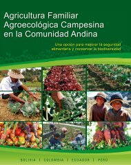
1t0SC7l
1t0SC7l
1t0SC7l

You also want an ePaper? Increase the reach of your titles
YUMPU automatically turns print PDFs into web optimized ePapers that Google loves.
4 TRENDS IN FIELD EXPANSION AND SOIL DEGRADATION, IN<br />
RELATION TO CROP YIELD AND POPULATION PRESSURE<br />
4.1 INTRODUCTION<br />
In the tropical forest area, agriculture has always been pointed out as the main factor of land<br />
degradation because of its effects leading to soil degradation and deforestation. In Chapter 2,<br />
various agricultural systems practised in the study area have been reviewed and their effects on<br />
soil behaviour have been evaluated in Chapter 3. The food cropping systems appeared to bear the<br />
main characteristics of shifting cultivation as result of important changes in soil properties during<br />
the cropping period. This shifting effect of agricultural fields is cause of continuous deforestation.<br />
This chapter aims to evaluate the expansion rates and trends of these fields and analyses the<br />
relationships with the causal factors and their effects on the spatial sustainability of forest<br />
management.<br />
4.2 METHODOLOGY<br />
Trends in agricultural field expansion are best studied by multi-temporal remote sensing images.<br />
In this study, only the 1984 - 1985 aerial photo interpretation landscape ecological map was<br />
available showing undisturbed forest land and land under agricultural activities (Touber, 1993).<br />
This landscape ecological map was digitised and computerised using arc-info software. To obtain<br />
the proportion estimate of the agricultural field expansion, the maps of the 290 agricultural fields<br />
population sample (see Section 2.2.4) opened between 1995 and 1997 were overlaid on the 1984 -<br />
1985 aerial photo-interpretation landscape ecological map using arc-view software. Fields that<br />
were in 1984-1985 still undisturbed forestland were grouped to compute the sample proportion of<br />
the forest that has been transformed into agricultural land during the 13-year period. The<br />
following formula was used to determine the total land area (A 13 ) under agriculture in 1997:<br />
A n* A 0<br />
A 13 = -----------<br />
A n0<br />
Where:<br />
A 13 = total land area under agriculture in 1997<br />
A 0 = total land area under agriculture in 1984<br />
A n = total measured agricultural sample fields population in 1995-1997<br />
A n0 = total measured agricultural sample fields population under agriculture in 1984<br />
The agricultural field expansion into the forest after 13 years is defined by A 13 - A 0<br />
Stepwise multiple linear regression analysis was used to evaluate the relationships between soil<br />
property changes and crop yields.<br />
4.3 RESULTS AND DISCUSSIONS<br />
4.3.1Trends in agricultural field expansion<br />
From the Landscape Ecological Survey of the study area (van Gemerden and Hazeu, 1999) based<br />
on aerial photograph of 1984 - 1985, over a total area of 167,350 ha and 51,180 ha were used for<br />
low and high intensity agriculture respectively. This agricultural area represented about 31% of<br />
the total TCP area (Table 4.1). A sample of 94.5 ha was mapped and used proportionally to the<br />
46