Kabul Urban Survey - Groupe URD
Kabul Urban Survey - Groupe URD
Kabul Urban Survey - Groupe URD

Create successful ePaper yourself
Turn your PDF publications into a flip-book with our unique Google optimized e-Paper software.
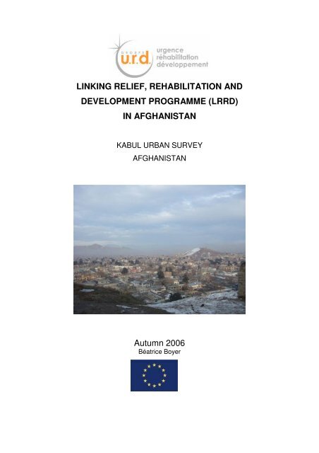
LINKING RELIEF, REHABILITATION AND<br />
DEVELOPMENT PROGRAMME (LRRD)<br />
IN AFGHANISTAN<br />
KABUL URBAN SURVEY<br />
AFGHANISTAN<br />
Autumn 2006<br />
Béatrice Boyer
CONTENTS<br />
EXECUTIVE SUMMARY ................................................................................................... 5<br />
1 INTRODUCTION ...................................................................................................... 9<br />
1.1 Initial part of the survey.......................................................................................... 9<br />
1.2 Problems in <strong>Kabul</strong> can be identified at different levels ........................................... 9<br />
1.3 Overview of the situation in <strong>Kabul</strong> in 2006.............................................................. 9<br />
1.4 Method of analysis ................................................................................................10<br />
1.5 Thematic issues....................................................................................................10<br />
2 IMPACT OF A SYMBOLIC IMAGE.............................................................................. 11<br />
2.1 The urban theatre becomes the theatre of war......................................................11<br />
2.2 <strong>Urban</strong> war, war of images .....................................................................................11<br />
2.3 <strong>Urban</strong> image, urban identity ..................................................................................11<br />
3 VISUAL APPROACH OF PHYSICAL SITUATION........................................................... 12<br />
3.1 Overview of <strong>Kabul</strong>.................................................................................................12<br />
3.2 Presence of several hills .......................................................................................13<br />
3.3 <strong>Urban</strong> fabric ..........................................................................................................14<br />
3.4 Hills views / Informal settlements in hills ...............................................................15<br />
3.5 Infrastructure issues & specific solutions...............................................................16<br />
3.6 In settlement areas in the hills...............................................................................17<br />
3.7 Different typologies of housing..............................................................................18<br />
3.8 Housing demolition ...............................................................................................19<br />
3.9 Homeless..............................................................................................................20<br />
3.10 Symbolic demolition ..............................................................................................21<br />
3.11 Construction..........................................................................................................22<br />
3.12 Horizontal urban expansion with informal settlements and self building ................23<br />
3.13 <strong>Urban</strong> expansion with ‘private town’......................................................................24<br />
4 EXISTING URBAN ANALYSIS .................................................................................. 25<br />
4.1 <strong>Kabul</strong> urban issues according to the MoUD ..........................................................25<br />
4.1.1 Multiple issues & challenges but also multiple opportunities ...................................... 25<br />
4.1.2 Priorities for <strong>Kabul</strong> ....................................................................................................... 26<br />
4.2 <strong>Kabul</strong> urban policy issues according to <strong>Kabul</strong> Municipality....................................26<br />
4.2.1 <strong>Kabul</strong> urban issues at present..................................................................................... 27<br />
4.2.2 <strong>Urban</strong> policy issues ..................................................................................................... 27<br />
4.2.3 <strong>Urban</strong> Development priorities...................................................................................... 30<br />
4.2.4 Policy recommendations from KM urban advisor........................................................ 31<br />
4.2.5 Clarifying planning institutions and the role of <strong>Kabul</strong> city............................................ 33<br />
4.3 <strong>Kabul</strong> urban policy issues according to the WB.....................................................36<br />
4.4 <strong>Kabul</strong> urban policy issues according to UN agencies and international aid ...........38<br />
4.5 <strong>Kabul</strong> urban social and vulnerability analysis ........................................................38<br />
5 URBAN DATA IN KABUL AND SPATIAL ISSUES ......................................................... 39<br />
5.1 Existing data for spatial vision...............................................................................39<br />
5.1.1 Historical maps of <strong>Kabul</strong>.............................................................................................. 39<br />
5.1.2 Existing administrative maps and plans of <strong>Kabul</strong>........................................................ 41<br />
5.1.3 Aerial spatial data........................................................................................................ 45<br />
5.1.4 <strong>Urban</strong> maps produced by or with the aid of international organisations ..................... 49<br />
5.2 Observations on spatial data.................................................................................53<br />
5.2.1 Outdated spatial reference .......................................................................................... 53<br />
5.2.2 Steps in providing training on spatial representation .................................................. 53<br />
Page 1
5.2.3 Accelerate spatial expertise in parallel........................................................................ 53<br />
5.3 Actors involved in urban planning: process & problems ........................................53<br />
5.3.1 Multiplicity of actors and data sources ........................................................................ 53<br />
5.3.2 Fragmented spatial urban vision ................................................................................. 54<br />
5.3.3 Ministry of <strong>Urban</strong> Development (MoUD) as mapping developer................................. 55<br />
5.3.4 <strong>Kabul</strong> Municipality mapping......................................................................................... 56<br />
5.3.5 AGCHO & AIMS as mapping offices........................................................................... 56<br />
5.4 Spatial analysis of <strong>Kabul</strong> city.................................................................................58<br />
5.4.1 A short analysis of <strong>Kabul</strong>’s urban structure................................................................. 58<br />
5.4.2 A geographical and cultural crossing .......................................................................... 60<br />
5.4.3 Strategic position: protection and vulnerability............................................................ 60<br />
5.4.4 Past and present spatial stakes .................................................................................. 61<br />
6 URBAN MECHANISMS ........................................................................................... 64<br />
6.1 Different decision-making levels............................................................................64<br />
6.1.1 At a national level and international control ................................................................ 64<br />
6.1.2 At the city level ............................................................................................................ 64<br />
6.1.3 At the community level ................................................................................................ 64<br />
6.2 Different level of spatial reconstruction strategies .................................................66<br />
6.2.1 Rehabilitation projects ................................................................................................. 66<br />
6.2.2 Development vision, programmes and risks ............................................................... 67<br />
7 CONCLUSION....................................................................................................... 72<br />
7.1 <strong>Urban</strong> situation......................................................................................................72<br />
7.1.1 Physical situation......................................................................................................... 72<br />
7.1.2 General lack of urban management and unclear institutional roles............................ 72<br />
7.1.3 Policies, programmes and projects ............................................................................. 73<br />
7.2 Analysis shows absence of spatial vision and lack of data....................................74<br />
7.2.1 Lack of synthesis with all analysis............................................................................... 74<br />
7.2.2 Lack of spatial reference ............................................................................................. 74<br />
7.2.3 Lack of coordination and information .......................................................................... 74<br />
7.3 Recommendations................................................................................................74<br />
7.3.1 Establishing reference documents and validating them officially................................ 74<br />
7.3.2 Response needs to cover different timeframes........................................................... 75<br />
7.3.3 A specific technical, urban development engineering agency .................................... 76<br />
BIBLIOGRAPHY ........................................................................................................... 77<br />
Page 2
ACKNOWLEDGEMENTS<br />
I would like to thank all the interlocutors I have met during this survey. However the list is too<br />
long to name everyone personally so I mention below all those who gave me specific advice<br />
and information within the framework of this urban survey on <strong>Kabul</strong> city. I am extremely<br />
grateful to all those who are not specifically named below.<br />
In this specific period of Afghan history, with its opening up to more international values, I<br />
would like to prioritise all the women I have met in different posts with urban responsibilities.<br />
Zahra Breshna, Architect, Engineer and <strong>Urban</strong> Planner who provided me with a wealth of<br />
information related to her work on urban challenges with components of the “Program for the<br />
Safeguarding & Development of Historical <strong>Kabul</strong>”, as well as her analysis and guidelines that<br />
she has developed within the Ministry of <strong>Urban</strong> Development over the past two years.<br />
Pushpa Pathak, as <strong>Urban</strong> planner and Policy Advisor in <strong>Kabul</strong> Municipality (KM) who has<br />
patiently explained to me the complexity of the partition on <strong>Kabul</strong> urban management and<br />
urban coordination between <strong>Kabul</strong> Municipality and the Ministry of <strong>Urban</strong> Development.<br />
Sultana Parwanta, who is currently working in the Ministry of Trade after her previous post as<br />
Economist <strong>Urban</strong> Planner Advisor in the Ministry of <strong>Urban</strong> Development. She has proved a<br />
valuable contact within this Ministry for all the different urban surveys that I have conducted<br />
in <strong>Kabul</strong> for the <strong>Groupe</strong> <strong>URD</strong>.<br />
Anna Soave, Architect working with Aga Khan Trust for Culture (AKTC within Aga Khan<br />
Foundation), for all the information on AKTC projects and on traditional Afghan architectural<br />
patterns that are visible in old <strong>Kabul</strong> centre.<br />
Soraya Goga, as <strong>Urban</strong> management officer for the World Bank. Unfortunately our<br />
encounters were too brief but long enough to understand the difficulties of managing<br />
international funds and Afghan capacity to absorb them in a constructive way, especially with<br />
respect to <strong>Kabul</strong> urban issues.<br />
And among all my different interlocutors, special acknowledgments to the following:<br />
Engineer Mohammad Yousaf Pashtun, Minister of the Ministry of <strong>Urban</strong> Development and<br />
Housing, and Deputy Ministers Dr Sayed Sharif Hossainy and Eng. Qiumuddiu Djallazada for<br />
having shown interest in this type of survey and allowing me to interview various members of<br />
staff in the different technical urban directorates within the MoUD. Furthermore Eng. Arch.<br />
Abdul Khaliq Neimat is specifically thanked for our discussions on <strong>Kabul</strong> regional urban<br />
development, as is Arch. and urban designer Al-Haj Wahid Abdul Ahad for the information on<br />
<strong>Kabul</strong> urban rehabilitation programmes and Arch. A. Hasib Latifi for his interest in this survey.<br />
Thank-you to Jamal Nazir for having helped organise meetings with the MoUD meetings.<br />
Tressan Sullivan, as advisor in <strong>Kabul</strong> Municipality, for providing me with urban maps of <strong>Kabul</strong><br />
and a wealth of information about the specific issues on land tenure. With his colleague,<br />
Andre Hernandez, within the Emerging Market Group supported by USAID, they helped me<br />
to understand the importance of land ownership and land market issues to solve other urban<br />
issues.<br />
My meeting with Fernando Da Cruz from UN-HABITAT was appreciated for the interest that<br />
he showed in this survey and its potential for complementing UN-HABITAT’s “City Profile of<br />
UN-HABITAT”.<br />
Page 3
ACRONYMS<br />
AGCHO<br />
AIMS<br />
AKTC<br />
ANDS<br />
ARDS<br />
ARTF<br />
AUWMP<br />
CAWSS<br />
ECHO<br />
EIRP<br />
EMG<br />
GIS<br />
GPS<br />
IDA<br />
LM<br />
LTERA<br />
MRRD<br />
MoF<br />
MoI<br />
MUDH<br />
MUD<br />
NDF<br />
O&M<br />
P,D&C<br />
PMU<br />
KM<br />
KURP<br />
SDP<br />
SoE<br />
TSU<br />
UNHCR<br />
WB<br />
WG<br />
WS<br />
Afghanistan Geodesy & Cartographic Head Office<br />
Afghanistan Information Management Services<br />
Aga Khan Trust for Culture<br />
Afghanistan National Development Strategy<br />
Afghanistan Reconstruction and Development Services<br />
Afghanistan Reconstruction Trust Fund<br />
Afghanistan <strong>Urban</strong> Waste Management Project<br />
Central Authority for Water Supply and Sanitation<br />
European Commission Humanitarian Aid Office<br />
Emergency Infrastructure Reconstruction Project<br />
Emerging Market Group<br />
Geographic Information System<br />
Global Positioning System<br />
International Development Association<br />
<strong>Kabul</strong> <strong>Urban</strong> Land Management<br />
Land Titling and Registration in Afghanistan (USAID)<br />
Ministry of Rural Rehabilitation and Development<br />
Ministry of Finance<br />
Ministry of Interior<br />
Ministry of <strong>Urban</strong> Development and Housing<br />
Ministry of <strong>Urban</strong> Development<br />
National Development Framework<br />
Operation & Maintenance<br />
Planning, Design and Contracts Management (Consultant)<br />
Project Management Unit<br />
<strong>Kabul</strong> Municipality<br />
<strong>Kabul</strong> <strong>Urban</strong> Reconstruction Project<br />
Strategic Regional Development Project<br />
Statement of Expenditure<br />
Technical support Unit<br />
United Nations High Commission for Refugees.<br />
World Bank<br />
Working Group<br />
Water Sanitation<br />
Page 4
EXECUTIVE SUMMARY<br />
Introduction on the impact of <strong>Kabul</strong>’s international image<br />
“The aftermath of September 11, 2001 precipitated major changes in the political and military<br />
situation in Afghanistan”. <strong>Kabul</strong> city became the scene of civil war theatre, an international<br />
military intervention and then an unprecedented influx of international aid. This international<br />
focus on Afghanistan and specifically on <strong>Kabul</strong> city was provoked by an urban event. The<br />
sudden and rapid destruction of the famous twin towers in New York city is inextricably linked<br />
with the long process of reconstruction in <strong>Kabul</strong>. Two urban societies have to cope with<br />
physical and symbolic impacts following destruction. In each city, images of conflict disaster<br />
war in urban areas and urban images are at stake. This introduction highlights the need of<br />
symbolic level as well multidimensional needs in the reconstruction process and how much<br />
image and city are in dissociable in collective representation and collective urban<br />
appropriation.<br />
<strong>Urban</strong> situation, physical approach and analysis of urban management capacity<br />
Although the urban situation at present is highly deteriorated due to both lack of<br />
administrative urban management as to the effects of war on urban areas, <strong>Kabul</strong> has the<br />
potential to become the pleasant city that it was a few decades ago. The challenge in urban<br />
development is to restore the quality of a regular structured city, located in a particularly<br />
beautiful circle of surrounding high mountains, whilst also dealing with the uncontrolled and<br />
chaotic development of urban settlements. But this process is hampered by the current<br />
disastrous situation. There is a consensus among all urban actors and urban inhabitants that<br />
the physical situation in <strong>Kabul</strong> city is chaotic, dirty, with uncontrolled housing settlements and<br />
buildings, severe traffic congestion, poor maintenance of road networks, insufficient power,<br />
unsafe water for domestic use and so on: <strong>Kabul</strong> needs to upgrade its physical context.<br />
Adding to this situation, an inventory of fixtures also includes other inadequacies such as<br />
general weakness of urban management, insufficient capacity among urban planners and<br />
confusion in institutional roles. The institutional urban sector has taken almost five years after<br />
the end of the conflict before becoming a coherent priority. Today an institutional urban<br />
framework exists but urban priorities according to the different urban stakeholders are still<br />
uncertain and urban policies are in the process of being established.<br />
Context of <strong>Kabul</strong>’s urban reconstruction process<br />
This urban survey was conducted in 2005 and 2006. At the end of 2005, very few<br />
reconstruction programmes were being conducted in <strong>Kabul</strong> city, excluding the private sector.<br />
This survey raised different questions about the urban reconstruction process supported by<br />
the international community. A draft of understanding has been drawn up covering the<br />
difficulties with which Afghan <strong>Urban</strong> Authorities have to cope with, such as upgrading the<br />
physical situation, increasing their urban planning making and management capacities or<br />
clarifying the urban institutional roles. The present phase of the survey attempts in the<br />
subsequent chapters to provide an overview of <strong>Kabul</strong> urban situation in 2006, at a critical<br />
phase mid-term in the reconstruction process with the support of International Aid. As, again<br />
one year later, hardly any new general upgrading of infrastructure is visible in urban areas;<br />
this survey attempts to understand the institutional mechanisms that are responsible for<br />
these delays.<br />
According to the Ministry of <strong>Urban</strong> Development<br />
The challenges for <strong>Kabul</strong> City Rehabilitation, after the destruction of the war, are<br />
overwhelming, complex, multidimensional and are characterised by several interlinking<br />
factors. But, <strong>Kabul</strong> shares points in common with many cities undergoing development in<br />
terms of different urban issues, due to the urban population growth and a general lack of<br />
infrastructure. According to the Deputy Minister Q. Djallazada, the reconstruction process<br />
Page 5
offers <strong>Kabul</strong> a dual outlook: on the one hand, urban issues that need to be tackled and, on<br />
the other, opportunities that must not be missed. Rehabilitation and the creation of new<br />
adapted infrastructure, improving traffic systems and transport network, resolving land tenure<br />
issues and supplying new migrants with land are some of the issues that must be dealt with.<br />
Alternatively, innovative urban practices, ensuring the sustainable preservation of<br />
environmental resources or strengthening institutional urban planning and maintenance<br />
capacity can be counted among the different opportunities in this period. Moreover, in the<br />
<strong>Kabul</strong> context, there are some highly important specific activities that need to be taken into<br />
account: ensuring land tenure security with regularisation of land property, upgrading<br />
infrastructure in informal settlements, establishing clear governance among <strong>Kabul</strong> urban<br />
authorities, providing the necessary conditions for economic recovery, ensuring power<br />
supply, development programmes and establishing a system for determining land value.<br />
According to <strong>Kabul</strong> Municipality<br />
<strong>Kabul</strong> Municipality is faced with a number of difficulties in urban management of <strong>Kabul</strong> city.<br />
The population has increased dramatically over the past five years without any development<br />
of basic urban services nor any building of urban management capacity. The population is<br />
estimated at between 3 and 4 million, depending on the different understandings of the city<br />
boundaries, with the result that informal settlements now represent 70% of the city’s housing.<br />
<strong>Kabul</strong> Municipality is still working with the outdated urban administrative reference, the 1978<br />
Master Plan, and has severely underestimated the size of the urban challenge. The general<br />
lack of basic urban infrastructure covers in 2006, about 70% of the city and the need for a<br />
coherent global urban policy is urgent in order to provide an urban framework for<br />
implementing programmes both within the public and private sector.<br />
Many recommendations have been put forward by advisors for upgrading KM: at the national<br />
level, such as revision of Municipal Law, <strong>Urban</strong> land Policy and <strong>Urban</strong> Law, and at the local<br />
level, with local elections, city development strategy and plans, organisational reform and<br />
restructuring, revenue enhancing and financing urban development. The objectives include<br />
coping with the main urban issues, such as urban administrative regulation and the need to<br />
strengthen urban planning capacity. However the main challenge is to resolve the confusion<br />
that reigns over who is responsible for leading urban planning in <strong>Kabul</strong> city. KM claims its<br />
right to leadership, but given its lack of urban capacity, the Ministry of <strong>Urban</strong> Development<br />
(MoUD) is seeking to become the urban leader in this transitional period with the support of<br />
international aid.<br />
According to the World Bank<br />
For the World Bank, there must be no delay in prioritising the activities for improving <strong>Kabul</strong>.<br />
According to their representatives, financial and technical efforts need to be focused urgently<br />
on rehabilitating existing urban areas, rather than development programmes. For almost five<br />
years, the WB has recommended upgrading infrastructure in existing areas, whether they be<br />
legal or illegal in administrative terms. For the WB, the problem lies not in the administrative<br />
technicalities but in responding to people’s needs where they are currently living. Different<br />
technical surveys are ongoing in Water Supply and Sanitation and Solid Waste Collect<br />
systems. But the financial support for a wide-reaching rehabilitation programme the “<strong>Kabul</strong><br />
<strong>Urban</strong> Rehabilitation Programme” (KURP) has taken almost five years to be accepted by the<br />
different Afghan partners. According to the WB, <strong>Kabul</strong>’s development can be analysed at<br />
different levels in terms of space and time, in order to satisfy to increasing need for housing<br />
for new migrants. For the present urban situation, urgent decisions have to be taken for<br />
rehabilitation.<br />
According to UN agencies and international aid<br />
UNDP and UN-HABITAT are in charge of advisory services and coordination for the whole<br />
reconstruction process in the sector. On the one hand, UN-HABITAT is supervising pilot<br />
Page 6
programmes with communities for upgrading areas and on the other, it is analysing urban<br />
management and planning capacities at the municipal level with “City Profile Programmes”<br />
which have been tested in Kandahar and Herat. <strong>Kabul</strong> Municipality has not yet benefited<br />
from this programme, but UN-HABITAT is present and active both in <strong>Kabul</strong> Municipality and<br />
in the Ministry of <strong>Urban</strong> Development. UNDP will be participating in the coordination process.<br />
Lack of spatial data on <strong>Kabul</strong> city and spatial vision in existing urban analysis<br />
One way of understanding an urban situation is to obtain a spatial overview of the city and<br />
suburbs. The analysis of reconstruction efforts and needs in this transitional period between<br />
rehabilitation and development has constantly been confronted with a critical lack of urban<br />
reference maps.<br />
Reticence for producing urban maps<br />
The fact is that Afghanistan is not accustomed to allowing the general public to access maps<br />
of its territory. Traditionally, cartography and geodesy data were a military concern. A<br />
national administration, the Afghan Geodesy and Cartography Head Office (AGCHO), which<br />
works as a Ministry directly under the control of the Islamic Republic of Afghanistan’s<br />
President, is in charge of topographical and cartography surveys throughout the country. The<br />
maps produced by AGCHO are reserved for strategic matters and gaining access to these<br />
maps for civil issues, such as urban development, is difficult. Furthermore, in the past, very<br />
few urban maps were made, because urban areas were not so important and strategic in<br />
comparison with agricultural areas. Moreover, the different conflicts and resulting population<br />
movement over the past few decades have considerably altered urban expansion patterns,<br />
urban landscapes and de facto the urban knowledge of the real situation. Finally, for several<br />
reasons, such as the top-secret use of topographical data, the succession of wars and<br />
subsequent destruction, outdated urban planning skills and the risk of land property disputes,<br />
few urban maps have been updated and the old ones that exist are completely disconnected<br />
from current geographical data. We have observed lots of different background for spatial<br />
representation of <strong>Kabul</strong> city and in consequences lots of different spatial vision of the city.<br />
Lack of spatial references<br />
In this report, we have written at length about the lack of spatial representation, the<br />
difficulties encountered in obtaining relevant maps, the inexistence of urban plans, the<br />
obsolete administrative spatial references, the absence of cadastral maps, incorrect data on<br />
existing plans, lack of scales and the absence of a detailed urban map. The problem is not<br />
so much having to cope without the necessary maps of the real urban situation, because<br />
satellite images are always available by default. The real problem is what this implies,<br />
i.e. urban authorities do not have a coherent spatial vision for urban issues, nor do they have<br />
an inventory of projects to implement. A considerable amount of work needs to be done on<br />
updating spatial data and establishing an urban planning map.<br />
Lack of coordination and information<br />
There appears to be plans for a coordination mechanism within the MoUD, but in 2006 it is<br />
not yet in operation. There is a lack of coordination at all the levels of decision making,<br />
planning, assessments, surveys, implementation and works. There is no communication<br />
between the institutional actors themselves, but also with civil urban actors and especially<br />
urban citizens. The urban population does not understand why the situation has not<br />
improved. There is the risk that instead of being urban partners, they might become<br />
disruptive components of the urban improvement process.<br />
<strong>Urban</strong> reconstruction mechanisms<br />
Various urban development mechanisms focusing on different development strategies are<br />
currently being put into operation at different levels. The urban sector is so severely affected<br />
that the challenges are multiple. For example, at the national level, the priority is to define<br />
Page 7
urban and land property policy, whereas at the municipal level, urban management expertise<br />
requires immediate support. For the city inhabitants, improving physical conditions and basic<br />
services in the city is the main challenge. While urban actors are busy prioritising decisions,<br />
delays have incurred in programme implementation and improvements are not yet visible in<br />
the field. Some pilot programmes which have been conducted effectively by UN advisors by<br />
means of a community approach are unfortunately too much limited in scope to provide a<br />
response to the major urban issues. The rehabilitation programmes funded by the World<br />
Bank (KURP) have not yet been implemented. This programme aims to bring an albeit<br />
limited improvement to twenty small areas in the city. Alternatively Afghan authorities would<br />
have preferred to solve urban problems by developing a new city in the outskirts of <strong>Kabul</strong>.<br />
The Japanese Cooperation is working on the feasibility of this type of programme but it is a<br />
long-term vision and <strong>Kabul</strong> needs to resolve its existing urban issues before thinking about a<br />
new expansion project.<br />
Recommendations for improving urban reconstruction process<br />
<strong>Urban</strong> authorities need to develop some reference documents in order establish a better and<br />
more coordinated spatial vision amongst all urban actors. Firstly a Synthesis Report should<br />
be produced. Based on all the surveys that have already been conducted, this Synthesis<br />
Report would provide a clear hierarchy of the relevant recommendations, propositions of<br />
studies and activities to be carried out in each field in terms of quality and needs, prioritise<br />
these different studies and activities and establish a consensus between all the policy<br />
makers and urban stakeholders. Secondly, a General Directory, as a primary planning<br />
document, must be flexible and easy to adapt in light of future analysis and rapidly changing<br />
contexts. This document must provide an urban framework for the activities that will be<br />
conducted in different timeframes: short term, medium term and long term. Several<br />
components have to be included in this framework: institutional references, such as<br />
administrative maps; urban policies and technical guidelines; and all the findings of the<br />
different research studies and surveys.<br />
The General Directory must take in consideration the desire to improve <strong>Kabul</strong>’s image in<br />
terms of quality, national identify and international status. Both the Synthesis Report and the<br />
General Directory should be validated by all the policy makers under the supervision of <strong>Kabul</strong><br />
Municipality throughout all phases of production. Then the conditions for rehabilitation and<br />
new programmes need to be coordinated effectively in order to accelerate the reconstruction<br />
process. In other words, <strong>Kabul</strong> Municipality could once again take over responsibility for the<br />
urban management of <strong>Kabul</strong> city.<br />
Page 8
1 INTRODUCTION<br />
1.1 Initial part of the survey<br />
The first phase in the <strong>Kabul</strong> urban survey was carried out by <strong>Groupe</strong> <strong>URD</strong> at the end of<br />
2005 1 . The findings were presented at a conference organised by <strong>Groupe</strong> <strong>URD</strong> in the<br />
Ministry of Agriculture 2 as part of a general presentation on rural and urban research. This<br />
presentation gave a general overview of the urban situation in <strong>Kabul</strong>, four years after the<br />
beginning of the reconstruction process, and the main points are summarised in a short<br />
article entitled “From the spreading of the Pakistani architecture to the growing urban<br />
expansion of <strong>Kabul</strong> into the surrounding hills, what will <strong>Kabul</strong> look like in the near future?”.<br />
The positive aspects mainly concerned the dynamics of the private sector which has seen<br />
the emergence of a large number of houses and buildings. Some of these houses are<br />
located in informal settlements in the hills and therefore lie outside of the administrative<br />
boundaries and other new buildings stray from the traditional Afghan architectural design.<br />
Locally they are known as ‘Pakistani houses’. “Yet, it should also be pointed out that the<br />
private sector is definitely responsible for speeding things up and invests the most in <strong>Kabul</strong>’s<br />
reconstruction while the KM and the MUDH are unable to provide enough houses 3 ” for the<br />
increasing population.<br />
1.2 Problems in <strong>Kabul</strong> can be identified at different levels<br />
Physical urban fabric. The article highlighted the lack of basic urban services and<br />
infrastructure: “urgent issues such as housing for the poor, water and electricity supply,<br />
drainage, roads, traffic congestion and general planning issues” and the lack of control over<br />
expanding city boundaries with informal settlements and horizontal urban expansion.<br />
On a governance level. It is difficult for urban authorities to make progress in the<br />
reconstruction process because of weaknesses in Afghan urban skills and financial capacity,<br />
lack of proper urban tools to deal with <strong>Kabul</strong>’s issues, outdated legal administrative and<br />
technical framework and significant shortcomings among the main urban institutional actors,<br />
including the <strong>Kabul</strong> Municipality (KM) and the Ministry of <strong>Urban</strong> Development (MoUD). In<br />
general, “it appears that the KM is in denial which is causing major problems for development<br />
in <strong>Kabul</strong>”.<br />
In terms of risks and opportunities. On the one hand, there is the risk that the widespread<br />
building currently undertaken by the private sector and urban planning will continue without<br />
the necessary controls, leading to the increasingly exclusion of the most vulnerable people.<br />
On the other hand, following the recommendations for reconstruction priorities put forward on<br />
the basis of WB analysis and financial support, there are opportunities for upgrading existing<br />
areas under construction instead relocating so many people “…in favour of instigating an<br />
upgrading scheme for the informal houses as the government does not have the financial<br />
capacity to acquire land and resettle people”.<br />
1.3 Overview of the situation in <strong>Kabul</strong> in 2006<br />
This survey aims to present an overview of the urban situation in <strong>Kabul</strong> in 2006, mid-term in<br />
the reconstruction process. Twelve months after the research began, there is hardly any new<br />
1 Mariani C., “From the spreading of the Pakistani architecture to the growing urban expansion of<br />
<strong>Kabul</strong> into the surrounding hills, what will <strong>Kabul</strong> look like in the near future?”, LRRD Programme, 2005<br />
2 <strong>Groupe</strong> <strong>URD</strong> conference at the Ministry of Agriculture, Animal Husbandry and Food, <strong>Kabul</strong> (13<br />
December 2005)<br />
3 Idem note 1<br />
Page 9
upgraded infrastructure visible in urban areas and this survey tries to understand where the<br />
responsibility for these delays lies.<br />
1.4 Method of analysis<br />
To present an overview of <strong>Kabul</strong>’s urban situation and an inventory of <strong>Urban</strong> Issues,<br />
Strategies, Policies, Programmes or Projects that are ongoing in <strong>Kabul</strong>, different urban areas<br />
were visited, the main urban actors met and a large quantity of urban reports and documents<br />
were analysed. The urban situation in <strong>Kabul</strong> is still confused and the actors involved are<br />
numerous and highly varied. A lot of literature has been produced on this sector over the last<br />
five years. The urban sector is highly complex with many cross-cutting issues which makes it<br />
difficult to present a clear analysis on each issue. It is not our objective to carry out a<br />
thorough urban technical analysis. As many urban analysts involved in <strong>Kabul</strong>’s issues, we<br />
have a fragmented view and there is still a lot of urban data missing. Below we present a<br />
general overview of the different urban analysis that has been produced to date.<br />
1.5 Thematic issues<br />
After a presentation of the urban situation by means of a visual analysis, existing urban<br />
research helps broaden our understanding the main institutional decision and policy making<br />
processes undertaken by <strong>Kabul</strong> Municipality and the Ministry of <strong>Urban</strong> Development. One of<br />
the major difficulties encountered by all actors interested in sharing data on urban issues is<br />
the lack of a common coherent spatial reference. An inventory is carried out of existing urban<br />
mapping for <strong>Kabul</strong>, with the idea that it could be useful for urban actors to improve their<br />
understanding of this information. This survey focuses on the urban data issue because of<br />
the lack of adequate spatial documents and, as a result, an absence of coherent spatial<br />
visions. Finally, urban reconstruction mechanisms are presented as well as rehabilitation<br />
programmes or projects that are in the decision and design process, rather than the<br />
implementation phase.<br />
Page 10
2 IMPACT OF A SYMBOLIC IMAGE<br />
The attacks of 11 September 2001 on New York had a symbolic impact on <strong>Kabul</strong> and these<br />
events must not be overlooked when studying current urban issues in Afghanistan as a<br />
whole: “The aftermath of September 11, 2001 precipitated major changes in the political and<br />
military situation in Afghanistan” 4 . The cause and effect link between the specific destruction<br />
in New York and global reconstruction in <strong>Kabul</strong> can be assessed by its symbolic impact and<br />
lessons in urban development can be learnt.<br />
2.1 The urban theatre becomes the theatre of war<br />
The sudden destruction of the Twin Towers in Manhattan, New York, as two commercial<br />
airplanes crashed into them provoked highly emotional reactions throughout the world. If the<br />
deaths of many innocent people was seen as a painful and terrible act of violence, it is<br />
interesting to study the symbolic impact of the destruction of the building itself. What was the<br />
point of this violent and total destruction of the highest and most famous buildings in New<br />
York? They lay at the core of the city and were symbols of Western society, of national<br />
pride and the symbolic core of international cities. Cities are an urban theatre, with the<br />
symbolic expression of culturally, financially and technically remarkable buildings. This<br />
terrorist act used the city as a theatre of war, causing a dual impact on society: firstly,<br />
physical death and destruction and secondly the symbolic destruction of a “civil pride of the<br />
city”.<br />
2.2 <strong>Urban</strong> war, war of images<br />
Another observation is that the same sophisticated strategy of destruction traditionally<br />
reserved for official, political or military buildings was used for a famous civilian office<br />
building. This spectacular event produced shock waves that were merely heightened with the<br />
repeated television broadcasts. Television programmes presented on loop images of the<br />
astonishing and terrifying destructive power and the symbol of high technical performance,<br />
financial power and proud building construction. The values of urban environment and urban<br />
society are as much about urban images as they are the physical situation.<br />
2.3 <strong>Urban</strong> image, urban identity<br />
As mentioned above, urban images contribute considerably to how an urban society<br />
identifies itself. <strong>Urban</strong> reconstruction, with its multidimensional needs (social, economic,<br />
technical) and multi-sector needs (roads, networks, housing, engineering, management) also<br />
have to deal with importance of image. Those involved in urban reconstruction need to find a<br />
cultural balance between the image of Afghan identity, basic material needs and<br />
modernisation. <strong>Urban</strong> images produce a sense of coherence for the rebuilding of urban<br />
society.<br />
Needs at a symbolic level<br />
A society can be affected by physical destruction but also by symbolic destruction. In<br />
the same way, a city’s (re)construction has to take in consideration both the symbolic<br />
reconstruction as well as physical rebuilding.<br />
Need for multidimensional urban fabric<br />
The notion of urban theatre is also important and implies that urban planning and<br />
(re)construction must necessarily be the product of a sophisticated urbanisation at<br />
different levels, including economic, social, technical and symbolic levels.<br />
Image and urban appropriation<br />
The events in New York illustrate to what extent image and city are linked in collective<br />
representation and collective urban appropriation.<br />
4 IDA, (International Development Association of the World Bank) Afghanistan: <strong>Kabul</strong> Reconstruction<br />
Project; Technical Annex, July 2004<br />
Page 11
3 VISUAL APPROACH OF PHYSICAL SITUATION<br />
3.1 Overview of <strong>Kabul</strong><br />
Figure 1: View from television hill<br />
<strong>Kabul</strong> city expands over a high plateau: the landscape of the city is shaped by several visual<br />
and physical characteristics.<br />
- High mountains surround the flat urban area<br />
- <strong>Kabul</strong> River crosses the city from west to east<br />
- Several hills are included within the city<br />
Figure 2: <strong>Kabul</strong> River<br />
Page 12
3.2 Presence of several hills<br />
Figure 3 Figure 4<br />
In the past, the hills were protected and reserved for different social and symbolic<br />
occupations, such as military camps, religious sites, parks or cemeteries. Due to the last<br />
decades of wars and the influx of returnees and refugees, nearly all the hills now are<br />
occupied by self built houses. Each day, the increasing expansion of housing gains ground<br />
on these hills, gradually making their way to the summit. This urban situation, known as<br />
“informal settlements”, is one of the major problems that urban authorities have to cope<br />
with.<br />
Figure 5: Several hills in urban area<br />
Hills gradually occupied by housing<br />
Hills still protected as natural areas<br />
Page 13
3.3 <strong>Urban</strong> fabric<br />
1. Traditional historical urban fabric in flat areas, made up of individual plots (houses and<br />
private gardens) and regular streets on a grid network.<br />
2. A few scattered high buildings, monuments or modern buildings or some residential<br />
blocks of flats grouped together in a neighbourhood, such as in Microrayan area.<br />
3. Informal settlements either expanding around the city or climbing the various hills inside<br />
the city “….the city has a population of more than 3.5 million, with impoverished<br />
residents filling war-devastated sections of the city and constructing new dwellings<br />
higher and higher on the surrounding hillsides” 5 .<br />
Figure 6<br />
2 3<br />
Different<br />
degrees of<br />
density<br />
1<br />
Figure 7: View with lake<br />
A<br />
B<br />
C<br />
Potential<br />
environmental<br />
assets to<br />
preserve in very<br />
short term.<br />
A- Existing<br />
Green areas<br />
B- Lake and<br />
<strong>Kabul</strong> River<br />
C -Some hills or<br />
at least top of<br />
hills already<br />
occupied<br />
5 Q.Djallalzada.<br />
Page 14
3.4 Hills views / Informal settlements in hills<br />
Figures 8, 9, 10 & 11<br />
Traditional official settlement<br />
& informal settlement<br />
<strong>Urban</strong> issues<br />
Negative aspects: <strong>Urban</strong> areas do not have<br />
basic urban services, such as water<br />
supply, sewage networks, electricity or road<br />
access. Problems of pollution, health and<br />
insecurity.<br />
Positive aspects: Considerable financial<br />
participation from inhabitants themselves<br />
who build their own houses to compensate<br />
for sever housing shortages.<br />
Architectural issues<br />
Negative aspects: Lack of basic technical<br />
equipment and sustainable energy<br />
construction and systems.<br />
Positive aspects: Strong cultural coherence<br />
of architectural patterns with safeguarding of<br />
traditional distribution using both inside and<br />
outside space.<br />
Page 15
3.5 Infrastructure issues & specific solutions<br />
In flat urban areas<br />
Figures 12, 13, 14 & 15<br />
Not enough power for permanent supply<br />
everywhere in the city.<br />
With the lack of basic electricity for housing,<br />
this is an important handicap for restarting the<br />
economy.<br />
Besides much of the power supply benefits<br />
wealthier families, so the electricity network<br />
and power supply needs to be extended to<br />
all areas of urban settlement.<br />
The lack of clean water supply is a problem<br />
but the lack of sewage network is a major<br />
health urban issue.<br />
Specific rehabilitation needs to be expanded<br />
from pilot operations to every neighbourhood.<br />
As well as successful community participation,<br />
a general rehabilitation policy has to be<br />
established at national level.<br />
Page 16
3.6 In settlement areas in the hills<br />
Figures 16, 17, 18, 19, 20 & 21<br />
Garbage<br />
will not<br />
be<br />
removed<br />
if nobody<br />
is in<br />
charge of<br />
clearing<br />
the<br />
Garbage passage. is<br />
not removed<br />
if nobody is<br />
responsible<br />
for clearing<br />
the<br />
passage.<br />
Access & garbage issues<br />
Access to existing settlements in the hills is partly<br />
solved by this type of concrete stair but this pilot<br />
operation highlights the limits of the garbage<br />
collection system (only one stair was seen).<br />
Page 17
3.7 Different typologies of housing<br />
Figure 22, Figure 23, Figure 24 & Figure 25<br />
Traditional houses<br />
Most of this self build housing consists of<br />
traditional mud buildings with one or two<br />
floors, flat roofs and wooden windows.<br />
Blocks of flats<br />
Prefabricated blocks date from Soviet<br />
period (concentrated in Microrayan areas).<br />
‘Pakistani Houses’<br />
<strong>Urban</strong> issues<br />
These buildings take up a lot more space<br />
than traditional houses inside a plot<br />
surrounded by walls. This reduces the natural<br />
ecological equilibrium and traditional outside<br />
use. Pakistani houses are grouped together in<br />
rich ‘ghetto’ areas.<br />
Architectural issues<br />
Those new buildings copy a foreign style of<br />
architecture, either Arab or Pakistani. They are<br />
much larger than traditional houses. This<br />
building density could pose problem of lack of<br />
privacy.<br />
Environmental issues<br />
These buildings, with wide windows and<br />
powerful generators, are not energy efficient.<br />
Traditional mud houses<br />
Self building with rural techniques need<br />
rehabilitation and permanent maintenance.<br />
Building houses out of mud is energy efficient<br />
but can be complemented with other<br />
solutions, such as insulation and solar<br />
system.<br />
Page 18
3.8 Housing demolition<br />
Within the urban environment<br />
Figures 26 & 27<br />
In some cases, buildings have only been<br />
partially destroyed and could be saved with<br />
good structural expertise before<br />
rehabilitation.<br />
But restoring a building is always a lot<br />
more expensive than a new building. In this<br />
case, there are several abandoned<br />
buildings that will require destruction.<br />
Strategic or<br />
symbolic areas<br />
Figures 29 & 29<br />
Some urban areas,<br />
such as those close<br />
to the airport or the<br />
King’s Palace, have<br />
been particularly<br />
affected and are in<br />
ruins.<br />
Page 19
3.9 Homeless<br />
Squats<br />
Figures 30 & 31<br />
Ruined houses with no roofs, windows where some of the walls are being used as housing,<br />
probably by owners who want to stay in their own property or by the first arrivals.<br />
People living in ruins<br />
Figures 32 & 33<br />
Some have found walls or a roof in half destroyed buildings, such as office buildings or other<br />
types of building such as the Russian cultural centre (on the right) and use this as housing.<br />
Makeshift tents<br />
Figure 34<br />
In 2005, many people were<br />
still living under tents or<br />
pieces of cloth next to<br />
building sites.<br />
Page 20
3.10 Symbolic demolition<br />
Figures 35, 36, 37 & 38<br />
The Palace of the<br />
King was particularly<br />
the subject of<br />
attacks. Indeed,<br />
there may still be<br />
some mines inside.<br />
This monument<br />
could be restored<br />
both for symbolic<br />
revival and as a<br />
good architectural<br />
feature.<br />
Page 21
3.11 Construction<br />
Figures 39, 40 & 41<br />
The private construction<br />
industry is highly dynamic<br />
and requires a technical<br />
framework of norms and<br />
standards.<br />
Just like any<br />
contemporary society,<br />
Afghan people want<br />
their city<br />
to look modern.<br />
Page 22
3.12 Horizontal urban expansion with informal settlements and self<br />
building<br />
Figures 42, 43 & 44<br />
Page 23
3.13 <strong>Urban</strong> expansion with ‘private town’<br />
Figures 45, 46 & 47<br />
<strong>Urban</strong> expansion with<br />
private funds in the<br />
desert area north of<br />
<strong>Kabul</strong>: risk that<br />
housing will be built<br />
without the necessary<br />
public services.<br />
Risk that people will<br />
try to build a utopia<br />
rather than satisfying<br />
needs<br />
Page 24
4 EXISTING URBAN ANALYSIS<br />
Research on <strong>Kabul</strong> city and Afghan urban issues in general has generated a lot of literature<br />
from different actors involved in the urban sector: at a national level with the Ministry of<br />
<strong>Urban</strong> Development (and Housing); at a local level with the <strong>Kabul</strong> Municipality; at an<br />
international level with donors (World Bank and partners) and operational organisations,<br />
such as the PNUD, UN-HABITAT and some international organisations such as AKTC-AKDN<br />
or research institutions, such as AREU and Universities, etc. The present inventory of <strong>Kabul</strong><br />
urban issues takes its source from the points raised by this variety of research and analysis<br />
on the sector, and includes urban policy issues, physical reconstruction issues<br />
(infrastructure, housing and building materials), urban needs and urban priorities. Below, we<br />
present some of the reports, research and recommendations that shed light on the situation<br />
in <strong>Kabul</strong>. The complexity and interdependence of the various issues are presented as they in<br />
the original text. Similarly, the different authors are not necessary in agreement as how the<br />
different needs and solutions should be prioritised. A difference of views between the two<br />
major institutional actors, the MUD and KM, is at the centre of the debate.<br />
4.1 <strong>Kabul</strong> urban issues according to the MoUD<br />
<strong>Kabul</strong>’s urban population is estimated at around 50-60% of the urban population in<br />
Afghanistan as a whole. In this way, the urban issues affecting Afghanistan and <strong>Kabul</strong> in<br />
particular are entirely dependent on the MoUD’s expertise, decisions and management. The<br />
understanding of how the Ministry of <strong>Urban</strong> Development functions was the subject of a<br />
previous report written by <strong>Groupe</strong> <strong>URD</strong> in April 2006, “<strong>Urban</strong> Sector Review”. Therefore, in<br />
this report, we shall present an overview of the urban situation as seen by the MoUD’s<br />
Deputy Minister.<br />
4.1.1 Multiple issues & challenges but also multiple opportunities<br />
Qiamuddin Djallalzada is the Deputy Minister, within the Ministry of <strong>Urban</strong> Development<br />
(MoUD). In order to convey the official point of view of the Afghan government on the<br />
development of <strong>Kabul</strong>, we present the main components of Mr Q. Djallazada’s presentation<br />
on the situation entitled “Planning the future development of <strong>Kabul</strong>” 6 which was given at a<br />
colloquium organised in Lausanne in 2005. Mr Djallazada believes that the urban situation of<br />
<strong>Kabul</strong> will be shaped by global urbanisation trends: …“one of the critical global trends<br />
shaping the future”. He explains that the reversal from a predominantly rural population<br />
towards an urban population over the next decades is a fact. Afghanistan cannot escape this<br />
global urban phenomenon. Just like other less developed regions, the urban population is<br />
increasing particularly rapidly and the urban authorities are not sufficiently prepared to<br />
manage the “most complex, dynamic and powerful systems” that cities represent today.<br />
“Cities are intrinsically multidimensional in character”. The challenges are multiple with<br />
interdependence of several factors. As well as the urgent need for reconstruction after the<br />
destruction of the war, there appear to be two opportunities in this type of forced<br />
urbanisation.<br />
• <strong>Urban</strong> issues to tackle<br />
On the one hand, extensive rehabilitation has to take place to ensure the significant need of<br />
development:<br />
“….Rapid urbanization is also resulting in dangerous pressures on antiquated infrastructure<br />
that can not meet the water, electricity and other requirements of large portions of the<br />
population, while problems of health and hygiene associated with high density settlements<br />
are common. Infrastructure such as roads, traffic system, telephone system, electricity, water<br />
6 Djallazada Q., “Planning the future development of <strong>Kabul</strong>,” in Development of <strong>Kabul</strong> –Reconstruction<br />
and planning issues, issued from the Section entitled “Past and future of <strong>Kabul</strong>” for the colloquium<br />
organised by MUNTAZ (B)-NOSHIS (K) ), <strong>Kabul</strong>, 2004<br />
Page 25
and sanitation, renovation of buildings, is in shambles and the need for reconstruction is very<br />
necessary to bring back the city of <strong>Kabul</strong> to a better place for living.”<br />
• <strong>Urban</strong> opportunities<br />
On the other hand, Q. Djallazada opens the debate by suggesting that what is need is not so<br />
much a rehabilitation of the situation as it was before but a better urban situation for <strong>Kabul</strong>.<br />
This could be an opportunity for the Afghan urban sector and particularly for <strong>Kabul</strong> city to<br />
move forward with modernisation and secondly to try to avoid the urban problems of the old<br />
cities, such as environmental pollution, reduction of green space in the city, lack of respect<br />
for traditional use of urban space and architecture, poor energy management and democratic<br />
participation in urban decisions: “… adoption and adaptation in the urban context of a<br />
reinforcing system of innovative practices, including the building of institutional capacities to<br />
implement and maintain them. There are a multiplicity of initiatives that are currently<br />
advancing performance in areas ranging from poverty reduction, social capital formation,<br />
employment generation, gender equality, and environmental sustainability, through to good<br />
governance processes and partnerships, effective planning and management, and the<br />
socially just and equitable distribution of resources to those who need them most.”<br />
4.1.2 Priorities for <strong>Kabul</strong><br />
“…In recent years, more than three million refugees returned to the country, with the majority<br />
settling in the country’s urban centres and primarily in the capital city, <strong>Kabul</strong>. <strong>Kabul</strong> is a<br />
powerful magnet for Afghans looking for security and a better life after decades of civil war,<br />
particularly for refugees returning from abroad and IDPs throughout the country”.<br />
According to Q. Djallazada, there is a substantial amount of work that needs to be done in<br />
order to ensure secure land properties, basic services, a proper road network, better traffic<br />
and transport. None of this is possible without support in urban planning capacity building for<br />
all urban institutions (MoUD, KM, etc.) and an improved financial situation with the <strong>Kabul</strong> tax<br />
system and land market, as summarised in the following extract.<br />
Extract from “Past and future of <strong>Kabul</strong>”, Q. Djallazada<br />
1. “Systematic rebuilding of <strong>Kabul</strong> city that has been destroyed, with shelter and housing<br />
2. being critical areas of support for the returning population. This means rebuilding houses,<br />
including informal housing, and providing infrastructure and services to the city residents.<br />
3. Finalization of an Action/ Reconstruction plan.<br />
4. A number of quick start projects to provide serviced land for housing, facilitating self-build<br />
and other housing, with proper coordination and planning for maximum impact.<br />
5. A project to regularize unplanned areas and facilitate improvements to Services, in these<br />
areas.<br />
6. A project to improve land registration, property valuation, land survey and demarcation<br />
and to develop land dispute resolution mechanisms.<br />
7. Capacity building support for the Ministry of <strong>Urban</strong> Development and Housing, <strong>Kabul</strong><br />
8. Municipality and other stakeholders.<br />
9. Provision of a proper Traffic and Transportation plan.<br />
10. A project to mobilize the financial sector with respect to property, to ensure that the<br />
11. Government expenditure is targeted, to develop a mortgage market and to review the<br />
potential for property taxation.”<br />
4.2 <strong>Kabul</strong> urban policy issues according to <strong>Kabul</strong> Municipality<br />
According to <strong>Kabul</strong> Municipality, <strong>Kabul</strong> city is above all the responsibility of <strong>Kabul</strong><br />
Municipality rather than the responsibility of the MoUD. Below, we provide details of the<br />
issues, priorities and recommendations formulated by KM through Pushpa Pathak’s analysis.<br />
Page 26
P. Pathak is the <strong>Urban</strong> Planning and Policy Advisor in <strong>Kabul</strong> Municipality, formerly the Senior<br />
<strong>Urban</strong> advisor in UN-HABITAT. She has been working on urban issues since 2004 and has<br />
produced several drafts for discussions amongst urban stakeholders, analysis and<br />
recommendations about the urban situation in <strong>Kabul</strong>, Municipal Law, <strong>Urban</strong> Policies and<br />
<strong>Urban</strong> Priorities. In 2004, she produced a draft for the reform of “Municipal Law of<br />
Afghanistan”; in 2005 a text on “KM-Planning Institutions, Roles and Recommendations for<br />
<strong>Kabul</strong> City”; and in 2006 a draft for discussion on “KM-<strong>Urban</strong> Policy Issues, Priorities and<br />
Recommendations for <strong>Kabul</strong>”. We present below the main components of her analysis, most<br />
of the time in her words in order to remain true to the complexity of the situation. <strong>Kabul</strong> urban<br />
issues encompass a variety of different aspects, such as urban population and settlements,<br />
urban institutional context, issues and priorities.<br />
4.2.1 <strong>Kabul</strong> urban issues at present<br />
The population has increased dramatically over the last five years without any development<br />
of basic urban services. The population is estimated at between 3 and 4 million, depending<br />
the different stakeholders’ understanding of where the city boundaries lie. No recent census<br />
has been carried out and “large urban areas continue to attract migrants as places with<br />
better livelihood opportunities, urban services amenities and grater security”. KM has to cope<br />
with a permanent population growth. Among the various urban problems, it is possible to<br />
highlight the following issues as being critical in this transitional period toward reconstruction.<br />
• Informal urban population<br />
Most of the new inhabitants (returnees, Internally Displaced Persons (IDPs)) have settled<br />
anywhere they could find available land. In consequence, “…Rapid population growth has<br />
resulted in large-scale informal land and housing development. About 70 per cent of the city<br />
is informally developed.” This means that more than 70% of <strong>Kabul</strong> population needs to<br />
regularise their administrative rights to occupy the land on which they have settled and to<br />
secure their own land property.<br />
• Lack of basic urban infrastructure and services<br />
The majority of <strong>Kabul</strong> inhabitants, in both informal and formal settlements, suffer from poor<br />
living conditions and lack of basic urban services such as: insufficient access “… to safe<br />
piped water supply (30%) …no sewerage network system (10%)… any solid waste collect<br />
organisation … acute shortage of power and communication facilities…damaged and no<br />
asphalted roads (60%) …traffic jams and air pollution”.<br />
• Need for a globally coherent urban policy for rehabilitation and development<br />
The physical urban issues are challenging and require a coherent policy but the most<br />
important challenge lies in the KM’s urban planning ability. “…damaged and destruction of<br />
numerous buildings and streets are added to those lacks issues. The bad urban situation is<br />
due as much to the consequences of the last decades of war for a part, as to the inability of<br />
urban responsibilities to manage the city. <strong>Urban</strong> situation in <strong>Kabul</strong> needs an urgent but<br />
coherent reconstruction programme. According to huge financial need, and to the very few<br />
ability of <strong>Kabul</strong> Municipality’s income, a think about prioritising was necessary.”<br />
4.2.2 <strong>Urban</strong> policy issues<br />
• Institutional actors slow to develop urban policy<br />
In 2006, no clear national urban policy has yet been formulated, as highlighted in the <strong>Groupe</strong><br />
<strong>URD</strong> survey “<strong>Urban</strong> Sector Review” 7 . <strong>Urban</strong> issues were at first not seen as a priority within<br />
the reconstruction process nor as a coherent domain, but were nonetheless present at each<br />
step of the rebuilding of national institutions. Pathak confirms below in the short synthesis<br />
about urban issues the long process for urban sector to establish itself in the national<br />
reconstruction process.<br />
7 <strong>Groupe</strong> <strong>URD</strong>, “<strong>Urban</strong> Sector Review“ for LRRD programme, 2006<br />
Page 27
Extract from Pathak, <strong>Kabul</strong> 2006, “<strong>Urban</strong> Policy Issues, Priorities and Recommendations for<br />
<strong>Kabul</strong>” Draft for discussion<br />
- “In 2002, national visions, priorities and strategies are developed within the “National<br />
Development Framework”: Some urban issues were drafted for different afghan cities<br />
:”The key national urban management goals articulating government’s vision for this<br />
sector, included: (i) Investment in a balanced urban development program across the<br />
country: (ii) Municipal infrastructure development in twelve cities; (iii) Opening up energy<br />
and infrastructure sectors to private investment; (iv) Reconstruction and rehabilitation of<br />
the power system; (v) Systematic rebuilding of <strong>Kabul</strong> and other cities that have been<br />
destroyed.<br />
- In 2004, the “Securing Afghanistan’s Future” recognizes the range of post-conflict<br />
urban development challenges facing Afghanistan with the issues “of land allocation,<br />
uncertain properties rights, critical provision of urban services.”[…] This document also<br />
estimated urban development and investment needs of major cities in the country, with a<br />
purpose of attracting donor funding for urban development priorities.”<br />
- In 2004, a “National <strong>Urban</strong> Program» was launched as one of the 12 National Priority<br />
Programs, which is an indication of recognition of the urban sector in the national<br />
development. The National <strong>Urban</strong> Program was designed to provide a cohesive long<br />
term framework for urban development in the country. The Program had a budget of US<br />
$1,085 million for the next 15 Years.<br />
- In 2005 <strong>Urban</strong> Development and Housing Strategy. The Strategy recognizes that<br />
special attention will be needed to address policy issues facing <strong>Kabul</strong> City.” The Strategy<br />
also realizes that the urban sector has remained acutely under-funded during the past<br />
four years, while a major proportion of the emergency relief and reconstruction effort was<br />
directed to rural areas. “<br />
- In 2005, the Government of Afghanistan initiated the process of preparing a<br />
comprehensive Afghanistan National Development Strategy (ANDS) with the twin<br />
objective of economic development and poverty reduction. As a part of this initiative, an<br />
<strong>Urban</strong> Development and Housing Strategy has also been prepared that builds on the<br />
past efforts to develop an urban development strategy and program for the country. The<br />
Strategy includes a number of fundable projects for <strong>Kabul</strong>, other major cities as well as<br />
provincial cities.” 8<br />
• Importance of strengthening Municipal Law<br />
As explained above, a national urban framework is being drawn up at the national level but at<br />
the municipal level there are many gaps and weaknesses. This is the case for all<br />
municipalities in Afghanistan. But <strong>Kabul</strong> is the Afghan capital and for <strong>Kabul</strong> Municipality, the<br />
main issue consists in clarifying its role and urban responsibilities on the city within the<br />
institutional game. This implies having a clear institutional statute and looking precisely at the<br />
terms of Municipal Law. Some of the components of Municipal Law need to be revised but<br />
some just need to be applied in order to establish the KM’s capacity and rights to manage its<br />
own city. In 2004, when acting as an advisor for UN-HABITAT, Pathak participated in<br />
discussions on Municipal Law evolution with urban stakeholders, Afghan engineers and<br />
foreign advisors, mayors and senior officials of <strong>Kabul</strong>, but also from Kandahar, Herat and<br />
Bamiyan municipalities. She summarised the main issues in a draft for discussion “Municipal<br />
Law of Afghanistan” 9 in December 2004. On the basis of this survey, Mac Auslan, a<br />
consultant, prepared a draft on Municipal law in August 2005 in order “to look at the<br />
definition, the structures and functions of and manner of exercising powers by<br />
8 Pathak P., “<strong>Urban</strong> Policy Issues, Priorities and Recommendations for <strong>Kabul</strong>, Draft for discussion<br />
<strong>Kabul</strong> 2006<br />
9 Pathak P., “Municipal Law of Afghanistan”. Draft for discussion, <strong>Kabul</strong>, 2004<br />
Page 28
municipalities.” 10 : A new Municipal law which is currently being prepared, needs to take into<br />
account the new urban institutional context as well the old prerogatives.<br />
• <strong>Urban</strong> policy issue at Municipal level<br />
Pathak gives a detailed analyse of <strong>Kabul</strong> urban issues, component by component,<br />
highlighting the lack of clear distribution of different urban responsibilities and deficiencies in<br />
urban planning capacity.<br />
Need for a clearer definition of the role of <strong>Kabul</strong> Municipality<br />
One of the major difficulties for the Municipality of <strong>Kabul</strong> is ensuring that it is recognised as<br />
the main decision maker for <strong>Kabul</strong> city, in contrast with other Afghan cities where the MoUD<br />
has the ultimate say. “… <strong>Kabul</strong> Municipality governing the capital city has special status,<br />
which is equivalent to a ministry.”<br />
Lack of clarity on Institutional roles and responsibilities and weak coordination<br />
“[…] For instance, there is conflict over urban planning and control function between KM and<br />
the Ministry of <strong>Urban</strong> Development and Housing (MUDH) […] there are few and week<br />
organizational coordination mechanisms to facilitate inter-ministerial policy dialogue and<br />
investment decision making… Lack of coordination is also partially a result of the national<br />
and local governments not having the skills or capacity to consult each”<br />
Gap between pilot rehabilitation projects and scale of informal development issues<br />
“ …According to the latest estimates, about 2.8 million people are living in informally<br />
developed areas in <strong>Kabul</strong>. Dealing with the informally developed areas, for providing legal<br />
status as wells as infrastructure and services, is a major problem especially since a planning<br />
framework is not available to guide the formalization process in the city. Suspension of the<br />
<strong>Kabul</strong> Master Plan-1978 and unavailability of an updated Development Plan has created a<br />
vacuum for future legal development of the city. The institutional confusion between KM and<br />
MUDH over who should plan for <strong>Kabul</strong> City is one of the major unresolved issues, which is<br />
preventing a revised development plan preparation for the city.[…] A few informal settlement<br />
upgrading pilots in <strong>Kabul</strong>, including the completed EC-III/UNHABITAT project, and currently<br />
being implemented EC-V/UNHABITAT project, WB-KURP, USAID-EMG/LTERA projects, are<br />
not adequate to respond to the scale of the problem of informal settlements.”<br />
Absence of urban land policy and outdated urban land management<br />
“…There are several problems associated with outdated urban land management system in<br />
Afghanistan, and in <strong>Kabul</strong> : Outdated land Information system; lack of fund in KM for land<br />
acquisition for public us; roads and other public utilities; efficient land dispute resolution<br />
system is not operational; the rules and regulations, such as the Land Acquisition Law, are<br />
outdated in regard with the present urban contexts.”<br />
Lack of appropriate service delivery standards<br />
This is the most urgent problem for 80% of the urban population: “…The poor conditions of<br />
road, chaotic traffic, inadequate water supply, appalling sanitation conditions and high levels<br />
of air pollution have adverse impact on the health and quality of life of the people…”<br />
High levels of poverty and vulnerability<br />
“…Going by the extent of informally developed areas and high number of returnees and IDPs<br />
it can be stated that poverty and vulnerability levels are very high in <strong>Kabul</strong> city.”<br />
Pathak highlights the weaknesses and insufficient capacity and transparency in funding,<br />
planning and management in the Municipality with the following problems:<br />
10 Mac Ausland P., “Municipal Law in Islamic Republic of Afghanistan An Issues and Options Paper<br />
Draft, August 2005<br />
Page 29
• Inadequate Municipal revenues and financing for <strong>Urban</strong> Development<br />
• Inadequate capacity for <strong>Urban</strong> Development planning and management<br />
• Inadequate transparency and accountability measures<br />
• Weak interface between local government and community and citizens<br />
4.2.3 <strong>Urban</strong> Development priorities<br />
Below are some of the key issues and problems identified by Pathak on the basis of two<br />
viewpoints: on the one hand, KM staff and on the other, <strong>Kabul</strong> inhabitants.<br />
• Keys issues and priorities according to <strong>Kabul</strong> Municipality<br />
- “Lack of coordination, both within KM and with other agencies<br />
- Lack of sewerage system<br />
- No waste water management<br />
- Too few job opportunities<br />
- Poor water supply<br />
- Population increase<br />
- Outdated municipal law<br />
- Problem in land acquisition<br />
- Damaged and poorly maintained roads<br />
- High traffic congestion<br />
- Poor environmental sanitation<br />
- Pollution of <strong>Kabul</strong> River and other water resources<br />
- Illegal occupation of land<br />
- Unplanned development of the city”<br />
- Planned areas also lack services like schools, clinics, roads and power etc.<br />
- Lack of adequate shelter and housing<br />
- Equipments owned by KM are old and inadequate<br />
- Lack of comprehensive urban policy<br />
- No good plans to solve these problems<br />
- Too old Master Plan<br />
- All areas do not have Detail Plans<br />
- Expansion of <strong>Kabul</strong> city and no control over new areas”<br />
Further three top institutional development priorities are specified<br />
- “Clarification on the authority and autonomy of KM and its relationship with MUDH, other<br />
concerned Ministries and government agencies.<br />
- Preparing a revised development plan for <strong>Kabul</strong> that should also address the problem of<br />
informally developed areas.<br />
- Securing more finance for <strong>Kabul</strong>’s infrastructure development, including enhanced<br />
revenue generation, central transfers and donor funding.”<br />
Three service delivery priorities<br />
- “Construction of new roads and repairing and upgrading of the existing roads, including<br />
roadside drainage.<br />
- Solid waste management.<br />
- Protection and expansion of green areas.<br />
- The KM leadership also considers improved water supply and sewerage a high priority<br />
for the city”<br />
• People’s priorities at a local level<br />
The key priorities summarised below were gathered in different urban areas, with different<br />
income groups.<br />
Page 30
Table 1: Key issues according to <strong>Kabul</strong> inhabitants<br />
Project name EC-III Project LTERA <strong>Urban</strong> livelihood<br />
Project objective<br />
To provide only<br />
physical<br />
infrastructure and<br />
services<br />
<strong>Kabul</strong> localisation District 6,7 and 8<br />
Land tenure<br />
regularisation, plus<br />
rehabilitation<br />
District 7, CDC 1 and<br />
2<br />
<strong>Survey</strong><br />
In three cities: <strong>Kabul</strong>,<br />
Jalalabad, Herat<br />
<strong>Urban</strong> actor UN-HABITAT EMG AREU Pathak<br />
Priorities<br />
1) Drainage and<br />
access roads<br />
2) Water Supply<br />
3) Household<br />
sanitation<br />
4) Vocational training<br />
Source: Author with the P. Pathak’s data.<br />
1) Health services<br />
2) Water supply<br />
3)Vocational training<br />
1) Employment and<br />
income generating<br />
opportunities<br />
2) Tenure security<br />
3) Access to basic<br />
services<br />
Informal<br />
discussions<br />
With relatively high<br />
income groups<br />
Microrayan, Wazir<br />
Akbar, Taimane<br />
Khair Khana<br />
1) Roads and traffic<br />
management<br />
2) Cleanliness of the<br />
city, including<br />
drainage<br />
3) Regular power<br />
supply<br />
Access to basic services with health services (cleaning, drainage, household sanitation) are<br />
required by all city inhabitants but even more important is the need for vocational training,<br />
employment and income generating opportunities. Afghan people do not necessarily want to<br />
be assisted but require support to manage the works themselves.<br />
4.2.4 Policy recommendations from KM urban advisor<br />
Pathak proposes recommendations in policy terms: “The problems and issues faced by<br />
<strong>Kabul</strong>, and recommendations to address them, have been highlight in various publications as<br />
well as in a number of seminars and conferences. But, policy and institutional changes that<br />
are critical to the implementation of many of these recommendations have not been made as<br />
yet.”<br />
• At a national level<br />
Besides the strategies developed at the national level: “The urban policy should pay attention<br />
to the special needs of <strong>Kabul</strong> as the capital and the largest city in the country.”<br />
Revision of Municipal Law<br />
“Existing law should be revised with adding<br />
- city Service Tax Law, Greenery and Sanitation Rules and Safai Tax Law.<br />
- new processes for good urban governance principles and growth oriented strategies.<br />
- redefinition the authority and mandate of KM<br />
- municipal taxation allowing periodic reassessment of revenue generation potential of the<br />
existing charges, taxes and fees as well as implementation of innovative revenue<br />
generation mechanisms.<br />
- a provision (as revenues taxes) for central transfer including core fund allocation and<br />
more tax sharing, at least in the short run.<br />
- Institutionalisation of public participation in local governance and management… as with<br />
…citizen’s initiative, citizen’s assembly and referendum.”<br />
Ensuring coherency between urban land policy and urban law<br />
“…<strong>Urban</strong> land policy, should address the issue of informal settlement to facilitate providing<br />
tenure security and access to services in the unplanned areas..”<br />
Page 31
Need for Land Law<br />
Mac Auslan prepared a thorough analysis and a series of recommendations in his publication<br />
<strong>Urban</strong> Land Law 11 . He explains the need for change in the legal apparatus: laws on tenure,<br />
laws on master planning, laws on dispute settlement: “…During the last two years and<br />
especially in the last few months a veritable cornucopia of books and reports on land law in<br />
Afghanistan has been published….. The laws on tenure will be considered first, followed by<br />
the laws on master planning and then the laws on dispute settlement.” 12<br />
National <strong>Urban</strong> Poverty Reduction Program<br />
“An urban poverty reduction program needs to be developed to address the needs of the<br />
increasing numbers of the urban poor and vulnerable in Afghanistan... In urban areas, it is<br />
important that any community based program has strong linkages with the city wide systems<br />
of service delivery and governance structures to ensure long term sustainability.”<br />
Strengthening the secondary database<br />
“… Baseline surveys and benchmark also have to be developed for various urban services to<br />
assess the progress made against specified service standards.”<br />
• At a local level<br />
The responsibility for managing <strong>Kabul</strong>’s development needs to lie first and foremost in the<br />
hands of <strong>Kabul</strong> Municipality with the following:<br />
Local elections<br />
“Election should be conducted in KM, including in the main office and 22 districts, to install a<br />
truly representative and responsive local government…”<br />
City development strategy and plans<br />
“KM needs to formulate a city development strategy and revised development plan KM<br />
should be the lead agency for development planning for <strong>Kabul</strong> city …and should be<br />
endorsed by appropriate legal provision. KM should set up a city development plan, should<br />
consider the possibility of physical expansion and satellite towns’ development:<br />
- an inclusive and participatory planning process<br />
- a land and infrastructure development, but also on social dimensions<br />
- an effective coordination mechanism”<br />
Organisational reform and restructuring<br />
“…challenge is building up human resources of KM in a sustainable manner through the<br />
acquisition and application of new skills, knowledge and attitudes….Need of reform process<br />
with the PRR, … judicious recruitment of limited number of personnel with specific skills<br />
should be taken up… A 3-5 year capacity development plan with performance linked<br />
incentives”<br />
Revenue enhancement and financing urban development<br />
“… a revaluation and rationalization of taxes and user charges is necessary that is linked to<br />
the current, market value of properties and cost of providing services..; It should concern<br />
:trade licenses, market fees, garbage collection fees property tax, rental tax updating land<br />
titling tax.…” need …to start a financial management project with WB-KURP support.”<br />
• Need for a specific approach to informal settlements and poverty reduction<br />
“KM needs to develop its approach to dealing with informal settlements and poverty<br />
reduction within the relevant national policy perspectives and its own city planning<br />
11 Mac Auslan P, “<strong>Urban</strong> Land Law” in the Republic of Afghanistan, Issues and Options, 2005<br />
12 Idem note 25.<br />
Page 32
framework. Upgrading of informal settlements is proven to be an effective tool for improving<br />
the quality life of large numbers of the poor….<br />
1. City specific urban poverty reduction programs also need to be developed, which link skill<br />
development, employment and income generation opportunities to local economic<br />
development. Dealing with the informally developed areas, for providing legal status as<br />
wells as<br />
2. Protection and expansion of green areas.<br />
The KM leadership also considers improved water supply and sewerage a high priority for<br />
the city.”<br />
4.2.5 Clarifying planning institutions and the role of <strong>Kabul</strong> city<br />
One of the major reasons for all the difficulties and delays encountered in the urban<br />
rehabilitation process are the different roles of the two major institutions, the Ministry of<br />
<strong>Urban</strong> Development and the Municipality for <strong>Kabul</strong>, and the non clarification of institutional<br />
issues. In a document presented in November 2005 13 , Pathak gave a precise analysis of the<br />
institutional situation within the existing legal framework. The question remains as to who is<br />
responsible for revising the Master Plan: “Therefore, the institutional issue pertaining to<br />
planning for <strong>Kabul</strong> needs to be resolved urgently without further delay”.<br />
Legal provisions giving <strong>Kabul</strong> a leading role in its planning<br />
• According to Presidential Decree Number 919, 20-05-1381 (2002), Pathak confirms that<br />
the design and amendment of “the General Master Plan is carried out by Central Office of<br />
Architecture and Planning (now the Ministry of <strong>Urban</strong> Development and Housing or<br />
MUDH) in collaboration with its sub-offices in consultation with municipalities”, but she<br />
highlights that the “control and supervision of implementation of Master Plans is the<br />
responsibility of the Master Plan designer and municipalities.”<br />
• Pathak also details how the Joint Resolution of the Leadership of the Ministry of <strong>Urban</strong><br />
Development and Housing and Municipality of <strong>Kabul</strong>, 4-4-1383 (July, 2004) has evolved<br />
where it is stated that for <strong>Kabul</strong> Municipality “the department of design and<br />
implementation of city planning should work under the organizational structure of <strong>Kabul</strong><br />
Municipality……., and Ministry of <strong>Urban</strong> Development and Housing will set up a<br />
commission of experts and specialists in its organizational structure for approval of city<br />
plans.”<br />
• The Presidential Decree Number 1673 (July 2004) states that “the City Planning<br />
Department of <strong>Kabul</strong> Municipality should be under the control of <strong>Kabul</strong> Municipality…. In<br />
response, the President referred the KM request to the High Commission for <strong>Urban</strong><br />
Development to solve the problem of <strong>Kabul</strong> Municipality according to the law.”<br />
• “The High Commission for <strong>Urban</strong> Development recommended that (Number 48,<br />
dated 8-5-1383), in accordance with the Protocol between MUDH and KM, the City<br />
Planning Department should work under the authority of <strong>Kabul</strong> Municipality, specify their<br />
jobs and should implement it as before. The commission’s recommendation clearly made<br />
the City Planning Department an integral part of the KM institutional structure. However, it<br />
did not specifically recommend any legal action to re-confirm the Master Planning<br />
responsibility of <strong>Kabul</strong> city as before. Therefore, Commission’s recommendation offered<br />
only a partial solution to the confusion over city planning responsibility between KM and<br />
MUDH.”<br />
The confusion over responsibilities in terms of the development process in <strong>Kabul</strong> does not<br />
appear to become any clearer with the High Commission recommendations.<br />
13 Pathak P, Planning, Roles and Recommendations for <strong>Kabul</strong> City, <strong>Kabul</strong>, 2005<br />
Page 33
• Application for the PRR Stage 2 14<br />
Another highly pertinent recommendation put forward by Pathak concerns the development<br />
role and capacity in urban planning:<br />
- “the decision on master planning and detail planning might ultimately be transferred to<br />
the KM.<br />
- … updating the master plans requires resources that are beyond the capacity of either<br />
MUDH or KM alone, therefore, the task of updating the Master Plan (at present) be taken<br />
up by a joint group … reporting directly to the Office of the President for final approval.<br />
- MUDH and KM shall each appoint five technicians to serve as a National Capital Master<br />
Plan Task Group, which with external experts,…<br />
- Government of Afghanistan should oversee a phased transfer of planning function from<br />
MUDH to KM.<br />
- The two parties should sign a Memorandum of Understanding with new lines of<br />
responsibilities.”<br />
Details are provided as to how the urban responsibilities on <strong>Kabul</strong> City Development should<br />
be shared and amongst whom, with the old historic district of <strong>Kabul</strong> remaining under MUD<br />
responsibilities.<br />
• Difficulties for planning institutions and the role of <strong>Kabul</strong> city<br />
The following information helps explain why <strong>Kabul</strong>’s rehabilitation and reconstruction process<br />
has encountered such important delays in starting. Pathak has deduced that until now<br />
institutional complexity represented a barrier for <strong>Kabul</strong> management and planning. ”As per<br />
this legislation, KM is clearly responsible for revising the City Master Plan, and hence<br />
planning for <strong>Kabul</strong> city.” but as the following different decrees were unclear, “it has certainly<br />
added to the institutional confusion regarding the roles and responsibilities for planning for<br />
<strong>Kabul</strong> city… Therefore, the issue of a legally endorsed institutional arrangement for<br />
planning for <strong>Kabul</strong> that is accepted both by KM and MUDH remains unresolved. This is<br />
a major barrier in planning and development for <strong>Kabul</strong> city.”<br />
Confusion and disagreements between KM and MoUD<br />
“Since passing of the Presidential Decree in 2002, MUDH has not been able to take up<br />
revision of Master Plans due to lack of required basic data and resources” … A Strategic<br />
Plan for <strong>Kabul</strong> was also formulated by MUDH in 2003.” with recommended development<br />
actions for 2003-04: … The Development Plan 2003 is basically a land-use plan with some<br />
suggested actions for development of <strong>Kabul</strong> 15 . It seems that this was a quick planning<br />
exercise of emergency nature responding to the rebuilding needs of a war torn city. It was<br />
undertaken without in-depth situational analysis and background studies….But, the fact that<br />
this plan could not be enacted for implementation confirms that the planning process and<br />
recommendations were not owned and accepted by KM….<br />
In spite of the protocol signed by MUDH and KM assigning the responsibility of detail<br />
planning to KM, it is important to note that MUDH did not abide by their own agreement and<br />
continued to prepare Detail Plans for some sections of <strong>Kabul</strong> city. There is also considerable<br />
debate over the quality and feasibility of these plans between KM and MUDH. So much so<br />
that KM refuses to implement some of these plans. … Detailed plans have been made for<br />
<strong>Kabul</strong> by MUDH since July 2004…” but the Commission of Experts and Specialists for<br />
approval of city plans has not yet been set up.<br />
14 Independent Administrative Reform and Civil Service Commission: <strong>Kabul</strong> Municipality Application<br />
for the PRR Stage 2, August 2005 – Assad 1384<br />
15 MUDH: Development Plan for <strong>Kabul</strong>, 2003<br />
Page 34
MUDH has proposed planning initiatives which concern <strong>Kabul</strong> city<br />
1. MUDH: Strategic Development plan for <strong>Kabul</strong> and 6 cities. Budget $750,000 from<br />
discretionary funds of the Ministry of Finance, GoA. Minister Pahstoon would like this<br />
fund to be used for preparing Strategic Regional Development Plan for major cities,<br />
including the National Capital Region. At present, there is no legislation for preparing<br />
Regional Plans in Afghanistan, including a relevant law as well as institutional<br />
mechanism like an inter-ministerial Regional Planning Board and a fully equipped<br />
Regional Planning Team at MUDH.<br />
2. UN-HABITAT: City profile of 6 largest cities including <strong>Kabul</strong>, to assess the development<br />
needs and priorities, which would help in drafting of a city development strategy.<br />
3. World Bank funded KURP: $600,000 allocated as a part of the cost for <strong>Kabul</strong> Master<br />
Plan. The World Bank has estimated the total cost of a Master Plan for <strong>Kabul</strong> to be about<br />
$3 million and hopes to get co-funding from other agencies. The Terms of Reference<br />
(ToRs) for a Structure Plan/Development Plan for <strong>Kabul</strong> are being drafted by the World<br />
Bank team and KURP Program Management Unit in consultation with other partners. The<br />
ToRs have yet to be discussed and agreed with the KM leadership and planning<br />
professionals.<br />
Position of KM on MoUD’s initiatives<br />
Pathak explains that for these projects, it is clear that “<strong>Kabul</strong> municipality has not been<br />
involved much discussion in these initiatives”<br />
“<strong>Kabul</strong> Municipality has been in existence since 1912. The municipality was responsible for<br />
leading a major city planning exercise in the early 1970s. In 1973, a planning team consisting<br />
of a large number of national staff and 35 international experts was set up to prepare a<br />
Master Plan for the city. It took 5 years to develop the Master Plan 1978. The 25-year plan<br />
was designed for a city of 2 million inhabitants. About 60 per cent of this plan has been<br />
implemented. The plan is due for revision, especially in view of the unexpected rapid<br />
population growth and physical expansion of the city in the aftermath of two decades of war.<br />
In recent years, the City Planning Department of <strong>Kabul</strong> Municipality has prepared Detail<br />
Plans for some parts of the city. Some of these plans are for new extensions to be included<br />
in the planned area. The following Detail Plans have been made by the City Planning<br />
Department of <strong>Kabul</strong> Municipality since July 2004”.<br />
• Issues<br />
Confusion still reigns over who is leading urban planning in <strong>Kabul</strong> City<br />
There is “considerable institutional confusion over the planning responsibility for <strong>Kabul</strong>.<br />
…The Commission also did not recommend any legal action to re-confirm the Master<br />
Planning responsibility of <strong>Kabul</strong> city as before. The PRR recommendation to sign a<br />
Memorandum of Understanding and set up a Joint Planning Team for <strong>Kabul</strong> Master Planning<br />
between MUDH and KM is not acceptable to KM. The main reason for KM not accepting the<br />
PRR proposal is that it does not clearly assign the leadership for city in Planning to KM to be<br />
taken up through a joint planning team”.<br />
The emergency phase is over: what is needed now is a development vision and tools<br />
“Now that the political-economic situation has improved the country is moving from<br />
emergency reconstruction to development stage.”<br />
Problems include:<br />
- clarifying the roles of the MoUD and KM but not necessarily by means of Presidential<br />
decree. A “protocol with legal basis for division of planning and plan approval<br />
responsibilities between MUDH and KM” could suffice.<br />
- Establishing a legal framework for the question of “Who should approve city plans of<br />
<strong>Kabul</strong>? A Commission of Experts and Specialists led by MUDH as proposed in the<br />
Page 35
Protocol between MUDH and KM, Office of the President, Elected Council of the KM or<br />
an Inter-ministerial Planning Board?”<br />
- Defining what type of urban plan should be devised “A Structure Plan, Strategic<br />
Development Plan, or a revised Master Plan? Which groups of people should participate?<br />
How can we strengthen the planning capacity of different urban actors?”<br />
Recommendations put forward by Pathak in 2006<br />
1. Institutional issue: Institutional clarity on planning responsibility, funding and capacity.<br />
2. Local governance for <strong>Kabul</strong> city, not at a national level. Therefore, KM should be the<br />
lead agency for master planning and development planning for <strong>Kabul</strong> city. This should be<br />
endorsed by appropriate legal provision.<br />
3. Need for joint decisions on national infrastructure in <strong>Kabul</strong>. Planning decisions on<br />
issues of national interest, such as airports, highways, international, national buildings<br />
and international missions, should be taken jointly by the national government, concerned<br />
ministries and KM.<br />
4. Participatory process “engage with the key partners and stakeholders, including the<br />
citizens and civil society”<br />
5. The capacity of KM staff could be strengthened by external technical assistance<br />
6. Need to strengthen KM engineer and architect’s planning capacity. … More Afghan<br />
professionals trained as urban and town planners need to be recruited to strengthen<br />
these departments.<br />
7. A Regional Development Plan has to be established with “… an Inter-ministerial Regional<br />
Planning Board and a fully equipped Regional Planning Team at MUDH.<br />
8. “An ideal planning process would be to prepare a City Development Strategy followed<br />
by a Master Plan or a number of Detail <strong>Urban</strong> Plans as considered possible given<br />
the available resources and priority of <strong>Kabul</strong> city.”<br />
9. It should be approved by An Inter-ministerial Committee or Board.<br />
4.3 <strong>Kabul</strong> urban policy issues according to the WB<br />
The differing points of view between the international aid community and Afghan urban<br />
authorities, and also within the various Afghan urban institutions with regards to where the<br />
priorities lie, have caused major delays in starting the aid process. The World Bank (WB) is<br />
playing a major role in bringing together funds for the reconstruction process. Several<br />
funding mechanisms are still ongoing for reconstruction needs, but the Afghan urban<br />
institutions have not yet succeeded in absorbing a large proportion of these budgets under<br />
the conditions stipulated by donors. The complexity of the situation and the difficulties<br />
involved in achieving a consensus on priorities between the different urban stakeholders,<br />
have prompted WB to launch a series of economic and technical analysis with external<br />
expertise. The WB has produced a number of documents measuring the requirements in<br />
terms of budget. Here we try to understand some of the difficulties and challenges of urban<br />
issues in term of programmes, rather than in financial terms. We also look at WB’s<br />
observations and the arguments and recommendations put forward with a view to prioritising<br />
urban decisions within the present financial context. In January 2006, the WB presented the<br />
results of their analysis, their recommendations, and what they see as being the priorities in<br />
a series of “<strong>Kabul</strong> <strong>Urban</strong> Policy Notes” 16 . They highlight the following recommendations:<br />
- “<strong>Kabul</strong> <strong>Urban</strong> land crisis : A summary of issues and recommendations”<br />
- “Why and how should <strong>Kabul</strong> upgrade its informal settlements”?<br />
- “Should <strong>Kabul</strong> grow by expanding to a new town or by building up its existing suburbs”<br />
- “What are the sources of conflict in urban land tenure?”<br />
- “Will formal documents of title and the courts resolve all land disputes?”<br />
- “Conflicts over property rights and resolution of disputes in <strong>Kabul</strong> Conclusions”;<br />
16 World Bank (Author: wb297073], 2006, <strong>Kabul</strong> <strong>Urban</strong> Policy Notes<br />
Page 36
• WB recommendations<br />
Different steps for providing housing over the coming years<br />
In response to the following question “Should <strong>Kabul</strong> grow by expanding to a new town or by<br />
building up its existing suburbs”, the WB proposes different steps of urban expansion after<br />
having identified the different needs in terms of population for the next decade.<br />
- Density in existing built-up areas “In the short term, infill of the existing built up area for<br />
accommodating 300,000 people”<br />
- Extension of areas adjacent to the city “In the medium term, development on the eastern<br />
plateau for accommodating 1 million people” could be facilitated by developing existing<br />
suburbs and available flat land<br />
- Creation of a new town for New <strong>Kabul</strong> city much further out “And in the long term,<br />
development of the plateau in the north, to benefit from water sources identified in those<br />
areas”.<br />
Improving infrastructure to alleviate congestion in the city centre<br />
<strong>Kabul</strong> development plan should be a priority<br />
“Development plans with an updated Master Plan through a more flexible development plan<br />
and well-grounded analysis including of its real assets and its liabilities”. WB identifies<br />
several conditions for designing an appropriate urban development plan for <strong>Kabul</strong>, including:<br />
- Spatial approach: spatial articulation between objectives and zoning map<br />
- Set of land development regulations<br />
- Speeding up the building permit procedure<br />
- Programme for progressive upgrading of infrastructure, with definition of the roles of<br />
government, community and private building enterprises<br />
- Programme for primary infrastructure network for medium-term expansion in adjacent<br />
areas<br />
- Demographic and spatial data framework<br />
- Resource mobilisation programme<br />
Speed up land development process<br />
It is important that the land settlement of the estimated additional 20,000 new households<br />
p.a. is controlled. The solution is to firstly build road and street networks to ensure that the<br />
new houses are built nearby this infrastructure, in order to slow down illegal expansion and<br />
settlements, particularly on the hills. Some standards need to be set up for preserving<br />
traditional land use with gardens and open spaces.<br />
To cope with the increasing population of migrants flooding into <strong>Kabul</strong>, the WB encourages<br />
Afghan urban authorities to adopt a rehabilitation process rather than alternative solutions.<br />
“<strong>Kabul</strong>’s main problem is not housing, but access to land and provision of infrastructure“ 17 .<br />
Strategic projects underway<br />
Several top priority projects have already secured funding and are being implemented. The<br />
World Bank, Germany, Japan, the International Committee of the Red Cross (ICRC) and<br />
CARE, for example, are funding or implementing urban water supply and sanitation projects.<br />
The European Union is funding several projects aimed at building municipal capacity to<br />
address issues such as solid waste, drainage and sanitation.<br />
17 World Bank, “<strong>Kabul</strong> urban land crisis. A summary of issues and recommendations”, <strong>Kabul</strong> <strong>Urban</strong><br />
Policy Note Series n1, 2006<br />
Page 37
4.4 <strong>Kabul</strong> urban policy issues according to UN agencies and<br />
international aid<br />
• Inclusive urban management<br />
UN-HABITAT is working with civil society, local authorities and the government to make<br />
urban development broad-based and inclusive.<br />
At the national level<br />
UN-HABITAT has supported the government in preparing an urban housing policy and<br />
continues to serve as the secretariat to the <strong>Urban</strong> Management Consultative Group.<br />
UN-HABITAT is working on a city governance assessment with a “City profile” survey, which<br />
has been piloted in Kandahar. Subsequently a similar initiative has been launched in <strong>Kabul</strong>.<br />
At the local level<br />
UN-HABITAT has been working with the <strong>Kabul</strong> Municipality (as it has done previously with<br />
the municipalities of Kandahar, Jalalabad, Herat, and Mazar-e Sharif) with a view to<br />
strengthening their management and implementation capacity.<br />
4.5 <strong>Kabul</strong> urban social and vulnerability analysis<br />
The main objective of the international presence in Afghanistan is to bring aid to the affected<br />
population. These actors require a variety of different social research assessments in order<br />
to design programmes, specific projects or strategic programmes for urban rehabilitation, or<br />
to define a system for supplying basic services. Several international organisations have<br />
contributed to shedding light on the urban vulnerability situation.<br />
- The independent research institute, Afghanistan Research and Evaluation Unit (AREU)<br />
has carried out research on livelihoods, including a study on <strong>Kabul</strong>, “<strong>Urban</strong> livelihoods<br />
and community based needs” 18 .<br />
- In 2006, the UNHCR conducted a case study on <strong>Kabul</strong> 19 and MEDAIR launched a similar<br />
initiative for ECHO 20 .<br />
- In 2006, ACF is updating its 2003 “<strong>Kabul</strong> Vulnerability Mapping”.<br />
18 Schutte S., “<strong>Urban</strong> livelihoods and community based needs”, AREU survey & publication:<br />
Afghanistan Research and Evaluation Unit<br />
19 Levron E., Modes de subsistance des réfugiés en milieu urbain, <strong>Kabul</strong> Field case, Afghanistan-<br />
EPAU/2006/03-2 for UNHCR<br />
20 ECHO/MEDAIR, “<strong>Kabul</strong> vulnerable programme” as a 2006 evaluation<br />
Page 38
5 URBAN DATA IN KABUL AND SPATIAL ISSUES<br />
In order to develop a comprehensive understanding of the urban situation, we need to look at<br />
spatial representations. This chapter focuses on urban mapping issues within the wider<br />
context of the current urban situation and urban development mechanisms. The absence of<br />
an urban map of <strong>Kabul</strong> is felt especially keenly by international urban actors. Indeed, the<br />
various urban stakeholders all appear to be working with different urban maps. A website<br />
inventory was quickly set up in view of the lack of coherence in data and resources. Some<br />
maps exist and are available on different websites but the search engine on the <strong>Kabul</strong> map<br />
website (Webmaster@afghan_network.net) responds with the following request: “If you have<br />
any new maps of Afghanistan, please send them to Afghan Specialist Coordinator”. The<br />
results of a prolonged search for maps via different websites, reports, visits to Afghan and<br />
international urban actors can be summarised as follows:<br />
- Historical maps of <strong>Kabul</strong> from the previous century<br />
- Existing administrative maps and plans of <strong>Kabul</strong><br />
- <strong>Urban</strong> plans produced by internal organisations<br />
- Aerial spatial data<br />
A draft of the main urban mapping process is followed by a presentation of maps and a short<br />
spatial analysis in order to shed light on some of the different spatial issues. Different<br />
cartography websites were visited to obtain historical maps and satellite maps.<br />
5.1 Existing data for spatial vision<br />
5.1.1 Historical maps of <strong>Kabul</strong><br />
Some of the historical maps of <strong>Kabul</strong>, available on the Internet, give an overview of the<br />
boundaries of the city from 1892 to 1992.<br />
• Military maps<br />
The oldest maps identified, dating from 1892, show the location of an initial city “Cabul”,<br />
linked with the military strategic position of the “Sherpur cantonment camp”. The northwest –<br />
southeast hill range is clearly used as protection both for the small city and the military camp.<br />
Figure 48: 1892 Cabul map<br />
Figure 49: 1892 Cabul, the<br />
Cantonment camp, The Second<br />
Afghan War 1878-1880<br />
Source: Internet<br />
Source: Internet<br />
Page 39
• Strategic maps<br />
On the strategic maps are highlighted some components of the city according to the strategic<br />
objectives but no more data. On the left, only the streets are drawn, on the right only areas<br />
and main roads.<br />
Figure 50: 1942(?) CIA <strong>Kabul</strong> area map<br />
Figure 51: 1980 <strong>Kabul</strong> map<br />
Source: Internet<br />
Source: Internet<br />
“Portion of sheet I-42 J <strong>Kabul</strong>. Original scale 1:253,440 Compiled and published originally under the<br />
direction of the <strong>Survey</strong>or-General of India 1916 and Revised to 1940. Published by the War Office,<br />
1942 and reprinted by the U.S. Army Map Service October 1942.”<br />
• Inadequate urban maps<br />
Whether the source be Russian, American or Arabic, the data, scale or landscape<br />
information provided by these maps are not of much use for urban issues. Either the maps<br />
are too complicated or too simple<br />
Figure 52: 1985 Russian <strong>Kabul</strong> map, scale: 1/50 000 Figure 53: 1992 US <strong>Kabul</strong> map<br />
Source: Internet<br />
Source: Internet<br />
Comments<br />
The military objectives or international political stakes are clearly the origin of the<br />
majority of maps in Afghanistan. The study of historical maps allows us to identify some<br />
of <strong>Kabul</strong>’s urban characteristics and urban actors that must be taken into consideration<br />
in the urban reconstruction process, including:<br />
Page 40
<strong>Urban</strong> military presence which is still the case today with an important military base<br />
situated in the middle of the city. This military presence is central to a general sense<br />
of social uneasiness illustrated by the 2006 riots.<br />
Specific behaviour of <strong>Kabul</strong>’s institutional urban actors, particularly Afghan<br />
cartography administration who are reticent to supply urban actors with spatial maps.<br />
Difficulties in analysing existing maps, with a variety of foreign names for different<br />
locations.<br />
Predominance of the hills which have geographical, symbolic and social role to<br />
play.<br />
5.1.2 Existing administrative maps and plans of <strong>Kabul</strong><br />
• <strong>Urban</strong> maps of <strong>Kabul</strong> are inappropriate<br />
The urban map of <strong>Kabul</strong> which can be considered as the main administrative spatial<br />
reference, consists of a paper map fixed on the wall of the <strong>Kabul</strong> Municipality administration<br />
office. This map is the only one on which urban information is identified but a wealth of urban<br />
administrative data is absent. It is possible to identify:<br />
- The old city centre, composed of the districts 1, 2 and 3.<br />
- Surrounding this centre, districts 10, 15, 9, 16, 8, 7, 6 and 4, reading clockwise, are<br />
apparent with the district limits.<br />
- But the scale of the map is too small to include all the external district boundaries<br />
(i.e. districts 18, 19, 12, 22, 13, 5, 17 and 11 do not appear on this map).<br />
Figure 54<br />
Source: KM (participation of “Australian Tranvers Mercator”)<br />
Page 41
Comments<br />
The study of an up-to-date administrative map is very important for understanding the<br />
link between administrative location and urban issues such as urban vulnerability, lack<br />
of basic services or public infrastructure.<br />
This map is too imprecise. This map cannot be used for an urban survey as it is too<br />
imprecise for localising the administrative boundaries of different districts.<br />
It is also too incomplete, given that much of the data is missing, such as the location<br />
of districts 20 and 21, the road network and hilly landscape.<br />
It is not apparently used by international urban actors<br />
Details on this map need to be verified to check whether they represent the exact<br />
urban location.<br />
• An obsolete administrative town planning map: 1978 Master Plan (MP)<br />
The second administrative urban plan is an out-of-date Master Plan (MP) of <strong>Kabul</strong> 1978. For<br />
<strong>Kabul</strong> Municipality and other main Afghan municipalities, the Master Plans are the only<br />
accepted administrative references on which urban responsibilities, implementation and<br />
urban planning development policy should be based.<br />
It is difficult to have access to this Master Plan. One example is fixed on a wall in <strong>Kabul</strong><br />
Municipality office. This photo was taken from another paper copy with hand colouring which<br />
is situated in EMG/USAID 21 office. No paper copy is available and it is not digitalised.<br />
Figure 55: Master Plan of <strong>Kabul</strong> 1978<br />
Source: Photo by the author<br />
The Master Plan was established for <strong>Kabul</strong> during the 1970s during the Soviet period, as for<br />
all major cities in Afghanistan, such as Kandahar, Mazar-e Sharif, Jalalabad, Kundunz and<br />
21 Emerging Market Group, American land tenure survey company funded by United States Aid<br />
Page 42
Herat. The use of this map represents a major urban management and development<br />
problem.<br />
Historical context of the Master Plan<br />
The <strong>Kabul</strong> Master Plan was established more than thirty years ago. Marcus Shadl, an<br />
architect working for the Aga Khan Trust for Culture (AKTC), an international organisation<br />
who has been heavily involved in the physical rehabilitation of <strong>Kabul</strong>, presents some aspects<br />
of the historical context in which the Master Plan was drawn up. “In 1964 the first Master<br />
Plan for <strong>Kabul</strong> was developed with the help of the Soviet Union. Later, in 1971, the original<br />
plan was slightly revised. Simultaneously, the first Soviet-style apartment blocks with<br />
prefabricated elements were raised in Mikrorayan. By the mid 1970s the city was inhabited<br />
by approximately 750,000 people. According to the Master Plan, <strong>Kabul</strong> should have been<br />
adequately remodelled and enlarged for an estimated population of 1.4 million people<br />
between 1978 and 2003, less than half of today’s estimated. Soon after the implementation<br />
of the plan had started, the shadow of war and destruction fell on <strong>Kabul</strong> and the rest of the<br />
country for the next 22 years 22 ”<br />
General consensus for the need to update this 1978 Master Plan<br />
All urban actors in <strong>Kabul</strong> are in agreement that a new Master Plan needs to be drawn up for<br />
the next twenty years. Pathak, as urban planner and policy advisor to the <strong>Kabul</strong> Municipality,<br />
highlights the need to review the now obsolete 1978 Master Plan. “A Master Plan for <strong>Kabul</strong><br />
was prepared in 1978. This Plan was based on the projected population of the city to be 2<br />
million in 2003. The present population of <strong>Kabul</strong> is estimated between 3.5 million to 4.0<br />
million. There is a general consensus on the fact that this Master Plan is outdated as the<br />
city’s population is already double of what was projected. Therefore, the Plan needs to be<br />
revised taking into account the present reality and projected needs of the city for the next 15-<br />
20 years 23 .<br />
Master Plan as an obsolete administrative reference for spatial boundaries<br />
The expansion of <strong>Kabul</strong> city today is far removed from this outdated spatial administrative<br />
reference. <strong>Kabul</strong> was initially composed of sixteen administrative districts. Even if today the<br />
extra six new districts are supposed to be linked to administrative urban areas, they do not<br />
cover all of the existing urban settlements that can be considered to be part of <strong>Kabul</strong>. There<br />
is no consensus on the boundaries of the city. “As per the <strong>Kabul</strong> Master Plan-1978, <strong>Kabul</strong><br />
city with an area of 33,240 hectares was designed for a population of 2 million to be reached<br />
in 2003. […] The boundary of <strong>Kabul</strong> city has increased to include 22 Districts spread over an<br />
area of about 95,000 hectares. The current population of the city is estimated to be about<br />
4.00 million, which accounts for about half of the country’s total urban population” 24 , (an<br />
estimated 61% by the Strategy Development Team within the MoUDH).<br />
Comments<br />
This administrative overview on spatial representation references is important with<br />
respect to the impact that it has on the urban living conditions.<br />
Whole sectors of the urban population are excluded from urban administrative<br />
responsibilities<br />
In <strong>Kabul</strong>, like the other main Afghan cities, the problem is that urban administration<br />
does not tally with the urban physical reality. There is no link between urban<br />
administrative authorities, which work with administrative decisions made seventy years<br />
ago, and the physical urban territory, which is the urban reality of today. As a<br />
22 Shadl M., “Historic notes on <strong>Kabul</strong>” in Development of <strong>Kabul</strong> - Reconstruction and planning issues,<br />
issued from the colloquium organised by MUNTAZ (B)-NOSHIS (K), Lausanne, 2004<br />
23 Pathak P., “Planning Institutions, Roles and Recommendations for <strong>Kabul</strong> City”, <strong>Kabul</strong>, 2005<br />
24 Pathak P., “<strong>Urban</strong> Policy, priorities and Recommendations for <strong>Kabul</strong>”, <strong>Kabul</strong>, 2006<br />
Page 43
consequence, a large proportion of the urban population, estimated at 70% of <strong>Kabul</strong><br />
population, is not covered by urban authorities. This means that urban authorities do<br />
not feel that they are responsible for ensuring basic public services for these people,<br />
such as water supply, power, sewage collection or social infrastructure. Furthermore, in<br />
administrative terms, they are not obliged to do so, and even more absurdly, they do<br />
not the administrative rights to provide for this 70% of the urban population. In April<br />
2006, <strong>Groupe</strong> <strong>URD</strong> presented its analysis on this issue in a review based on a multi<br />
and cross-sector approach 25 , as a global issue in urban areas in Afghanistan.<br />
Lack of or imprecise administrative boundaries is a cause of confusion, delays in<br />
rehabilitation programmes, misunderstandings<br />
There is no spatial representation of the MP boundaries on updated maps of <strong>Kabul</strong> and<br />
the districts limits presented in new administrative references are imprecise. This<br />
problem presents a number of difficulties for urban actors, including:<br />
- coping with land tenure insecurity<br />
- establishing limits, regulating land tenure<br />
- improving living conditions for most city inhabitants<br />
- coordination between urban stakeholders, implementation of urban programmes,<br />
rehabilitation<br />
- prioritisation for supply of municipal services such as water, electricity<br />
- decision making and launching urban programmes.<br />
This lack of spatial representation is one of the reasons for two or three years delay in<br />
implementing the main <strong>Kabul</strong> <strong>Urban</strong> Rehabilitation Programme 26 , funded by the World<br />
Bank.<br />
There is a general need for spatial surveys on the existing situation with regard<br />
to old administrative guidelines.<br />
It is necessary to develop a more thorough spatial assessment for localising<br />
settlements in relation to urban administrative management. Eberhard Knapp<br />
formulates an approach in this way with his text entitled “The need for one "<strong>Urban</strong><br />
vision" and many "Master plans" 27 , as does A. Viaro with this question “What is the use<br />
of a Master Plan for <strong>Kabul</strong>?” 28 for the colloquium on “Development of <strong>Kabul</strong> -<br />
Reconstruction and planning issues”.<br />
• An incomplete legal map for <strong>Kabul</strong> with the cadastral plans<br />
It is possible to find some information on cadastral plans within the Administrative Cadastral<br />
Department of AGCHO. However the Cadastral Department Office is not readily forthcoming<br />
with their data, when they exist, which is not the case for every area in <strong>Kabul</strong>. A lot of<br />
properties have changed since they were registered (succession, division of plots, land taken<br />
illegally, construction without permits, blurring of building and property limits during the<br />
conflict, etc.). This data is not digitalised and is therefore not of much use for urban surveys.<br />
25 <strong>Groupe</strong> <strong>URD</strong>, “A review based on a Multi and Cross Sector Approach”, in LRRD, Chp2, <strong>Urban</strong><br />
development sector, 2006<br />
26 Called “KURP”<br />
27 Knapp E., “The need for one "<strong>Urban</strong> vision" and many "Master plans" in Development of <strong>Kabul</strong> –<br />
Reconstruction and planning issues, from the “Lessons from <strong>Kabul</strong>” colloquium organised by MUNTAZ<br />
(B)-NOSHIS (K), KFW, Frankfurt and <strong>Kabul</strong><br />
28 Viaro A., “What is the use of a Master Plan for <strong>Kabul</strong>”, in Development of <strong>Kabul</strong> –Reconstruction<br />
and planning issues, from the “Guidance for Planning” colloquium organised by MUNTAZ (B)-NOSHIS<br />
(K)<br />
Page 44
Comments<br />
Almost inexistent data<br />
Establishing a detailed and up-to-date urban cadastral register is a major land issue<br />
and a long process.<br />
• An imprecise 2006 tourist map of <strong>Kabul</strong> city<br />
In view of the lack of urban maps, we studied with interest a 2006 “tourist map”, the only<br />
official one available on <strong>Kabul</strong> city. This map was updated and produced by the Afghan<br />
Geodesic and Cartography Head Office (AGCHO), the national administration in charge of<br />
Afghan mapping, but this map is deliberately approximate.<br />
Comments<br />
Approximate data<br />
There is no mention of scale on this simplified paper tourist map of <strong>Kabul</strong>, nor are there<br />
any details or accurate positioning of the streets. This map is deliberately approximate<br />
and slightly distorted due an old Afghan reflex which attributes a certain military value<br />
to spatial data. It is available in paper form but we do not have any information on<br />
whether a digital format exists.<br />
5.1.3 Aerial spatial data<br />
Besides the maps of the city, and global or detailed urban plans, other spatial data exist.<br />
• Aerial photographs<br />
AGCHO along with the Afghan army have produced numerous aerial photos of <strong>Kabul</strong><br />
between 1962 and 1970, which are compiled in a database containing roughly 600,000<br />
units. However this database is not being used directly and the photos are not classified in<br />
such a way that they could be useful for understanding different regional areas. According to<br />
EMG, they would be of interest for spatial research but could not be exploited for<br />
implementation or development surveys in order to address urban issues today. They are<br />
completely obsolete in terms of using them as a current spatial urban reference. In view of<br />
the most recent period of conflict in Afghanistan, a National Decree prohibits flying above<br />
territory and taking new pictures.<br />
In conclusion, the cadastral urban updating process would benefit from updated aerial<br />
photos. According to a special agreement between EMG/USAID and the Afghan<br />
Government, new aerial photos of Afghanistan could be taken for a specific cadastral survey<br />
within the “Land Titling, Registration & Economic Restructuring Project” funded by USAID 29 .<br />
As EMG was granted specific authorisation to fly over Ghazni city for a pilot land survey<br />
programme, similar work needs to be done on <strong>Kabul</strong> city urban area and other land areas in<br />
order to update aerial spatial data and thus establish a precise cadastral plan as a<br />
background for urban plans and urban planning.<br />
Figure 47 is an aerial photo of Ghazni taken in 2006 by EMG with AGCHO and the<br />
collaboration of the Afghan army’s helicopter as an example of data precision for a current<br />
urban survey. In Figure 48, the AGCHO, Afghan Army, EMG team and the Afghan army<br />
helicopter.<br />
29 .LTERA<br />
Page 45
Figure 47: Up-to-date aerial photos Figure 48: Cadastral team with army helicopter used<br />
exceptionally for taking aerial photos<br />
Source: EMG/USAID pictures<br />
Comments<br />
Aerial photos cannot be used directly for urban planning<br />
Afghan aerial photos are outdated and there is a need for new updated aerial photos.<br />
Aerial photos are a part of a complex process for establishing spatial urban data. This<br />
requires time, sophisticated technology, equipment and budget. It is an important step<br />
in the development of the urbanisation process, but it is also necessary to use other<br />
available data in the transitional phase of urban reconstruction.<br />
• Satellite maps as temporary background support<br />
Figure 56: Satellite map of the northwestern part of <strong>Kabul</strong><br />
Page 46
Previously, the satellite map system was reserved for military use. This type of spatial<br />
representation is now benefiting numerous civil activities, of which the urban sector is one.<br />
Different sources of satellite map are available and can be used for certain types of data,<br />
although using them for urban issues is not so apparent. Given the lack of existing urban<br />
plans with the right scale and that show the correct position of buildings and streets, and<br />
given the time involved in establishing precise cadastral plans, urban planning organisations<br />
often design their own spatial urban background for implementing programmes and projects.<br />
The satellite map is one of these supports. This is the case for the majority of actors such as<br />
urban institutional actors, international organisations or private operators design their own<br />
spatial data. All urban actors, including some institutional urban survey teams have access to<br />
satellite maps and use them as a background such as for regularising land tenure issues, for<br />
urban development, for reorganising existing urban areas, or for implementing rehabilitation<br />
programmes, etc. In this transitional period, with an absence of urban plans, satellite maps<br />
allow urban planners to: identify where to carry out their assessment, decide the limits of<br />
their programmes, design their projects, communicate and coordinate their activities, improve<br />
their decision making. International access to this database is useful to allow international aid<br />
organisations to plan their activities and to ensure that the different urban actors have a<br />
shared understanding of the spatial situation.<br />
This is the case for urban administrations such as the MoUD for the <strong>Kabul</strong> <strong>Urban</strong><br />
Rehabilitation Programme (KURP) or for the Rehabilitation of <strong>Kabul</strong> Old Town survey<br />
programme. The Central Administration of Water Supply and Sewerage (CAWSS) also<br />
uses this background information for monitoring the water supply networks drawn by<br />
international organisations on satellite maps by the ICRC, Care International or NGOs.<br />
Different urban actors use them.<br />
Land surveys<br />
The map below entitled “Locality” was established by EMG urban officers for identifying<br />
where to implement a pilot programme LTERA and is used as a background document for<br />
research and plans.<br />
Figure 57<br />
Source: EMG/USAID<br />
<strong>Urban</strong> rehabilitation programmes<br />
Satellite maps are very important for integrating rehabilitation programmes into the existing<br />
urban fabric, i.e. Aga Khan foundation’s programmes with AKTC. All their programmes are<br />
located on satellite map. AKTC is working in the old centre with housing and street<br />
rehabilitation and Babur park (in green below). The satellite map is detailed enough for them<br />
to plan where to carry out their activities.<br />
Page 47
Figure 58: Project in <strong>Kabul</strong> 2003-07<br />
Source: AKTC<br />
As for technical networks programmes<br />
With this example the zoning definition for implementing water supply network is just an<br />
information and needs a lot more urban plan<br />
Figure 59: <strong>Kabul</strong> map assessment (January-February 2006)<br />
Source: ICRC<br />
Comments on satellite maps<br />
Not topographic map<br />
As mentioned above, satellite maps are not urban maps, nor are they topographic<br />
maps. The precision of spatial data depends on the location of the satellite information<br />
system (images that are at a distance from the city centre are generally blurred,<br />
e.g. Google). There is no three-dimensional information. These maps require specific<br />
Page 48
technical tools in order to situate certain areas on them. The urban process requires<br />
more precision and coordination with physical and administrative contexts.<br />
Not administrative reference<br />
They cannot be used as an administrative reference. The urban process requires more<br />
precision and coordination with physical and administrative contexts.<br />
Not coordination tool<br />
The majority of international organisations and NGOs who are working in the urban or<br />
building sector have to establish a GIS service in their own offices. One of the main<br />
problems is that there are no links made between the different types of information<br />
drawn on the various satellite maps.<br />
5.1.4 <strong>Urban</strong> maps produced by or with the aid of international organisations<br />
As explained above, there is a general lack of available updated data and administrative<br />
urban plans. Afghan urban actors are accustomed to working with their own knowledge of<br />
the city. However this results in much confusion and disagreements in the field and<br />
additionally, the international community, who is funding the major urban rehabilitation<br />
programmes, does not have sufficient information on the localisation of landmarks and<br />
district boundaries in the city. To cope with this lack of spatial understanding, a number of<br />
basic maps have been developed since 2002 by international organisations with a view to<br />
developing a range of urban coordination spatial tools. Below is a list of the urban maps<br />
made available by all the urban stakeholders (ranging from small to large scale).<br />
• City map on a regional scale<br />
Spatial data at the regional level is presented in the “<strong>Kabul</strong> City, Municipalities and Police<br />
Districts” 30 map. This regional <strong>Kabul</strong> geographic plan, dating from 12 January, 2005, is<br />
available in digital format. This map was produced both by the Afghan cartography military<br />
department HQ KMNB G2-GEO and the International Security Assistance Force ISAF, and<br />
has been approved by all the Afghan institutional authorities: the Minister of Interior Affairs,<br />
the Mayor of <strong>Kabul</strong> City and the Governor of <strong>Kabul</strong> Province. The scale of this map is<br />
1/75,000 and it covers an area of roughly 100km from west to east, and 45km from north to<br />
south around <strong>Kabul</strong> city.<br />
- It gives a technical geographical background for regional strategy development within the<br />
MoUDH.<br />
Comments<br />
<strong>Urban</strong> regional reference<br />
It important to underline that this map is a good urban reference for strategic planning.<br />
- Designed on the basis of scientifically objective spatial data.<br />
- Represents an institutional reference that has been approved both by the major<br />
Afghan institutions and Afghan and International Military.<br />
- Represents a common spatial reference for urban management and urban surveys,<br />
as it was drawn up with the participation of engineers and managers from<br />
Municipality - Office, <strong>Kabul</strong> City Office and KMNB within a working Group.<br />
- Available for urban actors.<br />
- Gives a wide geographical overview of <strong>Kabul</strong> city in relation to a regional area.<br />
But it is not suitable for urban rehabilitation or implementation surveys<br />
The map is too large for urban development (i.e. the scale is to small).<br />
30 Annexe map n°1<br />
Page 49
• City map on an urban scale<br />
Spatial data at city level is available on the “2005 <strong>Kabul</strong> City Map”, “<strong>Kabul</strong> City Centre” and<br />
“<strong>Kabul</strong> Districts Maps” 31 : These maps have been drawn up as “<strong>Kabul</strong> city maps” by AIMS,<br />
(Afghanistan Information Management Services), an international organisation created by<br />
UNDP and also supported by European Commission and USAID. AIMS has developed<br />
different global spatial data on Afghanistan and some specific urban maps for the five main<br />
Afghan cities. AIMS maps are based on different sources 32 :<br />
- Superimposition of 2000 and 2002 satellite maps, one metre resolution from Ikonos<br />
Satellite Imagery.<br />
- Data collection and ground truthing done in collaboration with AGCHO and <strong>Kabul</strong><br />
Municipality.<br />
- Municipality district boundaries were derived from the 2005 YSAF <strong>Kabul</strong> Map.<br />
- Map projection: Geographic Geodetic Datum: WGS 84.<br />
Comments<br />
AIMS is one of the key actors for urban data coordination with different urban actors,<br />
international and Afghan, even though the accuracy of these is contested<br />
(cf. section 5.3 for further information on AIMS).<br />
Maps have a certain value in that they exist and are accessible<br />
AIMS has carried out considerable work in the urban sector and has filled a gap in<br />
terms of providing urban maps and plans. They plan to continue providing more data of<br />
this type.<br />
But information is inaccurate and outdated<br />
AIMS’s different urban maps which focus on different aspects, such as the whole city,<br />
the city centre or specific districts, are drawn up on the same scale. No matter how<br />
large or small an area the map covers, each map presents exactly the same details,<br />
with many a few more area names added.<br />
- This type of map is like a diagram or an urban image rather than a map for urban<br />
planning.<br />
- No street names are provided and not all the streets are represented.<br />
- The satellite image on which the maps are based dates from 2000 and 2002 but the<br />
urban situation has changed radically since then.<br />
- In general, Afghan urban officers do not use these maps.<br />
• Detailed city map<br />
Spatial data at a more detailed level: It is possible to obtain some simple maps from the<br />
Internet but many of them do not specify a date, a source or other relevant information.<br />
Some of them only indicate a few place names. Others only present information in Arabic,<br />
which means that the major international urban actors cannot use them. Another problem is<br />
that most of them present only a small area of the city, i.e. the city centre or the northeastern<br />
area. It was not possible to find a corresponding map of the whole city.<br />
31 Annexe map n°2<br />
32 Electronic copies can be downloaded at www.aims.org.af<br />
Page 50
Figure 60 Figure 61<br />
Figure 62: <strong>Kabul</strong> 2005, Drawing by a private Dutch architectural agency, AFIR<br />
Source: www.aisk.org (American International School of <strong>Kabul</strong> website)<br />
The above example of a new simplified map, established in 2005 by architect students under<br />
the supervision of a foreign architecture teacher, Anne Feenstra, is a relevant response to<br />
the need for urban maps, although this one could benefit from more data.<br />
Comments<br />
Map for general use, not an urban map<br />
The <strong>Kabul</strong> 2005 map (Map 11) is the first map to use different colours to define<br />
different areas and is practical for getting around in the city. However, in general, it is<br />
too simplified an image and does not present technical urban locations. Many of the<br />
streets are not included and many of the street names have been missed out. It is an<br />
attractive guide which gives a simple spatial idea of a part of the city.<br />
Page 51
Map does not cover the whole city<br />
The city has expanded significantly and on no account do these maps represent the<br />
whole city of <strong>Kabul</strong>. The image is limited to the northeastern areas used by the<br />
international community as its international headquarters. It therefore gives a view of<br />
international <strong>Kabul</strong>, not the <strong>Kabul</strong> used by the majority of the <strong>Kabul</strong>i population.<br />
These maps are not “urban plans”<br />
This type of image cannot be used to plan urban issues.<br />
• City map with cadastral data<br />
The following maps below are a type of detailed urban plan, as they show some land<br />
property details. They were established in 2005 by Emerging Market Group (EMG) with<br />
USAID funds. This detailed urban plan covers a very small area in district 7. They were<br />
drawn up as part of a specific land tenure survey which aims to provide a spatial overview of<br />
the different land tenure data. These urban plans produced on a small urban area with an<br />
updated and highly precise land occupation and properties plans constitute rigorous urban<br />
plan.<br />
Figure 63: Old Cadastral information Plan and Land Use Plan<br />
Source: EMG/LTERA<br />
Comments<br />
Detailed urban cadastral plans need to be made for all urban areas<br />
This type of urban map is useful for managing all urban issues and should be used as<br />
urban background data for all urban actors. All the urban areas need to be drawn like<br />
this small area in order to establish a good understanding of the existing urban<br />
situation. However given the time is takes to compile land data, the process is complex<br />
and long, with legal implications and high technology is required for representing the<br />
data appropriately. EMG has tested this process on this small area with the approval of<br />
Page 52
the Government of Afghanistan. The aim is to extend this work on a national scale but<br />
it will take a considerable amount of time to complete this.<br />
5.2 Observations on spatial data<br />
5.2.1 Outdated spatial reference<br />
In conclusion, for analysing, working, programming, tackling urban issues and implementing<br />
urban programmes, the different urban actors do not have many maps of <strong>Kabul</strong> city at their<br />
disposal.<br />
- Two out-of-date plans used as administrative references by <strong>Kabul</strong> Municipality: the<br />
Master Plan of <strong>Kabul</strong> 1978 and the <strong>Kabul</strong> Map with 22 districts which is currently in use.<br />
- Different departments in the MoUD use different data.<br />
- The international community involved in the urban sector use satellite maps or AIMS<br />
2005 plans.<br />
5.2.2 Steps in providing training on spatial representation<br />
The different administrative departments have received some computer training but a lot of<br />
time is required before they are operational with computers. For example, AGCHO received<br />
its first computer only three or four years ago and one was reserved for administration.<br />
Participants attending GIS training need to be computer literate. So different approaches<br />
could be adopted to improve efficiency in GIS:<br />
- Various levels of training. This process has already begun with AIMS and EMG/USAID<br />
training sessions which provide various levels of training programmes. This will take<br />
longer than with a normal training session because many of the engineers are middleaged<br />
and were trained in the 1970s under the Soviet occupation. Learning new<br />
techniques will take time.<br />
- Mixed classes of professional engineers and students in the medium term.<br />
Providing training to both AGCHO engineers and students from technologic engineering<br />
university departments could be a means of accelerating the exchange of practical<br />
experience and training the new generation in GIS. The time required to master these<br />
skills is estimated at between two and four years.<br />
- Budget to pay competent engineers in the present term. In order to benefit from<br />
international and modern technical assistance with Afghan or foreign engineers, it is<br />
important that all engineers in the GIS map departments are capable of working with<br />
computer software.<br />
5.2.3 Accelerate spatial expertise in parallel<br />
Updating existing city maps and creating new spatial graphic information at different levels is<br />
urgently required in order to build a database of the real urban situation and to be able to<br />
coordinate forthcoming rehabilitation or extension programmes. Establishing a consensus<br />
between all the different urban stakeholders on urban maps is necessary in order to resolve<br />
urban issue collectively. An acceleration in the process with the support of external expertise<br />
could allow international aid organisms to target programmes more quickly towards locally<br />
affected populations and needs.<br />
5.3 Actors involved in urban planning: process & problems<br />
5.3.1 Multiplicity of actors and data sources<br />
In the period of institutional reconstruction, the roles of local traditional institutions,<br />
international aid organisations, funding partners, UN advisors and NGOs are unclear. Each<br />
actor has its own objectives and ideas on the subject of rehabilitation but coordination needs<br />
to be established between:<br />
Page 53
Institutional authorities<br />
- MoUDH (now MoUD): the Ministry of <strong>Urban</strong> and Housing (MoUDH) changed its name in<br />
2006 to the Ministry of <strong>Urban</strong> Development (MoUD)<br />
- KM: <strong>Kabul</strong> Municipality<br />
- CAWSS: Central Authority for Water Supply and Sewerage<br />
- AGCHO: Administration Geodesy and Cartography Head Office with the Cadastral<br />
Department<br />
- And all other ministries involved in urban issues.<br />
International urban actors<br />
- UN agencies: AIMS, UNDP, UN-HABITAT, ISAF<br />
- Banks: World Bank, ADB<br />
- Bilateral cooperation: JICA, GTZ…<br />
- International organisations: Agar Khan foundation (AKTC), ICRC<br />
- Different NGOs: CARE International, Solidarités, etc.<br />
Private organisations<br />
- USAID/EMG<br />
- All international and Afghan construction companies.<br />
As we have seen above, urban data comes from different actors<br />
- <strong>Kabul</strong> Municipality: KM administration<br />
- Afghanistan Information Management Service (AIMS): The website and <strong>Kabul</strong> office<br />
were visited to get maps.<br />
- AGCHO Office “Afghan Geodesy and Cartography Head Office”: The AGCHO office was<br />
visited but no data was provided apart from a tourist map of <strong>Kabul</strong>. Very little information<br />
and no documents were obtained from the <strong>Kabul</strong> Cadastral Department.<br />
The history of relations between the Afghan national cartography administration AGCHO and<br />
AIMS are described below in an extract from a 2004 UNDP study carried out by S. Heghland:<br />
Afghanistan Management Information is mapping <strong>Kabul</strong> and Progress Towards<br />
Development.<br />
5.3.2 Fragmented spatial urban vision<br />
The global lack of spatial urban vision, spatial urban references, updated spatial urban plans<br />
continue to pose a major problem. The existing urban plans and ongoing administrative<br />
plans, such as the Master Plan and strategic or project plans, are not based on the same<br />
background information and no attempt has been made to bring these plans together in order<br />
to identify possible gaps or problems linked to spatial understanding. So requirements,<br />
questions and recommendations concerning spatial issues are subject to several<br />
misunderstandings. Several surveys have been conducted on the subject of spatial<br />
strategies and spatial representation: “The need for one "<strong>Urban</strong> vision" and many "Master<br />
plans" 33 , “What is the use of a Master Plan for <strong>Kabul</strong>?” 34 , or “The role of spatial strategies in<br />
planning <strong>Kabul</strong>'s future” 35 highlight the need to rethink urban issues with a spatial vision.<br />
33 Knapp E., KFW, Frankfurt and <strong>Kabul</strong>, “The need for one "<strong>Urban</strong> vision" and many "Master plans" in<br />
“Development of <strong>Kabul</strong> –Reconstruction and planning issues”, issued from the Section three titled “<br />
Lessons from <strong>Kabul</strong> ” of the colloquium organized by MUNTAZ (B)-NOSHIS (K)<br />
34 Viaro A., “What is the use of a Master Plan for <strong>Kabul</strong>?”, in “Development of <strong>Kabul</strong> –Reconstruction<br />
and planning issues”, issued from the Section five titled “ Guidance for Planning” of the colloquium<br />
organized by MUNTAZ (B)-NOSHIS (K)<br />
35 Gosh P., Lausanne 2004, “The role of spatial strategies in planning <strong>Kabul</strong>'s future” in “Development<br />
of <strong>Kabul</strong> –Reconstruction and planning issues”, issued from the Section five titled “ Guidance for<br />
planning ” of the colloquium organized by MUNTAZ (B)-NOSHIS (K)<br />
Page 54
Comments<br />
Spatial dysfunctioning<br />
In certain areas, there is a proliferation of documents produced with no links between<br />
them and in other areas there are not enough updated spatial references. This has<br />
resulted in significant dysfunctions:<br />
- Spatial confusion.<br />
- Poor coordination between different actors<br />
- Delays in financing, technical expertise and implementing projects<br />
- Poor urban drawing skills and spatial analysis<br />
- Insufficient analysis of data sources<br />
5.3.3 Ministry of <strong>Urban</strong> Development (MoUD) as mapping developer<br />
The different administrations in charge of urban planning are not working with the same<br />
spatial background. Even within the MoUDH, surveys carried out in different departments of<br />
associated programme offices are based on different urban plans. For example:<br />
Satellite maps<br />
are being used for Rehabilitation Programmes in some MoUD departments:<br />
- The “Rehabilitation of <strong>Kabul</strong> Old Town & City Centre Development Plan Programme” is<br />
drawn up by the Department for Safeguarding of Afghanistan’s <strong>Urban</strong> Heritage<br />
- The KURP “<strong>Kabul</strong> <strong>Urban</strong> Reconstruction Project” designed by the PMU team<br />
KURP/MUD, is managed within the Project Management Unit Team of the <strong>Kabul</strong> <strong>Urban</strong><br />
Reconstruction Project<br />
1978 Old Master Plan<br />
is still the reference for<br />
- Technical Departments who are in charge of supplying building permits, designing public<br />
buildings, and codes and standards<br />
- The CAWSS has limited the planning and implementation of water networks to areas<br />
included in the Master Plan.<br />
<strong>Kabul</strong> City, Municipalities and Police Districts map 36<br />
They have come to an agreement on the map used:<br />
- The SDP/NCR team, the Strategic Development Plan Team for the National Capital<br />
Region <strong>Kabul</strong> Programme 2005-2030 is working with this map , with the 2002 AIMS map<br />
for “Data Population Density”, with the USAID 2005 map for “Population Density in NCR”<br />
- A GIS office was visited in the MoUD which produces a number of maps. It was not clear<br />
which type of graphic background they are working with and to what extent their maps<br />
are used by other departments. This GIS is not mentioned as such in the new 2006 MUD<br />
organisational chart.<br />
Comments<br />
Confused reference even within the MUD<br />
The Ministry of <strong>Urban</strong> Development who should be the reference for all other urban<br />
actors is working with multiple references.<br />
Having the right urban reference<br />
All clarification with regard to urban references has to come from the MUD who is faced<br />
with a number of challenges:<br />
- Increasing urban skills<br />
- Ensuring that actors have the right urban plans<br />
- Communicating about urban plans.<br />
36 cf. Annexe 1<br />
Page 55
Need for flexible urban plans<br />
The other challenge for urban plan designers is to produce flexible plans which allow<br />
for potential consultation and evolution.<br />
5.3.4 <strong>Kabul</strong> Municipality mapping<br />
Pathak considers that the KM urban planning office has a significant potential of architects<br />
and engineers that would be capable of establishing urban plans, after appropriate training.<br />
They need to update their knowledge. For now, the map drawing office and skills are too<br />
weak in KM office. They “are working from the foundation of the 1978 Soviet Master Plan.<br />
Muhammad Ali, one of the staff members trained at AIMS, is still hand-drawing plans for a<br />
new residential zoning area in a neighbourhood in west <strong>Kabul</strong>.” 37 “There are some ongoing<br />
attempts of capacity building of the existing KM staff. Regular English, computers and GIS<br />
courses are organized by the Independent Administrative Reform and Civil Service<br />
Commission (IARCSC) and UNDP/AIMS program. Trainings sessions are also being<br />
conducted by national and international advisors on strategic city planning and financial<br />
management. But, the current knowledge and skill base is so low that it will take several<br />
years for the prerequisite capacity to be built.” 38<br />
Comments<br />
The absence of a consensus on spatial vision is one of the main problems facing all<br />
institutional, international and private urban actors. This issue is linked to:<br />
- lack of global urban data (demography, social, poverty, economic),<br />
- lack of urban plans, or outdated graphic administrative documents,<br />
- weak capacities in urban planning and in generating digital plans with insufficient<br />
computer equipment,<br />
- difficulties of cooperation between the two main urban actors, the Ministry of <strong>Urban</strong><br />
Development and <strong>Kabul</strong> Municipality<br />
- Weak communication within the MUD<br />
5.3.5 AGCHO & AIMS as mapping offices<br />
Before all urban skills within MoUD and KM can be updated, an international organisation<br />
has been trying to fill the gap. This initiative is contested, by afghan cartography office<br />
(AGCHO).<br />
AIMS, as international UN actor, and AGCHO, as Afghan mapping institution<br />
AGCHO is an institution that lies within central government, like a ministry. Its role is to<br />
provide “every kind of land survey, map and mapping activities in Afghanistan… It is also<br />
involved in surveying for the future gas pipeline linking Turkmenistan to the Arabian Sea.” 39<br />
To cope the lack of urban plans, AIMS was set up by the UN to provide and share spatial<br />
information products and services within the international community as well as to share<br />
spatial vision with Afghan institutions. Their work consists of elaborating a wide range of map<br />
products, database design and distributing of documents. “The UNDP programme<br />
Afghanistan Information Management Services (AIMS) has worked closely with <strong>Kabul</strong><br />
Municipality and the Afghanistan Geodesic and Cartographic Head Office (AGCHO) to<br />
digitalize, reform and refine <strong>Kabul</strong>’s map 40 . The process of urban mapping, as an<br />
unavoidable base for any programme, is sufficiently important and complex, as explained by<br />
S. Hegland (UNDP) below.<br />
37 Hegland S., UNDP, Afghanistan Management Information is mapping <strong>Kabul</strong> and Progress Towards<br />
Development, 2004<br />
38 Pathak P., <strong>Kabul</strong>, February 2006, “ <strong>Urban</strong> Policy, priorities and Recommendations for <strong>Kabul</strong>”, in<br />
chapter: “Inadequate Capacity for <strong>Urban</strong> Development Planning and Management” p 10.<br />
39 idem note HEGLAND, UNDP<br />
40 idem note HEGLAND, UNDP<br />
Page 56
• Outdated <strong>Kabul</strong> mapping process<br />
“It is a long-overdue process. Every map of <strong>Kabul</strong> until now has been based on aerial<br />
photographs taken in 1986 that were hand-plotted on drafting tables by the governmentbased<br />
AGCHO and then digitised by the international community. The coordinate system<br />
was based on manual geometric techniques that have been used for nearly five hundred<br />
years, and countless roads, settlements and landmarks have gone unmapped since the<br />
original version.” AIMS is updating a forty year-old process which consisted of drawing maps<br />
by hand on transparent paper placed over AGCHO aerial photographs. “AGCHO workers<br />
would hand-trace the lines and contours, using different thickness of pens to delineate<br />
altitude. […]<br />
- A 1978 city Master plan produced by <strong>Kabul</strong> Municipality is written in Cyrillic letters. The<br />
Soviets used the <strong>Kabul</strong> map to present grand plans for zoning and road planning.<br />
- In 1986, AGCHO updated the city map based on new aerial photographs and groundtruthing.<br />
- In 1994, the NGO ACTED updated the map yet again. It still had numerous problems,<br />
among them its inclusion of buildings that had been destroyed and its exclusion of new<br />
roads that had been built. However the map had been used since then for town planning<br />
and security issues.” 41<br />
Since the launch of the reconstruction process in 2001, there is a high demand for new<br />
updated maps for coordination of physical building works and infrastructure, and upstream<br />
for coordination between the different stakeholders, surveys and programmes and projects in<br />
a number of fields, such as “historical conservation, road clearing, water systems and tourist<br />
sites”.<br />
• Outdated spatial background data<br />
Two satellite databases have been used by AIMS to establish maps of <strong>Kabul</strong><br />
- One source is a 2000 satellite photo of <strong>Kabul</strong> produced by Spaceimaging.com. This<br />
image shows only the north side of the city with several landmarks such as the airport,<br />
Akbar Khan Hospital, Pashtun Square, Royal Palace and Blue Mosque.<br />
- The other source is a satellite image produced by Ikonos Image from 2002.<br />
“The first limitation that AIMS faced in addressing these new demands was the lack of<br />
updated aerial photographs of <strong>Kabul</strong>. The bombing of the city in the early nineties destroyed<br />
AGCHO’s camera-equipped plane, along with its entire storehouse of map negatives and<br />
prints. Through the European Commission, AIMS was finally able to secure the rights to use<br />
satellite photographs of <strong>Kabul</strong> taken in 2002, and has negotiated for the right of the<br />
Government to own these images.” 42<br />
• Need for modern topographic tools<br />
“…The Government … travelled the city with the AIMS team, gathering Global Positioning<br />
System (GPS) satellite coordinates and verifying the presence of new buildings and<br />
settlements. The GPS coordinates were overlaid onto the digitised satellite images, and then<br />
the district boundaries outlined using the 1978 city master Plan” 43<br />
• Standardisation of different languages<br />
In the quality control process, the names of every road, neighbourhood and park had to be<br />
verified. “… AIMS had to request the participation of Afghan government employers who<br />
knew well <strong>Kabul</strong> city to for standardize the spellings of the English names on the map. It was<br />
41 idem note HEGLAND, UNDP<br />
42 idem note HEGLAND, UNDP<br />
43 idem note HEGLAND, UNDP<br />
Page 57
the case of” Ghulam Jelani, now an AIMS Government Liaison who has 35 years of<br />
experience with AGCHO and was a quality control expert employed within AIMS. 44<br />
• Computer training a necessity for KM and AGCHO staff<br />
AIMS has worked with AGCHO, training employees in the process of computerised<br />
information and mapping systems: Geographic Information System (GIS). It is a long<br />
process.<br />
“Both satellite photographs as well as the satellite-coordinate Global Positioning System<br />
(GPS), once purely privileges of the military, can now be accessed commercially, and at<br />
rapidly diminishing costs. “The problem now is building capacity—it’s critical to build upon a<br />
solid foundation of human resources to continue this system.”<br />
• AIMS’s mandate<br />
AIMS has a mandate, firstly, to build “information management capacity” in the government<br />
of Afghanistan, and, secondly, to provide “information management services” to the<br />
government and the broader humanitarian community. The programme promotes common<br />
data and technology standards and the free flow of information, through focused customer<br />
service, product delivery, capacity building and supporting information policy development.<br />
Currently, AIMS is directly serving over ten government departments, and has regional<br />
offices in five cities and a main office in <strong>Kabul</strong>. 45<br />
• Very weak skills<br />
Eng. Abdul Raouf, General President of AGCHO said to AIMS: “We urgently need new and<br />
modern equipment to respond to the demand for maps in Afghanistan. …” But as AIMS<br />
highlights “ …a hundred workers (in AGCHO offices) hunched over the same Swiss<br />
machines used for the last forty years, meticulously recreating the destroyed maps of cities<br />
across Afghanistan from the same photographs they were working on before the war.”…<br />
So “AIMS is gradually trying to nudge mapmaking in AGCHO into the digital era. It<br />
considered government training a critical component of its <strong>Kabul</strong> mapmaking process, and<br />
involved AGCHO and Municipality employees extensively in digital mapping techniques and<br />
the use of the GPS to plot precise, satellite-verified coordinates. 46<br />
5.4 Spatial analysis of <strong>Kabul</strong> city<br />
Further to our analysis of institutional roles and policy issues, in this section we aim to<br />
present a spatial vision of <strong>Kabul</strong>, despite the confusion due to all the different types of maps<br />
and plans. Below some diagrams are presented in order to understand some of the most<br />
urban characteristics of <strong>Kabul</strong> today.<br />
5.4.1 A short analysis of <strong>Kabul</strong>’s urban structure<br />
Satellite maps are used as background data for analysing and explaining the geographical<br />
situation. <strong>Kabul</strong> city has expanded from an old centre, which was protected by hills and the<br />
<strong>Kabul</strong> river, towards the northeast and the southwest. The presence of numerous hills, is one<br />
of the most important topographical characteristics of this city and is linked to its past,<br />
strategic considerations, vulnerability and defence. The airport in the north is linked by a<br />
straight road which is in the process of being repaired by the international community since<br />
2005.<br />
44 idem note HEGLAND, UNDP<br />
45 idem note HEGLAND, UNDP<br />
46 idem note HEGLAND, UNDP<br />
Page 58
Figure 64<br />
NORTH-EAST<br />
KABUL PART<br />
airport<br />
hills<br />
<strong>Kabul</strong> River<br />
Historic<br />
<strong>Kabul</strong><br />
center<br />
SOUTH WEST<br />
KABUL PART<br />
Development<br />
of the city<br />
Comments<br />
This satellite map presents primarily the northeastern area of the city, as do most<br />
available maps of <strong>Kabul</strong>. It is important to bear in mind that the city has expanded out<br />
into a large area in the southwest. The reason for this imbalance can be accounted for<br />
by the presence of a line of hills running through the middle of the city. A narrow<br />
passage between two hills provides access between the west and east of the city<br />
through which the river and the main road pass. This satellite image highlights how the<br />
narrow passage acts as a bottleneck in the centre of the <strong>Kabul</strong> urban layout.<br />
Page 59
5.4.2 A geographical and cultural crossing<br />
Figure 65: Zahra Breshna’s illustration on the basis of a topographical plan<br />
<strong>Kabul</strong> is symbolic in its role as a crossing<br />
in terms of history, culture and trade at<br />
regional and international levels. Zahra<br />
Bresna, architect and urban planner in<br />
charge of the Department for the<br />
Safeguarding of Afghanistan’s urban<br />
Heritage in the MoUDH from 2003 to 2006,<br />
introduces her analysis of the “Program for<br />
Rehabilitation and development of <strong>Kabul</strong>’s<br />
Historic Centre” with the diagram<br />
presented below. <strong>Kabul</strong> can be seen “as a<br />
geographical and cultural crossing”, with “a<br />
pivotal position between the fables Silk<br />
Route and India”.<br />
Source: Zahra Breshna’s illustration on the basis of a topographical plan from Albert Szabo / Thomas<br />
J. Barfield<br />
Comments<br />
Strategic crossroads<br />
<strong>Kabul</strong> is situated on a strategic international crossroads and presents a stake for the<br />
country itself, for the region with bilateral interests (Pakistan, Iran, India, Tajikistan,<br />
etc.) and on an international level.<br />
5.4.3 Strategic position: protection and vulnerability<br />
• A historical crossroads<br />
The characteristics of <strong>Kabul</strong>’s situation is accentuated by an important physical aspect which<br />
is highlighted on the “1892 Cabul map” below. The crossroads composed of the main roads,<br />
the <strong>Kabul</strong> river and hills is shaped by a very narrow passage between the western and<br />
eastern areas through which runs the <strong>Kabul</strong> river and the west to east main road.<br />
Page 60
Figure 66: Author’s geographical issues diagram on an old 1892 Cabul Map<br />
Protected<br />
areas<br />
Cross road<br />
Critical point<br />
Military camp<br />
Sherpur Cantonment<br />
Unprotected<br />
areas<br />
« Cabul River »<br />
« Cabul city »<br />
Barier of hills<br />
Source: Internet<br />
• Protected areas and unprotected areas<br />
The hills constitute a natural north(west)-south(east) boundary between the western area<br />
and the eastern area where the future development of <strong>Kabul</strong> is planned. <strong>Kabul</strong> city first<br />
developed on the eastern side, which is well protected by high hills, leaving all the western<br />
area as agriculture land without protection.<br />
• Military territory<br />
The old maps are not exact but give some cultural data, such as the large military camp that<br />
can be seen to the northeast of Figure 9. The 1892 map “Cabul cantonment and the<br />
surrounding country” shows the Sherpur Camp in the same area. It illustrates both the<br />
importance of the military presence, the amount of land occupied by the army, which<br />
probably remains the case even today. All of these aspects remain the reality to this day.<br />
• Different urban structures<br />
Another observation that can be made on the same Figure 9 is the spatial organisation with<br />
the contrast between the “City of Cabul” which was concentrated close to the defensive<br />
position of the hills and the large expanse of area occupied by the military camp, forts and<br />
orchards.<br />
Comments<br />
Certain urban characteristics that were present two centuries ago can still be observed<br />
in some of <strong>Kabul</strong>’s neighbourhoods today: density in the centre with no space to<br />
expand and large, green areas with residential housing in the north where the military<br />
camp was situated.<br />
5.4.4 Past and present spatial stakes<br />
This map explains where the major destruction has occurred in the city (in black in Breshna’s<br />
diagram). The defensive position of the hills have a dual effect: on the one hand, they<br />
provided protection for the creation of an initial city settlement on the eastern side; on the<br />
other, due to the strategic position of the hills, they have been the scene of conflict and<br />
danger over the last decades.<br />
Page 61
Figure 10<br />
Map 22<br />
Airport<br />
Protected<br />
areas<br />
Residential areas<br />
<strong>Kabul</strong> River<br />
Cross road<br />
Critical point<br />
Old Center<br />
Barier of hills<br />
Source: Z. Breshna<br />
“At the moment, the chief characteristics of the historic centre are, primarily, poverty, misery<br />
and ruin; about 80% of the structural fabric of the old town (450 ha) has been destroyed".<br />
Comments<br />
The beginnings of a spatial analysis<br />
Looking at maps of <strong>Kabul</strong> from the past and the present gives us some clues for<br />
understanding the present urban situation, such as:<br />
- Specific physical position<br />
- History linked to this position<br />
- Current situation<br />
- Spatial location of different type of urban needs<br />
- Strategic development of the city firstly in the protected areas in the east and then<br />
informal expansion on the west side in agricultural areas.<br />
Strategic and vulnerable<br />
The strategic defensive position with the hills meant that the city enjoyed a certain<br />
amount of natural protection for its development. However, over the past few decades,<br />
this position has also led to the city’s destruction, as represented by the black areas in<br />
Breshna’s diagram.<br />
Crux of the city<br />
This strategic point is today at the origin of a huge traffic problems and severe<br />
constraints. This problem has reached such a critical level that it could serve as a<br />
pretext for putting in place a public transport system as mentioned in some reports. It is<br />
Page 62
interesting to see how a negative point can also have potential of stimulating new<br />
infrastructure.<br />
Need for spatial urban expertise<br />
<strong>Kabul</strong> city with its multiple urban issues could be understood more easily with more<br />
widespread spatial analysis.<br />
Page 63
6 URBAN MECHANISMS<br />
Various urban development mechanisms are being operated in parallel at different levels of<br />
decision making and at different levels of spatial strategy.<br />
6.1 Different decision-making levels<br />
All urban actors need to provide an answer to the following question: Who is in charge of<br />
each step of programming decision making and project implementation? The question<br />
remains open in <strong>Kabul</strong> with a lot of discussions as related above this document. “Who builds<br />
a city?” 47 is another way of looking at the question of urban governance as Tom Sacher 48<br />
writes in his report of <strong>Kabul</strong> issues.<br />
6.1.1 At a national level and international control<br />
In this period of institutional reconstruction, international assistance plays a major role in<br />
supporting policy decisions and the different stakeholders involved in Afghan urban<br />
reconstruction. The <strong>Kabul</strong> Municipality, the Government of Afghanistan, the MoUD and all<br />
the other ministries concerned have held several consultative working groups and meetings<br />
since 2001 with the international community, advisors and financial partners, such as UN-<br />
HABITAT, UNDP, AKTC, and different donors, such as the European Commission, WB, GTZ<br />
and ADB. After five years, the MoUD is starting to introduce reforms in its staffing policy and<br />
its processes, but at present, financial issues are still the responsibility of international<br />
stakeholders. Plans made at a political level must then be aligned with the available budget<br />
and international conditions. Moreover, the capacity for urban governance has been<br />
strengthened with urban institutions but in <strong>Kabul</strong>, the operational capacity of the MoUD<br />
differs from that of other cities, give the specific independent status of the capital.<br />
6.1.2 At the city level<br />
As mentioned before, one of the major difficulties is the lack of urban planning capacity within<br />
the KM. To understand and to cope with this absence of city governance, UN-HABITAT is<br />
currently assessing urban planning skills with its City Profile Programmes. This analysis<br />
process is being piloted in Kandahar, Herat and Jalalabad before it is introduced to <strong>Kabul</strong><br />
Municipality. Its objective is to provide an inventory of fixtures in order to assess the<br />
Municipality’s capacity in implementation, decision making, design and collecting taxes and<br />
where the priorities lie for improving the situation.<br />
6.1.3 At the community level<br />
• Community-based capacity building<br />
Stakeholders are currently considering the possibility of developing community capacity<br />
building with a view to implementing a part of the rehabilitation process directly at the<br />
affected population‘s level. “Community-based urban development programme for <strong>Kabul</strong>:<br />
Building on rural experience” was one of the subjects presented by Mohamad Sharif from<br />
UN-HABITAT at the colloquium on Development of <strong>Kabul</strong> - Reconstruction and Planning<br />
issues in Lausanne. The success of the National Solidarity Programme (NSP), managed by<br />
the Ministry of Rehabilitation and Rural Development (MRRD) for rural sector, has prompted<br />
the idea of adapting this initiative for the urban sector. But, according to UN-HABITAT, there<br />
are two specific problems with this approach:<br />
- The urban population is not so much of a coherent social and cultural group as it tends to<br />
be in villages. Some pilots are being carried out for small programmes in which a<br />
selected group of families are brought together to form Community Development<br />
Councils (CDC).<br />
47 Schacher T., SDC, “Who builds a city?” in “Development of <strong>Kabul</strong> –Reconstruction and planning<br />
issues”, issued from the Section two titled “ Social Challenges for <strong>Kabul</strong>” of the colloquium organized<br />
by MUNTAZ (B)-NOSHIS (K)<br />
48 Tom Sacher works for the Swiss Agency for Development and Cooperation<br />
Page 64
- Establishing which area rehabilitation projects will be implemented, i.e. Area<br />
Development Plans (ADP), is a major problem. The different administrative boundaries<br />
have not been clearly identified at the different levels. The lack of consensus over city,<br />
district and gozar boundaries has not yet been resolved. Additionally, the gozar, the<br />
smallest administrative division, is still too big for managing a rehabilitation project at the<br />
community level, in terms of cost, time and social issues.<br />
• Community-based urban development<br />
Some pilot programmes have been launched by UN-HABITAT, with EC support, covering<br />
roughly 300 families. Two projects have been conducted in Districts 6 and 7. The choice of<br />
beneficiaries was made on the basis of families that need to regularise their land tenure in<br />
administrative terms. Some people have lived in this area for several decades although legal<br />
land occupation was rural thirty years ago. Given that this area is relatively flat, it was also<br />
considered simpler to test the process in this district, rather than in the hill settlements.<br />
The upgrading of informal settlements has been the subject of the “<strong>Urban</strong> upgrading Project<br />
– <strong>Kabul</strong> funding”, a pilot operation with the complex process detailed below:<br />
Target population 49<br />
- Settlements where the inhabitants are without secure tenure and limited access to<br />
essential urban infrastructure services.<br />
- Settlements where a significant portion of inhabitants will be returnees and IDPs.<br />
- Partners of the project<br />
- MUD, KM, UN-Habitat EC and community.<br />
Outcomes of the project:<br />
- “ Increase access to essential urban services<br />
- Increase Security of tenure<br />
- Strengthened capacity of communities<br />
- Broader-based representation inside community’s decision making<br />
- Establishment of transparent process<br />
The social objectives:<br />
- To enable household to address their immediate and pressing needs for infrastructure,<br />
shelter and basic services<br />
- Establishing or strengthening local governance institutions that support their integration<br />
into the city fabric<br />
- To create opportunities and remove obstacles which impede the flow of people’s<br />
investment in housing and related services (as insecurity of tenure)<br />
Different phases<br />
- Phase 1: Identification of boundaries and establishment of groups (key contact)<br />
- Phase 2: Establishment of Development Council<br />
- Phase 3: Preparation of CAP (Community Initiative project)<br />
- Phase 4: Design and Proposal preparation (with help of engineers from MUDH, KM,<br />
submitting, and contracting for implantation.<br />
- Phase 5: Implementation of the projects (using local resources)<br />
Comments<br />
A coordination process is required<br />
With so many actors, issues and the complications of spatial management, it is<br />
essential that roles and responsibilities are allocated appropriately and that good<br />
coordination mechanisms are set up. Managing an urban vision, urban strategies,<br />
urban planning, urban programmes and urban projects requires multiple efforts of<br />
information, consultation, participation and coordination.<br />
49 <strong>Urban</strong> Upgrading project –<strong>Kabul</strong>, EC Funding 2004, taken from a powerpoint presentation<br />
Page 65
6.2 Different level of spatial reconstruction strategies<br />
6.2.1 Rehabilitation projects<br />
• Rehabilitation and historical issues (guidelines)<br />
The history of the city is one of the main components for understanding present urban issues<br />
and should be the first step in any assessment. <strong>Kabul</strong> is an old city. The buildings, even<br />
illegal or informal housing are built relatively well with a general sense of coherence as local<br />
materials are used which are adapted to the climate and most houses have been built in a<br />
traditional way. The lack of development over several decades has to a certain extent<br />
preserved a <strong>Kabul</strong>i identity in terms of the urban structure and buildings. Knowledge about<br />
patterns and historical urban development plays an important role in preserving the<br />
traditional Afghan way of life besides the obvious need for modernisation. After the trauma<br />
that the Afghan population has suffered, it is important that some traditional aspects are<br />
preserved in their new urban life. The issue of identity is of great importance and deserves<br />
some thorough investigation, such as:<br />
- Within the MoUDH, a widespread survey has been conducted by Zahra Breshna. The<br />
“Program for the Safeguarding & Development of Historical <strong>Kabul</strong>” aimed to propose an<br />
urban framework for preserving <strong>Kabul</strong> city centre from anarchic development by private<br />
investors and businesses 50 .<br />
- Architectural issues and cultural identity have been the subject of study programmes in<br />
1975 with Nancy Dupree 51 , in 1986 by Kazimee Bashir with “Traditional Housing<br />
Patterns: The old City of <strong>Kabul</strong> Afghanistan 52 ”, and some of the architects 53 from the Aga<br />
Khan Foundation, who have been very much involved in preserving architectural heritage<br />
within the “Agar Khan Trust for Culture” AKTC in <strong>Kabul</strong> (and Herat).<br />
• <strong>Kabul</strong> <strong>Urban</strong> Reconstruction Project (KURP)<br />
The needs for rehabilitation in the city are so huge and funds limited, that a lot of analysis,<br />
workshops, meetings and surveys have been necessary to help in the decision-making<br />
process regarding priorities and spatial implementation. Since 2004, the <strong>Kabul</strong> <strong>Urban</strong><br />
Reconstruction Project has been monitoring a long process of negotiation between the<br />
different stakeholders, mainly the Ministry of <strong>Urban</strong> Development and <strong>Kabul</strong> Municipality, in<br />
presence of the main donor: the World Bank. UN-HABITAT holds a permanent advisory role.<br />
The Ministry of Finance (MoF) and the Ministry of Interior (MoI) are also directly involved.<br />
Different surveys have been conducted by World Bank technical staff and consultants, by the<br />
KURP Unit Team within the MUDH and by <strong>Kabul</strong> Municipality before the last accord of July<br />
2006. Among the documents available for this survey:<br />
- The Energy and Infrastructure Unit within the South Asia Region Department of the<br />
World Group Bank prepared in June 2004 a financial proposal for <strong>Kabul</strong>’s urban<br />
reconstruction issues with “Technical Annex for a proposed credit of SDR 17,1 million to<br />
Islamic Republic of Afghanistan for a <strong>Kabul</strong> <strong>Urban</strong> Reconstruction Project”. 54<br />
50 Breshna Z., MoUDH, Program for the Safeguarding & Development of Historical <strong>Kabul</strong>, Proposal for<br />
phase 1 of Implementation May 2005-0ctober 2005, <strong>Kabul</strong>, 2005. Presented by HE.Eng.M. Yousuf<br />
Pashtun, Minister of <strong>Urban</strong> development & Housing.<br />
51 Dupree N.H., “<strong>Kabul</strong> City” - The Asia Society -The Afghanistan Council, New York, 1975<br />
52 Bashir A. Kazimee, “Traditional Housing Patterns: The old City of <strong>Kabul</strong> Afghanistan”, in Open<br />
House International Vol.11 N°1, 1986<br />
53 Najimi A. W., AKTC, “Preservation and revival of cultural identity”, Shadl M., AKTC, “Historic notes<br />
on <strong>Kabul</strong>” and Soave A., AKTC, “The historical neighbourhoods of <strong>Kabul</strong>: Planning efforts and<br />
negotiation processes”, all texts produced in Development of <strong>Kabul</strong> –Reconstruction and planning<br />
issues, issued for the colloquium organised by MUNTAZ & NOSHIS, Lausanne 2004<br />
54 World Bank, June 2004, “Technical Annex for a proposed credit of SDR 17,1 million to Islamic<br />
Republic of Afghanistan for a <strong>Kabul</strong> <strong>Urban</strong> Reconstruction Project”. Energy and Infrastructure Unit,<br />
South Asia Region<br />
Page 66
- This analysis was used for the “Afghanistan: <strong>Kabul</strong> <strong>Urban</strong> Reconstruction Project” 55 , a<br />
Technical Annex document of the International Development Association (IDA) in July<br />
2004.<br />
- On 13-15 August 2005, a meeting was held for the “KURP Project launch program” with<br />
the MoF, the MUDH, KM, the MOI, the World Bank, and with the participation of UN-<br />
HABITAT and the Agar Khan Trust for Culture (AKTC).<br />
- Several technical programmes are included in the KURP: Afghanistan <strong>Urban</strong> Waste<br />
Management Project, Afghanistan <strong>Urban</strong> Land Management and <strong>Kabul</strong> University <strong>Urban</strong><br />
Learning Program.<br />
- The “<strong>Kabul</strong> <strong>Urban</strong> Reconstruction Project” was presented by the PMU Team, and Eng.<br />
ABDUL AHAD (W), Leader KURP/MUDH in November 2005.<br />
Rehabilitation issues<br />
Need for rehabilitation guidelines<br />
Further to this rehabilitation programme, there is a need for guidelines for all types of<br />
programme being implemented in the city: rehabilitation of the old centre with<br />
preservation of urban and architectural heritage, as well as any restoration in the city.<br />
6.2.2 Development vision, programmes and risks<br />
“<strong>Kabul</strong> has grown at a rate of approximately 15% per year since 1999 and its projected<br />
growth is 5% (3 migrants, 3% natural growth), representing 150 000 new people per year.<br />
This burgeoning growth has raised debates on how accommodate the city’ expansion and<br />
how to develop the existing city.” 56 In order to resolve some urban issues, especially housing<br />
needs over the next few years due to population growth, there are two strategies:<br />
- Afghan authorities would like to expand the city through the creation of a new <strong>Kabul</strong> city<br />
outside the existing urban area;<br />
- The main international urban actors with the World Bank recommend an approach based<br />
on various phases that will be implemented on different timescales and in different areas.<br />
• Point of view of international organisations<br />
Existing settlements cannot be displaced without provoking riots. The “informal settlements”<br />
have the financial advantage that they have already been built and the building has been<br />
funded by their inhabitants. The population participates in <strong>Kabul</strong>’s economy: not everyone in<br />
illegal or informal situations is poor.<br />
To a certain extent, international aid and international funds for the reconstruction of the<br />
country can be understood as aid for the rehabilitation of an existing situation. In 2006, the<br />
World Bank raised the question “Should <strong>Kabul</strong> grow by expanding to a new town or by<br />
building up its existing suburbs” and put forward the following response: “the answer lies in<br />
its existing spatial and built-up environment 57 ”.<br />
• The Afghan point of view<br />
The initial reasoning of Afghan stakeholders was simple: the 1978 Master Plan laid down<br />
plans for <strong>Kabul</strong> city for 2 million inhabitants. Today, the population is estimated at around 4<br />
million and is increasing every day so therefore it was deemed necessary to build a new city<br />
for 2 million people. Another strategy put forward by the Afghan government was to give the<br />
private sector the necessary space, with the idea that private investment, via entrepreneurs<br />
or private companies, could be found for the new town, with an adequate road network and<br />
infrastructure, plus the possibility of developing different types of buildings, such as markets,<br />
resorts, etc.<br />
55 IDA, International Development Association, July 2004 “Afghanistan: <strong>Kabul</strong> <strong>Urban</strong> Reconstruction<br />
Project”, Technical Annexe<br />
56 World Bank, January 2006 <strong>Kabul</strong> <strong>Urban</strong> Policy notes Series n°3<br />
57 World Bank, idem note n 51<br />
Page 67
Development issues<br />
Alternatively, <strong>Kabul</strong> city needs to be able to supply new houses and urban activities; it needs<br />
to modernise its image as an international capital and develop technical networks, roads,<br />
build its economy and set up cultural programmes that are all characteristic of modern cities<br />
in order to attract private investment. Besides the significant amount of aid that has been<br />
provided for rehabilitation programmes, some international aid has supported more thorough<br />
feasibility studies on the issue of <strong>Kabul</strong>’s urban expansion.<br />
- One survey, the Strategic Development Plan for National Capital Region <strong>Kabul</strong><br />
2005-2030, was conducted by the MoUD.<br />
- Another survey, the <strong>Kabul</strong> Metropolitan Area <strong>Urban</strong> Development Project, was<br />
conducted by the Japanese cooperation, following a request from the Government of<br />
Afghanistan.<br />
• Strategic Development Plan for National Capital Region <strong>Kabul</strong> 2005-2030<br />
پلان انکشافی ستراتيژيکی منطقوی کابل<br />
The survey<br />
Below are the main issues taken from the “Strategic Development Plan for National Capital<br />
Region <strong>Kabul</strong> 2005-2030” presented by the Strategic Development Plan team.<br />
“Why regional planning?<br />
1. Disintegration of development in the region. (it is more point development instead of area<br />
development).<br />
2. Unbalanced urban and rural development.<br />
3. Organic growth of urban settlements in the region”Balanced development in the region<br />
with enhanced productivity and better quality of life.<br />
Goals:<br />
4. Economic development through using all relevant resources.<br />
5. Poverty reduction.<br />
6. Environmental sustainability.<br />
7. Providing better quality of life.<br />
Objectives<br />
8. Maximizing the development potential of the region.<br />
9. To reduce the urban poverty through <strong>Urban</strong> Development<br />
10. To promote the urbanization process in national level<br />
11. To formulate <strong>Urban</strong> policy for the region.<br />
12. To promote planned urban development in the region.<br />
13. To balance the urban rural development in regional level through integrated developing of<br />
urban settlements.<br />
Needs of establishing priorities<br />
14. The priorities should come from the people<br />
15. The priorities should be adopted to the possibilities<br />
16. The adopted priorities should be planned.<br />
Output<br />
in terms of planning<br />
17. A leading information for preparing the city Master plans and sector plan for <strong>Kabul</strong> region.<br />
18. Estimation and data analyze not only for urban planning but also for the planning of other<br />
economic sectors.<br />
19. A practical understanding of urban problem and proposed solution for that.<br />
20. Finding the direction of urban development and making actual strategy for the future<br />
expansion of the towns and cities in the region.<br />
21. Integration of all urban development in regional and national level<br />
Page 68
in term of socio economic bases<br />
22. Enabling environment for economic development and poverty reduction in term of<br />
legalization<br />
23. Prevention of informal housing through offering an appropriate planned solution and<br />
policy for meeting the demand for housing.<br />
in term of capacity building<br />
24. A trained group of engineers and planners, who would be ready to make strategic plans<br />
for other regions in the country.<br />
25. Public awareness of urban living; (rights and responsibilities)<br />
26. Exchange of knowledge and experiences and consciences building amongst various<br />
partners.<br />
27. Developing of urban planning standards for the whole nation in urban sector<br />
Some urban data is given<br />
Total urban population of Afghanistan<br />
4,629,000<br />
Total population in <strong>Kabul</strong><br />
61%<br />
density of <strong>Kabul</strong> 751 pers/sq Km<br />
Delineation of the National Capital Region of <strong>Kabul</strong><br />
Due to the geographical location, organic growth and development of the area <strong>Kabul</strong> Region<br />
has the potential of development to the following directions:<br />
- From North to Jabulsaraj.<br />
- From East to Tangi and Khak-e-Jabar.<br />
- From south to Logar.<br />
- From West to Maidan Shahr.<br />
Figure 67<br />
About 100km from<br />
the north to the<br />
south<br />
About 50km from<br />
the west to the<br />
east<br />
Source: SDP Presentation<br />
Page 69
• The Study of the <strong>Kabul</strong> Metropolitan Area <strong>Urban</strong> Development<br />
This survey, which was requested by the Government of Afghanistan, was carried out by<br />
JICA, the Japanese cooperation with RECS International Inc. survey, in 2006. It was<br />
conducted by a technical group of experts as a draft exercise in contributing information for<br />
the preparation of a master plan for a new city project in Dih Sabz. This initial study<br />
examined the strategy and directions for urban development in <strong>Kabul</strong> and clarified issues<br />
involved in the new city. The results were presented in July 2006 to the major <strong>Kabul</strong> <strong>Urban</strong><br />
authorities. The following points are taken from this presentation:<br />
The survey<br />
The Study on the <strong>Kabul</strong> Metropolitan Area, <strong>Urban</strong> Development in the Islamic Republic of<br />
Afghanistan<br />
The study objectives:<br />
- Examine directions and alternatives for <strong>Kabul</strong> urban development.<br />
- Prepare a conceptual development plan for the <strong>Kabul</strong> new city<br />
- Clarify the position and viability of <strong>Kabul</strong> new city development and issues involved.<br />
<strong>Kabul</strong> <strong>Urban</strong> Development Strategy<br />
- Participatory community development<br />
- Formalization of informal settlements<br />
- Improvement of core infrastructure in city centre<br />
- New residential developments on outer districts<br />
- New city development in Dih Sanz.<br />
New juridical context has to be set for the feasibility of a the new city<br />
- <strong>Urban</strong> planning law<br />
- Building code<br />
- Land acquisition law<br />
- Local government law<br />
- Dih Sabz special economic zone act<br />
Spatial Framework in the North East of the city and specify the characterisation of<br />
New City<br />
- Self-reliant with lively-economic activities.<br />
- Symbol of National unity for reconciliation and co-existence of various people.<br />
- Provision of low-cot housing<br />
- Spacious urban living environment<br />
New Management Institutional Structure for this urban project<br />
- A new Structure besides the traditional institutional structure with KM, MUD<br />
- With a Presidential office<br />
- With a Board (Task Force) in relation with a steering consultative and coordinate<br />
committee that has to be created within KM and the MUD.<br />
- With a central role as Master Developer.<br />
- And a staff of Developers and utility companies.<br />
JICA estimates an initial Phase of New city’s Development<br />
- A definition and repartition of land use,<br />
- with several density of residential (low, medium and high),<br />
- with various using : office, commercial, cultural, high education and research park<br />
- tourism & recreation areas, urban parks<br />
- arterial roads<br />
- and agro-industrial zone<br />
Priorities of infrastructure must be developed with the initial phase<br />
- Transport (arterial roads ad service roads, option for a new airport after 2012)<br />
- Water supply by aquifer from groundwater of Parwan, deep wells,<br />
- Sewerage and drainage (combination of different systems)<br />
- Power supply (link to <strong>Kabul</strong>, by private company)<br />
Page 70
- Telecommunications (satellite system, and international service provider)<br />
- Solid Waste Management.(with recycling and composting system)<br />
Financial cost analysis<br />
- The investment has to be shared between Public investment and Private Investment<br />
- Difficulties would be critical for the 5 first years, more difficult cash for development<br />
corporation” 58<br />
Point of view of the Japanese cooperation and recommendations<br />
Constraints of the project<br />
According to Mr N. Okuda, Ambassador of Japan, and Mr Nakahara, Resident<br />
Representative of the JICA Afghanistan Office, the development of a new <strong>Kabul</strong> city is really<br />
much more complicated, requires significant resources and budget and urban development<br />
expertise than was first thought.<br />
- This project was thought up after twenty years of neglect to the city infrastructure and<br />
conflict.<br />
- <strong>Kabul</strong> city is nearly 350 years old. The new city needs to be a symbol of nationality and<br />
pride for the country and throughout the world.<br />
- There are numerous immediate priorities: implementing a new road network, an option of<br />
railway transport could be assessed, water supply needs to be sourced over 20km,<br />
building a sewage system from scratch and, first and foremost, land tenure issues need<br />
to be resolved. This new town would cover about 25km 2 and must include a lot of public<br />
facilities, open space, etc. Several laws need to be introduced to cover water and land<br />
tenure issues.<br />
- The budget required for building a new city is huge.<br />
- Afghan capacity in urban planning is weak.<br />
Feasibility<br />
According to these comments, the development of a new city depends on a number of<br />
conditions:<br />
- Building a new city depends totally on private investment given the current financial<br />
situation in Afghanistan.<br />
- Attracting private investment requires specific skills that do not yet exist within current<br />
Afghan urban institutions, such as the MoUDH or KM. The Government of Afghanistan<br />
needs to delegate the management of this aspect to an urban managerial team which<br />
would have an institutional independent status in relation to the MoUDH and KM, but not<br />
integrated with.<br />
- The management of active transactions with partners is a lengthy process and it would<br />
be advisable to engage in this process as soon as possible if Afghan authorities want to<br />
appear credible to potential investors.<br />
58 JICA, extract from Powerpoint Presentation<br />
Page 71
7 CONCLUSION<br />
7.1 <strong>Urban</strong> situation<br />
7.1.1 Physical situation<br />
• Positive view of <strong>Kabul</strong> city<br />
Despite the present damaged urban situation due to both a lack of administrative urban<br />
management and to the effects of conflict, <strong>Kabul</strong> has the potential of becoming a pleasant<br />
city as it was a few decades before. The city has preserved some of its urban structure to<br />
cope with the different challenges. The road network with straight tree-lined streets is well<br />
defined in flat urban areas. In most neighbourhoods, the urban fabric is regular with large<br />
plots where walls protect gardens surrounding houses. The urban landscape is coherent with<br />
regular one or two storey-high buildings. Houses are built in traditional shapes and with<br />
traditional materials, with flat roofs, large square wooden-framed windows and mud walls.<br />
<strong>Kabul</strong> city has a coherent architectural view from the top of some of its hills. Some parks, like<br />
the famous Babur Park, which is undergoing restoration, gives an idea of what <strong>Kabul</strong> could<br />
become again. A spacious, green and well-structured city surrounded by beautiful high<br />
mountains and hills. The old centre and a number of major streets play a critical business<br />
role and density with new modern buildings could be the solution for attracting private<br />
investments. <strong>Kabul</strong> city could benefit from a healthy equilibrium within a specific climate,<br />
contrasted but favourable, for example with clean air and abundant fruit supply. The<br />
overwhelming desire of the Afghan people to live normally again both now in the present as<br />
well as in the future is no more apparent than in the self-build dynamics. The international<br />
focus on the capital of Afghanistan could be an opportunity for opening up <strong>Kabul</strong> to<br />
international urban challenges, like other cities in countries under development.<br />
• Negative aspects: <strong>Kabul</strong>’s physical situation<br />
However all urban actors and urban users agree that <strong>Kabul</strong> city at present is chaotic, dirty,<br />
with uncontrolled housing settlements and buildings, traffic jams, streets network that have<br />
fallen into disrepair, insufficient power and unsafe water for domestic use. <strong>Kabul</strong>’s river is<br />
polluted with little running water, the streets are full of garbage, the open sewers overflow<br />
onto the pedestrian walkways producing an overpowering stench day and night. In winter,<br />
the ground turns into a muddy field and some streets and in summer, the air is highly<br />
polluted as a permanent frog of dust invades everything.<br />
Similarly, urban expansion and development appears to be uncontrolled. Pretentious private<br />
buildings are popping up like mushrooms in the traditional urban fabric. Informal settlements<br />
are spreading up every available slopes of the different hills situated in the middle of the city.<br />
As it suffocates in the centre, the city has launched into a rapid horizontal expansion towards<br />
the outskirts, with people stealing land or occupying stolen land, or a modernist new town<br />
expansion which are generally private initiatives. 70% of the urban population has no basic<br />
services.<br />
• <strong>Kabul</strong> needs to upgrade its physical environment but also enhance its image in the<br />
eyes of the <strong>Kabul</strong>i people, Afghanistan as a whole and the international community.<br />
7.1.2 General lack of urban management and unclear institutional roles<br />
• Lack of urban management and urban planners<br />
In addition to the weak capacity of urban administration, the deplorable state or total absence<br />
of basic infrastructure is an indication that something is amiss with <strong>Kabul</strong> urban<br />
management. The most recent conflict alone does not explain why the city remains in such a<br />
disastrous state. The different interviews and analysis undertaken for this survey highlight the<br />
weaknesses in urban management and urban planning skills in <strong>Kabul</strong> Municipality and in the<br />
Ministry of <strong>Urban</strong> Development, in terms of cartography and topography administration<br />
Page 72
(AGCHO). In fact, overall urban and building knowledge is outdated. The engineers all<br />
studied in the Soviet bloc thirty years ago and their technical skills and urban understanding<br />
is no longer appropriate to the present situation. In the same way, the administrative<br />
framework has not evolved since 1978 and the Master Plan is becoming a stumbling block<br />
rather than providing the necessary guidelines. There is no updated Afghan database. All<br />
urban actors are working with different spatial references. There is no coordination on urban<br />
planning. Municipal law is either not applied or contested. KM does not have the necessary<br />
budget or capacity to manage the city.<br />
• Institutional misunderstandings<br />
According to a KM advisor, dissension exists between the main urban institutional<br />
authorities: <strong>Kabul</strong> Municipality and Ministry of <strong>Urban</strong> Development. The overt conflict<br />
between them is one of the main difficulties for <strong>Kabul</strong> city planning. KM has a special status<br />
like that of a Ministry and answers directly to the President. KM is not subordinate to the<br />
MoUD and KM wants to retain control of city planning decisions. Some aspects of the<br />
existing Municipal law in favour of municipality independence do not appear to be applied.<br />
Other aspects need to be changed or added to give KM real support in its role. However, due<br />
to the lack of urban skills and an inefficient tax collecting system, the MoUD is involved in<br />
resolving <strong>Kabul</strong>’s urban issues. The time spent by the two institutions in negotiating is by and<br />
large responsible for the delays in reconstructing the city.<br />
Other institutions involved in urban sector and <strong>Kabul</strong> in general are also outdated in their way<br />
of managing their urban responsibilities. For example AGCHO, in charge of cartography, has<br />
not drawn up current plans and delays handing over information. The cadastral department<br />
has no available plans either. The CAWSS, as water administration, is closely involved in<br />
water issues but is not in charge of solid waste collection. <strong>Urban</strong> management in <strong>Kabul</strong> is not<br />
coherent in institutional terms.<br />
7.1.3 Policies, programmes and projects<br />
<strong>Urban</strong> institutions have taken almost five years since the end of the conflict to become a<br />
priority. During this time, some programmes were assessed in different ways such as<br />
infrastructure rehabilitation, informal settlement analysis, development strategies and land<br />
tenure regularisation but very few projects were implemented. The different issues related to<br />
urban policy (such as rehabilitation, development, governance) are still in discussion. Today<br />
an urban framework exists but the urban priorities according to the different urban<br />
stakeholders are still in question. One of the main problems was the opposition between<br />
international aid (World Bank, UN-HABITAT) and Afghan points of view. Given the<br />
complexity of the different issues (illegal occupation, technical difficulties in supplying basic<br />
services in existing areas, population growth, urban management at a standstill), the Afghan<br />
authorities would like to develop a new town on the outskirts of <strong>Kabul</strong>. International aid<br />
stakeholders want help the city by upgrading existing areas, regardless of the illegal or<br />
informal status of urban occupation.<br />
A few pilot projects conducted by international organisations (UN-HABITAT, EC) will be<br />
followed by a more significant Rehabilitation Project for <strong>Kabul</strong> (KURP). The WB decided to<br />
fund this project two years ago but an agreement on how and where to implement it was only<br />
reached in July 2006. A technical survey was then carried out and project implementation will<br />
only start in 2007. Anyway, this project only concerns a few, very small areas in <strong>Kabul</strong>. Some<br />
international organisations participate in building water sanitation networks, but a coherent<br />
water sanitation policy requires greater state involvement.<br />
The other main urban issue is finding a solution to cope with population growth. Afghan<br />
authorities are intent on creating a new city north of <strong>Kabul</strong>. The GoA submitted a request to<br />
the Japanese Cooperation (JICA) to carry out the feasibility study but the WB is still advising<br />
Afghan authorities to move forwards more prudently by undertaking several steps of<br />
Page 73
development, such as density in some areas, extension in the east and at a later day, other<br />
programmes can be implemented.<br />
7.2 Analysis shows absence of spatial vision and lack of data<br />
7.2.1 Lack of synthesis with all analysis<br />
A lot of surveys have been conducted by different urban actors, advisors, international<br />
organisations, both within the institutional framework and outside but there appears to be a<br />
lack of any synthesis between the different conclusions. It seems that some issues have<br />
given rise to a wealth of research, such as land tenure and property issues, vulnerability,<br />
infrastructure upgrading, governance, urban capacity building, and more specifically, the<br />
financial sustainable system to implement in KM.<br />
But an official document providing an overview of these different fields is not yet available for<br />
urban actors. There is also a degree of confusion over the number and content of all these<br />
documents. According to the Deputy Minister, the MoUD is collecting all the publications<br />
about the different subjects, in which case it would be worthwhile extracting all the necessary<br />
information and drawing up an inventory of findings and recommendations.<br />
7.2.2 Lack of spatial reference<br />
In this report, we have written at length about the lack of spatial representation, the<br />
difficulties encountered in obtaining relevant maps, the inexistence of urban plans, the<br />
obsolete administrative spatial references, the absence of cadastral maps, incorrect data on<br />
existing plans, lack of scales and the absence of a detailed urban map. The problem is not<br />
so much having to cope without the necessary maps of the real urban situation, because<br />
satellite images are always available by default. The real problem is what this implies,<br />
i.e. urban authorities do not have a coherent spatial vision for urban issues, nor do they have<br />
an inventory of projects to implement. A considerable amount of work needs to be done on<br />
updating spatial data and establishing an urban planning map.<br />
7.2.3 Lack of coordination and information<br />
With only a partial synthesis or lack of official synthesis on the different urban analysis on the<br />
one hand, and the lack of updated spatial references on the other, proper coordination<br />
mechanisms between urban actors cannot exist. There appears to be plans for a<br />
coordination mechanism within the MoUD, but in 2006 it is not yet in operation. Then<br />
coordination between urban stakeholders is missing at all the levels of decision making,<br />
planning, assessments, surveys, implementation and works. In terms of coordination, there is<br />
a general lack of communication between the institutional actors themselves, but also with<br />
civil urban actors and especially urban citizens. The absence of information about the<br />
upgrading process is a major error. The urban population does not understand why the<br />
situation has not improved. There is the risk that instead of being urban partners, they might<br />
become disruptive components of the urban improvement process.<br />
7.3 Recommendations<br />
7.3.1 Establishing reference documents and validating them officially<br />
• Synthesis Report<br />
There is a need to produce a Synthesis Report:<br />
Based on all the surveys that have already been conducted, this Synthesis Report would<br />
provide a clear hierarchy of the relevant recommendations, propositions of studies and<br />
activities to be carried out in each field in terms of quality and needs, prioritise these different<br />
studies and activities and establish a consensus between all the policy makers and urban<br />
stakeholders. The Synthesis Report needs to be validated by all decision makers.<br />
Page 74
• General Directory<br />
The validation of the Synthesis Report is the starting point for establishing a General<br />
Directory. This General Directory, as a primary planning document, must be flexible and easy<br />
to adapt in light of future analysis and rapidly changing contexts. This document must<br />
provide an urban framework for the activities that will be conducted in different timeframes:<br />
short term, medium term and long term. Several components have to be included in this<br />
framework: institutional references, such as administrative maps; urban policies and<br />
technical guidelines; and all the findings of the different research studies and surveys.<br />
The General Directory must take in consideration the desire to improve <strong>Kabul</strong>’s image in<br />
terms of quality, Afghan identify and international status.<br />
This document must be open to international urban thinking about different urban questions,<br />
such as:<br />
- Limiting urban population growth with different housing solutions outside of the city and<br />
income generation schemes linked to the city but not in the city.<br />
- Preservation of environmental balance, terms of reference for reducing pollution,<br />
methods for reducing energy expenditure and details of the constraints involved, water<br />
supply with sustainable system and practices. Garbage collection and sewer network<br />
needs to be thought out at the inhabitants’ level but also at municipal level and<br />
surrounding areas.<br />
The General Directory should be validated by all policy makers. A monitoring process<br />
needs to be set up to include new maps and documents, always with an updated validation<br />
process.<br />
7.3.2 Response needs to cover different timeframes<br />
This particular situation of rehabilitation and reconstruction which is being funded by specific<br />
budget lines that are limited in time, means that the classic urban approach needs to be<br />
broken down into different phases.<br />
• Emergency response in the short term<br />
The emergency response is in general gradually winding down. Certainly many pressing<br />
needs remain in different urban areas, such as informal settlements, or in different domains,<br />
such as health problems linked to garbage disposals or vulnerability due to lack of income.<br />
These specific problems could be addressed by NGOs or international organisations but it is<br />
essential to assess which needs exist where. It is up to Afghan authorities to collect all the<br />
relevant data about people’s needs because otherwise there is a risk that international aid<br />
will leave Afghanistan because these needs are no longer visible. Assessments should be<br />
launched again in the urban community in order to determine in which technical sector or<br />
area there is still a need for an emergency response. However, in the reconstruction process,<br />
there is still a need for some specific activities or projects. These activities tend to be socially<br />
oriented, such as providing support for income generating activities at the community or<br />
individual level. For the projects, apart from some small specific fields, such as thermal<br />
insulation, solar power, water supply systems, the best way of supporting this nascent urban<br />
policy is by assisting the urban community in its development programmes and supervising<br />
implementation.<br />
• <strong>Urban</strong> planning capacity in the medium term<br />
The financial commitments of the international community have reached their midway point.<br />
What is now needed is an acceleration in the process, but in view of the difficulties<br />
encountered by Afghan urban administrations in building their planning capacity, the<br />
authorities should call on high performance technical engineers and urban planners. Afghan<br />
engineers are not yet capable of carrying out the necessary amount of research or producing<br />
the relevant documents that are required for policy making and budget design. Given the<br />
Page 75
current level of expertise amongst Afghan urban officers, training urban professionals is<br />
going to take more time than usual (more than four years). At this stage, KM and MoUD staff<br />
should both be trained in urban planning but should also be encouraged to work alongside<br />
urban professionals who have a thorough knowledge of the modern processes of<br />
rehabilitation and planning and are accustomed to working with the relevant computer<br />
software. This phase is critical if <strong>Kabul</strong> is to move forwards out of the previous five years of<br />
inactivity and prepare its future development.<br />
The international community is still present with funding and capacity, and Afghan authorities<br />
are responsible for drawing up a framework of all urban expertise, surveys, activities,<br />
budgets and projects for the next four years. The building sector needs time between<br />
receiving the go ahead and completing the works, on average more than twelve months for<br />
each project. Afghan urban authorities must not miss this opportunity for international aid.<br />
This is an urgent priority if people are to experience the beginnings of a better life in urban<br />
areas.<br />
• Long-term vision and the development process<br />
Afghan urban authorities are impatient to develop new towns besides the existing city of<br />
<strong>Kabul</strong>, and the same applies for other cities in Afghanistan. But as advisors and donors<br />
concur, this solution will not resolve the current urban problems faced by existing urban<br />
populations. It is inevitable that <strong>Kabul</strong> city will eventually evolve in this way but it firstly needs<br />
to respond to needs in existing urban areas because water supply, power supply, transport<br />
network and employment opportunities in the new city will all depend on the solutions found<br />
for the existing city. It is a mistake to split up the different urban issues when synthesis and<br />
an overall spatial vision may reveal a link between the different areas and the different urban<br />
sectors. Development should be a process, from improving existing areas to creating a new<br />
urban centre. Similarly the criteria for future development must be based on and learn from<br />
the current situation. Anyway, the main determining factor for developing a new city is the<br />
financial capacity of <strong>Kabul</strong> Municipality. As JICA confirmed, it is a question of finding a<br />
balance with financial objectives. One recommendation is to prepare a solid operational<br />
framework for private investment partners, without whom, KM is incapable of engaging in the<br />
development process but with whom there is the risk of social disaster if the urban<br />
administration fails to impose its authority as the guarantor of social rights.<br />
7.3.3 A specific technical, urban development engineering agency<br />
In this transitional period, the development process needs to be speeded up with a wide<br />
range of complementary expertise in various fields, such as improving the skills of urban<br />
planners, technical and cross-cutting analysis, urban plans with different levels of detail,<br />
coordination at the political level, as well as management and implementation levels.<br />
Traditional urban authorities are completely preoccupied with updating information at all<br />
levels. The urban reconstruction process is fragmented and inefficient. It would be beneficial<br />
to establish an intermediate urban organisation, such as a “National <strong>Urban</strong> Agency”, with a<br />
specific status that enables it to engage all the necessary skills and expertise with a view to<br />
preparing a solid base for the urban planning process. This should enable KM and the MoUD<br />
to speed up the decision-making process and establish a thorough background knowledge of<br />
the situation, such as the conditions required for development. This agency could act as a<br />
good neutral advocate for the different urban stakeholders, both Afghan institutions and<br />
international actors. This agency would be the means of engaging all Afghan professional<br />
engineers, urban planners and architects in an international technical team. On setting up<br />
this agency, stakeholders must determine a time when its responsibilities, data and skills will<br />
be handed over to urban authorities.<br />
Page 76
BIBLIOGRAPHY<br />
NATIONAL PUBLICATIONS<br />
SAF “Securing Afghanistan’s Future”, March 2004, “<strong>Urban</strong> Development Technical<br />
Annex” SAF, January 2004<br />
ADF “Afghanistan Development Forum”, April 2004<br />
I-NDS “Intermediate National Development Strategy”<br />
NDS “National Development Strategy”, August 2004<br />
NPP National Priority Program, June 2004<br />
PRSPs Poverty Reduction Strategy Papers, July 2005<br />
Minutes of urban meeting<br />
01/03/03, Third meeting of <strong>Urban</strong> Management Consultative Group (Draft Minutes)<br />
09/07/05, Meeting held at NDS Secretariat, in ANDS National Development Strategy<br />
02/08/05 National Development Strategy,<br />
02/08/05, Briefing with MUDH, Meeting held at NDS Secretariat, NDS.<br />
03/08/05, Process followed to prepare <strong>Urban</strong> Sector, for Afghanistan National Development<br />
Strategy ( ANDS)<br />
13/08/05, NDS – <strong>Urban</strong> Sector<br />
<strong>Urban</strong> water supply and sewerage sector<br />
“Institutional Development Plan”, Ministry of <strong>Urban</strong> Development, September20th 2005<br />
“<strong>Urban</strong> water supply and sewerage sector policy” Ministry of <strong>Urban</strong> Development, September<br />
2005-<br />
Land Tenure<br />
UN-Habitat .” Preliminary Study of Land Tenure Related Issues in <strong>Urban</strong> Afghanistan with<br />
Special Reference to <strong>Kabul</strong> City”, 2003<br />
EMG -USAID,” Land Titling and Economic Restructuring in Afghanistan” LTERA<br />
GREMEDHIN (Y), <strong>Kabul</strong>, July 2005,” Legal issues in Afghanistan Land Titling and<br />
Registration”<br />
GREMEDHIN (Y),<strong>Kabul</strong> January 2006, “ Legal issues pertaining to Land Titling and<br />
Registration in Afghanistan”<br />
KABUL URBAN POLICY ISSUES<br />
DJALLAZADA (Q), <strong>Kabul</strong>, 2004 “Planning the future development of <strong>Kabul</strong>,” in Development<br />
of <strong>Kabul</strong> –Reconstruction and planning issues, issued from the Section one titled “ Past and<br />
future of <strong>Kabul</strong>” within the colloquium organized by MUNTAZ (B)-NOSHIS (K), pp19-22,<br />
MAC AUSLAN (P), August 2005, “Municipal Law in Islamic Republic of Afghanistan An<br />
Issues and Options Paper Draft<br />
MAC AUSLAN (P), August 2005, “<strong>Urban</strong> Land Law” in the Republic of Afghanistan, Issues<br />
and Options Paper Draft<br />
PATHAK (P), <strong>Kabul</strong>, December 2004, “Municipal Law of Afghanistan”. Draft for discussion<br />
(Text produced as Senior Advisor, Un-HABITAT)<br />
PATHAK (P), <strong>Kabul</strong>, November 2005, “KM-Planning Institutions, Roles and<br />
Recommendations for <strong>Kabul</strong> City”.( Text produced as <strong>Urban</strong> Planning and Policy Advisor,<br />
<strong>Kabul</strong> Municipality)<br />
Page 77
PATHAK (P), 14 February 2006, “KM-<strong>Urban</strong> Policy Issues, Priorities and Recommendations<br />
for <strong>Kabul</strong>,” Draft for discussion. (Text produced <strong>Urban</strong> Planning and Policy Advisor, <strong>Kabul</strong><br />
Municipality.)<br />
EVANS, Manning, Osmani, Tully,Wilder, “A guide to Government in Afghanistan”, <strong>Kabul</strong><br />
2004<br />
KABUL URBAN SITUATION ANALYSES<br />
Overview on the urban situation<br />
MUNTAZ (B)-NOSHIS (K), Lausanne 2004, “Introduction”, pp 5-11 in Development of <strong>Kabul</strong><br />
–Reconstruction and planning issues, 171 p. Edition of the 10 th Architecture & Behavior<br />
colloquium Monte Verita – Ticino Switzerland, 2004 with support of ANAC,EPFL, AKTC and<br />
SDC and Cantone Ticino.<br />
WORLD BANK (author : wb297073], 2006, in <strong>Kabul</strong> <strong>Urban</strong> Policy Notes,<br />
Notes series n°1- “<strong>Kabul</strong> <strong>Urban</strong> land crisis : A summary of issues and recommendations”<br />
Notes series n°2- “Why and how should <strong>Kabul</strong> upgrade its informal settlements”?<br />
Notes series n°3- “Should <strong>Kabul</strong> grow by expanding to a new town or by building up its<br />
existing suburbs”<br />
Notes series n°4- “What are the sources of conflict in urban land tenure?”<br />
Notes series n°5- “Will formal documents of title and the courts resolve all land disputes?”<br />
Notes series n°6- “Conflicts over property rights and resolution of disputes in <strong>Kabul</strong><br />
Conclusions”<br />
VASCO, (V),”Land administration and management: a Palestinian case and an Egyptian<br />
experience” in “Development of <strong>Kabul</strong> –Reconstruction and planning issues”, issued from the<br />
Sectionfour titled “ Lessons from other places <strong>Kabul</strong>” of the colloquium organized by<br />
MUNTAZ (B)-NOSHIS (K), pp 11-118<br />
Vulnerability analyses<br />
ACF “<strong>Kabul</strong> Vulnerability Mapping” January 2004<br />
ACF “Terms of Reference <strong>Kabul</strong> Vulnerability Study”June 2006<br />
de BERRY (J) “<strong>Kabul</strong> : a child friendly city” within the NGO Save the Children, in<br />
“Development of <strong>Kabul</strong> –Reconstruction and planning issues”, issued from the Section two<br />
titled “ Social Challenges for <strong>Kabul</strong>” of the colloquium organized by MUNTAZ (B)-NOSHIS<br />
(K), pp 51-54.<br />
ECHO/MEDAIR “<strong>Kabul</strong> vulnerable programme” as a 2006 evaluation<br />
LEVRON (E), « Modes de subsistance des réfugiés en milieu urbain »- <strong>Kabul</strong> Field case,<br />
Afghanistan- EPAU/2006/03-2 for UNHCR ,<br />
SCHUTTE (S)-AREU “<strong>Urban</strong> livelihoods and community based needs” AREU survey &<br />
publication: Afghanistan Research and evaluation Unit, and in “Development of <strong>Kabul</strong> –<br />
Reconstruction and planning issues”, issued from the Section two titled “ Social Challenges<br />
for <strong>Kabul</strong>” of the colloquium organized by MUNTAZ (B)-NOSHIS (K), pp 61-66.<br />
URBAN TOOLS ISSUES<br />
Spatial urban vision & cartography issue<br />
HEGLAND (S), 2004, UNDP, Afghanistan Management Information is mapping <strong>Kabul</strong> and<br />
Progress Towards Development. 5 p<br />
Page 78
KNAPP ( E)-KFW, Frankfurt and <strong>Kabul</strong>, “The need for one "<strong>Urban</strong> vision" and many "Master<br />
plans" in “Development of <strong>Kabul</strong> –Reconstruction and planning issues”, issued from the<br />
Section three titled “ Lessons from <strong>Kabul</strong> ” of the colloquium organized by MUNTAZ (B)-<br />
NOSHIS (K), pp 94-101.<br />
VIARO ( A), “What is the use of a Master Plan for <strong>Kabul</strong>”, in “Development of <strong>Kabul</strong> –<br />
Reconstruction and planning issues”, issued from the Section five titled “ Guidance for<br />
Planning” of the colloquium organized by MUNTAZ (B)-NOSHIS (K), pp 153-164<br />
GOSH (P), Lausanne 2004, “The role of spatial strategies in planning <strong>Kabul</strong>'s future” in<br />
“Development of <strong>Kabul</strong> –Reconstruction and planning issues”, issued from the Section five<br />
titled “ Guidance for planning ” of the colloquium organized by MUNTAZ (B)-NOSHIS (K), pp<br />
<strong>Urban</strong> planning & governance<br />
MUMTAZ (B), Lausanne 2004, “A livelihoods approach to urban planning” in “Development<br />
of <strong>Kabul</strong> –Reconstruction and planning issues”, issued from the Section five titled “ Guidance<br />
for Planning” of the colloquium organized by MUNTAZ (B)-NOSHIS (K), pp 141-152.<br />
SCHACHER (T)-SDC, “Who builds a city?” in “Development of <strong>Kabul</strong> –Reconstruction and<br />
planning issues”, issued from the Section two titled “ Social Challenges for <strong>Kabul</strong>” of the<br />
colloquium organized by MUNTAZ (B)-NOSHIS (K). (SDC:Swiss Agency for Development<br />
and Cooperation).<br />
AREU, 2005 March “Shaping <strong>Urban</strong> Futures”, “Challenges to Governing and Managing<br />
Afghan Cities”, Jo Beal and Daniel Esser<br />
Community base urban development<br />
MOHAMAD SHARIF-UN Habitat, “Community-based urban development programme for<br />
<strong>Kabul</strong>: Building on rural experience”, in “Development of <strong>Kabul</strong> –Reconstruction and planning<br />
issues”, issued from the Section three titled “ Lessons from <strong>Kabul</strong> ” of the colloquium<br />
organized by MUNTAZ (B)-NOSHIS (K), pp 93-101.<br />
PROGRAMMES & PROJECTS FOR REHABILITATION<br />
Rehabilitation and Historical issues<br />
BASHIR A.KAZIMEE, 1986, “Traditional Housing Patterns: The old City of <strong>Kabul</strong><br />
Afghanistan”, in Open House International Vol.11 N°1 , pp 24-30.<br />
BRESHNA (Z)-MoUDH , <strong>Kabul</strong>, 2005, “Program for the Safeguarding & Development of<br />
Historical <strong>Kabul</strong>”, Proposal for phase 1 of Implementation May 2005-0ctober 2005, 58 p,<br />
Presented by HE.Eng.M. Yousuf Pashtun, Minister of <strong>Urban</strong> development & Housing;<br />
Prepared by<br />
BRESHNA (Z), Lausanne 2004, “A programme for the rehabilitation and development of<br />
<strong>Kabul</strong>'s historic centre”, “in Development of <strong>Kabul</strong>, Reconstruction and planning issues”,<br />
issued from the colloquium organized by MUNTAZ & NOSHIS, pp 23-49.<br />
DUPREE (N.H.), 1975, “<strong>Kabul</strong> City” - The Asia Society -The Afghanistan Council, NewYork,<br />
19p.<br />
NAJIMI (A. W.)-AKTC, “Preservation and revival of cultural identity” pp.13-17.<br />
SHADL (M.)- AKTC, Lausanne 2004, “Historic notes on <strong>Kabul</strong>” in Development of <strong>Kabul</strong> –<br />
Reconstruction and planning issues, issued from the colloquium organized by MUNTAZ &<br />
NOSHIS, pp.13-17.<br />
Page 79
SOAVE (A)-AKTC, Lausanne 2004, “The historical neighbourhoods of <strong>Kabul</strong>: Planning<br />
efforts and negotiation processes”, in Development of <strong>Kabul</strong> –Reconstruction and planning<br />
issues, issued from the colloquium organized by MUNTAZ & NOSHIS.<br />
Rehabilitation with social & infrastructure issues<br />
VAN DER TAS (J)- AKTC, “Social services, access to land and transportation “,in<br />
Development of <strong>Kabul</strong> –Reconstruction and planning issues, issued of section two “Social<br />
Challenge for <strong>Kabul</strong>” from the colloquium organized by MUNTAZ & NOSHIS.<br />
DAD MOHAMMAD, CARE International, “A note on service and infrastructure needs in<br />
Kabu”, in Development of <strong>Kabul</strong> –Reconstruction and planning issues, issued of section two<br />
“Social Challenge for <strong>Kabul</strong>” from the colloquium organized by MUNTAZ & NOSHIS.<br />
Rehabilitation with Projects KURP: <strong>Kabul</strong> <strong>Urban</strong> Reconstruction Project<br />
IDA International Development Association, January 2004, World Bank – Technical Annexe<br />
(TAN) for a proposed credit of SSR 17Million (US$2 million equivalent) to Islamic Republic of<br />
Afghanistan, Project name : “AF-<strong>Kabul</strong> <strong>Urban</strong> Reconstruction Project”<br />
WORLD BANK, June 2004, “Technical Annex for a proposed credit of SDR 17,1 million to<br />
Islamic Republic of Afghanistan for a <strong>Kabul</strong> <strong>Urban</strong> Reconstruction Project”. Energy and<br />
Infrastructure Unit, South Asia Region.<br />
IDA International Development Association, January 2004, World Bank – Technical Annex<br />
(TAN) for a proposed credit of SSR 17Million (US$é( million equivalent) to Islamic Republic<br />
of Afghanistan, Project name : “AF-<strong>Kabul</strong> <strong>Urban</strong> Reconstruction Project”<br />
MUDH, Nov 2005, “<strong>Kabul</strong> <strong>Urban</strong> Reconstruction Project” powerpoint presentation by PMU<br />
Team, and Eng. ABDUL AHAD (W), Leader KURP/MUDH<br />
MUD & KM, 2 April 2006, “Terms of Reference for the preparation of a Development for<br />
<strong>Kabul</strong>”,<br />
DEVELOPMENT / VISION & PROGRAMMES<br />
On <strong>Kabul</strong> development strategy<br />
SDP/MoUD, September 2005, “Strategic Regional Development Project (SDP) ”within a<br />
Strategic Development Plan for National capital region <strong>Kabul</strong> 2005-2030, Study by<br />
SDP/MoUD, Team of <strong>Urban</strong> & regional Planning<br />
JICA, “The <strong>Kabul</strong> Metropolitan Area <strong>Urban</strong> Development”, Study & RECS International Inc.,<br />
Nippon Koei Co, Ltd, JICA, presentation for the Workshop on July 2006, presentation by Dr<br />
T. Hashimoto, the team leader, JICA study Team<br />
ON GRAPHIC DATAS<br />
AIMS Afghanistan Information Management Service<br />
Website : http://www.aims.org.af<br />
Historic maps<br />
<strong>Kabul</strong> maps 1892, 1942, 1980, 1985, 1986, 1992<br />
Present used maps<br />
AIMS English maps and Dari maps<br />
<strong>Kabul</strong> city map, February 2005<br />
<strong>Kabul</strong> city centre, February 2005<br />
<strong>Kabul</strong> districts maps, February 2005<br />
Page 80
<strong>Kabul</strong> Municipality<br />
<strong>Kabul</strong> Municipality map, with districts, scale 1:75 000<br />
<strong>Kabul</strong> City, Municipalities and Police Districts, scale 1:75 000, January 2005<br />
Satellite maps used as background<br />
Page 81