Kabul Urban Survey - Groupe URD
Kabul Urban Survey - Groupe URD
Kabul Urban Survey - Groupe URD

Create successful ePaper yourself
Turn your PDF publications into a flip-book with our unique Google optimized e-Paper software.
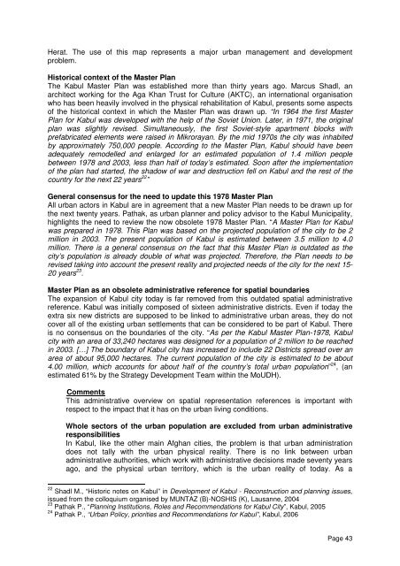
Herat. The use of this map represents a major urban management and development<br />
problem.<br />
Historical context of the Master Plan<br />
The <strong>Kabul</strong> Master Plan was established more than thirty years ago. Marcus Shadl, an<br />
architect working for the Aga Khan Trust for Culture (AKTC), an international organisation<br />
who has been heavily involved in the physical rehabilitation of <strong>Kabul</strong>, presents some aspects<br />
of the historical context in which the Master Plan was drawn up. “In 1964 the first Master<br />
Plan for <strong>Kabul</strong> was developed with the help of the Soviet Union. Later, in 1971, the original<br />
plan was slightly revised. Simultaneously, the first Soviet-style apartment blocks with<br />
prefabricated elements were raised in Mikrorayan. By the mid 1970s the city was inhabited<br />
by approximately 750,000 people. According to the Master Plan, <strong>Kabul</strong> should have been<br />
adequately remodelled and enlarged for an estimated population of 1.4 million people<br />
between 1978 and 2003, less than half of today’s estimated. Soon after the implementation<br />
of the plan had started, the shadow of war and destruction fell on <strong>Kabul</strong> and the rest of the<br />
country for the next 22 years 22 ”<br />
General consensus for the need to update this 1978 Master Plan<br />
All urban actors in <strong>Kabul</strong> are in agreement that a new Master Plan needs to be drawn up for<br />
the next twenty years. Pathak, as urban planner and policy advisor to the <strong>Kabul</strong> Municipality,<br />
highlights the need to review the now obsolete 1978 Master Plan. “A Master Plan for <strong>Kabul</strong><br />
was prepared in 1978. This Plan was based on the projected population of the city to be 2<br />
million in 2003. The present population of <strong>Kabul</strong> is estimated between 3.5 million to 4.0<br />
million. There is a general consensus on the fact that this Master Plan is outdated as the<br />
city’s population is already double of what was projected. Therefore, the Plan needs to be<br />
revised taking into account the present reality and projected needs of the city for the next 15-<br />
20 years 23 .<br />
Master Plan as an obsolete administrative reference for spatial boundaries<br />
The expansion of <strong>Kabul</strong> city today is far removed from this outdated spatial administrative<br />
reference. <strong>Kabul</strong> was initially composed of sixteen administrative districts. Even if today the<br />
extra six new districts are supposed to be linked to administrative urban areas, they do not<br />
cover all of the existing urban settlements that can be considered to be part of <strong>Kabul</strong>. There<br />
is no consensus on the boundaries of the city. “As per the <strong>Kabul</strong> Master Plan-1978, <strong>Kabul</strong><br />
city with an area of 33,240 hectares was designed for a population of 2 million to be reached<br />
in 2003. […] The boundary of <strong>Kabul</strong> city has increased to include 22 Districts spread over an<br />
area of about 95,000 hectares. The current population of the city is estimated to be about<br />
4.00 million, which accounts for about half of the country’s total urban population” 24 , (an<br />
estimated 61% by the Strategy Development Team within the MoUDH).<br />
Comments<br />
This administrative overview on spatial representation references is important with<br />
respect to the impact that it has on the urban living conditions.<br />
Whole sectors of the urban population are excluded from urban administrative<br />
responsibilities<br />
In <strong>Kabul</strong>, like the other main Afghan cities, the problem is that urban administration<br />
does not tally with the urban physical reality. There is no link between urban<br />
administrative authorities, which work with administrative decisions made seventy years<br />
ago, and the physical urban territory, which is the urban reality of today. As a<br />
22 Shadl M., “Historic notes on <strong>Kabul</strong>” in Development of <strong>Kabul</strong> - Reconstruction and planning issues,<br />
issued from the colloquium organised by MUNTAZ (B)-NOSHIS (K), Lausanne, 2004<br />
23 Pathak P., “Planning Institutions, Roles and Recommendations for <strong>Kabul</strong> City”, <strong>Kabul</strong>, 2005<br />
24 Pathak P., “<strong>Urban</strong> Policy, priorities and Recommendations for <strong>Kabul</strong>”, <strong>Kabul</strong>, 2006<br />
Page 43