

A Benthic Terrain Classification Scheme for American Samoa
A Benthic Terrain Classification Scheme for American Samoa
A Benthic Terrain Classification Scheme for American Samoa

You also want an ePaper? Increase the reach of your titles
YUMPU automatically turns print PDFs into web optimized ePapers that Google loves.
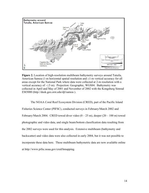
Figure 2. Location of high-resolution multibeam bathymetry surveys around Tutuila,<br />
<strong>American</strong> <strong>Samoa</strong> (1-m horizontal spatial resolution and +1-m vertical accuracy <strong>for</strong> all<br />
areas except <strong>for</strong> the National Park where data were collected at 2-m resolution with a<br />
vertical accuracy of ~+5 m). Projection: Geographic, WGS84. Bathymetry was<br />
collected in April and May of 2001 and November of 2002 with the Kongsberg Simrad<br />
EM3000 (http://dusk.geo.orst.edu/djl/samoa ).<br />
The NOAA Coral Reef Ecosystem Division (CRED), part of the Pacific Island<br />
Fisheries Science Center (PIFSC), conducted surveys in February/March 2002 and<br />
February/March 2004. CRED towed diver video (0 – 25 m), deeper (20 – 100 m) towed<br />
photographic and video data, and single beam/bottom classification data resulting from<br />
the 2002 surveys were used <strong>for</strong> this analysis. Extensive multibeam (bathymetry and<br />
backscatter) and video data were also collected in early 2004, but it was not possible to<br />
incorporate these data here. These multibeam bathymetric data are now available online<br />
at http://www.pifsc.noaa.gov/cred/hmapping.<br />
14


