

A Benthic Terrain Classification Scheme for American Samoa
A Benthic Terrain Classification Scheme for American Samoa
A Benthic Terrain Classification Scheme for American Samoa

Create successful ePaper yourself
Turn your PDF publications into a flip-book with our unique Google optimized e-Paper software.
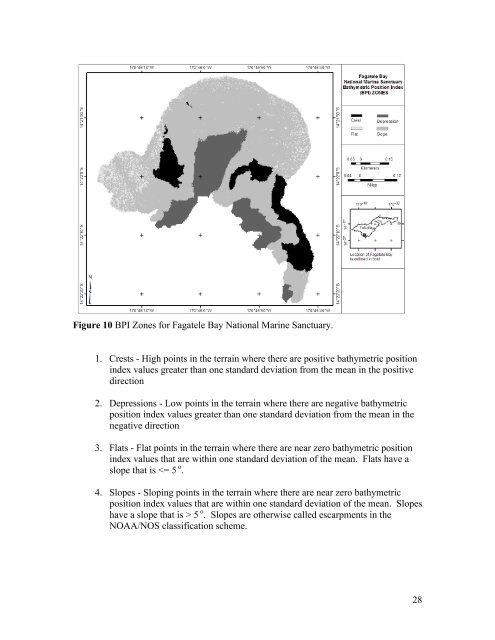
Figure 10 BPI Zones <strong>for</strong> Fagatele Bay National Marine Sanctuary.<br />
1. Crests - High points in the terrain where there are positive bathymetric position<br />
index values greater than one standard deviation from the mean in the positive<br />
direction<br />
2. Depressions - Low points in the terrain where there are negative bathymetric<br />
position index values greater than one standard deviation from the mean in the<br />
negative direction<br />
3. Flats - Flat points in the terrain where there are near zero bathymetric position<br />
index values that are within one standard deviation of the mean. Flats have a<br />
slope that is 5 o . Slopes are otherwise called escarpments in the<br />
NOAA/NOS classification scheme.<br />
28


