

A Benthic Terrain Classification Scheme for American Samoa
A Benthic Terrain Classification Scheme for American Samoa
A Benthic Terrain Classification Scheme for American Samoa

Create successful ePaper yourself
Turn your PDF publications into a flip-book with our unique Google optimized e-Paper software.
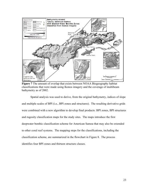
Figure 7 The amount of overlap that exists between NOAA Biogeography habitat<br />
classifications that were made using Ikonos imagery and the coverage of multibeam<br />
bathymetry as of 2002.<br />
Spatial analysis was used to derive, from the original bathymetry, indices of slope<br />
and multiple scales of BPI (i.e., BPI zones and structures). The resulting derivative grids<br />
were combined with a new algorithm to develop final products: BPI zones, BPI structures<br />
and rugosity classification maps <strong>for</strong> the study sites. The maps introduce the first<br />
deepwater benthic classification scheme <strong>for</strong> <strong>American</strong> <strong>Samoa</strong> that may also be extended<br />
to other coral reef systems. The mapping steps <strong>for</strong> the classifications, including the<br />
classification scheme, are summarized in the flowchart in Figure 8. The process<br />
identifies four BPI zones and thirteen structure classes.<br />
23


