Techniques for flood hazard zonation and vulnerability ... - NDMA
Techniques for flood hazard zonation and vulnerability ... - NDMA
Techniques for flood hazard zonation and vulnerability ... - NDMA

You also want an ePaper? Increase the reach of your titles
YUMPU automatically turns print PDFs into web optimized ePapers that Google loves.
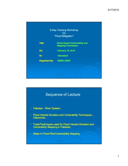
3/17/2010<br />
5-Day Training Workshop<br />
On<br />
“Flood Mitigation”<br />
Title:<br />
On:<br />
At:<br />
Organized By:<br />
Flood Hazard Vulnerability <strong>and</strong><br />
Mapping <strong>Techniques</strong><br />
February 16, 2010<br />
Islamabad<br />
<strong>NDMA</strong>-UNDP<br />
Sequence of Lecture<br />
• Pakistan - River System;<br />
• Flood Hazard Zonation <strong>and</strong> Vulnerability <strong>Techniques</strong> -<br />
Objectives;<br />
• Tools/<strong>Techniques</strong> used <strong>for</strong> Flood Hazard Zonation <strong>and</strong><br />
Vulnerability Mapping in Pakistan;<br />
• Steps In Flood Risk/Vulnerability Mapping.<br />
1
3/17/2010<br />
INDUS RIVER SYSTEM<br />
Objectives of Flood Hazard Zonation <strong>and</strong> Vulnerability<br />
Mapping <strong>Techniques</strong> Used in Pakistan<br />
This is done <strong>for</strong> achieving the following objectives:<br />
• To identify the severity of <strong>flood</strong> <strong>hazard</strong> <strong>and</strong> <strong>vulnerability</strong><br />
of certain area <strong>for</strong> necessary <strong>flood</strong> planning ;<br />
• To ensure that measures adopted <strong>for</strong> <strong>flood</strong> <strong>hazard</strong> <strong>and</strong><br />
<strong>vulnerability</strong> management are sufficient;<br />
• To ensure a balance between <strong>flood</strong> preparedness <strong>and</strong><br />
measures<br />
taken <strong>for</strong><br />
<strong>flood</strong> <strong>hazard</strong> & <strong>vulnerability</strong><br />
reduction;<br />
• Assessment of available capacities that may facilitate in<br />
<strong>flood</strong> risk management.<br />
2
3/17/2010<br />
Tools/<strong>Techniques</strong> Used <strong>for</strong> Flood Hazard Zonation<br />
<strong>and</strong><br />
Vulnerability Mapping<br />
• Meteorological data;<br />
• Flood Frequency Analysis;<br />
• Hydrological Data;<br />
• Past /Historical Flood Damages Record;<br />
• Flood Plain Maps;<br />
• Bathymetric Surveys;<br />
• Flood Forecasting Computer Model;<br />
• Comprehensive Flood Management Plans;<br />
• Flood Warning Manual;<br />
• Telemetry System;<br />
• St<strong>and</strong>ard Operating Procedures <strong>for</strong> Dams;<br />
• Weather Radars.<br />
Tools/<strong>Techniques</strong> Used <strong>for</strong> Flood Hazard Zonation<br />
<strong>and</strong><br />
Vulnerability Mapping<br />
• Meteorological data:<br />
Rainfall data collected <strong>for</strong> the past years (62<br />
years) is used to make an<br />
analysis/estimate<br />
of any<br />
likely<br />
<strong>flood</strong>ing<br />
situation<br />
on any<br />
river<br />
system/river catchment/urban area based on which future planning<br />
towards <strong>flood</strong> control/l<strong>and</strong>-use<br />
etc. can be made. This data is collected<br />
from various rainfall gauges installed in the province <strong>and</strong> is available<br />
on CD, internet etc. (Used at National, Provincial <strong>and</strong> District levels).<br />
• Flood Frequency Analysis:<br />
This tool is used <strong>for</strong> the design of an effective <strong>flood</strong> management<br />
system (dam/bund/dike/spur etc.) based on a<strong>flood</strong><br />
of certain definite<br />
return period (5/10/25/50/100/10001000 years etc.). Certain engineering<br />
techniques (Log Pearson, Log Gumbel etc.) are used <strong>for</strong> this analysis.<br />
(Used at National, Provincial <strong>and</strong> District levels).<br />
3
3/17/2010<br />
Tools/<strong>Techniques</strong> Used <strong>for</strong> Flood Hazard Zonation<br />
<strong>and</strong><br />
Vulnerability Mapping<br />
• Hydrological Data:<br />
The success or failure of any Flood Frequency Analysis technique<br />
depends largely on the authenticity of hydrological data <strong>and</strong> the<br />
correctness of hydrological data is dependent on the measurement<br />
system by virtue of which this data is gathered/recorded. Such data<br />
include: rainfall, runoff, discharge/river flow/stream flow etc. (Used at<br />
both Provincial <strong>and</strong> District levels).<br />
• Past /Historical Flood Damages Record:<br />
Records<br />
of past<br />
<strong>flood</strong><br />
damages due<br />
to <strong>flood</strong>s<br />
in<br />
certain river<br />
system/urban area/hill torrent area help in the planning of future <strong>flood</strong><br />
control works/embankments/bunds/spurs/new<br />
infrastructure in<br />
the<br />
cities etc. (Used at National, both Provincial <strong>and</strong> District levels).<br />
4
3/17/2010<br />
HISTORICAL FLOOD DAMAGES<br />
HISTORICAL FLOOD DAMAGES<br />
5
3/17/2010<br />
Tools/<strong>Techniques</strong> Used <strong>for</strong> Flood Hazard Zonation<br />
<strong>and</strong><br />
Vulnerability Mapping<br />
• Flood Plain Maps:<br />
For main<br />
rivers,<br />
Flood Plain<br />
Maps<br />
have<br />
been<br />
prepared based on various categories of <strong>flood</strong>s<br />
(Medium/High/Very<br />
High/Exceptionally High<br />
etc.)<br />
based on which, owing to a particular <strong>flood</strong> category,<br />
inundation levels are assessed <strong>for</strong> the existing <strong>and</strong><br />
the new planned infrastructure activity/<strong>flood</strong> control<br />
facility/cropping activity<br />
etc.<br />
(Used<br />
at<br />
National,<br />
Provincial <strong>and</strong> District levels).<br />
INDUS RIVER SYSTEM – Flood Risk Map<br />
6
3/17/2010<br />
INDUS RIVER SYSTEM - Flood Risk Map<br />
Tools/<strong>Techniques</strong> Used <strong>for</strong> Flood Hazard Zonation<br />
<strong>and</strong><br />
Vulnerability Mapping<br />
• Bathymetric Surveys:<br />
Every year during the monsoon season, river discharges increase on<br />
one h<strong>and</strong> <strong>and</strong> at the same time lot of debris, sediment <strong>and</strong> silt is<br />
brought which<br />
results<br />
in accretion/degradation<br />
of<br />
river<br />
profile.<br />
Bathymetric surveys carried out across the flow of river help in<br />
underst<strong>and</strong>ing changed river cross-sectionalsectional profile <strong>and</strong> hence in<br />
better <strong>for</strong>ecasting of flows. (Used at National, Provincial <strong>and</strong> District<br />
levels).<br />
• Flood Forecasting Computer Model:<br />
Anticipated <strong>flood</strong><br />
events<br />
are<br />
assessed through<br />
FEWS<br />
(Flood<br />
Forecasting Early Warning System) Computer Model which helps not<br />
only in instant <strong>flood</strong> <strong>for</strong>ecasting but also in future estimate of <strong>flood</strong>s<br />
both at the provincial as well as at the district level. (Used at National ,<br />
Provincial <strong>and</strong> District levels).<br />
7
3/17/2010<br />
Tools/<strong>Techniques</strong> Used <strong>for</strong> Flood Hazard Zonation<br />
<strong>and</strong><br />
Vulnerability Mapping<br />
• Comprehensive Flood Management Plans:<br />
For <strong>flood</strong> <strong>hazard</strong> risk assessment <strong>and</strong> management<br />
at National,<br />
Provincial<br />
<strong>and</strong> District<br />
levels<br />
comprehensive<br />
<strong>flood</strong> management<br />
plans<br />
are<br />
prepared p <strong>for</strong> a period of 10 years. Based on <strong>flood</strong><br />
risk assessment, these plans are implemented in a<br />
phased manner to avert future <strong>flood</strong> threats. (Used at<br />
National, Provincial <strong>and</strong> District levels).<br />
8
3/17/2010<br />
Tools/<strong>Techniques</strong> Used <strong>for</strong> Flood Hazard Zonation<br />
<strong>and</strong><br />
Vulnerability Mapping<br />
• Flood Warning Manual:<br />
Flood Warning Manual is used primarily in conjunction with <strong>flood</strong> plain<br />
maps. Its usage at present is limited. It helps in assessment of<br />
<strong>vulnerability</strong> of areas which may get inundated in the event of <strong>flood</strong> of<br />
a certain category <strong>and</strong> also helps in future planning purposes.<br />
• Telemetry System:<br />
A good <strong>flood</strong> telemetry system exists at the National <strong>and</strong> Provincial<br />
level which assists in timely collection <strong>and</strong> dissemination of rainfall<br />
<strong>and</strong> river flow data which is used as a planning tool <strong>for</strong> future<br />
designing <strong>and</strong> implementation of <strong>flood</strong> infrastructure (dams/bunds<br />
etc.) besides rural <strong>and</strong> urban planning.<br />
FLOOD FORECASTING DIVISION,(FFD), LAHORE<br />
( H.F.RADIO NETWORK)<br />
TARBELA<br />
MANGLA<br />
Besham, Jaglot<br />
Skardu, Daggar<br />
Phulra, Oghi<br />
Shinkiari, Khairabad<br />
Nowshera<br />
CHASMA<br />
Kallar, G.H.Ullah<br />
Muzaffarabad, Domel<br />
Kotli, Kohala<br />
Pl<strong>and</strong>ri, Azadpatan<br />
W.R.M.D.<br />
SUNNY VIEW LAHORE<br />
FLOOD FORECASTING DIVISION<br />
LAHORE<br />
9
3/17/2010<br />
Tools/<strong>Techniques</strong> Used <strong>for</strong> Flood Hazard Zonation<br />
<strong>and</strong><br />
Vulnerability Mapping<br />
• St<strong>and</strong>ard Operating Procedures For Dams:<br />
For Mangla Dam on River Jhelum in order to cater <strong>for</strong> Category-I,<br />
II <strong>and</strong><br />
III <strong>flood</strong>s, St<strong>and</strong>ard Operating Procedures have been devised <strong>for</strong><br />
effective Dam Operation during <strong>flood</strong>s specifically <strong>for</strong> the purpose of<br />
safety of dam <strong>and</strong> downstream areas. (Used at National, Provincial <strong>and</strong><br />
District levels). Similar arrangements exist <strong>for</strong> Tarbela Dam.<br />
• Weather Radars:<br />
The existing weather radars at Lahore, Sialkot, Mangla, Rahim Yar<br />
Khan, D.I.Khan,<br />
Karachi <strong>and</strong> Islamabad are used to assess the weather<br />
condition <strong>and</strong> based on cloud moisture content, anticipated <strong>flood</strong><br />
situation is <strong>for</strong>ecasted which helps in timely pre-emptiveemptive measures.<br />
(Used <strong>for</strong> both Provincial <strong>and</strong> District levels).<br />
Weather Radar Network<br />
10
3/17/2010<br />
Steps In Flood Hazard Zonation<br />
<strong>and</strong><br />
Vulnerability Mapping<br />
• Availability of rain/river-flow/runoff i / ff measurement system<br />
<strong>and</strong> relevant data;<br />
• L<strong>and</strong>-use/River surveys;<br />
• Flood Frequency Analysis;<br />
• Flood Hazard/Vulnerability Maps<br />
Departments That Can Assist In Flood Hazard<br />
Zonation <strong>and</strong> Vulnerability Mapping<br />
• Provincial Irrigation Department;<br />
• Federal Flood Commission;<br />
• National Engineering Services of Pakistan;<br />
• SUPARCO<br />
• Flood Management Experts<br />
11
3/17/2010<br />
End of Presentation<br />
Thank You<br />
12