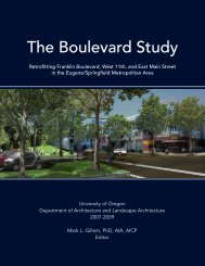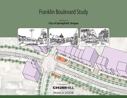
Franklin Boulevard Study - City of Springfield
Franklin Boulevard Study - City of Springfield
Franklin Boulevard Study - City of Springfield

You also want an ePaper? Increase the reach of your titles
YUMPU automatically turns print PDFs into web optimized ePapers that Google loves.
<strong>Franklin</strong> <strong>Boulevard</strong> <strong>Study</strong><br />
PREPARED FOR<br />
<strong>City</strong> <strong>of</strong> <strong>Springfield</strong>, Oregon<br />
PREPARED BY<br />
March 2009
CONTENTS<br />
Section<br />
Page<br />
Figures<br />
Project Staff..................................................................................................ii<br />
<strong>City</strong> <strong>of</strong> <strong>Springfield</strong>.........................................................................ii<br />
CH2M HILL ...................................................................................ii<br />
Kittelson Associates, Inc. ..............................................................ii<br />
Freedman, Tung and Bottomly....................................................ii<br />
Stakeholder Advisory Committee ...........................................................ii<br />
1 Introduction...................................................................................... 1<br />
1 <strong>Franklin</strong> <strong>Boulevard</strong> <strong>Study</strong> Area......................................................1<br />
2 Project Timeline.................................................................................2<br />
3 Alignment Options ...........................................................................5<br />
4 <strong>Franklin</strong> <strong>Boulevard</strong> Concept between Glenwood Blvd.<br />
and Henderson Avenue.................................................................10<br />
5 <strong>Franklin</strong> <strong>Boulevard</strong> Concept between Henderson Avenue<br />
and Mississippi Avenue.................................................................11<br />
6 <strong>Franklin</strong> <strong>Boulevard</strong> Concept between Mississippi Avenue<br />
and Brooklyn Avenue ....................................................................12<br />
2 Planning Process.............................................................................. 3<br />
Public Involvement ....................................................................... 3<br />
Goals and Evaluation Criteria ..................................................... 3<br />
Existing and Future Conditions Review .................................... 5<br />
Development and Evaluation <strong>of</strong> Alternatives........................... 6<br />
3 Recommendations........................................................................... 9<br />
Recommended Improvements .................................................... 9<br />
Appendices<br />
A Stakeholder Advisory Committee Notes<br />
B Open House Summaries<br />
C Cost Estimates<br />
D Problem Statement<br />
E Evaluation Framework<br />
F Conceptual Designs Advanced<br />
G Concepts from Design Charrette<br />
H Conceptual Design Report<br />
Tables<br />
1 Criteria Categories, Criteria, and Measures ................................. 4<br />
2 Concept Evaluation Matrix............................................................. 7<br />
FRANKLIN BOULEVARD STUDY i
F R A N K L I N B O U L E V A R D S T U D Y , C I T Y O F S P R I N G F I E L D , O R E G O N<br />
Project Staff<br />
CITY OF SPRINGFIELD<br />
Tom Boyatt, Transportation Division Manager, Project Manager<br />
John Tamulonis, Economic Development Manager<br />
Len Goodwin, Assistant Public Works Director<br />
Greg Mott, Planning Manager<br />
Brian Barnett, PE, <strong>City</strong> Traffic Engineer<br />
CH2M HILL<br />
Kristin Hull, Project Manager<br />
Sam Seskin<br />
John Willis, PE<br />
Billy Adams<br />
KITTELSON ASSOCIATES, INC.<br />
Brian Ray, PE<br />
Julia Kuhn, PE<br />
Jamie Parks<br />
FREEDMAN, TUNG AND BOTTOMLY<br />
Greg Tung<br />
Stakeholder Advisory Committee<br />
Steve Roth, Roaring Rapids Pizza<br />
Joany Armstead, Glenwood resident<br />
Debbie Nelson, Glenwood property owner<br />
John Oldham, Oldham Cranes<br />
Guy Santiago, Oregon River Sports<br />
Dave Carvo, Glenwood resident<br />
Councilor Hillary Wiley, <strong>Springfield</strong> <strong>City</strong> Council<br />
Steve Moe, Glenwood resident and property owner<br />
Ed Moore, ODOT (through January 2008)<br />
David Helton, ODOT (after January 2008)<br />
Tom Schwetz, Lane Transit District<br />
Councilor John Woodrow, <strong>Springfield</strong> Economic Development<br />
Agency<br />
Nathan Phillips, W&G Development<br />
Randy Hledik, Wildish Development<br />
Dan Egan, <strong>Springfield</strong> Chamber <strong>of</strong> Commerce<br />
Michael Kritzman<br />
ii<br />
FRANKLIN BOULEVARD STUDY
The <strong>Franklin</strong> <strong>Boulevard</strong> <strong>Study</strong> identifies improvements to <strong>Franklin</strong><br />
<strong>Boulevard</strong> and the McVey Highway to support potential land use<br />
changes in the Glenwood community.<br />
Figure 1 shows the study area. The following objectives guided the<br />
development and evaluation <strong>of</strong> concepts for the <strong>Franklin</strong> <strong>Boulevard</strong><br />
<strong>Study</strong>:<br />
<br />
A process that is collaborative and transparent and is focused on<br />
achieving consensus around transportation improvements and<br />
providing certainty about future plans.<br />
<br />
<br />
<br />
<br />
Facility improvements that enhance the natural environment.<br />
Facility improvements that include opportunities to incorporate<br />
sustainable design principles.<br />
A project that creates an active and safe street environment.<br />
A project that improves visual and physical connections to the<br />
river.<br />
<br />
<br />
<br />
<br />
<br />
<br />
<br />
<br />
A project that minimizes or equitably addresses impacts<br />
to existing business owners, property owners, and<br />
residents.<br />
A funding strategy in which costs are paid in proportion<br />
to benefits received.<br />
A project that benefits the future business community as<br />
a whole.<br />
A cost-effective project.<br />
Improvements to <strong>Franklin</strong> <strong>Boulevard</strong> and McVey<br />
Highway that promote redevelopment in Glenwood.<br />
Designs that are distinctive.<br />
Designs that accommodate all transportation modes<br />
including car and truck traffic, buses, cyclists,<br />
pedestrians, and alter-abled people.<br />
Transportation improvements that can accommodate<br />
long-term transportation needs in the area.<br />
Figure 1. <strong>Franklin</strong> <strong>Boulevard</strong> <strong>Study</strong> Area<br />
FRANKLIN BOULEVARD STUDY 1
This section summarizes the four elements <strong>of</strong> the project’s planning<br />
process: public involvement, problem statement, goals and evaluation<br />
criteria, and development and evaluation <strong>of</strong> alternatives. A timeline<br />
for the project is shown in Figure 2.<br />
Public Involvement<br />
Community members, stakeholders, and other interested parties<br />
actively participated in the development <strong>of</strong> the preferred concept<br />
which began in July 2007 (see Figure 2). The public involvement<br />
process kicked-<strong>of</strong>f with a series <strong>of</strong> stakeholder interviews designed to<br />
help the project team understand community issues. A 15-member<br />
stakeholder advisory committee met 8 times during the study. The<br />
project developed alternatives through a design workshop held in<br />
August 2007. The three-day design workshop included two meetings<br />
with the Stakeholder Advisory Committee and a public open house.<br />
A second public open house was held in February 2008 to review the<br />
Stakeholder Advisory Committee’s final recommendation.<br />
Documentation <strong>of</strong> the public involvement process is included in<br />
Appendix A.<br />
Problem Statement<br />
The Stakeholder Advisory Committee and <strong>City</strong> staff worked together<br />
to develop a problem statement for the project that identified the<br />
range <strong>of</strong> issues and aspirations that the project should address. The<br />
problem statement included reference to the following issues or<br />
opportunities:<br />
<br />
<br />
<br />
<br />
<br />
<strong>Franklin</strong> <strong>Boulevard</strong> is a major east-west route in the area and a<br />
gateway to Eugene, downtown <strong>Springfield</strong>, the University <strong>of</strong><br />
Oregon, and Glenwood.<br />
<strong>Franklin</strong> <strong>Boulevard</strong> lacks adequate pedestrian and bike facilities<br />
<strong>Franklin</strong> <strong>Boulevard</strong>, in its current form, does not support the<br />
community’s redevelopment goals.<br />
<strong>Franklin</strong> <strong>Boulevard</strong> has a constrained right-<strong>of</strong>-way and any<br />
widening <strong>of</strong> the existing cross section will require displacement<br />
<strong>of</strong> businesses and acquisition <strong>of</strong> private property.<br />
<strong>Franklin</strong> <strong>Boulevard</strong> serves a range <strong>of</strong> transportation needs from<br />
freight movement to commuters to those patronizing businesses<br />
in the corridor. It is also a bus rapid transit corridor where buses<br />
currently operate in mixed traffic.<br />
Stakeholder Advisory Committee meeting (February 2008)<br />
2 FRANKLIN BOULEVARD STUDY
Project activities were aligned with opportunities for public input via the SAC, project open houses and actions by <strong>City</strong> decision-making bodies.<br />
This timeline shown in Figure 2 illustrates the integration <strong>of</strong> work products and tasks with public input opportunities.<br />
Public input Project activities<br />
• Establish<br />
committees<br />
• Develop<br />
evaluation<br />
framework<br />
• Understand<br />
existing and<br />
future conditions<br />
• Hold design<br />
workshop<br />
• Identify<br />
alternatives<br />
• Analyze and<br />
evaluate<br />
alternatives<br />
• Select preferred<br />
concept for<br />
further<br />
refinement<br />
• Develop<br />
preferred<br />
concept to a<br />
higher level <strong>of</strong><br />
detail<br />
• Evaluate<br />
intersection<br />
types<br />
• Planning<br />
Commission<br />
recommendation<br />
• <strong>City</strong> Council<br />
decision<br />
July 2007 August 2007 Fall 2007 Winter 2007-2008 Spring 2008<br />
• Stakeholder<br />
Advisory<br />
Committee<br />
(SAC) meeting<br />
#1 and #2<br />
• Public open<br />
house<br />
• SAC meetings<br />
#3 and #4<br />
• Council briefing<br />
and direction<br />
• SAC meeting #5<br />
• SAC meetings<br />
#6 and #7<br />
• Public open<br />
house<br />
• Planning<br />
Commission<br />
hearing<br />
• <strong>City</strong> Council<br />
hearing<br />
Figure 2. Project Timeline<br />
FRANKLIN BOULVARD STUDY 3
F R A N K L I N B O U L E V A R D S T U D Y , C I T Y O F S P R I N G F I E L D , O R E G O N<br />
Goals and Evaluation Criteria<br />
The project team and Stakeholder Advisory Committee worked together to develop goals and evaluation criteria to guide refinement and<br />
selection <strong>of</strong> design concepts. Table 1 shows the goals and evaluation criteria that provided a framework for balancing trade-<strong>of</strong>fs between design<br />
concepts.<br />
Table 1. Criteria Categories, Criteria, and Measures<br />
Criteria categories Criteria Measures<br />
1. Cost Project cost (unit costs for roadway and urban design features) Comparative assessment <strong>of</strong> project costs (high, medium, low)<br />
2. Natural environment<br />
3. Community values<br />
and economic<br />
development<br />
4. Transportation<br />
performance<br />
Enhances the natural environment.<br />
Provides opportunities to incorporate sustainable design principles.<br />
Improves visual and physical connections to the river.<br />
Enhances <strong>Franklin</strong> <strong>Boulevard</strong>’s role as a gateway to Glenwood, downtown<br />
<strong>Springfield</strong>, Eugene and the University <strong>of</strong> Oregon.<br />
Promotes mixed-use, clustered redevelopment in Glenwood.<br />
Benefits the future business community as a whole.<br />
Provides for the safety and convenience <strong>of</strong> pedestrians including alter-abled<br />
people<br />
Provides for safety and convenience <strong>of</strong> cyclists<br />
Provides for efficient operation <strong>of</strong> transit<br />
Distinctive designs<br />
Minimizes impacts to private property and businesses<br />
Accommodates efficient intersection function<br />
Accommodates freight<br />
Accommodate long-term traffic needs<br />
Accommodates local and regional traffic<br />
Will not be measured at this time.<br />
Will not be measured at this time.<br />
Will not be measured at this time.<br />
Will not be measured at this time.<br />
Minimizes right-<strong>of</strong>-way impacts north <strong>of</strong> <strong>Franklin</strong> <strong>Boulevard</strong>.<br />
Could be constructed in phases.<br />
Assessment <strong>of</strong> quality <strong>of</strong> pedestrian environment and crossings.<br />
Qualitative assessment <strong>of</strong> crossing conditions.<br />
Assessment <strong>of</strong> the quality <strong>of</strong> bike facilities.<br />
Assessment <strong>of</strong> whether the concept includes separated transit lanes.<br />
Will not be measured at this time.<br />
Assessment <strong>of</strong> business impacts (high, medium, low)<br />
Assessment <strong>of</strong> property impacts (high, medium, low)<br />
Will not be measured at this time.<br />
Will not be measured at this time.<br />
Assessment <strong>of</strong> traffic accommodation in terms <strong>of</strong> speed and throughput.<br />
Assessment <strong>of</strong> separation <strong>of</strong> local and through traffic.<br />
4 FRANKLIN BOULEVARD STUDY
F R A N K L I N B O U L E V A R D S T U D Y , C I T Y O F S P R I N G F I E L D , O R E G O N<br />
Development and Evaluation <strong>of</strong> Alternatives<br />
Alternatives were developed and evaluated for the following parts<br />
<strong>of</strong> the study area:<br />
<br />
<br />
<br />
<br />
<strong>Franklin</strong> <strong>Boulevard</strong> from I-5 to the <strong>Springfield</strong> bridges.<br />
McVey Highway from the <strong>Franklin</strong> <strong>Boulevard</strong>/McVey Highway<br />
intersection south to Nugget Way.<br />
The intersection <strong>of</strong> <strong>Franklin</strong> <strong>Boulevard</strong>/A Street/Main Street<br />
(<strong>Franklin</strong>/McVey intersection).<br />
The intersection <strong>of</strong> <strong>Franklin</strong> <strong>Boulevard</strong> and Glenwood<br />
<strong>Boulevard</strong>.<br />
the improved arterial, plus an access lane in each direction separated<br />
from the through travel lanes by a planted median.<br />
Seven possible alignments for <strong>Franklin</strong> <strong>Boulevard</strong> were explored<br />
during the concept development workshop. Four alignments were<br />
set-aside at the workshop. The alignments set aside are shown in<br />
Figure 3<br />
Through the concept development workshop, three alignment<br />
concepts were advanced for further study. These included concepts<br />
to realign <strong>Franklin</strong> <strong>Boulevard</strong> to 14th Avenue, and to widen <strong>Franklin</strong><br />
<strong>Boulevard</strong> on its existing alignment either to the south or both to the<br />
north and to the south <strong>of</strong> the existing right-<strong>of</strong>-way.<br />
The alternatives development and evaluation process is detailed in<br />
Appendix H.<br />
ALTERNATIVE DEVELOPMENT AND SCREENING<br />
In August 2007, the project team held a 3-day concept development<br />
workshop aimed at generating a complete universe <strong>of</strong> improvement<br />
concepts. The concept development workshop included<br />
opportunities for <strong>City</strong> staff, the Stakeholder Advisory Committee,<br />
and the general public to weigh in on concept development and<br />
initial screening.<br />
During the concept development workshop, three potential cross<br />
sections were developed for <strong>Franklin</strong> <strong>Boulevard</strong>: improved arterial,<br />
multiway boulevard, and a hybrid <strong>of</strong> the multiway boulevard and<br />
arterial cross sections. One cross section that included a travel lane in<br />
each direction, a center turn lane/median, sidewalks, and bike lanes<br />
was agreed-upon for the McVey Highway. An improved arterial<br />
cross-section would include two travel lanes in each direction, a<br />
center turn lane or median, bike lanes, and sidewalks.<br />
A multiway boulevard cross section would include all elements <strong>of</strong><br />
Brown: couplet<br />
Green: snake<br />
Blue: reverse snake<br />
Red: southern bypass<br />
Figure 3. Alignment Options<br />
The project team developed concepts for the <strong>Franklin</strong><br />
<strong>Boulevard</strong>/McVey Highway intersection. The team developed a<br />
roundabout option, a signalized option, and a couplet-like option<br />
(also referred to as the square-about).<br />
In September 2007, the <strong>Springfield</strong> <strong>City</strong> Council reviewed and<br />
approved further study <strong>of</strong> the following concepts:<br />
FRANKLIN BOULEVARD STUDY 5
F R A N K L I N B O U L E V A R D S T U D Y , C I T Y O F S P R I N G F I E L D , O R E G O N<br />
<strong>Franklin</strong>/McVey Intersection<br />
Roundabout<br />
Signal<br />
<strong>Franklin</strong> <strong>Boulevard</strong><br />
14th Avenue Multiway <strong>Boulevard</strong><br />
After reviewing the evaluation results, shown in Table 2, the<br />
Stakeholder Advisory Committee recommended moving forward an<br />
option that would widen <strong>Franklin</strong> <strong>Boulevard</strong> to the south with both<br />
multiway boulevard and enhanced arterial sections. The Stakeholder<br />
Advisory Committee also asked the project team to consider<br />
straightening the curve east <strong>of</strong> Glenwood <strong>Boulevard</strong> as much as<br />
possible without shifting the alignment as far south as 14th Avenue.<br />
<br />
<br />
<br />
<br />
<br />
<br />
<br />
<br />
14th Avenue Arterial<br />
14th Avenue Hybrid (half multiway boulevard/half arterial)<br />
<strong>Franklin</strong> <strong>Boulevard</strong> Arterial, widened to the south<br />
<strong>Franklin</strong> <strong>Boulevard</strong> Multiway <strong>Boulevard</strong>, widened to the south<br />
<strong>Franklin</strong> <strong>Boulevard</strong> Hybrid (half multiway boulevard/half<br />
arterial), widened to the south<br />
<strong>Franklin</strong> <strong>Boulevard</strong> Arterial, widened to the north and south<br />
<strong>Franklin</strong> <strong>Boulevard</strong> Multiway <strong>Boulevard</strong>, widened to the north<br />
and south<br />
<strong>Franklin</strong> <strong>Boulevard</strong> Hybrid (half multiway boulevard/half<br />
arterial), widened to the north and south<br />
The project team developed a hybrid concept that reflected the<br />
Stakeholder Advisory Committee’s input. The refined concept<br />
included an arterial cross section from I-5 to Henderson Street, a<br />
multiway boulevard cross section from Henderson Street to<br />
Mississippi Street, and a cross section with arterial on the south side<br />
<strong>of</strong> <strong>Franklin</strong> <strong>Boulevard</strong> and multiway boulevard on the north side <strong>of</strong><br />
<strong>Franklin</strong> <strong>Boulevard</strong> from Mississippi Street to Brooklyn Street.<br />
CONCEPT REFINEMENT AND EVALUATION<br />
The project team refined the nine concepts for improvements to<br />
<strong>Franklin</strong> <strong>Boulevard</strong> to a level <strong>of</strong> detail that could be evaluated based<br />
on the measures shown in Table 1. The measures that helped to<br />
differentiate between concepts included:<br />
<br />
<br />
<br />
Minimizing cost, property impacts, and business acquisitions<br />
Separating through and local traffic<br />
Establishing comfortable pedestrian environment<br />
6 FRANKLIN BOULEVARD STUDY
FRANKLIN BOULEVARD STUDY CONCEPT EVALUATION<br />
Criteria categories Criteria Measures<br />
Existing alignment<br />
Existing alignment<br />
1. Cost Project cost (unit costs for roadway<br />
and urban design features)<br />
Minimizes project cost (High= lowest<br />
project cost)<br />
Improved<br />
arterial<br />
widened south<br />
Multiway Hybrid<br />
boulevard<br />
Improved<br />
arterial<br />
widened center<br />
Multiway Hybrid<br />
boulevard<br />
Improved<br />
arterial<br />
14th Street alignment<br />
Multiway<br />
boulevard<br />
Hybrid<br />
3. Community values and<br />
economic development<br />
Promotes mixed-use, clustered<br />
redevelopment in Glenwood.<br />
Benefits the future business<br />
community as a whole.<br />
Provides for the safety and<br />
convenience <strong>of</strong> pedestrians<br />
including alter-abled people<br />
Provides for safety and<br />
convenience <strong>of</strong> cyclists<br />
Provides for efficient operation <strong>of</strong><br />
transit<br />
Minimizes impacts to private<br />
property and businesses<br />
Minimizes right <strong>of</strong> way acquisitions on<br />
the north side <strong>of</strong> <strong>Franklin</strong><br />
Has potential for phased implementation<br />
Provides sidewalks adjacent to low-traffic<br />
roadways<br />
Provides for safe crossing <strong>of</strong> <strong>Franklin</strong><br />
<strong>Boulevard</strong> (all have the same crossing<br />
distance for the arterial portion)<br />
Provides bike lanes or other bike facilities<br />
Accomodates a separate lane for transit<br />
Minimizes impacts to businesses and<br />
residences (structures)<br />
Minimizes impacts to private property<br />
(total right-<strong>of</strong>-way)<br />
4. Transportation performance Accommodate long-term traffic<br />
needs<br />
Minimizes travel times on <strong>Franklin</strong><br />
Boulvard<br />
Maximizes through-put on <strong>Franklin</strong><br />
<strong>Boulevard</strong><br />
Accommodates local and regional<br />
traffic<br />
Provies for separation <strong>of</strong> through and<br />
local traffic<br />
TOTAL SCORE<br />
30 30 N/A 27 27 N/A 27 28 N/A<br />
High/meets criteria well -- 3 pts<br />
Medium/meets criteria somewhat -- 2 pts<br />
Low/meets criteria poorly -- 1 pt<br />
Not applicable/could not be measured<br />
at this level <strong>of</strong> detail<br />
FRANKLIN BOULEVARD STUDY 7
Recommended Improvements<br />
The <strong>Springfield</strong> <strong>City</strong> Council unanimously approved advancing the<br />
improvements to the east-west section <strong>of</strong> <strong>Franklin</strong> <strong>Boulevard</strong> from<br />
I-5 to the <strong>Springfield</strong> Bridges and the north-south portion <strong>of</strong> <strong>Franklin</strong><br />
<strong>Boulevard</strong> (McVey Highway) from the <strong>Franklin</strong>/McVey intersection<br />
to the railroad tracks. The <strong>City</strong> Council concurred with the<br />
Stakeholder Advisory Committee’s recommendation.<br />
The <strong>City</strong> Council’s recommendation included the following<br />
elements:<br />
• Develop <strong>Franklin</strong> <strong>Boulevard</strong> as an enhanced arterial from I-5 to<br />
Henderson Street<br />
• Provide a continuous bike lane on <strong>Franklin</strong>, a parallel route, or<br />
on a riverfront trail<br />
They also asked the <strong>City</strong> to pay special attention to whether the<br />
roundabout at <strong>Franklin</strong>/McVey:<br />
• Provides adequate truck access<br />
• Provides enough traffic capacity<br />
• Minimizes business and property impacts<br />
• Includes safe pedestrian crossings<br />
The <strong>City</strong> <strong>of</strong> <strong>Springfield</strong> will advance the project or project elements<br />
for conceptual design as funding is available.<br />
• Develop both the north and south sides <strong>of</strong> <strong>Franklin</strong> <strong>Boulevard</strong> as<br />
a multiway boulevard from Henderson Street to Mississippi<br />
Street<br />
• Develop the south side <strong>of</strong> <strong>Franklin</strong> <strong>Boulevard</strong> as an arterial and<br />
the north side <strong>of</strong> <strong>Franklin</strong> <strong>Boulevard</strong> as multiway boulevard<br />
from Mississippi Street to Brooklyn Street<br />
• Pursue a roundabout at the <strong>Franklin</strong>/McVey intersection<br />
The Stakeholder Advisory Committee asked the <strong>City</strong> to continue to<br />
consider the following issues:<br />
• Seek to minimize right-<strong>of</strong>-way and business impacts as the<br />
design is advanced<br />
• Identify the design as a concept that can be modified to fit with<br />
development<br />
8 FRANKLIN BOULEVARD STUDY
F R A N K L I N B O U L E V A R D S T U D Y , C I T Y O F S P R I N G F I E L D , O R E G O N<br />
FRANKLIN BOULEVARD STUDY 9
F R A N K L I N B O U L E V A R D S T U D Y , C I T Y O F S P R I N G F I E L D , O R E G O N<br />
10 FRANKLIN BOULEVARD STUDY
F R A N K L I N B O U L E V A R D S T U D Y , C I T Y O F S P R I N G F I E L D , O R E G O N<br />
FRANKLIN BOULEVARD STUDY 11
APPENDIX A<br />
Stakeholder Advisory Committee Notes
<strong>Franklin</strong> Stakeholder Advisory Committee<br />
5:30-7:30 p.m. Tuesday, July 10 – Meeting #1<br />
<strong>Springfield</strong> <strong>City</strong> Hall, Library meeting room<br />
225 Fifth Street, <strong>Springfield</strong><br />
Meeting summary<br />
SAC members present<br />
Steve Roth, Roaring Rapids Pizza<br />
Joany Armstead, resident<br />
Debbie Nelson, property owner<br />
John Oldham, Oldham Cranes<br />
Guy Santiago, Oregon River Sports<br />
Dave Carvo, resident<br />
Steve Moe, property owner<br />
Ed Moore, ODOT<br />
Dan Ingrim, Apex Development<br />
John Tamulonis, SEDA<br />
John Woodrow, SEDA Board President<br />
Nathan Philips, W&G Development<br />
SAC members absent<br />
Tom Schwetz, LTD<br />
Randy Hledik, Wildish Development<br />
Hillary Wiley, <strong>Springfield</strong> <strong>City</strong> Council<br />
Dan Egan, <strong>Springfield</strong> Chamber <strong>of</strong><br />
Commerce<br />
Staff present<br />
Tom Boyatt, <strong>City</strong> <strong>of</strong> <strong>Springfield</strong><br />
Linda Pauly, <strong>City</strong> <strong>of</strong> <strong>Springfield</strong> Kristin<br />
Hull, CH2M HILL<br />
Sam Seskin, CH2M HILL<br />
Jamie Parks, Kittelson Associates<br />
Meeting purpose:<br />
Share background information about <strong>Franklin</strong> <strong>Boulevard</strong> <strong>Study</strong>.<br />
Establish protocols for working together.<br />
Begin discussion about study goals.<br />
Agenda:<br />
1. Welcome and introductions – Kristin Hull<br />
2. Project purpose and committee charge – Tom Boyatt<br />
3. SAC protocols – Kristin Hull<br />
4. Project overview – Sam Seskin<br />
5. Close/next steps – Kristin Hull<br />
1. Welcome and introductions<br />
Kristin welcomed the group and thanked them for agreeing to participate in the SAC<br />
process. John Woodrow suggested that the roster be revised to show him as the SEDA<br />
representative and Hillary Wiley as the council representative since the study area is in her<br />
ward. The SAC requested a roster <strong>of</strong> all SAC members.<br />
2. Project purpose and committee charge<br />
Tom Boyatt explained that the purpose <strong>of</strong> the study is to develop a new cross-section for<br />
<strong>Franklin</strong> <strong>Boulevard</strong> and McVay Highway through technical analysis. He told the group that<br />
he hoped they would get close to consensus through this process but that he anticipated<br />
differences <strong>of</strong> opinion. He explained that this group was responsible for provide a
ecommendation or input to the <strong>City</strong> Council and Planning Commission. He told the group<br />
that they would explore trade-<strong>of</strong>fs between the options.<br />
Dave Carvo asked if the group could review past work done in this area including analysis<br />
<strong>of</strong> the <strong>Franklin</strong>/McVay intersection. Councilor Woodrow suggested that the University <strong>of</strong><br />
Oregon should be invited to participate in this process. Tom and John Tamulonis agreed to<br />
follow-up with the University <strong>of</strong> Oregon.<br />
3. SAC protocols<br />
Kristin Hull introduced the draft protocols and explained that the draft was just a starting<br />
place based on the work <strong>of</strong> previous groups and that the SAC could make any changes that<br />
they wanted to make to the protocols. The group made the following key decisions about<br />
protocols:<br />
Determined that group members can send alternates to SAC meetings and that<br />
alternates can participate in group decision making at the discretion <strong>of</strong> the SAC member<br />
that they are representing. SAC members are responsible for letting Tom or Kristin<br />
know when an alternate will be attending in his/her stead and if the alternate is<br />
authorized to participate in group decision making. The SAC also clarified that<br />
alternates should represent the same group or point-<strong>of</strong>-view as the SAC member that<br />
they are representing.<br />
Agreed to receive meeting materials by email.<br />
Agreed to hear public comment at the beginning <strong>of</strong> the meeting and to limit comment to<br />
ten minutes <strong>of</strong> total meeting time and three minutes per individual without SAC<br />
consent.<br />
Agreed to use a threshold <strong>of</strong> 2/3 <strong>of</strong> SAC members supporting a recommendation for it<br />
to be considered a group recommendation.<br />
Agreed to include Councilors Woodrow and Wylie, and John Tamulonis, a city staff<br />
person, as voting members.<br />
Clarified that the SAC could revisit decisions if new information was uncovered.<br />
Agreed to only speak to the media on his/her own behalf and not on the behalf <strong>of</strong> the<br />
committee.<br />
Kristin agreed to revise the protocols based on this discussion and provide a version for<br />
adoption at the next meeting.<br />
3. Project overview<br />
Sam Seskin reviewed the project schedule. He explained that the schedule includes eight<br />
SWG meetings between now and next spring. He explained that the project team is<br />
planning a design workshop for August 1 and August 2 aimed at developing design<br />
concepts for the project and that the SWG would be invited to attend meetings both<br />
evenings to review team progress and provide input.<br />
Sam reviewed the study area noting that the formal study area boundary included <strong>Franklin</strong><br />
from I-5 to McVay and McVay from <strong>Franklin</strong> to Nugget Way. A committee member asked<br />
why the study area did not include McVay all the way to I-5. Tom explained that the<br />
Council is moving toward directing staff to undertake a planning process for all <strong>of</strong><br />
Glenwood, but that this study was focused on a smaller, more manageable area. Staff
agreed to explore opportunities to expand the study area later in the process. Ed Moore<br />
agreed to find out where the I-5 ramps begin on McVay. The group agreed that the railroad<br />
trestle was a logical place for this study to end.<br />
A committee member asked which agency would have jurisdiction over <strong>Franklin</strong> <strong>Boulevard</strong><br />
after this project. Tom responded that, in the future, the city would likely enter into<br />
negotiations with ODOT to take jurisdiction for <strong>Franklin</strong>.<br />
Linda Pauly told the group that she was nervous about the <strong>Franklin</strong> <strong>Boulevard</strong> <strong>Study</strong> being<br />
too far out in front <strong>of</strong> the update to the Glenwood Refinement Plan.<br />
Linda requested that the project team look into using a physical model <strong>of</strong> the corridor in<br />
public events to help community members visualize the area. Tom told Linda that a model<br />
was not in the scope, but there is a contingency task in the scope for the consultant team to<br />
provide 3-D renderings <strong>of</strong> design options. Linda suggested that the U.O. design<br />
studio/AIA process may have a physical model that the project team could borrow.<br />
5. Close and next steps<br />
The group agreed to begin future meetings at 5 p.m.<br />
Kristin reminded the group that their next meeting was on Wednesday, July 18 from 5-7<br />
p.m.<br />
Sam asked the group to email Kristin the top three ways that they would complete the<br />
sentence “The <strong>Franklin</strong> <strong>Boulevard</strong> <strong>Study</strong> will be successful if…” before the July 18 meeting.<br />
Kristin agreed to recap the meeting schedule and homework in an email.
<strong>Franklin</strong> Stakeholder Advisory Committee<br />
5-7 p.m. Wednesday, July 18 – Meeting #2<br />
<strong>Springfield</strong> <strong>City</strong> Hall, Library meeting room<br />
225 Fifth Street, <strong>Springfield</strong><br />
Meeting summary<br />
SAC members present<br />
Steve Roth, Roaring Rapids Pizza<br />
Joany Armstead, resident<br />
Debbie Nelson, property owner<br />
John Oldham, Oldham Cranes<br />
Guy Santiago, Oregon River Sports<br />
Steve Moe, property owner<br />
Ed Moore, ODOT<br />
Dan Ingrim, Apex Development<br />
John Tamulonis, SEDA<br />
John Woodrow, SEDA Board President<br />
Nathan Philips, W&G Development<br />
Tom Schwetz, LTD<br />
Randy Hledik, Wildish Development<br />
Dan Egan, <strong>Springfield</strong> Chamber <strong>of</strong><br />
Commerce<br />
SAC members absent<br />
Hillary Wiley, <strong>Springfield</strong> <strong>City</strong> Council<br />
Dave Carvo, resident<br />
Staff present<br />
Tom Boyatt, <strong>City</strong> <strong>of</strong> <strong>Springfield</strong><br />
Kristin Hull, CH2M HILL<br />
Sam Seskin, CH2M HILL<br />
Greg Mott, <strong>City</strong> <strong>of</strong> <strong>Springfield</strong><br />
Meeting purpose:<br />
Develop evaluation framework for study.<br />
Agenda:<br />
1. Welcome and introductions – Kristin Hull<br />
2. Public comment<br />
3. Confirm protocols – Kristin Hull<br />
4. Purpose statement and outcomes – Sam Seskin<br />
5. Close/next steps – Kristin Hull<br />
1. Welcome and introductions<br />
Kristin welcomed the group and asked all group members to introduce themselves. The<br />
group adopted the meeting #1 summary with changes. Kristin agreed to include a list <strong>of</strong><br />
action items with each meeting summary.<br />
2. Public comment<br />
Art Paz<br />
Art told the group that the American Institute <strong>of</strong> Architects had just finished a process<br />
around the <strong>Franklin</strong> <strong>Boulevard</strong> corridor from the Courthouse in Eugene to the <strong>Springfield</strong><br />
bridges. He encouraged the group to look at the outcomes <strong>of</strong> that process which included<br />
significant public participation.<br />
3. Confirm protocols
The group had a brief discussion about whether this group should require a quorum for<br />
decision-making and agreed that 2/3 <strong>of</strong> SAC members in attendance at a meeting had to be<br />
agree to formulate a group recommendation. The group adopted the protocols.<br />
3. Problem statement and project outcomes<br />
Sam reviewed the draft problem statement with the group. He noted that both the problem<br />
statement and project outcomes were drafted based on responses to the SAC’s homework<br />
question. The group revised the problem statement noting that:<br />
Jargon and technical language should be avoided.<br />
Projected and current traffic volumes may be too low.<br />
The statement should recognize <strong>Franklin</strong>’s role as a gateway to Eugene as well as<br />
<strong>Springfield</strong>.<br />
Bus rapid transit should be called out specifically.<br />
Same reviewed the project outcomes noting that more specific measures would be<br />
developed to help us evaluate concepts based on these outcomes. The group had a robust<br />
discussion <strong>of</strong> how to evaluate impacts to businesses and how to capture both impacts to<br />
current businesses and land owners while recognizing the redevelopment potential in the<br />
corridor. The group agreed to include outcomes aimed at fairness to existing business and<br />
property owners as well as creating a positive business climate for future business in the<br />
corridor.<br />
The group made many other changes to the outcome statements including dividing the<br />
outcome statements into a process category and evaluation category. Kristin agreed to<br />
update the problem statement and outcomes based on the group’s discussion. The revised<br />
problem statement and outcomes are attached to these notes.<br />
5. Close and next steps<br />
Kristin reminded the group that the SAC would meet twice during the design workshop: 6-<br />
8 p.m. Tuesday, August 1 and 5-6 p.m. Wednesday, August 2 at the <strong>Springfield</strong> Depot.<br />
Action items<br />
1. Check on possible participation from the University <strong>of</strong> Oregon in the SAC process (Tom<br />
Boyatt/John Tamulonis)<br />
2. Revise meeting notes and SAC protocols (Kristin Hull)<br />
3. Revise problem statement and outcomes (Kristin Hull)<br />
4. Distribute committee roster (Kristin Hull)
<strong>Franklin</strong> Stakeholder Advisory Committee<br />
6-8 p.m. Wednesday, August 1 – Meeting #3<br />
<strong>Springfield</strong> Chamber <strong>of</strong> Commerce, Depot Room<br />
101 South A Street, <strong>Springfield</strong><br />
Meeting summary<br />
SAC members present<br />
Steve Roth, Roaring Rapids Pizza<br />
Joany Armstead, resident<br />
Debbie Nelson, property owner<br />
John Oldham, Oldham Cranes<br />
Guy Santiago, Oregon River Sports<br />
Steve Moe, property owner<br />
Ed Moore, ODOT<br />
Dan Ingrim, Apex Development<br />
John Tamulonis, SEDA<br />
John Woodrow, SEDA Board President<br />
Nathan Philips, W&G Development<br />
Stef Viggiano, LTD (for Tom Schwetz)<br />
Dan Egan, <strong>Springfield</strong> Chamber <strong>of</strong><br />
Commerce<br />
Dave Carvo, resident<br />
SAC members absent<br />
Hillary Wiley, <strong>Springfield</strong> <strong>City</strong> Council<br />
Randy Hledik, Wildish Development<br />
Staff present<br />
Tom Boyatt, <strong>City</strong> <strong>of</strong> <strong>Springfield</strong><br />
Kristin Hull, CH2M HILL<br />
Sam Seskin, CH2M HILL<br />
Greg Mott, <strong>City</strong> <strong>of</strong> <strong>Springfield</strong><br />
Brian Ray, Kittelson Associates Inc.<br />
Jamie Parks, Kittelson Associates Inc.<br />
John Willis, CH2M HILL<br />
Meeting purpose:<br />
Review and provide input on design concepts<br />
Agenda:<br />
1. Welcome and introductions – Kristin Hull<br />
2. Review cross-section concepts – Greg Tung<br />
3. Review alignment concepts – John Willis<br />
4. Review intersection concepts – Brian Ray<br />
5. Discuss concepts -- All<br />
6. Close/next steps – Kristin Hull<br />
1. Welcome and introductions – Kristin Hull<br />
Kristin welcomed the group and noted that the group would not spend time on the<br />
problems statement at tonight’s meeting as listed on the agenda. She said that the meeting<br />
would focus on reviewing design concepts generated by the consultant team and city staff at<br />
meetings over the past two days. She told the SAC that this meeting is their best<br />
opportunity to suggest any ideas that they would like to see considered.<br />
Sam explained that Greg Tung would review possible cross-sections, Brian Ray would<br />
review intersection concepts and John Willis would review possible alignments. He<br />
encouraged the group to ask questions at any time. Kristin told the group that three<br />
questions needed to be resolved at this meeting:<br />
1. Which <strong>of</strong> these ideas should be carried forward?
2. Which <strong>of</strong> these ideas should be set aside at this time?<br />
3. Are there any other ideas that should be considered?<br />
2. Street cross-section concepts – Greg Tung<br />
Greg presented a slideshow on multiway boulevards that emphasized how multiway<br />
boulevards improve the street environment for properties that front the street. He noted<br />
that all cross-sections include two separated EmX lanes. The cross-sections presented range<br />
from 111’ to 169’ compared to 73’ <strong>of</strong> right-<strong>of</strong>-way today. Brian reminded the group that any<br />
<strong>of</strong> these cross-sections, including the enhanced arterial, would be difficult to implement and<br />
would dramatically change the street. He told the group that access management would<br />
need to be addressed with any design.<br />
The SAC discussed whether the decision to accommodate EmX in dedicated lanes was final<br />
and how that decision had been made. A committee member asked if the transit lanes as<br />
shown would accommodate light rail. A project team member explained that some<br />
modifications would need to be made to accommodate light rail in the bus lanes as shown.<br />
A committee member asked who would pay for expanded right-<strong>of</strong>-way, business relocation<br />
and maintenance <strong>of</strong> landscaping. John Tamulonis explained that capital costs would likely<br />
be shared between a number <strong>of</strong> agencies and that the city would probably pay for<br />
maintenance.<br />
3. Alignment concepts – John Willis<br />
John explained that the consultant team began developing alignment alternatives by looking<br />
at how different alignments would affect development near the river and how residential<br />
uses could be avoided. He told the group that the project team discovered that the right-<strong>of</strong>way<br />
was constrained enough that business acquisitions would be necessary, even with<br />
relatively modest right-<strong>of</strong>-way expansions.<br />
A committee member noted that gas, water and sewer lines are currently located under<br />
<strong>Franklin</strong> <strong>Boulevard</strong> and that those utility locations would have major implications for any<br />
realignment scenario. The project team explained that the right-<strong>of</strong>-way could be used for an<br />
interior roadway to preserve the utility corridor. A committee member noted that<br />
development could accommodate the utility lines.<br />
A committee member noted that he had always expected that any widening would occur<br />
south <strong>of</strong> the existing <strong>Franklin</strong> right-<strong>of</strong>-way.<br />
3. Intersection concepts – Brian Ray<br />
Brian introduced the intersection concepts by explaining that he started with the<br />
assumption that the bridgeheads are not going to move. He told the group that the location<br />
<strong>of</strong> the bridgeheads means that the intersection <strong>of</strong> McVay and <strong>Franklin</strong> may need to shift<br />
west and south to function optimally.<br />
A committee member asked if the roundabout sketch represents a roundabout that would<br />
handle truck traffic. Brian confirmed that the roundabout could accommodate trucks. The<br />
committee discussed that roundabouts have low operating costs and relatively high capital
costs. A committee member requested that the project team check-in with emergency<br />
service providers about these designs.<br />
4. Discussion <strong>of</strong> concepts<br />
John Tamulonis noted that developers are more interested in <strong>Franklin</strong>/Glenwood than<br />
<strong>Franklin</strong>/McVay at this point, so the west end <strong>of</strong> the project area is important and<br />
realignments could enhance or detract from the attractiveness <strong>of</strong> this area for development.<br />
A committee member noted that it would be important to consider the size <strong>of</strong> lots created by<br />
realignment.<br />
The following ideas or questions were raised:<br />
Consider a couplet using <strong>Franklin</strong> <strong>Boulevard</strong> and 14 th Street.<br />
Couplets <strong>of</strong>ten have one strong street and one weak street.<br />
May be difficult to accommodate all modes on one street – may need to consider<br />
multiple routes.<br />
Likes the 14 th Street alignment because it is a straight, fast road. Bike and pedestrian<br />
traffic could be accommodated on a parallel route.<br />
14 th Street alignment would create bigger parcels for redevelopment.<br />
Realignment makes sense in some ways, but would be difficult to implement.<br />
Would moving the road near the river actually create a nicer view or further separate the<br />
community from the river?<br />
Can we consider a southern bypass for through cars or through trucks?<br />
Bypass <strong>of</strong> Glenwood should not be considered.<br />
Ideas are fine, but the key to a project will be cost.<br />
Ideas that move <strong>Franklin</strong> <strong>Boulevard</strong> south and create more land between <strong>Franklin</strong> and<br />
the river are preferred.<br />
Ideas that reduce the size <strong>of</strong> parcels near the river should not be considered.<br />
14 th Street alignment has been discussed for years and should be considered.<br />
Separated BRT lanes are important in any option. The project needs to ensure that BRT<br />
route can accommodate increases in ridership and frequency as the system expands.<br />
Does recent market study affect where <strong>Franklin</strong> would go?<br />
Not sure that Glenwood can support high density residential development fronting a<br />
boulevard.<br />
Think long-term about the corridor.<br />
After discussion, the group agreed to eliminate the “reverse snake” from further<br />
consideration and advance the “snake” to the open house though there was not much<br />
support for it. The group did generally say that options using the existing <strong>Franklin</strong><br />
alignment and options on 14 th Street should be considered further.<br />
5. Close<br />
Kristin adjourned the meeting and reminded the group that they would have an<br />
opportunity to preview the information for the open house at 5 p.m. on Thursday. Kristin<br />
told the group SAC would not meet in September, but SAC members were invited to attend<br />
the council meeting on September 10 where the results on the design workshop would be<br />
presented. The next regular SAC meetings would be held on October 10 and October 24.
Stakeholder Advisory Committee Meeting #4<br />
August 2, 2007<br />
5:00 pm<br />
Kristin Hull – just a check-in to show the work that we did today. Primarily work on<br />
alignments and cross-sections.<br />
Sam Seskin – cross-sections show ranges for dimensions. Carried forward 3<br />
alternatives: improved arterial, hybrid arterial, and multiway boulevard. Also have 3<br />
alignment alternatives: 1) Existing <strong>Franklin</strong>, widen from center 2) Existing <strong>Franklin</strong>,<br />
widen to South and 3) 14 th Street, widen to North.<br />
Dave Carvo – have we thought about what kind <strong>of</strong> increase in carrying capacity these<br />
changes will make?<br />
Brian Ray – won’t increase the auto capacity considerably, but that’s ok because a 5-lane section<br />
has plenty <strong>of</strong> capacity.<br />
Greg Mott – do any <strong>of</strong> these options require LTD to move?<br />
Sam Seskin – No<br />
Sam Seskin – Group also considered, but did not carry forward 4 alignments.<br />
Dave Carvo – group has come up with the same thing as everybody else that has looked<br />
at the issue over the last 10 years. The concepts are the right things, but they are too<br />
politically hard to actually accomplish. Widening to the South along current alignment<br />
would be the correct thing to do.<br />
Group spent time to look more closely at the developed concepts and share their<br />
opinions.
<strong>Franklin</strong> Stakeholder Advisory Committee<br />
5-7 p.m. Wednesday, October 24 – Meeting #6<br />
Library Meeting Room, <strong>Springfield</strong> <strong>City</strong> Hall<br />
225 Fifth Street, <strong>Springfield</strong><br />
Meeting summary<br />
SAC members present<br />
Steve Roth, Roaring Rapids Pizza<br />
Joany Armstead, resident<br />
John Oldham, Oldham Cranes<br />
Steve Moe, property owner<br />
Ed Moore, ODOT<br />
John Tamulonis, SEDA<br />
Nathan Philips, W&G Development<br />
Randy Hledik, Wildish Development<br />
SAC members absent<br />
Debbie Nelson, property owner<br />
Guy Santiago, Oregon River Sports<br />
Dave Carvo, resident<br />
Hillary Wiley, <strong>Springfield</strong> <strong>City</strong> Council<br />
Tom Schwetz, LTD<br />
Dan Egan, <strong>Springfield</strong> Chamber <strong>of</strong><br />
Commerce<br />
John Woodrow, SEDA Board President<br />
Staff present<br />
Tom Boyatt, <strong>City</strong> <strong>of</strong> <strong>Springfield</strong><br />
Sam Seskin, CH2M HILL<br />
Meeting purpose:<br />
Review evaluation framework and alternatives evaluation.<br />
Agenda:<br />
1. Welcome and introductions – Sam Seskin<br />
2. Public comment<br />
3. Review concepts from workshop and <strong>City</strong> Council direction – Sam Seskin/Tom Boyatt<br />
4. Review evaluation framework – Sam Seskin<br />
5. Discuss evaluation <strong>of</strong> alternatives – Sam Seskin<br />
6. Close/next steps – Sam Seskin<br />
1. Welcome and introductions – Sam Seskin<br />
Sam welcomed the group and told the group that tonight’s meeting would focus on<br />
reviewing the evaluation <strong>of</strong> the alternatives developed at the August design workshop. The<br />
group adopted the August meeting summary without comment.<br />
The group looked at their protocols and confirmed that they were able to make decisions<br />
with only eight members present.<br />
2. Public comment<br />
None.<br />
3. Concepts from workshop and <strong>City</strong> Council direction – Sam Seskin and Tom Boyatt<br />
Sam reviewed the existing condition, improved arterial and multiway cross-sections and the<br />
design concepts from the August workshop. He reminded the group that these are high-
level concepts and that refinement and additional design work will follow for the selected<br />
concept.<br />
4. Evaluation framework – Sam Seskin<br />
Sam reviewed the criteria and measures. He explained that the high, medium, low scale is<br />
appropriate to the level <strong>of</strong> detail at this point in the project. He explained that some <strong>of</strong> the<br />
criteria could not be measured at this level <strong>of</strong> detail.<br />
The group then discussed the evaluation. Comments included:<br />
14 th Street alignment may enhance the natural environment. Weakens the process to say<br />
that we’re not considering the natural environment at this time.<br />
There may be two possible choices for efficient operations <strong>of</strong> transit since the crosssections<br />
could be modified to show one shared transit lane in the median.<br />
The evaluation memo needs the range <strong>of</strong> square footage and property impacts added.<br />
Sam reviewed the concept evaluation output. He told the group that they needed to give<br />
high level confirmation <strong>of</strong> key ideas and explained that cost was directly related to right-<strong>of</strong>way<br />
width.<br />
There was discussion as to why the 14 th St. alignment didn’t rank higher, especially under<br />
criterion 3(a) and 3(b). The members also asked why the north side parcels were said to be<br />
better suited to mixed use development. A committee member asked why weights were not<br />
applied to the criteria.<br />
A committee member noted that parcel depth, a key issue to understanding redevelopment,<br />
should be captured under the community and economic development goal. A committee<br />
member asked about minimizing access from arterial to multiway boulevard. Sam<br />
explained that this was captured in the separate local and regional traffic criterion.<br />
A committee member requested that we show the required riparian setback on the maps.<br />
5. Discussion <strong>of</strong> concepts<br />
Sam began the discussion by reminding the SAC that it was important that they make a<br />
recommendation about alignment at the meeting. He explained that the key difference<br />
between a 14 th Street alignment and a <strong>Franklin</strong> Street alignment is the ability to phase<br />
construction.<br />
A committee member suggested that we should widen <strong>Franklin</strong>, take the “hump” out and<br />
build a multiway boulevard. The committee agreed that the project team should design an<br />
arterial alignment (widened to the south) on <strong>Franklin</strong> with multiway elements. They also<br />
agreed that the design should smooth the curve on <strong>Franklin</strong> <strong>Boulevard</strong>.<br />
6. Close<br />
Sam told committee members that Kristin would be in touch with them about their next<br />
meeting time.
<strong>Franklin</strong> Stakeholder Advisory Committee<br />
5-6:30 p.m. Thursday, Feb. 14 – Meeting #7<br />
Library meeting room, <strong>Springfield</strong> <strong>City</strong> Hall<br />
Meeting Summary<br />
SAC Members Present<br />
Steve Roth, Roaring Rapids Pizza<br />
Joany Armstead, Resident<br />
John Oldham, Oldham Cranes<br />
John Woodrow, <strong>Springfield</strong> <strong>City</strong> Council<br />
Nathan Philips, W&G Development<br />
David Helton, ODOT<br />
Randy Hledik, Wildish Development<br />
Debbie Nelson, Property Owner<br />
SAC Members Absent<br />
Dave Carvo, Resident<br />
Councilor Hilary Wylie<br />
Dan Egan, <strong>Springfield</strong> Chamber <strong>of</strong><br />
Commerce<br />
Guy Santiago, Oregon River Sports<br />
Tom Schwetz, LTD<br />
Steve Moe, property owner<br />
John Tamulonis, SEDA<br />
Staff Present<br />
Tom Boyatt, <strong>City</strong> <strong>of</strong> <strong>Springfield</strong><br />
Kristin Hull, CH2M HILL<br />
Sam Seskin, CH2M HILL<br />
Meeting Purpose:<br />
Review input from the open house and develop final SAC recommendation.<br />
Agenda:<br />
1. Welcome and introductions – Kristin Hull<br />
2. Public comment<br />
3. Open house report – Kristin Hull<br />
4. SAC recommendation – Kristin Hull<br />
5. Communicating our recommendation – Sam Seskin<br />
6. Next steps<br />
1. Welcome and introductions – Kristin Hull<br />
Kristin welcomed the group and reminded them that this was their last meeting. Tom told<br />
the group that he would be taking their recommendations to the <strong>City</strong> Council on March 10.<br />
The project concept would then be carried through a plan amendment process. Tom<br />
stressed that this study will result in a concept – not a project – and that more work will be<br />
done before anything is constructed.<br />
2. Public Comment<br />
None<br />
3. Open house report – Kristin Hull<br />
Kristin reviewed the open house summary. She reported that more than 100 people<br />
attended the open house and that 34 completed comment forms. She noted that many<br />
people really liked the hybrid concept because it would support redevelopment in<br />
Glenwood. She also told that group that those who did not like the concept were concerned
about the amount <strong>of</strong> property required for the hybrid concept. She also noted that a few<br />
people expressed concern about the roundabout.<br />
Councilor Woodrow requested a count <strong>of</strong> the comment forms for and against the project.<br />
4. SAC recommendation – Kristin Hull/All<br />
The SAC discussed the design concept. They recommended the following:<br />
<strong>Franklin</strong> <strong>Boulevard</strong> hybrid concept with both multiway boulevard and arterial segments<br />
Enhanced arterial from I-5 to Henderson<br />
Multiway boulevard on both north and south sides <strong>of</strong> <strong>Franklin</strong> from Henderson to<br />
Mississippi<br />
Multiway boulevard on north side and arterial on south side from Mississippi to<br />
Brooklyn<br />
Continue studying the roundabout at <strong>Franklin</strong>/McVay<br />
The SAC requested further work on the following:<br />
<br />
<br />
<br />
Seek to minimize right-<strong>of</strong>-way and business impacts as design is advanced<br />
Identify the design as a concept that can be modified to fit with development<br />
Provide a continuous bike lane on <strong>Franklin</strong>, a parallel route or on a riverfront trail<br />
The SAC asked the project team to consider studying the roundabout, paying special<br />
attention to whether the roundabout:<br />
Provides adequate truck access<br />
Provides enough traffic capacity<br />
Minimizes business and property impacts<br />
Includes safe pedestrian crossings<br />
5. Communicating our recommendation – Sam Seskin/All<br />
Sam asked the SAC to discuss why they arrived at this recommendation and why it was the<br />
best thing for the Glenwood community. The group discussed the following ideas:<br />
If we don’t do it right, someone else will do it wrong.<br />
Future works for smoothly for everyone.<br />
Improving <strong>Franklin</strong> is the key to realizing what can happen in Glenwood.<br />
Like to see Glenwood as a desirable place to go or own a business – this helps move in<br />
that direction.<br />
Improvement on original plan because it embraces <strong>Franklin</strong>.<br />
Possiblity.<br />
Councilor Woodrow encouraged all the SAC members to attend <strong>City</strong> Council and Planning<br />
Commission meetings where this recommendation will be discussed and to show their<br />
support for the recommendation.<br />
6. Next steps<br />
Tom, Sam and Kristin all thanked committee members for their time over the last eight<br />
months and commended the group for their hard work. Kristin agreed to keep the SAC<br />
apprised <strong>of</strong> the adoption process and their opportunities to participate.
APPENDIX B<br />
Open House Summaries
<strong>Franklin</strong> <strong>Boulevard</strong> <strong>Study</strong> open house #1 summary<br />
Thursday, August 2, 2007<br />
Overview<br />
The <strong>City</strong> <strong>of</strong> <strong>Springfield</strong> hosted an open house on<br />
Thursday, August 2, 2007. The open house was<br />
the final event held during a three-day design<br />
workshop aimed at developing concepts to be<br />
evaluated during the <strong>Franklin</strong> <strong>Boulevard</strong> <strong>Study</strong>.<br />
The open house was the public’s first<br />
opportunity to review possible roadway crosssections<br />
for <strong>Franklin</strong> <strong>Boulevard</strong> and possible<br />
designs for the intersections <strong>of</strong> <strong>Franklin</strong><br />
<strong>Boulevard</strong> and the McVay Highway, and<br />
<strong>Franklin</strong> <strong>Boulevard</strong> and Glenwood <strong>Boulevard</strong>.<br />
These concepts were developed during the<br />
workshop by the consultant team in consultation with <strong>City</strong>, Oregon Department <strong>of</strong><br />
Transportation (ODOT) and Lane Transit District staff, and the project’s Stakeholder<br />
Advisory Committee.<br />
Participants at the open house were invited to review the concepts and provide input about<br />
what they liked and did not like about each concept. Participants provided input by talking<br />
with staff and by completing a written comment form.<br />
About 30 community member attended the open house, though not all attendees signed-in<br />
or completed a comment form. The five comment forms submitted are summarized here.<br />
The comment forms were completed by two residents, one property owner and two people<br />
who neither lived nor owned property in Glenwood. All those who completed the<br />
comment form drove the corridor frequently but did not <strong>of</strong>ten walk, bike or take transit in<br />
the area.<br />
<strong>Study</strong> outcomes<br />
When asked how important each <strong>of</strong> the proposed study outcomes are, most respondents<br />
said that all <strong>of</strong> the outcomes were important. All outcomes, except “a cost-effective project,”<br />
received an average score <strong>of</strong> four or higher on a scale <strong>of</strong> one to five with one being least<br />
important and five being most important.<br />
All participants who ranked the importance <strong>of</strong> the outcomes “designs that accommodate all<br />
transportation modes” and “transportation improvements that can accommodate long-term<br />
transportation needs in the area” said that they were very important.
Average score (out <strong>of</strong> five for most important) for each project outcome:<br />
Outcome<br />
Average score<br />
(possible 5)<br />
A project that benefits the future business community as a 4.4<br />
whole.<br />
A cost-effective project. 3.7<br />
Improvements to <strong>Franklin</strong> <strong>Boulevard</strong> and McVay Highway 4<br />
that promote redevelopment in Glenwood.<br />
Designs that are distinctive. 4.5<br />
Designs that accommodate all transportation modes<br />
5<br />
including car and truck traffic, buses, cyclists, pedestrians<br />
and alter-abled people.<br />
Transportation improvements that can accommodate longterm<br />
transportation needs in the area.<br />
5<br />
Facility improvements that enhance the natural environment 4.8<br />
and include opportunities to incorporate sustainable design<br />
principles.<br />
A project that creates an active and safe street environment. 4.7<br />
A project that improves connections to the river. 4.7<br />
One participant recorded on his comment form that only minimal improvements to the<br />
<strong>Franklin</strong> <strong>Boulevard</strong> corridor should be considered. Other participants said that bike paths<br />
and improved connections to I-5 were important outcomes <strong>of</strong> this project.<br />
<strong>Franklin</strong> <strong>Boulevard</strong> concepts<br />
Both participants who responded to questions about the <strong>Franklin</strong> <strong>Boulevard</strong> concepts,<br />
preferred the multiway boulevard concept. One participant noted that the widening<br />
<strong>Franklin</strong> to the south along the current alignment was preferable to the 14 th Street<br />
alignment.<br />
One participant noted that the<br />
green concept, that would shift<br />
<strong>Franklin</strong> south <strong>of</strong> its current<br />
alignment west <strong>of</strong> Glenwood<br />
<strong>Boulevard</strong> and north <strong>of</strong> its<br />
current alignment east <strong>of</strong><br />
Glenwood <strong>Boulevard</strong>, that was<br />
set-aside should be considered<br />
further. This participant<br />
suggested shifting the alignment<br />
north to avoid impacts to the<br />
Lane Transit District and state motor pool facilities.<br />
Concepts set aside<br />
Anecdotally, project staff reported strong interest in the multiway boulevard concepts from<br />
participants at the open house. Many participants noted that the multiway boulevard<br />
concepts could help to revitalize the area. The owners <strong>of</strong> one property south <strong>of</strong> <strong>Franklin</strong>
<strong>Boulevard</strong> attended the open house and stated their preferences for leaving <strong>Franklin</strong><br />
<strong>Boulevard</strong> alone.<br />
Intersection <strong>of</strong> <strong>Franklin</strong> <strong>Boulevard</strong> and the McVay Highway<br />
Both participants who responded to questions about the <strong>Franklin</strong> <strong>Boulevard</strong> and McVay<br />
Highway intersection noted their preference for the roundabout design. Project staff<br />
verified that this was consistent with the viewpoints <strong>of</strong> other open house participants.
<strong>City</strong> Launches <strong>Franklin</strong> <strong>Boulevard</strong> <strong>Study</strong><br />
The <strong>City</strong> <strong>of</strong> <strong>Springfield</strong> is beginning<br />
a study to examine improvements to<br />
<strong>Franklin</strong> <strong>Boulevard</strong>/McVay Highway<br />
to support redevelopment and new<br />
investment in the Glenwood area.<br />
The study will develop design concepts<br />
for <strong>Franklin</strong> <strong>Boulevard</strong> and McVay<br />
Highway from I-5 to Nugget Way<br />
and for the intersection <strong>of</strong> <strong>Franklin</strong><br />
<strong>Boulevard</strong> and McVay Highway near the<br />
<strong>Springfield</strong> bridges.<br />
Join us for our first<br />
project open house!<br />
Drop in at your convenience:<br />
7 to 9 p.m. Thursday, August 2<br />
<strong>Springfield</strong> Chamber <strong>of</strong> Commerce/Depot<br />
101 South A Street, <strong>Springfield</strong><br />
This is your opportunity to review preliminary design<br />
concepts and suggest any ideas that you think<br />
should be considered.<br />
For more information, please contact Tom Boyatt, <strong>City</strong> <strong>of</strong> <strong>Springfield</strong> Transportation Division Manager:<br />
Phone: 541-744-3373 | E-mail: tboyatt@ci.springfield.or.us<br />
<strong>City</strong> Launches <strong>Franklin</strong> <strong>Boulevard</strong> <strong>Study</strong><br />
The <strong>City</strong> <strong>of</strong> <strong>Springfield</strong> is beginning<br />
a study to examine improvements to<br />
<strong>Franklin</strong> <strong>Boulevard</strong>/McVay Highway<br />
to support redevelopment and new<br />
investment in the Glenwood area.<br />
The study will develop design concepts<br />
for <strong>Franklin</strong> <strong>Boulevard</strong> and McVay<br />
Highway from I-5 to Nugget Way<br />
and for the intersection <strong>of</strong> <strong>Franklin</strong><br />
<strong>Boulevard</strong> and McVay Highway near the<br />
<strong>Springfield</strong> bridges.<br />
Join us for our first<br />
project open house!<br />
Drop in at your convenience:<br />
7 to 9 p.m. Thursday, August 2<br />
<strong>Springfield</strong> Chamber <strong>of</strong> Commerce/Depot<br />
101 South A Street, <strong>Springfield</strong><br />
This is your opportunity to review preliminary design<br />
concepts and suggest any ideas that you think<br />
should be considered.<br />
For more information, please contact Tom Boyatt, <strong>City</strong> <strong>of</strong> <strong>Springfield</strong> Transportation Division Manager:<br />
Phone: 541-744-3373 | E-mail: tboyatt@ci.springfield.or.us
<strong>Franklin</strong> <strong>Boulevard</strong> <strong>Study</strong> area<br />
North<br />
The highlighted area<br />
shows the study area.<br />
I-5<br />
225 Fifth Street<br />
<strong>Springfield</strong>, OR 97477<br />
<strong>Franklin</strong> Blvd<br />
Glenwood Blvd<br />
Henderson Ave<br />
Seneca St<br />
Lexington Ave<br />
Mississippi Ave<br />
Concord Ave<br />
Brooklyn St<br />
Nugget Way<br />
19th Ave<br />
<strong>Franklin</strong> Blvd/<br />
McVay Hwy<br />
A St<br />
Main St<br />
First <strong>Franklin</strong> <strong>Boulevard</strong> <strong>Study</strong> open house!<br />
7 to 9 p.m. Thursday, August 2<br />
See reverse for details...<br />
<strong>Franklin</strong> <strong>Boulevard</strong> <strong>Study</strong> area<br />
North<br />
The highlighted area<br />
shows the study area.<br />
I-5<br />
225 Fifth Street<br />
<strong>Springfield</strong>, OR 97477<br />
<strong>Franklin</strong> Blvd<br />
Glenwood Blvd<br />
Henderson Ave<br />
Seneca St<br />
Lexington Ave<br />
Mississippi Ave<br />
Concord Ave<br />
Brooklyn St<br />
Nugget Way<br />
19th Ave<br />
<strong>Franklin</strong> Blvd/<br />
McVay Hwy<br />
A St<br />
Main St<br />
First <strong>Franklin</strong> <strong>Boulevard</strong> <strong>Study</strong> open house!<br />
7 to 9 p.m. Thursday, August 2<br />
See reverse for details...
MEMORANDUM<br />
<strong>Franklin</strong> <strong>Boulevard</strong> open house #2 summary<br />
TO:<br />
COPIES:<br />
FROM:<br />
<strong>Franklin</strong> <strong>Boulevard</strong> Stakeholder Advisory Committee<br />
Tom Boyatt, <strong>City</strong> <strong>of</strong> <strong>Springfield</strong><br />
Kristin Hull<br />
DATE: February 12, 2008<br />
Overview<br />
The <strong>City</strong> <strong>of</strong> <strong>Springfield</strong> hosted an open house on Tuesday, February 5, 2008 at Roaring<br />
Rapids Pizza. The open house was the community’s opportunity to review the Stakeholder<br />
Advisory Committee’s recommended design concept for the <strong>Franklin</strong> <strong>Boulevard</strong> and the<br />
McVay Highway. Over 100 community members attended the open house and 34 people<br />
completed comment forms.<br />
Participants at the open house were invited to review the alternatives development and<br />
evaluation process, and the preferred concept including layout, cross-sections and<br />
intersection form. Participants provided input by talking with staff and by completing a<br />
written comment form.<br />
The open house was thoroughly advertised in the Glenwood area. Over 800 postcards were<br />
mailed to Glenwood residents and interested people. In addition, an article about the study<br />
that mentioned the open house was published in the Register Guard on February 4, 2008.<br />
Finally, an article about the study and an illustration <strong>of</strong> the proposed design concept were<br />
included in an issue Glenwood Gazette that was distributed in late January.<br />
Comments<br />
Many participants noted that they liked the boulevard concept. Most people who liked the<br />
concept said that it would improve the look <strong>of</strong> <strong>Franklin</strong> <strong>Boulevard</strong> and development<br />
potential in Glenwood. Some noted that the concept would also improve traffic flow. Some<br />
participants noted that they liked the dedicated EmX route.<br />
Some participants noted that the concept requires too much property acquisition and<br />
eliminates too many existing businesses in the corridor. Some said that the current five lane<br />
cross-section was wide enough and that only sidewalks should be added to the corridor.<br />
Some noted that the cost to construct this concept would be too expensive. Finally, some<br />
business owners raised concerns that impacts such as removing parking would make<br />
continued operations <strong>of</strong> existing businesses difficult.<br />
Several participants noted that the idea <strong>of</strong> directing cyclists to use the access lanes was<br />
inadequate and that a separated bike lane on the outside <strong>of</strong> the through-travel lane should<br />
be added throughout the corridor.<br />
PDX/OPEN HOUSE #2 SUMMARY V2.DOC 1
FRANKLIN BOULEVARD OPEN HOUSE #2 SUMMARY<br />
One participant requested that we look closely at the impacts to the newly constructed Bring<br />
Recycling facility and try to shift the alignment to eliminate impacts to that building.<br />
Another participant asked us to look closely at how access would be provided in areas<br />
where parcels are “land locked” by changes to the street system.<br />
Some participants liked the concept <strong>of</strong> the roundabout at <strong>Franklin</strong> and McVay. Others<br />
expressed concern about how easy it would be to drive through or just noted that they were<br />
opposed to roundabouts.<br />
PDX/OPEN HOUSE #2 SUMMARY V2.DOC 2
FRANKLIN BOULEVARD OPEN HOUSE #2 SUMMARY<br />
Full text <strong>of</strong> comments received<br />
What do you like about the current design concept? Why?<br />
• Nothing. This is not Europe. Why must I sacrifice my business parking for shrubs and<br />
sidewalks?<br />
• OK as is.<br />
• It throws senior citizens out and it puts what they have worked for and have in someone<br />
else’s pocket. It destroys thriving businesses and gives it to someone else.<br />
• Better looks, better traffic flow plan for the future <strong>of</strong> Glenwood.<br />
• I am disappointed with the attitude. People live her and work here. Your big plans are<br />
what your vision is at the expense <strong>of</strong> those who live here and work here. You’re going<br />
to clean up gritty Glenwood and go home to your house. Take a look at downtown<br />
<strong>Springfield</strong> and other areas. What makes your opinion more valid than mine? Growth<br />
and change are inevitable, but conscience should play a part.<br />
• We would love to have some new development along the river. Go for it!<br />
• You want to take too much property. You will run everyone out <strong>of</strong> business on the<br />
south side and take our long-term investment. Sidewalk and planter next to walk only!<br />
Bike lane? That’s it!<br />
• Keep the EMX dedicated route. Like the boulevard design a lot.<br />
• It’s fine to move traffic through quickly. My main concern is downward-directed<br />
lighting. Lighting technology is very advanced now. Useless diffusion can be almost<br />
eliminated and is saves money, less confusing to wildlife overhead, and good for night<br />
sky viewers.<br />
• Don’t like it. New sewers in past 3 years, no need to re-do. Too many lanes! Street is<br />
fine as is, need only sidewalks.<br />
• No roundabout. Traffic is way too heavy during rush hours. You’re looking for many<br />
fender benders, blowing horns, angry drivers and horrible back ups after inevitable<br />
crashes.<br />
• Nothing yet. We have 5 lanes currently. We do not need more. This proposal is<br />
obviously extremely expensive and unbalanced. It will destroy the Glenwood<br />
community and destroy many jobs for families in the community. How much has been<br />
spent thus far? How much will the proposal cost? Where will the money come from?<br />
• I think it is too dangerous to place the bike lane into the slow traffic lane due the parked<br />
cars backing out and other cars driving and looking for parking spots, not watching<br />
bikers as closely.<br />
• Bring recycling has just finished is buildings. The plan shows McVey cutting <strong>of</strong>f a<br />
corner <strong>of</strong> the buildings. Please move it over a few feet.<br />
• Why a roundabout? It’s absolutely not needed, unwanted and a total waste <strong>of</strong> money.<br />
The people <strong>of</strong> Glenwood and SPED should have a moratorium on roundabouts. Put it<br />
to vote and let the people decide.<br />
• Improved looks. Improved property values. Better traffic flow.<br />
• <strong>Springfield</strong> government is spending money like a bunch <strong>of</strong> drunken sailors. Don’t<br />
spend us into lower bond rating and a debt load that the tax payers can’t deal with. Fix<br />
our city streets, potholes, etc… Stop wasting money on dreams.<br />
PDX/OPEN HOUSE #2 SUMMARY V2.DOC 3
FRANKLIN BOULEVARD OPEN HOUSE #2 SUMMARY<br />
• I like it mostly but I am uncomfortable with the roundabout.<br />
• I don’t like all the traffic we already have.<br />
• I enjoy the fact that people are caring about the Glenwood area. Heck, it would be nice<br />
to see the <strong>Springfield</strong> downtown area cleaned up first. I sort <strong>of</strong> fear too much hustle and<br />
bustle. Plus, we are still rural and I want it to stay rural.<br />
• I think it is a bit ambitious for Glenwood. I’m concerned for the residents and business<br />
owners <strong>of</strong> Glenwood. I would like to see a development plan that works with and for<br />
the long-term benefit <strong>of</strong> the people <strong>of</strong> Glenwood and reflect the Glenwood people<br />
positively.<br />
• I think that this is a positive, promising solution that will provide a huge incentive for<br />
redevelopment. I’m sad that the current concept dies not call for improvements to<br />
<strong>Franklin</strong> for the RR to Nugget. My properties are “land-locked” on E 20th Ave, accessed<br />
only by a 20’ easement. This leaves the street as a cul-de-sac <strong>of</strong> crime and drug use, with<br />
little hope <strong>of</strong> improving property values.<br />
• With the current businesses and trailer parks, the street is an armpit. Any development<br />
would be an improvement, especially regarding valuable river front that would make<br />
interesting areas for commerce and entertainment. I like the traffic circle and multi way<br />
transits with green tree canopies.<br />
• No roundabouts in <strong>Springfield</strong> – please.<br />
• Glenwood needs improvement and we are all for growth and progress, but this would<br />
force most businesses out <strong>of</strong> their “current” state <strong>of</strong> business. I’m sure it would be a<br />
slow process. Our business could not stand any loss <strong>of</strong> “frontline” but it may not even<br />
affect us (according to the plans).<br />
• Alternative transportation needed for dedicated bus lanes and more attention needed to<br />
bikes and pedestrians. This is a bold vision, cleaning house in Glenwood. It is better use<br />
<strong>of</strong> natural and physical resources, connection to river and more greenery.<br />
• It’s always nice to see new areas trees and boulevards akin to those in European<br />
countries. We all appreciate goals.<br />
• Establish bike lane needed all the way through. Wider sidewalks and separation <strong>of</strong><br />
bikes from pedestrians.<br />
• Pedestrian/Auto/cycle buffer streets needed. Roundabout okay if properly signed. My<br />
suggestion there is to label colors assigned to given destinations ahead <strong>of</strong> the<br />
intersection. Within the intersection, colored arrows show the roundabout exits based on<br />
those destinations, either as sign boards or roadway paint. No thinking required, no<br />
reading required in the intersection.<br />
• We live south <strong>of</strong> Glenwood and would love to see the area upgraded. Of particular<br />
interest are the wide array <strong>of</strong> businesses, attractive roadway, sidewalks, and especially<br />
good, safe bike routes. We like the roundabout and would like to see another added at<br />
the <strong>Franklin</strong> and Glenwood intersection.<br />
What parts <strong>of</strong> the current design concept do you think needs improvement? Why?<br />
• Wider bike lanes and mixed use segments, enough room for biking families (kiddie<br />
trailers) to pass each other, as well as wide local-delivery trucks.<br />
• I think the width <strong>of</strong> the road is excessive and wasteful. You have callous lack <strong>of</strong> concern<br />
for those you plan to displace. The people in the trailer courts with low incomes have<br />
PDX/OPEN HOUSE #2 SUMMARY V2.DOC 4
FRANKLIN BOULEVARD OPEN HOUSE #2 SUMMARY<br />
few choices for new dwelling places. Those <strong>of</strong> us whose businesses you don’t find<br />
within your vision are just out <strong>of</strong> luck. Did it occur to you that these businesses<br />
contribute to our incomes? You seek the weak to look for little resistance. You need to<br />
<strong>of</strong>fer alternatives to those you dispossess. You find no problem with removing elderly<br />
residents. You need to <strong>of</strong>fer solutions. If you want to avoid lawsuits.<br />
• Inconsistent bike paths/lanes<br />
• I would need more information.<br />
• I think you’re homework and looked at the alternatives. I like where you’ve landed.<br />
• Give me time and I’ll tell you.<br />
• I don’t.<br />
• The roundabout makes me feel uncomfortable. I am unused to the rules <strong>of</strong> the road<br />
concerning roundabouts. I worry about causing an accident.<br />
• No roundabout.<br />
• Quicker development. Talks have been going on seems like forever.<br />
• We don’t need more than five lanes as is current. Business owners/employees will be<br />
devastated. Nothing but tax increases through bond indebtedness will be burdensome<br />
on the taxpayers.<br />
• Downsize street to existing.<br />
• No street parking. They can park on our lit if you don’t take it.<br />
• Too early to tell.<br />
• Excessively expensive to only take right-<strong>of</strong>-way from the south side <strong>of</strong> the street.<br />
• Leaves narrow lots on the south side which will not be good for anything.<br />
Please share any other thoughts you have about the design concept or study.<br />
• I also do not want to plug the idea <strong>of</strong> a local bridge at Aspen and Glenwood<br />
Blvd/<strong>Franklin</strong> Blvd. Increased markets <strong>of</strong> north bank into Glenwood and even better, a<br />
north bank connection up to I-5!<br />
• Why is the <strong>City</strong> Council’s decision the end? I’ll still be living here! How will these<br />
concepts play into my future? What’s next, regardless <strong>of</strong> the <strong>City</strong> Council’s decision? Is<br />
this a business scenario? I saw mostly <strong>Franklin</strong> front land owners who are worried now<br />
so many residents who will be living with the outcome! Who will be <strong>Springfield</strong>’s<br />
residents?<br />
• The roundabout will need good advance signage.<br />
• Why not add a lane on the left side <strong>of</strong> the SW end <strong>of</strong> the bridge to go to LCC/McVay<br />
Highway. Beginning at the end <strong>of</strong> the architectural concrete and green steel structure. It<br />
would serve millions.<br />
• The concepts are not realistic, the new proposed concepts. The intersection and new<br />
roads go through the middle <strong>of</strong> my business.<br />
• Where does the semi-industrial area <strong>of</strong> Glenwood go? Please invite and bring rep to<br />
participate in future planning.<br />
• Please do improve Glenwood. Improve the river side. That should be your focus.<br />
• Consider a handmade clock tower at the traffic signal. Free Glenwood wi-fi site for local<br />
businesses and to draw customers. Probably
FRANKLIN BOULEVARD OPEN HOUSE #2 SUMMARY<br />
• I moved to Glenwood because it was rural. No curbs, no sidewalks. Now you want to<br />
make it an “active urban community”. Why not make your dreams come true in Eugene<br />
and <strong>Springfield</strong>. They are already active and urban. Why blight Glenwood?<br />
• Are there any plans concerning redesigning the I-5 <strong>Franklin</strong> Ave. exit?<br />
• Stop wasting our tax dollars. Fix what you got!<br />
• The 172’ design seems excessive. If it must go big maybe the 159’ would work.<br />
• The EMX is a boondoggle. This concept does nothing but expand this waste <strong>of</strong> tax<br />
payers money. The roundabout proposal is not acceptable. Everyone I know hates all <strong>of</strong><br />
the others that have been shoved down their throats. <strong>Springfield</strong> and Glenwood have<br />
many other projects in process and /or been proposed yet to be completed. This process<br />
circumvents measure 5 tax limits through bond indebtedness just to name a few.<br />
• Looks like it’s coming along. Good to see input from the community and businesses.<br />
PDX/OPEN HOUSE #2 SUMMARY V2.DOC 6
APPENDIX C<br />
Cost Estimates
CH2M HILL<br />
SUMMARY - ALTERNATIVE COST ESTIMATE SUMMARY<br />
PROJECT:<br />
<strong>Franklin</strong> <strong>Boulevard</strong> <strong>Study</strong><br />
DATE:<br />
SHEET:<br />
DESIGN LEVEL:<br />
Planning<br />
6/19/2009 1 <strong>of</strong> 7<br />
Alternative Right-<strong>of</strong>-Way Impacts (sf) Rank<br />
Private Property/ Business Impacts<br />
LOW MEDIUM HIGH<br />
Project Cost<br />
Rank<br />
Multi-Way Center<br />
Multi-Way South<br />
Arterial Center<br />
Arterial South<br />
14th Ave. Arterial<br />
14th Ave. Multi-Way<br />
430,540 5 0-3 4-6 20-25 $13,100,000 5<br />
418,150 4 0-2 1-3 18-24 $13,100,000 5<br />
235,810 1 0-2 2-5 14-18 $7,500,000 2<br />
238,800 2 2-3 2-3 12-14 $7,500,000 2<br />
356,330 3 3-4 3-5 15-20 $7,200,000 1<br />
497,250 6 3-6 4-6 20-28 $12,600,000 4<br />
― Items Included In This Estimate:<br />
Engineering Design & Construction Fees<br />
New Asphalt Concrete and Aggregate Base<br />
Excavation / Embankment<br />
Pavement Markings<br />
Concrete Curbs<br />
Sidewalks<br />
Drainage<br />
Erosion Control<br />
Illumination<br />
Traffic Signals<br />
Landscaping<br />
Mobilization<br />
Contingency<br />
McVay Intersection is not being addressed at this time.<br />
Page 1 <strong>of</strong> 8
CH2M HILL<br />
SUMMARY - QUICK COST ESTIMATE<br />
PROJECT: <strong>Franklin</strong> <strong>Boulevard</strong> <strong>Study</strong> - Multi-Way<br />
DESIGN LEVEL:<br />
KIND OF WORK:<br />
Center<br />
Planning<br />
Roadway<br />
PREPARED BY:<br />
Billy Adams / 503.235.5000<br />
LENGTH (MILE):<br />
0.78<br />
DATE:<br />
6/19/2009<br />
SHEET:<br />
1 <strong>of</strong> 1<br />
NO. ITEM<br />
UNIT QUANTITY UNIT COST COST<br />
1 Curb, Gutter, Sidewalks & Drainage Mi. 2.3 $1,097,900.00 $2,557,608<br />
2 Bike <strong>Boulevard</strong><br />
Mi. $140,600.00 $0<br />
3 New Roadway<br />
Lane-Mi. 8.5 $358,200.00 $3,059,625<br />
4 Overlay Existing Roadway<br />
Lane-Mi. $61,300.00 $0<br />
5 Reconstruct Existing Roadway<br />
Lane-Mi. $107,100.00 $0<br />
6 Intersection Widening<br />
EA $68,400.00 $0<br />
7 Roundabouts<br />
EA $1,100,000.00 $0<br />
8 Restriping Existing Roadway<br />
Lane-Mi. $8,700.00 $0<br />
9 Interconnect Signal<br />
LS $35,000.00 $0<br />
10 New Signal<br />
EA 1 $250,000.00 $250,000<br />
11 Signal Modifications<br />
EA $65,000.00 $0<br />
12 Transit Enhancements<br />
EA $25,000.00 $0<br />
13 Traffic Calming<br />
5-10% - $0<br />
14 Illumination<br />
Mi. 1.6 $260,000.00 $403,788<br />
15 Landscaping<br />
Mi. 1.6 $235,000.00 $364,962<br />
16 Bridges<br />
SF $0<br />
17 Walls<br />
SF<br />
SUBTOTAL<br />
$50.00 $0<br />
$6,635,983<br />
ADDITIONAL CONST. COSTS<br />
Construction Surveying<br />
TP & DT<br />
Mobilization<br />
Erosion Control<br />
Contingency<br />
Escalation (per year)<br />
Design Year<br />
Construction Year<br />
SUGGESTED PERCENTAGE<br />
COST<br />
1.0-2.5% 2.5% $165,900<br />
3.0-8.0% 6.0% $398,200<br />
8.0-10.0% 10.0% $663,600<br />
0.5-2.0% 2.0% $132,700<br />
30-40% 40.0% $2,654,400<br />
0.5-2.0%<br />
$0<br />
$0<br />
TOTAL CONSTRUCTION COST<br />
$10,650,783<br />
RIGHT OF WAY COSTS<br />
UNIT QUANTITY UNIT COST COST<br />
Right <strong>of</strong> Way Acquisition<br />
SF 430,540 $0.00 $0<br />
Business Acquisition<br />
High EA $0.00 $0<br />
Medium EA $0.00 $0<br />
ENGINEERING COSTS SUGGESTED PERCENTAGE<br />
COST<br />
Design Engineering<br />
13.0% 13.0% $1,384,600<br />
Construction Engineering<br />
10.0% 10.0% $1,065,100<br />
TOTAL PROJECT COST<br />
Assumptions:<br />
Based on 2007 Dollars<br />
Existing Roadway Will Be Removed<br />
Supporting BRT Features Are Not Included (Shelters, Signing, etc.)<br />
<strong>Franklin</strong>/Glenwood Intersection is Assumed To Be Signalized<br />
$13,100,000
PROJECT:<br />
<strong>Franklin</strong> <strong>Boulevard</strong> <strong>Study</strong> - Multi-Way<br />
DESIGN LEVEL:<br />
KIND OF WORK:<br />
South<br />
Planning<br />
Roadway<br />
PREPARED BY:<br />
Billy Adams / 503.235.5000<br />
LENGTH (MILE):<br />
0.78<br />
DATE:<br />
6/19/2009<br />
SHEET:<br />
1 <strong>of</strong> 1<br />
NO. ITEM<br />
UNIT QUANTITY UNIT COST COST<br />
1 Curb, Gutter, Sidewalks & Drainage Mi. 2.3 $1,097,900.00 $2,557,608<br />
2 Bike <strong>Boulevard</strong><br />
Mi. $140,600.00 $0<br />
3 New Roadway<br />
Lane-Mi. 8.5 $358,200.00 $3,059,625<br />
4 Overlay Existing Roadway<br />
Lane-Mi. $61,300.00 $0<br />
5 Reconstruct Existing Roadway Lane-Mi. $107,100.00 $0<br />
6 Intersection Widening<br />
EA $68,400.00 $0<br />
7 Roundabouts<br />
EA $1,100,000.00 $0<br />
8 Restriping Existing Roadway<br />
Lane-Mi. $8,700.00 $0<br />
9 Interconnect Signal<br />
LS $35,000.00 $0<br />
10 New Signal<br />
EA 1 $250,000.00 $250,000<br />
11 Signal Modifications<br />
EA $65,000.00 $0<br />
12 Transit Enhancements<br />
EA $25,000.00 $0<br />
13 Traffic Calming<br />
5-10% - $0<br />
14 Illumination<br />
Mi. 1.6 $260,000.00 $403,788<br />
15 Landscaping<br />
Mi. 1.6 $235,000.00 $364,962<br />
16 Bridges<br />
SF $0<br />
17 Walls<br />
SF<br />
SUBTOTAL<br />
$50.00 $0<br />
$6,635,983<br />
ADDITIONAL CONST. COSTS<br />
Construction Surveying<br />
TP & DT<br />
Mobilization<br />
Erosion Control<br />
Contingency<br />
Escalation (per year)<br />
Design Year<br />
Construction Year<br />
CH2M HILL<br />
SUMMARY - QUICK COST ESTIMATE<br />
SUGGESTED PERCENTAGE<br />
COST<br />
1.0-2.5% 2.5% $165,900<br />
3.0-8.0% 6.0% $398,200<br />
8.0-10.0% 10.0% $663,600<br />
0.5-2.0% 2.0% $132,700<br />
30-40% 40.0% $2,654,400<br />
0.5-2.0%<br />
$0<br />
$0<br />
TOTAL CONSTRUCTION COST<br />
$10,650,783<br />
RIGHT OF WAY COSTS UNIT QUANTITY UNIT COST COST<br />
Right <strong>of</strong> Way Acquisition<br />
SF 418,150 $0.00 $0<br />
Business Acquisition<br />
High EA $0.00 $0<br />
Medium EA $0.00 $0<br />
ENGINEERING COSTS SUGGESTED PERCENTAGE<br />
COST<br />
Design Engineering<br />
13.0% 13.0% $1,384,600<br />
Construction Engineering<br />
10.0% 10.0% $1,065,100<br />
TOTAL PROJECT COST<br />
Assumptions:<br />
Based on 2007 Dollars<br />
Existing Roadway Will Be Removed<br />
Supporting BRT Features Are Not Included (Shelters, Signing, etc.)<br />
<strong>Franklin</strong>/Glenwood Intersection is Assumed To Be Signalized<br />
$13,100,000
PROJECT:<br />
CH2M HILL<br />
SUMMARY - QUICK COST ESTIMATE<br />
DESIGN LEVEL:<br />
KIND OF WORK:<br />
<strong>Franklin</strong> <strong>Boulevard</strong> <strong>Study</strong> - Arterial Center<br />
Planning<br />
Roadway<br />
PREPARED BY:<br />
Billy Adams / 503.235.5000<br />
LENGTH (MILE):<br />
0.78<br />
DATE:<br />
6/19/2009<br />
SHEET:<br />
1 <strong>of</strong> 1<br />
NO. ITEM<br />
UNIT QUANTITY UNIT COST COST<br />
1 Curb, Gutter, Sidewalks & Drainage Mi. 0.8 $1,097,900.00 $852,536<br />
2 Bike <strong>Boulevard</strong><br />
Mi. $140,600.00 $0<br />
3 New Roadway<br />
Lane-Mi. 6.2 $358,200.00 $2,225,182<br />
4 Overlay Existing Roadway<br />
Lane-Mi. $61,300.00 $0<br />
5 Reconstruct Existing Roadway Lane-Mi. $107,100.00 $0<br />
6 Intersection Widening<br />
EA $68,400.00 $0<br />
7 Roundabouts<br />
EA $1,100,000.00 $0<br />
8 Restriping Existing Roadway<br />
Lane-Mi. $8,700.00 $0<br />
9 Interconnect Signal<br />
LS $35,000.00 $0<br />
10 New Signal<br />
EA 1 $250,000.00 $250,000<br />
11 Signal Modifications<br />
EA $65,000.00 $0<br />
12 Transit Enhancements<br />
EA $25,000.00 $0<br />
13 Traffic Calming<br />
5-10% - $0<br />
14 Illumination<br />
Mi. 0.8 $260,000.00 $201,894<br />
15 Landscaping<br />
Mi. 1.2 $235,000.00 $273,722<br />
16 Bridges<br />
SF $0<br />
17 Walls<br />
SF<br />
SUBTOTAL<br />
$50.00 $0<br />
$3,803,333<br />
ADDITIONAL CONST. COSTS<br />
Construction Surveying<br />
TP & DT<br />
Mobilization<br />
Erosion Control<br />
Contingency<br />
Escalation (per year)<br />
Design Year<br />
Construction Year<br />
SUGGESTED PERCENTAGE COST<br />
1.0-2.5% 2.0% $76,100<br />
3.0-8.0% 6.0% $228,200<br />
8.0-10.0% 10.0% $380,300<br />
0.5-2.0% 2.0% $76,100<br />
30-40% 40.0% $1,521,300<br />
0.5-2.0%<br />
$0<br />
$0<br />
TOTAL CONSTRUCTION COST<br />
$6,085,333<br />
RIGHT OF WAY COSTS<br />
UNIT QUANTITY UNIT COST COST<br />
Right <strong>of</strong> Way Acquisition<br />
SF 235,810 $0.00 $0<br />
Business Acquisition<br />
High EA $0.00 $0<br />
Medium EA $0.00 $0<br />
ENGINEERING COSTS SUGGESTED PERCENTAGE COST<br />
Design Engineering<br />
13.0% 13.0% $791,100<br />
Construction Engineering<br />
10.0% 10.0% $608,500<br />
TOTAL PROJECT COST<br />
Assumptions:<br />
Based on 2007 Dollars<br />
Existing Roadway Will Be Removed<br />
Supporting BRT Features Are Not Included (Shelters, Signing, etc.)<br />
<strong>Franklin</strong>/Glenwood Intersection is Assumed To Be Signalized<br />
$7,500,000
CH2M HILL<br />
SUMMARY - QUICK COST ESTIMATE<br />
PROJECT:<br />
DESIGN LEVEL:<br />
KIND OF WORK:<br />
<strong>Franklin</strong> <strong>Boulevard</strong> <strong>Study</strong> - Arterial South<br />
Planning<br />
Roadway<br />
PREPARED BY:<br />
Billy Adams / 503.235.5000<br />
LENGTH (MILE):<br />
0.78<br />
DATE:<br />
6/19/2009<br />
SHEET:<br />
1 <strong>of</strong> 1<br />
NO. ITEM<br />
UNIT QUANTITY UNIT COST COST<br />
1 Curb, Gutter, Sidewalks & Drainage Mi. 0.8 $1,097,900.00 $852,536<br />
2 Bike <strong>Boulevard</strong><br />
Mi. $140,600.00 $0<br />
3 New Roadway<br />
Lane-Mi. 6.2 $358,200.00 $2,225,182<br />
4 Overlay Existing Roadway<br />
Lane-Mi. $61,300.00 $0<br />
5 Reconstruct Existing Roadway Lane-Mi. $107,100.00 $0<br />
6 Intersection Widening<br />
EA $68,400.00 $0<br />
7 Roundabouts<br />
EA $1,100,000.00 $0<br />
8 Restriping Existing Roadway<br />
Lane-Mi. $8,700.00 $0<br />
9 Interconnect Signal<br />
LS $35,000.00 $0<br />
10 New Signal<br />
EA 1 $250,000.00 $250,000<br />
11 Signal Modifications<br />
EA $65,000.00 $0<br />
12 Transit Enhancements<br />
EA $25,000.00 $0<br />
13 Traffic Calming<br />
5-10% - $0<br />
14 Illumination<br />
Mi. 0.8 $260,000.00 $201,894<br />
15 Landscaping<br />
Mi. 1.2 $235,000.00 $273,722<br />
16 Bridges<br />
SF $0<br />
17 Walls<br />
SF<br />
SUBTOTAL<br />
$50.00 $0<br />
$3,803,333<br />
ADDITIONAL CONST. COSTS<br />
Construction Surveying<br />
TP & DT<br />
Mobilization<br />
Erosion Control<br />
Contingency<br />
Escalation (per year)<br />
Design Year<br />
Construction Year<br />
SUGGESTED PERCENTAGE COST<br />
1.0-2.5% 2.0% $76,100<br />
3.0-8.0% 6.0% $228,200<br />
8.0-10.0% 10.0% $380,300<br />
0.5-2.0% 2.0% $76,100<br />
30-40% 40.0% $1,521,300<br />
0.5-2.0%<br />
$0<br />
$0<br />
TOTAL CONSTRUCTION COST<br />
$6,085,333<br />
RIGHT OF WAY COSTS<br />
UNIT QUANTITY UNIT COST COST<br />
Right <strong>of</strong> Way Acquisition<br />
SF 238,800 $0.00 $0<br />
Business Acquisition<br />
High EA $0.00 $0<br />
Medium EA $0.00 $0<br />
ENGINEERING COSTS SUGGESTED PERCENTAGE COST<br />
Design Engineering<br />
13.0% 13.0% $791,100<br />
Construction Engineering<br />
10.0% 10.0% $608,500<br />
TOTAL PROJECT COST<br />
Assumptions:<br />
Based on 2007 Dollars<br />
Existing Roadway Will Be Removed<br />
Supporting BRT Features Are Not Included (Shelters, Signing, etc.)<br />
<strong>Franklin</strong>/Glenwood Intersection is Assumed To Be Signalized<br />
$7,500,000
CH2M HILL<br />
SUMMARY - QUICK COST ESTIMATE<br />
PROJECT: <strong>Franklin</strong> <strong>Boulevard</strong> <strong>Study</strong> - 14th Ave.<br />
DESIGN LEVEL:<br />
KIND OF WORK:<br />
Arterial<br />
Planning<br />
Roadway<br />
PREPARED BY:<br />
Billy Adams / 503.235.5000<br />
LENGTH (MILE):<br />
0.76<br />
DATE:<br />
6/19/2009<br />
SHEET:<br />
1 <strong>of</strong> 1<br />
NO. ITEM<br />
UNIT QUANTITY UNIT COST COST<br />
1 Curb, Gutter, Sidewalks & Drainage Mi. 0.8 $1,097,900.00 $831,742<br />
2 Bike <strong>Boulevard</strong><br />
Mi. $140,600.00 $0<br />
3 New Roadway<br />
Lane-Mi. 6.1 $358,200.00 $2,170,909<br />
4 Overlay Existing Roadway<br />
Lane-Mi. $61,300.00 $0<br />
5 Reconstruct Existing Roadway<br />
Lane-Mi. $107,100.00 $0<br />
6 Intersection Widening<br />
EA $68,400.00 $0<br />
7 Roundabouts<br />
EA $1,100,000.00 $0<br />
8 Restriping Existing Roadway<br />
Lane-Mi. $8,700.00 $0<br />
9 Interconnect Signal<br />
LS $35,000.00 $0<br />
10 New Signal<br />
EA 1 $250,000.00 $250,000<br />
11 Signal Modifications<br />
EA $65,000.00 $0<br />
12 Transit Enhancements<br />
EA $25,000.00 $0<br />
13 Traffic Calming<br />
5-10% - $0<br />
14 Illumination<br />
Mi. 0.8 $260,000.00 $196,970<br />
15 Landscaping<br />
Mi. 1.1 $235,000.00 $267,045<br />
16 Bridges<br />
SF $0<br />
17 Walls<br />
SF<br />
SUBTOTAL<br />
$50.00 $0<br />
$3,716,667<br />
ADDITIONAL CONST. COSTS<br />
Construction Surveying<br />
TP & DT<br />
Mobilization<br />
Erosion Control<br />
Contingency<br />
Escalation (per year)<br />
Design Year<br />
Construction Year<br />
SUGGESTED PERCENTAGE COST<br />
1.0-2.5% 2.0% $74,300<br />
3.0-8.0% 4.0% $148,700<br />
8.0-10.0% 10.0% $371,700<br />
0.5-2.0% 2.0% $74,300<br />
30-40% 40.0% $1,486,700<br />
0.5-2.0%<br />
$0<br />
$0<br />
TOTAL CONSTRUCTION COST<br />
$5,872,367<br />
RIGHT OF WAY COSTS<br />
UNIT QUANTITY UNIT COST COST<br />
Right <strong>of</strong> Way Acquisition<br />
SF 356,330 $0.00 $0<br />
Business/ Residential Acquisition<br />
High Residential EA $0.00 $0<br />
Buisness EA $0.00 $0<br />
Medium Residential EA $0.00 $0<br />
Buisness EA $0.00 $0<br />
ENGINEERING COSTS SUGGESTED PERCENTAGE COST<br />
Design Engineering<br />
13.0% 13.0% $763,400<br />
Construction Engineering<br />
10.0% 10.0% $587,200<br />
TOTAL PROJECT COST<br />
Assumptions:<br />
Based on 2007 Dollars<br />
Existing Roadway Will Be Removed<br />
Supporting BRT Features Are Not Included (Shelters, Signing, etc.)<br />
<strong>Franklin</strong>/Glenwood Intersection is Assumed To Be Signalized<br />
$7,200,000
CH2M HILL<br />
SUMMARY - QUICK COST ESTIMATE<br />
PROJECT: <strong>Franklin</strong> <strong>Boulevard</strong> <strong>Study</strong> - 14th Ave. Multi-<br />
DESIGN LEVEL:<br />
KIND OF WORK:<br />
Way<br />
Planning<br />
Roadway<br />
PREPARED BY:<br />
Billy Adams / 503.235.5000<br />
LENGTH (MILE):<br />
0.76<br />
DATE:<br />
6/19/2009<br />
SHEET:<br />
1 <strong>of</strong> 1<br />
NO. ITEM<br />
UNIT QUANTITY UNIT COST COST<br />
1 Curb, Gutter, Sidewalks & Drainage Mi. 2.3 $1,097,900.00 $2,495,227<br />
2 Bike <strong>Boulevard</strong><br />
Mi. $140,600.00 $0<br />
3 New Roadway<br />
Lane-Mi. 8.3 $358,200.00 $2,985,000<br />
4 Overlay Existing Roadway<br />
Lane-Mi. $61,300.00 $0<br />
5 Reconstruct Existing Roadway Lane-Mi. $107,100.00 $0<br />
6 Intersection Widening<br />
EA $68,400.00 $0<br />
7 Roundabouts<br />
EA $1,100,000.00 $0<br />
8 Restriping Existing Roadway<br />
Lane-Mi. $8,700.00 $0<br />
9 Interconnect Signal<br />
LS $35,000.00 $0<br />
10 New Signal<br />
EA 1 $250,000.00 $250,000<br />
11 Signal Modifications<br />
EA $65,000.00 $0<br />
12 Transit Enhancements<br />
EA $25,000.00 $0<br />
13 Traffic Calming<br />
5-10% - $0<br />
14 Illumination<br />
Mi. 1.5 $260,000.00 $393,939<br />
15 Landscaping<br />
Mi. 1.5 $235,000.00 $356,061<br />
16 Bridges<br />
SF $0<br />
17 Walls<br />
SF<br />
SUBTOTAL<br />
$50.00 $0<br />
$6,480,227<br />
ADDITIONAL CONST. COSTS<br />
Construction Surveying<br />
TP & DT<br />
Mobilization<br />
Erosion Control<br />
Contingency<br />
Escalation (per year)<br />
Design Year<br />
Construction Year<br />
SUGGESTED PERCENTAGE<br />
COST<br />
1.0-2.5% 2.5% $162,000<br />
3.0-8.0% 4.0% $259,200<br />
8.0-10.0% 10.0% $648,000<br />
0.5-2.0% 2.0% $129,600<br />
30-40% 40.0% $2,592,100<br />
0.5-2.0%<br />
$0<br />
$0<br />
TOTAL CONSTRUCTION COST<br />
$10,271,127<br />
RIGHT OF WAY COSTS<br />
UNIT QUANTITY UNIT COST COST<br />
Right <strong>of</strong> Way Acquisition<br />
SF 497,250 $0.00 $0<br />
Business Acquisition<br />
High Residential EA $0.00 $0<br />
Buisness EA $0.00 $0<br />
Medium Residential EA $0.00 $0<br />
Buisness EA $0.00 $0<br />
ENGINEERING COSTS SUGGESTED PERCENTAGE<br />
COST<br />
Design Engineering<br />
13.0% 13.0% $1,335,200<br />
Construction Engineering<br />
10.0% 10.0% $1,027,100<br />
TOTAL PROJECT COST<br />
Assumptions:<br />
Based on 2007 Dollars<br />
Existing Roadway Will Be Removed<br />
Supporting BRT Features Are Not Included (Shelters, Signing, etc.)<br />
<strong>Franklin</strong>/Glenwood Intersection is Assumed To Be Signalized<br />
$12,600,000
Unit Cost Descriptions (Based on 2007 ODOT Region 1 Prices)<br />
ITEM DESCRIPTION UNIT UNIT PRICE<br />
Curb, Gutter, Sidewalks &<br />
Enclosed Drainage<br />
Bike <strong>Boulevard</strong><br />
New Roadway<br />
Overlay Existing Roadway<br />
Reconstruct Existing<br />
Roadway<br />
Intersection Widening<br />
Roundabouts<br />
~0.5-ft curb, 1.5-ft gutter pan and 7-ft wide sidewalk (each side)<br />
~18-inch concrete pipe storm system w/ 2-ft <strong>of</strong> cover<br />
~Storm manhole every 500 LF<br />
~Standard catch basin every 250 LF (each side <strong>of</strong> the roadway)<br />
Separated bike facility:<br />
~11-ft wide, 2-in <strong>of</strong> AC and 12-in <strong>of</strong> aggregate base<br />
~Clearing and grubbing and removal <strong>of</strong> structures are included<br />
~20-ft long 12-in culverts every 400 LF<br />
~Subgrade preparation, 6-in <strong>of</strong> AC, 14-in <strong>of</strong> aggregate base<br />
~Clearing/grubbing, excavation/embankment, removal <strong>of</strong> struct.<br />
~18-in culverts every 500 LF.<br />
~1 solid stripe <strong>of</strong> thermoplastic pavement striping per lane<br />
~Grinding 25% <strong>of</strong> existing surface and 2-in <strong>of</strong> new AC<br />
~1 solid stripe <strong>of</strong> thermoplastic pavement striping per lane<br />
Removal <strong>of</strong> existing roadway and rebuilding a new facility:<br />
~Removal cost <strong>of</strong> 4-in AC and 14-in aggregate base<br />
~"New Roadway" cost (listed above)<br />
Widening two approaches <strong>of</strong> an existing intersection:<br />
~4 lanes for 150 LF (2 left turn lanes and 2 right turn bay)<br />
~Demolition <strong>of</strong> all approach curbs and sidewalks.<br />
~6-in AC and 14-in aggregate base<br />
~Curb, gutter, and sidewalk ft 300 LF per approach<br />
~Relocation <strong>of</strong> obstructions, clearing/grubbing, landscaping<br />
~2 solid stripes <strong>of</strong> thermoplastic pavement striping per lane<br />
Cost to construct 1-lane roundabout at existing intersection:<br />
~4 lanes for 150 LF (2 left turn lanes and 2 right turn bay)<br />
~Demolition <strong>of</strong> all approach curbs and sidewalks.<br />
~6-in AC and 14-in aggregate base<br />
~Curb, gutter, and sidewalk ft 300 LF per approach<br />
~Relocation <strong>of</strong> obstructions, clearing/grubbing, landscaping<br />
~2 solid stripes <strong>of</strong> thermoplastic pavement striping per lane<br />
Mile $1,097,900.00<br />
Mile $140,600.00<br />
Lane-Mile $358,200.00<br />
Lane-Mile $61,300.00<br />
Lane-Mile $107,100.00<br />
Each $68,400.00<br />
Each $1,100,000.00<br />
Restriping Existing Roadway ~Removal <strong>of</strong> existing striping and restriping <strong>of</strong> existing facility Lane-Mile $8,700.00<br />
Interconnect Signal ~Lump sum cost to interconnect signal system Lump Sum $35,000.00<br />
New Signal<br />
~The signal system and all appurtenances (pole, wiring, detection devices,<br />
etc) for one intersection<br />
Each $250,000.00<br />
Signal Modifications ~All evaluations and modifications Each $65,000.00<br />
Transit Enhancements ~Bus shelter, bench, light, appropriate signing, and sidewalk/roadway<br />
modifications<br />
Each $25,000.00
Traffic Calming<br />
~Assumed to entail median strips, traffic circles, speed bumps<br />
~Approximately 5-10% <strong>of</strong> all other construction costs<br />
Percentage 5-10%<br />
Illumination<br />
~luminaire, pole, wiring, and all other appurtenances<br />
~one light pole on each side <strong>of</strong> the roadway every 200 LF<br />
Mile $260,000.00<br />
Landscaping ~Plantings, topsoil, and irrigation requirements Mile $235,000.00<br />
Bridges ~Based on estimated square footage <strong>of</strong> bridge (See note 3, Directions tab) Square Foot VARIES<br />
Walls ~Cost <strong>of</strong> Standard Retaining Wall Square Foot $50.00<br />
ITEM<br />
Additional Construction & Engineering Costs<br />
DESCRIPTION<br />
General Construction Costs Insert the desired percentage from the common range for each factor:<br />
~Construction Surveying: 1.0-2.5%<br />
~Temporary Protection and Direction <strong>of</strong> Traffic: 3.0-8.0%<br />
~Mobilization: 8.0-10.0%<br />
~Erosion Control: 0.5-2.0%<br />
Contingency Factor<br />
Escalation Factor<br />
General Contingency for Construction Costs: 30-40%.<br />
Given the year and escalation percentage, this estimate can roughly<br />
approximate yearly inflation <strong>of</strong> prices:<br />
~Insert the desired yearly percentage from the common range: 0.5-2.0%<br />
~Insert the design year (must be 2007 or later)<br />
~Insert the construction year (must be design year or later)<br />
Right-<strong>of</strong>-Way Basic ROW estimator based on anticipated ROW area to be acquired Square Foot $8.00<br />
Engineering Costs<br />
Calculated as a percentage <strong>of</strong> the total Construction Costs:<br />
~Design Engineering: 13.0%<br />
~Construction Engineering: 10.0%
Unit Costs (Based on 2007 ODOT Region 1 Prices)<br />
Curb, Gutter, Sidewalks, & Enclosed Drainage (Unit: Mile)<br />
ITEM UNIT AMOUNT UNIT COST TOTAL COMMENTS<br />
Concrete Curb and Gutter LF 10,560 $11.00 $116,160.00 For Both Sides <strong>of</strong> Rdwy<br />
Concrete Sidewalk SF 52,800 $6.00 $316,800.00 For Both Sides <strong>of</strong> Rdwy, 5' Wide<br />
18 Inch Storm Sewer Pipe, 10' deep LF 5,280 $100.00 $528,000.00 Long. Storm Pipe, Including Trenching/Backfill<br />
Storm Manhole EA 21 $2,700.00 $56,700.00 Every 250' (10 in a mile)<br />
Standard Catch Basin EA 42 $1,600.00 $67,200.00 Every 250' (21 in a mile*2 for both sides= 42)<br />
SUBTOTAL $1,084,860.00<br />
Removal <strong>of</strong> Structures - 1.2% $13,018.32<br />
TOTAL UNIT COST $1,097,900.00<br />
Bike <strong>Boulevard</strong> (Unit: Mile)<br />
ITEM UNIT AMOUNT UNIT COST TOTAL COMMENTS<br />
Asphalt TN 668 $60.00<br />
10' Lane, 5280' long, depth=2 IN, density=2.050<br />
$40,088.89<br />
TN/CY<br />
Aggregate Base TN 3,618 $21.00<br />
10' Lane, 5280' long, depth=12 IN, density=1.850<br />
$75,973.33<br />
TN/CY<br />
12 Inch Storm Sewer Pipe, 5' deep LF 260 $85.00 $22,100.00 Lateral Culverts: 20' long, every 400 LF (13/mile)<br />
SUBTOTAL $138,162.22<br />
Clearing and Grubbing - 0.6% $828.97<br />
Removal <strong>of</strong> Structures - 1.2% $1,657.95<br />
TOTAL UNIT COST $140,600.00<br />
New Roadway (Unit: Lane-Mile)<br />
ITEM UNIT AMOUNT UNIT COST TOTAL COMMENTS<br />
Asphalt TN 2,405 $60.00<br />
12' Lanes, 5280' long, depth=6 IN, density=2.050<br />
$144,320.00<br />
TN/CY<br />
Aggregate Base TN 5,065 $21.00<br />
12' Lanes, 5280' long, depth=14 IN, density=1.850<br />
$106,362.67<br />
TN/CY<br />
18 Inch Storm Sewer Pipe, 10' deep LF 273 $100.00 $27,300.00 Lateral Culverts: 13' per lane, every 250 LF (21/mile)<br />
Excavation CY 2,933 $13.00 $38,133.33 Length=5280/2=2640LF, Max depth = 5'<br />
Embankment CY 2,347 $13.00 $30,506.67 Length=5280/2=2640LF, Max depth = 4'<br />
Thermoplastic Pavement Striping LF 5,280 $1.00 $5,280.00 1 solid stripe per lane<br />
SUBTOTAL $351,902.67<br />
Clearing and Grubbing - 0.6% $2,111.42<br />
Removal <strong>of</strong> Structures - 1.2% $4,222.83<br />
TOTAL UNIT COST $358,200.00
Overlay Existing Roadway (Unit: Lane-Mile)<br />
ITEM UNIT AMOUNT UNIT COST TOTAL COMMENTS<br />
Asphalt TN 802 $60.00<br />
12' Lanes, 5280' long, depth=2 IN, density=2.050<br />
$48,106.67<br />
TN/CY<br />
Cold Plane Pavement Removal SF 15,840 $0.50 $7,920.00 12' Lanes, 5280' long, 25% <strong>of</strong> extg. rdwy.<br />
Thermoplastic Pavement Striping LF 5,280 $1.00 $5,280.00 1 solid stripe per lane<br />
TOTAL UNIT COST $61,300.00<br />
Reconstruct Existing Roadway (Unit: Lane-Mile)<br />
ITEM UNIT AMOUNT UNIT COST TOTAL COMMENTS<br />
Excavation CY 3,520 $13.00 $45,760.00 Removal <strong>of</strong> 4in. AC and 14in Aggregate Base<br />
New Roadway - - - $61,300.00 See 'New Roadway' Sheet for Cost Breakdown<br />
TOTAL UNIT COST $107,100.00<br />
Intersection Widening (Unit: Each)<br />
ITEM UNIT AMOUNT UNIT COST TOTAL COMMENTS<br />
Asphalt TN 296 $60.00<br />
26' <strong>of</strong> widening per approach, 2 approaches, 150'<br />
$17,766.67<br />
long, depth=6 IN, density=2.050 TN/CY<br />
Aggregate Base TN 624 $21.00<br />
26' <strong>of</strong> widening per approach, 2 approaches, 150'<br />
$13,093.89<br />
long, depth=14 IN, density=1.850 TN/CY<br />
Concrete Curb and Gutter LF 600 $11.00 $6,600.00 300' per approach, 2 approaches<br />
Sidewalk SF 4,200 $6.00 $25,200.00 300' per approach, 2 approaches, 7' Wide<br />
Demolition <strong>of</strong> Extg. Curb/Sidewalk CY 200 $15.00 $3,000.00 300' per approach, 2 approaches, 9' Wide, 1' Deep<br />
Thermoplastic Pavement Striping LF 1,200 $1.00 $1,200.00 2 solid stripes per lane, 4 new lanes, 150' long<br />
SUBTOTAL $66,860.56<br />
Clearing and Grubbing - 0.6% $401.16<br />
Removal <strong>of</strong> Structures - 1.2% $802.33<br />
Landscaping - 0.5% $334.30<br />
TOTAL UNIT COST $68,400.00
Roundabouts (Unit: Each)<br />
ITEM UNIT AMOUNT UNIT COST TOTAL COMMENTS<br />
Asphalt TN $60.00<br />
26' <strong>of</strong> widening per approach, 2 approaches, 150'<br />
$0.00<br />
long, depth=6 IN, density=2.050 TN/CY<br />
Aggregate Base TN $21.00<br />
26' <strong>of</strong> widening per approach, 2 approaches, 150'<br />
$0.00<br />
long, depth=14 IN, density=1.850 TN/CY<br />
Concrete Curb and Gutter LF $11.00 $0.00 300' per approach, 2 approaches<br />
Concrete Sidewalk SF $6.00 $0.00 300' per approach, 2 approaches, 7' Wide<br />
Concrete Islands SF $12.00<br />
Demolition <strong>of</strong> Extg. Curb/Sidewalk CY $15.00 $0.00 300' per approach, 4 approaches, 9' Wide, 1' Deep<br />
Thermoplastic Pavement Striping LF $1.00 $0.00 2 solid stripes per lane, 4 new lanes, 150' long<br />
SUBTOTAL $0.00<br />
Clearing and Grubbing - 0.6% $0.00<br />
Removal <strong>of</strong> Structures - 1.2% $0.00<br />
Landscaping - 0.5% $0.00<br />
Roundabout OLD EA 1 $1,100,000.00 $1,100,000.00<br />
TOTAL UNIT COST $1,100,000.00<br />
Includes all costs associated with the construction <strong>of</strong><br />
a One Lane Roundabout. Cost per Rick Kuehn.<br />
Restriping Existing Roadway (Unit: Lane-Mile)<br />
ITEM UNIT AMOUNT UNIT COST TOTAL COMMENTS<br />
Stripe Removal LF 5,280 $0.65 $3,432.00 1 solid stripe removed per lane<br />
Thermoplastic Pavement Striping LF 5,280 $1.00 $5,280.00 1 solid stripe per lane<br />
TOTAL UNIT COST $8,700.00<br />
Interconnnect Signal (Unit: Lump Sum)<br />
ITEM UNIT AMOUNT UNIT COST TOTAL COMMENTS<br />
Interconnect Signal System LS 1 $35,000.00 $35,000.00 Includes all costs to interconnect<br />
TOTAL UNIT COST $35,000.00<br />
New Signal (Unit: Each)<br />
ITEM UNIT AMOUNT UNIT COST TOTAL COMMENTS<br />
New Signal LS 1 $150,000.00 $150,000.00<br />
BRT Signalization LS 1 $100,000.00 $100,000.00<br />
TOTAL UNIT COST $250,000.00<br />
Includes signal system and all appurtenances (pole,<br />
wiring, detectiion devices, etc.) for 1 intersection
Signal Modifications (Unit: Each)<br />
ITEM UNIT AMOUNT UNIT COST TOTAL COMMENTS<br />
Modify Signal LS 1 $65,000.00<br />
Includes all evaluations and modifications to the<br />
$65,000.00<br />
signal at one intersection<br />
TOTAL UNIT COST $65,000.00<br />
Transit Enhancements (Unit: Each)<br />
ITEM UNIT AMOUNT UNIT COST TOTAL COMMENTS<br />
Bus Shelter LS 1 $25,000.00 $25,000.00 per John Willis<br />
TOTAL UNIT COST $25,000.00<br />
Traffic Calming (Unit: Percentage)<br />
ITEM UNIT AMOUNT UNIT COST TOTAL COMMENTS<br />
The cost <strong>of</strong> this item is dependent on other<br />
$0.00<br />
contruction costs; typically 5-10% <strong>of</strong> const. cost<br />
TOTAL UNIT COST $0.00<br />
Illumination (Unit: Mile)<br />
ITEM UNIT AMOUNT UNIT COST TOTAL COMMENTS<br />
Luminaire and appurtenances EA 52 $ 5,000.00 $260,000.00<br />
TOTAL UNIT COST $260,000.00<br />
Luminaire, pole, wiring, etc (1 pole on each side<br />
every 200'=52 poles)<br />
Landscaping (Unit: Mile)<br />
ITEM UNIT AMOUNT UNIT COST TOTAL COMMENTS<br />
Landscaping LS 1 $ 235,000.00 $235,000.00<br />
TOTAL UNIT COST $235,000.00<br />
Plantings, Trees, Topsoil, and Irrigation sums up to<br />
aproximately $235,000 per mile (for both sides <strong>of</strong><br />
roadway)<br />
Bridges (Unit: Square Foot)<br />
ITEM UNIT AMOUNT UNIT COST TOTAL COMMENTS<br />
The cost <strong>of</strong> this item is project dependent; see note 3<br />
$0.00<br />
<strong>of</strong> the directions tab for more information<br />
TOTAL UNIT COST $0.00<br />
Walls (Unit: Square Foot)<br />
ITEM UNIT AMOUNT UNIT COST TOTAL COMMENTS<br />
Standard Retaining Wall LS 1 $50.00 $50.00 Wall cost is approx. $50/SF<br />
TOTAL UNIT COST $50.00
Right-<strong>of</strong>-Way (Unit: Square Foot)<br />
ITEM UNIT AMOUNT UNIT COST TOTAL COMMENTS<br />
Right-<strong>of</strong>-Way Acquisition LS 1 $8.00 $8.00 ROW acquisition cost is approx. $8/SF<br />
TOTAL UNIT COST $8.00
CH2M HILL<br />
SUMMARY - FRANKLIN/McVAY INTERSECTION COST ESTIMATE SUMMARY<br />
PROJECT:<br />
<strong>Franklin</strong> <strong>Boulevard</strong> <strong>Study</strong><br />
DATE:<br />
SHEET:<br />
DESIGN LEVEL:<br />
Planning<br />
6/19/2009 1 <strong>of</strong> 3<br />
Alternative Right-<strong>of</strong>-Way Impacts (sf) Rank<br />
Private Property/ Business Impacts<br />
LOW MEDIUM HIGH<br />
Project Cost<br />
Rank<br />
Roundabout<br />
Signal<br />
499,374 1 4 10 $4,100,000 1<br />
500,945 2 3 11 $4,500,000 2<br />
― Items Included In This Estimate:<br />
Engineering Design & Construction Fees<br />
New Asphalt Concrete and Aggregate Base<br />
Excavation / Embankment<br />
Pavement Markings<br />
Concrete Curbs<br />
Sidewalks<br />
Drainage<br />
Erosion Control<br />
Illumination<br />
Traffic Signals<br />
Landscaping<br />
Mobilization<br />
Contingency<br />
Page 1 <strong>of</strong> 8
CH2M HILL<br />
SUMMARY - QUICK COST ESTIMATE<br />
PROJECT: <strong>Franklin</strong> <strong>Boulevard</strong> <strong>Study</strong>:<br />
<strong>Franklin</strong>/McVay Intersection -<br />
DESIGN LEVEL:<br />
KIND OF WORK:<br />
Roundabout<br />
Planning<br />
Roadway<br />
PREPARED BY:<br />
Billy Adams / 503.235.5000<br />
LENGTH (MILE):<br />
0.50<br />
DATE:<br />
6/19/2009<br />
SHEET:<br />
1 <strong>of</strong> 1<br />
NO. ITEM<br />
UNIT QUANTITY UNIT COST COST<br />
1 Curb, Gutter, Sidewalks & Drainage Mi. 0.50 $1,097,900.00 $547,910<br />
2 Bike <strong>Boulevard</strong><br />
Mi. $140,600.00 $0<br />
3 New Roadway<br />
Lane-Mi. 2.9 $358,200.00 $1,040,476<br />
4 Overlay Existing Roadway<br />
Lane-Mi. $61,300.00 $0<br />
5 Reconstruct Existing Roadway Lane-Mi. $107,100.00 $0<br />
6 Restriping Existing Roadway<br />
Lane-Mi. $8,700.00 $0<br />
7 Interconnect Signal<br />
LS $35,000.00 $0<br />
8 New Signal<br />
EA $250,000.00 $0<br />
9 Signal Modifications<br />
EA $65,000.00 $0<br />
10 Transit Enhancements<br />
EA $25,000.00 $0<br />
11 Traffic Calming<br />
5-10% - $0<br />
12 Illumination<br />
Mi. 0.50 $260,000.00 $129,754<br />
13 Landscaping<br />
Mi. 0.63 $235,000.00 $149,189<br />
14 Bridges<br />
SF $0<br />
15 Walls<br />
SF $50.00 $0<br />
16 Concrete Islands<br />
SF 13,780<br />
SUBTOTAL<br />
$12.00 $165,360<br />
$2,032,690<br />
ADDITIONAL CONST. COSTS SUGGESTED PERCENTAGE<br />
COST<br />
Construction Surveying<br />
1.0-2.5% 2.5% $50,800<br />
TP & DT<br />
3.0-8.0% 8.0% $162,600<br />
Mobilization<br />
8.0-10.0% 10.0% $203,300<br />
Erosion Control<br />
0.5-2.0% 2.0% $40,700<br />
Contingency<br />
30-40% 40.0% $813,100<br />
Escalation (per year)<br />
Design Year<br />
Construction Year<br />
0.5-2.0%<br />
2008 $0<br />
$0<br />
TOTAL CONSTRUCTION COST<br />
$3,303,190<br />
RIGHT OF WAY<br />
UNIT QUANTITY<br />
Right <strong>of</strong> Way Acquisition<br />
SF 499,374<br />
Business Acquisition<br />
High EA 10<br />
Medium EA 4<br />
ENGINEERING COSTS SUGGESTED PERCENTAGE<br />
COST<br />
Design Engineering<br />
13.0% 13.0% $429,400<br />
Construction Engineering<br />
10.0% 10.0% $330,300<br />
TOTAL PROJECT COST<br />
Assumptions:<br />
Based on 2007 Dollars<br />
Existing Roadway Will Be Removed<br />
Supporting BRT Features Are Not Included (Shelters, Signing, etc.)<br />
Used for Comparsion <strong>of</strong> Signal vs. Roundabout Only<br />
$4,100,000
PROJECT:<br />
<strong>Franklin</strong> <strong>Boulevard</strong> <strong>Study</strong>:<br />
DESIGN LEVEL:<br />
KIND OF WORK:<br />
<strong>Franklin</strong>/McVay Intersection - Signalized<br />
Planning<br />
Roadway<br />
PREPARED BY:<br />
Billy Adams / 503.235.5000<br />
LENGTH (MILE):<br />
0.51<br />
DATE:<br />
6/19/2009<br />
SHEET:<br />
1 <strong>of</strong> 1<br />
NO. ITEM<br />
UNIT QUANTITY UNIT COST COST<br />
1 Curb, Gutter, Sidewalks & Drainage Mi. 0.51 $1,097,900.00 $559,555<br />
2 Bike <strong>Boulevard</strong><br />
Mi. $140,600.00 $0<br />
3 New Roadway<br />
Lane-Mi. 3.3 $358,200.00 $1,178,346<br />
4 Overlay Existing Roadway<br />
Lane-Mi. $61,300.00 $0<br />
5 Reconstruct Existing Roadway Lane-Mi. $107,100.00 $0<br />
6 Restriping Existing Roadway<br />
Lane-Mi. $8,700.00 $0<br />
7 Interconnect Signal<br />
LS $35,000.00 $0<br />
8 New Signal<br />
EA 1 $250,000.00 $250,000<br />
9 Signal Modifications<br />
EA $65,000.00 $0<br />
10 Transit Enhancements<br />
EA $25,000.00 $0<br />
11 Traffic Calming<br />
5-10% - $0<br />
12 Illumination<br />
Mi. 0.51 $260,000.00 $132,511<br />
13 Landscaping<br />
Mi. 0.51 $235,000.00 $119,770<br />
14 Bridges<br />
SF $0<br />
15 Walls<br />
SF $50.00 $0<br />
16 Concrete Islands<br />
SF 4,442<br />
SUBTOTAL<br />
$12.00 $53,304<br />
$2,293,486<br />
ADDITIONAL CONST. COSTS<br />
Construction Surveying<br />
TP & DT<br />
Mobilization<br />
Erosion Control<br />
Contingency<br />
Escalation (per year)<br />
Design Year<br />
Construction Year<br />
CH2M HILL<br />
SUMMARY - QUICK COST ESTIMATE<br />
SUGGESTED PERCENTAGE<br />
COST<br />
1.0-2.5% 2.5% $57,300<br />
3.0-8.0% 4.0% $91,700<br />
8.0-10.0% 10.0% $229,300<br />
0.5-2.0% 2.0% $45,900<br />
30-40% 40.0% $917,400<br />
0.5-2.0%<br />
2008 $0<br />
$0<br />
TOTAL CONSTRUCTION COST<br />
$3,635,086<br />
RIGHT OF WAY<br />
UNIT QUANTITY<br />
Right <strong>of</strong> Way Acquisition<br />
SF 500,945<br />
Business Acquisition<br />
High EA 11<br />
Medium EA 3<br />
ENGINEERING COSTS SUGGESTED PERCENTAGE<br />
COST<br />
Design Engineering<br />
13.0% 13.0% $472,600<br />
Construction Engineering<br />
10.0% 10.0% $363,500<br />
TOTAL PROJECT COST<br />
Assumptions:<br />
Based on 2007 Dollars<br />
Existing Roadway Will Be Removed<br />
Supporting BRT Features Are Not Included (Shelters, Signing, etc.)<br />
Used for Comparison <strong>of</strong> Signal vs. Roundabout Only<br />
$4,500,000
Unit Cost Descriptions (Based on 2007 ODOT Region 1 Prices)<br />
ITEM DESCRIPTION UNIT UNIT PRICE<br />
Curb, Gutter, Sidewalks &<br />
Enclosed Drainage<br />
Bike <strong>Boulevard</strong><br />
New Roadway<br />
Overlay Existing Roadway<br />
Reconstruct Existing<br />
Roadway<br />
Intersection Widening<br />
Roundabouts<br />
~0.5-ft curb, 1.5-ft gutter pan and 7-ft wide sidewalk (each side)<br />
~18-inch concrete pipe storm system w/ 2-ft <strong>of</strong> cover<br />
~Storm manhole every 500 LF<br />
~Standard catch basin every 250 LF (each side <strong>of</strong> the roadway)<br />
Separated bike facility:<br />
~11-ft wide, 2-in <strong>of</strong> AC and 12-in <strong>of</strong> aggregate base<br />
~Clearing and grubbing and removal <strong>of</strong> structures are included<br />
~20-ft long 12-in culverts every 400 LF<br />
~Subgrade preparation, 6-in <strong>of</strong> AC, 14-in <strong>of</strong> aggregate base<br />
~Clearing/grubbing, excavation/embankment, removal <strong>of</strong> struct.<br />
~18-in culverts every 500 LF.<br />
~1 solid stripe <strong>of</strong> thermoplastic pavement striping per lane<br />
~Grinding 25% <strong>of</strong> existing surface and 2-in <strong>of</strong> new AC<br />
~1 solid stripe <strong>of</strong> thermoplastic pavement striping per lane<br />
Removal <strong>of</strong> existing roadway and rebuilding a new facility:<br />
~Removal cost <strong>of</strong> 4-in AC and 14-in aggregate base<br />
~"New Roadway" cost (listed above)<br />
Widening two approaches <strong>of</strong> an existing intersection:<br />
~4 lanes for 150 LF (2 left turn lanes and 2 right turn bay)<br />
~Demolition <strong>of</strong> all approach curbs and sidewalks.<br />
~6-in AC and 14-in aggregate base<br />
~Curb, gutter, and sidewalk ft 300 LF per approach<br />
~Relocation <strong>of</strong> obstructions, clearing/grubbing, landscaping<br />
~2 solid stripes <strong>of</strong> thermoplastic pavement striping per lane<br />
Cost to construct 1-lane roundabout at existing intersection:<br />
~4 lanes for 150 LF (2 left turn lanes and 2 right turn bay)<br />
~Demolition <strong>of</strong> all approach curbs and sidewalks.<br />
~6-in AC and 14-in aggregate base<br />
~Curb, gutter, and sidewalk ft 300 LF per approach<br />
~Relocation <strong>of</strong> obstructions, clearing/grubbing, landscaping<br />
~2 solid stripes <strong>of</strong> thermoplastic pavement striping per lane<br />
Mile $1,097,900.00<br />
Mile $140,600.00<br />
Lane-Mile $358,200.00<br />
Lane-Mile $61,300.00<br />
Lane-Mile $107,100.00<br />
Each $68,400.00<br />
Each $1,100,000.00<br />
Restriping Existing Roadway ~Removal <strong>of</strong> existing striping and restriping <strong>of</strong> existing facility Lane-Mile $8,700.00<br />
Interconnect Signal ~Lump sum cost to interconnect signal system Lump Sum $35,000.00<br />
New Signal<br />
~The signal system and all appurtenances (pole, wiring, detection devices,<br />
etc) for one intersection<br />
Each $250,000.00<br />
Signal Modifications ~All evaluations and modifications Each $65,000.00<br />
Transit Enhancements ~Bus shelter, bench, light, appropriate signing, and sidewalk/roadway<br />
modifications<br />
Each $25,000.00
Traffic Calming<br />
~Assumed to entail median strips, traffic circles, speed bumps<br />
~Approximately 5-10% <strong>of</strong> all other construction costs<br />
Percentage 5-10%<br />
Illumination<br />
~luminaire, pole, wiring, and all other appurtenances<br />
~one light pole on each side <strong>of</strong> the roadway every 200 LF<br />
Mile $260,000.00<br />
Landscaping ~Plantings, topsoil, and irrigation requirements Mile $235,000.00<br />
Bridges ~Based on estimated square footage <strong>of</strong> bridge (See note 3, Directions tab) Square Foot VARIES<br />
Walls ~Cost <strong>of</strong> Standard Retaining Wall Square Foot $50.00<br />
ITEM<br />
Additional Construction & Engineering Costs<br />
DESCRIPTION<br />
General Construction Costs Insert the desired percentage from the common range for each factor:<br />
~Construction Surveying: 1.0-2.5%<br />
~Temporary Protection and Direction <strong>of</strong> Traffic: 3.0-8.0%<br />
~Mobilization: 8.0-10.0%<br />
~Erosion Control: 0.5-2.0%<br />
Contingency Factor<br />
Escalation Factor<br />
General Contingency for Construction Costs: 30-40%.<br />
Given the year and escalation percentage, this estimate can roughly<br />
approximate yearly inflation <strong>of</strong> prices:<br />
~Insert the desired yearly percentage from the common range: 0.5-2.0%<br />
~Insert the design year (must be 2007 or later)<br />
Right-<strong>of</strong>-Way<br />
~Insert the construction year (must be design year or later)<br />
Basic ROW estimator based on anticipated ROW area to be acquired Square Foot $8.00<br />
Engineering Costs<br />
Calculated as a percentage <strong>of</strong> the total Construction Costs:<br />
~Design Engineering: 13.0%<br />
~Construction Engineering: 10.0%
Unit Costs (Based on 2007 ODOT Region 1 Prices)<br />
Curb, Gutter, Sidewalks, & Enclosed Drainage (Unit: Mile)<br />
ITEM UNIT AMOUNT UNIT COST TOTAL COMMENTS<br />
Concrete Curb and Gutter LF 10,560 $11.00 $116,160.00 For Both Sides <strong>of</strong> Rdwy<br />
Concrete Sidewalk SF 52,800 $6.00 $316,800.00 For Both Sides <strong>of</strong> Rdwy, 5' Wide<br />
18 Inch Storm Sewer Pipe, 10' deep LF 5,280 $100.00 $528,000.00 Long. Storm Pipe, Including Trenching/Backfill<br />
Storm Manhole EA 21 $2,700.00 $56,700.00 Every 250' (10 in a mile)<br />
Standard Catch Basin EA 42 $1,600.00 $67,200.00 Every 250' (21 in a mile*2 for both sides= 42)<br />
SUBTOTAL $1,084,860.00<br />
Removal <strong>of</strong> Structures - 1.2% $13,018.32<br />
TOTAL UNIT COST $1,097,900.00<br />
Bike <strong>Boulevard</strong> (Unit: Mile)<br />
ITEM UNIT AMOUNT UNIT COST TOTAL COMMENTS<br />
Asphalt TN 668 $60.00<br />
10' Lane, 5280' long, depth=2 IN, density=2.050<br />
$40,088.89<br />
TN/CY<br />
Aggregate Base TN 3,618 $21.00<br />
10' Lane, 5280' long, depth=12 IN, density=1.850<br />
$75,973.33<br />
TN/CY<br />
12 Inch Storm Sewer Pipe, 5' deep LF 260 $85.00 $22,100.00 Lateral Culverts: 20' long, every 400 LF (13/mile)<br />
SUBTOTAL $138,162.22<br />
Clearing and Grubbing - 0.6% $828.97<br />
Removal <strong>of</strong> Structures - 1.2% $1,657.95<br />
TOTAL UNIT COST $140,600.00<br />
New Roadway (Unit: Lane-Mile)<br />
ITEM UNIT AMOUNT UNIT COST TOTAL COMMENTS<br />
Asphalt TN 2,405 $60.00<br />
12' Lanes, 5280' long, depth=6 IN, density=2.050<br />
$144,320.00<br />
TN/CY<br />
Aggregate Base TN 5,065 $21.00<br />
12' Lanes, 5280' long, depth=14 IN, density=1.850<br />
$106,362.67<br />
TN/CY<br />
18 Inch Storm Sewer Pipe, 10' deep LF 273 $100.00 $27,300.00 Lateral Culverts: 13' per lane, every 250 LF (21/mile)<br />
Excavation CY 2,933 $13.00 $38,133.33 Length=5280/2=2640LF, Max depth = 5'<br />
Embankment CY 2,347 $13.00 $30,506.67 Length=5280/2=2640LF, Max depth = 4'<br />
Thermoplastic Pavement Striping LF 5,280 $1.00 $5,280.00 1 solid stripe per lane<br />
SUBTOTAL $351,902.67<br />
Clearing and Grubbing - 0.6% $2,111.42<br />
Removal <strong>of</strong> Structures - 1.2% $4,222.83<br />
TOTAL UNIT COST $358,200.00
Overlay Existing Roadway (Unit: Lane-Mile)<br />
ITEM UNIT AMOUNT UNIT COST TOTAL COMMENTS<br />
Asphalt TN 802 $60.00<br />
12' Lanes, 5280' long, depth=2 IN, density=2.050<br />
$48,106.67<br />
TN/CY<br />
Cold Plane Pavement Removal SF 15,840 $0.50 $7,920.00 12' Lanes, 5280' long, 25% <strong>of</strong> extg. rdwy.<br />
Thermoplastic Pavement Striping LF 5,280 $1.00 $5,280.00 1 solid stripe per lane<br />
TOTAL UNIT COST $61,300.00<br />
Reconstruct Existing Roadway (Unit: Lane-Mile)<br />
ITEM UNIT AMOUNT UNIT COST TOTAL COMMENTS<br />
Excavation CY 3,520 $13.00 $45,760.00 Removal <strong>of</strong> 4in. AC and 14in Aggregate Base<br />
New Roadway - - - $61,300.00 See 'New Roadway' Sheet for Cost Breakdown<br />
TOTAL UNIT COST $107,100.00<br />
Intersection Widening (Unit: Each)<br />
ITEM UNIT AMOUNT UNIT COST TOTAL COMMENTS<br />
Asphalt TN 296 $60.00<br />
26' <strong>of</strong> widening per approach, 2 approaches, 150'<br />
$17,766.67<br />
long, depth=6 IN, density=2.050 TN/CY<br />
Aggregate Base TN 624 $21.00<br />
26' <strong>of</strong> widening per approach, 2 approaches, 150'<br />
$13,093.89<br />
long, depth=14 IN, density=1.850 TN/CY<br />
Concrete Curb and Gutter LF 600 $11.00 $6,600.00 300' per approach, 2 approaches<br />
Sidewalk SF 4,200 $6.00 $25,200.00 300' per approach, 2 approaches, 7' Wide<br />
Demolition <strong>of</strong> Extg. Curb/Sidewalk CY 200 $15.00 $3,000.00 300' per approach, 2 approaches, 9' Wide, 1' Deep<br />
Thermoplastic Pavement Striping LF 1,200 $1.00 $1,200.00 2 solid stripes per lane, 4 new lanes, 150' long<br />
SUBTOTAL $66,860.56<br />
Clearing and Grubbing - 0.6% $401.16<br />
Removal <strong>of</strong> Structures - 1.2% $802.33<br />
Landscaping - 0.5% $334.30<br />
TOTAL UNIT COST $68,400.00<br />
Roundabouts (Unit: Each)<br />
ITEM UNIT AMOUNT UNIT COST TOTAL COMMENTS<br />
Asphalt TN $60.00<br />
26' <strong>of</strong> widening per approach, 2 approaches, 150'<br />
$0.00<br />
long, depth=6 IN, density=2.050 TN/CY<br />
Aggregate Base TN $21.00<br />
26' <strong>of</strong> widening per approach, 2 approaches, 150'<br />
$0.00<br />
long, depth=14 IN, density=1.850 TN/CY<br />
Concrete Curb and Gutter LF $11.00 $0.00 300' per approach, 2 approaches<br />
Concrete Sidewalk SF $6.00 $0.00 300' per approach, 2 approaches, 7' Wide<br />
Concrete Islands SF $12.00
Demolition <strong>of</strong> Extg. Curb/Sidewalk CY $15.00 $0.00 300' per approach, 4 approaches, 9' Wide, 1' Deep<br />
Thermoplastic Pavement Striping LF $1.00 $0.00 2 solid stripes per lane, 4 new lanes, 150' long<br />
SUBTOTAL $0.00<br />
Clearing and Grubbing - 0.6% $0.00<br />
Removal <strong>of</strong> Structures - 1.2% $0.00<br />
Landscaping - 0.5% $0.00<br />
Roundabout OLD EA 1 $1,100,000.00 $1,100,000.00<br />
TOTAL UNIT COST $1,100,000.00<br />
Includes all costs associated with the construction <strong>of</strong><br />
a One Lane Roundabout. Cost per Rick Kuehn.<br />
Restriping Existing Roadway (Unit: Lane-Mile)<br />
ITEM UNIT AMOUNT UNIT COST TOTAL COMMENTS<br />
Stripe Removal LF 5,280 $0.65 $3,432.00 1 solid stripe removed per lane<br />
Thermoplastic Pavement Striping LF 5,280 $1.00 $5,280.00 1 solid stripe per lane<br />
TOTAL UNIT COST $8,700.00<br />
Interconnnect Signal (Unit: Lump Sum)<br />
ITEM UNIT AMOUNT UNIT COST TOTAL COMMENTS<br />
Interconnect Signal System LS 1 $35,000.00 $35,000.00 Includes all costs to interconnect<br />
TOTAL UNIT COST $35,000.00<br />
New Signal (Unit: Each)<br />
ITEM UNIT AMOUNT UNIT COST TOTAL COMMENTS<br />
New Signal LS 1 $150,000.00 $150,000.00<br />
BRT Signalization LS 1 $100,000.00 $100,000.00<br />
TOTAL UNIT COST $250,000.00<br />
Includes signal system and all appurtenances (pole,<br />
wiring, detectiion devices, etc.) for 1 intersection<br />
Signal Modifications (Unit: Each)<br />
ITEM UNIT AMOUNT UNIT COST TOTAL COMMENTS<br />
Modify Signal LS 1 $65,000.00<br />
Includes all evaluations and modifications to the<br />
$65,000.00<br />
signal at one intersection<br />
TOTAL UNIT COST $65,000.00
Transit Enhancements (Unit: Each)<br />
ITEM UNIT AMOUNT UNIT COST TOTAL COMMENTS<br />
Bus Shelter LS 1 $25,000.00 $25,000.00 per John Willis<br />
TOTAL UNIT COST $25,000.00<br />
Traffic Calming (Unit: Percentage)<br />
ITEM UNIT AMOUNT UNIT COST TOTAL COMMENTS<br />
The cost <strong>of</strong> this item is dependent on other<br />
$0.00<br />
contruction costs; typically 5-10% <strong>of</strong> const. cost<br />
TOTAL UNIT COST $0.00<br />
Illumination (Unit: Mile)<br />
ITEM UNIT AMOUNT UNIT COST TOTAL COMMENTS<br />
Luminaire and appurtenances EA 52 $ 5,000.00 $260,000.00<br />
TOTAL UNIT COST $260,000.00<br />
Luminaire, pole, wiring, etc (1 pole on each side<br />
every 200'=52 poles)<br />
Landscaping (Unit: Mile)<br />
ITEM UNIT AMOUNT UNIT COST TOTAL COMMENTS<br />
Landscaping LS 1 $ 235,000.00 $235,000.00<br />
TOTAL UNIT COST $235,000.00<br />
Plantings, Trees, Topsoil, and Irrigation sums up to<br />
aproximately $235,000 per mile (for both sides <strong>of</strong><br />
roadway)<br />
Bridges (Unit: Square Foot)<br />
ITEM UNIT AMOUNT UNIT COST TOTAL COMMENTS<br />
The cost <strong>of</strong> this item is project dependent; see note 3<br />
$0.00<br />
<strong>of</strong> the directions tab for more information<br />
TOTAL UNIT COST $0.00<br />
Walls (Unit: Square Foot)<br />
ITEM UNIT AMOUNT UNIT COST TOTAL COMMENTS<br />
Standard Retaining Wall LS 1 $50.00 $50.00 Wall cost is approx. $50/SF<br />
TOTAL UNIT COST $50.00<br />
Right-<strong>of</strong>-Way (Unit: Square Foot)<br />
ITEM UNIT AMOUNT UNIT COST TOTAL COMMENTS<br />
Right-<strong>of</strong>-Way Acquisition LS 1 $8.00 $8.00 ROW acquisition cost is approx. $8/SF<br />
TOTAL UNIT COST $8.00
APPENDIX D<br />
Problem Statement
<strong>Franklin</strong> <strong>Boulevard</strong> <strong>Study</strong> Problem Statement<br />
<strong>Franklin</strong> <strong>Boulevard</strong> is the major east-west route within the Glenwood<br />
community and one <strong>of</strong> only four east-west arterials in the region that connect<br />
Eugene and <strong>Springfield</strong>. It is an important gateway to Eugene, downtown<br />
<strong>Springfield</strong>, the University <strong>of</strong> Oregon, and Glenwood. <strong>Franklin</strong> <strong>Boulevard</strong> is<br />
a five lane roadway with frequent business accesses and bus rapid transit<br />
service that operates in mixed traffic. The corridor has sidewalks in some<br />
places, but they are narrow and <strong>of</strong>ten located on private property or<br />
easements.<br />
The Glenwood area, the <strong>City</strong> <strong>of</strong> <strong>Springfield</strong>’s first urban renewal district, is<br />
poised for extensive redevelopment. The principal focus for redevelopment<br />
has been near the intersection <strong>of</strong> <strong>Franklin</strong> <strong>Boulevard</strong> and the McVay<br />
Highway. The proposals for this area, first outlined in the Glenwood<br />
Riverfront Plan, favor higher density, mixed-use development oriented<br />
toward the river. In their present form, neither <strong>Franklin</strong> <strong>Boulevard</strong> nor McVay<br />
Highway support these redevelopment goals. Limited transportation dollars<br />
combined with the high cost <strong>of</strong> facility improvements will make these<br />
improvements a challenge to deliver.<br />
The current condition and appearance <strong>of</strong> both corridors is widely perceived<br />
as an impediment to the area’s economic renewal. <strong>Franklin</strong> <strong>Boulevard</strong>’s<br />
visual environment is defined by frequent access points, unappealing and<br />
competing signage, minimal landscaping, inefficient land development and<br />
unorganized parking. The Willamette River, a significant environmental<br />
asset, is largely ignored and disconnected from the adjacent corridors and<br />
neighborhoods.<br />
The existing <strong>Franklin</strong> <strong>Boulevard</strong> right-<strong>of</strong>-way is constrained. Any future<br />
improvements will require widening the right-<strong>of</strong>-way, and any widening <strong>of</strong><br />
<strong>Franklin</strong> <strong>Boulevard</strong> will require property acquisition. Some owners <strong>of</strong><br />
existing businesses are concerned that improvements will either deprive their<br />
property <strong>of</strong> all economic value or devalue their property by making it<br />
unsuitable to current uses. Some residents and property owners are<br />
concerned that plans that encourage redevelopment <strong>of</strong> parcels and relocation<br />
<strong>of</strong> current uses will change the community fabric and ultimately harm<br />
Glenwood. Many stakeholders are excited about redevelopment<br />
opportunities in Glenwood and see improvements to <strong>Franklin</strong> <strong>Boulevard</strong> as<br />
an important way to invigorate the area.<br />
REVISED 8/24/07
<strong>Franklin</strong> <strong>Boulevard</strong> serves a wide-range <strong>of</strong> transportation modes including<br />
through and local car and truck traffic, transit, bikes and pedestrians in a<br />
constrained right-<strong>of</strong>-way. In the future, <strong>Franklin</strong> <strong>Boulevard</strong> will continue to<br />
be a key regional arterial and will need to accommodate 30,000-35,000 cars<br />
and trucks each day and <strong>of</strong>fer sufficient mobility and accessibility to support<br />
growth in both local and regional traffic, as well as a substantial increase in<br />
bike and pedestrian trips. McVay Highway will need to accommodate a<br />
similar mix <strong>of</strong> local and through trips. Both corridors have a variety <strong>of</strong> access<br />
management, parking, connectivity, safety and operational issues that require<br />
correction or improvement.<br />
The intersections <strong>of</strong> <strong>Franklin</strong> <strong>Boulevard</strong> and the McVay Highway and<br />
<strong>Franklin</strong> <strong>Boulevard</strong> and Glenwood <strong>Boulevard</strong> will need to accommodate<br />
anticipated increased traffic volumes. The McVay Highway/<strong>Franklin</strong><br />
<strong>Boulevard</strong> intersection today is a “T” configuration; in the future, a fourth<br />
intersection leg is planned to allow for access north into the riverfront area.<br />
The Glenwood <strong>Boulevard</strong>/<strong>Franklin</strong> <strong>Boulevard</strong> intersection is the area’s<br />
gateway from I-5 and will need to accommodate traffic generated from new<br />
uses in the broader area including the Glenwood Riverfront and a proposed<br />
University <strong>of</strong> Oregon basketball arena.<br />
<strong>Franklin</strong> <strong>Boulevard</strong> is a bus rapid transit corridor, where buses operate in<br />
mixed traffic. Lane Transit District has built temporary bus rapid transit<br />
stations that can be replaced in their current locations or rebuilt in new<br />
locations. Any design for the corridor must accommodate bus rapid transit<br />
stations that support future land uses.
APPENDIX E<br />
Evaluation Framework
MEMORANDUM<br />
Revised <strong>Franklin</strong> <strong>Boulevard</strong> <strong>Study</strong> evaluation process<br />
TO:<br />
COPIES:<br />
FROM:<br />
Tom Boyatt<br />
Stakeholder Advisory Committee<br />
Sam Seskin<br />
Brian Ray<br />
Jamie Parks<br />
Greg Tung<br />
Kristin Hull<br />
DATE: REVISED October 30, 2007<br />
Introduction<br />
Concepts for the <strong>Franklin</strong> <strong>Boulevard</strong> <strong>Study</strong> will be evaluated against a set <strong>of</strong> criteria. The<br />
criteria will measure the concepts relative to each other and will be a way to better<br />
understand the attributes <strong>of</strong> each concept. The evaluation <strong>of</strong> the concepts will likely be used<br />
to develop a hybrid concept rather than to select any <strong>of</strong> the “pure” concepts as they are<br />
currently defined.<br />
The goal <strong>of</strong> this evaluation process is to understand the trade-<strong>of</strong>fs between the <strong>Franklin</strong><br />
<strong>Boulevard</strong> concepts well enough to develop a hybrid concept for the section <strong>of</strong> <strong>Franklin</strong><br />
<strong>Boulevard</strong> between McVay Highway and I-5. Concepts for two segments <strong>of</strong> the study area,<br />
the <strong>Franklin</strong>/McVay intersection and the McVay Highway, will not be evaluated at this<br />
stage. These concepts will be evaluated and refined as part <strong>of</strong> the development <strong>of</strong> a hybrid<br />
concept. The reason for this is that developing the alignment and cross-section on <strong>Franklin</strong><br />
<strong>Boulevard</strong> first allows us to develop intersection concepts that more accurately respond to<br />
and minimize impacts. Finally, the refinement <strong>of</strong> the McVay Highway alignment depends<br />
almost wholly on the location and type <strong>of</strong> intersection at McVay Highway and <strong>Franklin</strong><br />
<strong>Boulevard</strong> due to the short distance between the intersection and the existing railroad<br />
trestle.<br />
Most criteria are drawn specifically from the study’s evaluative outcome statements<br />
reviewed by the Stakeholder Advisory Committee and <strong>City</strong> staff. The criteria shaded in<br />
gray were added based on the revised problem statement and project experience. The<br />
criteria are organized within categories to display trade-<strong>of</strong>fs.<br />
We have proposed measures for each criterion. A High/Medium/Low scale along with a<br />
qualitative description <strong>of</strong> the trade-<strong>of</strong>fs between concepts will be developed for each<br />
criterion. Some criteria are labeled “will not be measured at this time” because they cannot<br />
be evaluated at this level <strong>of</strong> detail, but they are still shown to denote their importance to the<br />
advisory committee and staff.<br />
PDX/PROPOSED EVALUATION FRAMEWORK MEMO V4.DOC 1
REVISED FRANKLIN BOULEVARD STUDY EVALUATION PROCESS<br />
<strong>City</strong> staff and the stakeholders will be invited to review the evaluation <strong>of</strong> the concepts and<br />
provide input about which options make the most sense in which segments <strong>of</strong> the corridor.<br />
They will also be invited to provide input on which concepts, if any, should be set aside.<br />
<strong>City</strong> staff and the Stakeholder Advisory Committee (SAC) will then focus on building a<br />
hybrid alternative.<br />
Approach to assessing business impacts and benefits<br />
One <strong>of</strong> the key trade-<strong>of</strong>fs between concepts considers enhancing redevelopment<br />
opportunities in the corridor versus protecting existing businesses. This is expressed<br />
through the following criteria:<br />
• Promotes mixed-use, clustered redevelopment in Glenwood.<br />
• Benefits the future business community as a whole.<br />
• Minimizes impacts to private property and businesses<br />
To assess the criteria related to enhancing redevelopment opportunities, the consultant team<br />
will interview economic development and real estate experts to ascertain the difference<br />
between the concepts. The consultant team will ask questions about:<br />
• The role <strong>of</strong> street design in attracting investment.<br />
• The role <strong>of</strong> parcel size in attracting investment.<br />
• Likely redevelopment locations and uses.<br />
• Overall redevelopment potential in corridor by use.<br />
To assess business impacts, we propose to make a qualitative assessment <strong>of</strong> the likelihood<br />
that a building would be impacted by each concept with ‘High’ signifying a building likely<br />
to be impacted and ‘Low’ signifying a building unlikely to be impacted. The number <strong>of</strong><br />
High, Medium and Low impacts will be totaled for each concept.<br />
To assess property impacts, we propose to calculate the square footage <strong>of</strong> private property<br />
that would have to be acquired to construct each alternative. The square footage <strong>of</strong> impact<br />
will be converted to a size range to better reflect the level <strong>of</strong> detail <strong>of</strong> the design concepts.<br />
PDX/PROPOSED EVALUATION FRAMEWORK MEMO V4.DOC 2
REVISED FRANKLIN BOULEVARD STUDY EVALUATION PROCESS<br />
Proposed criteria and measures<br />
Criteria categories Criteria Measures<br />
1. Cost Project cost (unit costs for<br />
roadway and urban design<br />
features)<br />
The scale for roadway and urban design features<br />
cost will be measured in ranges to accommodate<br />
the relatively low level <strong>of</strong> detail available at this<br />
stage. The scale is as follows:<br />
High – The concept has a relatively low<br />
construction cost.<br />
Medium – The concept has a moderate<br />
construction cost.<br />
Low – The concept has a relatively high<br />
construction cost.<br />
2. Natural<br />
environment<br />
Enhances the natural<br />
environment.<br />
Provides opportunities to<br />
incorporate sustainable<br />
design principles.<br />
Improves visual and physical<br />
connections to the river.<br />
Will not be measured at this time.<br />
Will not be measured at this time.<br />
Will not be measured at this time.<br />
PDX/PROPOSED EVALUATION FRAMEWORK MEMO V4.DOC 3
REVISED FRANKLIN BOULEVARD STUDY EVALUATION PROCESS<br />
3. Community<br />
values and<br />
economic<br />
development<br />
Enhances <strong>Franklin</strong><br />
<strong>Boulevard</strong>’s role as a gateway<br />
to Glenwood, downtown<br />
<strong>Springfield</strong>, Eugene and the<br />
University <strong>of</strong> Oregon.<br />
Promotes mixed-use,<br />
clustered redevelopment<br />
in Glenwood.<br />
Benefits the future<br />
business community as a<br />
whole.<br />
Provides for the safety and<br />
convenience <strong>of</strong> pedestrians<br />
including alter-abled<br />
people<br />
Will not be measured at this time.<br />
Minimizes right-<strong>of</strong>-way impacts north <strong>of</strong><br />
<strong>Franklin</strong> <strong>Boulevard</strong>.<br />
Could be constructed in phases.<br />
The scale for sidewalk location/relationship to<br />
roadway is as follows:<br />
High – The concept locates sidewalks adjacent to<br />
a low-traffic roadway.<br />
Medium – The concept locates some sidewalks<br />
adjacent to a low-traffic roadway.<br />
Low – The concept locates sidewalks adjacent to<br />
a high-traffic roadway.<br />
Qualitative assessment <strong>of</strong> crossing conditions.<br />
Provides for safety and<br />
convenience <strong>of</strong> cyclists<br />
Provides for efficient<br />
operation <strong>of</strong> transit<br />
The scale for safety and convenience <strong>of</strong> cyclists is<br />
as follows:<br />
High – The concept provides bike facilities.<br />
Medium – The concept provides some bike<br />
facilities .<br />
Low – The concept does not provide bike<br />
facilities .<br />
The scale for safety and convenience <strong>of</strong> transit is<br />
as follows:<br />
High – The concept provides transit lanes.<br />
Low –The concept does not provide transit lanes<br />
PDX/PROPOSED EVALUATION FRAMEWORK MEMO V4.DOC 4
REVISED FRANKLIN BOULEVARD STUDY EVALUATION PROCESS<br />
<br />
Distinctive designs<br />
Minimizes impacts to<br />
private property and<br />
businesses<br />
Will not be measured at this time.<br />
Business impacts will be assessed on the<br />
following scale:<br />
High – The concept will likely require the<br />
acquisition <strong>of</strong> the building.<br />
4. Transportation<br />
performance<br />
Accommodates efficient<br />
intersection function<br />
Medium – The concept is within 5 feet <strong>of</strong> the<br />
building.<br />
Low – The concept is more than 5 feet away from<br />
the building.<br />
To compare, the number <strong>of</strong> low, medium and<br />
high impacts will be counted for each concept.<br />
Property impacts will be assessed on the<br />
following scale:<br />
Medium – The concept will require acquisition <strong>of</strong><br />
less than 410,000 square feet <strong>of</strong> private property.<br />
Low – The concept will require acquisition <strong>of</strong><br />
more than 410,000 square feet <strong>of</strong> private<br />
property.<br />
Will not be measured at this time.<br />
Accommodates freight<br />
Will not be measured at this time.<br />
Accommodate long-term<br />
traffic needs<br />
Accommodates local and<br />
regional traffic<br />
Long-term traffic needs will be evaluated in<br />
terms <strong>of</strong> speed.<br />
Long-term traffic needs will be evaluated in<br />
terms <strong>of</strong> through-put.<br />
The scale for accommodates local and regional<br />
traffic is as follows:<br />
High – The concept separates local and regional<br />
traffic.<br />
Low – The concept does not separate local and<br />
regional traffic.<br />
PDX/PROPOSED EVALUATION FRAMEWORK MEMO V4.DOC 5
Attachment A. Methodology for traffic evaluation<br />
REVISED FRANKLIN BOULEVARD STUDY EVALUATION PROCESS<br />
Attachment 1. Traffic evaluation methodology<br />
Alignment<br />
Traffic<br />
Corridor Travel Time Through-put<br />
14th Street Alignment, Multiway <strong>Boulevard</strong>, widened to north High High<br />
14th Street Alignment, Arterial, widened to north High High<br />
<strong>Franklin</strong> Alignment, Multiway Blvd., center widening Medium High<br />
<strong>Franklin</strong> Alignment, Multiway Blvd., widened to south Medium High<br />
<strong>Franklin</strong> Alignment, Arterial, center widening Medium High<br />
<strong>Franklin</strong> Alignment, Arterial, widened to south Medium High<br />
Table 1. Summary <strong>of</strong> traffic evaluation<br />
Travel speed was compared between the concepts using the corridor travel time as the<br />
performance measure:<br />
• Speed evaluation was based on the length <strong>of</strong> the alignment, as vehicle delay along<br />
the corridor is expected to be roughly equivalent between concepts.<br />
• Alignments along the existing <strong>Franklin</strong> <strong>Boulevard</strong> have an overall length<br />
approximately 4% longer than the 14 th Street alignments (.78 miles compared to .75<br />
miles).<br />
• Therefore, <strong>Franklin</strong> <strong>Boulevard</strong> alignments expected to have corridor travel times<br />
slightly longer than the 14 th Street alignments.<br />
Traffic through-put was evaluated by considering the capacity <strong>of</strong> the concepts to handle<br />
expected traffic volumes on the corridor.<br />
• All concepts include 2 through-lanes in either direction, separated BRT lanes, and<br />
bicycle facilities separated from through-travel lanes (whether in bike lanes or local<br />
access roads).<br />
• Separating BRT and bikes from the automobile travel lanes will serve to increase<br />
capacity over the existing <strong>Franklin</strong> <strong>Boulevard</strong> cross-section. Additionally, any access<br />
management/consolidation along the corridor will also increase capacity.<br />
• Consequently, total capacity <strong>of</strong> the concepts to handle through-traffic is roughly<br />
equivalent.<br />
• Expected daily traffic volumes on the corridor within the study timeframe are<br />
expected to be 35,000 vehicles or less. All <strong>of</strong> the concepts generated have sufficient<br />
capacity to handle this volume.<br />
• Any capacity problems/bottlenecks along the corridor will occur at intersections,<br />
primarily <strong>Franklin</strong>/McVay. Concept evaluation at <strong>Franklin</strong>/McVay will consider<br />
intersection capacity.<br />
PDX/PROPOSED EVALUATION FRAMEWORK MEMO V4.DOC 6
FRANKLIN BOULEVARD STUDY CONCEPT EVALUATION<br />
Criteria categories Criteria Measures<br />
Existing alignment<br />
Existing alignment<br />
1. Cost Project cost (unit costs for roadway<br />
and urban design features)<br />
Minimizes project cost (High= lowest<br />
project cost)<br />
Improved<br />
arterial<br />
widened south<br />
Multiway Hybrid<br />
boulevard<br />
Improved<br />
arterial<br />
widened center<br />
Multiway Hybrid<br />
boulevard<br />
Improved<br />
arterial<br />
14th Street alignment<br />
Multiway<br />
boulevard<br />
Hybrid<br />
3. Community values and<br />
economic development<br />
Promotes mixed-use, clustered<br />
redevelopment in Glenwood.<br />
Benefits the future business<br />
community as a whole.<br />
Provides for the safety and<br />
convenience <strong>of</strong> pedestrians<br />
including alter-abled people<br />
Provides for safety and<br />
convenience <strong>of</strong> cyclists<br />
Provides for efficient operation <strong>of</strong><br />
transit<br />
Minimizes impacts to private<br />
property and businesses<br />
Minimizes right <strong>of</strong> way acquisitions on<br />
the north side <strong>of</strong> <strong>Franklin</strong><br />
Has potential for phased implementation<br />
Provides sidewalks adjacent to low-traffic<br />
roadways<br />
Provides for safe crossing <strong>of</strong> <strong>Franklin</strong><br />
<strong>Boulevard</strong> (all have the same crossing<br />
distance for the arterial portion)<br />
Provides bike lanes or other bike facilities<br />
Accomodates a separate lane for transit<br />
Minimizes impacts to businesses and<br />
residences (structures)<br />
Minimizes impacts to private property<br />
(total right-<strong>of</strong>-way)<br />
4. Transportation performance Accommodate long-term traffic<br />
needs<br />
Minimizes travel times on <strong>Franklin</strong><br />
Boulvard<br />
Maximizes through-put on <strong>Franklin</strong><br />
<strong>Boulevard</strong><br />
Accommodates local and regional<br />
traffic<br />
Provies for separation <strong>of</strong> through and<br />
local traffic<br />
TOTAL SCORE<br />
30 30 N/A 27 27 N/A 27 28 N/A<br />
High/meets criteria well -- 3 pts<br />
Medium/meets criteria somewhat -- 2 pts<br />
Low/meets criteria poorly -- 1 pt<br />
Not applicable/could not be measured<br />
at this level <strong>of</strong> detail<br />
Evaluation framework graphic.xls 10/30/2007
APPENDIX F<br />
Conceptual Designs Advanced
MULTIWAY BOULEVARD WEST END -<br />
“GATEWAY” OPPORTUNITY FOR CORNER BUILDINGS<br />
<br />
<br />
<br />
<br />
<br />
<br />
<br />
<br />
<br />
<br />
<br />
<br />
<br />
<br />
<br />
<br />
MULTIWAY SIDE LANES - DIAGONAL PARKING<br />
<br />
<br />
<br />
<br />
<br />
<br />
<br />
<br />
<br />
<br />
<br />
<br />
<br />
<br />
<br />
<br />
<br />
<br />
<br />
<br />
<br />
<br />
<br />
<br />
<br />
<br />
<br />
<br />
<br />
FRANKLIN BLVD./MAIN ST. ROUNDABOUT -<br />
LANDMARK OPPORTUNITY<br />
<br />
<br />
<br />
<br />
<br />
<br />
<br />
<br />
<br />
<br />
<br />
<br />
<br />
<br />
<br />
<br />
<br />
<br />
<br />
<br />
<br />
<br />
<strong>Franklin</strong> Blvd.<br />
<br />
<br />
Henderson Ave.<br />
Main St.<br />
MULTIWAY SIDE LANES - PARALLEL PARKING<br />
<br />
<br />
<br />
<br />
<br />
Mississippi Ave.<br />
South A St.<br />
<br />
<br />
<br />
<br />
<br />
<br />
<br />
<br />
<br />
<br />
<br />
<br />
<br />
<br />
BULB-OUT OPPORTUNITY SITES<br />
<br />
<br />
<br />
<br />
<br />
<br />
<br />
<br />
<br />
<br />
<br />
<br />
<br />
<br />
<br />
<br />
<br />
<strong>Franklin</strong> Blvd.<br />
Legend<br />
- Street Tree<br />
- Street Light<br />
N<br />
- Proposed Right-<strong>of</strong>-Way<br />
- Side/parking lane with<br />
possible permeable paving<br />
<br />
<br />
- EmX Lane<br />
<br />
<br />
<br />
<br />
- Bulb-out Opportunity Site<br />
<strong>Franklin</strong> <strong>Boulevard</strong><br />
Multiway <strong>Boulevard</strong> Urban Design Concepts
APPENDIX G<br />
Concepts from Design Charrette
Possible street cross-sections<br />
<strong>Franklin</strong> <strong>Boulevard</strong>
Typical width <strong>of</strong> street features<br />
• Lanes: 11’ to 13’<br />
• Transit lanes: 23’ to 35’<br />
• Medians with trees: 10’ to 14’<br />
• Bike lane: 6’<br />
• Parallel parking: 8’<br />
• Angle parking: 18’<br />
• Access lane (multiway boulevard): 10’ to 12’<br />
• Sidewalk: 12’ to 16’<br />
• Sidewalk with planting strip: 16’ to 20’
APPENDIX H<br />
Conceptual Design Report
<strong>Franklin</strong> <strong>Boulevard</strong> <strong>Study</strong> Concept<br />
Development Report<br />
Introduction<br />
Between May 2007 and March 2008, the <strong>City</strong> <strong>of</strong> <strong>Springfield</strong> and its consultant team led by<br />
CH2M HILL considered and evaluated improvements to <strong>Franklin</strong> <strong>Boulevard</strong> from I-5 to<br />
Nugget Way and to the intersections. The improvements included arterial and multiway<br />
boulevard options. The project’s study area extended from I-5 to the west, the <strong>Springfield</strong><br />
bridges to the east, the Willamette River to the north, and Nugget Way to the south. The<br />
process <strong>of</strong> developing and evaluating options relied on input gathered from a 17-member<br />
Stakeholder Advisory Committee, project open houses, and meetings with the <strong>Springfield</strong><br />
<strong>City</strong> Council.<br />
This report documents the alternatives considered, the screening process, and the<br />
development <strong>of</strong> a preferred alternative as well as the public and agency involvement<br />
process. For clarity, the north-south section <strong>of</strong> <strong>Franklin</strong> <strong>Boulevard</strong>/McVey Highway is<br />
referred to as the McVey Highway in this report.<br />
Concept development and selection process<br />
Project purpose and evaluation framework<br />
The project team and Stakeholder Advisory Committee worked together to develop a<br />
statement <strong>of</strong> project purpose and evaluation framework for comparing concepts. The<br />
<strong>Franklin</strong> <strong>Boulevard</strong> <strong>Study</strong> Problem Statement and evaluation framework is attached to this<br />
report. The evaluation framework included criteria in the following categories:<br />
<br />
<br />
<br />
<br />
Cost (project costs and land acquisition)<br />
Natural environment (sustainability, relationship to the river, environmental impacts)<br />
Community values and economic development (multimodal access, development<br />
potential, impacts to the existing business community)<br />
Transportation performance (freight, intersection performance, local and regional traffic)<br />
The project team developed measures for criteria developed by the Stakeholder Advisory<br />
Committee.<br />
Concept development workshop<br />
In August 2007, the project team held a three-day concept development workshop aimed at<br />
generating a complete universe <strong>of</strong> improvement concepts for:<br />
<br />
<strong>Franklin</strong> <strong>Boulevard</strong> from I-5 to the <strong>Springfield</strong> bridges.<br />
1 6/19/2009<br />
CH2M HILL
FRANKLIN BOULEVARD STUDY CONCEPT DESIGN REPORT<br />
<br />
<br />
<br />
McVey Highway from the <strong>Franklin</strong> <strong>Boulevard</strong>/McVey Highway intersection south to<br />
Nugget Way.<br />
The intersection <strong>of</strong> <strong>Franklin</strong> <strong>Boulevard</strong>/A Street/Main Street (<strong>Franklin</strong>/McVey<br />
intersection).<br />
The intersection <strong>of</strong> <strong>Franklin</strong> <strong>Boulevard</strong> and Glenwood <strong>Boulevard</strong>.<br />
The concept development workshop included the consultant team, city staff representing<br />
the <strong>Springfield</strong> Economic Development Agency (SEDA) and the transportation and<br />
planning divisions, the general public, and members <strong>of</strong> the Stakeholder Advisory<br />
Committee. The results <strong>of</strong> the design workshop were presented to the <strong>City</strong> Council for their<br />
approval.<br />
Cross sections<br />
During the concept development workshop, three potential cross-sections were developed<br />
for <strong>Franklin</strong> <strong>Boulevard</strong>: improved arterial, multiway boulevard, and a hybrid <strong>of</strong> the<br />
multiway boulevard and arterial cross sections. One cross-section that included a travel lane<br />
in each direction, a center turn lane/median, sidewalks and bike lanes was agreed-upon for<br />
the McVey Highway.<br />
Concepts advanced at design workshop<br />
The project team developed concepts to realign <strong>Franklin</strong> <strong>Boulevard</strong> to 14 th Avenue, and to<br />
widen <strong>Franklin</strong> <strong>Boulevard</strong> on its existing alignment either to the south or both to the north<br />
and to the south. These concepts, 14 th Avenue alignment, <strong>Franklin</strong> widened south, and<br />
<strong>Franklin</strong> widened north and south, were advanced for further study after the concept<br />
development workshop.<br />
Intersection concepts advanced at design workshop<br />
The project team also developed concepts for the <strong>Franklin</strong> <strong>Boulevard</strong>/McVey Highway<br />
intersection. The team developed a roundabout option, a signalized option and a coupletlike<br />
option (also referred to a square-about).<br />
Concept design workshop results<br />
At the conclusion <strong>of</strong> the design workshop, <strong>City</strong> Council directed the project team to<br />
consider the following nine concepts for improvements to <strong>Franklin</strong> <strong>Boulevard</strong>:<br />
1. 14 th Avenue Multiway <strong>Boulevard</strong><br />
2. 14 th Avenue Arterial<br />
3. 14 th Avenue Hybrid (half multiway boulevard/half arterial)<br />
4. <strong>Franklin</strong> <strong>Boulevard</strong> Arterial, widened to the south<br />
5. <strong>Franklin</strong> <strong>Boulevard</strong> Multiway <strong>Boulevard</strong>, widened to the south<br />
6. <strong>Franklin</strong> <strong>Boulevard</strong> Hybrid (half multiway boulevard/half arterial), widened to the<br />
south<br />
7. <strong>Franklin</strong> <strong>Boulevard</strong> Arterial, widened to the north and south<br />
8. <strong>Franklin</strong> <strong>Boulevard</strong> Multiway <strong>Boulevard</strong>, widened to the north and south<br />
9. <strong>Franklin</strong> <strong>Boulevard</strong> Hybrid (half multiway boulevard/half arterial), widened to the<br />
north and south<br />
2 6/19/2009<br />
CH2M HILL
FRANKLIN BOULEVARD STUDY CONCEPT DESIGN REPORT<br />
<strong>City</strong> Council also directed the project team to continue studying a three-lane enhanced<br />
arterial concept for McVey <strong>Boulevard</strong>. They also directed the team to continue considering<br />
a roundabout option and signalized option at the intersection <strong>of</strong> <strong>Franklin</strong> <strong>Boulevard</strong> and the<br />
McVey Highway.<br />
Concepts set-aside at design workshop<br />
The alignments shown below were set aside during the design workshop.<br />
<br />
<br />
<br />
<br />
The “blue” concept would have encroached on the Greenway and reduced development<br />
potential near the Willamette River.<br />
The “green” concept would have required expensive relocations <strong>of</strong> major facilities such<br />
as the Lane Transit District headquarters.<br />
The “brown” concept would have required development on four frontages <strong>of</strong> the<br />
<strong>Franklin</strong>/14 th couplet to create an activated district and would have reduced traffic flow<br />
on <strong>Franklin</strong> <strong>Boulevard</strong> creating a less attractive retail environment.<br />
The “red” concept would have impacted residential areas and would have created a<br />
bypass that would compete with <strong>Franklin</strong> <strong>Boulevard</strong> for retail development.<br />
Comments from Stakeholder Advisory Committee members and the general public<br />
supported the team’s recommendation to set these concepts aside.<br />
Concept evaluation and narrowing<br />
The project team then evaluated the nine concepts against the agreed-upon criteria. Some<br />
criteria or criteria categories were not used in this process as they did not help differentiate<br />
between concepts. The detailed concept evaluation matrix is attached to this report.<br />
The criteria that best differentiated between alternatives included:<br />
Minimize project costs<br />
Minimize right-<strong>of</strong>-way acquisition<br />
Minimize impacts to businesses and residences<br />
Minimize impacts to private property<br />
There were some trade-<strong>of</strong>fs between the multiway boulevard and arterial options. The<br />
multiway boulevard options all created a better pedestrian environment than arterial<br />
options because sidewalks were adjacent to low-traffic roadways. The multiway boulevard<br />
options also separated local and regional traffic better than arterial options. The arterial<br />
options typically had lower project costs (excluding right-<strong>of</strong>-way) than the multiway<br />
boulevard options.<br />
The 14 th Street alignment option would be more difficult to construct in phases than either<br />
<strong>of</strong> the existing alignment options. The existing alignment widened to both the north and<br />
south had more impacts to businesses and private property than the existing alignment<br />
widened south concept.<br />
3 6/19/2009<br />
CH2M HILL
FRANKLIN BOULEVARD STUDY CONCEPT DESIGN REPORT<br />
The existing alignment widened south options for both the improved arterial and multiway<br />
boulevard had more benefits and fewer impacts than the other options. The hybrid options<br />
could not be compared to the arterial and multiway options at this stage <strong>of</strong> design. The<br />
project team and Stakeholder Advisory Committee agreed that a hybrid design that<br />
combined sections <strong>of</strong> arterial and multiway boulevard based on the existing alignment<br />
widened to the south be advanced for further design.<br />
<strong>Franklin</strong>/McVey intersection<br />
The project team compared the costs, benefits and impacts <strong>of</strong> a roundabout and a signal<br />
treatment at the corner <strong>of</strong> <strong>Franklin</strong> <strong>Boulevard</strong> and the McVey Highway. The signal and<br />
roundabout options had similar construction costs, right-<strong>of</strong>-way impacts and building<br />
displacements. With the current level <strong>of</strong> transportation analysis, both treatments are<br />
expected to accommodate future traffic demands.<br />
The Stakeholder Advisory Committee preferred the roundabout treatment because it<br />
provided an opportunity to create a gateway site for people entering Glenwood from<br />
downtown <strong>Springfield</strong>.<br />
Signal treatment<br />
Roundabout treatment<br />
Preferred concept<br />
The project team developed a hybrid option that included segments <strong>of</strong> the improved arterial<br />
and multiway boulevard cross-sections. This preferred concept includes an improved<br />
arterial segment, a segment with multiway boulevard treatments on both sides <strong>of</strong> <strong>Franklin</strong><br />
<strong>Boulevard</strong>, and a hybrid segment with multiway boulevard treatments on the north side <strong>of</strong><br />
<strong>Franklin</strong> <strong>Boulevard</strong> and enhanced arterial treatments on the south side <strong>of</strong> <strong>Franklin</strong><br />
<strong>Boulevard</strong>. It is illustrative, in the sense that the segments lengths and treatments illustrate<br />
relationships between the right <strong>of</strong> way and adjacent development. The Stakeholder<br />
Advisory Committee unanimously endorsed this concept.<br />
The Stakeholder Advisory Committee preferred this concept because it advances the<br />
riverfront plan and community goals for redevelopment, while reflecting the input <strong>of</strong><br />
4 6/19/2009<br />
CH2M HILL
FRANKLIN BOULEVARD STUDY CONCEPT DESIGN REPORT<br />
stakeholders. The Stakeholder Advisory Committee requested that the design be identified<br />
as a concept that can be modified to fit with development.<br />
Next steps<br />
The Stakeholder Advisory Committee requested that the following items be addressed as<br />
work continues on <strong>Franklin</strong> <strong>Boulevard</strong> and the <strong>Franklin</strong>/McVey intersection:<br />
<br />
<br />
<br />
<br />
Seek to minimize right-<strong>of</strong>-way and business impacts.<br />
Provide a continuous bike route and safe pedestrian crossings.<br />
Ensure that the roundabout provides adequate truck access.<br />
Ensure that the roundabout provides enough traffic capacity.<br />
5 6/19/2009<br />
CH2M HILL