Franklin Boulevard Study - City of Springfield
Franklin Boulevard Study - City of Springfield
Franklin Boulevard Study - City of Springfield

You also want an ePaper? Increase the reach of your titles
YUMPU automatically turns print PDFs into web optimized ePapers that Google loves.
F R A N K L I N B O U L E V A R D S T U D Y , C I T Y O F S P R I N G F I E L D , O R E G O N<br />
Development and Evaluation <strong>of</strong> Alternatives<br />
Alternatives were developed and evaluated for the following parts<br />
<strong>of</strong> the study area:<br />
<br />
<br />
<br />
<br />
<strong>Franklin</strong> <strong>Boulevard</strong> from I-5 to the <strong>Springfield</strong> bridges.<br />
McVey Highway from the <strong>Franklin</strong> <strong>Boulevard</strong>/McVey Highway<br />
intersection south to Nugget Way.<br />
The intersection <strong>of</strong> <strong>Franklin</strong> <strong>Boulevard</strong>/A Street/Main Street<br />
(<strong>Franklin</strong>/McVey intersection).<br />
The intersection <strong>of</strong> <strong>Franklin</strong> <strong>Boulevard</strong> and Glenwood<br />
<strong>Boulevard</strong>.<br />
the improved arterial, plus an access lane in each direction separated<br />
from the through travel lanes by a planted median.<br />
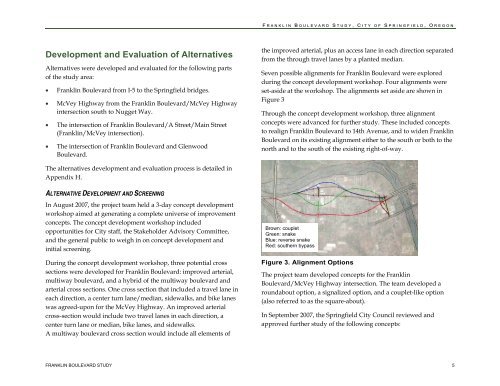
Seven possible alignments for <strong>Franklin</strong> <strong>Boulevard</strong> were explored<br />
during the concept development workshop. Four alignments were<br />
set-aside at the workshop. The alignments set aside are shown in<br />
Figure 3<br />
Through the concept development workshop, three alignment<br />
concepts were advanced for further study. These included concepts<br />
to realign <strong>Franklin</strong> <strong>Boulevard</strong> to 14th Avenue, and to widen <strong>Franklin</strong><br />
<strong>Boulevard</strong> on its existing alignment either to the south or both to the<br />
north and to the south <strong>of</strong> the existing right-<strong>of</strong>-way.<br />
The alternatives development and evaluation process is detailed in<br />
Appendix H.<br />
ALTERNATIVE DEVELOPMENT AND SCREENING<br />
In August 2007, the project team held a 3-day concept development<br />
workshop aimed at generating a complete universe <strong>of</strong> improvement<br />
concepts. The concept development workshop included<br />
opportunities for <strong>City</strong> staff, the Stakeholder Advisory Committee,<br />
and the general public to weigh in on concept development and<br />
initial screening.<br />
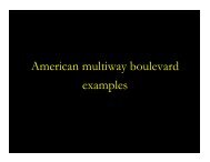
During the concept development workshop, three potential cross<br />
sections were developed for <strong>Franklin</strong> <strong>Boulevard</strong>: improved arterial,<br />
multiway boulevard, and a hybrid <strong>of</strong> the multiway boulevard and<br />
arterial cross sections. One cross section that included a travel lane in<br />
each direction, a center turn lane/median, sidewalks, and bike lanes<br />
was agreed-upon for the McVey Highway. An improved arterial<br />
cross-section would include two travel lanes in each direction, a<br />
center turn lane or median, bike lanes, and sidewalks.<br />
A multiway boulevard cross section would include all elements <strong>of</strong><br />
Brown: couplet<br />
Green: snake<br />
Blue: reverse snake<br />
Red: southern bypass<br />
Figure 3. Alignment Options<br />
The project team developed concepts for the <strong>Franklin</strong><br />
<strong>Boulevard</strong>/McVey Highway intersection. The team developed a<br />
roundabout option, a signalized option, and a couplet-like option<br />
(also referred to as the square-about).<br />
In September 2007, the <strong>Springfield</strong> <strong>City</strong> Council reviewed and<br />
approved further study <strong>of</strong> the following concepts:<br />
FRANKLIN BOULEVARD STUDY 5