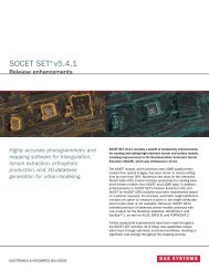
SOCET SET® brochure - BAE Systems GXP Geospatial eXploitation ...
SOCET SET® brochure - BAE Systems GXP Geospatial eXploitation ...
SOCET SET® brochure - BAE Systems GXP Geospatial eXploitation ...

You also want an ePaper? Increase the reach of your titles
YUMPU automatically turns print PDFs into web optimized ePapers that Google loves.
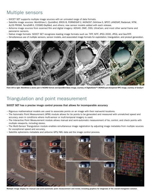
Multiple sensors<br />
−−<strong>SOCET</strong> SET supports multiple image sources with an unrivaled range of data formats.<br />
−−Satellite image sources: WorldView-1, QuickBird, EROS B, FORMOSAT-2, IKONOS®, OrbView-3, SPOT, LANDSAT, Radarsat, NTM,<br />
ALOS PRISM, TerraSAR-X, COSMO-SkyMed, and others; new sensor models added with each release.<br />
−−Airborne image sources from scanned film and digital imagery: ADS40, DMC, DSS, UltraCam, and most other aerial frame and<br />
panoramic sensors.<br />
−−Native image formats: <strong>SOCET</strong> SET recognizes leading image formats such as: TIFF, NITF, JPEG 2000, JPEG, and GeoTIFF.<br />
−−Simultaneous use of multiple sensors, sensor models, and associated image formats for exploitation, triangulation, and product generation.<br />
From left to right: WorldView-1 stereo pair in NCDRD format and QuickBird Basic Image, courtesy of DigitalGlobe; IKONOS pan-sharpened RPC image, courtesy of GeoEye®.<br />
Triangulation and point measurement<br />
<strong>SOCET</strong> SET has a precise image control process that allows for incomparable accuracy<br />
−−Rigorous mathematical models are used to associate points on an image with their real-world locations.<br />
−−The Automatic Point Measurement (APM) module allows for tie points to be generated and measured with unmatched speed and<br />
accuracy, even in conditions where multi-sensor or multi-temporal imagery is used.<br />
−−The Interactive Point Measurement module allows manual and semi-automatic measurement of tie, control, and check points with<br />
multiple viewports, including stereo.<br />
−−The Multi-Sensor Triangulation module enables simultaneous image registration by adjusting image metadata from multiple sources<br />
for exceptional speed and accuracy.<br />
−−Satellite ephemeris metadata and airborne GPS/IMU data aid the image control process.<br />
Multiple image display for manual and semi-automatic point measurement and review, including graphics for diagnosis of the overall triangution solution.