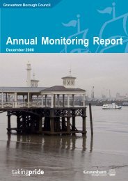
gravesend riverside conservation area - Gravesham Borough Council
gravesend riverside conservation area - Gravesham Borough Council
gravesend riverside conservation area - Gravesham Borough Council

Create successful ePaper yourself
Turn your PDF publications into a flip-book with our unique Google optimized e-Paper software.
Riverside Conservation Area Appraisal 2009<br />
eroded exposing the rocks below, while the<br />
chalk along the edge has been more resilient<br />
to erosion and formed the North Downs in<br />
Kent and South Downs in Sussex The <strong>area</strong><br />
between the two is the Weald, notable for its<br />
heavy clays and sandstone outcrops.<br />
Gravesend also lies close to <strong>area</strong>s of Thanet<br />
beds which contain clay and together with<br />
the London Clay found on the nearby Hoo<br />
Peninsula to the east produced the raw<br />
materials for brick making. Therefore, this<br />
<strong>area</strong> supplied the London stock bricks<br />
that were used for the intensive building<br />
programmes in London and Gravesend in the<br />
19th and 20th centuries.<br />
While chalk is also found locally it is too soft to<br />
be used for building large structures, although<br />
it supplied the raw materials for lime and,<br />
later, cement. Flints, found with chalk, are<br />
also evident in parts of Gravesend, and are<br />
sometimes used as a walling material. Kentish<br />
Ragstone, quarried from neighbouring <strong>area</strong>s,<br />
is also found in the architecture of the town.<br />
3.5 Relationship of the Conservation Area to<br />
its surroundings<br />
The immediate surroundings of the<br />
Conservation Area are urban townscape,<br />
some of which is designated in separate<br />
<strong>conservation</strong> <strong>area</strong>s.<br />
The following features form the immediate<br />
setting of the Conservation Area:<br />
• To the south: The large public surface car<br />
park that backs onto Ordnance Road and<br />
a large early 20th century school beyond;<br />
• To the west: 19th century residential<br />
streets of the New Town and the<br />
continuation of Royal Pier Road including<br />
the Clarendon Royal Hotel and St<br />
Andrews Arts Centre. Further west lies St<br />
Andrews Gardens;<br />
• To the north: The River Thames;<br />
• To the east: Modern industrial buildings.<br />
There are no formal designations of Sites<br />
of Special Scientific Interest (SSSI) in<br />
the Conservation Area or, indeed, in the<br />
immediate vicinity of Gravesend, although<br />
there is the large South Thames Estuary &<br />
Marshes SSSI, which extends to the <strong>area</strong> a<br />
short distance to the east of the town.<br />
Farmland around Gravesend is largely<br />
permanent arable and pasture, with some<br />
hedgerows that support an abundance of wild<br />
plants and attendant wildlife.<br />
Some invasive non-native plants including<br />
self seeding sycamores and, more worryingly,<br />
Japanese Knot Weed, are notable within the<br />
<strong>conservation</strong> <strong>area</strong>.<br />
7