gravesend riverside conservation area - Gravesham Borough Council
gravesend riverside conservation area - Gravesham Borough Council
gravesend riverside conservation area - Gravesham Borough Council

Create successful ePaper yourself
Turn your PDF publications into a flip-book with our unique Google optimized e-Paper software.
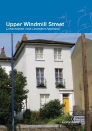
Riverside Conservation Area Appraisal 2009<br />
28<br />
APPENDIX 1<br />
History of Gravesend<br />
The earliest written recording of a settlement<br />
here is a reference to <strong>Gravesham</strong> in The<br />
Domesday Book of 1086. The name most<br />
likely means “graaf-ham”, the home of the<br />
reeve or bailiff of the Lord of the Manor.<br />
The Book refers to <strong>Gravesham</strong> being in the<br />
ownership of Odo, Bishop of Bayeux (the<br />
brother of William I) although it notes that the<br />
Manor had been split into three under the<br />
ownership of three Saxon thanes (or lords)<br />
before 1066. The Saxon settlement had grown<br />
around the Old Dover Road where the Saxon<br />
Parish Church of St Mary was built. There was<br />
also a small community to the north centred<br />
on a landing place (“hithe”) close to the<br />
location of the Town Pier, at the head of what<br />
was to become High Street.<br />
In the 11th century <strong>Gravesham</strong> was an<br />
agricultural estate but by the 14th century it<br />
had grown into a small market town. By the<br />
end of the 13th century it had adopted the<br />
name Gravesend and the Bishop of London<br />
was Richard de Gravesende at this time.<br />
The oldest building in Gravesend, Milton<br />
Chantry, dates from the 14th century<br />
and stands in the Gravesend Riverside<br />
Conservation Area next to the fort. It was a<br />
religious institution that owned considerable<br />
land in the <strong>area</strong>, on the outskirts of the<br />
fledgling town.<br />
The course of High Street had been<br />
established by the middle of the 14th century.<br />
It stood at the centre of a network of streets<br />
and created a direct route from the river<br />
landing stage southwards out of the town<br />
towards the old Parish Church. It seems that<br />
at the time of the town’s first market charter,<br />
in 1356, the town re-established itself in a<br />
new position closer to the river and it is likely<br />
that the market itself was sited on the corner<br />
of High Street and West Street next to the<br />
landing stage. This development led to the<br />
redundancy of the church and a chapel was<br />
built behind High Street on the present day<br />
site of the Parish Church of St George.<br />
The town grew under various lordships<br />
including the crown, nobility and the Cistercian<br />
Abbey of the St Mary Graces in London.<br />
Although the location of the manor house has<br />
never been discovered, it would have been<br />
close to the church and possibly within or<br />
adjacent to the boundary of the Conservation<br />
Area.<br />
In the medieval period most of the buildings<br />
were constructed of timber and therefore<br />
susceptible to fire damage. Although the<br />
houses and shops that lined the rising<br />
gradient of High Street would not have been<br />
as densely packed or as tall as they are today,<br />
the threat from the spread of fire was still<br />
great. Towards the end of the 14th century<br />
the town was almost completely destroyed by<br />
a combined French and Spanish force that<br />
sailed as far as Gravesend before retreating<br />
from an attack aimed at London. The resultant<br />
destruction led to the first rebuilding of the<br />
town.<br />
In recompense for the attack, Richard II<br />
granted the people of Gravesend sole rights to<br />
ferry passengers to London and this gave rise<br />
to Gravesend’s growth as a maritime centre<br />
and trading port. The suitability of Gravesend<br />
in this regard was supported by its location as<br />
the first settlement after the estuary, the deep<br />
anchorage in the <strong>area</strong> and the relatively short<br />
crossing to the north bank at this location.<br />
Open barges transported passengers to and<br />
from the Pool of London and larger, ocean-