gravesend riverside conservation area - Gravesham Borough Council
gravesend riverside conservation area - Gravesham Borough Council
gravesend riverside conservation area - Gravesham Borough Council
You also want an ePaper? Increase the reach of your titles
YUMPU automatically turns print PDFs into web optimized ePapers that Google loves.
Riverside Conservation Area Appraisal 2009<br />
13<br />
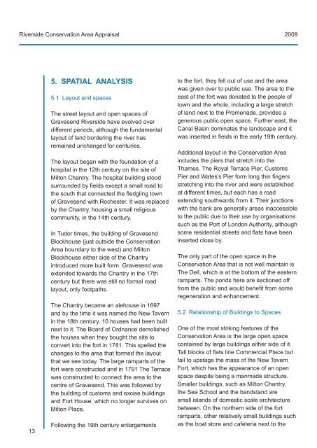
5. SPATIAL ANALYSIS<br />
5.1 Layout and spaces<br />
The street layout and open spaces of<br />
Gravesend Riverside have evolved over<br />
different periods, although the fundamental<br />
layout of land bordering the river has<br />
remained unchanged for centuries.<br />
The layout began with the foundation of a<br />
hospital in the 12th century on the site of<br />
Milton Chantry. The hospital building stood<br />
surrounded by fields except a small road to<br />
the south that connected the fledgling town<br />
of Gravesend with Rochester. It was replaced<br />
by the Chantry, housing a small religious<br />
community, in the 14th century.<br />
In Tudor times, the building of Gravesend<br />
Blockhouse (just outside the Conservation<br />
Area boundary to the west) and Milton<br />
Blockhouse either side of the Chantry<br />
introduced more built form. Gravesend was<br />
extended towards the Chantry in the 17th<br />
century but there was still no formal road<br />
layout, only footpaths.<br />
The Chantry became an alehouse in 1697<br />
and by the time it was named the New Tavern<br />
in the 18th century, 10 houses had been built<br />
next to it. The Board of Ordnance demolished<br />
the houses when they bought the site to<br />
convert into the fort in 1781. This spelled the<br />
changes to the <strong>area</strong> that formed the layout<br />
that we see today. The large ramparts of the<br />
fort were constructed and in 1791 The Terrace<br />
was constructed to connect the <strong>area</strong> to the<br />
centre of Gravesend. This was followed by<br />
the building of customs and excise buildings<br />
and Fort House, which no longer survives on<br />
Milton Place.<br />
Following the 19th century enlargements<br />
to the fort, they fell out of use and the <strong>area</strong><br />
was given over to public use. The <strong>area</strong> to the<br />
east of the fort was donated to the people of<br />
town and the whole, including a large stretch<br />
of land next to the Promenade, provides a<br />
generous public open space. Further east, the<br />
Canal Basin dominates the landscape and it<br />
was inserted in fields in the early 19th century.<br />
Additional layout in the Conservation Area<br />
includes the piers that stretch into the<br />
Thames. The Royal Terrace Pier, Customs<br />
Pier and Wates’s Pier form long thin fingers<br />
stretching into the river and were established<br />
at different times, but each has a road<br />
extending southwards from it. Their junctions<br />
with the bank are generally <strong>area</strong>s inaccessible<br />
to the public due to their use by organisations<br />
such as the Port of London Authority, although<br />
some residential streets and flats have been<br />
inserted close by.<br />
The only part of the open space in the<br />
Conservation Area that is not well maintain is<br />
The Dell, which is at the bottom of the eastern<br />
ramparts. The ponds here are sectioned off<br />
from the public and would benefit from some<br />
regeneration and enhancement.<br />
5.2 Relationship of Buildings to Spaces<br />
One of the most striking features of the<br />
Conservation Area is the large open space<br />
contained by large buildings either side of it.<br />
Tall blocks of flats line Commercial Place but<br />
fail to upstage the mass of the New Tavern<br />
Fort, which has the appearance of an open<br />
space despite being a manmade structure.<br />
Smaller buildings, such as Milton Chantry,<br />
the Sea School and the bandstand are<br />
small islands of domestic scale architecture<br />
between. On the northern side of the fort<br />
ramparts, other relatively small buildings such<br />
as the boat store and cafeteria next to the


