Silas Deane Highway Final Report - Town of Rocky Hill
Silas Deane Highway Final Report - Town of Rocky Hill
Silas Deane Highway Final Report - Town of Rocky Hill

Create successful ePaper yourself
Turn your PDF publications into a flip-book with our unique Google optimized e-Paper software.
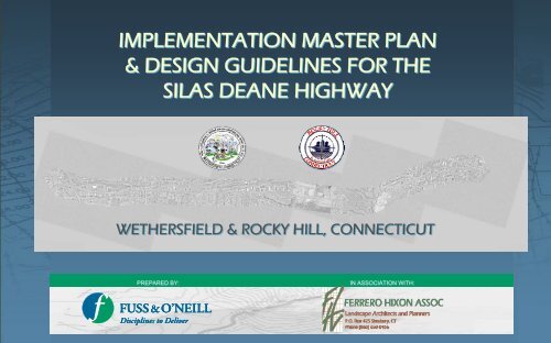
IMPLEMENTATION MASTER PLAN<br />
& DESIGN GUIDELINES FOR THE<br />
SILAS DEANE HIGHWAY<br />
WETHERSFIELD & ROCKY HILL, CONNECTICUT<br />
PREPARED BY:<br />
IN ASSOCIATION WITH:
Footer goes here<br />
TABLE OF CONTENTS<br />
INTRODUCTION…………………………………………………………………………………..I-<br />
LAND USE……………………………………………………………………………………………..L-<br />
LAND USE RECOMMENDATIONS……………………<br />
TRANSPORTATION……………………………………………………………………………..T-<br />
TRANSPORTATION………….<br />
TRANSPORTATION…………….<br />
TRANSPORTATION………….<br />
TRANSPORTATION…………….<br />
TRANSPORTATION………….<br />
TRANSPORTATION…………….<br />
BRAND IMAGE……………………………………………………………………………………B<br />
STREETSCAPE……………………………………………………………………………………….S-<br />
STREETSCAPE KEY MAP………………<br />
TYPICAL SECTIONS BY AREA……….<br />
TYPICAL SECTIONS BY AREA…..<br />
PLANT PALLET…………..<br />
WALKS………….<br />
PARKING BUFFERS………<br />
STREETSCAPE FURNITURE…………..<br />
CROSSWALKS……………….<br />
ARCHITECTURE………………………………………………………………………………………………..A-<br />
ARCHITECTURE…………………<br />
ARCHITECTURE…………………<br />
ARCHITECTURE…………………<br />
ZONING…………………………………………………………………………………………………………….Z-<br />
ZONING…………<br />
ZONING…………<br />
REINVESTMENT SITES……………………………………………………………………………………..R-<br />
REINVESTMENT SITES……………<br />
TOWN CENTER- WETHERSFIELD…………<br />
TOWN CENTER- ROCKY HILL……………………<br />
2006- SILAS DEANE REVITALIZATION COMMITTEE<br />
ROCKY HILL<br />
Mayor Anthony LaRosa<br />
Ex –Officio/<strong>Town</strong> Manager Barbara Gilbert<br />
Staff –<br />
Jeanne Webb Chavez – Economic Development Coordinator<br />
James Sollmi, P.E. – <strong>Town</strong> Engineer<br />
Chairman Larry deBear<br />
Councilman Rocco Sanzo<br />
Councilwoman Barbara Surwilo<br />
Dr. Ann Flandermeyer -Economic Development Commission<br />
John Harvey - <strong>Rocky</strong> <strong>Hill</strong> Chamber<br />
<strong>Silas</strong> <strong>Deane</strong> Businesses<br />
David Schweitzer P.E -HNTB<br />
Melroy D’Costa -Hampton Inn<br />
Rob St. John - F.X. Messina<br />
WETHERSFIELD<br />
Mayor Russ Morin<br />
Ex –Officio/<strong>Town</strong> Manager Bonnie Therrien<br />
Staff –<br />
Peter Gillespie – Economic Development Director<br />
Mike Turner, P.E. – <strong>Town</strong> Engineer<br />
Betty Rosania – Economic Development and<br />
Improvement Commission<br />
Dave Edwards – Planning and Zoning Commission<br />
Carmela Moore – Chamber <strong>of</strong> Commerce<br />
Leonardo Gugliotti – <strong>Silas</strong> <strong>Deane</strong> <strong>Highway</strong> Business<br />
John Lepper – Resident and Tree Warden<br />
Steve Foote – Resident<br />
Bernadine Franco - Resident<br />
CONSULTING TEAM<br />
Fuss & O’Neill, Inc. – Prime Consultant<br />
Ferrero Hixon Associates<br />
RKG Associates<br />
James Vance and Associates<br />
Planimetrics<br />
Moser Pilon Nelson
The <strong>Silas</strong> <strong>Deane</strong><br />
Vision<br />
For<br />
Reinvestment<br />
Prepared By<br />
In Association With<br />
Action Items and Design Guideline
TABLE OF CONTENTS<br />
Acknowledgements……………………………….<br />
Introduction……………………………………….<br />
Land Use……………………………………….<br />
Opportunities and Constraints<br />
Recommendations<br />
Design Guideline<br />
Transportation………………………………<br />
Opportunities and Constraints<br />
Recommendations<br />
Design Guideline<br />
Streetscape…………………………………<br />
Opportunities and Constraints<br />
Recommendations<br />
Design Guideline<br />
Architecture………………………………<br />
Opportunities and Constraints<br />
Recommendations<br />
Design Guideline<br />
Reinvestment Sites………………………<br />
<strong>Town</strong> Centers……………………………<br />
Action Items…………………………..<br />
Prepared By<br />
In Association With<br />
The <strong>Silas</strong> <strong>Deane</strong> Action<br />
Items and Design Guideline<br />
Wethersfield & <strong>Rocky</strong> <strong>Hill</strong>, Connecticut<br />
Date : April, 2006<br />
Scale : NTS<br />
P.1
Acknowledgements<br />
Collaboration between the neighboring <strong>Town</strong>s <strong>of</strong> Wethersfield and <strong>Rocky</strong> <strong>Hill</strong> in the area <strong>of</strong> economic development has presented a unique opportunity to<br />
bring positive change in the <strong>Silas</strong> <strong>Deane</strong> corridor. The contributions <strong>of</strong> the <strong>Silas</strong> <strong>Deane</strong> Advisory Committee, Public Officials, and <strong>Town</strong> Staff through the<br />
public involvement process have yielded a compelling vision for reinvestment in each town.<br />
SILAS DEANE ADVISORY COMMITTEE<br />
<strong>Rocky</strong> <strong>Hill</strong><br />
Chairman Larry deBear<br />
Councilman Rocco Sanzo<br />
Councilwoman Barbara Surwilo<br />
Dr. Ann Flandermeyer -Economic Development Commission<br />
John Harvey - <strong>Rocky</strong> <strong>Hill</strong> Chamber<br />
David Schweitzer P.E –HNTB (<strong>Silas</strong> <strong>Deane</strong> Business)<br />
Melroy D’Costa -Hampton Inn (<strong>Silas</strong> <strong>Deane</strong> Business)<br />
Rob St. John - F.X. Messina (<strong>Silas</strong> <strong>Deane</strong> Business)<br />
Wethersfield<br />
Betty Rosania – Economic Development and Improvement Commission<br />
Dave Edwards – Planning and Zoning Commission<br />
Carmela Moore – Chamber <strong>of</strong> Commerce<br />
Leonardo Gugliotti – <strong>Silas</strong> <strong>Deane</strong> Business<br />
John Lepper – Resident and Tree Warden<br />
Steve Foote – Resident<br />
Bernadine Franco – Resident<br />
Mayor Anthony LaRosa<br />
Ex –Officio/<strong>Town</strong> Manager Barbara Gilbert<br />
Staff –<br />
Jeanne Webb Chavez – Economic Development Coordinator<br />
James Sollmi, P.E. – <strong>Town</strong> Engineer<br />
Mayor Russ Morin<br />
Ex –Officio/<strong>Town</strong> Manager Bonnie Therrien<br />
Staff –<br />
Peter Gillespie – Economic Development Director<br />
Mike Turner, P.E. – <strong>Town</strong> Engineer<br />
CONSULTING TEAM<br />
Fuss & O’Neill, Inc. – Prime Consultant<br />
Ferrero Hixon Associates<br />
RKG Associates<br />
James Vance and Associates<br />
Planimetrics<br />
Moser Pilon Nelson<br />
Prepared By<br />
In Association With<br />
The <strong>Silas</strong> <strong>Deane</strong> Action<br />
Items and Design Guideline<br />
Wethersfield & <strong>Rocky</strong> <strong>Hill</strong>, Connecticut<br />
Date : April, 2006<br />
Scale : NTS<br />
P.2
INTRODUCTION<br />
Wethersfield and <strong>Rocky</strong> <strong>Hill</strong> public <strong>of</strong>ficials, staff, business owners, and volunteer residents have worked<br />
diligently in the past 24 months to define a vision for the <strong>Silas</strong> <strong>Deane</strong> <strong>Highway</strong> in order to promote economic<br />
revitalization, create a sense <strong>of</strong> place, improve aesthetics, and restore a connection to the history <strong>of</strong> the region.<br />
Today each community stands ready for this Implementation Phase.<br />
The Fuss & O’Neill / Ferrero Hixon Associates team was selected by the <strong>Silas</strong> <strong>Deane</strong> Advisory Committee<br />
(SDAC) to build upon the significant work done in the past, add details to the plan, and begin implementing<br />
improvements to the <strong>Silas</strong> <strong>Deane</strong> <strong>Highway</strong>. This project presents a unique challenge <strong>of</strong> dual municipalities,<br />
state owned roadway and a diversity <strong>of</strong> required disciplines including transportation engineering, land use<br />
planning, streetscape, market analysis, and architecture.<br />
Our team has conducted field work, visual analysis, data collection and preparation <strong>of</strong> base mapping. We have<br />
attended field walks with members <strong>of</strong> each community and held numerous public involvement and work shop<br />
meetings in each town, including an evaluation <strong>of</strong> opportunities and constraints and a full market study<br />
prepared and presented to the SDAC. The project has included the preliminary coordination <strong>of</strong> our<br />
transportation engineering, and access management ideas with the Connecticut Department <strong>of</strong> Transportation<br />
in order to gather early input into the process for potential modifications within the State right <strong>of</strong> way.<br />
The information provided herein summarizes the vision for The <strong>Silas</strong> <strong>Deane</strong> and necessary action items to<br />
achieve the vision. Design Guidelines are provided to allow the <strong>Town</strong>s to manage the process <strong>of</strong> change in the<br />
corridor. The document is broken into the sections <strong>of</strong> Land Use, Transportation, Streetscape, Architecture, and<br />
Zoning. Each section includes a discussion <strong>of</strong> existing conditions opportunities and constraints, followed by<br />
recommendations and design guidelines. This document is intended to be used by both towns as a guideline<br />
to design and review <strong>of</strong> public and private development and infrastructure projects.<br />
The <strong>Silas</strong> <strong>Deane</strong> <strong>Highway</strong> (Route 99) in the towns <strong>of</strong> Wethersfield and <strong>Rocky</strong> <strong>Hill</strong> is a 4 lane roadway, classified<br />
by the Connecticut Department <strong>of</strong> Transportation (ConnDOT) as an urban minor arterial. The project limits<br />
extend approximately 5 miles from the intersection at Route 160 (Elm Street) at the south end through the<br />
Interstate 91 (I-91) interchange and continuing north to the Routes 5/15 overpass. The land along the <strong>Silas</strong><br />
<strong>Deane</strong> <strong>Highway</strong> is heavily developed with a mix <strong>of</strong> retail, <strong>of</strong>fice, and residential developments in both towns.<br />
Traffic congestion is typically not a major issue along the highway in either town, with a few exceptions. The 4<br />
lane configuration typically provides excess capacity for the existing traffic volumes, and travel speeds are<br />
correspondingly high. In Wethersfield, the <strong>Silas</strong> <strong>Deane</strong> <strong>Highway</strong> provides a five lane cross-section, allowing for<br />
left turn lanes at major driveways and all signalized intersections.<br />
The following table summarizes opportunities and constraints for the corridor. Opportunities and constraints<br />
are defined as follows:<br />
Opportunities to enhance the corridor, and promote reinvestment by private property owners<br />
Constraints which limit or prohibit physical improvement and economic revitalization<br />
Summary <strong>of</strong> Opportunities and Constraints<br />
Opportunities<br />
Constraints<br />
Transportation<br />
Wide Right <strong>of</strong> Way<br />
Available capacity to support traffic growth<br />
Interstate visibility<br />
Access management<br />
Transit potential: railroad corridor<br />
Transit service : Bus<br />
Streetscape<br />
Existing trees in some places<br />
Potential gateway areas<br />
Bridges (portals)<br />
Generous tree belts<br />
Land Use<br />
Available parcels<br />
Regional location<br />
Mixed uses<br />
Connections to historic Wethersfield<br />
Nodal development<br />
Established shopping centers and <strong>of</strong>fice uses<br />
Strong residential component<br />
Solid government centers<br />
Architectural<br />
Brick treatments<br />
Significant buildings<br />
Portals<br />
High vehicular speeds<br />
Expansive pavement width<br />
State owned roadway, ConnDOT<br />
coordination<br />
Many curb cuts<br />
Bicycle limitations<br />
Pedestrian safety at intersections<br />
Sidewalk system breaks<br />
Lack <strong>of</strong> hierarchy<br />
Mono-aesthetic<br />
Lack <strong>of</strong> nodes and landmarks<br />
Inconsistent theme<br />
Front yard parking<br />
<strong>Town</strong> signage location/ aesthetics<br />
No tree belts or buffers to parking<br />
Many underutilized properties / buildings<br />
Individual small parcels / ownership<br />
Many small property owners, small parcels<br />
Property depth (very shallow)<br />
Regulatory constraints<br />
Wetlands<br />
Overhead high voltage power corridor<br />
Many small, diverse style, older buildings<br />
Brand / Image<br />
River commonality<br />
“Portal Concept”<br />
<strong>Silas</strong> <strong>Deane</strong> controversial as a person<br />
Strip mall corridor perception<br />
Prepared By<br />
In Association With<br />
The <strong>Silas</strong> <strong>Deane</strong> Action<br />
Items and Design Guideline<br />
Wethersfield & <strong>Rocky</strong> <strong>Hill</strong>, Connecticut<br />
INTRODUCTION<br />
Date : April, 2006<br />
Scale : NTS<br />
P.3
LAND USE<br />
Constraints:<br />
•Under utilized land and buildings: There are many properties and developments along the corridor, which are<br />
currently under utilized with respect to the maximization <strong>of</strong> appropriate land uses in the corridor as a whole.<br />
Possible reasons include individual property ownership and development patterns, there by substantially<br />
reducing overall property and land efficiency, market factors, and current regulatory and environmental<br />
limitations.<br />
•Lack <strong>of</strong> property consolidation and cross parking connections, etc.: As much <strong>of</strong> the corridor is in individual<br />
property ownership, this may represent one <strong>of</strong> the greatest challenges to positive redevelopment, as much <strong>of</strong> this<br />
redevelopment may be contingent on property owner cooperation and agreement. This challenge will be most<br />
prevalent in attempts to consolidate smaller parcels and enhance access management. In general, the greatest<br />
challenge will be amongst the smaller parcels.<br />
•Current regulatory guidelines: Current regulatory guidelines appear to inhibit the potential for new<br />
development patterns as outlined by the SDHAC. The components <strong>of</strong> corridor scale, development <strong>of</strong><br />
recognizable nodes, streetscape hierarchies and development incentives may be attributed to zoning issues such<br />
as maximum allowable coverage and FAR, building height limitations, property line setbacks, and to some extent<br />
parking regulations. Modifications to these existing regulations may support a more positive climate for change<br />
along the corridor.<br />
•Property depth: There are a number <strong>of</strong> small sized properties along the corridor in both towns. The depth <strong>of</strong><br />
many <strong>of</strong> these properties is further restricted by adjacent environmental systems or single-family residential<br />
neighborhoods. This may prove to be a deterrent to consolidation <strong>of</strong> multiple properties for a single use,<br />
particularly with respect to property depth.<br />
•Market constraints: Although the market study prepared as part <strong>of</strong> this plan indicates regional draw along the<br />
interchange areas, the remainder <strong>of</strong> the commercial uses are, and will be shaped by more local supply and<br />
demand. This may influence the market ability <strong>of</strong> property consolidation and larger mix-used developments in<br />
areas other than the highway interchanges.<br />
Opportunities:<br />
· Available parcels: There are a number <strong>of</strong> available and developable parcels along the corridor and identified<br />
by the town.<br />
· Mixed Uses: In general existing corridor land uses exhibit an array <strong>of</strong> mixed uses from multi family housing<br />
to commercial, industrial and hospitality uses. There is an opportunity to continue to foster the development <strong>of</strong><br />
mixed uses particularly in market-defined gaps.<br />
· Connections to historic Wethersfield: As historic Wethersfield is an important element in the cultural aspects<br />
<strong>of</strong> Wethersfield its location and proximity to the <strong>Silas</strong> <strong>Deane</strong> <strong>Highway</strong> should be promoted and exploited.<br />
•Nodal development: There exists an opportunity to develop a hierarchy <strong>of</strong> patterns along the corridor with<br />
the creation and enhancement <strong>of</strong> specific nodes. These development nodes would primarily be located at each<br />
<strong>of</strong> the major interchanges as well as each <strong>of</strong> the town centers <strong>of</strong> Wethersfield and <strong>Rocky</strong> <strong>Hill</strong>. The nodal<br />
development opportunity is enhanced in Wethersfield by the utilization expansion and connections <strong>of</strong> Beaver<br />
Brook Road with the <strong>Silas</strong> <strong>Deane</strong> <strong>Highway</strong> augmenting existing traditional town center land uses <strong>of</strong><br />
government, business, education and religion. In <strong>Rocky</strong> <strong>Hill</strong> this nodal development may be enhanced through<br />
a more direct connection <strong>of</strong> the town hall complex to the <strong>Silas</strong> Dean <strong>Highway</strong> interchange in that area. <strong>Rocky</strong><br />
<strong>Hill</strong>’s town center may also exploit some <strong>of</strong> these traditional town center uses.<br />
•Established land uses: In certain portions <strong>of</strong> the corridor, particularly at the I 91 highway interchange there<br />
exists many well established land uses including hospitality, commercial, retail, <strong>of</strong>fice and service. This<br />
interchange area currently represents the most desirable and marketable portion <strong>of</strong> the highway. As such an<br />
opportunity exists to build and expand on existing and future complimentary uses in these areas and elsewhere<br />
on the corridor. The development <strong>of</strong> appropriate incentives, aesthetics and partial consolidation options will<br />
,enhance this areas viability as a regional destination as well as provide a catalyst for enhancements to<br />
properties on the remainder <strong>of</strong> the corridor.<br />
•Strong residential component: There are several stable residential neighborhoods and communities along or<br />
adjacent to the <strong>Silas</strong> <strong>Deane</strong> <strong>Highway</strong> in both <strong>Rocky</strong> <strong>Hill</strong> and Wethersfield. Wethersfield’s neighborhoods<br />
primarily exist single-family neighborhoods while <strong>Rocky</strong> <strong>Hill</strong>’s are primarily multi-family. The proximity <strong>of</strong><br />
residential neighborhoods to the <strong>Silas</strong> <strong>Deane</strong> <strong>Highway</strong> lends to the true mixed nature <strong>of</strong> the corridor.<br />
Opportunities for creating transitional, higher density residential housing exist in both towns. These higher<br />
density-housing areas will help provide impetus for further neighborhood commercial expansion and provide<br />
an appropriate transition from lower density residential neighborhoods to the commercial corridor. The specific<br />
target market for potential residential communities in each <strong>of</strong> the towns will vary.<br />
•Solid government centers: The governmental land uses in both towns represent strong opportunities for the<br />
development <strong>of</strong> solid identifiable nodes along the corridor. The proximity <strong>of</strong> these areas in relation to the <strong>Silas</strong><br />
<strong>Deane</strong> should be strengthened and exploited. Complementary land uses, attractive mixed use out door activity<br />
areas and direct vehicular and pedestrian opportunities exist. The coincidental location <strong>of</strong> these areas begins to<br />
create the desired hierarchy <strong>of</strong> uses and nodes.<br />
•Beaver Brook Open Space: This natural area provided limitless opportunities to create direct pedestrian and<br />
recreational connections to the corridor from the adjacent neighborhoods in Wethersfield. Additional studies<br />
may focus on the physical feasibility <strong>of</strong> developing these areas into a town wide recreational amenity consistent<br />
with the findings <strong>of</strong> the Beaver Brook Open Space study prepared in the 1960’s..<br />
Prepared By<br />
In Association With<br />
The <strong>Silas</strong> <strong>Deane</strong> Action<br />
Items and Design Guideline<br />
Wethersfield & <strong>Rocky</strong> <strong>Hill</strong>, Connecticut<br />
LAND USE<br />
Date : April, 2006<br />
Scale : NTS<br />
P.4
PROMOTE CONTINUOUS REAR ACCESS<br />
ROAD AND BIKE PATH ALONG RAILROAD<br />
RIGHT OF WAY. POTENTIAL COMMERCIAL<br />
FRONTAGE AND LOT ACCESSES. PROVIDE<br />
MULTIPLE ACCESS POINTS TO SILAS<br />
DEANE.<br />
“TOWN GREEN”<br />
TOWN CENTER DEVELOPMENT<br />
INCLUDING “TOWN GREEN”, BEAVER<br />
BROOK ROAD EXTENSION, ETC<br />
IMPLEMENT BEAVER BROOK OPEN<br />
SPACE PLAN AND NEIGHBORHOOD<br />
CONNECTIONS- BIKE PATH<br />
FUTURE LOT / BUILDING<br />
RECONFIGURATION PERPENDICULAR<br />
TO SILAS DEANE<br />
CONTINUE BIKE / PEDESTRIAN<br />
CONNECTION TO FERRY AREA<br />
FUTURE VILLAGE<br />
IMPROVEMENTS TO FERRY<br />
ACCESS<br />
TOWN CENTER DEVELOPMENT<br />
INCLUDING ROUNDABOUT, NEW<br />
CONNECTING ROADS, TOWN GREEN,<br />
ETC<br />
1<br />
6 5<br />
4<br />
2<br />
3<br />
PRESERVE RESIDENTIAL<br />
CHARACTER<br />
GATEWAY PARK-<br />
PRESERVE OPEN<br />
LAWN AND VIEWS<br />
TO STEEPLE<br />
FUTURE MULTI-<br />
FAMILY HOUSING<br />
TRANSITION ZONE<br />
REALIGN HEWITT ST<br />
ROADWAY CONNECTORS CONNECT<br />
GOVERNMENT CENTER AREA WITH<br />
HIGHWAY USES<br />
PROVIDE SIGNAGE / DIRECT CONNECTION<br />
TO “HERITAGE WAY BIKE PATH”<br />
PROPOSED TOWN GREEN<br />
GATEWAY GREEN<br />
Prepared By<br />
In Association With<br />
The <strong>Silas</strong> <strong>Deane</strong> Action<br />
Items and Design Guideline<br />
Wethersfield & <strong>Rocky</strong> <strong>Hill</strong>, Connecticut<br />
LAND USE<br />
Date : April, 2006<br />
Scale : NTS<br />
P.5
TRANSPORTATION<br />
Constraints<br />
•Speed: Vehicle speeds are typically 10 to 15 mph higher than the posted speed limits. These speeds are<br />
encouraged during <strong>of</strong>f peak periods when traffic is light and the freedom <strong>of</strong> many lanes <strong>of</strong> pavement and open<br />
road result in higher speeds. High vehicular speeds contribute to many other challenges to businesses along<br />
the <strong>Silas</strong> <strong>Deane</strong>. Access to/from unsignalized driveways can be very difficult, particularly making a left turn<br />
across multiple lanes <strong>of</strong> traffic traveling at 50 mph.<br />
•Pavement width: The <strong>Silas</strong> <strong>Deane</strong> is four to five lanes wide in both towns with turning lanes at major<br />
intersections and traffic signals. Although the number <strong>of</strong> lanes allows traffic to move very well, it also<br />
encourages higher speeds during <strong>of</strong>f peak periods. The pavement width also presents a constraint in that it’s<br />
difficult to have a “sense <strong>of</strong> community”, or pedestrian scale to such a wide roadway corridor.<br />
•State owned road: The <strong>Silas</strong> <strong>Deane</strong> <strong>Highway</strong> is designated as State Route 99 and the right <strong>of</strong> way is owned by<br />
the Connecticut Department <strong>of</strong> Transportation. Any proposed improvements within the right <strong>of</strong> way lines will<br />
necessitate review and approval by ConnDOT through the encroachment permit process.<br />
•Curb cuts: The land along the <strong>Silas</strong> <strong>Deane</strong> <strong>Highway</strong> has been heavily developed over the years, and the result<br />
is many driveways scattered along both sides <strong>of</strong> the roadway. There are numerous conflicts for vehicles turning<br />
in and out <strong>of</strong> the many drives. Accident data provided by ConnDOT indicate that approximately 50 percent <strong>of</strong><br />
the accidents on the <strong>Silas</strong> <strong>Deane</strong> <strong>Highway</strong> take place at private driveways.<br />
•Bicycle limitations: The roadway corridor provides a typical two foot wide shoulder for bicycles. This narrow<br />
shoulder is adjacent to multiple travel lanes with high speed traffic and is therefore very uncomfortable for<br />
bicyclist use. The <strong>Silas</strong> <strong>Deane</strong> is not a designated Bike Route by the Connecticut Department <strong>of</strong> Transportation.<br />
•Pedestrian safety: High speeds, and expansive pavement width contribute to an unsafe condition for<br />
pedestrian crossings the sixty foot wide <strong>Silas</strong> <strong>Deane</strong> <strong>Highway</strong>. Sidewalk ramps are missing, or outdated at many<br />
locations resulting in a difficult maneuver for wheel chair users.<br />
•Sidewalk system breaks: The sidewalk system has many gaps in each town making it difficult for pedestrians<br />
who live or work in the corridor to safely walk to and from local businesses, restaurants, and convenience<br />
stores.<br />
•Intersections: Several problematic intersections were noted during our field work. See Opportunities and<br />
constraints report prepared under separate cover for detailed analysis:<br />
Opportunities<br />
•Wide right <strong>of</strong> way: Typical right <strong>of</strong> way width ranges from 85 feet to 150 feet wide with the average section<br />
being approximately 100 feet wide. Pavement width varies from 55 to 80 feet wide within the right <strong>of</strong> way.<br />
The excess right <strong>of</strong> way outside the pavement supports the presence <strong>of</strong> sidewalk, guide rail, culvert bridges and<br />
other amenities.<br />
•Capacity reducing modifications could potentially be made to the <strong>Silas</strong> <strong>Deane</strong> <strong>Highway</strong> without adversely<br />
affecting traffic operations. Possible modifications include angled on street parking, lane reductions, lane width<br />
reductions, landscaped medians, or two-way center left turn lanes. These modifications would help to reduce<br />
the average speed <strong>of</strong> vehicles traveling on the roadway, increasing the safety for all road users.<br />
•“Road diet” is a buzz word and a relatively new idea in roadway enhancement. The concept is to reduce the<br />
number <strong>of</strong> lanes on roadways where excess capacity exists. The resulting benefits are many, including<br />
reduced speed, reduction in the number and severity <strong>of</strong> accidents, increased access for pedestrians and<br />
bicyclists, and increased property value.A road diet typically involves reducing the capacity <strong>of</strong> the roadway by<br />
way <strong>of</strong> narrowing or reducing lanes, along with installing new roadway features such as center turning lanes,<br />
landscaped medians, or bicycle lanes. Road diets are most <strong>of</strong>ten applied to roads with ADT <strong>of</strong> 12,000 to<br />
18,000, but may be applicable on roads with volumes as high as 25,000 vehicles per day.<br />
•Installation <strong>of</strong> a center two-way left turn lane in the place <strong>of</strong> the existing alternating exclusive left turn lanes<br />
on the roadway segments between signalized intersections would improve access to businesses that currently<br />
do not have left turn lanes. This option also improves the safety along the corridor.<br />
•Designation <strong>of</strong> a landscaped median would beautify the <strong>Silas</strong> <strong>Deane</strong> <strong>Highway</strong>, while improving traffic safety.<br />
Restricting left turn movements from unsignalized driveways will reduce the number <strong>of</strong> accidents, but may<br />
negatively impact local businesses. Specific stake holder discussions would be required prior to the initiation <strong>of</strong><br />
final plans.<br />
•The installation <strong>of</strong> sidewalks and crosswalks where they are missing.<br />
•ConnDOT Coordination: Any modifications proposed for the <strong>Silas</strong> <strong>Deane</strong> <strong>Highway</strong> must first be reviewed<br />
and approved by ConnDOT, in accordance with their regulations for state highways. Meetings were held<br />
with ConnDOT in order to determine issues with the various concepts developed by the design team.<br />
A roundabout can be considered at the Five Corners intersection in <strong>Rocky</strong> <strong>Hill</strong> and for locations where ADT<br />
on the <strong>Silas</strong> <strong>Deane</strong> <strong>Highway</strong> is less than 20,000 vehicles.<br />
Available Capacity: The number <strong>of</strong> lanes provide an ability to support additional development and associated<br />
increases in traffic volumes. Most intersections can accommodate traffic increases, and right <strong>of</strong> way is<br />
available to support traffic improvements to several intersections where traffic congestion exists. Potential<br />
improvements at several intersections might be considered and are illustrated on the following pages..<br />
Access Management: The goal <strong>of</strong> access management is to reduce the number <strong>of</strong> conflict points along a<br />
roadway and to manage the spacing <strong>of</strong> conflict points to ensure safe and efficient travel.. There are several<br />
measures that can be considered in order to provide better access management along a roadway. These<br />
recommendations include: parking lots with multiple entry and exit points, wide curb cuts can be narrowed,<br />
access to businesses located on an intersection can be limited to the minor street, where conflicting traffic<br />
volumes are lower, provide internal connector roads to the rear <strong>of</strong> adjacent sites. We have identified<br />
numerous opportunities for curb cut reduction and internal driveway connections.<br />
Transit – Railroad: Active railroad tracks run parallel to the <strong>Silas</strong> <strong>Deane</strong> <strong>Highway</strong> within the project limits. This<br />
rail corridor is a consideration for potential long term transit connectors to Hartford. The railroad right <strong>of</strong> way<br />
may be considered for other uses such as a multi use path which could provide a connection to the Beaver<br />
Brook Linear park, historic Wethersfield, the <strong>Rocky</strong> <strong>Hill</strong> Ferry, etc. Alternatively, the railroad corridor could be<br />
used in some Wethersfield locations to provide rear internal connections between sites in order to reduce curb<br />
cuts and promote access management.<br />
Transit – Bus Service: Opportunities exist to improve the bus service within the corridor through additional<br />
stop locations at key reinvestment properties and enhancement <strong>of</strong> existing bus stop amenities.<br />
Prepared By<br />
In Association With<br />
The <strong>Silas</strong> <strong>Deane</strong> Action<br />
Items and Design Guideline<br />
Wethersfield & <strong>Rocky</strong> <strong>Hill</strong>, Connecticut<br />
TRANSPORTATION<br />
Date : April, 2006<br />
Scale : NTS<br />
P.6
TRANSPORTATION GUIDELINES<br />
The guiding principles for implementation <strong>of</strong> transportation improvements can be summarized in the following<br />
corridor goals:<br />
Reduce speed without reducing capacity <strong>of</strong> the roads and intersections:<br />
Reduce pavement width, introduce center planted islands, and reduce geometry (radii, etc) to send a message<br />
to the driver that 35mph is the right speed. One example is the removal <strong>of</strong> the high speed ramps to<br />
and from I-91.<br />
Create a pedestrian friendly environment, a place where people want to live, work, and recreate: Upgrade<br />
sidewalk ramps, and push buttons to create a corridor that is friendly to the disabled and elderly<br />
communities.<br />
Manage access to the <strong>Silas</strong> <strong>Deane</strong>:<br />
Combine curb cuts and create rear connector drives, and internal parking lot connections between sites. Install<br />
two way center left turn lanes where recommended. Create on street parking opportunities to “bring<br />
the street to the building”, thus reducing setbacks. As site development projects are brought to the<br />
<strong>Town</strong>, <strong>Town</strong> staff should stress the incorporation <strong>of</strong> shared drives, and internal connections and should<br />
also preserve the land for a rear connector drive in an easement.<br />
New traffic signals could be proposed at major shared driveways as an incentive for property owners to<br />
combine access. Other access management incentives could include density, shared parking<br />
(reduction <strong>of</strong> required parking), or signage increases.<br />
Roundabout:<br />
The intersection <strong>of</strong> <strong>Silas</strong> <strong>Deane</strong> at Route 160 has been depicted as a roundabout intersection as part <strong>of</strong> our<br />
recommendations. Although we feel confident that this is the best option to meet the <strong>Town</strong>’s objectives in<br />
the <strong>Town</strong> Center, we also understand that the proposal has evoked strong opinions from the public.<br />
We suggest that the <strong>Town</strong> undertake an effort to conduct preliminary engineering and evaluation <strong>of</strong><br />
alternatives specific to this intersection. Other options including traffic signal will work, but will not allow for<br />
the significant reduction <strong>of</strong> travel speeds, safety enhancement, and aesthetic benefits <strong>of</strong> the roundabout. We<br />
feel that the <strong>Town</strong> should take the time to fully understand the pros and cons <strong>of</strong> each option before making<br />
this important decision.<br />
Funding:<br />
Preliminary conversations with ConnDOT have indicated that several projects would be eligible for State and<br />
Federal funding. The improvements concept for removal <strong>of</strong> the high speed I-91 ramps was viewed favorably<br />
by ConnDOT as an opportunity for a safety enhancement.<br />
The <strong>Town</strong>s should continue to collaborate on packaging transportation projects for funding through the<br />
DECD STEAP Grants, and ConnDOT Enhancement, and Safety Improvement Programs.<br />
Improve transit service:<br />
Provide bus pull <strong>of</strong>fs as recommended. Change the CT Transit route to follow the <strong>Silas</strong> <strong>Deane</strong> in <strong>Rocky</strong> <strong>Hill</strong>.<br />
Architectural bus shelters can be provided to fit with the streetscape <strong>of</strong> the corridor.<br />
Long term action will be to work with the Capitol Region Council <strong>of</strong> Governments to initiate passenger service<br />
on the Valley Rail Line railroad corridor to create a commuter route to Hartford, connection to Adriaen’s<br />
Landing, and opportunities for the proposed Housing element in the <strong>Silas</strong> <strong>Deane</strong> corridor.<br />
Transit oriented development would be a natural benefit <strong>of</strong> additional rail stations in Wethersfield and <strong>Silas</strong><br />
<strong>Deane</strong>.<br />
Prepared By<br />
In Association With<br />
The <strong>Silas</strong> <strong>Deane</strong> Action<br />
Items and Design Guideline<br />
Wethersfield & <strong>Rocky</strong> <strong>Hill</strong>, Connecticut<br />
TRANSPORTATION<br />
Date : April, 2006<br />
Scale : NTS<br />
P.7
Prepared By<br />
In Association With<br />
The <strong>Silas</strong> <strong>Deane</strong> Action<br />
Items and Design Guideline<br />
Wethersfield & <strong>Rocky</strong> <strong>Hill</strong>, Connecticut<br />
TRANSPORTATION<br />
Date : April, 2006<br />
Scale : NTS P.8
Prepared By<br />
In Association With<br />
The <strong>Silas</strong> <strong>Deane</strong> Action<br />
Items and Design Guideline<br />
Wethersfield & <strong>Rocky</strong> <strong>Hill</strong>, Connecticut<br />
TRANSPORTATION<br />
Date : April, 2006<br />
Scale : NTS P.9
Prepared By<br />
In Association With<br />
The <strong>Silas</strong> <strong>Deane</strong> Action<br />
Items and Design Guideline<br />
Wethersfield & <strong>Rocky</strong> <strong>Hill</strong>, Connecticut<br />
TRANSPORTATION<br />
Date : April, 2006<br />
Scale : NTS<br />
P.10
Prepared By<br />
In Association With<br />
The <strong>Silas</strong> <strong>Deane</strong> Action<br />
Items and Design Guideline<br />
Wethersfield & <strong>Rocky</strong> <strong>Hill</strong>, Connecticut<br />
TRANSPORTATION<br />
Date : April, 2006<br />
Scale : NTS<br />
P.11
REMOVE RAMP<br />
REMOVE RAMP<br />
Prepared By<br />
In Association With<br />
The <strong>Silas</strong> <strong>Deane</strong> Action<br />
Items and Design Guideline<br />
Wethersfield & <strong>Rocky</strong> <strong>Hill</strong>, Connecticut<br />
TRANSPORTATION<br />
Date : April, 2006<br />
Scale : NTS<br />
P.12
Prepared By<br />
In Association With<br />
The <strong>Silas</strong> <strong>Deane</strong> Action<br />
Items and Design Guideline<br />
Wethersfield & <strong>Rocky</strong> <strong>Hill</strong>, Connecticut<br />
TRANSPORTATION<br />
Date : April, 2006<br />
Scale : NTS<br />
P.13
BRAND / IMAGE<br />
The development <strong>of</strong> a meaningful “brand” and image” <strong>of</strong> a space such as the <strong>Silas</strong> <strong>Deane</strong><br />
requires insight into it’s users, it’s history, and it’s future vision. From the combination <strong>of</strong><br />
these elements, in conjunction with the existing positive images, the idea <strong>of</strong> an image, and<br />
subsequently a brand, emerges.<br />
Recommendations <strong>of</strong> the organization <strong>of</strong> the image <strong>of</strong> the space includes the presentation<br />
<strong>of</strong> a common theme for the corridor in both towns, while highlighting, or personalizing<br />
elements unique to each town, or space. In addition, the concept <strong>of</strong> the Portals, and that<br />
<strong>of</strong> the promotion <strong>of</strong> a graduated hierarchy <strong>of</strong> Nodal Development has led the design team<br />
to the following thoughts on branding, image, and the utilization there<strong>of</strong> along the<br />
corridor.<br />
SOURCES OF POSSIBLE IMAGE DEVELOPMENT COMMON TO BOTH TOWNS.<br />
The Connecticut River: The river has played a crucial role in the development and<br />
settlement <strong>of</strong> each town from the fertile farmlands in Wethersfield to the boat building and<br />
ferry in <strong>Rocky</strong> <strong>Hill</strong>. Building on the concept <strong>of</strong> the corridor as a series <strong>of</strong> Portals and a<br />
hierarchy <strong>of</strong> Node and activity centers, the entire space may be viewed as a “contemporary<br />
river <strong>of</strong> commerce”. Node areas representing harbors along the river where movement<br />
slows and activity is concentrated versus the in between movement areas. Details could be<br />
developed in these area corresponding to the agrarian connections to the river in<br />
Wethersfield, and the Boat building connections to the river in <strong>Rocky</strong> <strong>Hill</strong>. The sketches<br />
presented illustrate a couple <strong>of</strong> many possible examples <strong>of</strong> how this theme may<br />
translate to physical design. <strong>Final</strong> design <strong>of</strong> these elements would require building design<br />
consensus among interested parties and will be contingent on technical review by the<br />
towns and the DOT. Streetscape elements along the corridor and in the nodes may also<br />
reflect this design motif.<br />
In addition to this treatment <strong>of</strong> Portals and nodes, other opportunities may include:<br />
All signage excluding gateways and portals and including way finding, street signs,<br />
business signage both on street and façade mounted, awnings, Banners, traffic signage (if<br />
possible), etc. The idea would be to exhibit through design a colorful motif which exhibits<br />
flow, and movement.<br />
The full development <strong>of</strong> the Beaver Brook pedestrian / open space corridor and the future<br />
utilization <strong>of</strong> the Rail Road ROW as pedestrian connectors may be common to both towns<br />
and developed utilizing detailing consistent with this theme.<br />
Potential water features located within each <strong>of</strong> the two town center nodes and near the<br />
interchange gateway / portal areas<br />
Light standards: Modern but picking up on selected period shapes and forms<br />
Walk ways: In the early 20th century the Bolton Bluestone Company supplied this area<br />
with materials which were used for sidewalk construction. The use <strong>of</strong> bluestone or a<br />
bluestone like material and brick would be complementary, and provide both image<br />
linkages and the look <strong>of</strong> permanence and quality.<br />
NUMEROUS SMALL REFLECTIVE PANELS<br />
UNDER BRIDGE DECK.. PROVIDE<br />
LIGHTING TO CREATE A WATER “GLITTER”<br />
EFFECT<br />
BRIDGE “RIVER<br />
ATTACHMENT”<br />
TYPICAL WAY FINDING SIGNAGE<br />
LANDSCAPED CENTER<br />
MEDIAN AS PERMITTED<br />
LOGO INSET<br />
BRICK SIGN FACE PICKS<br />
UP ON BRICK USE IN<br />
TOWN CENTER AND<br />
TOWN HALL COMPLEX<br />
OFF WHITE PRECAST<br />
ARCHITECTURAL<br />
CAPPING<br />
BRONZE OR BRASS<br />
LETTERING ON INSET<br />
BRICK PANEL<br />
PRECAST OFF WHITE<br />
CONCRETE CYLINDERS<br />
SYMBOLIZING HISTORIC<br />
DOCK/WHARF RIVER USE<br />
AT THE FERRY<br />
BASALT WALL BASE<br />
SYMBOLIC OF THE TOWN’S<br />
NAMESAKE<br />
ABUTMENT BUFFERS<br />
LANDSCAPE IN “CROP ROWS”<br />
NEW CONNECTING SIDEWALK<br />
BOTH SIDES<br />
TOWN FLAG AND POLE. ONE<br />
TOWN ON EACH SIDE OF<br />
BRIDGE<br />
TYPICAL PORTAL / BRIDGE ENHANCEMENT<br />
SILAS DEANE LOGO AND OR TAG<br />
LINE<br />
BRIGHT GRAPHICS IN BRIDGE PANEL<br />
INSETS. PROVIDE UP LIGHTING<br />
NEW COBRA STREET LIGHTS<br />
WARF / PIER BRIDE ABUTMENT<br />
FEATURES<br />
TYPICAL GATEWAY SIGNAGE (ROCKY HILL)<br />
Prepared By<br />
In Association With<br />
The <strong>Silas</strong> <strong>Deane</strong> Action<br />
Items and Design Guideline<br />
Wethersfield & <strong>Rocky</strong> <strong>Hill</strong>, Connecticut<br />
BRAND / IMAGE<br />
Date : April, 2006<br />
Scale : NTS<br />
P.14
STREETSCAPE<br />
Constraints:<br />
•Corridor scale / special hierarchy: The majority <strong>of</strong> the <strong>Silas</strong> <strong>Deane</strong> is comprised <strong>of</strong> a massive road cross section<br />
abutting one and two story structures with generous property line setbacks on both sides <strong>of</strong> the road. These<br />
proportions, combined with unbuffered front yard parking areas create a harsh non-pedestrian scale where the<br />
automobile and overhead utilities are clearly the dominant corridor elements.<br />
•No consistency to theme / motif: With the exception <strong>of</strong> the automobile and overhead utilities, there is no<br />
substantial common repeating thematic elements which would serve to tie the corridor together visually.<br />
•Lack <strong>of</strong> Nodes and Landmarks: Nodes and landmarks, particularly in a linear system, help establish variety, natural<br />
way finding and recognition, identity and hierarchy. With the exception <strong>of</strong> the church near the Wethersfield <strong>Town</strong><br />
Hall, and small hand full <strong>of</strong> other buildings, the highway appears devoid <strong>of</strong> anything resembling a nodal center or<br />
architecturally significant landmark.<br />
•Visual clutter: Vertical elements in the landscape (natural or man made) have the most substantial visual impact on<br />
any given space. They define space, character, scale and proportion. With the exception <strong>of</strong> overhead utilities and<br />
automobiles, the vertical elements along the highway are inconsistent, random and chaotic and include such<br />
elements as business and traffic signage, building facades and setbacks, front yard parking or amenities, etc.<br />
Opportunities:<br />
•Limited Existing Street Trees: There exists in a few isolated areas along the corridor including good examples <strong>of</strong><br />
commercial streetscaping as well as a few older developments with mature trees close to the property line . It is<br />
apparent that the larger newer developments have been urged to provide street trees along there respected<br />
frontages. As parking areas visible from the corridor, there are also some positive attempts at buffering these areas<br />
such as utilizing mixed landscape beds or hedges.<br />
•Clearly Defined Gateway Areas: The two highway interchanges represent clearly defined and logical locations for<br />
town wide gateway signage as well as acting as “portals” to the corridor itself. Celebration <strong>of</strong> the corridor itself as<br />
well as entrance to the respective towns should be enhanced in these existing areas.<br />
•Portals ( Bridges): Tall Vertical elements in the landscape will provide a sense <strong>of</strong> scale in the area. Currently the only<br />
vertical features providing scale are a few isolated multi-story buildings, visually dominant overhead utilities and very<br />
limited mature street trees.<br />
•Bridge Structures and abutments: An opportunity exists to enhance bridge structures and abutments in a way that<br />
provides a sense <strong>of</strong> entry and exit into the space, at the two ends and celebrates the arrival and departure from <strong>Silas</strong><br />
<strong>Deane</strong>.<br />
•Right <strong>of</strong> Way/ Tree Belts: The <strong>Silas</strong> <strong>Deane</strong> <strong>Highway</strong> enjoys every generous state highway right <strong>of</strong> way. The<br />
rearrangement <strong>of</strong> elements within this right <strong>of</strong> way should seek to maximize the efficiency <strong>of</strong> land available for<br />
streetscaping purposes. Traffic studies should investigate the reduction <strong>of</strong> corridor lanes where appropriated and the<br />
distribution <strong>of</strong> excess land shared either in wider tree belts or center medians.<br />
STREETSCAPE PLAN<br />
There are many components to the streetscape plan. These components and designs seek to enhance the safety,<br />
pedestrian circulation, aesthetics and the scale <strong>of</strong> the corridor as a whole. Many components may be implemented<br />
in the short term however numerous items will require private property cooperation, CT.DOT review and or property<br />
consolidation and reinvestment in order to be realized. Long-term implementation should be coordinated and<br />
realized as new opportunities are presented. Therefore, this plan is categorized into phases and includes elements<br />
that may be implemented immediately (short term implementation) and elements, the implementation <strong>of</strong> which<br />
would only coalesce upon the appropriate development conditions listed above, (long term implementation).<br />
Although the elements proposed along the corridor vary by section, the long term short term implementation<br />
concept is the same for all areas. The primary elements <strong>of</strong> the plan are described below and illustrated on sheets<br />
entitled “Typical Cross Sections”:<br />
Short-term improvements:<br />
Landscaping: Landscape (planting) will be limited to the roadway edges. A planting palette has been proposed.<br />
Short-term landscape should be coordinated with longer-term goals.<br />
Parking lot buffers: Every effort should be made to screen or remove existing parking lots along the highway. Low<br />
hedges and fences are proposed depending on the section <strong>of</strong> the corridor.<br />
Signage: Gateway and Way finding signage as well as the development <strong>of</strong> “the portals” and new street signs may be<br />
implemented immediately. Similarly, coordination with CTDOT to reduce traffic signage should be studied in the short<br />
term.<br />
Lighting: Based on safety considerations, and the width <strong>of</strong> the travel lanes, it may be anticipated that ornamental<br />
lighting alone will not provide the light necessary wash. Ornamental lighting, while substantially improving the<br />
aesthetic quality <strong>of</strong> the corridor, will be primarily ornamental; it’s greatest functional benefit being illumination <strong>of</strong> the<br />
pedestrian sidewalk system. It should be noted that the maintenance <strong>of</strong> ornamental fixtures might be require by the<br />
municipality. Replacing existing cobra lighting with a more contemporary fixture should be considered.<br />
Bus Stop Enhancements: New and aesthetically coordinated bus stop and shelter areas should be implemented<br />
immediately as they will provide a highly visible vertical enhancement to the corridor.<br />
Walkways: Priority should be geared toward missing sections, including development <strong>of</strong> pedestrian paths under the<br />
highway overpasses. Sidewalk development should conform to types and locations illustrated herein.<br />
Crosswalks at intersections: Painted and patterned cross walks may be installed immediately.<br />
Portal enhancements: A primary component <strong>of</strong> this study is aesthetic and thematic enhancements to the two<br />
highway underpass bridges. These improvements will have immediate and significant aesthetic benefits to the overall<br />
image <strong>of</strong> the corridor.<br />
Long Term Improvements:<br />
New / modified roadway configurations as illustrated in the transportation section<br />
Parking lot connections and curb cut reductions (access management): These improvements will substantially<br />
enhance all aspects <strong>of</strong> the corridor. It is also expected to be the most difficult concept to implement corridor wide. As<br />
such, efforts should be made to implement these recommendations on a case-by-case basis, including the<br />
corresponding implementation <strong>of</strong> affected streetscape improvements.<br />
Underground utilities: Overhead utilities along the corridor are the most visually intrusive element on the highway.<br />
Given the expense <strong>of</strong> relocating these utilities underground for the entire length, the towns should focus on acquiring<br />
the capital to bury utilities within the town center areas.<br />
Center medians: This is also a significant visual and traffic calming improvement which will be contingent on required<br />
traffic engineering as well as curb cut reductions and consolidations, and should be developed on a case by case basis<br />
with particular emphasis on the town center areas.<br />
Building setbacks: Only applies to reinvestment areas. The concept <strong>of</strong> building heights and setbacks is a long-term<br />
recommendation, which provides a hierarchy <strong>of</strong> horizontal and vertical scale to the corridor. The concept will also<br />
create visually distinct districts along the highway. In general, the regional commercial areas associated with the<br />
highway interchanges would include taller buildings set farther back into the lots with the informal landscaped front<br />
yards and streetscapes. Progression <strong>of</strong> building height generally remains the same, but building setbacks diminish<br />
greatly toward the centers. This long-term concept in the centers will promote urbanized pedestrian active centers<br />
while substantially calming existing traffic speeds and creating a distinctly different feel than the interchange areas.<br />
Prepared By<br />
In Association With<br />
The <strong>Silas</strong> <strong>Deane</strong> Action<br />
Items and Design Guideline<br />
Wethersfield & <strong>Rocky</strong> <strong>Hill</strong>, Connecticut<br />
STREETSCAPE<br />
Date : April, 2006<br />
Scale : NTS<br />
P.15
NOTES:<br />
•BUILDING SETBACKS IN NS-1 WETHERSFIELD MAY BE ADJUSTED DUE TO LIMITED LOT DEPTH<br />
•PARKING BETWEEN BUILDING LINES AND FRONT LINE SHALL BE DISCOURAGED IN ALL CORRIDOR SECTIONS<br />
•CENTER MEDIANS SHALL BE IMPLEMENTED WHEREVER ACCESS MANAGEMENT AND TURNING LANES ALLOW<br />
•BUS STOPS AT ALL INTERSECTIONS TO RECEIVE BUS SHELTER AREA (SEE SKETCHES)<br />
•PROVIDE CENTER MEDIANS ON ALL EW INTERSECTION ROADWAYS WHERE POSSIBLE<br />
•WAYFINDING SIGNAGE PLACEMENT TO BE +/- 200’ FROM INTERSECTION, ONE SIGN NORTH & ONE SOUTH OF INTERSECTION<br />
•SEE PLANT PALETTE FOR CORRIDOR AND INTERSECTION LANDSCAPING GUIDELINES<br />
INSTRUCTIONS TO THE USER:<br />
•BASED ON THE ANALYSIS AND CONCEPTS OF CORRIDOR REHABILITATION CONTAINED HEREIN, THE FOLLOWING CHARTS ARE INTENDED<br />
AS A GUIDE FOR FUTURE PRIVATE AND PUBLIC DEVELOPMENT PROJECTS. THE CORRIDOR IS DIVIDED INTO BOTH NORTH / SOUTH<br />
SECTIONS LABELED AS ( NS #) AND EAST / WEST SECTIONS LABELED AS ( EW #). SIMILARLY, EACH MAJOR INTERSECTION IS IDENTIFIED AND<br />
LABELED ( I #). THE PROPOSED ATTRIBUTES RELATING TO EACH CORRIDOR SECTION AND INTERSECTION ARE EACH KEYED TO SPECIFIC<br />
DESIGN RECOMMENDATIONS WHICH ARE CONTAINED ON THE FOLLOWING PAGES. THE EXACT BOUNDARIES OF EACH DESIGNATION<br />
WILL BE DETERMINED BY THE LAND USE AGENCIES FOR EACH TOWN IN ORDER TO PROVIDE SOME DEVELOPMENT FLEXIBILITY.<br />
•PROPOSED BUS STOP AREAS, WAY FINDING SIGNAGE, AND GATEWAY SIGNAGE LOCATIONS ARE INTENDED AS APPROXIMATE AND WILL<br />
BE DETERMINED THROUGH SITE SPECIFIC DESIGN WITHIN THE DESIGNATED AREAS.<br />
CORRIDORS Maximum / Minimum Minimum<br />
NS-1<br />
Walks Lighting Parking Buffers<br />
(Short Term)<br />
W-1<br />
L-1<br />
PB-1<br />
Tree Belts<br />
+/- 15’<br />
Building Setbacks<br />
Building Stories<br />
Furniture/ Street Amenities<br />
NS-2<br />
NS-3<br />
EW-1<br />
EW-2<br />
EW-3<br />
W-2<br />
W-3<br />
W-1<br />
W-2<br />
W-3<br />
L-1<br />
L-1 & L-2<br />
L-1<br />
L-1<br />
L-1 & L-2<br />
PB-2<br />
PB-3<br />
PB-1<br />
PB-2<br />
PB-3<br />
7 -10’<br />
4 - 7’<br />
4’<br />
0 – 4’<br />
0<br />
10’ min / 20’ max<br />
10’ max<br />
20’ min<br />
10’ min / 20’ max<br />
10’ max<br />
2 - 3<br />
2 - 4<br />
1 - 4<br />
2 - 4<br />
2 - 4<br />
Minimum<br />
Maximum<br />
None - Minimum<br />
Minimum<br />
Maximum<br />
35’ min<br />
1 - +/-8<br />
None – Min.<br />
Comments<br />
Tallest buildings at interchanges- Tree belt widths may vary at Rt. 15<br />
interchange area due to limited parcel size<br />
Banners on all 0-1 lights<br />
INTERSECTIONS- (Uncolored Intersections Primarily Follow Intersection Guidelines)<br />
Walks<br />
(See Walk<br />
Details)<br />
Crosswalks<br />
(See Crosswalk<br />
Details & Intersection<br />
Enlargement)<br />
Lighting<br />
(See Cut<br />
Sheets)<br />
Parking<br />
Buffers<br />
On-Street<br />
Parking<br />
Turning<br />
Radii<br />
Max/Min<br />
Building<br />
Setbacks<br />
Building /<br />
Stories<br />
Streetscape Furniture<br />
(See Cut Sheets)<br />
Other<br />
Comments<br />
I-1 JORDAN LANE<br />
I-2 CUMBERLAND<br />
AVENUE<br />
I-3 NOTT STREET<br />
I-4 CHURCH ST<br />
I-5 WELLS RD<br />
I-6 MAPLE AVE<br />
I-7 TOWN LINE RD<br />
I-8 PARSONAGE ST<br />
I-9 ELM ST<br />
I-10 DIVIDEND RD<br />
Prepared By<br />
W-1<br />
W-1<br />
W-2<br />
W-3<br />
W-3<br />
W-2<br />
W-1<br />
W-2<br />
W-3<br />
W-2<br />
CW-1<br />
CW-2<br />
CW-3<br />
CW-3<br />
CW-3<br />
CW-2<br />
CW-1<br />
CW-2<br />
CW-3<br />
CW-2<br />
L-1 PB-1<br />
L-1 PB-1<br />
L-2 PB-2<br />
L-2 PB-3<br />
L-2 PB-3<br />
L-1 PB-2<br />
L-1 PB-1<br />
L-2 PB-2<br />
L-2 PB-3<br />
L-2 PB-3<br />
In Association With<br />
NO<br />
NO<br />
NO<br />
YES<br />
YES<br />
NO<br />
NO<br />
NO<br />
YES<br />
NO<br />
25’<br />
25’<br />
25’<br />
25’<br />
60’<br />
60’<br />
60’<br />
60’<br />
60’<br />
25’<br />
25’ min<br />
10’/15’<br />
10’/15’<br />
0’/10'<br />
0’/10’<br />
10’/15’<br />
25' min.<br />
10’/15’<br />
0’-10'<br />
0’-20'<br />
Minimum-Maximum<br />
The <strong>Silas</strong> <strong>Deane</strong> Action<br />
Items and Design Guideline<br />
Wethersfield & <strong>Rocky</strong> <strong>Hill</strong>, Connecticut<br />
1-5<br />
1-3<br />
2-4<br />
3-5<br />
2-4<br />
2-3<br />
1-5<br />
2-3<br />
2-5<br />
2-4<br />
None-Minimum<br />
Minimum<br />
Minimum-Maximum<br />
Maximum<br />
Minimum-Maximum<br />
None-Minimum<br />
None-Minimum<br />
Minimum<br />
Maximum<br />
Date : April, 2006<br />
Scale : NTS<br />
Gateway area include water<br />
Connect to Heritage Bike Way<br />
Taller Buildings allowed near interchange<br />
STREETSCAPE KEY MAP<br />
P.16
NS-1<br />
REGIONAL CORRIDOR AREAS - TALLER STRUCTURES, BROAD INFORMAL<br />
TREE BELTS AND FRONT YARDS, LARGE SETBACKS<br />
NS-2<br />
TRANSITION AREAS - FORMALIZED STREETSCAPE, MODERATE SETBACKS<br />
EXISTING FRONT YARD<br />
PARKING<br />
EXISTING<br />
BUILDING<br />
R.O.W. (TYP)<br />
EXISTING<br />
BUILDING 1-2<br />
STORIES<br />
EXISTING<br />
CONDITIONS<br />
EXISTING<br />
BUILDING<br />
R.O.W. (TYP)<br />
EXISTING FRONT YARD<br />
PARKING<br />
EXISTING BUILDING<br />
1-2 STORIES<br />
PRIVATE PROPERTY PARKING LOT<br />
BUFFERS & LANDSCAPE<br />
INFORMAL CORRIDOR LANDSCAPE<br />
- MIX OF STREET AND FLOWERING TREES, BROAD TREE BELTS<br />
ORNAMENTAL<br />
OVERHEAD LIGHTS<br />
REPLACE DOT COBRA<br />
LIGHTS<br />
SHORT TERM<br />
FORMAL RYTHYM OF<br />
FLOWERING TREES IN FRONT<br />
YARD – REQUIRES FRONT<br />
PROPERTY AGREEMENT<br />
ORNAMENTAL OVERHEAD LIGHTS<br />
REPLACE DOT COBRA LIGHTS<br />
EXISTING<br />
BUILDING<br />
EXISTING<br />
BUILDING<br />
EXISTING<br />
BUILDING<br />
EXISTING<br />
BUILDING<br />
PARKING LOT BUFFERS / PLANT MATERIAL<br />
OPTIONAL MEDIAN TREATMENT – INVESTIGATE<br />
CURB CUT CONSOLIDATION AND TURNING<br />
LANE ISSUES (SEE ENGINEERING DRAWINGS<br />
FOR LOCATIONS)<br />
LONG TERM<br />
ORNAMENTAL LIGHT POLES<br />
ILLUMINATE PEDESTRIAN WALKWAYS<br />
(BOTH SIDES)<br />
MEDIAN TREATMENT W/ ORNAMENTAL LIGHTING<br />
AND DIRECTIONAL SIGNAGE– INVESTIGATE CURB<br />
CUT CONSOLIDATION AND TURNING LANE ISSUES<br />
PROPERTY LONG<br />
TERM REINVESTMENT<br />
STRUCTURES 1-8<br />
STORIES (TYP)<br />
PROPERTY LONG TERM<br />
REINVESTMENT<br />
STRUCTURES 2-3<br />
STORIES<br />
MINIMUM SETBACK = 35’<br />
BOTH SIDES WHERE<br />
FEASIBLE<br />
BLDG SETBACKS 10’ MIN- 20’ MAX<br />
PROMOTE PEDESTRIAN STREET FRONT ACCESS<br />
(BOTH SIDES)<br />
Prepared By<br />
In Association With<br />
The <strong>Silas</strong> <strong>Deane</strong> Action<br />
Items and Design Guideline<br />
Wethersfield & <strong>Rocky</strong> <strong>Hill</strong>, Connecticut<br />
TYPICAL CROSS SECTIONS<br />
Date : April, 2006<br />
Scale : NTS<br />
P.17
EXISTING OVERHEAD<br />
UTILITIES / COBRA LIGHTS<br />
EXISTING<br />
BUILDING<br />
NS-3 ROCKY HILL<br />
R.O.W. (TYP)<br />
EXISTING FRONT YARD<br />
PARKING (TYP)<br />
EXISTING<br />
BUILDING<br />
EXISTING<br />
CONDITIONS<br />
EXISTING<br />
BUILDING<br />
NS-3 WETHERSFIELD<br />
R.O.W. (TYP)<br />
EXISTING<br />
BUILDING<br />
EXISTING OVERHEAD<br />
UTILITIES / COBRA LIGHTS<br />
EXISTING FRONT YARD<br />
PARKING (TYP)<br />
ORNAMENTAL OVERHEAD<br />
LIGHTS REPLACE DOT COBRA<br />
LIGHTS (TYP)<br />
ORNAMENTAL LIGHT POLES<br />
ILLUMINATE PEDESTRIAN WALKS<br />
LANDSCAPE FRONT YARDS WITH<br />
INFORMAL TREE PLANTING, IF<br />
POSSIBLE, IN SHORT TERM<br />
PARKING LOT BUFFERS<br />
SHORT TERM<br />
LANDSCAPE FRONT YARDS WITH<br />
INFORMAL TREE PLANTING, IF<br />
POSSIBLE, IN SHORT TERM<br />
ORNAMENTAL OVERHEAD<br />
LIGHTS REPLACE DOT COBRA<br />
NEEDS<br />
PARKING LOT BUFFERS<br />
EXISTING<br />
BUILDING<br />
EXISTING<br />
BUILDING<br />
EXISTING<br />
BUILDING<br />
PROVIDE FRONT DOOR ACCESS TO CORRIDOR FROM<br />
NEW RESIDENTIAL UNITS WITH FRONT YARD<br />
LANDSCAPE AND OPTIONAL FENCING OR HEDGES<br />
EXISTING<br />
BUILDING<br />
MEDIAN TREATMENT W/ ORNAMENTAL<br />
LIGHTING AND DIRECTIONAL SIGNAGE–<br />
INVESTIGATE CURB CUT CONSOLIDATION<br />
AND TURNING LANE ISSUES<br />
LONG TERM<br />
MEDIAN TREATMENT W/ ORNAMENTAL<br />
LIGHTING AND DIRECTIONAL SIGNAGE–<br />
INVESTIGATE CURB CUT CONSOLIDATION AND<br />
TURNING LANE ISSUES<br />
10’ MAXIMUM BUILDING SETBACK – PROMOTE<br />
PEDESTRIAN ACTIVITY AT STREET LEVEL<br />
INTEGRATED WITH THE WALK SYSTEM –<br />
COORDINATE FURNITURE & BUILDING SIGNAGE<br />
PROPERTY LONG TERM REINVESTMENT<br />
STRUCTURES<br />
2-4 STORIESOUTSIDE OF CENTERS<br />
2-5 STORIES IN CENTER AREAS<br />
MINIMUM BUILDING SETBACK<br />
10’ MAXIMUM BUILDING SETBACK – PROMOTE<br />
PEDESTRIAN ACTIVITY AT STREET LEVEL INTEGRATED<br />
WITH THE WALK SYSTEM – COORDINATE FURNITURE<br />
& BUILDING SIGNAGE<br />
PROPERTY LONG TERM REINVESTMENT<br />
STRUCTURES<br />
2-4 STORIESOUTSIDE OF CENTERS<br />
3-5 STORIES IN CENTER AREAS<br />
MINIMUM BUILDING SETBACK<br />
ROCKY HILL<br />
NOTE: WALK ENLARGES TO 10’ AT WEST STREET<br />
INTERSECTION AREA (BOTH SIDES)<br />
NS-3 GENERAL<br />
NOTES:<br />
-CENTER MEDIANS TO CONTAIN ORNAMENTAL LIGHTING WITH<br />
BANNER ARMS<br />
-DIAGONAL ON-STREET PARKING WHERE FEASIBLE<br />
WETHERSFIELD<br />
NOTE: WALK WIDENS TO 10’ BETWEEN BEAVER BROOK ROAD NORTH TO<br />
BEYOND CHURCH STREET INTERSECTION (BOTH SIDES)<br />
Prepared By<br />
In Association With<br />
The <strong>Silas</strong> <strong>Deane</strong> Action<br />
Items and Design Guideline<br />
Wethersfield & <strong>Rocky</strong> <strong>Hill</strong>, Connecticut<br />
TYPICAL CROSS SECTIONS<br />
Date : April, 2006<br />
Scale : NTS<br />
P.18
STREET TREES<br />
FLOWERING TREES<br />
RECOMMENDATIONS<br />
CORRIDORS<br />
NS-1<br />
70% Red Maple/ 30%<br />
Sugar Maple<br />
Tea Crabapple<br />
NS-2<br />
70% American Elm/<br />
30% Red Oak<br />
Sargent Cherry<br />
NS-3<br />
Zelkova<br />
Tree Lilac<br />
EW-1<br />
See NS-1<br />
Wethersfield: Centurion Crabapple<br />
<strong>Rocky</strong> <strong>Hill</strong>: Red Barron Crabapple<br />
EW-2<br />
EW-3<br />
See NS-2<br />
See NS-3<br />
Wethersfield: Centurion Crabapple<br />
<strong>Rocky</strong> <strong>Hill</strong>: Red Barron Crabapple<br />
Wethersfield: Centurion Crabapple<br />
<strong>Rocky</strong> <strong>Hill</strong>: Red Barron Crabapple<br />
‘Valley Forge’ American Elm<br />
Red Oak<br />
‘’Bloodgood’ London Planetree<br />
‘Green Vase’ Japanese<br />
Zelkova<br />
PRIMARY INTERSECTIONS<br />
I-3<br />
London Planetree<br />
Centurion Crabapple<br />
I-4<br />
London Planetree<br />
Purple Leaf Sand Cherry<br />
I-5<br />
London Planetree<br />
Centurion Crabapple<br />
I-8<br />
London Planetree<br />
Red Barron Crabapple<br />
I-9<br />
London Planetree<br />
Purple Leaf Sand Cherry<br />
(FOR REMAINING INTERSECTIONS SEE NS/EW CORRIDOR DESIGNATIONS FOR PLANT PALETTE)<br />
PARKING BUFFERS<br />
30% EVERGREEN<br />
Sargent Juniper<br />
Dwarf Mugo Pine<br />
Dwarf Yew<br />
Centurion Crabapple<br />
Tea Crab<br />
Red Maple<br />
Sugar Maple<br />
PB-1<br />
PB-2<br />
MEDIANS<br />
40% BROAD LEAF<br />
EVERGREEN<br />
30% DECIDUOUS<br />
MATERIAL<br />
HEDGE MATERIAL<br />
ALL CORRIDORS<br />
Catawba Rhododendron<br />
Summersweet Clethra ‘Hummingbird’<br />
Inkberry<br />
Van Houtte Spirea<br />
Arrowwood Viburnum ‘Blue Muffin’<br />
Big Leaf Hydrangea<br />
Columnar Sargent Cherry<br />
Inkberry<br />
Dwarf Yew<br />
NOTES:<br />
1) STREET TREES SHALL NOT BE PLANTED<br />
WITHIN D.O.T. CLEAR ZONE- ASSUMED TO BE<br />
16’ FROM CLOSEST THROUGH LANE<br />
MARKING.<br />
2) FLOWERING TREES WITHIN CLEAR ZONE<br />
SHALL BE MAXIMUM 9” CALIPER AT MATURITY<br />
AND REVIEWED FOR SITE LINES, ETC.<br />
Red Barron<br />
Crabapple<br />
Tree Lilac<br />
Columnar Sargent<br />
Cherry<br />
Prepared By<br />
In Association With<br />
The <strong>Silas</strong> <strong>Deane</strong> Action<br />
Items and Design Guideline<br />
Wethersfield & <strong>Rocky</strong> <strong>Hill</strong>, Connecticut<br />
PLANT PALLET<br />
Date : April, 2006<br />
Scale : NTS<br />
P.19
W-1<br />
CONCRETE WALK<br />
W-2<br />
CONCRETE WALK/ BRICK BANDING<br />
W-3<br />
BRICK BANDING/ BLUESTONE<br />
W-4<br />
CENTERS: BRICK BANDING/ BLUESTONE/ COBBLE<br />
32” BRICK TEXTURED<br />
BORDER<br />
GRASS STRIP +/- 15’ ON NS & +/- 4’ ON EW<br />
EXPANSION<br />
JOINTS (TYP)<br />
SCORE<br />
JOINTS (TYP)<br />
CENTER SCORE<br />
JOINT (TYP)<br />
P L P L P L<br />
TYPICAL COBBLE TREE<br />
P L<br />
PLANTING<br />
GRASS STRIP +/- 7’<br />
16” BRICK<br />
TEXTURED<br />
BORDER-<br />
2 COURSES<br />
CENTER SCORE<br />
JOINT (TYP)<br />
GRASS STRIP +/- 7’-10’ ON NS & +/- 0’-4’ ON EW<br />
16” BRICK<br />
TEXTURED<br />
BORDER-<br />
2 COURSES<br />
BLUESTONE<br />
TEXTURED<br />
PAVEMENT<br />
BLUESTONE<br />
TEXTURED PAVEMENT<br />
LOCATE BOLLARD-LIKE<br />
AMENITIES AND TRAFFIC<br />
SIGNAGE AT REAR OF BRICK<br />
BORDER<br />
COBBLE TEXTURED<br />
PAVEMENT TO BUILDING<br />
FAÇADE. LOCATE TREES/<br />
WALLS/ PLANTERS OTHER<br />
SITE AMENTITIES/ FURNITURE<br />
GRASS STRIP<br />
VARIES<br />
Prepared By<br />
In Association With<br />
The <strong>Silas</strong> <strong>Deane</strong> Action<br />
Items and Design Guideline<br />
Wethersfield & <strong>Rocky</strong> <strong>Hill</strong>, Connecticut<br />
WALKS<br />
Date : April, 2006<br />
Scale : NTS<br />
P.20
PB-1<br />
INFORMAL MIX<br />
(SEE PLANT PALETTE)<br />
PB-3<br />
IRON FENCING / WALLS WITH<br />
OPTIONAL PERENNIALS<br />
MIX IN STREET &<br />
FLOWERING TREES<br />
(INFORMAL PATTERNS)<br />
4’ FENCE<br />
2’ RECTILINEAR STONE<br />
WALL WITH 2” CONCRETE<br />
CAP AND 2’ FENCE<br />
MIX 30% EVERGREEN,<br />
40% BROAD LEAF EVERGREEN, &<br />
30% DECIDUOUS MATERIAL.<br />
MATURE SHRUB HEIGHT MAX 4’-6’<br />
OPTIONAL<br />
PERENNIALS<br />
PB-2<br />
HEDGE W/ OPTIONAL PERENNIALS<br />
(SEE PLANT PALETTE)<br />
WETHERSFIELD<br />
PICKET FORM FENCE WITH ROUNDED FIELD STONE WALL<br />
MIX IN STREET AND FLOWERING<br />
TREES (FORMAL HEDGE ROW<br />
PATTERN)<br />
4’ HEDGE SHEARED<br />
ROCKY HILL<br />
IRON FENCE WITH RECTILINEAR FIELD STONE WALL<br />
OPTIONAL LOW COLORFUL<br />
PLANTING IN FRONT<br />
Prepared By<br />
In Association With<br />
The <strong>Silas</strong> <strong>Deane</strong> Action<br />
Items and Design Guideline<br />
Wethersfield & <strong>Rocky</strong> <strong>Hill</strong>, Connecticut<br />
PARKING BUFFERS<br />
Date : April, 2006<br />
Scale : NTS<br />
P.21
LIGHTING<br />
BENCHES<br />
BOLLARDS<br />
COBRA<br />
BACK<br />
BACKLESS<br />
IRON<br />
BLOCK<br />
COMMON BOTH TOWNS<br />
CONCRETE W/<br />
OPTIONAL CHAIN<br />
COMMON BOTH TOWNS<br />
L 2<br />
ORNAMENTAL<br />
(OPTIONAL<br />
BANNER ARMS)<br />
COMMON BOTH TOWNS<br />
WETHERSFIELD<br />
ROUNDED FIELD STONE<br />
WALLS<br />
ROCKY HILL<br />
RECTILINEAR FIELD STONE<br />
BUS SHELTER<br />
COMMON BOTH TOWNS<br />
Prepared By<br />
In Association With<br />
The <strong>Silas</strong> <strong>Deane</strong> Action<br />
Items and Design Guideline<br />
Wethersfield & <strong>Rocky</strong> <strong>Hill</strong>, Connecticut<br />
STREETSCAPE FURNITURE<br />
Date : April, 2006<br />
Scale : NTS<br />
P.22
CW-1 CW-2 CW-3<br />
SEE L-2 FOR RECOMMENDED<br />
INTERSECTION RADIUS<br />
STAMPED CONCRETE -<br />
BLUESTONE TEXTURE<br />
BITUMINOUS<br />
PAVEMENT<br />
BITUMINOUS<br />
PAVEMENT<br />
PAINTED<br />
CROSSWALK (BLUE)<br />
STAMPED CONCRETE<br />
CROSSWALK (8’ WIDE MIN)<br />
STAMPED CONCRETE<br />
(8’ WIDE MIN)-<br />
COBBLE TEXTURE<br />
NOTE: SEE WALKS FOR MATERIAL<br />
IMAGES<br />
Prepared By<br />
In Association With<br />
The <strong>Silas</strong> <strong>Deane</strong> Action<br />
Items and Design Guideline<br />
Wethersfield & <strong>Rocky</strong> <strong>Hill</strong>, Connecticut<br />
CROSSWALKS<br />
Date : April, 2006<br />
Scale : NTS<br />
P.23
ARCHITECTURAL GUIDELINES<br />
The following architectural guidelines are intended for use as a tool<br />
both in renovation and new construction projects along the corridor.<br />
Similar to the streetscape recommendations, these guidelines break the<br />
corridor down into identifiable segments based on existing<br />
architectural styles and the development <strong>of</strong> a consistent theme <strong>of</strong><br />
design. These guidelines support the nodal concept <strong>of</strong> development<br />
where styles, setbacks, building heights, etc. vary depending on where<br />
in the corridor the project may lie. The implementation <strong>of</strong> these<br />
guidelines will help promote an identifiable image and hierarchy <strong>of</strong><br />
corridor spaces as recommended. These guidelines are to be used in<br />
conjunction with the land use recommendations and streetscape<br />
guidelines contained in this report. The streetscape guidelines include<br />
recommendations on building setbacks and height as well as other<br />
streetscape related elements.<br />
•Objectives <strong>of</strong> the Guidelines -<br />
Integrate good and rational design guidelines with the practical and<br />
economic needs <strong>of</strong> the owners, developers and users to improve the<br />
opportunity for long term stability and commercial success.<br />
•Encourage and support renewal and development by developing<br />
guidelines that integrate investment and town goals.<br />
•Support increased density by encouraging mixed use and pedestrian<br />
friendly design.<br />
•Provide a “sense <strong>of</strong> place” on the corridor while encouraging a<br />
variety <strong>of</strong> high quality contemporary design and identity for<br />
neighborhoods along the corridor.<br />
•Encourage highly legible signage and identification standards for<br />
drivers to more easily find merchants and locations.<br />
BUILDING DESIGN GUIDELINES<br />
EXISTING<br />
Intersection Stories Pref Ro<strong>of</strong> Form Style Pref ext mat Tenant Signage<br />
1 to 5 Larger Scale Contemporary Durable at grade Building Fascia - 10-18', 2' max height, uniform internally<br />
RM<br />
illuminated box signs at multi tennant buildings<br />
I-1<br />
Jordan Lane<br />
N-S 1A<br />
Jordan Lane to<br />
C<br />
I-2<br />
b l d<br />
Cumberland Street<br />
N-S 2A<br />
Cumberland to Nott<br />
I-3<br />
Nott ST.<br />
RM<br />
MU1<br />
MU1<br />
MU2<br />
N-S 2B Nott to Church TC<br />
I-3<br />
Church St.<br />
NS 3A<br />
Church to Welles.<br />
I-5<br />
Welles Rd.<br />
N-S 2C<br />
Welles to Maple<br />
I-6<br />
Maple Ave.<br />
N-S 1B<br />
Maple to <strong>Town</strong> Line Road<br />
TC<br />
TC<br />
MU2<br />
MU1<br />
RM<br />
RM<br />
1 to 8 Contemporary /<br />
Traditional<br />
1 to 3 Contemporary /<br />
Traditional<br />
2 to 3 Contemporary /<br />
Traditional<br />
2 to 4 Contemporary /<br />
Traditional<br />
Contemporary /<br />
Traditional<br />
Contemporary /<br />
Traditional<br />
Contemporary /<br />
Traditional<br />
Contemporary /<br />
Traditional<br />
2 to 3 Traditional Contemporary /<br />
Traditional<br />
3 to 5 Public Scale -<br />
traditional<br />
3 to 5 Contemporary /<br />
Traditional<br />
Traditional<br />
Contemporary /<br />
Traditional<br />
2 to 4 Traditional Durable,<br />
Traditional<br />
2 to 3 Contemporary Contemporary /<br />
Traditional<br />
2 to 3 Traditional /<br />
Contemporary<br />
TOWN OF WETHERSFIELD<br />
Durable at grade Building Fascia - 10-18', 2' max height, uniform internally<br />
illuminated letter signs, uniform per building.<br />
Durable at grade Building Fascia - 10-18', 18"' max height, externally illuminated.<br />
Durable at grade Building Fascia - 10-18', 18"' max height, externally illuminated.<br />
Durable at grade, Building Fascia - 10-18', 18"' max height, externally illuminated. Individual buildings, <strong>of</strong>fices - strong entrance<br />
Traditional<br />
identification.<br />
Durable at grade, Building Fascia - 10-18', 18"' max height, externally illuminated. Major buildings - enphasized main entry.<br />
Traditional<br />
Strip shopping, pedestrian canopy.<br />
Durable,<br />
Traditional<br />
Durable,<br />
Traditional<br />
Durable,<br />
Traditional<br />
Building Fascia - 10-18', 18"' max height, externally illuminated.<br />
Building Fascia - 10-18', 18" max height, uniform internally<br />
illuminated letter signs, uniform per building.<br />
Building Fascia - 10-18', 18" max height, uniform internally<br />
illuminated letter signs, uniform per building.<br />
Durable at grade Building Fascia - 10-18', 18" max height, uniform internally<br />
illuminated letter signs, uniform per building.<br />
Durable Durable Building Fascia - 10-18', 18" max height, uniform internally<br />
illuminated letter signs, uniform per building.<br />
1 to 8 Contemporary Contemporary Durable at grade Building Fascia - 10-18', 24" max height, uniform internally<br />
illuminated box signs, uniform per building.<br />
TOWN OF ROCKY HILL<br />
Entrance/Canopy<br />
Major buildings - enphasized main entry.<br />
Strip shopping, pedestrian canopy.<br />
Small buildings need entrance identification.<br />
Individual buildings, <strong>of</strong>fices - strong entrance<br />
identification.<br />
Individual buildings, <strong>of</strong>fices - strong entrance<br />
identification.<br />
Major buildings - enphasized main entry.<br />
Strip shopping, pedestrian canopy.<br />
Major buildings - enphasized main entry.<br />
Strip shopping, pedestrian canopy.<br />
Major buildings - enphasized main entry.<br />
Strip shopping, pedestrian canopy.<br />
Individual buildings, <strong>of</strong>fices - strong entrance<br />
identification.<br />
earth tones for new structures and additions<br />
Major buildings - enphasized main entry.<br />
Strip shopping, pedestrian canopy.<br />
NR<br />
NR<br />
NR<br />
NR<br />
Building Colors<br />
earth tones toward town<br />
center<br />
earth tones toward town<br />
center<br />
earth tones<br />
earth tones<br />
earth tones for new<br />
structures and additions<br />
NR<br />
NR<br />
NR<br />
INSTRUCTIONS TO THE USER:<br />
•THE USE OF THE GUIDELINE / CHART SYSTEM FOR<br />
ARCHITECTURAL GUIDELINES IS SIMILER TO AND<br />
COORDINATED WITH THE CHART SYSTEM FOR STREET<br />
SCAPE. EACH AREA IS IDENTIFIED BY ITS LOCATION<br />
WITHIN THE COORIDOR ( “I #” FOR INTERSECTIONS<br />
AND “NS # FOR OTHER COORIDOR SECTIONS). EACH<br />
SECTION IS FOLLOWED TO A COLOR CODED DESIGN<br />
DESIGNATION ( RM, MU1, MU2, TC ) WHICH IS KEYED<br />
TO SPECIFIC RECOMMENDATIONS ON THE<br />
FOLLOWING PAGES.<br />
I-7<br />
<strong>Town</strong> Line Rd.<br />
NS-1C<br />
<strong>Town</strong> Line Rd. to<br />
I-8<br />
Parsonage St.<br />
NS-2D<br />
Parsonage St. to Elm St.<br />
I-9<br />
Elm St.<br />
NS-3B<br />
Elm St. to Dividend<br />
RM<br />
RM<br />
MU1<br />
MU2<br />
TC<br />
TC<br />
1 to 5 Contemporary Contemporary Durable at grade Building Fascia - 10-18', 2' max height, uniform internally<br />
illuminated box signs, uniform per building.<br />
1 to 5 Contemporary Contemporary Durable at grade Building Fascia - 10-18', 2' max height, uniform internally<br />
illuminated letter signs, uniform per building.<br />
2 to 3 Contemporary Contemporary Durable at grade Building Fascia - 10-18', 18" max height, uniform internally<br />
illuminated letter signs, uniform per building.<br />
2 to 3 Traditional /<br />
Contemporary<br />
2 to 5 public scale -<br />
traditional<br />
2 to 4 Large scale<br />
contemporary<br />
Traditional /<br />
Contemporary<br />
Durable,<br />
Traditional<br />
Durable at grade Building Fascia - 10-18', 18" max height, uniform internally<br />
illuminated letter signs, uniform per building.<br />
Durable,<br />
Traditional<br />
Building Fascia - 10-18', 18" max height, uniform internally<br />
illuminated letter signs, uniform per building.<br />
Contemporary Durable Building Fascia - 10-18', 2' max height, uniform internally<br />
illuminated letter signs, uniform per building.<br />
Major buildings - enphasized main entry.<br />
Strip shopping, pedestrian canopy.<br />
Major buildings - enphasized main entry.<br />
Strip shopping, pedestrian canopy.<br />
Major buildings - enphasized main entry.<br />
Strip shopping, pedestrian canopy.<br />
Major buildings - enphasized main entry.<br />
Strip shopping, pedestrian canopy.<br />
Major buildings - enphasized main entry.<br />
Strip shopping, pedestrian canopy.<br />
Major buildings - enphasized main entry.<br />
Strip shopping, pedestrian canopy.<br />
NR<br />
NR<br />
NR<br />
Earth tones closer to town<br />
center<br />
earth tones<br />
earth tones<br />
Prepared By<br />
In Association With<br />
The <strong>Silas</strong> <strong>Deane</strong> Action<br />
Items and Design Guideline<br />
Wethersfield & <strong>Rocky</strong> <strong>Hill</strong>, Connecticut<br />
ARCHITECTURE<br />
Date : April, 2006<br />
Scale : NTS<br />
P.24
TC -TOWN CENTER DESIGN PREFERENCES<br />
MIXED USE<br />
•STRONG TRADITIONAL ROOFLINES, SLOPED ROOFS WITH GABLES OR HIPS, FLAT<br />
ROOFS WITH CORNICES OR DECORATED PARAPETS. ROOFING MATERIAL – SHINGLES<br />
OR METAL ROOFING, COLORS -GRAYS, BROWNS REDS AND GREENS<br />
•DURABLE AND PERMANENT BUILDING EXTERIOR MATERIALS – BRICK, STONE,<br />
CONCRETE – FOCUS ON EARTH TONES<br />
•OFFICE AND APARTMENT ENTRANCES ARE EMPHASIZED AND TRANSITION WITH<br />
OVERHANGS AND VESTIBULES<br />
•SIGNAGE RESTRICTED TO SIGN FASCIA, UNIFORM LETTERING<br />
•RETAIL BUILDINGS HAVE SHOW WINDOWS AND CONTINUOUS CANOPIES FOR<br />
PEDESTRIAN BROWSING.<br />
•RESTAURANTS MAY HAVE OUTDOOR SEATING.<br />
•COLORS RESTRICTED TO EARTH TONES.<br />
•REAR AND SIDE YARD SCREENING OF UTILITY AREAS AND MECHANICAL<br />
EQUIPMENT.<br />
TOWN CENTER – MIXED USE<br />
TOWN CENTER -OFFICE<br />
TOWN CENTER – MUNICIPAL BUILDING<br />
TOWN CENTER -MIXED USE BUILDING<br />
MU1 -MIXED USE DESIGN PREFERENCES<br />
RETAIL, RESTAURANT<br />
MODULATED ROOFLINES, SLOPED ROOFS, GABLES OR HIPS EXPOSED TO THE STREET<br />
OR, FLAT ROOFS WITH PEDIMENT OR ARCH FORMS.<br />
DURABLE AND PERMANENT BUILDING MATERIALS TO TOP OF FIRST FLOOR<br />
WINDOWS – BRICK, STONE, CONCRETE, CONCRETE BLOCK AND FAUX STONE<br />
VENEER.<br />
CONTINUOUS PEDESTRIAN CANOPIES.<br />
SIGNAGE RESTRICTED TO GROUND BASED ID SIGNAGE AND SIGN FASCIA WITH<br />
UNIFORM LETTERING.<br />
COLORS NOT RESTRICTED, BUT LOCAL DESIGN REVIEW.<br />
MIXED USE – OFFICE OVER<br />
RESTAURANT, OUTDOOR SEATING<br />
RESTAURANT – ROOF SEATING<br />
STRIP SHOPPING CENTER WITH<br />
STRONG ROOF FORMS<br />
GROCERY STORE WITH EASY<br />
PEDESTRIAN STREET ACCESS<br />
Prepared By<br />
In Association With<br />
The <strong>Silas</strong> <strong>Deane</strong> Action<br />
Items and Design Guideline<br />
Wethersfield & <strong>Rocky</strong> <strong>Hill</strong>, Connecticut<br />
ARCHITECTURE<br />
Date : April, 2006<br />
Scale : NTS<br />
P.25
MU1 -MIXED USE DESIGN PREFERENCES<br />
OFFICE, APARTMENT<br />
•MODULATED ROOFLINES, SLOPED ROOFS, GABLES OR HIPS EXPOSED TO THE STREET<br />
OR, FLAT ROOFS WITH PEDIMENT OR ARCH FORMS.<br />
•DURABLE AND PERMANENT BUILDING MATERIALS TO TOP OF FIRST FLOOR WINDOWS<br />
– BRICK, STONE, CONCRETE, CONCRETE BLOCK AND FAUX STONE VENEER.<br />
•STRONG ENTRY IDENTIFICATION, TRANSITIONAL ENTRIES.<br />
•SIGNAGE RESTRICTED TO GROUND BASED ID SIGNAGE AND SIGN FASCIA WITH<br />
UNIFORM LETTERING.<br />
•TRADITIONAL AND DURABLE EXTERIOR MATERIALS, BRICK, STONE, CLAPBOARD<br />
SIDINGS, METAL AND ASPHALT SHINGLE ROOFING<br />
•COLORS NOT RESTRICTED, BUT LOCAL DESIGN REVIEW.<br />
MIXED USE – OFFICE<br />
OVER RETAIL<br />
OFFICE WITH STRONG ENTRY<br />
APARTMENT WITH<br />
STRONG ENTRY<br />
BRANCH OFFICE,<br />
CONTEMPORARY STYLE<br />
MU2 -MIXED USE DESIGN PREFERENCES<br />
RETAIL, OFFICE, APARTMENT<br />
•MODULATED ROOFLINES, SLOPED ROOFS, GABLES OR HIPS EXPOSED TO THE STREET<br />
OR, FLAT ROOFS WITH PEDIMENT OR ARCH FORMS.<br />
•STRONG ENTRY IDENTIFICATION, TRANSITIONAL ENTRIES.<br />
•SIGNAGE RESTRICTED TO GROUND BASED ID SIGNAGE AND SIGN FASCIA WITH<br />
UNIFORM LETTERING.<br />
•TRADITIONAL AND DURABLE EXTERIOR MATERIALS, BRICK, STONE, CONCRETE,<br />
CONCRETE BLOCK AND FAUX STONE VENEER, METAL AND ASPHALT SHINGLE<br />
ROOFING<br />
•COLORS 60% EARTH TONES ON EXTERIOR, 20% OF FAÇADE VISIBLE ROOF FORM.<br />
•FULL SCREENING OF MECHANICAL EQUIPMENT AND LOADING.<br />
MIXED USE – OFFICE OVER<br />
RETAIL, TRADITIONAL<br />
OFFICE WITH STRONG<br />
TRADITIONAL FORM<br />
RETAIL – CONTEMPORARY WITH STRONG<br />
TRADITIONAL ELEMENTS.<br />
OFFICE WITH TRADITIONAL<br />
FORM MATERIALS AND ROOF<br />
Prepared By<br />
In Association With<br />
The <strong>Silas</strong> <strong>Deane</strong> Action<br />
Items and Design Guideline<br />
Wethersfield & <strong>Rocky</strong> <strong>Hill</strong>, Connecticut<br />
ARCHITECTURE<br />
Date : April, 2006<br />
Scale : NTS<br />
P.26
RM – REGIONAL MARKET USE DESIGN<br />
PREFERENCES<br />
BIG BOX, NATIONAL FRANCHISE<br />
•MODULATED ROOFLINES, SLOPED ROOFS, GABLES OR HIPS<br />
EXPOSED TO THE STREET OR, FLAT ROOFS WITH PEDIMENT OR ARCH<br />
FORMS. EASY PEDESTRIAN ACCESS WHERE ADJACENT TO THE<br />
STREET.<br />
•DURABLE AND PERMANENT BUILDING MATERIALS TO TOP OF FIRST<br />
FLOOR WINDOWS – BRICK, STONE, CONCRETE, CONCRETE BLOCK<br />
AND FAUX STONE VENEER.<br />
•PEDESTRIAN CANOPIES OR STRONG ENTRY IDENTIFICATION.<br />
•GROUND BASED ID SIGNAGE ADJACENT TO S. D. LIMIT STANCHION<br />
SIGNAGE TO 91 AND 15 VISIBILITY, AND TENANT SIGNS TO SIGN<br />
FASCIA WITH UNIFORM LETTERING.<br />
•COLORS MINIMUM -40% OF EXTERIOR NEUTRAL COLOR, WITH<br />
LOCAL DESIGN REVIEW.<br />
•REAR AND SIDE SCREENING OF UTILITY AREAS AND MECHANICAL<br />
EQUIPMENT.<br />
BOX STORE IS PEDESTRIAN<br />
FRIENDLY.<br />
ROOF STRUCTURES BREAK STRIP MALL INTO<br />
SMALLER MASSES.<br />
CONTEMPORARY OFFICE WITH<br />
BRICK AND EARTH TONES.<br />
WELL LANDSCAPED OFFICE<br />
BUILDING WITH STRONG ENTRY.<br />
Prepared By<br />
In Association With<br />
The <strong>Silas</strong> <strong>Deane</strong> Action<br />
Items and Design Guideline<br />
Wethersfield & <strong>Rocky</strong> <strong>Hill</strong>, Connecticut<br />
ARCHITECTURE<br />
Date : April, 2006<br />
Scale : NTS<br />
P.27
Introduction<br />
It is anticipated that the recommendations for the <strong>Silas</strong> <strong>Deane</strong> <strong>Highway</strong> corridor will be<br />
implemented over time as:<br />
• public agencies undertake projects in the corridor (using the recommendations<br />
<strong>of</strong> this report as a benchmark for how improvements should be prioritized and<br />
configured to have the most beneficial impact on the corridor over the long<br />
term), and<br />
• property owners elect to improve their properties as opportunities arise or as<br />
circumstances suggest, and<br />
• developers undertaking substantial reinvestment opportunities on properties<br />
along the corridor.<br />
This Chapter is intended to illustrate how the land use recommendations for private,<br />
and in some cases public, property in the corridor could be implemented by the<br />
Planning and Zoning Commissions in Wethersfield and <strong>Rocky</strong> <strong>Hill</strong>. This is expected to<br />
occur through the adoption <strong>of</strong> zoning regulations which will guide private activities in<br />
the corridor.<br />
General Approach<br />
This section is only intended to illustrate the regulatory concepts and mechanics that<br />
are suggested for the corridor at this time. It is not intended to define the specific<br />
provisions that would be necessary as part <strong>of</strong> adopting a regulation.<br />
There are several reasons for this:<br />
• additional investigation is needed in each community to define the specific<br />
boundaries <strong>of</strong> the land use areas and to confirm these areas with the<br />
community, and<br />
• additional research is needed as to how best to integrate these concepts into<br />
the regulatory structure <strong>of</strong> each community.<br />
As a result, the recommended approach is for each community to undertake a twophase<br />
approach to implementation <strong>of</strong> the study recommendations. The first phase<br />
would be to adopt an overlay zone that will enable many <strong>of</strong> the dimensional and design<br />
standards to be established. Then, after the additional investigation and research has<br />
been conducted, new zoning districts can be put in place with the specific language,<br />
SILAS DEANE HIGHWAY OVERLAY ZONE (SDH-OZ)<br />
1. Purpose<br />
The <strong>Silas</strong> <strong>Deane</strong> <strong>Highway</strong> Overlay Zone is established to promote compatible<br />
development and redevelopment along the <strong>Silas</strong> <strong>Deane</strong> <strong>Highway</strong> and in the<br />
town centers. The overlay zone is intended to guide the form <strong>of</strong> improvements<br />
on public and private property in order to encourage economic reinvestment<br />
and enhance community character.<br />
2. Zone Delineation<br />
The location <strong>of</strong> the overlay zone shall be as shown on the (insert map name)<br />
Zoning Map and the overlay zone shall be construed to include the full extent<br />
<strong>of</strong> any property within the insert map name and / or that fronts on the <strong>Silas</strong><br />
<strong>Deane</strong> <strong>Highway</strong>.<br />
(see land use map for preliminary delineation <strong>of</strong> properties)<br />
3. Special Permit Required<br />
a. Any development activity within the overlay zone shall require a Special<br />
Permit from the Commission.<br />
b. Such development activity shall, unless modified by the Commission as<br />
provided below, comply with:<br />
i. the use standards <strong>of</strong> the underlying zone, and<br />
ii. the dimensional and other standards <strong>of</strong> the underlying zone<br />
unless such standards are specified in the overlay zone in<br />
which case the standards for the overlay zone shall control.<br />
c. The Commission may, by Special Permit, allow other uses where the<br />
applicant has demonstrated to the Commission’s satisfaction that such<br />
use(s) will promote compatible development and redevelopment along<br />
the <strong>Silas</strong> <strong>Deane</strong> <strong>Highway</strong> in accordance with the goals, objectives and<br />
recommendations <strong>of</strong> the “Implementation Master Plan and Design<br />
Guidelines”.<br />
d. The Commission may, by Special Permit, modify the dimensional<br />
standards <strong>of</strong> the underlying zone or the overlay zone where the<br />
applicant has demonstrated to the Commission’s satisfaction that such<br />
modification will promote compatible development and redevelopment<br />
along the <strong>Silas</strong> <strong>Deane</strong> <strong>Highway</strong> and is in accordance with the goals,<br />
objectives and recommendations <strong>of</strong> the “Implementation Master Plan<br />
and Design Guidelines”.<br />
Prepared By<br />
In Association With<br />
The <strong>Silas</strong> <strong>Deane</strong> Action<br />
Items and Design Guideline<br />
Wethersfield & <strong>Rocky</strong> <strong>Hill</strong>, Connecticut<br />
ZONING<br />
Date : April, 2006<br />
Scale : NTS<br />
P.28
4. Regulating Plans / Schedules<br />
a. The following regulating plans shall be referred to for any development<br />
activity proposed within the <strong>Silas</strong> <strong>Deane</strong> <strong>Highway</strong> Overlay Zone.<br />
b. The “Implementation Master Plan and Design Guidelines” including all<br />
subsequent detail sheets prepared by Fuss & O’Neill and Ferrero Hixon<br />
Associates including the Land Use Recommendations, Transportation<br />
recommendations, Streetscape Design Guidelines, and Architectural<br />
Design Guidelines (or other plan(s) adopted by the Commission) shall<br />
be used for identifying:<br />
The following text is suggested to be included within the overlay zone (or the overall<br />
Zoning Regulations) in order to help encourage property owners to consolidate their<br />
parcels for the purposes <strong>of</strong> development. Experience has shown that such a provision<br />
encourages the interconnection and consolidated development <strong>of</strong> property and can<br />
result in more floor area for the owners with better results for the community.<br />
5. Consolidated Parcel Provision (if needed)<br />
For the purpose <strong>of</strong> integrated development, any number <strong>of</strong> contiguous parcels<br />
may be consolidated for the purpose <strong>of</strong> development, and the consolidated parcel<br />
shall be construed to be one lot when computing building coverage and yard<br />
requirements, and permitted uses, provided:<br />
a. The owner <strong>of</strong> each lot shall give to the owner <strong>of</strong> each lot in the consolidated<br />
Parcel by deed, easement, or agreement filed in the Office <strong>of</strong> the <strong>Town</strong> Clerk, the<br />
right <strong>of</strong> entrance, exit, passage, parking and loading.<br />
b. The consolidated parcel is developed with an integrated plan <strong>of</strong> buildings,<br />
parking, loading and unloading, and open space.<br />
The Commission may require or limit use <strong>of</strong> access driveways to one or more<br />
parcels, whether or not under separate ownership, in order to assure safe traffic<br />
movement onto the street and to avoid congestion.<br />
3. Requirements -<br />
• Where street geometry, traffic volumes or traffic patterns warrant, the Commission<br />
may, in general conformance with the Implementation Master Plan and Design<br />
Guidelines document:<br />
• limit the number <strong>of</strong> driveways that serve a specific site,<br />
• designate the location <strong>of</strong> any driveway,<br />
• require the use or provision <strong>of</strong> a shared driveway with associated easements, and<br />
• limit access to a major street and require access from a minor street<br />
• As part <strong>of</strong> application approval, the Commission may require an applicant or owner<br />
to:<br />
• establish mutual driveway or other easement(s) to provide a single point <strong>of</strong> access for<br />
two or more abutting properties in a location acceptable to the Commission and the<br />
Traffic Authority,<br />
• file such easement(s) on the land records in favor <strong>of</strong> the abutting property owners<br />
and/or the <strong>Town</strong> as shall be acceptable to the Commission and the <strong>Town</strong> Attorney,<br />
and/or<br />
utilize a mutual driveway or other easement that exists on abutting property in lieu <strong>of</strong><br />
having a separate curb cut onto a road or street.<br />
The following text is suggested to be included within the overlay zone (or the overall<br />
Zoning Regulations) in order to help encourage on-street parking (where appropriate) and<br />
shared access and parking.<br />
6. Access Management Requirements (if needed)<br />
1. Purpose - This section is intended to control the number, size, and location <strong>of</strong><br />
driveways and access points for business uses in order to promote overall traffic<br />
control and promote public safety and welfare in accordance with the<br />
Implementation Master Plan and Design Guidelines document<br />
2. Considerations - The Commission shall review parking layout and configuration,<br />
traffic circulation within the site, the number and location <strong>of</strong> access points to<br />
and from the site, and the nature and type <strong>of</strong> traffic circulation on adjacent<br />
roadways to ensure that public safety and welfare is promoted with the greatest<br />
efficiency.<br />
Prepared By<br />
In Association With<br />
The <strong>Silas</strong> <strong>Deane</strong> Action<br />
Items and Design Guideline<br />
Wethersfield & <strong>Rocky</strong> <strong>Hill</strong>, Connecticut<br />
ZONING<br />
Date : April, 2006<br />
Scale : NTS<br />
P.29
The following text is suggested to be included within the overlay zone (or the overall<br />
Zoning Regulations) in order to help manage curb cuts and access within the corridor.<br />
7. Reduced Parking Provisions (if needed)<br />
a. For any development that provides on-street parking in a location suggested<br />
on a regulating plan and approved by the Commission, the Commission may<br />
count such on-street parking spaces towards the <strong>of</strong>f-street parking<br />
requirement for that development and may reduce the total parking<br />
requirement by up to twenty percent (20%) with the submission <strong>of</strong> an<br />
acceptable parking needs analysis.<br />
b. For any development that shares vehicular access and integrates its parking<br />
arrangement with one or more adjoining properties in a meaningful way, the<br />
Commission may, with the submission <strong>of</strong> an acceptable parking needs<br />
analysis, reduce the total parking requirement by up to twenty percent (20%)<br />
in addition to any other reduction provided by these Regulations.<br />
c. In no event shall the Commission reduce the total parking requirement to less<br />
than three spaces per 1,000 square feet <strong>of</strong> gross floor area for retail<br />
development or less than four spaces per 1,000 square feet <strong>of</strong> gross floor area<br />
for <strong>of</strong>fice development except that the commission may require less parking<br />
In the case <strong>of</strong> mixed use developments with the submission <strong>of</strong> an acceptable<br />
shared parking analysis.<br />
Phase Two - Adopt New Zones<br />
In the longer term, it is recommended that each community establish new zones that<br />
codify the recommendations <strong>of</strong> this study. Since each zone may differ from any other<br />
zone (due to the portal-node concept and other recommendations), each zone should<br />
be uniquely defined. When this is done, the new zone would replace the underlying<br />
zone and the SDH-OZ in that area.<br />
The new zoning designations would likely include the following sections:<br />
ZONE NAME<br />
1. Purpose<br />
2. Permitted Uses<br />
3. Special Permit Uses<br />
4. Dimensional Standards<br />
5. Public Improvement Standards<br />
6. Building Design Guidelines<br />
7. Special Permit Uses<br />
8. Special Permit Uses<br />
If necessary, additional sections could be added for:<br />
9. Consolidated Parcel Provisions<br />
10. Access Management Requirements<br />
11. Reduced Parking Provisions<br />
Prepared By<br />
In Association With<br />
The <strong>Silas</strong> <strong>Deane</strong> Action<br />
Items and Design Guideline<br />
Wethersfield & <strong>Rocky</strong> <strong>Hill</strong>, Connecticut<br />
ZONING<br />
Date : April, 2006<br />
Scale : NTS<br />
P.30
REINVESTMENT SITES:<br />
Six sites were selected by the towns in order for<br />
the design team to illustrate the development<br />
potential (reinvestment) opportunities utilizing<br />
the land use, transportation, market assessment<br />
and streetscape conclusions and concepts<br />
developed through out the process. In general,<br />
these studies contain mixed use development<br />
with greater coverage and floor area ratios and<br />
smaller building setbacks than may currently be<br />
allowed along the corridor. It is anticipated that<br />
these techniques would provide additional<br />
development incentive while creating the scale<br />
and visual hierarchy recommended. Access<br />
management, shared parking and in many cases,<br />
reduced parking ratios were also employed.<br />
These sketch concepts are intended as broad<br />
representation <strong>of</strong> potential development patterns<br />
and could vary substantially depending on the<br />
final land uses.<br />
SITE 6<br />
SILAS DEANE<br />
SITE 5<br />
SILAS DEANE<br />
SITE 4<br />
REINVESTMENT SITE LOCATOR<br />
SITE 3<br />
SILAS DEANE<br />
SITE 2<br />
SITE 1<br />
DEVELOPMENT DATA<br />
RETAIL DEVELOPMENT 12,700 SF<br />
OFFICE/SERVICE 26,900 SF<br />
RESIDENTIAL UNITS 20<br />
BUILDING DATA<br />
1. FIRST FLOOR<br />
RETAIL/CAFÉ/RESTURANT<br />
SECOND FLOOR OFFICE<br />
THIRD FLOOR 6 RESIDENTIAL UNITS<br />
2. FIRST FLOOR RETAIL<br />
SECOND FLOOR OFFICE<br />
THIRD FLOOR 5 RESIDENTIAL UNITS<br />
3. FIRST FLOOR OFFICE/SERVICE<br />
SECOND FLOOR 9 RESIDENTAIL UNITS<br />
PARKING DATA<br />
MIXED USES @ 3.5 SP/<br />
1000 SF<br />
RESIDENTIAL @ 1.5 SP/<br />
UNIT<br />
TOTAL REQUIRED 179 SP<br />
TOTAL PROVIDED 184<br />
DEVELOPMENT DATA<br />
RETAIL/ SERVICE 36,600 SF<br />
OFFICE 47,200 SF<br />
(OPTIONAL RESIDENTIAL UNITS IN BLDG, #1=10)<br />
PARKING DATA<br />
TOTAL REQUIRED @ 3.5<br />
SP/1000 SF= 294<br />
TOTAL PROVIDED<br />
=294<br />
BUILDING DATA<br />
FIRST FLOOR RETAIL/SERVICE<br />
SECOND<br />
FLOOR OFFICE<br />
THIRD FLOOR<br />
OFFICE AND RESIDENTIAL<br />
UNITS<br />
FIRST FLOOR RETAIL/ SERVICE<br />
SECOND<br />
FLOOR OFFICE<br />
ROUNDABOUT INTERSECTION<br />
LANDMARK<br />
ARCHITECTURE WITH<br />
CLOCK TOWER<br />
3<br />
2<br />
1<br />
ON STREET PARKING (TYP)<br />
PLAZA / SITTING<br />
AREAS<br />
NATURAL PARKING LOT BUFFER<br />
TO EXTEND EXISTING WOODS<br />
BROAD INFORMAL TREE BELTS<br />
AND FRONT YARD HARDSCAPE<br />
INTERSECTION PLAZA<br />
W/ SCULPTURAL WATER<br />
FEATURE<br />
SITE 1<br />
PLANTING LOT BUFFERS<br />
TEXTURED PAVEMENTS<br />
AND CROSSWALKS<br />
SITE 2<br />
Prepared By<br />
In Association With<br />
The <strong>Silas</strong> <strong>Deane</strong> Action<br />
Items and Design Guideline<br />
Wethersfield & <strong>Rocky</strong> <strong>Hill</strong>, Connecticut<br />
REINVESTMENT SITES<br />
Date : April, 2006<br />
Scale : NTS<br />
P.31
DEVELOPMENT DATA<br />
HOTEL/ RESORT +/- 225 ROOMS (+/- 6-7 STORIES)<br />
(ASSUME DECK PARKING @ 50 SP)<br />
RESTURANT/ LOUNGE 8,000 SF<br />
PARKING DATA<br />
RESTURANT/ LOUNGE @ 4SP/1,000 GSF= 32SP<br />
HOTEL/INN @ 1SP/ GUEST ROOM =225<br />
REQUIRED PARKING =257<br />
PARKING PROVIDED =210 SP<br />
(SURFACE)<br />
OPTIONAL PARKING DECK =50 SP<br />
TOTAL POTENTIAL PARKING<br />
=260 SP<br />
SURFACE<br />
PARKING UNDER<br />
RAMP UP TO<br />
OPTIONAL PARKING<br />
DECK<br />
SURFACE PARKING UNDER<br />
BUILDING<br />
ACCESS MANAGEMENT WALKS<br />
AND STREETSCAPE<br />
LANDSCAPE NORTHSIDE TOWN<br />
LIKE ROAD<br />
RESTURANT AND LOUNGE<br />
REALIGN RAMP SYSTEM TO<br />
“T” INTERSECTION<br />
SILAS DEANE<br />
TOWN LINE ROAD CENTER MEDIAN<br />
AND LANDSCAPE<br />
EMERGENCY ACCESS ONLY<br />
TO TOWN LINE ROAD<br />
REAR YARD<br />
TERRACES/ACCESS<br />
FUTURE FRONT TOWN HALL<br />
EXPANSION<br />
SILAS DEANE HIGHWAY<br />
PLAZA DROP OFF AND MAIN<br />
ENTRANCE<br />
OPTIONAL PULL OUT & BUS<br />
SHELTER<br />
INTERSECTION ENHANCEMENTS<br />
SITE 3<br />
USE EXISTING RIGHT OF WAY<br />
FOR LOADING ACCESS<br />
COMBINE DRIVES<br />
BROAD STREETSCAPE/INFORMAL<br />
LANDSCAPE<br />
SITE 4<br />
DEVELOPMENT DATA<br />
RETAIL / RESTAURANT: 23,000SF<br />
OFFICE / SERVICE: 44,000SF<br />
1<br />
2 3<br />
MUNICIPAL PARKING<br />
DECK / GARAGE<br />
BEAVER BROOK EXTENSION<br />
BIKE PATH<br />
EXISTING USE TO REMAIN. OPTIONAL LAND USE<br />
– RESIDENTIAL +/- 50-75 MID<br />
RISE/GARDEN STYLE UNITS.<br />
NEW THROUGH ROAD CONNECTOR<br />
NOTE:<br />
UNITS SHALL BE CONSTRUCTED ABOVE 100 YEAR<br />
4<br />
CHURCH STREET<br />
TOWN CENTER PARK<br />
ON STREET PARKING (TYP)<br />
PARKING DATA<br />
REQUIRED @3.5/1000SF=234<br />
PROVIDED: ON STREET: 40<br />
ONSITE/GARAGE: 275<br />
TOTAL +/-315<br />
BUILDING DATA<br />
1. 1ST FLOOR RETAIL/SERVICE<br />
2ND FLOOR OFFICE<br />
2. 1ST FL. RETAIL<br />
2ND FL. OFFICE<br />
3. 1ST FL. RETAIL/RESTAURANT<br />
2ND FL. OFFICE<br />
3RD FL. OFFICE<br />
4. 1ST FL. RETAIL/SERVICE<br />
2ND FL. RETAIL/RESTAURANT<br />
3RD FL. OFFICE<br />
FAÇADE<br />
FENESTRATIONS<br />
EMPLOYEE<br />
PARKING<br />
LOT +/- 10’ BELOW<br />
GRADE<br />
SILAS DEANE HIGHWAY<br />
TEXTURED CROSS<br />
WALKS (TYP)<br />
BUS STOP PULL OUT<br />
INTERSECTION<br />
LANDSCAPING<br />
BROAD TREE BELT<br />
UNITS SHALL BE CONSTRUCTED ABOVE 100<br />
PARKING REQUIRED @ 4/1000 GFA =352<br />
FLOOD- INVESTIGATE UNDER BUILDING PARKING SITE 5<br />
YEAR FLOOD- INVESTIGATE UNDER<br />
SITE 6<br />
LOADING<br />
DEVELOPMENT DATA<br />
RETAIL/GROCERY +/- 88,000 SF<br />
1<br />
BOX<br />
RETAIL/GR<br />
OCERY +/-<br />
68,000 SF<br />
PARKING PROVIDED 371 (4.2/1000 GFA)<br />
EMPLOYEE PARKING<br />
RETAIL +/- 20,000<br />
SF<br />
2<br />
REAR YARD CONNECTOR<br />
BIKE PATH<br />
ASSUMED WETLANDS<br />
NOTE:<br />
BUILDING PARKING<br />
JORDAN LANE<br />
Prepared By<br />
OPTIONS:<br />
UTILIZE EXCESS PARKING FOR ADDITIONAL<br />
RESIDENTIAL AND, OR OFFICE USES.<br />
ADD ADDITIONAL STORIES TO<br />
BUILDINGS # 2,3 & 4<br />
SUBSTITUTE UPPER STORY OFFICES FOR<br />
In Association With<br />
The <strong>Silas</strong> <strong>Deane</strong> Action<br />
Items and Design Guideline<br />
Wethersfield & <strong>Rocky</strong> <strong>Hill</strong>, Connecticut<br />
REINVESTMENT SITES<br />
Date : April, 2006<br />
Scale : NTS<br />
P.32
INTERSECTION PLAZA WITH<br />
SEATING<br />
LARGE SCULPTURAL PARK ENTRANCE<br />
PYLONS<br />
PROMOTE ON-STREET<br />
DIAGONAL PARKING<br />
TOWN CENTER PARK WITH SECONDARY<br />
ARCHITECTURE/ BUILDINGS. PROMOTE OUTDOOR<br />
USES/ EVENTS. LARGE LAWN AREAS WITH PERIMETER<br />
URBAN PLAZAS AND AMENITIES<br />
NEW ORNAMENTAL SIGNAL<br />
POLES (TYP)<br />
ROUTE BUS PULL-OFF AND<br />
SHELTER<br />
LANDMARK CORNER<br />
RCHITECTURE WITH CLOCK<br />
TOWER<br />
CREATE TOWN CENTER PLAZA ON<br />
TOWN LAND. WATER FEATURE,<br />
STONE WALLS, FLAG POLES, BUS<br />
SHELTERS, ETC.<br />
ORNAMENTAL LIGHTS WITH<br />
BANNER ARMS (TYP)<br />
PARKING LOT BUFFERS<br />
SPECIALITY PAVING (TYP)<br />
BOLLARDS WITH CHAINS<br />
(OPTIONAL) (TYP)<br />
Prepared By<br />
In Association With<br />
The <strong>Silas</strong> <strong>Deane</strong> Action<br />
Items and Design Guideline<br />
Wethersfield & <strong>Rocky</strong> <strong>Hill</strong>, Connecticut<br />
TOWN CENTER- WETHERSFIELD<br />
Date : April, 2006<br />
Scale : NTS<br />
P.33
MEMORIAL MONOLITH STONES (TYP)<br />
TOWN GREEN<br />
LOW CONCRETE BOLLARDS WITH CHAINS (TYP)<br />
SPECIALTY PAVEMENTS (TYP)<br />
SILAS DEANE<br />
HIGHLIGHT CHURCH<br />
LANDMARK<br />
PARKING LOT BUFFERS<br />
PLAZA<br />
MAIN STREET<br />
LARGE WATER<br />
FEATURE<br />
ELM STREET<br />
ORNAMENTAL LIGHTS WITH<br />
BANNER ARMS (TYP)<br />
CLOCK TOWER<br />
STORE FRONT STREET<br />
PLACES<br />
LANDMARK/ SIGNATURE BUILDING-<br />
PEDESTRIAN USES, ENTERTAINMENT,<br />
RESTAURANT, RETAIL, ETC<br />
LANDMARK ARCHITECTURE AT<br />
INTERSECTIONS<br />
NEW REINVESTMENT BUILDINGS CLOSE<br />
TO STREET (TYP)<br />
REAR YARD PARKING AREAS WITH<br />
CONNECTIONS TO STREET<br />
Prepared By<br />
In Association With<br />
The <strong>Silas</strong> <strong>Deane</strong> Action<br />
Items and Design Guideline<br />
Wethersfield & <strong>Rocky</strong> <strong>Hill</strong>, Connecticut<br />
TOWN CENTER- ROCKY HILL<br />
Date : April, 2006<br />
Scale : NTS<br />
P.34
ACTION ITEMS<br />
Land Use<br />
1. Overlay Zoning<br />
2. Encourage housing component through mixed use projects<br />
3. Density bonuses, and other incentives to reinvestment<br />
4. <strong>Town</strong> center master plan – <strong>Rocky</strong> <strong>Hill</strong><br />
5. Beaver Brook implementation<br />
6. Brownfield Grants<br />
7. Public / Private partnerships for mixed use redevelopment<br />
8. Transit oriented development<br />
Transportation<br />
1. Access management program to interact with business owners<br />
2. New sidewalk connections<br />
3. Pedestrian push button, signals, and curb ramp upgrades<br />
4. ConnDOT coordination for transportation funding through Federal programs<br />
5. Wayfinding sign system<br />
6. Long term use <strong>of</strong> the Valley rail line as a commuter rail<br />
7. Multi use trail adjacent to the railroad corridor<br />
8. Design , permitting and construction <strong>of</strong> transportation recommendations<br />
Preliminary engineering and cost estimate<br />
ConnDOT review and comment<br />
Semi <strong>Final</strong> Design<br />
Permits and final estimate<br />
<strong>Final</strong> Design<br />
Bid, award, construction<br />
Streetscape<br />
1. Annual maintenance budget for streetscape and landscaping elements<br />
2. Northeast Utilities partnership for encouraging reinvestment and reducing overhead power lines<br />
3. Annual budget for removing overhead power lines: <strong>Town</strong> centers first, then overhead crossings<br />
4. Architectural<br />
5. Wethersfield express façade improvement program to use design guidelines<br />
Projects implementation priority<br />
1. <strong>Town</strong> Centers in each <strong>Town</strong><br />
2. Gateway at I-91<br />
3. Small business / mixed use district<br />
4. Regional commercial areas<br />
Brand / Image<br />
Encourage the use <strong>of</strong> streetscape details in new projects<br />
Marketing campaign for “The <strong>Silas</strong> <strong>Deane</strong>” as a borough, and as a destination<br />
Streetscape<br />
Annual maintenance budget for streetscape and landscaping elements<br />
Northeast Utilities partnership for encouraging reinvestment and reducing overhead power lines<br />
Annual budget for removing overhead power lines: <strong>Town</strong> centers first, then overhead crossings<br />
Architectural<br />
Wethersfield express façade improvement program to use design guidelines<br />
Prepared By<br />
In Association With<br />
The <strong>Silas</strong> <strong>Deane</strong> Action<br />
Items and Design Guideline<br />
Wethersfield & <strong>Rocky</strong> <strong>Hill</strong>, Connecticut<br />
STREETSCAPE<br />
Date : April, 2006<br />
Scale : NTS<br />
P.35