Edition 08 of 2008. - Indian Naval Hydrographic Department
Edition 08 of 2008. - Indian Naval Hydrographic Department
Edition 08 of 2008. - Indian Naval Hydrographic Department
Create successful ePaper yourself
Turn your PDF publications into a flip-book with our unique Google optimized e-Paper software.
19<br />
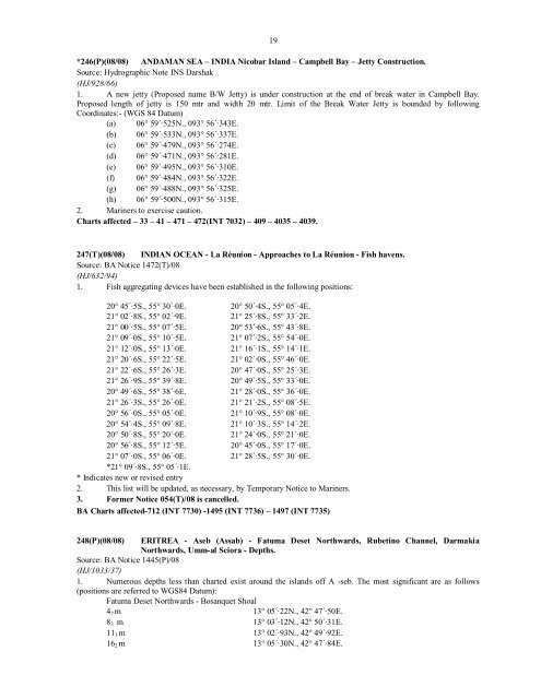
*246(P)(<strong>08</strong>/<strong>08</strong>) ANDAMAN SEA – INDIA Nicobar Island – Campbell Bay – Jetty Construction.<br />
Source: <strong>Hydrographic</strong> Note INS Darshak<br />
(HJ/928/66)<br />
1. A new jetty (Proposed name B/W Jetty) is under construction at the end <strong>of</strong> break water in Campbell Bay.<br />
Proposed length <strong>of</strong> jetty is 150 mtr and width 20 mtr. Limit <strong>of</strong> the Break Water Jetty is bounded by following<br />
Coordinates:- (WGS 84 Datum)<br />
(a) 06° 59´·525N., 093° 56´·343E.<br />
(b) 06° 59´·533N., 093° 56´·337E.<br />
(c) 06° 59´·479N., 093° 56´·274E.<br />
(d) 06° 59´·471N., 093° 56´·281E.<br />
(e) 06° 59´·495N., 093° 56´·310E.<br />
(f) 06° 59´·484N., 093° 56´·322E.<br />
(g) 06° 59´·488N., 093° 56´·325E.<br />
(h) 06° 59´·500N., 093° 56´·315E.<br />
2. Mariners to exercise caution.<br />
Charts affected – 33 – 41 – 471 – 472(INT 7032) – 409 – 4035 – 4039.<br />
247(T)(<strong>08</strong>/<strong>08</strong>) INDIAN OCEAN - La Réunion - Approaches to La Réunion - Fish havens.<br />
Source: BA Notice 1472(T)/<strong>08</strong><br />
(HJ/632/94)<br />
1. Fish aggregating devices have been established in the following positions:<br />
20° 45´·5S., 55° 30´·0E. 20° 50´·4S., 55° 05´·4E.<br />
21° 02´·8S., 55° 02´·9E. 21° 25´·8S., 55° 33´·2E.<br />
21° 00´·5S., 55° 07´·5E. 20° 53´·6S., 55° 43´·8E.<br />
21° 09´·0S., 55° 10´·5E. 21° 07´·2S., 55° 54´·0E.<br />
21° 12´·0S., 55° 13´·0E. 21° 16´·1S., 55° 14´·1E.<br />
21° 20´·6S., 55° 22´·5E. 21° 02´·0S., 55° 46´·0E.<br />
21° 22´·6S., 55° 26´·3E. 20° 47´·0S., 55° 25´·3E.<br />
21° 26´·9S., 55° 39´·8E. 20° 49´·5S., 55° 33´·0E.<br />
20° 49´·6S., 55° 38´·6E. 21° 28´·0S., 55° 36´·0E.<br />
21° 26´·3S., 55° 26´·0E. 21° 21´·2S., 55° <strong>08</strong>´·5E.<br />
20° 56´·0S., 55° 05´·0E. 21° 10´·9S., 55° <strong>08</strong>´·0E.<br />
20° 54´·4S., 55° 09´·8E. 21° 10´·3S., 55° 14´·2E.<br />
20° 50´·8S., 55° 20´·0E. 21° 24´·0S., 55° 21´·0E.<br />
20° 56´·8S., 55° 12´·5E. 20° 45´·0S., 55° 17´·0E.<br />
21° 07´·0S., 55° 06´·0E. 21° 28´·5S., 55° 30´·0E.<br />
*21° 09´·8S., 55° 05´·1E.<br />
* Indicates new or revised entry<br />
2. This list will be updated, as necessary, by Temporary Notice to Mariners.<br />
3. Former Notice 054(T)/<strong>08</strong> is cancelled.<br />
BA Charts affected-712 (INT 7730) -1495 (INT 7736) – 1497 (INT 7735)<br />
248(P)(<strong>08</strong>/<strong>08</strong>) ERITREA - Aseb (Assab) - Fatuma Deset Northwards, Rubetino Channel, Darmakia<br />
Northwards, Umm-al Sciora - Depths.<br />
Source: BA Notice 1445(P)/<strong>08</strong><br />
(HJ/1033/37)<br />
1. Numerous depths less than charted exist around the islands <strong>of</strong>f A -seb. The most significant are as follows<br />
(positions are referred to WGS84 Datum):<br />
Fatuma Deset Northwards - Bosanquet Shoal<br />
4 7 m 13° 05´·22N., 42° 47´·50E.<br />
8 3 m 13° 03´·12N., 42° 50´·31E.<br />
11 1 m 13° 02´·93N., 42° 49´·92E.<br />
16 2 m 13° 05´·30N., 42° 47´·84E.


