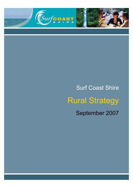
Rural Strategy - Surf Coast Shire
Rural Strategy - Surf Coast Shire
Rural Strategy - Surf Coast Shire

You also want an ePaper? Increase the reach of your titles
YUMPU automatically turns print PDFs into web optimized ePapers that Google loves.
<strong>Surf</strong> <strong>Coast</strong> <strong>Shire</strong><br />
<strong>Rural</strong> <strong>Strategy</strong><br />
September 2007
Reference Document<br />
The <strong>Surf</strong> <strong>Coast</strong> <strong>Shire</strong> <strong>Rural</strong> <strong>Strategy</strong> is a reference document of the <strong>Surf</strong> <strong>Coast</strong> Planning Scheme. As<br />
a reference document it provides background information to assist in understanding the context within<br />
which a particular policy or provision has been framed. This document is not part of the <strong>Surf</strong> <strong>Coast</strong><br />
Planning Scheme and has no legislative status under the Planning and Environment Act, 1987.<br />
<strong>Surf</strong> <strong>Coast</strong> <strong>Shire</strong> Council, 2008.
Contact Details:<br />
Name: Shelley McGuinness<br />
Title: Senior Consultant<br />
Address: 880 Toorak Road, Glen Iris 3146<br />
P: 1300 306 043<br />
F: 1300 724 181<br />
M: 0408 194 993<br />
E: shelleym@rmcg.com.au<br />
International Standards<br />
Certification<br />
QAC/R61//0611<br />
Document Review & Authorisation<br />
Job Number: 22-S-02<br />
Document<br />
Version<br />
Final/Draft Date Author<br />
Reviewed<br />
By<br />
Release<br />
Approved By<br />
Issued to Copies Comments<br />
1.0 Draft 7/3/2007 S McGuinness<br />
<strong>Surf</strong><br />
<strong>Shire</strong><br />
<strong>Coast</strong><br />
1(e)<br />
Draft<br />
comment<br />
for<br />
2.0 Draft 20/3/2007 S McGuinness R Standen R Standen<br />
<strong>Surf</strong><br />
<strong>Shire</strong><br />
<strong>Coast</strong><br />
1 (e)<br />
Draft for<br />
Community<br />
Consultation<br />
3.0 Final 30/8/2007 S McGuinness S McGuinness S McGuinness<br />
<strong>Surf</strong><br />
<strong>Shire</strong><br />
<strong>Coast</strong><br />
1 (e)<br />
Final Report for<br />
Council<br />
Consideration<br />
4.0 Final 20/9/2007 S McGuinness S McGuinness S McGuinness<br />
<strong>Surf</strong><br />
<strong>Shire</strong><br />
<strong>Coast</strong><br />
1 (e)<br />
Final Report for<br />
Council<br />
Adoption<br />
5.0 Final 10/12/2007 S McGuinness S McGuinness S McGuinness<br />
<strong>Surf</strong><br />
<strong>Shire</strong><br />
<strong>Coast</strong><br />
1(e)<br />
Final Report<br />
with<br />
amendments<br />
following<br />
adoptions<br />
Note: (e) after number of copies indicates electronic distribution<br />
Disclaimer:<br />
This report has been prepared in accordance with the scope of services described in the contract or agreement between RMCG and the Client.<br />
Any findings, conclusions or recommendations only apply to the aforementioned circumstances and no greater reliance should be assumed or<br />
drawn by the Client. Furthermore, the report has been prepared solely for use by the Client and RMCG accepts no responsibility for its use by<br />
other parties.<br />
Macintosh HD:Users:janetteq:Desktop:SCS Final Report 10-12.doc
<strong>Surf</strong> <strong>Coast</strong> <strong>Shire</strong> <strong>Rural</strong> <strong>Strategy</strong> Review<br />
Final Report<br />
Table of Contents<br />
Executive Summary<br />
i<br />
1 Introduction 1<br />
2 Review Process 2<br />
2.1 Project Context ...............................................................................................................................................2<br />
2.1.1 Land Use Planning ...........................................................................................................................3<br />
2.2 Project Aims and Objectives..........................................................................................................................3<br />
2.3 Approach to the Project .................................................................................................................................4<br />
3 Planning Policy 5<br />
3.1 State Planning Policy .....................................................................................................................................5<br />
3.2 New <strong>Rural</strong> Zones............................................................................................................................................6<br />
3.3 Local Planning Policy.....................................................................................................................................9<br />
3.4 Audit of Planning Scheme Performance.................................................................................................... 11<br />
3.5 Tenement Provisions .................................................................................................................................. 11<br />
3.6 Conclusions ................................................................................................................................................. 16<br />
4 Agriculture 17<br />
4.1 <strong>Surf</strong> <strong>Coast</strong> <strong>Shire</strong> Agricultural Industries ..................................................................................................... 17<br />
4.2 Agricultural Quality ...................................................................................................................................... 18<br />
4.3 Drivers of Change in Agriculture in the <strong>Surf</strong> <strong>Coast</strong> <strong>Shire</strong>.......................................................................... 21<br />
4.4 Intensive Animal Industries......................................................................................................................... 23<br />
4.5 Conclusions ................................................................................................................................................. 24<br />
5 <strong>Rural</strong> Area Economy and Population Trends 25<br />
5.1 Land use and population trends ................................................................................................................. 25<br />
5.2 Future Growth.............................................................................................................................................. 25<br />
5.2.1 Managing Growth........................................................................................................................... 25<br />
5.2.2 Lifestyle .......................................................................................................................................... 25<br />
5.2.3 Urban Growth................................................................................................................................. 26<br />
5.3 Tourism ........................................................................................................................................................ 26<br />
5.4 Conclusions ................................................................................................................................................. 27<br />
6 <strong>Rural</strong> Living in the <strong>Surf</strong> <strong>Coast</strong> <strong>Shire</strong> 28<br />
6.1 Existing <strong>Rural</strong> Living Locations .................................................................................................................. 28<br />
6.2 Current <strong>Rural</strong> Residential <strong>Strategy</strong> ............................................................................................................ 28<br />
6.3 Ad Hoc <strong>Rural</strong> Living Development ............................................................................................................. 29<br />
6.4 State Policy.................................................................................................................................................. 31<br />
6.4.1 Ministerial Direction 6 – <strong>Rural</strong> Residential Development ............................................................ 31<br />
6.4.2 Applying the <strong>Rural</strong> Zones Planning Practice Note....................................................................... 32<br />
6.5 Regional Direction for <strong>Rural</strong> Living............................................................................................................. 33<br />
RMCG Consultants for Business, Communities & Environment
<strong>Surf</strong> <strong>Coast</strong> <strong>Shire</strong> <strong>Rural</strong> <strong>Strategy</strong> Review<br />
Final Report<br />
6.6 <strong>Surf</strong> <strong>Coast</strong> <strong>Shire</strong> Housing <strong>Strategy</strong> ............................................................................................................ 34<br />
6.7 <strong>Rural</strong> Living Conclusions ............................................................................................................................ 37<br />
7 Environment and Landscape 38<br />
7.1 Environmental Action Plans and Strategies .............................................................................................. 38<br />
7.2 <strong>Rural</strong> Landscape Assessment.................................................................................................................... 41<br />
7.2.1 Great Ocean Road Region Landscape Assessment................................................................... 42<br />
7.2.2 <strong>Surf</strong> <strong>Coast</strong> Landscape North of the Princes Highway ................................................................. 43<br />
7.2.3 Changes since GORRLAS............................................................................................................ 44<br />
7.3 Climate Change........................................................................................................................................... 44<br />
7.4 Conclusions ................................................................................................................................................. 44<br />
8 Consultation 45<br />
8.1 Issues Paper................................................................................................................................................ 45<br />
8.2 Council Staff Workshop .............................................................................................................................. 46<br />
8.3 Council Committees .................................................................................................................................... 46<br />
8.4 Agency Workshop ....................................................................................................................................... 46<br />
8.5 Agricultural Industry Workshop .................................................................................................................. 47<br />
8.6 Tourism Industry.......................................................................................................................................... 47<br />
8.7 Stakeholder Workshop Findings ................................................................................................................ 47<br />
8.8 Stage 1 Consultation Conclusions ............................................................................................................. 48<br />
9 <strong>Surf</strong> <strong>Coast</strong> <strong>Rural</strong> <strong>Strategy</strong> (2007) 50<br />
9.1 Revised <strong>Rural</strong> <strong>Strategy</strong> ............................................................................................................................... 50<br />
9.2 Key Strategic Elements............................................................................................................................... 50<br />
9.3 Vision ........................................................................................................................................................... 50<br />
9.4 Key Strategic Directions.............................................................................................................................. 51<br />
9.5 Agriculture.................................................................................................................................................... 52<br />
9.6 Tourism ........................................................................................................................................................ 52<br />
9.7 <strong>Rural</strong> Living.................................................................................................................................................. 54<br />
9.8 Lot Sizes, Dwellings, Excisions .................................................................................................................. 54<br />
9.9 Minimum Lot Sizes ...................................................................................................................................... 54<br />
9.10 Dwellings .................................................................................................................................................... 55<br />
9.11 Excisions .................................................................................................................................................... 56<br />
10 Delivering the Vision 57<br />
10.1 <strong>Surf</strong> <strong>Coast</strong> Planning Scheme.................................................................................................................... 57<br />
10.2 <strong>Rural</strong> Zones................................................................................................................................................ 58<br />
10.2.1 Farming Zone................................................................................................................................. 58<br />
10.2.2 <strong>Rural</strong> Activity Zone......................................................................................................................... 58<br />
10.2.3 <strong>Rural</strong> Living Zone........................................................................................................................... 59<br />
10.2.4 <strong>Rural</strong> Conservation Zone .............................................................................................................. 60<br />
10.3 Precinct 1 - Winchelsea Plains ................................................................................................................. 63<br />
RMCG Consultants for Business, Communities & Environment
<strong>Surf</strong> <strong>Coast</strong> <strong>Shire</strong> <strong>Rural</strong> <strong>Strategy</strong> Review<br />
Final Report<br />
10.3.1 Description ..................................................................................................................................... 63<br />
10.3.2 <strong>Rural</strong> Land Use Observations ....................................................................................................... 65<br />
10.3.3 Objectives....................................................................................................................................... 65<br />
10.3.4 Strategies ....................................................................................................................................... 65<br />
10.3.5 Implementation............................................................................................................................... 66<br />
10.4 Precinct 2 – Barrabool............................................................................................................................... 67<br />
10.4.1 Description ..................................................................................................................................... 67<br />
10.4.2 <strong>Rural</strong> Land Use Observations ....................................................................................................... 68<br />
10.4.3 Objectives....................................................................................................................................... 69<br />
10.4.4 Strategies ....................................................................................................................................... 69<br />
10.4.5 Implementation............................................................................................................................... 69<br />
10.5 Precinct 3 Mixed Farming ......................................................................................................................... 71<br />
10.5.1 Description ..................................................................................................................................... 71<br />
10.5.2 <strong>Rural</strong> Land Use Observations ....................................................................................................... 73<br />
10.5.3 Objectives....................................................................................................................................... 74<br />
10.5.4 Strategies ....................................................................................................................................... 74<br />
10.5.5 Implementation............................................................................................................................... 75<br />
10.6 Precinct 4 – Cape Otway Road to the Ranges and <strong>Coast</strong>...................................................................... 76<br />
10.6.1 Description ..................................................................................................................................... 76<br />
10.6.2 <strong>Rural</strong> Land Use Observations ....................................................................................................... 78<br />
10.6.3 Objectives....................................................................................................................................... 79<br />
10.6.4 Strategies ....................................................................................................................................... 79<br />
10.6.5 Implementation............................................................................................................................... 79<br />
10.7 Precinct 5 – Otway Ranges and <strong>Coast</strong> .................................................................................................... 81<br />
10.7.1 Description ..................................................................................................................................... 81<br />
10.7.2 Future Land Use Outcomes .......................................................................................................... 83<br />
10.7.3 Objectives....................................................................................................................................... 84<br />
10.7.4 Strategies ....................................................................................................................................... 84<br />
10.7.5 Implementation............................................................................................................................... 84<br />
11 Next Steps 86<br />
Appendix 1: Precinct 4 Analysis 87<br />
RMCG Consultants for Business, Communities & Environment
<strong>Surf</strong> <strong>Coast</strong> <strong>Shire</strong> <strong>Rural</strong> <strong>Strategy</strong> Review<br />
Final Report<br />
Executive Summary<br />
The <strong>Surf</strong> <strong>Coast</strong>’s <strong>Shire</strong> current <strong>Rural</strong> Land Use <strong>Strategy</strong> was prepared in 1997. The strategy has a<br />
strong focus on providing for agricultural use of the land and preservation of the significant rural<br />
landscape values. In the 10 years since the strategy was prepared there have been significant<br />
changes in the rural land use circumstances. The changes include a shift towards more intensive<br />
farming, farming for lifestyle and demand for additional uses other than agriculture, such as tourism in<br />
the rural areas. This review of the <strong>Rural</strong> <strong>Strategy</strong> seeks to test if the current planning policy and<br />
controls that relate to the rural areas is meeting the challenges posed by these changed<br />
circumstances.<br />
Scope of the Review<br />
RM Consulting Group was engaged to undertake the review in conjunction with O’Neil Pollock and<br />
Associates, planisphere, KPLAN and Keaney Planning and Research. The aims of the study are to<br />
provide Council with:<br />
A strategy and policies that will support the sustainable use and development of the rural areas for<br />
agriculture and other compatible land uses; and<br />
The basis for preparation of an amendment to the <strong>Surf</strong> <strong>Coast</strong> Planning Scheme to give effect to the<br />
strategy and policies.<br />
The objectives of the project are to:<br />
Review the existing rural land use strategy and policies so as to ensure that they are promoting<br />
and supporting: sustainable agriculture and rural land use, integrated farming practices, the<br />
retention of high quality agricultural land from fragmentation and the preservation of attractive and<br />
valued rural landscapes; and<br />
Investigate options for diversifying land uses in the rural areas in suitable locations to support: high<br />
value rural industries, intensive agricultural production, accommodating tourism demands and<br />
other uses which are compatible with the primary purpose of the <strong>Shire</strong>’s rural areas.<br />
The Project began in June 2006 and was undertaken in two Stages. Stage 1 Review and Scoping<br />
provided a comprehensive review of the <strong>Shire</strong>’s rural strategy to ensure that the land use policies<br />
reflect the current and likely circumstances relating to rural land use development and included<br />
targeted consultation with stakeholders and the community.<br />
Stage 2 involved undertaking further analyses on priority issues identified in Stage 1, providing<br />
recommendations for redrafting of planning controls as required and preparation of a Draft <strong>Strategy</strong>.<br />
A comprehensive community consultation program was undertaken on the Draft <strong>Strategy</strong>.<br />
Planning Policy<br />
The State Planning Policy Framework has objectives relevant to rural land in <strong>Surf</strong> <strong>Coast</strong> including<br />
agriculture, intensive farming industries, coastal areas, tourism rural residential development and the<br />
Great Ocean Road. The recommendations arising from the review will seek to identify strategies and<br />
actions consistent with these objectives.<br />
In June 2004, the State Government introduced a new suite of <strong>Rural</strong> Zones which were incorporated<br />
in the <strong>Surf</strong> <strong>Coast</strong> Planning Scheme in 2005 via a direct translation of <strong>Rural</strong> Zoned land to Farming<br />
RMCG Consultants for Business, Communities & Environment<br />
Page i
<strong>Surf</strong> <strong>Coast</strong> <strong>Shire</strong> <strong>Rural</strong> <strong>Strategy</strong> Review<br />
Final Report<br />
Zone and Environmental <strong>Rural</strong> Zoned land to <strong>Rural</strong> Conservation. The examination of the rural<br />
strategy confirmed the direct translation of the new zones and provided an opportunity to resolve<br />
conflicts between the new zones and existing land use.<br />
The current planned future for the rural areas of <strong>Surf</strong> <strong>Coast</strong> is for the land to be used for agriculture.<br />
This is achieved through application of the Farming Zone and a schedule of minimum lot sizes of 40<br />
and 80 hectares. The <strong>Rural</strong> Conservation Zone has been applied to rural areas with special<br />
environmental characteristics. A range of overlays have been applied to achieve protection of areas<br />
with significant environmental values and protection from flooding and wildfire.<br />
Local policy is used to provide guidance on dwelling entitlements and subdivision. In particular<br />
tenement provisions are utilised to limit dwellings in rural areas and break the nexus between<br />
subdivision and housing. An analysis of the implementation of the tenement provisions found that<br />
they have been effective in managing housing development in rural areas and it was recommended<br />
that they be retained to prevent pressure for additional dwellings throughout the rural areas.<br />
An audit of the performance of the planning scheme found that the direction provided by the planning<br />
scheme is reflected in decision-making and when tested at VCAT, the planning policy framework has<br />
been found to be robust and Council administration of the scheme has been faithful.<br />
Agriculture<br />
Agriculture, while modest compared to tourism, has continued to grow as an economic sector in the<br />
<strong>Shire</strong> but the makeup of the industries has and continues to move from traditional broadacre cropping,<br />
grazing and dairying to more intensive uses being the most economically significant. This trend is<br />
being driven by farm viability and high prices of agricultural land.<br />
There is potential for an expansion of soil and shed based irrigated horticulture utilising recycled water<br />
from the Black Rock Wastewater Treatment Plant. This would be focused on the area between<br />
Torquay and Mount Duneed. Any shed based agriculture needs to be carefully sited to preserve<br />
landscape values.<br />
The preferred location for intensive animal industries is in the northern area of the <strong>Shire</strong> to build on<br />
existing businesses, preserve landscapes and minimise impacts on other land users.<br />
Planning controls are necessary to support the ongoing use of land for agriculture by maintaining land<br />
parcels in larger lots, minimising the potential for conflict between agriculture and other uses and<br />
ensuring that land is retained to capitalise on opportunities for agriculture in the future.<br />
<strong>Rural</strong> Area Economy and Population Trends<br />
Significant population growth is expected to continue in the <strong>Shire</strong> as major transport routes improve<br />
commuter access within the <strong>Shire</strong> and to major urban centres. The <strong>Surf</strong> <strong>Coast</strong> Housing <strong>Strategy</strong><br />
found that there is sufficient existing zoned land within townships to meet expected growth over the<br />
next 20 years. The Housing <strong>Strategy</strong> also noted the importance of the rural areas and agriculture in<br />
maintaining the green break between urban settlements.<br />
The Great Ocean Road and coastal townships have traditionally been the focus of the tourist industry<br />
with agriculture supported in the rural hinterland. Demand for tourism opportunities to be facilitated in<br />
the rural hinterland has been expressed anecdotally and through consultation associated with this<br />
study. An action noted in the <strong>Surf</strong> <strong>Coast</strong> Tourism <strong>Strategy</strong> is for Council to review the planning<br />
RMCG Consultants for Business, Communities & Environment<br />
Page ii
<strong>Surf</strong> <strong>Coast</strong> <strong>Shire</strong> <strong>Rural</strong> <strong>Strategy</strong> Review<br />
Final Report<br />
scheme in light of the new rural zones and identify opportunities for the application of the <strong>Rural</strong> Activity<br />
Zone.<br />
<strong>Rural</strong> Living<br />
<strong>Rural</strong> living opportunities in the <strong>Shire</strong> are currently provided via planned rural living and low-density<br />
residential estates. Demand for additional rural residential opportunities was noted during<br />
consultation associated with this study. However, this review found that <strong>Surf</strong> <strong>Coast</strong> wont be facilitating<br />
supply of additional rural residential land because:<br />
The <strong>Shire</strong>’s rural lands are a finite resource and unplanned urban / residential intrusion onto such<br />
land is strongly discouraged by State Policy and the <strong>Surf</strong> <strong>Coast</strong> Housing <strong>Strategy</strong>.<br />
<strong>Rural</strong> living is more appropriately addressed as an urban issue in township structure plans.<br />
This review found that provision of additional land zoned <strong>Rural</strong> Living could not be justified under<br />
the guidelines for rural residential development, Ministerial Direction No. 6, at this time.<br />
However, it is recognised that some rural land, although zoned for farming, is and will, be used for<br />
larger scale rural living.<br />
Environment and Landscape<br />
Since 1997 a significant body of work has been completed that document, evaluate and prioritise<br />
environmental assets and threats in the <strong>Surf</strong> <strong>Coast</strong> <strong>Shire</strong>. These include the Corangamite Regional<br />
Catchment <strong>Strategy</strong> 2003 – 2008, Corangamite River Health <strong>Strategy</strong> (2004), Regional <strong>Coast</strong>al Action<br />
Plan West Victoria (2005), Estuaries <strong>Coast</strong>al Action Plan Central West Victoria (2005) and the <strong>Surf</strong><br />
<strong>Coast</strong> Environmental <strong>Strategy</strong> (2006).<br />
A comprehensive review of these strategies identified opportunities to strengthen the <strong>Surf</strong> <strong>Coast</strong><br />
Planning Scheme with respect to environmental protection.<br />
The landscape of the <strong>Shire</strong> was documented in the 1997 <strong>Rural</strong> <strong>Strategy</strong>. This work has been<br />
superseded by the Great Ocean Road Region Landscape Assessment which documents the<br />
landscape values of the <strong>Shire</strong> and makes a number of recommendations on changes to the <strong>Surf</strong><br />
<strong>Coast</strong> planning scheme, education and statutory support.<br />
As part of this review, a landscape assessment was undertaken of land north of the Princes Highway<br />
not included in GORLASS. This assessment also provides recommendations for changes to the <strong>Surf</strong><br />
<strong>Coast</strong> planning scheme.<br />
Consultation<br />
An important element of reviewing the <strong>Surf</strong> <strong>Coast</strong> <strong>Rural</strong> <strong>Strategy</strong> was to seek the views and opinions<br />
of the community and stakeholders. Workshop and community forums were used to identify issues,<br />
validate findings and provide feedback on the long-term use of the rural areas of the <strong>Shire</strong>. The<br />
consultation found that, in general, the current planing provisions were well supported and that<br />
agriculture is significant both as an economic sector but also in defining the rural landscape and as a<br />
valued lifestyle. The consultation found that the current planning scheme provide little guidance with<br />
regard to:<br />
What (if any) tourism should be encouraged in the rural areas;<br />
Location and controls associated with group accommodation; and<br />
Protection of landscape values.<br />
RMCG Consultants for Business, Communities & Environment<br />
Page iii
<strong>Surf</strong> <strong>Coast</strong> <strong>Shire</strong> <strong>Rural</strong> <strong>Strategy</strong> Review<br />
Final Report<br />
<strong>Surf</strong> <strong>Coast</strong> <strong>Rural</strong> <strong>Strategy</strong> (2007)<br />
The review of the rural land strategy has concluded the following:<br />
A long history of agricultural production has left a legacy of rural landscapes and townships valued<br />
by the <strong>Surf</strong> <strong>Coast</strong> community and significant to the <strong>Shire</strong>’s identity and livability;<br />
While comparatively modest, the economic value of agriculture continues to grow and there is<br />
potential for further development of agricultural production, particularly horticulture, based on<br />
recycled water;<br />
Farming and agriculture are particularly important and valued in the northern area of the <strong>Shire</strong>;<br />
The <strong>Shire</strong> has significant environmental assets that contribute to the amenity and landscape of the<br />
<strong>Shire</strong> and are important to the <strong>Shire</strong>’s tourism;<br />
Landholders farming for lifestyle purposes are a significant proportion of the rural population,<br />
particularly in the rural hinterland;<br />
Farming and the rural landscape provide non-urban breaks particularly between Geelong and<br />
Torquay and between coastal settlements and are an important element of the settlement strategy;<br />
and<br />
Tourism has traditionally focused on the coast however, there are opportunities for tourism<br />
development, particularly in the farmed rural hinterland. These opportunities should not come at<br />
the expense of environmental, landscape, social and agricultural values.<br />
Vision<br />
The <strong>Surf</strong> <strong>Coast</strong> <strong>Rural</strong> Land Use <strong>Strategy</strong> sets out a long term vision for the <strong>Shire</strong>’s rural areas that:<br />
Encourages growth of sustainable agriculture;<br />
Grows and maintains prosperous and sustainable rural communities;<br />
Minimises urban-rural conflicts;<br />
Protects rural landscapes; and<br />
Protects and enhances environmental assets.<br />
Key Strategic Directions<br />
The key strategic directions of the <strong>Surf</strong> <strong>Coast</strong> <strong>Rural</strong> Land Use <strong>Strategy</strong> are:<br />
Provide a planning framework that will support agriculture and protect the rural-farmed landscape<br />
and not prejudice the ability of future generations to productively farm the land;<br />
Support agricultural activities and associated rural industries that will maintain and build on the<br />
economic base of the <strong>Shire</strong>;<br />
Strongly discourage fragmentation and non-productive uses of agricultural land as well as<br />
additional dwellings unrelated to the agricultural use of the land;<br />
Encourage the use of existing small lots for innovative or niche productive activities that are not<br />
dependent upon or associated with the development of a dwelling on the lot;<br />
Refuse inappropriate subdivisions or land uses that take rural land out of agricultural production;<br />
Provide opportunities to increase the size of land holdings in order to increase economics of scale<br />
through the continued application of the <strong>Shire</strong>’s tenement controls;<br />
RMCG Consultants for Business, Communities & Environment<br />
Page iv
<strong>Surf</strong> <strong>Coast</strong> <strong>Shire</strong> <strong>Rural</strong> <strong>Strategy</strong> Review<br />
Final Report<br />
Discourage non-productive uses and additional houses unrelated to the rural use of the land;<br />
Support infrastructure and resources that will enhance productive agriculture;<br />
Protect and maintain the existing rural character of the <strong>Shire</strong> by providing clear definitions and<br />
distinctions between rural and urban areas;<br />
Broaden the basis for establishing minimum lot sizes from a consideration of land units to support<br />
viable agriculture to include protection of the rural-farmed landscape;<br />
Provide for rural based tourism uses and development in appropriate areas via the application of<br />
the <strong>Rural</strong> Activity Zone; and<br />
Ensure consistency with the Corangamite Regional Catchment <strong>Strategy</strong> (2003), Regional <strong>Coast</strong>al<br />
Action Plan, Central West Victoria (2003) and the Estuaries <strong>Coast</strong>al Action Plan, Central West<br />
Victoria (2005).<br />
Implementation<br />
This <strong>Rural</strong> <strong>Strategy</strong> Review found that the current Planning Scheme was robust, well justified,<br />
generally supported by the community and was achieving the strategy objectives. Therefore, the<br />
implementation measures proposed in this <strong>Rural</strong> <strong>Strategy</strong> do not represent a significant shift from the<br />
current policy position.<br />
The current policy position for the rural areas has placed a strong emphasis on protecting land for<br />
agricultural purposes. While it acknowledges the importance of landscapes, it does not provide<br />
implementation measures to achieve landscape protection. This has been achieved incidentally<br />
through the minimum lot size schedule and tenement provisions. There is no direction with respect to<br />
tourism development in rural areas.<br />
The revised rural strategy will seek to maintain and support agriculture, while acknowledging that for<br />
many this is for lifestyle purposes, elevate the importance of landscape protection for both economic<br />
and social reasons and provide appropriate opportunities for tourism in rural areas.<br />
To implement the recommendations, the rural areas of the <strong>Shire</strong> have been segmented into a number<br />
of <strong>Rural</strong> Precincts to reflect the diversity of landscape and agricultural values and the current rural<br />
land uses and rural land use trends.<br />
Precincts allow for the planning controls to be tailored to meet the specific land use outcomes desired<br />
within each precinct rather than a ‘one-size-fits all’ approach. The land within each precinct has<br />
common characteristics that will influence application of the planning controls. The<br />
characteristics that were considered in defining the precincts include:<br />
Current land use;<br />
Settlement patterns and urban development<br />
Allotment and tenements sizes;<br />
Agricultural quality;<br />
Landscape characteristics and objectives; and<br />
Environmental values.<br />
RMCG Consultants for Business, Communities & Environment<br />
Page v
<strong>Surf</strong> <strong>Coast</strong> <strong>Shire</strong> <strong>Rural</strong> <strong>Strategy</strong> Review<br />
Final Report<br />
Each precinct has been described with respect to each attribute and the land use considerations,<br />
strategic directions and planning controls to implement the strategic objectives for each precinct are<br />
detailed.<br />
In broad terms the rural zones have been implemented as follows:<br />
The Farming Zone will be applied where the primary land use outcome will be agriculture both now<br />
and in the future and to maintain the rural-farmed landscapes;<br />
The <strong>Rural</strong> Activity Zone will be applied to two areas. One around Deans Marsh and the other around<br />
Bellbrae to provide for small scale tourism activities;<br />
The existing areas zoned for rural living purposes should remain in the <strong>Rural</strong> Living Zone. No<br />
additional areas are recommended to be zoned for <strong>Rural</strong> Living.<br />
The existing areas zoned for <strong>Rural</strong> Conservation purposes should remain in the <strong>Rural</strong> Conservation<br />
Zone. Environmentally sensitive sites in Freshwater Creek and adjacent the Otway foothills south of<br />
Deans Marsh should be considered for inclusion in the <strong>Rural</strong> Conservation Zone.<br />
With regard to the existing policy framework the following recommendations were made:<br />
Retain Council’s existing schedule of minimum lot sizes but broaden the basis from a consideration<br />
of land units to support agriculture to include consideration and protection of the rural farmed<br />
landscape;<br />
Retain the tenement provisions that limit a housing entitlement to one per tenement; and<br />
Discourage small lot excision (with or without houses).<br />
RMCG Consultants for Business, Communities & Environment<br />
Page vi
<strong>Surf</strong> <strong>Coast</strong> <strong>Shire</strong> <strong>Rural</strong> <strong>Strategy</strong> Review<br />
Final Report<br />
1 Introduction<br />
The <strong>Surf</strong> <strong>Coast</strong> <strong>Shire</strong> has commissioned RM Consulting Group (RMCG) to review the rural<br />
land use strategy and where appropriate make recommendations for amendments to the<br />
planning scheme relevant to rural land use. The key outcomes of this project will be a<br />
revised vision for rural land across the <strong>Shire</strong> and strategic directions that reflect the current<br />
circumstances and pressures driving changes in rural land use.<br />
The <strong>Surf</strong> <strong>Coast</strong>’s <strong>Shire</strong> current <strong>Rural</strong> Land Use <strong>Strategy</strong> was prepared in 1997 by R.G.<br />
Ashby and Co. The strategy has a strong focus on providing for agricultural use of the land<br />
and preservation of the significant rural landscape values. In the 10 years since this strategy<br />
was prepared there have been significant changes in the rural land use circumstances. The<br />
changes include a shift towards more intensive farming, farming for lifestyle and demand for<br />
additional uses other than agriculture, such as tourism. The review of the <strong>Rural</strong> <strong>Strategy</strong><br />
seeks to test if the current planning policy and controls that relate to the rural areas is<br />
meeting the challenges posed by these changed circumstances.<br />
RMCG Consultants for Business, Communities & Environment Page 1
<strong>Surf</strong> <strong>Coast</strong> <strong>Shire</strong> <strong>Rural</strong> <strong>Strategy</strong> Review<br />
Final Report<br />
2 Review Process<br />
RMCG undertook the project in conjunction with O’Neil Pollock and Associates, Planisphere,<br />
KPLAN and Keaney Planning and Research. The members of the consulting team included:<br />
Shelley McGuinness, RMCG – Project Manager and agricultural and natural resource<br />
management consultant;<br />
William O’Neil, OPA – planning consultant (strategic planning);<br />
Lisa Riddle, planisphere – planning consultant (landscape);<br />
Gavin Polkinghorn, planisphere – planning consultant (landscape);<br />
Michael Kirsch, KPLAN – planning consultant (statutory planning); and<br />
John Keaney, Keaney Planning and Research – planning consultant (statutory planning).<br />
2.1 Project Context<br />
The <strong>Surf</strong> <strong>Coast</strong> <strong>Shire</strong> Council recognised the need to undertake an examination of the<br />
<strong>Shire</strong>’s existing rural strategy and to ensure that the land use policies fully reflected that<br />
strategy and the current and likely circumstances relating to land use and development.<br />
The Council required the examination to be undertaken in the context of:<br />
Council’s review of the Municipal Strategic Statement in 2003;<br />
Application of the new <strong>Rural</strong> Zones from the Victorian Planning Provisions including the<br />
possible use of the <strong>Rural</strong> Activities Zone;<br />
Continuing development pressure on some rural areas to support the growth of tourism<br />
uses;<br />
The changing practices and scope for further agricultural production, value adding, local<br />
processing and intensive agricultural uses;<br />
The findings and directions set in the Draft <strong>Rural</strong> Land Use <strong>Strategy</strong> 1997 that is a<br />
reference document in the planning scheme;<br />
The changing demands and requirements for land uses in rural areas and opportunities<br />
for these changing demands to be provided for through the implementation of the new<br />
<strong>Rural</strong> Zones;<br />
Providing for and protecting the agricultural resources of the <strong>Shire</strong> including high quality<br />
and productive agricultural areas from inappropriate uses and fragmentation of holdings;<br />
Providing for the protection of environmental assets and resources within the <strong>Shire</strong>, such<br />
as waterways, lakes, wetlands, flora and fauna;<br />
The geographic advantage of the area in terms of proximity to markets, transport facilities<br />
and labour markets;<br />
The outstanding landscape values of the <strong>Shire</strong>’s rural areas which includes the<br />
maintenance of the productive use of land and the avoidance of ad hoc development;<br />
and<br />
Your Visions – Community Plan: 2004.<br />
RMCG Consultants for Business, Communities & Environment Page 2
<strong>Surf</strong> <strong>Coast</strong> <strong>Shire</strong> <strong>Rural</strong> <strong>Strategy</strong> Review<br />
Final Report<br />
The examination of the rural strategy and local policies will provide major input to Council’s<br />
overall strategies and policies for the long-term direction and management of the land use<br />
and development of the <strong>Shire</strong>.<br />
2.1.1 Land Use Planning<br />
It is important to note that while the study will research and note a range of issues and<br />
opportunities affecting the rural areas of the <strong>Shire</strong>, such as farm viability and sea change<br />
trends, the <strong>Rural</strong> <strong>Strategy</strong> is essentially a land use planning document. The issues are<br />
investigated in this study to provide an understanding of the drivers of land use change and<br />
are used in community consultation to establish a vision for the rural areas. Planning<br />
scheme controls can then be tailored to address particular issues and opportunities and<br />
provide the land use planning framework to achieve the long term vision. These planning<br />
controls must be consistent with the State Planning Policy Framework (Section 3) and drawn<br />
from the suite of standard planning provisions as set out in the Victorian Planning<br />
Provisions.<br />
Where appropriate, recommendations for further work will be made to address issues raised<br />
in this study that cannot be resolved through the planning scheme.<br />
2.2 Project Aims and Objectives<br />
The aims of the project are to provide Council with:<br />
a strategy and policies that will support the sustainable use and development of the rural<br />
areas for agriculture and other compatible land uses; and<br />
the basis for preparation of an amendment to the <strong>Surf</strong> <strong>Coast</strong> Planning Scheme to give<br />
effect to the strategy and policies.<br />
The objectives of the project are to:<br />
review the existing rural land use strategy and policies so as to ensure that they are<br />
promoting and supporting: sustainable agriculture and rural land use, integrated farming<br />
practices, the retention of high quality agricultural land from fragmentation and the<br />
preservation of attractive and valued rural landscapes; and<br />
Investigate options for diversifying land uses in the rural areas in suitable locations to<br />
support: high value rural industries, intensive agricultural production, accommodating<br />
tourism demands and other uses which are compatible with the primary purpose of the<br />
<strong>Shire</strong>’s rural areas.<br />
RMCG Consultants for Business, Communities & Environment Page 3
<strong>Surf</strong> <strong>Coast</strong> <strong>Shire</strong> <strong>Rural</strong> <strong>Strategy</strong> Review<br />
Final Report<br />
2.3 Approach to the Project<br />
The Project was undertaken in two Stages:<br />
Stage 1 Review and Scoping<br />
Stage 1 provided a comprehensive review of the <strong>Shire</strong>’s rural strategy to ensure that the<br />
land use policies reflect the current and likely circumstances relating to rural land use<br />
development. This included:<br />
Validating the underlying assumptions of the 1997 <strong>Rural</strong> <strong>Strategy</strong> and identifying any<br />
significant changes that have occurred in the rural structure of the Municipality since its<br />
preparation;<br />
Documenting and assessing the performance of the controls in place to address the rural<br />
issues in the existing planning scheme;<br />
Identifying issues addressed in strategic studies which have been prepared since the<br />
<strong>Rural</strong> <strong>Strategy</strong> was introduced in the Planning Scheme; and<br />
Undertaking consultation to determine stakeholder views regarding the applicability,<br />
transparency and effectiveness of the existing direction and controls contained in the<br />
Planning Scheme.<br />
The key output from Stage 1 was identification of:<br />
<strong>Rural</strong> land planning controls that have an appropriate direction, are transparent and used<br />
effectively in decision making;<br />
<strong>Rural</strong> land planning controls that have an appropriate direction but for which extra<br />
guidance or control is required to improve effectiveness;<br />
<strong>Rural</strong> land planning controls for which the direction is misguided or wrong;<br />
Important rural land issues for which Council may have discretion, but currently have no<br />
planning controls; and<br />
Other rural land issues.<br />
Stage 2 Further Work and Implementation<br />
Stage 2 involved undertaking further analyses on priority issues identified in Stage 1 and<br />
providing recommendations for redrafting of planning controls as required.<br />
RMCG Consultants for Business, Communities & Environment Page 4
<strong>Surf</strong> <strong>Coast</strong> <strong>Shire</strong> <strong>Rural</strong> <strong>Strategy</strong> Review<br />
Final Report<br />
3 Planning Policy<br />
The key purpose of the <strong>Rural</strong> <strong>Strategy</strong> Review was to test the planning scheme against the<br />
current rural land use circumstances. This section of the report summarises the current<br />
policy as it applies to rural land across the <strong>Shire</strong> and includes a discussion of State and<br />
Local Planning Policy.<br />
3.1 State Planning Policy<br />
The State Planning Policy Framework has the following Objectives relevant to rural land.<br />
The recommendations of this report identify Strategies and Actions that will seek to<br />
implement these Objectives.<br />
Agriculture<br />
Ensure that the State’s agricultural base is protected from the unplanned loss of productive<br />
agricultural land due to permanent changes of land use and to enable protection of<br />
productive farmland that is of strategic significance in the local or regional context.<br />
Intensive animal industries<br />
Facilitate the establishment and expansion of cattle feedlots, piggeries, poultry farms and<br />
other intensive animal industries in a manner consistent with orderly and proper planning<br />
and protection of the environment.<br />
<strong>Coast</strong>al Areas<br />
Protect and enhance the natural ecosystems and landscapes of the coastal and marine<br />
environment, ensure sustainable use of natural coastal resources, achieve development that<br />
provides an environmental, social and economic balance and recognise and enhance the<br />
community’s value of the coast.<br />
Tourism<br />
Encourage tourism development to maximise the employment and long-term economic,<br />
social and cultural benefits of developing the State as a competitive domestic and<br />
international tourist destination.<br />
<strong>Rural</strong> Residential Development<br />
Control development in rural areas to protect agriculture, landscapes and environmental<br />
values.<br />
Encourage the consolidation in existing settlements and discourage development of isolated<br />
small lots in rural zones from use for rural living.<br />
RMCG Consultants for Business, Communities & Environment Page 5
<strong>Surf</strong> <strong>Coast</strong> <strong>Shire</strong> <strong>Rural</strong> <strong>Strategy</strong> Review<br />
Final Report<br />
Great Ocean Road Region<br />
Protect the landscape and environment and manage the impact of development on<br />
catchments and coastal areas and environmental values.<br />
Encourage sustainable tourism and resource use by supporting the land use needs of key<br />
regional industries including tourism.<br />
3.2 New <strong>Rural</strong> Zones<br />
The State Government introduced new rural zones in June 2004 through Amendment VC24<br />
to the Victorian Planning Provisions. The new rural zones consist of the:<br />
Farming Zone that replaces the <strong>Rural</strong> Zone and is the main zone for agricultural areas.<br />
The purpose of the Farming Zone is to encourage retention of productive agricultural land<br />
and discourage uses that may have adverse impacts on agriculture.<br />
<strong>Rural</strong> Activity Zone, a new zone that provides for agriculture and other uses. The<br />
purpose of the <strong>Rural</strong> Activity Zone is to provide for agriculture and other uses that are<br />
compatible with the agricultural, the environmental and landscape values of the area<br />
<strong>Rural</strong> Conservation Zone that replaces the Environmental <strong>Rural</strong> Zone for land with<br />
significant environmental values; and<br />
<strong>Rural</strong> Living Zone that upgrades the existing <strong>Rural</strong> Living Zone and provides for rural<br />
residential areas.<br />
The <strong>Surf</strong> <strong>Coast</strong> Planning Scheme incorporated the new suite of <strong>Rural</strong> Zones in November<br />
2005 via a direct translation of <strong>Rural</strong> Zoned land to the Farming Zone, Environmental <strong>Rural</strong><br />
Zoned land to <strong>Rural</strong> Conservation Zone and land previously zoned <strong>Rural</strong> Living was retained<br />
as <strong>Rural</strong> Living. Map 1 shows the application of zones to land across the <strong>Surf</strong> <strong>Coast</strong> <strong>Shire</strong>.<br />
The examination of the rural strategy will seek to confirm the outcomes of the direct<br />
translation and resolve conflicts between land use and application of the new <strong>Rural</strong> Zones.<br />
RMCG Consultants for Business, Communities & Environment Page 6
Map 1
<strong>Surf</strong> <strong>Coast</strong> <strong>Shire</strong> <strong>Rural</strong> <strong>Strategy</strong> Review<br />
Final Report<br />
3.3 Local Planning Policy<br />
The key clauses of the current scheme relevant to this review are now summarised.<br />
<strong>Surf</strong> <strong>Coast</strong> <strong>Shire</strong> Vision, Goals and Objectives<br />
The <strong>Surf</strong> <strong>Coast</strong> <strong>Shire</strong>’s goal is to “achieve world-wide recognition for its unique blend of<br />
natural environment and quality of life which offers the best of all worlds to its residents,<br />
stakeholders and visitors” and is committed to:<br />
Preserving and enhancing our natural environment.<br />
Promoting sustainable tourism and other business development.<br />
Developing and communicating a rural policy.<br />
In it’s 2020 vision, the <strong>Shire</strong> nominated the following objectives:<br />
To conserve our coastal and rural environments.<br />
To discourage rural subdivision for hobby farms in areas of good to high agricultural<br />
value.<br />
To prevent ribbon development in coastal areas.<br />
To maintain green belts or buffer zones between towns.<br />
To designate and protect sustainable agriculture areas.<br />
The <strong>Shire</strong> acknowledges the value of the environment and landscape and seeks to:<br />
Manage the diverse environmental values of the <strong>Shire</strong> in a sustainable manner by<br />
balancing the needs of present and future generations with the protection of biodiversity<br />
and natural processes.<br />
Preserve and enhance scenic landscapes and cultural heritage values through the<br />
responsible management of land use and development.<br />
With respect to rural land the <strong>Shire</strong> seeks the following objectives:<br />
To support and encourage growth in the agricultural economy through sustainable and<br />
productive agricultural activities and rural industries.<br />
To minimise the fragmentation and loss of good to high quality agricultural land and<br />
minimise speculative increases in rural land values.<br />
To consolidate rural residential and rural living development within existing areas zoned<br />
for such purposes.<br />
To evaluate opportunities for new rural residential and rural living subdivision only within<br />
those areas specifically identified in the Municipal Strategic Statement as special<br />
investigation areas.<br />
RMCG Consultants for Business, Communities & Environment Page 9
<strong>Surf</strong> <strong>Coast</strong> <strong>Shire</strong> <strong>Rural</strong> <strong>Strategy</strong> Review<br />
Final Report<br />
<strong>Rural</strong> <strong>Strategy</strong><br />
The <strong>Surf</strong> <strong>Coast</strong> <strong>Shire</strong> <strong>Rural</strong> Land Use <strong>Strategy</strong>, 1997 provides the strategic basis for the <strong>Surf</strong><br />
<strong>Coast</strong> <strong>Shire</strong> Planning Scheme. The current strategic objectives for agriculture and rural land<br />
are to:<br />
encourage agricultural activities and associated rural industries that will maintain and<br />
build on the economic base of the municipality.<br />
protect the natural and physical resources on which agricultural activities rely.<br />
ensure agricultural land is retained in productive units.<br />
These objectives are implemented through the Planning Scheme by:<br />
Applying the Farming Zone to the majority of the rural area with a schedule detailing<br />
subdivision and lot sizes for dwellings varying between 40 hectares and 80 hectares.<br />
Applying the <strong>Rural</strong> Conservation Zone to rural areas with special environmental<br />
characteristics e.g. south of Deans Marsh, and land adjoining the Great Ocean Road and<br />
Great Otway National Park.<br />
Applying the Vegetation Protection Overlay, Significant Landscape Overly and<br />
Environmental Significance Overlay to areas that have significant environmental values.<br />
Applying the Floodway Overlay and Land Subject to Inundation Overlay to areas prone to<br />
flooding.<br />
Using local policy to:<br />
Provide guidance on dwelling entitlements and subdivision. In relation to Dwelling<br />
entitlements TENEMENT provisions are utilised to limit the number of dwellings<br />
that will be approved on a tenement (a single lot or group of lots held in the same<br />
ownership) in order to protect rural and environmentally sensitive land for future<br />
generations.<br />
Break the perceived nexus between subdivision and housing in rural and<br />
environmentally sensitive areas, by emphasizing that the purpose of the rural<br />
zones is not to accommodate future housing needs.<br />
The need for Section 173 Agreements to be entered into to restrict further subdivision<br />
activity and the need for ‘land plans’ to accompany applications for subdivision are<br />
highlighted.<br />
<strong>Rural</strong> Residential <strong>Strategy</strong><br />
The current strategic objectives for rural residential development are:<br />
To ensure that rural residential and rural living development is appropriately located so as<br />
not to remove land from agricultural production or to constrain future urban growth.<br />
To ensure that rural residential and rural living development is appropriately located so as<br />
to avoid loss of amenity and hazard to residents and loss of productivity to adjoining<br />
landowners arising from land use conflict.<br />
To ensure that rural residential and rural living development does not detract from the<br />
landscape, cultural heritage or environmental values of adjoining land.<br />
RMCG Consultants for Business, Communities & Environment Page 10
<strong>Surf</strong> <strong>Coast</strong> <strong>Shire</strong> <strong>Rural</strong> <strong>Strategy</strong> Review<br />
Final Report<br />
To limit rural residential and rural living subdivision and development to existing areas<br />
and to areas specifically identified as ‘potential future development areas’.<br />
These objectives are implemented through the Planning Scheme by:<br />
Applying the <strong>Rural</strong> Living Zone to nominated rural residential areas and encouraging<br />
minimum lot sizes of greater than 8 hectares and discouraging lot sizes less than 4<br />
hectares;<br />
3.4 Audit of Planning Scheme Performance<br />
<strong>Surf</strong> <strong>Coast</strong> <strong>Shire</strong> planning staff conducted a detailed audit of planning application decisions<br />
issued since the year 2000 to determine the degree of support that has been afforded to the<br />
current directions outlined in the Scheme. The audit concluded the following:<br />
The vast majority of permits granted for subdivision and dwelling development in rural<br />
areas have been determined under delegation and have been determined consistent with<br />
the current policy.<br />
It was considered that the policy framework which seeks to limit inappropriate subdivision<br />
and dwelling development has been very successful. They note that only a limited<br />
number of permits have been granted contrary to policy in the LPPF.<br />
Anecdotally approximately 2 enquiries a week for rural subdivision or dwelling<br />
development are discouraged from being lodged as they would be unlikely to be<br />
supported per policy in the LPPF.<br />
Decisions to refuse applications based on policy have rarely been appealed to VCAT but<br />
where this has occurred in recent times the decision to refuse applications has been<br />
supported by the Tribunal.<br />
From a planning administration perspective, the findings are particularly encouraging as the<br />
audit confirms that the direction provided by the Planning Scheme is being reflected in<br />
decision-making. The audit noted that when the existing planning controls and Council’s<br />
determination of applications have been “tested” at VCAT, the planning policy framework<br />
has been found to be robust and Council administration of the Scheme has been faithful.<br />
3.5 Tenement Provisions<br />
The tenement provisions were introduced into the <strong>Surf</strong> <strong>Coast</strong> <strong>Shire</strong> Planning Scheme, in<br />
part, as a measure to control the number and concentration of housing in rural areas by<br />
allowing only one dwelling per tenement. Council staff have undertaken an audit to<br />
determine the take up of housing entitlements since 1997 and to determine the remaining<br />
capacity for additional houses on the tenements.<br />
Map 2 shows the number of vacant tenements in 1997 and 2006 and the location of<br />
tenements that are no longer vacant. In 1997 there were 306 vacant tenements, of these,<br />
145 are no longer vacant. This highlights that approximately half of the opportunities for new<br />
dwellings in the rural areas of the <strong>Shire</strong> have already been taken up in the past 8 years, at<br />
an average rate of 34 dwellings per year.<br />
RMCG Consultants for Business, Communities & Environment Page 11
<strong>Surf</strong> <strong>Coast</strong> <strong>Shire</strong> <strong>Rural</strong> <strong>Strategy</strong> Review<br />
Final Report<br />
Map 3 shows where in the <strong>Shire</strong> dwelling permits were issued between 1997 and 2006.<br />
Most approvals for dwellings were in the Modewarre, Winchelsea, Moriac, Bambra, Deans<br />
Marsh and Wensleydale areas.<br />
Note that the permit audit indicated that 209 permits for dwellings had been granted since<br />
1997. The discrepancy of 64 dwellings is thought to relate to dwellings being granted a<br />
permit but not being constructed and new tenements proved through detailed title<br />
investigations that were not known when the 1997 tenements were mapped.<br />
Map 4 provides a breakdown of the size of the tenements still vacant in 2006. Of note is the<br />
number of small tenements, approximately 50 less than 80 hectares, between Torquay and<br />
the Princes Highway. With much of the land in this area having average to poor agricultural<br />
quality, these tenements are not of a sufficient size to support a viable farm business. The<br />
high land values across the <strong>Shire</strong> are likely to see these tenements purchased for rural<br />
lifestyle purposes.<br />
It is considered that the existing tenement provisions have proved to be an effective tool in<br />
managing, among other things, housing development in the rural areas of the <strong>Shire</strong>. Based<br />
on existing tenements controls “only” 161 additional dwellings are capable of being<br />
developed in the rural areas of the <strong>Shire</strong>. While this number may be considered large, it is<br />
considered that demand is far greater than this. It is therefore suggested that the existing<br />
tenement provisions should be retained as their removal will otherwise likely result in an<br />
increased pressure for additional dwellings throughout the rural areas.<br />
RMCG Consultants for Business, Communities & Environment Page 12
Map 2<br />
Legend<br />
Vacant Tenements in 1997 & 2006 (161)<br />
Tenements No Longer Vacant from 1997 (145)<br />
25 GROSSMANS ROAD<br />
PO BOX 350<br />
TORQUAY, VICTORIA<br />
AUSTRALIA 3228<br />
PHONE : +61 3 5261 0600<br />
FAX : +61 3 5261 4527<br />
INTERNET : www.surfcoast.vic.gov.au<br />
EMAIL : info@surfcoast.vic.gov.au<br />
<strong>Surf</strong> <strong>Coast</strong> <strong>Shire</strong><br />
1997 vs 2006 Vacant Tenements<br />
1000 0 1000 2000 3000 4000 5000 6000 7000 8000 9000 10000 11000 12000 13000 14000 15000 16000 17000 18000 19000 20000 m<br />
'The Place of Wellbeing'<br />
Contains Vicmap Information<br />
© The State of Victoria, Department of Sustainability & Environment, 2003<br />
Reproduced by permission of the Department of Sustainability and Environment.<br />
This material may be of assistance to you but the State of Victoria, <strong>Surf</strong> <strong>Coast</strong> <strong>Shire</strong><br />
and its employees do not guarantee that the publication is without flaw of<br />
any kind or is wholly appropriate for your particular purposes and<br />
therefore disclaims all liability for any error, loss or consequences which<br />
may arise from your relying on any information contained in this material.<br />
Scale 1:100000<br />
Print Date: 3/8/2006<br />
Page Size (A1)<br />
This map is produced on the Geocentric Datum of Australia (GDA94).<br />
GDA94 supersedes the Australian Geodetic Datum 1966 (AGD66).<br />
<strong>Surf</strong> <strong>Coast</strong> <strong>Shire</strong> uses the Map Grid of Australia (MGA94) Zone 55 projection.<br />
Council Ref: F:\Public\GIS\Data\
Map 3
Map 4<br />
Current Vacant Tenements by Area (Ha)<br />
< 5 Ha (6)<br />
5 to 10 Ha (9)<br />
10 to 40 Ha (43)<br />
40 to 80 Ha (46)<br />
> 80 Ha (56)<br />
25 GROSSMANS ROAD<br />
PO BOX 350<br />
TORQUAY, VICTORIA<br />
AUSTRALIA 3228<br />
PHONE : +61 3 5261 0600<br />
FAX : +61 3 5261 4527<br />
INTERNET : www.surfcoast.vic.gov.au<br />
EMAIL : info@surfcoast.vic.gov.au<br />
<strong>Surf</strong> <strong>Coast</strong> <strong>Shire</strong><br />
Current Vacant Tenements by Area<br />
1000 0 1000 2000 3000 4000 5000 6000 7000 8000 9000 10000 11000 12000 13000 14000 15000 16000 17000 18000 19000 20000 m<br />
'The Place of Wellbeing'<br />
Contains Vicmap Information<br />
© The State of Victoria, Department of Sustainability & Environment, 2003<br />
Reproduced by permission of the Department of Sustainability and Environment.<br />
This material may be of assistance to you but the State of Victoria, <strong>Surf</strong> <strong>Coast</strong> <strong>Shire</strong><br />
and its employees do not guarantee that the publication is without flaw of<br />
any kind or is wholly appropriate for your particular purposes and<br />
therefore disclaims all liability for any error, loss or consequences which<br />
may arise from your relying on any information contained in this material.<br />
Scale 1:100000<br />
Print Date: 7/8/2006<br />
Page Size (A1)<br />
This map is produced on the Geocentric Datum of Australia (GDA94).<br />
GDA94 supersedes the Australian Geodetic Datum 1966 (AGD66).<br />
<strong>Surf</strong> <strong>Coast</strong> <strong>Shire</strong> uses the Map Grid of Australia (MGA94) Zone 55 projection.<br />
Council Ref: F:\Public\GIS\Data\
<strong>Surf</strong> <strong>Coast</strong> <strong>Shire</strong> <strong>Rural</strong> <strong>Strategy</strong> Review<br />
Final Report<br />
3.6 Conclusions<br />
The <strong>Shire</strong>’s existing rural strategy is consistent with State Policy;<br />
An audit of the performance of the existing planning controls that relate to rural land use<br />
found that the direction provided by the Planning Scheme is reflected in decision-making<br />
and that planning policy framework was found to be robust and faithfully administered by<br />
Council; and<br />
The tenement provisions should be retained as an effective tool to manage housing<br />
development in rural areas of the <strong>Shire</strong>.<br />
RMCG Consultants for Business, Communities & Environment Page 16
<strong>Surf</strong> <strong>Coast</strong> <strong>Shire</strong> <strong>Rural</strong> <strong>Strategy</strong> Review<br />
Final Report<br />
4 Agriculture<br />
4.1 <strong>Surf</strong> <strong>Coast</strong> <strong>Shire</strong> Agricultural Industries<br />
Agriculture in <strong>Surf</strong> <strong>Coast</strong> <strong>Shire</strong> generated approximately $50 million (ABS Census Data<br />
2001) an increase from $42 million in 1993/94 and $31 million in 1983/84. Traditionally, the<br />
major agricultural industries have been soil-based including dairying and grazing. However,<br />
intensive shed-based farming such as poultry, pig and horticultural production are emerging<br />
as the most economically significant in the <strong>Shire</strong>.<br />
The most significant agricultural industries, with respect to gross value of agricultural<br />
production, are poultry followed by dairy, beef cattle and nurseries and cut flowers (Table<br />
4-1). Poultry production is focussed mainly north of the Princes Highway where there is<br />
sufficient land to meet buffer requirements.<br />
Horticultural enterprises, including turf, tomato and flower production are based around<br />
recycled water supplied from Barwon Water’s Black Rock Wastewater Treatment Plant.<br />
These industries have grown in significance since 1993 and Barwon Water has indicated<br />
that there will be increased scope for productive use of recycled water in the future.<br />
Currently, expansion of horticultural development is constrained by the cost of infrastructure<br />
to deliver recycled water to suitable areas.<br />
There has been significant interest from a number of sources for investment in horticultural<br />
development between Torquay and Mount Duneed based on the increased availability of<br />
recycled water for productive use.<br />
Table 4-1 Gross value of agricultural production as a percentage of the total GVAP for<br />
major agricultural industries in the <strong>Surf</strong> <strong>Coast</strong> <strong>Shire</strong><br />
Industry Number of producers Gross Value of<br />
Agricultural<br />
Production ($million)<br />
Gross Value of Agricultural<br />
Production as a percentage<br />
of the total GVAP for the<br />
<strong>Shire</strong> (2001 ABS)<br />
Poultry 9 11.5 24%<br />
Beef and sheep 360 11.1 24%<br />
Dairy 41 7.7 16%<br />
Nurseries 11 6.8 15%<br />
Cropping 113 5.9 12%<br />
Wool production 174 4.2 9%<br />
Total 534 47.2 100%<br />
RMCG Consultants for Business, Communities & Environment Page 17
<strong>Surf</strong> <strong>Coast</strong> <strong>Shire</strong> <strong>Rural</strong> <strong>Strategy</strong> Review<br />
Final Report<br />
An analysis of the <strong>Surf</strong> <strong>Coast</strong> <strong>Shire</strong> agricultural industries using ABS data between 1983 and<br />
2001 found that:<br />
There has been a significant drop in the number of primary producers and the total area<br />
of primary production;<br />
Beef production has remained steady though the number of farms has declined possibly<br />
through farm amalgamation;<br />
Sheep production is declining in the <strong>Shire</strong>; and<br />
Dairy production has declined significantly.<br />
These trends are largely driven by the high land prices in the <strong>Shire</strong>.<br />
4.2 Agricultural Quality<br />
A current State objective for agriculture, contained in Clause 17.05-1 of the State Planning<br />
Policy Framework states that:<br />
“To ensure that the State’s agricultural base is protected from the unplanned loss of<br />
productive agricultural land due to permanent changes of land use and to enable protection<br />
of productive farmland which is of strategic significance in the local or regional context.”<br />
Productive agricultural land was assessed for the 1997 <strong>Shire</strong> <strong>Rural</strong> Land Use <strong>Strategy</strong> to<br />
provide a classification of agricultural quality. The <strong>Rural</strong> Land Use <strong>Strategy</strong> classified the<br />
agricultural quality of the land based on the following soil, climate and landscape attributes:<br />
Length of growing season;<br />
Availability of supplementary water;<br />
Slope;<br />
Drainage;<br />
Soil texture;<br />
Depth of friable soil;<br />
Soil fertility;<br />
Depth of bedrock;<br />
Flooding frequency; and<br />
Arability.<br />
Profile permeability;<br />
RMCG Consultants for Business, Communities & Environment Page 18
<strong>Surf</strong> <strong>Coast</strong> <strong>Shire</strong> <strong>Rural</strong> <strong>Strategy</strong> Review<br />
Final Report<br />
Based on the values of these attributes, the land was classed according to the following<br />
definitions of agricultural quality.<br />
Class 1 or Very<br />
High<br />
Class 2 or High<br />
Class 3 or Average<br />
Class 4 or Poor<br />
Class 5 or Very<br />
Poor<br />
Agriculturally versatile land, with high inherent productive potential through<br />
possessing deep permeable and fertile soils, a flat to gently undulating land<br />
form, and a growing season of at least 7-8 months.<br />
Agriculturally versatile, but requiring a higher level of inputs to achieve the<br />
same productivity as Class 1. Slope is greater, soils more variable, and the<br />
growing season is 7-8 months.<br />
Sound grazing land but limited in versatility. Generally unsuited to cropping<br />
either because of contour, lack of topsoil depth, or presence of rock. Fertility<br />
levels are moderate to low, growing season limited to 6-9 months depending on<br />
the rainfall. With high inputs, high productivity levels may be achieved.<br />
Capable of growing under moderate to low stocking rates where clearing has<br />
occurred. Slopes are moderate to steep, with shallow, infertile soils, which<br />
need care in their management. Fertility levels are generally low. Erosion<br />
hazard high. Forest is often the best and most stable form of land use.<br />
Land unsuited to agriculture. Constraints may be steepness of slope, shallow,<br />
sandy or rock soils, high erosion susceptibility. Environmental stability may be<br />
best achieved through isolating areas and strictly controlling or eliminating<br />
agricultural uses<br />
The agricultural quality mapping (Map 5) indicates that most of the land north of the Otway<br />
Ranges is Class 2 to 3 or high to average agricultural quality suited to some cropping but<br />
mostly grazing. South of the ranges, most of the land is Class 4 to 5 agricultural quality or<br />
poor to very poor. This land is mainly forested public land and urban residential land.<br />
A review of the methodology and output of the land classification found that:<br />
The definitions of agricultural quality and the attributes used to assess the agricultural<br />
quality of the land is consistent with the accepted assessment methodology used<br />
throughout Victoria which is in turn, based on the United States Department of Agriculture<br />
Land Capability Assessment method (National Soil Survey Handbook Part 622);<br />
The scale of the mapping (1:250,000) is considered to be the absolute maximum level<br />
needed for land classification. Ideally, land capability assessment for the purposes of<br />
land use planning is undertaken at 1:25,000 to 1:50,000 scale;<br />
The nature of land systems mapping, means that the classification would have been<br />
based on an “averaging” of the attributes of a number of different soil types within the<br />
land system which would reduce the accuracy of the classification; and<br />
The land was classed in terms of its inherent qualities. Soil degraded through poor land<br />
management practices erosion or secondary salinity would not have been noted in this<br />
assessment as the land systems data was not ground-truthed.<br />
It should be noted that agricultural quality is only one of a number of considerations that will<br />
influence the location and type of agriculture. Land prices, buffer requirements for intensive<br />
agriculture, proximity to urban and industrial development and suitability for horticultural<br />
development will impact on the nature of the agricultural industry (intensive or broadacre)<br />
and the preferred location.<br />
RMCG Consultants for Business, Communities & Environment Page 19
LOCALITY_POINTS Legend<br />
Point<br />
RoadSegments_Final_recoloured Legend<br />
A<br />
B<br />
C<br />
D<br />
E<br />
F<br />
G<br />
H<br />
J<br />
area3 Legend<br />
Region<br />
land_capability_mapped Legend<br />
1<br />
1-2<br />
2<br />
2-3<br />
3<br />
3-4<br />
4<br />
4-5<br />
5<br />
Municipal_boundary Legend<br />
Region<br />
I<br />
Lawn Court<br />
Volum Road<br />
Merrawarp Merrawarp Merrawarp Merrawarp Merrawarp Merrawarp Merrawarp Merrawarp Merrawarp Road Road Road Road Road Road Road Road Road (Vic (Vic (Vic (Vic (Vic (Vic (Vic (Vic (Vic Rds) Rds) Rds) Rds) Rds) Rds) Rds) Rds) Rds)<br />
Nobles Road (Gnarwarre)<br />
Kahls Road<br />
Inverleigh-Winchelsea Road (Vic Rds)<br />
Rawson Road<br />
Gnarwarre Road<br />
McIntyres McIntyres McIntyres McIntyres McIntyres McIntyres McIntyres McIntyres McIntyres Road Road Road Road Road Road Road Road Road<br />
Georges Georges Georges Georges Georges Georges Georges Georges Georges Road Road Road Road Road Road Road Road Road<br />
Haines Haines Haines Haines Haines Haines Haines Haines Haines Road Road Road Road Road Road Road Road Road<br />
GNARWARRE<br />
Thomas Road<br />
Barwon Barwon Barwon Barwon Barwon Barwon Barwon Barwon Barwon Park Park Park Park Park Park Park Park Park Road Road Road Road Road Road Road Road Road<br />
Shelford Shelford Shelford Shelford Shelford Shelford Shelford Shelford ShelfordRoadRoad<br />
Road Road Road Road Road Road Road<br />
Wingeel Road<br />
Honeys Road<br />
BARRABOOL<br />
Polleys Road<br />
Heaths Road<br />
Reads Road<br />
Callemondah Callemondah Road Road<br />
Andersons Road<br />
Buckley Road North<br />
Peels Peels Peels Peels Peels Peels Peels Peels Peels Road Road Road Road Road Road Road Road Road<br />
Block Lane<br />
Simmonds Road<br />
MOUNT MORIAC<br />
McFarlanes Lane<br />
Phillips Lane<br />
Cape Cape Otway Otway Rd Rd Rd (Vic (Vic Rds) Rds)<br />
Ervins Road<br />
Hendy Main Road<br />
Barrabool Road<br />
Cressy Cressy Cressy Cressy Cressy Cressy Road<br />
Kellys Lane<br />
Mt Duneed Road<br />
Pettavel Road<br />
Waltons Road<br />
Trebeck Trebeck Trebeck Trebeck Trebeck Trebeck Trebeck Trebeck Trebeck Court Court Court Court Court Court<br />
Lower Duneed Road (Vic Rds)<br />
Greenfields Greenfields Drive Drive<br />
McConachy Lane<br />
Princes Princes Princes Princes Princes Princes Princes Princes Princes Highway Highway Highway Highway Highway Highway Highway Highway Highway (Vic (Vic (Vic (Vic (Vic (Vic (Vic (Vic (Vic Rds) Rds) Rds) Rds) Rds) Rds) Rds) Rds) Rds)<br />
Mirnee School Road<br />
Armytage Road<br />
Ondit Road<br />
Ondit Road West<br />
McCanns Road<br />
Ghazeepore Road<br />
Dickins Road<br />
Lowndes Road<br />
Taylors Road<br />
Buckley Road South<br />
BUCKLEY<br />
Mt Pollock Road<br />
Murrengurk Road<br />
MORIAC<br />
Underwoods Lane<br />
WINCHELSEA<br />
Lewis Road<br />
Randles Road<br />
Williams Road<br />
FRESHWATER CREEK<br />
Hunts Road<br />
MODEWARRE<br />
Russell Russell Russell Russell Russell Russell Russell Russell Russell Street Street Street Street Street Street Street Street Street<br />
Marshmans Road<br />
Tutegong Tutegong Tutegong Tutegong Tutegong Tutegong Tutegong Tutegong Tutegong Road Road Road Road Road Road Road Road Road<br />
Atkins Road<br />
Stephenson Road<br />
Larcombes Road<br />
Swabys Lane<br />
Lloyds Lane<br />
Fisher Road<br />
Grassdale Road<br />
Blackgate Road<br />
Robertson Robertson Road Road<br />
Minya Lane<br />
PARAPARAP<br />
Yandina Road<br />
Ballyliffen Crescent<br />
Lune Lune Lune Lune Lune Lune Lune Lune Lune Court Court Court Court Court Court Court Court Court<br />
Brushfields Road<br />
Willowite Road<br />
Hendy Hendy Hendy Hendy Hendy Hendy Hendy Hendy Hendy Main Main Main Main Main Main Main Main MainRoad Road Road Road Road Road Road Road Road (Vic (Vic (Vic (Vic (Vic (Vic (Vic (Vic (Vic Rds) Rds) Rds) Rds) Rds) Rds) Rds) Rds) Rds)<br />
Parishs Lane<br />
Grays Road<br />
Nobles Road (Modewarre)<br />
Marshmans Marshmans Marshmans Marshmans Marshmans Marshmans Marshmans Marshmans Marshmans Outlet Outlet Outlet Outlet Outlet Outlet Outlet Outlet Outlet<br />
Scorpio Street<br />
Cape Cape Cape Cape Cape Cape Cape Cape Cape Otway Otway Otway Otway Otway Otway Otway Otway Otway Road Road Road Road Road Road Road Road Road<br />
Ingleby Road<br />
Wormbete Station Road<br />
Wormbete Station Road<br />
Wormbete Station Road<br />
Kildean Road<br />
Warrin Warrin Street<br />
Flaxbournes Road<br />
Gt Ocean Rd (Jan Juc)<br />
Wurdale Road<br />
Centre Road<br />
McGilvrays Lane<br />
Forest Road<br />
Road<br />
Nobles Road Service Rd (Modewarre)<br />
Guye Guye Guye Guye Guye Guye Guye Guye Guye Court Court Court Court Court Court Court Court Court<br />
Dysons Lane<br />
Gleneagles Close<br />
Grossmans Road<br />
Ashmore Ashmore Ashmore Ashmore Ashmore Ashmore Ashmore Ashmore Ashmore Road Road Road Road Road Road Road Road Road<br />
Nortons Road<br />
Rochforts Road<br />
WURDIBOLUC<br />
Coombes Road<br />
Gherang Road<br />
WINCHELSEA SOUTH<br />
Piper Lane<br />
GHERANG<br />
TORQUAY<br />
The Esplanade<br />
BELLBRAE<br />
Portreath Road<br />
St Andrews Drive<br />
Dangers Road<br />
Tanners Tanners Tanners Tanners Tanners Tanners Tanners Tanners Tanners Road Road Road Road Road Road Road Road Road<br />
Glyn Street<br />
JAN JUC<br />
Sunset Strip<br />
Lidgerwoods Lane<br />
Bones Bones Bones Bones Bones Bones Bones Bones Bones Road Road Road Road Road Road Road Road Road<br />
Woodacres Road<br />
Vickerys Road<br />
Gundrys Road<br />
Car Park (Bells Beach)<br />
Bald Bald Bald Bald Bald Bald Bald Bald Bald Hills Hills Hills Hills Hills Hills Hills Hills Hills Road Road Road Road Road Road Road Road Road<br />
Wensleydale Station Road<br />
Seaches Outlet<br />
Fultons Lane<br />
Jarosite Road<br />
Gum Gum Gum Gum Gum Gum Flats Flats Flats Flats Flats Flats Road Road Road Road Road Road Road Road Road<br />
Winchelsea-Deans Winchelsea-Deans Winchelsea-Deans Winchelsea-Deans Winchelsea-Deans Winchelsea-Deans Winchelsea-Deans Winchelsea-Deans Winchelsea-Deans Marsh Road (Vic Rds)<br />
Point Addis Road<br />
Hurst Road<br />
Elkington Road<br />
WENSLEYDALE<br />
Paddys Paddys Paddys Paddys Paddys Paddys Paddys Paddys Paddys Swamp Swamp Swamp Swamp Swamp Swamp Swamp Swamp Swamp Road Road Road Road Road Road Road Road Road<br />
Draytons Road<br />
BAMBRA<br />
BELLS BEACH<br />
Rifle Butts Road<br />
Gt Ocean Rd (Anglesea)<br />
Coalmine Coalmine Coalmine Coalmine Coalmine Coalmine Coalmine Coalmine Coalmine Road Road Road Road Road Road Road Road Road (Anglesea) (Anglesea) (Anglesea) (Anglesea) (Anglesea) (Anglesea) (Anglesea) (Anglesea) (Anglesea)<br />
Breakfast Breakfast Breakfast Breakfast<br />
Breakfast Breakfast Breakfast Breakfast Breakfast Creek Creek Creek Creek<br />
Creek Creek Creek Creek Creek Road Road Road Road<br />
Road Road Road Road Road<br />
Salt Creek Lane<br />
No. 2 2 Road<br />
Bambra-Aireys Bambra-Aireys Bambra-Aireys Bambra-Aireys Bambra-Aireys Bambra-Aireys Bambra-Aireys Bambra-Aireys Bambra-AireysInletInlet Inlet Inlet Inlet Inlet Inlet Inlet InletRoadRoad<br />
Road Road Road Road Road Road Road<br />
Jinda Park Lane<br />
Inverlochy Street<br />
Murray Street<br />
Retreat Retreat Retreat Retreat Retreat Retreat Retreat Retreat Retreat Road Road Road Road Road Road Road Road Road<br />
Bambra-Boonah Road<br />
Swayns Lane<br />
DEANS MARSH<br />
Smiths Lane<br />
Distillery Distillery Distillery Distillery Distillery Distillery Distillery Distillery Distillery Creek Creek Creek Creek Creek Creek Creek Creek Creek Road Road Road Road Road Road Road Road Road<br />
Aurel Road<br />
ANGLESEA<br />
O'Donohue Road<br />
BOONAH<br />
Bambra Bambra Bambra Bambra Bambra Bambra Bambra Bambra Bambra Cemetery Cemetery Cemetery Cemetery Cemetery Cemetery Cemetery Cemetery Cemetery Road Road Road Road Road Road Road Road Road<br />
Pennyroyal Pennyroyal Pennyroyal Pennyroyal Pennyroyal Pennyroyal Pennyroyal Pennyroyal Pennyroyal Station Road<br />
Spence Spence Spence Spence Spence Spence Spence Spence Spence Avenue Avenue Avenue Avenue Avenue Avenue Avenue Avenue Avenue<br />
Old Old Old Old Old Old Old Old Old Coach Coach Coach Coach Coach Coach Coach Coach Coach Road Road Road Road Road Road Road Road Road<br />
Seaview Road<br />
Sincocks Sincocks Sincocks Sincocks Sincocks Sincocks Sincocks Sincocks Sincocks Road Road Road Road Road Road Road Road Road<br />
PENNYROYAL<br />
AIREYS INLET<br />
Alice Alice Alice Alice Alice Alice Alice Alice AliceRoadRoad<br />
Road Road Road Road Road Road Road<br />
Timbara Timbara Timbara Timbara Timbara Timbara Close Close Close Close Close<br />
Close<br />
Dunse Dunse Dunse Dunse Dunse Dunse Dunse Dunse DunseTrack<br />
Track Track Track Track Track Track Track Track<br />
MOGGS CREEK FAIRHAVEN<br />
Lohan Lohan Lohan Lohan Lohan Lohan Lohan Lohan Lohan Rise Rise<br />
Rise<br />
Merran Grove<br />
McPhillamy Road<br />
0 2 4<br />
kilometres<br />
EASTERN VIEW<br />
Pennyroyal-Wymbooliel Road<br />
BENWERRIN<br />
Mair Mair Mair Mair Mair Mair Mair Mair Mair Road Road Road Road Road Road Road Road Road<br />
Norman Track<br />
BIG HILL (LORNE)<br />
Hendy Hendy Road Road<br />
Erskine Erskine Erskine Erskine Erskine Erskine Erskine Erskine Erskine Falls Falls Falls Falls Falls Falls Falls Falls Falls Road Road Road Road Road Road Road Road Road<br />
Erskine Erskine Erskine Erskine Erskine Erskine Erskine Erskine Erskine Falls Falls Falls Falls Falls Falls Falls Falls Falls Access Access Access Access Access Access Access Access Access Road Road Road Road Road Road Road Road Road<br />
Deans Deans Deans Deans Deans Deans Deans Deans Deans Marsh-Lorne Marsh-Lorne Marsh-Lorne Marsh-Lorne Marsh-Lorne Marsh-Lorne Marsh-Lorne Marsh-Lorne Marsh-Lorne Road Road Road Road Road Road Road Road Road (Vic (Vic (Vic (Vic (Vic (Vic (Vic (Vic (Vic Rds) Rds) Rds) Rds) Rds) Rds) Rds) Rds) Rds)<br />
Holliday Holliday Holliday Holliday Holliday Holliday Holliday Holliday Holliday Road Road Road Road Road Road Road Road Road<br />
Seascape Seascape Seascape Seascape Seascape Seascape Seascape Seascape Seascape Court Court Court Court Court Court Court Court Court<br />
LORNE<br />
Mountjoy Mountjoy Mountjoy Mountjoy Mountjoy Mountjoy Mountjoy Mountjoy Mountjoy Parade Parade Parade Parade Parade Parade Parade Parade Parade<br />
Gt Gt Gt Gt Gt Gt Gt Gt Gt Ocean Ocean Ocean Ocean Ocean Ocean Ocean Ocean Ocean Rd Rd Rd Rd Rd Rd Rd Rd Rd (Lorne) (Lorne) (Lorne) (Lorne) (Lorne) (Lorne) (Lorne) (Lorne) (Lorne)<br />
Benwerrin-Mount Sabine Road<br />
Prices Prices Prices Prices Prices Prices Prices Prices Prices Lane Lane Lane Lane Lane Lane Lane Lane Lane<br />
Map 5
<strong>Surf</strong> <strong>Coast</strong> <strong>Shire</strong> <strong>Rural</strong> <strong>Strategy</strong> Review<br />
Final Report<br />
4.3 Drivers of Change in Agriculture in the <strong>Surf</strong> <strong>Coast</strong> <strong>Shire</strong><br />
Farm viability and escalating land prices have been identified as major drivers of change in<br />
the makeup of the agricultural industries in the <strong>Surf</strong> <strong>Coast</strong> <strong>Shire</strong>.<br />
Farm Viability<br />
For a full-time farming household, business viability is based on its capacity to:<br />
Generate sufficient disposable income to pay living expenses, invest in farm production<br />
and service debt;<br />
Support more than one household as the farm is passed to the next generation; and<br />
Grow or change over time to remain viable. Agriculture faces a long-term decline in<br />
terms of trade and needs to increase productivity or expand to remain viable, usually<br />
both.<br />
Benchmarking of agricultural and horticultural industries and the Future Family Farms<br />
Program suggests that a viable farm should generate at least $270,000 – $300,000 of gross<br />
income. The 2001 income from farm businesses across the <strong>Shire</strong> has been segmented<br />
based on the Estimated Value of Agricultural Operations sourced from the ABS and is<br />
summarised in Table 4-2<br />
This data shows that 88% of farm businesses fall into the part and small property categories.<br />
These would include lifestyle farms where income is generated off-farm and older<br />
businesses with little or no debt. For instance a large proportion of the part time and small<br />
businesses run sheep and beef enterprises which are common agricultural uses for lifestyle<br />
property owners.<br />
In the absence of off-farm income, small and part-time businesses will need to increase<br />
production either through farm amalgamation or intensification or they may choose to sell<br />
the property and pursue agriculture elsewhere.<br />
RMCG Consultants for Business, Communities & Environment Page 21
<strong>Surf</strong> <strong>Coast</strong> <strong>Shire</strong> <strong>Rural</strong> <strong>Strategy</strong> Review<br />
Final Report<br />
Table 4-2 <strong>Surf</strong> <strong>Coast</strong> <strong>Shire</strong> agricultural industry structure analysis 2001 by<br />
Estimated Value of Agricultural Operations (Source ABS Census 2001)<br />
2001<br />
Industry<br />
Part Time<br />
Properties<br />
($1million)<br />
Total<br />
Properties<br />
Poultry 3 4 2 9<br />
Dairy 14 7 13 3 37<br />
Beef 84 3 1 88<br />
Plant<br />
nurseries<br />
4 4<br />
Flowers 3 2 5<br />
Crop and<br />
Plant Nec*<br />
9 1 1 1 12<br />
Grain 11 1 1 1 14<br />
Sheep 56 7 1 64<br />
Sheep-beef 36 9 20<br />
Other 32 11 13 1 2<br />
Total 249 43 34 5 4 335<br />
% of Total 75 13 10 1 1 100<br />
*Crop and Plant Nec – properties engaged in growing plants not elsewhere classified e.g.<br />
bamboo, pasture seed, mushrooms<br />
Farm Affordability in the <strong>Surf</strong> <strong>Coast</strong> <strong>Shire</strong><br />
The value of rural land across the <strong>Shire</strong> is influenced by a number of factors including:<br />
The scenic rural ‘feel’ of the <strong>Shire</strong> continuing to attract new small farm development;<br />
Prohibitive coastal land prices forcing those seeking a lifestyle change to investigate<br />
inland opportunities; and<br />
Farm businesses requiring access to more land to grow over time.<br />
With the increasing demand for rural lifestyle properties, an emerging factor for the future of<br />
agriculture within the <strong>Shire</strong> is availability of affordable land. Sales activity relating to an<br />
increase in small farm number will tend to increase land prices.<br />
Table 4-3 compares the median sales prices in 2004 of rural land in the <strong>Surf</strong> <strong>Coast</strong> and<br />
Colac Otway <strong>Shire</strong>. Of note is the significantly higher prices paid for land used for beef and<br />
dairy production, farm land without a dwelling and vacant hobby farmland. This suggests<br />
that demand for lifestyle properties has already had a significant impact on land values and<br />
is supported by anecdotal information collected through the community consultation.<br />
RMCG Consultants for Business, Communities & Environment Page 22
<strong>Surf</strong> <strong>Coast</strong> <strong>Shire</strong> <strong>Rural</strong> <strong>Strategy</strong> Review<br />
Final Report<br />
Land prices higher than the productive value may have a number of implications for farm<br />
business investment decisions and the way farms are operated in the <strong>Shire</strong>. Some<br />
businesses will overcome high land prices by intensifying farm operations and hence the<br />
emergence of poultry and pig production in the northern end of the <strong>Shire</strong>. Some businesses<br />
will sell and reap the benefits of the high land prices and seek cheaper land outside the<br />
<strong>Shire</strong>. This is consistent with the reduction in farm businesses and the reduction in the total<br />
area farmed in <strong>Surf</strong> <strong>Coast</strong>. Some will seek off farm income or value adding opportunities<br />
such as farm stays.<br />
Council is limited in its capacity to influence farm affordability through the planning scheme<br />
and local policy.<br />
Table 4-3 Median sales price in 2004 of rural land in the <strong>Surf</strong> <strong>Coast</strong> and Colac Otway<br />
<strong>Shire</strong>s.<br />
Land Use<br />
<strong>Surf</strong> <strong>Coast</strong> Median Sales<br />
Price ($/ha)<br />
Colac Otway Median Sales<br />
Price ($/ha)<br />
Beef $11,275 $1,730<br />
Cereal $5,784 $7,653<br />
Dairy $13,609 $5,523<br />
Farmland (without buildings) $16,027 $5,339<br />
Hobby farm (with dwelling) $62,439 $54,863<br />
Hobby farmland (vacant) $46,594 $14,520<br />
4.4 Intensive Animal Industries<br />
In 2002, the Geelong – Barwon Region Intensive Animal Industries Study, (November 2002),<br />
was jointly commissioned by the Greater Geelong, Colac-Otway, Golden Plains and <strong>Surf</strong><br />
<strong>Coast</strong> Councils to address concerns that significant opportunities for intensive animal<br />
industries were being lost because of difficulties associated with site selection.<br />
It provides an overview of the key intensive animal industries together with the factors that<br />
influence the development of these industries, including environmental, economic, social<br />
and management priorities. SWOT analyses and an assessment of competitive advantages<br />
and other factors led to the identification of potential locations by industry and municipality.<br />
In relation to <strong>Surf</strong> <strong>Coast</strong>, the study mapped preferred areas for intensive animal husbandry<br />
that extends from the Cape Otway Road in the south, to the municipal boundary in the north.<br />
Having reviewed the findings of the 2002 report and having undertaken an assessment of<br />
the precinct (refer Precinct 1 Assessment, Section 9.5) the project team endorses this area’s<br />
suitability for intensive animal industries.<br />
RMCG Consultants for Business, Communities & Environment Page 23
<strong>Surf</strong> <strong>Coast</strong> <strong>Shire</strong> <strong>Rural</strong> <strong>Strategy</strong> Review<br />
Final Report<br />
4.5 Conclusions<br />
The following conclusions have been drawn from the analysis of agriculture in the <strong>Surf</strong> <strong>Coast</strong><br />
<strong>Shire</strong>:<br />
Agriculture is a significant industry in the <strong>Shire</strong> and is making an increasing contribution<br />
to the <strong>Shire</strong>’s economy;<br />
More intensive agricultural industries are replacing the traditional land-based industries<br />
as being the most economically significant;<br />
There is a significant future opportunity for increased horticultural development (shedded<br />
and land based) based on additional recycled water available for productive use from the<br />
Black Rock Wastewater Treatment Plant;<br />
The <strong>Rural</strong> Land <strong>Strategy</strong> needs to articulate the importance of protecting farming land<br />
from inappropriate uses and development in order to avoid land use conflicts; and<br />
Farm viability and high prices of agricultural land are driving the trends towards<br />
intensification of farm operations and a shift from traditional broadacre farming to<br />
management of land for rural lifestyle purposes.<br />
RMCG Consultants for Business, Communities & Environment Page 24
<strong>Surf</strong> <strong>Coast</strong> <strong>Shire</strong> <strong>Rural</strong> <strong>Strategy</strong> Review<br />
Final Report<br />
5 <strong>Rural</strong> Area Economy and Population Trends<br />
5.1 Land use and population trends<br />
The <strong>Surf</strong> <strong>Coast</strong> <strong>Shire</strong> covers an area of 1,560 square kilometres (Regional Innovation 2005)<br />
of which approximately 45% of the total area is used for farming and other rural uses. The<br />
balance is mainly public land associated with the Great Otway National Park and Angahook-<br />
Lorne State Park.<br />
The total population of the <strong>Shire</strong> is 21,000 with 27% of the total population living in rural<br />
areas. The rural areas of the <strong>Shire</strong> experienced significant growth between 1981 and 2001<br />
with the population growing by 75% and the number of dwellings increasing by 88%.<br />
Like many communities in close proximity to major urban centres, <strong>Surf</strong> <strong>Coast</strong> <strong>Shire</strong> has<br />
experienced significant growth, primarily associated with the sea change phenomenon. The<br />
<strong>Shire</strong>’s annual growth rate (2.5%) between 1996 and 2003 was double the State rate in the<br />
same period (National Sea Change Taskforce 2005). This trend is expected to continue,<br />
especially in light of the proposed Geelong Bypass which will improve commuter access<br />
between the <strong>Shire</strong> and Geelong and Melbourne.<br />
A consequence of the population growth in rural areas is a reduction in the total land area<br />
used for farming from 93,000 hectares in 1983 to 69,000 hectares in 2001. This represents a<br />
reduction of 26% in the land area used for farming. (Note that farming in this context refers<br />
to businesses that derive most income from the farm, as opposed to lifestyle or hobby<br />
farms).<br />
5.2 Future Growth<br />
5.2.1 Managing Growth<br />
The <strong>Surf</strong> <strong>Coast</strong> <strong>Shire</strong> has effectively managed growth and development in the farming areas<br />
of the <strong>Shire</strong> through the use of the tenement provisions. The tenement provisions will limit<br />
scope for further development or population growth in the prime agricultural areas of the<br />
<strong>Shire</strong>. Under the existing zoning regime and associated tenement controls, 161 additional<br />
dwellings could be developed in the key agricultural areas of the <strong>Shire</strong>. Future growth will<br />
therefore be focussed on existing townships. This outcome is highly supported as it protects<br />
the <strong>Shire</strong>’s agricultural land base for agricultural production activities.<br />
5.2.2 Lifestyle<br />
While the total area used for farming in the <strong>Shire</strong> has declined, the number of farm<br />
businesses has increased. This supports the anecdotal reports of small properties being<br />
purchased primarily for lifestyle purposes and is in part satisfying some demand for rural<br />
living opportunities. The community consultation highlighted this trend, particularly around<br />
Moriac, Deans Marsh, Freshwater Creek and Modewarre. As the price of land continues to<br />
increase above its productive value, particularly in areas in close proximity to the coast, the<br />
trend of farms being purchased for lifestyle purposes is expected to continue.<br />
RMCG Consultants for Business, Communities & Environment Page 25
<strong>Surf</strong> <strong>Coast</strong> <strong>Shire</strong> <strong>Rural</strong> <strong>Strategy</strong> Review<br />
Final Report<br />
Purchasing farms for lifestyle purposes is limited to those with the necessary spending<br />
capacity. Other opportunities for a rural lifestyle experience is provided in existing<br />
designated rural living around Wensleydale and Gherang and also in a number low-density<br />
residential areas around Deans Marsh, Winchelsea, Bells Beach, Moriac, Jan Juc and<br />
Torquay, Breamlea and Bellbrae. Section 6 of this report examines the need for additional<br />
<strong>Rural</strong> Living land in the <strong>Shire</strong>.<br />
5.2.3 Urban Growth<br />
The <strong>Surf</strong> <strong>Coast</strong> Housing <strong>Strategy</strong> (2006) identified that the population of the <strong>Shire</strong> is<br />
expected to increase from approximately 21,000 (in 2001) to 35,000 by 2021. High prices of<br />
houses close to the coast are forcing home-buyers into the hinterland and rural townships in<br />
search of more affordable housing choices.<br />
A key finding of the Housing <strong>Strategy</strong> was that there is sufficient existing zoned land to meet<br />
the expected population growth over the next 25 years. Therefore this study will not<br />
consider urban expansion of towns and settlements. Recommendations from this study<br />
regarding the future of agriculture within the <strong>Shire</strong> will provide guidance with respect to<br />
urban growth constraints.<br />
5.3 Tourism<br />
The <strong>Surf</strong> <strong>Coast</strong> <strong>Shire</strong> Municipal Strategic Statement notes that “the economic base of the<br />
<strong>Surf</strong> <strong>Coast</strong> <strong>Shire</strong> is centred on tourism and agriculture. The two sub-economics reflect the<br />
geographical characteristics. The Great Ocean Road and the coastal townships form the<br />
basis of the tourist industry and the rural hinterland supports the agricultural economy. The<br />
Great Otway National Park separates the two.”<br />
In more recent years, there has been a shift, with tourism broadening its focus to include the<br />
ranges and rural hinterland. As a consequence tourism and agriculture are increasingly<br />
occurring in combination or in parallel. There has been significant demand, expressed<br />
anecdotally and through consultation associated with this study, to provide more flexibility for<br />
tourism to take place in rural areas of the <strong>Shire</strong>.<br />
A detailed Tourism <strong>Strategy</strong> is currently being developed. The <strong>Shire</strong>’s Economic<br />
Development <strong>Strategy</strong> provides an overview of recommended strategic directions in tourism.<br />
Of relevance to this review are the following strategies and actions:<br />
<strong>Strategy</strong>: Council review the Planning Scheme in light of the new rural zones and<br />
opportunities this afford for farming, tourism and commercial activities<br />
Actions: Council review the planning scheme in light of the new rural zones and<br />
determine designated areas in which tourism and commercial operations will be<br />
permitted, subject to adopted controls within the <strong>Rural</strong> Activity Zone;<br />
<strong>Strategy</strong>: Negotiate for the continuing operation of caravan parks as key accommodation<br />
facilities<br />
Action: That council assist private operators to establish quality parks in appropriately<br />
zoned areas.<br />
RMCG Consultants for Business, Communities & Environment Page 26
<strong>Surf</strong> <strong>Coast</strong> <strong>Shire</strong> <strong>Rural</strong> <strong>Strategy</strong> Review<br />
Final Report<br />
It is noted that a range of tourism development and uses, in association with agriculture, can<br />
be applied for in the Farming and <strong>Rural</strong> Conservation zones. However a greater range of<br />
such uses are facilitated via the <strong>Rural</strong> Activity Zone.<br />
5.4 Conclusions<br />
Significant demand for population growth across the <strong>Shire</strong> and in rural areas is expected<br />
to continue as major transport routes improve commuter access between the <strong>Shire</strong> and<br />
major urban centres;<br />
While the population of the <strong>Surf</strong> <strong>Coast</strong> <strong>Shire</strong> is predicted to grow significantly in the next<br />
20 years, there is sufficient designated urban growth areas (specifically at Torquay and<br />
Winchelsea) to meet the housing needs to accommodate this growth;<br />
Urban intrusion into productive agricultural areas of the <strong>Shire</strong> should be avoided; and<br />
The opportunity for additional rural tourism development should be facilitated via the<br />
application of the <strong>Rural</strong> Activity Zone in appropriate locations within the rural hinterland.<br />
RMCG Consultants for Business, Communities & Environment Page 27
<strong>Surf</strong> <strong>Coast</strong> <strong>Shire</strong> <strong>Rural</strong> <strong>Strategy</strong> Review<br />
Final Report<br />
6 <strong>Rural</strong> Living in the <strong>Surf</strong> <strong>Coast</strong> <strong>Shire</strong><br />
6.1 Existing <strong>Rural</strong> Living Locations<br />
<strong>Rural</strong> Living in the <strong>Surf</strong> <strong>Coast</strong> <strong>Shire</strong> is provided in existing designated rural living nodes<br />
around Wensleydale and Gherang, a number of low-density residential areas around Deans<br />
Marsh, Winchelsea, Bells Beach, Moriac, Jan Juc and Torquay and Breamlea and informally<br />
through the purchase of farms for lifestyle purposes.<br />
6.2 Current <strong>Rural</strong> Residential <strong>Strategy</strong><br />
The <strong>Shire</strong>’s Current <strong>Rural</strong> Residential <strong>Strategy</strong> places a strong emphasis on discouraging<br />
rural residential development beyond existing areas, particularly where it may have adverse<br />
environmental or social impacts. Limited opportunities for rural residential development are<br />
identified at Spring Creek, Deans Marsh and Bellbrae. The strategy is summarised below.<br />
<strong>Rural</strong> Residential <strong>Strategy</strong><br />
The current strategic objectives for rural residential development were outlined in Section<br />
3.3 of this report.<br />
To implement the objectives for rural residential development the current <strong>Surf</strong> <strong>Coast</strong><br />
planning scheme notes the following strategies:<br />
Oppose new rural residential or rural living subdivision and development on land where<br />
any of the following circumstances apply. Land:<br />
classified as high or very high quality for agriculture,<br />
of high biological significance due to its flora and fauna values,<br />
of high landscape, cultural heritage, or archaeological significance,<br />
adjoining an existing or proposed industrial area unless there is an adequate buffer<br />
zone that will protect the amenity of future residents,<br />
physically unsuited or potentially hazardous for such purposes,<br />
likely to be adversely affected by an existing or seriously entertained use or<br />
development on adjacent or nearby land, or<br />
in an area where such development would increase expectations for subdivision of<br />
surrounding agricultural land or conflict with reasonable farming operations.<br />
Discourage new rural residential or rural living subdivision and development on land<br />
where any of the following circumstances apply. Land:<br />
classified as good or average quality for agriculture unless a special investigation<br />
is undertaken to establish that the development would have minimal impact on the<br />
local agricultural economy,<br />
of moderate biological significance unless a special investigation is first undertaken<br />
and site specific provisions are used to protect significant values, or<br />
unable to be efficiently or economically serviced by existing physical and<br />
community infrastructure.<br />
RMCG Consultants for Business, Communities & Environment Page 28
<strong>Surf</strong> <strong>Coast</strong> <strong>Shire</strong> <strong>Rural</strong> <strong>Strategy</strong> Review<br />
Final Report<br />
Oppose rural residential and rural living subdivision and development beyond existing<br />
areas and areas identified as ‘potential future development areas’. (Refer below)<br />
The current planning scheme (based on research and recommendations of the 1997 <strong>Rural</strong><br />
Land Use <strong>Strategy</strong>) identifies the following preferred areas for future additional rural living:<br />
Spring Creek Corridor<br />
Bellbrae<br />
Future urban development is a very long-term objective and in the interim to this<br />
area being required for residential growth, the corridor could be re-subdivided to<br />
provide lots suitable for hobby farm type purposes (possibly in the range of 8 to 15<br />
ha.).<br />
The scheme notes at Clause 21.16 that there may be some scope to increase the<br />
density of the existing rural living allotments to the east and south of the township<br />
depending on servicing constraints and the ability to provide appropriately<br />
designed access and landscaping.<br />
Deans Marsh<br />
There may also be some scope to encourage rural living opportunities in the<br />
hinterland of the town, for example on land rising between Penny Royal Valley<br />
Road and the Old Lorne Road, which has moderate slopes, a northerly aspect and<br />
opportunities for a range of ecotourism businesses.<br />
6.3 Ad Hoc <strong>Rural</strong> Living Development<br />
Existing <strong>Rural</strong> Living Zoned land was subdivided in the 1970’s. Since then, there has been<br />
no additional land re-zoned to <strong>Rural</strong> Living. As outlined in Section 4.3 of this report, there is<br />
strong evidence that many lots zoned Farming are being used for lifestyle purposes or<br />
hobby farming.<br />
Council has a relatively strong position on preventing ad hoc rural living development<br />
through the tenement provisions and the schedule to the Farming Zone (Map 6) that<br />
supports the retention of large rural lots. However, the analysis of vacant tenements and<br />
permit approvals for dwellings (Section 3.5) supports the observation that ad hoc<br />
development is occurring and is likely to continue.<br />
In 1997 there were 306 vacant tenements. By 2006, 145 tenements had received a permit<br />
for a dwelling. The analysis also identified the location and size of the remaining 161<br />
tenements that may be eligible for a dwelling permit. While many of these are larger than 80<br />
hectares, in the past, this has not discouraged purchases of land for lifestyle purposes.<br />
RMCG Consultants for Business, Communities & Environment Page 29
Map 6
<strong>Surf</strong> <strong>Coast</strong> <strong>Shire</strong> <strong>Rural</strong> <strong>Strategy</strong> Review<br />
Final Report<br />
6.4 State Policy<br />
The State Planning Policy Framework at Clause 16.03 <strong>Rural</strong> living and rural residential<br />
development provides clear guidelines for implementation of the <strong>Rural</strong> Living and Low<br />
Density Residential Zones. The clause states that land should only be zoned for rural living<br />
or rural residential development where it:<br />
Is located close to existing towns and urban centres, but not in areas that will be required<br />
for fully serviced urban development.<br />
Can be supplied with electricity and water and good quality road access.<br />
Land should not be zoned for rural living or rural residential development if it will<br />
encroach on high quality productive agricultural land or adversely impact on waterways or<br />
other natural resources.<br />
Further guidance for rural residential development is outlined in Ministerial Direction No. 6<br />
6.4.1 Ministerial Direction 6 – <strong>Rural</strong> Residential Development<br />
Ministerial Direction No. 6 seeks to ensure that a new rural residential development is a<br />
sustainable use of the land. In order to amend a planning scheme to provide for rural<br />
residential use through application of the <strong>Rural</strong> Living Zone, a Council must demonstrate<br />
that the proposed development:<br />
Is consistent with the housing and settlement strategy of the area;<br />
Is supported by and supports sustainable and viable settlements and communities;<br />
Does not compromise the sustainable future use of existing natural resources, including<br />
productive agricultural land, water, mineral and energy resources;<br />
Protects existing visual and environmental qualities for the area, such as landscape,<br />
water quality, native vegetation, habitat and biodiversity values;<br />
Avoids predictable adverse environmental processes and effects such as flooding,<br />
erosion, landslip, salinity or wildfire; and<br />
Can efficiently be serviced by social and physical infrastructure, at an acceptable and<br />
sustainable community cost.<br />
Ministerial Direction No.6 seeks to address some of the negative impacts of rural living such<br />
as:<br />
<strong>Rural</strong> living is an inefficient use of land to accommodate growth with fewer persons<br />
accommodated per hectare of land compared to urban settlement.<br />
<strong>Rural</strong> living is often supplied in a format encircling urban centres which, tends to<br />
perpetuate urban sprawl rather than create distinct green breaks between towns and<br />
rural areas.<br />
<strong>Rural</strong> living is more costly per household with regard to provision of services and<br />
infrastructure including roads, garbage collection and community facilities compared to<br />
more densely established settlements.<br />
RMCG Consultants for Business, Communities & Environment Page 31
<strong>Surf</strong> <strong>Coast</strong> <strong>Shire</strong> <strong>Rural</strong> <strong>Strategy</strong> Review<br />
Final Report<br />
6.4.2 Applying the <strong>Rural</strong> Zones Planning Practice Note<br />
DSE has prepared a Planning Practice Note: Applying the new rural Zones (DSE 2007)<br />
which provides guidance on the application of the rural zones. With respect to rural living<br />
development, it places particular importance on first determining the housing needs and<br />
trends of the municipality.<br />
In addition, the following circumstances would be deemed to exist or emerge in the<br />
application of the <strong>Rural</strong> Living Zone:<br />
While catering primarily for residential use, the allotment size and subdivision layout<br />
should provide opportunity for farming activities to occur.<br />
Farming activities should not adversely affect the natural environment or the amenity of<br />
surrounding land uses.<br />
Access should exist to a reasonable range of community infrastructure and services<br />
normally expected for residential areas.<br />
Farming of adjacent land should not be compromised.<br />
The Practice Note goes on to say that if the objective is to encourage rural residential<br />
development at higher densities that are defacto large residential lots or which preclude<br />
farming activities, then the Low Density Residential Zone should be considered.<br />
Possible <strong>Rural</strong> Living Zone areas include:<br />
<strong>Rural</strong> areas that have been substantially subdivided and developed for dwellings in<br />
proximity to an urban area or township with a range of urban services and infrastructure.<br />
<strong>Rural</strong> land adjacent to an urban area or township which meets the key strategic and land<br />
capability requirements of Ministers Direction No. 6.<br />
RMCG Consultants for Business, Communities & Environment Page 32
<strong>Surf</strong> <strong>Coast</strong> <strong>Shire</strong> <strong>Rural</strong> <strong>Strategy</strong> Review<br />
Final Report<br />
6.5 Regional Direction for <strong>Rural</strong> Living<br />
The City of Greater Geelong and the Colac Otway <strong>Shire</strong> have recently released Draft <strong>Rural</strong><br />
Strategies for comment. The Golden Plains <strong>Shire</strong> is currently undertaking preparation of a<br />
Draft <strong>Rural</strong> <strong>Strategy</strong> that will be released shortly for comment.<br />
The City of Greater Geelong has a number of existing areas of land zoned and developed<br />
for rural living. The Draft <strong>Rural</strong> <strong>Strategy</strong> (2007) recommended that:<br />
<strong>Rural</strong> living in the form traditionally provided in Geelong should be limited to the<br />
existing nodes, any further expansion should be strictly limited and further nodes<br />
developed. <strong>Rural</strong> living in this form is contrary to the vision of an open farmed<br />
landscape being maintained in the rural areas. It is recognised that some rural land,<br />
although zoned for agriculture, is or will, in reality, be used for larger scale rural living.<br />
The Colac Otway <strong>Shire</strong> currently has no land zoned <strong>Rural</strong> Living. The Draft <strong>Rural</strong> <strong>Strategy</strong><br />
(2007) recommended that candidate areas for rural residential development should be<br />
identified and that consideration be given to the introduction of the <strong>Rural</strong> Living Zone.<br />
Candidate areas were identified on the basis of consideration of the following criteria:<br />
Existing subdivision pattern;<br />
Amount of existing dwelling development (i.e. dwelling density);<br />
Proximity to townships; and<br />
Agricultural capability.<br />
The Colac <strong>Strategy</strong> notes that the candidate areas will require further analysis to meet the<br />
requirements of Ministerial Direction No 6 for justifying a planning scheme amendment.<br />
Discussions with Golden Plains <strong>Shire</strong> indicate that rural living in the southern end of the<br />
<strong>Shire</strong>, adjacent to the <strong>Surf</strong> <strong>Coast</strong> <strong>Shire</strong>, is focused in townships via the Low Density<br />
Residential Zone. Preliminary findings indicate that any future additional rural living<br />
development in this area will be focussed on townships through application of the Low<br />
Density Residential Zone and not the <strong>Rural</strong> Living Zone.<br />
As outlined above, from a regional perspective, Councils are consistently seeking to retain<br />
rural landscape and environmental values, protect high quality agricultural land and prevent<br />
isolated rural residential development that introduces servicing difficulties. Surrounding<br />
municipalities also acknowledge that a portion of land zoned Farming is likely to be used for<br />
larger scale rural living. As a consequence, the municipalities in the region have identified<br />
limited additional opportunities for rural living development.<br />
RMCG Consultants for Business, Communities & Environment Page 33
<strong>Surf</strong> <strong>Coast</strong> <strong>Shire</strong> <strong>Rural</strong> <strong>Strategy</strong> Review<br />
Final Report<br />
6.6 <strong>Surf</strong> <strong>Coast</strong> <strong>Shire</strong> Housing <strong>Strategy</strong><br />
As noted at Section 6.4.1, Ministerial Direction No. 6 requires that Councils demonstrate that<br />
an amendment to the planning scheme through application of the <strong>Rural</strong> Living Zone must be<br />
consistent with the housing and settlement strategy for the area. The <strong>Surf</strong> <strong>Coast</strong> Housing<br />
<strong>Strategy</strong> was adopted by Council in 2006.<br />
The Housing <strong>Strategy</strong> noted the following Objectives, relevant to the <strong>Rural</strong> <strong>Strategy</strong>:<br />
1.1 Protect areas of the <strong>Shire</strong> with significant environmental and landscape<br />
values<br />
1.2 Protect viable agricultural land from further encroachment by residential uses<br />
and township growth<br />
1.3 Ensure that urban development minimises the impact on the environment,<br />
makes efficient use of land, infrastructure and resources, and is concentrated in<br />
accessible locations.<br />
2.2 Increase the supply of affordable housing for low income households and<br />
improve affordability of housing for low income households<br />
The Housing <strong>Strategy</strong> also outlines a range strategies and actions. relevant to the <strong>Rural</strong><br />
<strong>Strategy</strong> and these are summarised and analysed in Table 6-1 in terms of any support that<br />
they lend to justification of additional land for rural living development. The strategies and<br />
actions are targeted towards:<br />
Protecting environmental and landscape values;<br />
Discouraging fringe development around serviced towns and isolated rural living<br />
development;<br />
Maintaining green breaks; and<br />
Protecting of land with significant agricultural values.<br />
It was concluded from this analysis that strategies and actions outlined in the Housing<br />
<strong>Strategy</strong> provide no or only qualified support to additional <strong>Rural</strong> Living zoned land in <strong>Surf</strong><br />
<strong>Coast</strong>. Instead rural residential development would be more appropriately addressed as<br />
urban issue in township structure plans.<br />
Further to this the Housing <strong>Strategy</strong> found that the land supply in existing and future<br />
residentially zoned land is adequate to meet the forecast needs for the <strong>Shire</strong> for<br />
approximately 30 years.<br />
Demand for rural living was articulated through the consultation. This assessment of the<br />
Housing <strong>Strategy</strong> has found that provision of additional land zoned <strong>Rural</strong> Living would not be<br />
consistent with the Housing <strong>Strategy</strong> objectives as required by Ministerial Direction No. 6.<br />
RMCG Consultants for Business, Communities & Environment Page 34
<strong>Surf</strong> <strong>Coast</strong> <strong>Shire</strong> <strong>Rural</strong> <strong>Strategy</strong> Review<br />
Final Report<br />
Table 6-1<br />
(2006)<br />
Analysis of Recommendations of the <strong>Surf</strong> <strong>Coast</strong> Housing <strong>Strategy</strong><br />
Recommendations/Findings of Housing <strong>Strategy</strong><br />
Analysis of Support for Additional<br />
RLZ<br />
<strong>Strategy</strong>: 1.1.1 Constrain development to avoid<br />
expansion of urban areas into sensitive environments.<br />
Action:<br />
Maintain <strong>Rural</strong> Conservation Zone on significant<br />
environments and landscapes surrounding coastal towns.<br />
No RLZ to be provided in areas of<br />
significant environmental or landscape<br />
values<br />
Reinforce urban growth boundaries (including long term<br />
boundaries) by consistently and firmly delineating these<br />
in the Planning Scheme, including through amendments<br />
to township maps in the LPPF<br />
<strong>Strategy</strong>: 1.1.4 Maintain green breaks between towns<br />
and settlements free of urban development.<br />
Action:<br />
Reiterate strategies to protect green breaks where<br />
required in the Planning Scheme and other planning<br />
strategies, in particular:<br />
– Restrict outward growth of coastal townships into<br />
areas of environmental or landscape significance<br />
– Maintain the green break between Torquay and<br />
Geelong.<br />
– Maintain the green break between Moriac and Waurn<br />
Ponds.<br />
No support for RLZ around coastal<br />
townships<br />
No support for RLZ between Torquay<br />
and Geelong<br />
No support for RLZ between Moriac and<br />
Waurn Ponds<br />
– Prevent ribbon development along the Great Ocean<br />
Road between townships<br />
– Maintain agricultural uses and the rural landscape<br />
between the ridgeline to the north of Torquay and the<br />
northern boundary of the municipality at Mount<br />
Duneed.<br />
No support for RLZ between Torquay<br />
and Mount Duneed<br />
Strategies: 1.2.1 Ensure agricultural values that constrain<br />
future urban growth are identified<br />
Action:<br />
Complete the review of the <strong>Rural</strong> <strong>Strategy</strong> to further<br />
refine strategies and develop implementation actions<br />
Identify constraints to growth posed by identified<br />
agricultural values in the Local Planning Policy<br />
Framework<br />
Refer Section 9<br />
Refer Section 4.2<br />
RMCG Consultants for Business, Communities & Environment Page 35
<strong>Surf</strong> <strong>Coast</strong> <strong>Shire</strong> <strong>Rural</strong> <strong>Strategy</strong> Review<br />
Final Report<br />
Strategies: 1.2.2 Restrict the expansion of rural residential<br />
and low density residential land use and development into<br />
productive agricultural land<br />
Action:<br />
Review opportunities through the <strong>Rural</strong> <strong>Strategy</strong> Review<br />
for rural residential development (and the application of<br />
the <strong>Rural</strong> Living Zone) currently identified in the Municipal<br />
Strategic Statement<br />
Develop criteria for the assessment of rural residential<br />
and subdivision proposals outside urban areas<br />
Maintain the Farming Zone (including minimum<br />
subdivision areas) on valuable agricultural land<br />
surrounding the hinterland townships of Deans Marsh,<br />
Moriac and Winchelsea, as well as those areas outside<br />
the designated growth areas surrounding Torquay, Jan<br />
Juc/Bells Beach and Bellbrae<br />
Guidelines for identifying land conducive<br />
to future agricultural uses and unsuitable<br />
for RLZ are identified in Section 6.5 of<br />
this report.<br />
Refer to Ministerial Direction No. 6<br />
No support for RLZ. Note possible<br />
conflict between this recommendation<br />
and <strong>Rural</strong> Residential <strong>Strategy</strong> with<br />
regard to RLZ around Deans Marsh<br />
<strong>Strategy</strong>: 1.3.5 Discourage low density or rural<br />
residential land uses (particularly lots above 2000m2):<br />
In serviced areas within townships; and<br />
In un-serviced areas that are remote from townships and<br />
the provision of public transport, infrastructure and<br />
services<br />
Action:<br />
Avoid the application of the Low Density Residential<br />
Zone or the <strong>Rural</strong> Living Zone in serviced areas or areas<br />
where planned infrastructure extensions will service the<br />
area<br />
Avoid the application of the <strong>Rural</strong> Living Zone, except<br />
where areas close to un-serviced townships are identified<br />
in the <strong>Rural</strong> <strong>Strategy</strong> Review.<br />
Qualified support for <strong>Rural</strong> Living on<br />
urban boundaries<br />
Qualified support for <strong>Rural</strong> Living with<br />
strategic justification<br />
<strong>Strategy</strong>: 2.2.5 Actively encourage new caravan and<br />
camping facilities to provide for key or seasonal worker<br />
accommodation and discourage the subdivision of existing<br />
caravan parks for private housing<br />
Action:<br />
Develop guidelines for the location of caravan parks within<br />
urban areas, and outside urban areas as part of the <strong>Rural</strong><br />
<strong>Strategy</strong> Review<br />
Caravan Parks are prohibited in the<br />
Farming Zone but are a Section 2 use<br />
(permit required) in the <strong>Rural</strong> Activity<br />
Zone. This review will investigate<br />
opportunities for application of the <strong>Rural</strong><br />
Activity Zone<br />
RMCG Consultants for Business, Communities & Environment Page 36
<strong>Surf</strong> <strong>Coast</strong> <strong>Shire</strong> <strong>Rural</strong> <strong>Strategy</strong> Review<br />
Final Report<br />
6.7 <strong>Rural</strong> Living Conclusions<br />
Provision of additional land zoned for rural living must be strategically justified taking into<br />
consideration the State Policy Objectives for <strong>Rural</strong> Living and Ministerial Direction No. 6.<br />
While the consultation phase of this review found that demand did exist for rural residential<br />
land, zoning of additional land for <strong>Rural</strong> Living is not supported because:<br />
State Policy generally discourages rural residential development unless it is located close<br />
to existing towns and urban centres, can be supplied with electricity, water and good<br />
quality road access and will not encroach on high quality productive agricultural land or<br />
adversely impact on waterways or other natural resources.<br />
Candidate areas for rural living are limited by the direction of the Housing <strong>Strategy</strong><br />
Objectives and Strategies particularly:<br />
Protecting environmental and landscape values;<br />
Discouraging fringe development around serviced towns and isolated rural living<br />
development;<br />
Maintaining green breaks; and<br />
Protection of land with significant agricultural values.<br />
The <strong>Surf</strong> <strong>Coast</strong> <strong>Shire</strong> Housing <strong>Strategy</strong> found that there is sufficient land to meet existing<br />
and future residential needs for the next 30 years without additional <strong>Rural</strong> Living zoned<br />
land;<br />
<strong>Rural</strong> residential development is more appropriately addressed as an urban issue in<br />
township structure plans;<br />
<strong>Rural</strong> living is an inefficient use of land to accommodate growth and is costly to service;<br />
It is consistent with the approach to rural residential development across the region, with<br />
limited opportunities for rural living identified in neighbouring municipalities so that rural<br />
landscape and environmental values are protected, high quality agricultural land is<br />
protected and to prevent isolated rural residential development that introduces servicing<br />
difficulties. Surrounding municipalities also acknowledge that a portion of land zoned<br />
Farming is likely to be used for larger scale rural living.<br />
As a consequence it is considered that provision of additional land zoned <strong>Rural</strong> Living could<br />
not be justified under the guidelines of Ministerial Direction No. 6 at this time.<br />
RMCG Consultants for Business, Communities & Environment Page 37
<strong>Surf</strong> <strong>Coast</strong> <strong>Shire</strong> <strong>Rural</strong> <strong>Strategy</strong> Review<br />
Final Report<br />
7 Environment and Landscape<br />
The <strong>Surf</strong> <strong>Coast</strong> <strong>Shire</strong> is recognised for its environmental and landscape values. Of<br />
particular significance is the Great Ocean Road and Great Otway National Park. There has<br />
been a significant body of work completed since the 1997 <strong>Rural</strong> Land Use <strong>Strategy</strong><br />
documenting and prioritising the environmental and landscape assets and threats across the<br />
<strong>Shire</strong>. A comprehensive review of these strategies has identified opportunities to strengthen<br />
the <strong>Surf</strong> <strong>Coast</strong> Planning Scheme with respect to protection of the environmental and<br />
landscape values.<br />
7.1 Environmental Action Plans and Strategies<br />
Since the adoption of the 1997 <strong>Rural</strong> Land Use <strong>Strategy</strong> a number of action plans and<br />
strategies relating to management of environmental assets and threats within the <strong>Surf</strong> <strong>Coast</strong><br />
<strong>Shire</strong> have been prepared that may influence future land use planning. These include:<br />
Corangamite Regional Catchment <strong>Strategy</strong> 2003-2008;<br />
Corangamite River Health <strong>Strategy</strong> (2004) Summary Draft for Consultation;<br />
Regional <strong>Coast</strong>al Action Plan West Victoria (2003);<br />
Estuaries <strong>Coast</strong>al Action Plan Central West Victoria (2005); and<br />
<strong>Surf</strong> <strong>Coast</strong> <strong>Shire</strong> Environmental <strong>Strategy</strong> (2006).<br />
A comprehensive review has identified which strategies have relevance to the <strong>Surf</strong> <strong>Coast</strong><br />
Planning Scheme and whether a planning scheme response is required. The full details of<br />
this review are documented in the Stage 1 – Background Report No.1 Issues Paper and<br />
Consultation Findings. A summary of the findings is presented below.<br />
Corangamite Regional Catchment <strong>Strategy</strong> 2003 – 2008 (December 2003),<br />
Corangamite Catchment Management Authority<br />
The Corangamite Regional Catchment <strong>Strategy</strong> (RCS) provides a vision under the themes<br />
of ‘a healthy environment’, ‘sustainable use of natural resources’, ‘a smaller footprint’, ‘a<br />
planned landscape’, ‘cohesive innovative communities’ and ‘partnership between community<br />
and government’.<br />
The RCS is the overarching environmental plan for the region and planning schemes should<br />
seek to be consistent with it and to implement its relevant elements.<br />
As an overall observation, the current Planning Scheme generally covers the Key Threats<br />
identified in the RCS though there is scope to further refine some elements and to determine<br />
whether further planning controls could be introduced related to specific issues. This latter<br />
possibility will be largely determined by the extent to which relevant environmental matters<br />
have been mapped and analysed.<br />
RMCG Consultants for Business, Communities & Environment Page 38
<strong>Surf</strong> <strong>Coast</strong> <strong>Shire</strong> <strong>Rural</strong> <strong>Strategy</strong> Review<br />
Final Report<br />
Possible implications for the <strong>Surf</strong> <strong>Coast</strong> Planning Scheme include:<br />
Relevant background descriptive material should be included in a revised MSS;<br />
The existing objectives, strategies and implementation measures of the existing MSS<br />
should be reviewed against the CRCS;<br />
The Corangamite Regional Catchment <strong>Strategy</strong> should be included as a reference<br />
document in the MSS; and<br />
Any relevant and completed environmental mapping or analysis undertaken by the<br />
CCMA (such as flooding, salinity, recharge areas, estuarine protection, erosion etc<br />
should be included in the Planning Scheme.<br />
Corangamite River Health <strong>Strategy</strong> (September 2004), Summary Report – Draft for<br />
Public Consultation, Corangamite Catchment Management Authority<br />
The Corangamite River Health <strong>Strategy</strong> (CRHS) supports the Corangamite Regional<br />
Catchment <strong>Strategy</strong> 2003-2008 (RCS). The CRHS provides an assessment of assets,<br />
threats and current conditions of rivers within the catchments, including the Barwon and<br />
Otway <strong>Coast</strong> basins that are within <strong>Surf</strong> <strong>Coast</strong> <strong>Shire</strong>. This assessment provides the basis<br />
for the subsequent prioritisation of waterways, the development of programs and the<br />
expression of integrated River Health Objectives.<br />
The CRHS seeks to implement the RCS and as such planning schemes should seek to be<br />
consistent with it and to implement its relevant elements.<br />
There were no direct findings or recommendations arising from the review of the CRHS.<br />
The potential for the Planning Scheme to respond to some of these major threats identified<br />
in the CRHS is limited however there is a need to identify any mapping or analysis that could<br />
form the basis of new or revised planning scheme tools to address specific issues.<br />
Possible implications for the <strong>Surf</strong> <strong>Coast</strong> Planning Scheme include:<br />
Relevant background descriptive material should be included in a revised MSS.<br />
The existing objectives, strategies and implementation measures of the existing MSS<br />
should be review against the CRHS.<br />
The Corangamite River Health <strong>Strategy</strong> (September 2004) should be included as a<br />
Reference Document in the MSS.<br />
Any relevant and completed mapping or analysis (such as vegetation, erosion, etc)<br />
undertaken should be included in the Planning Scheme.<br />
Regional <strong>Coast</strong>al Action Plan Central West Victoria (December 2003)<br />
The Regional <strong>Coast</strong>al Action Plan Central West Victoria (CAP) was prepared in accordance<br />
with the <strong>Coast</strong>al Management Act 1995 as a mechanism to implement the Victorian <strong>Coast</strong>al<br />
<strong>Strategy</strong>.<br />
RMCG Consultants for Business, Communities & Environment Page 39
<strong>Surf</strong> <strong>Coast</strong> <strong>Shire</strong> <strong>Rural</strong> <strong>Strategy</strong> Review<br />
Final Report<br />
The CAP includes the vision:<br />
Quality Future<br />
Sustainable use and develop<br />
Protect and restore natural and cultural values<br />
The vision is supported by a range of regional objectives and an action plan. The action<br />
plan identifies outcomes and key strategic actions under the themes of ‘integrated coastal<br />
zone planning and management’, ‘biodiversity’, ‘natural and cultural heritage’, ‘coastal land’,<br />
‘coastal waters’ and ‘human settlement’.<br />
The CAP seeks to implement the Victorian <strong>Coast</strong>al <strong>Strategy</strong> and as such planning schemes<br />
should seek to be consistent with it and to implement its relevant elements.<br />
While the Planning Scheme is generally consistent with the CAP, there is scope to update<br />
the coverage of coastal issues in the LPPF and to determine whether any recently<br />
completed mapping and analysis of coastal issues is suitable for inclusion in the Planning<br />
Scheme as part of the project.<br />
Possible implications for the <strong>Surf</strong> <strong>Coast</strong> Planning Scheme include:<br />
Relevant background and descriptive material from the Plan should be included in a<br />
revised MSS;<br />
The existing objectives, strategies and implementation measures of the existing MSS<br />
should be reviewed against the RCAPWV;<br />
The Regional <strong>Coast</strong>al Action Plan Central West Victoria (December 2003) should be<br />
included as a Reference Document in the MSS;<br />
Any relevant and completed mapping or analysis undertaken (such as areas of natural<br />
significance, biodiversity, coastal areas of high risk and/or sensitivity etc) should be<br />
included in the Planning Scheme; and<br />
Determine status and relevance of the recommendations from the Central West Victoria<br />
<strong>Coast</strong>al Planning Scheme Review 2001.<br />
Estuaries <strong>Coast</strong>al Action Plan Central West Victoria (August 2005)<br />
The Estuaries <strong>Coast</strong>al Action Plan Central West Victoria (ECAP) was prepared in<br />
accordance with the <strong>Coast</strong>al Management Act 1995 as a mechanism to implement the<br />
Victorian <strong>Coast</strong>al <strong>Strategy</strong>. It applies to the central west coast of Victoria, between<br />
Moonlight Head and Point Lonsdale.<br />
The ECAP includes a Strategic Direction for estuary management and an overview of<br />
estuary values and management issues. This material informs subsequent sections that<br />
detail the Action Plans, the Toolkit for Estuary Management and Implementation.<br />
The ECAP seeks to implement the Victorian <strong>Coast</strong>al <strong>Strategy</strong> and as such planning<br />
schemes should seek to be consistent with it and to implement its relevant elements. The<br />
ECAP proposes changes to the LPPF (as they relate to the rural areas).<br />
RMCG Consultants for Business, Communities & Environment Page 40
<strong>Surf</strong> <strong>Coast</strong> <strong>Shire</strong> <strong>Rural</strong> <strong>Strategy</strong> Review<br />
Final Report<br />
Possible implications for the <strong>Surf</strong> <strong>Coast</strong> Planning Scheme include:<br />
The key recommended changes to the LPPF as specified in the Action Plan should be<br />
included in a revised LPPF;<br />
The Estuaries <strong>Coast</strong>al Action Plan Central West Victoria (August 2005) should be<br />
included as a Reference Document in the MSS; and<br />
Determine the need for and preferred means of introducing planning scheme controls to<br />
the nominated estuaries (Eg – Consider the application of an ESO for the Thompsons<br />
Creek, Anglesea River, Moggs Creek, Erskine River, St George River and Cumberland<br />
River).<br />
Environmental Management <strong>Strategy</strong>, 2006, <strong>Surf</strong> <strong>Coast</strong> <strong>Shire</strong><br />
The Environmental Management <strong>Strategy</strong> (EMS) is founded on the guiding principle to<br />
protect, manage and enhance the local environment while making a contribution to the<br />
regional, state and national environmental objectives.<br />
The EMS includes overviews of the <strong>Shire</strong>, the environmental management context, the<br />
derivation of the strategy and a roadmap for the future under the themes of ‘balanced<br />
decision making’, ‘environmental awareness and education’, ‘biodiversity’, ‘pest plants and<br />
animals’, ‘the coastline’, ‘waterways, lakes and wetlands’, and ‘resource efficiency’. These<br />
themes are adopted for describing Council’s aims and responses.<br />
This is Council’s principal environmental strategy and relevant and appropriate elements<br />
should be reflected/incorporated in the Planning Scheme.<br />
The EMS includes a number of Planning Scheme related recommendations under the<br />
themes of:<br />
Biodiversity on Private Land (Issue 7);<br />
<strong>Coast</strong>al Management (Issue 10); and<br />
Waterways (Issues 12 and 13).<br />
The <strong>Strategy</strong> also proposes that Local Policies be developed that mandate consideration of<br />
water conservation measures in new subdivisions and buildings, and consideration of<br />
energy conservation measures in new subdivisions and buildings.<br />
Possible implications for the <strong>Surf</strong> <strong>Coast</strong> Planning Scheme include:<br />
Relevant background and descriptive material should be included in a revised MSS;<br />
Ensure consistency between the objectives, strategies and implementation measures of<br />
<strong>Rural</strong> and Environmental components of a revised MSS; and<br />
The adopted Environmental Management <strong>Strategy</strong>, 2006 should be included as a<br />
reference document in the MSS when it is finalised.<br />
7.2 <strong>Rural</strong> Landscape Assessment<br />
The 1997 <strong>Rural</strong> Land Use <strong>Strategy</strong> included maps of physiography and geomorphic land<br />
systems and a Visual Analysis that identifies and maps a number of landscape units. The<br />
RMCG Consultants for Business, Communities & Environment Page 41
<strong>Surf</strong> <strong>Coast</strong> <strong>Shire</strong> <strong>Rural</strong> <strong>Strategy</strong> Review<br />
Final Report<br />
<strong>Strategy</strong> also recommends process-oriented actions, minimum lot sizes, tenement controls<br />
and preferred approaches to subdivision excisions, transfer of development rights and other<br />
matters.<br />
Subsequent to the 1997 <strong>Strategy</strong>, a number of studies have assessed the landscape values<br />
of <strong>Surf</strong> <strong>Coast</strong> and provide direction for the <strong>Surf</strong> <strong>Coast</strong> planning scheme. These are now<br />
summarised.<br />
7.2.1 Great Ocean Road Region Landscape Assessment<br />
The Great Ocean Road Region Landscape Assessment Study (GORRLAS) was undertaken<br />
as part of the Great Ocean Road Region <strong>Strategy</strong> (GORRS). The study and the strategy,<br />
completed in 2004, cover an area stretching from Torquay to Warrnambool, including the<br />
hinterland north to the Princes Highway.<br />
The <strong>Strategy</strong> documents and maps the Landscape Character Precincts identified in the<br />
Great Ocean Road Region Landscape Assessment for <strong>Surf</strong> <strong>Coast</strong> <strong>Shire</strong>, south of the<br />
Princes Highway. The <strong>Strategy</strong> also makes a number of recommendations on changes to<br />
the <strong>Surf</strong> <strong>Coast</strong> Planning Scheme, community education, staff skilling and statutory support.<br />
The recommended changes to the planning scheme were:<br />
Local Policy<br />
Introduce new Local Policy specific to the landscape character of <strong>Surf</strong> <strong>Coast</strong>,<br />
including Precinct Descriptions, Distinctive Qualities and Development Principles<br />
(including Landscape Objectives) relating to the Precincts in the <strong>Shire</strong>.<br />
Include brief policy statements about each of the Landscape Elements in the new<br />
Local Policy. It is envisaged that the policy statements would be incorporated into the<br />
relevant Local Policy for that Landscape Character Precinct.<br />
Local Policy should include an indigenous vegetation buffer requirement for<br />
plantations adjacent to Road Zone Category 1 (RDZ1).<br />
Review relevant related Local Policies for inconsistencies with the proposed Local<br />
Policy (eg Development Principles).<br />
Significant Landscapes<br />
The Great Ocean Road Region Landscape Assessment undertook a comprehensive<br />
analysis of landscape significance and made recommendations about introducing Significant<br />
Landscape Overlays (SLOs) over areas determined to have regional, state or national<br />
significance. It was concluded that <strong>Surf</strong> <strong>Coast</strong> already had in place SLOs covering areas<br />
identified as having landscape significance within the GORRS study area.<br />
State Planning Policy Framework<br />
The GORR <strong>Strategy</strong> resulted in changes to the State Planning Policy Framework (SPPF)<br />
with the introduction of a new policy: 15.08-3 Geographic Strategies – Great Ocean Road<br />
Region. This policy contains strategies that have been adopted from the Great Ocean Road<br />
Region – A Land Use and Transport <strong>Strategy</strong> (DSE, 2004).<br />
RMCG Consultants for Business, Communities & Environment Page 42
<strong>Surf</strong> <strong>Coast</strong> <strong>Shire</strong> <strong>Rural</strong> <strong>Strategy</strong> Review<br />
Final Report<br />
The strategies of this policy with relevance to GORRLAS include:<br />
Protect the landscape and environment by:<br />
Ensuring development responds to the identified landscape character of the area.<br />
Manage the growth of towns by:<br />
Directing urban growth to strategically identified areas.<br />
Improve the management of access and transport by:<br />
Improving the safety and operational performance of the inland routes from the<br />
Princes Highway to the Great Ocean Road.<br />
7.2.2 <strong>Surf</strong> <strong>Coast</strong> Landscape North of the Princes Highway<br />
In parallel with the <strong>Rural</strong> <strong>Strategy</strong> Review, a landscape assessment was undertaken of land<br />
north of the Princes Highway using a simplified version of the methodology used for<br />
GORLASS. The draft report, Landscape Assessment North of the Princes Highway (2007),<br />
found that the landscape is part of the Western Plains, Cones and Lakes Character Type<br />
and identified two precincts, Western Plains and Barrabool Hills.<br />
The report recommends that the finding of this study and GORRLAS should be implemented<br />
into the Planning Scheme in concert. The recommended changes to the planning scheme<br />
include:<br />
Landscape and Culture <strong>Strategy</strong> - The Landscape and Culture <strong>Strategy</strong> (21.06) of the<br />
MSS should be reviewed and updated. The landscape units should be updated to align<br />
with the landscape Character Precincts as defined in GORRLAS and this study. In<br />
addition to the existing descriptions and objectives, the strategy should be updated to<br />
include the following sections from the Precinct Packages:<br />
Precinct Descriptions;<br />
Key Characteristics;<br />
Future Directions; and<br />
Landscape Objectives.<br />
This will require editing of the existing descriptions and objectives to retain the<br />
aspects that are not covered in this study. For example, references to land uses<br />
and tenement issues may need to be retained, while references to landscape<br />
character can be replaced with new objectives.<br />
General MSS Review - A review of the MSS content relating to landscape is required<br />
with strengthening of wording relating to the importance of landscape and ensuring that<br />
new development respects the existing character. The MSS should be reviewed with<br />
regard to:<br />
landscape character, particularly clause: 21.04 Strategic Framework (particularly<br />
the sections regarding Environment and Landscape, and Housing and Settlement);<br />
rural residential development particularly clause: 21.09 <strong>Rural</strong> Residential<br />
<strong>Strategy</strong>; and<br />
RMCG Consultants for Business, Communities & Environment Page 43
<strong>Surf</strong> <strong>Coast</strong> <strong>Shire</strong> <strong>Rural</strong> <strong>Strategy</strong> Review<br />
Final Report<br />
townships within the landscape, with regard to clause: 21.14 Winchelsea<br />
<strong>Strategy</strong>.<br />
<strong>Rural</strong> and Environmental Development Policy - The <strong>Rural</strong> and Environmental<br />
Development Policy (22.02) should be reviewed and updated to include the Precinct<br />
Development Principles from the Precinct Packages. This policy should also include a<br />
map of the Character Precincts.<br />
7.2.3 Changes since GORRLAS<br />
GORRLAS recommended that a new local policy be introduced specific to the landscape<br />
character of <strong>Surf</strong> <strong>Coast</strong>, including Precinct Descriptions, Distinctive Qualities and<br />
Development Principles (including Landscape Objectives) relating to Precincts in the <strong>Shire</strong>.<br />
This recommendation has been abandoned in preference of the above<br />
recommendation of refining existing strategies and policies to reduce the number of<br />
clauses to which a user must refer in the permit assessment process.<br />
7.3 Climate Change<br />
A report by DSE (2004) Climate Change in the Corangamite Region provides projections for<br />
and assesses the likely impacts of climate change. The report notes that “In the<br />
Corangamite region the impacts on dryland grazing (beef, sheep and dairy) may include<br />
some benefit from the higher CO 2 but this will be offset by the effect of higher temperature.<br />
For high rainfall pastures, the risk of an overall negative impact on production is higher if<br />
substantial rainfall decreases accompany the warming and may lead to declines in animal<br />
production.”<br />
Until the specific impacts on agriculture at the local and regional level are better understood,<br />
it is appropriate to apply the precautionary principle in response to climate change by<br />
ensuring that the planning scheme recommendations will provide for adaptability to any<br />
unforseen problems or opportunities created by climate change. In this regard protecting<br />
land for agriculture into the future is considered appropriate.<br />
7.4 Conclusions<br />
There has been a significant body of recent strategy work which documents and<br />
prioritises the environmental and landscape assets of the <strong>Shire</strong>;<br />
There are opportunities to strengthen the MSS by updating with more recent information<br />
from GORLASS and the Landscape Assessment North of the Princes Highway;<br />
There are opportunities to implement policy from GORLASS and the Landscape<br />
Assessment North of the Princes Highway as detailed in sections 7.2.1 and 7.2.2<br />
Council in conjunction with DSE is currently updating its BioMapping which will update<br />
the <strong>Shire</strong>’s map base with more recent data as identified in this report.<br />
Preliminary assessment of climate change impacts indicate that protection of high quality<br />
agricultural land for agriculture in the future is appropriate.<br />
RMCG Consultants for Business, Communities & Environment Page 44
<strong>Surf</strong> <strong>Coast</strong> <strong>Shire</strong> <strong>Rural</strong> <strong>Strategy</strong> Review<br />
Final Report<br />
8 Consultation<br />
An important element of reviewing the <strong>Surf</strong> <strong>Coast</strong> <strong>Rural</strong> <strong>Strategy</strong> was to seek the views and<br />
opinions of the community and stakeholders. Stakeholders consulted during the project<br />
included:<br />
<strong>Surf</strong> <strong>Coast</strong> <strong>Shire</strong> <strong>Rural</strong> Development Committee<br />
<strong>Surf</strong> <strong>Coast</strong> <strong>Shire</strong> Environment Advisory Committee<br />
<strong>Surf</strong> <strong>Coast</strong> <strong>Shire</strong> Planning Committee<br />
Corangamite Catchment Management Authority<br />
Department of Sustainability and Environment<br />
Barwon Water<br />
Plains Water<br />
Department of Primary Industry<br />
Western <strong>Coast</strong>al Board<br />
Agricultural Industry representatives<br />
Tourism Industry representatives<br />
Council staff are considered to be critical in the consultation process as they are responsible<br />
for the day to day administration of the planning scheme and able to articulate its<br />
performance relative to the <strong>Shire</strong>’s objectives for rural land.<br />
The full details of this consultation are documented in the Stage 1 – Background Report<br />
No.1 Issues Paper and Consultation Findings. A summary of the findings is presented<br />
below.<br />
8.1 Issues Paper<br />
An Issues Paper - <strong>Surf</strong> <strong>Coast</strong> <strong>Shire</strong>: An examination of the <strong>Shire</strong>’s rural strategy and<br />
policies: Stage 1 Issues Paper was prepared prior to the consultation and circulated to<br />
workshop participants as a basis for discussion. The paper provided analysis and<br />
discussion on the following:<br />
Review of the 1997 <strong>Rural</strong> Land Use <strong>Strategy</strong>;<br />
Trends in rural land use;<br />
<strong>Surf</strong> <strong>Coast</strong> <strong>Shire</strong> Trends in Agriculture;<br />
Key Actions Plans and Strategies; and<br />
Audit of <strong>Surf</strong> <strong>Coast</strong> Planning Controls.<br />
A number of workshop participants also provided written feedback on the Issues Paper.<br />
These were reviewed and incorporated into the consultation findings.<br />
RMCG Consultants for Business, Communities & Environment Page 45
<strong>Surf</strong> <strong>Coast</strong> <strong>Shire</strong> <strong>Rural</strong> <strong>Strategy</strong> Review<br />
Final Report<br />
8.2 Council Staff Workshop<br />
A workshop was held with Council staff to discuss the findings of the Issues Paper and the<br />
strengths and weaknesses of the planning scheme. The demand for rural residential<br />
development had been effectively kept in check through the tenement provisions. The<br />
tenement provisions were identified as a significant strength of the planning scheme and had<br />
effectively constrained over- development in rural areas. In light of future demand it was<br />
clearly stated that these provisions should be retained.<br />
Policy vacuums were identified with regard to tourism on rural land (especially behind the<br />
coast and into the hinterland) and non-traditional uses such as greyhounds, dog kennels and<br />
wind farms. A consistent approach to landscape values for land north of the Princes<br />
Highway as per the GORLASS study would strengthen policy for this area of the <strong>Shire</strong>.<br />
The <strong>Surf</strong> <strong>Coast</strong> <strong>Shire</strong> Planning Staff also provided detailed written comments on the various<br />
clauses of the planning scheme relevant to rural land. These were reviewed and<br />
incorporated in to the consultation findings.<br />
8.3 Council Committees<br />
Council has a Planning Committee and two community advisory committees, the <strong>Rural</strong><br />
Development Committee and Environment Advisory Committee, comprising members of the<br />
community. The Planning Committee comprises non-elected members of the community to<br />
decide on planning permit applications where Council Officers recommend a refusal or there<br />
are objections. The Planning Committee has full delegation from Council.<br />
The <strong>Rural</strong> Development Committee and the Environment Advisory Committee comprise<br />
members of the <strong>Surf</strong> <strong>Coast</strong> community and provide advise to Council on rural and<br />
environmental issues respectively.<br />
A workshop with the Committees found land traditionally used for farming is increasingly<br />
being purchased for lifestyle purposes and that this may bring some benefits in terms of<br />
cultural diversity and reinvigoration of rural communities. It has also caused an escalation of<br />
land values above productive values, a decline in the management of some land and a clash<br />
in the traditional values and expectations of the farming community and the values and<br />
expectations of more recent migrants to the rural areas.<br />
8.4 Agency Workshop<br />
Representatives from the Corangamite Catchment Management Authority, Department of<br />
Sustainability, Barwon Water, Plains Water, Department of primary Industry and the Western<br />
<strong>Coast</strong>al Board participated in a workshop for stakeholders. The challenge identified by the<br />
stakeholder group included demand for rural residential development and tourism<br />
accommodation and concomitant population increase and demand for additional services,<br />
particularly water and pressure on natural resources.<br />
The workshop supported the update of the <strong>Rural</strong> <strong>Strategy</strong> and the importance of maintaining<br />
the rural feel and landscape of the rural areas of the <strong>Shire</strong> and identification of opportunities<br />
for more diverse uses in the rural areas.<br />
RMCG Consultants for Business, Communities & Environment Page 46
<strong>Surf</strong> <strong>Coast</strong> <strong>Shire</strong> <strong>Rural</strong> <strong>Strategy</strong> Review<br />
Final Report<br />
8.5 Agricultural Industry Workshop<br />
Representatives of the farming community and agricultural businesses in the <strong>Shire</strong><br />
participated in a workshop where a key focus of discussion was the future for agriculture in<br />
the <strong>Shire</strong>. Most expressed a desire to continue farming and more intensive industries were<br />
seen as one of the keys to remaining viable in the face of escalating land prices. However,<br />
a reliable supply of high quality water is required, especially for horticulture.<br />
8.6 Tourism Industry<br />
Representatives of the tourism industry were contacted to provide a perspective on issues<br />
around tourism in rural areas of the <strong>Shire</strong>. Tourism development, particularly in the<br />
hinterland, is considered to be constrained by the current planning controls, particularly the<br />
<strong>Rural</strong> Conservation Zone, and that alternative controls should be considered to encourage<br />
tourism in the rural areas of the <strong>Shire</strong>.<br />
8.7 Stakeholder Workshop Findings<br />
The following points summarises the conclusions of the Stakeholder Workshops:<br />
There was general agreement with the trends and drivers of rural land use change in the<br />
<strong>Shire</strong>;<br />
There was general agreement that the <strong>Rural</strong> <strong>Strategy</strong> and planning scheme controls had<br />
been effective in managing development in rural areas;<br />
A number of opportunities were identified for rural land:<br />
Tourism in rural areas;<br />
Boutique industries with value adding eg. cellar door/farmstay;<br />
Additional rural living;<br />
Recycled Water from the Black Rock Treatment Plant; and<br />
More intensive agricultural industries with access to good quality water and<br />
infrastructure.<br />
A number of threats to rural land were identified:<br />
Unplanned ad hoc rural living through purchase of farms for mainly residential<br />
purposes;<br />
Poor land management on rural lifestyle properties;<br />
Encroachment of rural living/urban development on agricultural businesses<br />
Impacts of development on the environment and landscapes<br />
High land prices will force agriculture – particularly broadacre industries out of the<br />
<strong>Shire</strong><br />
RMCG Consultants for Business, Communities & Environment Page 47
<strong>Surf</strong> <strong>Coast</strong> <strong>Shire</strong> <strong>Rural</strong> <strong>Strategy</strong> Review<br />
Final Report<br />
8.8 Stage 1 Consultation Conclusions<br />
The key findings of the Stage 1 consultation are summarised below.<br />
Current <strong>Surf</strong> <strong>Coast</strong> <strong>Shire</strong> <strong>Rural</strong> <strong>Strategy</strong> and Planning Scheme<br />
The <strong>Surf</strong> <strong>Coast</strong> <strong>Shire</strong> Vision and Objectives are still valid and the Planning Scheme has<br />
been very effective in achieving the Objectives;<br />
The <strong>Shire</strong>’s existing rural strategy is consistent with State Policy;<br />
Direct translation of the <strong>Rural</strong> Zoned Land to Farming Zone and the Environmental <strong>Rural</strong><br />
Zoned land to <strong>Rural</strong> Conservation Zone was generally confirmed by the consultation;<br />
Greater flexibility was sought for expansion of tourism uses in the <strong>Rural</strong> Conservation<br />
Zone (note that this will require Ministerial support);<br />
An audit of the performance of the existing planning controls that relate to rural land use<br />
find that the direction provided by the Planning Scheme is reflected in decision-making<br />
and that planning policy framework was found to be robust and faithfully administered by<br />
Council;<br />
The tenement provisions have been an effective tool in managing housing development<br />
in rural areas of the <strong>Shire</strong> and that they should be retained;<br />
There was no consensus regarding current lot size provisions. Some stakeholders<br />
advocated their retention and that the current schedule of lot sizes was appropriate –<br />
other indicated a preference for their removal so that applications could be considered<br />
individually on their merit; and<br />
There was universal agreement that the MSS should be shortened and that the findings<br />
of recent strategic work should be incorporated in a revised LPPF including the:<br />
Corangamite Regional Catchment <strong>Strategy</strong>; Estuaries <strong>Coast</strong>al Action Plan Central West<br />
Victoria; Regional <strong>Coast</strong>al Action Plan Central West Victoria; Corangamite River Health<br />
<strong>Strategy</strong>.<br />
Agriculture<br />
Agriculture is a significant industry in the <strong>Shire</strong> and is making an increasing contribution<br />
to the <strong>Shire</strong> economy;<br />
More intensive agricultural industries are replacing the traditional land-based industries<br />
as being the most economically significant;<br />
There is a significant opportunity for future increased horticultural development (shedded<br />
and land based) based on additional recycled water available for productive use from the<br />
Black Rock Wastewater Treatment Plant; and<br />
Farm viability and high prices of agricultural land are driving the trends towards<br />
intensification of farm operations and a shift from traditional broadacre farming to<br />
management of land for rural lifestyle purposes.<br />
RMCG Consultants for Business, Communities & Environment Page 48
<strong>Surf</strong> <strong>Coast</strong> <strong>Shire</strong> <strong>Rural</strong> <strong>Strategy</strong> Review<br />
Final Report<br />
Environment and Landscape<br />
There has been a significant body of work completed to document and prioritise the<br />
environmental and landscape assets of the <strong>Shire</strong>;<br />
There are opportunities to strengthen the <strong>Shire</strong> planning controls by augmenting and<br />
updating the <strong>Shire</strong>’s map base; and<br />
There are opportunities to strengthen the <strong>Shire</strong>’s planning controls by updating the MSS<br />
with more recent information and adoption of a number of policy and overlay<br />
recommendations (Note: These findings have been incorporated into Councils recently<br />
adopted revised Environmental Management <strong>Strategy</strong>).<br />
Population and <strong>Rural</strong> Land Use<br />
Significant population growth pressures are expected across the <strong>Shire</strong> and in rural areas<br />
as major transport routes improve commuter access between the <strong>Shire</strong> and major urban<br />
centres;<br />
While the population of the <strong>Surf</strong> <strong>Coast</strong> <strong>Shire</strong> is predicted to grow significantly in the next<br />
20 years, there is sufficient existing zoned land to meet this growth;<br />
Urban intrusion into productive agricultural areas of the <strong>Shire</strong> should be avoided; and<br />
The opportunity for additional rural tourism development should be facilitated via the<br />
application of the <strong>Rural</strong> Activity Zone in appropriate locations within the rural hinterland.<br />
Policy Vacuums<br />
The key policy vacuums identified (eg – little or no guidance provided in the existing<br />
scheme) included:<br />
What (if any) tourism related development activity should be encouraged in the rural<br />
areas of the <strong>Shire</strong> (and in which locations);<br />
Guidance on the location and controls associated with group accommodations; and<br />
Additional guidance on protection of landscape values.<br />
RMCG Consultants for Business, Communities & Environment Page 49
<strong>Surf</strong> <strong>Coast</strong> <strong>Shire</strong> <strong>Rural</strong> <strong>Strategy</strong> Review<br />
Final Report<br />
9 <strong>Surf</strong> <strong>Coast</strong> <strong>Rural</strong> <strong>Strategy</strong> (2007)<br />
9.1 Revised <strong>Rural</strong> <strong>Strategy</strong><br />
Based on the findings of the rural strategy review investigations, including stakeholder<br />
consultation undertaken to date, the project team recommends the following elements be<br />
embraced as the <strong>Shire</strong>’s revised <strong>Rural</strong> <strong>Strategy</strong> (2007).<br />
9.2 Key Strategic Elements<br />
9.3 Vision<br />
The review of the rural land strategy has concluded the following:<br />
A long history of agricultural production has left a legacy of rural landscapes and<br />
townships valued by the <strong>Surf</strong> <strong>Coast</strong> community and significant to the <strong>Shire</strong>’s identity and<br />
liveability;<br />
While comparatively modest, the economic value of agriculture continues to grow and<br />
there is potential for further development of agricultural production, particularly<br />
horticulture, based on recycled water;<br />
Farming and agriculture are particularly important and valued in the northern area of the<br />
<strong>Shire</strong>;<br />
The <strong>Shire</strong> has significant environmental assets that contribute to the amenity and<br />
landscape of the <strong>Shire</strong> and are important to the <strong>Shire</strong>’s tourism;<br />
Landholders farming for lifestyle purposes are a significant proportion of the rural<br />
population, particularly in the rural hinterland;<br />
Farming and the rural landscape provide non-urban breaks particularly between Geelong<br />
and Torquay and between coastal settlements and are an important element of the<br />
settlement strategy; and<br />
Tourism has traditionally focused on the coast however, there are opportunities for<br />
tourism development, particularly in the farmed rural hinterland. These opportunities<br />
should not come at the expense of environmental, landscape, social and agricultural<br />
values.<br />
The <strong>Surf</strong> <strong>Coast</strong> <strong>Rural</strong> Land Use <strong>Strategy</strong> sets out a long term vision for the <strong>Shire</strong>’s rural<br />
areas that:<br />
Encourages growth of sustainable agriculture;<br />
Grows and maintains prosperous and sustainable rural communities;<br />
Minimises urban-rural conflicts;<br />
Protects rural landscapes; and<br />
Protects and enhances environmental assets.<br />
RMCG Consultants for Business, Communities & Environment Page 50
<strong>Surf</strong> <strong>Coast</strong> <strong>Shire</strong> <strong>Rural</strong> <strong>Strategy</strong> Review<br />
Final Report<br />
The rural areas of the <strong>Shire</strong> are highly valued as a place to live, work and recreate. The <strong>Surf</strong><br />
<strong>Coast</strong> rural communities are diverse ranging from traditional farming businesses to those<br />
seeking to combine work and home in an attractive environment.<br />
Agriculture has made a significant contribution to both the rural landscape and the character<br />
of the <strong>Surf</strong> <strong>Coast</strong> rural townships and communities. The agricultural community has<br />
diversified and includes both full time and part time farmers producing traditional and niche<br />
commodities. Maintaining and supporting a diverse agricultural sector will contribute to the<br />
growth and prosperity of rural communities and protect and maintain the landscape and<br />
liveability of the <strong>Shire</strong>.<br />
The environmental and landscape values are highly valued for their contribution to the<br />
amenity and liveability of the <strong>Shire</strong> as well as the contribution to tourism and recreation.<br />
The rural areas of the <strong>Shire</strong> also provide green breaks between urban centres, help to define<br />
town boundaries and contribute to maintaining the character and identity of the <strong>Surf</strong> <strong>Coast</strong><br />
communities. Agriculture is an important element in maintaining green breaks.<br />
9.4 Key Strategic Directions<br />
The key strategic directions of the <strong>Surf</strong> <strong>Coast</strong> <strong>Rural</strong> Land Use <strong>Strategy</strong> are:<br />
Provide a planning framework that will support agriculture and protect the rural-farmed<br />
landscape and not prejudice the ability of future generations to productively farm the land;<br />
Support agricultural activities and associated rural industries that will maintain and build<br />
on the economic base of the <strong>Shire</strong>;<br />
Strongly discourage fragmentation and non-productive uses of agricultural land as well as<br />
additional dwellings unrelated to the agricultural use of the land;<br />
Encourage the use of existing small lots for innovative or niche productive activities that<br />
are not dependent upon or associated with the development of a dwelling on the lot;<br />
Refuse inappropriate subdivisions or land uses that take rural land out of agricultural<br />
production;<br />
Provide opportunities to increase the size of land holdings in order to increase economics<br />
of scale through the continued application of the <strong>Shire</strong>’s tenement controls;<br />
Discourage non-productive uses and additional houses unrelated to the rural use of the<br />
land;<br />
Support infrastructure and resources that will enhance productive agriculture;<br />
Protect and maintain the existing rural character of the <strong>Shire</strong> by providing clear definitions<br />
and distinctions between rural and urban areas;<br />
Broaden the basis for establishing minimum lot sizes from a consideration of land units to<br />
support viable agriculture to include protection of the rural-farmed landscape;<br />
Provide for rural based tourism uses and development in appropriate areas via the<br />
application of the <strong>Rural</strong> Activity Zone; and<br />
Ensure consistency with the Corangamite Regional Catchment <strong>Strategy</strong> (2003), Regional<br />
<strong>Coast</strong>al Action Plan, Central West Victoria (2003) and the Estuaries <strong>Coast</strong>al Action Plan,<br />
Central West Victoria (2005).<br />
RMCG Consultants for Business, Communities & Environment Page 51
<strong>Surf</strong> <strong>Coast</strong> <strong>Shire</strong> <strong>Rural</strong> <strong>Strategy</strong> Review<br />
Final Report<br />
9.5 Agriculture<br />
Agriculture has continued to grow as an economic sector in the <strong>Shire</strong> but the makeup of the<br />
industries has and continues to move from traditional broadacre cropping, grazing and<br />
dairying to more intensive uses being the most economically significant.<br />
There is potential for an expansion of soil and shed based irrigated horticulture utilising<br />
recycled water from the Black Rock Wastewater Treatment Plant. This would be focused on<br />
the area between Torquay and Mount Duneed. Any shed based agriculture needs to be<br />
carefully sited to preserve landscape values.<br />
The preferred location for intensive animal industries is in the northern area of the <strong>Shire</strong> to<br />
build on existing businesses, preserve landscapes and minimise impacts on other land<br />
users.<br />
Planning controls are necessary to support the ongoing use of land for agriculture by<br />
maintaining land parcels in larger lots, minimising the potential for conflict between<br />
agriculture and other uses and ensuring that land is retained to capitalise on opportunities<br />
for agriculture in the future.<br />
9.6 Tourism<br />
Tourism is a major economic sector within the <strong>Shire</strong> and traditionally has focused on the<br />
coast and the Great Ocean Road. Tourism in <strong>Surf</strong> <strong>Coast</strong> is broadening its focus and seeks<br />
to capitalise on the environmental and landscape values of the rural hinterland for nature<br />
based tourism.<br />
Tourist facilities in the farming areas of the <strong>Shire</strong> should generally be of a small scale that do<br />
not compromise the agricultural use of the land. They should also of be of a nature and<br />
sited to avoid conflict with existing rural uses, preserve the rural landscapes and<br />
environmental values, avoid loss of high quality agricultural land, and be in close proximity to<br />
existing townships. Tourism facilities should generally be discouraged from the prime<br />
farming areas, particularly in areas with an open rural landscape.<br />
It is the recommendation of this rural review that there is an opportunity to accommodate<br />
modest scale tourism in appropriate rural locations and facilitated via the application of <strong>Rural</strong><br />
Activity Zone. In this context, the review identifies appropriate locations for the application of<br />
the <strong>Rural</strong> Activity Zone in the vicinity of Deans Marsh and south west of Bellbrae between<br />
Gundrys Road and the Great Ocean Road (Appendix 1 details the approach to identification<br />
of locations for application of the <strong>Rural</strong> Activity Zone).<br />
The preferred mix of uses in the <strong>Rural</strong> Activity Zone in these localities includes:<br />
Agriculture;<br />
Tourist and recreational activities;<br />
Group accommodation associated with tourist or recreational activities (including<br />
backpacker accommodation, camping and caravan park, cabins, residential motel etc);<br />
and<br />
Restaurant, but only in association with a tourist / recreational activity.<br />
RMCG Consultants for Business, Communities & Environment Page 52
<strong>Surf</strong> <strong>Coast</strong> <strong>Shire</strong> <strong>Rural</strong> <strong>Strategy</strong> Review<br />
Final Report<br />
All development and use should be:<br />
Of modest scale, relevant to the land size, surrounding uses and the ability to nestle into<br />
the landscape;<br />
Subservient to the landscape so as not to detract from the quality of the landscape;<br />
Capable of net gain environmental outcomes; and<br />
Self-sufficient in the provision of relevant infrastructure and associated development<br />
costs.<br />
Uses that would not be supported include a convenience shop, equestrian supplies, motor<br />
racing track, hotel, landscape gardening supplies, tavern and similar uses.<br />
In the hinterland behind Lorne and Aireys Inlet, tourism opportunities are constrained by a<br />
requirement that uses such as group accommodation must be in conjunction with farming<br />
under the <strong>Rural</strong> Conservation Zone. These areas are partially or substantially vegetated,<br />
are adjacent to public land with significant environmental and landscape values and often<br />
have never been used for farming.<br />
The <strong>Rural</strong> Conservation Zone is the appropriate zone for these areas reflecting their<br />
significant environmental and landscape values and changing the zone to accommodate<br />
tourism would not be appropriate. Council has committed to pursuing with State<br />
Government a change to the requirements of the <strong>Rural</strong> Conservation Zone that will widen<br />
the scope for tourism opportunities while ensuring that environmental and landscape values<br />
remain protected. If resolution of this issue has not been achieved within 48 months of<br />
adoption of the <strong>Strategy</strong>, Council has resolved to work with affected landowners to<br />
investigate other options.<br />
While this section of the <strong>Strategy</strong> has clearly articulated Council’s preferred approach to<br />
tourism in rural areas of the municipality, it is acknowledged that there may be one-off<br />
proposals of a substantial size not associated with agriculture that may have significant<br />
regional benefits. Such proposals would be subject to a rezoning proposal.<br />
It is recommended that Council investigate further via its Tourism <strong>Strategy</strong> in the Scheme:<br />
Whether any large-scale one-off proposals are appropriate in the <strong>Shire</strong>;<br />
How such proposals link with the townships; and<br />
Develop appropriate policy around these issues.<br />
With regard to the findings of this <strong>Rural</strong> <strong>Strategy</strong> it would be important that such a project<br />
consider the following from a rural perspective:<br />
Why such development requires a rural location and why it cannot be located within a<br />
town;<br />
What are the site selection criteria what would make a site suitable for tourist<br />
development; and<br />
What are the necessary or minimum benefits any proposal should be capable of<br />
demonstrating to warrant consideration of a non-urban location.<br />
RMCG Consultants for Business, Communities & Environment Page 53
<strong>Surf</strong> <strong>Coast</strong> <strong>Shire</strong> <strong>Rural</strong> <strong>Strategy</strong> Review<br />
Final Report<br />
If the former matters are adequately addressed the following matters should be included as<br />
minimum requirements:<br />
That the development be consistent with the precinct objectives and strategies (Section<br />
10);<br />
That the development will not compromise the rural landscape;<br />
That the land use is compatible with the use of adjoining and surrounding lands; and<br />
That the proposal will not compromise the vision for the rural areas that involves<br />
providing for agriculture and preserving the rural farmed landscape.<br />
9.7 <strong>Rural</strong> Living<br />
There is existing <strong>Rural</strong> Living opportunities in the <strong>Shire</strong> at present which are being provided<br />
via planned rural living and low-density residential estates. The <strong>Shire</strong>’s rural lands are a<br />
finite resource and unnecessary urban / residential intrusion onto such land is strongly<br />
discouraged. Council’s Housing <strong>Strategy</strong> and this <strong>Rural</strong> Review does not support the need<br />
for additional <strong>Rural</strong> Living rezonings at this time. It is recognised that some rural land,<br />
although zoned for farming, is and will, be used for larger scale rural living.<br />
9.8 Lot Sizes, Dwellings, Excisions<br />
Encouraging the productive use of agriculturally valuable land remains a priority for the<br />
<strong>Shire</strong>’s rural lands. Council’s existing policies on minimum lot sizes, rural dwellings and<br />
small lot excisions seek to facilitate increased productivity in agriculture, not to create an<br />
opportunity for additional dwellings in rural areas. This review endorses the retention of<br />
such policies (refer rationale below), which seek to maintain rural land values by separating<br />
the nexus between subdivision and dwelling approvals.<br />
9.9 Minimum Lot Sizes<br />
It is inappropriate for the <strong>Shire</strong> to become involved in determining what is an economically<br />
viable lot size. Rather, lot sizes should be based on what is technically viable. That is, lots<br />
should be sufficiently large to maintain the integrity of the landscape and to enable the<br />
landowners to own and use such equipment and skills as are necessary to maintain the land<br />
using best practice. Accordingly, the existing Schedule to the Farming Zone provides for<br />
minimum lot sizes based on the land capability systems previously described, with<br />
modifications taking into consideration factors such as existing tenement patterns,<br />
landscape values and environmental significance.<br />
This review tested, via consultation, the appropriateness of the current lot size schedule to<br />
the Farming Zone and found that there was general support for their retention. Combined<br />
with the tenement provisions the specified schedule is achieving the degree of control<br />
warranted.<br />
The past regime of minimum lot size has left a legacy of rural-farmed landscapes across the<br />
<strong>Shire</strong>. These landscapes are valued by the <strong>Surf</strong> <strong>Coast</strong> community and contribute to the<br />
amenity and liveability of the <strong>Shire</strong> and increasingly local tourism. The rural-farmed<br />
landscape was identified as a key element in defining the landscape character in GORLASS<br />
and the Landscape Assessment North of the Princes Highway. Preventing ribbon<br />
RMCG Consultants for Business, Communities & Environment Page 54
<strong>Surf</strong> <strong>Coast</strong> <strong>Shire</strong> <strong>Rural</strong> <strong>Strategy</strong> Review<br />
Final Report<br />
development between towns, development at township and natural landscape edges and<br />
along road corridors were identified as critical to maintaining landscape character and<br />
values. Reducing the minimum lot size particularly at urban boundaries for rural residential<br />
development would have significant negative impacts on landscape character.<br />
It is a recommendation of this study that the basis for establishing minimum lot sizes be<br />
broadened from a consideration of land units to support agriculture to include consideration<br />
and protection of the rural-farmed landscape.<br />
9.10 Dwellings<br />
In seeking to minimise the fragmentation of rural land, there is a need to achieve a cultural<br />
change in the expectation that a dwelling may be constructed on every lot. The primary<br />
justifications for a house on a rural lot must be that it complements and improves the<br />
agricultural use of the land and preserves the existing rural character of the area.<br />
In the Farming Zone a permit is not required to use land for a dwelling provided it meets the<br />
minimum lot size specified in the zone schedule. On smaller lots a permit may be granted,<br />
provided (amongst other things) that the dwelling is reasonably required for the operation of<br />
the rural activity conducted on the land.<br />
This provision allows for a wide interpretation of what is “reasonably” required for a rural<br />
activity and, indeed, what is considered to be a bone fide rural activity. Without clear<br />
guidelines it will be very difficult to make effective and consistent decisions, particularly if an<br />
applicant uses personal hardship or family reasons to reinforce the planning grounds.<br />
Given that the purpose of the provision is to limit the proliferation of dwellings in a rural zone,<br />
it would create a dilemma if Council were to approve a dwelling on an existing single small<br />
lot, but refuse a dwelling on a similar sized lot which was part of a multiple land holding. In<br />
the first instance, there has been an historical expectation that a person can build a dwelling<br />
on a lot if it exists as a single tenement holding before the introduction of planning scheme<br />
controls. In the second case, if permits were to be issued for dwellings on all existing<br />
undersized allotments throughout the <strong>Shire</strong> this would result in substantial fragmentation and<br />
loss of existing rural land.<br />
Council has addressed this problem through the use of tenement provisions at Clause 22.02<br />
(<strong>Rural</strong> and Environmental Development Policy). That is, a dwelling will only be permitted on<br />
a lot less than the minimum size for the zone provided that the lot has historically been in<br />
different ownership to adjoining lots.<br />
In the past, tenement provisions have been generally effective in limiting the number of<br />
houses built in the rural area and in encouraging retention of rural land holdings and their<br />
continued use for traditional farming production. By maintaining this policy, an equitable<br />
entitlement to housing is managed which avoids the encouragement to fragment land<br />
holdings. Owners can build on smaller existing tenements without prejudicing the decision<br />
guideline requiring, in all other cases, that an application for a house on an undersized<br />
allotment be justified on the basis of being required for the operation of the rural activity.<br />
RMCG Consultants for Business, Communities & Environment Page 55
<strong>Surf</strong> <strong>Coast</strong> <strong>Shire</strong> <strong>Rural</strong> <strong>Strategy</strong> Review<br />
Final Report<br />
9.11 Excisions<br />
Past experience shows that the excision provisions in planning schemes have been abused,<br />
with excised lots being sold to buyers unrelated to the farm operation and with some owners<br />
seeking to take advantage of this opportunity on two, three and more occasions.<br />
Generally, small lot excisions (with or without houses) are inappropriate in rural areas. They<br />
are usually used as a way of circumventing the minimum lot sizes in the zone. The<br />
additional house entitlement created is rarely necessary to improve the farm operation on<br />
the land from which it was excised. This is effectively the means by which rural land has<br />
been progressively lost to hobby farming or rural residential type living and is in direct<br />
conflict with the aims and objectives of this strategy.<br />
RMCG Consultants for Business, Communities & Environment Page 56
<strong>Surf</strong> <strong>Coast</strong> <strong>Shire</strong> <strong>Rural</strong> <strong>Strategy</strong> Review<br />
Final Report<br />
10 Delivering the Vision<br />
This section of the report identifies the implementation measures to deliver the vision and<br />
strategic directions for the <strong>Surf</strong> <strong>Coast</strong> <strong>Shire</strong>. This <strong>Rural</strong> <strong>Strategy</strong> Review found that the<br />
current Planning Scheme was robust, well justified, generally supported by the community<br />
and was achieving the strategy objectives. Therefore, the implementation measures<br />
proposed in this <strong>Rural</strong> <strong>Strategy</strong> do not represent a significant shift from the current policy<br />
position.<br />
The current policy position for the rural areas has placed a strong emphasis on protecting<br />
land for agricultural purposes. While it acknowledges the importance of landscapes, it does<br />
not provide implementation measures to achieve landscape protection. This has been<br />
achieved incidentally through the minimum lot size schedule and tenement provisions.<br />
There is no direction with respect to tourism development in rural areas.<br />
The revised rural strategy will seek to maintain and support agriculture, while acknowledging<br />
that for many this is for lifestyle purposes, elevate the importance of landscape protection for<br />
both economic and social reasons and provide appropriate opportunities for tourism in rural<br />
areas.<br />
10.1 <strong>Surf</strong> <strong>Coast</strong> Planning Scheme<br />
To implement these objectives and strategies, the rural areas of the <strong>Shire</strong> have been<br />
segmented into a number of <strong>Rural</strong> Precincts to reflect the diversity of landscape and<br />
agricultural values and the current rural land uses and rural land use trends discussed in<br />
Sections 4 and 5 of this report.<br />
The future rural land use outcomes being sought by Council and the community vary across<br />
the <strong>Shire</strong>. Precincts allow for the planning controls to be tailored to meet the specific land<br />
use outcomes desired within each precinct rather than a ‘one-size-fits all’ approach.<br />
The land within each precinct has common characteristics that will influence application of<br />
the planning controls. The characteristics that were considered in defining the precincts<br />
include:<br />
Current land use;<br />
Settlement patterns and urban development<br />
Allotment and tenements sizes;<br />
Agricultural quality;<br />
Landscape characteristics and objectives; and<br />
Environmental values.<br />
Each precinct has been described with respect to each attribute. The land use<br />
considerations, strategic directions and planning controls to implement the strategic<br />
objectives for each precinct are detailed in sections 9.6 to 9.11.<br />
Map 7 shows the location of the five rural area precincts. Map 8 shows the location of<br />
relevant overlays across the <strong>Shire</strong>.<br />
RMCG Consultants for Business, Communities & Environment Page 57
<strong>Surf</strong> <strong>Coast</strong> <strong>Shire</strong> <strong>Rural</strong> <strong>Strategy</strong> Review<br />
Final Report<br />
10.2 <strong>Rural</strong> Zones<br />
This section of the report provides a description of the zones available for application to the<br />
rural areas. Selection of the appropriate zone is based on the land use outcomes being<br />
sought in an area.<br />
10.2.1 Farming Zone<br />
The stated purposes of the Farming Zone as set out in the Victorian Planning Provisions<br />
are:<br />
To implement the State Planning Policy Framework and the Local Planning Policy<br />
Framework, including the Municipal Strategic Statement and local planning policies;<br />
To provide for the use of land for agriculture;<br />
To encourage the retention of productive agricultural land;<br />
To ensure that non-agricultural uses, particularly dwellings, do not adversely affect the<br />
use of land for agriculture;<br />
To encourage use and development of land based on comprehensive and sustainable<br />
land management practices and infrastructure provision; and<br />
To protect and enhance natural resources and the biodiversity of the area.<br />
The Farming Zone is appropriate, and will be considered, in situations where:<br />
Farmers require certainty about undertaking normal farming practices and need the<br />
flexibility to change farming practices in the future;<br />
Farming is the primary activity in the area and the protection of productive farmland is of<br />
primary strategic importance;<br />
The farmland is of State, regional or local significance in terms of agricultural production<br />
or employment;<br />
The farmland has physical attributes that are scarce or essential to sustaining particular<br />
agricultural activities;<br />
Pressures to use and develop land for non-farming purposes pose a significant threat to<br />
the supply and productivity of farmland in the area;<br />
The scale, nature and intensity of farming uses in the area have the potential to<br />
significantly impact upon sensitive land uses, such as housing; and<br />
The efficient and effective use of agricultural infrastructure will be minimised.<br />
The Farming Zone will be applied where the primary land use outcome will be agriculture<br />
both now and in the future and to maintain the rural-farmed landscapes.<br />
10.2.2 <strong>Rural</strong> Activity Zone<br />
The stated purposes of the <strong>Rural</strong> Activity Zone as set out in the Victorian Planning<br />
Provisions are:<br />
To implement the State Planning Policy Framework and the Local Planning Policy<br />
Framework, including the Municipal Strategic Statement and local planning policies;<br />
RMCG Consultants for Business, Communities & Environment Page 58
<strong>Surf</strong> <strong>Coast</strong> <strong>Shire</strong> <strong>Rural</strong> <strong>Strategy</strong> Review<br />
Final Report<br />
To provide for the use of land for agriculture;<br />
To provide for other uses and development, in appropriate locations, which are<br />
compatible with agriculture and the environmental and landscape characteristics of the<br />
area;<br />
To ensure that use and development does not adversely affect surrounding land uses;<br />
To protect and enhance natural resources and the biodiversity of the area; and<br />
To encourage use and development of land based on comprehensive and sustainable<br />
land management practices and infrastructure provision.<br />
The <strong>Rural</strong> Activity Zone will be considered, in situations where:<br />
Farming is a primary activity in the area but the planning objectives identified for the land<br />
support the establishment of other land uses;<br />
A mixed use function would support farming in the area, assist in preventing the<br />
unplanned loss of productive agricultural land elsewhere, or allow the logical and efficient<br />
provision of infrastructure;<br />
The use of land in the area for non-farming purposes would not compromise the long<br />
term productivity of surrounding farmland; and<br />
Appropriate buffers can be provided between different land uses so that land use<br />
conflicts are avoided.<br />
The <strong>Rural</strong> Activity Zone will be applied to two areas identified as appropriate for small scale<br />
tourism development.<br />
10.2.3 <strong>Rural</strong> Living Zone<br />
The stated purposes of the <strong>Rural</strong> Living Zone as set out in the Victorian planning Provisions<br />
are:<br />
To implement the State Planning Policy Framework and the Local Planning Policy<br />
Framework, including the Municipal Strategic Statement and local planning policies;<br />
To provide for residential use in a rural environment;<br />
To provide for agricultural land uses which do not adversely affect the amenity of<br />
surrounding land uses;<br />
To protect and enhance the natural resources, biodiversity and landscape and heritage<br />
values of the area; and<br />
To encourage use and development of land based on comprehensive and sustainable<br />
land management practices and infrastructure provision.<br />
The <strong>Rural</strong> Living Zone may include:<br />
<strong>Rural</strong> areas that have been substantially subdivided and developed for dwellings in<br />
proximity to an urban area or township with a range of urban services and infrastructure;<br />
and<br />
<strong>Rural</strong> land adjacent to an urban area or township which meets the key strategic and land<br />
capability requirements of Ministers Direction No. 6.<br />
RMCG Consultants for Business, Communities & Environment Page 59
<strong>Surf</strong> <strong>Coast</strong> <strong>Shire</strong> <strong>Rural</strong> <strong>Strategy</strong> Review<br />
Final Report<br />
The existing areas zoned for rural living purposes should remain in the <strong>Rural</strong> Living Zone.<br />
No additional areas are recommended to be zoned for <strong>Rural</strong> Living.<br />
10.2.4 <strong>Rural</strong> Conservation Zone<br />
The stated purpose of the <strong>Rural</strong> Conservation Zone as set out in the Victorian planning<br />
Provisions includes:<br />
To implement the SPPF and LPPF, including the MSS and planing policies;<br />
To provide for agricultural use consistent with the conservation of environmental and<br />
landscape values of the area;<br />
To protect and enhance natural resources and the biodiversity of the area;<br />
To protect and enhance the natural environment and natural processes for their historic,<br />
archaeological and scientific interest, landscape, faunal habitat and cultural values; and<br />
To conserve and enhance cultural significance and character of open rural and scenic<br />
non-urban landscapes.<br />
The <strong>Rural</strong> Conservation Zone is designed to be applied to rural areas where:<br />
The protection of the environmental features of the land is of primary strategic<br />
importance, These features could include native vegetation, flora and fauna, significant<br />
habitats, or they could relate to the visual qualities of the land;<br />
The environmental features of the land are scarce and strict controls are required to<br />
prevent the futures loss or decline of those features; and<br />
Land use and development could directly or indirectly threaten the environmental values<br />
of the land and strict controls are required to manage this.<br />
The existing areas zoned for <strong>Rural</strong> Conservation purposes should remain in the <strong>Rural</strong><br />
Conservation Zone. Environmentally sensitive sites in Freshwater Creek and adjacent the<br />
Otway foothills south of Deans Marsh should be considered for inclusion in the <strong>Rural</strong><br />
Conservation Zone.<br />
RMCG Consultants for Business, Communities & Environment Page 60
Map 7
Map 8
<strong>Surf</strong> <strong>Coast</strong> <strong>Shire</strong> <strong>Rural</strong> <strong>Strategy</strong> Review<br />
Final Report<br />
10.3 Precinct 1 - Winchelsea Plains<br />
10.3.1 Description<br />
Precinct 1 includes land from the Princes Highway to the <strong>Shire</strong> border in the north and west<br />
and the Barrabool Road and Pollocksford Road in the east.<br />
Current land use<br />
The land within the precinct is generally used for broadacre farming and has a pattern of<br />
large lots and tenements. There has been a recent move to more intensive animal<br />
husbandry (pigs and poultry), and it is noted that poultry production is now the most<br />
economically significant agricultural industry within the <strong>Shire</strong>.<br />
Settlement patterns and urban development<br />
The precinct is sparsely settled with farmhouses. The only urban development in the<br />
precinct is the township of Winchelsea on the Princes Highway, the southern boundary of<br />
the precinct. This is the main service centre for the north western community of the <strong>Shire</strong>.<br />
Allotment and tenements sizes<br />
There is a pattern of larger allotments with the majority of tenements greater than 100<br />
hectares.<br />
Agricultural quality<br />
The agricultural capability of the precinct varies from Class 3 (moderate) in the west through<br />
to Class 1 (very high) and Class 1-2 (very high to high) through the centre of the precinct.<br />
The balance is predominantly Class 2-3 (high to moderate).<br />
Landscape characteristics and objectives<br />
The landscape is described in the Draft Landscape Assessment North of the Princes<br />
Highway (2007). The landscape character type is Western Plains and is characterised by<br />
flat topography with occasional volcanic outcrops and the volcanic cone of Mt Pollack in the<br />
east. The precinct is bisected north-south by the Barwon River and features the large water<br />
body of Lake Murdeduke and other smaller wetlands, particularly proximate to the Barwon<br />
River. The key characteristics of the landscape include:<br />
A sense of openness and vastness;<br />
Long distance views to a low horizon;<br />
Large paddocks, occasionally dissected by shelterbelts;<br />
Sparse pockets or narrow corridors of indigenous vegetation emphasising landscape<br />
features; and<br />
Intermittent farming infrastructure.<br />
RMCG Consultants for Business, Communities & Environment Page 63
<strong>Surf</strong> <strong>Coast</strong> <strong>Shire</strong> <strong>Rural</strong> <strong>Strategy</strong> Review<br />
Final Report<br />
The landscape objectives noted in the Landscape Assessment include:<br />
To increase the indigenous vegetation in the precinct, particularly along creek and river<br />
valleys;<br />
To ensure shelter belt planting remains a feature of the area;<br />
To minimise the visual impact of development on the landscape;<br />
To retain the sense of openness and long distance views in the precinct; and<br />
To maintain the dominance of the open, rural landscape from main road corridors outside<br />
townships.<br />
Environmental Values<br />
The precinct is within the Victorian Volcanic Plains bioregion and prior to European<br />
settlement in 1750 featured extensive native grasslands with small patches of open<br />
woodlands and riparian vegetation along the rivers and shallow lakes. Over 95% of the<br />
native vegetation in the bioregion has been cleared primarily for agriculture, making what<br />
remains highly significant. The precinct includes a series of lakes, rivers, creeks wetlands<br />
and swamps. Lake Murdeduke is an extremely important site for waterbirds and large<br />
populations of international migratory species occur here. The lake is listed under the Ramsar<br />
Convention and Directory of Important Wetlands. The lake and surrounds has diverse<br />
aquatic habitats which contributes to the diversity of waterbirds, and is a breeding site for<br />
threatened water birds including the Freckled Duck (Stictonetta naevosa).<br />
The wetlands east of Lake Murdeduke provide critical Brolga (Grus rubicunda) habitat in<br />
Victoria for one of two core populations. The sites consist of several brackish and<br />
freshwater wetlands with extensive shallow water zones providing a diverse range of<br />
habitats. Kelly’s Swamp is a semi-saline wetland providing habitat for the Great Egret<br />
(Ardea alba) and other threatened water birds.<br />
The Barwon River supports endangered riparian vegetation and provides instream habitat<br />
for aquatic fauna and includes a series of wetlands that are also significant in the Bioregion.<br />
The river and wetlands provide habitat for numerous threatened water birds including<br />
Australasian Shoveler (Anas rhynchotis), Lathams Snipe (Gallinago hardwickii) and Royal<br />
Spoonbill (Platalea regia).<br />
The precinct also includes scattered paddock trees providing breeding sites and habitat for<br />
threatened fauna, and patches of endangered grassland and shrubland with a diverse range<br />
of native grasses and herbs species that is potential habitat for the nationally vulnerable<br />
Stripped Legless Lizard (Delma impar).<br />
Key attributes: A network of significant wetlands supporting endangered flora and fauna.<br />
Hollow bearing trees and intact grasslands.<br />
Key threats: Pollution of waterways from land use. Grazing by stock and weed invasion.<br />
Fragmentation of vegetation with poor linkages.<br />
RMCG Consultants for Business, Communities & Environment Page 64
<strong>Surf</strong> <strong>Coast</strong> <strong>Shire</strong> <strong>Rural</strong> <strong>Strategy</strong> Review<br />
Final Report<br />
10.3.2 <strong>Rural</strong> Land Use Observations<br />
From both an economic analysis and land use analysis, there is a strong future for<br />
agriculture in the precinct. The current settlement pattern, allotment and tenement sizes,<br />
and agricultural capability are conducive to agriculture, and this is reflected in the continuing<br />
use of land for broadacre farming and the growing intensive animal husbandry industry of<br />
pig and poultry production.<br />
<strong>Rural</strong> residential development and small lot excisions have not made any significant inroads<br />
into this precinct, thus there are minimal urban- rural conflicts impacting on the farming<br />
industry. The remaining vacant tenements in the precinct are predominantly greater than 80<br />
hectares, hence their future development with dwellings should not have serious<br />
consequences.<br />
The majority of the original native vegetation has been removed, and what remains,<br />
particularly of the native grasses has high environmental values and needs to be protected.<br />
Similarly, the remaining wetlands and riparian vegetation have high ecological value for the<br />
habitat they provide to native wildlife and migratory birds.<br />
10.3.3 Objectives<br />
The objectives for the Winchelsea Plains Precinct are:<br />
10.3.4 Strategies<br />
To foster and encourage agriculture within the precinct;<br />
To protect and maintain the open rural landscape, including vistas from main road<br />
corridors; and<br />
To protect and enhance the environmental values of the remnant vegetation and<br />
wetlands of the precinct.<br />
Discourage the subdivision of rural land so as to maintain technically viable farming land<br />
parcels.<br />
Prevent the proliferation of housing on small lots and housing unrelated to farming.<br />
Discourage uses not directly related to, or that would introduce conflict with, soil based<br />
agriculture and intensive animal agriculture industries.<br />
Ensure the maintenance of buffers around intensive animal industries.<br />
Encourage the sighting of intensive industries and dwellings such that that they do not<br />
distract from, or bisect clear views of, the open rural landscape.<br />
Prevent adverse impact on natural resources of the area, including further loss of<br />
remnant grasses and loss of environmental and habitat values of wetlands and the<br />
Barwon River, resulting from agricultural practices and other activities.<br />
RMCG Consultants for Business, Communities & Environment Page 65
<strong>Surf</strong> <strong>Coast</strong> <strong>Shire</strong> <strong>Rural</strong> <strong>Strategy</strong> Review<br />
Final Report<br />
10.3.5 Implementation<br />
Current planning controls<br />
The precinct is currently zoned Farming with a schedule applicable to the precinct that states<br />
that 80 hectares is both the minimum subdivision area and the minimum lot size for which no<br />
permit is required for a dwelling. Small areas of Public Conservation and Resources Zone<br />
are associated with the volcanic lakes.<br />
A number of overlays apply to the precinct:<br />
Environmental Significance Overlay (Schedule 1 – Wetland and associated dryland<br />
habitat protection) in recognition of the wetland and habitat values associated with Lake<br />
Murdeduke, the Barwon River and smaller wetlands.<br />
Land Subject to Inundation and Floodway Overlay for land associated with the Barwon<br />
River, Lake Murdeduke and interspersed wetlands;<br />
The above planning controls are also guided by the <strong>Rural</strong> and Environmental Development<br />
Policy which, in respect of the precinct:<br />
Restricts the development of lots for a dwelling through tenement provisions.<br />
Restricts the excision of an existing dwelling.<br />
The current planning controls are considered appropriate to achieve most of the strategic<br />
directions of the precinct. Consideration should be given to providing further appropriate<br />
protection to all natural resources and to protection of the main landscape elements.<br />
Recommendations<br />
To implement the strategic direction, the following planning controls are recommended:<br />
Retain the Farming Zone and the associated schedule of minimum lot size of 80<br />
hectares.<br />
Retain the <strong>Rural</strong> and Environmental Development Policy but redraft to make the policy<br />
clearer.<br />
Retain the Environmental Significance Overlay (Schedule 1 – Wetland and associated<br />
dryland habitat protection), including a minimum 100 metre buffer either side of the<br />
Barwon River.<br />
Apply the Vegetation Protection Overlay to identified environmental assets, particularly<br />
native grasses (refer Amendment C39).<br />
Consider the incorporation of a policy or strategic statement to guide development within<br />
the preferred landscape setting.<br />
RMCG Consultants for Business, Communities & Environment Page 66
<strong>Surf</strong> <strong>Coast</strong> <strong>Shire</strong> <strong>Rural</strong> <strong>Strategy</strong> Review<br />
Final Report<br />
10.4 Precinct 2 – Barrabool<br />
10.4.1 Description<br />
Precinct 2 takes in the north-east corner of the <strong>Shire</strong>, north of the Princes Highway and east<br />
of the Barrabool and Pollocksford Roads.<br />
Current land use<br />
The land within the precinct is generally used for sheep and beef grazing with a small<br />
number of properties used for rural lifestyle purposes.<br />
Settlement patterns and urban development<br />
While the precinct is generally sparsely settled with farmhouses, there are stretches of<br />
smaller lot frontages that characterise some roads. There is no urban development in the<br />
precinct. The Ceres township is located further to the east within the City of Greater<br />
Geelong.<br />
Allotment and tenements sizes<br />
There is a varied pattern of settlement and lot sizes within the area. Large to moderate<br />
sized allotments and tenements of 40 to over 80 hectares predominates, intermixed with<br />
smaller lots and excisions.<br />
Agricultural quality<br />
The agricultural capability of the precinct is predominantly Class 2-3 (high to moderate) with<br />
a small area of moderate agricultural capability (Class 3) in the west.<br />
Landscape characteristics and objectives<br />
The Draft Landscape Assessment North of the Princes Highway (2007) identifies the<br />
character type of this precinct as Barrabool Hills and describes it as flat to gently rolling open<br />
topography, punctuated in some areas by volcanic outcrops and the volcanic cone of Mount<br />
Moriac. The landscape comprises mostly paddocks sporadically marked by shelterbelts with<br />
few stands of remnant vegetation. The Barwon River forms a relatively deeply dissected<br />
northern boundary to the precinct<br />
The key landscape characteristics include:<br />
Hilly topography of the Barrabool Hills and scenic Barwon River escarpment.<br />
Elevated long distance views across the <strong>Shire</strong> and beyond.<br />
Homesteads, sheds and associated gardens in distinct clusters (particularly historic<br />
buildings).<br />
The roads and sporadic shelterbelt plantings draped across the landscape emphasising<br />
the rolling topography.<br />
RMCG Consultants for Business, Communities & Environment Page 67
<strong>Surf</strong> <strong>Coast</strong> <strong>Shire</strong> <strong>Rural</strong> <strong>Strategy</strong> Review<br />
Final Report<br />
The landscape objectives for this precinct include:<br />
To increase the indigenous vegetation in the precinct, particularly along creek and river<br />
valleys.<br />
To ensure shelter belt planting remains a feature of the area.<br />
To encourage discreet placement of simple structures within the landscape.<br />
Environmental Values<br />
The precinct is within the Otway Plain bioregion which, prior to European settlement in 1750,<br />
featured open forests with heathy understorey dominated by Eucalyptus particularly River<br />
Red Gum along drainage lines. As with much of the <strong>Shire</strong>, the Barrabool Hills have been<br />
extensively farmed and as a result most of the original vegetation has been cleared.<br />
The Barwon River forms the northern boundary of the precinct and supports endangered<br />
riparian vegetation and provides instream habitat for aquatic fauna. The river provides<br />
habitat for numerous threatened water birds including Australasian Shoveler (Anas<br />
rhynchotis), Lathams Snipe (Gallinago hardwickii) and Royal Spoonbill (Platalea regia).<br />
The precinct contains a small grassland at Georges Road. The precinct also contains<br />
scattered paddock trees providing breeding sites and habitat for threatened fauna.<br />
Key attributes: hollow-bearing trees, diverse wildlife corridor along the Barwon River, stream<br />
habitat (reed beds) and water quality.<br />
Key threats: Linear vegetation with limited native vegetation beyond the river zone.<br />
10.4.2 <strong>Rural</strong> Land Use Observations<br />
Agriculture has an ongoing important future in this precinct. The current allotment and<br />
tenement sizes, and agricultural capability are conducive to agriculture, and this is reflected<br />
in the continuing use of land for broadacre farming. The topography and agricultural<br />
capability, married with the strategic location near a major market, provides opportunity for<br />
more intensive horticultural production, subject to water needs/supply.<br />
The settlement pattern of the area is relatively sparse and there is minimal urban-rural<br />
conflict. Smaller lots do exist, but these are generally concentrated in short stretches along<br />
a few roads. Low-key bed and breakfast opportunities exist through the scattering of<br />
heritage buildings. More intense development would likely cause conflict with the<br />
agricultural and landscape values of the area.<br />
The Barwon River and its associated environs is fairly degraded, but offers immense<br />
opportunity for increasing landscape and habitat values and restoring river health. This<br />
similarly applies to the Waurn Ponds Creek that traverses the southern part of the precinct.<br />
RMCG Consultants for Business, Communities & Environment Page 68
<strong>Surf</strong> <strong>Coast</strong> <strong>Shire</strong> <strong>Rural</strong> <strong>Strategy</strong> Review<br />
Final Report<br />
10.4.3 Objectives<br />
The objectives for the Barrabool precinct include:<br />
10.4.4 Strategies<br />
To foster and encourage agriculture within the precinct.<br />
To value and enhance the picturesque nature of the rolling rural landscape.<br />
To ensure development is compatible to the landscape values and farming land uses of<br />
the area.<br />
To restore and enhance the habitat and landscape values of the Barwon River and other<br />
waterways that traverse the precinct.<br />
Prevent subdivision of agricultural land to maintain technically viable farming land<br />
parcels.<br />
Avoid housing unrelated to farming.<br />
Discourage uses not related to, or that would introduce conflict with, soil based<br />
agriculture and animal husbandry.<br />
Ensure buildings are suitably designed and sighted in the landscape to foster the historic<br />
rural landscape qualities of the area.<br />
Prevent large scale tourism facilities and rural living from being developed within this<br />
precinct.<br />
Prevent adverse impacts on the natural resources of the area resulting from agricultural<br />
practices and other activities and encourage the reafforestation and enhancement of<br />
environmental values of waterways, particularly the Barwon River and Waurn Ponds<br />
Creek.<br />
10.4.5 Implementation<br />
Current Planning Controls<br />
The precinct is currently zoned Farming and the schedule applicable to the precinct that<br />
states that the minimum lot size for which no permit is required is 40 hectares.<br />
A number of overlays apply to the precinct:<br />
Land Subject to Inundation and Floodway Overlay for land associated with the Barwon<br />
River and Waurn Ponds Creek.<br />
Environmental Significance Overlay associated with the Barwon River.<br />
Heritage Overlay associated with a number of stone and timber cottages, churches and<br />
halls.<br />
The above planning controls are also guided by the <strong>Rural</strong> and Environmental Development<br />
Policy which, in respect of the precinct:<br />
Restricts the development of lots for a dwelling through tenement provisions.<br />
Restricts the excision of an existing dwelling.<br />
RMCG Consultants for Business, Communities & Environment Page 69
<strong>Surf</strong> <strong>Coast</strong> <strong>Shire</strong> <strong>Rural</strong> <strong>Strategy</strong> Review<br />
Final Report<br />
The current planning controls are generally considered appropriate to achieve the strategic<br />
directions of the precinct. Consideration should be given to providing further appropriate<br />
protection to all natural resources and to protection of the main landscape elements.<br />
Recommendations<br />
To implement the strategic direction, the following planning controls are recommended:<br />
Retain the Farming Zone and the associated schedule of a 40 hectare minimum lot size.<br />
Retain the <strong>Rural</strong> and Environmental Development Policy but redraft to make the policy<br />
clearer.<br />
Apply the Environmental Significance Overlay (Schedule 1) to the Waurn Ponds Creek.<br />
Apply the Significant Landscape Overlay to the volcanic cone of Mount Moriac and the<br />
hills north of Barrabool Road.<br />
Investigate Siting & Design guidelines for buildings and farm structures.<br />
RMCG Consultants for Business, Communities & Environment Page 70
<strong>Surf</strong> <strong>Coast</strong> <strong>Shire</strong> <strong>Rural</strong> <strong>Strategy</strong> Review<br />
Final Report<br />
10.5 Precinct 3 Mixed Farming<br />
10.5.1 Description<br />
Precinct 3 extends east – west across the <strong>Shire</strong>, with the Princes Highway forming the<br />
northern boundary of the precinct, and the Cape Otway Road and Hendy Main Road<br />
generally defining the southern boundary.<br />
Current land use<br />
This precinct is predominantly used for beef and sheep grazing, though farms across the<br />
centre and eastern end of the precinct have a greater predominance of being managed for<br />
rural lifestyle and landscape purposes. A small, but economically significant, irrigated<br />
horticulture industry has developed based on the availability of recycled water from the Black<br />
Rock Sewerage Treatment Plant. Products include hydroponic tomatoes and turf and these<br />
businesses make a significant contribution to the <strong>Shire</strong>’s economy.<br />
Settlement patterns and urban development<br />
The settlement pattern is generally scattered farmhouses with a more dense settlement<br />
pattern in the east, including the Freshwater Creek area and two low density residential<br />
hamlets of Lower Duneed and Connewarre, and a more sparsely settled pattern in the west.<br />
The township of Moriac is centrally located in the precinct, with Winchelsea on the northernwestern<br />
boundary and Bellbrae, Torquay & Jan Juc on its eastern boundary. West of Moriac<br />
on the Cape Otway Road is an old, undeveloped township (Modewarre) which is not<br />
acknowledged as an urban settlement by way of its rural zoning.<br />
Allotment and tenements sizes<br />
There is a pattern of medium to smaller allotments and tenements, generally less than 60<br />
hectares, interspersed with larger holdings through the central and eastern end of the<br />
precinct, whereas in the west the predominant land holding is greater than 80 hectares. The<br />
Modewarre township comprises numerous small lots held in only a few ownerships.<br />
Agricultural quality<br />
The agricultural quality of the land across the precinct is predominantly Class 2-3 (high to<br />
moderate) with pockets of Class 1-2 (high) adjacent to the Barwon River in the west and<br />
Class 3 (moderate) and Class 4 (low) interspersed throughout. Agricultural quality is<br />
generally fairly consistent throughout the precinct.<br />
Future access to recycled water for irrigation could result in a reclassification (upgrading) of<br />
agricultural quality class for land in the south-eastern end of the precinct.<br />
Landscape characteristics and objective<br />
The landscape character type is predominantly that of the Western Plains (GORLASS,<br />
2003) comprising the sub-categories Winchelsea Western Plains in the west and Undulating<br />
Mixed Farming in the east. The landscape comprises flat to gently rolling topography<br />
occasionally divided by shelter belts, with some stands of remnant vegetation mainly<br />
RMCG Consultants for Business, Communities & Environment Page 71
<strong>Surf</strong> <strong>Coast</strong> <strong>Shire</strong> <strong>Rural</strong> <strong>Strategy</strong> Review<br />
Final Report<br />
concentrated along the Barwon River, Thompson Creek and in pockets around Freshwater<br />
Creek. Other features include the 2 large water bodies of Wurdi Boluc Reservoir and Lake<br />
Modewarre. Around Breamlea in the eastern end, the landscape is characterised by<br />
saltmarshes centred around the lower reaches and estuary of the Thompson Creek.<br />
The key characteristics of the precinct include:<br />
An open, undulating terrain with a rural outlook from road corridors.<br />
Long distance views to a low horizon in the west and east, contrasting with a sense of<br />
enclosure in the centre aided by undulating topography, remnant vegetation and shelter<br />
belt planting.<br />
Large paddocks, occasionally delineated by shelter belts.<br />
Indigenous vegetation emphasising some landscape features (Barwon River, road<br />
reserves).<br />
The character of simple farming structures and their discreet placement among the vales<br />
and trees.<br />
The landscape objectives for the precinct, noted in GORLASS, include:<br />
To increase indigenous vegetation in the precinct, particularly adjacent to road corridors<br />
and waterways, while retaining a rural outlook from inland main road corridors.<br />
To emphasise the sense of enclosure in the hinterland landscape, maintaining shelter<br />
belt planting as a feature of the area.<br />
To recognise the contribution of farming structures to the character of the working<br />
landscape.<br />
To improve the appearance of residential and other development located on the fringes<br />
of townships, particularly on hill faces and ridges.<br />
To minimise the encroachment of urban structures, signs and development into the<br />
landscape, particularly in the low lands, hill faces and main road corridors.<br />
To protect wetlands and saltmarshes from the impacts of urban development and<br />
agricultural practices.<br />
Environmental Values<br />
The precinct is within both the Victorian Volcanic Plain and Otway Plain bioregions. Prior to<br />
European settlement in 1750 the Victorian Volcanic Plain bioregion featured extensive native<br />
grasslands with small patches of open woodlands and riparian vegetation along the rivers<br />
and shallow lakes. The Otway Plain bioregion featured open forests with heathy<br />
understorey dominated by Eucalyptus particularly River Red Gum along drainage lines.<br />
Heathy and native grassy woodlands and coastal scrubs dominated the coastal areas.<br />
There has been substantial clearing of all vegetation types particularly those on the more<br />
fertile soils utilized for agriculture and along the coast as a result of urban and tourism<br />
development.<br />
The precinct includes a series of lakes, rivers, creeks, wetlands, swamps and estuaries.<br />
Lake Modewarre, Lake Dubin, and Lake Gherang are all shallow lakes and are significant<br />
wetlands in the Victorian Volcanic Plain Bioregion. The lakes are flocking sites and provide<br />
RMCG Consultants for Business, Communities & Environment Page 72
<strong>Surf</strong> <strong>Coast</strong> <strong>Shire</strong> <strong>Rural</strong> <strong>Strategy</strong> Review<br />
Final Report<br />
habitat for a range of threatened water birds including the Australian Shoveler (Anas<br />
rhynchotis), Freckled Duck (Stictonetta naevosa) and Brolga (Grus rubicunda).<br />
The Barwon River supports endangered riparian vegetation and provides instream habitat<br />
for numerous aquatic fauna and includes a series of wetlands that are also significant in the<br />
Bioregion. The river and wetlands provide habitat for numerous threatened water birds<br />
including Lathams Snipe (Gallinago hardwickii) and Royal Spoonbill (Platalea regia).<br />
The Spring Creek and Deep Creek support endangered riparian woodland containing the<br />
threatened Bellarine Yellow-gum (Eucalyptus leucoxylon subsp. Bellarinensis) in very high<br />
densities. Near the coast Spring Creek supports Moonah and Deep Creek contains<br />
Drooping Sheoake. The Spring and Thompson Creeks support a wide range of threatened<br />
in stream species including Yarra Pygmy Perch (Nannoperca obscura), Shortfinned Eel<br />
(Anguilla australis) and Spotted Galaxias (Galaxias truttaceus), and estuarine/marine fish<br />
including Black Bream (Acanthopagrus butcheri) and Australian Salmon (Arripis trutta).<br />
Spring, Thompson and Deep Creeks also support an assemblage of threatened water birds<br />
including the Fairy Prion and Great Egret, and Spring Creek supports the threatened<br />
Growling Grass Frog (Litoria raniformis).<br />
The Breamlea saltmarsh is a regionally significant wetland due to the threatened status and<br />
diversity of species it supports. Providing habitat for State and Nationally threatened<br />
species including the Hooded Plover and the Orange Bellied Parrot (Neophema<br />
chrysogaster). Point Impossible supports relatively intact coastal vegetation with <strong>Coast</strong><br />
Wirilda (Acacia retinoides var. uncifolia) in large numbers and is a nesting site of the Hooded<br />
Plover and a variety of threatened sea birds.<br />
The precinct contains patches of grasslands and woodlands. The grasslands support a<br />
diverse range of native grasses and herbs potentially providing habitat for the Legless Lizard<br />
(Delma impar). There are numerous patches of endangered grassy woodland with an over<br />
storey of either Drooping Sheoake or River Red Gums including high densities of the<br />
threatened Bellarine Yellow Gum around Torquay. The precinct also includes scattered<br />
paddock trees providing breeding sites and habitat for threatened fauna including the<br />
Powerful Owl (Ninox strenua).<br />
Key attributes: A network of significant wetlands supporting endangered flora and fauna.<br />
Intact grasslands, patches of woodland and scattered hollow bearing trees.<br />
Key threats: Pollution from land use. Grazing by stock and weed invasion. Fragmentation<br />
of vegetation with poor linkages. Urban growth.<br />
10.5.2 <strong>Rural</strong> Land Use Observations<br />
While there is a trend towards farming for lifestyle in the area there is a perceivable future for<br />
agriculture in the precinct. In the west the allotment and tenement sizes are conducive to<br />
agricultural production and broad acre farming. The agricultural viability of the land is<br />
reflected in its current use as grazing land for cattle and sheep. In the east the potential<br />
exists for sustaining an irrigated agricultural industry through the use of recycled water from<br />
the near by water treatment plant. With such irrigation the classification of the lands<br />
agricultural capability is likely to increase significantly<br />
RMCG Consultants for Business, Communities & Environment Page 73
<strong>Surf</strong> <strong>Coast</strong> <strong>Shire</strong> <strong>Rural</strong> <strong>Strategy</strong> Review<br />
Final Report<br />
The settlement pattern in the precinct is scattered and varies in its density. There is existing<br />
demand for rural living and various forms of rural tourism / tourism accommodation,<br />
particularly in the east of the precinct closer to Geelong and the coast. Increased rural living<br />
would conflict with maintaining agricultural opportunities in this precinct and with maintaining<br />
a rural green belt between Geelong and Torquay. Small scale tourism development should<br />
also avoid siting in the green belt, and elsewhere be mindful of agricultural activities and<br />
landscape values in the precinct and avoid future conflict with such uses and values.<br />
There is an old township layout south-west of Moriac on the Cape Otway Road that is<br />
inconsistent with the current zoning in place.<br />
Much of the remnant vegetation in the area has been removed or has been degraded by<br />
stock or weed invasion, and what remains of the native grasses, woodlands, riparian and<br />
esturine vegetation, are of high environmental significance. Due to the scarcity of such<br />
vegetation and the habitat it provides for State and Nationally significant species, its<br />
conservation and enhancement needs to be a priority. Of particular environmental<br />
significance is the wetlands and habitat values associated with the Breamlea Swamp and<br />
Thompson Creek environ.<br />
10.5.3 Objectives<br />
The objectives for the Mixed Farming Precinct are:<br />
10.5.4 Strategies<br />
To encourage and foster agriculture within the precinct, and in particular maintain options<br />
for more intensified irrigated horticulture.<br />
To maintain the Thompson Creek valley as a rural farming / landscape break between<br />
Torquay and Geelong.<br />
To ensure that agricultural related industries and small scale tourism developments are<br />
conducive to the landscape values, land use and settlement patterns of the precinct.<br />
To protect and enhance the environmental values associated with the remnant<br />
vegetation and wetlands within the precinct.<br />
Strongly discourage the subdivision of land to preserve long term farming opportunities.<br />
Prevent the proliferation of housing on small lots and housing unrelated to farming.<br />
Discourage uses not directly related to, or that may have an adverse impact on, soil<br />
based agriculture and future agricultural opportunities.<br />
Reinforce the Torquay township settlement boundary south of the Torquay Heights<br />
ridgeline and avoid any commercialisation along the <strong>Surf</strong> <strong>Coast</strong> Highway and Anglesea<br />
Roads between Geelong and Torquay / Bellbrae.<br />
To provide for appropriate agricultural related tourism facilities of a small scale within the<br />
central ‘enclosed landscape’ portion of the precinct, which are sympathetic to the<br />
settlement pattern and use of this area.<br />
RMCG Consultants for Business, Communities & Environment Page 74
<strong>Surf</strong> <strong>Coast</strong> <strong>Shire</strong> <strong>Rural</strong> <strong>Strategy</strong> Review<br />
Final Report<br />
Encourage the design and sighting of buildings to complement existing farm structures<br />
and to avoid distracting from the landscape values of the area.<br />
Provide for the consolidation of the old and inappropriate township layout of Modewarre<br />
and ensure its use as agricultural land.<br />
Encourage the enhancement of the environmental assets of the area; native grasslands,<br />
woodlands, creeks and wetlands.<br />
10.5.5 Implementation<br />
Current Planning Controls<br />
The precinct is predominantly zoned Farming. The precinct contains three minimum lot<br />
sizes related to subdivision and the use of land for a dwelling:<br />
80 hectares for the small area north of Kildean Lane in the west;<br />
40 hectares for the small area south of Kildean Lane and east of the Winchelsea-Deans<br />
Marsh Road; and<br />
60 hectares for the bulk of the precinct lying west of the Winchelsea-Deans Marsh Road<br />
and through to Breamlea. This 60ha minimum may be reduced to 40ha subject to the<br />
achievement of specific environmental outcomes.<br />
The immediate area of Lake Modewarre and the Breamlea wetlands are zoned <strong>Rural</strong><br />
Conservation. The two hamlets of Lower Duneed and Connewarre are zoned Low Density<br />
Residential.<br />
A number of overlays apply to the area:<br />
Environmental Significance Overlay is applied to waterways and wetlands including the<br />
Breamlea and Karaaf wetlands, Barwon River and Thompson Creek;<br />
Vegetation Protection Overlay is applied to significant / remnant native vegetation;<br />
Land Subject to Inundation and Floodway Overlay is associated with the rivers/creeks,<br />
lakes and wetlands; and<br />
Wildfire Management Overlay applies to a portion of the Freshwater Creek bush area<br />
covered by the VPO.<br />
Heritage Overlay covers the property containing the Ingelby Homestead and outbuildings<br />
off Cape Otway Road.<br />
The current planning controls are considered appropriate to achieve most of the strategic<br />
directions of the precinct. Consideration should be given to providing further protection to all<br />
of the precinct’s natural resources and to protection of its main landscape values.<br />
Recommendations<br />
To implement the strategic direction, the following planning controls are recommended:<br />
Retain the Farming Zone and the associated schedule of minimum lot sizes of 80, 60 and<br />
40 hectares.<br />
Retain the <strong>Rural</strong> Conservation Zone where it is currently applied.<br />
RMCG Consultants for Business, Communities & Environment Page 75
<strong>Surf</strong> <strong>Coast</strong> <strong>Shire</strong> <strong>Rural</strong> <strong>Strategy</strong> Review<br />
Final Report<br />
Consider the application of the <strong>Rural</strong> Conservation Zone to the large area of remnant<br />
vegetation at Freshwater Creek.<br />
Retain the <strong>Rural</strong> and Environmental Development Policy but redraft to make the policy<br />
clearer.<br />
Expand the application of the Vegetation Protection Overlay and Environmental<br />
significance Overlay to identified environmental assets, particularly native grasses and<br />
wetland habitats (refer Amendment C39).<br />
Apply a Restructure Overlay to the old Modewarre township to facilitate the consolidation<br />
of lots in the same ownership.<br />
Consider the incorporation of a policy / strategic statement and/or overlay to guide<br />
development within the preferred landscape setting and protect the rural / landscape<br />
environment.<br />
Investigate Siting & Design guidelines for buildings and farm structures.<br />
Investigate the application of a suitable zone and planning controls to facilitate<br />
horticultural development associated with recycled water access in the area between Mt<br />
Duneed and Torquay.<br />
10.6 Precinct 4 – Cape Otway Road to the Ranges and <strong>Coast</strong><br />
10.6.1 Description<br />
Precinct 4 traverses the <strong>Shire</strong> east to west between Precinct 3 and the foot of the Otway<br />
ranges, emerging near the coast adjacent Point Addis.<br />
Current land use<br />
Land use in this precinct has been evolving over the past 20 or so years, with a shifting of<br />
emphasis to lifestyle / landscape farming, rural living and tourism. Dairying, which is<br />
particularly concentrated around Deans Marsh, has declined and timber and grass seed<br />
production and vines (grape and olive) are emerging. There are a number and variety of<br />
rural tourism businesses, mainly accommodation, that have established in the Deans Marsh<br />
and Bellbrae areas in particular.<br />
Settlement patterns and urban development<br />
The settlement pattern comprises scattered farm / rural lifestyle houses throughout the<br />
precinct with greater concentrations in pockets of various sizes in Winchelsea South,<br />
Wensleydale, Gherang, Freshwater Creek and Bellbrae (Gundrys Rd). In addition the<br />
precinct contains the small township of Deans Marsh at its south-west end with Bellbrae<br />
abutting its eastern end.<br />
Allotment and tenements sizes<br />
The allotment and tenement sizes are universally mixed throughout the precinct, containing<br />
the full range between 4 hectares to over 80 hectares. The greater smattering of smaller<br />
tenements corresponds to the settlement pattern with concentrations in the Gherang and<br />
Bellbrae areas. There are few tenements throughout the precinct without a dwelling.<br />
RMCG Consultants for Business, Communities & Environment Page 76
<strong>Surf</strong> <strong>Coast</strong> <strong>Shire</strong> <strong>Rural</strong> <strong>Strategy</strong> Review<br />
Final Report<br />
Agricultural quality<br />
The agricultural quality of the precinct is generally evenly divided between Class 2-3 (high to<br />
moderate) in the west, with slithers of 1-2 along creek lines; to Class 4 (low) and pockets of<br />
4-5 covering the eastern half. In addition, the northern strip of the precinct comprises Class<br />
3 (moderate) with pockets of higher agricultural quality land.<br />
Landscape characteristics and objectives<br />
There are two landscape character types. Immediately south of Cape Otway Road and just<br />
north of Deans Marsh the landscape character type is part Winchelsea Western Plains and<br />
part Undulating Grazing (GORLASS, 2003) characterised by its flat to gently rolling<br />
topography, with subtle features of landscape interest such as incised creeks and broad<br />
valleys, with little remnant vegetation.<br />
Adjacent to the Otway Ranges the landscape character type is Northern Foothills<br />
(GORLASS, 2003) characterised by hilly topography, varying from gentle to steep slopes<br />
often incised with rivers, creeks and gullies. A patchwork of paddocks and shelter-belts<br />
exists, with some remnant vegetation in waterways and valleys, and more significant areas<br />
of vegetation adjacent Crown Land / Forest Reserves of the Otway foothills.<br />
This precinct comprises the transition from the flat, open, sparse agricultural plains to the<br />
steep, heavily vegetated slopes of the Otway ranges. The key characteristics include:<br />
Pleasant rural outlooks from road corridors<br />
A variety of views, including the Otway foothills to the south and volcanic features to the<br />
north and west.<br />
Discreet placement of simple structures in the landscape.<br />
Increasing dominance of vegetation closer to the foothills<br />
High sense of enclosure in the foothill valleys<br />
The landscape objectives for the two landscape types include:<br />
To increase the prevalence of indigenous vegetation within the precinct, particularly to<br />
emphasise landscape features and foster the sense of enclosure in the landscape.<br />
To maintain the dominance of the natural landscape from main road corridors outside<br />
townships.<br />
To encourage the subtle placement of buildings, being tucked into the landscape rather<br />
than being sited on prominent ridges and hilltops.<br />
To minimise the visibility of commercial timber plantations from main road corridors.<br />
Environmental Values<br />
The precinct is within the Otway Plain bioregion which, prior to European settlement in 1750,<br />
featured open forests with heathy understorey dominated by Eucalyptus particularly River<br />
Red Gum along drainage lines. Heathy and native grassy woodlands and coastal scrubs<br />
dominated the coastal areas. There has been substantial clearing of all vegetation types<br />
particularly those on the more fertile soils utilized for agriculture and along the coast as a<br />
result of urban and tourism development.<br />
RMCG Consultants for Business, Communities & Environment Page 77
<strong>Surf</strong> <strong>Coast</strong> <strong>Shire</strong> <strong>Rural</strong> <strong>Strategy</strong> Review<br />
Final Report<br />
The precinct includes two wetlands near Deans Marsh, containing good quality wetland<br />
vegetation, and numerous creeks including Pennyroyal, Retreat and Wormbete Creek and<br />
the upper reaches of the Thompson and Spring Creeks. All support intact riparian<br />
vegetation. The Spring Creek supports endangered riparian woodland containing the<br />
threatened Bellarine Yellow-gum (Eucalyptus leucoxylon subsp. Bellarinensis) in very high<br />
densities. Both the Spring and Thompson Creeks support a wide range of threatened in<br />
stream species including Yarra Pygmy Perch (Nannoperca obscura), Shortfinned Eel<br />
(Anguilla australis) and Spotted Galaxias (Galaxias truttaceus). The creeks also support an<br />
assemblage of threatened water birds. Browns Swamp is a significant wetland supporting<br />
an assemblage of threatened waterfowl.<br />
The precinct includes isolated patches of endangered grasslands which support a diversity<br />
of species. The woodlands in this precinct are highly significant as they are high quality and<br />
provide linkages to larger remnants, generally in public ownership (Great Otway National<br />
Park). Numerous woodlands support threatened species including the Anglesea grevillea<br />
(Grevillea infecunda), New Holland Mouse, White-footed Dunnart and Rufous Bristlebird.<br />
Large tree hollows provide nesting habitat for Powerful Owl (Ninox strenua) and Grey<br />
Goshawk (Accipiter novaehollandiae novaehollandiae). Scattered paddock trees provide<br />
habitat, linkages and breeding sites for threatened species.<br />
Key attributes: proximity to public land providing linkages, high quality vegetation with low<br />
level of disturbance.<br />
Key threats: weed invasion, stock grazing, incremental clearing, loss of tree hollows and<br />
altered fire regimes.<br />
10.6.2 <strong>Rural</strong> Land Use Observations<br />
While the main land use in the precinct is farming, the land use occurs predominantly for<br />
lifestyle purposes. The larger allotments, tenement sizes and agricultural capability are<br />
conducive to agriculture. Nevertheless, there are established tourist and boutique type farm<br />
uses in the Farming and <strong>Rural</strong> Conservation Zones that is indicative of the pressure placed<br />
upon the region for alternative land uses. The tourist uses that have established have been<br />
attracted by the landscape qualities of this precinct and have generally managed to blend<br />
into the landscape. This is especially the case around Deans Marsh and Bellbrae and there<br />
appears scope to further foster this form of development at an appropriate scale.<br />
The establishment of permanent large scale or intensive tourist developments outside of<br />
townships have been avoided to date. This has contributed to maintaining the valued<br />
environmental and landscape qualities that help make this <strong>Shire</strong> unique. This is a quality<br />
that for the time being should be reinforced, subject to future review through continuing<br />
research into tourism patterns and needs and management of landscape values.<br />
The isolated areas of rural living may meet a particular market demand, but are increasingly<br />
difficult to justify from a sustainability perspective.<br />
The environmental values of the area are contributors to the attraction of tourist and lifestyle<br />
uses that have established. These environmental values need to be protected, and if<br />
alternative uses are permitted to establish it should be based on a pre-requisite of enhancing<br />
these values.<br />
RMCG Consultants for Business, Communities & Environment Page 78
<strong>Surf</strong> <strong>Coast</strong> <strong>Shire</strong> <strong>Rural</strong> <strong>Strategy</strong> Review<br />
Final Report<br />
10.6.3 Objectives<br />
The objectives for this precinct include:<br />
10.6.4 Strategies<br />
To foster and encourage the farming use of the suitable agricultural land.<br />
To protect and enhance the landscape and environmental qualities of the precinct.<br />
To provide for tourist and farm related uses in appropriate locations compatible with the<br />
agricultural, environmental and landscape characteristics of the area.<br />
Strongly discourage the subdivision of land to preserve long term farming and farming<br />
related opportunities and to maintain the valued landscape.<br />
Prevent the proliferation of housing on small lots. Avoid the expansion of the existing<br />
rural living zones.<br />
Discourage uses not directly related to, or that may have an adverse impact on, soil<br />
based agriculture and future agricultural opportunities, or that don’t inter-relate with the<br />
natural environment and landscape assets.<br />
Provide for tourism facilities in appropriate locations, compatible with the agricultural,<br />
environmental and landscape characteristics of the area.<br />
Ensure tourism facilities are limited in their intensity and scale to avoid adverse visual<br />
impact on the natural environment and rural landscape and to retain the marketing<br />
characteristic of low key, eco-based tourist values.<br />
Ensure the design and sighting of buildings complement existing farm structures and<br />
landscape settings and encompass sustainable energy practices.<br />
Require new uses and development to achieve significant long term enhancement of the<br />
environmental and landscape attributes of the area.<br />
10.6.5 Implementation<br />
Current Planning Controls<br />
The area is predominantly zoned Farming. The schedule to the zone contains two minimum<br />
lot sizes related to subdivision and the use of land for a dwelling that are applicable to the<br />
precinct, being 40 hectares in the west and 60 hectares in the east.<br />
South of Deans Marsh and east of Bellbrae are areas of land zoned <strong>Rural</strong> Conservation in<br />
recognition of the environmental, water supply catchment and landscape values associated<br />
with these areas.<br />
In Gherang and Wensleydale there are two small areas zoned <strong>Rural</strong> Living.<br />
A number of overlays apply to the area:<br />
Environmental Significance Overlay covering water supply catchments and creeks;<br />
Vegetation Protection Overlay applying to both densely and sparsely vegetated areas<br />
within the precinct;<br />
RMCG Consultants for Business, Communities & Environment Page 79
<strong>Surf</strong> <strong>Coast</strong> <strong>Shire</strong> <strong>Rural</strong> <strong>Strategy</strong> Review<br />
Final Report<br />
Land Subject to Inundation and Floodway Overlay; and<br />
Wildfire Management Overlay.<br />
The above planning controls are also guided by the <strong>Rural</strong> and Environmental Development<br />
Policy which, in respect of the precinct:<br />
Restricts the development of lots for a dwelling through tenement provisions.<br />
Restricts the excision of an existing dwelling.<br />
For much of the precinct, the continued application of the Farming Zone and <strong>Rural</strong><br />
Conservation Zone will achieve the strategic directions. Consideration should be given to<br />
providing further protection to all of the precinct’s natural resources and to protection of its<br />
main landscape values. The application of the <strong>Rural</strong> Activity Zone should be considered to<br />
provide for tourism development of an appropriate form and scale in appropriate locations.<br />
Recommendations<br />
To implement the strategic direction, the following planning controls are recommended:<br />
Retain the Farming Zone for the majority of the area;<br />
Retain the <strong>Rural</strong> Conservation Zone where it is currently applied and consider the<br />
application of this zone to the Otway foothills south of Deans Marsh, adjacent the Great<br />
Otway National park.<br />
Apply the <strong>Rural</strong> Activity Zone around Deans Marsh and Bellbrae (Refer to Appendix 1 for<br />
analysis underpinning identification of candidate land for the <strong>Rural</strong> Activity Zone).<br />
Include a strategic statement to guide the form and scale of appropriate development<br />
within the new <strong>Rural</strong> Activity Zone.<br />
Expand the application of the appropriate environmental overlay to identified<br />
environmental assets as recommended in the draft Deans Marsh Structure Plan.<br />
Retain the <strong>Rural</strong> and Environmental Development Policy but redraft to make the policy<br />
clearer.<br />
Investigate Siting & Design guidelines for buildings and farm structures.<br />
RMCG Consultants for Business, Communities & Environment Page 80
<strong>Surf</strong> <strong>Coast</strong> <strong>Shire</strong> <strong>Rural</strong> <strong>Strategy</strong> Review<br />
Final Report<br />
10.7 Precinct 5 – Otway Ranges and <strong>Coast</strong><br />
10.7.1 Description<br />
Precinct 5 is the Otway Ranges and coastal headlands from Lorne to Jan Juc. It includes<br />
pockets of alienated land distributed through the ranges and in the hinterlands behind and<br />
between the coastal towns of Lorne, Aireys Inlet, Anglesea and Jan Juc.<br />
Current land use<br />
The bulk of the precinct is public land, including the Great Otway National Park, Forest<br />
Reserves and Alcoa Lease Land. For the balance, while a number of properties are farmed<br />
(mainly grazing), the sites are generally used for lifestyle and tourism purposes and many<br />
are wholly or partly vegetated.<br />
Settlement patterns and urban development<br />
The precinct abuts the urban coastal settlements from Jan Juc to Lorne. The settlement<br />
pattern is generally lifestyle farms, landscape retreats / holiday homes, or home based<br />
tourism businesses with associated clusters of cabins or similar accommodation / facilities.<br />
Agricultural quality<br />
The Agricultural capability of the precinct is overall poor to very poor (Class 4 to 5 and Class<br />
5).<br />
Landscape characteristics and objectives<br />
This precinct has significant landscape values. The landscape character type is<br />
predominantly Otway Ranges Forests and <strong>Coast</strong>, with Dry <strong>Coast</strong>al Woodland and Low<br />
<strong>Coast</strong>al Heath between Jan Juc and Eastern View (GORRLAS). The Otway Ranges<br />
landscape around and inland of Lorne features large areas of dense, tall forest covering hilly<br />
terrain, extending to the sea with high, rugged cliffs in places. The coastal landscape<br />
between Jan Juc and Eastern View features both diverse heathland with sporadic trees and<br />
salt tolerant shrubs and low growing trees.<br />
The key landscape characteristics include:<br />
Isolation and enclosure of the majestic forests contrasting with the coast.<br />
<strong>Coast</strong>line views and high visibility of built form along the coast.<br />
Low coastal vegetation.<br />
The landscape objectives for this precinct include:<br />
To retain an indigenous, vegetation dominated, natural landscape outlook from the Great<br />
Ocean Road, coastal lookouts and other main road corridors, whether this be tall<br />
bluegums, stunted messmate or coastal heathland.<br />
To protect existing views to the coast, particularly from the Great Ocean Road.<br />
To ensure that buildings and structures are designed to a high standard, and are<br />
integrated with the landscape, avoiding ridge tops and the need to remove vegetation.<br />
RMCG Consultants for Business, Communities & Environment Page 81
<strong>Surf</strong> <strong>Coast</strong> <strong>Shire</strong> <strong>Rural</strong> <strong>Strategy</strong> Review<br />
Final Report<br />
To restore the balance between vegetation and built form in highly visible locations on the<br />
edges of townships.<br />
To encourage discreet placement of simple structures within the landscape.<br />
Environmental values<br />
This precinct is within both the Otway Plains and the Otway Ranges bioregion. The Otway<br />
Plain bioregion featured heathy and native grassy woodlands and coastal scrubs which<br />
dominated the coastal areas prior to European settlement. There has been substantial<br />
clearing of all vegetation types for the coastal settlements and surrounding farms. The<br />
Otway Ranges bioregion featured moist and dry foothill forest with small areas of lowland<br />
forest, heathy woodland and riparian forest. 80% of the bioregion is under public ownership<br />
and large areas have been set aside as catchment areas for water supply. Part of the<br />
bioregion has been cleared for agriculture and forestry but tourism is expected to increase<br />
with the phasing out of logging.<br />
The precinct includes many creeks. The largest of these are the Retreat and Wormbete<br />
Creeks which flow through the northern foothills of the Otways and both support intact<br />
riparian vegetation. On the coast the most significant creeks are the Painkalac, which has<br />
high estuarine values and supports endangered and diverse riparian and wetland<br />
vegetation, and the Erskine River and Anglesea River which have good/moderate stream<br />
condition and support endangered riparian vegetation.<br />
The precinct includes the Great Otway National Park that covers much of the Otway Ranges<br />
from the northern foothills to the coastal towns of Lorne, Aireys Inlet, Anglesea and Jan Juc.<br />
The private land behind Lorne is surrounded by the park adding to it’s conservation value as<br />
it provides linkages and habitat for a range of threatened flora including Brooker's Gum<br />
(Eucalyptus brookeriana) and Wrinkled Buttons (Leiocarpa gatesii). Threatened fauna<br />
include Southern Brown Bandicoot (Isoodon obesulus obesulus), Masked Owl (Tyto<br />
novaehollandiae novaehollandiae) and Powerful Owl (Ninox strenua). The vegetation in this<br />
area is often of very high quality.<br />
Private land adjacent to the coast provides an important link between the National Park and<br />
<strong>Coast</strong>al Reserve which is important for the movement of species such as Rufous Bristlebird.<br />
The heathland between Anglesea and Moggs Creek is also of regional to national<br />
significance due to its botanical value and the adjacent beaches that provide habitat for a<br />
range of threatened shore birds.<br />
Land adjoining the townships of Anglesea, Aireys Inlet, Fairhaven, Moggs Creek and<br />
Eastern View supports a mosaic of shrubland, woodland, grassland and heathland.<br />
Dominant species include Moonah (FFG listed community), Drooping Sheoake, Messmate<br />
and Ironbark with other Eucalyptus species scattered throughout. Understorey species<br />
include tussock- grass, sedges, grasses and prostate herbs. Significant flora include<br />
numerous species of orchid, such as Merrans Sun Orchid (Thelymitra x merraniae), and<br />
Anglesea Grevillea (Grevillea infecunda) and the most southerly known occurrence of Otway<br />
Grey Gum. Significant fauna include White-footed Dunnart (Sminthopsis leucopus), Rufous<br />
Bristlebird (Dayornis broadbenti) and White-bellied Sea-Eagle (Haliaeetus).<br />
The Anglesea heathlands are nationally significant due to their floristic diversity and the<br />
habitat they provide for numerous State threatened species. Fauna include Southern toadlet<br />
RMCG Consultants for Business, Communities & Environment Page 82
<strong>Surf</strong> <strong>Coast</strong> <strong>Shire</strong> <strong>Rural</strong> <strong>Strategy</strong> Review<br />
Final Report<br />
(Pseudophryne semimarmorata), New Holland Mouse (Pseudomys novaehollandiae) and<br />
White footed Dunnart (Sminthopsis leucopus). Flora include a wide variety of orchids and<br />
herbs including Anglesea Grevillea (Grevillea infecunda), Southern Plume-orchid (Pterostylis<br />
tasmanica) and Bluebeard Wax-lip Hybrid Orchid (X Glossadenia tutelata).<br />
Point Addis <strong>Coast</strong>al Reserve and the Ironbark basin are included in the Great Otway<br />
National Park and link the forest park to the Marine Park. The coastal reserve supports<br />
heath, Red Iron Bark forest and coastal woodlands supporting threatened species including<br />
Bellarine Yellow Gum, Rufous Bristlebird, Brown Toadlet (Pseudophryne bibronii) and<br />
Elegant Parrot (Neophema elegans)<br />
Bells Beach and Jan Juc support Bellarine Yellow Gum in very high densities, scattered<br />
Moonah and a variety of other threatened species. The vegetation and landscape of Bells<br />
Beach is regarded as environmentally, aesthetically and culturally significant.<br />
Key attributes: Great Otway National Park covering much of the Otways and Ironbark Basin.<br />
Large areas of remnant vegetation that connect to public land supporting numerous<br />
threatened species. High quality and diverse species including trees with hollows.<br />
Key threats: Weed invasion, feral animals, urban / tourism development and subdivision<br />
and altered fire regimes.<br />
10.7.2 Future Land Use Outcomes<br />
The natural beauty of the Great Ocean Road and its settlements and hinterland makes it a<br />
popular tourist destination which brings with it development pressure for both rural living and<br />
tourist and holiday accommodation and facilities. Development between coastal settlements<br />
is strongly discouraged at the State and Local levels of government, as espoused in the<br />
Victorian <strong>Coast</strong>al <strong>Strategy</strong>, Great Ocean Road Region <strong>Strategy</strong>, <strong>Coast</strong>al Spaces <strong>Strategy</strong><br />
and <strong>Surf</strong> <strong>Coast</strong> Planning Scheme. This has been reinforced through the recent<br />
strengthening of coastal settlement boundaries and modification to the rural zones.<br />
The settlements of Anglesea to Eastern View are coastal treasures within a unique<br />
environment that is to be protected at all costs. The fragile heathlands and open dry<br />
woodlands separating these towns have a very low capability for absorbing even small scale<br />
tourist development, beyond bed and breakfast type uses. The landscape value and cultural<br />
heritage experience of the iconic Bells Beach <strong>Surf</strong>ing Recreation Reserve similarly deserves<br />
to ensure that there are no development impacts on this area of the coast.<br />
Lorne, in contrast, is identified as a tourist node and, within the constraints presented by the<br />
proximity of the National Park, the wildfire risk and specific physical site limitations<br />
(vegetation and slope), offers limited potential for low scale tourist accommodation inland<br />
from the town.<br />
The environmental significance and international landscape values of the precinct must take<br />
precedence over any form of development.<br />
RMCG Consultants for Business, Communities & Environment Page 83
<strong>Surf</strong> <strong>Coast</strong> <strong>Shire</strong> <strong>Rural</strong> <strong>Strategy</strong> Review<br />
Final Report<br />
10.7.3 Objectives<br />
The objectives of this precinct are:<br />
10.7.4 Strategies<br />
To protect and enhance the significant environmental, landscape and cultural heritage<br />
values of the precinct.<br />
To provide for an appropriate form and level of tourism development in selected areas of<br />
the coastal hinterland.<br />
Prevent any further subdivision of land.<br />
Prevent the expansion of coastal settlements beyond minor boundary adjustments.<br />
Restrict new tourist development to the Lorne hinterland, and to high quality, low<br />
intensive, unobtrusive tourism based facilities.<br />
Make traditional home-based activities, bed and breakfast accommodation, cultural<br />
tourism, interpretative eco-tourism, sight-seeing and bushwalking the focus of tourism in<br />
the area.<br />
Avoid any development within the viewshed of the Bells Beach <strong>Surf</strong>ing Recreation<br />
Reserve.<br />
Require any new development to incorporate long-term net environmental benefits for the<br />
sites on which they are proposed.<br />
Restrict commercial plantations to native hardwood species and require plantations to be<br />
screened from abutting roads with permanent native vegetation buffers.<br />
10.7.5 Implementation<br />
Current planning controls<br />
Apart from a small pocket of Low Density Residential Zoned land in Bellbrae, all other sites<br />
within this precinct are currently zoned <strong>Rural</strong> Conservation reflecting their significant<br />
environmental and landscape values.<br />
The following overlays apply to the area:<br />
Environmental Significance Overlay applied to declared water catchments and important<br />
vegetated eco-systems around Aireys Inlet- Eastern view.<br />
Vegetation Protection Overlay applied to the bulk of the vegetated private holdings<br />
throughout the precinct.<br />
Significant landscape Overlay acknowledges the landscape significance of the viewshed<br />
of the coast line.<br />
Heritage Overlay is applied to the Bells Beach <strong>Coast</strong>al Recreation reserve.<br />
Land subject to Flooding and Inundation Overlay.<br />
Wildfire Management Overlay applied to the bulk of the private land throughout the<br />
precinct.<br />
RMCG Consultants for Business, Communities & Environment Page 84
<strong>Surf</strong> <strong>Coast</strong> <strong>Shire</strong> <strong>Rural</strong> <strong>Strategy</strong> Review<br />
Final Report<br />
The above planning controls are also guided by the <strong>Rural</strong> and Environmental Development<br />
Policy which, in respect of the precinct:<br />
Restricts the development of lots for a dwelling through tenement provisions.<br />
Restricts the excision of an existing dwelling.<br />
While the <strong>Rural</strong> Conservation Zone is considered to be the most appropriate zone for the<br />
precinct, it does not provide for the type of tourist development that exists in and continues<br />
to be envisaged for the Lorne hinterland in particular.<br />
The Significant Landscape Overlay should be reviewed in light of the findings and<br />
recommendations of the GORRLAS.<br />
Recommendations<br />
To implement the strategic direction, the following planning controls are recommended:<br />
Retain the <strong>Rural</strong> Conservation Zone, however continue discussions with DSE to broaden<br />
the scope for tourism opportunities while ensuring the protection of the environmental<br />
and landscape values.<br />
Retain the <strong>Rural</strong> and Environmental Development Policy but redraft to make the policy<br />
clearer.<br />
Review the provisions of Schedule 1 to the SLO and the application of the overlay based<br />
on the GORRLAS.<br />
10.8 Other Implementation Measures<br />
In addition to the changes to the planning scheme outlined above, the following measures<br />
are recommended as part of implementation of the <strong>Rural</strong> <strong>Strategy</strong>:<br />
Write to the Minister for Planning seeking changes to the <strong>Rural</strong> Conservation Zone to<br />
allow tourism uses that support environmental outcomes on the land as outlined in<br />
Section 9.6 and continue to advocate broader changes to the new rural zones to facilitate<br />
agricultural development;<br />
Apply for funding to undertake an investigation of irrigated horticulture north of Torquay;<br />
Commit to investigating future opportunities for the <strong>Rural</strong> Activity Zone in other parts of<br />
the <strong>Shire</strong> targeted to different uses as part of the three years Strategic Planning work<br />
program;<br />
Commit to the Tourism <strong>Strategy</strong> and Economic Development <strong>Strategy</strong> being referenced<br />
in the <strong>Surf</strong> <strong>Coast</strong> Planing Scheme as part of the project to rewrite the Municipal Strategic<br />
Statement.<br />
RMCG Consultants for Business, Communities & Environment Page 85
<strong>Surf</strong> <strong>Coast</strong> <strong>Shire</strong> <strong>Rural</strong> <strong>Strategy</strong> Review<br />
Final Report<br />
11 Next Steps<br />
Based on the output of this report it is intended that planning scheme amendment<br />
documentation will be prepared including:<br />
A rewrite of Clause 21.07 of the Municipal Strategic Statement;<br />
Introduction of the final <strong>Rural</strong> <strong>Strategy</strong> Review report as a reference document into the<br />
scheme;<br />
Introduction of the <strong>Rural</strong> Activity Zone to the two locations as detailed in Section 9 of this<br />
report; and<br />
Implementation of the findings of the GOR/<strong>Coast</strong>al Spaces Landscape Assessment and<br />
the Landscape Assessment North of the Princes Highway report.<br />
The amendments to the planning scheme will be subject to a formal planning scheme<br />
amendment process.<br />
RMCG Consultants for Business, Communities & Environment Page 86
<strong>Surf</strong> <strong>Coast</strong> <strong>Shire</strong> <strong>Rural</strong> <strong>Strategy</strong> Review<br />
Final Report<br />
Appendix 1: Precinct 4 Analysis<br />
Precinct 4 was identified as having potential for uses such as tourism, which could be<br />
compatible with agriculture and the environmental landscape values. This was based on the<br />
proximity to the coast, a trend away from primary production to rural lifestyle farming and the<br />
significant landscape and environmental values of the precinct. By comparison, tourism and<br />
uses other than agriculture are considered to be inappropriate in the other precincts due to<br />
policy constraints and better quality agricultural land.<br />
The Economic Development <strong>Strategy</strong> identified the need to provide for more tourism<br />
facilities in the rural hinterland. Consequently, it was recommended that Precinct 4 be<br />
evaluated to identify candidate areas for application of the <strong>Rural</strong> Activity Zone.<br />
1.1 Current Zoning<br />
Currently, rural land within Precinct 4 is zoned Farming or <strong>Rural</strong> Conservation. It is<br />
important to understand the intent of the current zoning and whether rezoning to <strong>Rural</strong><br />
Activity is appropriate.<br />
1.1.1 Comparison of the Farming Zone and the <strong>Rural</strong> Activity Zone<br />
As can be seen from the following table, the primary purpose of both the Farming Zone and<br />
the <strong>Rural</strong> Activity Zone, is to provide for the use of land for agriculture. The key difference,<br />
shaded in blue, provides for other uses under the <strong>Rural</strong> Activity Zone, if they are compatible<br />
with agriculture and environmental and landscape characteristics of an area.<br />
The primary purpose of the <strong>Rural</strong> Conservation Zone is to protect, enhance and conserve<br />
significant environmental, landscape or cultural values.<br />
Purpose of the Farming Zone<br />
To provide for the use of land for agriculture.<br />
To encourage the retention of productive<br />
agricultural land.<br />
To ensure that non-agricultural uses,<br />
particularly dwellings, do not adversely affect<br />
the use of land for agriculture.<br />
To encourage use and development of land<br />
based on comprehensive and sustainable land<br />
management practices and infrastructure<br />
provision.<br />
To protect and enhance natural resources and<br />
the biodiversity of the area.<br />
Purpose of the <strong>Rural</strong> Activity Zone<br />
To provide for the use of land for agriculture.<br />
To provide for other uses and development, in<br />
appropriate locations, which are compatible<br />
with agriculture and the environmental and<br />
landscape characteristics of the area.<br />
To ensure that use and development does not<br />
adversely affect surrounding land uses.<br />
To encourage use and development of land<br />
based on comprehensive and sustainable land<br />
management practices and infrastructure<br />
provision.<br />
To protect and enhance natural resources and<br />
the biodiversity of the area.<br />
RMCG Consultants for Business, Communities & Environment Page 87
<strong>Surf</strong> <strong>Coast</strong> <strong>Shire</strong> <strong>Rural</strong> <strong>Strategy</strong> Review<br />
Final Report<br />
Section 1 uses are uses that do not require a permit and these are exactly the same in the<br />
Farming Zone and <strong>Rural</strong> Activity Zone. It is the Section 2 uses that require a permit that<br />
define the differences between the two zones.<br />
In the <strong>Rural</strong> Activity Zone, Council has discretion to issue a permit for the following uses,<br />
which are prohibited in the Farming Zone:<br />
Backpackers lodge;<br />
Camping and caravan park;<br />
Convenience shop;<br />
Equestrian supplies;<br />
Motor racing track;<br />
Hotel;<br />
Landscape gardening supplies;<br />
Tavern; and<br />
Group accommodation*, Residential hotel, Restaurant not used in conjunction with<br />
agriculture, outdoor recreation facility, rural industry or winery.<br />
*Note that Council has discretion to issue a permit for Group accommodation in the Farming<br />
Zone, but only where it is in conjunction with agriculture, outdoor recreation facility, rural<br />
industry or winery and for no more than 6 dwellings.<br />
1.1.2 Comparison of the <strong>Rural</strong> Activity Zone and <strong>Rural</strong> Conservation Zone<br />
As can be seen from the following table the purposes of the two zones are quite different.<br />
The primary purpose of the <strong>Rural</strong> Activity Zone is to provide for agriculture and other uses<br />
where they are compatible with agriculture and environmental and landscape values. In<br />
comparison, the primary purpose of the <strong>Rural</strong> Conservation Zone is to protect, enhance and<br />
conserve significant environmental, landscape or cultural values.<br />
RMCG Consultants for Business, Communities & Environment Page 88
<strong>Surf</strong> <strong>Coast</strong> <strong>Shire</strong> <strong>Rural</strong> <strong>Strategy</strong> Review<br />
Final Report<br />
Purpose of the <strong>Rural</strong> Activity Zone<br />
To provide for the use of land for<br />
agriculture.<br />
To provide for other uses and<br />
development, in appropriate locations,<br />
which are compatible with agriculture and<br />
the environmental and landscape<br />
characteristics of the area.<br />
To ensure that use and development does<br />
not adversely affect surrounding land uses.<br />
To encourage use and development of<br />
land based on comprehensive and<br />
sustainable land management practices<br />
and infrastructure provision.<br />
To protect and enhance natural resources<br />
and the biodiversity of the area.<br />
Purpose of the <strong>Rural</strong> Conservation Zone<br />
To conserve the values specified in the schedule<br />
to this zone.<br />
To protect and enhance the natural environment<br />
and natural processes for their historic,<br />
archaeological and scientific interest, landscape,<br />
faunal habitat and cultural values.<br />
To protect and enhance natural resources and the<br />
biodiversity of the area.<br />
To encourage development and use of land which<br />
is consistent with sustainable land management<br />
and land capability practices, and which takes into<br />
account the conservation values and<br />
environmental sensitivity of the locality.<br />
To provide for agricultural use consistent with the<br />
conservation of environmental and landscape<br />
values of the area.<br />
To conserve and enhance the cultural significance<br />
and character of open rural and scenic non urban<br />
landscapes.<br />
The schedule to the <strong>Rural</strong> Conservation Zone identifies the following values to be protected<br />
in Precinct 4:<br />
Bellbrae, Bells Beach and Point Addis - The flora, fauna habitat and scenic landscape.<br />
Existing vegetation and undeveloped rural landscape. Remnant vegetation on private and<br />
public land and the coastal reserve.<br />
Pennyroyal and Bambra - The water supply catchments declared under the Catchment<br />
and Land Protection Act 1994.<br />
It is considered that retention of the <strong>Rural</strong> Conservation Zone is the most effective and<br />
transparent mechanism to ensure the long term protection of these values.<br />
RMCG Consultants for Business, Communities & Environment Page 89
<strong>Surf</strong> <strong>Coast</strong> <strong>Shire</strong> <strong>Rural</strong> <strong>Strategy</strong> Review<br />
Final Report<br />
1.2 Draft Planning Practice Note: Applying the rural zones<br />
The Draft Planning Practice Note: Applying the rural zones (2006), notes that the <strong>Rural</strong><br />
Activity Zone is designed to be applied to areas where:<br />
Farming is a primary activity in the area but the planning objectives identified for the land<br />
support the establishment of other land uses;<br />
A mixed use function would support farming in the area, assist in preventing the<br />
unplanned loss of productive agricultural land elsewhere, or allow the logical and efficient<br />
provision of infrastructure;<br />
The use of land in the area for non-farming purposes would not compromise the long<br />
term productivity of surrounding farmland; and<br />
Appropriate buffers can be provided between different land uses so that land use<br />
conflicts are avoided.<br />
Possible <strong>Rural</strong> Activity Zone areas:<br />
An existing mixed use rural area where the mix of uses complements the agricultural,<br />
environmental and landscape values of the area and supports Council’s urban settlement<br />
objectives.<br />
<strong>Rural</strong> areas where commercial, tourism or recreation development will complement and<br />
benefit the particular agricultural pursuits, landscape features or natural attractions of the<br />
area.<br />
Farming areas where use and complementary rural industry, agribusiness uses, and rural<br />
research facilities are encouraged.<br />
Areas where use and development needs to be strictly controlled so that potential land<br />
use conflicts can be avoided.<br />
1.3 Criteria for identifying candidate RAZ<br />
To identify candidate areas for application of the <strong>Rural</strong> Activity Zone, criteria for assessment<br />
of land within the Precinct were agreed with the Project Steering Committee. These criteria<br />
seek to ensure that application of RAZ to land identified in Precinct 4 is consistent with the<br />
direction provided by the Draft Planning Practice Note and revised rural land objectives for<br />
the <strong>Surf</strong> <strong>Coast</strong> <strong>Shire</strong>.<br />
The table below outlines the derivation of the criteria from the Practice Note and the <strong>Rural</strong><br />
Land Objectives.<br />
RMCG Consultants for Business, Communities & Environment Page 90
<strong>Surf</strong> <strong>Coast</strong> <strong>Shire</strong> <strong>Rural</strong> <strong>Strategy</strong> Review<br />
Final Report<br />
Planning Practice Note<br />
Direction<br />
Existing mixed uses that<br />
complement agriculture,<br />
environmental and landscape<br />
values<br />
Supports Councils urban<br />
settlement objectives<br />
Considerations<br />
Consider areas where there are<br />
existing rural based tourism<br />
facilities<br />
Avoid isolated development;<br />
Consider areas close to existing<br />
settlements<br />
Criteria or Land Attribute<br />
for Evaluation<br />
Existing land use<br />
Proximity to existing<br />
townships<br />
Commercial tourism will<br />
complement agricultural pursuits,<br />
landscape features or natural<br />
attractions<br />
Avoid land use conflicts<br />
<strong>Surf</strong> <strong>Coast</strong> <strong>Shire</strong> <strong>Rural</strong> Land<br />
Objectives<br />
Minimise urban-rural conflicts<br />
Protect rural landscapes<br />
Encourage growth of sustainable<br />
agriculture<br />
Protect and enhance<br />
environmental assets<br />
Grow and maintain prosperous<br />
rural communities<br />
Consider areas significant<br />
landscape values and proximity to<br />
parks, reserves and the coast<br />
Consider areas generally used for<br />
lifestyle purposes and avoid areas<br />
used for primary production<br />
Considerations<br />
Consider areas generally used for<br />
lifestyle purposes and avoid areas<br />
used for primary production<br />
Avoid open landscapes<br />
Consider areas that have<br />
opportunities to site development<br />
without compromising landscape<br />
values<br />
Avoid areas with high and very<br />
high agricultural quality land<br />
Avoid areas within proclaimed<br />
water catchments<br />
Avoid area with environmental<br />
values elevated through<br />
government policy and strategies<br />
Consider areas in close proximity<br />
to townships<br />
Landscape values<br />
Environmental values<br />
Proximity and accessibility<br />
to the coast<br />
Existing use<br />
Criteria or Land Attribute<br />
for Evaluation<br />
Existing use<br />
Landscape values<br />
Landscape sensitivity<br />
Agricultural quality of the<br />
land<br />
Current planning controls<br />
Proximity to existing<br />
townships<br />
RMCG Consultants for Business, Communities & Environment Page 91
<strong>Surf</strong> <strong>Coast</strong> <strong>Shire</strong> <strong>Rural</strong> <strong>Strategy</strong> Review<br />
Final Report<br />
The criteria or land attributes that will be used for identifying land suitable for application of<br />
the RAZ are therefore:<br />
Existing land uses suited to application of RAZ e.g. cabin accommodation;<br />
Proximity to existing townships;<br />
Accessibility to the coast;<br />
Landscape values;<br />
Landscape sensitivity;<br />
Agricultural quality; and<br />
Current planning controls.<br />
1.4 Assessment of Precinct 4<br />
Land currently zoned Farming within Precinct 4 was surveyed and assessed against the<br />
criteria. An initial coarse assessment clearly identified land that was not suitable for RAZ,<br />
primarily due to the lack of proximity to townships and accessibility to the coast, current<br />
planning controls, landscape values and landscape sensitivity. A more detailed assessment<br />
of the remaining land against all the criteria refined the boundaries of the areas found to be<br />
suitable for RAZ.<br />
The assessment concludes that two areas within Precinct 4 are appropriate for application of<br />
RAZ as highlighted in Map 9 and Map 10. The rationale for the recommendations is<br />
outlined in sections 1.4.1 and 1.4.2.<br />
RMCG Consultants for Business, Communities & Environment Page 92
DEANS MARSH<br />
AREA RECOMMENDED FOR REZONING TO<br />
RURAL ACTIVITY ZONE<br />
PCRZ<br />
FZ<br />
FZ<br />
FZ<br />
RCZ<br />
RCZ<br />
Deans Marsh <strong>Rural</strong> Activity Zone<br />
<strong>Rural</strong> <strong>Strategy</strong> Review<br />
date | Mar / 07 revision | 02<br />
client | <strong>Surf</strong> <strong>Coast</strong> <strong>Shire</strong><br />
Metres<br />
500<br />
1000 1500<br />
Parkers Parkers Parkers Parkers Parkers Parkers Parkers Parkers Parkers Parkers Parkers Parkers Parkers Parkers Parkers Parkers Rd Rd Rd Rd Rd Rd Rd Rd Rd Rd Rd Rd Rd Rd Rd Rd<br />
Bambra Bambra Bambra Bambra Bambra Bambra Bambra Bambra Bambra Bambra Bambra Bambra Bambra Bambra Bambra Bambra Cemetery Cemetery Cemetery Cemetery Cemetery Cemetery Cemetery Cemetery Cemetery Cemetery Cemetery Cemetery Cemetery Cemetery Cemetery Cemetery Rd<br />
Winchelsea-<br />
Deans Marsh Rd<br />
Birregurra-<br />
Deans Marsh Rd<br />
Parkers Rd<br />
DEANS<br />
MARSH<br />
Splatts Rd<br />
Deans Marsh-<br />
Lorne Rd<br />
Pennyroyal Valley Rd<br />
Pennyroyal Station Rd<br />
PENNYROYAL<br />
GREAT OTWAY<br />
NATIONAL PARK<br />
BOONAH<br />
BOONAH FOREST<br />
STATE FOREST<br />
GREAT OTWAY<br />
NATIONAL PARK<br />
Map 9<br />
Recommended location for<br />
rezoning to <strong>Rural</strong> Activity Zone<br />
Existing Zoning<br />
Farming Zone<br />
<strong>Rural</strong> Conservation Zone<br />
Low Density Residential Zone<br />
Township Zone<br />
Public Conservation & Recreation Zone<br />
Public Park & Recreation Zone
GUNDRYS ROAD<br />
AREA RECOMMENDED FOR REZONING TO<br />
RURAL ACTIVITY ZONE<br />
PPRZ<br />
BELLBRAE<br />
Map 10<br />
PCRZ P<br />
R1<br />
Recommended location for<br />
rezoning to <strong>Rural</strong> Activity Zone<br />
Existing Zoning<br />
Farming Zone<br />
<strong>Rural</strong> Conservation Zone<br />
LDRZ<br />
R1Z<br />
Low Density Residential Zone<br />
Township Zone<br />
PPRZ<br />
PPRZ<br />
PPRZ<br />
Public Conservation & Recreation Zone<br />
JAN JUC<br />
Public Park & Recreation Zone<br />
Special Use Zone<br />
Public Use Zone<br />
Gundrys Road <strong>Rural</strong> Activity Zone<br />
<strong>Rural</strong> <strong>Strategy</strong> Review<br />
date | Mar / 07 revision | 02<br />
client | <strong>Surf</strong> <strong>Coast</strong> <strong>Shire</strong><br />
Metres<br />
500<br />
1000 1500<br />
Bones Rd<br />
Anglesea Rd<br />
Great Ocean Road<br />
Jarosite Rd<br />
Point Addis Rd<br />
Vickerys Rd<br />
Eagle Point Rd<br />
Gundrys Rd<br />
Elkington Rd Elkington Rd<br />
Forest Rd<br />
Rd<br />
Great Great Great Great Great Great Great Great Great Great Great Great Great Ocean Ocean Ocean Ocean Ocean Ocean Ocean Ocean Ocean Ocean Ocean Ocean Ocean Road Road Road Road Road Road<br />
Road<br />
Road<br />
Road Road Road Road Road<br />
Hurst Rd<br />
Portreath Rd
<strong>Surf</strong> <strong>Coast</strong> <strong>Shire</strong> <strong>Rural</strong> <strong>Strategy</strong> Review<br />
Final Report<br />
1.4.1 Deans Marsh<br />
Location/Description<br />
Deans Marsh is a small town located on the western fringe of the <strong>Shire</strong> in the northern<br />
foothills of the Great Otway National Park. There are 45 homes in and around the town<br />
serviced by a school, shop and church in the town centre.<br />
Existing land use<br />
Farming is the predominant land use of the land surrounding the Deans Marsh township.<br />
Previously a noted dairying district, many properties are now being farmed for lifestyle<br />
purposes. A number of tourist uses are developing in the area, particularly along the road to<br />
Lorne and around Pennyroyal such as bed and breakfast and cabin accommodation.<br />
Timber plantations is also a common use on the more steeply undulating land.<br />
Agricultural quality<br />
The land immediately associated with Deans Marsh Creek forms a narrow ribbon of Class 2<br />
(high) agricultural quality land. Note that some of this high agricultural quality land is within<br />
the Town Zone.<br />
The remaining land is Class 2-3 (high to average) agricultural quality with the quality moving<br />
sharply from high to moderate as the land becomes more steeply undulating.<br />
Landscape values<br />
The area straddles the Deans Marsh-Lorne Road and the Winchelsea Deans Marsh Road<br />
and incorporates the scenic agricultural landscape at the northern foothills of the Otway<br />
Ranges. The boundaries are defined by a landscape unit based approximately on a<br />
viewshed from the township of Deans Marsh.<br />
The area is characterised by rolling topography with creek valleys (the most significant being<br />
the Deans Marsh Creek) rising from the flat pastoral land of the north to the hilly Otway<br />
Ranges in the south. There are significant stands of native vegetation and plantation<br />
forestry. While the views relatively enclosed, occasional views across the plains to the<br />
north, and to the hills in the south may be enjoyed.<br />
The area around Deans Marsh is characterised by a number of scenic landscape values:<br />
Landform features such as the rolling hills and vales with incised creek valleys.<br />
The combination of both enclosed views and occasional broad long range views,<br />
including views to the plains in the north and views south to the Otway Ranges.<br />
Landscape edges in the area such as the shift from cleared land to dense native<br />
bushland (of the Otway Ranges), and the creek valleys.<br />
The rural agricultural landscape with smaller scale farming and significant stands of<br />
native vegetation and plantation forestry;<br />
The historic/rural township featuring white weatherboard houses with coloured<br />
colourbond roofing set in a treed valley.<br />
RMCG Consultants for Business, Communities & Environment Page 95
<strong>Surf</strong> <strong>Coast</strong> <strong>Shire</strong> <strong>Rural</strong> <strong>Strategy</strong> Review<br />
Final Report<br />
Landscape Sensitivity<br />
The undulating hilly topography offers opportunities to tuck development into the landscape.<br />
The presence of shelterbelts, large areas of native vegetation and roadside vegetation<br />
means that trees can be used to hide or screen developments. Development should follow<br />
the existing rural pattern of development, with buildings located in small clusters, away from<br />
road corridors and screened at least in part by vegetation. It is important to locate<br />
development sparsely in the landscape to preserve the rural character.<br />
Scale of Development<br />
Deans Marsh is rural hamlet with minimal services. Existing dwellings are modest, single<br />
story houses.<br />
Existing Planning controls<br />
There is a large area of land (29ha) zoned Low Density Residential on the eastern outskirts<br />
of the settlement. The land immediately surrounding the town is zoned Farming.<br />
A Heritage Overlay applies to a number of buildings in the town centre.<br />
A Land Subject to Inundation and Floodway overlay applies to land west of the Winchelsea-<br />
Deans Marsh Road and north of the Birregurra Deans Marsh Road associated with the<br />
Deans March Creek.<br />
A Wildfire Management Overlay applies to some land within the area.<br />
A Vegetation Protection Overlay applies to a number of parcels of land.<br />
A Salinity Management Overlay is proposed to the north and south if the township.<br />
Note that the draft Deans Marsh Structure Plan has undertaken a more detailed analysis of<br />
the environmental qualities of the area and has recommended that some lots nominated for<br />
RAZ in this study, be rezoned to <strong>Rural</strong> Conservation. The draft Deans Marsh Structure Plan<br />
is to be presented to Council in October 2007, prior to exhibition.<br />
Environmental values<br />
Immediately surrounding the township is grazing land with roadside and property boundary<br />
vegetation of both exotic and native species. The Deans Marsh Creek is a minor stream<br />
that rises in the foothills and runs north-west through the town. Most of the riparian<br />
vegetation has been cleared where the stream runs through farming land.<br />
Deans Marsh is in the foothills of the Great Otway National Park and adjacent to the Boonah<br />
State Forest. Extensive clearing has taken place over the past 150 years such that remnant<br />
native vegetation is very significant. The area contains numerous threatened species of<br />
flora and fauna.<br />
RMCG Consultants for Business, Communities & Environment Page 96
<strong>Surf</strong> <strong>Coast</strong> <strong>Shire</strong> <strong>Rural</strong> <strong>Strategy</strong> Review<br />
Final Report<br />
Proximity to townships and accessibility to the coast<br />
There is a strong interface between the limited development in the Deans Marsh township<br />
and surrounding rural land. This is reinforced by the LDRZ and a number of vacant blocks<br />
scattered throughout the town.<br />
Lorne is approximately 23 kilometres or a 20 minute drive from Deans Marsh through the<br />
Great Otway National Park.<br />
It should be noted that Deans Marsh is a small township with limited services eg. there is no<br />
reticulated sewerage supply and most of the secondary roads are unsealed.<br />
Evaluation for RAZ<br />
The following table summarises the features of the Deans Marsh District against each of the<br />
criteria. Each feature has been scored with respect to the level of support it provides for<br />
application of the <strong>Rural</strong> Activity Zone.<br />
Criteria<br />
Existing land use<br />
Agricultural quality<br />
Landscape values<br />
Landscape sensitivity<br />
Environmental values<br />
Scale of Development<br />
Existing planning<br />
controls<br />
Comment<br />
Land is generally farmed with many lifestyle properties<br />
A narrow ribbon of very high agricultural quality land<br />
associated with the creek otherwise moderate to high<br />
Landscape values are high<br />
Opportunity to reduce impact of development on landscape<br />
within the undulating topography<br />
Fully vegetated sites will not be considered. Cleared or<br />
partially vegetated sites will be considered and provide an<br />
opportunity to enhance environmental values and augment<br />
and protect remnant vegetation<br />
Scale of existing development is small (single storey modest<br />
homes) and any new development must be complement the<br />
scale and rural appearance<br />
Farming Zone<br />
Support<br />
for RAZ<br />
Proximity to<br />
townships and<br />
accessibility coast<br />
Strong support for RAZ<br />
Moderate support for RAZ<br />
Little support for RAZ<br />
Recommendation<br />
Close to Deans Marsh<br />
23 kilometres from the coast and accessible via the Deans<br />
Marsh – Lorne Road<br />
The area around the Deans Marsh township (as identified in Map 10) is considered suitable<br />
for application of the <strong>Rural</strong> Activity Zone.<br />
RMCG Consultants for Business, Communities & Environment Page 97
<strong>Surf</strong> <strong>Coast</strong> <strong>Shire</strong> <strong>Rural</strong> <strong>Strategy</strong> Review<br />
Final Report<br />
A rezoning of the area to RAZ should be accompanied by a review of the planning controls<br />
to achieve the following objectives:<br />
To enhance environmental values, increase indigenous vegetation, and protect existing<br />
vegetation including shelterbelts.<br />
To retain the dominance of the undulating pastoral landscape<br />
To ensure development is ‘tucked into’ the landform, and not visually dominant of ridges<br />
and hilltops, particularly from key viewing locations.<br />
To improve the outlook from main corridors by minimising the visibility of buildings and<br />
structures. Large buildings should be avoided;<br />
To maintain the dominance of the natural landscape from main road corridors outside<br />
townships.<br />
To ensure development is small scale with a rural appearance to complement the rural<br />
feel of Deans Marsh and reflecting the limited services available in the area;<br />
To ensure that any development is compatible with the existing overlay controls,<br />
particularly the Wildfire Management Overlay, Salinity Management Overlay and<br />
Vegetation Protection Overlay and minimises conflict with adjoining land uses such as<br />
timber plantations;<br />
1.4.2 Gundrys Road to the Great Ocean Road<br />
Location/Description<br />
Between Bells Beach and Bellbrae - south of Gundrys Road extending to the Great Ocean<br />
Road.<br />
Land use<br />
The area is predominantly an agricultural area, though most properties are used for rural<br />
lifestyle. There are also a number of accommodation facilities such as bed and breakfast.<br />
Agricultural capability/versatility<br />
The land within the precinct has been assessed as having agricultural quality of Class 4<br />
(poor) and Class 4 to 5 (Poor to very poor).<br />
Landscape values<br />
The Gundrys Road area is characterised by a number of scenic landscape values:<br />
Landform features such as the large stands of native vegetation, and vegetated creek<br />
valleys.<br />
A combination of enclosed views in wooded areas and longer views across open<br />
paddocks and along road corridors.<br />
Landscape edges such as where open paddocks meet creek valleys and the edge of the<br />
native bushland and hilly topography of the Otway Ranges.<br />
The agricultural landscape and the areas of native bushland with a natural and largely<br />
undeveloped character.<br />
RMCG Consultants for Business, Communities & Environment Page 98
<strong>Surf</strong> <strong>Coast</strong> <strong>Shire</strong> <strong>Rural</strong> <strong>Strategy</strong> Review<br />
Final Report<br />
Landscape Sensitivity<br />
The presence of large areas of native vegetation means that development, if sensitively<br />
designed and sited, may be hidden amongst trees. The flat topography means that in the<br />
open flatter areas development may be visible from some distance, within the area, however<br />
the presence of shelterbelts stands of tree often shortens the views to property boundaries,<br />
or to around 500m (an approximate distance between paddocks). The shallow vegetated<br />
creek valleys offer many opportunities to tuck development into the landform. It is important<br />
to locate development sparsely in the landscape to preserve the rural character.<br />
The eastern boundary is defined by the need to avoid compromising the substantial open<br />
views from the Great Ocean Road near Bellbrae.<br />
Existing planning controls<br />
Most of the land in the area is zoned Farming. There are also some areas of <strong>Rural</strong><br />
Conservation Zone.<br />
An Environmental Significance Overlay, Land Subject to Inundation Overlay and Floodway<br />
applies to land associated with Springs Creek.<br />
A Vegetation Protection Overlay and Wildfire Management Overlay apply to much of the<br />
area<br />
Environmental values<br />
The presence of significant stands of native vegetation (dry open woodland) throughout the<br />
area is a significant landscape feature. Interspersed with the native vegetation are open<br />
pastoral paddocks. A number of properties have extensive coverage with native vegetation.<br />
A number of creek valleys, tributaries of Spring Creek, dissect the area.<br />
Proximity to townships and coast<br />
The area is in close proximity to Bellbrae, and is readily accessible to the seaside towns of<br />
Jan Juc and Torquay. Bellbrae is a small township with some services while Jan Juc and<br />
Torquay have extensive services and infrastructure.<br />
There are limited services within the area recommended for RAZ eg. there is no reticulated<br />
sewerage and most secondary roads are unsealed.<br />
RMCG Consultants for Business, Communities & Environment Page 99
<strong>Surf</strong> <strong>Coast</strong> <strong>Shire</strong> <strong>Rural</strong> <strong>Strategy</strong> Review<br />
Final Report<br />
Evaluation for RAZ<br />
The following table summarises the features of the Gundrys Road to Great Ocean Road<br />
Area against each of the criteria. Each feature has been scored with respect to the level of<br />
support it provides for application of the <strong>Rural</strong> Activity Zone.<br />
Criteria<br />
Existing land use<br />
Agricultural quality<br />
Landscape values<br />
Landscape sensitivity<br />
Scale of development<br />
Environmental values<br />
Existing planning controls<br />
Proximity to townships and<br />
accessibility to the coast<br />
Strong support for RAZ<br />
Comment<br />
Land is generally farmed with many lifestyle properties<br />
Existing tourism facilities mainly accommodation<br />
Poor to very poor<br />
Moderate landscape values<br />
Opportunity to reduce impact of development on<br />
landscape within the undulating topography and areas of<br />
vegetation<br />
Scale of existing development is small to medium (single<br />
storey modest homes to medium sized double story<br />
homes) and any new development must be complement<br />
the scale and rural appearance<br />
Fully vegetated sites will not be considered. Cleared or<br />
partially vegetated sites will be considered and provide an<br />
opportunity to enhance environmental values and<br />
augment and protect remnant vegetation<br />
Farming Zone<br />
Close and readily accessible to Torquay, Bellbrae, Jan<br />
Juc townships<br />
Close and readily accessible to Bells Beach and Jan Juc<br />
beaches via the Great Ocean Road<br />
Support<br />
for RAZ<br />
Moderate support for RAZ<br />
Little support for RAZ<br />
Recommendations<br />
The area around between Gundrys Road and the Great Ocean Road (as identified in Map<br />
11) is considered suitable for application of the <strong>Rural</strong> Activity Zone.<br />
A rezoning of the area to RAZ should be accompanied by a review of the planning controls<br />
to achieve the following objectives:<br />
To ensure that development is sited to retain native vegetation;<br />
To ensure that ridge tops are kept free of bulky development;<br />
To improve the outlook from main corridors by minimising the visibility of buildings and<br />
structures. Large buildings should be avoided;<br />
RMCG Consultants for Business, Communities & Environment Page 100
<strong>Surf</strong> <strong>Coast</strong> <strong>Shire</strong> <strong>Rural</strong> <strong>Strategy</strong> Review<br />
Final Report<br />
To ensure that the appearance of a forested landscape is the dominant feature between<br />
townships;<br />
To ensure that development is compatible with the existing overlay controls; and<br />
To ensure that the scale of development reflects the level of services available.<br />
1.4.3 Balance of Precinct 4<br />
Location/Description<br />
The area of Precinct 4 not within the areas recommended for RAZ around Deans Marsh and<br />
Gundry’s Road.<br />
Existing land use<br />
Land is used predominantly for agriculture. In the north-western end of the precinct, there<br />
are still a number of farms used for primary production and there is a pattern of larger<br />
allotments. Further east the properties tend to be smaller and there are a greater proportion<br />
of rural lifestyle farms.<br />
Agricultural quality<br />
The agricultural quality varies from Class 2-3 (high to moderate) in the western end of the<br />
precinct through to Class 3, moderate and Class 3-4 (moderate to low) and Class 4 (low) in<br />
the east.<br />
Landscape values<br />
The landscape is generally open plains in a strip along the north of Precinct 4, extending<br />
from the foothills north to the Cape Otway Road and Hendy Main Road. The area is<br />
generally flat with long distance views to a low horizon, with shelterbelt and roadside<br />
planting.<br />
Landscape Sensitivity<br />
The flat, cleared landscapes are more sensitive to development, with less ability to ‘hide’ or<br />
screen development in topography or vegetation.<br />
Existing Planning controls<br />
The area is zoned Farming.<br />
A number of overlays apply to the area:<br />
Vegetation Protection Overlay;<br />
Wildfire Management Overlay;<br />
Environmental Significance Overlay; and<br />
Land Subject to Inundation Overlay.<br />
Environmental values<br />
A number of small streams dissect the area. There are some significant stands of native<br />
vegetation particularly adjacent to the ranges.<br />
RMCG Consultants for Business, Communities & Environment Page 101
<strong>Surf</strong> <strong>Coast</strong> <strong>Shire</strong> <strong>Rural</strong> <strong>Strategy</strong> Review<br />
Final Report<br />
Proximity to townships and coast<br />
Other than Deans Marsh, there are no townships within Precinct 4, though Moriac and<br />
Bellbrae are on the precinct boundaries. The northern part of Precinct 4 is within 10km of<br />
Winchelsea. Access to the coast is limited through the centre of the Precinct due to the<br />
natural barrier of the ranges and lack of direct routes.<br />
Evaluation for RAZ<br />
The following table summarises the features of the area against each of the criteria. Each<br />
feature has been scored with respect to the level of support it provides for application of the<br />
<strong>Rural</strong> Activity Zone.<br />
Criteria<br />
Existing land use<br />
Agricultural quality<br />
Landscape values<br />
Landscape sensitivity<br />
Environmental values<br />
Scale of development<br />
Existing planning<br />
controls<br />
Proximity to townships<br />
and accessibility to the<br />
coast<br />
Comment<br />
Land is generally farmed with many lifestyle properties<br />
Moderate to high in the west through to low in the east<br />
Flat to gently undulating open landscape, with lesser<br />
landscape values<br />
Open landscape has high landscape sensitivity<br />
Fully vegetated sites will not be considered. Cleared or<br />
partially vegetated sites will be considered and provide an<br />
opportunity to enhance environmental values and augment<br />
and protect remnant vegetation<br />
Development is generally scattered, single story, modest<br />
farm houses and any new development would need to<br />
complement the existing scale and rural appearance.<br />
Farming Zone<br />
Other than Deans marsh and Bellbrae, the only townships<br />
are Winchelsea and Moriac and these are not considered<br />
suitable for the intended rural tourism development<br />
Indirectly accessible to the coast<br />
Support<br />
for RAZ<br />
Strong support for RAZ<br />
Moderate support for RAZ<br />
Little support for RAZ<br />
Recommendation<br />
The northern area of Precinct 4 is not considered suitable for application of the <strong>Rural</strong> Activity<br />
Zone. A key consideration is that the towns of Moriac and Winchelsea are not viewed as<br />
appropriate for the tourism opportunities intended in the <strong>Rural</strong> Activity Zone. Also, the<br />
relatively flat, open landscape makes integration of development into the rural areas more<br />
difficult. It is recommended that land should be retained in the Farming Zone and that the<br />
current lot size schedule be retained.<br />
RMCG Consultants for Business, Communities & Environment Page 102