Rural Strategy - Surf Coast Shire
Rural Strategy - Surf Coast Shire
Rural Strategy - Surf Coast Shire

You also want an ePaper? Increase the reach of your titles
YUMPU automatically turns print PDFs into web optimized ePapers that Google loves.
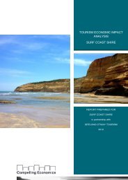
<strong>Surf</strong> <strong>Coast</strong> <strong>Shire</strong> <strong>Rural</strong> <strong>Strategy</strong> Review<br />
Final Report<br />
5 <strong>Rural</strong> Area Economy and Population Trends<br />
5.1 Land use and population trends<br />
The <strong>Surf</strong> <strong>Coast</strong> <strong>Shire</strong> covers an area of 1,560 square kilometres (Regional Innovation 2005)<br />
of which approximately 45% of the total area is used for farming and other rural uses. The<br />
balance is mainly public land associated with the Great Otway National Park and Angahook-<br />
Lorne State Park.<br />
The total population of the <strong>Shire</strong> is 21,000 with 27% of the total population living in rural<br />
areas. The rural areas of the <strong>Shire</strong> experienced significant growth between 1981 and 2001<br />
with the population growing by 75% and the number of dwellings increasing by 88%.<br />
Like many communities in close proximity to major urban centres, <strong>Surf</strong> <strong>Coast</strong> <strong>Shire</strong> has<br />
experienced significant growth, primarily associated with the sea change phenomenon. The<br />
<strong>Shire</strong>’s annual growth rate (2.5%) between 1996 and 2003 was double the State rate in the<br />
same period (National Sea Change Taskforce 2005). This trend is expected to continue,<br />
especially in light of the proposed Geelong Bypass which will improve commuter access<br />
between the <strong>Shire</strong> and Geelong and Melbourne.<br />
A consequence of the population growth in rural areas is a reduction in the total land area<br />
used for farming from 93,000 hectares in 1983 to 69,000 hectares in 2001. This represents a<br />
reduction of 26% in the land area used for farming. (Note that farming in this context refers<br />
to businesses that derive most income from the farm, as opposed to lifestyle or hobby<br />
farms).<br />
5.2 Future Growth<br />
5.2.1 Managing Growth<br />
The <strong>Surf</strong> <strong>Coast</strong> <strong>Shire</strong> has effectively managed growth and development in the farming areas<br />
of the <strong>Shire</strong> through the use of the tenement provisions. The tenement provisions will limit<br />
scope for further development or population growth in the prime agricultural areas of the<br />
<strong>Shire</strong>. Under the existing zoning regime and associated tenement controls, 161 additional<br />
dwellings could be developed in the key agricultural areas of the <strong>Shire</strong>. Future growth will<br />
therefore be focussed on existing townships. This outcome is highly supported as it protects<br />
the <strong>Shire</strong>’s agricultural land base for agricultural production activities.<br />
5.2.2 Lifestyle<br />
While the total area used for farming in the <strong>Shire</strong> has declined, the number of farm<br />
businesses has increased. This supports the anecdotal reports of small properties being<br />
purchased primarily for lifestyle purposes and is in part satisfying some demand for rural<br />
living opportunities. The community consultation highlighted this trend, particularly around<br />
Moriac, Deans Marsh, Freshwater Creek and Modewarre. As the price of land continues to<br />
increase above its productive value, particularly in areas in close proximity to the coast, the<br />
trend of farms being purchased for lifestyle purposes is expected to continue.<br />
RMCG Consultants for Business, Communities & Environment Page 25