Reporter No 60, May 2009, English (PDF 2,58 MB) - Leica ...
Reporter No 60, May 2009, English (PDF 2,58 MB) - Leica ...
Reporter No 60, May 2009, English (PDF 2,58 MB) - Leica ...

You also want an ePaper? Increase the reach of your titles
YUMPU automatically turns print PDFs into web optimized ePapers that Google loves.
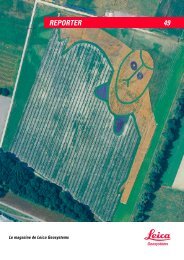
Garden extents extracted automatically using Land-<br />
Base and CIR imagery over Leicestershire, UK.<br />
In capturing a “snapshot in time” LandBase has been<br />
proven to aid change detection when used with historical<br />
data. Semi-automatic mapping has been carried<br />
out over Leicester and Maidstone to identify<br />
areas which have recently been built up; from new<br />
housing estates down to the level of newly tarmaced<br />
driveways. This was made possible by comparing<br />
the latest <strong>Leica</strong> ADS40 imagery and historical<br />
imagery within LandBase. Areas which have changed<br />
from vegetation to artificial surface or buildings are<br />
automatically highlighted by a classification routine.<br />
Such a method has proven even more effective than<br />
manual interpretation because of the difficulties of<br />
a seemingly easy game of spot-the-difference – we<br />
all know is never as easy as you expect. The image<br />
resolution has allowed the identification of changes<br />
to existing properties, for example building extensions,<br />
as well as new developments to be detected,<br />
and the wide area coverage has added large sample<br />
sizes giving greater statistical validity when doing<br />
cross analysis.<br />
About the Authors:<br />
Andrew Tewkesbury is Technical Development Manager<br />
at Infoterra Ltd. His focus is developing new<br />
image processing techniques and utilizing new satellite<br />
and airborne sensors. Dr Anthony Denniss, COO<br />
for Infoterra Ltd., is responsible for delivering operational<br />
efficiencies across the entire business on a dayto-day<br />
basis. Anthony’s academic background is in<br />
cartography and geological remote sensing.<br />
The Future<br />
The quality and depth of data available from the<br />
<strong>Leica</strong> ADS40 has significantly helped Infoterra meet<br />
its goal of being able to quantify and monitor the<br />
environment/surroundings in acute detail. Also the<br />
wide area collection of the sensor gives more scope<br />
for consistent data and regular updates. Statistics at a<br />
level not previously available can allow more informed<br />
decision making for a range of areas – urban planning,<br />
environmental management, and flood modelling.<br />
As the above example shows, the real power<br />
of the <strong>Leica</strong> ADS40 and successive camera’s such as<br />
the <strong>Leica</strong> ADS80, might be in providing a time series<br />
of consistent imagery, from which detailed change<br />
detection can be undertaken – allowing a new level<br />
of precision for monitoring what is really happening<br />
to our urban and rural landscapes.<br />
If you thought the <strong>Leica</strong> ADS40 only delivers good<br />
quality imagery, then think again about the wealth of<br />
information that imagery actually contains.<br />
More information:<br />
http://www.infoterra.co.uk/data_landbase.php<br />
The Global Magazine of <strong>Leica</strong> Geosystems | 21