Reporter No 60, May 2009, English (PDF 2,58 MB) - Leica ...
Reporter No 60, May 2009, English (PDF 2,58 MB) - Leica ...
Reporter No 60, May 2009, English (PDF 2,58 MB) - Leica ...

Create successful ePaper yourself
Turn your PDF publications into a flip-book with our unique Google optimized e-Paper software.
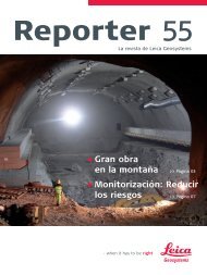
under the mountain specifically for the surveying<br />
operations and the survey concept was designed to<br />
suit these conditions. “When you are underground<br />
you do not know how gravity is behaving in response<br />
to different rock densities – these errors would be<br />
transferred immediately into our measurements.<br />
Therefore we refer back to survey models based<br />
on measurements we have taken on the surface,”<br />
explains Ivo Schätti.<br />
Dam wall monitoring on the surface<br />
While the tunnel boring machines are continuously<br />
eating their way through the base of the Gotthard<br />
massif, other measurements are being taken on<br />
the surface. Some parts of the tunnel pass directly<br />
under three water storage reservoirs, and although<br />
the tunnel lies very far underground, the effects on<br />
the surface should not be underestimated. “A tunnel<br />
affects the normal flows and pressures of ground<br />
water. The pressure loss due to the removal of the<br />
water in the rock could cause the mountain literally to<br />
cave in,” explains Ivo Schätti. A change of pressure like<br />
this could have disastrous consequences for the dam<br />
walls of the three reservoirs at Curnera, Nalps, and<br />
Santa Maria in the Upper Rhine Valley – and the tunnel<br />
driving would have to be stopped immediately.<br />
monitoring the valley walls near the dam walls and<br />
the area in front of them. Measuring points were<br />
fixed directly on the rock or were set on up to 3-<br />
metre-high concrete pillars which the team constructed<br />
themselves. <strong>No</strong> easy task, given that all the<br />
materials had to be flown in by helicopter and the<br />
prisms fixed on to vertical rock faces. Highly precise<br />
<strong>Leica</strong> TCA2003 total stations, protected against<br />
the weather in small enclosures and controlled using<br />
<strong>Leica</strong> GeoMoS, measure the movements of the prisms<br />
and transmit the data to monitoring software developed<br />
in-house. “The instruments have been operating<br />
since 2000 and continue to work perfectly,” he<br />
adds on behalf of a satisfied BSF Swissphoto. Spot<br />
level surveys were carried out at particularly critical<br />
areas along the route using a <strong>Leica</strong> GPS System 500<br />
to determine the settlement of individual points.<br />
The long, hard winters in the Swiss mountains make<br />
the team's job even more difficult: “In places the<br />
snow depths are huge, some points in avalanche<br />
areas are off limits for the whole of the winter, and<br />
often ice forms on the prisms and can remain there<br />
all day. In spite of all this we have been able to reach<br />
90 percent of our points, even in the winter,” concludes<br />
Ivo Schätti.<br />
For this reason BSF Swissphoto AG, the lead surveying<br />
consultant of the ARGE Los349 consortium, is<br />
The Global Magazine of <strong>Leica</strong> Geosystems | 5