Supaul Bihar Annual District Plan 2011-12 - nrcddp
Supaul Bihar Annual District Plan 2011-12 - nrcddp
Supaul Bihar Annual District Plan 2011-12 - nrcddp

You also want an ePaper? Increase the reach of your titles
YUMPU automatically turns print PDFs into web optimized ePapers that Google loves.
: • . • : • • • • : .<br />
CHAPTER I<br />
INTRODUCTION. METHODOLOGY AND PROFILE OF THE DISTRICT<br />
INTRODUCTION :<br />
HISTORICAL<br />
The <strong>District</strong> of <strong>Supaul</strong> has been a part of Mithilanchal since theVedic period. The area has been referred to<br />
as the fishery area (Matsya Kshetra) in the Hindu mythology. The two oldest democracies namely Angutaran and<br />
Aapanigam are known for their existence in the Budhist era. With the establishment of Magadh Empire the Koshi<br />
river basin became the part of Teer Bhikti and Pondravardhan Bhukti. Buddhism existed and flourished here for<br />
about 200 years in the regime of Pala dynasty. In the ancient period <strong>Supaul</strong> area was ruled by the Nanda Vansha,<br />
Maurya, Sungas and the Mithila Kings.During late medieval period it remained under the rule of Muslims followed<br />
by the British. The British realized its geographical and strategic importance and accorded <strong>Supaul</strong> the status of a<br />
Sub-division in 1862. In the process of administrative reorganization, <strong>Supaul</strong> was notified as <strong>District</strong> on 14-03-91.<br />
GEOGRAPHICAL<br />
<strong>Supaul</strong> is situated at 25037'-26025' N latitude and 86022'-87010' E longitude. Soil is alluvial type. The<br />
river Koshi flows through the district which is considered the sorrow of the area. Tilyuga, Chhaimra, Kali, Tilawe,<br />
Bhenga, Mirchaiya, Sursar are the tributaries to it. The type of soil is sandy. Somewhere it is acetic and somewhere<br />
it is basic in nature. The PH factor varies from 5.5 to 8.5. Minerals such as Sodium, Potassium and Magnesium are<br />
deficient in the soil.<br />
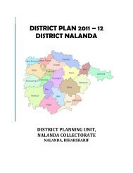
<strong>Supaul</strong> district covers an area of 2,420 sq km. <strong>Supaul</strong> district is apart of the Kosi division. <strong>Supaul</strong> town is the<br />
administrative headquarters of the district. The district is bounded by Nepal in the north, Saharsa district in the<br />
south, by Araria district in the East and on the west by Madhubani district.<br />
Situation of <strong>Supaul</strong><br />
(numbers are the<br />
population) in <strong>Bihar</strong><br />
v<br />