draft tomales bay vessel management plan - Gulf of the Farallones ...
draft tomales bay vessel management plan - Gulf of the Farallones ...
draft tomales bay vessel management plan - Gulf of the Farallones ...

Create successful ePaper yourself
Turn your PDF publications into a flip-book with our unique Google optimized e-Paper software.
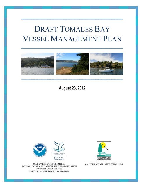
DRAFT TOMALES BAY<br />
VESSEL MANAGEMENT PLAN<br />
August 23, 2012<br />
U.S. DEPARTMENT OF COMMERCE <br />
NATIONAL OCEANIC AND ATMOSPHERIC ADMINISTRATION <br />
NATIONAL OCEAN SERVICE <br />
NATIONAL MARINE SANCTUARY PROGRAM <br />
CALIFORNIA STATE LANDS COMMISSION
ABOUT THIS DOCUMENT:<br />
This document includes two distinct elements: 1) <strong>the</strong> Tomales Bay Vessel Management<br />
Plan (TBVMP), and 2) <strong>the</strong> accompanying Environmental Assessment/Initial Study<br />
(EA/IS) as required by <strong>the</strong> National Environmental Policy Act (NEPA) and <strong>the</strong> California<br />
Environmental Quality Act (CEQA). The environmental impact assessment portion <strong>of</strong> <strong>the</strong><br />
document can be found in Appendix I, directly following <strong>the</strong> TBVMP, however <strong>the</strong><br />
EA/IS draws from and refers to <strong>the</strong> background information and o<strong>the</strong>r materials included<br />
throughout <strong>the</strong> TBVMP. This document also includes <strong>the</strong> proposed Tomales Bay<br />
Mooring Program (Appendix V), which provides specific criteria for where moorings are<br />
allowed on <strong>the</strong> <strong>bay</strong>, introduces mandatory specifications for mooring tackle, and lays out<br />
requirements for <strong>the</strong> inspection and maintenance <strong>of</strong> moorings.<br />
The TBVMP was prepared by <strong>Gulf</strong> <strong>of</strong> <strong>the</strong> <strong>Farallones</strong> National Marine Sanctuary<br />
(GFNMS) and California State Lands Commission (CSLC), in collaboration with <strong>the</strong><br />
Tomales Bay Interagency Committee (TBIC). The TBIC includes <strong>the</strong> following agencies:<br />
• California Coastal Commission<br />
• California Department <strong>of</strong> Boating and Waterways<br />
• California Department <strong>of</strong> Fish and Game<br />
• California Department <strong>of</strong> Public Health<br />
• California Department <strong>of</strong> Transportation<br />
• California State Lands Commission<br />
• California State Parks<br />
• Marin County and Marin County Sheriff’s Office<br />
• NOAA’s <strong>Gulf</strong> <strong>of</strong> <strong>the</strong> <strong>Farallones</strong> National Marine Sanctuary<br />
• National Park Service, Point Reyes National Seashore<br />
• State Water Resources Control Board and Regional Water Quality Control Boards<br />
GFNMS and CSLC would like to thank <strong>the</strong> GFNMS Advisory Council Working Group<br />
on Tomales Bay Vessel Management for its contribution to <strong>the</strong> final recommendations<br />
from <strong>the</strong> GFNMS Advisory Council. This working group consisted <strong>of</strong> <strong>the</strong> following<br />
participants:<br />
• Dominique Richard, Chair, GFNMS Advisory Council<br />
• Colin Smith, National Park Service<br />
• Nanci Smith, State Lands Commission<br />
• Tom Moore, Dept. <strong>of</strong> Fish and Game<br />
• Jerry Abbot, Inverness Yacht Club<br />
• Mark Bartolini, Tomales Bay Boaters Association<br />
• George Clyde, East Shore Planning Group<br />
• John Finger, Hog Island Oyster Company<br />
• Fred Smith, Environmental Action Committee <strong>of</strong> West Marin<br />
• Gordon Bennett, Sierra Club<br />
• Willy Vogler, Lawson’s Landing<br />
August 23, 2012 <br />
2
• Gene Maffucci, Herring Fishman<br />
• Skip Vilicich, Marshall Boat Works<br />
• Jeremy Fisher-Smith, Fisher-Smith Boat Works<br />
List <strong>of</strong> Preparers for <strong>the</strong> TBVMP:<br />
Maria Brown, GFNMS<br />
Brad Damitz, GFNMS<br />
Miriam Gordon, GFNMS<br />
Karen Reyna, GFNMS<br />
Tim Reed, GFNMS<br />
Vicki Wedell, ONMS<br />
Eric Gillies, CSLC<br />
Cy Oggins, CSLC<br />
Grace Kato, CSLC<br />
Theodore M. Beuttler, NOAA General Counsel<br />
August 23, 2012 <br />
3
TABLE OF CONTENTS<br />
X<br />
I. EXECUTIVE SUMMARY and INTRODUCTION<br />
A. PURPOSE AND NEED<br />
B. PROCESS FOR DEVELOPING THE TBVMP<br />
C. PARTICIPATING AGENCIES<br />
D. SCOPE OF THE TBVMP<br />
E. IMPLEMENTATION PROCESS FOR THE TBVMP<br />
F. SUMMARY OF PROPOSED ACTIONS<br />
II.<br />
PROPOSED ACTIONS FOR VESSEL MANAGEMENT PLAN<br />
A. SEWAGE SERVICES<br />
• ISSUE STATEMENT<br />
• PROPOSED ACTIONS<br />
B. OIL AND BILGE SERVICES<br />
• ISSUE STATEMENT<br />
• PROPOSED ACTIONS<br />
C. VESSEL MOORING PROGRAM<br />
• ISSUE STATEMENT<br />
• PROPOSED ACTIONS<br />
D. BOATER EDUCATION AND OUTREACH<br />
• ISSUE STATEMENT<br />
• PROPOSED ACTIONS<br />
E. PREVENTING INTRODUCED SPECIES<br />
• ISSUE STATEMENT<br />
• PROPOSED ACTIONS<br />
III.<br />
EXISTING ENVIRONMENTAL CONDITIONS<br />
A. PHYSICAL ENVIRONMENT<br />
1. Location <strong>of</strong> <strong>the</strong> Proposed Action and Geologic Conditions<br />
2. Physical Environment Introduction<br />
3. Hydrology/Water Quality<br />
B. HUMAN ENVIRONMENT<br />
1. Socioeconomics—Vessel Use<br />
2. Vessel moorings<br />
3. Vessel-related Facilities<br />
4. Water-based Recreation<br />
August 23, 2012 <br />
4
5. Aquaculture<br />
6. Recreational and Commercial Fishing<br />
7. Land Use<br />
8. Water Supply and Sewage Treatment<br />
C. BIOLOGICAL ENVIRONMENT<br />
1. Biological Environment Introduction<br />
2. Biological Resources—Seagrass<br />
3. Biological Resources—Wildlife<br />
4. Biological Resources—Fish<br />
5. Biological Resources—Special Status Species<br />
ADDITIONAL REFERENCES<br />
REFERENCES CITED<br />
ACKNOWLEDGEMENTS<br />
LIST OF FIGURES<br />
Figure 1: Map <strong>of</strong> Proposed Tomales Bay Mooring Zones.….…………………………..37<br />
Figure 2: Tomales Bay Locator Map………………….…..……….…………………….57<br />
Figure 3: Tomales Bay Bathymetry Map …...…...………………………………..…….58<br />
Figure 4: Public Health and Water Quality Protection Siting Criteria....………….…….61<br />
Figure 5: Existing Moorings in Tomales Bay (from 2006 survey)……………….……..67<br />
Figure 6: Map <strong>of</strong> Proposed Mooring Zones with Combined Protection Areas<br />
and Existing Moorings (from 2006)...….………….………………….…….…71<br />
Figure 7: Shoreline Restroom Facilities………………………………..………….…….75<br />
Figure 8: Public Safety Siting Criteria Map ………………………..….……….……….78<br />
Figure 9: Natural Resource Protection Siting Criteria Map…………….……….……….91<br />
LIST OF TABLES<br />
Table 1: Summary <strong>of</strong> TBVMP Proposed Strategies and Activities…………….….…….16<br />
Table 2: Tomales Bay Boating Facilities………………………………………….….….76<br />
Table 3: Tomales Bay Aquaculture Production………………………..………….….….83<br />
APPENDICES<br />
APPENDIX I: TBVMP ENVIRONMENTAL ASSESSMENT/INITIAL STUDY<br />
APPENDIX II: DEFINITIONS<br />
APPENDIX III: GOVERNMENT AGENCY JURISDICTION AND REGULATIONS<br />
APPENDIX IV: GFNMS ADVISORY COUNCIL RECOMMEDATIONS<br />
APPENDIX V: TOMALES BAY MOORING PROGRAM<br />
APPENDIX VI: TOMALES BAY GIS PROJECT LAYER DESCRIPTIONS<br />
APPENDIX VII: MOORING ANCHOR PULL TEST REPORT<br />
August 23, 2012 <br />
5
I. LIST OF ABBREVIATIONS AND ACRONYMS JURIS ULATION<br />
AWAF<br />
BMP<br />
CalTrans<br />
CCC<br />
CDFG<br />
CDBW<br />
CDP<br />
CDPH<br />
CEQA<br />
CFR<br />
CMSP<br />
CSLC<br />
CSP<br />
CWA<br />
EFH<br />
GGNRA<br />
GFNMS<br />
GIS<br />
MCSTOPPP<br />
MPN<br />
MPWC<br />
Abandoned Watercraft Abatement Fund<br />
Best Management Practice<br />
California Department <strong>of</strong> Transportation<br />
California Coastal Commission<br />
California Department <strong>of</strong> Fish and Game<br />
California Department <strong>of</strong> Boating and Waterways<br />
Coastal Development Permit<br />
California Department <strong>of</strong> Public Health<br />
California Environmental Quality Act<br />
Code <strong>of</strong> Federal Regulations<br />
Coastal and Marine Spatial Planning<br />
California State Lands Commission<br />
California State Parks<br />
Clean Water Act<br />
Essential Fish Habitat<br />
Golden Gate National Recreation Area<br />
<strong>Gulf</strong> <strong>of</strong> <strong>the</strong> <strong>Farallones</strong> National Marine Sanctuary<br />
Geographic Information System<br />
Marin County Stormwater Pollution Prevention Program<br />
Most Probable Number<br />
Motorized Personal Watercraft<br />
August 23, 2012 <br />
6
MSD<br />
NCDEM<br />
NDZ<br />
NEPA<br />
NMSA<br />
NOAA<br />
NPS<br />
NSSP<br />
OLE<br />
ONMS<br />
PRNS<br />
RWQCB<br />
SWRCB<br />
TBIC<br />
TBMP<br />
TBVMP<br />
TBWC<br />
TBSP<br />
TMDL<br />
USCG<br />
U.S. EPA<br />
Marine Sanitation Device<br />
North Carolina Department for Environmental Management<br />
No-Discharge Zone<br />
National Environmental Policy Act<br />
National Marine Sanctuaries Act<br />
National Oceanic and Atmospheric Administration<br />
National Park Service<br />
National Shellfish Sanitation Program<br />
NOAA, Office <strong>of</strong> Law Enforcement<br />
NOAA, Office <strong>of</strong> National Marine Sanctuaries<br />
Point Reyes National Seashore<br />
Regional Water Quality Control Board<br />
State Water Resources Control Board<br />
Tomales Bay Interagency Committee<br />
Tomales Bay Mooring Program<br />
Tomales Bay Vessel Management Plan<br />
Tomales Bay Watershed Council<br />
Tomales Bay State Park<br />
Total Maximum Daily Load<br />
United States Coast Guard<br />
United States Environmental Protection Agency<br />
August 23, 2012 <br />
7
I.I.<br />
EXECUTIVE SUMMARY AND INTRODUCTION<br />
A. PURPOSE AND NEED<br />
The Tomales Bay Draft Vessel Management Plan (TBVMP) is <strong>the</strong> result <strong>of</strong> a long-term<br />
multi-agency effort to streamline and coordinate <strong>vessel</strong> <strong>management</strong> activities for <strong>the</strong><br />
benefit <strong>of</strong> <strong>the</strong> public. The TBVMP aims to improve water quality, protect wildlife and<br />
habitat, protect public health and ensure recreational opportunities in Tomales Bay. It<br />
was developed by National Oceanic and Atmospheric Administration’s (NOAA) <strong>Gulf</strong> <strong>of</strong><br />
<strong>the</strong> <strong>Farallones</strong> National Marine Sanctuary (GFNMS) staff and <strong>the</strong> California State Lands<br />
Commission (CSLC) staff in collaboration with nine o<strong>the</strong>r local, state and federal<br />
agencies with jurisdiction in Tomales Bay collectively known as <strong>the</strong> Tomales Bay<br />
Interagency Committee (TBIC).<br />
GFNMS has been vested with <strong>the</strong> authority, in accordance with <strong>the</strong> National Marine<br />
Sanctuaries Act (NMSA; 16 U.S.C 1431-1445c), to provide comprehensive and<br />
coordinated conservation and <strong>management</strong> <strong>of</strong> 967.8 square nautical miles <strong>of</strong> nearshore<br />
and <strong>of</strong>fshore waters and submerged lands <strong>of</strong>f California. Since its designation in 1981,<br />
GFNMS has <strong>the</strong> authority to regulate certain activities within its boundaries, pursuant to<br />
<strong>the</strong> NMSA. The primary objective <strong>of</strong> <strong>the</strong> NMSA is resource protection, which is carried<br />
out in regulations codified at 15 CFR Part 922, and through <strong>the</strong> issuance <strong>of</strong> permits and<br />
coordination with o<strong>the</strong>r local, state, and federal agencies and by outreach, education,<br />
research, monitoring, and enforcement.<br />
The GFNMS Management Plan is <strong>the</strong> site-specific <strong>plan</strong>ning and <strong>management</strong> document<br />
that guides <strong>the</strong> operation <strong>of</strong> <strong>the</strong> sanctuary for <strong>the</strong> next five to ten years, helping <strong>the</strong><br />
sanctuary set budget and project priorities each year in preparation <strong>of</strong> its annual operating<br />
<strong>plan</strong> (GFNMS, 2008). The <strong>management</strong> <strong>plan</strong> was developed during a multi-year public<br />
process that identified priority sanctuary resource <strong>management</strong> issues. This <strong>plan</strong> includes<br />
a resource protection strategy (Strategy RP-12) that directs GFNMS, in coordination with<br />
ten o<strong>the</strong>r local, state and federal agencies, to develop and implement “a comprehensive<br />
<strong>plan</strong> to ensure <strong>the</strong> protection <strong>of</strong> water quality, wildlife, habitats, and safety in Tomales<br />
Bay.” The strategy includes specific guidance to address <strong>vessel</strong> <strong>management</strong> issues such<br />
as moorings and moored <strong>vessel</strong>s, sewage waste disposal, derelict and abandoned <strong>vessel</strong>s,<br />
and o<strong>the</strong>r habitat and water quality issues in <strong>the</strong> <strong>bay</strong>. Strategy RP-12 is being<br />
implemented through <strong>the</strong> development <strong>of</strong> <strong>the</strong> TBVMP.<br />
CSLC was established in 1938 with authority detailed in Division 6 <strong>of</strong> <strong>the</strong> California<br />
Public Resources Code. CSLC manages nearly 4 million acres <strong>of</strong> "Sovereign Lands"<br />
underlying <strong>the</strong> state's navigable and tidal waterways, including <strong>the</strong> beds <strong>of</strong> more than 120<br />
rivers, streams and sloughs; nearly 40 non-tidal navigable lakes; <strong>the</strong> tidal navigable <strong>bay</strong>s<br />
and lagoons including Tomales Bay; and, <strong>the</strong> tide and submerged lands adjacent to <strong>the</strong><br />
entire coast and <strong>of</strong>fshore islands <strong>of</strong> <strong>the</strong> state from <strong>the</strong> mean high tide line to three nautical<br />
miles <strong>of</strong>fshore.<br />
Persons who place moorings on ungranted sovereign land under <strong>the</strong> jurisdiction <strong>of</strong> <strong>the</strong><br />
CSLC are required to obtain a lease from <strong>the</strong> CSLC. While most <strong>of</strong> <strong>the</strong> moorings on <strong>the</strong><br />
<strong>bay</strong> are located on <strong>the</strong>se “sovereign lands”, <strong>the</strong> vast majority are not currently authorized<br />
August 23, 2012 <br />
8
y a CSLC lease or permit from GFNMS or any o<strong>the</strong>r resource protection agency and are<br />
<strong>the</strong>refore considered in trespass and illegal.<br />
The TBVMP addresses <strong>the</strong> following issues:<br />
1) Planning for Sewage Services;<br />
2) Planning for Oil and Bilge Services;<br />
3) Adopting a Tomales Bay Mooring Program that addresses <strong>the</strong> issue <strong>of</strong> illegal<br />
moorings and provides a mechanism to allow for limited moorings on <strong>the</strong> <strong>bay</strong> while<br />
meeting <strong>the</strong> mandates and regulations <strong>of</strong> GFNMS and CSLC;<br />
4) Outlining a Boater Education and Outreach Plan; and<br />
5) Preventing <strong>the</strong> Introduction <strong>of</strong> Introduced Species.<br />
The TBVMP is consistent with <strong>the</strong> Interim Framework for Effective Coastal and Marine<br />
Spatial Planning and has been scaled to <strong>the</strong> specific needs <strong>of</strong> <strong>the</strong> agencies that regulate<br />
and <strong>the</strong> people who use Tomales Bay (Interagency Ocean Policy Task Force, 2009).<br />
Coastal and Marine Spatial Planning (CMSP) is one <strong>of</strong> <strong>the</strong> nine priority objectives<br />
proposed in <strong>the</strong> Interim Report <strong>of</strong> <strong>the</strong> Interagency Ocean Policy Task Force (Interagency<br />
Ocean Policy Task Force, 2009).<br />
The <strong>plan</strong> also implements <strong>the</strong> mandates and regulations <strong>of</strong> both GFNMS and CSLC. It<br />
represents extensive input from <strong>the</strong> boating community and o<strong>the</strong>r local stakeholders, and<br />
addresses numerous issues including <strong>vessel</strong> sewage discharge, impacts from moorings,<br />
derelict or deserted <strong>vessel</strong>s, introduction <strong>of</strong> invasive species, disturbance <strong>of</strong> wildlife, and<br />
discharges <strong>of</strong> oil, fuel, and <strong>vessel</strong> maintenance products. GFNMS has regulatory<br />
authority over all <strong>the</strong>se issues, and <strong>the</strong> applicable regulations can be found at 15 CFR Part<br />
992 Subpart H.<br />
Goals and Objectives<br />
The participating agencies developed <strong>the</strong> following set <strong>of</strong> goals and objectives for <strong>the</strong><br />
TBVMP, which represent <strong>the</strong> collective agency mandates to protect public health and<br />
ecological resources in Tomales Bay:<br />
1. Protect public health and improve water quality by:<br />
• Preventing <strong>the</strong> improper discharge <strong>of</strong> <strong>vessel</strong>-related sewage;<br />
• Preventing <strong>the</strong> discharge <strong>of</strong> oil, gas, and toxic substances including <strong>vessel</strong><br />
maintenance products;<br />
• Providing adequate facilities for proper sewage disposal;<br />
• Designating Tomales Bay as a No-Discharge Zone for <strong>vessel</strong>s under <strong>the</strong> Clean<br />
Water Act (CWA), following installation <strong>of</strong> sewage services;<br />
• Addressing <strong>vessel</strong> desertion and abandonment <strong>of</strong> harmful matter aboard deserted<br />
<strong>vessel</strong>s;<br />
• Removing and preventing illegal and inappropriate mooring materials;<br />
• Removing abandoned or deserted <strong>vessel</strong>s; and<br />
• Reducing closures <strong>of</strong> commercial shellfish harvest due to poor water quality.<br />
2. Protect habitat and decrease threats to and disturbance <strong>of</strong> wildlife by:<br />
August 23, 2012 <br />
9
• Permitting moorings and exploring <strong>vessel</strong> storage options that avoid seagrass<br />
beds, seal haul-out areas, and aquaculture lease areas;<br />
• Preventing <strong>the</strong> introduction <strong>of</strong> invasive species;<br />
• Preventing anchoring in seagrass protection areas;<br />
• Removing and preventing illegally and improperly placed moorings; and<br />
• Removing and preventing grounded, derelict, and deserted <strong>vessel</strong>s.<br />
3. Ensure safe and enjoyable water-related recreation by:<br />
• Removing and preventing illegally and improperly placed moorings and mooring<br />
materials in areas where <strong>the</strong>re is a high concentration <strong>of</strong> recreation, such as,<br />
swimming beaches; and<br />
• Removing and preventing grounded, derelict, and deserted <strong>vessel</strong>s.<br />
Background<br />
GFNMS has regulatory authority over <strong>the</strong> submerged lands and waters <strong>of</strong> <strong>the</strong> sanctuary,<br />
including Tomales Bay, to <strong>the</strong> mean high water line. CSLC manages <strong>the</strong> ungranted<br />
tidelands and submerged lands <strong>of</strong> California. Both agencies work in coordination with<br />
o<strong>the</strong>r federal, state and local agencies and governments. As an area <strong>of</strong> exceptional<br />
biological significance, supporting a diversity <strong>of</strong> flora, fauna and habitats, <strong>the</strong> <strong>bay</strong> has<br />
long been recognized by citizens, local, state, and federal agencies as a special place<br />
deserving a high level <strong>of</strong> ecosystem protection. In 1962, portions <strong>of</strong> Tomales Bay on <strong>the</strong><br />
west shore were established as part <strong>of</strong> <strong>the</strong> Point Reyes National Seashore (PRNS). In<br />
1972, additional areas <strong>of</strong> Tomales Bay on <strong>the</strong> east shore were designated as part <strong>of</strong> <strong>the</strong><br />
Golden Gate National Recreation Area (GGNRA). In 1979, <strong>the</strong> California Coastal<br />
Commission (CCC) designated Tomales Bay as a “Special Resource Area”. Under <strong>the</strong><br />
State Water Resources Control Board’s (SWRCB’s) non-point source coastal pollution<br />
regulatory program, Tomales Bay is listed as one <strong>of</strong> <strong>the</strong> state’s Critical Coastal Areas. In<br />
1981, <strong>the</strong> majority <strong>of</strong> Tomales Bay was designated part <strong>of</strong> <strong>the</strong> GFNMS. Tomales Bay was<br />
also designated in September 2002 by <strong>the</strong> United Nations as a “Wetland <strong>of</strong> International<br />
Significance” in an international treaty known as <strong>the</strong> Ramsar Convention on Wetlands.<br />
Tomales Bay is a significant biological community that supports a diversity <strong>of</strong> habitats,<br />
including eelgrass beds, intertidal sand and mud flats, and salt and freshwater marshes.<br />
Thousands <strong>of</strong> species <strong>of</strong> birds, o<strong>the</strong>r vertebrates, invertebrates and <strong>plan</strong>ts, including<br />
numerous threatened and endangered species, inhabit <strong>the</strong> <strong>bay</strong>. The watershed is<br />
especially important to approximately 20,000 wintering shorebirds, seabirds, and<br />
waterbirds, among many o<strong>the</strong>r bird species that occur both seasonally and year-round<br />
(Kelly, 1998). The waters <strong>of</strong> Tomales Bay are also important to many fish species,<br />
including salmon, eel, sturgeon, halibut, endangered coho salmon, and <strong>the</strong> commercially<br />
important Pacific Herring that rely on its creeks and extensive eelgrass beds to spawn.<br />
Several species <strong>of</strong> marine mammals have been documented in <strong>the</strong> <strong>bay</strong> and a resident<br />
harbor seal population breeds <strong>the</strong>re—<strong>the</strong> seal population ranges between 500 and 800<br />
individuals depending on <strong>the</strong> time <strong>of</strong> year.<br />
While Tomales Bay has long been considered a pristine body <strong>of</strong> water, human activity<br />
within <strong>the</strong> watershed has resulted in some degradation <strong>of</strong> <strong>the</strong> <strong>bay</strong>’s water quality,<br />
August 23, 2012 <br />
10
habitats, and special status species. The San Francisco Regional Water Quality Control<br />
Board listed <strong>the</strong> <strong>bay</strong> as an impaired water body for pathogens, sediment, mercury, and<br />
nutrients and established a Tomales Bay Watershed Pathogens Total Maximum Daily<br />
Load (TMDL) as an update to <strong>the</strong> Water Quality Control Plan, San Francisco Bay<br />
Region, or Basin Plan. The goal <strong>of</strong> this TMDL is to minimize human exposure to<br />
disease-causing pathogens <strong>the</strong>reby ensuring protection <strong>of</strong> water contact recreational uses<br />
and Tomales Bay shellfish harvesting. The TMDL in <strong>the</strong> amended Basin Plan defines<br />
allowable density-based bacteria levels and prohibits <strong>the</strong> discharge <strong>of</strong> human waste; <strong>the</strong><br />
Basin Plan also includes an implementation <strong>plan</strong> that specifies required implementation<br />
measures, or actions necessary to protect and restore beneficial uses <strong>of</strong> <strong>the</strong> <strong>bay</strong>. One <strong>of</strong><br />
<strong>the</strong>se implementation measures requires <strong>the</strong> Regional Water Quality Control Board<br />
(RWQCB) to: “coordinate with participating agencies and rely on <strong>the</strong>ir interests and<br />
authorities to develop and implement a Tomales Bay boating <strong>management</strong> <strong>plan</strong> that<br />
includes: evaluation <strong>of</strong> existing moorings and water quality impacts; permitting and<br />
enforcement procedures to ensure compliance with applicable mooring requirements and<br />
to ensure no sewage discharge from boats” (San Francisco Bay RWQCB, 2005).<br />
Vessels and <strong>vessel</strong>-related facilities, (e.g. including toilets, <strong>vessel</strong> launch ramps,<br />
moorings, marinas, and campgrounds), have <strong>the</strong> potential to adversely affect <strong>the</strong> Tomales<br />
Bay ecosystem and impact water quality, habitat and public health, recreation and safety.<br />
When improperly managed or maintained, <strong>vessel</strong>s and <strong>the</strong> facilities that support boating<br />
threaten <strong>the</strong> valuable resources <strong>of</strong> Tomales Bay through: pathogen and nutrient<br />
impairment <strong>of</strong> beneficial uses, including aquaculture; decreased water quality from<br />
discharges <strong>of</strong> fuel, oil, and toxic materials; ecological effects <strong>of</strong> invasive species<br />
introduced by <strong>vessel</strong>s; disturbance <strong>of</strong> wildlife; habitat damage and threats to navigation<br />
from anchoring, mooring or deserted <strong>vessel</strong>s that come aground; and public safety threats<br />
from improperly moored, grounded, or deserted <strong>vessel</strong>s. Due to <strong>the</strong> myriad <strong>of</strong> federal,<br />
state, and local laws, regulations and ordinances that govern Tomales Bay, <strong>the</strong>re is a need<br />
to address <strong>the</strong>se issues in a coordinated and streamlined manner that is consistent with <strong>the</strong><br />
diverse set <strong>of</strong> mandates <strong>of</strong> <strong>the</strong> participating agencies.<br />
B. PROCESS FOR DEVELOPING THE TBVMP<br />
Beginning in 1994, a group <strong>of</strong> local, state, and federal agencies with jurisdiction over<br />
various parts <strong>of</strong> <strong>the</strong> <strong>bay</strong>, water quality, and boating met periodically to discuss <strong>vessel</strong><br />
<strong>management</strong>, moorings, and water quality concerns for Tomales Bay. In reviewing<br />
existing information, <strong>the</strong> collaborating agencies recognized that <strong>vessel</strong>s and associated<br />
facilities may adversely impact <strong>the</strong> water quality, public health and safety, and wildlife<br />
and natural habitats <strong>of</strong> Tomales Bay.<br />
The mandates <strong>of</strong> <strong>the</strong> agencies involved include maintaining or improving water quality,<br />
maintaining or improving native wildlife populations and natural habitats, protecting<br />
public health, access, and safety, and providing opportunities for recreation and oceandependent<br />
commercial uses.<br />
Over time, <strong>the</strong> concerns <strong>of</strong> <strong>the</strong> participating agencies evolved from focusing on impacts<br />
from <strong>vessel</strong> sewage discharge, moorings, and derelict or deserted <strong>vessel</strong>s, to also include<br />
August 23, 2012 <br />
11
threats from <strong>the</strong> introduction <strong>of</strong> invasive species, disturbance to wildlife, and discharges<br />
<strong>of</strong> oil, fuel, and <strong>vessel</strong> maintenance products. The participating agencies committed to<br />
acting in a coordinated manner to address all <strong>of</strong> <strong>the</strong>se <strong>vessel</strong>-related <strong>management</strong> issues<br />
including <strong>the</strong> consideration <strong>of</strong> <strong>vessel</strong> storage needs in Tomales Bay. GFNMS facilitated<br />
this collaborative process through establishing <strong>the</strong> TBIC. CLSC is a co-lead with <strong>the</strong><br />
GFNMS in developing <strong>the</strong> TBVMP.<br />
In 2007, GFNMS and CSLC produced <strong>the</strong> document, “Protecting Tomales Bay by<br />
Managing Vessel Usage: A Document for Public Input.” The document was a multiagency<br />
effort to coordinate current and future <strong>vessel</strong>-related activities to improve water<br />
quality, protect wildlife and habitat, and protect public health and ensure recreational<br />
opportunities in Tomales Bay. The document presented participating agencies’ current<br />
activities as well as new concepts for <strong>vessel</strong> <strong>management</strong>. The purpose <strong>of</strong> this document<br />
was to solicit <strong>vessel</strong> <strong>management</strong> recommendations from individuals and organizations in<br />
<strong>the</strong> local community and users <strong>of</strong> Tomales Bay to protect <strong>the</strong> ecosystem and public health<br />
in <strong>the</strong> <strong>bay</strong>. The document was released for a 60-day comment period and two<br />
“brainstorming” workshops were held.<br />
As a result <strong>of</strong> public comments on <strong>the</strong> document, GFNMS continued to engage boaters<br />
and <strong>the</strong> local community to provide input on <strong>the</strong> development <strong>of</strong> a <strong>draft</strong> <strong>vessel</strong><br />
<strong>management</strong> <strong>plan</strong> for Tomales Bay. To that end, <strong>the</strong> GFNMS Advisory Council initiated<br />
a Working Group for Tomales Bay Vessel Management. The working group consisted <strong>of</strong><br />
representatives <strong>of</strong> boating associations, shellfish growers, commercial fishermen, boat<br />
services operations, conservation organizations, shore-side property owners, and state and<br />
federal agencies with jurisdiction in Tomales Bay. GFNMS facilitated seven working<br />
group meetings through April 2009. Working group topics included: <strong>vessel</strong> sewage and<br />
oil waste disposal services; mooring criteria; mooring fields; mooring tackle; mooring<br />
permitting process; and boater education. These meetings resulted in a list <strong>of</strong><br />
recommendations to <strong>the</strong> GFNMS Advisory Council. In December 2009 <strong>the</strong> Advisory<br />
Council reviewed <strong>the</strong> working group recommendations and forwarded a final list <strong>of</strong><br />
recommendations to GFNMS (Appendix IV).<br />
C. PARTICIPATING AGENCIES<br />
The TBVMP was prepared by GFNMS and CSLC.<br />
NOAA - <strong>Gulf</strong> <strong>of</strong> <strong>the</strong> <strong>Farallones</strong> National Marine Sanctuary (GFNMS)<br />
GFNMS includes <strong>the</strong> submerged lands and waters <strong>of</strong> Tomales Bay to <strong>the</strong> mean high<br />
water line throughout <strong>the</strong> <strong>bay</strong> to <strong>the</strong> Point Reyes National Seashore boundary on <strong>the</strong><br />
western shore <strong>of</strong> Tomales Bay south <strong>of</strong> Duck Cove. Pursuant to <strong>the</strong> NMSA, NOAA has<br />
<strong>the</strong> authority for comprehensive and coordinated conservation and <strong>management</strong> <strong>of</strong> <strong>the</strong><br />
sanctuary, including Tomales Bay. The subsequent designation <strong>of</strong> <strong>the</strong> site in 1981, as a<br />
National Marine Sanctuary, provided GFNMS with <strong>the</strong> authority to regulate certain<br />
activities within its boundaries, pursuant to <strong>the</strong> NMSA.<br />
August 23, 2012 <br />
12
With certain exceptions, GFNMS regulations prohibit <strong>the</strong> following activities within <strong>the</strong><br />
sanctuary (for <strong>the</strong> complete text <strong>of</strong> <strong>the</strong> GFNMS prohibitions, refer to 15 CFR Part<br />
922.82.):<br />
• Discharging or depositing <strong>of</strong> materials or o<strong>the</strong>r matter directly into <strong>the</strong> sanctuary;<br />
• Discharging or depositing <strong>of</strong> materials from outside <strong>the</strong> sanctuary that enter and<br />
injure Sanctuary resources;<br />
• Constructing any structure o<strong>the</strong>r than a navigational aid;<br />
• Placing or abandoning any structure;<br />
• Dredging or o<strong>the</strong>rwise altering <strong>the</strong> submerged lands <strong>of</strong> <strong>the</strong> Sanctuary;<br />
• Using motorized personal watercraft (MPWC - defined as a <strong>vessel</strong> which uses an<br />
inboard motor powering a water jet pump as its primary source <strong>of</strong> motive power, and<br />
which is designed to be operated by a person sitting, standing, or kneeling on <strong>the</strong><br />
<strong>vessel</strong> ra<strong>the</strong>r than <strong>the</strong> conventional manner <strong>of</strong> sitting or standing inside <strong>the</strong> <strong>vessel</strong>);<br />
• Taking, harassing or disturbing seabirds, marine mammals, and sea turtles;<br />
• Attracting white sharks;<br />
• Deserting a <strong>vessel</strong> aground, at anchor, or adrift in <strong>the</strong> Sanctuary;<br />
• Leaving harmful matter in a deserted <strong>vessel</strong>;<br />
• Moving or removing historic resources (such as shipwrecks); and<br />
• Anchoring in Tomales Bay seagrass protection zones.<br />
California State Lands Commission (CSLC)<br />
CSLC has jurisdiction over all state-owned filled and unfilled tidelands, submerged<br />
lands, and beds <strong>of</strong> navigable waterways (sovereign lands). The state acquired ownership<br />
<strong>of</strong> all such lands within its boundaries upon its admission to <strong>the</strong> United States in 1850.<br />
These lands include, but are not limited to, <strong>the</strong> beds <strong>of</strong> more than 120 navigable rivers<br />
and sloughs, nearly 40 navigable lakes, and <strong>the</strong> three-mile wide band <strong>of</strong> tide and<br />
submerged lands adjacent to <strong>the</strong> coast and <strong>of</strong>fshore islands <strong>of</strong> <strong>the</strong> state. The state holds<br />
<strong>the</strong>se lands pursuant to <strong>the</strong> common law Public Trust Doctrine for <strong>the</strong> benefit <strong>of</strong> all its<br />
people for public trust purposes such as water related commerce, navigation, fisheries,<br />
water oriented recreation, and open space.<br />
The CSLC derives its authority from both <strong>the</strong> Public Resources Code and <strong>the</strong> California<br />
Code <strong>of</strong> Regulations. Public Resources Code section 6301 grants exclusive jurisdiction<br />
to <strong>the</strong> CSLC over all ungranted tidelands and submerged lands owned by <strong>the</strong> state, and<br />
<strong>the</strong> beds <strong>of</strong> navigable rivers, streams, lakes, and <strong>bay</strong>s. CSLC administers this authority,<br />
including <strong>the</strong> leasing <strong>of</strong> state lands for marinas, docks, and moorings, pursuant to Title 2,<br />
Division 3, Chapter 1, California Code <strong>of</strong> Regulations. Moorings located on <strong>the</strong>se<br />
sovereign lands are required to have a valid lease from CSLC.<br />
Generally, Tomales Bay involves ungranted sovereign land under <strong>the</strong> jurisdiction <strong>of</strong><br />
CSLC and lands <strong>the</strong> state patented through various tideland surveys, including, but not<br />
limited to, Tideland Surveys 1 (Marin County), 157 (Marin County), 107 (Marin<br />
County), 99 (Marin County), 145 (Marin County), 241 (Marin County), and 170 (Marin<br />
County), 172 (Marin County). Tomales Bay also involves lands that are subject to<br />
August 23, 2012 <br />
13
certain Boundary Line Agreements and Title Settlement Agreements, including certain<br />
portions <strong>of</strong> <strong>the</strong> areas <strong>of</strong> Marconi Cove and Chicken Ranch Beach.<br />
The proposed mooring areas located within Tomales Bay are located waterward <strong>of</strong> lands<br />
<strong>the</strong> state patented and on ungranted sovereign land under <strong>the</strong> jurisdiction <strong>of</strong> <strong>the</strong> CSLC.<br />
The Tomales Bay Interagency Committee (TBIC)<br />
GFNMS and CSLC have worked as members <strong>of</strong> <strong>the</strong> Tomales Bay Interagency<br />
Committee (TBIC). The TBIC includes <strong>the</strong> numerous local, state, and federal agencies<br />
with legal and regulatory interest in <strong>the</strong> waters <strong>of</strong> Tomales Bay and <strong>the</strong> nearshore<br />
adjacent areas. TBIC agencies include:<br />
• California Coastal Commission<br />
• California Department <strong>of</strong> Boating and Waterways<br />
• California Department <strong>of</strong> Fish and Game<br />
• California Department <strong>of</strong> Public Health<br />
• California Department <strong>of</strong> Transportation<br />
• California State Lands Commission<br />
• California State Parks<br />
• Marin County and Marin County Sheriff’s Office<br />
• NOAA’s <strong>Gulf</strong> <strong>of</strong> <strong>the</strong> <strong>Farallones</strong> National Marine Sanctuary<br />
• National Park Service, Point Reyes National Seashore<br />
• State Water Resources Control Board and Regional Water Quality Control Boards<br />
The TBIC and <strong>the</strong> process to develop <strong>the</strong> Tomales Bay Vessel Management Plan are<br />
described in Process for Developing <strong>the</strong> TBVMP above. A more detailed description <strong>of</strong><br />
TBIC agencies (and o<strong>the</strong>r agencies with jurisdiction over boating or Tomales Bay) and<br />
pertinent regulations are contained in Appendix III.<br />
D. SCOPE OF THE TOMALES BAY VESSEL MANAGEMENT PLAN<br />
The TBVMP provides recommendations to achieve its stated goals. It reflects a multiagency<br />
effort to streamline and coordinate future <strong>vessel</strong>-related activities. The intended<br />
outcome is to have a coordinated, collaborative <strong>plan</strong> that provides guidance to <strong>the</strong><br />
agencies and <strong>the</strong> public for improving <strong>the</strong> water quality, protecting and restoring <strong>the</strong><br />
natural resources and ensuring public health and safety <strong>of</strong> water-related uses <strong>of</strong> Tomales<br />
Bay. This <strong>plan</strong> does not establish any new legal authorities; none <strong>of</strong> <strong>the</strong> proposed actions<br />
will alter existing authorities with regard to <strong>management</strong> <strong>of</strong> resources or regulation <strong>of</strong><br />
activities within Tomales Bay.<br />
The TBVMP is not intended to be a static <strong>plan</strong>, but ra<strong>the</strong>r a living document based upon<br />
an adaptive <strong>management</strong> approach; thus, it will continue to evolve and adapt to changing<br />
circumstances. While <strong>the</strong> goals and objectives should remain unchanged, <strong>the</strong> TBVMP<br />
will be reviewed and evaluated during <strong>the</strong> next GFNMS <strong>management</strong> <strong>plan</strong> review and<br />
may be amended accordingly. These revisions and additions to <strong>the</strong> TBVMP, if and when<br />
necessary, will ensure that it is responsive to emerging issues and reflects changing<br />
conditions and priorities. Moreover, implementation <strong>of</strong> <strong>the</strong> proposed actions in <strong>the</strong><br />
August 23, 2012 <br />
14
TBVMP is contingent upon availability <strong>of</strong> funding over time; <strong>the</strong>refore modifications to<br />
<strong>the</strong> strategies and activities may need to be made due to unforeseen circumstances.<br />
E. IMPLEMENTATION PROCESS FOR THE TBVMP<br />
GFNMS and CSLC are currently seeking comments on <strong>the</strong> <strong>draft</strong> proposed TBVMP and<br />
<strong>the</strong> EA/IS. The 30-day public comment period will include a public hearing, which will<br />
be held in <strong>the</strong> Tomales Bay area. When <strong>the</strong> comment period closes, both agencies will<br />
review and respond to comments received and will develop a proposed final TBVMP and<br />
EA/IS, which will <strong>the</strong>n need to be approved by <strong>the</strong> CSLC at a properly noticed public<br />
meeting.<br />
Once <strong>the</strong> final TBVMP and EA/IS have been approved, a Tomales Bay Mooring Program<br />
(TBMP) will be implemented over a set timeframe to ensure adequate time for public<br />
notification. A mooring lease application along with instructions and guidance materials<br />
will be made available for individuals seeking a CSLC Lease for mooring <strong>of</strong> recreational<br />
<strong>vessel</strong>s on Tomales Bay. These materials will assist individuals with <strong>the</strong> application<br />
process and will include a Tomales Bay Vessel Mooring Handbook and an interactive<br />
map showing mooring zones, restricted areas, and o<strong>the</strong>r points <strong>of</strong> interest. The TBMP<br />
will provide a streamlined approach that minimizes, to <strong>the</strong> extent possible, <strong>the</strong> time for<br />
permitting agency staff to process applications by addressing <strong>the</strong> lease requirements,<br />
including where moorings will be allowed, what types <strong>of</strong> equipment will be acceptable,<br />
and how <strong>the</strong> moorings should be installed, inspected, and maintained.<br />
F. SUMMARY OF PROPOSED ACTIONS<br />
The TVMP covers five categories <strong>of</strong> issues: 1) Sewage Services; 2) Oil and Bilge<br />
Services; 3) Vessel Mooring Program; 4) Boater Education and Outreach; and 5)<br />
Preventing <strong>the</strong> Introduction <strong>of</strong> Non-native Species. The discussion <strong>of</strong> each issue area<br />
includes specific strategies to address existing problems and is fur<strong>the</strong>r divided into<br />
specific actions, or “activities” for <strong>the</strong> agencies’ staff to carry out. Activities will be<br />
implemented, contingent on funding, to achieve <strong>the</strong> goals and objectives <strong>of</strong> <strong>the</strong> TBVMP.<br />
Table 1 is a summary <strong>of</strong> <strong>the</strong> issues, strategies and activities. For an overview <strong>of</strong> <strong>the</strong><br />
structure <strong>of</strong> <strong>the</strong> proposed actions and detailed discussion about <strong>the</strong> issues, strategies and<br />
activities, see Section II, Proposed Actions for <strong>the</strong> Vessel Management Plan.<br />
August 23, 2012 <br />
15
TABLE 1 — PROPOSED ACTIONS SUMMARY TABLE<br />
Issue Strategy Activity<br />
SS-1: Plan for and<br />
implement adequate <strong>vessel</strong>based<br />
sewage services for<br />
Tomales Bay.<br />
SS 1.1 - Establish at least three portable toilet dump stations<br />
adjacent to Tomales Bay.<br />
SS 1.2 - Establish one sewage pumpout station adjacent to<br />
Tomales Bay.<br />
SS-2: Designate Tomales<br />
Bay as a No-Discharge<br />
Zone for Vessel Sewage.<br />
SS 2.1 - Recommend that <strong>the</strong> U.S. Environmental Protection<br />
Agency (EPA) designate Tomales Bay as a No Discharge Zone<br />
(NDZ).<br />
SEWAGE SERVICES (SS)<br />
SS-3: Plan for and<br />
implement additional landbased<br />
sewage services for<br />
Tomales Bay.<br />
SS 3.1 - Recommend that <strong>the</strong> National Park Service (NPS) or<br />
Marin County install and maintain a portable bathroom facility<br />
(i.e. “Port-a-John”) at Grassy Point (NPS-GGNRA 17-<br />
111/Marin County Assessors Parcel No. 104-230-23).<br />
SS 3.2 - Encourage <strong>the</strong> purchase <strong>of</strong> Marconi Cove for <strong>the</strong><br />
installation <strong>of</strong> public boating facilities.<br />
SS-4: Ensure that future<br />
sewage services needs are<br />
met for Tomales Bay<br />
SS 4.1 - Recommend to TBIC agencies that no new waterfront<br />
facilities or expansion <strong>of</strong> existing waterfront facilities be<br />
permitted without documentation/assurance <strong>of</strong> adequate sewage<br />
waste <strong>management</strong> facilities.<br />
SS-5: Develop a boater<br />
outreach <strong>plan</strong> for <strong>vessel</strong><br />
sewage practices.<br />
SS 5.1 - Ensure that a boater outreach <strong>plan</strong> for <strong>vessel</strong> sewage<br />
practices is included as part <strong>of</strong> <strong>the</strong> Tomales Bay Boater<br />
Education and Outreach Program (see Strategy EO-1).<br />
August 23, 2012 <br />
16
Table 1 (Continued): Proposed Actions Summary Table<br />
Issue Strategy Activity<br />
OS 1.1 - Identify funding sources and pursue <strong>plan</strong>ning for<br />
absorbent exchange program.<br />
OIL AND BILGE SERVICES (OS)<br />
OS-1: Implement an oil<br />
absorbent exchange<br />
program for Tomales Bay.<br />
OS-2: Develop a boater<br />
outreach <strong>plan</strong> for <strong>vessel</strong> oil<br />
and bilge practices.<br />
OS 1.2 - Implement a “pilot” bilge absorbent exchange<br />
program at two initial locations.<br />
OS 1.3 - Evaluate effectiveness <strong>of</strong> <strong>the</strong> two absorbent exchange<br />
program “pilot” sites and adapt as necessary.<br />
OS 2.1 - Compile and distribute existing educational materials<br />
and information on Best Management Practices (BMPs) for<br />
proper <strong>management</strong> <strong>of</strong> oil fuel and o<strong>the</strong>r boat maintenance<br />
products.<br />
OS 2.2 - Compile and analyze information on all existing used<br />
<strong>vessel</strong> oil recycling locations.<br />
VM 1.1- Adopt <strong>the</strong> following criteria for siting <strong>of</strong> <strong>vessel</strong><br />
moorings on Tomales Bay:<br />
VESSEL MOORING PROGRAM (VM)<br />
VM-1: Implement siting<br />
criteria and zones for<br />
<strong>vessel</strong> moorings in<br />
Tomales Bay based on a<br />
marine spatial <strong>plan</strong>ning<br />
approach.<br />
1. Seagrass: No <strong>vessel</strong> moorings shall be allowed in seagrass<br />
beds.<br />
2. Wildlife Disturbance: No moorings shall be allowed in<br />
areas within 300 feet <strong>of</strong> seal haul-out areas.<br />
3. Parcels Under Private Ownership: No <strong>vessel</strong> moorings<br />
shall be allowed on tidelands and submerged lands under<br />
private ownership.<br />
4. PRNS Submerged Lands: O<strong>the</strong>r than as necessary for NPS<br />
administrative use, no moorings shall be allowed on <strong>the</strong><br />
submerged lands owned by NPS on <strong>the</strong> western shore <strong>of</strong><br />
Tomales Bay north <strong>of</strong> <strong>the</strong> nor<strong>the</strong>rn boundary <strong>of</strong> Tomales<br />
Bay State Park at Duck Cove, as depicted in Figure 9:<br />
Natural Resource Protection Siting Criteria Map.<br />
August 23, 2012 <br />
17
Table 1 (Continued): Proposed Actions Summary Table<br />
Issue Strategy Activity<br />
5. Swimming Beach/Boat Launch Areas: No moorings shall<br />
be allowed within 100 feet <strong>of</strong> swimming beaches and boat<br />
launch ramps.<br />
6. State Parks Criteria: No moorings shall be allowed within<br />
1000 feet <strong>of</strong>fshore <strong>of</strong> State Parks property.<br />
VESSEL MOORING PROGRAM (VM)<br />
VM-1: (CONTINUED)<br />
Implement siting criteria<br />
and zones for <strong>vessel</strong><br />
moorings in Tomales Bay<br />
based on a marine spatial<br />
<strong>plan</strong>ning approach.<br />
7. Aquaculture: No moorings shall be allowed within areas<br />
that fail to meet <strong>the</strong> California Department <strong>of</strong> Public<br />
Health calculations for safe distances between moorings<br />
and shellfish growing operations. No moorings shall be<br />
located within state water bottom lease areas for<br />
aquaculture unless directly associated with aquaculture<br />
pursuant to a valid lease, permit, license or o<strong>the</strong>r<br />
authorization issued by <strong>the</strong> State <strong>of</strong> California.<br />
8. Navigation Channels: No moorings shall be allowed within<br />
navigation channels <strong>of</strong> Tomales Bay.<br />
VM 1.2- Implement mooring zones sited within historically<br />
used mooring locations <strong>of</strong> <strong>the</strong> <strong>bay</strong> that are consistent with <strong>the</strong><br />
criteria in Activity VM 1.1, and regulatory requirements <strong>of</strong> all<br />
TBIC agencies.<br />
VM 2.1 - Develop CSLC lease terms and conditions that are<br />
consistent with all TBIC agencies’ mandates, regulations and<br />
policies, and are in compliance with mooring criteria<br />
established in Activity VM 1.1.<br />
VM-2: Implement a<br />
Tomales Bay Vessel<br />
Mooring Permitting<br />
Process based on a marine<br />
spatial <strong>plan</strong>ning approach<br />
VM 2.2 - Establish policies/regulations limiting <strong>the</strong> maximum<br />
number <strong>of</strong> moorings allowed under <strong>the</strong> TBMP to no more than<br />
165 moorings.<br />
VM 2.3 - Implement mooring tackle requirements to include<br />
specifications for mooring tackle and a program for inspection<br />
and maintenance.<br />
August 23, 2012 <br />
18
Table 1 (Continued): Proposed Actions Summary Table<br />
Issue Strategy Activity<br />
VESSEL MOORING PROGRAM (VM)<br />
VM-3: Introduce a<br />
process for compliance<br />
with Vessel Mooring<br />
Program that includes a<br />
clear public education<br />
and outreach<br />
component.<br />
VM-4: Streng<strong>the</strong>n<br />
existing Tomales Bay<br />
enforcement<br />
partnerships to ensure<br />
compliance with all<br />
<strong>vessel</strong>-related mandates,<br />
policies and regulations<br />
VM 3.1 - Implement a process to introduce <strong>the</strong> Vessel Mooring<br />
Program and permitting process to <strong>the</strong> community.<br />
VM 3.2 - Continue to implement a process for removing derelict<br />
and deserted moorings.<br />
VM 3.3 - Define and implement a process for ensuring future<br />
compliance with <strong>the</strong> Vessel Mooring Program.<br />
VM 4.1 - Conduct an analysis <strong>of</strong> Tomales Bay enforcement<br />
capabilities and review and determine if a formal agreement is<br />
needed among enforcement agencies.<br />
VM 4.2 - Ensure adequate patrol <strong>of</strong> <strong>bay</strong> from aircraft, <strong>vessel</strong>s and<br />
by on-foot observation.<br />
VM 4.3 - Enhance training <strong>of</strong> enforcement personnel on Tomales<br />
Bay <strong>vessel</strong> related issues and regulations.<br />
BOATER EDUCATION AND OUTREACH<br />
PROGRAM (EO)<br />
EO-1: Develop a<br />
Tomales Bay Boater<br />
Education and Outreach<br />
Program.<br />
EO 1.1- Ensure local businesses receive existing boater education<br />
materials.<br />
EO 1.2– Conduct outreach to inform Tomales Bay boaters <strong>of</strong> <strong>the</strong><br />
TBVMP and promote boater compliance with <strong>the</strong> Vessel<br />
Mooring Program and o<strong>the</strong>r laws, regulations and policies.<br />
EO 1.3- Develop a Tomales Bay boater website and a map<br />
(interactive and hard copy).<br />
EO 1.4- Develop and provide new outreach materials and<br />
programs specific to Tomales Bay boating.<br />
EO 1.5- Develop an educational program for proper boat<br />
anchoring practices.<br />
INTRODUCED SPECIES (IS)<br />
IS-1: Encourage <strong>vessel</strong><br />
operators to prevent <strong>the</strong><br />
introduction <strong>of</strong> nonnative<br />
species.<br />
IS-2: Encourage ongoing<br />
monitoring <strong>of</strong><br />
introduced species<br />
IS 1.1 – Promote Best Management Practices (BMPs) by<br />
distributing recommendations on how to prevent introduced<br />
species to <strong>the</strong> Tomales Bay boating community.<br />
IS 2.1 – Support efforts by agencies and organizations that<br />
conduct regular monitoring <strong>of</strong> introduced species, including<br />
writing letters <strong>of</strong> support for specific projects.<br />
August 23, 2012 <br />
19
II. PROPOSED ACTIONS FOR THE VESSEL MANAGEMENT PLAN N<br />
This section provides an overview <strong>of</strong> all <strong>management</strong> actions proposed by CSLC and<br />
GFNMS. Actions are divided among <strong>the</strong> following topics: sewage services, oil and bilge<br />
services, <strong>vessel</strong> mooring program, education and outreach program, and introduced<br />
species prevention. The first section, “Structure”, describes how each issue is addressed<br />
in <strong>the</strong> TBVMP.<br />
STRUCTURE<br />
Issue Statement<br />
The issue statement concisely explains “why” this is an issue to be addressed by GFNMS<br />
and/or CSLC. It may include a brief description <strong>of</strong> <strong>the</strong> current situation or problem, and<br />
areas that need attention.<br />
Strategies and Activities<br />
This section describes how <strong>the</strong> issue will be addressed. Each strategy addresses <strong>the</strong> issue<br />
and is divided into specific activities for <strong>the</strong> agency staff to carry out. Activities are<br />
designed to achieve <strong>the</strong> goals and objectives <strong>of</strong> <strong>the</strong> TBVMP.<br />
In certain cases anticipated products associated with implementation <strong>of</strong> <strong>the</strong> activities are<br />
listed in <strong>the</strong> descriptions. These anticipated products were projected during <strong>the</strong><br />
development <strong>of</strong> <strong>the</strong> TBVMP; however as <strong>the</strong> strategies and activities are completed over<br />
time and/or funding is made available, different or additional products may become more<br />
appropriate.<br />
Where applicable, potential partners and estimated cost are listed below <strong>the</strong> activity<br />
descriptions. The potential partners are organizations or entities that GFNMS and CSLC<br />
have identified who have shown interest in contributing or could possibly lead, provide<br />
support, or o<strong>the</strong>rwise be involved in <strong>the</strong> implementation <strong>of</strong> that particular activity. The<br />
current potential partners identified in <strong>the</strong> TBVMP are also partners <strong>of</strong> <strong>the</strong> TBIC. This<br />
list does not limit <strong>the</strong> potential partners or establish a commitment for those currently on<br />
<strong>the</strong> list, but merely serves as a guide when implementing <strong>the</strong> activity.<br />
Budget numbers listed under estimated costs represent a rough estimate <strong>of</strong> expenses<br />
associated with conducting <strong>the</strong> activity described. These estimates are contingent on a<br />
number <strong>of</strong> factors:<br />
1) Funding for a GFNMS Tomales Bay Project Coordinator is obtained;<br />
2) A budget is available each year from appropriated funds;<br />
3) There are both availability <strong>of</strong> and opportunity to receive additional funding;<br />
4) The estimates do not take into account increasing personnel costs each year or<br />
inflation;<br />
5) The estimates do not take into account unexpected events, emergencies or<br />
unforeseen projects.<br />
August 23, 2012 <br />
20
Due to existing limited resources and existing mandates and workload priorities, it would<br />
be necessary for GFNMS to hire a dedicated staff position to coordinate <strong>the</strong><br />
implementation <strong>of</strong> <strong>the</strong> activities in this <strong>plan</strong>, conduct <strong>the</strong> required collaboration between<br />
agencies, and facilitate <strong>the</strong> TBIC. This position is <strong>the</strong> Tomales Bay Project Coordinator,<br />
which is referenced throughout this <strong>plan</strong>. Although <strong>the</strong> specifics <strong>of</strong> this new project<br />
coordinator position have not been thoroughly discussed, it is envisioned to be a part time<br />
position.<br />
Finally, most <strong>of</strong> <strong>the</strong> strategies and activities in <strong>the</strong> Proposed Actions <strong>of</strong> <strong>the</strong> TBVMP were<br />
developed by <strong>the</strong> GFNMS Advisory Council Working Group on Tomales Bay Vessel<br />
Management, reviewed and refined by <strong>the</strong> GFNMS Advisory Council, which provided<br />
<strong>the</strong>m to <strong>the</strong> sanctuary superintendent for consideration in <strong>the</strong> development <strong>of</strong> <strong>the</strong><br />
TBVMP. For more information on this stakeholder process, see <strong>the</strong> Process for<br />
Developing <strong>the</strong> TBVMP in <strong>the</strong> Executive Summary and Introduction section. To see <strong>the</strong><br />
GFNMS Advisory Council recommendations and <strong>the</strong> sanctuary superintendent’s<br />
response, see Appendix IV.<br />
A. SEWAGE SERVICES<br />
Issue Statement:<br />
Traditionally, <strong>vessel</strong> use has played an important role throughout <strong>the</strong> modern history <strong>of</strong><br />
Tomales Bay, for both commercial and recreational purposes—and boating continues to<br />
be a popular activity for residents and visitors to <strong>the</strong> <strong>bay</strong>. Unfortunately however, despite<br />
<strong>the</strong> level <strong>of</strong> <strong>vessel</strong> use, <strong>the</strong>re are currently no pumpout or dump stations (for onboard<br />
portable toilets) on or around Tomales Bay where boaters can dispose <strong>of</strong> <strong>the</strong>ir waste. A<br />
study conducted by California Department <strong>of</strong> Boating and Waterways (CDBW)<br />
documented <strong>the</strong> number and type <strong>of</strong> <strong>vessel</strong>s and <strong>vessel</strong>-related facilities near Tomales<br />
Bay. This study determined that <strong>the</strong>re were 87 <strong>vessel</strong>s requiring a dump station and 71<br />
<strong>vessel</strong>s requiring a pumpout, on and around <strong>the</strong> <strong>bay</strong>. Based on <strong>the</strong>se results CDBW made<br />
a recommendation to SWRCB that, at a minimum, one pumpout station and one dump<br />
station are needed in Tomales Bay to provide adequate sewage waste facilities (CDBW,<br />
2004).<br />
Tomales Bay is currently on <strong>the</strong> Section 303(d) Clean Water Act (CWA) list <strong>of</strong> impaired<br />
waterbodies due to elevated fecal coliform levels. Fecal coliform bacteria are “indicator”<br />
organisms commonly measured in water quality testing to establish <strong>the</strong> presence <strong>of</strong><br />
human waste and o<strong>the</strong>r potentially harmful pathogens. Water-related recreational and<br />
commercial uses can contribute fecal coliform bacteria and pathogens contaminating <strong>the</strong><br />
<strong>bay</strong>. In particular, overboard human sewage discharges to <strong>the</strong> <strong>bay</strong> can impact <strong>the</strong><br />
commercial oyster industry in Tomales Bay, and can threaten public health through <strong>the</strong><br />
consumption <strong>of</strong> contaminated shellfish or from water contact recreational uses such as<br />
swimming.<br />
August 23, 2012 <br />
21
Studies demonstrate a correlation between boating activity and elevated levels <strong>of</strong> fecal<br />
coliform, especially in areas <strong>of</strong> poor water circulation (North Carolina Department for<br />
Environmental Management [NCDEM], 1990; Sawyer & Golding, 1990; Milliken &<br />
Lee, 1990; Gaines & Solow, 1990; Seabloom et al., 1989; Fisher et al., 1987). Fecal<br />
coliform levels in marinas and mooring fields become elevated near <strong>vessel</strong>s during<br />
periods <strong>of</strong> high <strong>vessel</strong> occupancy and usage. The discharge <strong>of</strong> untreated sewage from<br />
one weekend boater can result in <strong>the</strong> same amount <strong>of</strong> water-based bacterial pollution as<br />
<strong>the</strong> discharge <strong>of</strong> treated land-based sewage <strong>of</strong> 10,000 people for <strong>the</strong> same time period<br />
(Environmental Protection Agency [EPA], 2001). For more detailed information on<br />
environmental impacts <strong>of</strong> sewage refer to <strong>the</strong> information on pathogens and nutrient<br />
impairment in <strong>the</strong> Existing Environmental Conditions section <strong>of</strong> this document.<br />
Eliminating discharges <strong>of</strong> human waste into Tomales Bay by providing <strong>vessel</strong> and landbased<br />
sewage services will protect pathogen-impaired beneficial uses such as shellfish<br />
harvesting and consumption, water contact recreation (e.g. swimming, scuba diving, and<br />
fishing), and non-contact water recreation (e.g. boating and beach camping). Eliminating<br />
discharges <strong>of</strong> human waste into <strong>the</strong> <strong>bay</strong> will also protect <strong>the</strong> aquatic ecosystem, including<br />
marine habitat, estuarine habitat, cold and warm freshwater habitat, and wildlife habitat,<br />
from o<strong>the</strong>r harmful constituents found in human waste. Additional information on<br />
sewage impacts can be found in <strong>the</strong> Existing Environmental Conditions section and<br />
Appendix I, <strong>of</strong> this document.<br />
Without a single dump station or pumpout within Tomales Bay, <strong>the</strong>re are currently<br />
insufficient facilities in place to provide adequate disposal <strong>of</strong> sewage waste from existing<br />
<strong>vessel</strong>s. Given <strong>the</strong> known water quality impairment due to pathogens in Tomales Bay<br />
and <strong>the</strong> potential risks associated with sewage discharge, GFNMS will collaborate with<br />
<strong>the</strong> identified partners to pursue several strategies and activities. GFNMS staff are<br />
expected to play an active role in <strong>the</strong> implementation <strong>of</strong> <strong>the</strong> Sewage Services proposed<br />
actions described below, and CSLC staff’s role will be limited to input provided through<br />
<strong>the</strong>ir involvement as a member <strong>of</strong> <strong>the</strong> TBIC.<br />
Proposed actions:<br />
STRATEGY SS-1: Plan for and implement adequate <strong>vessel</strong>-based sewage services for<br />
Tomales Bay.<br />
GFNMS with its partners would coordinate with existing public and private boating<br />
facility operators to encourage development <strong>of</strong> adequate sewage pumpout and dump<br />
stations. Coordination would include facilitation <strong>of</strong> necessary permits and pursuance <strong>of</strong><br />
public funding sources to support construction <strong>of</strong> sewage waste facilities.<br />
Activity SS 1.1 Establish at least three portable toilet dump stations adjacent to Tomales<br />
Bay.<br />
Boaters use dump stations to empty portable toilet units (port-a-potties) carried onboard<br />
<strong>the</strong>ir <strong>vessel</strong>s. These facilities consist <strong>of</strong> a dedicated piece <strong>of</strong> equipment that typically<br />
August 23, 2012 <br />
22
esembles a large sink basin, <strong>of</strong>ten equipped with a water hose to flush out <strong>the</strong> portable<br />
units.<br />
GFNMS staff, with partner agencies, would encourage and facilitate <strong>the</strong> installation <strong>of</strong><br />
dump stations Lawson’s Landing, Miller Park, and Marconi. O<strong>the</strong>r potential locations<br />
include Marshall Boat Works and Tomales Bay Resort. Marin County has already<br />
committed to <strong>the</strong> installation <strong>of</strong> a dump station at Miller Park; however, installation has<br />
not yet occurred. CDBW <strong>of</strong>fers grants for up to 75% <strong>of</strong> <strong>the</strong> installed cost <strong>of</strong> dump<br />
stations, including <strong>the</strong> cost <strong>of</strong> new equipment, piping, on-site holding tanks, pier or dock<br />
modifications, signs, permits and o<strong>the</strong>r miscellaneous equipment needed for a complete<br />
and efficient station (CDBW, 2010).<br />
Potential Partners: Marin County, NPS, RWQCB, local property owners<br />
Estimated Cost: CDBW estimates that pump stations can cost anywhere from $500 -<br />
$10,000 each to install depending upon site conditions. Maintenance costs are typically<br />
$100 - $500 annually (CDBW, 2004). Grants may cover up to 75% <strong>of</strong> <strong>the</strong> installation<br />
costs. Funding for a GFNMS Tomales Bay Project Coordinator or <strong>the</strong> commitment <strong>of</strong><br />
dedicated staff time by ano<strong>the</strong>r agency is needed to implement this recommendation.<br />
Activity SS 1.2 Establish one sewage pumpout station adjacent to Tomales Bay.<br />
Pumpout stations, typically installed at location with easy boat access, consist <strong>of</strong><br />
dedicated equipment, which empties <strong>the</strong> onboard holding tanks into a landside sewage<br />
system or a municipal sewage line. These facilities consist <strong>of</strong> a pump unit with an<br />
associated suction hose and shut-<strong>of</strong>f valve. GFNMS staff, with partner agencies, would<br />
encourage and facilitate <strong>the</strong> installation <strong>of</strong> a pumpout station at ei<strong>the</strong>r Nick’s Cove or<br />
Marshall Boat Works.<br />
CDBW <strong>of</strong>fers grants for up to 75% <strong>of</strong> <strong>the</strong> installed cost <strong>of</strong> pumpout stations. This<br />
includes <strong>the</strong> cost <strong>of</strong> new equipment, necessary pumps, piping, lift stations, on-site holding<br />
tanks, pier or dock modifications, signs, permits and o<strong>the</strong>r miscellaneous equipment<br />
needed for a complete and efficient station (CDBW, 2010).<br />
Potential Partners: Marin County, NPS, RWQCB, local property owners<br />
Estimated Cost: CDBW estimates that installation <strong>of</strong> a pumpout station can range in cost<br />
from $3,000 - $20,000 each depending upon site conditions. Maintenance costs vary<br />
between $100 and $2,500 per year (CDBW, 2004). Grants may cover up to 75% <strong>of</strong> <strong>the</strong><br />
installation costs. Funding for a GFNMS Tomales Bay Project Coordinator or <strong>the</strong><br />
commitment <strong>of</strong> dedicated staff time by ano<strong>the</strong>r agency is needed to implement this<br />
recommendation.<br />
August 23, 2012 <br />
23
STRATEGY SS-2: Designate Tomales Bay as a No-Discharge Zone for Vessel<br />
Sewage.<br />
A No Discharge Zone (NDZ) under <strong>the</strong> authority <strong>of</strong> Section 312 <strong>of</strong> <strong>the</strong> U.S. Clean Water<br />
Act (CWA), prohibits discharges <strong>of</strong> any human waste, treated or untreated, into Tomales<br />
Bay. An NDZ is a portion <strong>of</strong> a water body or an entire water body (e.g. Tomales Bay)<br />
into which <strong>the</strong> discharge <strong>of</strong> sewage (whe<strong>the</strong>r treated or untreated) from all or a certain<br />
class <strong>of</strong> <strong>vessel</strong>s is completely prohibited with no exceptions. In Tomales Bay, discharges<br />
would be prohibited from all <strong>vessel</strong>s. Although Tomales Bay is part <strong>of</strong> a proposed larger<br />
NDZ along <strong>the</strong> entire California coast, <strong>the</strong> larger NDZ’s prohibition would be specific to<br />
passenger <strong>vessel</strong>s <strong>of</strong> 300 gross tons or more and ocean-going <strong>vessel</strong>s <strong>of</strong> 300 gross tons or<br />
more that have at least two days <strong>of</strong> sewage holding capacity; however, <strong>the</strong> size class <strong>of</strong><br />
<strong>vessel</strong>s which use Tomales Bay is much smaller than this and would <strong>the</strong>refore not be<br />
affected by <strong>the</strong> designation <strong>of</strong> <strong>the</strong> larger NDZ.<br />
Activity SS 2.1 - Recommend that <strong>the</strong> U.S. Environmental Protection Agency (EPA)<br />
designate Tomales Bay as an NDZ.<br />
GFNMS staff would submit a letter <strong>of</strong> support to <strong>the</strong> EPA for <strong>the</strong> designation <strong>of</strong> an NDZ,<br />
and provide support to SWRCB in applying to <strong>the</strong> EPA for designation under §<br />
312(f)(4)(A) <strong>of</strong> <strong>the</strong> CWA.<br />
Potential Partners: SWRCB, RWQCB, EPA, United States Coast Guard (USCG)<br />
Estimated Cost: Costs are limited to staff time. Funding for a GFNMS Tomales Bay<br />
Project Coordinator or <strong>the</strong> commitment <strong>of</strong> dedicated staff time by ano<strong>the</strong>r agency is<br />
needed to implement this recommendation.<br />
STRATEGY SS-3: Plan for and implement additional land-based sewage services for<br />
Tomales Bay.<br />
While <strong>the</strong>re are numerous onshore restroom services around Tomales Bay, <strong>the</strong>re are still<br />
locations that experience high levels <strong>of</strong> boating and water recreation-related use but lack<br />
facilities. GFNMS would work with partner agencies and <strong>the</strong> Tomales Bay Watershed<br />
Council (TBWC) to identify funding sources for new facilities at <strong>the</strong>se locations. In<br />
addition to conventional restroom facilities and portable units, composting toilets should<br />
be considered for more remote locations.<br />
Activity SS 3.1 - Recommend that NPS or Marin County install and maintain a portable<br />
toilet facility (i.e. “Port-a-John”) at Grassy Point (NPS-GGNRA 17-111/Marin County<br />
Assessors Parcel No. 104-230-23).<br />
This location, popular for windsurfing and o<strong>the</strong>r water-related recreation, currently lacks<br />
restroom facilities. Marin County or NPS have <strong>the</strong> authority to designate and maintain a<br />
portable toilet facility. This activity would involve GFNMS staff making a<br />
August 23, 2012 <br />
24
ecommendation to Marin County or NPS to designate and maintain a portable toilet<br />
facility at this location.<br />
Potential Partners: NPS, Marin County<br />
Estimated Cost: In addition to staff time needed to coordinate <strong>the</strong> designation <strong>of</strong> <strong>the</strong><br />
facility, <strong>the</strong> cost to install and maintain this facility would be about $185 per month, or<br />
$2,200 per year—although a source for this funding currently has not been identified.<br />
Activity SS 3.2 - Encourage <strong>the</strong> purchase <strong>of</strong> <strong>the</strong> Marconi Cove parcel for <strong>the</strong> installation<br />
<strong>of</strong> public boating facilities.<br />
The private Marconi Cove parcel, currently used as a boat ramp, is an optimal location<br />
for launching <strong>of</strong> boats on Tomales Bay. Tomales Bay State Park (TBSP) recently<br />
acquired an adjacent former marina site at Marconi Cove and identified it as an area to be<br />
developed as <strong>the</strong> park’s primary recreational east shore <strong>bay</strong> access; <strong>the</strong> TBSP General<br />
Plan proposes providing a small campground, a picnic area, and boat launching facilities<br />
(TBSP, 2004).<br />
It is recommended that this property be purchased and designated as a public boat<br />
launching facility and that a dump station and restroom be installed. GFNMS staff, and<br />
partner agencies, would investigate <strong>the</strong> status <strong>of</strong> <strong>the</strong> property, identify potential<br />
purchasers, and encourage its purchase for public boating use.<br />
Potential Partners: Marin County, CSP<br />
Estimated Cost: Availability <strong>of</strong> and cost for acquiring this property are currently not<br />
known.<br />
STRATEGY SS-4: Ensure that future sewage services needs are met for Tomales Bay.<br />
Activity SS 4.1 - Recommend to TBIC agencies that no new waterfront facilities or<br />
expansion <strong>of</strong> existing waterfront facilities be permitted without documentation/assurance<br />
<strong>of</strong> adequate sewage waste <strong>management</strong> facilities.<br />
This action would involve GFNMS staff submitting a formal letter to all agencies<br />
charged with permitting <strong>of</strong> facilities adjacent to Tomales Bay recommending that <strong>the</strong>y<br />
institute a new requirement to provide sewage waste <strong>management</strong> facilities, appropriate<br />
to number and size <strong>of</strong> <strong>vessel</strong>s and number <strong>of</strong> visitors for all new waterfront businesses<br />
such as restaurants, marinas and <strong>vessel</strong> repair facilities or proposed expansion <strong>of</strong> existing<br />
facilities.<br />
Potential Partners: Marin County, CCC<br />
Estimated Cost: Costs are limited to staff time. Funding for a GFNMS Tomales Bay<br />
Project Coordinator or <strong>the</strong> commitment <strong>of</strong> dedicated staff time by ano<strong>the</strong>r agency is<br />
needed to implement this recommendation.<br />
August 23, 2012 <br />
25
STRATEGY SS-5: Develop a boater outreach <strong>plan</strong> for <strong>vessel</strong> sewage practices.<br />
GFNMS would work with partners to develop and implement an education and outreach<br />
<strong>plan</strong> for all <strong>vessel</strong> users (overnight and day users) on proper <strong>management</strong> <strong>of</strong> <strong>vessel</strong><br />
sewage waste.<br />
Activity SS 5.1 - Ensure that a boater outreach <strong>plan</strong> for <strong>vessel</strong> sewage practices is<br />
included as part <strong>of</strong> <strong>the</strong> Tomales Bay Boater Education and Outreach Program (see<br />
Strategy EO-1).<br />
This proposed action would involve GFNMS staff working with partners to develop and<br />
implement an education and outreach <strong>plan</strong> for all <strong>vessel</strong> users (overnight and day users)<br />
on proper <strong>management</strong> <strong>of</strong> <strong>vessel</strong> sewage waste. The <strong>plan</strong> would include Best<br />
Management Practices, as well as locations for all <strong>vessel</strong> and land-based sewage services<br />
on <strong>the</strong> <strong>bay</strong> (including restroom facilities, and sewage dump/pumpout stations when<br />
available).<br />
Potential Partners: NPS, CCC, CDBW<br />
Estimated Cost: Costs are limited to staff time. Funding for a GFNMS Tomales Bay<br />
Project Coordinator or <strong>the</strong> commitment <strong>of</strong> dedicated staff time by ano<strong>the</strong>r agency is<br />
needed to implement this recommendation.<br />
B. OIL AND BILGE SERVICES<br />
Issue Statement:<br />
Although boating on <strong>the</strong> <strong>bay</strong> has been a long-popular activity, <strong>the</strong>re are currently no oil<br />
and bilge services existing adjacent to or nearby Tomales Bay (with <strong>the</strong> exception <strong>of</strong> used<br />
oil recycling at Lawson’s Landing and Greenbridge Auto and Gas in Point Reyes<br />
Station). Fortunately, many <strong>of</strong> <strong>the</strong> environmental impacts from <strong>vessel</strong> oil can be easily<br />
avoided. Because <strong>of</strong> <strong>the</strong> significant threat that oil can have on Tomales Bay, promoting<br />
recycling <strong>of</strong> used boat oil and implementing an oil absorbent exchange program can help<br />
to protect sensitive ecosystems by preventing <strong>the</strong> discharge <strong>of</strong> oil from <strong>vessel</strong>s, and are<br />
<strong>the</strong>refore included as proposed actions in <strong>the</strong> TBVMP.<br />
The use <strong>of</strong> motor-driven <strong>vessel</strong>s has <strong>the</strong> potential to increase petroleum hydrocarbons in<br />
<strong>the</strong> <strong>bay</strong>. Vessels can release fuel, oil, and o<strong>the</strong>r hydrocarbon-based pollutants to <strong>the</strong><br />
water through emissions <strong>of</strong> marine engines, discharges <strong>of</strong> fuel and oil from engines and<br />
bilges, spills associated with fueling, spills occurring during oil changes and used oil<br />
transfer, and spills caused by derelict, deserted and sunken <strong>vessel</strong>s.<br />
The accidental or purposeful discharge <strong>of</strong> oil, contaminated bilge water, or o<strong>the</strong>r toxic<br />
materials generated by boating activities can have serious effects on marine organisms.<br />
August 23, 2012 <br />
26
Even at low concentrations, some components are toxic to marine <strong>plan</strong>ts and animals and<br />
can cause cancer, mutations, and/or birth defects, and behavioral changes in shellfish and<br />
fish (Johnson, 1998).<br />
Measures to prevent <strong>the</strong> discharge <strong>of</strong> oil can include <strong>the</strong> use <strong>of</strong> oil absorbents, which are<br />
pads, pillows, or sheets that soak up oil and gas, but do not absorb water. They are<br />
placed under a boat’s engine where drips may occur and in <strong>the</strong> bilge. A bilge pump-out<br />
station can also prevent oil discharge. Potential establishment <strong>of</strong> a bilge pump-out station<br />
was considered, however initial assessments determined that it would not be appropriate<br />
for Tomales Bay due to several factors including: a lack <strong>of</strong> larger commercial <strong>vessel</strong>s<br />
with bilges on <strong>the</strong> <strong>bay</strong> which would use this type <strong>of</strong> facility; high costs; permitting<br />
difficulties and maintenance issues.<br />
For more detailed information on environmental impacts <strong>of</strong> oil and fuel refer to <strong>the</strong><br />
information on discharges <strong>of</strong> fuel, oil and toxic <strong>vessel</strong> maintenance products in <strong>the</strong><br />
Existing Environmental Conditions section and Appendix I <strong>of</strong> this document.<br />
Proposed actions:<br />
STRATEGY OS-1: Implement an oil absorbent exchange program for Tomales Bay.<br />
The oil absorbent exchange program would provide new absorbents and collecting used<br />
pads at <strong>the</strong> same convenient location at no cost to Tomales Bay boaters. There are<br />
numerous successful absorbent exchange programs in California, including <strong>the</strong> Keep <strong>the</strong><br />
Delta Clean program that was recently established for <strong>the</strong> California Delta.<br />
Activity OS 1.1 - Identify funding sources and pursue <strong>plan</strong>ning for absorbent exchange<br />
program.<br />
This proposed activity would involve GFNMS staff investigating funding sources,<br />
identifying a project lead, and assisting with <strong>plan</strong>ning for an oil absorbent exchange<br />
program.<br />
Potential Partners: Marin County/MCSTOPPP, CCC, <strong>vessel</strong>-related facility owners<br />
Estimated Cost: Costs include staff time and funding for education materials. Funding for<br />
a GFNMS Tomales Bay Project Coordinator or <strong>the</strong> commitment <strong>of</strong> dedicated staff time<br />
by ano<strong>the</strong>r agency is needed to implement this recommendation.<br />
Activity OS 1.2 - Implement a “pilot” <strong>vessel</strong> oil absorbent exchange program at two<br />
initial locations.<br />
Marshall Boatworks; Lawson’s Landing; Nick’s Cove and Tomales Bay Resort have<br />
been identified as potential host sites for an absorbent exchange program. GFNMS staff<br />
with its partners would fur<strong>the</strong>r investigate potential locations and recommend two initial<br />
locations from this list where an absorbent exchange program can be set up. Once <strong>the</strong><br />
August 23, 2012 <br />
27
sites have been selected, GFNMS would provide existing background information to<br />
assist with setting up program.<br />
Potential Partners: Marin County/MCSTOPPP, CCC, owners <strong>of</strong> <strong>vessel</strong>-related facilities<br />
Estimated Cost: Estimated $2,000 annually per location for all equipment and services:<br />
1,500 absorbent sheets, and 3-4 pickups <strong>of</strong> used oil absorbent. However, additional<br />
funding for coordination and administration services for such a program would be<br />
required.<br />
Activity OS 1.3 - Evaluate effectiveness <strong>of</strong> <strong>the</strong> two absorbent exchange program “pilot”<br />
sites and adapt as necessary.<br />
Once <strong>the</strong> program has been underway for at least six months, GFNMS staff and partners<br />
would conduct an evaluation to determine whe<strong>the</strong>r adjustments to <strong>the</strong> program are<br />
necessary. Adjustments could include modifications to equipment or procedures and<br />
establishment <strong>of</strong> additional sites or relocation <strong>of</strong> equipment from “pilot” sites to alternate<br />
locations. The proposed evaluation would consider <strong>the</strong> number <strong>of</strong> absorbents distributed,<br />
volume <strong>of</strong> used oil collected, and identification <strong>of</strong> issues and challenges for personnel for<br />
each site.<br />
Potential Partners: Marin County/MCSTOPPP, CCC, <strong>vessel</strong>-related facility owners<br />
Estimated Cost: Costs are limited to Partner Agency staff time. Funding for a GFNMS<br />
Tomales Bay Project Coordinator may be necessary.<br />
STRATEGY OS-2: Develop a boater outreach <strong>plan</strong> for <strong>vessel</strong> oil and bilge practices.<br />
GFNMS staff <strong>plan</strong>s to develop and implement an education and outreach <strong>plan</strong> for all<br />
<strong>vessel</strong> users (overnight and day users) on proper <strong>management</strong> <strong>of</strong> <strong>vessel</strong> oil, fuel and o<strong>the</strong>r<br />
maintenance products.<br />
Activity OS 2.1 - Compile and distribute existing educational materials and information<br />
on BMPs for proper <strong>management</strong> <strong>of</strong> oil fuel and o<strong>the</strong>r boat maintenance products.<br />
Staff from GFNMS and partner agencies would compile and review existing information<br />
and educational materials regarding BMPs for proper <strong>management</strong> <strong>of</strong> <strong>vessel</strong> oil, fuel and<br />
o<strong>the</strong>r boat maintenance products. Appropriate educational materials would be distributed<br />
to boaters on <strong>the</strong> <strong>bay</strong> as part <strong>of</strong> <strong>the</strong> Tomales Bay Boater Education and Outreach Program<br />
(see Strategy EO-1 for more information on this proposed program).<br />
Potential Partner Agencies: CCC, CDBW, NPS, Marin County/MCSTOPPP<br />
Estimated Cost: Costs are limited to Partner Agency staff time. Funding for a GFNMS<br />
Tomales Bay Project Coordinator or <strong>the</strong> commitment <strong>of</strong> dedicated staff time by ano<strong>the</strong>r<br />
agency is needed to implement this recommendation.<br />
August 23, 2012 <br />
28
Activity OS 2.2 - Compile and analyze information on all existing used <strong>vessel</strong> oil<br />
recycling locations.<br />
GFNMS staff would compile locations and contact information for all existing oil<br />
recycling facilities for Tomales Bay for inclusion in potential future boater education and<br />
outreach products. Additionally, based on <strong>the</strong> information compiled, GFNMS staff and<br />
partner agencies would investigate <strong>the</strong> need and feasibility for new oil recycling locations<br />
near <strong>the</strong> <strong>bay</strong> and, if necessary, make recommendations on future locations for <strong>the</strong>se<br />
services.<br />
Potential Partner Agencies: NPS, CCC, Marin County/MCSTOPPP<br />
Estimated Cost: Costs are limited to Partner Agency staff time. Funding for a GFNMS<br />
Tomales Bay Project Coordinator or <strong>the</strong> commitment <strong>of</strong> dedicated staff time by ano<strong>the</strong>r<br />
agency is needed to implement this recommendation.<br />
Activity OS 2.3 - Conduct a needs assessment and develop new educational materials<br />
regarding proper <strong>management</strong> <strong>of</strong> <strong>vessel</strong> oil, fuel and o<strong>the</strong>r maintenance products.<br />
Following <strong>the</strong> review <strong>of</strong> information and materials that are currently available, staff from<br />
GFNMS and partner agencies would assess <strong>the</strong> need for new educational materials<br />
regarding <strong>management</strong> <strong>of</strong> <strong>vessel</strong> oil, fuel and o<strong>the</strong>r maintenance products. If reviewers<br />
identified a need for new materials specifically for Tomales Bay boaters, <strong>the</strong>n additional<br />
materials, such as electronic and paper maps, signage and o<strong>the</strong>r print materials would be<br />
developed for distribution to boaters if <strong>the</strong> financial and staffing resources were available.<br />
Potential Partner Agencies: CCC, CDBW, Marin County/MCSTOPPP<br />
Estimated Cost: Costs include staff time and funding for <strong>the</strong> development <strong>of</strong> educational<br />
materials. Funding for a GFNMS Tomales Bay Project Coordinator, or <strong>the</strong> commitment<br />
<strong>of</strong> dedicated staff time by ano<strong>the</strong>r agency is needed to implement this recommendation.<br />
See Strategy EO-1 for additional costs for associated outreach materials.<br />
Activity OS 2.4 - Ensure that <strong>vessel</strong> oil <strong>management</strong> is included as part <strong>of</strong> <strong>the</strong> Tomales<br />
Bay Boater Education and Outreach Program (see Strategy EO-1).<br />
During <strong>the</strong> implementation <strong>of</strong> Strategy EO-1, GFNMS staff would integrate information<br />
compiled and developed while carrying out Activities OS 2.1, 2.2 and 2.3 is integrated<br />
into <strong>the</strong> Boater Education and Outreach Program. This program would include BMPs for<br />
<strong>vessel</strong> oil practices, as well as identify locations for all <strong>vessel</strong> oil services on <strong>the</strong> <strong>bay</strong><br />
(including oil absorbent exchange and used oil recycling locations). The program would<br />
evolve as more information becomes available and new oil service facilities are<br />
constructed.<br />
Potential Partner Agencies: CCC, CDBW, Marin County/MCSTOPPP<br />
August 23, 2012 <br />
29
Estimated Cost: Costs are limited to staff time. Funding for a GFNMS Tomales Bay<br />
Project Coordinator, or <strong>the</strong> commitment <strong>of</strong> dedicated staff time by ano<strong>the</strong>r agency is<br />
needed to implement this recommendation.<br />
C. VESSEL MOORING PROGRAM<br />
Issue Statement:<br />
Moored boats have been a familiar part <strong>of</strong> <strong>the</strong> Tomales Bay landscape for many years,<br />
and <strong>the</strong>se moorings have historically been and continue to be concentrated in several<br />
primary mooring areas on both <strong>the</strong> east and west shores <strong>of</strong> <strong>the</strong> <strong>bay</strong>. Mooring <strong>vessel</strong>s in<br />
Tomales Bay requires both GFNMS and CSLC authorization. To accomplish this<br />
GFNMS will issue a permit, or some o<strong>the</strong>r legally supportable mechanism that is<br />
acceptable to both agencies, to CSLC to administer <strong>the</strong> Vessel Mooring Program and<br />
CSLC will issue individual leases to be issued for each mooring. GFNMS staff, in<br />
partnership with CSLC staff, has developed <strong>the</strong> following proposed Tomales Bay<br />
Mooring Program, which includes criteria for where moorings can be sited, specifications<br />
for allowable mooring tackle, and requirements for <strong>the</strong> inspection and maintenance <strong>of</strong><br />
moorings. The mooring program would be subject to a maximum number <strong>of</strong> moorings<br />
that could not be exceeded on Tomales Bay.<br />
CSLC requires a lease for all private <strong>vessel</strong> moorings in Tomales Bay on sovereign lands,<br />
however only one CSLC private <strong>vessel</strong> mooring lease has been issued, and that lease<br />
expired in 2008 and is no longer valid. There is a permitted mooring field in <strong>the</strong> north<br />
part <strong>of</strong> <strong>the</strong> <strong>bay</strong> at Lawson’s Landing, which is under a CSLC commercial lease. On<br />
December 16, 1998, <strong>the</strong> Commission authorized <strong>the</strong> 25-year lease at Lawson’s Landing<br />
for an existing marina with a total <strong>of</strong> 35 moorings (12 side ties and 23 poles); <strong>the</strong> lease<br />
for <strong>the</strong> marina expires on December 31, 2023. In 1981, when <strong>the</strong> GFNMS was<br />
designated, Sanctuary regulations prohibited <strong>the</strong> discharge <strong>of</strong> materials into GFNMS and<br />
disturbance to <strong>the</strong> seabed, which includes <strong>the</strong> placement <strong>of</strong> moorings. Non-authorized<br />
moorings installed in Tomales Bay after GFNMS designation, except those used for state<br />
permitted aquaculture, are illegal pursuant to <strong>the</strong> National Marine Sanctuaries Act<br />
(NMSA), 16 USC §1431 et seq., and regulations <strong>the</strong>reunder (15 CFR Part 922). Noncompliance<br />
<strong>of</strong> CSLC mooring lease requirements and GFNMS regulations has been a<br />
persistent issue in Tomales Bay.<br />
Moorings located within state water bottom lease areas for aquaculture must be directly<br />
associated with aquaculture pursuant to a valid lease, permit, license or o<strong>the</strong>r<br />
authorization issued by <strong>the</strong> California Department <strong>of</strong> Fish and Game (CDFG). Moorings<br />
used in conjunction with aquaculture operations are exempt from <strong>the</strong> GFNMS seabed<br />
disturbance regulations in Tomales Bay and are <strong>the</strong>refore not addressed as part <strong>of</strong> <strong>the</strong><br />
TBVMP; however, <strong>the</strong>se moorings are subject to CDFG and California Department <strong>of</strong><br />
Public Health (CDPH) regulations and must meet all requirements set forth in <strong>the</strong> terms<br />
<strong>of</strong> <strong>the</strong> aquaculture lease.<br />
August 23, 2012 <br />
30
Surveys <strong>of</strong> moorings in Tomales Bay were conducted in 2002, 2004 and 2006. The 2006<br />
survey (data is shown in Figure 5 in Section 3, Existing Environmental Conditions)<br />
resulted in a total count <strong>of</strong> 178 moorings in <strong>the</strong> <strong>bay</strong>, including 13 moorings located within<br />
aquaculture state water bottom lease areas as well as private unauthorized moorings, <strong>the</strong><br />
35 moorings within Lawson’s Landing, moorings associated with littoral lands, channel<br />
markers, demarcation buoys (e.g. those at swimming beaches) and o<strong>the</strong>r unidentified,<br />
inactive, or abandoned buoys.<br />
If not properly designed and sited, moorings can disrupt <strong>the</strong> marine ecosystem by<br />
displacing, altering or destroying benthic habitat, including seagrass beds that provide an<br />
important ecosystem function to <strong>the</strong> <strong>bay</strong>. Mooring materials may also contribute to <strong>the</strong><br />
degradation <strong>of</strong> <strong>the</strong> marine ecosystem if <strong>the</strong> materials contain harmful substances or are<br />
abandoned on <strong>the</strong> seafloor. Moorings that are poorly constructed and/or are not properly<br />
maintained can fail causing <strong>vessel</strong>s to break free, threatening public safety, shoreline<br />
habitats and property and <strong>the</strong> aquatic ecosystem. Improper placement <strong>of</strong> moorings or<br />
improperly moored <strong>vessel</strong>s can cause hazardous conditions for navigation. Mooring or<br />
long-term anchoring <strong>of</strong> large <strong>vessel</strong>s or <strong>the</strong> construction <strong>of</strong> docks and piers can shade <strong>the</strong><br />
seafloor and cut <strong>of</strong>f light sources essential to seagrass beds. Fur<strong>the</strong>rmore, moorings<br />
placed in seagrass beds or shallow waters can destroy habitat due to scouring <strong>of</strong> <strong>the</strong><br />
seafloor by <strong>the</strong> chain and o<strong>the</strong>r mooring tackle and scarring <strong>of</strong> <strong>the</strong> seabed from boat<br />
propellers, <strong>the</strong>reby having long-term impacts on <strong>the</strong> health <strong>of</strong> <strong>the</strong> seagrass community<br />
(Walker et al., 1989; Kentworthy et al., 2006).<br />
Derelict or deserted <strong>vessel</strong>s can be hazardous to navigation by entering into or<br />
obstructing navigation channels, damaging <strong>vessel</strong>s, damaging habitat, and threatening<br />
human health and safety. When derelict <strong>vessel</strong>s sink, <strong>the</strong>y have <strong>the</strong> potential to release<br />
pollutants that damage <strong>the</strong> environment or threaten wildlife or human health. Derelict or<br />
deserted <strong>vessel</strong>s may also drift into o<strong>the</strong>r <strong>vessel</strong>s, marina docks or o<strong>the</strong>r structures<br />
causing damage to both public and private property and potentially causing o<strong>the</strong>r <strong>vessel</strong>s<br />
to sink (Port <strong>of</strong> Oakland, 2001).<br />
Vessels that come aground may damage sensitive ecological resources. Grounded and<br />
deserted <strong>vessel</strong>s are a problem in many coastal areas, and <strong>the</strong>y are recognized as a<br />
significant threat for seagrass habitats (Kentworthy, 2006). In addition to <strong>the</strong> physical<br />
crushing and smo<strong>the</strong>ring <strong>of</strong> habitats, grounded <strong>vessel</strong>s pose a significant danger <strong>of</strong> oil<br />
spills and release <strong>of</strong> o<strong>the</strong>r pollutants. They may impede navigation, block public and<br />
private uses <strong>of</strong> intertidal and subtidal habitats such as aquaculture, become sites for<br />
illegal dumping <strong>of</strong> waste oils and hazardous materials, become visual eyesores, entrap<br />
wildlife, and create public health hazards (Michel et al., 2002).<br />
For more information on <strong>vessel</strong> use and moorings on Tomales Bay refer to <strong>the</strong> Existing<br />
Environmental Conditions section and Appendix I <strong>of</strong> this document.<br />
Proposed actions:<br />
August 23, 2012 <br />
31
STRATEGY VM-1: Implement siting criteria for <strong>vessel</strong> moorings in Tomales Bay<br />
based on a marine spatial <strong>plan</strong>ning approach.<br />
A typical mooring consists <strong>of</strong> a permanent weight on <strong>the</strong> seafloor attached to a chain and<br />
a buoy. Moorings can damage <strong>the</strong> sensitive ecological resources and present a public<br />
health and safety threat if <strong>the</strong>y are not located in appropriate areas. In identifying <strong>the</strong><br />
potential risks to water quality, habitats, and public health, safety, and recreation, staff<br />
from GFNMS and CSLC in partnership with TBIC agencies’ staff identified a list <strong>of</strong><br />
sensitive areas in Tomales Bay where biological resources or public health and safety are<br />
likely to be negatively impacted by <strong>vessel</strong> mooring and operation. The practice <strong>of</strong><br />
mooring <strong>vessel</strong>s in <strong>the</strong>se areas has a high potential to degrade water quality, impact<br />
sensitive habitat and/or wildlife, or threaten public safety.<br />
Based on assessments <strong>of</strong> sensitive areas, identification <strong>of</strong> zones with jurisdictional<br />
limitations and identification <strong>of</strong> locations within Tomales Bay where <strong>vessel</strong>s have<br />
historically been moored, GFNMS and CSLC staff implemented a comprehensive coastal<br />
and marine spatial <strong>plan</strong>ning process to determine areas that are: 1) suitable for mooring;<br />
2) areas where existing moorings should be relocated; and 3) areas where future<br />
moorings should be prevented. This adaptive, integrated, and ecosystem-based approach<br />
utilizes <strong>the</strong> best available information for analyzing current and anticipated uses <strong>of</strong><br />
Tomales Bay and determining appropriate mooring locations that are consistent with <strong>the</strong><br />
various mandates <strong>of</strong> <strong>the</strong> TBIC agencies and <strong>the</strong> TBVMP while allowing for continued<br />
mooring <strong>of</strong> boats by <strong>the</strong> boating community. This approach will help ensure <strong>the</strong><br />
protection <strong>of</strong> water quality, natural resources, public health and safety, and recreation,<br />
while allowing for mooring in <strong>the</strong> <strong>bay</strong>.<br />
More detailed information on <strong>the</strong>se sensitive areas and habitats within Tomales Bay can<br />
be found in <strong>the</strong> Existing Environmental Conditions section <strong>of</strong> this document.<br />
Activity VM 1.1 - Adopt criteria for siting <strong>of</strong> <strong>vessel</strong> moorings on Tomales Bay.<br />
Upon consultation with <strong>the</strong> TBIC, GFNMS and CSLC have established criteria for <strong>the</strong><br />
siting <strong>of</strong> moorings on Tomales Bay to achieve <strong>the</strong> three goals <strong>of</strong> <strong>the</strong> <strong>plan</strong>: 1) Protect<br />
public health and improve water quality; 2) Protect habitat and decrease threats to and<br />
disturbance <strong>of</strong> wildlife; and 3) Ensure safe and enjoyable water-related recreation. This<br />
action will involve GFNMS applying <strong>the</strong> criteria below as part <strong>of</strong> <strong>the</strong> conditions <strong>of</strong> <strong>the</strong><br />
permit or o<strong>the</strong>r legally supportable mechanism issued to CSLC. CSLC will <strong>the</strong>n integrate<br />
<strong>the</strong>se criteria into leases issued under <strong>the</strong> <strong>vessel</strong> mooring leasing program. These criteria<br />
will be applied through <strong>the</strong> issuance <strong>of</strong> leases under existing authorities and would not<br />
require changes to existing laws and regulations. All moorings on Tomales Bay, with <strong>the</strong><br />
exception <strong>of</strong> those used for aquaculture operations within state water bottom lease areas,<br />
will be required to meet <strong>the</strong> following eight criteria:<br />
1. Seagrass: No <strong>vessel</strong> moorings shall be allowed in seagrass beds.<br />
August 23, 2012 <br />
32
Because moored <strong>vessel</strong>s can cause irreversible damage to seagrass (or eelgrass) beds,<br />
<strong>vessel</strong> moorings shall be excluded from <strong>the</strong>se areas. No moorings will be allowed in<br />
designated seagrass beds, or within buffer areas surrounding <strong>the</strong> seagrass beds to<br />
ensure that <strong>the</strong> outside edges are also protected. To determine <strong>the</strong> locations and extent<br />
<strong>of</strong> current seagrass beds in Tomales Bay, eelgrass survey results from <strong>the</strong> 1992<br />
Department <strong>of</strong> Fish and Game aerial survey were merged with updates from 2000,<br />
2001, and 2002. Current seagrass beds are depicted in Figure 9: Natural Resource<br />
Protection Siting Criteria Map. Based on adaptive <strong>management</strong>, designated seagrass<br />
beds will be periodically updated using aerial surveys or side-scan sonar data if<br />
funding is available.<br />
Moorings within designated seagrass beds must be relocated to an approved mooring<br />
area meeting all <strong>of</strong> <strong>the</strong> mooring criteria. After <strong>the</strong> chain and buoy are removed,<br />
existing deadweight mooring anchors fully submerged in sediment within seagrass<br />
areas are required to be abandoned in-place instead <strong>of</strong> being removed, as removal can<br />
cause significant impacts to seagrass habitat.<br />
2. Wildlife Disturbance: No moorings shall be allowed in areas within 300 feet <strong>of</strong> seal<br />
haul-out areas.<br />
Using information from <strong>the</strong> National Park Service’s database, several seal haul-out<br />
areas have been identified. These areas are depicted in Figure 9: Natural Resource<br />
Protection Siting Criteria Map. Since <strong>vessel</strong>s are known to cause disturbance to<br />
marine mammals and can negatively affect <strong>the</strong>ir resting, breeding and feeding<br />
habitats, <strong>vessel</strong>s should be prohibited from mooring within 300 feet <strong>of</strong> <strong>the</strong>se haul-out<br />
areas. This buffer zone is based on <strong>the</strong> recommended guidelines <strong>of</strong> <strong>the</strong> National<br />
Marine Fisheries Service.<br />
3. Parcels Under Private Ownership: This Vessel Management Plan does not authorize<br />
<strong>vessel</strong> moorings on tidelands and submerged lands under private ownership.<br />
Due to <strong>the</strong> lack <strong>of</strong> a mechanism for leasing or permitting moorings on private fee<br />
owned parcels within Tomales Bay, this Vessel Management Plan only covers<br />
moorings placed on ungranted sovereign lands under CSLC jurisdiction.<br />
4. PRNS Submerged Lands: O<strong>the</strong>r than as necessary for NPS administrative use, no<br />
moorings shall be allowed on <strong>the</strong> submerged lands owned by NPS on <strong>the</strong> western<br />
shore <strong>of</strong> Tomales Bay north <strong>of</strong> <strong>the</strong> nor<strong>the</strong>rn boundary <strong>of</strong> Tomales Bay State Park at<br />
Duck Cove, as depicted in Figure 9: Natural Resource Protection Siting Criteria<br />
Map.<br />
While NPS jurisdiction covers most <strong>of</strong> <strong>the</strong> <strong>bay</strong>, <strong>the</strong> majority <strong>of</strong> <strong>the</strong> submerged lands<br />
<strong>of</strong> <strong>the</strong> <strong>bay</strong> (i.e. Tomales Bay seafloor) are publicly owned sovereign lands managed<br />
by CSLC and regulated by GFNMS. The exception is a strip <strong>of</strong> submerged land <strong>of</strong>f<br />
<strong>of</strong> <strong>the</strong> western shore <strong>of</strong> <strong>the</strong> <strong>bay</strong> beginning just south <strong>of</strong> Duck Cove and extending<br />
north around <strong>the</strong> tip <strong>of</strong> Tomales Point. The only moorings that currently exist within<br />
August 23, 2012 <br />
33
this entire area are <strong>of</strong>fshore <strong>of</strong> Duck Cove, which will be removed. Placement <strong>of</strong> new<br />
moorings on <strong>the</strong>se submerged lands will be prohibited.<br />
5. Swimming Beach/Boat Launch Areas: No moorings shall be allowed within 100 feet<br />
<strong>of</strong> swimming beaches and boat launch ramps.<br />
There are three designated swimming areas in Tomales Bay: Shell Beach, Hearts<br />
Desire Beach and Chicken Ranch Beach. Vessel moorings are restricted from being<br />
placed within 100 feet <strong>of</strong> <strong>the</strong>se areas to eliminate <strong>the</strong> potential for sewage<br />
contamination <strong>of</strong> public swimming areas. There is one public <strong>vessel</strong> launch area in<br />
Tomales Bay. A 100-foot buffer zone around <strong>the</strong> launch area will ensure safe access<br />
to <strong>the</strong> ramp. Swimming beaches and boat launch areas are depicted in Figure 4:<br />
Public Health and Water Quality Map.<br />
6. State Parks Criteria: No moorings shall be allowed within 1000 feet <strong>of</strong>fshore <strong>of</strong> State<br />
Parks property.<br />
Currently CSP policy does not allow moorings within 1000 feet <strong>of</strong>fshore <strong>of</strong> State<br />
Parks property. The CSP no-mooring zones for Tomales Bay can be seen in Figure<br />
9: Natural Resource Protection Siting Criteria Map.<br />
7. Aquaculture: No moorings shall be allowed within areas that fail to meet <strong>the</strong><br />
California Department <strong>of</strong> Public Health calculations for safe distances between<br />
moorings and shellfish growing operations. No moorings shall be located within<br />
state water bottom lease areas for aquaculture unless directly associated with<br />
aquaculture pursuant to a valid lease, permit, license or o<strong>the</strong>r authorization issued by<br />
<strong>the</strong> State <strong>of</strong> California.<br />
Leases and permits for all aquaculture operations are administered by CDFG, while<br />
CDPH oversees <strong>the</strong> quality and safety <strong>of</strong> <strong>the</strong> harvested product. CDPH oversees<br />
shellfish monitoring programs to assure food quality and applies national ordinances<br />
and guidelines to prevent potential contaminants from human sewage by setting safe<br />
distances between <strong>vessel</strong> moorings and shellfish growing operations. These safe<br />
distances between moorings and shellfish growing operations are calculated by<br />
CDPH based on dilution ratios and must be applied on a case-by-case basis upon<br />
review <strong>of</strong> each TBMP lease application. Commercial aquaculture moorings within<br />
state water bottom lease areas are regulated by CDFG and will be excluded from this<br />
criterion.<br />
Aquaculture lease areas, as provided by CDFG, are depicted in Figure 4: Public<br />
Health and Water Quality Map. Additional information on Tomales Bay aquaculture<br />
and related potential public health impacts and agency policies and regulations can be<br />
found in <strong>the</strong> Existing Environmental Conditions section.<br />
8. Navigation Channels: No moorings shall be allowed within navigation channels <strong>of</strong><br />
Tomales Bay.<br />
August 23, 2012 <br />
34
There are two identified navigation channels in Tomales Bay. These areas serve as<br />
important avenues <strong>of</strong> <strong>vessel</strong> movement around <strong>the</strong> shallow <strong>bay</strong>. To ensure public<br />
safety and protect <strong>vessel</strong> navigation, moored <strong>vessel</strong>s are prohibited from <strong>the</strong>se<br />
navigation channels, as well as a 100-foot buffer on <strong>the</strong> channels. Navigation<br />
channels are depicted in Figure 8: Public Safety Siting Criteria Map.<br />
Potential Partner Agencies: Marin County Sheriff’s Office, NPS<br />
Estimated Cost: Costs for mooring lease application are incurred by <strong>the</strong> applicant, based<br />
on CSLC staff review and processing time. Additionally, as part <strong>of</strong> <strong>the</strong> lease terms, <strong>the</strong><br />
lessee will be required to pay annual rent for <strong>the</strong> use <strong>of</strong> sovereign lands under <strong>the</strong><br />
jurisdiction <strong>of</strong> <strong>the</strong> CSLC. Partner agency costs are limited to enforcement staff time to<br />
ensure compliance with criteria.<br />
Activity VM 1.2 - Implement <strong>vessel</strong> mooring zones sited within historically used<br />
mooring locations <strong>of</strong> <strong>the</strong> <strong>bay</strong> that are consistent with <strong>the</strong> criteria in Activity VM 1.1 and<br />
regulatory requirements <strong>of</strong> all TBIC agencies.<br />
In consultation with <strong>the</strong> TBIC, GFNMS and CSLC staff have identified eleven proposed<br />
<strong>vessel</strong> mooring zones (depicted in Figures 1 and 6) that meet all <strong>of</strong> <strong>the</strong> mooring siting<br />
criteria in Activity VM 1.1 and fall within areas that have historically been used for<br />
mooring boats on Tomales Bay. The areas were determined by analyzing a composite <strong>of</strong><br />
<strong>the</strong> best available aerial photos and agency boat-based surveys including: aerial photos<br />
taken in 1979 and 2003 for CDBW; a mooring survey conducted by GFNMS and NPS in<br />
2006; and a buoy/<strong>vessel</strong> count conducted by members <strong>of</strong> <strong>the</strong> GFNMS Advisory Council<br />
Working Group on Tomales Bay Vessel Management. Using a marine spatial <strong>plan</strong>ning<br />
approach, <strong>the</strong>se historical mooring areas were <strong>the</strong>n analyzed for consistency with <strong>the</strong><br />
mooring siting criteria from Activity VM 1.1 above, and a set <strong>of</strong> initial proposed mooring<br />
zones were developed that: 1) meet all mooring siting criteria as described above; 2) are<br />
located entirely within public submerged lands under jurisdiction <strong>of</strong> CSLC; and 3) are<br />
large enough, in combined area, to safely accommodate a number <strong>of</strong> moored <strong>vessel</strong>s up<br />
to <strong>the</strong> maximum allowed by <strong>the</strong> TBVMP. The mooring zones being proposed in <strong>the</strong><br />
TBVMP were established by refining <strong>the</strong> initial proposed zones based on input from <strong>the</strong><br />
TBIC and <strong>the</strong> GFNMS Advisory Council Working Group on Tomales Bay Vessel<br />
Management (through a recommendation from <strong>the</strong> GFNMS Advisory Council to <strong>the</strong><br />
sanctuary superintendent).<br />
Since land-based access to some <strong>of</strong> <strong>the</strong> proposed zones will be restricted, all applicants<br />
who are not able to provide evidence <strong>of</strong> <strong>the</strong>ir littoral ownership will be required to<br />
provide evidence <strong>of</strong> authorized access to <strong>the</strong>ir mooring as a condition <strong>of</strong> <strong>the</strong>ir lease; if <strong>the</strong><br />
proposed point <strong>of</strong> access includes entry onto a private parcel, <strong>the</strong>n a letter <strong>of</strong> permission<br />
from <strong>the</strong> owner <strong>of</strong> that parcel will be required. Additionally, certain zones (e.g. if in<br />
proximity to aquaculture operations) may be subject to a limitation <strong>of</strong> <strong>the</strong> number <strong>of</strong><br />
moorings allowed within that zone. A brief description <strong>of</strong> each proposed mooring zone<br />
as well as a map (Figure 1) showing <strong>the</strong> locations <strong>of</strong> <strong>the</strong> zones, is below.<br />
August 23, 2012 <br />
35
This activity would involve GFNMS and CSLC applying a set <strong>of</strong> mooring zones and<br />
integrating <strong>the</strong>se zones into <strong>the</strong> TBMP upon which consideration <strong>of</strong> individual mooring<br />
leases will be based.<br />
All Tomales Bay <strong>vessel</strong> moorings will be required to be located within <strong>the</strong> Vessel<br />
Mooring Zones with <strong>the</strong> following four exceptions:<br />
1) State permitted aquaculture moorings used for aquaculture operations within state<br />
water bottom lease areas;<br />
2) Permitted moorings located on sovereign lands adjacent to developed littoral<br />
properties in compliance with CSLC requirements*, owned by <strong>the</strong> owner <strong>of</strong> <strong>the</strong><br />
adjacent littoral property and meeting all siting criteria from Activity VM 1.1;<br />
3) Permitted moorings in locations meeting all siting criteria from Activity VM 1.1<br />
whereby <strong>the</strong> owner has provided sufficient evidence <strong>the</strong>ir mooring has existed in<br />
<strong>the</strong> same location since February 2006, and sufficient evidence <strong>of</strong> permission by<br />
all littoral property owners adjacent to that mooring has been provided to CSLC<br />
(permission <strong>of</strong> adjacent littoral property owners is a requirement for all CSLC<br />
mooring leases) and permission from all littoral property owners is maintained<br />
throughout <strong>the</strong> life <strong>of</strong> <strong>the</strong> lease; and<br />
4) Up to thirty-five (35) moorings at Lawson’s Landing, subject to <strong>the</strong> terms and<br />
conditions <strong>of</strong> <strong>the</strong> 25-year commercial lease issued by CSLC in 1998.<br />
* Additional moorings may be allowed on sovereign lands under CSLC jurisdiction,<br />
<strong>of</strong>fshore <strong>of</strong> developed littoral properties, solely for <strong>the</strong> use <strong>of</strong> <strong>the</strong> owner or <strong>the</strong> lessee<br />
<strong>of</strong> that property. The CSLC may, in its sole discretion, issue leases for more than one<br />
mooring, if <strong>the</strong> property owner can demonstrate that commercial needs or legitimate<br />
private needs justify a greater number.<br />
August 23, 2012 <br />
36
Figure 1: Map <strong>of</strong> Proposed Tomales Bay Mooring Zones<br />
August 23, 2012 <br />
37
Figure 1a: Map <strong>of</strong> Proposed Tomales Bay Mooring Zones<br />
August 23, 2012 <br />
38
Figure 1b: Map <strong>of</strong> Proposed Tomales Bay Mooring Zones<br />
Descriptions <strong>of</strong> Proposed Mooring Zones:<br />
Mooring Zone 1: This is <strong>the</strong> nor<strong>the</strong>rnmost <strong>of</strong> <strong>the</strong> proposed mooring zones on Tomales<br />
Bay, located on <strong>the</strong> East Shore just south <strong>of</strong> Miller Park and in <strong>the</strong> waters <strong>of</strong>fshore <strong>of</strong><br />
Nick’s Cove restaurant. There were eight moorings identified in <strong>the</strong> vicinity <strong>of</strong> this zone<br />
during <strong>the</strong> 2006 mooring survey. Due to <strong>the</strong> presence <strong>of</strong> seagrass beds in <strong>the</strong> shallow<br />
waters where moorings currently exist, Mooring Zone 1 was moved directly <strong>of</strong>fshore<br />
outside <strong>of</strong> <strong>the</strong> eelgrass protection area.<br />
August 23, 2012 <br />
39
Mooring Zone 2: This proposed zone is located south <strong>of</strong> Blake’s Landing, <strong>of</strong>fshore <strong>of</strong><br />
several private parcels along Highway 1. There were two moorings identified in <strong>the</strong><br />
vicinity <strong>of</strong> this zone during <strong>the</strong> 2006 mooring survey. Access to this site by land may be<br />
complicated due to <strong>the</strong> private parcels on <strong>the</strong> shoreline in front <strong>of</strong> this zone. Eelgrass<br />
beds cover <strong>the</strong> seafloor in <strong>the</strong> shallow areas between <strong>the</strong> mooring zone and <strong>the</strong> shore.<br />
Mooring Zone 3: This proposed zone is located <strong>of</strong>f <strong>of</strong> Marshall Cove, <strong>of</strong>fshore <strong>of</strong><br />
shoreline parcel boundaries and eelgrass beds. The 2006 mooring survey identified seven<br />
moorings in this area. The zone boundaries were drawn <strong>of</strong>fshore <strong>of</strong> <strong>the</strong> existing<br />
moorings to avoid eelgrass beds.<br />
Mooring Zone 4: This proposed zone is a narrow rectangular area that runs parallel to <strong>the</strong><br />
shoreline lengthwise, approximately midway between Marshall Cove and Marshall<br />
Boatworks. This zone is located <strong>of</strong>fshore <strong>of</strong> <strong>the</strong> private parcels along Highway 1.<br />
During <strong>the</strong> 2006 mooring survey five mooring buoys were identified in this area,<br />
however Mooring Zone 4 boundaries were extended fur<strong>the</strong>r <strong>of</strong>fshore from <strong>the</strong> existing<br />
moorings to avoid eelgrass beds.<br />
Mooring Zone 5: This proposed zone is located directly <strong>of</strong>fshore <strong>of</strong> Marshall Boat<br />
Works within <strong>the</strong> area <strong>of</strong> Tomales Bay with <strong>the</strong> highest concentration <strong>of</strong> moored <strong>vessel</strong>s.<br />
During <strong>the</strong> 2006 mooring survey, 42 moorings were identified in this area. Most <strong>of</strong> <strong>the</strong><br />
existing moorings are located within <strong>the</strong> proposed boundaries <strong>of</strong> <strong>the</strong> zone; however <strong>the</strong><br />
boundaries were moved slightly <strong>of</strong>fshore since <strong>the</strong> moorings closest to shore appear to be<br />
within or in close proximity to eelgrass beds.<br />
Mooring Zone 6: This proposed mooring zone is located <strong>of</strong>fshore <strong>of</strong> Reynolds Cove, just<br />
beyond several privately owned parcels found along <strong>the</strong> shoreline. Similar to Mooring<br />
Zone 5, Reynolds Cove is an area that has historically been used for mooring <strong>vessel</strong>s on<br />
Tomales Bay. During <strong>the</strong> 2006 mooring survey, 32 moorings were identified in <strong>the</strong> area.<br />
The boundaries <strong>of</strong> this mooring zone were moved slightly <strong>of</strong>fshore to avoid being in<br />
privately owned parcels, since <strong>the</strong>re is no mechanism that exists to permit moorings<br />
located on private parcels. Due to <strong>the</strong> existence <strong>of</strong> <strong>the</strong> private parcels, in order for this<br />
mooring zone to be adopted, it will be necessary to obtain permission from <strong>the</strong>se<br />
landowners to allow <strong>vessel</strong>s to be moored adjacent to <strong>the</strong>ir properties. In all mooring<br />
areas, applicants will be required to provide documentation that <strong>the</strong>y are able to access<br />
<strong>the</strong> mooring area proposed to be leased.<br />
Mooring Zones 7 and 8: These proposed zones are located <strong>of</strong>fshore <strong>of</strong> Marconi Cove.<br />
The boundaries <strong>of</strong> Zones 7 and 8 were delineated outside <strong>of</strong> <strong>the</strong> CSP 1000-foot <strong>of</strong>fshore<br />
buffer (see Appendix III paragraph F). 15 moorings were identified in <strong>the</strong> vicinity <strong>of</strong><br />
<strong>the</strong>se two proposed zones during <strong>the</strong> 2006 mooring survey. About half <strong>of</strong> <strong>the</strong>se existing<br />
moorings appear to be within <strong>the</strong> CSP buffer area and will be required to be relocated just<br />
up <strong>the</strong> coast to proposed Zone 7 or down <strong>the</strong> coast to proposed Zone 8. Proposed<br />
Mooring Zone 8 is in close proximity to an aquaculture lease area, so it is likely that if<br />
adopted, Mooring Zone 8 would allow only a limited number <strong>of</strong> moorings to meet <strong>the</strong><br />
goal <strong>of</strong> protecting public health.<br />
August 23, 2012 <br />
40
Mooring Zone 9: This proposed zone is located <strong>of</strong>fshore <strong>of</strong> <strong>the</strong> Inverness Yacht Club.<br />
There were two moorings identified in <strong>the</strong> vicinity <strong>of</strong> this zone during <strong>the</strong> 2006 mooring<br />
survey. There is a submarine cable zone identified on <strong>the</strong> NOAA chart, located in<br />
between this zone and proposed Zone 10. No eelgrass beds currently exist in this area. A<br />
boat launch ramp is located at <strong>the</strong> Inverness Yacht Club.<br />
Mooring Zone 10: This proposed zone is located <strong>of</strong>f <strong>of</strong> Teacher’s Beach, adjacent to<br />
proposed Zone 9. Eight moorings were present in this area during <strong>the</strong> 2006 mooring<br />
survey, though several <strong>of</strong> <strong>the</strong>se were swimming beach marker buoys and not <strong>vessel</strong><br />
moorings. Two swimming beaches lie in proximity to this proposed zone. There are also<br />
eelgrass beds along <strong>the</strong> shoreline; however, <strong>the</strong> boundaries <strong>of</strong> <strong>the</strong> proposed zone were<br />
created to avoid this habitat.<br />
Mooring Zone 11: This proposed zone is located <strong>of</strong>fshore <strong>of</strong> Shallow Beach. Three<br />
moorings were identified during <strong>the</strong> 2006 mooring survey. To avoid eelgrass beds, <strong>the</strong><br />
proposed zone boundaries were placed <strong>of</strong>fshore <strong>of</strong> <strong>the</strong> existing moorings. This is <strong>the</strong><br />
nor<strong>the</strong>rnmost zone <strong>of</strong> <strong>the</strong> west shore <strong>of</strong> <strong>the</strong> <strong>bay</strong>.<br />
Potential Partner Agencies: Marin County Sheriff’s Office, NPS, CDPH<br />
Estimated Cost: Costs for <strong>the</strong> mooring lease application will be incurred by <strong>the</strong> applicant,<br />
based on CSLC staff review and processing time. Additionally, as part <strong>of</strong> <strong>the</strong> lease terms,<br />
<strong>the</strong> lessee will be required to pay annual rent for <strong>the</strong> use <strong>of</strong> sovereign lands under <strong>the</strong><br />
jurisdiction <strong>of</strong> <strong>the</strong> CSLC.<br />
STRATEGY VM-2: Implement a Tomales Bay Vessel Mooring Leasing/Permitting<br />
Process based on a marine spatial <strong>plan</strong>ning approach<br />
The primary goals for establishing a mechanism for leasing and permitting moorings in<br />
Tomales Bay are to protect habitat, decrease threats to and disturbance <strong>of</strong> wildlife, and<br />
ensure safe and enjoyable water-related recreation by removing and preventing illegally<br />
and improperly placed moorings and mooring materials. A mooring leasing/permitting<br />
process will be developed and implemented as part <strong>of</strong> <strong>the</strong> Tomales Bay Mooring Program<br />
(TBMP). All mooring owners will be required to obtain a lease from CSLC for <strong>the</strong>ir<br />
mooring(s). Moorings that do not hold a valid lease or are not in <strong>the</strong> process <strong>of</strong> obtaining<br />
a lease are in trespass. The mooring owner is responsible for <strong>the</strong> cost <strong>of</strong> removal or<br />
decommissioning <strong>of</strong> an unpermitted or illegal mooring. No current mooring owner is<br />
granted an automatic right to moor (except those holding legal CSLC individual or<br />
commercial leases) and no moorings will be automatically grandfa<strong>the</strong>red in as exempt<br />
from <strong>the</strong> permitting process described in <strong>the</strong> TBVMP.<br />
It is necessary that <strong>the</strong> permitting process meet <strong>the</strong> statutory requirements and policies <strong>of</strong><br />
<strong>the</strong> numerous agencies with jurisdiction on <strong>the</strong> <strong>bay</strong>. To reduce <strong>the</strong> burden to lease<br />
applicants, a proposed mooring lease and permitting process has been developed and<br />
outlined in <strong>the</strong> TBVMP.<br />
August 23, 2012 <br />
41
The main objective <strong>of</strong> <strong>the</strong> proposed TBMP is to develop a streamlined approach that<br />
minimizes, to <strong>the</strong> extent possible, <strong>the</strong> time for permitting agency staff to process<br />
applications. By doing this, costs to mooring owners applying for a lease would likely be<br />
reduced. This efficiency is possible because <strong>the</strong> TBMP described in this document lays<br />
out in advance most <strong>of</strong> <strong>the</strong> lease requirements, including where moorings will be allowed,<br />
what types <strong>of</strong> equipment will be acceptable, and how <strong>the</strong> moorings should be installed,<br />
inspected, and maintained.<br />
Under its authority GFNMS will issue a permit, or some o<strong>the</strong>r legally supportable<br />
mechanism to CSLC to assist in managing <strong>the</strong> sanctuary by administering <strong>the</strong> <strong>vessel</strong><br />
mooring program. Under GFNMS regulations, a prohibited activity, such as mooring,<br />
can be conducted within <strong>the</strong> sanctuary if it is specifically authorized by, and conducted in<br />
accordance with, <strong>the</strong> scope, purpose, terms and conditions <strong>of</strong> an issued sanctuary permit<br />
(or o<strong>the</strong>r legally supportable mechanism). Any permit or legally supportable mechanism<br />
will only be issued by GFNMS for <strong>the</strong> <strong>vessel</strong> mooring program if <strong>the</strong> benefits to <strong>the</strong><br />
sanctuary outweigh <strong>the</strong> disadvantages or environmental consequences in both <strong>the</strong> short<br />
and long term. To determine whe<strong>the</strong>r or not an activity can be permitted, GFNMS<br />
permitting regulations establish evaluation criteria that must consider a proposed activity<br />
in terms <strong>of</strong> duration, effects on sanctuary resources and qualities, potential indirect,<br />
secondary, or cumulative effects, and whe<strong>the</strong>r it is necessary to conduct <strong>the</strong> activity in <strong>the</strong><br />
sanctuary. This permit evaluation process requires an analysis consistent with <strong>the</strong><br />
National Environmental Policy Act (NEPA) to assess <strong>the</strong> direct and indirect<br />
environmental impacts <strong>of</strong> conducting <strong>the</strong> proposed activity. An Environmental<br />
Assessment/Initial Study, in accordance with NEPA and <strong>the</strong> California Environmental<br />
Quality Act (CEQA), has been conducted to assess potential environmental and<br />
socioeconomic impacts associated with <strong>the</strong> implementation <strong>of</strong> <strong>the</strong> TBVMP.<br />
Under <strong>the</strong> permit, (or o<strong>the</strong>r legally supportable mechanism) from GFNMS, CSLC will<br />
consider lease applications for individual moorings on sovereign lands under its<br />
jurisdiction within Tomales Bay, consistent with <strong>the</strong> TBVMP. In order to issue a<br />
mooring lease <strong>of</strong> any type, CSLC will require that permission from any adjacent littoral<br />
property owners be submitted in <strong>the</strong> form <strong>of</strong> a letter <strong>of</strong> non-objection and permission<br />
maintained throughout <strong>the</strong> life <strong>of</strong> <strong>the</strong> lease.<br />
Under this permitting process <strong>the</strong> lessee will purchase and own all mooring tackle and<br />
incur all installation and maintenance costs. The applicant will also be required to submit<br />
an application fee for CSLC review and processing. Additionally, as part <strong>of</strong> <strong>the</strong> lease<br />
terms, <strong>the</strong> lessee will be required to pay annual rent for <strong>the</strong> use <strong>of</strong> sovereign lands under<br />
<strong>the</strong> jurisdiction <strong>of</strong> <strong>the</strong> CSLC.<br />
Activity VM 2.1 Develop CSLC lease terms and conditions that are consistent with all<br />
TBIC agencies’ mandates, regulations and policies, and in compliance with mooring<br />
criteria established in Activity VM 1.1.<br />
CSLC has a process for issuing mooring leases throughout <strong>the</strong> State that requires<br />
compliance with all o<strong>the</strong>r regulatory requirements. For <strong>the</strong> purpose <strong>of</strong> compliance with<br />
August 23, 2012 <br />
42
<strong>the</strong> TBVMP, CSLC staff will include <strong>the</strong> criteria required by <strong>the</strong> GFNMS permit (or<br />
o<strong>the</strong>r legally supportable mechanism). This activity will involve establishing details<br />
including: costs and timeframes for holding a mooring lease; procedures for applying for<br />
a lease, installing, inspecting, and maintaining a mooring; methods for tracking existing<br />
mooring leases; and policies for enforcement <strong>of</strong> lease conditions and termination <strong>of</strong><br />
leases.<br />
Potential Partner Agencies: Marin County, CCC<br />
Estimated Cost: CSLC costs include staff time for <strong>the</strong> processing <strong>of</strong> <strong>the</strong> lease application<br />
and <strong>management</strong> to ensure compliance with lease conditions.<br />
Activity VM 2.2 - Establish <strong>the</strong> maximum number <strong>of</strong> moorings allowed under <strong>the</strong> TBMP<br />
to no more than 165 moorings.<br />
The total number <strong>of</strong> moorings allowed in Tomales Bay under <strong>the</strong> proposed program, will<br />
be subject to a cap <strong>of</strong> 165, including littoral landowner moorings, and <strong>the</strong> 35 moorings<br />
associated with Lawson’s Landing. This cap does not include moorings permitted for use<br />
by aquaculture operations solely within state water bottom lease areas (see Figure 7).<br />
This activity requires GFNMS and CSLC adopting 165 as <strong>the</strong> maximum number <strong>of</strong><br />
moorings allowed in Tomales Bay.<br />
The maximum number <strong>of</strong> 165 moorings was determined based upon counts <strong>of</strong> existing<br />
moorings on <strong>the</strong> <strong>bay</strong> during a survey carried out in 2006 by GFNMS and NPS. The 2006<br />
survey yielded a count <strong>of</strong> 178 moorings, however this included 13 moorings associated<br />
with aquaculture operations within state water bottom lease areas—since moorings used<br />
for aquaculture operations within state water bottom lease areas are not addressed in <strong>the</strong><br />
TBVMP, <strong>the</strong> maximum number should be 178 minus 13, or 165 moorings. This<br />
maximum number is inclusive <strong>of</strong> <strong>the</strong> moorings at Lawson’s Landing, which are permitted<br />
by a CSLC commercial lease allowing up to 35 moorings. Refer to <strong>the</strong> ex<strong>plan</strong>ation in <strong>the</strong><br />
TBVMP describing <strong>the</strong> proposed Vessel Mooring Program for more information on how<br />
this maximum number <strong>of</strong> moorings for <strong>the</strong> <strong>bay</strong> was established.<br />
Both NPS and NOAA staff have conducted several on-<strong>the</strong>-water mooring surveys on<br />
Tomales Bay to obtain an accurate count <strong>of</strong> moorings. The first survey was conducted in<br />
February 2002 and additional mooring surveys were conducted by <strong>vessel</strong> in July 2004,<br />
October 2004 and February 2006. These surveys generally noted whe<strong>the</strong>r <strong>the</strong> mooring<br />
had a <strong>vessel</strong> attached, whe<strong>the</strong>r <strong>the</strong> <strong>vessel</strong> had valid registration information and whe<strong>the</strong>r<br />
<strong>the</strong> <strong>vessel</strong> appeared to be derelict or deserted. Staff noted in <strong>the</strong> October 2004 survey that<br />
approximately 30 <strong>of</strong> <strong>the</strong> moorings with <strong>vessel</strong>s appeared to be derelict or deserted <strong>vessel</strong>s<br />
and documented a total <strong>of</strong> approximately 165 moorings.<br />
The 2006 survey included <strong>the</strong> use <strong>of</strong> a hand-held GPS unit, which allowed staff to record<br />
<strong>the</strong> location <strong>of</strong> each mooring and to indicate <strong>the</strong> locations <strong>of</strong> moorings and derelict<br />
<strong>vessel</strong>s on a map. This survey recorded <strong>the</strong> highest known number <strong>of</strong> moorings on<br />
Tomales Bay with 178 moorings (inclusive <strong>of</strong> aquaculture operations, demarcation, and<br />
o<strong>the</strong>r unidentified buoys), concentrated in primary mooring areas including: Lawson’s<br />
August 23, 2012 <br />
43
Landing; Marshall Boatworks; Reynolds Cove; and Marconi on <strong>the</strong> east side <strong>of</strong> <strong>the</strong> <strong>bay</strong>;<br />
and Teachers Beach on <strong>the</strong> western side <strong>of</strong> <strong>the</strong> <strong>bay</strong>. The moorings on <strong>the</strong> <strong>bay</strong> were<br />
fabricated from a variety <strong>of</strong> material including concrete-filled steel drums, cement blocks,<br />
engines blocks, tires, and wood posts (J. Vilicich, personal communication, 2006).<br />
Potential Partner Agencies: NPS, CCC<br />
Estimated Cost: Past mooring surveys cost approximately $3,200 per survey, which<br />
includes <strong>vessel</strong> and equipment costs and <strong>the</strong> cost <strong>of</strong> staff time to conduct <strong>the</strong> survey and<br />
perform <strong>the</strong> subsequent GIS analysis, maps and reports.<br />
Activity VM 2.3 - Implement mooring tackle requirements to include specifications for<br />
mooring tackle and a program for inspection and maintenance.<br />
As part <strong>of</strong> <strong>the</strong> TBMP all mooring tackle will be required to comply with <strong>the</strong><br />
specifications detailed in Appendix V: Tomales Bay Mooring Program. This activity will<br />
involve GFNMS adopting <strong>the</strong>se mooring tackle specifications as a permit condition and<br />
CSLC integrating <strong>the</strong>se specifications into any leases. These specifications were<br />
established using <strong>the</strong> following criteria:<br />
1. Materials will result in minimal environment impacts; and<br />
2. Tackle will be appropriate for Tomales Bay benthic habitat and geologic and<br />
hydrodynamic conditions.<br />
The program will also include requirements for mooring installation, inspection and<br />
maintenance (also detailed in Appendix V).<br />
Current mooring owners applying for a lease from CSLC may request permission for<br />
continued use <strong>of</strong> <strong>the</strong>ir existing mooring equipment, however this will be subject to <strong>the</strong><br />
following conditions:<br />
Ø Pro<strong>of</strong> <strong>of</strong> ownership prior to February 2006 is provided;<br />
Ø Documentation is provided demonstrating that <strong>the</strong> existing mooring system passes<br />
a required inspection in accordance with <strong>the</strong> mooring inspection requirements<br />
specified in <strong>the</strong> TBMP, and;<br />
Ø Mooring location is consistent with <strong>the</strong> requirements detailed in Strategy VM-1.<br />
Existing moorings that meet <strong>the</strong> above conditions will be required to comply with all<br />
mooring siting criteria and all maintenance inspection requirements <strong>of</strong> <strong>the</strong> TBMP. When<br />
a mooring no longer passes <strong>the</strong> required inspection, <strong>the</strong> owner would <strong>the</strong>n be required to<br />
replace that mooring equipment with a system meeting <strong>the</strong> most recent TBVMP<br />
standards.<br />
The TBMP will utilize an adaptive <strong>management</strong> approach for decisions regarding various<br />
mooring technologies (anchor and all o<strong>the</strong>r equipment) in Tomales Bay to select those<br />
that are <strong>the</strong> least damaging to <strong>the</strong> environment and appropriate for Tomales Bay<br />
August 23, 2012 <br />
44
hydrodynamic conditions while allowing a transition period for existing mooring owners<br />
to transfer over to new technology. As new information is acquired and analyzed,<br />
requirements and specifications could be amended by GFNMS and CSLC.<br />
A GFNMS-approved Mooring Contractor will be required to sign <strong>of</strong>f on a mooring<br />
installation form as part <strong>of</strong> <strong>the</strong> lease application, which includes: GPS location; mooring<br />
tackle specifications; inspection sheet (if applicable); <strong>vessel</strong> description and up-to-date<br />
registration. Additionally, <strong>the</strong> contractor will be required to sign <strong>of</strong>f and submit an<br />
annual mooring inspection form.<br />
Potential Partners: Approved Mooring Contractors, NPS, CDBW<br />
Estimated Cost: Costs for mooring installation, inspections, and maintenance are incurred<br />
by <strong>the</strong> applicant. Cost to GFNMS is limited to staff time for establishing and maintaining<br />
a list <strong>of</strong> approved mooring services vendors.<br />
STRATEGY VM-3: Introduce a process for compliance with Vessel Mooring<br />
Program that includes a clear public education and outreach component.<br />
Current laws and regulations will be enforced. No unpermitted moorings are allowed to<br />
exist within Tomales Bay. TBIC enforcement agency staff are expected to play an active<br />
role in <strong>the</strong> implementation <strong>of</strong> <strong>the</strong> proposed actions described below; and CSLC staff’s<br />
role will be limited to input provided through <strong>the</strong>ir involvement as a member <strong>of</strong> <strong>the</strong><br />
TBIC. GFNMS staff will collaborate with enforcement agency partners to:<br />
1. Continue to notify existing mooring owners <strong>of</strong> <strong>the</strong> current regulations and address<br />
non-compliance;<br />
2. Continue to monitor mooring activities on <strong>the</strong> <strong>bay</strong>;<br />
3. Continue to ensure appropriate removal <strong>of</strong> deserted and derelict <strong>vessel</strong>s;<br />
4. Ensure compliance with <strong>the</strong> TBMP; and<br />
5. Ensure appropriate removal or decommissioning <strong>of</strong> all unpermitted moorings.<br />
Deserted <strong>vessel</strong>s increase <strong>the</strong> risk <strong>of</strong> damaging benthic habitat from sinking or grounding,<br />
and <strong>the</strong> likelihood <strong>of</strong> toxic product, oil, or fuel discharges. To address <strong>the</strong>se concerns,<br />
NOAA has a regulation to minimize this threat which prohibits <strong>the</strong> following: “Deserting<br />
a <strong>vessel</strong> aground, at anchor, or adrift in <strong>the</strong> Sanctuary and leaving harmful matter aboard<br />
ei<strong>the</strong>r a grounded or deserted <strong>vessel</strong> in <strong>the</strong> Sanctuary” (15 CFR 922.82).<br />
GFNMS staff will also continue <strong>the</strong> long-term <strong>plan</strong> for <strong>the</strong> removal <strong>of</strong> derelict or deserted<br />
<strong>vessel</strong>s. Approximately 30 derelict or deserted <strong>vessel</strong>s were identified during surveys<br />
conducted by GFNMS, NPS, and <strong>the</strong> Marin County Sheriff’s Office in <strong>the</strong> last 10 years.<br />
With <strong>the</strong> assistance <strong>of</strong> grant funding from CDBW and some additional funds from<br />
GFNMS, <strong>the</strong> Marin County Sheriff’s Office removed deserted and derelict <strong>vessel</strong>s from<br />
2005 to 2007. The Sheriff’s Office is authorized to take such action pursuant to <strong>the</strong><br />
California Harbors and Navigation Code, section 526.<br />
August 23, 2012 <br />
45
In addition to addressing priority enforcement actions, GFNMS and <strong>the</strong> partner agencies<br />
identified below will also coordinate <strong>the</strong>ir efforts to ensure <strong>the</strong> following ongoing actions:<br />
1. Enforce boater registration requirements and verify registration <strong>of</strong> existing<br />
<strong>vessel</strong>s;<br />
2. Improve cross-agency cooperation and coordination to maximize use <strong>of</strong><br />
existing enforcement personnel;<br />
3. Seek funding to assist with removal <strong>of</strong> identified <strong>vessel</strong>s and moorings; and<br />
4. Implement public education and outreach strategy regarding derelict and<br />
deserted <strong>vessel</strong>s and moorings.<br />
One potential source <strong>of</strong> funding for <strong>vessel</strong> removal is CDBW’s Abandoned Watercraft<br />
Abatement Fund (AWAF), which provides grants to local public agencies to remove,<br />
store and/or dispose <strong>of</strong> abandoned <strong>vessel</strong>s and o<strong>the</strong>r navigational hazards. The removal<br />
<strong>of</strong> moorings or o<strong>the</strong>r unpermitted development may require a Coastal Development<br />
Permit (CDP) from <strong>the</strong> CCC, or o<strong>the</strong>r CCC action, as appropriate.<br />
Activity VM 3.1 - Implement a process to introduce <strong>the</strong> Tomales Bay Mooring Program<br />
to <strong>the</strong> community.<br />
In order to ensure adequate outreach about <strong>the</strong> TBMP, GFNMS staff, in partnership with<br />
TBIC, will carry out a process to clearly explain <strong>the</strong> TBMP to <strong>the</strong> local community.<br />
Potential outreach could include hosting a public presentation or workshop, developing<br />
educational products, and sending notifications to local newspapers and to <strong>the</strong> radio<br />
station KWMR. The intent <strong>of</strong> this proposed process is to ensure that <strong>the</strong> boating<br />
community receives sufficient notification in order to adjust to <strong>the</strong> requirements <strong>of</strong> <strong>the</strong><br />
TBMP.<br />
If resources are available, GFNMS staff along with partners could develop a TBVMP<br />
website where <strong>the</strong> following materials could be found:<br />
• A Tomales Bay Vessel Mooring Handbook;<br />
• A decision tree that summarizes <strong>the</strong> mooring leasing process;<br />
• An interactive map showing mooring zones, restricted areas, and o<strong>the</strong>r points <strong>of</strong><br />
interest;<br />
• A list <strong>of</strong> Frequently Asked Questions;<br />
• A list <strong>of</strong> mooring tackle specification and inspection and maintenance<br />
requirements;<br />
• A list <strong>of</strong> approved Mooring Contractors; and<br />
• Appropriate forms required for a TBMP mooring lease application.<br />
Potential Partner Agencies: NPS, Marin County Sheriff’s Office, CCC, CDBW<br />
Estimated Cost: Costs are limited to staff time. Funding for a GFNMS Tomales Bay<br />
Project Coordinator is needed to implement this recommendation.<br />
August 23, 2012 <br />
46
Activity VM 3.2 - Continue to implement a process for removing derelict and deserted<br />
moorings and <strong>vessel</strong>s.<br />
GFNMS in coordination with TBIC partner agencies conducts enforcement and<br />
compliance monitoring and maintains a database <strong>of</strong> moorings and moored boats on <strong>the</strong><br />
<strong>bay</strong> to ensure that <strong>vessel</strong>s are not deserted within Tomales Bay. These efforts include on<br />
<strong>the</strong> water mooring surveys to identify derelict and deserted moorings and <strong>vessel</strong>s. Illegal<br />
moorings are tagged and if a <strong>vessel</strong> is present <strong>the</strong> owner will be notified that <strong>the</strong> mooring<br />
and <strong>vessel</strong> must be removed within a specified timeframe.<br />
Under this proposed activity current laws and regulations will be enforced—no<br />
unpermitted moorings are allowed to exist within Tomales Bay. Since all <strong>vessel</strong><br />
moorings on public lands within Tomales Bay are required to obtain a CSLC lease, this<br />
proposed action will involve GFNMS staff continuing to coordinate with participating<br />
agencies to ensure that applicable enforcement actions are taken in <strong>the</strong> following priority<br />
order:<br />
1. Remove derelict <strong>vessel</strong>s posing <strong>the</strong> greatest threat to public safety, natural<br />
resources, and water quality <strong>of</strong> Tomales Bay;<br />
2. Remove illegal moorings posing <strong>the</strong> greatest threat to public safety, natural<br />
resources, and water quality <strong>of</strong> Tomales Bay;<br />
3. Prevent anchoring in seagrass beds;<br />
4. Remove derelict and deserted <strong>vessel</strong>s and <strong>the</strong>ir associated moorings in<br />
Tomales Bay; and<br />
5. Remove illegal moorings throughout Tomales Bay.<br />
Potential Partner Agencies: NPS, Marin County Sheriff’s Office, CSP, CDBW<br />
Estimated Cost: Partner Agency costs include enforcement staff time. Mooring surveys<br />
cost approximately $3,200 each, which includes <strong>vessel</strong> and equipment costs and <strong>the</strong> cost<br />
<strong>of</strong> staff time to conduct <strong>the</strong> survey and perform <strong>the</strong> subsequent GIS analysis, maps and<br />
reports. Funding for a GFNMS Tomales Bay Project Coordinator is needed to implement<br />
this recommendation.<br />
Activity VM 3.3 - Define and implement a process for ensuring future compliance with<br />
<strong>the</strong> Vessel Mooring Program.<br />
GFNMS staff, in coordination with TBIC regulatory agencies will conduct regular<br />
ongoing compliance monitoring and maintain a database <strong>of</strong> permitted moorings on <strong>the</strong><br />
<strong>bay</strong>. This will also include a process for identifying and notifying/removing unpermitted<br />
moorings and derelict or deserted <strong>vessel</strong>s.<br />
Potential Partner Agencies: NPS, CSP, Marin County Sheriff’s Office<br />
Estimated Cost: Partner Agency costs include enforcement staff time. Mooring surveys<br />
cost approximately $3,200 each, which includes <strong>vessel</strong> and equipment costs and <strong>the</strong> cost<br />
<strong>of</strong> staff time to conduct <strong>the</strong> survey and perform <strong>the</strong> subsequent GIS analysis, maps and<br />
August 23, 2012 <br />
47
eports. Funding for a GFNMS Tomales Bay Project Coordinator is needed to implement<br />
this recommendation.<br />
STRATEGY VM-4: Streng<strong>the</strong>n existing enforcement partnerships to ensure<br />
compliance with all <strong>vessel</strong>-related mandates, policies and regulations for Tomales Bay.<br />
Enforcement is critical for <strong>the</strong> TBMP to achieve its water quality, resource protection,<br />
and public safety goals. The Partner Agencies identified in <strong>the</strong> activities that follow,<br />
have considered how best to coordinate <strong>the</strong> existing authorities, efforts, and resources to<br />
implement <strong>the</strong> overall goals <strong>of</strong> <strong>the</strong> TBVMP. Below is a discussion <strong>of</strong> short- and longterm<br />
strategies for ensuring implementation and enforcement <strong>of</strong> all <strong>of</strong> <strong>the</strong> elements<br />
contained in <strong>the</strong> TBVMP.<br />
There are extensive overlapping jurisdictions and authorities within Tomales Bay. The<br />
CCC has permitting authority over <strong>the</strong> entire <strong>bay</strong> and those portions <strong>of</strong> <strong>the</strong> u<strong>plan</strong>d areas<br />
that are in <strong>the</strong> coastal zone. The CSLC has leasing authority over <strong>the</strong> state-owned<br />
tidelands and submerged lands. The GFNMS has permitting authority over certain<br />
activities in <strong>the</strong> submerged lands and in <strong>the</strong> water column to <strong>the</strong> Mean High Water Line,<br />
including activities that alter <strong>the</strong> seabed. PRNS has jurisdiction over <strong>the</strong> west side <strong>of</strong> <strong>the</strong><br />
Tomales Bay, extending 0.25 miles into <strong>the</strong> <strong>bay</strong> from <strong>the</strong> shoreline and under. The<br />
GGNRA has jurisdiction along <strong>the</strong> eastern shoreline out to <strong>the</strong> PRNS boundary. If <strong>the</strong>re<br />
is any construction in <strong>the</strong> tidelands, Marin County Community Development Agency<br />
requires issuance <strong>of</strong> a tidelands permit. The CDFG has authority over <strong>the</strong> <strong>management</strong> <strong>of</strong><br />
oyster lease areas. The RWQCB has permitting authority for all discharges into Tomales<br />
Bay, and GFNMS has permitting authority over most discharges as well.<br />
The primary agencies that are involved in <strong>the</strong> enforcement <strong>of</strong> county, state and/or federal<br />
regulations with respect to boating operation in Tomales Bay include <strong>the</strong> County <strong>of</strong><br />
Marin Sheriff’s Office, CSP, NPS, CCC, CSLC, GFNMS, and USCG. The NPS has<br />
patrol <strong>vessel</strong>s and operators working on Tomales Bay. CSP has one ranger on <strong>the</strong> west<br />
side <strong>of</strong> <strong>the</strong> <strong>bay</strong> and GFNMS has a NOAA law enforcement agent assigned to Tomales<br />
Bay. These agencies are currently working toge<strong>the</strong>r to coordinate enforcement in<br />
Tomales Bay. The Coast Guard also has <strong>the</strong> authority to enforce federal regulations in<br />
Tomales Bay.<br />
The CCC’s enforcement tools include cease and desist and/or restoration orders and filing<br />
complaint(s) for civil penalties. Cease and desist orders are used by <strong>the</strong> CCC to halt<br />
ongoing violations, to order removal <strong>of</strong> un-permitted development, and to force<br />
developers to comply with <strong>the</strong> permit process; restoration orders are used to bring about<br />
<strong>the</strong> removal <strong>of</strong> un-permitted development and/or restoration <strong>of</strong> damaged coastal<br />
resources.<br />
The CSLC has authority to enforce <strong>the</strong> terms <strong>of</strong> any mooring lease issued under <strong>the</strong><br />
TBVMP as provided by law, including but not limited to, <strong>the</strong> enforcement <strong>of</strong> delinquent<br />
accounts receivables for lease payments, expired insurance, or o<strong>the</strong>r violations <strong>of</strong> lease<br />
terms and conditions, or unauthorized use <strong>of</strong> State-owned property.<br />
August 23, 2012 <br />
48
Activity VM 4.1 - Conduct an analysis <strong>of</strong> Tomales Bay enforcement capabilities and<br />
review and determine if a formal agreement is needed among enforcement agencies.<br />
GFNMS staff will conduct an analysis <strong>of</strong> enforcement capability <strong>of</strong> each <strong>of</strong> <strong>the</strong><br />
coordinating agencies to determine <strong>the</strong> number and type <strong>of</strong> enforcement <strong>of</strong>ficers, <strong>the</strong> need<br />
for cross-deputization or issuance <strong>of</strong> summary settlement authority, and need for<br />
providing public outreach materials to encourage compliance. The analysis will also<br />
determine <strong>the</strong> need for subsequent formal agreements.<br />
Potential Partner Agencies: NOAA Office <strong>of</strong> Law Enforcement (NOAA OLE), NPS,<br />
CSP, Marin County Sheriff’s Department<br />
Estimated Cost: Cost is limited to Partner Agency enforcement and contracting<br />
personnel staff time. Funding for a GFNMS Tomales Bay Project Coordinator is needed<br />
to implement this recommendation.<br />
Activity VM 4.2 - Ensure adequate patrol <strong>of</strong> <strong>the</strong> <strong>bay</strong> from aircraft, <strong>vessel</strong>s and by on-foot<br />
observation.<br />
GFNMS staff will convene a subcommittee <strong>of</strong> <strong>the</strong> TBIC regulatory agencies to develop<br />
an annual Tomales Bay patrol operations <strong>plan</strong> that identifies <strong>the</strong> following: principal<br />
participating agencies, partner agencies, points <strong>of</strong> contact, regulatory compliance<br />
priorities, prioritized patrol activities, directed short-term enforcement actions, and<br />
training requirements. This <strong>plan</strong> will ensure that <strong>the</strong> <strong>bay</strong> is patrolled regularly on a<br />
continuous basis.<br />
Potential Partner Agencies: NOAA OLE, NPS, CSP, Marin County Sheriff’s Department<br />
Estimated Cost: A percentage <strong>of</strong> <strong>the</strong> cost to fly <strong>the</strong> NOAA Twin Otter aircraft over<br />
Tomales Bay is approximately $500 per flight, which includes <strong>the</strong> cost <strong>of</strong> all staff time.<br />
Additional costs are incurred to enforcement and GFNMS regulatory personnel staff<br />
time.<br />
Activity VM 4.3 - Enhance training <strong>of</strong> enforcement personnel on Tomales Bay <strong>vessel</strong><br />
related issues and regulations.<br />
GFNMS staff will host a training session for all enforcement personnel with enforcement<br />
jurisdiction on <strong>the</strong> <strong>bay</strong> that will cover existing regulations related to <strong>vessel</strong> usage and<br />
provide education and outreach messages and/or materials to be used as part <strong>of</strong> an<br />
enforcement program.<br />
Potential Partner Agencies: NOAA OLE, NPS, CSP, Marin County Sheriff’s Department<br />
Estimated Cost: Costs include staff time for GFNMS and enforcement agency personnel.<br />
See Strategy EO-1 for additional costs for associated outreach materials.<br />
August 23, 2012 <br />
49
D. BOATER EDUCATION AND OUTREACH PROGRAM<br />
Issue Statement:<br />
Boater education programs, such as <strong>the</strong> California Boating Clean and Green Campaign<br />
and Dockwalkers, have been shown to be highly effective in changing behaviors and<br />
reducing environmental impacts from routine boat operation and maintenance. While<br />
several businesses and agencies with jurisdictions adjacent to Tomales Bay do educate<br />
visitors about protecting sensitive marine habitat, preventing harmful discharges, or<br />
preventing disturbance to wildlife, <strong>the</strong>re is currently no comprehensive boater education<br />
and outreach program for Tomales Bay specifically. GFNMS staff will ensure that<br />
boaters on Tomales Bay are informed <strong>of</strong> not only <strong>the</strong> importance <strong>of</strong> protecting <strong>the</strong> <strong>bay</strong><br />
but also ways to minimize <strong>the</strong>ir impacts <strong>vessel</strong> operation and <strong>the</strong> various laws and<br />
regulations with which <strong>the</strong>y must comply.<br />
Current education programs and materials related to Tomales Bay as well as general<br />
boating information such as <strong>the</strong> Clean Boating pamphlet and <strong>the</strong> ABCs <strong>of</strong> Boating could<br />
be incorporated into <strong>the</strong> Tomales Bay Boater Education Program. For example, several<br />
years ago CDBW produced a pamphlet entitled Safe Boating Hints on Tomales Bay; this<br />
document could be updated and expanded and distributed to Tomales Bay boaters.<br />
In order to be effective, <strong>the</strong> proposed education and outreach program must emphasize<br />
core messages that can be broadcast through a variety <strong>of</strong> mediums including brochures,<br />
signs, posters, presentations, and print and online media. Elements <strong>of</strong> <strong>the</strong> Tomales Bay<br />
Boater Education and Outreach Program should include specific products, programs and<br />
target locations.<br />
Implementation <strong>of</strong> <strong>the</strong> following boater education and outreach proposed actions will<br />
require additional funding and staffing resources. Although resources have currently not<br />
been identified, GFNMS staff will actively work with <strong>the</strong> <strong>Farallones</strong> Marine Sanctuary<br />
Association to seek funding for <strong>the</strong>se activities.<br />
Proposed actions:<br />
STRATEGY EO-1: Develop a Tomales Bay Boater Education and Outreach Program.<br />
GFNMS staff will work with partners to develop <strong>the</strong> Tomales Bay Boater Education and<br />
Outreach Program targeted at <strong>the</strong> local boating community and visiting boaters who use<br />
kayaks, sailboats and motor <strong>vessel</strong>s on <strong>the</strong> <strong>bay</strong>. This program should encompass <strong>the</strong><br />
following core messages:<br />
• Take out your trash when you leave <strong>the</strong> <strong>bay</strong>;<br />
• Dispose <strong>of</strong> human waste properly (including locations <strong>of</strong> all existing disposal<br />
sites);<br />
• Dispose <strong>of</strong> oil, fuel and maintenance products properly (including locations <strong>of</strong> all<br />
disposal sites);<br />
August 23, 2012 <br />
50
• Respect wildlife;<br />
• Prevent <strong>the</strong> introduction <strong>of</strong> non-native species;<br />
• Register your <strong>vessel</strong> and do not abandon boats;<br />
• Protect eelgrass: don’t anchor in eelgrass;<br />
• Do not disturb harbor seal haul-out sites, and<br />
• Reduce noise when operating a <strong>vessel</strong>.<br />
Activity EO 1.1 - Ensure local businesses receive existing boater education materials.<br />
Numerous boater educational materials exist, including pamphlets and brochures.<br />
GFNMS staff will conduct an inventory to determine what materials are available and<br />
applicable to Tomales Bay and consistent with <strong>the</strong> TBVMP and <strong>the</strong>n request that <strong>the</strong>se<br />
materials be distributed at strategic locations for boaters around <strong>the</strong> <strong>bay</strong>.<br />
Potential Partner Agencies: NPS, CCC, CDBW<br />
Estimated Cost: The CCC and CDBW provide existing boater materials. Funding for a<br />
GFNMS Tomales Bay Project Coordinator is needed to implement this recommendation.<br />
Activity EO 1.2 - Conduct outreach to inform Tomales Bay boaters <strong>of</strong> <strong>the</strong> TBVMP and<br />
promote boater compliance with <strong>the</strong> Vessel Mooring Program and associated laws,<br />
regulations and policies.<br />
In order to ensure boater awareness and compliance with <strong>the</strong> proposed Vessel Mooring<br />
Program, upon release <strong>of</strong> <strong>the</strong> final TBVMP GFNMS staff, in collaboration with TBIC<br />
partners, will conduct outreach to <strong>the</strong> community that could include a media release<br />
announcing <strong>the</strong> <strong>plan</strong>, notifications in local newspapers and on <strong>the</strong> radio, information<br />
posted on relevant websites, and presentations to <strong>the</strong> general public and Tomales Bay<br />
area user groups.<br />
The outreach should focus on <strong>the</strong> goals and objectives <strong>of</strong> <strong>the</strong> TBVMP and strategies and<br />
activities being introduced that will result in new practices, procedures, or policies being<br />
introduced regarding <strong>vessel</strong> operation or moorings for Tomales Bay.<br />
Potential Partner Agencies: NPS, CCC, CDBW<br />
Estimated Cost: Funding for a GFNMS Tomales Bay Project Coordinator is needed to<br />
implement this recommendation.<br />
Activity EO 1.3 - Develop a Tomales Bay boater website and map (interactive and hard<br />
copy).<br />
GFNMS staff will develop a webpage specifically focused on <strong>the</strong> TBVMP and boating in<br />
Tomales Bay. Phase I implementation will provide information and downloadable<br />
materials related to boating on Tomales Bay, <strong>the</strong> TBVMP and o<strong>the</strong>r existing information<br />
and materials such a mooring permitting handbook and forms. Phase II implementation<br />
would include periodic updates as new information and products become available, and<br />
August 23, 2012 <br />
51
links to o<strong>the</strong>r relevant websites (e.g. websites for o<strong>the</strong>r TBIC agencies, educational<br />
information about <strong>the</strong> <strong>bay</strong>, related organizations, and information on proper boating<br />
practices). Additionally, GFNMS staff will request that o<strong>the</strong>r websites focused on<br />
Tomales Bay or boating on <strong>the</strong> <strong>bay</strong> in turn include links to <strong>the</strong> TBVMP boater website.<br />
GFNMS staff will develop a Tomales Bay Interactive PDF Map and a printable map that<br />
would be available for download from <strong>the</strong> website. Key components <strong>of</strong> <strong>the</strong> proposed<br />
map include: names <strong>of</strong> places (coves, beaches, locations), aids to navigation (locations <strong>of</strong><br />
sand bar, eelgrass beds, etc.), marine mammal haul out areas, sensitive bird areas, sewage<br />
and oil services locations, public restroom locations, kayak rental companies and<br />
camping locations, <strong>of</strong>ficial launch ramps, tide information, and national, state and county<br />
parks.<br />
Potential Partner Agencies: NPS, CCC, CDBW<br />
Estimated Cost: To implement this recommendation, funding would be required for a<br />
GFNMS Tomales Bay Project Coordinator and a GIS Specialist.<br />
Activity EO 1.4 - Develop and provide new outreach materials and programs specific to<br />
Tomales Bay boating.<br />
Because <strong>the</strong>re is currently a lack <strong>of</strong> boater outreach and education materials developed<br />
specifically for Tomales Bay, GFNMS staff, in partnership with <strong>the</strong> TBIC, will develop<br />
and distribute materials, install signage, and establish new programs. These should<br />
incorporate core messages and encourage Best Management Practices for <strong>vessel</strong><br />
operation on Tomales Bay and promote long-term boater compliance with <strong>the</strong> laws,<br />
regulations and policies <strong>of</strong> <strong>the</strong> Tomales Bay Vessel Management Plan and Vessel<br />
Mooring Program.<br />
Outreach materials could include pamphlets, tide books, and maps focused on proper<br />
<strong>vessel</strong> operation and mooring practices to protect public health and improve water<br />
quality, protect habitat and decrease threats to and disturbance <strong>of</strong> wildlife, and ensure<br />
safe and enjoyable water-related recreation. GFNMS staff, in collaboration with<br />
partnerss, will also determine optimal locations for temporary and permanent signs<br />
around <strong>the</strong> <strong>bay</strong>. Signs could include placards at formal launch areas and marinas that<br />
highlight proper boating practices or show sensitive habitat areas and locations for<br />
environmental services. Potential locations for placement <strong>of</strong> <strong>the</strong>se materials include:<br />
Lawson’s Landing; Marshall Store; boat launch sites; Blue Waters Kayaking; Inverness<br />
Yacht Club; Golden Hinde; Nick’s Cove; and Drakes Oyster Company.<br />
Additionally, ongoing boater education programs could be developed including a lecture<br />
series on specific Tomales Bay topics related to boating and targeted educational efforts<br />
such as “peer visits” (e.g. Coastal Commission’s Dockwalkers program) to areas <strong>of</strong> heavy<br />
<strong>vessel</strong> usage during strategic times (e.g. opening <strong>of</strong> recreational fisheries or on summer<br />
weekends) or providing educational materials and staff presence at Tomales Bay boating<br />
events such as <strong>the</strong> Santa Rosa Sailing Club Regatta.<br />
August 23, 2012 <br />
52
Potential Partner Agencies: NPS, CCC, CDBW<br />
Estimated Cost: Education, outreach and media staff resources are needed in order to<br />
develop all materials. The cost <strong>of</strong> outreach materials is commensurate with <strong>the</strong> number,<br />
type and distribution <strong>of</strong> materials. Additionally, funding for a GFNMS Tomales Bay<br />
Project Coordinator is needed to implement this recommendation. Below is a list <strong>of</strong><br />
potential outreach materials and approximate cost associated with production (this does<br />
not include staff time):<br />
1. Brochures and Maps: $3000 - $7000 for design and initial printing 2,000 - 10,000.<br />
2. Permanent signs: $3000 per large sign.<br />
3. Tidebooks: $800 for 1000 books.<br />
4. Temporary signs: $100 per sign.<br />
Activity EO 1.5 - Develop an educational program for proper boat anchoring practices.<br />
In November 2008, GFNMS established seven Tomales Bay seagrass protection zones.<br />
These zones prohibit anchoring any <strong>vessel</strong>, except as necessary for aquaculture<br />
operations conducted pursuant to a valid lease, permit or license [15 CFR §<br />
922.82(a)(16)]. This activity will involve GFNMS employing a two-phase approach to<br />
educating boaters about <strong>the</strong>se zones. The first phase would focus on informing boaters<br />
through a variety <strong>of</strong> outreach materials that may include developing pamphlets, brochures<br />
and signage that depict <strong>the</strong> zones, and presenting information to adjacent businesses to<br />
promote a stewardship ethic on <strong>the</strong> <strong>bay</strong>. The second phase would focus on monitoring<br />
for effectiveness <strong>of</strong> this approach to preventing anchoring in seagrass areas by conducting<br />
<strong>vessel</strong> surveys during heavy-use boating days to determine compliance. If <strong>the</strong><br />
compliance monitoring indicated that this approach is not effective in preventing<br />
anchoring in seagrass, <strong>the</strong>n <strong>the</strong> approach would be adapted as necessary and may include<br />
<strong>the</strong> use <strong>of</strong> buoys to demarcate <strong>the</strong> seagrass protection zones. GFNMS staff will also<br />
request that <strong>the</strong> USCG post <strong>the</strong> zones in <strong>the</strong> Local Notice to Mariners, and will work with<br />
<strong>the</strong> NOAA Office <strong>of</strong> Coast Survey to determine if <strong>the</strong> zones can be placed on both<br />
electronic and paper nautical charts issued by NOAA.<br />
Potential Partner Agencies: NPS, USCG, NOAA Office <strong>of</strong> Coast Survey<br />
Estimated Cost: Funding for a GFNMS Tomales Bay Project Coordinator is needed to<br />
implement this recommendation. Also, future costs could potentially include <strong>the</strong><br />
purchase, installation and maintenance <strong>of</strong> demarcation buoys by GFNMS.<br />
E. PREVENTING INTRODUCED SPECIES<br />
Issue Statement:<br />
The incursion <strong>of</strong> non-native, introduced species in Tomales Bay can cause <strong>the</strong> loss <strong>of</strong><br />
native species and alter habitats. These losses can change food webs and <strong>the</strong>reby reduce<br />
<strong>the</strong> biological diversity <strong>of</strong> <strong>the</strong> <strong>bay</strong>. Invasive species can compete with commercially<br />
August 23, 2012 <br />
53
important species such as herring, steelhead and coho salmon that rely on <strong>the</strong> existing<br />
biological community structure <strong>of</strong> Tomales Bay. Introduced species can also impact <strong>the</strong><br />
surrounding landscape and affect shorelines and navigation. Introduced species may<br />
become a new form <strong>of</strong> predator, competitor, disturber, parasite or disease that can have<br />
deleterious effects upon ecosystems.<br />
Non-native invasive species are introduced into Tomales Bay in several ways.<br />
Historically, <strong>the</strong> main sources were ballast water and aquaculture activities. Near-shore<br />
currents that carry larvae and <strong>plan</strong>ts north from <strong>the</strong> San Francisco Bay, <strong>the</strong> most highly<br />
invaded estuary in <strong>the</strong> United States, have caused more recent introductions.<br />
In order to fur<strong>the</strong>r prevent injury to natural resources and to protect <strong>the</strong> integrity <strong>of</strong> <strong>the</strong><br />
marine ecosystem, GFNMS has promulgated a new regulation to prevent <strong>the</strong> intentional<br />
introduction <strong>of</strong> invasive species into <strong>the</strong> marine environment. The regulation prohibits<br />
introducing or o<strong>the</strong>rwise releasing from within or into <strong>the</strong> GFNMS an introduced species,<br />
with <strong>the</strong> exception <strong>of</strong>: (1) striped bass released during catch and release fishing activities,<br />
and (2) species cultivated by a aquaculture activity within <strong>the</strong> area <strong>of</strong> <strong>the</strong> sanctuary lying<br />
within <strong>the</strong> seaward boundary <strong>of</strong> <strong>the</strong> State <strong>of</strong> California and authorized by a valid lease,<br />
permit, license or o<strong>the</strong>r authorization issued by <strong>the</strong> state [15 CFR § 922.82 (a) (10)].<br />
Although this regulation is not 100% effective in preventing <strong>the</strong> accidental release <strong>of</strong><br />
introduced species, <strong>the</strong> regulation does provide a deterrent to deliberate releases and<br />
could prevent introductions associated with specific <strong>plan</strong>ned programs or projects.<br />
An “introduced species” is defined generally in <strong>the</strong> regulation as one that is non-native to<br />
<strong>the</strong> ecosystems protected by <strong>the</strong> GFNMS. The prohibition is designed to help reduce <strong>the</strong><br />
risk from introduced species that may become invasive, and provides additional<br />
protection to <strong>the</strong> biodiversity <strong>of</strong> <strong>the</strong> GFNMS ecosystem.<br />
In addition to GFNMS regulations, various state and federal legislation and regulations<br />
have been established to prohibit <strong>the</strong> introduction <strong>of</strong> non-native and invasive species into<br />
California waterways. These include federal actions such as Executive Order 13112,<br />
(February 1999), and <strong>the</strong> Non-Native Invasive Species Act (50 CFR 58976, 1996) as well<br />
as California law including <strong>the</strong> Coastal Ecosystems Protection Act (SB 497, 2006) and<br />
<strong>the</strong> California Marine Invasive Species Act (AB 433, 2003), AB 703 (1999) and various<br />
provisions <strong>of</strong> <strong>the</strong> California Fish and Game Code and Public Resources Code.<br />
Additional information on introduced species in Tomales Bay can be found in <strong>the</strong><br />
Existing Environmental Conditions section <strong>of</strong> this report.<br />
Proposed actions:<br />
STRATEGY IS-1: Encourage <strong>vessel</strong> operators to prevent <strong>the</strong> introduction <strong>of</strong> nonnative<br />
species.<br />
Activity IS 1.1 - Promote Best Management Practices (BMPs) by distributing<br />
recommendations to <strong>the</strong> Tomales Bay boating community.<br />
August 23, 2012 <br />
54
GFNMS staff, with partners, will distribute existing information on BMPs for preventing<br />
<strong>the</strong> introduction <strong>of</strong> non-native species through boating and <strong>vessel</strong>-based activities. The<br />
following recommendations adapted from <strong>the</strong> California Clean Marina Toolkit<br />
(California Coastal Commission, 2004) will be encouraged:<br />
• Drain live wells, bilge water, and transom wells before leaving <strong>the</strong> vicinity <strong>of</strong><br />
where <strong>vessel</strong> was used;<br />
• After leaving <strong>the</strong> water, inspect <strong>vessel</strong> and <strong>vessel</strong> accessories, and dispose <strong>of</strong> any<br />
<strong>plan</strong>ts or animals by placing <strong>the</strong>m in a garbage bin;<br />
• Empty bait buckets on land, never into <strong>the</strong> water;<br />
• Never dip bait or minnow bucket into <strong>the</strong> <strong>bay</strong> if <strong>the</strong> bucket contains water from<br />
ano<strong>the</strong>r body <strong>of</strong> water;<br />
• Never dump live fish or o<strong>the</strong>r organisms from one body <strong>of</strong> water into ano<strong>the</strong>r one;<br />
• At home, wash your <strong>vessel</strong>, tackle, downriggers, and trailer with hot water;<br />
• Flush water through <strong>the</strong> <strong>vessel</strong>’s motor cooling system and o<strong>the</strong>r parts <strong>of</strong> <strong>the</strong><br />
<strong>vessel</strong> that normally get wet. If possible, let everything dry for five days in <strong>the</strong> hot<br />
sun before using <strong>vessel</strong> in ano<strong>the</strong>r body <strong>of</strong> water.<br />
These BMPs will be included as key messages in <strong>the</strong> Boater Education and Outreach<br />
Program detailed in <strong>the</strong> previous section (Section D).<br />
Potential Partner Agencies: NPS, CCC, CDBW<br />
Estimated Cost: Funding for a GFNMS Tomales Bay Project Coordinator or <strong>the</strong><br />
commitment <strong>of</strong> <strong>the</strong> dedicated staff time <strong>of</strong> ano<strong>the</strong>r agency is needed to implement this<br />
recommendation.<br />
STRATEGY IS-2: Encourage on-going monitoring <strong>of</strong> introduced species<br />
Activity IS 2.1 – Support efforts by agencies and organizations that conduct regular<br />
monitoring <strong>of</strong> introduced species, including writing letters <strong>of</strong> support for specific<br />
projects.<br />
GFNMS staff will review projects aimed at monitoring introduced species and support<br />
efforts that are consistent with <strong>the</strong> TBVMP. Support will include existing state and<br />
federal agencies and academic institutions that regularly or occasionally conduct<br />
scientific research to monitor introduced species populations and assess <strong>the</strong>ir effects on<br />
<strong>the</strong> Tomales Bay ecosystem.<br />
Potential Partners: NPS, TBWC, Local researchers<br />
Estimated Cost: Funding for a GFNMS Tomales Bay Project Coordinator or <strong>the</strong><br />
commitment <strong>of</strong> <strong>the</strong> dedicated staff time <strong>of</strong> ano<strong>the</strong>r agency is needed to implement this<br />
recommendation.<br />
August 23, 2012 <br />
55
IIII. EXISTING ENVIRONMENTAL CONDITIONS OSED<br />
This Existing Environmental Conditions section includes a description <strong>of</strong> <strong>the</strong> existing<br />
condition <strong>of</strong> various aspects <strong>of</strong> Tomales Bay relevant to <strong>the</strong> TBVMP. The following<br />
information—which includes descriptions <strong>of</strong> <strong>the</strong> physical, human and biological<br />
environments <strong>of</strong> <strong>the</strong> Tomales Bay region—provides a scientific context for <strong>the</strong> proposed<br />
actions in <strong>the</strong> TBVMP and serves as a baseline for use in assessing potential impacts <strong>of</strong><br />
<strong>the</strong> alternatives for <strong>the</strong> attached EA/IS in Appendix 1.<br />
A. PHYSICAL ENVIRONMENT<br />
Physical Environment - Location <strong>of</strong> <strong>the</strong> Proposed Action and Geologic Conditions:<br />
The Tomales Bay region is located primarily in western Marin County, northwest <strong>of</strong> San<br />
Francisco, with a small portion located in Sonoma County. The <strong>bay</strong> is a shallow, highly<br />
unidirectional, Mediterranean-type coastal estuary, alternating between a classical estuary<br />
(net dilutive basin) during <strong>the</strong> wet winter and a hyper saline estuary (net evaporative<br />
basin) during <strong>the</strong> dry summer. Tomales Bay opens at <strong>the</strong> sou<strong>the</strong>rn end <strong>of</strong> Bodega Bay<br />
and extends in a sou<strong>the</strong>asterly direction. The <strong>bay</strong> is approximately 12 miles long and less<br />
than one mile wide with an area at mean low water <strong>of</strong> 10.9 square miles (28.4 square<br />
kilometers). The average depth is approximately 12 feet (3.7 meters) at sea level; its<br />
greatest depth is 61 feet with a total volume <strong>of</strong> 48 x 106 cubic meters (TBWC, 2003).<br />
The San Andreas Fault (<strong>the</strong> source <strong>of</strong> <strong>the</strong> 1906 earthquake that ravaged San Francisco)<br />
runs directly through Tomales Bay. The <strong>bay</strong> is a shallow estuary within <strong>the</strong> long,<br />
straight, submerged “rift” valley that was formed over time between <strong>the</strong> northwestwardmoving<br />
Pacific plate and <strong>the</strong> continental North American plate (NPS, 2007).<br />
The Tomales Bay watershed comprises a total area <strong>of</strong> land 255 square miles in size—an<br />
area almost twenty times as large as <strong>the</strong> <strong>bay</strong> itself (TBWC, 2010). This includes nearly<br />
one-quarter <strong>of</strong> <strong>the</strong> lands in Marin County, extending from Mount Tamalpais and Bolinas<br />
Ridge, east to <strong>the</strong> headwaters <strong>of</strong> Walker, Nicasio and Lagunitas Creeks, and west to <strong>the</strong><br />
Inverness Ridge. The lands <strong>of</strong> <strong>the</strong> watershed include privately owned ranchlands,<br />
parklands, public water districts, and residential areas <strong>of</strong> nine towns. The watershed is<br />
rugged with a maximum elevation <strong>of</strong> 2605 feet and several o<strong>the</strong>r peaks exceeding 984<br />
feet.<br />
Walker and Lagunitas Creeks are <strong>the</strong> two primary tributaries draining into Tomales Bay.<br />
Lagunitas Creek encompasses about 52% <strong>of</strong> <strong>the</strong> total watershed drainage, while Walker<br />
Creek and its tributaries comprise approximately 35%. About twenty intermittent<br />
streams that drain into <strong>the</strong> <strong>bay</strong> from <strong>the</strong> eastern and western shores provide <strong>the</strong> remaining<br />
13% <strong>of</strong> <strong>the</strong> watershed drainage (TBWC, 2007).<br />
August 23, 2012 <br />
56
Figure 2: Tomales Bay Locator Map<br />
August 23, 2012 <br />
57
Figure 3: Tomales Bay Bathymetry Map<br />
Physical Environment - Hydrology/Water Quality<br />
Tomales Bay water quality is adversely impacted by human uses including agriculture,<br />
failing septic systems, landfill operations, and oil spills. Swimming beaches within <strong>the</strong><br />
<strong>bay</strong> and adjacent areas occasionally must be closed due to poor water quality.<br />
August 23, 2012 <br />
58
Additionally, water quality impairments have forced temporary closures in <strong>the</strong><br />
aquaculture operations, economically impacting one <strong>of</strong> <strong>the</strong> primary industries <strong>of</strong> <strong>the</strong> <strong>bay</strong>.<br />
During <strong>the</strong> late 1990s, fecal contamination in Tomales Bay was associated with an<br />
outbreak <strong>of</strong> a virus among people eating oysters raised in <strong>the</strong> <strong>bay</strong>. In addition to<br />
pollution associated with human waste and discharge <strong>of</strong> petroleum products, mercury<br />
contamination in <strong>the</strong> sediments <strong>of</strong> <strong>the</strong> <strong>bay</strong> (an artifact <strong>of</strong> local historical mercury mines<br />
inoperative since <strong>the</strong> 1970s) continues to threaten commercially and recreationally<br />
important fisheries (NPS, 2007).<br />
Failure to consistently meet water quality standards led <strong>the</strong> San Francisco Regional Water<br />
Quality Control Board (RWQCB) to designate Tomales Bay as an impaired water body<br />
for sediment, nutrients, pathogens, and mercury under Section 303(d) <strong>of</strong> <strong>the</strong> CWA.<br />
Pursuant to <strong>the</strong> CWA, a TMDL for pathogens was established for <strong>the</strong> Tomales Bay<br />
Watershed in 2005. A TMDL expresses <strong>the</strong> total pollutant load a water body can receive<br />
and still meet water quality standards. Pursuant to <strong>the</strong> CWA, California establishes and<br />
enforces water quality standards in order to protect activities designated as “beneficial<br />
uses” in a particular water body. The TMDL lists shellfish harvesting, water contact<br />
recreation, and non-contact water recreation as beneficial uses impaired by pathogen<br />
contamination in Tomales Bay. The overall goal <strong>of</strong> <strong>the</strong> TMDL is to protect and restore<br />
<strong>the</strong>se beneficial uses by reducing <strong>the</strong> pathogen levels in Tomales Bay and its tributaries<br />
(RWQCB, 2005).<br />
Coast Guard regulations set water quality specifications for wastes discharged from<br />
boaters' Marine Sanitation Devices (MSDs). For example, a maximum fecal coliform<br />
count <strong>of</strong> 1,000 per 100 ml is allowed for wastes discharged from Type I MSDs, and a<br />
lower count for Type II MSDs. Type III MSDs are holding tanks and not treatment<br />
devices, <strong>the</strong>refore <strong>the</strong>y must only be emptied at an onshore pumpout station, with a<br />
portable pumpout unit or by a commercial service. Discharge <strong>of</strong> untreated sewage from a<br />
Type III MSD is not prohibited <strong>of</strong>fshore California if <strong>the</strong> <strong>vessel</strong> is operating outside <strong>of</strong><br />
<strong>the</strong> four California national marine sanctuaries, EPA-designated no-discharge zones, and<br />
in <strong>the</strong> open ocean beyond <strong>the</strong> three-mile limit <strong>of</strong> California state waters. This means that<br />
if a <strong>vessel</strong> has a Type III MSD in Tomales Bay, it must be emptied onshore, or <strong>the</strong> <strong>vessel</strong><br />
must transit to <strong>the</strong> nearest legal ocean discharge area, which is currently outside <strong>of</strong><br />
Tomales Bay North <strong>of</strong> GFNMS and Cordell Bank National Marine Sanctuary three miles<br />
<strong>of</strong>fshore.<br />
Commercial aquaculture is <strong>the</strong> activity on <strong>the</strong> <strong>bay</strong> most significantly affected by fecal<br />
contamination; <strong>the</strong>se operations are required to be closed an average <strong>of</strong> 70 days each year<br />
due to high bacteria counts associated with <strong>the</strong> presence <strong>of</strong> human waste (RWQCB,<br />
2005). The positive relationship between sewage-polluted shellfish and enteric disease is<br />
well documented (Berg, et al, 2000). Because shellfish pump and filter large quantities<br />
<strong>of</strong> water during feeding, rapid intake and concentrations <strong>of</strong> bacteria, viruses, marine<br />
toxins, and o<strong>the</strong>r poisonous and deleterious substances may occur. Therefore, shellfish<br />
may contain higher levels <strong>of</strong> chemical contaminants or pathogens than are found in <strong>the</strong><br />
water in which <strong>the</strong>y grow (National Shellfish Sanitation Program, 2005). The most likely<br />
sources <strong>of</strong> human sewage contamination to shellfish growing areas are from discharge <strong>of</strong><br />
a land-based sewage disposal system, improper waste handling on shore, or from<br />
August 23, 2012 <br />
59
overboard discharge by <strong>vessel</strong>s. In May 1998, an illness outbreak occurred affecting at<br />
least 171 people, and a similar outbreak <strong>of</strong> illness occurred in March 2005, affecting at<br />
least 14 people. Both <strong>of</strong> <strong>the</strong>se illness incidents were associated with <strong>the</strong> consumption <strong>of</strong><br />
raw oysters from Tomales Bay. The cause <strong>of</strong> both illness outbreaks was determined to be<br />
a Norwalk-like virus—a pathogen that is only found in <strong>the</strong> presence <strong>of</strong> human sewage<br />
(RWQCB, 2005).<br />
Recreation, too, has been interrupted or halted due to dangerous levels <strong>of</strong> water<br />
contamination in <strong>the</strong> <strong>bay</strong>. At various times, human health advisories from CDPH have<br />
been posted to warn against swimming at a number <strong>of</strong> popular swimming beaches on<br />
Tomales Bay and along Lagunitas Creek. The County <strong>of</strong> Marin has implemented a water<br />
quality-monitoring program to evaluate conditions for recreational activities, and found<br />
that some <strong>of</strong> <strong>the</strong> most popular swimming spots were not meeting state standards.<br />
Chicken Ranch Beach, Inkwells, and spots along Lagunitas Creek in Samuel P. Taylor<br />
State Park and near <strong>the</strong> Green Bridge were frequently found to be in excess for total<br />
coliform, E.coli, and Enterococcus bacteria (TBWC 2004). Some studies have found a<br />
significant increase in gastrointestinal illness for swimmers at 1,000 fecal coliform per<br />
100 ml - <strong>the</strong> amount allowed with a Type I MSD. A count <strong>of</strong> 200 fecal coliform bacteria<br />
per 100 ml <strong>of</strong> water will close public beaches to swimming, and a count <strong>of</strong> 14 per 100 ml<br />
requires a closure <strong>of</strong> commercial shellfish beds (CDPH, personal communication).<br />
Additional monitoring for pathogens has been conducted during a coastal volunteer<br />
monitoring event called “Snapshot Day,” a one-day activity where watershed groups<br />
partner with state and regional agencies and citizen volunteers to collect water quality<br />
data using standardized protocols. Test results from samples taken in May 2003 at more<br />
than fifteen different locations within <strong>the</strong> Tomales Bay watershed showed that <strong>the</strong><br />
following creeks exceeded <strong>the</strong> EPA established Ambient Water Quality Criteria for E.<br />
coli, <strong>of</strong> 235 MPN/100 ml: Haggerty Gulch (2,419.20 MPN/100 ml); Lagunitas Creek<br />
(261.30 MPN/100 ml); Olema Creek (387.30 MPN/100 ml); and Tomasini Creek (261.30<br />
MPN/100 ml). Miller Park Pier exceeded <strong>the</strong> standard for transparency (water clarity) <strong>of</strong><br />
not less than 25 cm (it was 12.10 cm) (TBWC, 2004).<br />
August 23, 2012 <br />
60
Figure 4: Public Health and Water Quality Protection Siting Criteria<br />
August 23, 2012 <br />
61
Figure 4a: Public Health and Water Quality Protection Siting Criteria<br />
August 23, 2012 <br />
62
Figure 4b: Public Health and Water Quality Protection Siting Criteria<br />
August 23, 2012 <br />
63
Figure 4c: Public Health and Water Quality Protection Siting Criteria<br />
B. HUMAN ENVIRONMENT<br />
Human Environment – Historical Setting:<br />
Humans and nature have co-existed in <strong>the</strong> Tomales Bay watershed for at least 5,000<br />
years, and perhaps as long as 13,000 years, since <strong>the</strong> time <strong>of</strong> <strong>the</strong> coastal Miwok. The<br />
more than 120 village sites that have been identified within PRNS provide evidence <strong>of</strong><br />
<strong>the</strong> Miwok’s presence and insight into <strong>the</strong>ir way <strong>of</strong> life. These early inhabitants <strong>of</strong> <strong>the</strong><br />
Tomales Bay watershed managed <strong>the</strong> landscape through burning, weeding, pruning and<br />
harvesting, which probably helped to create <strong>the</strong> coastal prairie that attracted early<br />
ranchers to settle <strong>the</strong> area following <strong>the</strong> Gold Rush (National Park Service, 2008).<br />
August 23, 2012 <br />
64
Human Environment – Vessel Moorings<br />
In 2006, <strong>the</strong>re were an estimated 178 moorings located throughout Tomales Bay,<br />
including moorings used for aquaculture operations within state water bottom lease areas,<br />
channel markers, demarcation buoys (e.g. those at swimming beaches), and o<strong>the</strong>r<br />
unidentified, abandoned, or inactive buoys. A typical, traditional mooring consists <strong>of</strong> a<br />
permanent weight on <strong>the</strong> seafloor attached by chain to a buoy that floats at <strong>the</strong> water’s<br />
surface.<br />
NPS and NOAA have conducted several on-<strong>the</strong>-water mooring buoy surveys on Tomales<br />
Bay to obtain an accurate count <strong>of</strong> moorings. The first survey was conducted in February<br />
2002 and additional mooring surveys were conducted in July 2004, October 2004 and<br />
February 2006. These surveys generally noted whe<strong>the</strong>r <strong>the</strong> mooring had a <strong>vessel</strong><br />
attached, whe<strong>the</strong>r <strong>the</strong> <strong>vessel</strong> had valid registration information and whe<strong>the</strong>r <strong>the</strong> <strong>vessel</strong><br />
appeared to be derelict or deserted. It should be noted that not all <strong>of</strong> <strong>the</strong> buoys recorded<br />
during <strong>the</strong>se surveys were active <strong>vessel</strong> moorings; also included were moorings<br />
associated with aquaculture operations (regulated by CDFG), demarcation buoys (e.g.<br />
those at swimming beaches), and o<strong>the</strong>r unidentified, abandoned, or inactive buoys. Staff<br />
noted in <strong>the</strong> October 2004 survey that approximately 30 <strong>of</strong> <strong>the</strong> moorings with <strong>vessel</strong>s<br />
appeared to be derelict or deserted <strong>vessel</strong>s and documented a total <strong>of</strong> approximately 165<br />
moorings.<br />
Information about <strong>the</strong> different types <strong>of</strong> moorings placed in <strong>the</strong> <strong>bay</strong> over time is largely<br />
anecdotal, based on reports from persons who have installed moorings over <strong>the</strong> years and<br />
<strong>the</strong> knowledge and personal observations by TBIC agency staff and <strong>of</strong>ficials. While<br />
several individuals from <strong>the</strong> local boating community have indicated that <strong>the</strong> majority <strong>of</strong><br />
moorings in Tomales Bay consist <strong>of</strong> an anchor <strong>of</strong> one or two concrete-filled 55-gallon<br />
drums and heavy chain, some moorings in <strong>the</strong> <strong>bay</strong> are also attached to anchors fabricated<br />
from a variety <strong>of</strong> materials including cement blocks, engines blocks, and tires (John<br />
Vilicich, personal communication, 2006). The mooring field at Lawson’s Landing uses<br />
long wooden poles called piles that are embedded into <strong>the</strong> seafloor and emerge several<br />
feet above <strong>the</strong> water’s surface where boats can <strong>the</strong>n tie into <strong>the</strong>m.<br />
Non-compliance <strong>of</strong> CSLC mooring lease requirements and GFNMS regulations has been<br />
a persistent issue in Tomales Bay. CSLC requires a lease for all private <strong>vessel</strong> moorings<br />
in Tomales Bay; however, to date only one CSLC private <strong>vessel</strong> mooring lease (lease<br />
expired 2008) has been issued. In addition to that one permitted private mooring <strong>the</strong>re is a<br />
permitted mooring field in <strong>the</strong> north part <strong>of</strong> <strong>the</strong> <strong>bay</strong> at Lawson’s Landing, which is under<br />
a CSLC commercial lease. On December 16, 1998, <strong>the</strong> CSLC authorized a 25-year lease<br />
at Lawson’s Landing for an existing marina with a total <strong>of</strong> 35 moorings (12 side ties and<br />
23 poles); <strong>the</strong> lease expires on December 31, 2023.<br />
In 1981, when <strong>the</strong> GFNMS was designated, sanctuary regulations prohibited <strong>the</strong><br />
discharge <strong>of</strong> materials into GFNMS and disturbance to <strong>the</strong> seabed, which includes <strong>the</strong><br />
placement <strong>of</strong> moorings. Moorings installed in Tomales Bay after GFNMS designation,<br />
except those used for state-permitted aquaculture, are illegal.<br />
August 23, 2012 <br />
65
Moorings located within state water bottom lease areas for aquaculture must be directly<br />
associated with aquaculture pursuant to a valid lease, permit, license or o<strong>the</strong>r<br />
authorization issued by <strong>the</strong> State <strong>of</strong> California. Moorings used in conjunction with<br />
aquaculture operations are exempt from <strong>the</strong> GFNMS seabed disturbance regulations in<br />
Tomales Bay and are <strong>the</strong>refore not addressed as part <strong>of</strong> <strong>the</strong> TBVMP. However <strong>the</strong>se<br />
moorings are subject to CDFG and CDPH regulations and must meet all requirements set<br />
forth in <strong>the</strong> terms <strong>of</strong> <strong>the</strong> aquaculture lease.<br />
Moorings have historically been and continue to be concentrated in several primary<br />
mooring areas <strong>of</strong> <strong>the</strong> <strong>bay</strong>. The following maps show <strong>the</strong> existing mooring buoys and<br />
locations from 2006 (Figure 5) and <strong>the</strong> proposed TBMP Mooring Zones with combined<br />
protection areas and 2006 locations (Figure 6).<br />
August 23, 2012 <br />
66
Figure 5 – Existing Moorings in Tomales Bay (from 2006 survey)<br />
August 23, 2012 <br />
67
Figure 5a – Existing Moorings in Tomales Bay (from 2006 survey)<br />
August 23, 2012 <br />
68
Figure 5b – Existing Moorings in Tomales Bay (from 2006 survey)<br />
August 23, 2012 <br />
69
Figure 5c – Existing Moorings in Tomales Bay (from 2006 survey)<br />
August 23, 2012 <br />
70
Figure 6: Map <strong>of</strong> Proposed Tomales Bay Mooring Zones with Combined Protection<br />
Areas and Existing Moorings (from 2006)<br />
August 23, 2012 <br />
71
Figure 6a: Map <strong>of</strong> Proposed Tomales Bay Mooring Zones with Combined<br />
Protection Areas and Existing Moorings (from 2006)<br />
August 23, 2012 <br />
72
Figure 6b: Map <strong>of</strong> Tomales Bay Mooring Zones with Combined Protection Areas<br />
and Existing Moorings (from 2006)<br />
August 23, 2012 <br />
73
Human Environment – Vessel Facilities<br />
A 2004 study conducted by CDBW for <strong>the</strong> California SWRCB reported on <strong>the</strong> number<br />
and type <strong>of</strong> <strong>vessel</strong>s and <strong>the</strong> number and types <strong>of</strong> <strong>vessel</strong>-related facilities in proximity to<br />
<strong>the</strong> <strong>bay</strong>. The survey identified <strong>the</strong> following boating facilities on or near Tomales Bay:<br />
one public boat launching facility, four marinas, two kayak rental facilities, and eleven<br />
public access areas (Table 2). The ownership <strong>of</strong> <strong>the</strong>se sites consisted <strong>of</strong> PRNS, County<br />
<strong>of</strong> Marin, CSP and privately-owned properties as shown below (CDBW, 2004).<br />
In addition, <strong>the</strong> study relied on an aerial overflight survey (conducted on Saturday,<br />
September 6, 2003, between approximately 1:00 – 2:00 pm) to ga<strong>the</strong>r additional<br />
information on <strong>the</strong> number and size <strong>of</strong> <strong>vessel</strong>s on and around Tomales Bay. The aerial<br />
survey documented a total <strong>vessel</strong> count <strong>of</strong> 449 <strong>vessel</strong>s in <strong>the</strong> water or on <strong>the</strong> immediate<br />
shoreline <strong>of</strong> Tomales Bay (it should be noted that not all <strong>of</strong> <strong>the</strong> <strong>vessel</strong>s along <strong>the</strong><br />
shoreline were operational). Of <strong>the</strong>se <strong>vessel</strong>s, <strong>the</strong>re were146 power craft, 165 sail <strong>vessel</strong>s,<br />
126 human powered craft (kayaks, canoes, sculling craft) and 12 unknown <strong>vessel</strong> types<br />
(CDBW, 2004).<br />
The study used this information to make a determination on <strong>the</strong> adequacy <strong>of</strong> public<br />
restroom facilities, sewage pumpout and dump stations for Tomales Bay. Finally, it also<br />
established that <strong>the</strong>re were no <strong>vessel</strong> sewage services on <strong>the</strong> <strong>bay</strong>; however <strong>the</strong>re were 87<br />
<strong>vessel</strong>s requiring a dump station and 71 <strong>vessel</strong>s requiring a pumpout. Based on <strong>the</strong>se<br />
results, CDBW made a recommendation to SWRCB that at a minimum, one pumpout<br />
station and one dump station are needed in Tomales Bay to provide adequate sewage<br />
waste facilities.<br />
The public park systems (local, state and federal) are <strong>the</strong> major providers <strong>of</strong> toilets<br />
around <strong>the</strong> shoreline <strong>of</strong> Tomales Bay (Figure 7). Most <strong>of</strong> <strong>the</strong> shoreline facilities are<br />
within a 10 to 15-minute run by motorized <strong>vessel</strong> from any place in <strong>the</strong> <strong>bay</strong>. All <strong>the</strong><br />
parks maintain records <strong>of</strong> service times, facility type, and status <strong>of</strong> <strong>the</strong> toilets under <strong>the</strong>ir<br />
supervision. There have been no records <strong>of</strong> overflowing toilets or major problems. The<br />
report concluded that <strong>the</strong>re is an adequate number <strong>of</strong> land-based public restroom facilities<br />
at <strong>the</strong> public access sites. The only complaint noted was that some <strong>of</strong> <strong>the</strong> facilities were<br />
<strong>of</strong> <strong>the</strong> non-permanent port-a-john or construction site type and lack <strong>the</strong> sanitary aes<strong>the</strong>tics<br />
associated with a permanent type installation (CDBW, 2004).<br />
August 23, 2012 <br />
74
Figure 7 - Shoreline Restroom Facilities<br />
August 23, 2012 <br />
75
TABLE 2 — TOMALES BAY BOATING FACILITIES<br />
SITES IDENTIFIED TYPE OF FACILITY OWNERSHIP<br />
Marshall Boat Works Marina Private<br />
Lawson’s Landing Marina Private<br />
Tamal Saka Kayak Rentals Kayak rental Private<br />
Inverness Yacht Club Marina Private<br />
Blue Waters Kayaking Kayak rental Private<br />
Golden Hind Inn & Marina Marina Private<br />
Point Reyes National Seashore<br />
1. Tomales Beach Public access Federal<br />
2. Laird’s Landing Public access Federal<br />
3. Marshall Beach Public access Federal<br />
4. Sacramento Landing Public access Federal<br />
County <strong>of</strong> Marin<br />
1. White House Pool<br />
(Lagunitas Creek access only)<br />
Public access<br />
County<br />
County<br />
2. Chicken Ranch Beach Public access County<br />
3. Miller Park Public access County<br />
August 23, 2012 <br />
76
Tomales Bay State Park<br />
State<br />
1. Hearts Desire Beach Public access State<br />
2. Indian Beach Public access State<br />
3. Millerton Point Public access State<br />
4. Marconi Cove (future site) Public access State
Figure 8: Public Safety Siting Criteria Map<br />
August 23, 2012 <br />
78
Figure 8a: Public Safety Siting Criteria Map<br />
August 23, 2012 <br />
79
Figure 8b: Public Safety Siting Criteria Map<br />
August 23, 2012 <br />
80
Figure 8c: Public Safety Siting Criteria Map<br />
August 23, 2012 <br />
81
Human Environment – Water-based Recreation:<br />
The term “water-based recreation” covers beach use, swimming, and launching <strong>of</strong> kayaks and<br />
o<strong>the</strong>r light <strong>vessel</strong>s without motors or with outboard motors. A variety <strong>of</strong> pleasure and fishing<br />
<strong>vessel</strong>s use <strong>the</strong> <strong>bay</strong>. A 2003 Marin County-commissioned study <strong>of</strong> water-related recreational<br />
uses in Tomales Bay showed an increase in boating activities in <strong>the</strong> years leading up to <strong>the</strong> study.<br />
It also established a trend <strong>of</strong> increasing numbers <strong>of</strong> kayakers using <strong>the</strong> <strong>bay</strong> (Prunuske-Chatham,<br />
2003).<br />
Regarding onshore recreation, PRNS has a limit <strong>of</strong> 7,200 <strong>vessel</strong>-in overnight camping permits<br />
per year and collects information on visitors who camp overnight on <strong>the</strong> west side <strong>of</strong> Tomales<br />
Bay in <strong>the</strong> PRNS. Two <strong>of</strong> <strong>the</strong> major factors affecting overnight campsite use by kayakers have<br />
been PRNS establishment <strong>of</strong> camping use permits and restriction <strong>of</strong> <strong>the</strong> numbers permitted to<br />
camp at any given time. Day use is more difficult to determine since <strong>the</strong>re are many entry points<br />
around <strong>the</strong> <strong>bay</strong> that are accessible to kayakers.<br />
The California Department <strong>of</strong> Parks and Recreation also tracks <strong>the</strong> number <strong>of</strong> visitors to<br />
Tomales State Park. There is an estimated total annual visitation <strong>of</strong> 124,000 visitors to all units<br />
within <strong>the</strong> park. The water-based recreational usage varies among shoreline locations at <strong>the</strong><br />
park. These counts are based on cars at parking lots at a particular time multiplied by a factor<br />
that reflects <strong>the</strong> number <strong>of</strong> passengers. Shell Beaches 1 and 2 and Hearts Desire Beach are <strong>the</strong><br />
most popular.<br />
Human Environment – Aquaculture:<br />
Tomales Bay (combined with nearby Drakes Estero) is one <strong>of</strong> four estuaries within <strong>the</strong> state <strong>of</strong><br />
California approved by CDPH as suitable for commercial oyster aquaculture, ranking second in<br />
<strong>the</strong> state for production volume. Oyster farming in Tomales Bay dates back to <strong>the</strong> early 1900s.<br />
Currently <strong>the</strong>re are twelve active leases covering an area <strong>of</strong> 513 acres (with 152 acres <strong>of</strong> actual<br />
footprint from <strong>the</strong> aquaculture operations). Aquaculture activities in Tomales Bay annually<br />
produce about 20 percent <strong>of</strong> California's commercial oyster crop (CSP, 2004). In addition to<br />
oysters, manila clams and mussels are also raised (TBWC, 2007).<br />
The twelve active aquaculture leases in Tomales Bay are held by six companies certified to sell<br />
shellfish in California. These leaseholders include: <strong>the</strong> Bro<strong>the</strong>rs Bernal (1 lease, 62 acres), <strong>the</strong><br />
Cove Mussel Company (1 lease, 10 acres), <strong>the</strong> Hog Island Oyster Company (4 leases, 163 acres),<br />
Marin Oyster Company (2 leases, 30 acres), <strong>the</strong> Pt. Reyes Oyster Company (3 leases, 92 acres),<br />
and Tomales Bay Shellfish Farms, Inc. (1 lease, 156 acres).<br />
The primary species <strong>of</strong> shellfish cultivated in Tomales Bay include European flat (Ostrea<br />
edulis), eastern (Crassostrea virginica), Pacific (Crassostrea gigas), Olympia (Ostrea lurida)<br />
and Kumamoto (Crassastrea sikamea) oysters; Manila (Venerupis philippinarum) and littleneck<br />
clams (Protothaca staminea), <strong>bay</strong> mussels (Mytilus edulis and M. galloprovincialis), and<br />
California sea mussels (M. californianus). In 2009, <strong>the</strong> production yields from aquaculture in<br />
Tomales Bay were as follows:<br />
August 23, 2012 <br />
82
TABLE 3 — TOMALES BAY AQUACULTURE PRODUCTION<br />
SPECIES WEIGHT (POUNDS) VALUE<br />
Pacific Oyster 307,192 $ 1,168,435<br />
Eastern 3,301 $ 66,404<br />
European 0 $ 0<br />
Kumamoto 15,617 $ 421,672<br />
Manila Clam 31,993 $ 159,965<br />
Mussel 17,226 $ 51,678<br />
TOTAL 701,572 $ 3,528,245<br />
The total weight <strong>of</strong> production in 2009 was 701,572 pounds and <strong>the</strong> total value <strong>of</strong> <strong>the</strong> shellfish<br />
was $3,528,245. Approved aquaculture methods in lease agreements include longline, rafts, rack<br />
and bag, longline on stakes, rack and tray, groundline and bag, bottom culture, floats, and<br />
modified stakes (CDFG, 2010).<br />
Leases and permits for all aquaculture operations are administered by CDFG, while CDPH<br />
oversees <strong>the</strong> quality and safety <strong>of</strong> <strong>the</strong> harvested product. Due to concerns over microbial<br />
contamination, each lease has received conditional approval by CDPH; this mechanism allows<br />
for closures to be enforced during periods when National Shellfish Sanitation Program (NSSP)<br />
standards are not met (e.g. during significant rainfall events) (TBWC, 2007). The shellfish<br />
growing areas <strong>of</strong> Tomales Bay have been given conditional approval by CDPH due to concerns<br />
over microbial contamination. The purpose <strong>of</strong> <strong>the</strong> conditionally approved classification is to<br />
provide a mechanism for <strong>the</strong> declaration <strong>of</strong> harvest closures during periods when <strong>the</strong> growing<br />
areas do not meet NSSP standards for harvesting shellfish for direct marketing for human<br />
consumption. In Tomales Bay <strong>the</strong> periods when harvesting shellfish are suspended occur during<br />
significant rainfall events (0.4 inches to 0.5 inches) within a 24-hour period.<br />
CDPH oversees shellfish monitoring programs to assure food quality. Two essential programs<br />
are <strong>the</strong> monitoring for indications <strong>of</strong> contamination by human sewage and for <strong>the</strong> occurrence <strong>of</strong><br />
natural biotoxins, such as paralytic shellfish poison, produced by toxic phyto<strong>plan</strong>kton. CDPH<br />
follows national ordinances and guidelines to prevent potential contaminants from human<br />
sewage including: <strong>the</strong> NSSP Model Ordinance Chapter IV@05 (2007); <strong>the</strong> NSSP Model<br />
Ordinance Public Health Ex<strong>plan</strong>ation III.IV@05 (2007); and <strong>the</strong> U.S. Food and Drug<br />
Administration Guidelines for Evaluation <strong>of</strong> Marinas by State Shellfish Sanitation Control<br />
Officials (1989). CDPH applies <strong>the</strong>se ordinances and guidelines by setting safe distances<br />
between moorings and shellfish growing operations. The safe distances between moorings and<br />
August 23, 2012 <br />
83
shellfish growing operations are based on dilution ratios that analyze <strong>the</strong> number <strong>of</strong> <strong>vessel</strong>s and<br />
volume <strong>of</strong> water surrounding each <strong>vessel</strong> relative to fecal coliform dilutions to safe levels (below<br />
14 Most Probable Number) and factor in o<strong>the</strong>r viruses and o<strong>the</strong>r pathogens. These calculations<br />
will be used to determine all approved mooring locations in Tomales Bay, consistent with <strong>the</strong><br />
<strong>vessel</strong> mooring siting criteria in Activity VM 1.1 <strong>of</strong> this <strong>plan</strong>.<br />
In <strong>the</strong> winter months, harvest and sales <strong>of</strong> shellfish can be restricted for prolonged periods. In<br />
1993, <strong>the</strong> passage <strong>of</strong> <strong>the</strong> Shellfish Protection Act created <strong>the</strong> Tomales Bay Shellfish Technical<br />
Advisory Committee to assess water quality issues and develop recommendations for water<br />
quality improvements (TBWC, 2007).<br />
Human Environment – Recreational and Commercial Fishing:<br />
Tomales Bay supports both recreational and commercial fisheries. The primary commercial<br />
fishery in Tomales Bay is Pacific Herring, driven almost exclusively by <strong>the</strong> Japanese herring roe<br />
market. Smaller commercial fisheries include halibut, perch and livebait. Historically, <strong>the</strong> <strong>bay</strong><br />
supported large commercial coho salmon and steelhead fisheries; however, <strong>the</strong>se fisheries are<br />
now completely closed due to <strong>the</strong> species’ listing under <strong>the</strong> Endangered Species Act (TBWC,<br />
2003).<br />
Fish and Game Code permits <strong>the</strong> use <strong>of</strong> herring gill nets in Tomales Bay (District 10) for <strong>the</strong><br />
commercial fishery. The authorizing statute is <strong>the</strong> Fish and Game Code, sections 8550-8559,<br />
and regulations are set forth in Title 14 <strong>of</strong> <strong>the</strong> California Code <strong>of</strong> Regulations, section 163. The<br />
herring fishery allows a limited-entry gill net program that targets egg-bearing females as <strong>the</strong>y<br />
congregate to spawn. The season runs annually from late December through <strong>the</strong> end <strong>of</strong><br />
February. In 2009, CDFG issued 25-limited entry gillnet permits for <strong>the</strong> fishery on Tomales<br />
Bay, with a quota <strong>of</strong> 350 tons. Regulations do not exclude fishing in seagrass beds, but <strong>the</strong><br />
practice is discouraged by CDFG for <strong>the</strong> protection <strong>of</strong> spawning habitat and rarely occurs during<br />
<strong>the</strong> commercial fishery.<br />
The predominant recreational fishery is halibut; however, o<strong>the</strong>r fish, clams, and crabs are also<br />
targeted (TBWC, 2007). Peak levels <strong>of</strong> recreational halibut fishing occur during <strong>the</strong> summer<br />
months—more than 200 boats per day have been counted during <strong>the</strong> peak halibut season with<br />
many more anglers participating from <strong>the</strong> shoreline. Recreational fishing in Tomales Bay also<br />
attracts those seeking several varieties <strong>of</strong> clams, Dungeness and rock crabs, perch, jacksmelt,<br />
sole, striped bass, sturgeon, and sharks and rays. Steep declines have been documented in <strong>the</strong><br />
populations <strong>of</strong> some species that are targeted recreationally in <strong>the</strong> <strong>bay</strong> including white sea bass,<br />
striped bass (an introduced species), starry flounder, diamond turbot, Pacific sardine, and Pacific<br />
littleneck clams. Contamination, too, has affected fishing in <strong>the</strong> <strong>bay</strong>; in 2000, Marin County<br />
issued a health advisory that recommended low consumption levels for sport-caught halibut,<br />
perch, smelt, sharks and rays due to detected mercury levels (Tomales Bay Watershed Council,<br />
2007).<br />
Human Environment – Land Use:<br />
The Tomales Bay watershed is a rural area characterized by abundant open space and a low<br />
human population density. Predominant land uses consist <strong>of</strong> residential and very limited<br />
commercial development within unincorporated communities <strong>of</strong> West Marin County;<br />
August 23, 2012 <br />
84
agricultural uses with a trend towards preservation <strong>of</strong> agricultural lands; aquaculture and limited<br />
commercial fisheries; and parks, recreation and open space uses.<br />
Of <strong>the</strong> 140,000 acres in <strong>the</strong> Tomales Bay watershed, about 70% <strong>of</strong> <strong>the</strong> land is privately owned<br />
with <strong>the</strong> remainder being publically-owned undeveloped land (TBWC, 2007). A human<br />
population <strong>of</strong> approximately 11,000 inhabits nine towns throughout <strong>the</strong> watershed, with less than<br />
1% <strong>of</strong> <strong>the</strong> total area developed into towns and roads (NPS, 2001). The lack <strong>of</strong> development and<br />
substantial areas <strong>of</strong> public lands and open space is attributable mainly to <strong>the</strong> rezoning that took<br />
place between 1972 and 1975 when <strong>the</strong> number <strong>of</strong> potential building sites was reduced from 1.2<br />
million to 3,000 (TBWC, 2003). Two-thirds <strong>of</strong> <strong>the</strong> land in <strong>the</strong> watershed is currently zoned as<br />
“A-60”, <strong>the</strong>reby creating a 60-acre minimum parcel size for agricultural lands identified in <strong>the</strong><br />
Marin County Master Plan (Marin County, 2007). The preservation <strong>of</strong> open space is also<br />
attributable to <strong>the</strong> establishment <strong>of</strong> numerous protected areas in <strong>the</strong> watershed including PRNS<br />
and <strong>the</strong> GGNRA and a variety <strong>of</strong> state and county parks has contributed <strong>the</strong> <strong>the</strong> area’s rural<br />
character.<br />
The communities within <strong>the</strong> Tomales Bay watershed include Inverness, Inverness Park,<br />
developments at Paradise Ranch Estates and Bear Valley, Marshall, Olema, Nicasio, Point Reyes<br />
Station, Tomales, and Dillon Beach. The total population <strong>of</strong> <strong>the</strong>se communities is projected to<br />
increase by 10.3% in <strong>the</strong> next 25 years (TBWC, 2007).<br />
Historically, logging and mercury mining also occurred in <strong>the</strong> area. Logging began as early as<br />
<strong>the</strong> 1850s and continued until 1970. Following World War II, mercury mining was practiced at<br />
seven different locations within <strong>the</strong> Tomales Bay watershed, with <strong>the</strong> majority taking place<br />
between <strong>the</strong> late sixties and early seventies (TBWC, 2007). The largest mine, at <strong>the</strong> Gambonini<br />
Ranch in <strong>the</strong> Walker Creek sub-watershed, closed in 1970. In 1982 a severe winter storm<br />
damaged <strong>the</strong> mine site and resulted in <strong>the</strong> release <strong>of</strong> large amounts <strong>of</strong> mercury-laden sediment<br />
into Walker Creek. Remediation <strong>of</strong> <strong>the</strong> mine site was completed in 2000; however mercury<br />
contamination continues to be problem in Walker Creek (Marin County Department <strong>of</strong> Public<br />
Works, 2010).<br />
Agriculture within <strong>the</strong> Tomales Bay watershed, mainly consisting <strong>of</strong> dairy farms and grazing,<br />
has been prevalent since <strong>the</strong> 1800s and accounts for about 55% <strong>of</strong> <strong>the</strong> total watershed area.<br />
Although <strong>the</strong>re has been a decrease in <strong>the</strong> number <strong>of</strong> operations over time, in 2007 <strong>the</strong>re were<br />
still ten active dairies in <strong>the</strong> watershed (TBWC, 2007).<br />
Human Environment – Water Supply and Sewage Treatment:<br />
Four water districts supply water to residents in <strong>the</strong> Tomales Bay watershed. The supply is<br />
sourced from groundwater, springs and surface water within <strong>the</strong> region. Two <strong>of</strong> <strong>the</strong> water<br />
districts supply water to <strong>the</strong> majority <strong>of</strong> <strong>the</strong>ir customers located outside <strong>of</strong> <strong>the</strong> watershed. Many<br />
rural residences and farms in <strong>the</strong> Tomales Bay region rely on wells, springs, or farm ponds on<br />
<strong>the</strong> property for water (TBWC, 2007).<br />
There are approximately 7,000 septic systems in Marin County; however, <strong>the</strong> exact number and<br />
locations <strong>of</strong> septic systems in <strong>the</strong> Tomales Bay watershed has not yet been determined. This<br />
information exists for only about half <strong>the</strong> septic systems in <strong>the</strong> watershed, particularly for those<br />
August 23, 2012 <br />
85
constructed since new septic regulations were adopted in 1984. In 2003, <strong>the</strong>re were 212 septic<br />
parcels within 100 feet <strong>of</strong> Tomales Bay or a creek draining to <strong>the</strong> <strong>bay</strong> on <strong>the</strong> west shore, 186 on<br />
<strong>the</strong> east shore, 808 within 100 feet <strong>of</strong> a creek or reservoir in <strong>the</strong> Lagunitas Creek sub-watershed,<br />
and 100 within <strong>the</strong> Walker Creek sub-watershed. Many <strong>of</strong> <strong>the</strong> septic systems on <strong>the</strong>se parcels<br />
are immediately adjacent to water bodies while o<strong>the</strong>rs are hundreds <strong>of</strong> yards away. In addition,<br />
<strong>the</strong>re are nine sewage treatment facilities in <strong>the</strong> Tomales Bay watershed, each regulated by <strong>the</strong><br />
RWQCB. The methods for waste treatment at <strong>the</strong>se facilities vary from digesters with primary<br />
and secondary treatment to holding ponds and subsequent spreading <strong>of</strong> treatment by-products<br />
(TBWC, 2003).<br />
August 23, 2012 <br />
86
C. BIOLOGICAL ENVIRONMENT<br />
Biological Environment Introduction:<br />
Tomales Bay is one <strong>of</strong> <strong>the</strong> most ecologically significant estuarine areas in California. The <strong>bay</strong><br />
and its watershed support more than 900 species <strong>of</strong> <strong>plan</strong>ts and animals within a diversity <strong>of</strong><br />
habitats, including eelgrass beds, intertidal sand and mud flats, and salt and freshwater marshes.<br />
Many <strong>of</strong> <strong>the</strong>se species are listed as threatened and endangered under <strong>the</strong> Endangered Species<br />
Act, or are o<strong>the</strong>rwise identified as Species <strong>of</strong> Concern by state and federal agencies (Marin<br />
County Department <strong>of</strong> Public Works, 2010). A wide diversity <strong>of</strong> land and aquatic mammals can<br />
also be found in and around Tomales Bay, including mountain lions, deer, elk, and river otters,<br />
which have been sighted in Lagunitas Creek.<br />
In addition sand dunes and intertidal, subtidal, and benthic marine habitats, <strong>the</strong> Tomales Bay<br />
watershed also supports estuarine wetland habitat along its periphery including mud flats, salt<br />
marshes, and freshwater marshes. Small islands in <strong>the</strong> <strong>bay</strong> provide roosts for birds and haul out<br />
areas for marine mammals (Marinwatersheds.org). The marshes at <strong>the</strong> headwaters <strong>of</strong> <strong>the</strong> <strong>bay</strong><br />
were once much more extensive than <strong>the</strong>y are today, but much <strong>of</strong> <strong>the</strong> land has been converted<br />
into pasture land since <strong>the</strong> region was settled in <strong>the</strong> 1800s; however, many marshes were created<br />
along <strong>the</strong> east shore <strong>of</strong> <strong>the</strong> <strong>bay</strong> when new railroad tracks blocked <strong>the</strong> waters, allowing marsh<br />
<strong>plan</strong>ts to become established. The marshes <strong>of</strong> <strong>the</strong> <strong>bay</strong> support a diversity <strong>of</strong> flora and fauna, as<br />
well as enhance <strong>the</strong> <strong>bay</strong>’s water quality by filtering water (Evens, 1993). Marshes serve many<br />
roles, for example, by being part <strong>of</strong> <strong>the</strong> migratory path <strong>of</strong> many species <strong>of</strong> shorebirds and<br />
waterfowl along <strong>the</strong> Pacific flyway and serving as important foraging and breeding areas for <strong>the</strong><br />
many birds in Tomales Bay (Evens, 1998; Kelly and Tappen, 1998). The watershed’s marshes<br />
also serve as valuable spawning and nursery areas for anadromous fish, such as coho salmon and<br />
steelhead trout.<br />
Biological Resources – Seagrass:<br />
Large seagrass beds grow in <strong>the</strong> nor<strong>the</strong>rn half <strong>of</strong> <strong>the</strong> <strong>bay</strong> with smaller ones lining <strong>the</strong> eastern<br />
shore (Marinwatershed.org). Seagrass and red algae (Gracilaria spp.) cover approximately 1.5<br />
square miles (13%) <strong>of</strong> Tomales Bay. The seagrass species found in Tomales Bay is Zostera<br />
marina, commonly called eelgrass. Large subtidal meadows <strong>of</strong> eelgrass grow in <strong>the</strong> nor<strong>the</strong>rn<br />
portion <strong>of</strong> Tomales Bay between Pelican Point and Tom’s Point where temperatures, salinities,<br />
and tidal exchange resemble those in <strong>the</strong> Pacific. Eelgrass is an easily recognizable aquatic <strong>plan</strong>t<br />
with thin ribbon-like leaves 10-20 inches long and three veins running along <strong>the</strong>ir length. Living<br />
eelgrass leaves are green; however, black or grayish-white leaves are <strong>of</strong>ten found washed up on<br />
<strong>the</strong> shore. Unlike kelp, eelgrass is a flowering <strong>plan</strong>t and not an alga, and <strong>the</strong>refore relies on <strong>the</strong><br />
release <strong>of</strong> pollen for reproduction (Stout, 2009).<br />
Eelgrass provides important habitat for numerous fish and o<strong>the</strong>r organisms in Tomales Bay,<br />
including <strong>bay</strong> pipefish, shiner perch, arrow goby, nor<strong>the</strong>rn anchovy, California halibut, Pacific<br />
staghorn sculpin, coho salmon, steelhead, Pacific herring and o<strong>the</strong>r fish. One study determined<br />
that <strong>the</strong>re are ten to 100 times more animals in eelgrass beds than adjacent sandy or muddy<br />
habitats (Hemminga and Duarte, 2000). High concentrations <strong>of</strong> fish are found in eelgrass habitat<br />
for several reasons: it provides abundant food sources (including algae, fish, invertebrates, and<br />
August 23, 2012 <br />
87
detritus); it provides a hiding space for many species <strong>of</strong> fish, protecting <strong>the</strong>m from predation by<br />
larger fish and birds; and eelgrass beds serve as an important nursery ground, providing a safer<br />
place for larvae and juvenile fish to feed and grow. Moreover, some species <strong>of</strong> fish use eelgrass<br />
beds for <strong>the</strong>ir spawning grounds, including <strong>the</strong> commercially important Pacific herring, which<br />
relies on abundant eelgrass beds to support its roe (Heck et al., 1989). O<strong>the</strong>r commercially<br />
valuable species feed in eelgrass beds at some point in <strong>the</strong>ir lives as well, including Dungeness<br />
crabs, rockfish, salmon and Pacific herring (Stout, 2009).<br />
Eelgrass beds also help to support a very large population <strong>of</strong> birds on Tomales Bay, which feed<br />
on eelgrass, fishes, and invertebrates in <strong>the</strong> beds and adjacent areas. For example, <strong>the</strong> eelgrass<br />
beds <strong>of</strong> <strong>the</strong> <strong>bay</strong> are used by black brant visiting Tomales Bay to feed and rest during <strong>the</strong>ir annual<br />
3000-mile migration between <strong>the</strong>ir feeding grounds in <strong>the</strong> Arctic and <strong>the</strong>ir wintering grounds in<br />
<strong>the</strong> estuaries and lagoons <strong>of</strong> sou<strong>the</strong>rn British Columbia, <strong>the</strong> United States and Mexico (Derksen<br />
et al., 1998).<br />
In addition to supporting fish and birds, eelgrass sustains a myriad invertebrate species: clams,<br />
shrimp, snails, nudibranchs, amphipods, worms, and bryozoans consume tiny algae that grow on<br />
eelgrass blades and filter detritus and phyto<strong>plan</strong>kton from <strong>the</strong> water. In turn, <strong>the</strong>se animals<br />
provide food for many o<strong>the</strong>r animals that live and/or feed in eelgrass beds.<br />
Eelgrass provides ecosystem services beyond providing habitat and food for animals. It<br />
improves water quality along <strong>the</strong> coast by trapping sediments and nutrients; an acre <strong>of</strong> healthy<br />
seagrass habitat can absorb approximately 6 pounds <strong>of</strong> nutrients per year, or <strong>the</strong> equivalent <strong>of</strong><br />
treated effluent from 490 people. With fewer nutrients available in <strong>the</strong> water column,<br />
phyto<strong>plan</strong>kton are less likely to multiply rapidly, <strong>the</strong>reby reducing algal blooms that can degrade<br />
water quality. Eelgrass also sequesters carbon; it is estimated that one acre <strong>of</strong> eelgrass can<br />
absorb 7,401 pounds <strong>of</strong> carbon per year, or <strong>the</strong> equivalent <strong>of</strong> <strong>the</strong> CO 2 emissions from an<br />
automobile that has traveled 3,860 miles. In some cases eelgrass can help to prevent shoreline<br />
erosion by buffering <strong>the</strong> impacts <strong>of</strong> wave energy and storms (Duarte et al., 2005).<br />
Because <strong>of</strong> <strong>the</strong>ir ecological importance and vulnerability to impacts from humans, eelgrass beds<br />
are protected in several different ways: <strong>the</strong>y are designated as “special aquatic sites” under<br />
Section 404(b)(1) Guidelines <strong>of</strong> <strong>the</strong> CWA; designated as Essential Fish Habitat (EFH) under <strong>the</strong><br />
Magnuson-Stevens Fishery Conservation Management Act; and protected under CDFG<br />
regulations. Moreover, GFNMS regulations also <strong>of</strong>fer protection through prohibiting <strong>vessel</strong><br />
anchoring within Tomales Bay Seagrass Protection Zones.<br />
Biological Resources – Wildlife:<br />
The watershed is especially important to a very large number <strong>of</strong> wintering shorebirds, seabirds,<br />
and waterbirds, among many o<strong>the</strong>r bird species that occur both seasonally and year-round (Kelly,<br />
1998). During <strong>the</strong> winter months as many as 50,000 waterbirds may depend on <strong>the</strong> <strong>bay</strong> (Kelly &<br />
Tappen, 1998), and it is estimated that 20,000 shorebirds use <strong>the</strong> eelgrass beds and adjacent areas<br />
in Tomales Bay as a feeding ground. Some <strong>of</strong> <strong>the</strong>se bird species include surf scoter, greater<br />
scaup, great blue heron, marbled godwit, western sandpiper, dunlin, and willet (Derksen et al.,<br />
1998).<br />
August 23, 2012 <br />
88
Several species <strong>of</strong> marine mammals have been documented in <strong>the</strong> <strong>bay</strong>. Seals and sea lions use<br />
<strong>the</strong> <strong>bay</strong> as a feeding ground and haul-out along <strong>the</strong> shoreline. There is a large resident harbor<br />
seal population that breeds <strong>the</strong>re; <strong>the</strong>ir population ranges between 500 and 800 seals depending<br />
on <strong>the</strong> time <strong>of</strong> year. Gray whales forage at <strong>the</strong> mouth <strong>of</strong> <strong>the</strong> <strong>bay</strong> and at times enter <strong>the</strong> <strong>bay</strong><br />
(Marin County Department <strong>of</strong> Public Works, 2010).<br />
Areas where species are particularly vulnerable to disturbance are Hog Island, Pelican Point and<br />
tidal sand bars north <strong>of</strong> Tom’s Point. Motorboats have been observed disturbing birds at Pelican<br />
Point, Hog Island, and those resting on <strong>the</strong> <strong>bay</strong>. In <strong>the</strong> past five years, a colony <strong>of</strong> Double<br />
Crested Cormorants began nesting on Hog Island and has been disturbed on occasion by<br />
recreational visitors accessing <strong>the</strong> area by <strong>vessel</strong>.<br />
Tomales Bay is one <strong>of</strong> several locations along <strong>the</strong> Point Reyes Peninsula where harbor seals<br />
(Phoca vitulina richardii) congregate onshore. The harbor seal colony in <strong>the</strong> <strong>bay</strong> is part <strong>of</strong> <strong>the</strong><br />
larger Point Reyes population, which represents about 20% <strong>of</strong> <strong>the</strong> estimated breeding population<br />
<strong>of</strong> California (Allen, 1992). Harbor seals come to Tomales Bay to breed and molt in <strong>the</strong> spring<br />
and summer and to feed on herring and o<strong>the</strong>r marine fish species. They haul out to give birth<br />
and rest on tidal sand bars, and sandy pocket beaches, especially on Hog Island and near Tom’s<br />
Point. Disturbance patterns for <strong>the</strong> seal haul-out areas near Tom’s Point have been studied for a<br />
number <strong>of</strong> years. The studies have included observations <strong>of</strong> disturbance patterns. Seals in<br />
Tomales Bay exhibited <strong>the</strong> highest disturbance level <strong>of</strong> any haul out within Point Reyes; for<br />
example, seals were disturbed on 49% <strong>of</strong> <strong>the</strong> observation days, compared with 29% at Double<br />
Point in Point Reyes. The study determined that recreational clammers and fisherman caused<br />
51% <strong>of</strong> <strong>the</strong> disturbances, boaters accounted for 30%, hikers 14% and dogs 5% (Allen and Huber,<br />
1984).<br />
In a separate study, from 1991 through 1994, seals were disturbed on 81% <strong>of</strong> <strong>the</strong> observation<br />
days (almost double <strong>the</strong> number <strong>of</strong> disturbances noted in earlier studies) (Allen and King, 1992).<br />
Overall, 1.2 disturbances to seals by humans were recorded every hour in 1991, which was <strong>the</strong><br />
highest rate <strong>of</strong> disturbance ever reported on <strong>the</strong> West Coast (Mortenson, et al., 1999). Allen and<br />
King (1992) also noted that <strong>the</strong> seals had mostly deserted <strong>the</strong>ir Hog Island haul-out sites.<br />
In 1998, PRNS, GFNMS and <strong>the</strong> <strong>Farallones</strong> Marine Sanctuary Association initiated a study to<br />
determine <strong>the</strong> types and levels <strong>of</strong> disturbances to seals within Tomales Bay, in conjunction with a<br />
docent program to help reduce disturbances. Data collected over <strong>the</strong> next six years demonstrated<br />
a shift from clamming to boating activity as <strong>the</strong> primary cause for disturbance. Finally,<br />
motorboats also cause impacts to local wildlife stemming from increased noise pollution, gas and<br />
oil discharge, and sewage discharge.<br />
Biological Resources – Fish:<br />
The waters <strong>of</strong> <strong>the</strong> <strong>bay</strong> are also important to many fish species, such as salmon (including<br />
endangered coho), eels, sturgeon, halibut, and Pacific herring. These species rely on <strong>the</strong> <strong>bay</strong>’s<br />
many creeks and eelgrass beds to spawn. There is still a significant population <strong>of</strong> wild coho<br />
salmon in <strong>the</strong> Lagunitas creek area, a major tributary <strong>of</strong> <strong>the</strong> Tomales Bay watershed. It is<br />
estimated that up to 10% <strong>of</strong> <strong>the</strong> population for <strong>the</strong> Central California Coast Evolutionarily<br />
Significant Unit (ESU) for coho salmon is located in this area. Chinook and chum salmon have<br />
also been observed in Lagunitas Creek. Pacific lampreys spawn in Lagunitas Creek, and until <strong>the</strong><br />
early 1980s, green sturgeon inhabited <strong>the</strong> creek (Marin County Department <strong>of</strong> Public Works,<br />
August 23, 2012 <br />
89
2010).<br />
Biological Resources – Special Status Species:<br />
Several species that are listed as threatened, endangered, or as a species <strong>of</strong> concern by state and<br />
federal agencies can be found in or around Tomales. Species that may be affected indirectly by<br />
<strong>the</strong> proposed action include: steelhead (Oncorhynchus mykiss); red-legged frogs (Rana aurora);<br />
western snowy plover (Charadrius alexandrinus); tidewater goby (Eucyclogobius newberryi);<br />
Steller sea lions (Eumetopias jubatus); California black rail (Laterallus jamaicensis coturniculus)<br />
and clapper rail (Rallus longirostris obsoletus); bank swallow (Riparia riparia); sandhill crane<br />
(Grus canadensis tabida); and lea<strong>the</strong>rback (Dermochelys coriacea) and olive ridley sea turtles<br />
(Lepidochelys olivacea) (Marin County Department <strong>of</strong> Public Works, 2010; NPS, 2007).<br />
Biological Resources – Introduced Species:<br />
Non-native species are introduced into Tomales Bay in several ways. Historically, <strong>the</strong> main<br />
sources were ballast water and aquaculture activities. Near-shore currents that carry larvae and<br />
<strong>plan</strong>ts north from <strong>the</strong> San Francisco Bay, <strong>the</strong> most highly invaded estuary in <strong>the</strong> United States,<br />
have caused more recent introductions.<br />
In order to fur<strong>the</strong>r prevent injury to natural resources and to protect <strong>the</strong> integrity <strong>of</strong> <strong>the</strong> marine<br />
ecosystem, GFNMS has promulgated a new regulation to prevent <strong>the</strong> intentional introduction <strong>of</strong><br />
non-native species into <strong>the</strong> marine environment. The regulation prohibits introducing or<br />
o<strong>the</strong>rwise releasing an introduced species from within or into <strong>the</strong> GFNMS an introduced species,<br />
with <strong>the</strong> exception <strong>of</strong>: (1) striped bass released during catch and release fishing activities, and<br />
(2) species cultivated by a aquaculture activity within <strong>the</strong> area <strong>of</strong> <strong>the</strong> sanctuary lying within <strong>the</strong><br />
seaward boundary <strong>of</strong> <strong>the</strong> State <strong>of</strong> California and authorized by a valid lease, permit, license or<br />
o<strong>the</strong>r authorization issued by <strong>the</strong> State [15 CFR § 922.82 (a) (10)]. An “introduced species” is<br />
defined generally in <strong>the</strong> regulation as one that is non-native to <strong>the</strong> ecosystems protected by <strong>the</strong><br />
GFNMS. The prohibition is designed to help reduce <strong>the</strong> risk from introduced species that may<br />
become invasive, and provides additional protection to <strong>the</strong> biodiversity <strong>of</strong> <strong>the</strong> GFNMS<br />
ecosystem. Although this regulation is not 100% effective in preventing <strong>the</strong> accidental release <strong>of</strong><br />
introduced species, <strong>the</strong> regulation does provide a deterrent to deliberate releases and could<br />
prevent introductions associated with specific <strong>plan</strong>ned programs or projects.<br />
Additionally, various state and federal regulations prohibit <strong>the</strong> introduction <strong>of</strong> non-native and<br />
invasive species into California waterways: <strong>the</strong>se laws and regulations include Executive Order<br />
13112, February 1999; <strong>the</strong> Non-Native invasive Species Act <strong>of</strong> 1996; 50 CFR 58976; SB 497<br />
signed into California law in 2006, <strong>the</strong> California Marine Invasive Species Act <strong>of</strong> 2003, AB 703<br />
signed into California law in 1999, and various provisions <strong>of</strong> <strong>the</strong> California Fish and Game Code<br />
and Public Resources Code.<br />
August 23, 2012 <br />
90
Figure 9: Natural Resource Protection Siting Criteria Map<br />
August 23, 2012 <br />
91
Figure 9a: Natural Resource Protection Siting Criteria Map (inset)<br />
August 23, 2012 <br />
92
Figure 9b: Natural Resource Protection Siting Criteria Map (inset)<br />
August 23, 2012 <br />
93
Figure 9c: Natural Resource Protection Siting Criteria Map (inset)<br />
August 23, 2012 <br />
94
Masking ADDITIONAL REFERENCES<br />
S<br />
STUDIES AND REPORTS:<br />
GFNMS Management Plan: http://farallones.noaa.gov/manage/<strong>management</strong>_<strong>plan</strong>.html<br />
The National Marine Sanctuaries Act: http://sanctuaries.noaa.gov/about/legislation/<br />
Tomales Bay Marinas and Public Access Site Survey:<br />
http://www.waterboards.ca.gov/sanfrancisco<strong>bay</strong>/publications_forms/documents/Tomales<br />
%20Bay%20FINAL%20REPORT.doc<br />
Tomales Bay TMDL and Amended Basin Plan:<br />
http://www.waterboards.ca.gov/sanfrancisco<strong>bay</strong>/water_issues/programs/TMDLs/<strong>tomales</strong><br />
pathogens/09-21-05finalbpa.pdf<br />
Tomales Bay State Park General Plan: http://www.parks.ca.gov/page_id=22224<br />
TOMALES BAY INTERAGENCY COMMITTEE WEBSITES:<br />
GFNMS: http://farallones.noaa.gov<br />
CSLC: http://www.slc.ca.gov<br />
CCC: http://www.coastal.ca.gov/<br />
CDBW: http://www.dbw.ca.gov/<br />
CDFG: http://www.dfg.ca.gov/<br />
CDPH: http://www.cdph.ca.gov<br />
CalTrans: http://www.dot.ca.gov/<br />
CSP: http://www.parks.ca.gov/<br />
Marin County: http://www.co.marin.ca.us/<br />
Marin County Sheriff’s Office: http://www.marinsheriff.org/<br />
PRNS: http://www.nps.gov/pore/<strong>plan</strong>yourvisit/index.htm<br />
SWRCB: http://www.swrcb.ca.gov/<br />
RWQCB: http://www.swrcb.ca.gov/rwqcb2/<br />
OTHER TOMALES BAY RELATED WEBSITES:<br />
Tomales Bay Watershed Council: http://www.<strong>tomales</strong><strong>bay</strong>watershed.org<br />
Tomales Bay State Park: http://www.parks.ca.gov/page_id=470<br />
http://www.marinwatersheds.org/<strong>tomales</strong>_<strong>bay</strong>.html<br />
PRNS Association Website: http://www.<strong>tomales</strong><strong>bay</strong>.net/<br />
RESPONSIBLE BOATING WEBSITES:<br />
California Coastal Commission Links:<br />
http://www.coastal.ca.gov/ccbn/ccbndx.html<br />
http://www.coastal.ca.gov/ccbn/catalognew.html<br />
Dockwalkers Program: http://www.coastal.ca.gov/ccbn/dockwalkers.html<br />
California Boating Laws and Regulations:<br />
Boating Laws and Regulations: http://www.dbw.ca.gov/LawsRegs/<br />
California Boating Law: http://www.dbw.ca.gov/PDF/LawEnforc/2010CBL.pdf<br />
ABC’s <strong>of</strong> <strong>the</strong> California Boating Law: http://www.dbw.ca.gov/Pubs/Abc/ABCFull.pdf<br />
Boat Registration information: http://www.dmv.ca.gov/boatsinfo/boat.htm<br />
August 23, 2012 <br />
95
Masking REFERENCES CITED<br />
ASKING<br />
Allen, SG. 2006. Point Reyes National Seashore. Personal communication with author, January<br />
10, 2006.<br />
Allen SG and Huber. 1984. Assessment <strong>of</strong> pinniped/human interactions in Point Reyes,<br />
California 1983-1984. Initial Report to <strong>the</strong> Sanctuary Programs Office, National Oceanic<br />
and Atmospheric Administration.<br />
Allen SF and King ME. 1992. Tomales Bay Harbor Seals: A Colony at Risk. Proceedings from<br />
<strong>the</strong> 3 rd Biennial State <strong>of</strong> Tomales Bay Conference, 1992.<br />
Berg, D.E., Kohn, M.A., Farley, T.A. 2000. Multi-state Outbreaks <strong>of</strong> Acute Gastroenteritis<br />
Traced to Fecal-Contaminated Oysters Harvested in Louisiana. Journal <strong>of</strong> Infectious<br />
Diseases, 2000;181(Suppl2):S381-6.<br />
CDBW. 2004. Report to <strong>the</strong> State Water Resources Control Board: Recommendations for<br />
Pumpout and Dump Stations in Tomales Bay. Final Report, July 21, 2004.<br />
California Coastal Commission. 2004. California Clean Marina Toolkit: A Resource for<br />
Environmentally Sound Marina Management and Operation.<br />
http://www.coastal.ca.gov/ccbn/toolkit/marina-toolkit.pdf<br />
California Department <strong>of</strong> Public Health. 2002. Twelve Year Sanitary Survey Report: Shellfish<br />
Growing Classification for Tomales Bay, California.<br />
California Department <strong>of</strong> Public Health. 2007. Letter transmitted by A. Marc Commandatore to<br />
<strong>Gulf</strong> <strong>of</strong> <strong>the</strong> Farallons National Marine Sanctuary on January 22, 2007; and personal<br />
communication August 27, 2007.<br />
California State Coastal Conservancy. 1984. A Program for Restoring <strong>the</strong> Environment <strong>of</strong><br />
Tomales Bay. State Coastal Conservancy, Oakland, California. 1984<br />
California State Parks. 2004. The Tomales Bay State Park General Plan- Volumes 1and 2.<br />
Carlton, J.T. 1992. Introduced Marine and Estuarine Mollusks <strong>of</strong> North America: an End-<strong>of</strong>-<strong>the</strong>-<br />
20 th -Century Perspective. Journal <strong>of</strong> Shellfish Research, 11: 489-505.<br />
Commandatore, Marc. 2006. Department <strong>of</strong> Public Health. Personal communication with author,<br />
Feb 1, 2005.<br />
Derksen, Dirk V., Karen S. Bollinger, David H. Ward, James S. Sedinger, Yoshihiko<br />
Miya<strong>bay</strong>ashi. 1998. Black Brant from Alaska Staging and Wintering in Japan. The<br />
Condor 98:653-657.<br />
August 23, 2012 <br />
96
Duarte, C. M., J. J. Middelburg, and N. Caraco. 2005. Major role <strong>of</strong> marine vegetation on <strong>the</strong><br />
oceanic carbon cycle. Biogeosciences 2: 1-8.<br />
EPA. 2001. Using Your Head To Help Protect Our Aquatic Resources. A brochure by <strong>the</strong> <br />
United States Environmental Protection Agency, Office <strong>of</strong> Water. <br />
Evens, JG. 1993. The Natural History <strong>of</strong> <strong>the</strong> Point Reyes Peninsula. Revised Edition. Point<br />
Reyes National Seashore Association.<br />
Fisher, J.S., R.R. Perdue, M.F. Overton, M.D. Sobsey, and B.L. Sill. 1987. Comparison <strong>of</strong> Water<br />
Quality at Two Recreational Marinas During a Peak-Use Period. University <strong>of</strong> North<br />
Carolina Sea Grant College Program, Raleigh, NC.<br />
Francour, P. Ganteaumea, A., and Poulain, M. 1999. Effects <strong>of</strong> boat anchoring in Posidonia<br />
oceanica seagrass beds in <strong>the</strong> Port-Cros National Park (north-western Mediterranean<br />
Sea). Aquatic Conservation. 9: 391–400<br />
Gaines, A.G., and A.R. Solow. 1990. The Distribution <strong>of</strong> Fecal Coliform Bacteria in Surface<br />
Waters <strong>of</strong> <strong>the</strong> Edgartown Harbor Coastal Complex and Management Implications.<br />
Woods Hole Oceanographic Institution, Woods Hole, MA.<br />
<strong>Gulf</strong> <strong>of</strong> <strong>the</strong> <strong>Farallones</strong> National Marine Sanctuary (GFNMS). (2008).<br />
Designation Document. Federal Register, 15 CFR Part 922<br />
Grosholz, E. D., and G. M. Ruiz. 1995. Spread and potential impact <strong>of</strong> <strong>the</strong> recently introduced<br />
European green crab, Carcinus maenas, in central California. Marine Biology 122:239-<br />
247.<br />
Heck, Jr., K. L., K. W. Able, M. P. Fahay, C. T. Roman. 1989. Fishes and decapod crustaceans<br />
<strong>of</strong> Cape Cod eelgrass meadows: Species composition, seasonal abundance patterns and<br />
comparison with unvegetated substrates. Estuaries 12(2): 59-65.<br />
Hemminga, Marten and Carlos Duarte. 2000. Seagrass Ecology: An introduction. Cambridge:<br />
Cambridge University Press.<br />
Johnson, Leigh Taylor. 1998. Environmental Impacts <strong>of</strong> Pleasure Craft. University <strong>of</strong> California<br />
Cooperative Extension and Sea Grant Extension Program. San Diego, CA.<br />
Kelly, J.P., J.G. Evens, R.W. Stallcup, and D. Wimpfheimer. 1996. Effects <strong>of</strong> aquaculture on<br />
habitat use by wintering shorebirds in Tomales Bay, California. Calif. Fish Game<br />
82(4):160-174.<br />
Kelly, J.P. 2001. Distribution and Abundance <strong>of</strong> Winter Shorebirds on Tomales Bay, California:<br />
Implications for Conservation. Western Birds, 32 (3).<br />
August 23, 2012 <br />
97
Kelly JP and Tappen SL. 1998. Distribution, Abundance, and Implications for Conservation <strong>of</strong><br />
Winter Waterbirds on Tomales Bay, California. Western Birds, 29:103-120.<br />
Kentworthy, W. J., Hammerstrom, K., Fonseca, M. 2006. Scientific Evaluation <strong>of</strong> Sediment Fill<br />
Technique for <strong>the</strong> Restoration <strong>of</strong> Motor Vessel Injuries in Seagrass Beds <strong>of</strong> <strong>the</strong> Florida<br />
Keys National Marine Sanctuary, NOAA/NOS/NCCOS Center for Coastal Fisheries and<br />
Habitat Research, Beaufort, North Carolina, p.229.<br />
Leonard, D.L., M.A. Broutman, and K.E. Harkness. 1989. The Quality <strong>of</strong> Shellfish Growing<br />
Water on <strong>the</strong> East Coast <strong>of</strong> <strong>the</strong> United States. U.S. Department <strong>of</strong> Commerce, National<br />
Oceanic and Atmospheric Administration, Rockville, MD.<br />
Marco Milazzo, Renato Chemello, Fabio Badalamenti, Raffaele Camarda, Silvano Riggio. 2002.<br />
The Impact <strong>of</strong> Human Recreational Activities in Marine Protected Areas: What Lessons<br />
Should Be Learnt in <strong>the</strong> Mediterranean Sea Marine Ecology 23 (s1), 280–290.<br />
Marin County Department <strong>of</strong> Public Works. 2010. Marin County Watershed Program Website.<br />
http://marinwatersheds.org/<strong>tomales</strong>_<strong>bay</strong>.html<br />
Michel et al. 2002. Abandoned Vessels: Impacts to Coral Reefs, Seagrass, and Mangroves in <strong>the</strong><br />
U.S. Carribean and Pacific Territories with Implications for Removal. Marine Ecology.<br />
23, 26-35.<br />
Milliken, A.S., and V. Lee. 1990. Pollution Impacts from Recreational Boating: A Bibliography<br />
and Summary Review. Rhode Island Sea Grant Publications, University <strong>of</strong> Rhode Island<br />
Bay Campus, Narragansett, RI.<br />
Moore, Tom. 2006. California Department <strong>of</strong> Fish and Game. Personal communication and<br />
information provided.<br />
Mortenson et al. 1999. Seal Sanctuary Education Awareness and Long-term Stewardship.<br />
Annual Report – 1999. Unpublished Report, National Oceanic and Atmospheric<br />
Administration, <strong>Gulf</strong> <strong>of</strong> <strong>the</strong> <strong>Farallones</strong> National Marine Sanctuary, San Francisco, CA.<br />
National Park Service. 2001. Tomales Bay: Guidelines for Protection and Use. Point Reyes<br />
National Seashore. Point Reyes Station, CA.<br />
National Park Service. 2007. Final Environmental Impact Statement/Environmental Impact<br />
Report for <strong>the</strong> Giacomini Wetland Restoration Project.<br />
Niemi, T.M. and N.T. Hall. 1996. Historical changes in <strong>the</strong> tidal marsh <strong>of</strong> Tomales Bay<br />
and Olema Creek, Marin County, California. Journal <strong>of</strong> Coastal Research. 12: 90-102.<br />
North Carolina Department for Environmental Management (NCDEM). (1990). North Carolina<br />
Coastal Marinas: Water Quality Assessment. North Carolina Division <strong>of</strong> Environmental<br />
Management, Raleigh, NC. Report No. 90-01.<br />
August 23, 2012 <br />
98
North Carolina Department for Environmental Management (NCDEM). (1991). Coastal<br />
Marinas: Field Survey <strong>of</strong> Contaminants and Literature Review. North Carolina Division<br />
<strong>of</strong> Environmental Management, Raleigh, NC. Report No. 91-03.<br />
Olyarnik, Suzanne. 2006. Seagrass Beds in Tomales Bay: The Unsung Heroes <strong>of</strong> Habitat.<br />
Presentation provided at Olema, California, for <strong>the</strong> GFNMS on December 7, 2006.<br />
Orth, Robert J., Carru<strong>the</strong>rs, Tim J.B., Dennison, William C., Duarte, Carlos M., Fourqurean,<br />
James W., Heck, Jr., Kenneth L., Hughes, A. Randall, Kendrick, Gary A., W. Judson,<br />
Kenworthy, Olyarnik, Suzanne, Short, Fred T., Waycott, Michelle, Williams, Susan L.<br />
2006. A Global Crisis for Seagrass Ecosystems. BioScience 56(12): 987-996.<br />
Port <strong>of</strong> Oakland. 2001. Clean Water Team-brochure-What You Should Know About Derelict and<br />
Abandoned Vessels.<br />
Prunuske-Chatham, Inc. 2003. Survey <strong>of</strong> Water-Based Recreational User Activities in Tomales<br />
Bay. Prepared for Marin County Community Development Agency, Revised Draft, June<br />
2003.<br />
SFSU Public Research Institute. 1998. San Francisco State University. Boating Clean and Green<br />
Survey for <strong>the</strong> California Coastal Commission.<br />
Rasmussen E. 1977. The Wasting Disease <strong>of</strong> Eelgrass (Zostera marina) and its Effects on<br />
Environmental Factors and Fauna. McRoy CP, Helfferich C, eds. Seagrass Ecosystems.<br />
New York: Marcel Dekker. Pages 1–51.<br />
San Francisco Regional Water Quality Control Board. 2005. Pathogens in Tomales Bay<br />
Watershed Total Maximum Daily Load (TMDL) Staff Report. California Regional Water<br />
Quality Control Board, San Francisco Bay Region.<br />
RWQCB, San Francisco Estuary Project. How Vessel Sewage Discharges Effect <strong>the</strong><br />
Environment. From website: http://sfep.abag.ca.gov/programs/<strong>vessel</strong>ed/sewage.html.<br />
Sawyer, C.M., and A.F. Golding. 1990. Marina Pollution Abatement. International Marina<br />
Institute, Wickford, RI.<br />
Seabloom, R.A., G. Plews, F. Cox, and F. Kramer. 1989. The Effect <strong>of</strong> Sewage Discharges from<br />
Pleasure Craft on Puget Sound Waters and Shellfish Quality. Washington State<br />
Department <strong>of</strong> Health Shellfish Section, Olympia, WA.<br />
Stout, Prentis K. 2009. Rhode Island Sea Grant Fact Sheet Eelgrass (Zostera marina) Flowering<br />
<strong>plan</strong>ts <strong>of</strong> <strong>the</strong> sea. http://seagrant.gso.uri.edu/factsheets/eelgrass.html.<br />
Tomales Bay Biodiversity Partnership. 2010. Website: www.<strong>tomales</strong><strong>bay</strong>life.org/invasive_species.htm.<br />
August 23, 2012 <br />
99
Tomales Bay Watershed Council. 2003. The Tomales Bay Watershed Stewardship Plan: A<br />
Framework for Action. http://www.<strong>tomales</strong><strong>bay</strong>watershed.org/stewardship_framework.pdf<br />
Tomales Bay Watershed Council. 2007. Tomales Bay Integrated Coastal Watershed<br />
Management Plan (ICWMP).<br />
Tomales Bay Watershed Council. 2010. TBWC Website:<br />
www.<strong>tomales</strong><strong>bay</strong>watershed.org/watershed.<br />
University <strong>of</strong> California Cooperative Extension. 1995. The Marin Coastal Watershed<br />
Enhancement Project Final Report. Novato, CA.<br />
San Francisco Bay Regional Water Quality Control Board. 2005. Pathogens in Tomales Bay<br />
Watershed Total Maximum Daily Load Staff Report.<br />
Vilicich, John. 2006. Personal communication with Maria Brown, GFNMS Superintendent.<br />
Walker, D.I., Lukatelich, R.J., Bastyan, G. and McComb, A.J.. 1989. Effect <strong>of</strong> boat Moorings on<br />
Seagrass Beds near Perth, Western Australia. Aquatic Botany. 36, pp. 69–77.<br />
August 23, 2012 <br />
100
Masking ACKNOWLEDGEMENTS<br />
MASKING<br />
The GFNMS and CSLC would like to acknowledge <strong>the</strong> agencies and <strong>the</strong>ir representatives that<br />
have consistently devoted time and resources to consider <strong>vessel</strong> usage issues in Tomales Bay and<br />
to develop <strong>the</strong> <strong>draft</strong> TBVMP. The current members <strong>of</strong> <strong>the</strong> Committee include:<br />
Mara Noelle<br />
Kevin Atkinson<br />
Ryan Bartling<br />
Peter Krottje<br />
Kit Stycket<br />
Rose Blackburn<br />
Maria Brown<br />
Karen Reyna<br />
Tim Reed<br />
Brad Damitz<br />
Doug Pittman<br />
David Schifsky<br />
Rico Duazo<br />
Eric Gillies<br />
Grace Kato<br />
California Coastal Commission<br />
California Department <strong>of</strong> Boating and Waterways<br />
California Department <strong>of</strong> Fish and Game<br />
California Department <strong>of</strong> Public Health<br />
California Department <strong>of</strong> Transportation<br />
California State Parks<br />
NOAA <strong>Gulf</strong> <strong>of</strong> <strong>the</strong> <strong>Farallones</strong> National Marine Sanctuary<br />
NOAA, <strong>Gulf</strong> <strong>of</strong> <strong>the</strong> <strong>Farallones</strong> National Marine Sanctuary<br />
NOAA, <strong>Gulf</strong> <strong>of</strong> <strong>the</strong> <strong>Farallones</strong> National Marine Sanctuary<br />
NOAA, <strong>Gulf</strong> <strong>of</strong> <strong>the</strong> <strong>Farallones</strong> National Marine Sanctuary<br />
Marin County Sheriff’s Department<br />
National Park Service, Point Reyes National Seashore<br />
San Francisco Regional Water Quality Control Board<br />
State Lands Commission<br />
State Lands Commission<br />
Over time, IC representation has changed. GFNMS would like to thank <strong>the</strong> many people who in<br />
<strong>the</strong> past have participated in meetings, contributed to shaping <strong>the</strong> proposed actions and provided<br />
information and support including Rebecca Tuden, Miriam Gordon, Tom Moore, Lisa<br />
Sniderman, Mike Sotelo, A. Marc Commandatore, Vivian Matuk, Dave Ma<strong>the</strong>ws, Scott<br />
Anderson, Dave Schirokauer, Ed Ueber, Bill Price, John West, Dale Hopkins, Dave Plummer,<br />
Nanci Smith, Susan Young, and Dwight Sanders.<br />
August 23, 2012 <br />
101
AAPPENDIX I: TBVMP ENVIRONMENTAL ASSESSMENT/INITIAL STUDY<br />
Y<br />
ENVIRONMENTAL ASSESSMENT AND INITIAL STUDY<br />
FOR THE<br />
TOMALES BAY VESSEL MANAGEMENT PLAN<br />
Prepared by:<br />
<strong>Gulf</strong> <strong>of</strong> <strong>the</strong> <strong>Farallones</strong> National Marine Sanctuary<br />
Office <strong>of</strong> National Marine Sanctuaries<br />
National Ocean Service<br />
National Oceanic and Atmospheric Administration<br />
U.S. Department <strong>of</strong> Commerce<br />
and<br />
California State Lands Commission<br />
Division <strong>of</strong> Environmental Planning and Management<br />
August 23, 2012<br />
August 23, 2012 <br />
102
I. INTRODUCTION<br />
PURPOSE AND SCOPE OF THE ENVIRONMENTAL ASSESSMENT/INITIAL STUDY<br />
This Environmental Assessment/Initial Study (EA/IS) has been prepared by National Oceanic<br />
and Atmospheric Administration (NOAA) <strong>Gulf</strong> <strong>of</strong> <strong>the</strong> <strong>Farallones</strong> National Marine Sanctuary<br />
(GFNMS) staff and <strong>the</strong> California State Lands Commission (CSLC) staff to assess <strong>the</strong> potential<br />
environmental and socioeconomic effects associated with <strong>the</strong> implementation <strong>of</strong> <strong>the</strong> Tomales<br />
Bay Vessel Management Plan (TBVMP) (proposed action/preferred alternative) as well as a No<br />
Action Alternative. The TBVMP reflects a multi-agency effort to streamline and coordinate<br />
future <strong>vessel</strong>-related activities in Tomales Bay. The intended outcome <strong>of</strong> this proposed action is<br />
a coordinated, collaborative <strong>plan</strong> that recommends specific actions and provides guidance related<br />
to <strong>vessel</strong> use and related activities to <strong>the</strong> agencies and <strong>the</strong> public. The purpose and need for this<br />
action is to improve <strong>the</strong> water quality, protect and restore <strong>the</strong> natural resources and ensure public<br />
health and safety <strong>of</strong> water-related uses <strong>of</strong> <strong>the</strong> <strong>bay</strong>. The TBVMP does not establish any new legal<br />
authorities; none <strong>of</strong> <strong>the</strong> proposed actions will alter existing authorities with regard to<br />
<strong>management</strong> <strong>of</strong> resources or regulation <strong>of</strong> activities within Tomales Bay.<br />
This joint document is intended to fulfill requirements <strong>of</strong> <strong>the</strong> National Environmental Policy Act<br />
(NEPA) for an Environmental Assessment (EA) and <strong>of</strong> <strong>the</strong> California Environmental Quality Act<br />
(CEQA) for an Initial Study/Negative Declaration (IS/MND). The EA/IS utilizes NEPA criteria<br />
required by NOAA Administrative Order (NAO) 216-6 (revised May 20, 1999) and California<br />
CEQA Guidelines and potential impacts checklist for determining <strong>the</strong> significance <strong>of</strong> <strong>the</strong> impacts<br />
<strong>of</strong> a proposed action. GFNMS is <strong>the</strong> lead federal agency for <strong>the</strong> development and future<br />
implementation <strong>of</strong> <strong>the</strong> TBVMP as well as for this NEPA analysis and CSLC is <strong>the</strong> lead state<br />
agency in <strong>the</strong> development and implementation <strong>of</strong> <strong>the</strong> <strong>plan</strong> and <strong>the</strong> CEQA analysis.<br />
This EA/IS provides <strong>the</strong> following information:<br />
1. A description <strong>of</strong> <strong>the</strong> proposed action and alternatives.<br />
2. A description <strong>of</strong> <strong>the</strong> physical, biological, socioeconomic, and historical resources in <strong>the</strong><br />
area that may be affected by <strong>the</strong> proposed action.<br />
3. A discussion <strong>of</strong> <strong>the</strong> potential effects <strong>of</strong> <strong>the</strong> proposed action on <strong>the</strong> environmental and<br />
socioeconomic resources <strong>of</strong> <strong>the</strong> area.<br />
LIST OF PREPARERS FOR THIS EA/IS:<br />
Maria Brown, GFNMS<br />
Brad Damitz, GFNMS<br />
Karen Reyna, GFNMS<br />
Vicki Wedell, ONMS<br />
Theodore W. Beuttler, NOAA General<br />
Counsel<br />
Eric Gillies, CSLC<br />
Cy Oggins, CSLC<br />
Grace Kato, CSLC<br />
August 23, 2012 <br />
103
PARTICIPATING AGENCIES’ AUTHORITIES AND RESPONSIBILITIES<br />
The TBVMP was prepared by GFNMS and CSLC. The following is a brief description <strong>of</strong> <strong>the</strong><br />
two lead agencies, GFNMS and CSLC. For more detailed descriptions <strong>of</strong> GFNMS, CSLC and<br />
<strong>the</strong>ir partner agencies involved in <strong>the</strong> development <strong>of</strong> <strong>the</strong> <strong>plan</strong>, refer to Section I and Appendix III<br />
<strong>of</strong> <strong>the</strong> TBVMP.<br />
NOAA - <strong>Gulf</strong> <strong>of</strong> <strong>the</strong> <strong>Farallones</strong> National Marine Sanctuary (GFNMS)<br />
GFNMS includes <strong>the</strong> submerged lands and waters <strong>of</strong> Tomales Bay to <strong>the</strong> Mean High Water Line<br />
throughout <strong>the</strong> <strong>bay</strong> to <strong>the</strong> Point Reyes National Seashore boundary on <strong>the</strong> western shore <strong>of</strong><br />
Tomales Bay south <strong>of</strong> Duck Cove. Pursuant to <strong>the</strong> National Marine Sanctuaries Act (NMSA; 16<br />
U.S.C. 1431-1445c), NOAA has <strong>the</strong> authority for comprehensive and coordinated conservation<br />
and <strong>management</strong> <strong>of</strong> <strong>the</strong> sanctuary, including Tomales Bay. The subsequent designation <strong>of</strong> <strong>the</strong><br />
site in 1981 provided GFNMS with <strong>the</strong> authority to regulate certain activities within its<br />
boundaries, pursuant to <strong>the</strong> NMSA.<br />
Currently, with certain exceptions, GFNMS regulations generally prohibit <strong>the</strong> following<br />
activities within <strong>the</strong> sanctuary (for full text <strong>of</strong> GFNMS prohibitions see 15 CFR Part 922.82):<br />
• Discharges or deposits <strong>of</strong> materials or matter directly into <strong>the</strong> sanctuary;<br />
• Discharges or deposits <strong>of</strong> materials from outside <strong>the</strong> sanctuary that enters and injures<br />
sanctuary resources;<br />
• Constructing any structure o<strong>the</strong>r than a navigational aid;<br />
• Placing or abandoning any structure;<br />
• Dredging or o<strong>the</strong>rwise altering <strong>the</strong> submerged lands <strong>of</strong> <strong>the</strong> Sanctuary;<br />
• Using motorized personal watercraft (MPWC - defined as a <strong>vessel</strong> which uses an inboard<br />
motor powering a water jet pump as its primary source <strong>of</strong> motive power, and which is<br />
designed to be operated by a person sitting, standing, or kneeling on <strong>the</strong> <strong>vessel</strong> ra<strong>the</strong>r than <strong>the</strong><br />
conventional manner <strong>of</strong> sitting or standing inside <strong>the</strong> <strong>vessel</strong>);<br />
• Taking, harassing and disturbing seabirds, marine mammals, and sea turtles;<br />
• Attracting white sharks;<br />
• Deserting a <strong>vessel</strong> aground, at anchor, or adrift in <strong>the</strong> Sanctuary;<br />
• Leaving harmful matter in a deserted <strong>vessel</strong>;<br />
• Moving or removing historic resources (such as shipwrecks); and<br />
• Anchoring in Tomales Bay Seagrass Protection Zones.<br />
California State Lands Commission (CSLC)<br />
The CSLC derives its authority from both <strong>the</strong> Public Resources Code and <strong>the</strong> California Code <strong>of</strong><br />
Regulations. Public Resources Code section 6301 grants exclusive jurisdiction to <strong>the</strong> CSLC over<br />
all ungranted tidelands and submerged lands owned by <strong>the</strong> State, and <strong>the</strong> beds <strong>of</strong> navigable<br />
rivers, streams, lakes, and <strong>bay</strong>s. The CSLC administers this authority, including <strong>the</strong> leasing <strong>of</strong><br />
state lands for marinas, docks, and moorings, pursuant to Title 2, Division 3, Chapter 1,<br />
California Code <strong>of</strong> Regulations.<br />
The CSLC has jurisdiction over all state-owned filled and unfilled tidelands, submerged lands,<br />
and beds <strong>of</strong> navigable waterways (sovereign lands). The state acquired ownership <strong>of</strong> all such<br />
lands within its boundaries upon its admission to <strong>the</strong> United States in 1850. These lands include,<br />
August 23, 2012 <br />
104
ut are not limited to, <strong>the</strong> beds <strong>of</strong> more than 120 navigable rivers and sloughs, nearly 40<br />
navigable lakes, and <strong>the</strong> three-mile wide band <strong>of</strong> tide and submerged lands adjacent to <strong>the</strong> coast<br />
and <strong>of</strong>fshore islands <strong>of</strong> <strong>the</strong> state. The state holds <strong>the</strong>se lands for <strong>the</strong> benefit <strong>of</strong> all its people for<br />
<strong>the</strong> public trust purposes <strong>of</strong> water related commerce, navigation, fisheries, water oriented<br />
recreation, and open space.<br />
Generally, Tomales Bay involves ungranted sovereign land under <strong>the</strong> jurisdiction <strong>of</strong> <strong>the</strong> CSLC<br />
and lands <strong>the</strong> state patented through various tideland surveys, including, but not limited to,<br />
Tideland Surveys 157 (Marin County), 107 (Marin County), 99 (Marin County), 145 (Marin<br />
County) and 241 (Marin County). Tomales Bay also involves lands that are subject to certain<br />
Boundary Line Agreements and Title Settlement Agreements, including certain portions <strong>of</strong> <strong>the</strong><br />
areas <strong>of</strong> Marconi Cove and Chicken Ranch Beach.<br />
II.<br />
SUMMARY OF PROPOSED ACTIONS AND ALTERNATIVES<br />
This section provides an overview <strong>of</strong> all <strong>management</strong> actions proposed by CSLC and GFNMS,<br />
as well as a No Action Alternative for each <strong>of</strong> <strong>the</strong> following issue areas: sewage services, oil and<br />
bilge services, <strong>vessel</strong> mooring program, education and outreach program, and preventing<br />
introduced species.<br />
Proposed actions for each <strong>of</strong> <strong>the</strong> six issue areas are organized as Strategies and Activities. Each<br />
strategy addresses <strong>the</strong> issue broadly while <strong>the</strong> activities that fall under <strong>the</strong>m are <strong>the</strong> specific<br />
actions to be carried out as part <strong>of</strong> <strong>the</strong> TBVMP. For a detailed description <strong>of</strong> each proposed<br />
action refer to Section 2 <strong>of</strong> <strong>the</strong> TBVMP.<br />
NO ACTION ALTERNATIVE<br />
Under <strong>the</strong> No Action Alternative existing legal authorities would continue to apply and each<br />
agency on <strong>the</strong> TBIC would continue to regulate under its respective authority, but <strong>the</strong>re would be<br />
more limited and less comprehensive interagency coordination and <strong>the</strong> administrative<br />
efficiencies, streamlining, and unified effort by <strong>the</strong> TBIC would not be realized. The following<br />
joint activities identified in <strong>the</strong> preferred alternative would not be undertaken for Tomales Bay:<br />
1) sewage services; 2) oil and bilge services; 3) <strong>vessel</strong> mooring program; 4) boater education and<br />
outreach; and 5) preventing introduced species.<br />
All current state and federal prohibitions would continue to apply and all moorings that are not<br />
covered by a required lease from <strong>the</strong> CSLC (and permission from GFNMS) would be subject to<br />
legal action including removal and possible civil penalties. Law enforcement action and legal<br />
response would be applied on a case-by-case basis, and would be prioritized based on <strong>the</strong> level<br />
<strong>of</strong> potential threat to sensitive resources such as seagrass. The input received during <strong>the</strong> TBIC<br />
process to establish a comprehensive solution to <strong>vessel</strong>-related problems in Tomales Bay,<br />
including extensive public review and comment, would not be applied.<br />
August 23, 2012 <br />
105
PREFERRED ALTERNATIVE/PROPOSED ACTION<br />
The preferred alternative/proposed action is to adopt <strong>the</strong> TBVMP and conduct <strong>the</strong> activities<br />
included in <strong>the</strong> each <strong>of</strong> <strong>the</strong> following issue categories as described below and in <strong>the</strong> TBVMP: 1)<br />
sewage services; 2) oil and bilge services; 3) <strong>vessel</strong> mooring program; 4) boater education and<br />
outreach; and, 5) preventing introduced species. These strategies and activities are discussed in<br />
detail in Section 1 <strong>of</strong> <strong>the</strong> TBVMP and are summarized in Table 1 below.<br />
TABLE 1 — PROPOSED ACTIONS SUMMARY TABLE<br />
Issue Strategy Activity<br />
SS-1: Plan for and<br />
implement adequate <strong>vessel</strong>based<br />
sewage services for<br />
Tomales Bay.<br />
SS 1.1 - Establish at least three portable toilet dump stations<br />
adjacent to Tomales Bay.<br />
SS 1.2 - Establish one sewage pumpout station adjacent to<br />
Tomales Bay.<br />
SS-2: Designate Tomales<br />
Bay as a No-Discharge<br />
Zone for Vessel Sewage.<br />
SS 2.1 - Recommend that <strong>the</strong> U.S. Environmental Protection<br />
Agency (EPA) designate Tomales Bay as a No Discharge Zone<br />
(NDZ).<br />
SEWAGE SERVICES (SS)<br />
SS-3: Plan for and<br />
implement additional landbased<br />
sewage services for<br />
Tomales Bay.<br />
SS 3.1 - Recommend that <strong>the</strong> National Park Service (NPS) or<br />
Marin County install and maintain a portable bathroom facility<br />
(i.e. “Port-a-John”) at Grassy Point (NPS-GGNRA 17-<br />
111/Marin County Assessors Parcel No. 104-230-23).<br />
SS 3.2 - Encourage <strong>the</strong> purchase <strong>of</strong> Marconi Cove for <strong>the</strong><br />
installation <strong>of</strong> public boating facilities.<br />
SS-4: Ensure that future<br />
sewage services needs are<br />
met for Tomales Bay<br />
SS 4.1 - Recommend to TBIC agencies that no new waterfront<br />
facilities or expansion <strong>of</strong> existing waterfront facilities be<br />
permitted without documentation/assurance <strong>of</strong> adequate sewage<br />
waste <strong>management</strong> facilities.<br />
SS-5: Develop a boater<br />
outreach <strong>plan</strong> for <strong>vessel</strong><br />
sewage practices.<br />
SS 5.1 - Ensure that a boater outreach <strong>plan</strong> for <strong>vessel</strong> sewage<br />
practices is included as part <strong>of</strong> <strong>the</strong> Tomales Bay Boater<br />
Education and Outreach Program (see Strategy EO-1).<br />
August 23, 2012 <br />
106
Table 1 (Continued): Proposed Actions Summary Table<br />
Issue Strategy Activity<br />
OS 1.1 - Identify funding sources and pursue <strong>plan</strong>ning for<br />
absorbent exchange program.<br />
OIL AND BILGE SERVICES (OS)<br />
OS-1: Implement an oil<br />
absorbent exchange<br />
program for Tomales Bay.<br />
OS-2: Develop a boater<br />
outreach <strong>plan</strong> for <strong>vessel</strong> oil<br />
and bilge practices.<br />
OS 1.2 - Implement a “pilot” bilge absorbent exchange<br />
program at two initial locations.<br />
OS 1.3 - Evaluate effectiveness <strong>of</strong> <strong>the</strong> two absorbent exchange<br />
program “pilot” sites and adapt as necessary.<br />
OS 2.1 - Compile and distribute existing educational materials<br />
and information on Best Management Practices (BMPs) for<br />
proper <strong>management</strong> <strong>of</strong> oil fuel and o<strong>the</strong>r boat maintenance<br />
products.<br />
OS 2.2 - Compile and analyze information on all existing used<br />
<strong>vessel</strong> oil recycling locations.<br />
VM 1.1- Adopt <strong>the</strong> following criteria for siting <strong>of</strong> <strong>vessel</strong><br />
moorings on Tomales Bay:<br />
VESSEL MOORING PROGRAM (VM)<br />
VM-1: Implement siting<br />
criteria and zones for<br />
<strong>vessel</strong> moorings in<br />
Tomales Bay based on a<br />
marine spatial <strong>plan</strong>ning<br />
approach.<br />
1. Seagrass: No <strong>vessel</strong> moorings shall be allowed in seagrass<br />
beds.<br />
2. Wildlife Disturbance: No moorings shall be allowed in<br />
areas within 300 feet <strong>of</strong> seal haul-out areas.<br />
3. Parcels Under Private Ownership: No <strong>vessel</strong> moorings<br />
shall be allowed on tidelands and submerged lands under<br />
private ownership.<br />
4. PRNS Submerged Lands: O<strong>the</strong>r than as necessary for NPS<br />
administrative use, no moorings shall be allowed on <strong>the</strong><br />
submerged lands owned by NPS on <strong>the</strong> western shore <strong>of</strong><br />
Tomales Bay north <strong>of</strong> <strong>the</strong> nor<strong>the</strong>rn boundary <strong>of</strong> Tomales<br />
Bay State Park at Duck Cove, as depicted in Figure 9:<br />
Natural Resource Protection Siting Criteria Map.
Table 1 (Continued): Proposed Actions Summary Table<br />
Issue Strategy Activity<br />
5. Swimming Beach/Boat Launch Areas: No moorings shall<br />
be allowed within 100 feet <strong>of</strong> swimming beaches and boat<br />
launch ramps.<br />
6. State Parks Criteria: No moorings shall be allowed within<br />
1000 feet <strong>of</strong>fshore <strong>of</strong> State Parks property.<br />
VESSEL MOORING PROGRAM (VM)<br />
VM-1: (CONTINUED)<br />
Implement siting criteria<br />
and zones for <strong>vessel</strong><br />
moorings in Tomales Bay<br />
based on a marine spatial<br />
<strong>plan</strong>ning approach.<br />
7. Aquaculture: No moorings shall be allowed within areas<br />
that fail to meet <strong>the</strong> California Department <strong>of</strong> Public<br />
Health calculations for safe distances between moorings<br />
and shellfish growing operations. No moorings shall be<br />
located within state water bottom lease areas for<br />
aquaculture unless directly associated with aquaculture<br />
pursuant to a valid lease, permit, license or o<strong>the</strong>r<br />
authorization issued by <strong>the</strong> State <strong>of</strong> California.<br />
8. Navigation Channels: No moorings shall be allowed within<br />
navigation channels <strong>of</strong> Tomales Bay.<br />
VM 1.2- Implement mooring zones sited within historically<br />
used mooring locations <strong>of</strong> <strong>the</strong> <strong>bay</strong> that are consistent with <strong>the</strong><br />
criteria in Activity VM 1.1, and regulatory requirements <strong>of</strong> all<br />
TBIC agencies.<br />
VM 2.1 - Develop CSLC lease terms and conditions that are<br />
consistent with all TBIC agencies’ mandates, regulations and<br />
policies, and are in compliance with mooring criteria<br />
established in Activity VM 1.1.<br />
VM-2: Implement a<br />
Tomales Bay Vessel<br />
Mooring Permitting<br />
Process based on a marine<br />
spatial <strong>plan</strong>ning approach<br />
VM 2.2 - Establish policies/regulations limiting <strong>the</strong> maximum<br />
number <strong>of</strong> moorings allowed under <strong>the</strong> Tomales Bay Mooring<br />
Program (TBMP) to no more than 165 moorings.<br />
VM 2.3 - Implement mooring tackle requirements to include<br />
specifications for mooring tackle and a program for inspection<br />
and maintenance.<br />
August 23, 2012 <br />
108
Table 1 (Continued): Proposed Actions Summary Table<br />
Issue Strategy Activity<br />
VESSEL MOORING PROGRAM (VM)<br />
VM-3: Introduce a<br />
process for compliance<br />
with Vessel Mooring<br />
Program that includes a<br />
clear public education<br />
and outreach<br />
component.<br />
VM-4: Streng<strong>the</strong>n<br />
existing Tomales Bay<br />
enforcement<br />
partnerships to ensure<br />
compliance with all<br />
<strong>vessel</strong>-related mandates,<br />
policies and regulations<br />
VM 3.1 - Implement a process to introduce <strong>the</strong> Vessel Mooring<br />
Program and permitting process to <strong>the</strong> community.<br />
VM 3.2 - Continue to implement a process for removing derelict<br />
and deserted moorings.<br />
VM 3.3 - Define and implement a process for ensuring future<br />
compliance with <strong>the</strong> Vessel Mooring Program.<br />
VM 4.1 - Conduct an analysis <strong>of</strong> Tomales Bay enforcement<br />
capabilities and review and determine if a formal agreement is<br />
needed among enforcement agencies.<br />
VM 4.2 - Ensure adequate patrol <strong>of</strong> <strong>bay</strong> from aircraft, <strong>vessel</strong>s and<br />
by on-foot observation.<br />
VM 4.3 - Enhance training <strong>of</strong> enforcement personnel on Tomales<br />
Bay <strong>vessel</strong> related issues and regulations.<br />
BOATER EDUCATION AND OUTREACH<br />
PROGRAM (EO)<br />
EO-1: Develop a<br />
Tomales Bay Boater<br />
Education and Outreach<br />
Program.<br />
EO 1.1- Ensure local businesses receive existing boater education<br />
materials.<br />
EO 1.2– Conduct outreach to inform Tomales Bay boaters <strong>of</strong> <strong>the</strong><br />
TBVMP and promote boater compliance with <strong>the</strong> Vessel<br />
Mooring Program and o<strong>the</strong>r laws, regulations and policies.<br />
EO 1.3- Develop a Tomales Bay boater website and a map<br />
(interactive and hard copy).<br />
EO 1.4- Develop and provide new outreach materials and<br />
programs specific to Tomales Bay boating.<br />
EO 1.5- Develop an educational program for proper boat<br />
anchoring practices.<br />
INTRODUCED SPECIES<br />
(IS)<br />
IS-1: Encourage <strong>vessel</strong><br />
operators to prevent <strong>the</strong><br />
introduction <strong>of</strong> nonnative<br />
species.<br />
IS-2: Encourage ongoing<br />
monitoring <strong>of</strong><br />
introduced species<br />
IS 1.1 – Promote Best Management Practices (BMPs) by<br />
distributing recommendations on how to prevent introduced<br />
species to <strong>the</strong> Tomales Bay boating community.<br />
IS 2.1 – Support efforts by agencies and organizations that<br />
conduct regular monitoring <strong>of</strong> introduced species, including<br />
writing letters <strong>of</strong> support for specific projects.<br />
August 23, 2012 <br />
109
III.<br />
AFFECTED ENVIRONMENT<br />
The affected environment includes aspects <strong>of</strong> <strong>the</strong> physical, human, and biological environment<br />
that are fully described in <strong>the</strong> text and maps provided in Section III Existing Environmental<br />
Conditions <strong>of</strong> <strong>the</strong> TBVMP. The information provides <strong>the</strong> environmental context for <strong>the</strong><br />
alternatives considered in this EA/IS and serves as a baseline for assessing potential impacts <strong>of</strong><br />
<strong>the</strong> alternatives described below.<br />
IV.<br />
ENVIRONMENTAL CONSEQUENCES<br />
INTRODUCTION<br />
This section includes a discussion <strong>of</strong> <strong>the</strong> potential environmental consequences identified during<br />
<strong>the</strong> NEPA/CEQA analyses, conducted by GFNMS and CSLC staff, <strong>of</strong> both <strong>the</strong> proposed<br />
action/preferred alternative and <strong>the</strong> No Action Alternative. The following analysis <strong>of</strong> <strong>the</strong><br />
environmental consequences associated with implementation <strong>of</strong> <strong>the</strong> TBVMP draws from <strong>the</strong><br />
background information and issue characterizations in <strong>the</strong> Existing Environmental Conditions<br />
section <strong>of</strong> <strong>the</strong> TBVMP.<br />
This analysis yielded <strong>the</strong> following findings:<br />
1. Implementation <strong>of</strong> <strong>the</strong> TBVMP would not result in any significant adverse impacts.<br />
2. Less than significant beneficial effects were identified in <strong>the</strong> following three resource<br />
categories: biological resources (seagrass and wildlife), hydrology and water quality, and<br />
socioeconomics.<br />
Fur<strong>the</strong>r discussion <strong>of</strong> <strong>the</strong> impacts to <strong>the</strong> three resource categories is included in this section.<br />
Table 2 below includes a complete list <strong>of</strong> all resource categories addressed and <strong>the</strong> results <strong>of</strong> <strong>the</strong><br />
impact assessment completed by GFNMS and CSLC staff. See <strong>the</strong> CEQA Environmental<br />
Checklist at <strong>the</strong> end <strong>of</strong> this EA/IS for <strong>the</strong> specific CEQA criteria, under each issue category, used<br />
for determining <strong>the</strong> significance <strong>of</strong> <strong>the</strong> impacts <strong>of</strong> <strong>the</strong> proposed action.<br />
August 23, 2012 <br />
110
TABLE 2 — SUMMARY OF IMPACT ASSESSMENT COMPLETED<br />
Note: This table provides a summary <strong>of</strong> all<br />
identified potential impacts associated with <strong>the</strong><br />
implementation <strong>of</strong> <strong>the</strong> Tomales Bay Vessel<br />
Management Plan. Only those resource categories<br />
where impacts were identified will be discussed<br />
fur<strong>the</strong>r in this EA/IS.<br />
No Impacts<br />
LEVEL OF IMPACT<br />
Less than<br />
Significant<br />
Impacts<br />
Less than<br />
Significant<br />
Impacts with<br />
Mitigation<br />
Significant<br />
Impacts<br />
Aes<strong>the</strong>tics<br />
√<br />
Air quality<br />
√<br />
Biological resources – Seagrass<br />
√<br />
Biological resources – Wildlife<br />
√<br />
Cultural resources<br />
√<br />
Geology/Soils<br />
√<br />
RESOURCE CATEGORY<br />
Greenhouse Gas Emissions<br />
Hazardous Materials<br />
Hydrology/ Water Quality<br />
Land Use Planning<br />
Mineral Resources<br />
Noise<br />
√<br />
√<br />
√<br />
√<br />
√<br />
√<br />
Population/ Housing<br />
√<br />
Public Services<br />
√<br />
Recreation<br />
√<br />
Socioeconomics<br />
√<br />
Transportation/ Traffic<br />
√<br />
Utilities/Service Systems<br />
√<br />
August 23, 2012 <br />
111
BIOLOGICAL RESOURCES<br />
Impacts <strong>of</strong> <strong>the</strong> Preferred Alternative/Proposed Action<br />
Overview:<br />
• The proposed actions under Vessel Mooring Program would have less than significant<br />
beneficial effects on seagrass habitat and less than significant beneficial indirect effects to <strong>the</strong><br />
ecosystem due to <strong>the</strong> improvement in seagrass from <strong>the</strong> decommissioning/removal/relocation<br />
<strong>of</strong> moorings that are currently located in eelgrass beds.<br />
• The proposed actions under Sewage Services and Oil and Bilge Services to encourage <strong>the</strong><br />
improved access to services may increase <strong>the</strong> probability <strong>of</strong> appropriate services for <strong>vessel</strong><br />
sewage and oil being installed, and <strong>the</strong>refore would result in a less than significant beneficial<br />
effect on seagrass and wildlife due to improved water quality from removing sources <strong>of</strong><br />
pathogens and o<strong>the</strong>r contaminants.<br />
• The proposed action to develop a Boater Education and Outreach Program focused on<br />
eelgrass would result in a less than significant beneficial effect on eelgrass sand less than<br />
significant beneficial indirect effects to <strong>the</strong> ecosystem due to reduced <strong>vessel</strong> anchoring<br />
activity within seagrass protection zones.<br />
• The proposed actions under Boater Education and Outreach Program would have a less than<br />
significant beneficial effect on wildlife since implementation <strong>of</strong> <strong>the</strong> proposed actions could<br />
result in fewer disturbances to wildlife due to changes in boater behavior and adoption <strong>of</strong><br />
BMPs among boaters and o<strong>the</strong>r recreational users <strong>of</strong> <strong>the</strong> <strong>bay</strong>.<br />
• The proposed actions under Introduced Species could result in less than significant beneficial<br />
indirect effects on wildlife, since implementing <strong>the</strong>se activities may result in preventing <strong>the</strong><br />
introduction <strong>of</strong> or reducing <strong>the</strong> rate <strong>of</strong> expansion <strong>of</strong> non-native species, which could cause<br />
harm to certain wildlife species <strong>of</strong> Tomales Bay.<br />
Discussion: <br />
Potential Impacts from Implementing <strong>the</strong> Tomales Bay Mooring Program:<br />
Based on assessments <strong>of</strong> sensitive areas, GFNMS and CSLC implemented a comprehensive<br />
coastal and marine spatial <strong>plan</strong>ning process to establish areas that are suitable for mooring as<br />
well as areas where existing moorings should be relocated and future moorings prevented.<br />
Removing <strong>vessel</strong>s from eelgrass beds and redirecting future <strong>vessel</strong> placement would reduce<br />
physical impacts to eelgrass and allow better light penetration resulting in improved seagrass<br />
habitat. This approach would help ensure <strong>the</strong> protection <strong>of</strong> habitat, water quality, natural<br />
resources, public health and safety, and recreation, while allowing for mooring in <strong>the</strong> <strong>bay</strong>. The<br />
anticipated result would be reduction <strong>of</strong> conflicts among uses, increased protection <strong>of</strong> sensitive<br />
areas, a balance <strong>of</strong> compatible uses, and preservation <strong>of</strong> critical ecosystem services to meet <strong>the</strong><br />
goals and objectives <strong>of</strong> <strong>the</strong> TBVMP.<br />
The mooring program also includes proposed actions to address grounded and deserted or<br />
derelict <strong>vessel</strong>s that would result in less than significant impacts. Vessels that come aground<br />
may <strong>the</strong>mselves damage sensitive ecological resources, and are recognized specifically as a<br />
August 23, 2012 <br />
112
significant threat to seagrass habitats (Kentworthy et al., 2006). They may also impede<br />
navigation, block public and private uses <strong>of</strong> intertidal and subtidal habitats such as aquaculture,<br />
become sites for illegal dumping <strong>of</strong> waste oils and hazardous materials, become visual eyesores,<br />
entrap wildlife, and create public health hazards (Michel et al., 2002). When <strong>the</strong>se <strong>vessel</strong>s sink,<br />
<strong>the</strong>y have <strong>the</strong> potential to release pollutants that damage <strong>the</strong> environment or threaten wildlife or<br />
human health. Derelict or deserted <strong>vessel</strong>s may also drift into o<strong>the</strong>r <strong>vessel</strong>s, marina docks or<br />
o<strong>the</strong>r structures causing damage to both public and private property and potentially causing o<strong>the</strong>r<br />
<strong>vessel</strong>s to sink (Port <strong>of</strong> Oakland, 2001).<br />
Anchoring and mooring <strong>of</strong> <strong>vessel</strong>s can cause adverse impacts to <strong>the</strong> <strong>bay</strong>’s ecology and habitats.<br />
A typical mooring consists <strong>of</strong> a permanent weight on <strong>the</strong> seafloor attached to a chain and a buoy.<br />
For example, <strong>the</strong> weighted structures used in moorings or anchors can cause physical changes on<br />
<strong>the</strong> seafloor by displacing <strong>the</strong> habitat <strong>of</strong> organisms in <strong>the</strong> vicinity <strong>of</strong> <strong>the</strong> structure. Moorings<br />
placed in seagrass beds or shallow waters can destroy habitat due to scouring <strong>of</strong> <strong>the</strong> seafloor by<br />
<strong>the</strong> chain and o<strong>the</strong>r mooring tackle and scarring <strong>of</strong> <strong>the</strong> seabed from boat propellers, <strong>the</strong>reby<br />
having long-term impacts on <strong>the</strong> health <strong>of</strong> <strong>the</strong> seagrass community (Walker et al., 1989;<br />
Kentworthy et al., 2006).<br />
Seagrass:<br />
The seagrass species found in Tomales Bay is Zostera marina, commonly called eelgrass.<br />
Although healthy eelgrass meadows can provide many ecosystem services, notably habitat and<br />
foraging grounds for many bird and fish species in <strong>the</strong> <strong>bay</strong>, <strong>the</strong> meadows, and <strong>the</strong> services <strong>the</strong>y<br />
provide are highly susceptible to increase pressure from human activities. Because it needs<br />
sunlight to survive, eelgrass only occurs in shallow waters along <strong>the</strong> coast; <strong>the</strong>refore, its health<br />
and survival are closely linked to water clarity. In addition to impaired water clarity,<br />
anthropogenic threats to eelgrass in <strong>the</strong> <strong>bay</strong> include: increasing sediment and nutrient run<strong>of</strong>f<br />
from residential properties and agriculture operations; sewage from <strong>vessel</strong>s and septic systems;<br />
physical disturbances (dredging and damage from boating activities); and invasive species (Orth<br />
et al., 2006).<br />
Boating activity can harm or destroy eelgrass resulting in indirect impacts to wildlife and water<br />
quality. Examples <strong>of</strong> boating and boating-related activities causing impacts to eelgrass:<br />
anchoring, mooring, loss <strong>of</strong> fishing gear, constructing docks and piers, and disturbing habitat<br />
with wakes, prop scarring and turbidity caused by motorized <strong>vessel</strong>s. Motorboats <strong>of</strong> any size<br />
that enter seagrass beds can cause habitat destruction by increasing turbidity with propellers<br />
destroying <strong>the</strong> bottom and cutting <strong>plan</strong>ts. Frequent watercraft landings on seagrass beds can also<br />
physically damage eelgrass.<br />
Anchoring and mooring <strong>of</strong> those <strong>vessel</strong>s can also damage seagrass beds by interfering with <strong>the</strong><br />
reproductive system (<strong>the</strong> Rhizome system) <strong>of</strong> <strong>the</strong> eelgrass. As <strong>vessel</strong>s swing on <strong>the</strong>ir anchors,<br />
drag <strong>the</strong>m in strong winds, or pull up <strong>the</strong>ir anchors, <strong>the</strong> chain and anchor can “plow” up seagrass<br />
beds, dislodging <strong>the</strong>ir stems and killing <strong>the</strong> <strong>plan</strong>ts. The level <strong>of</strong> boating-related impacts to<br />
eelgrass is related to <strong>the</strong> size and type <strong>of</strong> <strong>vessel</strong> activity being conducted. Mooring or long term<br />
anchoring <strong>of</strong> large <strong>vessel</strong>s or <strong>the</strong> construction <strong>of</strong> docks and piers can shade <strong>the</strong> seafloor and cut<br />
<strong>of</strong>f light sources essential to seagrass photosyn<strong>the</strong>sis.<br />
August 23, 2012 <br />
113
Impacts to seagrass beds can also indirectly affect o<strong>the</strong>r organisms, since <strong>the</strong>y provide habitat<br />
and foraging grounds for many bird and fish species in Tomales Bay, <strong>the</strong>refore disturbance <strong>of</strong><br />
this habitat can indirectly cause reductions in populations <strong>of</strong> <strong>the</strong>se species.<br />
Removing <strong>vessel</strong>s from eelgrass beds and redirecting future <strong>vessel</strong> placement would reduce<br />
physical impacts to eelgrass and allow better light penetration resulting in improved seagrass<br />
habitat and <strong>the</strong> associated ecosystem services <strong>the</strong> eelgrass provides, and benefits to <strong>the</strong> species<br />
that rely on those services.<br />
Wildlife:<br />
Many human activities on and around Tomales Bay can disturb wildlife and wildlife habitats.<br />
Operation <strong>of</strong> <strong>vessel</strong>s can disturb marine wildlife, such as feeding gray whales and seabirds and<br />
resting or feeding harbor seals, and on-shore wildlife, such as elk, deer, raccoons and shorebirds.<br />
Vessels <strong>of</strong> all types can affect wildlife by interfering with rest and sleep cycles and disturbing<br />
nest sites and haul-out areas. People coming ashore from <strong>vessel</strong>s can disturb elk, deer, raccoons,<br />
seals and o<strong>the</strong>r wildlife that may be near <strong>the</strong> shore.<br />
Several studies have documented human-caused disturbance <strong>of</strong> seals and birds by kayaks in<br />
Tomales Bay. The effects <strong>of</strong> kayaks on wildlife are different than those <strong>of</strong> o<strong>the</strong>r types <strong>of</strong> <strong>vessel</strong>s.<br />
Kayaks have <strong>the</strong> least impact on marine and estuarine ecosystems since <strong>the</strong>re are no motors or<br />
discharges <strong>of</strong> pollutants from a kayak; however, resting or breeding seals and birds can be<br />
disturbed more frequently by kayaks than by motor <strong>vessel</strong>s, because kayaks, able to maneuver in<br />
shallow water where motor <strong>vessel</strong>s cannot, approach closer to wildlife than motor <strong>vessel</strong>s.<br />
Kayakers approaching wildlife initially unaware <strong>of</strong> <strong>the</strong>ir presence can <strong>of</strong>ten startle <strong>the</strong> animals<br />
and result in flushing (fleeing into <strong>the</strong> water to escape a threat) (Allen, 2006, personal<br />
communication).<br />
Implementation <strong>of</strong> <strong>the</strong> TBMP, as proposed in <strong>the</strong> TBVMP, would not result in beneficial or<br />
adverse effects on wildlife, since existing <strong>vessel</strong> mooring activities historically have not resulted<br />
in wildlife disturbance; however, proposed actions under boater education and outreach would<br />
potentially result in less than significant effect on wildlife. Because <strong>the</strong> proposed actions are<br />
designed to encourage changes in boater behavior and adoption <strong>of</strong> BMPs by boaters and o<strong>the</strong>r<br />
recreational users, education and outreach could lead to fewer disturbances to wildlife.<br />
Implementation <strong>of</strong> <strong>the</strong> proposed actions related to sewage services and oil and bilge services in<br />
<strong>the</strong> TBVMP could also potentially result in less than significant indirect beneficial impacts to<br />
wildlife due to improvements in water quality (see Hydrology/Water Quality below).<br />
Introduced Species:<br />
Proposed actions under Boater Education and Outreach and Introduced Species may have less<br />
than significant indirect beneficial effects on wildlife and habitats <strong>of</strong> <strong>the</strong> <strong>bay</strong> through <strong>the</strong><br />
potential to reduce <strong>the</strong> introduction and spread <strong>of</strong> introduced species through implementation <strong>of</strong><br />
BMPs. The introduction <strong>of</strong> non-native species in Tomales Bay can cause <strong>the</strong> loss <strong>of</strong> native<br />
species and alter habitats. Introduced species can also impact <strong>the</strong> surrounding landscape and<br />
affect shorelines and navigation. Introduced species may become a new form <strong>of</strong> predator,<br />
competitor, disturber, parasite or disease that can have devastating effects upon ecosystems.<br />
These losses can alter food webs and <strong>the</strong>reby degrade <strong>the</strong> biological diversity <strong>of</strong> <strong>the</strong> <strong>bay</strong>.<br />
Invasive species can compete with commercially important species such as herring, steelhead<br />
and coho salmon that rely on <strong>the</strong> existing biological community structure <strong>of</strong> Tomales Bay.<br />
August 23, 2012 <br />
114
Impacts <strong>of</strong> <strong>the</strong> No Action Alternative<br />
Over <strong>the</strong> long-term <strong>the</strong>re would be less than significant beneficial effects on seagrass beds and<br />
o<strong>the</strong>r habitats due to removal <strong>of</strong> moorings over time; however, benefits would not be realized as<br />
quickly as <strong>the</strong>y would with <strong>the</strong> proposed action/preferred alternative including a coordinated<br />
Vessel Mooring Program, which would facilitate <strong>the</strong> process <strong>of</strong> mooring removal and relocation.<br />
Under <strong>the</strong> No Action Alternative, removal would be conducted pursuant to case-by-case review<br />
<strong>of</strong> mooring sites with priority given to those located in ecologically sensitive area. Additionally,<br />
o<strong>the</strong>r potential indirect beneficial effects to seagrass beds <strong>of</strong> <strong>the</strong> actions in <strong>the</strong> TBVMP,<br />
including Sewage Services, Oil and Bilge Services, Boater Education and Outreach, and<br />
Introduced Species, would not be realized.<br />
Existing trends in <strong>the</strong> <strong>bay</strong> demonstrate an increase in <strong>vessel</strong>-based disturbances to wildlife,<br />
including those caused by kayak activity. Based on <strong>the</strong> assumption that this trend would<br />
continue over time and that measures would not be introduced to address <strong>the</strong>se issues, <strong>the</strong> No<br />
Action Alternative would result in less than significant indirect adverse effects to wildlife.<br />
HYDROLOGY/WATER QUALITY<br />
Impacts <strong>of</strong> <strong>the</strong> Preferred Alternative/Proposed Action<br />
Overview:<br />
• The proposed actions under Sewage Services and Oil and Bilge Services would have less<br />
than significant beneficial effects on water quality by increasing <strong>the</strong> likelihood <strong>of</strong> availability<br />
<strong>of</strong> services and facilities that were previously limited or nonexistent. The availability and use<br />
<strong>of</strong> <strong>the</strong>se facilities and services would thus eliminate prior sources <strong>of</strong> pathogens, oil and o<strong>the</strong>r<br />
<strong>vessel</strong>-related contaminants potentially resulting in improvements <strong>of</strong> <strong>the</strong> water quality <strong>of</strong> <strong>the</strong><br />
<strong>bay</strong>.<br />
• The proposed actions under Boater Education and Outreach could result in less than<br />
significant beneficial effects on water quality within <strong>the</strong> <strong>bay</strong>; boater behavior changes and<br />
implementation <strong>of</strong> BMPs by <strong>the</strong> boating community and o<strong>the</strong>r recreational users <strong>of</strong> Tomales<br />
Bay would decrease <strong>the</strong> input <strong>of</strong> discharges into <strong>the</strong> <strong>bay</strong>.<br />
Discussion:<br />
Without a single dump station or pumpout within Tomales Bay, <strong>the</strong>re are currently insufficient<br />
facilities in place to provide adequate disposal <strong>of</strong> sewage waste from existing <strong>vessel</strong>s (CDBW,<br />
2004). While <strong>the</strong>re are numerous onshore restroom services around Tomales Bay, <strong>the</strong>re are a<br />
few locations that experience high levels <strong>of</strong> boating and water recreation-related use that lack<br />
facilities. With few options for sewage disposal and, in certain areas, inconvenient land-based<br />
restroom options, it is likely that boaters instead directly dump sewage waste into <strong>the</strong> <strong>bay</strong>. Given<br />
<strong>the</strong> known water quality impairments due to pathogens in Tomales Bay and <strong>the</strong> potential risks<br />
associated with sewage discharge, implementation <strong>of</strong> <strong>the</strong> actions under Sewage Services would<br />
potentially result in less than significant impacts by increasing <strong>the</strong> likelihood <strong>of</strong> installation and<br />
use <strong>of</strong> both <strong>vessel</strong> and land-based sewage services; availability <strong>of</strong> <strong>the</strong>se services could, in turn,<br />
reduce human waste discharges into <strong>the</strong> <strong>bay</strong>. This reduction will protect pathogen-impaired<br />
August 23, 2012 <br />
115
eneficial uses such as shellfish harvesting, water contact recreation (e.g., swimming), and noncontact<br />
water recreation (e.g. boating), as well as, protect <strong>the</strong> aquatic ecosystem from o<strong>the</strong>r<br />
harmful constituents found in human waste.<br />
High levels <strong>of</strong> o<strong>the</strong>r pollutants in <strong>the</strong> <strong>bay</strong> may also be related to a dearth <strong>of</strong> boater services. The<br />
use <strong>of</strong> motor-driven <strong>vessel</strong>s has <strong>the</strong> potential to increase petroleum hydrocarbons in <strong>the</strong> <strong>bay</strong>.<br />
Vessels can contribute fuel and o<strong>the</strong>r hydrocarbon-based pollutants to <strong>the</strong> water through<br />
emissions <strong>of</strong> marine engines, discharges <strong>of</strong> fuel and oil from engines and bilges, spills associated<br />
with fueling, spills occurring during oil changes and used oil transfer, and spills caused by<br />
derelict, deserted and sunken <strong>vessel</strong>s. The accidental or purposeful discharge <strong>of</strong> oil,<br />
contaminated bilge water, or o<strong>the</strong>r toxic materials generated by boating activities can have<br />
serious effects on marine organisms. Even at low concentrations, some components are toxic to<br />
marine <strong>plan</strong>ts and animals, can cause cancer, mutations and/or birth defects, and behavioral<br />
changes in shellfish and fish (Johnson, 1998).<br />
Currently no oil and bilge services exist adjacent to or in <strong>the</strong> vicinity <strong>of</strong> Tomales Bay, with <strong>the</strong><br />
exception <strong>of</strong> used oil recycling at Lawson’s Landing and Greenbridge Auto and Gas in Point<br />
Reyes Station. Because <strong>of</strong> <strong>the</strong> significant threat that oil can have on Tomales Bay, promoting<br />
recycling <strong>of</strong> used boat oil and implementing an oil absorbent exchange program can prevent <strong>the</strong><br />
discharge <strong>of</strong> oil from <strong>vessel</strong>s, improving water quality. By increasing <strong>the</strong> likelihood <strong>of</strong><br />
introducing an oil absorbent exchange program and <strong>the</strong>refore providing a mechanism to reduce<br />
<strong>the</strong> amount <strong>of</strong> oil discharged into <strong>the</strong> <strong>bay</strong>, <strong>the</strong> proposed actions under Oil and Bilge Services<br />
would also potentially result in less than significant direct beneficial impacts on water quality <strong>of</strong><br />
<strong>the</strong> <strong>bay</strong>.<br />
Moreover, water quality improvements could lead indirectly to beneficial impacts to wildlife and<br />
seagrass beds and o<strong>the</strong>r organisms <strong>of</strong> <strong>the</strong> <strong>bay</strong>. The following is a discussion on <strong>the</strong> potential<br />
impacts to water quality and <strong>the</strong>ir effects on organisms <strong>of</strong> <strong>the</strong> <strong>bay</strong>, due to discharge <strong>of</strong> sewage,<br />
oil, and o<strong>the</strong>r boat maintenance products.<br />
Sewage:<br />
Known sources <strong>of</strong> pathogens include run<strong>of</strong>f from confined animal facilities (dairies), grazing<br />
lands, equestrian facilities, wildlife, <strong>vessel</strong>s, and faulty septic systems, however it is <strong>vessel</strong><br />
discharges and septic systems that are thought to be <strong>the</strong> main sources <strong>of</strong> human sewage in<br />
Tomales Bay. Although no studies have been carried out on Tomales Bay to establish linkages<br />
between boating activities and pollution caused by human waste, it is widely acknowledged that<br />
<strong>the</strong> large number <strong>of</strong> <strong>vessel</strong>s accessing Tomales Bay each year represents a potentially significant<br />
source <strong>of</strong> human pathogens and it is likely that discharges <strong>of</strong> waste from some <strong>of</strong> <strong>the</strong>se boats are<br />
contributing to fecal contamination <strong>of</strong> <strong>the</strong> <strong>bay</strong> (RWQCB, 2005). O<strong>the</strong>r studies clearly<br />
demonstrate a correlation between boating activity and elevated levels <strong>of</strong> fecal coliform,<br />
especially in areas <strong>of</strong> poor flushing (NCDEM, 1990; Sawyer and Golding, 1990; Milliken and<br />
Lee, 1990; Gaines and Solow, 1990; Seabloom et al., 1989; Fisher et al., 1987). Fecal coliform<br />
levels in marinas and mooring fields become elevated near <strong>vessel</strong>s during periods <strong>of</strong> high <strong>vessel</strong><br />
occupancy and usage. NOAA identified boating activities (<strong>the</strong> presence <strong>of</strong> marinas, shipping<br />
lanes, or intracoastal waterways) as a contributing source in <strong>the</strong> closure to harvesting <strong>of</strong> millions<br />
<strong>of</strong> acres <strong>of</strong> shellfish-growing waters on <strong>the</strong> east coast <strong>of</strong> <strong>the</strong> United States (Leonard et al., 1989).<br />
August 23, 2012 <br />
116
Pathogens in human and animal waste can adversely affect commercial oyster harvesting, water<br />
contact recreational activities, clamming, and <strong>the</strong> general aes<strong>the</strong>tics <strong>of</strong> <strong>the</strong> <strong>bay</strong>. Although both<br />
human and animal waste are associated with a variety <strong>of</strong> bacterial and protozoa pathogens,<br />
human waste can also contain viral pathogens, which are <strong>of</strong> greatest concern to human health<br />
(RWQCB, 2005).<br />
Disease-causing organisms found in human waste can include noroviruses, hepatitis viruses, E.<br />
coli (a fecal coliform species) and o<strong>the</strong>r enteric (intestinal origin) pathogens. Fecal<br />
contamination makes water unsightly and unsuitable for recreation, and <strong>the</strong>se pathogens,<br />
especially if introduced to shellfish harvesting areas, can cause severe human health problems<br />
such as gastroenteritis, hepatitis, or even death (RWQCB, 2005). In addition to <strong>the</strong> impacts<br />
associated with pathogens, human waste also contains nutrients that can pose a threat to<br />
beneficial uses <strong>of</strong> <strong>the</strong> <strong>bay</strong> by introducing additional demand for oxygen that can impair <strong>the</strong> health<br />
<strong>of</strong> <strong>the</strong> aquatic environment. Sewage discharge stimulates algae blooms—<strong>the</strong> decomposition <strong>of</strong><br />
<strong>the</strong>se algae results in a reduction <strong>of</strong> available oxygen needed by fish and o<strong>the</strong>r organisms and can<br />
result in die-<strong>of</strong>fs <strong>of</strong> marine organism. Tomales Bay, Walker Creek, and Lagunitas Creek are<br />
listed as impaired by excess nutrients. Human waste may also introduce low levels <strong>of</strong> o<strong>the</strong>r<br />
harmful constituents such as pharmaceuticals and personal care products (RWQCB, 2005).<br />
Oil:<br />
The use <strong>of</strong> motor-driven <strong>vessel</strong>s has <strong>the</strong> potential to increase petroleum hydrocarbons in <strong>the</strong> <strong>bay</strong>.<br />
Vessels can contribute fuel and o<strong>the</strong>r hydrocarbon-based pollutants to <strong>the</strong> water through<br />
emissions <strong>of</strong> marine engines, discharges <strong>of</strong> fuel and oil from engines and bilges, spills associated<br />
with fueling, spills occurring during oil changes and used oil transfer, and spills caused by<br />
deserted and sunken <strong>vessel</strong>s. Boating facilities, such as marinas, <strong>vessel</strong> repair facilities, and<br />
fueling stations, can contribute to <strong>the</strong> degradation <strong>of</strong> <strong>the</strong> Tomales Bay ecosystem. Pier<br />
construction and/or maintenance for boating may change circulation patterns in <strong>the</strong> <strong>bay</strong> and piles<br />
can release toxic substances. Discharges <strong>of</strong> toxic <strong>vessel</strong> cleaning and maintenance products,<br />
such as copper-laden bottom paints, solvents, and soaps, are common from <strong>vessel</strong> maintenance<br />
facilities in California. Spills and drips from fueling facilities can also contribute to water<br />
quality degradation. <br />
Research conducted in 1998 by <strong>the</strong> CCC’s Boating Clean and Green Campaign revealed that<br />
76% <strong>of</strong> boaters whose <strong>vessel</strong>s have a marine engine change <strong>the</strong> oil on <strong>the</strong>ir <strong>vessel</strong>s <strong>the</strong>mselves<br />
(SFSU Public Research Institute, 1998). Changing oil on a <strong>vessel</strong> can cause spills that release oil<br />
to <strong>the</strong> bilge and/or nearby waterways. Fuel evaporates in <strong>the</strong> air, can be broken down by<br />
sediment microorganisms, and can accumulate in sediments, marine <strong>plan</strong>ts and animals,<br />
particularly in estuaries and intertidal areas. The accidental or purposeful discharge <strong>of</strong> oil,<br />
contaminated bilge water, or o<strong>the</strong>r toxic materials generated by boating activities can have<br />
serious effects on marine organisms. Even at low concentrations, some components are toxic to<br />
marine <strong>plan</strong>ts and animals, can cause cancer, mutations and/or birth defects, and behavioral<br />
changes in shellfish and fish.<br />
August 23, 2012 <br />
117
Impacts <strong>of</strong> <strong>the</strong> No Action Alternative<br />
The No Action Alternative reduces <strong>the</strong> likelihood that oil and sewage services would be installed<br />
in Tomales Bay. Assuming that use <strong>of</strong> <strong>the</strong> <strong>bay</strong> for recreational boating and o<strong>the</strong>r activities would<br />
continue to increase over time, and <strong>the</strong>refore increase <strong>the</strong> frequency and volume <strong>of</strong> discharges <strong>of</strong><br />
harmful materials to <strong>the</strong> <strong>bay</strong>, increased water contamination from oil and sewage would continue<br />
under <strong>the</strong> No Action Alternative. The potential benefits to water quality from <strong>the</strong> improved oil<br />
and sewage services <strong>of</strong>fered by <strong>the</strong> TBVMP would not be realized under <strong>the</strong> No Action<br />
Alternative. Fur<strong>the</strong>r, by not implementing <strong>the</strong> proposed actions under Boater Education and<br />
Outreach, <strong>the</strong> behavior changes and adoption <strong>of</strong> oil and sewage Best Management Practices<br />
resulting from education efforts would not occur. Any potential benefits to water quality <strong>of</strong> that<br />
program would not be realized under <strong>the</strong> No Action Alternative. Taken toge<strong>the</strong>r, <strong>the</strong> No Action<br />
Alternative would result in less than significant adverse effects on water quality.<br />
SOCIOECONOMICS IMPACTS<br />
Impacts <strong>of</strong> <strong>the</strong> Preferred Alternative/Proposed Action<br />
Overview:<br />
• The proposed actions under <strong>the</strong> Vessel Mooring Program could result in less than significant<br />
adverse effects on socioeconomics to Tomales Bay boaters, due to <strong>the</strong> costs associated with<br />
<strong>the</strong> mooring tackle requirements including purchase <strong>of</strong> required mooring equipment and<br />
maintenance and inspection fees.<br />
Discussion:<br />
Some <strong>of</strong> <strong>the</strong> <strong>vessel</strong> owners who are currently moored in <strong>the</strong> <strong>bay</strong> may decide not to participate in<br />
<strong>the</strong> Tomales Bay mooring permitting program because <strong>of</strong> <strong>the</strong> associated cost <strong>of</strong> obtaining a<br />
mooring lease and installation, maintenance, and inspection <strong>of</strong> a mooring system, as proposed.<br />
The cost associated with permitting <strong>of</strong> an individual mooring through a CSLC lease would be an<br />
additional expense that existing mooring owners on <strong>the</strong> <strong>bay</strong> are not accustomed to, however<br />
since mooring in <strong>the</strong> <strong>bay</strong> without a lease is an illegal activity, this expense is not addressed in<br />
this EA/IS. However, <strong>the</strong> TBVMP reflects a multi-agency effort to streamline and coordinate<br />
future <strong>vessel</strong>-related activities and provides a mechanism to allow for <strong>the</strong> legal use <strong>of</strong> <strong>vessel</strong><br />
moorings on <strong>the</strong> <strong>bay</strong>.<br />
Costs for mooring equipment vary by location and water depths, type <strong>of</strong> tackle used, installation<br />
techniques required, and o<strong>the</strong>r situational factors. The following cost estimates were compiled<br />
for a variety <strong>of</strong> different mooring types and situations:<br />
• In Tomales Bay a typical 55-gallon drum concrete mooring installed at 18-22 foot depth<br />
would cost $1,400 - $1,600 including installation (Vilicich, S., 2009).<br />
• Port San Luis provides estimated costs to mooring permittee <strong>of</strong> building and setting moorings<br />
beginning at $2,800 for a <strong>vessel</strong> up to 25-feet and up to $5,300 for a <strong>vessel</strong> up to 55 feet (Port<br />
San Luis, 2012).<br />
August 23, 2012 <br />
118
• In Santa Barbara, <strong>the</strong> cost <strong>of</strong> mooring equipment purchase and initial installation averages<br />
about $3,000 - $5,000 (Kronman, 2011).<br />
• A complete Helix mooring setup with Seaflex Rode and all o<strong>the</strong>r hardware, capable <strong>of</strong> a<br />
holding power <strong>of</strong> 15,000 lbs or more, is estimated by a mooring installation contractor to cost<br />
$2,670 installed (Rawlings, 2009).<br />
The CSLC requires a non-refundable $25 filing fee for a lease application and a minimum<br />
expense deposit <strong>of</strong> $1,000. All CSLC staff costs associated with processing <strong>the</strong> lease would be<br />
charged against <strong>the</strong> minimum expense deposit. Any monies not used will be refunded back to <strong>the</strong><br />
applicant. If <strong>the</strong> processing costs <strong>of</strong> <strong>the</strong> lease application exceed <strong>the</strong> minimum expense deposit,<br />
CSLC staff will advise <strong>the</strong> applicant <strong>of</strong> <strong>the</strong> overage. Precise costs for a CSLC mooring lease on<br />
Tomales Bay are dependent on a variety <strong>of</strong> factors and cannot be forecast. Additionally, <strong>the</strong>re<br />
will be an annual rent associated with <strong>the</strong> mooring lease on Tomales Bay within <strong>the</strong> CSLC’s<br />
jurisdiction. Based on <strong>the</strong> October 29, 2010 benchmark for recreational uses at Tomales Bay, <strong>the</strong><br />
annual rent for a mooring buoy with a swing area <strong>of</strong> 30 feet would be $250.00/year.<br />
Mooring lesees will also incur an additional cost for mooring inspection and maintenance by an<br />
approved Mooring Contractor. The following are examples <strong>of</strong> inspection and maintenance cost<br />
estimates in different mooring locations:<br />
• In Santa Barbara inspection and maintenance for each mooring is generally around $500 per<br />
year (Kronman, 2011).<br />
• Port San Luis conducts mooring inspections and repairs for permittees at a cost <strong>of</strong> $300/hour<br />
(Port San Luis, 2012).<br />
Implementation <strong>of</strong> <strong>the</strong> actions under Sewage Services could increase <strong>the</strong> probability <strong>of</strong> a<br />
pumpout station being installed using California Department <strong>of</strong> Boating and Waterways grant<br />
funding. Per <strong>the</strong> requirements <strong>of</strong> <strong>the</strong> grant, a maximum user fee <strong>of</strong> $5 can be charged for each<br />
use <strong>of</strong> <strong>the</strong> pumpout facility equipment. This represents an additional cost that did not previously<br />
exist for boaters on <strong>the</strong> <strong>bay</strong>. Implementation <strong>of</strong> <strong>the</strong>se actions would also reduce or eliminate<br />
discharges <strong>of</strong> human waste into <strong>the</strong> <strong>bay</strong>, which would provide a less than significant beneficial<br />
impact through potential improvements to activities such as shellfish harvesting, water contact<br />
recreation (e.g., swimming), and non-contact water recreation (e.g. boating) and by protecting<br />
<strong>the</strong> Tomales Bay ecosystem from o<strong>the</strong>r harmful constituents found in human waste.<br />
Impacts <strong>of</strong> <strong>the</strong> No Action Alternative<br />
Not implementing <strong>the</strong> Vessel Mooring Program would not result in socioeconomic impacts since<br />
mooring in Tomales Bay without a permit is an illegal activity under existing regulations (for<br />
more information on agency jurisdictions and regulations regarding moorings in <strong>the</strong> <strong>bay</strong> refer to<br />
<strong>the</strong> description under Vessel Mooring Program in <strong>the</strong> Proposed Actions section and Appendix III<br />
<strong>of</strong> <strong>the</strong> TBVMP). The No Action Alternative, however, would forgo <strong>the</strong> mechanism provided by<br />
<strong>the</strong> TBVMP to allow for <strong>the</strong> use <strong>of</strong> individual <strong>vessel</strong> moorings under existing agency regulations<br />
and mandates.<br />
August 23, 2012 <br />
119
Under <strong>the</strong> No Action Alternative, moorings installed prior to <strong>the</strong> designation <strong>of</strong> GFNMS in 1981<br />
would still be required to obtain a lease from CSLC. In this case <strong>the</strong> mooring owner would be<br />
required to submit evidence demonstrating to CSLC that <strong>the</strong> mooring was installed prior to<br />
GFNMS designation and existed under <strong>the</strong>ir ownership continuously since <strong>the</strong>n. If <strong>the</strong> mooring<br />
were not confirmed to exist prior to GFNMS designation, <strong>the</strong>n removal <strong>of</strong> <strong>the</strong> mooring would be<br />
required at some point in <strong>the</strong> future at cost to <strong>the</strong> owner.<br />
CUMULATIVE IMPACTS<br />
CEQA and NEPA regulations require that cumulative impacts be addressed.<br />
Section 15355 <strong>of</strong> <strong>the</strong> CEQA Guidelines states:<br />
"Cumulative impacts" refers to two or more individual effects which, when considered<br />
toge<strong>the</strong>r, are considerable or which compound or increase o<strong>the</strong>r environmental impacts. (a)<br />
The individual effects may be changes resulting from a single project or a number <strong>of</strong><br />
separate projects. (b) The cumulative impact from several projects is <strong>the</strong> change in <strong>the</strong><br />
environment which results from <strong>the</strong> incremental impact <strong>of</strong> <strong>the</strong> project when added to o<strong>the</strong>r<br />
closely related past, present, and reasonable foreseeable probable future projects.<br />
Cumulative impacts can result from individually minor but collectively significant projects<br />
taking place over a period <strong>of</strong> time.<br />
The Council on Environmental Quality’s (CEQ) regulations (40 CFR Sections 1500 - 1508)<br />
containing <strong>the</strong> NEPA procedural provisions define cumulative effects as:<br />
The impact on <strong>the</strong> environment which results from <strong>the</strong> incremental impact <strong>of</strong> <strong>the</strong> action<br />
when added to o<strong>the</strong>r past, present, and reasonably foreseeable future actions regardless <strong>of</strong><br />
what agency (Federal or non-Federal) or person undertakes such o<strong>the</strong>r actions (40 CFR ~<br />
1508.7).<br />
The impacts analysis conducted pursuant to NEPA/CEQA by GFNMS and CSLC staff resulted<br />
in <strong>the</strong> finding that implementation <strong>of</strong> <strong>the</strong> TBVMP would result in a less than significant<br />
cumulative impact to <strong>the</strong> <strong>bay</strong>. Collectively, <strong>the</strong> actions <strong>of</strong> <strong>the</strong> TBVMP would incrementally<br />
benefit <strong>the</strong> environmental condition <strong>of</strong> <strong>the</strong> <strong>bay</strong> through: improved water quality from <strong>the</strong><br />
reduction <strong>of</strong> human waste and oil contamination; improved eelgrass habitat and associated<br />
ecosystem services by removing sources <strong>of</strong> physical impacts and shading; decreased wildlife<br />
disturbances; and decreased introduction <strong>of</strong> invasive species.<br />
August 23, 2012 <br />
120
V. NEGATIVE DECLARATION AND CEQA ENVIRONMENTAL CHECKLIST<br />
PROJECT DESCRIPTION AND BACKGROUND<br />
Project Title:<br />
Tomales Bay Vessel Management Plan<br />
(TBVMP)<br />
Lead agency name and address:<br />
California State Lands Commission<br />
100 Howe Ave, Suite 100<br />
South Sacramento, CA 95825-8202<br />
Contact person and phone number: Eric Gillies, (916) 574-1897<br />
Project Location:<br />
Project sponsor’s name and address:<br />
Tomales Bay, California<br />
California State Lands Commission<br />
100 Howe Ave, Suite 100<br />
South Sacramento, CA 95825-8202<br />
NOAA <strong>Gulf</strong> <strong>of</strong> <strong>the</strong> <strong>Farallones</strong> National Marine<br />
Sanctuary<br />
991 Marine Drive, The Presidio<br />
San Francisco, CA 94129<br />
General <strong>plan</strong> description:<br />
Zoning:<br />
N/A<br />
N/A<br />
Description <strong>of</strong> project: (Describe <strong>the</strong> whole<br />
action involved, including but not limited to later<br />
phases <strong>of</strong> <strong>the</strong> project, and any secondary,<br />
support, or <strong>of</strong>f-site features necessary for its<br />
implementation.)<br />
See Proposed Action (Section II) <strong>of</strong> <strong>the</strong> TBVMP<br />
Surrounding land uses and setting; briefly<br />
describe <strong>the</strong> project’s surroundings:<br />
See Existing Environmental Conditions<br />
(Section III) <strong>of</strong> <strong>the</strong> TBVMP<br />
O<strong>the</strong>r public agencies whose approval is<br />
required (e.g., permits, financial approval, or<br />
participation agreements):<br />
NOAA’s <strong>Gulf</strong> <strong>of</strong> <strong>the</strong> <strong>Farallones</strong> National Marine<br />
Sanctuary<br />
August 23, 2012 <br />
121
ENVIRONMENTAL FACTORS POTENTIALLY AFFECTED<br />
The environmental factors checked below would be potentially affected by this project. Please see <strong>the</strong><br />
CEQA Environmental Checklist below for additional information.<br />
Aes<strong>the</strong>tics Agriculture and Forestry Air Quality<br />
√ Biological Resources Cultural Resources Geology/Soils<br />
Greenhouse Gas Emissions Hazardous Materials √ Hydrology/Water Quality<br />
Land Use/Planning Mineral Resources Noise<br />
Population/Housing Public Services Recreation<br />
Transportation/Traffic<br />
DETERMINATION:<br />
Utilities/Service Systems<br />
Mandatory Findings <strong>of</strong><br />
Significance<br />
On <strong>the</strong> basis <strong>of</strong> this initial evaluation:<br />
√<br />
I find that <strong>the</strong> proposed project COULD NOT have a significant effect on <strong>the</strong> environment, and<br />
a NEGATIVE DECLARATION will be prepared.<br />
I find that although <strong>the</strong> proposed project could have a significant effect on <strong>the</strong> environment,<br />
<strong>the</strong>re will not be a significant effect in this case because revisions in <strong>the</strong> project have been<br />
made by or agreed to by <strong>the</strong> project proponent. A MITIGATED NEGATIVE DECLARATION<br />
will be prepared.<br />
I find that <strong>the</strong> proposed project MAY have a significant effect on <strong>the</strong> environment, and an<br />
ENVIRONMENTAL IMPACT REPORT is required.<br />
I find that <strong>the</strong> proposed project MAY have a "potentially significant impact" or "potentially<br />
significant unless mitigated" impact on <strong>the</strong> environment, but at least one effect 1) has been<br />
adequately analyzed in an earlier document pursuant to applicable legal standards, and 2) has<br />
been addressed by mitigation measures based on <strong>the</strong> earlier analysis as described on attached<br />
sheets. An ENVIRONMENTAL IMPACT REPORT is required, but it must analyze only <strong>the</strong><br />
effects that remain to be addressed.<br />
I find that although <strong>the</strong> proposed project could have a significant effect on <strong>the</strong> environment,<br />
because all potentially significant effects (a) have been analyzed adequately in an earlier EIR<br />
or NEGATIVE DECLARATION pursuant to applicable standards, and (b) have been avoided<br />
or mitigated pursuant to that earlier EIR or NEGATIVE DECLARATION, including revisions<br />
or mitigation measures that are imposed upon <strong>the</strong> proposed project, nothing fur<strong>the</strong>r is required<br />
Signature:<br />
Printed Name:<br />
Date:<br />
For:<br />
August 23, 2012 <br />
122
VI.<br />
CEQA ENVIRONMENTAL CHECKLIST<br />
This Initial Study (IS) has been completed for <strong>the</strong> Tomales Bay Vessel Management Plan<br />
(TBVMP) in accordance with California Environmental Quality Act (CEQA) Guidelines. The IS<br />
identifies impacts and evaluates <strong>the</strong>ir potential significance. The information, analysis and<br />
conclusions included in this IS provide <strong>the</strong> basis for determining <strong>the</strong> appropriate document<br />
needed to comply with CEQA. For <strong>the</strong> TBVMP, based on <strong>the</strong> analysis and information contained<br />
herein, <strong>the</strong> CSLC has found that <strong>the</strong> IS shows that <strong>the</strong>re is substantial evidence that <strong>the</strong> TBVMP<br />
will have a less than significant effect on <strong>the</strong> environment. As a result, <strong>the</strong> CSLC has concluded<br />
that this Negative Declaration (ND) is <strong>the</strong> appropriate CEQA document for implementation <strong>of</strong> <strong>the</strong><br />
TBVMP.<br />
The ND follows <strong>the</strong> environmental checklist form presented in Appendix G <strong>of</strong> <strong>the</strong> State CEQA<br />
Guidelines. The checklist form is used to describe <strong>the</strong> impacts <strong>of</strong> implementing <strong>the</strong> TBVMP. A<br />
discussion follows each environmental issue identified in <strong>the</strong> checklist.<br />
For this checklist, <strong>the</strong> following designations are used:<br />
Potentially Significant Impact: An impact that could be significant, and for which no mitigation<br />
has been identified. If any potentially significant impacts are identified and cannot be mitigated,<br />
an Environmental Impact Report (EIR) must be prepared.<br />
Less Than Significant Impact With Mitigation: An impact that requires mitigation to reduce <strong>the</strong><br />
impact to a less than significant level.<br />
Less Than Significant Impact: Any impact that would be adverse, but not considered<br />
significant.<br />
No Impact: The Project would not have any impact. This could also include a beneficial impact.<br />
Potentially<br />
Significant<br />
Impact<br />
Less Than<br />
Significant<br />
with<br />
Mitigation<br />
Less Than<br />
Significant<br />
Impact<br />
No<br />
Impact<br />
I. AESTHETICS: Would <strong>the</strong> project:<br />
a) Have a substantial adverse effect on a scenic vista<br />
√<br />
b) Substantially damage scenic resources, including, but not<br />
limited to, trees, rock outcroppings, and historic buildings within<br />
a state scenic highway<br />
c) Substantially degrade <strong>the</strong> existing visual character or quality<br />
<strong>of</strong> <strong>the</strong> site and its surroundings<br />
d) Create a new source <strong>of</strong> substantial light or glare which would<br />
adversely affect day or nighttime views in <strong>the</strong> area<br />
√<br />
√<br />
√<br />
Discussion<br />
(a - d) Implementation <strong>of</strong> <strong>the</strong> TBVMP will not affect scenic vistas or views, degrade visual quality <strong>of</strong> Tomales Bay, or<br />
create a new source light or glare. Vessel moorings currently exist in Tomales Bay and designating moorings<br />
in <strong>the</strong> Mooring Zones will not affect <strong>the</strong> visual character <strong>of</strong> Tomales Bay. (No Impact)<br />
August 23, 2012 <br />
123
Potentially<br />
Significant<br />
Impact<br />
Less Than<br />
Significant<br />
with<br />
Mitigation<br />
Less Than<br />
Significant<br />
Impact<br />
No<br />
Impact<br />
II. AGRICULTURE AND FOREST RESOURCES: In<br />
determining whe<strong>the</strong>r impacts to agricultural resources are<br />
significant environmental effects, lead agencies may refer to <strong>the</strong><br />
California Agricultural Land Evaluation and Site Assessment<br />
Model (1997) prepared by <strong>the</strong> California Dept. <strong>of</strong> Conservation<br />
as an optional model to use in assessing impacts on agriculture<br />
and farmland. In determining whe<strong>the</strong>r impacts to forest<br />
resources, including timberland, are significant environmental<br />
effects, lead agencies may refer to information compiled by <strong>the</strong><br />
California Department <strong>of</strong> Forestry and Fire Protection regarding<br />
<strong>the</strong> state’s inventory <strong>of</strong> forest land, including <strong>the</strong> Forest and<br />
Range Assessment Project and <strong>the</strong> Forest Legacy Assessment<br />
Project; and <strong>the</strong> forest carbon measurement methodology<br />
provided in Forest Protocols adopted by <strong>the</strong> California Air<br />
Resources Board. Would <strong>the</strong> project:<br />
a) Convert Prime Farmland, Unique Farmland, or Farmland <strong>of</strong><br />
Statewide Importance (Farmland), as shown on <strong>the</strong> maps<br />
prepared pursuant to <strong>the</strong> Farmland Mapping and Monitoring<br />
Program <strong>of</strong> <strong>the</strong> California Resources Agency, to non-agricultural<br />
use<br />
b) Conflict with existing zoning for agricultural use, or a<br />
Williamson Act contract<br />
√<br />
√<br />
c) Conflict with existing zoning for, or cause rezoning <strong>of</strong>, forest<br />
land (as defined in Public Resources Code section 12220(g)),<br />
timberland (as defined by Public Resources Code section 4526),<br />
or timberland zoned Timberland Production (as defined by<br />
Government Code section 51104(g))<br />
d) Result in <strong>the</strong> loss <strong>of</strong> forest land or conversion <strong>of</strong> forest land<br />
to non-forest use<br />
e) Involve o<strong>the</strong>r changes in <strong>the</strong> existing environment which, due<br />
to <strong>the</strong>ir location or nature, could result in conversion <strong>of</strong><br />
Farmland, to non-agricultural use or conversion <strong>of</strong> forest land to<br />
non-forest use<br />
√<br />
√<br />
√<br />
Discussion<br />
(a-e)<br />
Implementation <strong>of</strong> <strong>the</strong> TBVMP involves <strong>the</strong> permitting <strong>of</strong> leases for mooring <strong>vessel</strong>s in <strong>the</strong> marine environment.<br />
This activity does not have <strong>the</strong> potential to affect agricultural resources or forestland and will not result in any<br />
long-term impacts to underlying soils for future use. Therefore, <strong>the</strong> project would have no impacts to<br />
agricultural resources, and will not result in <strong>the</strong> conversion <strong>of</strong> any farmland or conflict with existing agricultural<br />
uses. (No Impact)<br />
August 23, 2012 <br />
124
Potentially<br />
Significant<br />
Impact<br />
Less Than<br />
Significant<br />
with<br />
Mitigation<br />
Less Than<br />
Significant<br />
Impact<br />
No<br />
Impact<br />
III. AIR QUALITY: Where available, <strong>the</strong> significance criteria<br />
established by <strong>the</strong> applicable air quality <strong>management</strong> or air<br />
pollution control district may be relied upon to make <strong>the</strong><br />
following determinations. Would <strong>the</strong> project:<br />
a) Conflict with or obstruct implementation <strong>of</strong> <strong>the</strong> applicable air<br />
quality <strong>plan</strong><br />
b) Violate any air quality standard or contribute substantially to<br />
an existing or projected air quality violation<br />
c) Result in a cumulatively considerable net increase <strong>of</strong> any<br />
criteria pollutant for which <strong>the</strong> project region is non- attainment<br />
under an applicable federal or state ambient air quality standard<br />
(including releasing emissions which exceed quantitative<br />
thresholds for ozone precursors)<br />
d) Expose sensitive receptors to substantial pollutant<br />
concentrations<br />
e) Create objectionable odors affecting a substantial number <strong>of</strong><br />
people<br />
√<br />
√<br />
√<br />
√<br />
√<br />
Discussion<br />
(a - e) Implementation <strong>of</strong> <strong>the</strong> TBVMP would not conflict any air quality <strong>plan</strong> or violate any air quality standards nor would it create<br />
any air pollutants or create any odors. (No Impact)<br />
IV. BIOLOGICAL RESOURCES: Would <strong>the</strong> project:<br />
a) Have a substantial adverse effect, ei<strong>the</strong>r directly or through<br />
habitat modifications, on any species identified as a candidate,<br />
sensitive, or special status species in local or regional <strong>plan</strong>s,<br />
policies, or regulations, or by <strong>the</strong> California Department <strong>of</strong> Fish<br />
and Game or U.S. Fish and Wildlife Service<br />
b) Have a substantial adverse effect on any riparian habitat or<br />
o<strong>the</strong>r sensitive natural community identified in local or regional<br />
<strong>plan</strong>s, policies, regulations or by <strong>the</strong> California Department <strong>of</strong><br />
Fish and Game or US Fish and Wildlife Service<br />
√<br />
√<br />
c) Have a substantial adverse effect on federally protected<br />
wetlands as defined by Section 404 <strong>of</strong> <strong>the</strong> Clean Water Act<br />
(including, but not limited to, marsh, vernal pool, coastal, etc.)<br />
through direct removal, filling, hydrological interruption, or o<strong>the</strong>r<br />
means<br />
d) Interfere substantially with <strong>the</strong> movement <strong>of</strong> any native<br />
resident or migratory fish or wildlife species or with established<br />
native resident or migratory wildlife corridors, or impede <strong>the</strong> use<br />
<strong>of</strong> native wildlife nursery sites<br />
e) Conflict with any local policies or ordinances protecting<br />
biological resources, such as a tree preservation policy or<br />
ordinance<br />
√<br />
√<br />
√<br />
August 23, 2012 <br />
125
Potentially<br />
Significant<br />
Impact<br />
Less Than<br />
Significant<br />
with<br />
Mitigation<br />
Less Than<br />
Significant<br />
Impact<br />
No<br />
Impact<br />
f) Conflict with <strong>the</strong> provisions <strong>of</strong> an adopted Habitat<br />
Conservation Plan, Natural Community Conservation Plan, or<br />
o<strong>the</strong>r approved local, regional, or state habitat conservation<br />
<strong>plan</strong><br />
√<br />
Discussion<br />
(a, b)<br />
(c)<br />
(d)<br />
(e, f)<br />
See discussion in <strong>the</strong> EA/IS for impacts on biological resources. (Less Than Significant Impact)<br />
The TBVMP involves <strong>the</strong> permitting <strong>of</strong> leases for mooring <strong>vessel</strong>s in <strong>the</strong> marine environment; <strong>the</strong>re would be no impacts<br />
on wetland resources. (No Impact)<br />
Implementing <strong>the</strong> TBVMP would not interfere with <strong>the</strong> movement <strong>of</strong> any native or migratory fish or wildlife. (No Impact)<br />
Implementing <strong>the</strong> TBVMP is meant to preserve/protect native marine habitats in Tomales Bay. As such, <strong>the</strong> TBVMP will<br />
not conflict with any local policies, ordinances, Habitat Conservation Plan, or Natural Community Conservation Plan<br />
protecting biological resources. Designating Mooring Zones away from sensitive marine biological resources (e.g.,<br />
eelgrass beds) is considered a beneficial environmental impact. The GFNMS has <strong>the</strong> authority, in accordance with <strong>the</strong><br />
National Marine Sanctuaries Act (NMSA; 16 U.S.C 1431-1445c), to provide comprehensive and coordinated conservation<br />
and <strong>management</strong> <strong>of</strong> 967.8 square nautical miles <strong>of</strong> nearshore and <strong>of</strong>fshore waters including Tomales Bay. The primary<br />
objective <strong>of</strong> <strong>the</strong> NMSA is resource protection, which is carried out in regulations codified at 15 CFR Part 922. The TBVMP<br />
is consistent with <strong>the</strong> NMSA’s primary objective <strong>of</strong> natural resource protection, as it addresses numerous issues including<br />
<strong>vessel</strong> sewage discharge, impacts from moorings, derelict or deserted <strong>vessel</strong>s, introduction <strong>of</strong> invasive species,<br />
disturbance <strong>of</strong> wildlife, and discharges <strong>of</strong> oil, fuel, and <strong>vessel</strong> maintenance products. GFNMS has regulatory authority<br />
over all <strong>the</strong>se issues, and <strong>the</strong> applicable regulations can be found at 15 CFR Part 992 Subpart H. (No Impact)<br />
V. CULTURAL RESOURCES: Would <strong>the</strong> project:<br />
a) Cause a substantial adverse change in <strong>the</strong> significance <strong>of</strong> a<br />
historical resource as defined in §15064.5<br />
b) Cause a substantial adverse change in <strong>the</strong> significance <strong>of</strong> an<br />
archaeological resource pursuant to §15064.5<br />
c) Directly or indirectly destroy a unique paleontological<br />
resource or site or unique geologic feature<br />
d) Disturb any human remains, including those interred outside<br />
<strong>of</strong> formal cemeteries<br />
√<br />
√<br />
√<br />
√<br />
Discussion<br />
(a - d) Implementation <strong>of</strong> <strong>the</strong> TBVMP in <strong>the</strong> marine environment does not include any activities with <strong>the</strong> potential to adversely<br />
affect archaeological, paleontological, or cultural resources. (No Impact)<br />
VI. GEOLOGY AND SOILS: Would <strong>the</strong> project:<br />
a) Expose people or structures to potential substantial adverse<br />
effects, including <strong>the</strong> risk <strong>of</strong> loss, injury, or death involving:<br />
i) Rupture <strong>of</strong> a known earthquake fault, as delineated on <strong>the</strong><br />
most recent Alquist-Priolo Earthquake Fault Zoning Map issued<br />
by <strong>the</strong> State Geologist for <strong>the</strong> area or based on o<strong>the</strong>r substantial<br />
evidence <strong>of</strong> a known fault Refer to Division <strong>of</strong> Mines and<br />
Geology Special Publication 42<br />
√<br />
√<br />
August 23, 2012 <br />
126
Potentially<br />
Significant<br />
Impact<br />
Less Than<br />
Significant<br />
with<br />
Mitigation<br />
Less Than<br />
Significant<br />
Impact<br />
No<br />
Impact<br />
ii) Strong seismic ground shaking (no impact)<br />
iii) Seismic-related ground failure, including liquefaction<br />
iv) Landslides<br />
√<br />
√<br />
√<br />
b) Result in substantial soil erosion or <strong>the</strong> loss <strong>of</strong> topsoil<br />
√<br />
c) Be located on a geologic unit or soil that is unstable, or that<br />
would become unstable as a result <strong>of</strong> <strong>the</strong> project, and potentially<br />
result in on- or <strong>of</strong>f-site landslide, lateral spreading, subsidence,<br />
liquefaction or collapse<br />
d) Be located on expansive soil, as defined in Table 18-1-B <strong>of</strong><br />
<strong>the</strong> Uniform Building Code (1994), creating substantial risks to<br />
life or property<br />
e) Have soils incapable <strong>of</strong> adequately supporting <strong>the</strong> use <strong>of</strong><br />
septic tanks or alternative waste water disposal systems where<br />
sewers are not available for <strong>the</strong> disposal <strong>of</strong> waste water<br />
√<br />
√<br />
√<br />
Discussion<br />
(a.i - iv)<br />
The San Andreas Fault lies beneath Tomales Bay; however, implementing <strong>the</strong> TBVMP would not result in any new<br />
structures out on <strong>the</strong> <strong>bay</strong>. Any seismic event would not affect <strong>the</strong> mooring buoys that would be designated in <strong>the</strong> Mooring<br />
Zones. (No Impact)<br />
(b - e) Implementing <strong>the</strong> TBVMP will occur in <strong>the</strong> marine environment and will have no impact to soils. (No Impact)<br />
VII. GREENHOUSE GAS EMISSIONS: Would <strong>the</strong> project:<br />
a) Generate greenhouse gas emissions, ei<strong>the</strong>r directly or<br />
indirectly, that may have a significant impact on <strong>the</strong><br />
environment<br />
b) Conflict with an applicable <strong>plan</strong>, policy or regulation adopted<br />
for <strong>the</strong> purpose <strong>of</strong> reducing <strong>the</strong> emissions <strong>of</strong> greenhouse gases<br />
√<br />
√<br />
Discussion<br />
(a)<br />
(b)<br />
Implementing <strong>the</strong> TBVMP would not exceed <strong>the</strong> number <strong>of</strong> mooring <strong>vessel</strong> that have historically occurred in Tomales Bay<br />
and <strong>the</strong>re will be a limit on <strong>the</strong> number <strong>of</strong> mooring that could be permitted in <strong>the</strong> <strong>bay</strong>; <strong>the</strong>refore, <strong>the</strong>re would be no net<br />
increase <strong>of</strong> greenhouse gas emissions from <strong>vessel</strong>s on Tomales Bay. (No Impact)<br />
The TBVMP would not conflict with any applicable <strong>plan</strong>, policy or regulations on reducing greenhouse gases. (No Impact)<br />
VIII. HAZARDS AND HAZARDOUS MATERIALS: Would <strong>the</strong><br />
project:<br />
a) Create a significant hazard to <strong>the</strong> public or <strong>the</strong> environment<br />
through <strong>the</strong> routine transport, use, or disposal <strong>of</strong> hazardous<br />
materials<br />
√<br />
August 23, 2012 <br />
127
Potentially<br />
Significant<br />
Impact<br />
Less Than<br />
Significant<br />
with<br />
Mitigation<br />
Less Than<br />
Significant<br />
Impact<br />
No<br />
Impact<br />
b) Create a significant hazard to <strong>the</strong> public or <strong>the</strong> environment<br />
through reasonably foreseeable upset and accident conditions<br />
involving <strong>the</strong> release <strong>of</strong> hazardous materials into <strong>the</strong><br />
environment<br />
c) Emit hazardous emissions or handle hazardous or acutely<br />
hazardous materials, substances, or waste within one-quarter<br />
mile <strong>of</strong> an existing or proposed school<br />
√<br />
√<br />
d) Be located on a site which is included on a list <strong>of</strong> hazardous<br />
materials sites compiled pursuant to Government Code Section<br />
65962.5 and, as a result, would it create a significant hazard to<br />
<strong>the</strong> public or <strong>the</strong> environment<br />
e) For a project located within an airport land use <strong>plan</strong> or, where<br />
such a <strong>plan</strong> has not been adopted, within two miles <strong>of</strong> a public<br />
airport or public use airport, would <strong>the</strong> project result in a safety<br />
hazard for people residing or working in <strong>the</strong> project area<br />
f) For a project within <strong>the</strong> vicinity <strong>of</strong> a private airstrip, would <strong>the</strong><br />
project result in a safety hazard for people residing or working in<br />
<strong>the</strong> project area<br />
g) Impair implementation <strong>of</strong> or physically interfere with an<br />
adopted emergency response <strong>plan</strong> or emergency evacuation<br />
<strong>plan</strong><br />
h) Expose people or structures to a significant risk <strong>of</strong> loss, injury<br />
or death involving wildland fires, including where wildlands are<br />
adjacent to urbanized areas or where residences are intermixed<br />
with wildlands<br />
√<br />
√<br />
√<br />
√<br />
√<br />
Discussion<br />
(a, b)<br />
(c)<br />
(d)<br />
The TBVMP would not include any activity with <strong>the</strong> potential to affect <strong>the</strong> environment through <strong>the</strong> use, disposal or<br />
transport <strong>of</strong> hazardous materials nor include any activities that involve <strong>the</strong> use <strong>of</strong> hazardous chemicals. (No Impact)<br />
The TBVMP area is not located within one-quarter mile <strong>of</strong> an existing or proposed school. (No Impact)<br />
Government Code section 65962.5 requires <strong>the</strong> California Environmental Protection Agency to maintain an annually<br />
updated list, known as <strong>the</strong> Cortese List that identifies <strong>the</strong> locations <strong>of</strong> hazardous materials release sites. A review <strong>of</strong> this<br />
list did not identify any hazardous materials release sites in <strong>the</strong> TBVMP area. (No Impact)<br />
(e - f) The TBVMP area is not located within two miles <strong>of</strong> a public or private airport. Consequently, <strong>the</strong>re are no safety hazards<br />
for personnel or to <strong>the</strong> general public. (No Impact)<br />
(g)<br />
(h)<br />
No impacts to <strong>the</strong> implementation <strong>of</strong> public emergency response <strong>plan</strong>s would occur from <strong>the</strong> TBVMP. (No Impact)<br />
Implementing <strong>the</strong> TBVMP would occur in <strong>the</strong> marine environment would not increase <strong>the</strong> likelihood <strong>of</strong> wildland fires. (No<br />
Impact)<br />
IX. HYDROLOGY AND WATER QUALITY: Would <strong>the</strong> project:<br />
a) Violate any water quality standards or waste discharge<br />
requirements<br />
√<br />
August 23, 2012 <br />
128
Potentially<br />
Significant<br />
Impact<br />
Less Than<br />
Significant<br />
with<br />
Mitigation<br />
Less Than<br />
Significant<br />
Impact<br />
No<br />
Impact<br />
b) Substantially deplete groundwater supplies or interfere<br />
substantially with groundwater recharge such that <strong>the</strong>re would<br />
be a net deficit in aquifer volume or a lowering <strong>of</strong> <strong>the</strong> local<br />
groundwater table level (e.g., <strong>the</strong> production rate <strong>of</strong> pre-existing<br />
nearby wells would drop to a level which would not support<br />
existing land uses or <strong>plan</strong>ned uses for which permits have been<br />
granted) (<br />
c) Substantially alter <strong>the</strong> existing drainage pattern <strong>of</strong> <strong>the</strong> site or<br />
area, including through <strong>the</strong> alteration <strong>of</strong> <strong>the</strong> course <strong>of</strong> a stream<br />
or river, in a manner which would result in substantial erosion or<br />
siltation on- or <strong>of</strong>f-site<br />
√<br />
√<br />
d) Substantially alter <strong>the</strong> existing drainage pattern <strong>of</strong> <strong>the</strong> site or<br />
area, including through <strong>the</strong> alteration <strong>of</strong> <strong>the</strong> course <strong>of</strong> a stream<br />
or river, or substantially increase <strong>the</strong> rate or amount <strong>of</strong> surface<br />
run<strong>of</strong>f in a manner which would result in flooding on- or <strong>of</strong>f-site<br />
e) Create or contribute run<strong>of</strong>f water which would exceed <strong>the</strong><br />
capacity <strong>of</strong> existing or <strong>plan</strong>ned stormwater drainage systems or<br />
provide substantial additional sources <strong>of</strong> polluted run<strong>of</strong>f<br />
√<br />
√<br />
f) O<strong>the</strong>rwise substantially degrade water quality<br />
√<br />
g) Place housing within a 100-year flood hazard area as<br />
mapped on a federal Flood Hazard Boundary or Flood<br />
Insurance Rate Map or o<strong>the</strong>r flood hazard delineation map<br />
h) Place within a 100-year flood hazard area structures which<br />
would impede or redirect flood flows<br />
i) Expose people or structures to a significant risk <strong>of</strong> loss, injury<br />
or death involving flooding, including flooding as a result <strong>of</strong> <strong>the</strong><br />
failure <strong>of</strong> a levee or dam<br />
√<br />
√<br />
√<br />
j) Inundation by seiche, tsunami, or mudflow<br />
√<br />
Discussion<br />
(a)<br />
(b)<br />
Implementing <strong>the</strong> TBVMP would include <strong>the</strong> removal and placement <strong>of</strong> mooring buoys in Tomales Bay. Such activity<br />
could cause minimal impacts to water quality caused by turbidity due to disturbance to <strong>bay</strong> sediment; however, this would<br />
not violate any water quality standards or waste discharge requirements. (No Impact)<br />
The TBVMP would not alter <strong>the</strong> course, flow, direction, or quality <strong>of</strong> groundwater in <strong>the</strong> area. Implementing <strong>the</strong> TBVMP<br />
would not include any excavation, grading, or o<strong>the</strong>r earth moving activity that has <strong>the</strong> potential to alter subsurface<br />
groundwater flow. (No Impact)<br />
(c - e) Implementing <strong>the</strong> TBVMP does not involve <strong>the</strong> development <strong>of</strong> any new structures, alterations to site terrain, or o<strong>the</strong>r<br />
factors that could result in an alteration to <strong>the</strong> drainage pattern <strong>of</strong> <strong>the</strong> site. The TBVMP would not result in potential<br />
impacts associated with absorption rates, drainage patterns, or surface run<strong>of</strong>f and would not alter existing stormwater<br />
drainages or have <strong>the</strong> potential to increase surface run<strong>of</strong>f. (No Impact)<br />
(f)<br />
See discussion in <strong>the</strong> EA/IS for impacts on hydrology and water quality. (Less Than Significant Impact)<br />
(g - i) The TBVMP does not involve <strong>the</strong> construction or placement <strong>of</strong> any homes or structures within a flood hazard area and<br />
does not involve <strong>the</strong> construction or placement <strong>of</strong> any structures that would be exposed to flooding or would result in <strong>the</strong><br />
impediment or redirection <strong>of</strong> flood flows. (No Impact)<br />
August 23, 2012 <br />
129
(j)<br />
The TBVMP involves permitting moorings in Tomales Bay and would not be impacted by inundation <strong>of</strong> seiche waves,<br />
tsunamis, or mudflows. (No Impact)<br />
X. LAND USE AND PLANNING: Would <strong>the</strong> project:<br />
a) Physically divide an established community<br />
√<br />
b) Conflict with any applicable land use <strong>plan</strong>, policy, or<br />
regulation <strong>of</strong> an agency with jurisdiction over <strong>the</strong> project<br />
(including, but not limited to <strong>the</strong> general <strong>plan</strong>, specific <strong>plan</strong>, local<br />
coastal program, or zoning ordinance) adopted for <strong>the</strong> purpose<br />
<strong>of</strong> avoiding or mitigating an environmental effect<br />
c) Conflict with any applicable habitat conservation <strong>plan</strong> or<br />
natural community conservation <strong>plan</strong><br />
√<br />
√<br />
Discussion<br />
(a)<br />
(b)<br />
(c)<br />
The TBVMP would not result in <strong>the</strong> physical division <strong>of</strong> an established community, e.g., Marshall, Point Reyes Station, or<br />
Inverness. (No Impact)<br />
The TBVMP was developed in collaboration with Marin County and eight o<strong>the</strong>r local, state and federal agencies with<br />
jurisdiction in Tomales Bay and <strong>the</strong>refore would not conflict with any <strong>plan</strong>, policy or regulation <strong>of</strong> any agency with<br />
jurisdiction over <strong>the</strong> project (No Impact)<br />
The TBVMP does not include any activity that will conflict with any applicable habitat conservation <strong>plan</strong> or natural<br />
community conservation <strong>plan</strong>. (No Impact)<br />
Potentially<br />
Significant<br />
Impact<br />
Less Than<br />
Significant<br />
with<br />
Mitigation<br />
Less Than<br />
Significant<br />
Impact<br />
No<br />
Impact<br />
XI. MINERAL RESOURCES: Would <strong>the</strong> project:<br />
a) Result in <strong>the</strong> loss <strong>of</strong> availability <strong>of</strong> a known mineral resource<br />
that would be <strong>of</strong> value to <strong>the</strong> region and <strong>the</strong> residents <strong>of</strong> <strong>the</strong><br />
state<br />
b) Result in <strong>the</strong> loss <strong>of</strong> availability <strong>of</strong> a locally-important mineral<br />
resource recovery site delineated on a local general <strong>plan</strong>,<br />
specific <strong>plan</strong> or o<strong>the</strong>r land use <strong>plan</strong><br />
√<br />
√<br />
Discussion<br />
(a, b)<br />
Tomales Bay is not designated within any Mineral Resource Preservation Sites identified in <strong>the</strong> Marin Countywide Plan<br />
(2007). No impact related to <strong>the</strong> loss <strong>of</strong> availability <strong>of</strong> a known mineral resource <strong>of</strong> value to <strong>the</strong> region and <strong>the</strong> residents <strong>of</strong><br />
<strong>the</strong> State or a locally important mineral resource recovery site delineated on a local general <strong>plan</strong>, specific <strong>plan</strong>, or o<strong>the</strong>r<br />
land use <strong>plan</strong> would result from implementing <strong>the</strong> TBVMP. (No Impact)<br />
XII. NOISE: Would <strong>the</strong> project result in:<br />
a) Exposure <strong>of</strong> persons to or generation <strong>of</strong> noise levels in<br />
excess <strong>of</strong> standards established in <strong>the</strong> local general <strong>plan</strong> or<br />
noise ordinance, or applicable standards <strong>of</strong> o<strong>the</strong>r agencies<br />
b) Exposure <strong>of</strong> persons to or generation <strong>of</strong> excessive<br />
groundborne vibration or groundborne noise levels<br />
c) A substantial permanent increase in ambient noise levels in<br />
<strong>the</strong> project vicinity above levels existing without <strong>the</strong> project<br />
√<br />
√<br />
√<br />
August 23, 2012 <br />
130
d) A substantial temporary or periodic increase in ambient noise<br />
levels in <strong>the</strong> project vicinity above levels existing without <strong>the</strong><br />
project<br />
e) For a project located within an airport land use <strong>plan</strong> or, where<br />
such a <strong>plan</strong> has not been adopted, within two miles <strong>of</strong> a public<br />
airport or public use airport, would <strong>the</strong> project expose people<br />
residing or working in <strong>the</strong> project area to excessive noise levels<br />
f) For a project within <strong>the</strong> vicinity <strong>of</strong> a private airstrip, would <strong>the</strong><br />
project expose people residing or working in <strong>the</strong> project area to<br />
excessive noise levels<br />
√<br />
√<br />
√<br />
Discussion<br />
(a - d) Implementation <strong>of</strong> <strong>the</strong> TBVMP would not expose persons to excessive noise levels and <strong>the</strong>re will be no permanent or<br />
temporary increase in ambient noise levels. (No Impact)<br />
(e, f)<br />
Tomales Bay is not located within two miles <strong>of</strong> a public use airport nor within <strong>the</strong> vicinity <strong>of</strong> a private airstrip; <strong>the</strong>refore,<br />
<strong>the</strong>re would be no exposure to excessive airport noise. (No Impact)<br />
Potentially<br />
Significant<br />
Impact<br />
Less Than<br />
Significant<br />
with<br />
Mitigation<br />
Less Than<br />
Significant<br />
Impact<br />
No<br />
Impact<br />
XIII. POPULATION AND HOUSING: Would <strong>the</strong> project:<br />
a) Induce substantial population growth in an area, ei<strong>the</strong>r<br />
directly (for example, by proposing new homes and businesses)<br />
or indirectly (for example, through extension <strong>of</strong> roads or o<strong>the</strong>r<br />
infrastructure)<br />
b) Displace substantial numbers <strong>of</strong> existing housing,<br />
necessitating <strong>the</strong> construction <strong>of</strong> replacement housing<br />
elsewhere<br />
c) Displace substantial numbers <strong>of</strong> people, necessitating <strong>the</strong><br />
construction <strong>of</strong> replacement housing elsewhere<br />
√<br />
√<br />
√<br />
Discussion<br />
(a - c) Major communities at Tomales Bay include Point Reyes Station and Inverness at <strong>the</strong> sou<strong>the</strong>rn end <strong>of</strong> <strong>the</strong> <strong>bay</strong>.<br />
Implementation <strong>of</strong> <strong>the</strong> TBVMP would not directly or indirectly induce population growth in <strong>the</strong> area or affect housing within<br />
communities adjacent to Tomales Bay. (No Impact)<br />
XIV. PUBLIC SERVICES:<br />
a) Would <strong>the</strong> project result in substantial adverse physical<br />
impacts associated with <strong>the</strong> provision <strong>of</strong> new or physically<br />
altered governmental facilities, need for new or physically<br />
altered governmental facilities, <strong>the</strong> construction <strong>of</strong> which could<br />
cause significant environmental impacts, in order to maintain<br />
acceptable service ratios, response times or o<strong>the</strong>r performance<br />
objectives for any <strong>of</strong> <strong>the</strong> public services:<br />
Fire protection<br />
Police protection<br />
Schools<br />
Parks<br />
√<br />
√<br />
√<br />
√<br />
August 23, 2012 <br />
131
O<strong>the</strong>r public facilities<br />
Potentially<br />
Significant<br />
Impact<br />
Less Than<br />
Significant<br />
with<br />
Mitigation<br />
Less Than<br />
Significant<br />
Impact<br />
No<br />
Impact<br />
√<br />
Discussion<br />
(a)<br />
The TBVMP is limited to permitting <strong>vessel</strong> moorings in Tomales Bay. Implementing <strong>the</strong> TBVMP would not require<br />
construction <strong>of</strong> new structures that would increase demand or require additional public services or facilities. (No Impact)<br />
XV. RECREATION:<br />
a) Would <strong>the</strong> project increase <strong>the</strong> use <strong>of</strong> existing neighborhood<br />
and regional parks or o<strong>the</strong>r recreational facilities such that<br />
substantial physical deterioration <strong>of</strong> <strong>the</strong> facility would occur or be<br />
accelerated<br />
b) Does <strong>the</strong> project include recreational facilities or require <strong>the</strong><br />
construction or expansion <strong>of</strong> recreational facilities which might<br />
have an adverse physical effect on <strong>the</strong> environment<br />
√<br />
√<br />
Discussion<br />
(a, b)<br />
Implementing <strong>the</strong> TBVMP would not increase <strong>the</strong> use <strong>of</strong> existing parks or recreational facilities around <strong>the</strong> <strong>bay</strong> and would<br />
not include or require <strong>the</strong> construction or expansion <strong>of</strong> recreational facilities; <strong>the</strong>refore, <strong>the</strong>re would be no impact to<br />
recreational resources. The TBVMP also requires that mooring to not be allowed on <strong>the</strong> submerged lands owned by<br />
National Park Service; no moorings will be allowed within 100 feet <strong>of</strong> swimming beaches and boat launch ramps; and, no<br />
moorings will be allowed within 1000 feet <strong>of</strong>fshore <strong>of</strong> State Parks property. (No Impact)<br />
XVI. TRANSPORTATION/TRAFFIC: Would <strong>the</strong> project:<br />
a) Conflict with an applicable <strong>plan</strong>, ordinance or policy<br />
establishing measures <strong>of</strong> effectiveness for <strong>the</strong> performance <strong>of</strong><br />
<strong>the</strong> circulation system, taking into account all modes <strong>of</strong><br />
transportation including mass transit and non-motorized travel<br />
and relevant components <strong>of</strong> <strong>the</strong> circulation system, including but<br />
not limited to intersections, streets, highways and freeways,<br />
pedestrian and bicycle paths, and mass transit<br />
b) Conflict with an applicable congestion <strong>management</strong> program,<br />
including, but not limited to level <strong>of</strong> service standards and travel<br />
demand measures, or o<strong>the</strong>r standards established by <strong>the</strong> county<br />
congestion <strong>management</strong> agency for designated roads or<br />
highways<br />
c) Result in a change in air traffic patterns, including ei<strong>the</strong>r an<br />
increase in traffic levels or a change in location that results in<br />
substantial safety risks<br />
d) Substantially increase hazards due to a design feature (e.g.,<br />
sharp curves or dangerous intersections) or incompatible uses<br />
(e.g., farm equipment)<br />
√<br />
√<br />
√<br />
√<br />
e) Result in inadequate emergency access<br />
√<br />
f) Conflict with adopted policies, <strong>plan</strong>s or programs regarding<br />
public transit, bicycle, or pedestrian facilities, or o<strong>the</strong>rwise<br />
decrease <strong>the</strong> performance or safety <strong>of</strong> such facilities<br />
√<br />
August 23, 2012 <br />
132
Discussion<br />
(a - f) Highway 1 and Sir Francis Drake Boulevard provide <strong>the</strong> only regional access around Tomales Bay. The TBVMP involves<br />
permitting <strong>vessel</strong> moorings in Tomales Bay that would not result in any impacts to transportation or traffic patterns around<br />
<strong>the</strong> <strong>bay</strong>. Continuing to allow <strong>vessel</strong> moorings and not increasing <strong>the</strong> number <strong>of</strong> moorings on <strong>the</strong> <strong>bay</strong> will not have any<br />
increase in traffic demand in <strong>the</strong> area. (No Impact)<br />
Potentially<br />
Significant<br />
Impact<br />
Less Than<br />
Significant<br />
with<br />
Mitigation<br />
Less Than<br />
Significant<br />
Impact<br />
No<br />
Impact<br />
XVII. UTILITIES AND SERVICE SYSTEMS: Would <strong>the</strong> project:<br />
a) Exceed wastewater treatment requirements <strong>of</strong> <strong>the</strong> applicable<br />
Regional Water Quality Control Board<br />
b) Require or result in <strong>the</strong> construction <strong>of</strong> new water or<br />
wastewater treatment facilities or expansion <strong>of</strong> existing facilities,<br />
<strong>the</strong> construction <strong>of</strong> which could cause significant environmental<br />
effects<br />
√<br />
√<br />
c) Require or result in <strong>the</strong> construction <strong>of</strong> new storm water<br />
drainage facilities or expansion <strong>of</strong> existing facilities, <strong>the</strong><br />
construction <strong>of</strong> which could cause significant environmental<br />
effects<br />
d) Have sufficient water supplies available to serve <strong>the</strong> project<br />
from existing entitlements and resources, or are new or<br />
expanded entitlements needed<br />
e) Result in a determination by <strong>the</strong> wastewater treatment<br />
provider which serves or may serve <strong>the</strong> project that it has<br />
adequate capacity to serve <strong>the</strong> project’s projected demand in<br />
addition to <strong>the</strong> provider’s existing commitments<br />
f) Be served by a landfill with sufficient permitted capacity to<br />
accommodate <strong>the</strong> project’s solid waste disposal needs<br />
g) Comply with federal, state, and local statutes and regulations<br />
related to solid waste<br />
√<br />
√<br />
√<br />
√<br />
√<br />
Discussion<br />
(a, b)<br />
(c, d)<br />
(e)<br />
(f, g)<br />
The TBVMP would not result in activities that would exceed wastewater treatment requirements <strong>of</strong> <strong>the</strong> San Francisco<br />
Regional Water Quality Control Board, nor would it result in any activities that would require expanded or new wastewater<br />
treatment facilities. However, implementation <strong>of</strong> <strong>the</strong> <strong>plan</strong> would likely increase <strong>the</strong> availability <strong>of</strong> sewage services and<br />
facilities (e.g. dump stations or pumpout station) that were previously limited or nonexistent. (No Impact)<br />
The TBVMP does not require or result in new stormwater drainage facilities and would not impact available water<br />
supplies. (No Impact)<br />
The TBVMP would not impact <strong>the</strong> demand for wastewater treatment. (No Impact)<br />
The TBVMP would not impact solid waste disposal needs or need to comply with regulations related to solid waste. (No<br />
Impact)<br />
August 23, 2012 <br />
133
Potentially<br />
Significant<br />
Impact<br />
Less Than<br />
Significant<br />
with<br />
Mitigation<br />
Less Than<br />
Significant<br />
Impact<br />
No<br />
Impact<br />
XVIII. MANDATORY FINDINGS OF SIGNIFICANCE<br />
a) Does <strong>the</strong> project have <strong>the</strong> potential to degrade <strong>the</strong> quality <strong>of</strong><br />
<strong>the</strong> environment, substantially reduce <strong>the</strong> habitat <strong>of</strong> a fish or<br />
wildlife species, cause a fish or wildlife population to drop below<br />
self-sustaining levels, threaten to eliminate a <strong>plan</strong>t or animal<br />
community, substantially reduce <strong>the</strong> number or restrict <strong>the</strong> range<br />
<strong>of</strong> a rare or endangered <strong>plan</strong>t or animal or eliminate important<br />
examples <strong>of</strong> <strong>the</strong> major periods <strong>of</strong> California history or<br />
prehistory<br />
b) Does <strong>the</strong> project have impacts that are individually limited,<br />
but cumulatively considerable ("Cumulatively considerable"<br />
means that <strong>the</strong> incremental effects <strong>of</strong> a project are considerable<br />
when viewed in connection with <strong>the</strong> effects <strong>of</strong> past projects, <strong>the</strong><br />
effects <strong>of</strong> o<strong>the</strong>r current projects, and <strong>the</strong> effects <strong>of</strong> probable<br />
future projects)<br />
c) Does <strong>the</strong> project have environmental effects which will cause<br />
substantial adverse effects on human beings, ei<strong>the</strong>r directly or<br />
indirectly<br />
√<br />
√<br />
√<br />
Discussion<br />
(a)<br />
(b)<br />
(c)<br />
Implementing <strong>the</strong> TBVMP is to protect eelgrass beds and o<strong>the</strong>r sensitive marine habitats in Tomales Bay. Therefore, <strong>the</strong><br />
TBVMP would not result in adverse impacts to biological resources and expected to result in a long-term beneficial impact<br />
to marine biological resources in Tomales Bay. Implementing <strong>the</strong> TBVMP would not eliminate important examples <strong>of</strong> <strong>the</strong><br />
major periods <strong>of</strong> California history or prehistory. (No Impact)<br />
The TBVMP involves permitting <strong>vessel</strong> moorings in <strong>the</strong> marine environment. This activity will not result in any significant<br />
adverse impacts or any cumulatively considerable impacts. (No Impact)<br />
The TBVMP would not cause substantial direct or indirect adverse effects on human beings. (No Impact) <br />
August 23, 2012 <br />
134
VII.<br />
REFERENCES CITED IN THIS ENVIRONMENTAL ASSESSMENT/INITIAL STUDY:<br />
Allen, SG. 2006. Point Reyes National Seashore. Personal communication with author, January<br />
10, 2006.<br />
Allen SG and Huber. 1984. Assessment <strong>of</strong> pinniped/human interactions in Point Reyes,<br />
California 1983-1984. Initial Report to <strong>the</strong> Sanctuary Programs Office, National Oceanic<br />
and Atmospheric Administration.<br />
CDBW. 2004. Report to <strong>the</strong> State Water Resources Control Board: Recommendations for<br />
Pumpout and Dump Stations in Tomales Bay. Final Report, July 21, 2004.<br />
Fisher, J.S., R.R. Perdue, M.F. Overton, M.D. Sobsey, and B.L. Sill. 1987. Comparison <strong>of</strong> Water<br />
Quality at Two Recreational Marinas During a Peak-Use Period. University <strong>of</strong> North<br />
Carolina Sea Grant College Program, Raleigh, NC.<br />
Francour, P. Ganteaumea, A., and Poulain, M. 1999. Effects <strong>of</strong> boat anchoring in Posidonia<br />
oceanica seagrass beds in <strong>the</strong> Port-Cros National Park (north-western Mediterranean<br />
Sea). Aquatic Conservation. 9: 391–400<br />
Gaines, A.G., and A.R. Solow. 1990. The Distribution <strong>of</strong> Fecal Coliform Bacteria in Surface<br />
Waters <strong>of</strong> <strong>the</strong> Edgartown Harbor Coastal Complex and Management Implications.<br />
Woods Hole Oceanographic Institution, Woods Hole, MA.<br />
<strong>Gulf</strong> <strong>of</strong> <strong>the</strong> <strong>Farallones</strong> National Marine Sanctuary (GFNMS). (2008).<br />
Designation Document. Federal Register, 15 CFR Part 922<br />
Johnson, Leigh Taylor. 1998. Environmental Impacts <strong>of</strong> Pleasure Craft. University <strong>of</strong> California<br />
Cooperative Extension and Sea Grant Extension Program. San Diego, CA.<br />
Kronman, Mick. 2011. Personal communication with Brad Damitz, GFNMS.<br />
Kentworthy, W. J., Hammerstrom, K., Fonseca, M. 2006. Scientific Evaluation <strong>of</strong> Sediment Fill<br />
Technique for <strong>the</strong> Restoration <strong>of</strong> Motor Vessel Injuries in Seagrass Beds <strong>of</strong> <strong>the</strong> Florida<br />
Keys National Marine Sanctuary, NOAA/NOS/NCCOS Center for Coastal Fisheries and<br />
Habitat Research, Beaufort, North Carolina, p.229.<br />
Leonard, D.L., M.A. Broutman, and K.E. Harkness. 1989. The Quality <strong>of</strong> Shellfish Growing<br />
Water on <strong>the</strong> East Coast <strong>of</strong> <strong>the</strong> United States. U.S. Department <strong>of</strong> Commerce, National<br />
Oceanic and Atmospheric Administration, Rockville, MD.<br />
Michel et al. 2002. Abandoned Vessels: Impacts to Coral Reefs, Seagrass, and Mangroves in <strong>the</strong><br />
U.S. Carribean and Pacific Territories with Implications for Removal. Marine Ecology.<br />
23, 26-35.<br />
August 23, 2012 <br />
135
Milliken, A.S., and V. Lee. 1990. Pollution Impacts from Recreational Boating: A Bibliography<br />
and Summary Review. Rhode Island Sea Grant Publications, University <strong>of</strong> Rhode Island<br />
Bay Campus, Narragansett, RI.<br />
National Park Service. 2007. Final Environmental Impact Statement/Environmental Impact<br />
Report for <strong>the</strong> Giacomini Wetland Restoration Project.<br />
North Carolina Department for Environmental Management (NCDEM). (1990). North Carolina<br />
Coastal Marinas: Water Quality Assessment. North Carolina Division <strong>of</strong> Environmental<br />
Management, Raleigh, NC. Report No. 90-01.<br />
Orth, Robert J., Carru<strong>the</strong>rs, Tim J.B., Dennison, William C., Duarte, Carlos M., Fourqurean,<br />
James W., Heck, Jr., Kenneth L., Hughes, A. Randall, Kendrick, Gary A., W. Judson,<br />
Kenworthy, Olyarnik, Suzanne, Short, Fred T., Waycott, Michelle, Williams, Susan L.<br />
2006. A Global Crisis for Seagrass Ecosystems. BioScience 56(12): 987-996.<br />
Port <strong>of</strong> Oakland. 2001. Clean Water Team-brochure-What You Should Know About Derelict and<br />
Abandoned Vessels.<br />
Port San Luis. 2012. Mooring Information Pamphlet. Available at:<br />
http://www.portsanluis.com/services/mooringinformation.pdf<br />
Prunuske-Chatham, Inc. 2003. Survey <strong>of</strong> Water-Based Recreational User Activities in Tomales<br />
Bay. Prepared for Marin County Community Development Agency, Revised Draft, June<br />
2003.<br />
San Francisco Regional Water Quality Control Board (RWQCB). 2005. Pathogens in Tomales<br />
Bay Watershed Total Maximum Daily Load (TMDL) Staff Report. California Regional<br />
Water Quality Control Board, San Francisco Bay Region.<br />
SFSU Public Research Institute. 1998. San Francisco State University. Boating Clean and Green<br />
Survey for <strong>the</strong> California Coastal Commission.<br />
Rawlings, Michael. 2009. Tomales Bay Anchor Test Final Report. Prepared by U.S. Mooring<br />
Systems, Inc. October 23, 2009. (Report can be found in Appendix 7 <strong>of</strong> <strong>the</strong> TBVMP).<br />
RWQCB, San Francisco Estuary Project. 2011. How Vessel Sewage Discharges Effect <strong>the</strong><br />
Environment. From website: http://sfep.abag.ca.gov/programs/<strong>vessel</strong>ed/sewage.html.<br />
Sawyer, C.M., and A.F. Golding. 1990. Marina Pollution Abatement. International Marina<br />
Institute, Wickford, RI.<br />
Seabloom, R.A., G. Plews, F. Cox, and F. Kramer. 1989. The Effect <strong>of</strong> Sewage Discharges from<br />
Pleasure Craft on Puget Sound Waters and Shellfish Quality. Washington State<br />
Department <strong>of</strong> Health Shellfish Section, Olympia, WA.<br />
August 23, 2012 <br />
136
San Francisco Bay Regional Water Quality Control Board. 2005. Pathogens in Tomales Bay<br />
Watershed Total Maximum Daily Load Staff Report.<br />
Vilicich, Skip. 2009. Personal communication with Brad Damitz, GFNMS April 29, 2009.<br />
Walker, D.I., Lukatelich, R.J., Bastyan, G. and McComb, A.J.. 1989. Effect <strong>of</strong> boat Moorings on<br />
Seagrass Beds near Perth, Western Australia. Aquatic Botany. 36, pp. 69–77.<br />
August 23, 2012 <br />
137
AAPPENDIX II: DEFINITIONS<br />
G<br />
Anchoring—The practice <strong>of</strong> temporarily securing a <strong>vessel</strong> in place at a fixed location by placing<br />
equipment (i.e. an anchor, and lines, rope, chain, or cable) on <strong>the</strong> seafloor, which is removed<br />
upon leaving <strong>the</strong> fixed location and carried onboard <strong>the</strong> <strong>vessel</strong> as regular equipment when<br />
underway.<br />
Benthic—The region <strong>of</strong> <strong>the</strong> ocean and Tomales Bay consisting <strong>of</strong> <strong>the</strong> seabed and <strong>the</strong> organisms<br />
that live on or in it.<br />
Essential Fish Habitat (EFH)— Those waters and substrate necessary to fish for spawning,<br />
breeding, feeding, or growth to maturity.<br />
Estuary—A water body that has constant exchange and interaction with ocean water.<br />
Fishing—In this document refers to lawful shoreline and in-<strong>bay</strong> recreational and commercial<br />
fishing.<br />
GIS—A Geographic Information System, or GIS is used to integrate electronic files (databases)<br />
containing environmental measurements taken at a specific location and maps that digitally<br />
represent geographic features.<br />
Habitat—The place where a <strong>plan</strong>t or animal species naturally lives and grows, or characteristics<br />
<strong>of</strong> <strong>the</strong> soil, water, and biologic community (o<strong>the</strong>r <strong>plan</strong>ts and animals) that make this possible.<br />
Invasive Species—Invasive Species are aquatic and terrestrial organisms and <strong>plan</strong>ts that have<br />
been introduced into new ecosystems throughout <strong>the</strong> United States and <strong>the</strong> world and are both<br />
harming <strong>the</strong> natural resources in <strong>the</strong>se ecosystems and threatening <strong>the</strong> human use <strong>of</strong> <strong>the</strong>se<br />
resources. They are also considered to be "nuisance" species or "exotic" species and <strong>the</strong> terms<br />
are <strong>of</strong>ten used interchangeably.<br />
Aquaculture—Farming <strong>of</strong> marine animals in ocean waters.<br />
Marine Sanitation Device (MSD)—Any equipment for installation on board a <strong>vessel</strong> which is<br />
designed to receive, retain, treat, or discharge sewage, and any process to treat such sewage.<br />
Type I MSDs are treatment systems that reduce bacteria and discharge no visible floating solids;<br />
Type II MSDs are similar to type one systems, but are more powerful, and do a better job <strong>of</strong><br />
treating waste, and; Type III MSDs are holding tanks designed to temporarily store waste. These<br />
are typically installed in boats over 65 feet because <strong>of</strong> <strong>the</strong> power demands, but can be used on<br />
any <strong>vessel</strong> outside <strong>of</strong> a no-discharge zone.<br />
Coastal and Marine Spatial Planning –A comprehensive, adaptive, integrated, ecosystembased,<br />
and transparent spatial <strong>plan</strong>ning process, based on sound science, for analyzing current<br />
and anticipated uses <strong>of</strong> <strong>the</strong> marine environment. It identifies areas most suitable for various<br />
types or classes <strong>of</strong> activities in order to reduce conflicts among uses, reduce environmental<br />
impacts, facilitate compatible uses, and preserve critical ecosystem services to meet economic,<br />
environmental, security, and social objectives.<br />
Mooring—The act <strong>of</strong> securing a <strong>vessel</strong> so that it remains in a particular place by attaching it<br />
with ropes or cables to a permanent mooring anchor and rode that is not carried onboard that<br />
<strong>vessel</strong> when underway. Also used as a noun to refer to <strong>the</strong> permanently fixed object to which a<br />
<strong>vessel</strong> is secured.<br />
Mooring Zone—Area designated by GFNMS and CSLC for mooring in Tomales Bay<br />
Mooring Tackle –The gear used to moor a <strong>vessel</strong>, which can include an anchor, shackles, rode<br />
and buoy.<br />
Pathogens—Any agent, most commonly a microorganism, that is capable <strong>of</strong> causing a disease.<br />
August 23, 2012 <br />
138
Pinnipeds—Aquatic carnivorous mammals having a streamlined body specialized for swimming<br />
with limbs modified as flippers (e.g. seals or sea lions).<br />
Recreational users—are considered, for <strong>the</strong> purposes <strong>of</strong> this document, fishermen, boaters<br />
(aboard all <strong>vessel</strong>s including sailboats, canoes, kayaks, and motorboats), windsurfers, and related<br />
overnight boaters at anchor-outs and on-shore campgrounds.<br />
Sensitive Species—Rare, endangered, threatened, and o<strong>the</strong>r federal or state designated special<br />
status species.<br />
Submerged lands: lands that are located below <strong>the</strong> ordinary low water mark.<br />
Tidelands: <strong>the</strong> land underneath <strong>the</strong> ebb and <strong>the</strong> flow <strong>of</strong> <strong>the</strong> tides. More precisely, tidelands are<br />
generally defined as <strong>the</strong> area <strong>of</strong> land between <strong>the</strong> ordinary low water mark and <strong>the</strong> ordinary high<br />
water mark.<br />
Tributary—A stream that discharges into a larger stream, river, lake, or o<strong>the</strong>r water body.<br />
Turbidity—The extent to which <strong>the</strong>re are suspended or stirred up particles or sediments, as in<br />
<strong>the</strong> water column.<br />
Vessel—A structure designated to be navigable upon water.<br />
Watershed—All <strong>the</strong> land and tributaries draining to a body <strong>of</strong> water.<br />
August 23, 2012 <br />
139
APPENDIX III: GOVERNMENT AGENCY JURISDICTION AND REGULATION<br />
AGENCIES WITH JURISDICION OVER BOATING ON TOMALES BAY<br />
The following agencies have jurisdiction in all or part <strong>of</strong> Tomales Bay. The public agencies<br />
primarily involved with <strong>vessel</strong> <strong>management</strong>, habitat, and water quality issues in Tomales Bay<br />
include: CCC, DBW, DFG, CDPH, CSLC, CSP, GGNRA, GFNMS, PRNS, RWQCB, and<br />
Tomales Bay State Park. This appendix also addresses <strong>the</strong> particular issues in <strong>the</strong> <strong>bay</strong> <strong>of</strong> <strong>vessel</strong><br />
use, habitat disturbance, and water quality and how <strong>the</strong>y are regulated by various agencies.<br />
A. California Coastal Commission (CCC)<br />
The CCC has <strong>the</strong> primary responsibility for implementation <strong>of</strong> <strong>the</strong> California Coastal Act and has<br />
been designated <strong>the</strong> State coastal zone <strong>plan</strong>ning and <strong>management</strong> agency for any and all<br />
purposes and may exercise any and all powers set forth in <strong>the</strong> Federal Coastal Zone Management<br />
Act <strong>of</strong> 1972 (16 U.S.C. §1451, et seq.) and any amendments <strong>the</strong>reto or o<strong>the</strong>r federal laws that<br />
relate to <strong>the</strong> <strong>plan</strong>ning or <strong>management</strong> <strong>of</strong> <strong>the</strong> coastal zone. The California Coastal Act mandates<br />
<strong>the</strong> protection and restoration <strong>of</strong> coastal waters. The CCC certifies local coastal programs and<br />
approves coastal development permits, energy projects, and federal projects within <strong>the</strong> Coastal<br />
Zone in accordance with water quality policies in <strong>the</strong> California Coastal Act. The CCC’s federal<br />
(CZMA) authority includes review <strong>of</strong> all federal agency activities and authorizations in or<br />
affecting <strong>the</strong> coastal zone, including, but not limited to, <strong>management</strong> <strong>plan</strong>s. The CCC protects<br />
water quality in its function <strong>of</strong> permit authority over development that generates run<strong>of</strong>f, creates<br />
spills, or o<strong>the</strong>rwise affects water quality. The CCC also implements educational and technical<br />
assistance programs and coordinates with o<strong>the</strong>r agencies to address land-use and development<br />
activities that may generate polluted run<strong>of</strong>f.<br />
The CCC’s enforcement tools include cease and desist and/or restoration orders. Cease and<br />
desist orders are used by <strong>the</strong> Commission to halt ongoing violations, to order removal <strong>of</strong><br />
unpermitted development, and to ensure developers comply with <strong>the</strong> permit process. Restoration<br />
orders are used to bring about <strong>the</strong> removal <strong>of</strong> unpermitted development and/or restoration <strong>of</strong><br />
damage coastal resources. The Commission can also litigate resolution <strong>of</strong> violations with <strong>the</strong><br />
assistance <strong>of</strong> <strong>the</strong> Attorney General’s Office.<br />
The CCC, in partnership with coastal cities and counties, <strong>plan</strong>s and regulates <strong>the</strong> use <strong>of</strong> land and<br />
water in <strong>the</strong> coastal zone. Tomales Bay is part <strong>of</strong> <strong>the</strong> Coastal Zone and falls under Marin<br />
County's certified Local Coastal Program (LCP). The primary goal <strong>of</strong> <strong>the</strong> LCP is to ensure that<br />
<strong>the</strong> local government's land use <strong>plan</strong>s, zoning ordinances, zoning district maps, and implemented<br />
actions meet <strong>the</strong> requirements <strong>of</strong>, and implements <strong>the</strong> provisions and polices <strong>of</strong> <strong>the</strong> California<br />
Coastal Act at <strong>the</strong> local level. Following adoption by a city council or county board <strong>of</strong><br />
supervisors, <strong>the</strong> CCC reviews an LCP for consistency with Coastal Act requirements. After an<br />
LCP has been approved, <strong>the</strong> CCC's coastal permitting authority over most new development is<br />
transferred to <strong>the</strong> local government, which applies <strong>the</strong> requirements <strong>of</strong> <strong>the</strong> LCP in reviewing<br />
proposed new developments. The CCC retains permanent coastal permit jurisdiction over<br />
development proposed on tidelands, submerged lands, and public trust lands, and <strong>the</strong> CCC also<br />
August 23, 2012 <br />
140
acts on appeals regarding certain local government coastal permit decisions. The CCC reviews<br />
and approves any amendments to previously certified LCPs.<br />
B. California Department <strong>of</strong> Boating and Waterways (DBW)<br />
Navigable waterways are defined in Harbors and Navigation Code (H&NC) sections 36, 100-107<br />
and Government Code section 170. DBW makes loans and provides grants, with <strong>the</strong> approval <strong>of</strong><br />
<strong>the</strong> Governor and State Legislature and are subject to <strong>the</strong> advice and consent <strong>of</strong> <strong>the</strong> Boating and<br />
Waterways Commission, as set forth in H&NC chapters 1, 2, 3, and 4, to improve or enhance <strong>the</strong><br />
public’s access to waterways through <strong>the</strong> construction <strong>of</strong> <strong>vessel</strong> launching facilities and small<br />
craft harbors, recreational boating trails, coastal beach erosion control, and <strong>vessel</strong> equipment and<br />
operation (including <strong>vessel</strong> sanitation and pollution control), for hire <strong>vessel</strong> operator and yacht<br />
and ship broker licensing, as specified in H&NC Chapters 5 and 6, and <strong>the</strong> regulations adopted to<br />
administer <strong>the</strong>se programs (Title 14 <strong>of</strong> <strong>the</strong> California Code <strong>of</strong> Regulations, Division 4, Chapters<br />
1 and 3). DBW provides grants to local government for <strong>the</strong> removal <strong>of</strong> derelict <strong>vessel</strong>s through<br />
<strong>the</strong> Abandoned Watercraft Abatement Grant Fund.<br />
C. California Department <strong>of</strong> Fish and Game (DFG)<br />
CDFG (<strong>the</strong> Department) is governed by <strong>the</strong> constitution and laws <strong>of</strong> <strong>the</strong> State <strong>of</strong> California, and<br />
<strong>the</strong> policies <strong>of</strong> <strong>the</strong> Fish and Game Commission (Commission). General policies and conduct <strong>of</strong><br />
<strong>the</strong> Department are formulated by <strong>the</strong> Fish and Game Commission pursuant to Section 703, Fish<br />
and Game Code. The Fish and Game Commission carries out a quasi-judicial role as it considers<br />
<strong>the</strong> revocation, suspension and/or reinstatement <strong>of</strong> licenses and permits for violation <strong>of</strong> sport and<br />
commercial laws and regulations, pursuant to Section 746, Title 14, California Code <strong>of</strong><br />
Regulations. Under <strong>the</strong> provisions <strong>of</strong> Sections 200-221, Fish and Game Code, <strong>the</strong> Commission<br />
is empowered to regulate <strong>the</strong> taking <strong>of</strong> fish and game to <strong>the</strong> extent and in <strong>the</strong> manner prescribed<br />
by law. The taking, processing, or use <strong>of</strong> fish, mollusks, crustaceans, kelp or o<strong>the</strong>r aquatic <strong>plan</strong>ts<br />
for commercial purposes is not affected by this article. However, <strong>the</strong> Commission regulates<br />
many aspects <strong>of</strong> commercial fishing including, but not limited to: fish reduction, ocean shrimp,<br />
herring and swordfish fisheries; kelp leases, oyster allotments (leases), shellfish cultivation and<br />
abalone regulations, and; aquaculture operations. Policies adopted by <strong>the</strong> Commission are<br />
printed in an appendix to <strong>the</strong> Fish and Game Code.<br />
The business <strong>of</strong> aquaculture is governed by Division 12, Fish and Game Code and is exempt<br />
from Part 3 (commencing with Section 7600) <strong>of</strong> Division 6 and any o<strong>the</strong>r provision <strong>of</strong> this code<br />
relating to commercial fishing, harvesting, processing, and marketing. Except as provided in<br />
Sections 15005, 15200, 15201, and 15202, <strong>the</strong> business <strong>of</strong> aquaculture processing, distribution,<br />
and marketing is administered by <strong>the</strong> Secretary <strong>of</strong> Food and Agriculture. The stocking <strong>of</strong> aquatic<br />
organisms is allowed pursuant to Sections 15200-15202 and in adherence to Commission Policy<br />
on Introduction <strong>of</strong> Exotics.<br />
The Department also oversees water pollution pursuant to Section 5650. Fish and Game<br />
wardens are authorized to issue citations for spills or discharges <strong>of</strong> any substance(s) considered<br />
deleterious to fish and wildlife. Violations are punishable as provided in Sections 12000-12002.<br />
August 23, 2012 <br />
141
Fish and Game staff report chronic (sublethal, long-term) water pollution conditions to<br />
RWQCBs and cooperate in obtaining corrections or abatements to <strong>the</strong> condition.<br />
D. California Department <strong>of</strong> Public Health (CDPH)<br />
The CDPH is <strong>the</strong> lead agency (<strong>the</strong> State Shellfish Program), which certifies and regulates<br />
sanitary procedures followed in <strong>the</strong> harvesting, handling, processing, storage and distribution <strong>of</strong><br />
bivalve molluscan shellfish intended for sale for human consumption. Within CDPH <strong>the</strong><br />
Environmental Management Branch in <strong>the</strong> Division <strong>of</strong> Drinking Water and Environmental<br />
Management regulates water quality and shellfish sanitation, at <strong>the</strong> pre-harvest stage, while <strong>the</strong><br />
Food and Drug Branch in <strong>the</strong> Division <strong>of</strong> Food, Drug, and Radiation Safety regulates shellfish<br />
after harvest.<br />
A shellfish growing area Management Plan is prepared and is administered by <strong>the</strong> Environmental<br />
Management Branch's Environmental Health Services Section, Pre-harvest Shellfish Unit, in<br />
cooperation with <strong>the</strong> shellfish growers, wastewater treatment <strong>plan</strong>t operators, public agencies,<br />
and <strong>the</strong> o<strong>the</strong>r involved parties discussed in this Plan. The National Shellfish Sanitation Program<br />
(NSSP) requires that <strong>the</strong> shellfish growers, <strong>the</strong> wastewater treatment <strong>plan</strong>ts involved, and <strong>the</strong><br />
applicable local and State agencies agree with <strong>the</strong> Management Plan. The "failure <strong>of</strong> any one<br />
party to agree shall constitute justification to deny <strong>the</strong> application <strong>of</strong> <strong>the</strong> Conditional Approved<br />
classification to <strong>the</strong> growing area." The Management Plan for commercial shellfish operations in<br />
Tomales Bay is developed pursuant to <strong>the</strong> NSSP Model Ordinance, Chapter IV (2003). The<br />
Management Plan has been prepared for adoption in accordance with <strong>the</strong> procedures set forth in<br />
Division 104, Part 6, Chapter 5 <strong>of</strong> <strong>the</strong> California Health and Safety Code section 112150 et. seq.<br />
The Management Plan sets forth all aspects <strong>of</strong> <strong>the</strong> CDPH Shellfish Program standards and<br />
procedures used to regulate commercial shellfish harvesting in Tomales Bay.<br />
CDPH also has jurisdiction pursuant to <strong>the</strong> Porter Cologne Water Quality Control Act<br />
(California Water Code, Division 7, Chapter 24, Section 14950-14958). Under this law <strong>the</strong><br />
RWQCB is required to form a technical advisory committee that includes CDPH. The<br />
Committee is formed for any commercial shellfish growing area that is determined to be<br />
threatened. One <strong>of</strong> <strong>the</strong> criteria for a "threatened" area is <strong>the</strong> number <strong>of</strong> days <strong>the</strong> area is closed to<br />
shellfish harvesting due to pollution threats. The Shellfish Protection Act provides that a<br />
shellfish area shall be designated as threatened if it is closed to harvesting for more than thirty<br />
days in each <strong>of</strong> three consecutive calendar years. This Act has been in effect for Tomales Bay<br />
since 1994. As a member <strong>of</strong> <strong>the</strong> technical advisory committee, CDPH informs <strong>the</strong> members <strong>of</strong><br />
changes in water quality relative to classification <strong>of</strong> shellfish growing areas. CDPH will assist in<br />
additional investigatory efforts by <strong>the</strong> committee if needed.<br />
E. California State Lands Commission (CSLC)<br />
The CSLC derives its authority from both <strong>the</strong> Public Resources Code and <strong>the</strong> California Code <strong>of</strong><br />
Regulations. Public Resources Code section 6301 grants exclusive jurisdiction to <strong>the</strong><br />
Commission over all ungranted tidelands and submerged lands owned by <strong>the</strong> State, and <strong>the</strong> beds<br />
<strong>of</strong> navigable rivers, streams, lakes, and <strong>bay</strong>s. The CSLC administers this authority, including <strong>the</strong><br />
August 23, 2012 <br />
142
leasing <strong>of</strong> state lands for marinas, docks, and moorings, pursuant to Title 2, Division 3, Chapter<br />
1, <strong>of</strong> <strong>the</strong> California Code <strong>of</strong> Regulations<br />
F. California State Parks (CSP)<br />
The CSP system is established in <strong>the</strong> Public Resources Code, Sections 500-514. The Public<br />
Resources Code and <strong>the</strong> California Code <strong>of</strong> Regulations call for California State Parks to<br />
“...administer, protect, provide for recreational opportunity, and develop <strong>the</strong> State Park<br />
System; to interpret <strong>the</strong> values <strong>of</strong> <strong>the</strong> State Park System to <strong>the</strong> public; to operate <strong>the</strong> Off-<br />
Highway Motor Vehicle Recreation Program; to administer <strong>the</strong> California Historical<br />
Resources Protection Program; and to administer federal and state grants and bond funds to<br />
local agencies.”<br />
The mission <strong>of</strong> <strong>the</strong> California Department <strong>of</strong> Parks and Recreation is to provide for <strong>the</strong> health,<br />
inspiration, and education <strong>of</strong> <strong>the</strong> people <strong>of</strong> California by helping to preserve <strong>the</strong> state’s<br />
extraordinary biological diversity, protecting its most valued natural and cultural resources, and<br />
creating opportunities for high-quality outdoor recreation. CSP’s core programs are <strong>the</strong> major<br />
activities that encompass <strong>the</strong> mission <strong>of</strong> <strong>the</strong> Department. They include Natural Resource<br />
Protection, Cultural Resource Protection, Facilities, Interpretation/Education, Public Safety and<br />
Recreation.<br />
Title 14, <strong>the</strong> Public Resources Code, section 5003.05 provides CSP with jurisdiction on:<br />
any granted or ungranted tidelands or submerged lands abutting property <strong>of</strong> <strong>the</strong><br />
Department and used for recreational purposes by members <strong>of</strong> <strong>the</strong> general public in<br />
conjunction with <strong>the</strong>ir use <strong>of</strong> <strong>the</strong> department’s property between <strong>the</strong> boundary <strong>of</strong> <strong>the</strong><br />
lands under <strong>the</strong> jurisdiction <strong>of</strong> <strong>the</strong> department and a line running parallel to and 1,000 feet<br />
waterward <strong>of</strong> <strong>the</strong> ordinary high water mark, so long as <strong>the</strong> rule or regulation being<br />
applied is not inconsistent with any rule or regulation <strong>of</strong> any o<strong>the</strong>r public agency which<br />
is applicable to <strong>the</strong> tide or submerged lands.<br />
G. National Oceanic and Atmospheric Administration --<strong>Gulf</strong> <strong>of</strong> <strong>the</strong> <strong>Farallones</strong> National<br />
Marine Sanctuary (GFNMS)<br />
GFNMS has been vested with <strong>the</strong> authority, in accordance with <strong>the</strong> NMSA (1972), to provide<br />
comprehensive and coordinated conservation and <strong>management</strong> <strong>of</strong> 967.8 square nautical miles <strong>of</strong><br />
nearshore and <strong>of</strong>fshore waters and submerged lands <strong>of</strong>f California. Since its designation in 1981,<br />
GFNMS has <strong>the</strong> authority to regulate certain activities within its boundaries, pursuant to <strong>the</strong><br />
NMSA. The primary objective <strong>of</strong> <strong>the</strong> NMSA is resource protection, which is carried out in <strong>the</strong><br />
GFNMS by regulations codified at 15 CFR Part 922, and through <strong>the</strong> issuance <strong>of</strong> permits and<br />
coordination with o<strong>the</strong>r local, state, and federal agencies and by outreach, education, research,<br />
monitoring, and enforcement.<br />
August 23, 2012 <br />
143
With certain exceptions, GFNMS regulations (15 CFR Part 922.82) generally prohibit <strong>the</strong><br />
following activities within <strong>the</strong> sanctuary:<br />
• Discharging or depositing <strong>of</strong> materials directly into <strong>the</strong> sanctuary;<br />
• Discharging or depositing <strong>of</strong> materials from outside <strong>the</strong> sanctuary that enters an injures<br />
sanctuary resources;<br />
• Constructing any structure o<strong>the</strong>r than a navigational aid;<br />
• Placing or abandoning any structure;<br />
• Dredging or o<strong>the</strong>rwise altering <strong>the</strong> submerged lands <strong>of</strong> <strong>the</strong> Sanctuary;<br />
• Using motorized personal watercraft (MPWC - defined as a <strong>vessel</strong> which uses an inboard<br />
motor powering a water jet pump as its primary source <strong>of</strong> motive power, and which is<br />
designed to be operated by a person sitting, standing, or kneeling on <strong>the</strong> <strong>vessel</strong> ra<strong>the</strong>r than <strong>the</strong><br />
conventional manner <strong>of</strong> sitting or standing inside <strong>the</strong> <strong>vessel</strong>);<br />
• Taking, harassing and disturbing seabirds, marine mammals, and sea turtles;<br />
• Attracting white sharks;<br />
• Deserting a <strong>vessel</strong> aground, at anchor, or adrift in <strong>the</strong> Sanctuary;<br />
• Leaving harmful matter in a deserted <strong>vessel</strong>;<br />
• Moving or removing historic resources (such as shipwrecks); and<br />
• Anchoring in Tomales Bay seagrass protection zones.<br />
Under section 1437 (d)(1) <strong>of</strong> <strong>the</strong> National Marine Sanctuaries Act, fines <strong>of</strong> up to $130,000 per<br />
incident per day can be assessed for violations, including sewage, oil and mooring material<br />
discharges; and construction and placement <strong>of</strong> unpermitted moorings. Under <strong>the</strong> section 312(j) <strong>of</strong><br />
<strong>the</strong> Clean Water Act fines <strong>of</strong> up to $2000 can also be imposed for illegal discharges.<br />
H. Marin County and <strong>the</strong> Marin County Sheriff’s Office<br />
The Marin County Sheriff’s Office is <strong>the</strong> primary agency within Marin County that has law<br />
enforcement authority in Tomales Bay. While primary law enforcement jurisdiction is <strong>the</strong><br />
purview <strong>of</strong> NOAA, GFNMS, NPS, and CSP for lands within <strong>the</strong>ir respective park boundaries,<br />
<strong>the</strong> Sheriff’s Office has authority to enforce all state and local laws within those park boundaries.<br />
O<strong>the</strong>r agencies within Marin County that have some jurisdiction over <strong>vessel</strong>-related issues in<br />
Tomales Bay include: <strong>the</strong> Marin Community Development Agency, which would permit <strong>the</strong><br />
expansion <strong>of</strong> <strong>vessel</strong>-related facilities, and <strong>the</strong> Marin County Parks and Open Space District,<br />
which manages <strong>the</strong> Miller <strong>vessel</strong> launch ramp.<br />
I. National Park Service (NPS) / Point Reyes National Seashore (PRNS) / Golden Gate<br />
National Recreation Area (GGNRA)<br />
The NPS has jurisdiction over a large portion <strong>of</strong> Tomales Bay through Point Reyes National<br />
Seashore (PRNS) and <strong>the</strong> Golden Gate National Recreation Area (GGNRA). For both parks,<br />
jurisdiction is established through <strong>the</strong> park’s enabling legislation (Public Law 87-657), as any<br />
water inside <strong>the</strong> park’s boundary is subject to park jurisdiction. This jurisdiction means that <strong>the</strong><br />
parks will enforce all sections <strong>of</strong> Title 36 <strong>of</strong> <strong>the</strong> Code <strong>of</strong> Federal Regulations, (Parks, Forests,<br />
August 23, 2012 <br />
144
and Public Property) on land and water within <strong>the</strong> park’s boundaries in addition to all o<strong>the</strong>r<br />
applicable federal and state laws. Title 36 includes provisions that address limits on overnight<br />
stays, activities that require permits, and <strong>vessel</strong> usage. Part III <strong>of</strong> Title 36 adopts state boating<br />
regulations and U.S. Coast Guard rules codified in Title 33 <strong>of</strong> <strong>the</strong> Code <strong>of</strong> Federal Regulations,<br />
Navigation and Navigable Waters:<br />
The Seashore has <strong>the</strong> authority to institute a permit system for <strong>vessel</strong> use within <strong>the</strong> Park and<br />
prohibit some activities. [Code <strong>of</strong> Federal Regulations Title 36, Parks, Forests, and Public<br />
Property, Part 3 Boating and Water Use Activities (cited as 36 CFR Parts 1, 2, and 3)].<br />
The PRNS Superintendent is also allowed to close <strong>the</strong> park to moorings, or allow <strong>the</strong>m under<br />
permit, control overnight stays, and prohibit residing on federal lands or waters, except<br />
under permit. Currently, kayakers camping overnight in <strong>the</strong> Park are required to obtain a<br />
permit from <strong>the</strong> Park. [36 CFR Parts 1, 2, and 3]<br />
The Park also has <strong>the</strong> authority to adopt state regulations for <strong>vessel</strong> operation and registration<br />
and licensing issues; allows <strong>the</strong> NPS to enforce Coast Guard regulations on park waters<br />
and includes regulations on discharge, <strong>vessel</strong> operation, <strong>vessel</strong> requirements, and<br />
documentation. [36 CFR Part 3]<br />
The Park also has authority to conduct enforcement <strong>of</strong> general boating rules including types<br />
<strong>of</strong> <strong>vessel</strong>s, equipment, moorings; and allows rangers to board and inspect <strong>vessel</strong>s in Park<br />
waters. [36 CFR and 43 CFR Navigation and Navigable Waters]<br />
Several federal laws designed to protect wildlife are applicable to water-based recreational uses<br />
in Tomales Bay. The Marine Mammal Protection Act <strong>of</strong> 1972 prohibits taking or harassing<br />
marine mammals. Harassment is defined as any act that has <strong>the</strong> potential to disturb an animal by<br />
causing disruption <strong>of</strong> normal behavioral patterns including, but not limited to, migration,<br />
breathing, nursing, breeding, feeding, or sheltering. Brown pelicans, a federally listed<br />
endangered species, roost on islands and floats in Tomales Bay. They use Pelican Point and Hog<br />
Island as resting areas and are protected under <strong>the</strong> Endangered Species Act <strong>of</strong> 1973 and <strong>the</strong><br />
Migratory Bird Treaty Act. The Migratory Bird Treaty Act also protects nesting Double-crested<br />
Cormorants on Hog Island.<br />
The GGNRA was established by Congress in 1972 as part <strong>of</strong> a movement known as “Parks to <strong>the</strong><br />
People.” The park has grown into <strong>the</strong> largest national park unit in an urban area in this country,<br />
and includes under its <strong>management</strong> two additional NPS units—Fort Point National Historical<br />
Site and Muir Wood National Monument. The park’s lands are located in three counties—<br />
Marin, San Francisco, and San Mateo. Upwards <strong>of</strong> 20 million people per year visit this<br />
remarkable park, located in <strong>the</strong> midst <strong>of</strong> a highly diverse metropolitan area <strong>of</strong> 7 million people.<br />
The Nor<strong>the</strong>rn Unit <strong>of</strong> GGNRA is administered by Point Reyes National Seashore.<br />
J. State Water Resources Control Board (California Water Board) and Regional Water<br />
Quality Control Boards (RWQCBs)<br />
The Porter-Cologne Water Quality Act (Cal. Water Code, Sections 13000 et seq.) was enacted in<br />
1969 to preserve, enhance and restore <strong>the</strong> quality <strong>of</strong> California’s water resources, and ensure<br />
<strong>the</strong>ir proper allocation and efficient use <strong>of</strong> <strong>the</strong> benefit <strong>of</strong> present and future generations. The Act<br />
August 23, 2012 <br />
145
established <strong>the</strong> State Water Resources Control Board (<strong>the</strong> California Water Board) and nine<br />
Regional Water Quality Control Boards as <strong>the</strong> principal State agencies with <strong>the</strong> responsibility for<br />
protecting water quality in California. Under <strong>the</strong> Act, <strong>the</strong> Water Board has <strong>the</strong> ultimate authority<br />
over State water rights and water quality policy, and <strong>the</strong> regional boards oversee water quality on<br />
a day-to-day basis at <strong>the</strong> regional level by determining <strong>the</strong> beneficial uses for all water-bodies<br />
within <strong>the</strong>ir jurisdiction, establishing and enforcing water quality standards for surface and<br />
groundwater, and taking actions needed to maintain <strong>the</strong> standards by controlling point and nonpoint<br />
sources <strong>of</strong> pollution. The Shellfish Act <strong>of</strong> 1993 established <strong>the</strong> requirement that <strong>the</strong><br />
Regional Board form a Technical Advisory Committee to investigate sources <strong>of</strong> pollution in<br />
threatened shellfish areas <strong>of</strong> <strong>the</strong> <strong>bay</strong>.<br />
The Porter Cologne Act and <strong>the</strong> San Francisco Bay Basin Plan prohibit <strong>the</strong> discharge <strong>of</strong> raw<br />
sewage or any waste that fails to meet waste discharge requirements into Tomales Bay. The<br />
Water Board has also adopted a Total Maximum Daily Load (TMDL) for pathogens in <strong>the</strong><br />
Tomales Bay Watershed, which includes a prohibition <strong>of</strong> human waste being discharged into <strong>the</strong><br />
<strong>bay</strong>. The RWQCB has <strong>the</strong> authority to investigate and regulate discharges <strong>of</strong> waste into Tomales<br />
Bay. State discharge requirements for marine areas are <strong>the</strong> same as federal requirements.<br />
The RWQCB has <strong>the</strong> authority to investigate which discharges <strong>of</strong> waste from house<strong>vessel</strong>s are<br />
inadequately regulated by local ordinance and can require a city or county to adopt an ordinance<br />
for <strong>the</strong> control <strong>of</strong> discharges <strong>of</strong> waste from an area (Porter-Cologne Act, Chapter 11, Section<br />
13900). This process is coordinated with <strong>the</strong> CDPH and DBW. The Water Board also has <strong>the</strong><br />
authority to develop and adopt regional standards and require installation <strong>of</strong> sewage disposal<br />
facilities at marinas (Harbors and Navigation Code Chapter 6, Division 3, sections 776 and 778).<br />
The California Code <strong>of</strong> Regulations (Title 23, Chapter 20 and 20.1) contains standards<br />
establishing criteria for <strong>the</strong> design, construction, operation, and maintenance <strong>of</strong> pumpout<br />
facilities. The RWQCB can require a public marina operator to provide a pumpout station. For<br />
private marinas, <strong>the</strong> RWQCB must petition <strong>the</strong> Water Board to require a pumpout facility.<br />
K. United States Coast Guard (USCG)<br />
The USCG has <strong>the</strong> authority to enforce numerous on <strong>the</strong> water regulations. USCG regulations<br />
prohibit dumping <strong>of</strong> plastic refuse and garbage mixed with plastic into any waters. Recreational<br />
<strong>vessel</strong>s 40 feet or more in length and equipped with a galley and berthing are required to carry<br />
and adhere to a Waste Management Plan if <strong>the</strong> <strong>vessel</strong> operates, or is certified to operate, beyond<br />
3 nautical miles from shore under U.S. Coast Guard jurisdiction.<br />
All <strong>vessel</strong>s with installed toilets must have a USCG-certified Marine Sanitation Device (MSD) if<br />
operating in U.S. navigational waters (33 CFR Part 159). Vessels with a Type I or Type II MSD<br />
must treat <strong>the</strong>ir sewage before discharge. For a Type I MSD, <strong>the</strong> fecal coliform count in <strong>the</strong><br />
effluent must be no greater than 1000 per 100 milliliters <strong>of</strong> water and have no visible floating<br />
solids. For a Type II MSD, <strong>the</strong> fecal coliform count must be no greater than 200 per 100<br />
milliliters, and suspended solids no greater than 150 milligrams per liter (33 CFR Part 159).<br />
Installed toilets that are not equipped with an MSD and that discharge raw sewage directly over<br />
<strong>the</strong> side, are illegal. Portable toilets, or “porta-potties,” are not considered installed toilets and<br />
August 23, 2012 <br />
146
are not subject to <strong>the</strong> MSD regulations. They are, however, subject to disposal regulations <strong>of</strong> <strong>the</strong><br />
USCG that prohibit <strong>the</strong> disposal <strong>of</strong> raw sewage within territorial waters (3 mile limit). <br />
The USCG performs a variety <strong>of</strong> inspection, enforcement, search and rescue, environmental, and<br />
public safety roles, on and within Tomales Bay. The USCG plays an integral role in NOAA’s<br />
charting program. Nine USCG districts throughout <strong>the</strong> country publish chart corrections weekly<br />
in “Local Notice to Mariners”. The Local Notice to Mariners and <strong>the</strong> Notice to Mariners<br />
(published by <strong>the</strong> National Geospatial-Intelligence Agency are <strong>the</strong> primary sources used by<br />
mariners to keep <strong>the</strong>ir charts updated.<br />
L. United States Environmental Protection Agency (U.S. EPA)<br />
Regulations issued under <strong>the</strong> Federal Water Pollution Control Act <strong>of</strong> 1972 (amended 1977)<br />
require all <strong>vessel</strong>s with propulsion machinery to have <strong>the</strong> capacity to retain oily mixtures on<br />
board. A bucket or bailer is suitable as a portable means for collecting oily waste on recreational<br />
<strong>vessel</strong>s for proper disposal. No person may intentionally drain oil or oily waste from any source<br />
into <strong>the</strong> bilge <strong>of</strong> any <strong>vessel</strong>.<br />
No Discharge Zones (NDZ) are established by <strong>the</strong> U.S. EPA. In <strong>the</strong>se areas, Type I or II Marine<br />
Sanitation Devices—types <strong>of</strong> treated waste—must be sealed, and no discharge to marine waters<br />
is allowed. The state requires any <strong>vessel</strong> operating in a lake, reservoir, or fresh water<br />
impoundment that is equipped with a toilet to seal or o<strong>the</strong>rwise render <strong>the</strong> unit inoperable; no<br />
discharge is permitted. U.S. Coast Guard is responsible for enforcement <strong>of</strong> NDZ regulations.<br />
One provision <strong>of</strong> <strong>the</strong> Clean Water Act (Section 312), entitled "Marine Sanitation Devices," gives<br />
U.S. EPA <strong>the</strong> authority to designate No Discharge Zones (NDZs). A NDZ is all or a portion <strong>of</strong> a<br />
waterbody into which <strong>the</strong> discharge <strong>of</strong> sewage (whe<strong>the</strong>r treated or untreated) from <strong>vessel</strong>s is<br />
completely prohibited (40 CFR Part 140.4). There are 11 U.S. EPA-designated No Discharge<br />
Zones in California. Tomales Bay is not one <strong>of</strong> <strong>the</strong>m. The area closest to Tomales Bay that is a<br />
NDZ is Richardson Bay.<br />
Discharges <strong>of</strong> oil or o<strong>the</strong>r hazardous substances are prohibited within 12 miles <strong>of</strong> <strong>the</strong> coast and<br />
within fisheries and marine preserves up to 200 miles from <strong>the</strong> coast under <strong>the</strong> Clean Water Act<br />
(40 CFR Part 110.6).<br />
M. Local Jurisdictions<br />
Local jurisdictions may have additional boating laws, rules, or ordinances. These local rules<br />
may include speed limits, no wake zones, <strong>vessel</strong> type and size restrictions as related to sanitation<br />
and pollution control, and zoning restrictions for areas closed to boaters and designated traffic<br />
patterns.<br />
August 23, 2012 <br />
147
PERMITTING AUTHORITY<br />
There are extensive overlapping jurisdictions and authorities within Tomales Bay. The CCC has<br />
permitting authority over <strong>the</strong> entire <strong>bay</strong> and those portions <strong>of</strong> <strong>the</strong> u<strong>plan</strong>d areas that are in <strong>the</strong><br />
coastal zone. The CSLC has leasing authority over <strong>the</strong> state-owned tidelands and submerged<br />
lands. The GFNMS has permitting authority over certain activities in <strong>the</strong> water column up to <strong>the</strong><br />
mean high water line, including activities that alter <strong>the</strong> submerged lands. PRNS has jurisdiction<br />
over <strong>the</strong> west side <strong>of</strong> <strong>the</strong> Tomales Bay, extending 0.25 miles into <strong>the</strong> <strong>bay</strong> from <strong>the</strong> shoreline and<br />
under. The GGNRA has jurisdiction along <strong>the</strong> eastern shoreline out to <strong>the</strong> PRNS boundary. If<br />
<strong>the</strong>re is any construction in <strong>the</strong> tidelands, Marin County Community Development Agency<br />
requires issuance <strong>of</strong> a tidelands permit.<br />
The DFG has authority over <strong>the</strong> <strong>management</strong> <strong>of</strong> oyster lease areas. State Parks has an<br />
administrative agreement with CSLC and authority 1000 feet out from State Parks Lands. The<br />
RWQCB has permitting authority for all discharges into Tomales Bay. GFNMS has permitting<br />
authority over any discharges that do not come from a Type I or Type II MSD.<br />
ENFORCEMENT AUTHORITY<br />
The primary agencies that are involved in <strong>the</strong> enforcement <strong>of</strong> county, state and/or federal<br />
regulations with respect to boating operation in Tomales Bay include <strong>the</strong> County <strong>of</strong> Marin<br />
Sheriff’s Office, CSP, NPS, CCC, CSLC, GFNMS and <strong>the</strong> U.S. Coast Guard.<br />
The Marin County Sheriff’s Office has authority to enforce county and state regulations. If a<br />
<strong>vessel</strong> is tied to a marina, <strong>the</strong> County has provisions for long-term anchored or moored <strong>vessel</strong>s<br />
upon which a person or persons live and moorings. If an illegal discharge is witnessed or <strong>the</strong>re is<br />
a probable cause or suspicion, <strong>the</strong> <strong>of</strong>ficer can inspect a <strong>vessel</strong>.<br />
The NPS has patrol <strong>vessel</strong>s and operators working on Tomales Bay. CSP conducts ranger<br />
patrols on <strong>the</strong> West side <strong>of</strong> <strong>the</strong> <strong>bay</strong> and on CSP property, and GFNMS has a NOAA law<br />
enforcement agent assigned to Tomales Bay. These agencies are currently working toge<strong>the</strong>r to<br />
coordinate enforcement in Tomales Bay. The USCG also has <strong>the</strong> authority to enforce<br />
regulations in Tomales Bay.<br />
The biggest challenge for boarding or inspecting <strong>vessel</strong>s for all agencies is that many <strong>of</strong> <strong>the</strong><br />
boating laws require that a person be on board a <strong>vessel</strong> in order for it to be boarded by an<br />
enforcement <strong>of</strong>ficer. Complaints are usually responded to by <strong>the</strong> agency to which <strong>the</strong> complaint<br />
was made. The agencies are working to attempt joint patrol operations on <strong>the</strong> <strong>bay</strong> for both<br />
“routine” and specific enforcement.<br />
In terms <strong>of</strong> <strong>the</strong> discharge or release <strong>of</strong> pollutants or species that can have adverse effects on<br />
water quality or <strong>the</strong> overall health <strong>of</strong> <strong>the</strong> <strong>bay</strong>, several agencies have jurisdiction and enforcement<br />
authority to stop or prevent such activities. The RWQCBs, <strong>the</strong> DFG, <strong>the</strong> U.S. Coast Guard,<br />
GFNMS, and <strong>the</strong> Marin County Sheriff’s Department have various authorities related to such<br />
activities in Tomales Bay.<br />
August 23, 2012 <br />
148
The CCC’s enforcement tools include cease and desist and/or restoration orders and filing<br />
complaint(s) for civil penalties. Cease and desist orders are used by <strong>the</strong> Commission to halt<br />
ongoing violations, to order removal <strong>of</strong> unpermitted development, and to force developers to<br />
comply with <strong>the</strong> permit process; restoration orders are used to bring about <strong>the</strong> removal <strong>of</strong><br />
unpermitted development and/or restoration <strong>of</strong> damaged coastal resources.<br />
The CSLC has authority to enforce <strong>the</strong> terms <strong>of</strong> any mooring lease issued under <strong>the</strong> TBVMP as<br />
provided by law, including but not limited to, <strong>the</strong> enforcement <strong>of</strong> delinquent accounts receivables<br />
for lease payments, expired insurance, or o<strong>the</strong>r violations <strong>of</strong> lease terms and conditions, or<br />
unauthorized use <strong>of</strong> State-owned property.<br />
August 23, 2012 <br />
149
AAPPENDIX IV: GFNMS ADVISORY COUNCIL RECOMMENDATIONS<br />
S<br />
In January 2001 <strong>the</strong> GFNMS Advisory Council was assembled to provide guidance and advice to<br />
<strong>the</strong> sanctuary superintendent on ecosystem <strong>management</strong> issues. The advisory council provides a<br />
platform for public input into <strong>the</strong> <strong>management</strong> <strong>of</strong> <strong>the</strong> GFNMS. This partnership has allowed<br />
GFNMS to make use <strong>of</strong> and build on <strong>the</strong> knowledge, roles, and resources that <strong>the</strong> public, <strong>the</strong><br />
private sector and o<strong>the</strong>r agencies have to <strong>of</strong>fer. The sanctuary advisory council has been a<br />
vehicle for making progress through cooperation, including <strong>the</strong> community in <strong>the</strong> decisionmaking<br />
process, and drawing in public support. The GFNMS Advisory Council has <strong>the</strong> ability<br />
to form working groups to address specific issues related to sanctuary <strong>management</strong>. The<br />
working groups do not directly advise sanctuary staff or <strong>the</strong> superintendent, but instead work<br />
products or recommendations are given to <strong>the</strong> GFNMS Advisory Council for deliberation at an<br />
open meeting.<br />
In 2008, <strong>the</strong> GFNMS Advisory Council initiated a Working Group for Tomales Bay Vessel<br />
Management. The working group consisted <strong>of</strong> representatives <strong>of</strong> boating associations, shellfish<br />
growers, commercial fishermen, boat services operations, conservation organizations, shore-side<br />
property owners, and state and federal agencies with jurisdiction in Tomales Bay. The working<br />
group met from March 2008 until December 2009, and sent all <strong>of</strong> its recommendations to <strong>the</strong><br />
GFNMS Advisory Council.<br />
The GFNMS Advisory Council reviewed working group recommendations and made final<br />
recommendations to <strong>the</strong> GFNMS Superintendent at four public meetings between July 2008 and<br />
December 2009. The following is a compilation <strong>of</strong> recommendations made by <strong>the</strong> GFNMS<br />
Advisory Council to <strong>the</strong> Superintendent regarding Tomales Bay <strong>vessel</strong> <strong>management</strong>. The<br />
recommendations are grouped into <strong>the</strong> following issue-based categories: Sewage Services (SS);<br />
Oil and Bilge Services (OB); Education and Outreach (EO); Mooring Criteria (MC); Mooring<br />
Zones (MZ); Mooring Tackle (MT); and Permitting Program (PP).<br />
Highlighted text indicates where GFNMS Advisory Council recommendations are different than<br />
actions being proposed by GFNMS and CSLC in <strong>the</strong> Tomales Bay Vessel Management Plan.<br />
SEWAGE SERVICES (SS)<br />
1-SS The Advisory Council requests that <strong>the</strong> Sanctuary Superintendent send a letter to <strong>the</strong><br />
Marin County Environmental Health Department asking <strong>the</strong>m to look into <strong>the</strong> following:<br />
• Is <strong>the</strong>re capacity for a Marshall Boat Works pumpout station for an East Shore<br />
wastewater treatment site under <strong>the</strong> existing system as structured under existing<br />
agreements, permits and capacity<br />
• What effect would holding tank chemicals from <strong>vessel</strong>s have on <strong>the</strong> treatment<br />
system<br />
• What will be <strong>the</strong> cost and feasibility <strong>of</strong> connecting to <strong>the</strong> ES system during phase 2 <strong>of</strong><br />
<strong>the</strong> project<br />
(7-25-08 SAC Meeting)<br />
August 23, 2012 <br />
150
2-SS<br />
3-SS<br />
4-SS<br />
5-SS<br />
6-SS<br />
7-SS<br />
The Advisory Council recommends that sanctuary staff follow up with Marin County<br />
Parks and Open Space District (MCPOSD) regarding putting a dump station at Miller<br />
Park. (7-25-08 SAC Meeting)<br />
The Advisory Council recommends that <strong>the</strong> Sanctuary Superintendent write a letter to <strong>the</strong><br />
Boating and Waterways Commission and Marin County Board <strong>of</strong> Supervisors requesting<br />
a dump station at Miller Park and to encouraging approval <strong>of</strong> phase 2 <strong>of</strong> <strong>the</strong> work. (7-25-<br />
08 SAC Meeting)<br />
The Advisory Council recommends that staff, with continued input from community<br />
stakeholders, pursue <strong>the</strong> investigation and <strong>plan</strong>ning for sewage services at <strong>the</strong> following<br />
locations: Lawson’s Landing, Marshall Boat Works, Marconi Cove, and Miller Park. (12-<br />
11-08 SAC Meeting)<br />
The Advisory Council recommends that staff support in pursuit <strong>of</strong> environmental services<br />
grants at those sites deemed appropriate in <strong>the</strong> investigation from #4 above. (12-11-<br />
08 SAC Meeting)<br />
The Advisory Council recommends that <strong>the</strong> Sanctuary encourage Marin County Parks<br />
and Recreation, State Parks and/or GGNRA to purchase <strong>the</strong> private Marconi Cove parcel<br />
up for sale that is currently being used as a boat ramp. (12-11-08 SAC Meeting)<br />
The Advisory Council recommends that <strong>the</strong> Sanctuary write a letter to National Park<br />
Service requesting that <strong>the</strong>y install and maintain a “Port-a-John” bathroom facility at<br />
Grassy Point on GGNRA 17-111 (Marin County Assessors Parcel No. 104-230-23). (12-<br />
11-08 SAC Meeting)<br />
OIL AND BILGE (OB)<br />
1-OB The Advisory Council recommends <strong>the</strong> issue <strong>of</strong> oil and bilge services be included as part<br />
<strong>of</strong> <strong>the</strong> Vessel Management Plan for reducing impacts to water quality, and impacts to<br />
wildlife, habitats, and human health. Specifically, <strong>the</strong> Advisory Council recommends:<br />
A. Oil absorbent exchange program for <strong>the</strong> following locations: Marshall Boatworks,<br />
Miller Park, and Lawson’s Landing.<br />
B. Identification <strong>of</strong> existing <strong>vessel</strong> oil recycling facilities for Tomales Bay (including<br />
Lawson’s Landing, Greenbridge Auto and Gas and o<strong>the</strong>rs) and investigation <strong>of</strong> <strong>the</strong><br />
potential for a new facility at Marshall Boat Works.<br />
(12-11-08 SAC Meeting)<br />
2-OB The Advisory Council recommends to not include a recommendation for pursuing a bilge<br />
pump-out station for Tomales Bay, in <strong>the</strong> Tomales Bay Vessel Management Plan. (12-11-<br />
08 SAC Meeting)<br />
EDUCATION AND OUTREACH (EO)<br />
1-EO The Advisory Council recommends an educational approach focused on not anchoring in<br />
eelgrass beds, ra<strong>the</strong>r than using buoys as markers <strong>of</strong> eelgrass beds or anchoring/noanchoring<br />
zones. (12-11-08 SAC Meeting)<br />
2-EO The Advisory Council recommends that a boater education and outreach program be<br />
developed that encompasses <strong>the</strong> following:<br />
August 23, 2012 <br />
151
A. Education and Outreach Messages:<br />
• Take out your trash<br />
• Dispose <strong>of</strong> human waste properly (locations <strong>of</strong> disposal sites)<br />
• Dispose <strong>of</strong> oil, fuel and maintenance products properly (disposal site locations)<br />
• Do not disturb wildlife;<br />
• Do not introduce non-native species;<br />
• Register your Vessel/ do not abandon boats<br />
• Protect eelgrass: don’t anchor in eelgrass.<br />
B. Education and Outreach Materials/Strategies and potential locations as identified in<br />
WG notes from 11/12/08. The highest/short-term priority was identified as creating a<br />
webpage with maps, locations for products and services, and integrated messages, and<br />
outreach at specific venues and events.<br />
(12-11-08 SAC Meeting)<br />
MOORING CRITERIA (MC)<br />
Seagrass Criteria<br />
1-MC The Advisory Council recommends that sanctuary staff ask <strong>the</strong> following questions to<br />
seagrass experts:<br />
• Do moorings have a measurable impact to seagrass, and if so what type <strong>of</strong> impact do<br />
moorings have<br />
• Is <strong>the</strong>re guidance that can be given on an adequate buffer for a moored boat<br />
• Do helical moorings have an impact on seagrass If so, what is <strong>the</strong> extent <strong>of</strong> that<br />
impact<br />
• Is <strong>the</strong>re a precedent that shows zero impact from installing moorings on seagrass<br />
beds<br />
• What is everything known about shading from boats and it’s impacts to seagrass<br />
considering new technology <strong>of</strong> mooring tackle<br />
• What is <strong>the</strong> possibility for local research on impacts to seagrass (and possibility<br />
benthic habitat) from moorings<br />
(7-25-08 SAC Meeting)<br />
2-MC The Advisory Council recommends a pilot test for <strong>the</strong> effectiveness <strong>of</strong> mooring and chain<br />
/ rode <strong>management</strong> systems installed and <strong>the</strong>ir environmental impacts using scientific<br />
protocol (including new and existing mooring systems). Costs should be part <strong>of</strong> <strong>the</strong><br />
study, but not a determinant <strong>of</strong> <strong>the</strong> study. The Advisory Council also recommends that<br />
<strong>the</strong> eelgrass expert panel should be consulted on <strong>the</strong> content <strong>of</strong> <strong>the</strong> tackle test study and<br />
that eelgrass research funding sources be discussed and considered by <strong>the</strong> eelgrass expert<br />
panel. (7-25-08 SAC Meeting)<br />
NOTE: GFNMS conducted a mooring anchor pilot test, and convened a panel <strong>of</strong><br />
eelgrass experts. However, when GFNMS investigated <strong>the</strong> need <strong>of</strong> determining <strong>the</strong><br />
environmental impact <strong>of</strong> mooring and chain / rode <strong>management</strong> systems as part <strong>of</strong> <strong>the</strong><br />
pilot test, staff determined two things: 1) Studies <strong>of</strong> similar habitats and species have<br />
been conducted and many <strong>of</strong> <strong>the</strong> conclusions are transferrable to Tomales Bay; and 2)<br />
<strong>the</strong> cost and time associated with conducting an environmental impacts study <strong>of</strong> this<br />
magnitude far exceeded available funding.<br />
August 23, 2012 <br />
152
3-MC The Advisory Council supported <strong>the</strong> following concept presented in <strong>the</strong> working group<br />
recommendation as quoted below, and <strong>the</strong> importance <strong>of</strong> having more restrictive criteria<br />
for an exception to <strong>the</strong> seagrass mooring criteria, but advised <strong>the</strong> Superintendent that<br />
more specific language needs to be developed on <strong>the</strong> types <strong>of</strong> exceptions.<br />
“Seagrass extents from 1992 were merged with updates from 2000, 2001, and 2002 to<br />
designate current seagrass beds. No mooring in designated seagrass beds will be<br />
permitted and, if mooring tackle touches submerged lands, a buffer equal to <strong>the</strong> radius <strong>of</strong><br />
<strong>the</strong> mooring tackle would be applied. Seagrass criteria can be amended to allow <strong>the</strong><br />
Sanctuary in its sole discretion to allow a mooring in a designated seagrass bed if its<br />
installation, maintenance, and use results in negligible impacts individually or<br />
cumulatively, or is beneficial to <strong>the</strong> environment in comparison to <strong>the</strong> alternatives.<br />
Based on adaptive <strong>management</strong>, designated seagrass beds will be periodically updated<br />
using surveys.” (12-11-08 SAC Meeting)<br />
NOTE: 1)The preferred alternative includes <strong>the</strong> recommendation language above for<br />
mooring in designated seagrass beds and for taking an adaptive <strong>management</strong> approach.<br />
However, upon consultation with seagrass experts, it has been determined that moorings<br />
in seagrass can have a detrimental effect on Sanctuary habitat. Therefore, <strong>the</strong> Sanctuary<br />
will not amend this criterion for <strong>vessel</strong> moorings and <strong>the</strong> following language was not<br />
adopted, “Seagrass criteria can be amended to allow <strong>the</strong> Sanctuary in its sole discretion<br />
to allow a mooring in a designated seagrass bed if its installation, maintenance, and use<br />
results in negligible impacts individually or cumulatively, or is beneficial to <strong>the</strong><br />
environment in comparison to <strong>the</strong> alternatives.” 2) The language in <strong>the</strong> Draft TBVMP<br />
regarding seagrass mooring criteria was fur<strong>the</strong>r clarified by GFNMS staff to be<br />
consistent with <strong>the</strong> intent <strong>of</strong> this original recommendation.<br />
4-MC The Advisory Council supported <strong>the</strong> following concept presented in <strong>the</strong> working group<br />
recommendation as quoted below for addressing migrating seagrass beds and <strong>the</strong> citing <strong>of</strong><br />
future seagrass beds and <strong>the</strong> importance <strong>of</strong> having more restrictive criteria for an<br />
exception, but advised <strong>the</strong> Superintendant that more specific language needs to be<br />
developed on <strong>the</strong> types <strong>of</strong> exceptions.<br />
“Recommendation for addressing migrating seagrass beds:<br />
A. Designated seagrass beds will be established at <strong>the</strong> time that <strong>the</strong> permitting process is<br />
approved, subject to amendment in accordance with periodic review;<br />
B. Prior to permit/lease renewal, evaluate location and extent <strong>of</strong> designated seagrass<br />
beds based on <strong>the</strong> most recent reviewed data. If moorings are within designated<br />
seagrass beds, consider repealing <strong>the</strong> mooring license or permit, relocating <strong>the</strong><br />
mooring or mandating alternative mooring technology in that location.<br />
C. Seagrass criteria can be amended to allow <strong>the</strong> Sanctuary, in its sole discretion, to<br />
allow a mooring in a designated seagrass bed if its installation, maintenance, and use<br />
results in negligible impact or is beneficial to <strong>the</strong> environment in comparison to <strong>the</strong><br />
alternatives.”<br />
(12-11-08 SAC Meeting)<br />
NOTE: For information on <strong>the</strong> specific language adopted, see 3-MC above, and see<br />
Strategy VM-1, Activity VM 1.1, Seagrass Criteria.<br />
August 23, 2012 <br />
153
State Parks Criteria<br />
5-MC The Advisory Council recommends that <strong>the</strong> Sanctuary investigate <strong>the</strong> possibility <strong>of</strong> State<br />
Parks revising <strong>the</strong>ir recommendations for mooring. Specifically, to change <strong>the</strong><br />
recommendation from “No mooring in areas 1000 feet <strong>of</strong>fshore <strong>of</strong> State Park lands” to<br />
“individual mooring permits be reviewed subject to <strong>the</strong> approval <strong>of</strong> State Parks, if<br />
required.” (12-11-08 SAC Meeting)<br />
Shoreside Properties Criteria<br />
6-MC The Advisory Council recommends that <strong>the</strong> Sanctuary bring for consideration to <strong>the</strong><br />
Interagency Committee <strong>the</strong> creation <strong>of</strong> a no-mooring buffer in front <strong>of</strong> residential<br />
shoreside properties without <strong>the</strong> consent <strong>of</strong> <strong>the</strong> property owner. (12-11-08 SAC Meeting)<br />
Aquaculture Criteria<br />
7-MC The Advisory Council proposed adding a sentence to <strong>the</strong> aquaculture criteria paragraph<br />
proposed by <strong>the</strong> working group. The sentence is noted below in italics.<br />
Areas that fail to meet <strong>the</strong> DPH calculations for safe distances between moorings<br />
and shellfish growing operations.<br />
Locations and extents <strong>of</strong> active aquaculture lease areas were provided by <strong>the</strong> California<br />
Department <strong>of</strong> Fish and Game. The safe distances between moorings and shellfish<br />
growing operations are based on dilution ratios that analyze <strong>the</strong> number <strong>of</strong> <strong>vessel</strong>s and<br />
volume <strong>of</strong> water surrounding each <strong>vessel</strong> relative to fecal coliform dilutions to safe levels<br />
(below 14 Most Probable Number) and factor in o<strong>the</strong>r viruses and o<strong>the</strong>r pathogens. The<br />
dilution ratios for moored boats near shellfish beds will be applied on a case-by-case<br />
basis. Additional consideration may be given to boat type, location, usage, and o<strong>the</strong>r<br />
factors.<br />
(7-25-08 SAC Meeting)<br />
NOTE: GFNMS does not have <strong>the</strong> authority to make this change. GFNMS forwarded<br />
this recommendation to CDPH, which has <strong>management</strong> authority over shellfish growing<br />
operations. Upon consultation, it was determined that this change cannot be made. For<br />
more information see Strategy VM-1, Activity VM 1.1, Aquaculture Criteria.<br />
MOORING ZONES (MZ)<br />
The Advisory Council recommends that GFNMS include in an environmental document <strong>the</strong><br />
following Tomales Bay Working Group recommendations, which <strong>the</strong> Advisory Council<br />
forwarded verbatium to <strong>the</strong> Sanctuary Superintendent:<br />
(8-13-09 SAC Meeting)<br />
Mooring Zones<br />
3-MZ Recommends that all existing moorings on <strong>the</strong> <strong>bay</strong> <strong>the</strong>re should be a process to permit<br />
<strong>the</strong>m in one group.<br />
4-MZ Recommends that public mooring zones be large enough to accommodate <strong>the</strong> existing<br />
moorings in <strong>the</strong> historical mooring areas, and that those existing moorings that fall<br />
outside <strong>the</strong> zones or those that do not meet mooring criteria should be relocated within<br />
<strong>the</strong>se zones on a priority basis as a part <strong>of</strong> an initial batch application.<br />
5-MZ Recommends that <strong>the</strong> boundaries for mooring zones should be lines extending<br />
approximately perpendicular from <strong>the</strong> shoreline.<br />
August 23, 2012 <br />
154
7-MZ Recommends that at mooring zone #6 <strong>the</strong> public mooring zone should end at <strong>the</strong> nor<strong>the</strong>rn<br />
boundary <strong>of</strong> <strong>the</strong> Vilicich family property and <strong>the</strong> area northwest <strong>of</strong> that is recognized as a<br />
historically used private mooring zone.<br />
8-MZ Recommends that <strong>the</strong> rights <strong>of</strong> littoral property owners should be considered in<br />
establishing public mooring zones.<br />
NOTE: GFNMS does not have <strong>the</strong> authority to allow this, but this recommendation was<br />
forwarded to CSLC, and this concept is incorporated into <strong>the</strong> TBVMP.<br />
9-MZ The sou<strong>the</strong>rn boundary for mooring zone #8 as depicted in <strong>the</strong> PDF map (a private<br />
mooring area) should be adjusted fur<strong>the</strong>r east to accommodate existing commercial<br />
fishing boat moorings.<br />
10-MZ Mooring zone #9 should be expanded since it is a potentially valuable public mooring<br />
area. The nor<strong>the</strong>rn boundary should be <strong>the</strong> new line between zones 8 and 9 located to <strong>the</strong><br />
south <strong>of</strong> Fisherman’s Town. The sou<strong>the</strong>rn boundary should be extended to <strong>the</strong><br />
aquaculture lease area.<br />
11-MZ Merge mooring zones #10 and 11. The sou<strong>the</strong>rn boundary should be at <strong>the</strong> yacht club,<br />
<strong>the</strong> nor<strong>the</strong>rn boundary at Teacher’s Beach. Investigate whe<strong>the</strong>r or not <strong>the</strong> cable area<br />
shown on <strong>the</strong> PDF Map should be an excluded area.<br />
The Advisory Council recommends <strong>the</strong> sanctuary forwards <strong>the</strong> following working group<br />
Recommendations to <strong>the</strong> to <strong>the</strong> Tomales Bay Interagency Committee for fur<strong>the</strong>r consideration:<br />
(8-13-09 SAC Meeting)<br />
Mooring Zones<br />
6-MZ Recommend that Mooring zones 3, 4, 5, 8, 12 and 13 as depicted in <strong>the</strong> PDF Map from<br />
<strong>the</strong> 4/29/09 working group meeting be recognized as historically used private mooring<br />
areas, and should not be recognized as public mooring zones.<br />
NOTE: All proposed mooring zones are located on State <strong>of</strong> California sovereign lands and<br />
<strong>the</strong>refore are not recognized as private mooring areas. However, land-based access to some <strong>of</strong><br />
<strong>the</strong> proposed zones will be restricted. All applicants who are not able to provide evidence <strong>of</strong><br />
<strong>the</strong>ir littoral ownership will be required to provide evidence <strong>of</strong> authorized access to <strong>the</strong>ir<br />
mooring as a condition <strong>of</strong> <strong>the</strong>ir lease; if <strong>the</strong> proposed point <strong>of</strong> access includes entry onto a<br />
private parcel, <strong>the</strong>n a letter <strong>of</strong> permission from <strong>the</strong> owner <strong>of</strong> that parcel will be required.<br />
Maximum Number <strong>of</strong> Moorings for Tomales Bay<br />
1-MZ Historically it has been established that <strong>the</strong> average number <strong>of</strong> moorings on <strong>the</strong> <strong>bay</strong> has<br />
been between 130 and 150. The working group recommends to <strong>the</strong> SAC that <strong>the</strong><br />
maximum number not exceed <strong>the</strong> historic number by more than 100 percent,<br />
appropriately balanced between public moorings and littoral property moorings.<br />
NOTE: Exceeding <strong>the</strong> historic number by more than 100 percent is not consistent with<br />
permitting policies. For more information see Strategy VM-2, Activity VM 2.2<br />
Recommended language regarding Littoral Properties<br />
2-MZ Recommends <strong>the</strong> following language: “A mooring is allowed <strong>of</strong>fshore <strong>of</strong> developed<br />
littoral properties for <strong>the</strong> use <strong>of</strong> <strong>the</strong> owner or <strong>the</strong> lessee <strong>of</strong> <strong>the</strong> property, unless<br />
commercial needs or legitimate private needs justify a greater number.”<br />
August 23, 2012 <br />
155
Defining Historical Mooring Areas<br />
12-MZ The following language is recommended regarding historical mooring areas:<br />
“Areas that have historically had moorings based on a composite <strong>of</strong> <strong>the</strong> best available<br />
aerial photos and agency boat-based surveys as referenced in Tomales Bay Vessel<br />
Management Plan."<br />
MOORING TACKLE (MT)<br />
(12-10-09 SAC Meeting)<br />
1-MT The Advisory Council recommends that a Standard be established within a predetermined<br />
timeframe for <strong>the</strong> mooring technology to be used in Tomales <strong>bay</strong>. This standard should<br />
review <strong>the</strong> engineering specifications <strong>of</strong> accepted mooring technologies and outline <strong>the</strong><br />
key elements <strong>of</strong> mandatory inspection programs that <strong>the</strong>se technologies entail.<br />
2-MT The Advisory Council recommends permitting <strong>the</strong> current moorings that meet or that<br />
upgrade to <strong>the</strong> standard established in recommendation 1-MT.<br />
3-MT The Advisory Council recommends that new technologies only be implemented for new<br />
and replacement mooring within a predetermined timeframe.<br />
4-MT The Advisory Council recommends that <strong>the</strong> sanctuary pursues adaptive <strong>management</strong> <strong>of</strong><br />
various mooring technologies (anchor and tackle) in Tomales Bay to select those that are<br />
(a) <strong>the</strong> least damaging to <strong>the</strong> environment, (b) appropriate for Tomales Bay<br />
hydrodynamic conditions and (c) affordable<br />
PERMITTING PROGRAM (PP)<br />
The Sanctuary Advisory Council Recommends that <strong>the</strong> Sanctuary Superintendent forward <strong>the</strong><br />
following to <strong>the</strong> State Lands Commission regarding permitting:<br />
(12-10-09 SAC Meeting)<br />
1-PP The Advisory Council recommends introducing permitting over a set time frame (e.g. from<br />
May to October) to assure adequate time for adjustment.<br />
2-PP The Advisory Council recommends to establish priority in <strong>the</strong> initial permitting batches by<br />
first processing existing mooring used by local residents, <strong>the</strong>n processing all o<strong>the</strong>r existing<br />
mooring and finally opening <strong>the</strong> permitting process to new moorings.<br />
3-PP The Advisory Council recommends introducing <strong>the</strong> permitting process to <strong>the</strong> community<br />
through public presentations or workshops, focusing on <strong>the</strong> criteria restricting mooring, <strong>the</strong><br />
designation <strong>of</strong> historical mooring areas, and <strong>the</strong> standards for mooring.<br />
4-PP The Advisory Council recommends consolidating information about <strong>the</strong> mooring permit<br />
process on a single web site that can be linked to all interested agencies. This web site<br />
should, at minimum, include:<br />
a. The decision tree that control <strong>the</strong> process;<br />
b. The interactive map showing historical mooring area, restricted area and<br />
existing mooring;<br />
c. Recommendations on mooring options and associated maintenance<br />
requirements;<br />
d. A list <strong>of</strong> Frequently Asked Questions; and<br />
e. Links to appropriate forms required for permit application.<br />
August 23, 2012 <br />
156
5-PP The Advisory Council recommends that <strong>the</strong> permit application be available both through<br />
mailing and interactively.<br />
August 23, 2012 <br />
157
APPENDIX V: TOMALES BAY MOORING PROGRAM S<br />
Introduction:<br />
The following proposed Tomales Bay Mooring Program (TBMP) was developed as part <strong>of</strong> <strong>the</strong><br />
Tomales Bay Vessel Management Plan by NOAA’s <strong>Gulf</strong> <strong>of</strong> <strong>the</strong> <strong>Farallones</strong> National Marine<br />
Sanctuary (GFNMS) staff in partnership with California State Lands Commission (CSLC) staff.<br />
The program includes specific criteria for where moorings are allowed on <strong>the</strong> <strong>bay</strong>, introduces<br />
mandatory specifications for mooring tackle, and requirements for <strong>the</strong> inspection and<br />
maintenance <strong>of</strong> moorings.<br />
The primary goals for establishing a program for siting and permitting <strong>of</strong> moorings on <strong>the</strong> <strong>bay</strong><br />
are to: protect habitat; decrease threats to and disturbance <strong>of</strong> wildlife; and ensure safe and<br />
enjoyable water-related recreation by removing and preventing illegally and improperly placed<br />
moorings and mooring materials. The TBMP utilizes an adaptive <strong>management</strong> approach for<br />
decisions regarding various mooring technologies (anchor and all o<strong>the</strong>r equipment) in Tomales<br />
Bay to select those that are <strong>the</strong> least damaging to <strong>the</strong> environment and appropriate for Tomales<br />
Bay hydrodynamic conditions. As new information is acquired and analyzed, requirements and<br />
specifications may be amended by GFNMS and CSLC.<br />
Tomales Bay Mooring Program Applicability and Exemptions:<br />
• The TBMP allows for up to 165 moorings on Tomales Bay. This includes 130 leases for <strong>the</strong><br />
use <strong>of</strong> State sovereign lands for privately owned <strong>vessel</strong> moorings and up to 35 moorings at<br />
Lawson’s Landing. Use <strong>of</strong> State sovereign land for moorings at Lawson’s Landing are<br />
subject to <strong>the</strong> terms and conditions <strong>of</strong> a 25-year commercial lease issued by CSLC in 1998<br />
and are not subject to <strong>the</strong> requirements <strong>of</strong> <strong>the</strong> TBMP.<br />
• Moorings directly associated with aquaculture operations and located within state water<br />
bottom lease areas for aquaculture pursuant to a valid lease, permit, license or o<strong>the</strong>r<br />
authorization are regulated by California Department <strong>of</strong> Fish and Game and Department <strong>of</strong><br />
Public Health and not subject to <strong>the</strong> requirements <strong>of</strong> <strong>the</strong> TBMP.<br />
CSLC Tomales Bay Mooring Program Lease Requirements:<br />
• CSLC administers <strong>the</strong> TBMP to issue leases for <strong>the</strong> use <strong>of</strong> State sovereign land for individual<br />
moorings within Tomales Bay. Without exceptions, all owners <strong>of</strong> private <strong>vessel</strong> moorings<br />
located within Tomales Bay are required to obtain a lease from <strong>the</strong> CSLC.<br />
• With <strong>the</strong> exception <strong>of</strong> moorings currently holding a valid CSLC individual or commercial<br />
mooring lease (e.g. Lawson’s Landing) and moorings within state water bottom lease areas<br />
for aquaculture pursuant to a valid CDFG lease, permit, license or o<strong>the</strong>r authorization, no<br />
current or past Tomales Bay mooring owner is granted an automatic right to moor and no<br />
moorings will be automatically grandfa<strong>the</strong>red in as exempt from <strong>the</strong> requirements <strong>of</strong> <strong>the</strong><br />
TBMP.<br />
• Moorings on Tomales Bay must have a valid CSLC lease. All o<strong>the</strong>r moorings are considered<br />
illegal.<br />
• Moorings that do not hold a valid lease or are not in <strong>the</strong> process <strong>of</strong> obtaining a lease will be<br />
tagged and given notice to apply for a lease or remove <strong>the</strong> mooring within a 45-days <strong>of</strong><br />
notification. The cost <strong>of</strong> removal <strong>of</strong> an unauthorized mooring is <strong>the</strong> responsibility <strong>of</strong> <strong>the</strong><br />
mooring owner. If <strong>the</strong> owner does not apply for a lease or remove <strong>the</strong> mooring within 45-<br />
August 23, 2012 <br />
158
days <strong>of</strong> notification, <strong>the</strong>n it will be removed and impounded at <strong>the</strong> owner’s expense pursuant<br />
to <strong>the</strong> National Marine Sanctuaries Act.<br />
• The lessee purchases and owns all mooring tackle and incurs all installation, inspection and<br />
maintenance costs.<br />
• CSLC General Lease- Recreational Use has a term <strong>of</strong> 10 years assuming <strong>the</strong> lessee remains<br />
in compliance with <strong>the</strong> terms <strong>of</strong> <strong>the</strong> lease.<br />
Special Conditions for Tomales Bay Mooring Leases:<br />
• Only one <strong>vessel</strong> is allowed on a mooring at one time. The <strong>vessel</strong> on <strong>the</strong> mooring must be<br />
registered to that mooring and to <strong>the</strong> lessee.<br />
• The mooring cannot be rented or used for commercial purposes.<br />
• All moored <strong>vessel</strong>s must be insured and registered and must display a current registration<br />
sticker on <strong>the</strong> starboard bow side <strong>of</strong> <strong>the</strong> <strong>vessel</strong>.<br />
• Each lessee is responsible for ensuring that mooring tackle is maintained in safe condition.<br />
Failure to maintain a safe mooring shall be considered grounds for termination <strong>of</strong> <strong>the</strong><br />
mooring Lease.<br />
• The moored <strong>vessel</strong> is required to be secured firmly and <strong>the</strong> anchor shall be <strong>of</strong> a size and<br />
design sufficient to prevent <strong>the</strong> <strong>vessel</strong> or mooring anchor from drifting, dragging or o<strong>the</strong>rwise<br />
moving <strong>of</strong>f <strong>the</strong> assigned mooring site.<br />
• All <strong>vessel</strong>s that are authorized to moor within Tomales Bay must remain in operable<br />
condition while attached to <strong>the</strong> mooring.<br />
• If during a routine mooring inspection or enforcement patrol, <strong>the</strong> <strong>vessel</strong> is determined to<br />
potentially be inoperable or in a condition that presents a threat to public health, safety or <strong>the</strong><br />
environment, <strong>the</strong>n <strong>the</strong> lessee will be contacted and issued a 45-day written notice. The notice<br />
will require <strong>the</strong> lessee to, within 45-days, ei<strong>the</strong>r: 1) provide pro<strong>of</strong> that repairs have been<br />
made or that <strong>the</strong> <strong>vessel</strong> passed an inspection by a qualified inspector such as <strong>the</strong> U.S. Coast<br />
Guard Auxiliary or a mooring services contractor, or 2) remove <strong>the</strong> <strong>vessel</strong> from Tomales<br />
Bay. If no action is taken within <strong>the</strong> 45-day grace period, <strong>the</strong>n <strong>the</strong> <strong>vessel</strong> will be removed<br />
and impounded at <strong>the</strong> owner’s expense.<br />
TBMP Siting Criteria:<br />
All CSLC mooring Leases subject to <strong>the</strong> TBMP shall only be issued in locations meeting all <strong>of</strong><br />
<strong>the</strong> following eight criteria:<br />
1. Seagrass: No <strong>vessel</strong> moorings shall be allowed in seagrass beds.<br />
2. Wildlife Disturbance: No moorings shall be allowed in areas within 300 feet <strong>of</strong> seal haulout<br />
areas.<br />
3. Parcels Under Private Ownership: No <strong>vessel</strong> moorings shall be allowed on tidelands and<br />
submerged lands under private ownership.<br />
4. PRNS Submerged Lands: O<strong>the</strong>r than as necessary for NPS administrative use, no<br />
moorings shall be allowed on <strong>the</strong> submerged lands owned by NPS on <strong>the</strong> western shore<br />
<strong>of</strong> Tomales Bay north <strong>of</strong> <strong>the</strong> nor<strong>the</strong>rn boundary <strong>of</strong> Tomales Bay State Park.<br />
5. Swimming Beach/Boat Launch Areas: No moorings shall be allowed within 100 feet <strong>of</strong><br />
swimming beaches and boat launch ramps.<br />
August 23, 2012 <br />
159
6. State Parks: No moorings shall be allowed within 1000 feet <strong>of</strong>fshore <strong>of</strong> State Parks<br />
property.<br />
7. Aquaculture: No moorings shall be allowed within areas that fail to meet <strong>the</strong> California<br />
Department <strong>of</strong> Public Health calculations for safe distances between moorings and<br />
shellfish growing operations. No moorings shall be located within state water bottom<br />
lease areas for aquaculture unless authorized by <strong>the</strong> State <strong>of</strong> California.<br />
8. Navigation Channels: No moorings shall be allowed within navigation channels <strong>of</strong><br />
Tomales Bay.<br />
• Existing moorings within designated seagrass beds are required to be relocated to an area<br />
meeting all <strong>of</strong> <strong>the</strong> siting criteria. Mooring anchors submerged in sediment within seagrass<br />
beds are required to be abandoned in-place instead <strong>of</strong> being removed, as removal can cause<br />
significant impacts to seagrass habitat.<br />
• All eight criteria are depicted on <strong>the</strong> Tomales Bay Interactive Map, which can be<br />
downloaded online here: http://farallones.noaa.gov/eco/<strong>tomales</strong>/<strong>tomales</strong>.html<br />
TBMP Requirements for Location <strong>of</strong> Moorings:<br />
All mooring leases shall be located on ungranted sovereign lands under <strong>the</strong> jurisdiction <strong>of</strong> <strong>the</strong><br />
State Lands Commission, subject to <strong>the</strong> TBMP. No mechanism currently exists for<br />
authorizing moorings on private parcels.<br />
• Moorings and associated ground tackle shall be located within <strong>the</strong> boundaries <strong>of</strong> <strong>the</strong> TBMP<br />
Mooring Zones depicted on Figure 2 <strong>of</strong> <strong>the</strong> TBVMP with <strong>the</strong> following exceptions:<br />
1. Aquaculture: State <strong>of</strong> California authorized aquaculture moorings used for aquaculture<br />
operations within state water bottom lease areas;<br />
2. Adjacent to Developed Littoral Properties: Owners <strong>of</strong> developed littoral properties shall<br />
be allowed under an approved lease, <strong>the</strong> use <strong>of</strong> submerged lands for <strong>the</strong> placement, use<br />
and maintenance <strong>of</strong> one mooring directly adjacent to and <strong>of</strong>fshore <strong>of</strong> that developed<br />
littoral parcel. Leases will only be issued if <strong>the</strong> associated littoral property meets <strong>the</strong><br />
CLSC’s qualifications for a developed littoral property. The mooring must be solely for<br />
<strong>the</strong> use <strong>of</strong> <strong>the</strong> littoral owner, and <strong>the</strong> mooring and attached <strong>vessel</strong> must meet all <strong>of</strong> <strong>the</strong><br />
requirements <strong>of</strong> <strong>the</strong> TBMP including criteria for siting, installation, inspection, and<br />
maintenance.<br />
o More than one mooring to a developed littoral property owner may be considered<br />
by CSLC, if <strong>the</strong> property owner can demonstrate need justifies a greater number.<br />
3. Pre-2006 Vessel Moorings: Leases may be issued for moorings on public submerged<br />
land, if <strong>the</strong> location meets all TBMP mooring siting criteria, whereby <strong>the</strong> owner can<br />
provide acceptable evidence <strong>the</strong>ir mooring has existed in <strong>the</strong> same location since<br />
February 2006. If <strong>the</strong> proposed mooring location is directly <strong>of</strong>fshore <strong>of</strong> a littoral<br />
property, <strong>the</strong>n permission from <strong>the</strong> property owner allowing <strong>the</strong> mooring is required<br />
before consideration <strong>of</strong> a lease application.<br />
August 23, 2012 <br />
160
• CSLC does not guarantee that a Lease will be issued for <strong>the</strong> same location as <strong>the</strong> desired<br />
mooring location proposed by <strong>the</strong> applicant, even if that site meets all TBMP Siting Criteria<br />
and is within an approved mooring zone. Space and capacity for moorings may be limited in<br />
some mooring zones based on proximity to aquaculture operations or o<strong>the</strong>r sensitive sites, or<br />
restricted land access to <strong>the</strong> mooring sites. If <strong>the</strong> proposed site is not accepted, <strong>the</strong>n CSLC<br />
will provide <strong>the</strong> applicant with an alternate location within a designated mooring zone, as<br />
near in proximity to <strong>the</strong> proposed location as feasible.<br />
Tomales Bay Mooring Program Mooring Tackle Requirements:<br />
In order to prevent <strong>vessel</strong>s from separating from <strong>the</strong>ir moorings during extreme wea<strong>the</strong>r and sea<br />
conditions on Tomales Bay, and to minimize environment impacts and public safety hazards, all<br />
<strong>vessel</strong> moorings authorized under <strong>the</strong> TBMP shall be subject to <strong>the</strong> following requirements for<br />
<strong>the</strong> design and construction, and inspection and maintenance <strong>of</strong> <strong>the</strong> mooring system:<br />
• Mooring lessees shall own and be responsible for maintaining all mooring tackle.<br />
• For a limited time period, when <strong>the</strong> TBMP first becomes effective, owners <strong>of</strong> existing<br />
moorings on Tomales Bay may request continued use <strong>of</strong> <strong>the</strong>ir existing mooring equipment,<br />
however permission would only be considered if <strong>the</strong> following conditions are met:<br />
Ø Pro<strong>of</strong> <strong>of</strong> ownership prior to February 2006 is provided (see TBMP Lease Application<br />
Submittal Requirements below for more information on acceptable evidence);<br />
Ø Documentation is provided (Mooring Inspection Form) demonstrating that <strong>the</strong> existing<br />
mooring system is safe and effective and passes an inspection by an approved Mooring<br />
Contractor in accordance with <strong>the</strong> TBMP, and that <strong>the</strong> proposed mooring tackle will not<br />
result in significant environmental impacts;<br />
Ø Mooring location is consistent with <strong>the</strong> requirements detailed in Mooring Siting Criteria<br />
described above.<br />
Existing moorings that qualify under <strong>the</strong> above conditions shall be required to comply<br />
with all Mooring Siting Criteria and maintenance and inspection requirements <strong>of</strong> <strong>the</strong><br />
TBMP. When a mooring no longer passes <strong>the</strong> required inspection, <strong>the</strong> owner would <strong>the</strong>n<br />
be required to replace <strong>the</strong> mooring equipment with a system meeting <strong>the</strong> most recent<br />
TBMP standards.<br />
• All mooring equipment must be installed and inspected in accordance with <strong>the</strong> TBMP tackle<br />
and inspection requirements and by a GFNMS approved Mooring Contractor, at <strong>the</strong> lessee’s<br />
sole cost and expense.<br />
• CSLC and GFNMS staff shall have final approval over all mooring tackle used for private<br />
<strong>vessel</strong> moorings on Tomales Bay. Mooring tackle that has been installed but not reviewed by<br />
a qualified Mooring Contractor and/or is not compliant with TBMP Mooring Tackle<br />
Requirements is illegal and considered grounds for mooring lease termination.<br />
• Vessels over 55-feet require <strong>the</strong> owner to submit mooring <strong>plan</strong>s from a credentialed marine<br />
engineer.<br />
August 23, 2012 <br />
161
• The mooring tackle and anchor shall be appropriate for Tomales Bay benthic habitat and<br />
geologic and hydrodynamic conditions, and capable <strong>of</strong> withstanding extreme wea<strong>the</strong>r and sea<br />
conditions. Extreme conditions within Tomales Bay can include: maximum sustained winds<br />
<strong>of</strong> 30 knots, with gusts up to 75 knots; wave heights <strong>of</strong> up to six feet (3-6 second intervals);<br />
maximum current speed <strong>of</strong> 2-3 knots, and; a maximum tidal variation <strong>of</strong> 9.1 feet.<br />
• Chafing gear is required between <strong>the</strong> pendant and <strong>vessel</strong>.<br />
• Mooring buoys shall be standard white, hard shell, with foam interior and with blue<br />
horizontal stripe.<br />
• The associated CSLC lease number must be prominently displayed on two opposite sides <strong>of</strong><br />
<strong>the</strong> mooring buoy in block letters (minimum <strong>of</strong> 4”) using black oil-based paint.<br />
• The cleat, post or deck hardware, which attaches to <strong>the</strong> pendant, shall be visibly free <strong>of</strong> rot,<br />
corrosion or disrepair and capable withstanding loads, to <strong>the</strong> satisfaction <strong>of</strong> <strong>the</strong> approved<br />
Mooring Contractor.<br />
• O<strong>the</strong>r than <strong>the</strong> mooring anchor, no parts <strong>of</strong> <strong>the</strong> mooring system, including chain, shall be<br />
allowed to contact <strong>the</strong> seafloor. All chain and mooring rodes must be equipped with midwater<br />
floats <strong>of</strong> appropriate size to permanently suspend all components <strong>of</strong> <strong>the</strong> mooring<br />
device above <strong>the</strong> seafloor.<br />
Mooring Anchors:<br />
• Mooring anchors must be metal or o<strong>the</strong>r dense non-porous material approved by a qualified<br />
Mooring Contractor. Concrete anchors and engine blocks are not authorized. Examples <strong>of</strong><br />
acceptable mooring anchors include pyramid (e.g., Dor Mor) or mushroom type anchors, and<br />
clean railroad wheels.<br />
• Anchor weight shall be proportional to <strong>the</strong> size <strong>of</strong> <strong>the</strong> <strong>vessel</strong> being moored and must be<br />
sufficient to hold <strong>the</strong> <strong>vessel</strong> in extreme wea<strong>the</strong>r conditions.<br />
• Helix anchors are permitted if installed according to manufacturer’s specifications and<br />
meeting or exceeding <strong>the</strong> following required minimum load specifications:<br />
Vessel Length:<br />
Helix Anchor<br />
Mooring Load Design:<br />
15-25 feet 4,000 lbs<br />
26-35 feet 5,900 lbs<br />
36-50 feet 10, 300 lbs<br />
50 + feet 17,000 lbs<br />
• Manta Ray anchors are not allowed.<br />
August 23, 2012 <br />
162
Rode:<br />
• Chain, if used, and all metal components such as shackles, swivels, and eyes, shall be<br />
appropriately sized and <strong>of</strong> a high manufacturing quality (e.g. American made, hot-dipped<br />
galvanized), to <strong>the</strong> satisfaction <strong>of</strong> <strong>the</strong> Mooring Contractor.<br />
• Stainless steel safety wire or o<strong>the</strong>r binding material shall be required on all shackles to<br />
prevent unscrewing.<br />
• If two individual lengths <strong>of</strong> chain (top and bottom chain) are required, <strong>the</strong>y shall be shackled<br />
toge<strong>the</strong>r, with swivel, to form one continuous length.<br />
• Where <strong>the</strong> mooring chain is a single piece <strong>the</strong> shackle and swivel shall be placed between <strong>the</strong><br />
anchor and chain.<br />
• A shackle and swivel shall be used between buoy and top <strong>of</strong> mooring chain.<br />
• All chain ½” and smaller shall be new upon initial installation.<br />
• Seaflex or o<strong>the</strong>r elastic rodes approved by <strong>the</strong> mooring inspector/installer and installed to<br />
manufacturer specifications are allowed. Seaflex requires a mid-water float to ensure that a<br />
vertical position is maintained in mid water.<br />
List <strong>of</strong> GFNMS Approved Mooring Contractors:<br />
• GFNMS staff, in collaboration with <strong>the</strong> TBIC, will develop and maintain a list <strong>of</strong> mooring<br />
services contractors approved for installing, inspecting and repairing/maintaining all<br />
moorings subject to <strong>the</strong> TBMP. It is required that a qualified contractor conducts all mooring<br />
installations and annual inspections, and submit completed forms for installation and annual<br />
inspection to CSLC.<br />
Inspection and Maintenance Requirements:<br />
• Inspections by an approved Mooring Contractor shall be required for all moorings leased<br />
under <strong>the</strong> TBMP, at <strong>the</strong> mooring lessee’s sole cost and expense. Inspection is required upon<br />
installation at <strong>the</strong> Mooring Site and annually <strong>the</strong>reafter at a specified date. It is <strong>the</strong> mooring<br />
lessee’s responsibility to schedule and ensure that <strong>the</strong> required inspections occur.<br />
• The mooring inspector must complete a Mooring Inspection Form, which includes <strong>the</strong><br />
current GPS location <strong>of</strong> <strong>the</strong> mooring anchor and a statement certifying <strong>the</strong> condition <strong>of</strong> <strong>the</strong><br />
mooring tackle and whe<strong>the</strong>r or not it passes inspection. It is required that this form be<br />
submitted by <strong>the</strong> mooring lessee or Mooring Contractor to CSLC within 14-days <strong>of</strong> <strong>the</strong><br />
inspection, along with <strong>the</strong> payment <strong>of</strong> annual lease fees and current <strong>vessel</strong> registration.<br />
• If <strong>the</strong> mooring does not pass inspection <strong>the</strong>n <strong>the</strong> lessee shall be given 45-days to take<br />
corrective actions, and submit a revised Mooring Inspection Form signed by an approved<br />
Mooring Contractor. If no corrective actions are taken within 45-days <strong>the</strong>n <strong>the</strong> CSLC<br />
mooring Lease shall be terminated and <strong>the</strong> <strong>vessel</strong> and all mooring tackle removed at <strong>the</strong><br />
owner’s expense pursuant to <strong>the</strong> authority <strong>of</strong> <strong>the</strong> National Marine Sanctuaries Act.<br />
August 23, 2012 <br />
163
• Moorings/<strong>vessel</strong>s that are determined during an inspection to present a high potential as a<br />
hazard to public safety or <strong>the</strong> environment shall be reported immediately by <strong>the</strong> Mooring<br />
Contractor to CSLC and GFNMS staff, and shall require immediate action including<br />
potential removal at <strong>the</strong> lessee’s expense.<br />
• Mooring pendants shall be inspected annually and kept in good condition at all times. The<br />
mooring lessee shall routinely check pendant for chafing and wear, and replace as necessary<br />
to prevent pendant failure.<br />
• When a Helix anchor is used, removal is not required for inspection. Wear points, including<br />
shackles, chain and swivels, between <strong>the</strong> anchor and <strong>the</strong> ground tackle (chain or Seaflex)<br />
shall be inspected annually by a qualified Mooring Contractor.<br />
Mooring Installation and Positioning:<br />
• Once approval has been given by CSLC, <strong>the</strong> mooring anchor location will be provided and<br />
<strong>the</strong> mooring must be installed by a qualified Mooring Contractor within 90-days.<br />
• The Mooring Contractor shall record <strong>the</strong> actual installed location <strong>of</strong> <strong>the</strong> mooring anchor and<br />
<strong>the</strong> coordinates shall be submitted to CSLC, initially by <strong>the</strong> contractor as part <strong>of</strong> <strong>the</strong> Mooring<br />
Installation Form, and again each year in <strong>the</strong> Mooring Inspection Forms.<br />
• The Mooring Contractor who is responsible for installation <strong>of</strong> a mooring, is required to fill<br />
out a Mooring Installation Form which shall be submitted by <strong>the</strong> lessee to CSLC within 14-<br />
days <strong>of</strong> installation. Required submittal information on this form includes: GPS location <strong>of</strong><br />
<strong>the</strong> mooring anchor; an initial mooring tackle inspection report demonstrating that all<br />
mooring tackle meets TBMP requirements; current <strong>vessel</strong> registration and lessee’s contact<br />
information, and; a color photograph <strong>of</strong> <strong>the</strong> installed mooring system and attached <strong>vessel</strong>.<br />
Mooring Lease Application Process and Information Submittal Requirements:<br />
• The following information shall be submitted by <strong>the</strong> applicant along with a completed TBMP<br />
Mooring Lease Application for review prior to consideration <strong>of</strong> approval <strong>of</strong> a mooring lease<br />
by <strong>the</strong> CSLC at a public meeting:<br />
ü The name and address <strong>of</strong> <strong>the</strong> <strong>vessel</strong> owner/mooring lease applicant;<br />
ü Precise latitude/longitude coordinates <strong>of</strong> <strong>the</strong> desired mooring anchor location;<br />
ü Recent color photograph(s) <strong>of</strong> and general description <strong>of</strong> <strong>the</strong> size and type <strong>of</strong> <strong>vessel</strong> to be<br />
attached to <strong>the</strong> mooring;<br />
ü Documentation <strong>of</strong> <strong>vessel</strong> ownership in <strong>the</strong> lease applicants name, consisting <strong>of</strong> applicable<br />
valid Department <strong>of</strong> Motor Vehicle registration or U.S. Coast Guard Certificate <strong>of</strong><br />
Documentation;<br />
ü Pro<strong>of</strong> <strong>of</strong> valid insurance on <strong>the</strong> <strong>vessel</strong> proposed to be moored;<br />
ü Detailed description <strong>of</strong> proposed mooring tackle;<br />
ü Request for a proposed mooring location, including latitude/longitude coordinates for <strong>the</strong><br />
anchor placement location or <strong>the</strong> name <strong>of</strong> Mooring Zone requested.<br />
August 23, 2012 <br />
164
• If <strong>the</strong> mooring lease application is for a littoral property owner requesting a CSLC lease, <strong>the</strong>n<br />
<strong>the</strong> following information, in addition to <strong>the</strong> above requirements, shall be required to be<br />
submitted:<br />
ü The address and Assessor’s Parcel Number <strong>of</strong> <strong>the</strong> developed littoral parcel.<br />
ü Proposed latitude/longitude coordinates <strong>of</strong> <strong>the</strong> desired mooring anchor location.<br />
ü Statement <strong>of</strong> need if more than one mooring is being requested.<br />
• If <strong>the</strong> mooring lease application is for an existing mooring owner requesting a CSLC lease<br />
for that mooring location, <strong>the</strong>n <strong>the</strong> following additional information shall be required to be<br />
submitted:<br />
ü Precise latitude/longitude coordinates <strong>of</strong> <strong>the</strong> existing mooring anchor location;<br />
ü Recent color photographs <strong>of</strong> <strong>the</strong> mooring’s visible tackle showing its relative location;<br />
ü Acceptable evidence <strong>of</strong> continued ownership <strong>of</strong> <strong>the</strong> mooring at that location since<br />
February 2006.<br />
• If <strong>the</strong> mooring Lease Applicant is requesting a waiver for continued use <strong>of</strong> <strong>the</strong>ir existing<br />
mooring equipment <strong>the</strong>n <strong>the</strong> following additional information is required to be submitted:<br />
ü Acceptable evidence <strong>of</strong> continued ownership <strong>of</strong> that mooring at that location since<br />
February 2006;<br />
ü Detailed description and schematic diagram <strong>of</strong> all mooring tackle currently being used;<br />
ü Recent color photographs <strong>of</strong> <strong>the</strong> all visible mooring tackle;<br />
ü A completed Mooring Inspection Form completed by a CSLC-approved Mooring<br />
Contractor.<br />
• When pro<strong>of</strong> <strong>of</strong> mooring ownership on Tomales Bay prior to 2006 is required <strong>the</strong> following<br />
may be considered to be acceptable by CSLC:<br />
-‐ Tax assessor’s records;<br />
-‐ Point-<strong>of</strong>-sale records;<br />
-‐<br />
-‐<br />
Datable photographs with clear reference features;<br />
Affidavits or testimonials from persons with knowledge <strong>of</strong> <strong>the</strong>se buoys (this method is<br />
not acceptable as <strong>the</strong> only evidence submitted and should be a complement to o<strong>the</strong>r<br />
evidence submitted).<br />
• Lessees shall be responsible for promptly notifying CSLC staff <strong>of</strong> any changes to <strong>the</strong> original<br />
information provided on <strong>the</strong> application.<br />
• If a lease is authorized, <strong>the</strong> lessee shall be required to have <strong>the</strong> mooring installed by an<br />
approved Mooring Contractor within 45 days. The mooring shall be installed in as close<br />
proximity to <strong>the</strong> authorized location as is feasible. It shall be required that an Initial<br />
Inspection and Installation form be submitted by <strong>the</strong> contractor to CSLC within 7 days <strong>of</strong> <strong>the</strong><br />
completed mooring installation.<br />
Mooring Permitting List:<br />
ü CSLC will maintain a TBMP list that includes locations, <strong>vessel</strong> information, and o<strong>the</strong>r<br />
relevant data as provided by lessees. This information will be updated and distributed to<br />
GFNMS and o<strong>the</strong>r TBIC regulatory agency staff for enforcement and monitoring<br />
purposes upon request.<br />
August 23, 2012 <br />
165
Transfer/Rental <strong>of</strong> Moorings:<br />
• No transfer, sale, rental or sub-leasing <strong>of</strong> mooring leases shall be allowed. Any transfer, sale,<br />
rental or sub-leasing <strong>of</strong> <strong>the</strong> mooring will result in immediate termination <strong>of</strong> <strong>the</strong> mooring<br />
Lease.<br />
• No <strong>vessel</strong> o<strong>the</strong>r than <strong>the</strong> one(s) specified on <strong>the</strong> mooring lease agreement shall be kept on <strong>the</strong><br />
assigned mooring by <strong>the</strong> lessee.<br />
• Changing <strong>of</strong> <strong>the</strong> <strong>vessel</strong> associated with <strong>the</strong> leased mooring is allowed as long as <strong>the</strong> mooring<br />
leaseholder is <strong>the</strong> owner <strong>of</strong> that <strong>vessel</strong>, and <strong>the</strong> <strong>vessel</strong> meets all TBMP requirements and <strong>the</strong><br />
lessee obtains prior written authorization from CSLC staff.<br />
Mooring Lease Fees:<br />
• An application fee and filing fee will be required by CSLC upon receipt <strong>of</strong> a mooring lease<br />
application.<br />
• Mooring lease rent shall be payable annually and must be submitted with a Mooring<br />
Inspection Form.<br />
• Lease Application Fees do not include <strong>the</strong> costs <strong>of</strong> <strong>the</strong> mooring equipment or its installation,<br />
inspection, maintenance or removal.<br />
Mooring Lease Termination:<br />
A Lease will include provisions that <strong>the</strong> lease may be terminated by CSLC upon a breach <strong>of</strong> <strong>the</strong><br />
lease, which includes, but is not limited to <strong>the</strong> following occurrences upon described notification<br />
as outlined in <strong>the</strong> lease:<br />
• Failure to pay mooring lease rent on time;<br />
• Failure to provide evidence <strong>of</strong> insurance;<br />
• Failure to submit an annual Mooring Inspection Report when due (with 45 day grace period);<br />
• Failure to comply with TBMP mooring tackle requirements or mooring inspection<br />
requirements;<br />
• Failure to perform required repairs and maintenance within 45 days <strong>of</strong> failing an annual<br />
mooring inspection;<br />
• Failure to maintain <strong>the</strong> moored <strong>vessel</strong> in seaworthy and operable condition; and<br />
• Transferring, sale, renting, subleasing or loaning <strong>of</strong> a mooring.<br />
If a mooring system and associated <strong>vessel</strong> are not removed by <strong>the</strong> lessee within 45 days <strong>of</strong> lease<br />
termination, <strong>the</strong>n <strong>the</strong> mooring system and associated <strong>vessel</strong> shall be removed and impounded at<br />
<strong>the</strong> lessee’s expense.<br />
Compliance Monitoring and Enforcement:<br />
• All unauthorized moorings shall be considered illegal. Owners <strong>of</strong> unauthorized moorings<br />
will be given notice to remove and will be removed and impounded at <strong>the</strong> owner’s expense if<br />
an owner does not apply for a mooring lease or remove all mooring tackle within 45 days <strong>of</strong><br />
notification.<br />
• Current laws and regulations shall be enforced. No unauthorized moorings are allowed to<br />
exist within Tomales Bay. GFNMS staff, in coordination with o<strong>the</strong>r TBIC agencies shall<br />
conduct regular ongoing compliance monitoring and maintain a database <strong>of</strong> permitted<br />
moorings on <strong>the</strong> <strong>bay</strong>.<br />
August 23, 2012 <br />
166
DECISION TREE FOR OBTAINING AN APPLICATION FOR A TOMALES BAY <br />
MOORING LEASE <br />
START HERE<br />
Choose a<br />
New<br />
Location<br />
Does <strong>the</strong> proposed<br />
recreational <strong>vessel</strong> mooring<br />
location meet all <strong>of</strong> <strong>the</strong><br />
TBMP Mooring Siting<br />
Criteria<br />
Yes<br />
Is <strong>the</strong> location within one<br />
<strong>of</strong> <strong>the</strong> TBMP Mooring<br />
Zones<br />
Yes<br />
Submit a CSLC Lease<br />
Application and<br />
required<br />
documentation for a<br />
Recreational Use<br />
Lease for a mooring<br />
on public submerged<br />
land within Tomales<br />
Bay Mooring Zones<br />
No<br />
No<br />
Does <strong>the</strong> applicant<br />
own a developed<br />
parcel onshore <strong>of</strong> <strong>the</strong><br />
proposed mooring<br />
location<br />
Submit a CSLC Lease<br />
Application and<br />
required<br />
documentation for<br />
Recreational Use<br />
Lease for a mooring<br />
on public submerged<br />
land <strong>of</strong>fshore <strong>of</strong> <strong>the</strong><br />
applicant’s developed<br />
parcel.<br />
No<br />
Can <strong>the</strong> mooring lease applicant<br />
provide evidence that a mooring<br />
has existed, under <strong>the</strong>ir<br />
ownership, continuously in its<br />
present location since February<br />
2006<br />
Yes<br />
Does land-based access to <strong>the</strong><br />
proposed mooring location<br />
require entrance onto private<br />
property<br />
Yes<br />
The applicant must obtain written<br />
permission from <strong>the</strong> owner for access<br />
to <strong>the</strong> private property before<br />
submitting a lease application.<br />
No<br />
No<br />
Was written permission to<br />
access from <strong>the</strong> adjacent private<br />
property owner obtained <br />
No<br />
Choose new<br />
location and<br />
return to<br />
“Start Here”<br />
Submit a CSLC<br />
Lease Application<br />
and required<br />
documentation for<br />
a Recreational<br />
Use Lease for a<br />
mooring on public<br />
submerged land<br />
outside <strong>of</strong><br />
Tomales Bay<br />
Mooring Zones.<br />
Yes<br />
August 23, 2012 <br />
167
APPENDIX VI: TOMALES BAY GIS PROJECT LAYER DESCRIPTIONS<br />
S<br />
Public Health and Water Quality Criteria: <br />
• Aquaculture lease areas <br />
Locations and extents <strong>of</strong> active aquaculture lease areas were provided by <strong>the</strong> CDFG. <br />
• Swimming beaches with 100-‐foot buffers <br />
The National Park Service provided point locations <strong>of</strong> swimming beaches. 100-‐foot <br />
radius buffer zones were added. <br />
Natural Resource Protection Criteria: <br />
• Point Reyes National Seashore no-‐mooring zone <br />
The PRNS no-‐mooring zone was clipped from <strong>the</strong> PRNS administrative boundary file to <br />
<strong>the</strong> area defined by <strong>the</strong> National Park Service. <br />
• California State Parks no-‐mooring zones <br />
A 1000-‐foot buffer zone was added to lands owned by CSP where <strong>the</strong>y are adjacent to <br />
<strong>the</strong> shoreline. The buffer zone was clipped approximately perpendicular to <strong>the</strong> <br />
shoreline trend. <br />
• Seagrass beds <br />
Seagrass bed extents from 1992 were merged with updates from 2000, 2001, and 2002 <br />
to represent current seagrass beds. (More recent data were not available at this time.) <br />
Data were provided by CDFG. <br />
• Seal haulouts with 300-‐foot buffers <br />
The National Park Service provided point locations <strong>of</strong> seal haulouts. 300-‐foot radius <br />
buffer zones were added. <br />
Public Safety Criteria: <br />
• Boat ramps with 100-‐foot buffers <br />
The National Park Service provided point locations <strong>of</strong> boat launching ramps. 100-‐foot <br />
radius buffer zones were added. <br />
• Navigation Channel <br />
The National Park Service provided <strong>the</strong> navigation channel digital line file. It was <br />
converted to a polygon (for inclusion in <strong>the</strong> combined areas polygon) by adding a 1-‐foot <br />
buffer zone. <br />
Combined protection areas <br />
The above polygon coverages were merged and internal boundaries were dissolved using <br />
ArcGIS 9.3 to create a single polygon representing combined protection areas. GIS analysis <br />
and cartography was performed by Tim Reed, Marine GIS Analyst for <strong>Gulf</strong> <strong>of</strong> <strong>the</strong> <strong>Farallones</strong> <br />
National Marine Sanctuary, tim.reed@noaa.gov.<br />
August 23, 2012 <br />
168
AAPPENDIX VII: MOORING ANCHOR PULL TEST REPORT<br />
T<br />
Lic. #872999<br />
U.S. MOORING SYSTEMS, INC.<br />
5842 McFadden Unit M. Huntington Beach, Ca. 92649<br />
Office (714) 894-3300<br />
Fax (714) 894-3377<br />
www.usmooringsystems.com<br />
Tomales Bay Anchor Test Final Report 10/23/2009<br />
Scope <strong>of</strong> Work<br />
On <strong>the</strong> 23 rd <strong>of</strong> June, 2009 by <strong>the</strong> direction <strong>of</strong> and under contract with <strong>Gulf</strong> <strong>of</strong> <strong>the</strong> <strong>Farallones</strong><br />
National Marine Sanctuary (GFNMS), U.S. Mooring Systems, Inc. installed 6 embedment<br />
anchors in Tomales Bay, California. Two anchors were installed <strong>of</strong>f Teachers Beach near an<br />
existing mooring field. One Helix SS5 anchor with a 10’ shaft and a single 14” disc was installed<br />
to a depth <strong>of</strong> 10’ below <strong>the</strong> mud line. In <strong>the</strong> same location a single Manta Ray with a MR2 head<br />
was installed to a depth <strong>of</strong> 7’ below <strong>the</strong> mud line.<br />
This same pattern <strong>of</strong> installation was repeated both in Marconi Cove and at Marshall Boat<br />
Works.<br />
After numerous schedule changes, <strong>the</strong> anchor pull test was scheduled and occurred on <strong>the</strong> 24 th <strong>of</strong><br />
August, 2009. See <strong>the</strong> results below.<br />
On Friday <strong>the</strong> 16 th <strong>of</strong> October a second pull test was conducted on a Helix anchor. This anchor<br />
was installed into <strong>the</strong> soil within <strong>the</strong> mooring field located at Marshall Boat Works in Tomales<br />
Bay, California. This anchor was installed at no charge to GFNMS.<br />
Anchor Pull Test Results<br />
On <strong>the</strong> Morning <strong>of</strong> <strong>the</strong> 24 th <strong>of</strong> August, 2009 a U.S. Mooring Systems dive crew arrived on scene<br />
at Tomales Bay, Ca. After locating <strong>the</strong> preinstalled marker floats indicating <strong>the</strong> location <strong>of</strong> <strong>the</strong> 6<br />
previously installed embedment anchors <strong>the</strong> crew met up with Brad Damitz <strong>of</strong> <strong>the</strong> GFNMS and a<br />
group <strong>of</strong> observers from <strong>the</strong> Tomales Bay Vessel Management Working Group on a Point Reyes<br />
National Seashore boat. At that point <strong>the</strong> crew also met up with <strong>the</strong> R/V Mussel Point, <strong>the</strong> <strong>vessel</strong><br />
used to conduct <strong>the</strong> pull test. This 42-foot research <strong>vessel</strong> is powered by twin turbo diesel<br />
engines and jet drives for a total <strong>of</strong> 1000 horsepower.<br />
The decision was made to begin <strong>the</strong> pull at Teachers Beach and work our way north. A diver<br />
entered <strong>the</strong> water and made <strong>the</strong> connection to <strong>the</strong> first anchor to be tested. The pull hawser used<br />
was a 60’ piece <strong>of</strong> one and one half inch Polypropylene three strand yellow line. A load meter<br />
was installed between <strong>the</strong> pull hawser and <strong>the</strong> tow bit. When a strain was placed on <strong>the</strong> tow<br />
hawser by advancing <strong>the</strong> throttle <strong>of</strong> <strong>the</strong> pull boat, <strong>the</strong> amount <strong>of</strong> load being placed on <strong>the</strong> anchor<br />
would be able to be read by visually watching <strong>the</strong> strain gauge. A video <strong>of</strong> this entire process<br />
was taken and will be made available to Brad Damitz with <strong>the</strong> GFNMS.<br />
Teachers Beach:<br />
August 23, 2012 <br />
169
The first anchor pulled was a 7’ Manta Ray anchor with a MR2 head. The next anchor pulled<br />
was a 10’ Helix anchor with a single 14” disc. Unfortunately both <strong>of</strong> <strong>the</strong>se anchors did not<br />
register a load on <strong>the</strong> meter, as <strong>the</strong> meter was not working properly. The problem was corrected<br />
however, but only after both anchors was pulled to failure. Although <strong>the</strong> meter failed to work<br />
properly during <strong>the</strong>se pulls, <strong>the</strong> pull <strong>vessel</strong> was running at more than 1,500 rpm. At this rpm, <strong>the</strong><br />
amount <strong>of</strong> pull on <strong>the</strong> anchors would have been significant.<br />
Marconi Cove:<br />
The next pair <strong>of</strong> anchors pulled was in Marconi Cove. The anchors were <strong>of</strong> <strong>the</strong> same type and<br />
configuration as <strong>the</strong> two previously pulled. The Manta Ray anchor failed at 2,500 lbs <strong>of</strong> pull.<br />
The Helix anchor failed at approximately 5,000 lbs <strong>of</strong> pull. The soils in this location were <strong>of</strong> a<br />
different texture and makeup in comparison to <strong>the</strong> o<strong>the</strong>r three sites. The Teachers Beach site and<br />
<strong>the</strong> Marshall Boat Works site were significantly s<strong>of</strong>ter with only s<strong>of</strong>t <strong>bay</strong> mud present. The<br />
Marconi Cove site was a dense clay and sand mix. This denser soil added significant resistance<br />
when we attempted to pull <strong>the</strong> anchor to failure. We <strong>the</strong>n completed a test pull on what was<br />
reportedly 100 gallon drum filled with Concrete with its existing tackle. This anchor failed at<br />
2,500 lbs <strong>of</strong> pull.<br />
Marshall Boat Works August 24th:<br />
The next pair <strong>of</strong> anchors was located in Marshall Boat Works. Both anchors were once again<br />
pulled to failure. The Manta Ray anchor failing with very little strain, and <strong>the</strong> Helix holding to<br />
3,000 lbs.<br />
Once again a dead weight reportedly being a 55-gallon drum with 1/2” chain was pulled. It failed<br />
at approximately 2,000 lbs.<br />
Marshall Boat Works October 16, 2009:<br />
The anchor was installed by a diver working <strong>of</strong>f a small work boat. The water depth at <strong>the</strong> time<br />
<strong>of</strong> installation was 30’. The diver installed <strong>the</strong> triple 14” disc anchor to a depth <strong>of</strong> 37’. This is<br />
exceptionally long and deep, but given <strong>the</strong> s<strong>of</strong>t soil we thought it best to install an anchor that we<br />
were certain would hold. The anchor was pulled on by <strong>the</strong> same work boat that was provided<br />
during our last visit. The <strong>vessel</strong> pulled on <strong>the</strong> tow line until a maximum <strong>of</strong> 2800 RPM was<br />
reached on <strong>the</strong> engines. This equates to a significant load, an estimated 900 horse power was<br />
being applied at this rpm.<br />
Engineering Load Estimate:<br />
BlueWater Design Group engineers calculated Mooring Load Estimates for various <strong>vessel</strong> sizes<br />
based on worst-case scenario conditions provided by GFNMS. These load estimates are included<br />
as an attachment to this report.<br />
Conclusion<br />
In conclusion, due to <strong>the</strong> s<strong>of</strong>t soils, all 6 embedment anchors pulled loose from <strong>the</strong> soil during<br />
<strong>the</strong> first day <strong>of</strong> testing (8/24/09). In <strong>the</strong> Marconi Cove location, <strong>the</strong> helix anchor held to 5,000 lbs<br />
<strong>of</strong> pull. This result is encouraging. It is clear that <strong>the</strong> s<strong>of</strong>t bottom soil will require a much larger<br />
anchor in both diameter and length to reach <strong>the</strong> desired holding power <strong>of</strong> a minimum <strong>of</strong> 4,000<br />
August 23, 2012 <br />
170
lbs. This minimum far exceeds <strong>the</strong> holding limits that are currently installed in <strong>the</strong> <strong>bay</strong> using<br />
dead weights.<br />
On <strong>the</strong> second day <strong>of</strong> testing (10/16/09), <strong>the</strong> larger anchor that was installed did not pull loose<br />
from <strong>the</strong> soil. Based on <strong>the</strong> original pull test, comparing RPM’s reached during <strong>the</strong> original test,<br />
and <strong>the</strong> RPM’s reached during this test; we could speculate that <strong>the</strong> load exerted onto this anchor<br />
was in excess <strong>of</strong> 15,000 lbs. This load far and exceeds <strong>the</strong> estimated holding strength required by<br />
<strong>the</strong> engineers load requirements.<br />
If we were to install a complete mooring for any given <strong>vessel</strong> that has a holding requirement <strong>of</strong><br />
this magnitude (15,000+ lbs.), here would be <strong>the</strong> breakdown <strong>of</strong> costs:<br />
30” Mooring Ball $325.00<br />
Helix Anchor 450.00<br />
Mid Water Float 45.00<br />
Hardware 100.00<br />
Line 150.00<br />
SeaFlex 1,200.00<br />
Installation 400.00<br />
Total 2,670.00<br />
If we were to install a complete mooring with a lower holding requirement, like <strong>the</strong> ones<br />
installed/tested during <strong>the</strong> first pull test (8/24), here would be a breakdown <strong>of</strong> <strong>the</strong> costs:<br />
30” Mooring Ball $325.00<br />
Helix Anchor 350.00<br />
Mid Water Float 45.00<br />
Hardware 100.00<br />
Line 150.00<br />
SeaFlex 995.00<br />
Installation 400.00<br />
Total 2,365.00<br />
These prices are firm for <strong>the</strong> next few months, any longer than that and I would have to re-quote.<br />
The only price that could change over <strong>the</strong> next few months is <strong>the</strong> Seaflex. The Seaflex comes<br />
from Sweden and <strong>the</strong>re are shipping charges associated with it. The more Seaflex ordered, <strong>the</strong><br />
greater <strong>the</strong> discount <strong>of</strong>f shipping. This Seaflex price could fluctuate a couple <strong>of</strong> hundred dollars<br />
each way. The quote for <strong>the</strong> installation is also contingent upon multiple moorings being<br />
installed on one trip. Minimum installations for this price should be 5.<br />
Suggestions/Recommendations<br />
With <strong>the</strong> knowledge that was gained from completing <strong>the</strong> pull test, I believe it is safe to say that<br />
<strong>the</strong> Manta Ray anchors would not be <strong>the</strong> best choice for a Tomales Bay mooring. However, I am<br />
confident that with <strong>the</strong> right length and diameter, a Helix anchor will meet your needs. For <strong>the</strong><br />
second installation and pull test which occurred on <strong>the</strong> 16 th <strong>of</strong> October a USMS crew installed<br />
August 23, 2012 <br />
171
one Helix anchor in a s<strong>of</strong>t bottom location, at Marshall Boat Works. The crew installed an<br />
anchor with enough length to build up a minimum <strong>of</strong> 1,500 lbs <strong>of</strong> back pressure on <strong>the</strong> hydraulic<br />
installation tool. Although <strong>the</strong> strain gage failed during this pull test, <strong>the</strong> anchor held under a<br />
significant amount <strong>of</strong> force exerted on it by <strong>the</strong> R/V Mussel Point. In <strong>the</strong> past, in s<strong>of</strong>t soils<br />
similar to what we are working with now, this amount <strong>of</strong> back pressure would normally yield an<br />
anchor with more than 20,000 lbs <strong>of</strong> holding power.<br />
When discussing <strong>the</strong> results <strong>of</strong> <strong>the</strong> pull test on <strong>the</strong> dead weights, please keep in mind that when<br />
<strong>the</strong>se were pulled to failure, it dislodged <strong>the</strong>m from <strong>the</strong> soils. It takes a great deal <strong>of</strong> time in calm<br />
wea<strong>the</strong>r for <strong>the</strong>se types <strong>of</strong> anchors to bury <strong>the</strong>mselves into <strong>the</strong> soils. The initial pull and<br />
subsequent holding resistance that we reached is only indicative <strong>of</strong> what <strong>the</strong>y are capable <strong>of</strong><br />
before <strong>the</strong>y become dislodged from <strong>the</strong> soils. Once released from this suction <strong>of</strong> <strong>the</strong> mud, <strong>the</strong>y<br />
were much easier to drag around. This has to be kept in mind when comparing dead weights<br />
against embedment anchors. Unlike dead weights, embedment anchors don’t become dislodged<br />
once <strong>the</strong> correct anchor is matched to <strong>the</strong> soils you are installing it into.<br />
The best argument for dead weights when used in conjunction with chain is that <strong>the</strong>y are<br />
relatively inexpensive. Most anybody can set <strong>the</strong>m, and <strong>the</strong>y require little to no maintenance.<br />
Unfortunately, <strong>the</strong>y do require replacement over time. The chain connection wears thin, and <strong>the</strong><br />
chain wears down due to <strong>the</strong> abrasion <strong>of</strong> <strong>the</strong> soils it drags upon. With <strong>the</strong> ever increasing cost <strong>of</strong><br />
steel, chain as an option will only become more and more expensive. A dynamic system such as<br />
Seaflex, requires very little to no maintenance, will outlast chain 10 to 1and nothing rides across<br />
<strong>the</strong> ocean floor causing damage to both <strong>the</strong> seafloor and <strong>the</strong> mooring rodes.<br />
I understand <strong>the</strong> concerns with a dynamic system. The constant beating <strong>of</strong> <strong>the</strong> boat in <strong>the</strong> short<br />
wave, or wind chop that is generated in Tomales Bay gives me concerns as well. Not so much for<br />
<strong>the</strong> Seaflex unit, but <strong>the</strong> line that connects <strong>the</strong> Seaflex to <strong>the</strong> mooring ball, and <strong>the</strong>n <strong>the</strong><br />
connection to <strong>the</strong> boat. Chafing <strong>of</strong> <strong>the</strong> line may be <strong>the</strong> biggest issue we will have to deal with.<br />
The staff and consultants at USMS have been working on this issue, and have many viable<br />
solutions to <strong>the</strong> problem.<br />
If you need fur<strong>the</strong>r information, please call me.<br />
Sincerely;<br />
Michael Rawlings<br />
President<br />
U.S. Mooring Systems, Inc.<br />
International Mooring Solutions, Inc.<br />
August 23, 2012 <br />
172