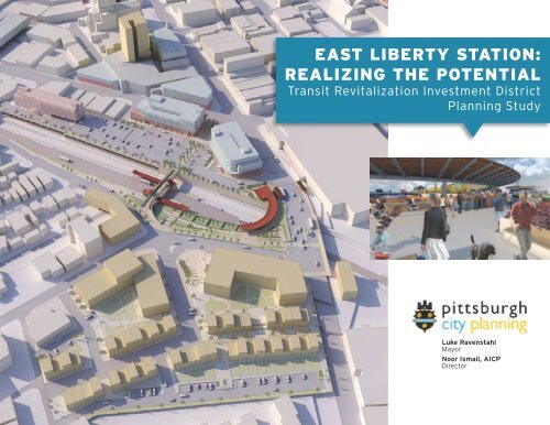
east liberty station: realizing the potential - City of Pittsburgh
east liberty station: realizing the potential - City of Pittsburgh
east liberty station: realizing the potential - City of Pittsburgh

You also want an ePaper? Increase the reach of your titles
YUMPU automatically turns print PDFs into web optimized ePapers that Google loves.
EAST LIBERTY STATION:<br />
REALIZING THE POTENTIAL<br />
Transit Revitalization Investment District<br />
Planning Study<br />
Luke Ravenstahl<br />
Mayor<br />
Noor Ismail, AICP<br />
Director<br />
November 2011
T LIBERTY STATION:<br />
Acknowledgement<br />
s<br />
Steering Committee<br />
Project Team<br />
Luke Ravenstahl - Mayor, <strong>City</strong> <strong>of</strong> <strong>Pittsburgh</strong> Patrick Roberts – DCP Project Manager GSP Consulting<br />
Joy Abbott – DCP Assistant Director Noor Ismail, AICP - Director <strong>of</strong> <strong>City</strong> Planning with Studio for Spatial Practice<br />
Ricky Burgess - <strong>Pittsburgh</strong> <strong>City</strong> Council Shelly Martz – DCP Neighborhood Planner Fitzgerald & Halliday<br />
Bill Peduto - <strong>Pittsburgh</strong> <strong>City</strong> Council Susheela Nemani-Stanger – URA Civil & Environmental Consultants<br />
Patrick Dowd - <strong>Pittsburgh</strong> <strong>City</strong> Council Rebecca Davidson Wagner – URA Urban Redevelopment Authority<br />
Joseph Preston, Jr. - State Representative Rebecca Schenck – URA<br />
Ronald Joseph – <strong>Pittsburgh</strong> Public Maurice Strul – ACED<br />
School District Lynn Heckman – ACED<br />
Rob Stephany - Director <strong>of</strong> <strong>Pittsburgh</strong> Urban Ryan Chismark – ACED<br />
Redevelopment Authority David Wohlwill – PAAC<br />
Denny Puko – PA DCED<br />
<strong>City</strong> <strong>of</strong> <strong>Pittsburgh</strong> Dave Totten – SPC<br />
Pennsylvania Department <strong>of</strong> Community & Chris Sandvig – PCRG<br />
Economic Development Nathan Wildfire – ELDI<br />
East Liberty Development Incorporated Nathan Cunningham – ELDI<br />
Mosites Company Skip Schwab – ELDI<br />
Mark Minnerly – Mosites Company<br />
REALIZING THE POTENT<br />
Transit Revitalization Investment District<br />
Planning Study
Table <strong>of</strong> Contents<br />
EXECUTIVE SUMMARY<br />
4<br />
TRID RECOMMENDATIONS<br />
60<br />
PROCESS<br />
11<br />
Applying <strong>the</strong> TOD Principles to East Liberty<br />
Recommended Infrastructure Improvements<br />
61<br />
63<br />
TOD PRINCIPALS & BEST PRACTICES<br />
Understanding TOD<br />
13<br />
14<br />
East Liberty Station Improvements<br />
Shady & Penn Intersection Reconfiguration<br />
66<br />
76<br />
Seven TOD Principles<br />
16<br />
Shady & Penn Bicycle Lanes & Road Diet<br />
80<br />
TOD Case Studies<br />
19<br />
Implementing Previously Identified Infrastructure<br />
Improvements<br />
81<br />
ANALYSIS<br />
Demographic Pr<strong>of</strong>ile<br />
Classifying East Liberty Station<br />
East Liberty Station & TOD<br />
Transportation Analysis<br />
Land Use Analysis<br />
25<br />
26<br />
28<br />
34<br />
40<br />
43<br />
TOD Site Improvement Needs<br />
Station Area Development Vision<br />
The Proposed TRID Boundary<br />
Financing TOD<br />
TRID Background<br />
elTRID Value Capture Strategy<br />
83<br />
84<br />
89<br />
95<br />
96<br />
97<br />
Zoning Analysis<br />
46<br />
elTRID Management Entity<br />
103<br />
East Liberty Planning Context<br />
47<br />
Real Estate Market Overview and Current Business Climate<br />
53<br />
APPENDIX<br />
Market Conditions<br />
56
4<br />
EXECUTIVE SUMMARY<br />
The <strong>City</strong> <strong>of</strong> <strong>Pittsburgh</strong> neighborhood<br />
<strong>of</strong> East Liberty was <strong>the</strong> third largest<br />
commercial district in <strong>the</strong> state <strong>of</strong><br />
Pennsylvania in <strong>the</strong> 1950’s with more than<br />
500 local businesses and a population<br />
<strong>of</strong> 14,000. As <strong>the</strong> automobile became<br />
<strong>the</strong> dominant mode <strong>of</strong> transportation,<br />
congestion increased. Residential and<br />
commercial shifts to <strong>the</strong> ‘car-friendly’<br />
suburbs in <strong>the</strong> following decades resulted<br />
in disastrous social and economic downturn<br />
that destroyed <strong>the</strong> urban fabric.<br />
Urban renewal schemes were devised<br />
to stop <strong>the</strong> flight. Penn Avenue was<br />
reconstructed as car friendly loop around<br />
<strong>the</strong> neighborhood with vast surface parking<br />
lots for a “mall” atmosphere in an effort to<br />
compete with suburban retail experience.<br />
When building this “circle”, many small<br />
businesses were closed and torn down.<br />
Development oriented to <strong>the</strong> use <strong>of</strong> <strong>the</strong><br />
automobile came at <strong>the</strong> expense <strong>of</strong> mass<br />
transit and pedestrian activity.<br />
Three large housing complexes were<br />
constructed to make up for <strong>the</strong> destruction <strong>of</strong><br />
<strong>the</strong> homes that were removed when creating<br />
Penn Circle. Though well intentioned, both<br />
contributed heavily to <strong>the</strong> decline <strong>of</strong> <strong>the</strong><br />
once vibrant community. For decades, East<br />
Liberty was characterized by thousands <strong>of</strong><br />
mostly vacant high rise housing units flanking<br />
a decaying business district. The areas<br />
lost more than one million square feet <strong>of</strong><br />
commercial space and half its population by<br />
1980. Blight spread and crime rates soared.<br />
East Liberty is now experiencing a longdelayed<br />
rebirth as a commercial hub that<br />
will be centered around direct access to <strong>the</strong><br />
Port Authority <strong>of</strong> Allegheny County (PAAC)<br />
Bus Rapid Transit (BRT) Corridor (known as<br />
<strong>the</strong> Martin Lu<strong>the</strong>r King, Jr. East Busway).<br />
To be successful in <strong>the</strong> 21st century and<br />
capitalize on redevelopment opportunities,<br />
<strong>the</strong> area requires a more robust pedestrian,<br />
bike and mass transit infrastructure. This<br />
strategy for reviving historical urban<br />
commercial districts through multimodal<br />
improvements can be a model not only for<br />
<strong>Pittsburgh</strong>, but for communities throughout<br />
Pennsylvania.<br />
East Liberty Station and <strong>the</strong> surrounding district today<br />
East Liberty is uniquely positioned to<br />
leverage <strong>the</strong> PAAC transit network,<br />
especially <strong>the</strong> East Busway. Through a<br />
partnership with <strong>the</strong> PAAC, Southwestern<br />
Pennsylvania Commission (SPC), Allegheny<br />
County, <strong>Pittsburgh</strong> Public School<br />
District, Urban Redevelopment Authority<br />
(URA), East Liberty Development Inc.<br />
(ELDI), various community development<br />
organizations and <strong>the</strong> private development<br />
community, <strong>the</strong> <strong>City</strong> <strong>of</strong> <strong>Pittsburgh</strong> is<br />
collaboratively building a sustainable<br />
strategy to continue revitalization <strong>of</strong> this<br />
transition neighborhood. Coordination <strong>of</strong><br />
transportation and land use through <strong>the</strong><br />
East Liberty TRID Study | <strong>Pittsburgh</strong> Department <strong>of</strong> <strong>City</strong> Planning
promotion <strong>of</strong> transit oriented development<br />
represents a key component <strong>of</strong> <strong>the</strong> <strong>City</strong>’s<br />
strategy.<br />
The East Liberty Transit Revitalization<br />
Investment District (elTRID) planning study<br />
examines <strong>the</strong> transportation, infrastructure<br />
and development scenarios in <strong>the</strong> vicinity <strong>of</strong><br />
<strong>the</strong> PAAC East Busway <strong>station</strong> in East<br />
Liberty. Building on existing development<br />
and infrastructure planning, elTRID refines<br />
existing proposals to maximize walkability,<br />
transit service, smart mobility and transit<br />
oriented development (TOD) <strong>potential</strong><br />
following “Livable Communities’ principles.<br />
elTRID examines <strong>the</strong> feasibility <strong>of</strong> creating a<br />
value capture boundary within <strong>the</strong> study<br />
area to facilitate <strong>the</strong>se opportunities. This<br />
new revitalization strategy will continue<br />
implementation <strong>of</strong> large-scale<br />
redevelopment projects while also fostering<br />
organic smaller-scale growth.<br />
5<br />
The major goals <strong>of</strong> <strong>the</strong> elTRID are to:<br />
• Combine <strong>the</strong> existing market<br />
analysis, infrastructure needs, and<br />
<strong>station</strong>/site development concepts to tell<br />
<strong>the</strong> complete story.<br />
• Refine <strong>the</strong> integration <strong>of</strong> <strong>station</strong> and<br />
site development with <strong>the</strong> surrounding<br />
neighborhoods to reconnect East Liberty<br />
and Shadyside through <strong>the</strong> application <strong>of</strong><br />
Livable Communities Principles.<br />
• Work with <strong>the</strong> communities and<br />
taxing bodies to determine if <strong>the</strong><br />
establishment <strong>of</strong> a TRID is acceptable<br />
and what area it should include based on<br />
<strong>the</strong> study results and <strong>potential</strong> development<br />
scenarios.<br />
• Identify <strong>the</strong> most pressing<br />
infrastructure needs to support <strong>the</strong> Eastern<br />
Gateway Project within <strong>the</strong> East Liberty<br />
business district.<br />
In <strong>the</strong> late 1990s, East Liberty saw its first<br />
spurt <strong>of</strong> commercial revitalization with <strong>the</strong><br />
construction <strong>of</strong> a new Home Depot retail<br />
store on <strong>the</strong> site <strong>of</strong> a failed Sears. Whole<br />
Foods Market soon followed on an<br />
abandoned stretch <strong>of</strong> Center Avenue during<br />
<strong>the</strong> first phase <strong>of</strong> <strong>the</strong> Eastside project by <strong>the</strong><br />
The proposed <strong>station</strong> design and integrated Eastside III Development<br />
Mosites Company. Several building<br />
within <strong>the</strong> central business district were<br />
rehabilitated with a mix <strong>of</strong> <strong>of</strong>fices above<br />
ground floor commercial space.<br />
Fur<strong>the</strong>r, <strong>the</strong> restaurant and<br />
entertainment district along South<br />
Highland Avenue in Shadyside started<br />
to expand across into <strong>the</strong> East Liberty<br />
core. Additional retail and<br />
entertainment space was added<br />
through <strong>the</strong> completion <strong>of</strong> <strong>the</strong> $32.5<br />
million 2 nd phases <strong>of</strong> Eastside by<br />
Mosites adjacent to <strong>the</strong> Whole Foods.<br />
Mosites continued <strong>the</strong>ir efforts with<br />
development <strong>of</strong> a Target Department
The market demand had only recently<br />
picked up.<br />
6<br />
store on Penn Avenue which recently<br />
opened in <strong>the</strong> summer <strong>of</strong> 2011.<br />
Redevelopment <strong>of</strong> <strong>the</strong> former Nabisco<br />
bakery on Penn Avenue into <strong>the</strong> mixeduse<br />
Bakery Square continued this<br />
momentum. New higher quality mixedincome<br />
rental and affordable housing<br />
projects commenced alongside <strong>the</strong><br />
commercial revitalization led by <strong>the</strong><br />
efforts <strong>of</strong> ELDI, <strong>the</strong> URS and The<br />
Community Builders. In a little over a<br />
decade, 1,400 public housing units<br />
within three high rise structures –<br />
Liberty Park, East Mall Tower and Penn<br />
Major TOD development opportunities in relation to <strong>the</strong> redesigned <strong>station</strong><br />
Circle Apartments – have been<br />
replaced with 450 new mixed-income<br />
units. While many affordable housing<br />
units were created by 2010, much <strong>of</strong><br />
this new development only included<br />
small amounts <strong>of</strong> market rate/affordable<br />
market rate rentals. Especially limited<br />
are new single family detached units.<br />
Within each core residential area <strong>of</strong><br />
each neighborhood, over 30% <strong>of</strong> <strong>the</strong><br />
housing stock was built before 1940.<br />
The focus on rental housing in East<br />
Liberty has somewhat detracted from<br />
<strong>the</strong> development <strong>of</strong> for-sale units where<br />
In an attempt to continue <strong>the</strong><br />
momentum <strong>of</strong> significant renewal<br />
efforts within <strong>the</strong> study area, <strong>the</strong><br />
latest planning strategy focuses on<br />
TOD as <strong>the</strong> preferred alternative to<br />
reverse decades <strong>of</strong> auto dependent<br />
development. TOD is a method for<br />
organizing relatively compact, high<br />
density mixed-use development<br />
around transit as a means <strong>of</strong><br />
encouraging transit use and creating<br />
more efficient and sustainable land<br />
use patterns. More than simply a<br />
project next to a train <strong>station</strong>, it<br />
represents <strong>the</strong> creation <strong>of</strong> a<br />
walkable, active and beautiful place<br />
centered-around transit access at a<br />
human scale. The approach aims to<br />
create healthy, connected<br />
neighborhoods with integration<br />
between <strong>the</strong> <strong>station</strong> and <strong>the</strong><br />
surrounding community.<br />
TOD provided a synergy between<br />
economic, land use, transportation,<br />
environmental, housing and social<br />
equity goals. By facilitating public<br />
transit use, this development type<br />
can reduce dependence on fossil<br />
fuels, lower residents’ transportation<br />
costs, ease congestion, improve<br />
safety, promote walking/health and
and improve environmental quality. It<br />
can also be a catalyst for neighborhood<br />
revitalization through new investments<br />
as residents are better connected to<br />
jobs, commercial activity and services.<br />
Proposed TRID<br />
Boundary & Phasing<br />
Years 1 - 5<br />
Years 5 - 10<br />
Years 10 +<br />
N<br />
Negley<br />
Ave<br />
Penn<br />
Circle<br />
W<br />
Penn Circle N<br />
East Liberty’s renaissance through TOD<br />
will be centered around direct access to<br />
<strong>the</strong> PAAC MLK East Busway. The local<br />
<strong>station</strong> lies at <strong>the</strong> heart <strong>of</strong> <strong>the</strong> elTRID<br />
study area. Both <strong>the</strong> <strong>station</strong> itself and<br />
<strong>the</strong> sites immediately adjacent to it are<br />
prime candidates for TOD. Combined<br />
with o<strong>the</strong>r <strong>potential</strong> sites within a short<br />
walk <strong>of</strong> <strong>the</strong> <strong>station</strong>, tremendous<br />
redevelopment opportunities exist in <strong>the</strong><br />
neighborhood. The elTRID study area is<br />
defined by <strong>the</strong> half-mil radius around <strong>the</strong><br />
<strong>station</strong> platforms and fur<strong>the</strong>r refined to<br />
<strong>the</strong> 5 & 10 minute walking distance as<br />
an even more accurate measure <strong>of</strong> TOD<br />
<strong>potential</strong>. All <strong>of</strong> <strong>the</strong> East Liberty<br />
business district sites within this <strong>station</strong><br />
pedestrian shed, with much <strong>of</strong> it within a<br />
five minute walk from <strong>the</strong> platform. The<br />
ten minute walking-shed extends well<br />
into Shadyside and to <strong>the</strong> edges <strong>of</strong> East<br />
Liberty into Larimer. Connections to<br />
Downtown <strong>Pittsburgh</strong> are provided by<br />
<strong>the</strong> busway with additional strong transit<br />
service to Oakland, <strong>the</strong> city’s university<br />
and medical hub.<br />
Estimated<br />
Assessed Value<br />
Penn<br />
Circle E<br />
Penn Ave<br />
Baum Blvd<br />
Penn Circle S<br />
N<br />
Hi<br />
Sh<br />
ghl<br />
ady<br />
Ellsworth<br />
an<br />
Av<br />
Ave<br />
d<br />
e<br />
Av<br />
e<br />
5 Minute Walk<br />
Marylan<br />
d Ave<br />
10 Minute Walk<br />
Larimer East<br />
Ave Liberty<br />
Blvd<br />
Broad St<br />
MLK East<br />
Busway<br />
Fifth Ave<br />
7<br />
The urban fabric and existing<br />
infrastructure within <strong>the</strong> study area<br />
present major hindrances limiting this<br />
TOD <strong>potential</strong> however. For decades,<br />
<strong>the</strong> area around <strong>the</strong> Busway <strong>station</strong> had<br />
been dominated by large expanses <strong>of</strong><br />
surface parking and infrastructure not<br />
designed for pedestrian comfort. Buried<br />
Incremental Growth<br />
Boundary 1 Base<br />
Boundary 2 Base<br />
Boundary 3 Base<br />
Boundary 3 Base<br />
(w/ boundary 1 removed)<br />
Boundary 3 Base<br />
(w/ boundary 2 removed)
8<br />
in <strong>the</strong> middle <strong>of</strong> <strong>the</strong> middle <strong>of</strong> <strong>the</strong> block<br />
between Highland Avenue and Shady<br />
Avenue, <strong>the</strong> <strong>station</strong> suffers from a lack<br />
<strong>of</strong> connectivity as it is situated a grade<br />
lower than <strong>the</strong> East Liberty business<br />
district. The <strong>station</strong>’s only public street<br />
frontage is along a section <strong>of</strong> Ellsworth<br />
Avenue that had historically not been a<br />
primary entrance point. No active uses<br />
actually face <strong>the</strong> <strong>station</strong> entry and<br />
access from East Liberty is only possible<br />
by crossing pedestrian bridges buried in <strong>the</strong><br />
back <strong>of</strong> <strong>the</strong> adjacent block. Large<br />
blocks and a lack <strong>of</strong> north-south<br />
connections also limit <strong>the</strong> pedestrian<br />
efficiency <strong>of</strong> <strong>the</strong> <strong>station</strong> making for a<br />
smaller 5 & 10 minute walking shed.<br />
O<strong>the</strong>r Existing Conditions with <strong>the</strong> Study<br />
Area:<br />
• Demographic and Market Value<br />
differences between Shadyside<br />
and East Liberty/Larimer<br />
• Approximately $4 million <strong>of</strong><br />
annual property tax revenue<br />
forgone by <strong>the</strong> local taxing<br />
bosied due to exempt properties<br />
(most controlled by <strong>the</strong> <strong>City</strong>,<br />
government authorities and<br />
parking/utilities)<br />
• Over 10% <strong>of</strong> <strong>the</strong> total land area<br />
is currently classified as vacant<br />
• Small development parcels and<br />
a high percentage <strong>of</strong><br />
underutilized land with low<br />
improvement values<br />
The principles <strong>of</strong> TOD are expected<br />
to drive real estate market activity<br />
across all segments. According to<br />
Emerging Trends in Real Estate<br />
2011 Published by <strong>the</strong> Urban Land<br />
Institute, Class A <strong>of</strong>fice buildings in<br />
primary 24-hour markets remain<br />
highly coveted by tenants. Developers<br />
will shift focus more on infill locations<br />
near vibrant downtown cores and<br />
urban districts. The demand for ‘green’<br />
space will only continue to grow as<br />
well. Expansion <strong>of</strong> <strong>the</strong> Oakland<br />
institutions’ toward East Liberty has<br />
been prompted by a shortage <strong>of</strong> Class<br />
A <strong>of</strong>fice space in <strong>the</strong> region’s primary<br />
institutional district.<br />
Twenty-something echo boomers want<br />
to experience more vibrant urban<br />
areas, and <strong>the</strong>ir aging baby boomer<br />
parents look for greater convenience<br />
in downscaled lifestyles. Driving costs<br />
and lost time make outer suburbs less<br />
economical, while <strong>the</strong> big-house and<br />
<strong>of</strong>fice park wave dissipates in a rough<br />
economic climate. To echo <strong>the</strong> popular<br />
<strong>the</strong>ory <strong>of</strong> <strong>the</strong> ‘creative class,’ those<br />
places where educated, energetic,<br />
creative young people want to be,<br />
complete with 24-hour attributes, will<br />
continue to succeed. New commercial<br />
and residential development is<br />
expected to continue over <strong>the</strong> next<br />
decade assuming infrastructure<br />
improvements, such as restoring <strong>the</strong><br />
street grid, allow for transportation<br />
mode shifts and increased density with<br />
a mix <strong>of</strong> uses.<br />
Within <strong>the</strong> study area, <strong>the</strong> current 5<br />
year development pipeline includes<br />
significant projects that will redevelop<br />
sites for a mix <strong>of</strong> new uses including<br />
residential, <strong>of</strong>fice, retail, hotels and<br />
a proposed movie <strong>the</strong>ater. Much <strong>of</strong> this<br />
activity will focus on <strong>the</strong> core <strong>of</strong> East<br />
Liberty’s commercial corridor and <strong>the</strong><br />
area commonly referred to as <strong>the</strong><br />
Eastern Gateway. Although ano<strong>the</strong>r<br />
significant mixed-use development<br />
opportunity exists at <strong>the</strong> former<br />
Reizenstein Middle School across Penn<br />
Avenue from Bakery Square. Many<br />
structures within <strong>the</strong> commercial core<br />
are currently underutilized and poised<br />
for redevelopment. This includes <strong>the</strong><br />
Broad Street Corridor which features<br />
<strong>the</strong> highest number <strong>of</strong> currently vacant<br />
and available properties within <strong>the</strong><br />
study area.<br />
In <strong>the</strong> future, revitalization efforts can<br />
focus on <strong>the</strong> traditional residential<br />
portions <strong>of</strong> <strong>the</strong> neighborhoods <strong>of</strong> East<br />
Liberty and Larimer. At <strong>the</strong> northwest<br />
corner <strong>of</strong> Penn Circle, conceptual plans<br />
call for redevelopment <strong>of</strong> surface<br />
parking lots and abandoned structures<br />
for new residential use including a mix<br />
<strong>of</strong> for sale single family detached<br />
houses and townhomes. Later TOD<br />
redevelopment <strong>potential</strong> exists for<br />
various surface parking lots and several<br />
large suburban style commercial<br />
plazas. Opportunity exists to<br />
reconfigure <strong>the</strong>se sites into more<br />
multimodal development at a pedestrian<br />
scale connected to <strong>the</strong> <strong>station</strong>.<br />
TOTAL POTENTIAL DEVELOPMENT<br />
PROGRAM - $285 million<br />
- 486,630 SF Office
- 163,995 SF Mixed-Use<br />
Commercial<br />
- 45,000 SF Stand Alone<br />
Commercial<br />
- 192 Hotel Rooms<br />
- 5 Screen Movie Theater<br />
- 345 Multi-Family Rental<br />
Units<br />
- 88 Single Family<br />
Detached Units<br />
- 204 Single Family<br />
Attached Units<br />
- 94 Multi-Family For<br />
Sale Units<br />
Infrastructure dominated by<br />
automobile use cannot support<br />
future planned high density urban<br />
development. Mode sharing,<br />
especially increased utilization <strong>of</strong><br />
transit, is necessary to facilitate<br />
<strong>the</strong>se opportunities. The East<br />
Liberty 2010 Community Plan<br />
focused on TOD as <strong>the</strong> preferred<br />
redevelopment strategy as <strong>the</strong>se<br />
challenges are addressed.<br />
Rebuilding <strong>the</strong> <strong>station</strong> and <strong>the</strong><br />
vacant bus transfer area and<br />
creating TOD as a result <strong>of</strong> better<br />
connections, is one <strong>of</strong> <strong>the</strong> major<br />
goals for <strong>the</strong> defined Eastern<br />
Gateway in <strong>the</strong> plan. Continued<br />
investment in infrastructure is key<br />
to fostering TOD <strong>potential</strong> around<br />
<strong>the</strong> <strong>station</strong> and continuing ongoing<br />
revitalization <strong>of</strong> <strong>the</strong> study area.<br />
Urban, mixed-use TOD projects<br />
are overburdened with additional<br />
costs when compared to<br />
competing real estate investments.<br />
These projects entail significantly<br />
more expense than o<strong>the</strong>r suburban or<br />
even infill real estate products. Higher<br />
costs result in TOD facing a difficulty in<br />
competing for investment dollars<br />
versus o<strong>the</strong>r products. This inherent<br />
gap <strong>of</strong>ten requires some type <strong>of</strong><br />
subsidy/inventive to ensure projects<br />
attract private financing and equity<br />
sources. TRID can provide <strong>the</strong> public<br />
financial assistance necessary to<br />
facilitate TOD projects within <strong>the</strong> study<br />
area.<br />
The creation <strong>of</strong> a TRID itself does not<br />
represent a direct source <strong>of</strong> upfront<br />
funding for TOD, transit improvements<br />
or o<strong>the</strong>r public infrastructure. Pursuant<br />
to <strong>the</strong> TRID Act, a coterminous value<br />
capture area shall be simultaneously<br />
created at <strong>the</strong> time a specific TRID<br />
boundary is determined.<br />
Establishment <strong>of</strong> this value capture<br />
boundary allows <strong>the</strong> local taxing<br />
bodies and transit agency to share<br />
incremental tax revenues generated<br />
without in <strong>the</strong> boundary to implement<br />
projects identified in <strong>the</strong> planning<br />
study. Essentially, <strong>the</strong> value capture<br />
area mirrors a 20 year TOD specific<br />
Tax Increment Financing (TIF) District<br />
with revenues dedicated to fund<br />
specific improvements and<br />
maintenance within <strong>the</strong> defined area.<br />
Recommendations<br />
Transportation and Infrastructure<br />
Improvements<br />
Recommended public infrastructure<br />
and transit improvements focus on<br />
application <strong>of</strong> <strong>the</strong> TOD principle within<br />
principles within <strong>the</strong> elTRID study<br />
area. The Busway and East Liberty<br />
<strong>station</strong> are existing transit assets<br />
that must be enhanced as <strong>the</strong> focus<br />
<strong>of</strong> <strong>the</strong> strategy to facilitate TOD.<br />
Areas outside <strong>of</strong> <strong>the</strong> immediate<br />
<strong>station</strong> vicinity should also<br />
incorporate <strong>the</strong>se guidelines to<br />
fur<strong>the</strong>r efforts to recreate a truly<br />
urban setting. Recommendations<br />
focus both on district-wide<br />
improvements and those necessary<br />
for specific <strong>potential</strong> TOD sites.<br />
Investments outlined in this report<br />
are necessary to foster revitalization<br />
led by key TOD opportunities.<br />
Much <strong>of</strong> <strong>the</strong> <strong>potential</strong> development<br />
identified within <strong>the</strong> study area is<br />
dependent on key district-wide<br />
infrastructure that will allow for<br />
increased density. Improvement to<br />
<strong>the</strong> <strong>station</strong> and immediate areas are<br />
a top priority as primary contributors<br />
to <strong>the</strong> recognized goal <strong>of</strong> increased<br />
transit utilization. Significant<br />
improvements to major streets<br />
around <strong>the</strong> <strong>station</strong> will provide for<br />
alternative modes <strong>of</strong> transportation<br />
while still accommodating<br />
automobile use. O<strong>the</strong>r<br />
recommended district-wide<br />
improvements include a coordinated<br />
district-wide parking strategy, public<br />
space and those that enhance o<strong>the</strong>r<br />
key parts <strong>of</strong> <strong>the</strong> road network.<br />
Detailed proposals are provided for<br />
a redesigned <strong>station</strong>, street<br />
reconfiguration options for <strong>the</strong> Penn<br />
and Shady intersection and<br />
recommendations for bicycle<br />
improvements on segments <strong>of</strong> <strong>the</strong>se<br />
9
10<br />
segments <strong>of</strong> <strong>the</strong>se roadways.<br />
Infrastructure investments will be<br />
prioritized by <strong>the</strong>ir ability to<br />
facilitate fur<strong>the</strong>r redevelopment<br />
and benefit multiple users in <strong>the</strong><br />
study area. The strategy would<br />
remain flexible to accommodate<br />
various future scenarios, but<br />
maintain <strong>the</strong> ability to provide<br />
assistance to large scale<br />
redevelopment projects as well<br />
as district-wide improvements.<br />
Fur<strong>the</strong>r planning, engineering and<br />
design related to infrastructure<br />
improvements are expected<br />
beyond <strong>the</strong> recommendations<br />
outlined by elTRID.<br />
elTRID Value Capture Strategy<br />
Implementation<br />
The TRID value capture<br />
mechanism allows for <strong>the</strong><br />
diversion <strong>of</strong> incremental tax<br />
revenues within <strong>the</strong> identified<br />
TRID Boundary as new<br />
development occurs.<br />
Establishment <strong>of</strong> value capture<br />
areas within this boundary allows<br />
for utilization <strong>of</strong> <strong>the</strong>se revenues to<br />
finance public transportation<br />
capital improvements, site<br />
development, o<strong>the</strong>r public<br />
infrastructure and maintenance in<br />
accordance with <strong>the</strong> Act. When<br />
examining <strong>the</strong> <strong>potential</strong> TRID<br />
Boundary, priority was given to<br />
<strong>the</strong> identified 5 and 10 minute<br />
walking sheds that are<br />
recognized as standard distance<br />
<strong>of</strong> TOD activity. These areas<br />
were <strong>the</strong>n compared to <strong>the</strong><br />
current development pipeline and<br />
identified TOD <strong>potential</strong> within <strong>the</strong><br />
study area to develop specific<br />
value capture area boundary<br />
recommendations.<br />
It is recommended <strong>the</strong> specific<br />
value capture areas within <strong>the</strong><br />
TRID boundary be phased to<br />
allow for diversion <strong>of</strong> <strong>the</strong> maximum<br />
amount <strong>of</strong> revenue to<br />
finance identified improvements<br />
and maintenance. Defined value<br />
capture area within <strong>the</strong> TRID<br />
Boundary should be expanded<br />
over time to accommodate<br />
development <strong>potential</strong> over <strong>the</strong><br />
next decade plus. This method<br />
allows for <strong>the</strong> flexibility necessary<br />
in light <strong>of</strong> such uncertainty<br />
surrounding future development<br />
schedules. elTRID’s<br />
recommended comprehensive<br />
value capture strategy addresses<br />
<strong>the</strong> collection <strong>of</strong> revenues and<br />
proposed infrastructure<br />
investments within <strong>the</strong> TRID<br />
Boundary.<br />
The recommended strategy<br />
combines elements <strong>of</strong> <strong>the</strong> project<br />
specific and district-wide<br />
approaches to provide a means<br />
for key investments that will facilitate<br />
TOD within <strong>the</strong> study area. To <strong>the</strong><br />
extent possible, <strong>the</strong> strategy provides<br />
for upfront funding for larger projects<br />
to overcome challenges inherent in<br />
<strong>the</strong>se urban, mixed-use<br />
developments. O<strong>the</strong>r redevelopment<br />
projects will contribute to <strong>the</strong> newly<br />
created elTRID value capture fund<br />
(VC Fund) which will be utilized<br />
primarily to fund district-wide<br />
improvements. A guiding principal <strong>of</strong><br />
<strong>the</strong> strategy will be to incentivize, not<br />
subsidize, TOD and infrastructure<br />
development within <strong>the</strong> study area.<br />
Investments will be prioritized by <strong>the</strong>ir<br />
ability to facilitate fur<strong>the</strong>r<br />
redevelopment. As with <strong>the</strong><br />
boundaries <strong>of</strong> <strong>the</strong> value capture area,<br />
<strong>the</strong> TRID Management Entity would<br />
be responsible for determining project<br />
financing structures and VC Fund<br />
investment priorities across <strong>the</strong><br />
district.<br />
Much <strong>of</strong> <strong>the</strong> <strong>potential</strong> development<br />
within <strong>the</strong> study area is dependent on<br />
key district-wide infrastructure that<br />
will allow for increased density.<br />
Phase value capture area expansion<br />
would respond to local market<br />
conditions and provide <strong>the</strong> greatest<br />
degree <strong>of</strong> flexibility in terms <strong>of</strong><br />
implementing <strong>the</strong> development,<br />
transit and infrastructure<br />
recommendations in this planning<br />
study. Proposed value capture area<br />
expansions are based upon<br />
maximizing <strong>the</strong> <strong>potential</strong> value
capture to fund <strong>the</strong>se<br />
improvements. The recommended<br />
elTRID value capture strategy will<br />
guide investment in project specific<br />
infrastructure, district-wide improvements<br />
and maintenance.<br />
Ultimately, successful TOD requires<br />
good markets, good <strong>station</strong> areas<br />
and excellent coordination between<br />
numerous parties all dedicated to<br />
its success. With all <strong>of</strong> <strong>the</strong>se<br />
ingredients, <strong>the</strong> study area is<br />
uniquely positioned to capitalize on<br />
TOD opportunities. However as<br />
discussed, <strong>the</strong> current infrastructure<br />
and urban fabric remains a<br />
hindrance to dense, mixed-use<br />
development in <strong>the</strong> vicinity <strong>of</strong> East<br />
Liberty <strong>station</strong>. Uncertainty as to<br />
how <strong>the</strong>se improvements will be<br />
financed deters <strong>the</strong> development<br />
community from advancing projects<br />
despite improving market<br />
conditions.<br />
A financial strategy to address <strong>the</strong><br />
site specific and district-wide<br />
impediments to TOD is critical to<br />
unlocking <strong>the</strong> redevelopment<br />
<strong>potential</strong> in <strong>the</strong> elTRID study area.<br />
It is anticipated over $280 million <strong>of</strong><br />
mixed-use and residential<br />
development will occur within <strong>the</strong><br />
TRID Boundary over <strong>the</strong> 30 year<br />
timeframe. This includes known<br />
projects within <strong>the</strong> pipeline as well<br />
as sites that have been identified as<br />
<strong>potential</strong> redevelopment<br />
opportunities. At full build out, this<br />
new development is expected to<br />
create over $230 million <strong>of</strong> total<br />
assessed value.<br />
Approximately $125 million <strong>of</strong><br />
incremental assessed value would<br />
be created by <strong>the</strong> development<br />
program at <strong>the</strong> peak <strong>of</strong> <strong>the</strong> TRID<br />
value capture area. The newly<br />
created value represents a 20%<br />
increase over <strong>the</strong> base assessed<br />
value today. Within <strong>the</strong> half-mile<br />
study area, new incremental value<br />
created in <strong>the</strong> TRID Boundary would<br />
represent an approximately 33%<br />
increase in total assessed value<br />
after all value capture areas<br />
expired. Annual incremental real<br />
property tax revenue <strong>of</strong> $3.8 million<br />
would be generated by this increase<br />
in assessed value during <strong>the</strong> peak.<br />
Approximate $65 million <strong>of</strong><br />
incremental revenues would be<br />
generated by new projects within<br />
<strong>the</strong> TRID Boundary over 30 years<br />
by phasing implementation <strong>of</strong> <strong>the</strong><br />
value capture areas. A portion <strong>of</strong><br />
<strong>the</strong>se new revenues would be<br />
diverted to fund specific project<br />
infrastructure or district wide<br />
improvements as outlined in <strong>the</strong><br />
recommended elTRID<br />
comprehensive value capture<br />
strategy.<br />
Obviously <strong>the</strong> capture <strong>of</strong> TRID<br />
revenues within <strong>the</strong> proposed value<br />
capture areas represents taxes<br />
foregone by <strong>the</strong> local taxing bodies.<br />
Every dollar <strong>of</strong> this public<br />
investment will leverage at l<strong>east</strong><br />
six dollars <strong>of</strong> private investment.<br />
However, significant economic impacts<br />
are expected within <strong>the</strong> study area<br />
following implementation <strong>of</strong> <strong>the</strong> elTRID.<br />
Estimated benefits include private<br />
investment, job creation, retention <strong>of</strong><br />
existing jobs and o<strong>the</strong>r non-real<br />
property or income tax revenues/fees<br />
associated with area wide revitalization<br />
following transportation and<br />
infrastructure improvements.<br />
PROCESS<br />
The elTRID planning study was<br />
undertaken by a multi-disciplinary team<br />
led by GSP Consulting Corp (GSP), a<br />
<strong>Pittsburgh</strong>-based consulting firm that<br />
specializes in economic development<br />
strategies, development finance and<br />
government relations. GSP coordinated<br />
a comprehensive TRID financing<br />
strategy based upon viable market<br />
alternatives and community<br />
assessment. The firm also managed<br />
<strong>the</strong> efforts <strong>of</strong> <strong>the</strong> consultant team and<br />
schedule. Studio for Spatial Practice, a<br />
local architecture, urban design and<br />
planning firm, provided conceptual<br />
designs for planned or <strong>potential</strong> TOD in<br />
conjunction with infrastructure<br />
improvements. They also worked to<br />
facilitate public input into <strong>the</strong> planning<br />
process, including <strong>the</strong> production <strong>of</strong><br />
outreach and training materials.<br />
Fitzgerald & Halliday, Inc assessed<br />
transit, transportation and parking<br />
systems and identified improvements.<br />
Review <strong>of</strong> utility infrastructure was<br />
conducted by Civil and Environmental<br />
Consultants, Inc.<br />
11
12<br />
elTRID commenced in February 2011<br />
as <strong>the</strong> consultant team initiated review<br />
<strong>of</strong> numerous past planning studies<br />
covering <strong>the</strong> study area. Early work<br />
also focused on benchmarking <strong>of</strong><br />
national TOD efforts drawing on <strong>the</strong><br />
Center for Transit Oriented<br />
Development (CTOD), a recognized<br />
research leader and TOD advocate<br />
group. A major component <strong>of</strong> this<br />
portion <strong>of</strong> <strong>the</strong> study was examination <strong>of</strong><br />
<strong>the</strong> CTOD <strong>station</strong> typologies which<br />
provide guidance on TOD<br />
opportunities in relation to <strong>station</strong><br />
location, function and performance.<br />
The consultant team analyzed existing<br />
conditions within <strong>the</strong> study area<br />
including demographics, land use,<br />
zoning, major recent redevelopment<br />
initiatives, local real estate market and<br />
physical characteristics <strong>of</strong> <strong>the</strong> built<br />
environment.<br />
A major goal throughout <strong>the</strong> planning<br />
process was incorporation <strong>of</strong> <strong>the</strong> vision<br />
<strong>of</strong> all local stakeholders, including all<br />
aspects <strong>of</strong> <strong>the</strong> community’s asset<br />
base. These participants in <strong>the</strong><br />
planning process formed <strong>the</strong> elTRID<br />
Steering Committee where elements <strong>of</strong><br />
<strong>the</strong> study methodology, analysis and<br />
strategy were reviewed. Over <strong>the</strong><br />
course <strong>of</strong> elTRID, three separate<br />
committee meetings were held in<br />
addition to o<strong>the</strong>r sessions with<br />
individual parties active in community<br />
development, transit and real estate in<br />
<strong>the</strong> study area. In August 2011, <strong>the</strong><br />
consultant team held a TRID<br />
Community Planning Session in<br />
conjunction with DCP and ELDI.<br />
The event sought to ensure that <strong>the</strong><br />
local residential and business community<br />
were educated about <strong>the</strong> TRID<br />
process and involved in reviewing<br />
preliminary options for <strong>the</strong> preferred<br />
TOD scenarios. During this meeting,<br />
<strong>the</strong> team convened a planning<br />
workshop to ga<strong>the</strong>r public input on<br />
what kinds <strong>of</strong> public improvements<br />
should be considered to improve<br />
mobility in East Liberty and to<br />
encourage TOD around <strong>the</strong> busway<br />
stop. Working in small groups<br />
participants and <strong>the</strong> consultant team<br />
discuss a series <strong>of</strong> questions about <strong>the</strong><br />
future <strong>of</strong> <strong>the</strong> <strong>station</strong> and movement in<br />
general in <strong>the</strong> study area.<br />
East Liberty TOD workshop<br />
As <strong>the</strong> planning process continued,<br />
public comments from <strong>the</strong> session and<br />
feedback from <strong>the</strong> Steering Committee<br />
meetings were incorporated into <strong>the</strong><br />
proposed TOD scenarios and<br />
recommended infrastructure<br />
improvements. The recommended<br />
TRID boundary and value capture area<br />
phases were developed in<br />
consideration <strong>of</strong> development <strong>potential</strong><br />
and necessary infrastructure. Building<br />
upon physical site characteristics,<br />
market analysis and community needs<br />
assessment, <strong>the</strong> comprehensive TRID<br />
value capture strategy was devised to<br />
provide <strong>the</strong> blueprint for revitalizing <strong>the</strong><br />
study area through TOD. The final draft<br />
report was presented to DCP and <strong>the</strong><br />
Steering Committee for comment in<br />
December 2011 and subsequently<br />
updated.
13<br />
1.<br />
TRANSIT ORIENTED DEVELOPMENT<br />
PRINCIPLES & BEST PRACTICES<br />
TOD is a method for organizing relatively<br />
compact, high density mixed-use<br />
development around transit as means <strong>of</strong><br />
encouraging transit use and creating more<br />
efficient and sustainable land use patterns.<br />
It typically consists <strong>of</strong> moderate and<br />
high-density housing, along with a mix <strong>of</strong><br />
complementary public uses, jobs, retail and<br />
services within a half-mile walk from a major<br />
transit stop. There has been tremendous<br />
demand for housing near transit over <strong>the</strong><br />
past decade with an anticipated 9 million<br />
additional households within half-mile <strong>of</strong> a<br />
transit <strong>station</strong> by 2030. 1<br />
More than simply a project next to a<br />
transit <strong>station</strong>, TOD is <strong>the</strong> creation <strong>of</strong><br />
a walkable, active and beautiful place<br />
centered around transit access at human<br />
scale. The approach aims to create healthy,<br />
connected neighborhoods with integration<br />
between <strong>the</strong> <strong>station</strong> and <strong>the</strong> surrounding<br />
community. In many respects, TOD <strong>of</strong>fers<br />
a return to early pre-1950 development<br />
patterns such as urban streetcar suburbs.<br />
Public transportation would be once again<br />
integrated into <strong>the</strong> physical and social<br />
fabric <strong>of</strong> <strong>the</strong> surrounding neighborhood.<br />
1. PolicyLink, Equitable Development Toolkit
14<br />
Understanding TOD<br />
Over <strong>the</strong> last two decades <strong>the</strong> concept<br />
<strong>of</strong> Transit Oriented Development has<br />
advanced from an approach to reforming<br />
suburban development advocated in books<br />
like Peter Calthorpe’s Next American<br />
Metropolis to a much more nuanced<br />
way <strong>of</strong> understanding how landuse<br />
and transportation can be organized in<br />
relation to one ano<strong>the</strong>r to create a more<br />
sustainable, functional and equitable urban<br />
region.<br />
A leader in TOD research is <strong>the</strong> Center<br />
for Transit Oriented Development a<br />
national nonpr<strong>of</strong>it “dedicated to providing<br />
best practices, research and tools to<br />
support market-based transit-oriented<br />
development.” CTOD has advanced <strong>the</strong><br />
concept <strong>of</strong> TOD, providing design and<br />
development principles for transit oriented<br />
development.<br />
Over <strong>the</strong> last fifteen years <strong>the</strong>re have also<br />
been a number <strong>of</strong> conscious attempts<br />
at transit oriented development in both<br />
suburban and urban contexts.<br />
Finally transit operators and planners have<br />
begun to embrace TOD as strategy to build<br />
support to expand transit systems, increase<br />
ridership, and better integrate existing<br />
transit facilities into <strong>the</strong>ir contexts.<br />
Principles and Best Practices: TOD 101 - CTOD<br />
Transit Oriented Development Guidelines - Marta<br />
TOD provides a synergy between<br />
economic, land use, transportation,<br />
environmental, housing and social equity<br />
goals. By facilitating public transit<br />
use, this development type can reduce<br />
dependence on fossil fuels, lower resident’s<br />
transportation costs, ease congestion,<br />
improve safety, promote walking/health<br />
and improve environmental quality. It<br />
can also be a catalyst for neighborhood<br />
revitalization through new investment as<br />
resident’s are better connected to jobs,<br />
commercial activity and services.<br />
Local Benefits:<br />
• Revitalization – especially vacant or<br />
underutilized parcels<br />
• Access to goods, services and<br />
employment<br />
• Reduced transportation costs – 2nd<br />
largest household expense in <strong>the</strong> United<br />
States(30%+ <strong>of</strong> a household’s budget)<br />
• Additional housing options<br />
• Public safety for pedestrians<br />
Regional Benefits:<br />
• Reduced burden on infrastructure<br />
• Reduced air pollution and carbon<br />
emissions<br />
This study draws on all <strong>of</strong> <strong>the</strong>se sources in<br />
considering TOD for East Liberty, looking<br />
to CTOD for principles and best practices,<br />
recent examples <strong>of</strong> TOD guidelines from<br />
Atlanta and three <strong>station</strong> area case studies.<br />
Recent TOD: Del Mar Station - Downtown Pasadena<br />
• Reduced traffic congestion<br />
• Smart growth sprawl reduction<br />
• Improved access to employment<br />
centers<br />
East Liberty TRID Study | <strong>Pittsburgh</strong> Department <strong>of</strong> <strong>City</strong> Planning
TOD Typologies<br />
In recent years CTOD has developed<br />
<strong>the</strong> concept <strong>of</strong> <strong>station</strong> typologies which<br />
classify transit <strong>station</strong>s and development<br />
opportunities according to <strong>the</strong>ir location,<br />
function and more recently performance,<br />
in <strong>the</strong> larger urban region. Classification<br />
strategies tend to rely on measure <strong>of</strong><br />
residential and employment density,<br />
housing to employment ratios and<br />
sometimes vehicle miles traveled (VMT.)<br />
Classification strategies designed to guide<br />
development have tended to focus on<br />
measures <strong>of</strong> land use intensity (residents<br />
and worker in <strong>the</strong> half mile <strong>station</strong> area)<br />
versus land use mix (ratio <strong>of</strong> workers to<br />
residents.) This approach is illustrated in<br />
CTOD’s study <strong>of</strong> Los Angeles shown at left.<br />
This typically is paired with TOD guidelines<br />
for each <strong>station</strong> type. In this study we have<br />
used this methodology to classify East<br />
Liberty in relation to <strong>the</strong> o<strong>the</strong>r stops on<br />
<strong>the</strong> East Busway as means <strong>of</strong> identifying<br />
development targets.<br />
In <strong>the</strong>ir more recent Performance-Based<br />
Transit-Oriented Development Typology<br />
Guidebook a more research oriented<br />
measure is put forward to benchmark and<br />
compare existing <strong>station</strong> areas and how<br />
various metrics compare. The typology is<br />
based on VMT versus a slightly different<br />
measure <strong>of</strong> land use mix calculated as total<br />
workers / workers + residents. This method<br />
allowed CTOD to compare <strong>the</strong> performance<br />
<strong>of</strong> hundreds <strong>of</strong> existing <strong>station</strong> areas across<br />
<strong>the</strong> country to develop normative metrics<br />
for a variety <strong>of</strong> measures.<br />
TOD <strong>station</strong> typology<br />
matrix for Los Angeles<br />
CTOD - Creating<br />
Successful Transit-<br />
Oriented Districts in<br />
Los Angeles, 2010<br />
Normative Metrics for<br />
TOD Station Types<br />
CTOD - Performance-<br />
Based Transit-Oriented<br />
Development Typology<br />
Guidebook, 2010<br />
(residents+workers per half mile)<br />
INTENSITY<br />
200,000<br />
not to scale<br />
45,000<br />
30,000<br />
25,000<br />
0<br />
Vermont/Beverly<br />
HOUSING<br />
Hollywood/Western<br />
Wilshire/Normandie (66,701 persons)<br />
Wilshire/Vermont<br />
Wilshire/Western (50,289 persons)<br />
Westlake/MacArthur Park (46,965 persons)<br />
Vermont/Santa Monica<br />
Hollywood/Highland<br />
(54,775 persons)<br />
Vermont/Sunset<br />
Urban Neighborhood Urban Center CBD/Special District<br />
Hollywood/Vine<br />
Soto<br />
21,000<br />
Avenue 57/Highland Park<br />
San Pedro 23rd Street<br />
Sherman<br />
USC/Expo Park<br />
-30% Indiana Mariachi Plaza<br />
VMT<br />
Roscoe<br />
Reseda<br />
Van Nuys<br />
Laurel Canyon<br />
Vernon<br />
Western<br />
La Brea Slauson<br />
North Hollywood Washington/National<br />
12,000 Vermont<br />
103rd Street<br />
Van Nuys<br />
French/Heritage Square<br />
Imperial<br />
De Soto<br />
Woodman Avenue 26/Lincoln Heights<br />
La Cienga<br />
-30% Avalon Slymar/San Fernando<br />
VMT<br />
Pico Aliso<br />
Harbor Freeway<br />
Northridge<br />
Crenshaw<br />
Chatsworth<br />
Southwest Museum<br />
Sun Valley<br />
7,000<br />
Woodley<br />
Pierce College<br />
Valley College<br />
Cal State LA<br />
5,000<br />
Tampa<br />
Balboa<br />
Transit Neighborhood Mixed Use Center Business District<br />
Sepulveda<br />
Universal <strong>City</strong><br />
0.5 1 1.5 2<br />
MIX (ratio <strong>of</strong> workers to residents)<br />
Grand<br />
Warner Center<br />
Suburban Neighborhood Neighborhood Center Office/Industrial District<br />
Table 4. Normative Metrics<br />
Place Types<br />
Total Intensity<br />
(residents + workers)<br />
Low VMT<br />
Low-Mod<br />
VMT<br />
Canoga<br />
Washington<br />
Nordh<strong>of</strong>f<br />
Pico/Convention Center<br />
(5.6 workers/resident)<br />
Glendale (3.0 workers/resident)<br />
Vermont (3.75 workers/resident)<br />
Aviation<br />
(5.5 workers/resident)<br />
not to scale<br />
3 25<br />
EMPLOYMENT<br />
Performance-Based Transit-Oriented Development Typology Guidebook<br />
Civic Center<br />
(24 workers/resident,<br />
(180,423 persons)<br />
Pershing Square(6.7 workers/resident,<br />
85,244 persons)<br />
Union Station(6.4 workers/resident,<br />
82,674 persons)<br />
Chinatown<br />
(6.3 workers/resident, 7th Street<br />
75,653 presons)<br />
(11.2 workers/resident,<br />
65,972 persons)<br />
Little Tokyo/Arts District<br />
(9.9 workers/resident, 56,107 persons)<br />
Jefferson (3.8 workers/resident)<br />
Residential Places Balanced Places Employment Places<br />
Mod VMT<br />
High-Mod<br />
VMT<br />
High VMT<br />
Low VMT<br />
Low-Mod<br />
VMT<br />
Mod VMT<br />
High-Mod<br />
VMT<br />
High VMT<br />
Low VMT<br />
Low-Mod<br />
VMT<br />
Mod VMT<br />
Blue Line<br />
Expo<br />
Gold<br />
Green<br />
Metrolink<br />
Orange<br />
Subway<br />
High-Mod<br />
VMT<br />
54,216 24,718 12,580 7,708 3,429 64,155 21,763 11,600 6,867 3,242 109,306 34,914 13,009 5,969 2,325<br />
Residents 44,293 20,106 10,229 6,292 2,716 29,875 10,732 5,884 3,695 1,764 12,581 5,103 2,065 1,154 321<br />
Workers 9,923 4,612 2,351 1,416 713 34,280 11,031 5,716 3,172 1,478 96,725 29,811 10,944 4,815 2,004<br />
Workers/Residents 18.3% 19.5% 19.6% 20.3% 19.6% 51.6% 49.7% 48.2% 46.0% 46.2% 86.5% 83.9% 84.2% 83.0% 87.1%<br />
Households 16,214 7,684 3,906 2,253 974 15,466 4,646 2,429 1,467 670 6,828 2,524 861 467 120<br />
Household Size 2.71 2.61 2.62 2.71 2.68 1.95 2.21 2.41 2.43 2.60 1.58 1.67 2.22 2.28 2.64<br />
Gross Density<br />
(units/acre)<br />
Residential Density<br />
(units/acre)<br />
50.0 21.6 10.3 5.7 2.2 48.7 16.4 7.6 4.0 1.9 28.5 10.3 4.6 2.2 0.9<br />
53.2 23.6 12.1 6.7 3.4 55.6 20.9 10.5 5.8 3.5 51.4 20.6 10.8 6.0 2.9<br />
Block Size (acres) 4.2 4.1 5.7 7.7 18.8 3.7 5.8 8.5 9.9 23.7 3.7 6.4 14.2 69.9 86.7<br />
Monthly T Cost $422 $563 $688 $781 $906 $394 $597 $721 $794 $900 $463 $613 $713 $793 $920<br />
Yearly T Cost $5,064 $6,756 $8,256 $9,372 $10,872 $4,728 $7,164 $8,652 $9,528 $10,800 $5,556 $7,356 $8,556 $9,516 $11,040<br />
Average Median<br />
Income (1999)<br />
Travel Time to Work<br />
(minutes)<br />
Employment<br />
Proximity<br />
High VMT<br />
$31,713 $35,643 $41,344 $53,492 $62,06t9 $43,997 $37,364 $43,395 $51,138 $65,544 $41,875 $34,183 $43,935 $40,985 $57,562<br />
35.6 31.4 27.4 25.5 24.7 23.5 22.1 21.4 21.6 22.9 18.0 17.1 18.7 19.0 21.5<br />
233,890 127,448 65,640 42,260 20,788 451,725 152,310 73,393 41,335 27,131 396,277 159,118 99,648 58,747 32,167<br />
Transit Access Index 31 19 13 10 3 56 28 11 9 4 85 45 19 10 4<br />
Autos/Household 0.45 0.82 1.18 1.47 1.71 0.52 0.87 1.22 1.41 1.68 0.48 0.74 1.11 1.18 1.61<br />
Home Journey to<br />
Work Transit<br />
Home Journey to<br />
Work Walk/Bike/<br />
Transit<br />
Workplace Journey<br />
to Work Transit<br />
Workplace Journey<br />
to Work Walk/Bike/<br />
Transit<br />
58% 39% 23% 15% 8% 43% 25% 14% 10% 8% 25% 16% 13% 9% 5%<br />
68% 47% 27% 18% 10% 64% 40% 23% 15% 11% 58% 37% 24% 18% 9%<br />
33% 20% 11% 7% 2% 38% 17% 8% 5% 3% 38% 16% 9% 5% 3%<br />
47% 30% 18% 12% 6% 48% 23% 12% 8% 5% 43% 19% 11% 7% 5%<br />
<br />
15<br />
y
16<br />
Seven Guiding TOD Principles<br />
The following is a list <strong>of</strong> seven key principles<br />
for TOD. In general we are drawing<br />
on and paraphrasing TOD principles generated<br />
by <strong>the</strong> Center For Transit Oriented<br />
Development, but also drawing on o<strong>the</strong>r<br />
sources and recommendations for TOD<br />
best practices.<br />
1. Maximize location efficiency<br />
TOD is based on <strong>the</strong> conscious placement<br />
<strong>of</strong> homes, jobs, civic uses, shopping, entertainment,<br />
parks and o<strong>the</strong>r amenities close<br />
to transit <strong>station</strong>s to promote walking,<br />
biking and transit use. This means that uses<br />
should be balanced relative to <strong>the</strong> <strong>station</strong><br />
type and that land use around <strong>the</strong> <strong>station</strong><br />
should be compact and dense relative to<br />
<strong>the</strong> surrounding community in order to<br />
create opportunities for as many people as<br />
possible to live, work, and shop within walking<br />
distance <strong>of</strong> <strong>the</strong> <strong>station</strong>.<br />
2. Build a mix <strong>of</strong> housing choices<br />
and complimentary uses<br />
TOD should expand housing choices and opportunities<br />
encouraging and allowing more<br />
people to ride transit. New housing should<br />
accommodate a variety <strong>of</strong> household types<br />
at a range <strong>of</strong> price points including long<br />
term strategies for including and maintaining<br />
affordable housing options. Complementary<br />
public uses, jobs, retail and services<br />
should be located in close proximity.<br />
3. Create walkable places for people.<br />
TOD should create beautiful pedestrian<br />
friendly places that integrate transit and<br />
mixed-use development into <strong>the</strong>ir surrounding<br />
context. New buildings, transit<br />
design, and infrastructure improvements<br />
should be organized in ways that reenforce<br />
one ano<strong>the</strong>r in <strong>the</strong> creation <strong>of</strong> a place<br />
where people’s daily needs can be met using<br />
transit and on foot and where people<br />
want to be. High quality public spaces, safe<br />
and active streetscapes, small navigable<br />
blocks, public art, high quality architecture<br />
and development, and <strong>the</strong> innovative use <strong>of</strong><br />
landscape elements are all key elements <strong>of</strong><br />
a successful public realm.<br />
East Liberty TRID Study | <strong>Pittsburgh</strong> Department <strong>of</strong> <strong>City</strong> Planning
4. Maximize <strong>station</strong> connectivity<br />
and visibility.<br />
The <strong>station</strong> should be a key node in <strong>the</strong><br />
public realm and pedestrian network, with<br />
maximum accessibility and visibility from<br />
<strong>the</strong> major street network and surrounding<br />
neighborhood. Station entries should<br />
connect to active pedestrian spaces<br />
which encourage ga<strong>the</strong>ring. Pedestrian<br />
connections to feeder transit routes should<br />
be visible and well-integrated into <strong>the</strong><br />
public space network.<br />
6. Manage parking effectively.<br />
Parking supply and location should reinforce<br />
TOD goals while balancing market<br />
demands. Parking should be shared to <strong>the</strong><br />
degree possible, and park-and-ride provision<br />
should be appropriate to <strong>the</strong> <strong>station</strong><br />
typology, generally decreasing as land use<br />
intensity increases. A parking strategy<br />
should also include bicycle parking, car<br />
pooling priority, and ideally bicycle and car<br />
sharing services.<br />
7. Capture <strong>the</strong> value <strong>of</strong> transit<br />
TOD should capitalize on <strong>the</strong> value <strong>of</strong> transit.<br />
Value capture strategies can include<br />
fiscal policies, including property and sales<br />
taxes, real-estate lease and sales revenues,<br />
farebox revenues, and fees on everything<br />
from parking to business licenses. Value<br />
capture strategies can also include nonfiscal<br />
strategies, including inclusionary<br />
zoning, where <strong>the</strong> value <strong>of</strong> transit access<br />
can induce a market-rate development to<br />
include affordable units, or “in kind” public<br />
improvements such as parks or plazas that<br />
are conditions <strong>of</strong> development. In <strong>the</strong> case<br />
<strong>of</strong> a Transit Reinvestment District, value<br />
capture can be a means to fund necessary<br />
infrastructure improvements, encourage<br />
higher quality development, and ensure<br />
community benefits such as affordable<br />
housing, small business opportunities and<br />
job creation.<br />
17<br />
5. Design streets for all users.<br />
Streets should be designed to safely accommodate<br />
all users including, pedestrians,<br />
bicycles, cars and buses. In close proximity<br />
to transit, priority should be given to accommodating<br />
non-automotive modes when<br />
conflicts arise.
18<br />
TOD in <strong>the</strong> context <strong>of</strong><br />
Livable Communities<br />
1. Provide more transportation<br />
choices.<br />
Develop safe, reliable and economical<br />
transportation choices to decrease<br />
household transportation costs, reduce<br />
our nation’s dependence on foreign oil,<br />
improve air quality, reduce greenhouse gas<br />
emissions and promote public health.<br />
5. Coordinate policies and leverage<br />
investment.<br />
Align federal policies and funding to<br />
remove barriers to collaboration, leverage<br />
funding and increase <strong>the</strong> accountability and<br />
effectiveness <strong>of</strong> all levels <strong>of</strong> government<br />
to plan for future growth, including making<br />
smart energy choices such as locally<br />
generated renewable energy.<br />
TOD is complementary to <strong>the</strong> Livable<br />
Communities Principles defined by <strong>the</strong><br />
Federal interagency Partnership between<br />
HUD, DOT and EPA for Sustainable<br />
Communities established in 2009. The<br />
Livable Communities Principles are<br />
consistent with principles and best<br />
practices for transit oriented development,<br />
emphasizing <strong>the</strong> creation <strong>of</strong> both housing<br />
and employment centers that are efficiently<br />
located and accessible by transit. The<br />
principles also specifically call out walkable<br />
transit oriented development in existing<br />
communities as sustainable and desirable<br />
development pattern for future growth.<br />
The core principles are:<br />
2. Promote equitable, affordable<br />
housing.<br />
Expand location- and energy-efficient<br />
housing choices for people <strong>of</strong> all ages,<br />
incomes, races and ethnicities to increase<br />
mobility and lower <strong>the</strong> combined cost <strong>of</strong><br />
housing and transportation.<br />
3. Enhance economic<br />
competitiveness.<br />
Improve economic competitiveness through<br />
reliable and timely access to employment<br />
centers, educational opportunities, services<br />
and o<strong>the</strong>r basic needs by workers as well as<br />
expanded business access to markets.<br />
4. Support existing communities.<br />
Target federal funding toward existing<br />
communities – through such strategies as<br />
transit-oriented, mixed-use development<br />
and land recycling – to increase community<br />
revitalization, improve <strong>the</strong> efficiency <strong>of</strong><br />
public works investments, and safeguard<br />
rural landscapes.<br />
6. Value communities and<br />
neighborhoods.<br />
Enhance <strong>the</strong> unique characteristics <strong>of</strong> all<br />
communities by investing in healthy, safe<br />
and walkable neighborhoods – rural, urban<br />
or suburban.<br />
In developing TOD and TRID<br />
recommendations for East Liberty <strong>the</strong><br />
Living Communities Principles served as<br />
a guide for developing infrastructure and<br />
development recommendations.<br />
East Liberty TRID Study | <strong>Pittsburgh</strong> Department <strong>of</strong> <strong>City</strong> Planning
Station Case Study:<br />
Del Mar Station - Pasadena, California<br />
Del Mar Station is an example <strong>of</strong> excellent<br />
integration <strong>of</strong> new mixed use development<br />
with an LRT <strong>station</strong> reconstruction project.<br />
The project includes 347 apartments and<br />
20,000 Sf <strong>of</strong> retail around an at grade<br />
light rail <strong>station</strong> situated in <strong>the</strong> middle <strong>of</strong><br />
<strong>the</strong> block. Mid-rise apartment buildings<br />
organized around <strong>the</strong> edges <strong>of</strong> <strong>the</strong> block<br />
form a series <strong>of</strong> public plazas which lead<br />
to <strong>the</strong> <strong>station</strong> platforms. A key attribute <strong>of</strong><br />
<strong>the</strong> project is <strong>the</strong> quality <strong>of</strong> <strong>the</strong> pedestrian<br />
spaces that lead to and include <strong>the</strong> <strong>station</strong>.<br />
Buildings are oriented to both <strong>the</strong> street<br />
and <strong>the</strong> mid-block pedestrian realm. Public<br />
art and high quality landscape treatments<br />
are used to connect <strong>the</strong> <strong>station</strong> to <strong>the</strong><br />
larger public realm.<br />
below right: Google Aerial <strong>of</strong> Del<br />
Mar Station<br />
below: Images <strong>of</strong> Del Mar Station -<br />
Rosenfeld, Daniel Urban Partners<br />
with design by Moule & Polyzoides<br />
Architects and Urbanists<br />
19
20<br />
Station Case Study:<br />
Mocking Bird Station<br />
Dallas, Texas<br />
Mockingbird Station is an example <strong>of</strong> a<br />
successful use <strong>of</strong> TOD to create a new<br />
pedestrian oriented node <strong>of</strong> development<br />
around a transit <strong>station</strong> in an o<strong>the</strong>rwise<br />
automobile oriented environment. The<br />
development includes 211 apartments,<br />
137,000 sf <strong>of</strong> <strong>of</strong>fice space and 178,000 sf<br />
<strong>of</strong> retail space. The project was successful<br />
in bringing new users to <strong>the</strong> Dallas transit<br />
system and in introducing higher density<br />
development adjacent to transit to <strong>the</strong><br />
Dallas region. The <strong>station</strong> is also a good<br />
example <strong>of</strong> using a combination <strong>of</strong> <strong>station</strong><br />
architecture and landscape improvements<br />
to connect a grade separated <strong>station</strong> to its<br />
surrounding urban context.<br />
below right: Google Aerial <strong>of</strong><br />
Mockingbird Station<br />
below: Images <strong>of</strong> Mockingbird Station<br />
- Hughes Development, with design by<br />
RTKL Selzer & Envirodesign<br />
East Liberty TRID Study | <strong>Pittsburgh</strong> Department <strong>of</strong> <strong>City</strong> Planning
Station Case Study:<br />
Hiawatha and Lake Street Station<br />
Minneapolis, Minnesota<br />
Hi-Lake Station is a relatively new <strong>station</strong><br />
on <strong>the</strong> Hiawatha line in Minneapolis.<br />
This <strong>station</strong> was introduced into an<br />
automobile dominated environment<br />
with a mix <strong>of</strong> existing retail, institutional<br />
and residential uses. Although <strong>station</strong><br />
area planning for TOD was in place and<br />
development and investment have occurred<br />
around <strong>the</strong> <strong>station</strong>, a lack <strong>of</strong> coordinated<br />
implementation and investment in <strong>the</strong><br />
surrounding streetscape and pedestrian<br />
realm has limited <strong>the</strong> success <strong>of</strong> this<br />
particular TOD.<br />
Hi-Lake underscores <strong>the</strong> need for coordination<br />
between <strong>station</strong> design, pedestrian and bicycle<br />
infrastructure investment and appropriate<br />
mixed use development.<br />
2001 Hi-Lake TOD plan by Calthorpe<br />
Associates and <strong>the</strong> IBI Group<br />
Below left & right: Google Aerial and<br />
Streetview <strong>of</strong> Hi-Lake today showing<br />
<strong>the</strong> new <strong>station</strong><br />
Below center: Planned and built<br />
condominium developments<br />
adjacent to Hi-lake <strong>station</strong><br />
21
Guidelines Case Study:<br />
Marta Transit Oriented Development Guidelines - Atlanta<br />
22<br />
In recent years <strong>the</strong> Center for Transit Oriented Development has<br />
developed <strong>the</strong> concept <strong>of</strong> TOD typologies which classify transit<br />
<strong>station</strong>s and development opportunities according to <strong>the</strong>ir location<br />
and function in <strong>the</strong> larger urban region. A particularly useful and<br />
sophisticated example <strong>of</strong> TOD guidelines organized by <strong>station</strong><br />
typology is <strong>the</strong> recent set <strong>of</strong> guidelines created for Atlanta by<br />
<strong>the</strong> regional transit operator Marta. The guidelines establish<br />
best practice targets for <strong>station</strong> area development uses, density<br />
and organization. Also included are standards for <strong>station</strong> area<br />
infrastructure including, organization, pedestrian and bicycle<br />
facility provision, complete streets strategies and parking provision<br />
and management. The document also contains a model zoning<br />
overlay district for TOD with density and parking modifications.<br />
The following pages are key excerpts from <strong>the</strong> Marta Guidelines:<br />
East Liberty TRID Study | <strong>Pittsburgh</strong> Department <strong>of</strong> <strong>City</strong> Planning
24<br />
Shady Avenue<br />
East Liberty TRID Study | <strong>Pittsburgh</strong> Department <strong>of</strong> <strong>City</strong> Planning
25<br />
2.<br />
ANALYSIS :<br />
EAST LIBERTY STATION<br />
East Liberty has historically been<br />
one <strong>of</strong> <strong>the</strong> most important mixed use<br />
neighborhoods in <strong>the</strong> <strong>City</strong> <strong>of</strong> <strong>Pittsburgh</strong>.<br />
It also has a long history as a transit<br />
destination and transfer point. The<br />
neighborhood was also <strong>the</strong> site <strong>of</strong> one <strong>of</strong><br />
<strong>Pittsburgh</strong>’s more ambitious and ultimately<br />
unsuccessful urban renew schemes.<br />
Today <strong>the</strong> neighborhood is experiencing<br />
a renaissance reemerging as a retail and<br />
entertainment destination for <strong>the</strong> city’s<br />
East End after a twenty year hiatus.<br />
East Liberty Station sits to one side <strong>of</strong><br />
<strong>the</strong> commercial district, adjacent also<br />
to high density residential sections <strong>of</strong><br />
Shadyside and <strong>the</strong> business district along<br />
Highland Avenue. Both <strong>the</strong> <strong>station</strong> itself<br />
and <strong>the</strong> sites immediately adjacent to it<br />
are prime candidates for transit oriented<br />
development, <strong>of</strong>fering an opportunity to<br />
support <strong>the</strong> ongoing revitalization <strong>of</strong> <strong>the</strong><br />
neighborhood.
26<br />
Population Density along <strong>the</strong> East Busway: 2010 Census<br />
people / acre<br />
1 - 2.5<br />
2.5 - 5<br />
5.1 - 10<br />
10.1 - 15<br />
15.1 - 20<br />
> 20.1<br />
East Liberty Station<br />
Demographic Pr<strong>of</strong>ile Study Area <strong>City</strong> <strong>of</strong> <strong>Pittsburgh</strong><br />
Population 17,754 305,704<br />
% Non-White 51% 34%<br />
Households 8,286 138,739<br />
Employment 8,725 148,197<br />
% Unemployed 15.89% FACT<br />
% < College Degree 53.70% 66.8% (25 yrs +)<br />
Median Household Income $31,544 $35,732<br />
% People Below Poverty Line 26.51% 21.70%<br />
Demographic Pr<strong>of</strong>ile<br />
Approximately 6% <strong>of</strong> <strong>the</strong> <strong>City</strong> population<br />
resides within <strong>the</strong> study area. Household<br />
density per acre is much higher at nearly 21<br />
units per acre compared to less than 5 for<br />
<strong>the</strong> <strong>City</strong> as a whole. The study area is also<br />
characterized by a larger percentage <strong>of</strong><br />
non-white residents than <strong>the</strong> <strong>City</strong> average.<br />
While over 50% <strong>of</strong> people have attained<br />
less than a college degree, this statistic is<br />
better that <strong>the</strong> <strong>City</strong>-wide higher education<br />
figures.<br />
Over 8,700 employed individuals currently<br />
reside within a half mile <strong>of</strong> <strong>the</strong> current East<br />
Liberty Station. According <strong>the</strong> URA Main<br />
Streets market pr<strong>of</strong>ile for <strong>the</strong> Penn Circle<br />
Commercial District (roughly corresponding<br />
to <strong>the</strong> study area), approximately 750<br />
people are employed within this area. The<br />
top neighborhood job categories include:<br />
• Education, health and social services<br />
• Pr<strong>of</strong>essional, scientific, administration<br />
and waste management<br />
• Retail trade<br />
• Arts, entertainment, recreation,<br />
accommodation and food services<br />
However, local unemployment is well<br />
above <strong>the</strong> regional and national averages<br />
at nearly 16%. Within this local population<br />
over a quarter <strong>of</strong> people live below <strong>the</strong><br />
established poverty line. Median household<br />
income is 12% lower than <strong>the</strong> level for <strong>the</strong><br />
entire <strong>City</strong> <strong>of</strong> <strong>Pittsburgh</strong>.<br />
East Liberty TRID Study | <strong>Pittsburgh</strong> Department <strong>of</strong> <strong>City</strong> Planning
It is important to once again note <strong>the</strong><br />
historical differences between <strong>the</strong><br />
communities that comprise <strong>the</strong> study area.<br />
Statistics for affluent Shadyside differ<br />
greatly when compared to areas to <strong>the</strong><br />
north and <strong>east</strong> <strong>of</strong> <strong>the</strong> Busway/rail line. The<br />
neighborhoods <strong>of</strong> East Liberty and Larimer<br />
include 4 census tracts where:<br />
• 80% <strong>of</strong> <strong>the</strong> population has attained less<br />
than a college degree<br />
• unemployment rate is 23%<br />
• median household income is $24,000<br />
• nearly 35% <strong>of</strong> people are below <strong>the</strong><br />
poverty line<br />
Once again, <strong>the</strong> differences between areas<br />
<strong>of</strong> <strong>the</strong> study area to <strong>the</strong> south versus those<br />
to <strong>the</strong> north are highlighted by <strong>the</strong> MVA.<br />
Areas <strong>of</strong> Shadyside rank among <strong>the</strong> highest<br />
market values in <strong>the</strong> <strong>City</strong> with portions<br />
closer to <strong>the</strong> upper midrange. Conversely,<br />
East Liberty and Larimer rank at <strong>the</strong><br />
bottom among <strong>the</strong> poorest markets in <strong>the</strong><br />
<strong>City</strong>. Within <strong>the</strong>se two neighborhoods,<br />
<strong>the</strong> average residential sale price is nearly<br />
$200,000 less than stronger markets with<br />
much higher incidences <strong>of</strong> foreclosure and<br />
Section 8 rental units<br />
Additionally, <strong>the</strong>y rank comparatively low in<br />
<strong>the</strong> neighborhood statistics including: 2<br />
• Code violations<br />
• Vacant residential units<br />
• Condemned properties<br />
• % <strong>of</strong> taxable properties with liens<br />
(including over 2 years)<br />
• Greater population loss after 1950<br />
The need for intervention to prevent<br />
fur<strong>the</strong>r market failure is evident throughout<br />
much <strong>of</strong> <strong>the</strong> study area. Though, <strong>the</strong>se<br />
weaker markets are bounded to <strong>the</strong> north<br />
by ano<strong>the</strong>r strong market in Highland Park<br />
as well.<br />
2. PGHSNAP Neighborhood Pr<strong>of</strong>ile<br />
27<br />
Each <strong>of</strong> <strong>the</strong>se areas is classified as Severely<br />
Distressed by <strong>the</strong> Community Development<br />
Financial Institutions (CDFI) Fund, a division<br />
<strong>of</strong> <strong>the</strong> US Department <strong>of</strong> <strong>the</strong> Treasury.<br />
These figures are comparably less<br />
favorable than <strong>the</strong> entire study area which<br />
contains portions <strong>of</strong> Shadyside.<br />
East Liberty<br />
Larimer<br />
The Market Value Analysis (MVA) is<br />
a statistical tool that uses market<br />
data to classify geographic areas and<br />
produce a map <strong>of</strong> <strong>the</strong> varying market<br />
types within <strong>the</strong> <strong>City</strong>. Market types<br />
are designated according to clustering<br />
similar characteristics, including housing<br />
units, residential, sales prices, vacancy,<br />
percent commercial, new unit permits,<br />
code violations, foreclosures and section<br />
8 rentals. With <strong>the</strong> goal <strong>of</strong> tailoring<br />
investment strategies to <strong>the</strong> conditions<br />
<strong>of</strong> each market area, <strong>the</strong> MVA is a tool to<br />
improve each unique neighborhood.<br />
Shadyside
28<br />
Classifying East Liberty Station<br />
In <strong>the</strong> larger context <strong>of</strong> <strong>the</strong> East Busway<br />
East Liberty can be classified as a Mixed<br />
Use Center, meaning it is a fairly dense<br />
mixed-use urban place with a balance <strong>of</strong><br />
housing and jobs present with in a half-mile<br />
<strong>of</strong> <strong>the</strong> <strong>station</strong>. The majority <strong>of</strong> <strong>station</strong>s on<br />
<strong>the</strong> busway have a mixed use character,<br />
but apart from Negely Station and <strong>the</strong><br />
Downtown terminus East Liberty has <strong>the</strong><br />
highest land use intensity and is <strong>the</strong> most<br />
significant employment center on <strong>the</strong><br />
Busway. Along <strong>the</strong> main stretch <strong>of</strong> <strong>the</strong><br />
Busway only Negely Station is surrounded<br />
by higher density development, with a<br />
larger residential population situated in <strong>the</strong><br />
half-mile transit shed.<br />
The <strong>station</strong> typology classification is<br />
useful because it <strong>of</strong>fers a best practice<br />
development target base line to measure<br />
proposed TOD against as <strong>the</strong> <strong>station</strong> area<br />
is developed in <strong>the</strong> future. As is reflected<br />
in <strong>the</strong> development targets, mixed-use<br />
centers tend to cover a wide range <strong>of</strong><br />
densities, from 25 units/acre all <strong>the</strong><br />
way up to 75 units/acre with residential<br />
development typologies ranging from town<br />
houses to mid-rise apartment and condo<br />
buildings. The development guidelines<br />
also recommend a broad mix <strong>of</strong> uses<br />
from housing and <strong>of</strong>fice to retail, and<br />
institutional uses.<br />
The Station in relation to East <strong>liberty</strong>’s core<br />
East Liberty Station - a grade separated bus rapid transit facility<br />
East Liberty TRID Study | <strong>Pittsburgh</strong> Department <strong>of</strong> <strong>City</strong> Planning
EAST BUSWAY TRANSIT ORIENTED DEVELOPMENT TYPOLOGY<br />
200,000<br />
East Busway Stops Compared:<br />
Downtown<br />
29<br />
45,000<br />
Land Use Intensity (residents & workers per half mile)<br />
35,000<br />
25,000<br />
21,000<br />
12,000<br />
7,000<br />
Urban Neighborhood Urban Center Downtown / Special District<br />
Transit Neighborhood<br />
Hamnett<br />
Roslyn<br />
Low Density Neighborhood<br />
0 0.5 1<br />
1.5 2 3 25<br />
Housing<br />
Swissvale<br />
Negley<br />
Mixed Use Center<br />
Wilkinsburg<br />
Homewood<br />
Herron<br />
East Liberty<br />
Mixed Use Neighborhood<br />
(ratio <strong>of</strong> Workers to Residents)<br />
Business District<br />
Office / Industrial District<br />
Jobs<br />
In relation to <strong>the</strong> o<strong>the</strong>r stops on <strong>the</strong><br />
Busway, Negley <strong>station</strong> is similar with<br />
but has higher housing densities near<br />
<strong>the</strong> <strong>station</strong>. Homewood, Wilkinsburg and<br />
Herron also qualify as mixed use, but<br />
have a lower land use intensity.<br />
Methodology & Data: Center for Transit Oriented Development / U.S. Census Bureau<br />
Population: Census 2000 aggregated from Census 2000 blocks / Jobs: CTOD Database2008 LED Work Area Characteristics<br />
total aggregated from Census 2008 Blocks. Note: East Liberty Station only reflects 2010 census population counts
30<br />
Downtown<br />
6,675 people<br />
48,889 jobs<br />
Negley<br />
12,364 people<br />
8,327 jobs<br />
Homewood<br />
6,403 people<br />
4,270 jobs<br />
Wilkinsburg<br />
7,526 people<br />
3,420 jobs<br />
Herron<br />
5,087 people<br />
2,669 jobs<br />
Seen on <strong>the</strong> map, <strong>the</strong> Busway connects<br />
<strong>the</strong> job center <strong>of</strong> Downtown to a series<br />
<strong>of</strong> mixed use places with East Liberty<br />
at <strong>the</strong>ir center. Beyond Wilkinsburg <strong>the</strong><br />
Busway serves passes through lower<br />
density residential places.<br />
Hamnett<br />
7,992 people<br />
2,391 jobs<br />
Roslyn<br />
6,721 people<br />
2,681 jobs<br />
Downtown<br />
Mixed Use Center<br />
East Liberty<br />
8,062 people<br />
5,802 jobs<br />
Mixed Use Neighborhood<br />
Swissvale<br />
5,420 people<br />
1,134 jobs<br />
Low Density Neighborhood<br />
East Liberty TRID Study | <strong>Pittsburgh</strong> Department <strong>of</strong> <strong>City</strong> Planning
DEVELOPMENT GUIDELINES FOR A MIXED USE CENTER<br />
A survey <strong>of</strong> best practice guidelines for<br />
transit-oriented development recommend<br />
<strong>the</strong> following targets for new development<br />
in a Mixed-Use Center like East Liberty.<br />
These targets are compiled from a variety<br />
<strong>of</strong> sources including CTOD’s <strong>station</strong><br />
typology studies for Denver and Los<br />
Angeles, Marta’s TOD guidelines for Atlanta<br />
and The New Transit Town - Best Practices<br />
in Transit-Oriented Development by Hank<br />
Dittmar and Gloria Ohland.<br />
Targets for 1/4 mile radius area:<br />
Land Uses<br />
Residential Density<br />
FAR<br />
Residential, Retail, Office, Civic &<br />
Entertainment<br />
25 - 75 Units / Acre Gross<br />
3.0 - 10.0 (1.0 Min)<br />
31<br />
Following <strong>the</strong>se guidelines for future<br />
development would suggest increasing<br />
residential development and exploring<br />
higher densities that currently exist around<br />
<strong>the</strong> <strong>station</strong> especially for new residential<br />
development.<br />
Housing Types<br />
Retail<br />
Midrise & Lowrise Multi-family, Townhouses<br />
Over 50,000 sf<br />
Scale & Mix<br />
Transit Function<br />
4 - 15 Stories<br />
Vertical mixed-use desirable<br />
Transit origin and destination<br />
Park-and-ride, if any, is secondary<br />
Rail or BRT interface with multiple<br />
local bus lines
32<br />
EAST LIBERTY<br />
STATION<br />
WALKING-SHED<br />
5 & 10 minute walks from <strong>the</strong><br />
<strong>station</strong> platform, corrected for<br />
actual street patterns<br />
All <strong>of</strong> <strong>the</strong> East Liberty business<br />
district sits within <strong>the</strong> <strong>station</strong><br />
pedestrian shed, with much <strong>of</strong><br />
it within a five minute walk from<br />
<strong>the</strong> platform. The ten minute<br />
walking-shed extends well into<br />
Shadyside and to <strong>the</strong> edges <strong>of</strong><br />
East <strong>liberty</strong> into Larimer. New<br />
development at Bakery Square<br />
sits just within <strong>the</strong> boundary on<br />
<strong>the</strong> <strong>east</strong>ern edge.<br />
The walking shed is made less<br />
efficient because <strong>of</strong> <strong>the</strong> scale<br />
and geometry <strong>of</strong> some <strong>of</strong> <strong>the</strong><br />
blocks around <strong>the</strong> <strong>station</strong>,<br />
especially to <strong>the</strong> <strong>east</strong>. In this<br />
area <strong>the</strong> lack <strong>of</strong> connections<br />
across <strong>the</strong> busway and rail line<br />
also limits <strong>the</strong> geography <strong>of</strong> <strong>the</strong><br />
pedestrian-shed.<br />
East Liberty TRID Study | <strong>Pittsburgh</strong> Department <strong>of</strong> <strong>City</strong> Planning
East Liberty Station & TOD<br />
East Liberty <strong>station</strong> already has many <strong>of</strong><br />
<strong>the</strong> qualities that TOD principles would<br />
recommend. Being situated in a historic<br />
urban neighborhood, <strong>the</strong> <strong>station</strong> area is<br />
already a relatively dense mixed use urban<br />
area with strong pedestrian activity and<br />
multi-modal connections.<br />
33<br />
However, <strong>the</strong> environment around <strong>the</strong><br />
<strong>station</strong> varies radically from one direction<br />
to ano<strong>the</strong>r from tightly knit single family<br />
houses immediately to <strong>the</strong> south and west<br />
to automobile oriented commercial uses<br />
to <strong>the</strong> <strong>east</strong> and some directions reflect<br />
<strong>the</strong> goals <strong>of</strong> transit oriented development<br />
better than o<strong>the</strong>rs.<br />
Since <strong>the</strong> creation <strong>of</strong> <strong>the</strong> Busway <strong>the</strong> area<br />
around <strong>the</strong> <strong>station</strong> has been dominated<br />
by large expanses <strong>of</strong> surface parking and<br />
infrastructure not designed for pedestrian<br />
comfort. The <strong>station</strong> also suffers from<br />
being buried in <strong>the</strong> middle <strong>of</strong> <strong>the</strong> block<br />
between Highland and Shady a grade lower<br />
than that <strong>of</strong> <strong>the</strong> East Liberty business<br />
district. The <strong>station</strong>’s only public street<br />
frontage is along a section <strong>of</strong> Ellsworth<br />
Avenue that has historically not been a<br />
front door. Thus no active uses actually<br />
face <strong>the</strong> <strong>station</strong> entry and access from<br />
East Liberty is only possible by crossing<br />
pedestrian bridges buried in <strong>the</strong> back<br />
<strong>of</strong> <strong>the</strong> block. Large blocks and a lack <strong>of</strong><br />
north-south connections also limits <strong>the</strong><br />
pedestrian efficiency <strong>of</strong> <strong>the</strong> <strong>station</strong> making<br />
for a smaller 5 & 10 minute walking shed.<br />
East Liberty Station
34<br />
East Liberty & <strong>the</strong> TOD principles<br />
As previously stated East Liberty Station<br />
already has many <strong>of</strong> <strong>the</strong> qualities desirable<br />
for TOD, but it also has factors that limit<br />
<strong>the</strong> its current functionality as a TOD and<br />
are barriers to future transit-oriented<br />
development.<br />
3. Create walkable places for people.<br />
Walkability around <strong>the</strong> <strong>station</strong> varies<br />
radically from one edge <strong>of</strong> <strong>the</strong> <strong>station</strong><br />
to ano<strong>the</strong>r. In part this is due to <strong>the</strong><br />
recent reconstruction efforts along Penn<br />
Circle which brought <strong>the</strong> standard <strong>of</strong> <strong>the</strong><br />
pedestrian environment to up to a very<br />
high standard through new streetscape<br />
improvements. The diversity <strong>of</strong> conditions<br />
in visible in <strong>the</strong> diagram on <strong>the</strong> next page<br />
and in <strong>the</strong> images below. The <strong>station</strong> itself<br />
could also be improved in <strong>the</strong> future with<br />
improved landscape, lighting and seating<br />
elements.<br />
1. Maximize location efficiency<br />
The area around <strong>the</strong> <strong>station</strong> is already very<br />
mixed use, providing a range <strong>of</strong> housing<br />
choices and employment opportunities.<br />
It’s location in <strong>the</strong> middle <strong>of</strong> <strong>the</strong> <strong>east</strong><br />
end plateau, means that numerous<br />
neighborhoods flow into direct connections<br />
making it a natural center for <strong>the</strong> <strong>east</strong>ern<br />
end <strong>of</strong> <strong>the</strong> city. Density varies around <strong>the</strong><br />
<strong>station</strong> and in some directions particularly<br />
to <strong>the</strong> <strong>east</strong>, <strong>the</strong>re are opportunities to<br />
increase <strong>the</strong> residential densities which are<br />
well below <strong>the</strong> desirable level for a Mixed-<br />
Use Urban Center <strong>station</strong> in some parts <strong>of</strong><br />
<strong>the</strong> <strong>station</strong> area.<br />
A<br />
New Penn Avenue Streetscape<br />
C<br />
Penn & Shady Intersection<br />
2. Build a mix <strong>of</strong> housing choices<br />
and complimentary uses<br />
C<br />
F<br />
As previously stated <strong>the</strong> land use around<br />
<strong>the</strong> <strong>station</strong> is already quite diverse, however<br />
<strong>the</strong>re are opportunities to increase<br />
housing density and choice in <strong>the</strong> <strong>station</strong><br />
area. Although higher density housing in<br />
<strong>the</strong> form <strong>of</strong> low-income high-rise tower<br />
was recently removed from East Liberty,<br />
looking to mid-rise residential buildings on<br />
some sites to <strong>the</strong> <strong>east</strong> <strong>of</strong> <strong>the</strong> <strong>station</strong> may be<br />
an appropriate future TOD strategy.<br />
The Ellsworth Station entrance<br />
Ellsworth sidewalk ends after <strong>the</strong> <strong>station</strong><br />
East Liberty TRID Study | <strong>Pittsburgh</strong> Department <strong>of</strong> <strong>City</strong> Planning
WALKABILITY ISSUES AROUND THE STATION<br />
35<br />
New Pedestrian Friendly Intersection<br />
New Pedestrian Friendly Intersection<br />
New Crossing & Bus Shelters<br />
A<br />
P<br />
A<br />
Narrow Unfriendly Sidewalk<br />
Target<br />
Bus Stop<br />
Difficult Crossing &<br />
Fast Traffic<br />
Ellsworth Avenue<br />
P<br />
East Liberty Station<br />
C<br />
F<br />
C<br />
Highland Ave<br />
Avenue<br />
F<br />
C<br />
P<br />
F<br />
Bus Stop<br />
Penn<br />
Avenue<br />
Dangerous Pedestrian Crossings<br />
Wide Unfriendly Crossing<br />
Sidewalk Ends - No Crosswalk<br />
Shady Avenue<br />
Difficult Crossing & Fast Traffic<br />
Giant Eagle<br />
Dangerous Pedestrian Crossing<br />
N
36<br />
4. Maximize <strong>station</strong> connectivity<br />
and visibility.<br />
The most public frontages around <strong>the</strong><br />
<strong>station</strong> are currently dominated by a bus<br />
access ramp connecting <strong>the</strong> <strong>station</strong> to a<br />
now unused street level bus plaza. The<br />
entire Penn Avenue and Shady Avenue<br />
edge is defined by <strong>the</strong> busway ramp which<br />
is separated by a gap from <strong>the</strong> bridge<br />
supporting Penn Avenue itself. This public<br />
front door to <strong>the</strong> <strong>station</strong> is show at right.<br />
The sidewalk is channeled between a<br />
concrete barrier and a chain-link fence<br />
which limits <strong>the</strong> visibility <strong>of</strong> <strong>the</strong> actual<br />
<strong>station</strong> platforms along its most public<br />
frontage along both Penn and Shady<br />
F<br />
When <strong>the</strong> <strong>station</strong> was built <strong>the</strong> main access<br />
route from this edge was through a bus<br />
layover and transfer plaza at Penn and Penn<br />
Circle South. This plaza was connected to <strong>the</strong><br />
<strong>station</strong> via a pedestrian bridge. This street<br />
level plaza is no longer in use and in <strong>the</strong><br />
current planning will become a development<br />
site which will put even more pressure on <strong>the</strong><br />
Penn and Shady edge <strong>of</strong> <strong>the</strong> <strong>station</strong> as it’s<br />
main public address in <strong>the</strong> future.<br />
In large part this condition is a result <strong>of</strong> <strong>the</strong><br />
curved busway ramp which sits between<br />
this area and <strong>the</strong> <strong>station</strong> platforms. The<br />
ramp is no longer in use as part <strong>of</strong> Port<br />
Authority’s operations and in currently only<br />
functioning as an emergency vehicle access<br />
route. Providing an alternative emergency<br />
access route would allow <strong>the</strong> ramp to be<br />
repurposed as a key component <strong>of</strong> <strong>the</strong><br />
pedestrian entry sequence for <strong>the</strong> <strong>station</strong>.<br />
The Penn Avenue edge <strong>of</strong> <strong>the</strong> <strong>station</strong> area<br />
One <strong>of</strong> <strong>the</strong> most public frontages <strong>of</strong> <strong>the</strong> <strong>station</strong> at Penn and Shady<br />
East Liberty TRID Study | <strong>Pittsburgh</strong> Department <strong>of</strong> <strong>City</strong> Planning
5. Design streets for all users.<br />
As previously demonstrated <strong>the</strong> area<br />
around <strong>the</strong> <strong>station</strong>, particularly to <strong>the</strong> south<br />
and <strong>east</strong> is designed primarily with automobiles<br />
in mind. Pedestrians have difficulty<br />
navigating key intersections in this zone<br />
including locations with major on-street<br />
bus stops along Penn Avenue.<br />
The bicycle infrastructure connections to<br />
<strong>the</strong> stop also suffer from <strong>the</strong> automobile<br />
oriented streets, again particularly along<br />
Penn avenue to <strong>the</strong> <strong>east</strong>. In recent years<br />
<strong>the</strong> <strong>City</strong> <strong>of</strong> <strong>Pittsburgh</strong> has made great progress<br />
in improving bicycle facilities throughout<br />
<strong>the</strong> city including <strong>the</strong> dedicated bicycle<br />
lanes found along East Liberty Boulevard,<br />
Beechwood Boulevard and in Mellon Park.<br />
There has also been significant progress in<br />
adding shared lane markings and signage<br />
to key on-street routes. However <strong>the</strong>se<br />
existing routes only serve <strong>the</strong> <strong>station</strong> area<br />
well from <strong>the</strong> south western side, approaching<br />
from Shadyside through smaller side<br />
streets.<br />
Key missing links in <strong>the</strong> bicycle infrastructure<br />
exist on <strong>the</strong> section <strong>of</strong> Penn avenue<br />
between Shady and East Liberty Boulevard<br />
and on Shady Avenue between Penn and<br />
Alder Street. The area shown in pink at<br />
right is in need <strong>of</strong> a complete street redesign<br />
to allow more modes <strong>of</strong> transportation<br />
to access <strong>the</strong> most public edge <strong>of</strong> <strong>the</strong> <strong>station</strong><br />
and to support future TOD.<br />
The <strong>station</strong> also lacks effective bicycle<br />
parking with only a single older bicycle rack<br />
that does not meet <strong>the</strong> current city<br />
standard for bicycle parking.<br />
Dedicated Bicycle Lanes<br />
Larimer Ave<br />
Penn Ave<br />
Broad St<br />
No Bicycle Infrastructure<br />
connects to <strong>the</strong> <strong>station</strong><br />
Fifth Ave<br />
East Liberty Station<br />
Alder St<br />
Centre Ave<br />
LARIMER EAST LIBERTY<br />
Collins St<br />
East Liberty Blvd<br />
Highland Ave<br />
Shady Ave<br />
Auto-oriented intersection at Penn and Shady<br />
Penn Circle N<br />
SHADYSIDE<br />
Baum Blvd<br />
Penn Circle W<br />
On-Street Bicycle Routes<br />
Penn Ave<br />
N<br />
Existing bicycle parking at <strong>the</strong> <strong>station</strong><br />
37
38<br />
6. Manage parking effectively.<br />
The parking in <strong>the</strong> <strong>station</strong> area and <strong>the</strong><br />
greater East Liberty business district is a<br />
poorly managed mix <strong>of</strong> public and private<br />
surface lots, limited structure parking<br />
associated with newer developments<br />
and on-street spaces, some <strong>of</strong> which are<br />
regulated by residential permit areas.<br />
Currently <strong>the</strong>re is no dedicated parking for<br />
<strong>the</strong> <strong>station</strong>, although a section <strong>of</strong> <strong>the</strong> Shady<br />
Hill Plaza is signed to allow for <strong>station</strong><br />
parking in what appears to be an effort<br />
to manage a tendency for unintended use<br />
<strong>of</strong> an over-sized parking field next to <strong>the</strong><br />
<strong>station</strong>. Typically for a mixed use <strong>station</strong><br />
park and ride provision is not a major goal,<br />
and parking is instead treated as a shared<br />
resource to support development with<br />
limited if any dedicated transit parking<br />
provided.<br />
Better parking management in <strong>the</strong> district<br />
around <strong>the</strong> <strong>station</strong> is however essential and<br />
much needed. Future parking management<br />
and provision should be oriented towards<br />
managing existing resources more<br />
effectively in a coordinated manner with<br />
better wayfinding and more consistent,<br />
demand driven pricing. As parking supply<br />
is increased to support redevelopment<br />
efforts parking should be developed and<br />
managed as a shared resource to <strong>the</strong><br />
degree possible.<br />
7. Capture <strong>the</strong> value <strong>of</strong> transit<br />
Significant investment and redevelopment<br />
has already occurred around <strong>the</strong><br />
<strong>station</strong> area over <strong>the</strong> last decade. Despite<br />
<strong>the</strong>se successes, fur<strong>the</strong>r investment is<br />
constricted by limited and obsolete public<br />
infrastructure, especially connections to<br />
<strong>the</strong> transit system. A mechanism is need<br />
to capture <strong>the</strong> value <strong>of</strong> transit to reinvest<br />
in <strong>the</strong> <strong>station</strong> itself, and <strong>the</strong> infrastructure<br />
around it in order to facilitate future transit-oriented<br />
development. To date <strong>the</strong> primary<br />
mechanism for this has been through<br />
large-scale project based TIFFs. This study<br />
will explore <strong>the</strong> feasibility and implications<br />
<strong>of</strong> creating a Transit Revitalization Investment<br />
District as a means <strong>of</strong> capturing <strong>the</strong><br />
value <strong>of</strong> transit district wide and reinvesting<br />
in a range <strong>of</strong> infrastructure needs in <strong>the</strong><br />
<strong>station</strong> area, as well as supporting key TOD<br />
projects.<br />
East Liberty TRID Study | <strong>Pittsburgh</strong> Department <strong>of</strong> <strong>City</strong> Planning
The existing <strong>station</strong><br />
39<br />
Looking west<br />
Looking East
40<br />
Transportation Analysis<br />
Issues affecting pedestrian and bicycle<br />
mobility in <strong>the</strong> area immediately around<br />
<strong>the</strong> <strong>station</strong> have already been discussed as<br />
factors that limit <strong>the</strong> effectiveness <strong>of</strong> <strong>the</strong><br />
<strong>station</strong> as driver for TOD.<br />
Despite <strong>the</strong>se limitations <strong>of</strong> <strong>the</strong> <strong>station</strong><br />
area, East Liberty is generally very well<br />
served by a range <strong>of</strong> transportation.<br />
Within <strong>the</strong> study area, resident workers<br />
travel on average 20 minutes to work.<br />
Approximately 73% <strong>of</strong> housing units have<br />
at l<strong>east</strong> one automobile available. Workers<br />
utilize transit, carpooling, cycle and<br />
pedestrian networks to access <strong>the</strong>ir place<br />
<strong>of</strong> employment. Only 46% <strong>of</strong> commuters<br />
travel within a single occupancy vehicle.<br />
Numerous bus routes serve East Liberty.<br />
Popular bus routes include <strong>the</strong> 64A, 71A,<br />
and 81B. The 64A runs through Squirrel<br />
Hill to <strong>the</strong> Homestead Waterfront shopping<br />
area. The 71A runs through Oakland to<br />
<strong>the</strong> Central Business District (Downtown),<br />
while <strong>the</strong> 81B runs from Wilkinsburg to<br />
Downtown through Homewood and <strong>the</strong> Hill<br />
District. The East Liberty <strong>station</strong> on <strong>the</strong><br />
Martin Lu<strong>the</strong>r King Jr. East Busway system<br />
is located at <strong>the</strong> <strong>east</strong>ern end <strong>of</strong> <strong>the</strong> Penn<br />
Avenue business district, and provides<br />
quick and easy access to Downtown and<br />
o<strong>the</strong>r parts <strong>of</strong> <strong>the</strong> East End.<br />
Road Capacity<br />
Along Penn Avenue just <strong>east</strong> <strong>of</strong> Shady<br />
Avenue, traffic is expected to peak at about<br />
1,100 vehicles per hour going westbound<br />
in <strong>the</strong> morning. Eastbound peaks in <strong>the</strong><br />
Primary Street Network<br />
Larimer Ave<br />
Penn Ave<br />
Broad St<br />
Collins St<br />
Fifth Ave<br />
East Liberty Blvd<br />
Highland Ave<br />
Shady Ave<br />
East Liberty Station Penn Circle Conversion<br />
Penn Circle N<br />
SHADYSIDE<br />
Centre Ave<br />
Baum Blvd<br />
LARIMER EAST LIBERTY<br />
Penn Circle W<br />
Penn Ave<br />
N<br />
The intersection <strong>of</strong> Penn and Shady Avenues<br />
East Liberty TRID Study | <strong>Pittsburgh</strong> Department <strong>of</strong> <strong>City</strong> Planning
afternoon with about 1,250 vehicles per<br />
hour. The volumes are likely less than<br />
predicted due to some changes to <strong>the</strong><br />
development program, including projects<br />
like <strong>the</strong> Indigo Hotel which have not yet<br />
been realized. Even assuming <strong>the</strong> high<br />
estimate, a single traffic lane in each<br />
direction should be sufficient to handle<br />
<strong>the</strong> demand. Instead, Penn Avenue <strong>east</strong><br />
<strong>of</strong> Shady Avenue consists <strong>of</strong> two lanes<br />
per direction and <strong>the</strong> approaches to<br />
Shady Avenue are even wider, including a<br />
dedicated high-speed right turn lane from<br />
Penn Avenue to Shady Avenue.<br />
Clearly, <strong>the</strong> need for multi-lane arterials in<br />
East Liberty is dependent on <strong>the</strong> storage<br />
space for vehicles waiting at traffic lights.<br />
Conventional traffic engineering practice<br />
focuses primarily on <strong>the</strong> improvement to<br />
vehicular mobility; however, East Liberty is<br />
a true multi-modal node in <strong>the</strong><br />
transportation network, consisting <strong>of</strong> a highdensity<br />
pedestrian environment, numerous<br />
bicyclists, and serves <strong>the</strong> highest ridership<br />
busway <strong>station</strong> outside <strong>of</strong> Downtown.<br />
If East Liberty is committed to Transit<br />
Oriented Development, and creating an<br />
environment that encourages cooperation<br />
over competition, <strong>the</strong>n it should embrace<br />
<strong>the</strong> notion <strong>of</strong> capacity constraint. This is<br />
explained in <strong>the</strong> following paragraphs.<br />
Continuous optimization <strong>of</strong> traffic signals<br />
and lane configurations at intersections is a<br />
never-ending challenge for communities<br />
fortunate enough to be growing. The<br />
limiting factor in urban arterial road design<br />
is <strong>the</strong> intersection and not <strong>the</strong> number <strong>of</strong><br />
lanes between intersections. Flowing<br />
freely, a single travel lane can carry 1900<br />
vehicles per hour, but when interrupted by<br />
a traffic signal, <strong>the</strong> capacity <strong>of</strong> a lane<br />
typically falls to 600-800 vehicles per hour;<br />
thus it is <strong>the</strong> capacity <strong>of</strong> a road’s major<br />
intersections that dictates <strong>the</strong> number <strong>of</strong><br />
vehicles that can easily be accommodated.<br />
For <strong>the</strong>se reasons, we recommend that<br />
Penn Avenue from Collins Street to East<br />
Liberty Boulevard be reimagined as a<br />
multimodal corridor that places a greater<br />
emphasis on transportation system<br />
capacity over car capacity. Constraining<br />
car-carrying capacity will better utilize <strong>the</strong><br />
overall road network, encourage greater<br />
transit use, improve safety for all users,<br />
prioritize pedestrians and bicyclists, and<br />
provide an attractive environment for future<br />
land development opportunities.<br />
41
EAST LIBERTY<br />
LAND USE<br />
42<br />
Key<br />
Commercial & Industrial<br />
Commercial<br />
Vacant Commercial<br />
Industrial<br />
Residential<br />
Residential<br />
Residential Condominium<br />
Residential Large-scale Rental Apartment<br />
Institutional<br />
Government<br />
Utilities<br />
Source: <strong>City</strong> <strong>of</strong> <strong>Pittsburgh</strong> & Allegheny County<br />
GIS | Studio fSP
Land Use Analysis<br />
Current Annual Property Tax Revenue:<br />
Today East Liberty already has many <strong>of</strong> <strong>the</strong><br />
attributes <strong>of</strong> <strong>the</strong> idealized Mixed Use Center<br />
TOD. The neighborhood contains a broad<br />
mix <strong>of</strong> uses including a variety <strong>of</strong> residential<br />
types and price points, complemented<br />
by main street retail, churches, <strong>of</strong>fice,<br />
industrial and government/school facilities.<br />
However despite this diversity, most <strong>of</strong> <strong>the</strong><br />
activity occurs within segregated areas.<br />
Unlike an idealized Mixed Use Center TOD<br />
East Liberty Station has only lower density<br />
residential use immediately adjacent to <strong>the</strong><br />
primary transit <strong>station</strong> and <strong>the</strong>y are only<br />
found close to <strong>the</strong> <strong>station</strong> to <strong>the</strong> immediate<br />
south. Moving in o<strong>the</strong>r directions <strong>the</strong><br />
adjacent land use is dominated by<br />
automobile oriented commercial uses,<br />
surface parking and <strong>of</strong>fice and retail uses.<br />
The residential density <strong>of</strong> <strong>the</strong> half-mile<br />
radius around <strong>the</strong> <strong>station</strong> varies widely<br />
from block to block with an average <strong>of</strong> only<br />
4.5 across <strong>the</strong> entire study area. While<br />
some block have no housing, o<strong>the</strong>rs have<br />
densities upwards <strong>of</strong> 25 units an acre. The<br />
current residential density pattern is less<br />
than ideal, with entire areas around <strong>the</strong><br />
<strong>station</strong> devoid <strong>of</strong> housing particularly to <strong>the</strong><br />
north and <strong>east</strong> <strong>of</strong> <strong>the</strong> <strong>station</strong>. These areas<br />
tend to be dominated by single use retail<br />
or <strong>of</strong>fice areas as well as large expanses<br />
<strong>of</strong> supporting surface parking. Looking to<br />
<strong>the</strong> future <strong>of</strong> TOD in East Liberty, a more<br />
mixed use pattern <strong>of</strong> development should<br />
be encouraged as should higher density<br />
residential uses particularly in <strong>the</strong> quartermile<br />
radius around <strong>the</strong> <strong>station</strong>.<br />
Gross Residential density<br />
Source: U.S. Census Bureau<br />
Housing Units 2010 Census<br />
Blocks<br />
units / acre 10.1 - 15<br />
< 2.5<br />
2.5 - 5<br />
5.1 - 10<br />
15.1 - 20<br />
20.1 - 25<br />
> 25<br />
Considered in terms <strong>of</strong> property value, <strong>the</strong><br />
half mile radius around <strong>the</strong> East Liberty<br />
Busway <strong>station</strong> comprises 390 acres<br />
currently assessed at approximately $513<br />
million. Within this study area, 33% <strong>of</strong><br />
<strong>the</strong> acreage, currently assessed at $139<br />
million, is tax exempt. This represents<br />
approximately $4 million <strong>of</strong> annual<br />
property tax revenue forgone by <strong>the</strong> local<br />
taxing bodies. The <strong>City</strong>, government<br />
authorities, and parking/utilities control<br />
60% <strong>of</strong> this exempt land area (40% <strong>of</strong><br />
exempt assessed value) with <strong>the</strong> majority<br />
<strong>of</strong> <strong>the</strong> rest utilized for religious purposes.<br />
Current annual property tax revenues <strong>of</strong><br />
approximate $11 million are generated by<br />
taxable properties within <strong>the</strong> study area.<br />
<strong>City</strong> <strong>of</strong> <strong>Pittsburgh</strong> $3,998,717.97<br />
Pgh School District $5,153,903.16<br />
Allegheny County $1,736,480.30<br />
Total $10,889,101.44*<br />
Parcel Sizes Taxable Exempt<br />
< 1 acre 2,139 284<br />
1-2 acres 21 14<br />
2-3 acres 3 2<br />
3+ acres 12 7<br />
Source: Allegheny County Office <strong>of</strong> Property Assessments<br />
*Does not include exempt property including parcels<br />
designated KOZ or within active TIF Districts<br />
The study area contains nearly 2,500 tax<br />
parcels with approximately 90% currently<br />
generating property tax revenue. Less<br />
than 3% <strong>of</strong> <strong>the</strong>se parcels are larger than 1<br />
acre. Of <strong>the</strong>se sizable parcels, only 15 have<br />
been estimated as suitable for development<br />
given <strong>the</strong>ir current status or use. Property<br />
assemblage will be necessary for large<br />
scale redevelopment initiatives.<br />
A ra<strong>the</strong>r high percentage <strong>of</strong> parcels are<br />
currently underutilized. Approximately<br />
15% <strong>of</strong> parcels within <strong>the</strong> study area have<br />
an improvement to land value ratio <strong>of</strong> less<br />
than .95. Much <strong>of</strong> this area is currently<br />
poorly utilized surface parking, or larger<br />
parcels with inefficient development<br />
patterns. Over 10% <strong>of</strong> <strong>the</strong> total land area is<br />
currently classified as vacant.<br />
43
Study Area<br />
<strong>City</strong> <strong>of</strong> <strong>Pittsburgh</strong><br />
44<br />
Total Housing units 11,167 156,165<br />
Single family detached 1,678 73,751<br />
% Single family detached 15.03% 47.23%<br />
% Owner occupied 27.15% 47.6%<br />
% Rental 72.85% 52.4%<br />
Vacant units 1,721 19,948<br />
% Units vacant 15.41% 12.77%<br />
Source: US Census American Community Survey 2005-09;<br />
<strong>City</strong> <strong>of</strong> <strong>Pittsburgh</strong><br />
Taxable Land: Assessed Value<br />
commercial<br />
multi-family residential<br />
single family residential<br />
industrial<br />
o<strong>the</strong>r<br />
Taxable Land: Acres<br />
commercial<br />
multi-family residential<br />
single family residential<br />
industrial<br />
o<strong>the</strong>r<br />
Approximately 75% <strong>of</strong> <strong>the</strong> land area is<br />
currently utilized for owner occupied or<br />
rental residential use. A much higher<br />
percentage <strong>of</strong> rental units exist within<br />
<strong>the</strong> study area as compared to <strong>City</strong>wide<br />
averages due to a concentration <strong>of</strong><br />
subsidized housing. Of <strong>the</strong> 11,000 total<br />
housing units within a half mile <strong>of</strong> <strong>the</strong><br />
transit <strong>station</strong>, over 15% are currently<br />
vacant.<br />
Single family residential use accounts for<br />
approximately half <strong>of</strong> <strong>the</strong> total taxable<br />
assessed value and 40% <strong>of</strong> acreage within<br />
<strong>the</strong> study area. Many <strong>of</strong> those units are<br />
located within <strong>the</strong> heart <strong>of</strong> Shadyside to<br />
<strong>the</strong> south <strong>of</strong> <strong>the</strong> Busway. Portions <strong>of</strong> <strong>the</strong><br />
primary residential area <strong>of</strong> East Liberty<br />
are captured within <strong>the</strong> nor<strong>the</strong>rn boundary<br />
<strong>of</strong> <strong>the</strong> study area. O<strong>the</strong>r pockets <strong>of</strong> single<br />
family residences can be found west <strong>of</strong><br />
Penn Circle to <strong>the</strong> north <strong>of</strong> Baum Boulevard<br />
towards Friendship and to <strong>the</strong> north<strong>east</strong> in<br />
Larimer.<br />
Approximately 20% <strong>of</strong> <strong>the</strong> taxable land<br />
area and assessed value comes from<br />
commercial multi-family properties. As<br />
mentioned, <strong>the</strong> concentration <strong>of</strong> rental<br />
units within <strong>the</strong> study is much higher<br />
than <strong>the</strong> ratio throughout <strong>the</strong> <strong>City</strong>. Multifamily<br />
units appear along much <strong>the</strong><br />
same geographic areas as single family<br />
residences. Though once again, differences<br />
exist between <strong>the</strong> product types in<br />
Shadyside versus East Liberty and Larimer.<br />
A few larger complexes exist within<br />
Shadyside especially along <strong>the</strong> 5th Avenue,<br />
Shady and South Highland corridors. Many<br />
<strong>of</strong> <strong>the</strong> multi-family units however are within<br />
large former owner occupied residences<br />
that have been renovated. Both are<br />
traditionally <strong>of</strong>fered at market rents.<br />
Within <strong>the</strong> historically low income<br />
neighborhoods to <strong>the</strong> north, several large<br />
subsidized housing towers have been<br />
recently demolished. These were replaced<br />
with modern apartment and townhouse<br />
complexes that still cater to low income<br />
residents. Most <strong>of</strong> <strong>the</strong> multi-family<br />
development occurs in larger 25+ unit<br />
structures or larger redevelopment sites as<br />
opposed to smaller renovated residences in<br />
Shadyside.<br />
Commercial retail, <strong>of</strong>fice and mixed-use<br />
parcels comprise <strong>the</strong> majority <strong>of</strong> <strong>the</strong> rest<br />
<strong>of</strong> <strong>the</strong> land use within <strong>the</strong> study area. The<br />
primary commercial corridor runs between<br />
Baum and Center Avenues to <strong>the</strong> West<br />
into <strong>the</strong> Penn Avenue corridor including<br />
<strong>the</strong> central business district within <strong>the</strong><br />
former Penn Mall loop. To <strong>the</strong> south <strong>of</strong> <strong>the</strong><br />
Busway, ancillary commercial areas can be<br />
found along Ellsworth and South Highland<br />
Avenues. A small cluster <strong>of</strong> industrial<br />
buildings is situated behind <strong>the</strong> Busway<br />
in Larimer to <strong>the</strong> <strong>east</strong> <strong>of</strong> East Liberty<br />
Boulevard.
EAST LIBERTY<br />
ZONING<br />
Key<br />
Mixed Use Districts<br />
UNC - urban neighborhood commercial<br />
LNC - local neighborhood commercial<br />
HC - highway commercial<br />
UI - urban Industrial<br />
AP- residential/commercial planned unit development<br />
CP - commercial planned unit development<br />
45<br />
Residential Districts<br />
RM-H - residential multi-family, high density<br />
RM-M - residential multi-family, moderate density<br />
R3-M - residential three-unit, moderate density<br />
R2-H - residential two-unit, high density<br />
R2-L - residential two-unit, low density<br />
R1A-H - residential single-unit attached, high density<br />
RP - residential Planned unit development<br />
PO - parks and open space<br />
Allowable Height & Density for key classifications:<br />
LNC<br />
FAR 2.0 - 3 Stories<br />
FAR 2.0 - 3 Stories<br />
UNC<br />
FAR 3.0 - 3 Stories<br />
FAR 4.0 - 4 Stories (1500’ from <strong>station</strong>)<br />
HC<br />
FAR 2.0 - 5 Stories<br />
FAR 3.0 - 5 Stories (1500’ from <strong>station</strong>)<br />
UI<br />
FAR 3.0 - 4 Stories<br />
FAR 4.0 - 4 Stories (1500’ from <strong>station</strong>)<br />
RM-M<br />
4 Stories<br />
RM-H<br />
9 Stories<br />
Planned Unit district height and intensity is generally<br />
regulated by that <strong>of</strong> <strong>the</strong> adjacent districts.<br />
Source: <strong>City</strong> <strong>of</strong> <strong>Pittsburgh</strong> GIS & Zoning Code |<br />
Studio fSP
46<br />
Zoning Analysis<br />
The zoning around East Liberty <strong>station</strong><br />
reflects <strong>the</strong> diversity <strong>of</strong> uses already<br />
discussed and explains some <strong>of</strong> <strong>the</strong> lower<br />
density land uses found around <strong>the</strong> <strong>station</strong>.<br />
In general <strong>the</strong> zoning is compatible with <strong>the</strong><br />
intent <strong>of</strong> TOD, although some areas would<br />
ultimately benefit from a different and/or<br />
higher intensity zoning classification.<br />
Much <strong>of</strong> <strong>the</strong> land immediately adjacent<br />
to <strong>the</strong> <strong>station</strong> is already zoned for some<br />
form <strong>of</strong> mixed use under <strong>the</strong> Urban and<br />
Local Neighborhood Commercial, Planned<br />
Commercial and Planned Commercial/<br />
Residential categories. These zoning<br />
categories allow for a mix <strong>of</strong> uses<br />
including retail, <strong>of</strong>fice and a range <strong>of</strong><br />
residential types. Of classifications in <strong>the</strong><br />
<strong>Pittsburgh</strong> zoning code, LNC and UNC are<br />
designed to encourage <strong>the</strong> type <strong>of</strong> mixed<br />
use pedestrian oriented development<br />
consistent with TOD principles.<br />
Adjacent to <strong>the</strong> <strong>station</strong> <strong>the</strong>re are also<br />
areas <strong>of</strong> Urban Industrial and Highway<br />
commercial which also allow for a mix<br />
<strong>of</strong> uses including retail, <strong>of</strong>fice, limited<br />
industrial uses and some types <strong>of</strong><br />
multifamily housing. These categories are<br />
less ideal for encouraging TOD, particularly<br />
<strong>the</strong> Highway Commercial category, which<br />
allows automobile oriented development<br />
standards and disallows almost all<br />
residential uses.<br />
The remainder <strong>of</strong> <strong>the</strong> areas around<br />
<strong>the</strong> <strong>station</strong> are zoned exclusively for<br />
residential at a variety <strong>of</strong> densities with<br />
<strong>the</strong> immediately adjacent areas zoned for<br />
multi-family. In general <strong>the</strong> residentially<br />
zoned areas are built out with existing<br />
residential uses ranging from detached<br />
single family houses to apartment buildings<br />
<strong>of</strong> up to 9 stories tall <strong>of</strong>ten at lower<br />
densities than are permitted by right.<br />
In <strong>the</strong> residential area to <strong>the</strong> immediate<br />
south <strong>of</strong> <strong>the</strong> <strong>station</strong> in Shadyside <strong>the</strong>re are<br />
areas <strong>of</strong> higher intensity residential zoning<br />
including RM-M and RM-H. While much<br />
<strong>of</strong> this area is built out with smaller one<br />
and two unit buildings, <strong>the</strong> current zoning<br />
would allow for higher density residential<br />
development around <strong>the</strong> <strong>station</strong> in <strong>the</strong><br />
future.<br />
Mixed-use buildings in <strong>the</strong> Highland Ave LNC district<br />
Single Family Houses in <strong>the</strong> RM-M district<br />
Apartments in <strong>the</strong> RM-M district
Major Studies<br />
A Vision for East Liberty - 1999<br />
Penn Circle Conversion Study - 2001<br />
Streetworks Plan - 2003<br />
Development Guidelines for <strong>the</strong> Center <strong>of</strong><br />
East Liberty - 2004<br />
47<br />
Above: 1999 Community Vision, Above right: 2010 East<br />
Liberty Community Plan<br />
East Liberty Planning Context<br />
East Liberty Development Incorporated<br />
(ELDI) has commissioned and led numerous<br />
community planning studies for <strong>the</strong><br />
neighborhood over <strong>the</strong> last two decades.<br />
This work has included a community vision<br />
plan in 1998 and a plan update in 2010.<br />
In addition to <strong>the</strong> comprehensive vision<br />
plans, numerous sector and project specific<br />
studies have been completed as well as a<br />
vision for green infrastructure and design<br />
guidelines for <strong>the</strong> neighborhood core.<br />
There have also been major studies <strong>of</strong> <strong>the</strong><br />
Penn Avenue corridor and its relationship<br />
to multiple <strong>east</strong> end neighborhoods.<br />
East Liberty Town Square - 2005<br />
Penn Avenue Corridor Plan - 2006<br />
Bakery Row Vision Plan - 2008<br />
East Liberty Green Vision - 2008<br />
Penn Avenue Corridor: Urban Catalogue &<br />
Streetscape Program - 2009<br />
Parking Study - 2009<br />
East Liberty Community Plan - 2010<br />
Larimer Vision Plan - 2010<br />
Transit & TOD<br />
Eastern Corridor Transit Study - 2003<br />
A Toolbox for Transit Oriented<br />
Communities - 2006<br />
Eastside TOD TRID/TIF Analysis - 2008<br />
Connect 09 Transit Development<br />
Plan - 2009<br />
East Liberty Station Development<br />
Strategy - 2011
EAST LIBERTY 2010 COMMUNITY PLAN:<br />
DEVELOPMENT STRATEGY AREAS<br />
48<br />
In <strong>the</strong> 2010 update <strong>of</strong> <strong>the</strong> community<br />
plan ELDI has created goals for<br />
different zones <strong>of</strong> <strong>the</strong> neighborhood.<br />
East Liberty Station sits in <strong>the</strong><br />
Eastern Gateway.<br />
The Eastern Gateway<br />
Source: ELDI 2010 East Liberty Community Master Plan
EAST LIBERTY 2010 COMMUNITY PLAN: EASTERN GATEWAY GOALS<br />
2010 Planning Goals<br />
In <strong>the</strong> 2010 community plan <strong>the</strong><br />
neighborhood was divided into a series <strong>of</strong><br />
geographic areas and distinct goals were<br />
articulated for each area. The <strong>station</strong> and<br />
<strong>the</strong> TOD parcels immediately adjacent to<br />
it are situated in <strong>the</strong> Eastern Gateway. Six<br />
major goals are put forth for <strong>the</strong> Eastern<br />
Gateway, two <strong>of</strong> which have already been<br />
achieved.<br />
Rebuilding <strong>the</strong> <strong>station</strong> and <strong>the</strong> bus loop<br />
and creating transit oriented development<br />
is one <strong>of</strong> <strong>the</strong> major goals for <strong>the</strong> Eastern<br />
Gateway. The o<strong>the</strong>r goals <strong>of</strong> bringing<br />
active uses up to <strong>the</strong> street edge along<br />
Penn and Shady and introducing bicycle<br />
infrastructure should inform <strong>the</strong> redesign<br />
<strong>of</strong> <strong>the</strong> <strong>station</strong> as well as future transit<br />
oriented development around it.<br />
The 2010 plan is informed by multiple<br />
previous planning studies for <strong>the</strong> area<br />
around <strong>the</strong> <strong>station</strong> and was followed by a<br />
study on <strong>the</strong> redevelopment <strong>of</strong> <strong>the</strong> <strong>station</strong><br />
and how it could be integrated into <strong>the</strong><br />
Eastside III & IV development. Key urban<br />
design plans from previous studies are<br />
shown on <strong>the</strong> following pages.<br />
EAST LIBERTY 2010 COMMUNITY PLAN:<br />
EASTERN GATEWAY GOALS<br />
• Develop a plan for <strong>the</strong> Shady Avenue & Penn Avenue<br />
intersection to foster development along <strong>the</strong> street<br />
edge and reposition <strong>the</strong> existing parking.<br />
• Work with existing and new property owners to<br />
encourage community-friendly, active façades with<br />
consistent setbacks along Penn Avenue.<br />
• Redevelop <strong>the</strong> East Liberty busway <strong>station</strong> and bus<br />
loop area to create transit-oriented development with<br />
anchor retail and parking.<br />
• Rebuild infrastructure where Penn Avenue meets Penn<br />
Circle East to restore it to a four point intersection and<br />
create good traffic and pedestrian flow.<br />
• Make accommodations for cycling and include bicycle<br />
parking with new infrastructure projects.<br />
• Develop “landmark” anchor retail on <strong>the</strong> former Penn<br />
Circle high-rise site with an entrance on Penn Avenue.<br />
49<br />
Source: ELDI 2010 East Liberty Community Master Plan
50<br />
Development Guidelines for <strong>the</strong><br />
Center <strong>of</strong> East Liberty - 2004<br />
The 2004 plan by Rothschild Doyno<br />
Architects shows <strong>the</strong> introduction <strong>of</strong> new<br />
mixed use transit-oriented development<br />
along Centre Avenue and at Shady and<br />
Penn. New buildings are shown at Penn<br />
and Centre that redefine and normalize<br />
<strong>the</strong> intersection. The <strong>station</strong> area itself<br />
is reorganized into an upper level transit<br />
plaza with a single major new pedestrian<br />
bridge connecting through <strong>the</strong> block from<br />
Ellsworth to Centre.<br />
Streetworks Plan - 2007<br />
The 2007 Streetworks plan updates <strong>the</strong><br />
vision for development adjacent to <strong>the</strong><br />
<strong>station</strong> reflecting <strong>the</strong> development <strong>of</strong><br />
Eastside II and <strong>the</strong> new Target store. The<br />
plan shows new mixed use buildings with<br />
retail, housing and <strong>of</strong>fice uses, and a<br />
parking garage in <strong>the</strong> blocks to <strong>the</strong> north <strong>of</strong><br />
<strong>the</strong> <strong>station</strong>. A major pedestrian connection<br />
with ground floor retail leads to <strong>the</strong> existing<br />
<strong>east</strong>ern pedestrian bridge <strong>of</strong> <strong>the</strong> <strong>station</strong>.<br />
A bus layover area is provided below <strong>the</strong><br />
parking deck for on-street bus routes.<br />
Bakery Row Vision Plan - 2008<br />
The 2008 plan by Pfaffmann Associates<br />
and Studio for Spatial Practice explores<br />
intensifying development on <strong>the</strong> Shady<br />
Hill Plaza site next to <strong>the</strong> <strong>station</strong>. New<br />
mixed use buildings define <strong>the</strong> street<br />
edge <strong>of</strong> Penn and Shady and include<br />
retail and housing directly adjacent to<br />
<strong>the</strong> <strong>station</strong>. The plan also proposes a<br />
pedestrian plaza at Penn and Shady. Future<br />
development is also envisioned for <strong>the</strong><br />
Penn Avenue corridor including scenarios<br />
for redeveloping Reizenstein school.
51<br />
East Liberty Station Development<br />
Strategy - 2011<br />
The 2011 plan by Urban Design Associates<br />
proposes reconstructing <strong>the</strong> busway<br />
<strong>station</strong> and integrating it into <strong>the</strong><br />
development <strong>of</strong> Eastside III & IV through a<br />
pair <strong>of</strong> pedestrian bridges and a multimodal<br />
parking facility. The <strong>station</strong> remains in<br />
its current location, but is reconstructed<br />
as a partially enclosed transit hall. The<br />
Eastside development includes a mix <strong>of</strong><br />
residential, <strong>of</strong>fice and retail uses with a<br />
major pedestrian connection to Penn and<br />
Centre intersection which is fronted by<br />
retail spaces. The design accommodates<br />
a bus layover space on <strong>the</strong> lower level <strong>of</strong><br />
<strong>the</strong> garage, which has since been deemed<br />
unnecessary for operations.
52<br />
Source: ELDI 2010 East Liberty Community Master Plan
Major Development 1999-2010<br />
1. Whole Foods Market<br />
2. Spinning Plate L<strong>of</strong>ts<br />
3. Tana Ethiopian Cuisine<br />
4. Navarro Design<br />
5. Carnegie Library<br />
6. Werner Building<br />
7. East Side<br />
8. 100 Sheridan Square and Penn Avenue<br />
Shops<br />
9. Liberty Building<br />
10. Penn Highland Building (Star Optical)<br />
11. Kelly-Strayhorn Theater<br />
12. Laughlin Building<br />
13. 5801 Penn Avenue<br />
14. Penn Manor<br />
15. New Pennley Place<br />
16. First Niagara Bank<br />
17. Fairfield Apartments<br />
18. Retail Development<br />
19. Station Street Hot Dog and Sandwich<br />
Shop<br />
20. Trader Joe’s<br />
21. Village <strong>of</strong> Eastside<br />
22. Staples<br />
23. Bakery Square<br />
24. Kingsley Association Community Center<br />
25. Home Depot<br />
26. Scattered Residential Developments<br />
27. Sojourner House MOMS<br />
28. Friendship Academy<br />
Real Estate Market Overview and<br />
Current Business Climate<br />
Commercial: The neighborhood saw its<br />
first spurt <strong>of</strong> commercial revitalization<br />
in <strong>the</strong> late 1990s with <strong>the</strong> construction<br />
<strong>of</strong> a new Home Depot retail store on <strong>the</strong><br />
site <strong>of</strong> a failed Sears. Soon, Whole Foods<br />
Market followed on an abandoned stretch<br />
<strong>of</strong> Center Avenue during <strong>the</strong> first phase<br />
<strong>of</strong> <strong>the</strong> Eastside project by <strong>the</strong> Mosites<br />
Company. Several buildings within <strong>the</strong><br />
central business district were rehabilitated<br />
with a mix <strong>of</strong> <strong>of</strong>fices above ground floor<br />
commercial space. Additionally, <strong>the</strong><br />
restaurant and entertainment district<br />
along South Highland Avenue in Shadyside<br />
started to expand across into <strong>the</strong> East<br />
Liberty core.<br />
Additional retail and entertainment space<br />
was added through <strong>the</strong> completion <strong>of</strong><br />
<strong>the</strong> $32.5 million 2nd phase <strong>of</strong> Eastside<br />
by <strong>the</strong> Mosites adjacent to Whole Foods.<br />
Constructed on an assemblage <strong>of</strong> five<br />
parcels along <strong>the</strong> Busway to <strong>the</strong> South<br />
Highland Avenue bridge, this phase<br />
includes an 85,000 square foot, threestory<br />
multi-building development with a<br />
deck parking structure. Completed in 2007,<br />
<strong>the</strong> project features tenants including<br />
Walgreen’s, TREK Bicycle shop, Wine &<br />
Spirits store, FedEx Office, Starbucks, a<br />
PNC Branch Bank, independent retailers<br />
and several restaurants. Mosites continued<br />
<strong>the</strong>ir efforts with development <strong>of</strong> a Target<br />
Department store on Penn Avenue which<br />
recently opened in <strong>the</strong> summer <strong>of</strong> 2011.<br />
53<br />
Infrastructure Changes<br />
a. One-Way to Two-Way Conversion<br />
b. Bicycle Lanes<br />
Source: ELDI 2010 East Liberty Community Master Plan<br />
Eastside II - Photo: The Design Alliance
54<br />
Around <strong>the</strong> same time as Eastside<br />
opened, <strong>the</strong> former East Liberty Station<br />
development along Penn Avenue<br />
rebranded itself as <strong>the</strong> Village at Eastside.<br />
Revitalization <strong>of</strong> <strong>the</strong> 130,000 square foot<br />
suburban style plaza commenced with<br />
<strong>the</strong> addition <strong>of</strong> <strong>the</strong> <strong>Pittsburgh</strong> areas first<br />
Trader Joe’s discount gourmet grocery<br />
store in 2006. The complex added national<br />
retailers Staples, Tuesday Morning and<br />
Petland soon <strong>the</strong>reafter along with a<br />
host <strong>of</strong> smaller commercial services and<br />
regional retail.<br />
Redevelopment <strong>of</strong> <strong>the</strong> former Nabisco<br />
bakery on Penn Avenue continued this<br />
momentum. Constructed in 1918, Nabisco<br />
vacated <strong>the</strong> facility in <strong>the</strong> late 1990s.<br />
The Regional Industrial Development<br />
Corporation (RIDC) took control and leased<br />
space to <strong>the</strong> Atlantic Baking Company<br />
Bakery Square - Photo: <strong>Pittsburgh</strong> Urban Redevelopment Authority<br />
for several years. It was eventually taken<br />
over by <strong>the</strong> Bake-Line Group who declared<br />
bankruptcy in 2004. RIDC commenced<br />
remediation in 2007 and <strong>the</strong> property<br />
was purchased by Walnut Capital shortly<br />
<strong>the</strong>reafter with plans for redevelopment.<br />
Known as Bakery Square, <strong>the</strong> $150<br />
million LEED Platinum project combined<br />
rehabilitation <strong>of</strong> <strong>the</strong> bakery complex with<br />
new construction. The urban lifestyle<br />
center combines over 200,000 square<br />
feet <strong>of</strong> class A <strong>of</strong>fice space with 160,000<br />
square feet <strong>of</strong> first floor commercial<br />
space, a fitness center and 110 room<br />
Marriot SpringHill Suites. A 900 plus<br />
space parking structure was also provided<br />
with an additional 99 surface spaces. In<br />
2010, Google commenced occupancy with<br />
<strong>the</strong>ir first <strong>of</strong>fice in <strong>the</strong> <strong>Pittsburgh</strong> region.<br />
Various programs <strong>of</strong> <strong>the</strong> University <strong>of</strong><br />
<strong>Pittsburgh</strong> followed along with UPMC’s<br />
Technology Development Center. Major<br />
commercial tenants include Urban Active<br />
Fitness, Anthropologie, Jimmy Johns and<br />
several boutique retailers.<br />
Residential: New higher quality mixedincome<br />
rental and affordable housing<br />
projects commenced alongside <strong>the</strong><br />
commercial revitalization led by <strong>the</strong> efforts<br />
<strong>of</strong> ELDI, <strong>the</strong> URA and The Community<br />
Builders. In a little over a decade, 1,400<br />
public housing units within three high rise<br />
structures - Liberty Park, East Mall Tower<br />
and Penn Circle Apartments - have been<br />
replaced with 450 new mixed-income units.<br />
New Pennley Place, a $23 million, mixedincome<br />
174-unit apartment complex on<br />
Penn Avenue and Broad Street marked<br />
<strong>the</strong> first major housing investment in<br />
<strong>the</strong> troubled neighborhood in more than<br />
a generation. The project redeveloped<br />
a severely distressed, HUD-insured<br />
residential “superblock” created as part<br />
<strong>of</strong> <strong>the</strong> sweeping urban renewal. Phase I<br />
<strong>of</strong> New Pennley Place opened in late 1999<br />
with 102 new and renovated apartment<br />
units in a mid-rise building, townhomes<br />
and duplex style residences. The next two<br />
phases followed in 2001 and 2002 with<br />
additional townhomes and duplexes, as well<br />
as a 38 unit low-rise apartment building for<br />
low income seniors. In total, New Pennley<br />
created 146 units reserved for low and<br />
moderate- income households along with<br />
market rate options.
Complementing New Pennley Place, Penn<br />
Manor Apartments was <strong>the</strong> first housing to<br />
replace <strong>the</strong> former East Mall Apartments<br />
demolished in 2005. Penn Manor features<br />
55 attractive one and two bedroom<br />
apartments, with fully equipped kitchens,<br />
wall-to-wall carpeting, and energy-efficient<br />
heating and cooling systems. Additional<br />
amenities include on-premises laundry,<br />
storage spaces, and community room.<br />
With units leased at both income-based<br />
and market-rate rents, Penn Manor creates<br />
an economically diverse new address and<br />
complements <strong>the</strong> adjacent development<br />
providing a cornerstone <strong>of</strong> quality new<br />
mixed-income rental housing in East<br />
Liberty. The project provided space for 23<br />
former East Mall residents while <strong>the</strong> o<strong>the</strong>r<br />
32 units went from construction completion<br />
to fully leased status within 60 days.<br />
The next wave <strong>of</strong> redevelopment focused<br />
on <strong>the</strong> former Liberty Park high-rise<br />
apartment site at Broad Street and Collins<br />
Avenue. The initial phase <strong>of</strong> <strong>the</strong> $20<br />
million Fairfield mixed-income complex<br />
consisted <strong>of</strong> 124 garden, townhouse and<br />
low units. Over 80 units were reserved for<br />
low income individuals including 48 former<br />
residents <strong>of</strong> Liberty Park Apartments, East<br />
Mall Apartments and Penn Circle Tower<br />
were placed into new apartments. The<br />
development includes a management <strong>of</strong>fice,<br />
community room, fitness room, and three<br />
tot lots. The apartments include individually<br />
controlled heating and air conditioning,<br />
carpeting, fully equipped kitchens, washers<br />
and dryers and digital accessibility among<br />
o<strong>the</strong>r features. An additional $15.7 million<br />
phase, Liberty Park II, broke ground in 2011<br />
and will add ano<strong>the</strong>r 71 units.<br />
Commencing in 2007, Negley Neighbors<br />
brought an additional 49 new low income<br />
rental units to East Liberty. Let by ELDI, <strong>the</strong><br />
$8.3 million scattered site housing initiative<br />
features a combination <strong>of</strong> new construction<br />
and property renovations on Jackson Street,<br />
Mellon Street and North Negley Avenue.<br />
The project <strong>of</strong>fers units with central air<br />
conditioning, digital access, dishwashers,<br />
disposals and mini-blinds. Onsite community<br />
buildings house a management <strong>of</strong>fice,<br />
computer learning lab and community room.<br />
Individual case management, supportive<br />
services and activities are available to<br />
help families achieve stability and prepare<br />
to become homeowners. This additional<br />
New Pennley Place Apartments - Photo: The Community Builders<br />
housing ensures that long-term affordable<br />
housing remains available as East Liberty<br />
and <strong>the</strong> southwest quadrant <strong>of</strong> Highland<br />
Park is revitalized.<br />
More recently, redevelopment <strong>of</strong> <strong>the</strong> East<br />
Mall continued with <strong>the</strong> mixed-use, mixed<br />
income East Liberty Place North. The $12.3<br />
million project provided 54 apartments<br />
above 11,000 square feet <strong>of</strong> retail space.<br />
Amenities in each apartment home include<br />
central heating and air conditioning, plush<br />
carpeting and tile floors, an all electric<br />
kitchen, washer/dryer and some paid<br />
utilities. The building achieved LEED Gold<br />
certification and is <strong>the</strong> region’s first LEED<br />
for HOMES multifamily certified project.<br />
Constructed in scale with <strong>the</strong> Penn Avenue<br />
streetscape, <strong>the</strong> building provides an<br />
anchor to <strong>the</strong> western gateway <strong>of</strong> <strong>the</strong><br />
central business district.<br />
55
56<br />
Market Conditions<br />
Commercial: Early successes <strong>of</strong> Home<br />
Depot and Whole Foods, followed by<br />
Eastside II, proved <strong>the</strong> market <strong>potential</strong><br />
<strong>of</strong> East Liberty. They also contributed<br />
to <strong>the</strong> aforementioned expansion <strong>of</strong> <strong>the</strong><br />
South Highland entertainment district in<br />
conjunction with renovation <strong>of</strong> <strong>the</strong> former<br />
Regent Theater (now <strong>the</strong> called <strong>the</strong> Kelly<br />
Strayhorn). The main street former<br />
pedestrian mall now features several<br />
popular venues including Shadow Lounge,<br />
Spoon, BRGR Kitchen, Abay, Tana and <strong>the</strong><br />
Waffle Shop with several o<strong>the</strong>r eateries<br />
along Penn Circle South as well. This<br />
entertainment district provides evening<br />
vitality for both residents and visitors alike<br />
while providing a key component <strong>of</strong> <strong>the</strong><br />
popular live/work/play dynamic.<br />
Redevelopment efforts helped attract<br />
shoppers from <strong>the</strong> nearby affluent<br />
neighborhoods <strong>of</strong> Shadyside, Friendship<br />
and Highland Park. These three adjoining<br />
communities feature some <strong>of</strong> <strong>the</strong> highest<br />
incomes – over 100,000 people with<br />
household incomes in excess <strong>of</strong> $81,000<br />
a year – in <strong>the</strong> <strong>City</strong>. Continued retail<br />
development within <strong>the</strong> study area,<br />
especially addition <strong>of</strong> <strong>the</strong> Target in 2011,<br />
has expanded <strong>the</strong> trade area even fur<strong>the</strong>r<br />
as more consumers are commuting to <strong>the</strong><br />
area from outside <strong>the</strong> immediate region.<br />
Attraction from national retail tenants<br />
continues.<br />
upon visual inspection, internet searches<br />
and interviews. Over 100 businesses<br />
reside within <strong>the</strong> core. Tenants include<br />
independent small retail businesses,<br />
neighborhood services and bar/<br />
restaurants. Though many cater primarily<br />
to <strong>the</strong> low income segment <strong>of</strong> <strong>the</strong> local<br />
population, especially services such as<br />
rent-to-own and payday check cashing.<br />
Many <strong>of</strong> <strong>the</strong> buildings in <strong>the</strong> core are older<br />
structures with floor plans that do not<br />
accommodate <strong>the</strong> demands <strong>of</strong> modern<br />
retailers. The structures are predominantly<br />
single story, though some multi-story<br />
exist as well. These can <strong>potential</strong>ly<br />
accommodate <strong>of</strong>fice or residential use<br />
above ground floor commercial. Most<br />
buildings have historically suffered<br />
from a lack <strong>of</strong> investment beyond minor<br />
renovations.<br />
O<strong>the</strong>r commercial districts impact <strong>the</strong><br />
market within <strong>the</strong> study area. Besides<br />
South Highland Avenue, <strong>the</strong> Shadyside<br />
retail and restaurant corridors <strong>of</strong> Ellsworth<br />
Avenue and Walnut Street lie to <strong>the</strong><br />
southwest <strong>of</strong> <strong>the</strong> transit <strong>station</strong>. Walnut<br />
Street is home to several national retailers<br />
intermixed with smaller independent<br />
boutiques and restaurants. Additional<br />
entertainment venues exist along Ellsworth<br />
Avenue with more <strong>of</strong> a focus on locally<br />
owned retail and services.<br />
To <strong>the</strong> northwest, <strong>the</strong> Penn Avenue Arts<br />
Initiative (PAAI) focuses on community<br />
development through <strong>the</strong> arts. Led by<br />
Friendship Development Associates and <strong>the</strong><br />
Bloomfield-Garfield Corporation, <strong>the</strong> PAAI<br />
seeks to increase <strong>the</strong> amount <strong>of</strong> artists<br />
living and working along <strong>the</strong> corridor to<br />
<strong>the</strong> west <strong>of</strong> Negley Avenue. This highly<br />
The central business district is relatively<br />
stable with only sporadic vacancy based<br />
Target in relation to <strong>the</strong> core <strong>of</strong> East Liberty - Photo: <strong>Pittsburgh</strong> Urban Redevelopment Authority
successful strategy has converted over<br />
150,000 square feet <strong>of</strong> vacant space for<br />
use as live/work space since <strong>the</strong> late 1990s.<br />
The core <strong>of</strong> East Liberty lies at <strong>the</strong> heart<br />
<strong>of</strong> several successful commercial districts.<br />
Situated at <strong>the</strong> intersection <strong>of</strong> <strong>the</strong> various<br />
galleries along Penn Avenue and <strong>the</strong><br />
entertainment district that has extended<br />
itself across <strong>the</strong> South Highland Avenue<br />
bridge, <strong>the</strong> central business district’s<br />
strategic location provides an opportunity<br />
to capitalize on 24-hour activity. In<br />
addition, <strong>the</strong> influence <strong>of</strong> successful retail<br />
along <strong>the</strong> two o<strong>the</strong>r Shadyside corridors,<br />
Eastside and Bakery Square will continue to<br />
drive demand in <strong>the</strong> study area.<br />
Target in relation to <strong>the</strong> core <strong>of</strong> East Liberty - Photo: <strong>Pittsburgh</strong> Urban Redevelopment Authority<br />
57<br />
Currently, <strong>the</strong> hotel supply is limited to <strong>the</strong><br />
110 rooms within Bakery Square. Nearby<br />
institutions drive much <strong>of</strong> <strong>the</strong> demand<br />
for hotel spaces given <strong>the</strong> lack rooms<br />
throughout <strong>the</strong> greater East End <strong>of</strong> <strong>the</strong><br />
<strong>City</strong>. Additional hotel development can also<br />
be supported by any <strong>potential</strong> new larger<br />
corporate <strong>of</strong>fice tenants within <strong>the</strong> study<br />
area.<br />
Office: The study area is conveniently<br />
located in close proximity to an abundance<br />
<strong>of</strong> educational institutions and o<strong>the</strong>r<br />
medical facilities. More than 350,000<br />
people reside within 5 miles <strong>of</strong> <strong>the</strong><br />
study area and three <strong>of</strong> <strong>the</strong> region’s top<br />
employers are located nearby – UPMC<br />
Hospitals, <strong>the</strong> University <strong>of</strong> <strong>Pittsburgh</strong> and<br />
Carnegie Mellon University. Toge<strong>the</strong>r <strong>the</strong>y<br />
account for 270,000 employees and 41,500<br />
students within a 5 mile radius. Within<br />
<strong>the</strong> central business district, <strong>the</strong> largest<br />
local employer, Novum Pharmaceuticals,<br />
operates a center providing clinical<br />
research, data management, statistical and<br />
reporting services to <strong>the</strong> pharmaceutical<br />
and related industries<br />
According to Emerging Trends in Real<br />
Estate 2011 published by <strong>the</strong> Urban Land<br />
Institute, Class A <strong>of</strong>fice buildings in primary<br />
24-hour markets remain highly coveted by<br />
tenants. Developers will shift focus more<br />
on infill locations near vibrant downtown<br />
cores and urban districts. The demand for<br />
‘green’ space will only continue to grow.<br />
Sustainable building concepts will become<br />
standard in next-generation projects and<br />
that many existing buildings will need<br />
to increase efficiencies and retr<strong>of</strong>it new<br />
systems in order to compete effectively.<br />
The institutions’ expansion toward East<br />
Liberty has been prompted by a shortage<br />
<strong>of</strong> Class A <strong>of</strong>fice space in Oakland, <strong>the</strong><br />
region’s primary institutional district.<br />
Oakland had a zero vacancy rate for <strong>the</strong><br />
fourth quarter <strong>of</strong> 2009, when <strong>the</strong> <strong>City</strong>’s<br />
overall commercial real estate market was<br />
ranked as <strong>the</strong> healthiest in <strong>the</strong> nation by<br />
Moody’s Investor Services. It is anticipated<br />
spill over from <strong>the</strong> Oakland <strong>of</strong>fice market<br />
can continue to drive <strong>the</strong> market for Class<br />
A <strong>of</strong>fice within <strong>the</strong> study area given <strong>the</strong><br />
proximity and public transit connection.<br />
Bakery Square represents <strong>the</strong> only<br />
significant new Class A <strong>of</strong>fice development<br />
within <strong>the</strong> study area in <strong>the</strong> past decade<br />
plus.<br />
Specifically, medical <strong>of</strong>fice continues to<br />
lead niche <strong>of</strong>fice type categories. UPMC<br />
Shadyside and <strong>the</strong> Hillman Cancer Center
58<br />
along Center Avenue dominate <strong>the</strong> corridor<br />
and will continue to drive activity. As baby<br />
boomers continue to age, physician visits<br />
will soar. Those locations in proximity to<br />
senior housing or with high levels <strong>of</strong> public<br />
transit access will become most desirable.<br />
Additional <strong>of</strong>fice market demand is driven<br />
by technology oriented start-ups and<br />
entrepreneurial small businesses. As <strong>the</strong>se<br />
segments <strong>of</strong>ten seek locations surrounded<br />
by a mix <strong>of</strong> uses and accessible via<br />
multiple transportation modes, <strong>the</strong> study<br />
area provides an ideal location. Historic<br />
renovations, such as <strong>the</strong> Liberty Bank<br />
Building, account for a significant share <strong>of</strong><br />
recent submarket leasing activity outside<br />
<strong>of</strong> Downtown <strong>Pittsburgh</strong>. Small firms are<br />
attracted to both <strong>the</strong> lower rental rates <strong>of</strong><br />
this Class B and C space, but also <strong>the</strong> live/<br />
work/play urban dynamic.<br />
History shows that following a downturn<br />
projects ‘early out <strong>of</strong> <strong>the</strong> ground’ have <strong>the</strong><br />
best success. Usually, <strong>the</strong>y are completed<br />
into a wave <strong>of</strong> pent-up tenant demand. This<br />
does assume that companies move away<br />
from efficiency mode into growth stages.<br />
Attracting larger <strong>of</strong>fice tenants, such as<br />
Google at Bakery Square, could contribute<br />
to <strong>the</strong> market for smaller and lower rent<br />
spaces as well<br />
Residential: The study area multi-family<br />
residential inventory features several<br />
classes including 20+ unit structures,<br />
renovated buildings and upper floors in<br />
small mixed-use buildings. As discussed,<br />
Shadyside <strong>of</strong>fers mostly market rate units,<br />
<strong>of</strong>ten catering to students, while East<br />
Liberty historically features low-income<br />
rental properties (with a small mix <strong>of</strong><br />
market rate). Many Shadyside rentals are<br />
within large formal single family homes<br />
that have been renovated for commercial<br />
residential use.<br />
Because subsidized housing had been<br />
concentrated in <strong>the</strong> neighborhood for<br />
decades, creating low income housing<br />
was a primary goal for East Liberty.<br />
Redevelopment <strong>of</strong> <strong>the</strong> former highrise<br />
housing structures resulted in <strong>the</strong><br />
development <strong>of</strong> 450 new rental housing<br />
units. Many <strong>of</strong> <strong>the</strong>se projects had ra<strong>the</strong>r<br />
long waiting lists for available units upon<br />
opening. While many affordable housing<br />
units were created by 2010, much <strong>of</strong> this<br />
new development only included small<br />
amounts <strong>of</strong> market rate/affordable market<br />
rate rentals.<br />
With continued turmoil in <strong>the</strong> for sale<br />
market nationwide, overall demand<br />
for multifamily rental units will remain<br />
strong. The market for low income rental<br />
residential is expected to remain consistent<br />
as well given local demographics. Likewise,<br />
demand for market rate units like those<br />
<strong>of</strong>fered in Shadyside will be continually<br />
fueled by <strong>the</strong> neighborhood’s perception<br />
and location to cultural/commercial<br />
amenities. Additional demand results<br />
from high quality affordable market rate<br />
units catering to young pr<strong>of</strong>essionals and<br />
students. Given <strong>the</strong> proximity to <strong>the</strong> PAAI,<br />
<strong>potential</strong> also exists for live/work space<br />
within converted structures.<br />
Significant opportunities exist in for<br />
retirement units especially given <strong>the</strong><br />
aging regional population. Additional<br />
nursing home and elder care facilities<br />
will be needed over <strong>the</strong> next 20 years as<br />
leading-edge boomers hit <strong>the</strong> 85-year-old<br />
threshold. Pedestrian-friendly, 24-hour<br />
neighborhoods provides for independence<br />
for ambulatory seniors to access <strong>the</strong><br />
services <strong>the</strong>y need.<br />
Within <strong>the</strong> study area, few new market<br />
rate or affordable market rate for sale<br />
units have been constructed ei<strong>the</strong>r in<br />
Shadyside or East Liberty. Especially<br />
limited are new single family detached<br />
units. Within each core residential areas<br />
<strong>of</strong> each neighborhood, over 30% <strong>of</strong> <strong>the</strong><br />
housing stock was built before 1940. 3<br />
Few opportunities for large scale new<br />
New Single Family Houses: East Liberty Prototype Houses<br />
Photo: <strong>Pittsburgh</strong> Magazine 3. TRF Policy Map, for years 2005-09.
construction exist in primarily built up<br />
and stable Shadyside. The focus on rental<br />
housing in East Liberty has somewhat<br />
detracted from <strong>the</strong> development <strong>of</strong> for sale<br />
units where <strong>the</strong> market demand has only<br />
recently picked up.<br />
Sales prices <strong>of</strong> new in-fill homes in East<br />
Liberty have grown: a 2,000-square foot<br />
house that sold for $100,000 before 2002<br />
now commands $170,000 or greater.<br />
Average sales price <strong>of</strong> a single-family home<br />
in that East Liberty climbed from $75,000<br />
in 2008 to $146,000 in 2010. This included<br />
a recorded sale <strong>of</strong> $315,000 by ELDI.<br />
Affordability <strong>of</strong> <strong>the</strong> <strong>Pittsburgh</strong> region as<br />
compared to major metropolitan areas<br />
extends into <strong>the</strong> for sale market <strong>of</strong> <strong>the</strong><br />
study area as well. The market remains<br />
steady without ei<strong>the</strong>r rapid growth or<br />
major cases <strong>of</strong> foreclosure. Over <strong>the</strong> last 9<br />
months, 34 for sale transactions have been<br />
reported with ano<strong>the</strong>r 34 units currently<br />
listed as available. In light <strong>of</strong> peripheral<br />
costs such as transportation, urban infill<br />
redevelopment remains strong. Attached<br />
homes and condos within mixed-use<br />
buildings are expected to become even<br />
more favored.<br />
The principles TOD are expected to<br />
drive real estate market activity across<br />
all segments. Twenty-something echo<br />
boomers want to experience more vibrant<br />
urban areas, and <strong>the</strong>ir aging baby boomer<br />
parents look for greater convenience<br />
in downscaled lifestyles. Driving costs<br />
and lost time make outer suburbs less<br />
economical, while <strong>the</strong> big-house and <strong>of</strong>fice<br />
park wave dissipates in a rough economic<br />
climate. To echo <strong>the</strong> popular <strong>the</strong>ory <strong>of</strong><br />
<strong>the</strong> ‘creative class,’ those places where<br />
educated, energetic, creative young<br />
people want to be, complete with 24-hour<br />
attributes, will continue to succeed. New<br />
commercial and residential development is<br />
expected to continue over <strong>the</strong> next decade<br />
assuming infrastructure improvements,<br />
such as restoring <strong>the</strong> street grid, allow for<br />
transportation mode shifts and increased<br />
density with a mix <strong>of</strong> uses.<br />
Median Sale Price (2008): 4<br />
• East Liberty - $46,334<br />
• Friendship - $172,000<br />
• Larimer - $10,000<br />
• Shadyside - $285,000<br />
4. PGHSNAP Neighborhood Pr<strong>of</strong>iles<br />
59<br />
Current Market Summary Units Lease Range / Sale Price<br />
For Sale Single Family Residential 34 Listings Current<br />
34 Recently Sold<br />
Rental Residential<br />
20 Units <strong>of</strong> Various<br />
sizes available<br />
$4,500-599,000<br />
$23,000-640,000<br />
$775-1,965 per month<br />
Retail 163,221 SF Available $13.58-28 per SF/Year<br />
Office 82,056 SF Available $11-29 per SF/Year<br />
Mixed-Use Commercial 56,575 SF Available $14-18 per SF/Year<br />
Industrial/Warehouse 82,859 SF Available $3-12 per SF/Year<br />
For-Sale Commercial/Industrial<br />
2 Industrial Buildings<br />
& 2 Commercial Sites<br />
available<br />
$80-90 per SF n/a
3.<br />
TRID RECOMMENDATIONS<br />
East Liberty is experiencing a long-delayed<br />
rebirth in both <strong>the</strong> historic business core<br />
<strong>of</strong> Penn Avenue, and along <strong>the</strong> busway<br />
edge through projects like East Side and<br />
Bakery Square. Development efforts over<br />
<strong>the</strong> last five years are transforming <strong>the</strong><br />
half-mile area around <strong>the</strong> <strong>station</strong> and have<br />
now reached <strong>the</strong> parcels adjacent to <strong>the</strong><br />
<strong>station</strong> which have been slated for transitoriented<br />
development in neighborhood<br />
planning studies for over ten years. For<br />
TOD to reach its maximum <strong>potential</strong> in <strong>the</strong><br />
immediate area <strong>of</strong> <strong>the</strong> <strong>station</strong> and in <strong>the</strong><br />
larger district beyond, key infrastructure<br />
improvements are needed.<br />
The <strong>station</strong> and surrounding public realm<br />
are not conducive to TOD and would<br />
benefit from reconstruction in conjunction<br />
with new development. Key projects to<br />
reconfigure existing streets and improve<br />
<strong>the</strong> public realm are an essential part <strong>of</strong> <strong>the</strong><br />
East Liberty Community plan and should<br />
be implemented to support development.<br />
Site improvements for major development<br />
sites are also needed. The creation <strong>of</strong> a<br />
Transit Revitalization Investment District<br />
can be a key tool for capturing <strong>the</strong> value<br />
<strong>of</strong> transit to finance public transportation<br />
capital improvements, site development,<br />
o<strong>the</strong>r public infrastructure and maintenance<br />
needs to support TOD in East Liberty.
Applying <strong>the</strong> TOD Principles:<br />
1. Maximize location efficiency<br />
The <strong>station</strong> is already surrounded by a mix<br />
<strong>of</strong> uses including, housing, <strong>of</strong>fices, shopping<br />
and civic uses. Enormous <strong>potential</strong><br />
exists for future mixed-use development<br />
adjacent to <strong>the</strong> <strong>station</strong>. To maximize this<br />
<strong>potential</strong> and to achieve principle 4, it is<br />
recommended that <strong>the</strong> <strong>station</strong> be relocated<br />
slightly to <strong>the</strong> <strong>east</strong> with a new front door at<br />
<strong>the</strong> Penn & Shady intersection.<br />
2. Build a mix <strong>of</strong> housing choices<br />
and complimentary uses<br />
New housing should be a key component <strong>of</strong><br />
<strong>the</strong> development adjacent to <strong>the</strong> <strong>station</strong>. Residential<br />
units should accommodate a variety<br />
<strong>of</strong> household types at a range <strong>of</strong> price points<br />
including long term strategies for including<br />
and maintaining affordable housing options.<br />
The diagram at right explores <strong>the</strong> possibility<br />
<strong>of</strong> a substantial new housing development on<br />
<strong>the</strong> Shady Hill Plaza in long term future.<br />
3. Create walkable places for people.<br />
New development and <strong>the</strong> redesign <strong>of</strong> <strong>the</strong><br />
<strong>station</strong> should be integrated so as to create<br />
a seamless high-quality pedestrian realm<br />
which connects <strong>the</strong> streets in East Liberty<br />
and Shadyside directly to <strong>the</strong> <strong>station</strong>. The<br />
proposed design includes a new public plaza<br />
and major connection thorough <strong>the</strong> private<br />
development site to <strong>the</strong> north <strong>of</strong> <strong>the</strong> <strong>station</strong>.<br />
4. Maximize <strong>station</strong> connectivity<br />
and visibility.<br />
The redesign <strong>of</strong> <strong>the</strong> <strong>station</strong> should create<br />
major pedestrian connections to key<br />
Eastside II<br />
Highland Ave<br />
Ellsworth Ave<br />
Station Platforms<br />
public street frontages and intersections<br />
to maximize pedestrian connectivity and<br />
<strong>station</strong> visibility especially along Penn<br />
and Shady Avenues. Adjacent private<br />
development should respond to <strong>the</strong> major<br />
<strong>station</strong> entry routes and organize building<br />
entries and pedestrian paths through <strong>the</strong><br />
development to reenforce <strong>the</strong> <strong>station</strong><br />
circulation, particularly on <strong>the</strong> parcels to<br />
<strong>the</strong> north <strong>of</strong> <strong>the</strong> <strong>station</strong>.<br />
5. Design streets for all users.<br />
Busway Ramp<br />
The unimproved streets and intersections to<br />
<strong>the</strong> south and <strong>east</strong> <strong>of</strong> <strong>the</strong> <strong>station</strong> should be<br />
redesigned to better accommodate bicycle<br />
and pedestrian access to <strong>the</strong> <strong>station</strong>. Existing<br />
bicycle infrastructure should be extended to<br />
reach <strong>the</strong> <strong>station</strong> entries and bicycle parking<br />
should be expanded.<br />
Business<br />
District<br />
Shady Ave<br />
Penn Ave<br />
Giant Eagle<br />
Target<br />
6. Manage parking effectively.<br />
New parking should be shared to <strong>the</strong><br />
degree feasible and folded into a larger<br />
coordinated district-wide parking strategy.<br />
Parking should be organized to encourage<br />
transit use. The parking strategy should<br />
include bicycle parking, car pooling priority,<br />
and ideally bicycle and car sharing services.<br />
7. Capture <strong>the</strong> value <strong>of</strong> transit<br />
A TRID should be established as a means<br />
to fund necessary infrastructure improvements,<br />
encourage higher quality development,<br />
and ensure community benefits<br />
such as affordable housing, small business<br />
opportunities and job creation.
APPLYING THE TOD PRINCIPLES<br />
TO EAST LIBERTY<br />
6. Manage parking<br />
effectively<br />
Highland Ave<br />
4. Maximize <strong>station</strong><br />
connectivity and<br />
visibility<br />
Penn Ave<br />
1. Maximize location<br />
efficiency<br />
2. Build a mix <strong>of</strong><br />
housing choices and<br />
complimentary uses<br />
Ellsworth Ave<br />
Shady Ave<br />
3. Create walkable<br />
places for people<br />
5. Design streets<br />
for all users<br />
7. Capture <strong>the</strong> value<br />
<strong>of</strong> transit
N Negley Ave<br />
Ellsworth Ave<br />
6.<br />
Baum Blvd<br />
Penn Circle W<br />
14.<br />
7.<br />
8.<br />
Penn Circle S<br />
N Highland Ave<br />
9.<br />
Penn Ave<br />
11.<br />
4.<br />
5.<br />
Penn Circle N<br />
Shady Ave<br />
Penn Circle E<br />
1.<br />
2.<br />
3.<br />
13.<br />
10.<br />
Larimer Ave<br />
East Liberty Blvd<br />
Broad St<br />
MLK East Busway<br />
RECOMMENDED<br />
INFRASTRUCTURE<br />
IMPROVEMENTS<br />
Transportation, Streetscape<br />
& Open Space<br />
1.<br />
2.<br />
3.<br />
4.<br />
5.<br />
6.<br />
7.<br />
8.<br />
9.<br />
East Liberty Station<br />
Improvements<br />
Shady & Penn Intersection<br />
Reconfiguration<br />
Shady & Penn Bike Lanes<br />
ITS Infrastructure &<br />
Signalization Upgrades*<br />
Coordinated Smart Parking<br />
District*<br />
Penn Avenue 2-Way<br />
Conversion*<br />
Broad Street 2-Way<br />
Conversion*<br />
Town Square Streetscape*<br />
Broad Street Plaza*<br />
5 Minute Walk<br />
12.<br />
10.<br />
Larimer Avenue Park*<br />
TOD Site Improvements<br />
11.<br />
Eastside III & IV*<br />
12.<br />
Bakery Square II*<br />
Proposed East Liberty Station Improvements<br />
Proposed Street Reconfiguration<br />
Completed Street Reconfiguration<br />
Proposed Bicycle Improvements<br />
Proposed Streetscape & Open Space Improvements<br />
Proposed Major TOD Site Improvements<br />
Recently Completed Transit-Oriented Development<br />
10 Minute Walk<br />
Fifth Ave<br />
13.<br />
14.<br />
Larimer Avenue Housing*<br />
Mellon’s Orchard<br />
* Recommendations based on existing<br />
neighborhood plans & know projects
64<br />
Recommended Infrastructure<br />
Improvements<br />
Recommended public infrastructure and<br />
transit improvements focus on application <strong>of</strong><br />
<strong>the</strong> TOD principles within <strong>the</strong> elTRID study<br />
area. The busway and East Liberty <strong>station</strong><br />
are existing transit assets that must be<br />
enhanced as <strong>the</strong> focus <strong>of</strong> <strong>the</strong> strategy to<br />
facilitate TOD. Areas outside <strong>of</strong> <strong>the</strong><br />
immediate <strong>station</strong> vicinity should also<br />
incorporate <strong>the</strong>se guidelines to fur<strong>the</strong>r efforts<br />
to recreate a truly urban setting.<br />
Investments outlined in this report are<br />
necessary to foster revitalization led by key<br />
TOD opportunities.<br />
The major infrastructure projects identified in<br />
this section are primarily proposals already<br />
envisioned in <strong>the</strong> current planning for <strong>the</strong><br />
neighborhood. These key improvements<br />
were also vetted with <strong>the</strong> public and various<br />
stakeholders through <strong>the</strong> planning process.<br />
Recommendations focus both on districtwide<br />
improvements and those necessary for<br />
specific <strong>potential</strong> TOD sites. Reconstruction<br />
<strong>of</strong> <strong>the</strong> urban fabric will facilitate an estimated<br />
$280 million <strong>of</strong> dense, mixed-use<br />
development in <strong>the</strong> study area.<br />
As <strong>of</strong>ten occurs with urban projects, large<br />
scale redevelopment efforts will require new<br />
infrastructure or significant enhancements.<br />
These sites will require public improvements<br />
such as structured parking, internal street<br />
networks and utility upgrades. elTRID<br />
identifies impediments to <strong>the</strong>se specific sites<br />
that are most conducive to TOD and<br />
provides conceptual designs <strong>of</strong> <strong>the</strong> <strong>station</strong><br />
area.<br />
ESTIMATED INFRASTRUCTURE COSTS<br />
East Liberty TRID<br />
Infrastructure Investments<br />
Estimated<br />
Project Cost Time Project Specific or VC Fund<br />
Eastside Structured Parking Facility 13,036,175 1-5 Part <strong>of</strong> Eastside project costs.<br />
Eastside TOD Infrastructure tbd 1-5 Part <strong>of</strong> Eastside project costs.<br />
Pedestrian Plaza, Ramp Conversion<br />
East Liberty Station Improvements tbd 1-5 Part <strong>of</strong> Eastside project costs.<br />
St Peter & Paul Demolition tbd 1-5 Could be tied to a specific future project<br />
83-S-243<br />
or through <strong>the</strong> value capture funds.<br />
Adaptive Signalization 250,000 1-5 Value Capture Funds<br />
Penn Circle Conversion tbd 10-15 Could be tied to a specific future project<br />
or through <strong>the</strong> value capture funds.<br />
Reizenstein-BkSq Phase II infrastructure 8,000,000 1-5 Part <strong>of</strong> BkSq Phase II project<br />
Broad Street Conversion tbd 5-10 Value capture funds.<br />
Lairmer Avenue Park tbd 5-10 Could be tied to <strong>the</strong> project or through<br />
<strong>the</strong> value capture funds.<br />
Lairmer Ave Development Infrastructure tbd 5-10 Could be tied to <strong>the</strong> project or through<br />
<strong>the</strong> value capture funds.<br />
Site Assemblege and Remediation tbd 5-20 Could be tied to a specific future project<br />
or through <strong>the</strong> value capture funds.<br />
Town Square Plan Implementation 600,000 1-5 Value capture funds or possibily tied to<br />
ELDIs projects.<br />
Broad Street Plaza 1,000,000 1-5<br />
Bicycle Lanes & Amenities tbd 1-20 Could be tied to a specific future project<br />
or through <strong>the</strong> value capture funds.<br />
General Streetscape & Pedestrian tbd 1-20 Could be tied to a specific future project<br />
Improvements<br />
or through <strong>the</strong> value capture funds.<br />
Parking Benefits District 750,000 1-10 Combination <strong>of</strong> ELDI projects and<br />
Pricing & Mgmt Strategy (Kiosks)<br />
general value capture.<br />
PAAC Maintenance Fund tbd 1-20 Specific for Eastside infrastructure but<br />
also portion <strong>of</strong> value capture.<br />
PAAC Infrastructure tbd 1-10 Could be tied to a specific future project<br />
Signage, Tech Upgrades, Shelters<br />
or through <strong>the</strong> value capture funds.<br />
Total (known costs) 23,636,175
Much <strong>of</strong> <strong>the</strong> <strong>potential</strong> development<br />
identified here is dependent on key<br />
district-wide infrastructure that will<br />
allow for increased density.<br />
Improvement to <strong>the</strong> <strong>station</strong> and<br />
immediate areas are a top priority as<br />
primary contributors to <strong>the</strong> recognized<br />
goal <strong>of</strong> increased transit utilization.<br />
Significant improvements to major<br />
streets around <strong>the</strong> <strong>station</strong> will provide<br />
for alternative modes <strong>of</strong> transportation<br />
while still accommodating automobile<br />
use. O<strong>the</strong>r recommended districtwide<br />
improvements include a<br />
coordinated district-wide parking<br />
strategy, public space and those that<br />
enhance o<strong>the</strong>r key parts <strong>of</strong> <strong>the</strong> road<br />
network. Detailed proposals are<br />
provided for a redesigned <strong>station</strong>,<br />
street reconfiguration options for <strong>the</strong><br />
Penn and Shady intersection and<br />
recommendations for bicycle<br />
improvements on segments <strong>of</strong> <strong>the</strong>se<br />
roadways.<br />
65<br />
Infrastructure investments will be<br />
prioritized by <strong>the</strong>ir ability to facilitate<br />
fur<strong>the</strong>r redevelopment and benefit<br />
multiple users in <strong>the</strong> study area. The<br />
strategy would remain flexible to<br />
accommodate various future<br />
scenarios, but maintain <strong>the</strong> ability to<br />
provide assistance to large scale<br />
redevelopment projects as well as<br />
district-wide improvements. Fur<strong>the</strong>r<br />
planning, engineering and design<br />
related to infrastructure improvements<br />
are expected beyond <strong>the</strong><br />
recommendations outlined by elTRID.
66<br />
EAST LIBERTY STATION<br />
IMPROVEMENTS<br />
The recommended strategy for redesigning<br />
<strong>the</strong> <strong>station</strong> moves <strong>the</strong> <strong>station</strong> platforms<br />
150’ to <strong>the</strong> <strong>east</strong> towards its most public<br />
street frontage along Shady and Penn<br />
Avenues. The front door <strong>of</strong> <strong>the</strong> <strong>station</strong> is<br />
<strong>the</strong>n moved to this major intersection by<br />
repurposing <strong>the</strong> existing busway access<br />
ramp into a new ADA accessible route to<br />
<strong>the</strong> <strong>station</strong> from a new <strong>station</strong> entry plaza.<br />
In addition a single new pedestrian bridge<br />
is created that connects <strong>the</strong> intersection <strong>of</strong><br />
Shady and Ellsworth Avenues<br />
1.<br />
New Relocated Platforms &<br />
Canopies<br />
2.<br />
Entry Plaza & Transfer Concourse<br />
3.<br />
On-Street Shelters, Waiting Areas &<br />
Bicycle Garage<br />
4.<br />
New Pedestrian Bridge & Stairs<br />
5.<br />
New Emergency Access<br />
5.<br />
4.<br />
3.<br />
1.<br />
2.
Existing Pedestrian<br />
Bridge & Stairs<br />
New Mixed-use<br />
Development<br />
New Relocated<br />
Platforms & Canopies<br />
New Mixed-use<br />
Development<br />
New Bicycle<br />
Garage<br />
New Gateway<br />
Public Art<br />
New Mixed-use<br />
Development<br />
New Emergency<br />
Access to Busway<br />
New Pedestrian<br />
Walkway<br />
New Pedestrian<br />
Bridge & Stairs<br />
New Transfer<br />
Concourse<br />
New On-Street<br />
Bus Shelters<br />
New Entry<br />
Plaza<br />
67<br />
Proposed Station Plan<br />
0 75 150<br />
N
Reconfiguring <strong>the</strong> Station for<br />
Connectivity and Visibility 69<br />
Top: The plaza looking west toward <strong>the</strong> <strong>station</strong><br />
and <strong>the</strong> on-street bus shelters<br />
Bottom: The on-street bus shelters and bicycle<br />
garage at <strong>the</strong> entrance to <strong>the</strong> new development
Entry to New<br />
Development<br />
New On-Street<br />
Bus Shelters<br />
New Plaza<br />
Canopy<br />
New Gateway<br />
public Art<br />
New Bicycle<br />
Garage<br />
Shared Lane<br />
& Bicycle Box<br />
New Seating<br />
New Plaza<br />
70<br />
Proposed Plaza Canopy<br />
and Bicycle Garage<br />
New structured cap<br />
between Penn Avenue<br />
bridge & busway access<br />
ramp bridge<br />
Reconfigured<br />
Intersection &<br />
Crosswalks<br />
Penn Avenue<br />
MLK East Busway<br />
Shady Avenue<br />
Proposed Station Plan<br />
0 25 50<br />
N
A New Gateway to East<br />
Liberty and <strong>the</strong> Station<br />
71<br />
Top: The plaza looking west toward <strong>the</strong> <strong>station</strong><br />
and <strong>the</strong> on-street bus shelters<br />
Bottom: The on-street bus shelters and bicycle<br />
garage at <strong>the</strong> entrance to <strong>the</strong> new development
Relocated Platforms<br />
& Canopies<br />
New ADA Route<br />
to Penn Avenue<br />
New Stair to<br />
Shady Avenue<br />
New Mixed-use<br />
Development<br />
New Pedestrian Connection<br />
to Station<br />
New Walkway to<br />
Highland Ave<br />
New Pedestrian<br />
Bridge & Stairs<br />
New Seating<br />
New Rain<br />
Garden<br />
New Retail<br />
Kiosk<br />
Existing<br />
Crosswalk<br />
72<br />
Proposed Station Plan<br />
0 25 50<br />
N
Connecting East Liberty<br />
and Shadyside Through <strong>the</strong><br />
Station<br />
73<br />
Top: The new pedestrian bridge leading towards<br />
East Liberty<br />
Bottom: The proposed <strong>station</strong> integrates a new<br />
bridge, stairs and platform canopies
74<br />
East Liberty Station Redesign:<br />
Proposed sections through <strong>the</strong> <strong>station</strong>,<br />
pedestrian bridge, canopies and plaza.
75<br />
East Liberty Station Redesign:<br />
Proposed platform relocation, lane alignments,<br />
and new emergency busway access ramp
76<br />
SHADY & PENN<br />
INTERSECTION<br />
RECONFIGURATION<br />
Existing Penn-Shady intersection<br />
Combined with a road diet for Penn Avenue<br />
<strong>east</strong> <strong>of</strong> Shady Avenue, <strong>the</strong> Penn-Shady<br />
intersection can <strong>potential</strong>ly be redesigned<br />
to make it more pedestrian and bicycle<br />
friendly. Replacing <strong>the</strong> high-speed right<br />
turn ramp from Penn Ave to Shady Ave<br />
will require vehicles to make <strong>the</strong> turning<br />
movement in a slow and controlled fashion.<br />
Textured crosswalks along all approaches<br />
will signal to drivers that pedestrians are to<br />
be expected. Also, bicycle lanes and bike<br />
priority treatments (including pavement<br />
markings and signage) should be used<br />
wherever possible to provide comfortable<br />
access through <strong>the</strong> intersection and to <strong>the</strong><br />
busway <strong>station</strong>.<br />
A review <strong>of</strong> signal plans along <strong>the</strong> Penn<br />
Avenue corridor revealed that <strong>the</strong> Penn-<br />
Shady intersection is not currently<br />
coordinated with <strong>the</strong> o<strong>the</strong>r traffic signals to<br />
<strong>the</strong> west. The redesign <strong>of</strong> this intersection<br />
should include new signal equipment and<br />
communication systems so that traffic<br />
along <strong>the</strong> corridor can be more efficiently<br />
managed. The following illustrations<br />
show some <strong>of</strong> <strong>the</strong> concepts that should<br />
be explored in greater detail for <strong>the</strong> Penn-<br />
Shady intersection.<br />
Penn Avenue<br />
Shady Avenue<br />
existing conditions<br />
Penn and Shady Intersection
Near-term: Intersection<br />
improvement to Penn and Shady<br />
As previously explained, Penn Avenue is<br />
a multi-lane arterial that is unfriendly to<br />
bicyclist and pedestrians. Eventually, Penn<br />
Avenue is constricted to a single travel lane<br />
in each direction west <strong>of</strong> Penn Circle East;<br />
however, in <strong>the</strong> immediate vicinity <strong>of</strong> Shady<br />
Avenue it is two lanes in each direction with<br />
turn lanes. Numerous pedestrian crossings<br />
have been observed at this intersection.<br />
The following illustration shows <strong>the</strong> number<br />
<strong>of</strong> lanes on Penn Avenue.<br />
The intersection alteration removes <strong>the</strong><br />
island and channelized right-turn lane<br />
on Penn and instead adds a right-turn<br />
pocket for <strong>the</strong> <strong>east</strong>-bound Penn to Shady<br />
movement. This lane is only possible<br />
in conjunction with <strong>the</strong> new plaza and<br />
structured cap. The proposed changes<br />
improve both pedestrian and bicycle safety<br />
and mobility by creating a complete set<br />
<strong>of</strong> crosswalks and through <strong>the</strong> addition <strong>of</strong><br />
bicycle boxes coordinated with <strong>the</strong> signal<br />
timing.<br />
Shady Avenue<br />
South-bound Shady Avenue<br />
reduced to one lane<br />
Shared travel lanes where<br />
bike lanes not possible<br />
Replace high-speed turn lane with right-hand pocket<br />
Penn Avenue<br />
Coordinate signal with Eastside<br />
entry and Penn Circle<br />
Textured and<br />
raised crosswalk<br />
2-way left<br />
turn lane<br />
Raised medians<br />
Bike box to facilitate left turns<br />
77<br />
Shady Avenue<br />
Penn Avenue<br />
y
Long-term: Roundabout at Penn<br />
Avenue and Shady Avenue<br />
78<br />
Modern roundabouts in both <strong>the</strong> United<br />
States and o<strong>the</strong>r countries have achieved<br />
a 50 to 90 percent reduction in collisions<br />
compared with intersections using traffic<br />
signals. Studies have found a particularly<br />
significant reduction (up to 90%) in<br />
<strong>the</strong> number <strong>of</strong> crashes that result in<br />
death or disability, in good part because<br />
roundabouts eliminate <strong>the</strong> high-speed,<br />
severe angle crashes (such as T-bone and<br />
head-on crashes) which occur at traffic<br />
signals. In addition, <strong>the</strong> high capacity <strong>of</strong><br />
<strong>the</strong> roundabouts is what makes it possible<br />
to remove lanes between intersections.<br />
This can <strong>potential</strong>ly allow for <strong>the</strong> addition<br />
<strong>of</strong> bicycle lanes in lieu <strong>of</strong> <strong>the</strong> underutilized<br />
travel lanes.<br />
Properly designed roundabouts provide<br />
large safety benefits for pedestrians, when<br />
compared to intersections controlled by<br />
ei<strong>the</strong>r stop signs or traffic signals. For<br />
example, a Dutch study <strong>of</strong> 181 intersections<br />
that were converted to roundabouts found<br />
an 89 percent reduction in casualties<br />
(fatalities and injuries). O<strong>the</strong>r studies<br />
have also found major improvements in<br />
pedestrian safety. This reduction in crashes<br />
occurs because roundabouts provide three<br />
key features that pedestrians need for a<br />
safe crossing: simple decision-making, short<br />
crossing distances, and low traffic speeds.<br />
Decision-making is simple because<br />
pedestrians cross one direction <strong>of</strong> traffic<br />
at a time, traveling from curb to splitter<br />
island, <strong>the</strong>n from splitter island to curb.<br />
Vehicle speeds are kept low by <strong>the</strong> physical<br />
constraints <strong>of</strong> <strong>the</strong> roundabout. On one<br />
side, pedestrians cross behind drivers who<br />
are waiting to enter <strong>the</strong> roundabout. On<br />
<strong>the</strong> o<strong>the</strong>r, drivers exiting <strong>the</strong> roundabout<br />
at low speed have room to pause outside<br />
<strong>the</strong> circle, while pedestrians cross <strong>the</strong><br />
13 feet from splitter-island to curb. By<br />
contrast, crossing Penn Avenue at a signal,<br />
pedestrians face conflicts from both rightturning<br />
and left-turning drivers who also<br />
have a green light, and also are at risk from<br />
drivers making a right-turn on red. All <strong>of</strong><br />
<strong>the</strong>se drivers at signals are simultaneously<br />
searching for gaps in traffic. Because<br />
roundabouts reduce <strong>the</strong> large number<br />
<strong>of</strong> conflicts found at signals, <strong>the</strong>y are<br />
able to provide safety improvements for<br />
pedestrians.<br />
Roundabouts also slow traffic, and<br />
are particularly useful in areas where<br />
drivers should recognize <strong>the</strong> presence <strong>of</strong><br />
pedestrians. They can also serve as an<br />
attractive gateway to a community. As<br />
East Liberty develops land adjacent to <strong>the</strong><br />
busway <strong>station</strong>, a more visible transit node<br />
will emerge which can be greatly enhanced<br />
by gateway treatments in <strong>the</strong> center <strong>of</strong> <strong>the</strong><br />
roundabout.<br />
Based on forecasted traffic volumes<br />
developed for <strong>the</strong> Eastside Development<br />
project, a roundabout that could work<br />
at <strong>the</strong> Penn Avenue/Shady Avenue<br />
intersection is shown in <strong>the</strong> above diagram.<br />
A conceptual illustration <strong>of</strong> this roundabout<br />
superimposed onto <strong>the</strong> <strong>station</strong> area<br />
plan is shown at right. This roundabout<br />
would need to be approximately 180 feet
in diameter to accommodate forecasted<br />
traffic and <strong>of</strong>fer <strong>the</strong> proper vehicle<br />
deflection to keep speeds low and maximize<br />
safety. From <strong>the</strong> illustration it is clear that<br />
such a roundabout would have impacts<br />
to property (<strong>the</strong> existing Giant Eagle site)<br />
and likely require some modification to <strong>the</strong><br />
bridge structure that carries Penn Avenue<br />
over <strong>the</strong> busway and railroad tracks.<br />
A roundabout <strong>of</strong> this geometric<br />
configuration would perform better than<br />
<strong>the</strong> existing traffic signal, and provide<br />
superior safety and traffic calming benefits.<br />
Perhaps <strong>the</strong> most significant downside<br />
to this concept is <strong>the</strong> impact to adjacent<br />
land use. This begs <strong>the</strong> question: Can <strong>the</strong><br />
roundabout be smaller<br />
Two Lane Roundabout<br />
Impact on Adjacent Parcels<br />
79<br />
Based on a very conceptual analysis, a<br />
single-lane roundabout at this location<br />
would work with a 30 percent reduction<br />
in traffic (see sections on following<br />
pages for possible solutions for traffic<br />
reduction). The roundabout would likely<br />
need to be elliptical to get <strong>the</strong> necessary<br />
vehicle deflection required for safe<br />
operations. With detailed design, <strong>the</strong><br />
correct orientation <strong>of</strong> <strong>the</strong> ellipse, and <strong>the</strong><br />
correct shape <strong>of</strong> <strong>the</strong> ellipse, <strong>the</strong> size <strong>of</strong><br />
<strong>the</strong> roundabout could likely be reduced.<br />
An alternative design could make minor<br />
realignments <strong>of</strong> <strong>the</strong> approach roads<br />
or move <strong>the</strong> roundabout <strong>of</strong>f-center,<br />
both <strong>of</strong> which can reduce <strong>the</strong> size <strong>of</strong><br />
<strong>the</strong> roundabout. There are numerous<br />
geometric options that can, and should be,<br />
explored.<br />
Shady Avenue<br />
Successful application <strong>of</strong> a single-lane<br />
roundabout at Penn and Shady will likely be<br />
dependent on <strong>the</strong> conversion <strong>of</strong> Penn Circle<br />
West and North to 2-way vehicular traffic.<br />
Preliminary analysis <strong>of</strong> <strong>the</strong> roundabout<br />
indicates that <strong>the</strong> afternoon peak hour is<br />
expected to exceed <strong>the</strong> capacity <strong>of</strong> a singlelane<br />
roundabout. In addition to overall<br />
higher traffic use in <strong>the</strong> afternoon, <strong>the</strong>re is<br />
a heavy <strong>east</strong>bound flow along Penn Avenue<br />
which will create a significant vehicle<br />
queue that could block <strong>the</strong> Eastside III<br />
Penn Avenue<br />
driveway and <strong>the</strong> Collins Street/Penn Circle<br />
intersection.<br />
If Penn Circle West and North were opened<br />
to traffic destined toward <strong>the</strong> north<strong>east</strong>,<br />
it is possible that enough traffic could be<br />
distributed from Penn Avenue to Broad<br />
St. and East Liberty Boulevard to make<br />
<strong>the</strong> roundabout work during <strong>the</strong> PM peak.<br />
Confirmation <strong>of</strong> this assumption would<br />
require a much more detailed study <strong>of</strong> traffic<br />
patterns than can be provided in this study.
80<br />
SHADY & PENN BICYCLE<br />
LANES & ROAD DIET<br />
A road diet is <strong>the</strong> conversion <strong>of</strong> a wide<br />
street to a narrower one, such as <strong>the</strong><br />
conversion <strong>of</strong> a four-lane undivided<br />
thoroughfare into a three-lane street<br />
composed <strong>of</strong> two travel lanes and a twoway<br />
left-turn lane. This conversion provides<br />
additional space to accommodate o<strong>the</strong>r<br />
desirable features such as bike lanes, wider<br />
sidewalks, pedestrian refuges, transit<br />
priority lanes, landscaping, or on-street<br />
parking. Case studies demonstrate that<br />
road diets reduce conflicts at intersections,<br />
reduce accidents and have minimal<br />
effects on traffic capacity and diversion<br />
on thoroughfares under 20,000 vehicles<br />
per day. According to 2011 traffic numbers<br />
maintained by PennDOT, Penn Avenue<br />
<strong>east</strong> <strong>of</strong> Shady Avenue carries about 13,600<br />
vehicles per day .<br />
Three-lane roadways can also improve<br />
emergency response by allowing<br />
emergency vehicles to bypass congestion<br />
by using <strong>the</strong> two-way left-turn lane. They<br />
create opportunities for pedestrian refuges<br />
at midblock and intersection crossings and<br />
eliminate <strong>the</strong> common “multiple threat”<br />
hazards pedestrians experience crossing<br />
four-lane roads. O<strong>the</strong>r benefits include<br />
easier egress from driveways (improved<br />
sight distance), and smaller curb returns,<br />
improvements for transit (allows curbside<br />
stops outside <strong>of</strong> travel lane). Road diets<br />
can improve <strong>the</strong> flow <strong>of</strong> traffic and reduce<br />
travel speeds, particularly when used in<br />
conjunction with roundabouts.<br />
10’ 10’ 10’ 10’<br />
40’<br />
Existing Penn Avenue Section: East Liberty Boulevard to Shady Avenue<br />
5’ 10’ 10’ 10’ 5’<br />
40’<br />
Proposed Penn Avenue Section: East Liberty Boulevard to Shady Avenue
IMPLEMENTING PREVIOUSLY IDENTIFIED<br />
INFRASTRUCTURE IMPROVEMENTS<br />
Numerous essential infrastructure needs<br />
have already been identified for East Liberty<br />
through past planning. In some cases, such<br />
as <strong>the</strong> Penn Circle Conversion, aspects <strong>of</strong><br />
<strong>the</strong>se projects have been implemented.<br />
Completing infrastructure improvements in<br />
<strong>the</strong> larger district is key to <strong>realizing</strong> <strong>the</strong> TOD<br />
<strong>potential</strong> in East Liberty and <strong>the</strong> creation <strong>of</strong><br />
a TRID can be a key mechanism for funding<br />
infrastructure improvements.<br />
ITS Infrastructure & Signalization<br />
Upgrades<br />
Traffic21 is a multi-disciplinary research<br />
initiative <strong>of</strong> Carnegie Mellon University.<br />
Its goal is to design, test, deploy and<br />
evaluate information and communications<br />
technology based solutions to address <strong>the</strong><br />
problems facing <strong>the</strong> transportation system<br />
<strong>of</strong> <strong>the</strong> <strong>Pittsburgh</strong> region.<br />
The <strong>Pittsburgh</strong> region will serve as a<br />
“learning lab,” deploying solutions that can<br />
be applied around <strong>the</strong> nation and <strong>the</strong> globe.<br />
Traffic21 will leverage Carnegie Mellon’s<br />
leadership in relevant areas such as critical<br />
infrastructure, transportation access,<br />
transportation routing, human factors,<br />
artificial intelligence, web applications and<br />
autonomous vehicles.<br />
One <strong>of</strong> Traffic 21’s initiatives is <strong>the</strong><br />
development <strong>of</strong> smart adaptive traffic<br />
signals. This includes technology that will<br />
allow traffic signals to communicate with<br />
each o<strong>the</strong>r and adapt to traffic in real time.<br />
A simulation model was developed for<br />
downtown traffic, and it has demonstrated<br />
that adaptive signals are effective and<br />
if even only a few lights can be made to<br />
adapt <strong>the</strong>ir signal patterns to changing<br />
conditions, substantial reductions in<br />
congestion can be achieved.<br />
A <strong>potential</strong> application <strong>of</strong> this technology<br />
could be to adjust traffic signals to<br />
prioritize routes around <strong>the</strong> TOD area and<br />
make better use <strong>of</strong> <strong>the</strong> larger roadway<br />
network. This could include roads such<br />
as Penn Circle West and North, Highland<br />
Avenue, Broad Street, Negley Run<br />
Boulevard, and East Liberty Boulevard.<br />
This technology can manage demand<br />
so that some <strong>of</strong> <strong>the</strong> through traffic is<br />
discouraged from using Penn Avenue,<br />
and directed to o<strong>the</strong>r routes. This would<br />
be advantageous to both <strong>the</strong> near-term<br />
intersection modification and <strong>the</strong> longerterm<br />
roundabout concepts.<br />
Coordinated Smart Parking District<br />
Currently parking in East Liberty is a<br />
mix <strong>of</strong> publicly owned and managed <strong>of</strong>fstreet<br />
surface lots, on-street metered<br />
parking, and private surface and garage<br />
parking some associated with large scale<br />
developments and individual businesses.<br />
Parking is inconsistently priced and<br />
underutilized. In accordance with TOD<br />
principles, parking should be managed with<br />
a coordinated district wide strategy. This<br />
should include improvements to existing<br />
parking resources such as <strong>the</strong> installation<br />
<strong>of</strong> shared pay <strong>station</strong>s for on-street parking<br />
and a coordinated graduated pay structure<br />
both on-street and <strong>of</strong>f-street parking.<br />
Mobile technology applications should also<br />
be employed to connect parking spaces<br />
to provide real-time parking availability<br />
information to incoming drivers. As new<br />
parking garages are constructed, strategies<br />
should be employed to created shared<br />
parking resources when possible. Finally<br />
provisions should be included for car<br />
sharing services and bicycle parking.<br />
Penn Avenue 2-Way Conversion<br />
To date two <strong>of</strong> <strong>the</strong> four sections <strong>of</strong> Penn<br />
Circle have been converted back to<br />
bidirectional traffic from <strong>the</strong> one-way loop<br />
implemented in <strong>the</strong> 1960s. While Penn<br />
Circle South and East have been converted<br />
81
82<br />
back into two-way traffic in 2003 and<br />
2011, Penn Circle West and North remain<br />
as sections <strong>of</strong> high-speed one-way street<br />
dividing <strong>the</strong> core <strong>of</strong> East Liberty from <strong>the</strong><br />
surrounding neighborhoods.<br />
Converting <strong>the</strong> remaining sections <strong>of</strong> Penn<br />
Circle to two-way traffic is essential for <strong>the</strong><br />
implementation <strong>of</strong> <strong>the</strong> residential housing<br />
strategy envisioned for <strong>the</strong> western edge<br />
<strong>of</strong> <strong>the</strong> neighborhood in <strong>the</strong> community<br />
plan. The conversion will also diversify <strong>the</strong><br />
available routes for PM peak traffic and<br />
relieve pressure from <strong>the</strong> segment <strong>of</strong> Penn<br />
Ave between Penn Circle South and Shady<br />
Avenue adjacent to <strong>the</strong> <strong>station</strong>.<br />
Town Square Streetscape<br />
Ano<strong>the</strong>r key public realm improvement for<br />
East Liberty is <strong>the</strong> Town Square project<br />
to improve <strong>the</strong> streetscapes and facades<br />
in <strong>the</strong> core <strong>of</strong> <strong>the</strong> retail district. The Town<br />
Square masterplan proposes minor street<br />
alterations and significant streetscape<br />
improvements in <strong>the</strong> blocks surrounding<br />
East Liberty Presbyterian Church.<br />
Larimer Avenue Park<br />
A final major infrastructure improvement<br />
is <strong>the</strong> creation <strong>of</strong> a new park along Larimer<br />
Avenue to <strong>the</strong> north <strong>of</strong> <strong>the</strong> <strong>station</strong>. This<br />
park proposed in <strong>the</strong> Larimer Vision<br />
Plan, will create a new green address for<br />
continued residential development along<br />
Larimer Avenue. The park is also a key<br />
element in <strong>the</strong> larger green infrastructure<br />
strategy for East Liberty, creating a<br />
series <strong>of</strong> rain gardens for <strong>the</strong> collection <strong>of</strong><br />
stormwater.<br />
Penn Circle West<br />
Penn Circle North<br />
Broad Street<br />
Broad Street 2-Way Conversion &<br />
Broad Street Plaza<br />
Like Penn Circle, Broad Street has also<br />
been identified a candidate for conversion<br />
from one-way to two-way traffic to<br />
support Broad street’s revitalization a<br />
secondary commercial street. The plan<br />
includes changes to <strong>the</strong> cartway as well as<br />
streetscape improvements and a plaza at<br />
Broad Street and Highland Avenue.<br />
Town Square Masterplan - Semple Brown Design<br />
The plan calls for new sidewalks, street<br />
trees and landscape, lighting, and street<br />
furniture, as well as special paving and new<br />
pavilions in key locations. In addition key<br />
development and renovation opportunities<br />
in this area are recommended. The town<br />
square will from <strong>the</strong> centerpiece <strong>of</strong> East<br />
Liberty’s public realm, and is essential<br />
to <strong>the</strong> community vision for a revitalized<br />
mixed-use district. The masterplan’s<br />
proposed streetscape improvements<br />
for Penn Avenue would connect to <strong>the</strong><br />
new pedestrian routes proposed for <strong>the</strong><br />
<strong>station</strong> in this study, creating a seamless<br />
high-quality public realm leading form<br />
<strong>the</strong> <strong>station</strong> platform to <strong>the</strong> center <strong>of</strong> <strong>the</strong><br />
neighborhood.<br />
Larimer Vision Plan - Strada Architecture
TRANSIT ORIENTED DEVELOPMENT<br />
SITE IMPROVEMENT NEEDS<br />
Some <strong>of</strong> <strong>the</strong> largest sites for future transitoriented<br />
development are currently<br />
organized as large super blocks lacking<br />
internal site circulation or utilities. In order<br />
for <strong>the</strong>se sites to be developed with a mix<br />
<strong>of</strong> uses including housing, <strong>the</strong>se larger<br />
sites will require substantial infrastructure<br />
improvements. Needs will include new<br />
streets and sidewalks, new street lighting,<br />
new on-site utilities, and new parking both<br />
surface and in some cases structured.<br />
In most cases <strong>the</strong>se sites are superblocks<br />
resulting from <strong>the</strong> Urban Renewal era<br />
reorganization <strong>of</strong> East Liberty’s streets.<br />
Creating a finer grain network <strong>of</strong> circulation<br />
on <strong>the</strong>se sites for pedestrians bicycles and<br />
cars is essential to allow <strong>the</strong>m to be<br />
redeveloped in a mix-use pedestrian<br />
oriented manner consistent with TOD<br />
principles.<br />
Eastside III<br />
Mellon’s Orchard<br />
Bakery Square II<br />
Larimer Ave.<br />
Housing<br />
Major TOD Sites<br />
The design creates an internal street<br />
along <strong>the</strong> railroad and busway edge<br />
ensuring that routes to <strong>the</strong> <strong>station</strong> are<br />
accessible and visible from key<br />
intersections in East Liberty. The deck<br />
also creates a new shared two-level<br />
parking reserve supporting <strong>the</strong> mixeduse<br />
Eastside development. The<br />
proposed new <strong>station</strong> pedestrian<br />
bridge is designed to connect to <strong>the</strong><br />
pedestrian sidewalks through<br />
Eastside. The upper level deck and<br />
pedestrian realm <strong>of</strong> Eastside are<br />
essential to connections to East<br />
Liberty Station that will help maximize<br />
<strong>the</strong> impact <strong>of</strong> <strong>the</strong> TOD in <strong>the</strong> larger<br />
district.<br />
83<br />
A private development site <strong>of</strong> particular<br />
importance to <strong>the</strong> <strong>station</strong> is <strong>the</strong> Eastside III<br />
project adjacent to <strong>the</strong> <strong>station</strong>. The current<br />
proposal for Eastside II, developed in<br />
conjunction with <strong>the</strong> proposed <strong>station</strong><br />
design, creates a continuous upper level<br />
deck at <strong>the</strong> elevation <strong>of</strong> <strong>the</strong> new <strong>station</strong><br />
pedestrian bridge and Penn and Highland<br />
Avenues. This new “ground plane” allows<br />
direct pedestrian routes to <strong>the</strong> <strong>station</strong><br />
through <strong>the</strong> development block from <strong>the</strong><br />
Penn, Highland and Penn Circle South.<br />
Eastside III Upper Level - The Design Alliance Architects<br />
Eastside III Lower Level - The Design Alliance Architects
STATION AREA DEVELOPMENT<br />
VISION<br />
84<br />
Significant opportunities exist for new<br />
transit-oriented development to transform<br />
<strong>the</strong> <strong>station</strong> area, integrating it into a new<br />
pedestrian oriented mixed-use district<br />
at <strong>the</strong> gateway to East Liberty’s historic<br />
core. The renderings on this and <strong>the</strong><br />
following page show how transit-oriented<br />
development could surround <strong>the</strong> <strong>station</strong> on<br />
all sides in <strong>the</strong> future. The developments<br />
pictured are a mix <strong>of</strong> projects which<br />
are already underway or are standing<br />
proposals, along with speculative proposals<br />
for how TOD best practices could be<br />
applied to sites like <strong>the</strong> Shady Hill plaza.<br />
The proposed vision builds on <strong>the</strong> East<br />
Liberty Community plan, and TOD<br />
principles to transform <strong>the</strong> Eastern<br />
Gateway.
Retail<br />
Office<br />
Hotel<br />
Housing<br />
Parking<br />
Possible Shady Hill<br />
Plaza Housing & Retail<br />
Eastside III<br />
hotel<br />
Possible Ellsworth<br />
Housing<br />
Eastside III retail<br />
& <strong>of</strong>fice<br />
Highland Building<br />
housing, retail & garage<br />
Proposed Odeon cinema,<br />
<strong>of</strong>fice & restaurant<br />
Possible Office<br />
& Retail building<br />
Eastside III retail<br />
& <strong>of</strong>fice<br />
Possible structured parking with<br />
retail & housing liner<br />
Target<br />
85<br />
Penn Ave<br />
Highland Ave<br />
Ellsworth Ave<br />
Shady Ave
86<br />
Above: The <strong>station</strong> area today<br />
Below: The long term vision for transit-oriented development in <strong>the</strong> <strong>station</strong> area
Existing Zoning and TOD<br />
While <strong>the</strong> existing zoning is relatively<br />
conducive to TOD in terms <strong>of</strong> allowable<br />
use mix, it is less than ideal in terms <strong>of</strong><br />
allowable development intensity and<br />
height. Currently <strong>the</strong> highest intensity<br />
residential zoning near <strong>the</strong> <strong>station</strong> is along<br />
Highland Avenue in <strong>the</strong> RM-H district<br />
allowing 9 story apartment buildings.<br />
On <strong>the</strong> parcels adjacent to <strong>the</strong> <strong>station</strong><br />
<strong>the</strong> maximum density is FAR 4.0 with a<br />
maximum height <strong>of</strong> 4 stories.<br />
Best practice development targets for<br />
a Mixed Use Center <strong>station</strong> such as East<br />
Liberty recommend higher intensity<br />
residential development than is currently<br />
permitted by zoning.<br />
In <strong>the</strong> area immediately adjacent to <strong>the</strong><br />
<strong>station</strong> in <strong>the</strong> East Liberty core and along<br />
Penn Avenue higher intensity residential<br />
development zoning should be explored<br />
in <strong>the</strong> future. Creating an additional TOD<br />
zoning overlay allowing midrise residential<br />
development typologies <strong>of</strong> 6-9 stories<br />
(FAR 5.0-6.0) within 700’ <strong>of</strong> major fixed<br />
guideway transit facilities would allow <strong>the</strong><br />
residential density in <strong>the</strong> immediate <strong>station</strong><br />
area to be significantly increased, creating<br />
a critical mass <strong>of</strong> transit friendly housing<br />
units and more appropriately capitalizing<br />
on <strong>the</strong> value <strong>of</strong> transit. Variations <strong>of</strong> this<br />
type are shown in <strong>the</strong> image <strong>of</strong> Portland at<br />
right and in <strong>the</strong> Del Mar Station case study.<br />
The implications <strong>of</strong> this for East Liberty<br />
Station are illustrated in <strong>the</strong> visualizations<br />
at right.<br />
In addition areas with zoning categories<br />
that are not conducive to TOD should<br />
be reconsidered as future development<br />
occurs. In particular parcels along Penn<br />
Avenue zoned Highway Commercial<br />
currently disallow almost all residential<br />
uses and allows site development<br />
standards which are automobile ra<strong>the</strong>r<br />
than pedestrian oriented.<br />
Visualization <strong>of</strong> 3-4 story mixeduse<br />
development on <strong>the</strong> Shady<br />
Hill Plaza adjacent to <strong>the</strong> <strong>station</strong>.<br />
Buildings are a mix <strong>of</strong> apartments,<br />
small retail spaces and town<br />
houses with structured parking<br />
Visualization <strong>of</strong> <strong>the</strong> same<br />
development with limited<br />
additions <strong>of</strong> 8-9 story midrise<br />
buildings. Allowing higher<br />
intensity residential development<br />
would create more units close to<br />
transit and would help support<br />
retail uses around <strong>the</strong> <strong>station</strong>.<br />
87
MAJOR TOD SITES<br />
Years 1-5<br />
88<br />
N Negley Ave<br />
q<br />
F<br />
E<br />
p<br />
Ellsworth Ave<br />
Maryland Ave<br />
Baum Blvd<br />
Penn Circle W<br />
k<br />
o<br />
Penn Circle S<br />
N Highland Ave<br />
m<br />
Penn Ave<br />
Penn Circle N<br />
i<br />
c<br />
h<br />
d<br />
b<br />
a<br />
Shady Ave<br />
Penn Circle E<br />
n<br />
5 Minute Walk<br />
j<br />
Larimer Ave<br />
l<br />
Broad St<br />
g<br />
j<br />
East Liberty Blvd<br />
r<br />
MLK East Busway<br />
a<br />
b<br />
c<br />
d<br />
e<br />
f<br />
g<br />
h<br />
i<br />
j<br />
k<br />
l<br />
M<br />
n<br />
o<br />
p<br />
q<br />
R<br />
Eastside III Hotel<br />
Eastside IV Retail/Office<br />
Odeon Theater/Office/Rest.<br />
Highland / Wallace Housing<br />
YMCA Hotel<br />
East Liberty Place II Mixed-Use<br />
Bakery Square II Office<br />
Years 5-10<br />
Penn/Center Mixed-Use<br />
Kirkwood Garage/Mixed-Use<br />
Larimer Avenue Housing<br />
Mellon’s Orchard<br />
Bakery Square II Housing<br />
Years 10+<br />
Governor’s Hotel Mixed-Use<br />
Shady Hill Plaza Mixed-Use<br />
Penn Circle North Sites<br />
Penn Circle West Sites<br />
Penn Plaza Housing<br />
Larimer Infill Housing<br />
Fifth Ave<br />
10 Minute Walk
THE PROPOSED TRID<br />
BOUNDARY<br />
The identified TOD principles provide a<br />
guide to key improvements that will enhance<br />
<strong>the</strong> public realm, especially in <strong>the</strong> area<br />
surrounding East Liberty <strong>station</strong> As<br />
detailed above, significant investment in site<br />
specific and district-wide public<br />
infrastructure is necessary in <strong>the</strong> effort to<br />
transform <strong>the</strong> elTRID study area into a place<br />
more conducive to TOD. These public<br />
improvements will increase <strong>the</strong> value <strong>of</strong><br />
surrounding private properties, in part due to<br />
improved access to services and activities.<br />
Sites in close proximity to public transit<br />
investments <strong>of</strong>ten experience a 5-20%<br />
increase in sale prices and rents for<br />
example.<br />
Funding such extensive public infrastructure<br />
from capital budgets alone has become<br />
more and more challenging. The TRID Act<br />
details a mechanism that provides for <strong>the</strong><br />
capture <strong>of</strong> a portion <strong>of</strong> <strong>the</strong> new value<br />
created as private property in <strong>the</strong> vicinity <strong>of</strong><br />
transit investments appreciates over time.<br />
Within <strong>the</strong> proposed TRID Boundary, real<br />
property tax and o<strong>the</strong>r select tax revenues<br />
can be utilized for <strong>the</strong> purposes <strong>of</strong><br />
implementing <strong>the</strong> improvements detailed in<br />
<strong>the</strong> planning study. Establishment <strong>of</strong> value<br />
capture areas within <strong>the</strong> boundary allows for<br />
<strong>the</strong> diversion <strong>of</strong> incremental tax revenues to<br />
finance public transportation capital<br />
improvements, site development, o<strong>the</strong>r<br />
public infrastructure and maintenance in<br />
accordance with <strong>the</strong> Act.<br />
Within <strong>the</strong> study area, <strong>the</strong> current 5 year<br />
development pipeline includes significant<br />
projects that will redevelop sites for a mix<br />
<strong>of</strong> new uses including residential, <strong>of</strong>fice,<br />
retail, hotels and a proposed movie<br />
<strong>the</strong>ater. Much <strong>of</strong> this activity will focus on<br />
<strong>the</strong> core <strong>of</strong> East Liberty’s commercial<br />
corridor and <strong>the</strong> area commonly referred to<br />
as <strong>the</strong> Eastern Gateway. The proposed<br />
initial 5 year TRID Boundary focuses on<br />
facilitating <strong>the</strong>se opportunities and is<br />
illustrated on <strong>the</strong> following page.<br />
Reconstruction <strong>of</strong> <strong>the</strong> East Busway <strong>station</strong><br />
will help facilitate <strong>the</strong> next two phases <strong>of</strong> <strong>the</strong><br />
Eastside project by Mosites. The closed<br />
former bus turnaround and transfer facility<br />
along with a surface parking lot will be<br />
redeveloped with several mixed-use<br />
<strong>of</strong>fice/retail structures and a hotel. Site<br />
infrastructure will transform 4 acres <strong>of</strong><br />
disconnected property into a new ground<br />
plane to serve as a podium for high-density<br />
development. More importantly, <strong>the</strong>se<br />
improvements will help physically and<br />
psychologically reconnect East Liberty to<br />
Shadyside as spatial barriers are<br />
overcome. New critical infrastructure<br />
constructed as part <strong>of</strong> <strong>the</strong> Eastern Gateway<br />
Intermodal Center will allow <strong>the</strong> project to<br />
be fully integrated with transit at this prime<br />
TOD location.
5 This project is currently within <strong>the</strong> KOZ and not<br />
included in conservative value capture estimates.<br />
Potential increment could be collected in 2017 and<br />
dedicated to <strong>the</strong> elTRID VC Fund.<br />
90<br />
Ano<strong>the</strong>r significant project is planned for<br />
vacant and underutilized properties at <strong>the</strong><br />
corner <strong>of</strong> South Highland Avenue and Penn<br />
Avenue. A joint development <strong>of</strong> ELDI and<br />
Blasier Urban, <strong>the</strong> Odeon building will<br />
feature a 5 screen movie <strong>the</strong>ater and café<br />
with additional restaurant space on <strong>the</strong><br />
second floor. Levels 3-6 will each include<br />
13,000 square feet <strong>of</strong> Class A <strong>of</strong>fice space.<br />
The redevelopment effort is seen as a<br />
significant catalyst for <strong>the</strong> core <strong>of</strong> East<br />
Liberty.<br />
Walnut Capital and Massaro Properties will<br />
soon commence ano<strong>the</strong>r key project at <strong>the</strong><br />
Highland Building within <strong>the</strong> central<br />
business district. The long vacant<br />
architectural landmark was constructed in<br />
1909 by industrialist Henry Clay Frick.<br />
Rehabilitation <strong>of</strong> <strong>the</strong> historic building and<br />
adjacent Wallace Building will create 123<br />
market rate rental residential units along<br />
with ancillary commercial space in to<br />
compliment <strong>the</strong> expansion <strong>of</strong> <strong>the</strong> South<br />
Highland Avenue entertainment district. 5<br />
ELDI is also negotiating with a ‘trendy’ hotel<br />
operator to occupy <strong>the</strong> former YMCA<br />
building on Whitfield Street. Public spaces<br />
within <strong>the</strong> unique structure can<br />
accommodate hotel amenities such as a<br />
ballroom, gymnasium and swimming pool.<br />
After a series <strong>of</strong> failed redevelopment<br />
attempts, <strong>the</strong> new concept will include<br />
approximately 65 boutique rooms.<br />
The proposed initial value capture area<br />
extends along <strong>the</strong> sou<strong>the</strong>rn side <strong>of</strong> Penn<br />
Avenue to Penn Circle West. Following<br />
<strong>the</strong>ir recently completed East Liberty Place<br />
North project, The Community Builders are<br />
also advancing plans for a second phase<br />
on <strong>the</strong> south parcel <strong>of</strong> <strong>the</strong> former East Mall<br />
apartment complex. It is anticipated <strong>the</strong><br />
project would include 60 additional<br />
apartment units above approximately<br />
13,000 square feet <strong>of</strong> ground floor<br />
commercial space.<br />
At <strong>the</strong> far <strong>east</strong>ern end <strong>of</strong> <strong>the</strong> Phase I area<br />
along Penn Avenue lies ano<strong>the</strong>r significant<br />
<strong>potential</strong> development site within <strong>the</strong><br />
elTRID study area. The former<br />
Reizenstein Middle School is now occupied<br />
by <strong>the</strong> <strong>Pittsburgh</strong> Public School District<br />
(PPSD) Barack Obama Academy <strong>of</strong><br />
International Studies (<strong>Pittsburgh</strong> Obama).<br />
Born out <strong>of</strong> <strong>the</strong> closed Schenley High<br />
School in Oakland, <strong>the</strong> magnet school<br />
serves grades 6-12. PPSD announced<br />
plans to relocate <strong>the</strong> <strong>Pittsburgh</strong> Obama to<br />
<strong>the</strong> Peabody High School building in 2010<br />
as part <strong>of</strong> a reconfiguration throughout <strong>the</strong><br />
East End.<br />
Faced with an estimated $50 million<br />
renovation <strong>of</strong> <strong>the</strong> facility, PPSD decided<br />
instead to obtain bids for <strong>the</strong> prime<br />
location. The proposed development<br />
program includes a mix <strong>of</strong> <strong>of</strong>fice, retail and<br />
market rate residential uses. It is<br />
anticipated <strong>the</strong> initial phase would focus on<br />
redevelopment <strong>of</strong> <strong>the</strong> Penn Avenue<br />
frontage with <strong>the</strong> commercial components<br />
in an effort to build <strong>of</strong>f <strong>the</strong> momentum <strong>of</strong><br />
<strong>the</strong> adjacent Bakery Square project.<br />
This front portion <strong>of</strong> <strong>the</strong> Reizenstein parcel<br />
which will be <strong>the</strong> focus <strong>of</strong> <strong>the</strong> first phases <strong>of</strong><br />
redevelopment is included within <strong>the</strong><br />
boundary. The Penn Avenue Right <strong>of</strong> Way<br />
is also included so that <strong>the</strong> proposed value<br />
capture area remains contiguous with o<strong>the</strong>r<br />
areas in <strong>the</strong> core.<br />
Phasing <strong>of</strong> <strong>the</strong> TRID value capture<br />
delineation in response to changing market<br />
conditions and development <strong>potential</strong> is a<br />
key component <strong>of</strong> <strong>the</strong> elTRID value capture<br />
strategy. It is anticipated <strong>the</strong> proposed<br />
TRID value capture area could be<br />
expanded by <strong>the</strong> elTRID Management<br />
Entity at a later date in an effort to continue<br />
revitalization within <strong>the</strong> study area. The Act<br />
specifically includes provisions for <strong>the</strong><br />
expansion <strong>of</strong> <strong>the</strong> specific value capture area<br />
based on local circumstances such as<br />
economic development and planning goals,<br />
community character, property boundary<br />
and scale variations. Expansion must be<br />
authorized by <strong>the</strong> Management Entity based<br />
upon <strong>the</strong> findings <strong>of</strong> <strong>the</strong> TRID Planning<br />
Study.<br />
Based upon <strong>the</strong> findings <strong>of</strong> elTRID<br />
contained here within, expansion would<br />
focus on facilitating redevelopment <strong>of</strong> key<br />
sites not currently within <strong>the</strong> known pipeline.<br />
However, <strong>the</strong>se areas are situated in close<br />
proximity to <strong>the</strong> first wave <strong>of</strong> investment and<br />
thus present opportunities where market<br />
forces are likely to drive redevelopment.<br />
The 2 nd phase <strong>of</strong> <strong>the</strong> proposed TRID value<br />
capture area would remain contiguous with<br />
<strong>the</strong> initial area as well.<br />
Proposed expansion would focus on similar<br />
areas within <strong>the</strong> central business district<br />
and Eastern Gateway. The Phase II area<br />
extends to <strong>the</strong> north <strong>of</strong> <strong>the</strong> commercial core<br />
between Penn Avenue and Harvard<br />
Square. The top floors <strong>of</strong> many structures<br />
along <strong>the</strong> nor<strong>the</strong>rn side <strong>of</strong> Penn Avenue
PROPOSED TRID<br />
BOUNDARY &<br />
PHASING<br />
Years 1 - 5<br />
Years 5 - 10<br />
Years 10 +<br />
East Liberty Blvd<br />
Broad St<br />
MLK East Busway<br />
Larimer Ave<br />
Fifth Ave<br />
Penn Circle N<br />
Penn Circle E<br />
Penn Ave<br />
Shady Ave<br />
5 Minute Walk<br />
10 Minute Walk<br />
N Highland Ave<br />
Penn Circle S<br />
Penn Circle W<br />
Baum Blvd<br />
Ellsworth Ave<br />
N Negley Ave<br />
Maryland Ave<br />
90
92<br />
are currently underutilized. This area<br />
also includes <strong>the</strong> Broad Street Corridor<br />
which features <strong>the</strong> highest number <strong>of</strong><br />
currently vacant and available<br />
properties within <strong>the</strong> study area. A<br />
PPAP surface parking lot lies between<br />
Kirkwood Street and Broad Street<br />
immediately adjacent to <strong>the</strong> new<br />
Target store. Phase II <strong>of</strong> <strong>the</strong> proposed<br />
value capture area would also extend<br />
towards <strong>the</strong> traditional residential<br />
portions <strong>of</strong> <strong>the</strong> neighborhoods <strong>of</strong> East<br />
Liberty and Larimer. At <strong>the</strong> northwest<br />
corner <strong>of</strong> Penn Circle, conceptual<br />
plans call for redevelopment <strong>of</strong> surface<br />
parking lots and abandoned structures<br />
for new residential use including a mix<br />
<strong>of</strong> for sale single family detached<br />
houses and townhomes. The<br />
traditional neighborhood design being<br />
planned calls for new units to fit <strong>the</strong><br />
existing context while maintaining <strong>the</strong><br />
historic and architectural integrity <strong>of</strong><br />
surrounding houses. In addition, <strong>the</strong><br />
TRID value capture area would be<br />
extended on <strong>the</strong> <strong>east</strong>ern portion<br />
behind <strong>the</strong> Target to include <strong>the</strong> first<br />
phase <strong>of</strong> a planned residential<br />
development <strong>of</strong>f Larimer Avenue in<br />
close proximity to o<strong>the</strong>r recent mixedincome<br />
residential initiatives along this<br />
corridor.<br />
Expansion <strong>of</strong> <strong>the</strong> value capture area<br />
accommodates <strong>the</strong> likely phasing <strong>of</strong><br />
redevelopment <strong>of</strong> <strong>the</strong> former<br />
Reizenstein school site as well. The<br />
recommended expansion in <strong>the</strong> 2nd<br />
phase would encompass <strong>the</strong><br />
remainder<br />
<strong>of</strong> <strong>the</strong> parcel slated for additional<br />
development. It is likely <strong>the</strong> residential<br />
components <strong>of</strong> <strong>the</strong> proposed project would<br />
occur at a later stage to best respond to<br />
market conditions.<br />
As <strong>the</strong> wave <strong>of</strong> revitalization continues, a<br />
3rd expansion could capture value <strong>of</strong><br />
longer term development <strong>potential</strong>. The<br />
final proposed TRID value capture area<br />
would encompass o<strong>the</strong>r fringe areas that<br />
present opportunities in <strong>the</strong> 10+ year<br />
horizon buiding upon early momentum<br />
within <strong>the</strong> study area. Beyond accounting<br />
for improved market conditions, this<br />
phased expansion strategy allows for <strong>the</strong><br />
greatest level <strong>of</strong> value capture to reinvest<br />
in TOD and o<strong>the</strong>r district-wide<br />
infrastructure improvements or<br />
maintenance.<br />
The TRID value capture area would be<br />
expanded to Penn Circle North to<br />
encapsulate <strong>the</strong> remainder <strong>of</strong> <strong>the</strong> central<br />
business district. This includes many<br />
properties that are suburban in nature and<br />
totally oriented to automobile use.<br />
Improvements would target better<br />
connectivity to <strong>the</strong> residential portions <strong>of</strong><br />
East Liberty to <strong>the</strong> north and Larimer to<br />
<strong>the</strong> <strong>east</strong>.<br />
Also within this expansion is a block <strong>of</strong><br />
vacant or underutilized structures in<br />
between North Highland Avenue and<br />
North Whitfield. These parcels, including<br />
<strong>the</strong> dilapidated former Governor’s Hotel<br />
building, were originally targeted for a<br />
large scale redevelopment comprising <strong>of</strong> a<br />
hotel and commercial space. Significant<br />
opportunity still exists within this block<br />
including building rehabilitation and new<br />
construction.<br />
Three key commercial areas would also<br />
be included in <strong>the</strong> final value capture<br />
area expansion. Underutilized<br />
properties across Center Avenue and<br />
<strong>the</strong> initial phases <strong>of</strong> Eastside present<br />
various opportunities to streng<strong>the</strong>n this<br />
corridor. Connectivity would improve<br />
with Friendship to <strong>the</strong> west and new<br />
residential developments along Penn<br />
Circle West. Although <strong>the</strong>y are stable<br />
drivers <strong>of</strong> local market activity, Ellsworth<br />
Avenue and South Highland Avenue do<br />
present opportunities for investment<br />
that will continue <strong>the</strong>ir success over <strong>the</strong><br />
longer term. Ellsworth Avenue<br />
especially could benefit from an<br />
extension <strong>of</strong> economic activity from its<br />
current terminus under <strong>the</strong> South<br />
Highland Avenue bridge towards <strong>the</strong><br />
new intermodal center and eventually<br />
connecting to Shady Avenue.<br />
Properties along Shady Avenue,<br />
especially Shady Hill Plaza, represent<br />
areas with <strong>the</strong> most significant TOD<br />
<strong>potential</strong> in <strong>the</strong> study area pending<br />
infrastructure improvements.<br />
Expansion <strong>of</strong> <strong>the</strong> TRID value capture<br />
area to include this suburban style<br />
shopping center would help facilitate its<br />
eventual reconfiguration into a more<br />
multimodal development at a pedestrian<br />
scale. Situated directly adjacent to <strong>the</strong><br />
new Eastern Gateway Intermodal<br />
Center, <strong>the</strong> site can also be connected<br />
to new activity along
an extended Ellsworth Avenue corridor.<br />
Similarly, <strong>the</strong> recently upgraded Village at<br />
East Side is ano<strong>the</strong>r suburban style shopping<br />
center that could benefit from future<br />
improvements aimed at multimodal use<br />
and pedestrian connectivity. The property<br />
benefits from tremendous access to <strong>the</strong> new<br />
intermodal center and significant on-street<br />
bus activity along Penn Avenue. Positioned<br />
between <strong>the</strong> central business district and<br />
Bakery Row developments, it could become<br />
ano<strong>the</strong>r anchor TOD within <strong>the</strong> district.<br />
It is anticipated over $280 million <strong>of</strong> mixeduse<br />
and residential development will occur<br />
within <strong>the</strong> TRID Boundary over <strong>the</strong> 30 year<br />
timeframe. 6 This includes known projects<br />
within <strong>the</strong> pipeline as well as sites that have<br />
been identified as <strong>potential</strong> redevelopment<br />
opportunities. At full build out, this new<br />
development is expected to create over<br />
$230 million <strong>of</strong> total assessed value. 7 This<br />
conservative estimate does not include<br />
smaller projects, background assessed value<br />
growth or redevelopment <strong>of</strong> certain targeted<br />
sites that could <strong>potential</strong>ly occur following<br />
district wide infrastructure improvements.<br />
Assessed value projections are estimates<br />
only and based upon assessment <strong>of</strong><br />
comparable properties both in and outside<br />
<strong>the</strong> study area as well as previous studies. 8<br />
6. Construction costs obtained from developers,<br />
comparable projects and <strong>the</strong> Eastside TOD/TIF Analysis<br />
performed by ERA (April 2008)<br />
7. Assessed value estimates do not include <strong>potential</strong><br />
residential exemptions available for owner occupied units<br />
and assume <strong>the</strong> study area is withdrawn from <strong>the</strong> LERTA<br />
Program.<br />
8. Eastside TOD/TIF Analysis performed by ERA (April 2008)<br />
TOTAL STUDY AREA DEVELOPMENT PROGRAM<br />
Product Type Units/SF Development Cost Estimated Assessed Value<br />
Boundary I<br />
Hotel 192 rooms $ 23,382,716 $ 14,535,837<br />
Office 447,630 sf $ 105,536,214 $ 67,730,762<br />
Mixed-Use Commercial* 153,995 sf<br />
n/a<br />
Theater* 5 screens n/a<br />
Multi-Family Rental 75 units $ 12,500,000 $ 6,853,304<br />
Stand Alone Commercial 10,000 sf $ 1,700,000 $ 2,100,000<br />
Total $ 143,118,930 $ 91,219,903<br />
Boundary II<br />
Office 39,000 sf $ 7,485,000 $ 5,365,000<br />
Mixed-Use Commercial* 10,000 sf n/a<br />
Single Family Detached 76 units S 18,200,000 $ 25,400,000<br />
Single Family Attached 106 units $ 20,289,000 $ 21,020,000<br />
Multi-Family Rental 110 units $ 9,324,000 $ 7,603,300<br />
Multi-Family For Sale 14 units $ 3,430,000 $ 2,152,500<br />
Total $ 58,728,000 $ 61,540,800<br />
Boundary III<br />
Single Family Detached 12 units $ 3,000,000 $ 4,200,000<br />
Single Family Attached 98 units $ 17,802,000 $ 18,400,000<br />
Multi-Family Rental 160 units $ 16,320,000 $ 13,320,000<br />
Multi-Family For Sale 80 units $ 19,600,000 $ 12,100,000<br />
Stand Alone Commercial 35,000 sf $ 5,950,000 $ 7,350,000<br />
Total $ 62,672,000 $ 55,370,000<br />
Grand Total** $ 284,518,930 $ 233,897,776<br />
*Cost included in <strong>of</strong>fice or residential component.<br />
**Grand Total includes cost <strong>of</strong> known public infrastructure and <strong>the</strong> incremental increase in assessed value <strong>of</strong> land<br />
93
94<br />
ESTIMATED ASSESSED VALUE<br />
Incremental Growth<br />
Boundary 1 Base<br />
Boundary 2 Base<br />
Boundary 3 Base<br />
Boundary 3 Base<br />
(w/ boundary 1 removed)<br />
Boundary 3 Base<br />
(w/ boundary 2 removed)<br />
The graphs on this page illustrate<br />
<strong>the</strong> assessed value growth over<br />
time along with projected real<br />
property tax increments that would<br />
be available for <strong>the</strong> elTRID value<br />
capture. Approximately $125 million<br />
<strong>of</strong> incremental assessed value<br />
would be created by <strong>the</strong><br />
development program at <strong>the</strong> peak <strong>of</strong><br />
<strong>the</strong> third TRID Boundary. The newly<br />
created value represents a 20%<br />
increase over <strong>the</strong> base assessed<br />
value <strong>of</strong> <strong>the</strong> largest district<br />
boundary. Within <strong>the</strong> half-mile<br />
study area, new incremental value<br />
created in <strong>the</strong> TRID Boundary would<br />
represent an approximately 33%<br />
increase in total assessed value<br />
after all value capture areas within<br />
<strong>the</strong> district expire.<br />
PROJECTED REAL PROPERTY TAX REVENUES<br />
Projected Taxes<br />
Base Taxes<br />
Incremental Taxes<br />
Annual incremental real property tax<br />
revenue <strong>of</strong> $3.8 million would be<br />
generated by this increase in<br />
assessed value during <strong>the</strong> peak.<br />
Approximate $62 million <strong>of</strong><br />
incremental revenues would be<br />
generated by new projects within<br />
<strong>the</strong> TRID Boundary over 30 years if<br />
<strong>the</strong> value capture area is phased<br />
over time. A portion <strong>of</strong> <strong>the</strong>se new<br />
revenues would be diverted to fund<br />
specific project infrastructure or<br />
district wide improvements as later<br />
outlined in <strong>the</strong> elTRID<br />
comprehensive value capture<br />
strategy.
DRAFT<br />
Financing TOD<br />
Urban, mixed-use TOD projects are<br />
overburdened with additional costs<br />
when compared to competing real estate<br />
investments. TOD has significantly more<br />
expense than o<strong>the</strong>r suburban or even infill<br />
real estate products. These additional cost<br />
factors include: 9<br />
TOD<br />
Urban Land<br />
Upgraded Utilities<br />
Environmental<br />
Remediation<br />
O<strong>the</strong>r Real Estate<br />
‘Greenfield’ Land<br />
New Utilities<br />
Low Impact Past Use<br />
The figure at right illustrates a few <strong>of</strong><br />
<strong>the</strong> numerous parties are involved in<br />
TOD implementation. This includes<br />
groups responsible for delivering transit,<br />
developing real estate and financing<br />
transactions. The process includes<br />
government entities at all levels as well as<br />
for-pr<strong>of</strong>it and non-pr<strong>of</strong>it entities. Special<br />
interest groups throughout <strong>the</strong> community<br />
are <strong>of</strong>ten involved in transactions especially<br />
in <strong>the</strong>ir efforts to advocate for initiatives<br />
such as affordable housing, living wage<br />
jobs and o<strong>the</strong>r local benefits.<br />
Private<br />
Funding<br />
Sources<br />
Transit<br />
Agency<br />
Developer<br />
TOD<br />
Community<br />
Public<br />
Funding<br />
Sources<br />
Local<br />
Government<br />
93<br />
Mid/High Rise<br />
Construction<br />
Low Rise Construction<br />
Mixed-Use Buildings<br />
Single Use Buildings<br />
Higher Interior Finish<br />
Standard Finishes<br />
Complex Street<br />
Network<br />
Minimal Street<br />
Network<br />
Multi-Modal<br />
Accommodations<br />
Auto-oriented Design<br />
Higher costs result in TOD facing a<br />
difficulty in competing for investment<br />
dollars versus o<strong>the</strong>r products. This<br />
inherent gap <strong>of</strong>ten requires some type <strong>of</strong><br />
subsidy/inventive to ensure TOD projects<br />
attract private financing and equity<br />
sources. TRID can provide <strong>the</strong> public<br />
financial assistance necessary to facilitate<br />
TOD projects within <strong>the</strong> study area.<br />
*Source: Fostering<br />
Equitable and Sustainable<br />
TOD, CTOD (Feb 2009)<br />
9 Fostering Equitable and Sustainable TOD, CTOD (Feb 2009)<br />
GSP Consulting | Studio for Spatial Practice | Fitzgerald & Halliday
96<br />
Conflicting goals <strong>of</strong> all parties involved can<br />
add to <strong>the</strong> cost or time frame necessary to<br />
implement TOD. Ultimately, successful<br />
TOD requires good markets, good <strong>station</strong><br />
areas and excellent coordination between<br />
numerous parties all dedicated to its<br />
success. With all <strong>of</strong> <strong>the</strong>se ingredients, <strong>the</strong><br />
study area is uniquely positioned to<br />
capitalize on TOD opportunities. However,<br />
<strong>the</strong> current infrastructure and urban fabric<br />
remains a hindrance to dense, mixed-use<br />
development in <strong>the</strong> vicinity <strong>of</strong> East Liberty<br />
<strong>station</strong>. Uncertainty as to how <strong>the</strong>se<br />
improvements will be financed deters <strong>the</strong><br />
development community from advancing<br />
projects despite improving market<br />
conditions. A financial strategy to address<br />
<strong>the</strong> site specific and district-wide<br />
impediments to TOD is critical to unlocking<br />
<strong>the</strong> estimated $280 million <strong>of</strong><br />
redevelopment <strong>potential</strong> in <strong>the</strong> elTRID<br />
study area.<br />
TRID Background<br />
elTRID represents <strong>the</strong> planning study<br />
mandated by Pennsylvania’s Transit<br />
Revitalization Investment District (TRID) Act<br />
238 <strong>of</strong> 2004 for municipalities, Counties and<br />
public transportation agencies seeking to<br />
implement a TRID based value capture<br />
strategy. Introduced with active<br />
participation by <strong>the</strong> Delaware Valley<br />
Regional Planning Commission, this<br />
innovative legislation passed by <strong>the</strong><br />
Commonwealth seeks to facilitate TOD,<br />
especially joint development opportunities.<br />
The Act defines <strong>the</strong> processes and<br />
procedures for <strong>the</strong> creation <strong>of</strong> a designated<br />
TRID whose intent is to:<br />
• Coordinate transportation, land use<br />
and private investment by promoting TOD<br />
and joint development.<br />
• Increase ridership on public<br />
transportation systems while generating<br />
additional revenues for current and<br />
expanded services, capital improvements<br />
and related ongoing maintenance.<br />
• Promote multi-municipal,<br />
cooperative approaches to generate new<br />
investment and community revitalization.<br />
• Establish appropriate mechanisms<br />
to capture <strong>the</strong> real property taxation and<br />
o<strong>the</strong>r values added by TOD activities for<br />
reinvestment in <strong>the</strong> transit system and<br />
local communities.<br />
• Encourage greater community<br />
involvement in design, implementation<br />
and investment activities.<br />
• Leverage existing Federal and<br />
State laws and programs.<br />
The creation <strong>of</strong> a TRID itself does not<br />
represent a direct source <strong>of</strong> upfront funding<br />
for TOD, transit improvements or o<strong>the</strong>r<br />
public infrastructure. Though <strong>the</strong> Act directs<br />
<strong>the</strong> PA Department <strong>of</strong> Community and<br />
Economic Development and o<strong>the</strong>r agencies<br />
to commit resources to assist with TRID<br />
implementation, <strong>the</strong> only funds available are<br />
for planning studies. No capital funding is<br />
currently committed directly and exclusively<br />
to TOD projects or o<strong>the</strong>r TRID initiatives.<br />
Developers or local public agencies seeking<br />
financial assistance must apply to o<strong>the</strong>r<br />
broad economic development programs.<br />
As budgetary pressures mount at all levels<br />
<strong>of</strong> government, <strong>the</strong>se funding programs are<br />
increasingly under scrutiny, continually<br />
faced with allocation cuts and thus more<br />
competitive than ever. The lack <strong>of</strong> a<br />
dedicated funding source has hindered <strong>the</strong><br />
implementation <strong>of</strong> TRID’s that have been<br />
studied throughout <strong>the</strong> Commonwealth. The<br />
Act however enables <strong>the</strong> use <strong>of</strong> a districtbased<br />
tax increment financing mechanism to<br />
capture increases in real property taxes<br />
resulting from new assessed values to pay<br />
for necessary improvements detailed in <strong>the</strong><br />
planning study. Although each features key<br />
differences regarding establishment and<br />
implementation, TIF and TRID are<br />
essentially <strong>the</strong> same financing tool based<br />
upon future tax revenues generated by<br />
projects that create new assessed value.<br />
Significant redevelopment projects <strong>of</strong>ten<br />
face funding gaps that result from necessary<br />
public infrastructure. TIF assists <strong>the</strong>se<br />
projects in <strong>the</strong> form <strong>of</strong> developer repayment<br />
<strong>of</strong> a portion <strong>of</strong> eligible costs incurred or by<br />
providing up front financing <strong>of</strong> certain<br />
improvements. Financing districts are<br />
created ei<strong>the</strong>r to facilitate single projects or<br />
various projects within a defined area. In<br />
southwestern PA, TIF is most commonly<br />
applied for specific known projects ra<strong>the</strong>r<br />
than <strong>the</strong> district-wide model used elsewhere<br />
In <strong>the</strong> in <strong>the</strong> country. Both <strong>the</strong> Bakery<br />
Square and Target component <strong>of</strong> Eastside<br />
benefited from TIF.<br />
Due to <strong>the</strong> upfront capital need to fill funding<br />
gaps, TIF typically utilizes incremental tax<br />
revenues generated to finance debt incurred<br />
to construct a project. TIF is nationally<br />
recognized as an instrument <strong>of</strong> economic<br />
development finance, but TRID is not an
established mechanism <strong>of</strong> municipal debt.<br />
Within a larger district such as TRID, much<br />
<strong>of</strong> <strong>the</strong> incremental revenue flow would be<br />
speculative at <strong>the</strong> time <strong>of</strong> establishment.<br />
The amount <strong>of</strong> upfront financing available<br />
would be dependent upon only known<br />
projects within <strong>the</strong> TRID or not available<br />
until construction is completed. These<br />
challenges limit <strong>the</strong> ability to raise initial<br />
capital funding through a TRID backed<br />
public revenue bond issuance.<br />
Whe<strong>the</strong>r district-wide or project specific,<br />
TIF statutes across <strong>the</strong> country are<br />
constructed with <strong>the</strong> elimination <strong>of</strong> blight<br />
and community revitalization as primary<br />
goals. New development is expected<br />
to result in private investment and job<br />
creation. However, few TIF programs<br />
have a direct emphasis on single public<br />
policy goals such as TOD. TRID is unique<br />
in this regard with its promotion <strong>of</strong><br />
TOD and transit improvements through<br />
comprehensive, community based planning.<br />
The elTRID value capture strategy detailed<br />
below is driven by this specific policy as a<br />
means to facilitate revitalization within <strong>the</strong><br />
study area.<br />
TIF could applied in an effort to foster<br />
TOD led redevelopment throughout <strong>the</strong><br />
elTRID study area ei<strong>the</strong>r for specific sites<br />
or on a district-wide basis. Though, <strong>the</strong>re<br />
are several issues that limit <strong>the</strong> ability to<br />
implement TIF to achieve <strong>the</strong> development<br />
and infrastructure program outlined within<br />
this study. The <strong>City</strong> is limited in <strong>the</strong> value <strong>of</strong><br />
taxable property within active TIF districts.<br />
Adding <strong>the</strong> full proposed TRID Boundary<br />
to <strong>the</strong> existing parcels within TIF districts<br />
throughout <strong>the</strong> <strong>City</strong> would bring <strong>the</strong> URA<br />
close, if not over, <strong>the</strong> 10% statutory limit.<br />
Fur<strong>the</strong>r, utilizing TIF for larger specific sites<br />
would limit <strong>the</strong> cohesive strategy between<br />
projects and momentum built through<br />
decades <strong>of</strong> planning.<br />
TIF would also require a certification <strong>of</strong><br />
‘blight’ which is <strong>of</strong>ten contentious especially<br />
when including non-blighted parcels in a<br />
larger district. The legislative approval<br />
process for expanding a TIF boundary<br />
would be approximately twice as long<br />
per <strong>the</strong> terms <strong>of</strong> each Act. TRID can be<br />
utilized in areas regardless <strong>of</strong> <strong>the</strong> condition<br />
<strong>of</strong> property and <strong>the</strong> Act includes specific<br />
provisions for boundary expansion. With<br />
its focus on TOD principles and increased<br />
stakeholder participation, TRID is <strong>the</strong><br />
preferred development finance tool to<br />
facilitate revitalization within <strong>the</strong> study area.<br />
elTRID Value Capture Strategy<br />
Pursuant to Chapter 7 <strong>of</strong> <strong>the</strong> Act, a<br />
coterminous value capture area shall<br />
be simultaneously created at <strong>the</strong> time a<br />
specific TRID boundary is determined.<br />
Establishment <strong>of</strong> this value capture<br />
boundary allows <strong>the</strong> local taxing bodies<br />
and transit agency to share incremental<br />
tax revenues generated without in <strong>the</strong><br />
boundary to implement projects identified<br />
in <strong>the</strong> planning study. As discussed, <strong>the</strong><br />
value capture area essentially mirrors a 20<br />
year TOD specific TIF District with revenues<br />
dedicated to fund specific improvements<br />
and maintenance. However, revenues<br />
DRAFT<br />
may not be utilized by municipalities<br />
and counties for general government<br />
purposes or by transit agencies for capital<br />
improvements elsewhere in <strong>the</strong> system.<br />
elTRID Value<br />
Capture<br />
District-wide or<br />
Project Specific<br />
Improvements<br />
New Increment<br />
Created<br />
Value Capture<br />
Fund Increase<br />
97<br />
95<br />
GSP Consulting | Studio for Spatial Practice | Fitzgerald & Halliday
98<br />
Under a district-wide strategy, improvements<br />
financed would most likely facilitate fur<strong>the</strong>r<br />
development that would create new<br />
incremental revenue. The amount available<br />
to a value capture fund would increase and<br />
allow additional district-wide or project<br />
specific improvements to be financed. This<br />
process would continue over <strong>the</strong> 20 year life<br />
<strong>of</strong> <strong>the</strong> TRID. Establishing a large value<br />
capture district, such as <strong>the</strong> full half-mile<br />
maximum radius, beyond current<br />
development opportunities would limit <strong>the</strong><br />
total amount <strong>of</strong> increment available for<br />
planning study recommended improvements<br />
and maintenance. For example,<br />
redevelopment <strong>of</strong> a site in year 10 would<br />
provide only 10 years <strong>of</strong> new increment<br />
dedicated to a value capture fund.<br />
As previously discussed, <strong>the</strong> recommended<br />
value capture area within <strong>the</strong> elTRID<br />
boundary would be expanded over time to<br />
accommodate redevelopment <strong>of</strong> key sites<br />
not currently within <strong>the</strong> known pipeline.<br />
Much <strong>of</strong> this <strong>potential</strong> development is<br />
dependent on key district-wide infrastructure<br />
that will allow for increased density. The<br />
expansion would respond to local market<br />
conditions and provide <strong>the</strong> greatest degree<br />
<strong>of</strong> flexibility in terms <strong>of</strong> implementing <strong>the</strong><br />
development, transit and infrastructure<br />
recommendations in this planning study.<br />
Proposed value capture area expansions<br />
are based upon maximizing <strong>the</strong> <strong>potential</strong><br />
value capture to fund <strong>the</strong>se improvements.<br />
The recommended elTRID value capture<br />
strategy will guide investment in project<br />
specific infrastructure, district-wide<br />
improvements and maintenance.<br />
Approximately $65 million <strong>of</strong> incremental<br />
revenues would be generated by new<br />
projects within <strong>the</strong> TRID Boundary over 30<br />
years by phasing <strong>the</strong> value capture areas.<br />
Implementing <strong>the</strong> full boundary today would<br />
result in significantly less TRID proceeds<br />
available for <strong>the</strong> recommended projects.<br />
Nearly $17 million <strong>of</strong> available increment<br />
would be generated after year 20 and not<br />
captured if <strong>the</strong> value capture area was<br />
coterminous with <strong>the</strong> TRID boundary. This<br />
amount would most likely be even larger as<br />
<strong>the</strong> redevelopment <strong>potential</strong> <strong>of</strong> several sites<br />
not included in <strong>the</strong> analysis above increase<br />
after significant future district-wide<br />
improvements, such as completion <strong>of</strong> <strong>the</strong><br />
Penn Circle Two-Way conversion, are<br />
completed. However, fur<strong>the</strong>r revitalization<br />
efforts dependent upon this infrastructure<br />
would be limited without additional<br />
investment from <strong>the</strong> additional TRID<br />
proceeds realized only under <strong>the</strong> phased<br />
strategy.<br />
The recommended elTRID value capture<br />
strategy combines elements <strong>of</strong> <strong>the</strong> project<br />
specific and district-wide approaches to<br />
provide a means for key investments that<br />
will facilitate TOD within <strong>the</strong> study area. To<br />
<strong>the</strong> extent possible, <strong>the</strong> strategy provides for<br />
upfront funding for larger projects to<br />
overcome challenges inherent in <strong>the</strong>se<br />
urban, mixed-use developments. O<strong>the</strong>r<br />
redevelopment projects will contribute to <strong>the</strong><br />
newly created elTRID value capture fund<br />
(VC Fund) which will be utilized primarily to<br />
fund district-wide improvements. A guiding<br />
principal <strong>of</strong> <strong>the</strong> strategy will be to<br />
incentivize, not subsidize, TOD and<br />
infrastructure development within <strong>the</strong><br />
study area. Investments will be<br />
prioritized by <strong>the</strong>ir ability to facilitate<br />
fur<strong>the</strong>r redevelopment. Like with <strong>the</strong><br />
local TIF program, <strong>the</strong> ‘but-for’ test<br />
should apply where projects should only<br />
seek assistance if <strong>the</strong>y cannot proceed<br />
without a TRID investment.<br />
Sections below detail an example <strong>of</strong><br />
how <strong>the</strong> value capture strategy could be<br />
implemented for both projects in <strong>the</strong><br />
immediate pipeline and those fur<strong>the</strong>r on<br />
<strong>the</strong> horizon. As with <strong>the</strong> boundaries <strong>of</strong><br />
<strong>the</strong> value capture area, <strong>the</strong> TRID<br />
Management Entity would be<br />
responsible for determining project<br />
financing structures and VC Fund<br />
investment priorities across <strong>the</strong> district.<br />
The strategy would remain flexible to<br />
accommodate various future scenarios,<br />
but maintain <strong>the</strong> ability to provide<br />
assistance to large scale<br />
redevelopment projects as well as<br />
improvements that benefit multiple<br />
users.<br />
Phase I Strategy<br />
As detailed earlier, <strong>the</strong> proposed<br />
Phase I value capture area within <strong>the</strong><br />
elTRID Boundary contains several<br />
major redevelopment projects<br />
expected to commence within <strong>the</strong> next<br />
5 years. One <strong>of</strong> <strong>the</strong> most significant is<br />
<strong>the</strong> proposed expansion <strong>of</strong> Eastside in<br />
conjunction with reconstruction <strong>of</strong> <strong>the</strong><br />
East Busway <strong>station</strong>. Site<br />
development and necessary public
infrastructure for Eastside III & IV are<br />
expected to exceed $12 million with<br />
approximately $13 million <strong>of</strong> additional<br />
costs tied to <strong>the</strong> Eastern Gateway<br />
Intermodal Center (EGIC)<br />
Public financial assistance is necessary<br />
to fill <strong>the</strong> funding gap that results from<br />
<strong>the</strong>se improvements. A top priority within<br />
<strong>the</strong> study area, <strong>the</strong> EGIC and associated<br />
Eastside site infrastructure will enable<br />
mode sharing and vastly improve<br />
connectivity. More active land use in <strong>the</strong><br />
immediate vicinity <strong>of</strong> <strong>the</strong> new <strong>station</strong> will<br />
yield numerous benefits, especially<br />
increase transit utilization. As identified in<br />
<strong>the</strong> 2010 Community Plan, <strong>the</strong> significant<br />
transit assets in this Eastern Gateway<br />
geographic zone can be built upon to<br />
facilitate fur<strong>the</strong>r revitalization throughout<br />
<strong>the</strong> neighborhood.<br />
At full build-out, <strong>the</strong> project will generate<br />
an estimated $723,864 <strong>of</strong> annual<br />
incremental real property tax and an<br />
additional $370,610 <strong>of</strong> income tax for<br />
<strong>potential</strong> capture. The value capture<br />
strategy provides <strong>the</strong> option for a standalone<br />
financing specific to <strong>the</strong> project and<br />
its funding gap. These incremental<br />
revenues could support approximately<br />
$3.25 million <strong>of</strong> TRID debt obligations or<br />
$5.5 million if income taxes are also<br />
pledged to debt repayment. Due to<br />
required coverage, excess increment<br />
would be available annually after<br />
payment <strong>of</strong> debt service. These funds<br />
could be made available for contribution<br />
to <strong>the</strong> VC Fund or to reimburse eligible<br />
project costs. Under this scenario<br />
an additional $4.3 million could be<br />
provided to <strong>the</strong> developer over <strong>the</strong><br />
term <strong>of</strong> <strong>the</strong> financing with $1.4 million<br />
flowing back to <strong>the</strong> fund. Several<br />
district-wide TIF models across <strong>the</strong><br />
country provide assistance only in <strong>the</strong><br />
form <strong>of</strong> repayment for eligible project<br />
costs.<br />
Due to <strong>the</strong> extraordinary public<br />
infrastructure cost associated with<br />
site development and <strong>the</strong> <strong>station</strong><br />
area, this scenario assumes 100% <strong>of</strong><br />
<strong>the</strong> <strong>City</strong> and County real property tax<br />
increment is pledged to <strong>the</strong> TRID. A<br />
diversion <strong>of</strong> 40% <strong>of</strong> annual School<br />
District revenues is assumed in line<br />
with <strong>the</strong> local TIF policy. Finally, if<br />
income taxes are also part <strong>of</strong> <strong>the</strong><br />
TRID financing it is assumed <strong>the</strong> <strong>City</strong><br />
and School District will each pledge<br />
1%. These assumptions are for<br />
example only and subject to change<br />
pending review by <strong>the</strong> TRID<br />
Management Entity. Again, <strong>the</strong><br />
implementation strategy aims to<br />
provide flexibility to account for<br />
circumstances such as <strong>the</strong> availability<br />
<strong>of</strong> o<strong>the</strong>r funding assistance to <strong>of</strong>f-set<br />
project costs. Appendix II includes a<br />
full analysis <strong>of</strong> incremental tax<br />
revenues generated by <strong>the</strong> project<br />
and <strong>potential</strong> TRID debt structure.<br />
The o<strong>the</strong>r projects within <strong>the</strong> initial<br />
elTRID value capture area do not<br />
require such large site specific public<br />
infrastructure improvements as to<br />
warrant an upfront financing.<br />
Incremental revenues generated<br />
upon <strong>the</strong>ir completion would contribute<br />
to <strong>the</strong> elTRID VC Fund. Proposed<br />
projects by ELDI and East Liberty Place<br />
South will generate an estimated<br />
$403,389 <strong>of</strong> annual incremental real<br />
property tax and an additional $228,005<br />
<strong>of</strong> income tax at full-build out for<br />
<strong>potential</strong> contribution to <strong>the</strong> fund. It is<br />
important to note this conservative<br />
estimate does not include incremental<br />
revenue derived from redevelopment <strong>of</strong><br />
<strong>the</strong> Highland Building. The project is<br />
included in <strong>the</strong> Phase I boundary, and<br />
could <strong>potential</strong>ly contribute to <strong>the</strong> fund<br />
after <strong>the</strong> KOZ exemption expires in<br />
2017.<br />
This analysis assumes only 60% <strong>of</strong><br />
incremental real property tax revenues<br />
are pledged to <strong>the</strong> fund by each taxing<br />
body. It is anticipated this amount will<br />
be sufficient to fund recommended<br />
Phase I improvements with participation<br />
by o<strong>the</strong>r funding sources attracted by<br />
<strong>the</strong> TRID investments. Initial<br />
infrastructure improvements should be<br />
prioritized on <strong>the</strong> basis <strong>of</strong> <strong>the</strong>ir benefit to<br />
multiple users and ability to facilitate<br />
fur<strong>the</strong>r redevelopment in <strong>the</strong> study area.<br />
Appendix III includes a full analysis <strong>of</strong><br />
incremental tax revenues and<br />
contributions to <strong>the</strong> VC Fund over <strong>the</strong><br />
life <strong>of</strong> <strong>the</strong> initial TRID Boundary.<br />
The elTRID value capture strategy<br />
examines <strong>the</strong> <strong>potential</strong> <strong>of</strong> dedicating a<br />
portion <strong>of</strong> <strong>the</strong> annual increment from<br />
o<strong>the</strong>r Phase I projects to provide<br />
99
100<br />
additional support for Eastside III & IV,<br />
including <strong>the</strong> EGIC infrastructure. If an<br />
additional $200,000 <strong>of</strong> stabilized annual<br />
incremental property tax revenues were<br />
diverted from <strong>the</strong> VC Fund to support<br />
<strong>the</strong> Eastside TRID debt, an upfront<br />
financing <strong>of</strong> approximately $4.65 million<br />
could be made available to defray a<br />
portion <strong>of</strong> <strong>the</strong> cost <strong>of</strong> necessary public<br />
infrastructure (not including <strong>potential</strong><br />
pledged income tax revenues). Fur<strong>the</strong>r,<br />
approximately $3.5 million <strong>of</strong> excess<br />
increment could be made available for<br />
developer reimbursement if appropriate.<br />
Considering several significant projects<br />
are expected to commence within <strong>the</strong><br />
next 5 years, <strong>the</strong> recommended value<br />
capture strategy provides yet ano<strong>the</strong>r<br />
option for funding necessary public<br />
improvements. A pooled financing<br />
mechanism could provide funding for<br />
both site specific and district-wide<br />
infrastructure. Estimated annual<br />
increment <strong>of</strong> $938,181 generated by<br />
Eastide III & IV, ELDI’s two projects and<br />
East Liberty Place South could be<br />
pooled to support a larger TRID debt<br />
issuance.<br />
These incremental revenues could<br />
support approximately $5.5 million <strong>of</strong><br />
TRID obligations or $9.2 million if<br />
income taxes are also pledged to<br />
to debt repayment. In addition,<br />
approximately $5.7 million <strong>of</strong> excess<br />
increment, or $7 million including<br />
pledged income taxes, could be made<br />
available for reimbursement <strong>of</strong> project<br />
costs in line with scenarios outlined<br />
above. Financing options would be<br />
similar to those for stand-alone<br />
structures. Linking <strong>the</strong>se projects<br />
toge<strong>the</strong>r results in larger annual cash<br />
flow and less investor risk as <strong>the</strong> tax<br />
base is more diversified. Station area<br />
improvements would remain a priority<br />
use <strong>of</strong> <strong>the</strong> net proceeds generated.<br />
Additional funds could be committed to<br />
district-wide infrastructure critical to<br />
facilitating fur<strong>the</strong>r TOD. This approach<br />
allows for more immediate availability<br />
<strong>of</strong> funds for <strong>the</strong>se initiates as opposed<br />
to waiting for VC Fund revenues to<br />
stabilize.<br />
The initial phase also includes <strong>the</strong><br />
proposed redevelopment <strong>of</strong> <strong>the</strong> former<br />
Reizenstein School with a mix <strong>of</strong><br />
<strong>of</strong>fice, commercial and residential<br />
uses. Phase I <strong>of</strong> <strong>the</strong> boundary<br />
includes <strong>the</strong> front <strong>of</strong> <strong>the</strong> parcel along<br />
Penn Avenue which is likely to be<br />
developed first with mixed-use<br />
buildings. A boundary expansion<br />
would capture <strong>the</strong> residential<br />
components <strong>of</strong> <strong>the</strong> project as build-out<br />
continues. It is anticipated this<br />
significant project will apply for a<br />
stand-alone financing as well with<br />
estimated infrastructure costs in<br />
excess <strong>of</strong> approximately $10 million.<br />
At full build-out <strong>of</strong> <strong>the</strong> commercial<br />
component, <strong>the</strong> project will generate<br />
an estimated $1,067,104 <strong>of</strong> annual<br />
incremental real property tax and an<br />
additional $882,000 <strong>of</strong> income tax for<br />
<strong>potential</strong> capture. These incremental<br />
revenues could support approximately<br />
$6.25 million <strong>of</strong> TRID financing or $10<br />
million if income taxes are also<br />
pledged to debt repayment.<br />
Diversion assumptions, including<br />
those for income tax revenue, match<br />
those <strong>of</strong> <strong>the</strong> Eastside project due to<br />
<strong>the</strong> funding need resulting from<br />
anticipated infrastructure costs. An<br />
additional $6.5 million could be<br />
provided to reimburse <strong>the</strong> developer<br />
over <strong>the</strong> term <strong>of</strong> <strong>the</strong> financing if<br />
appropriate. Annual increment <strong>of</strong><br />
$558,703 from <strong>the</strong> future residential<br />
component is assumed to be made<br />
available for <strong>the</strong> VC Fund. Appendix<br />
IV includes a full analysis <strong>of</strong><br />
incremental tax revenues generated<br />
by <strong>the</strong> project, contributions to <strong>the</strong> fund<br />
and <strong>potential</strong> TRID debt structure.<br />
During Phase I alone, approximately<br />
$3.7 million, or $7.4 million <strong>of</strong><br />
incremental revenues if income taxes<br />
are also diverted, would be contributed<br />
to <strong>the</strong> VC Fund by <strong>the</strong>se o<strong>the</strong>r projects<br />
(not including Reizenstein or <strong>potential</strong><br />
Highland Building Redevelopment<br />
revenues). These incremental<br />
revenues would be available for<br />
district-wide improvements outlined in<br />
<strong>the</strong> planning study to facilitate fur<strong>the</strong>r<br />
revitalization within <strong>the</strong> study area.<br />
Contributions to <strong>the</strong> elTRID VC Fund<br />
from future projects beyond <strong>the</strong> 5 year<br />
development pipeline would allow for<br />
even greater investment in planned<br />
infrastructure and transit facilities<br />
across <strong>the</strong> district continuing <strong>the</strong> cycle.
Strategy for Future Phases<br />
As revitalization continues with <strong>the</strong> 2nd and<br />
3rd recommended boundary expansions,<br />
implementation <strong>of</strong> <strong>the</strong> elTRID value capture<br />
strategy proceeds. No project specific TRID<br />
financings were analyzed so it is anticipated<br />
all available increment flows into <strong>the</strong> VC<br />
Fund. This assumes only 60% <strong>of</strong><br />
incremental real property tax revenues are<br />
pledged to <strong>the</strong> fund by each taxing body. An<br />
increase in this diversion rate could be<br />
requested depending on <strong>the</strong> investment<br />
strategy determined and <strong>the</strong> cost <strong>of</strong><br />
necessary improvements.<br />
Though, some small scale gap financing<br />
can also be <strong>of</strong>fered for merit projects<br />
within <strong>the</strong> initial boundary. Retention <strong>of</strong><br />
most <strong>of</strong> <strong>the</strong> elTRID VC Fund balance will<br />
allow those revenues to combine with<br />
more significant future revenues<br />
anticipated during Phases II and III <strong>of</strong> <strong>the</strong><br />
value capture area. Once annual TRID<br />
revenues have stabilized, larger scale<br />
district-wide improvements become more<br />
feasible.<br />
However, note it is likely that several<br />
<strong>potential</strong> large scale redevelopment<br />
projects noted earlier would pursue<br />
stand-alone financing, or be pooled<br />
toge<strong>the</strong>r, in an effort to defray site<br />
development and infrastructure costs.<br />
Project specific financings could in<br />
some cases utilize less than <strong>the</strong> full<br />
amount <strong>of</strong> increment available, with<br />
<strong>the</strong> remainder diverted to <strong>the</strong> VC<br />
Fund. A key component <strong>of</strong> <strong>the</strong> value<br />
capture strategy is use <strong>of</strong> <strong>the</strong> VC Fund<br />
as a means <strong>of</strong> leverage for o<strong>the</strong>r<br />
<strong>potential</strong> funding sources which could<br />
help limit <strong>the</strong> amount <strong>of</strong> fund proceeds<br />
required in <strong>the</strong>se transactions. Any<br />
101<br />
Appendix V & VI include a full analysis <strong>of</strong><br />
incremental tax revenues and contributions<br />
to <strong>the</strong> VC Fund over <strong>the</strong> life <strong>of</strong> <strong>the</strong> later<br />
phases <strong>of</strong> <strong>the</strong> elTRID value capture area.<br />
The Phase II expansion adds ano<strong>the</strong>r $25.4<br />
million <strong>of</strong> incremental revenue to <strong>the</strong> value<br />
capture fund over <strong>the</strong> 20 year period and<br />
ano<strong>the</strong>r $2.25 million if income taxes are<br />
also pledged. If <strong>the</strong> recommended final<br />
value capture area expansion is ano<strong>the</strong>r<br />
$15.7 million <strong>of</strong> incremental revenue would<br />
be available from those projects and ano<strong>the</strong>r<br />
$780,000 if incomes tax revenues are also<br />
captured.<br />
Implementation <strong>of</strong> Phase I only will result in<br />
capture <strong>of</strong> TRID proceeds insufficient to fund<br />
large scale infrastructure projects, such as<br />
<strong>the</strong> Penn Circle Conversion. For <strong>the</strong> first<br />
period until <strong>the</strong> 2 nd expansion, <strong>the</strong> VC Fund<br />
should be utilized to fund additional<br />
infrastructure and o<strong>the</strong>r necessary planning<br />
studies that provide a level <strong>of</strong> detail greater<br />
than <strong>the</strong> recommendations presented here.
102<br />
unencumbered revenues within <strong>the</strong><br />
elTRID VC Fund could also be utilized to<br />
provide additional security to any project<br />
specific TRID debt or dedicated to pooled<br />
financing like <strong>the</strong> earlier example.<br />
The figure above illustrates <strong>the</strong> annual<br />
incremental real property tax revenue<br />
flows into <strong>the</strong> elTRID VC Fund. When<br />
income tax increment is also pledged to<br />
<strong>the</strong> fund, <strong>the</strong> annual flows increase as<br />
illustrated in <strong>the</strong> figure on <strong>the</strong> right. The<br />
net present value <strong>of</strong> <strong>the</strong>se annual<br />
revenues is $12.3 million and $14.7<br />
million respectively representing a rough<br />
example <strong>of</strong> <strong>potential</strong> future financing<br />
capacity <strong>of</strong> <strong>the</strong> VC Fund. As <strong>the</strong> initial<br />
and Phase II value capture areas are<br />
retired, those tax revenues return in full<br />
to <strong>the</strong> taxing bodies and <strong>the</strong> annual<br />
amount available decreases accordingly.<br />
Private<br />
Funding<br />
Sources<br />
Transit<br />
Agency<br />
TOD<br />
Public<br />
Funding<br />
Sources<br />
Local<br />
Government<br />
Over <strong>the</strong> 30 year period until <strong>the</strong><br />
expiration <strong>of</strong> <strong>the</strong> 3 rd TRID value capture<br />
area, <strong>the</strong> VC Fund is expected to collect<br />
approximately $44 million <strong>of</strong> incremental<br />
revenues or $52 million if all income<br />
taxes are also diverted to <strong>the</strong> fund. The<br />
figure illustrates growth <strong>of</strong> <strong>the</strong> elTRID VC<br />
Fund over time minus <strong>potential</strong><br />
contributions to <strong>the</strong> Eastside III & IV<br />
projects. Again, this conservative<br />
estimate does not include smaller<br />
projects, background increment or<br />
redevelopment <strong>of</strong> certain targeted sites<br />
that could be targeted following district<br />
wide infrastructure improvements.<br />
The annual amount revenue available to<br />
<strong>the</strong> fund would be decreased if projects<br />
pursue financing based upon site specific<br />
increment created or several projects<br />
combine for a pooled TRID debt issuance.<br />
Those projects could also seek additional<br />
contributions from <strong>the</strong> VC Fund to support<br />
TRID backed debt like <strong>the</strong> Eastside<br />
example. However, <strong>the</strong>y could also return<br />
excess increment back to <strong>the</strong> fund if o<strong>the</strong>r<br />
funding sources are available. Remaining<br />
proceeds <strong>of</strong> <strong>the</strong> fund will be utilized for:<br />
• District-wide infrastructure and<br />
transit improvements<br />
• Infrastructure maintenance<br />
• Development site assemblage<br />
and remediation<br />
• Contributions to larger<br />
projects that require additional<br />
funding, including pledged<br />
security<br />
• Gap financing for smaller<br />
scale redevelopment projects<br />
to stabilize commercial core<br />
and preserve local business
would As mentioned, serve a <strong>the</strong>re duel is role a <strong>potential</strong> as elTRIDRA to<br />
Executive eventually Director issue in public preparing TRID materials revenue for<br />
review bonds by once <strong>the</strong> Board. <strong>the</strong> proposed<br />
Suggested development responsibilities within <strong>the</strong> <strong>of</strong> future <strong>the</strong> elTRIDRA<br />
include: Boundary has stabilized. The net<br />
present value amounts illustrated<br />
above do elTRID not factor Guidelines in o<strong>the</strong>r <strong>potential</strong><br />
large and small • scale Based projects upon or URATIF<br />
background growth Guidelines in assessed (including value<br />
over time. Marketability elements will such increase<br />
<strong>the</strong><br />
significantly after Hiring full build-out Plan, once MWDBE <strong>the</strong><br />
new developments requirements have an and green<br />
established history building) <strong>of</strong> assessments<br />
and tax payments. • Set Any investment issuance priorities<br />
could also be structured for value to capture include<br />
refinancing <strong>of</strong><br />
•<br />
stand-alone<br />
Guidelines<br />
TRID<br />
for<br />
debt<br />
TOD<br />
as well.<br />
design based on elTRID<br />
recommendations<br />
Obviously a great amount <strong>of</strong><br />
uncertainty<br />
Market<br />
exists with<br />
<strong>potential</strong><br />
regard<br />
development<br />
to<br />
<strong>potential</strong> increments<br />
sites within <strong>the</strong><br />
available<br />
study area<br />
and use<br />
<strong>of</strong> <strong>the</strong> VC Fund<br />
•<br />
beyond<br />
Solicit developer<br />
<strong>the</strong> first elTRID<br />
interest<br />
value capture area.<br />
and<br />
It is<br />
market TOD<br />
recommended that<br />
opportunities<br />
<strong>the</strong> general value<br />
with<br />
capture strategy remains<br />
assistance<br />
in place<br />
from<br />
to<br />
URA,<br />
provide a balance<br />
ELDI<br />
between<br />
and<br />
large<br />
Shadyside<br />
scale<br />
redevelopment and<br />
Action<br />
smaller<br />
Coalition<br />
organic<br />
growth facilitated as <strong>the</strong> urban fabric<br />
• Serve as <strong>the</strong> conduit<br />
and transit system within <strong>the</strong> study<br />
through with <strong>the</strong> PAAC<br />
area is enhanced. Investment<br />
can enter into joint<br />
priorities for <strong>the</strong> VC Fund will be <strong>the</strong><br />
development agreements<br />
responsibility <strong>of</strong> <strong>the</strong> elTRID<br />
with private developers<br />
Management Entity.<br />
• Assemble and remediate<br />
development sites within<br />
TRID Management Entity<br />
<strong>the</strong> study area<br />
Section 502 <strong>of</strong> <strong>the</strong> Act details creation<br />
<strong>of</strong> a management entity by <strong>the</strong><br />
partnering municipalities similar to<br />
o<strong>the</strong>r municipal authorities established<br />
to support transit, redevelopment<br />
activities or infrastructure development.<br />
The recommended elTRID<br />
Revitalization Authority (elTRIDRA)<br />
would be charged with implementation<br />
<strong>of</strong> value capture areas wthin <strong>the</strong> elTRID<br />
Boundary, <strong>the</strong> value capture strategy<br />
and <strong>the</strong> recommended VC Fund.<br />
Membership on <strong>the</strong> elTRIDRA Board <strong>of</strong><br />
Directors would be comprised <strong>of</strong><br />
representatives from <strong>the</strong> participating<br />
Proposed TRID<br />
Boundary & Phasing<br />
taxing bodies, PAAC, ELDI, Shadyside<br />
Action Coalition and three at-large<br />
members from <strong>the</strong> local business<br />
community serving set terms.<br />
elTRID Value<br />
Capture<br />
District-wide or<br />
Project Specific<br />
Improvements<br />
Value Capture Fund Increase<br />
Representatives <strong>of</strong> <strong>the</strong> three taxing<br />
bodies New would Increment be <strong>the</strong> only voting<br />
members <strong>of</strong> Created <strong>the</strong> organization as all<br />
o<strong>the</strong>rs would only serve in an<br />
advisory role. Additional advisory<br />
would come from agencies such<br />
as PA DCED and Contribute <strong>the</strong> to<br />
Southwestern Pennsylvania Stand Alone<br />
Commission as needed. As with<br />
Financing<br />
<strong>the</strong> <strong>Pittsburgh</strong> Industrial<br />
Development Authority, <strong>the</strong><br />
elTRIDRA would be housed within<br />
<strong>the</strong> URA, whose management and<br />
technical employees would provide<br />
day to day staff on behalf <strong>of</strong> <strong>the</strong><br />
Board. The URA Executive<br />
103
104<br />
would serve a duel role as elTRIDRA<br />
Executive Director in preparing<br />
materials for review by <strong>the</strong> Board.<br />
Suggested responsibilities <strong>of</strong> <strong>the</strong><br />
elTRIDRA include:<br />
elTRID Guidelines<br />
• Based upon URATIF<br />
Guidelines (including elements<br />
such as <strong>the</strong> Hiring Plan,<br />
MWDBE requirements and<br />
green building)<br />
• Set investment priorities for<br />
value capture<br />
• Guidelines for TOD design<br />
based on elTRID<br />
recommendations<br />
Market <strong>potential</strong> development sites<br />
within <strong>the</strong> study area<br />
• Solicit developer interest and<br />
market TOD opportunities with<br />
assistance from URA, ELDI<br />
and Shadyside Action Coalition<br />
• Serve as <strong>the</strong> conduit through<br />
with <strong>the</strong> PAAC can enter into<br />
joint development agreements<br />
with private developers<br />
• Assemble and remediate<br />
development sites within <strong>the</strong><br />
study area<br />
Project Review<br />
• TRID funding application<br />
similar to TIF for project<br />
requesting stand-alone<br />
financing to determine project<br />
feasibility<br />
• Stand-alone projects can be<br />
project specific TRID<br />
financing or GAP financing<br />
from VC Fund<br />
• Ensure market viability <strong>of</strong><br />
proposed development<br />
• Enter into development<br />
agreements to ensure goals<br />
<strong>of</strong> <strong>the</strong> local community<br />
• Collect administrative fees for<br />
stand-alone financings<br />
District-wide Improvements<br />
• Prioritize infrastructure and<br />
transit within <strong>the</strong> study area<br />
• Determine structure <strong>of</strong> pooled<br />
financings for district-wide<br />
improvements<br />
• Choose agency responsible<br />
for implementation <strong>of</strong> districtwide<br />
improvements<br />
• Solicit additional funding to<br />
<strong>of</strong>fset liability <strong>of</strong> <strong>the</strong> VC Fund<br />
Value Capture Area Boundaries<br />
• Define areas <strong>of</strong> value capture<br />
within <strong>the</strong> proposed elTRID<br />
Boundary, expanding <strong>the</strong><br />
area over time to correspond<br />
to market conditions<br />
Annual Reporting<br />
• Review <strong>of</strong> <strong>the</strong> elTRID standalone<br />
financings and VC fund<br />
activity<br />
• Potential return <strong>of</strong> any unutilized<br />
incremental revenue to <strong>the</strong><br />
taxing bodies<br />
elTRIDRA will implement <strong>the</strong> value<br />
capture strategy which is critical to<br />
guide TOD led revitalization in <strong>the</strong><br />
study area. Fur<strong>the</strong>r, oversight will<br />
make certain that TOD elements<br />
are incorporated into <strong>the</strong> project<br />
design and that development builds<br />
<strong>of</strong>f o<strong>the</strong>r investments in public<br />
infrastructure and <strong>the</strong> transit<br />
system. The strategy will blend<br />
asset preservation in stable<br />
portions.<br />
Obviously <strong>the</strong> capture <strong>of</strong> TRID<br />
revenues within <strong>the</strong> proposed value<br />
capture areas represents taxes<br />
foregone by <strong>the</strong> local taxing bodies.<br />
Every dollar <strong>of</strong> this public<br />
investment will leverage at l<strong>east</strong> six<br />
dollars <strong>of</strong> private investment. The<br />
strategy includes <strong>the</strong> ability for<br />
some revenues to be retained for<br />
general government use and a<br />
return <strong>of</strong> excess TRID revenues at<br />
certain times. However, significant<br />
economic impacts are expected<br />
within <strong>the</strong> study area following<br />
implementation <strong>of</strong> <strong>the</strong> elTRID.<br />
Estimated benefits include private<br />
investment, job creation, retention<br />
<strong>of</strong> existing jobs and o<strong>the</strong>r non-real<br />
property or income tax<br />
revenues/fees.
elTRID Approval and Implementation<br />
The Act includes specific instructions as to<br />
<strong>the</strong> process <strong>of</strong> advancing a TRID from a<br />
redevelopment concept around a transit<br />
<strong>station</strong> to implementation <strong>of</strong> <strong>the</strong> proposed<br />
value capture strategy and eventual<br />
financing <strong>of</strong> specific improvements. Once a<br />
location is identified, <strong>the</strong> process <strong>of</strong> planning,<br />
program management/implementation and<br />
execution <strong>of</strong> <strong>the</strong> TRID begins over 16<br />
defined steps. 10 Some <strong>of</strong> <strong>the</strong>se steps occur<br />
concurrently. elTRID represents <strong>the</strong><br />
required Planning Study and includes a<br />
detailed discussion <strong>of</strong> future implementation<br />
through <strong>the</strong> Value Capture Strategy outlined<br />
above.<br />
Planning<br />
Step 1 – <strong>City</strong> and PAAC agreed to work<br />
cooperatively to create a TRID (in<br />
conjunction with o<strong>the</strong>r agencies on<br />
Steering Committee)<br />
Step 2 – <strong>City</strong> selected Project Team for<br />
elTRID Planning Study to determine<br />
location, boundaries, and rationale<br />
Step 3 – <strong>City</strong> and PAAC conducted<br />
community public meeting on elTRID<br />
facilitated by Project Team<br />
10 Sources: Implementing Transit-Oriented Development in<br />
Pennsylvania, Delaware Valley Planning Commission (2005)<br />
and Implementing Transit Revitalization Investment Districts<br />
in Philadelphia, Econsult Corporation (2008). Revised in<br />
accordance with anticipated local implementation process<br />
based upon local TIF policies.<br />
Step 4 – elTRID is circulated to<br />
Steering Committee, revised and<br />
completed<br />
Step 5 – <strong>City</strong> (through <strong>the</strong><br />
Department <strong>of</strong> <strong>City</strong> Planning) and<br />
PAAC accept elTRID’s findings and<br />
recommendations<br />
Management and Implementation<br />
Step 6 – <strong>City</strong> and PAAC hold a<br />
public meeting on elTRID Value<br />
Capture Strategy and Phase I<br />
improvements<br />
Step 7 – <strong>City</strong> and PAAC coordinate<br />
with PPSD and <strong>the</strong> County on<br />
elTRID Value Capture Strategy<br />
(three taxing bodies authorize<br />
elTRID Resolutions)<br />
Step 8 – <strong>City</strong> forms elTRIDRA within<br />
<strong>the</strong> URA to administer elTRID<br />
implementation<br />
Step 9 – <strong>City</strong>, PPSD, County, URA,<br />
PAAC and elTRIDRA execute<br />
elTRID Cooperation Agreement and<br />
Tax Fund Agreements<br />
Execution<br />
Step 10 – elTRIDRA markets<br />
development sites and commences<br />
project review for specific<br />
redevelopment projects<br />
Step 11 – elTRIDRA prepares project<br />
lists <strong>of</strong> public sector infrastructure<br />
improvements, including costs,<br />
phasing and maintenance based on<br />
findings <strong>of</strong> elTRID<br />
Step 12 – Development proposals<br />
accepted by elTRIDRA<br />
Step 13 – elTRIDRA executes<br />
Development Agreement with<br />
Developer, including elTRID<br />
financed improvements and private<br />
sector commitments - or – elTRIDRA<br />
selects contractor to complete<br />
district-wide improvements<br />
Step 14 – Project construction and<br />
completion<br />
Step 15 – elTRIDRA administers<br />
captured revenues and project<br />
expenditures from <strong>the</strong> elTRID Value<br />
Capture Fund in accordance with <strong>the</strong><br />
approved elTRID Value Capture<br />
Strategy<br />
Step 16 – Amendments to<br />
Agreement or elTRID for future<br />
phases <strong>of</strong> <strong>the</strong> value capture area<br />
Appendix VII includes a draft <strong>of</strong> <strong>the</strong><br />
cooperation agreement, including<br />
development agreement template, as<br />
referenced in this process. It is<br />
anticipated <strong>the</strong> elTRID VC Fund would<br />
be held with an escrow agent who would<br />
105
also act as paying agent with respect to <strong>the</strong><br />
Fund or future TRID<br />
106<br />
backed obligations. A trust indenture would<br />
establish <strong>the</strong> rights, duties, responsibilities<br />
and remedies <strong>of</strong> elTRIDRA, <strong>the</strong> trustee and<br />
holders <strong>of</strong> any TRID obligations. Standalone<br />
financings would require a loan<br />
agreement and additional documents such<br />
as those associated with a typical TIF<br />
issuance.
Appendix I - elTRID<br />
Total Annual TRID Value Capture<br />
Year<br />
Effective Base<br />
Assessed Value (1)<br />
Estimated<br />
Assessed Value<br />
<strong>of</strong> Land &<br />
Develompent<br />
Projected Real Estate Taxes (2) Base Real Estate Taxes (3) Projected Tax Increments Projected Tax Increments Retained (4)<br />
<strong>Pittsburgh</strong> Public Allegheny<br />
<strong>City</strong> <strong>of</strong><br />
Allegheny<br />
<strong>Pittsburgh</strong> Public<br />
<strong>City</strong> <strong>of</strong> <strong>Pittsburgh</strong> School District County<br />
Total <strong>Pittsburgh</strong><br />
County Total <strong>City</strong> <strong>of</strong> <strong>Pittsburgh</strong> School District Allegheny County Total Total<br />
Millage==> Millage==> 10.8 13.92 4.69 29.41<br />
1 8,232,825 8,232,825 88,915 114,601 38,612 242,127 88,915 114,601 38,612 242,127 - - - - -<br />
2 31,914,511 344,677 444,250 149,679 938,606 88,915 114,601 38,612 242,127 255,762 329,649 111,067 696,478 184,873<br />
3 56,153,231 606,455 781,653 263,359 1,651,467 88,915 114,601 38,612 242,127 517,540 667,052 224,747 1,409,339 350,881<br />
4 91,952,285 993,085 1,279,976 431,256 2,704,317 88,915 114,601 38,612 242,127 904,170 1,165,375 392,644 2,462,189 592,674<br />
5 105,077,285 1,134,835 1,462,676 492,812 3,090,323 88,915 114,601 38,612 242,127 1,045,920 1,348,075 454,201 2,848,196 665,754<br />
6 20,033,025 116,877,485 1,262,277 1,626,935 548,155 3,437,367 216,357 278,860 93,955 589,171 1,045,920 1,348,075 454,201 2,848,196 665,754<br />
7 137,399,501 1,483,915 1,912,601 644,404 4,040,919 216,357 278,860 93,955 589,171 1,267,558 1,633,741 550,449 3,451,748 837,579<br />
8 173,038,751 1,868,819 2,408,699 811,552 5,089,070 216,357 278,860 93,955 589,171 1,652,462 2,129,840 717,597 4,499,898 1,144,098<br />
9 178,798,051 1,931,019 2,488,869 838,563 5,258,451 216,357 278,860 93,955 589,171 1,714,662 2,210,009 744,608 4,669,279 1,211,850<br />
10 192,819,801 2,082,454 2,684,052 904,325 5,670,830 216,357 278,860 93,955 589,171 1,866,097 2,405,192 810,370 5,081,659 1,376,802<br />
11 105,175,504 277,962,280 3,001,993 3,869,235 1,303,643 8,174,871 1,135,895 1,464,043 493,273 3,093,212 1,866,097 2,405,192 810,370 5,081,659 1,376,802<br />
12 289,046,780 3,121,705 4,023,531 1,355,629 8,500,866 1,135,895 1,464,043 493,273 3,093,212 1,985,810 2,559,488 862,356 5,407,654 1,453,132<br />
13 289,046,780 3,121,705 4,023,531 1,355,629 8,500,866 1,135,895 1,464,043 493,273 3,093,212 1,985,810 2,559,488 862,356 5,407,654 1,453,132<br />
14 293,246,780 3,167,065 4,081,995 1,375,327 8,624,388 1,135,895 1,464,043 493,273 3,093,212 2,031,170 2,617,952 882,054 5,531,176 1,502,540<br />
15 305,284,780 3,297,076 4,249,564 1,431,786 8,978,425 1,135,895 1,464,043 493,273 3,093,212 2,161,180 2,785,521 938,513 5,885,214 1,644,155<br />
16 324,144,780 3,500,764 4,512,095 1,520,239 9,533,098 1,135,895 1,464,043 493,273 3,093,212 2,364,868 3,048,052 1,026,966 6,439,886 1,866,024<br />
17 339,073,280 3,661,991 4,719,900 1,590,254 9,972,145 1,135,895 1,464,043 493,273 3,093,212 2,526,096 3,255,857 1,096,981 6,878,934 2,041,643<br />
18 339,073,280 3,661,991 4,719,900 1,590,254 9,972,145 1,135,895 1,464,043 493,273 3,093,212 2,526,096 3,255,857 1,096,981 6,878,934 2,070,643<br />
19 339,073,280 3,661,991 4,719,900 1,590,254 9,972,145 1,135,895 1,464,043 493,273 3,093,212 2,526,096 3,255,857 1,096,981 6,878,934 2,070,643<br />
20 339,073,280 3,661,991 4,719,900 1,590,254 9,972,145 1,135,895 1,464,043 493,273 3,093,212 2,526,096 3,255,857 1,096,981 6,878,934 2,070,643<br />
21 -105,077,283 233,995,995 2,527,157 3,257,224 1,097,441 6,881,822 1,046,980 1,349,442 454,661 2,851,083 1,480,177 1,907,782 642,780 4,030,739 1,399,311<br />
22 233,995,995 2,527,157 3,257,224 1,097,441 6,881,822 1,046,980 1,349,442 454,661 2,851,083 1,480,177 1,907,782 642,780 4,030,739 1,399,311<br />
23 233,995,995 2,527,157 3,257,224 1,097,441 6,881,822 1,046,980 1,349,442 454,661 2,851,083 1,480,177 1,907,782 642,780 4,030,739 1,399,311<br />
24 233,995,995 2,527,157 3,257,224 1,097,441 6,881,822 1,046,980 1,349,442 454,661 2,851,083 1,480,177 1,907,782 642,780 4,030,739 1,399,311<br />
25 233,995,995 2,527,157 3,257,224 1,097,441 6,881,822 1,046,980 1,349,442 454,661 2,851,083 1,480,177 1,907,782 642,780 4,030,739 1,399,311<br />
26 -87,742,516 146,253,479 1,579,538 2,035,848 685,929 4,301,315 919,538 1,185,183 399,318 2,504,039 660,000 850,665 286,611 1,797,276 693,781<br />
27 146,253,479 1,579,538 2,035,848 685,929 4,301,315 919,538 1,185,183 399,318 2,504,039 660,000 850,665 286,611 1,797,276 693,781<br />
28 146,253,479 1,579,538 2,035,848 685,929 4,301,315 919,538 1,185,183 399,318 2,504,039 660,000 850,665 286,611 1,797,276 693,781<br />
29 146,253,479 1,579,538 2,035,848 685,929 4,301,315 919,538 1,185,183 399,318 2,504,039 660,000 850,665 286,611 1,797,276 693,781<br />
30 146,253,479 1,579,538 2,035,848 685,929 4,301,315 919,538 1,185,183 399,318 2,504,039 660,000 850,665 286,611 1,797,276 693,781<br />
<strong>Pittsburgh</strong><br />
Public School<br />
District<br />
66,188,193 85,309,227 28,742,836 180,240,255 22,717,900 29,280,858 9,865,460 61,864,219 43,470,293 56,028,368 18,877,375 118,376,036 35,045,082<br />
37% 47% 16% 100% 30%<br />
Line denotes expansion <strong>of</strong> value capture area within elTRID Boundary. Additional contributions to base district value result from expansion. Actual base at time <strong>of</strong> expansion likely to be higher.<br />
(1) Base assessed value corresponds to effective value capture area phased over time (total base includes certain tax exempt parcels).<br />
(2) Does not assume background incremental growth <strong>of</strong> o<strong>the</strong>r parcels included in <strong>the</strong> elTRID boundary.<br />
(3) Portions <strong>of</strong> district currently tax exempt and not included in base tax calculations.<br />
(4) Estimated increment retained by <strong>the</strong> taxing bodies specific to <strong>the</strong> proposed elTRID Value Capture Strategy.
Appendix II - elTRID<br />
Private Development Summary - Eastside III & IV TOD Project<br />
Use<br />
Square Footage<br />
or Rooms Acres Phasing<br />
Total Private<br />
Development (1)<br />
Estimated<br />
Assessed Value<br />
Hotel 127 Year 4 17,882,716 9,525,000<br />
Mixed-Use Bldg 1: Year 2 20,069,019 9,157,578<br />
Retail 19,390<br />
Office 68,550<br />
Mixed-Use Bldg 2: Year 3 13,467,195 6,102,883<br />
Retail 12,105<br />
Office 46,080<br />
Infrastructure - Yr 1 & 2 12,000,000<br />
Land - 2.84 6,246,446 1,428,807<br />
TOTAL 146,125 2.84 69,665,376 26,214,267<br />
127<br />
(1) Includes value <strong>of</strong> site preparation, s<strong>of</strong>t costs and building construction.<br />
Parcel - Owner Base Assessed Value Base Taxes Acres<br />
84-F-183 - Eastside Limited Partnership III<br />
74,800.00 2,199.87 0.21<br />
84-G-27 - Eastside Limited Partnership III<br />
140,900.00 4,143.87 0.47<br />
84-G-27-1 - PAAC<br />
1,600.00 - 0.02<br />
84-G-26 - Eastside Limited Partnership III<br />
1,040,900.00 30,612.87 0.77<br />
84-G-14 - Eastside Limited Partnership III<br />
38,100.00 1,120.52 0.31<br />
84-G-14-1 - PAAC<br />
40,900.00 - 0.07<br />
84-C-55 - Eastside Limited Partnership III<br />
306,700.00 9,020.05 0.51<br />
84-C-57 - PAAC<br />
2,887,000.00 - 0.35<br />
84-C-72 - PAAC<br />
1,100.00 - 0.05<br />
84-C-74 - PAAC<br />
5,600.00 - 0.08<br />
4,537,600.00 47,097.17 2.84<br />
1,601,400.00
Appendix II - elTRID<br />
Real Property Tax Increments - Eastside III & IV TOD Project<br />
Year<br />
Estimated<br />
Assessed Value<br />
<strong>of</strong> Land &<br />
Develompent<br />
Projected Real Estate Taxes Base Real Estate Taxes (1) Projected Tax Increments<br />
<strong>Pittsburgh</strong><br />
<strong>Pittsburgh</strong><br />
Public<br />
<strong>Pittsburgh</strong><br />
<strong>City</strong> <strong>of</strong> Public School Allegheny<br />
<strong>City</strong> <strong>of</strong> School Allegheny<br />
<strong>City</strong> <strong>of</strong> Public School Allegheny<br />
<strong>Pittsburgh</strong> District County<br />
Total <strong>Pittsburgh</strong> District County Total <strong>Pittsburgh</strong> District County<br />
Total<br />
Millage==> 10.8 13.92 4.69 29.41<br />
1 1,601,400 17,295 22,291 7,511 47,097 17,295 22,291 7,511 47,097 - - - -<br />
2 10,586,385 114,333 147,362 49,650 311,346 17,295 22,291 7,511 47,097 97,038 125,071 42,140 264,248<br />
3 16,689,267 180,244 232,315 78,273 490,831 17,295 22,291 7,511 47,097 162,949 210,023 70,762 443,734<br />
4 26,214,267 283,114 364,903 122,945 770,962 17,295 22,291 7,511 47,097 265,819 342,611 115,434 723,864<br />
5 26,214,267 283,114 364,903 122,945 770,962 17,295 22,291 7,511 47,097 265,819 342,611 115,434 723,864<br />
6 26,214,267 283,114 364,903 122,945 770,962 17,295 22,291 7,511 47,097 265,819 342,611 115,434 723,864<br />
7 26,214,267 283,114 364,903 122,945 770,962 17,295 22,291 7,511 47,097 265,819 342,611 115,434 723,864<br />
8 26,214,267 283,114 364,903 122,945 770,962 17,295 22,291 7,511 47,097 265,819 342,611 115,434 723,864<br />
9 26,214,267 283,114 364,903 122,945 770,962 17,295 22,291 7,511 47,097 265,819 342,611 115,434 723,864<br />
10 26,214,267 283,114 364,903 122,945 770,962 17,295 22,291 7,511 47,097 265,819 342,611 115,434 723,864<br />
11 26,214,267 283,114 364,903 122,945 770,962 17,295 22,291 7,511 47,097 265,819 342,611 115,434 723,864<br />
12 26,214,267 283,114 364,903 122,945 770,962 17,295 22,291 7,511 47,097 265,819 342,611 115,434 723,864<br />
13 26,214,267 283,114 364,903 122,945 770,962 17,295 22,291 7,511 47,097 265,819 342,611 115,434 723,864<br />
14 26,214,267 283,114 364,903 122,945 770,962 17,295 22,291 7,511 47,097 265,819 342,611 115,434 723,864<br />
15 26,214,267 283,114 364,903 122,945 770,962 17,295 22,291 7,511 47,097 265,819 342,611 115,434 723,864<br />
16 26,214,267 283,114 364,903 122,945 770,962 17,295 22,291 7,511 47,097 265,819 342,611 115,434 723,864<br />
17 26,214,267 283,114 364,903 122,945 770,962 17,295 22,291 7,511 47,097 265,819 342,611 115,434 723,864<br />
18 26,214,267 283,114 364,903 122,945 770,962 17,295 22,291 7,511 47,097 265,819 342,611 115,434 723,864<br />
19 26,214,267 283,114 364,903 122,945 770,962 17,295 22,291 7,511 47,097 265,819 342,611 115,434 723,864<br />
20 26,214,267 283,114 364,903 122,945 770,962 17,295 22,291 7,511 47,097 265,819 342,611 115,434 723,864<br />
5,107,517 6,583,021 2,217,986 13,908,524 4,778,909 6,159,483 2,075,286 13,013,678<br />
37% 47% 16% 100%<br />
(1) Portions <strong>of</strong> development site currently tax exempt due to PAAC ownership.
Appendix II - elTRID<br />
Pledged Real Property Tax Increments - Eastside III & IV TOD Project<br />
Year<br />
Tax Increment Tax Increment to Taxing Bodies Pledged Tax Increment to TRID<br />
<strong>Pittsburgh</strong><br />
Public School<br />
District<br />
<strong>Pittsburgh</strong><br />
Public School<br />
District<br />
<strong>Pittsburgh</strong><br />
Public School<br />
District<br />
Discounted<br />
Pledged Tax<br />
Increment (1)<br />
<strong>City</strong> <strong>of</strong><br />
<strong>Pittsburgh</strong><br />
Allegheny<br />
County<br />
Total<br />
<strong>City</strong> <strong>of</strong><br />
<strong>Pittsburgh</strong><br />
Allegheny<br />
County Total<br />
<strong>City</strong> <strong>of</strong><br />
<strong>Pittsburgh</strong><br />
Allegheny<br />
County Total<br />
0% 40% 0% 100% 60% 100%<br />
1 - - - - - - - - - - - - -<br />
2 97,038 125,071 42,140 264,248 - 50,028 - 50,028 97,038 75,043 42,140 214,220 209,936<br />
3 162,949 210,023 70,762 443,734 - 84,009 - 84,009 162,949 126,014 70,762 359,725 352,530<br />
4 265,819 342,611 115,434 723,864 - 137,044 - 137,044 265,819 205,567 115,434 586,820 575,084<br />
5 265,819 342,611 115,434 723,864 - 137,044 - 137,044 265,819 205,567 115,434 586,820 575,084<br />
6 265,819 342,611 115,434 723,864 - 137,044 - 137,044 265,819 205,567 115,434 586,820 575,084<br />
7 265,819 342,611 115,434 723,864 - 137,044 - 137,044 265,819 205,567 115,434 586,820 575,084<br />
8 265,819 342,611 115,434 723,864 - 137,044 - 137,044 265,819 205,567 115,434 586,820 575,084<br />
9 265,819 342,611 115,434 723,864 - 137,044 - 137,044 265,819 205,567 115,434 586,820 575,084<br />
10 265,819 342,611 115,434 723,864 - 137,044 - 137,044 265,819 205,567 115,434 586,820 575,084<br />
11 265,819 342,611 115,434 723,864 - 137,044 - 137,044 265,819 205,567 115,434 586,820 575,084<br />
12 265,819 342,611 115,434 723,864 - 137,044 - 137,044 265,819 205,567 115,434 586,820 575,084<br />
13 265,819 342,611 115,434 723,864 - 137,044 - 137,044 265,819 205,567 115,434 586,820 575,084<br />
14 265,819 342,611 115,434 723,864 - 137,044 - 137,044 265,819 205,567 115,434 586,820 575,084<br />
15 265,819 342,611 115,434 723,864 - 137,044 - 137,044 265,819 205,567 115,434 586,820 575,084<br />
16 265,819 342,611 115,434 723,864 - 137,044 - 137,044 265,819 205,567 115,434 586,820 575,084<br />
17 265,819 342,611 115,434 723,864 - 137,044 - 137,044 265,819 205,567 115,434 586,820 575,084<br />
18 265,819 342,611 115,434 723,864 - 137,044 - 137,044 265,819 205,567 115,434 586,820 575,084<br />
19 265,819 342,611 115,434 723,864 - 137,044 - 137,044 265,819 205,567 115,434 586,820 575,084<br />
20 265,819 342,611 115,434 723,864 - 137,044 - 137,044 265,819 205,567 115,434 586,820 575,084<br />
4,778,909 6,159,483 2,075,286 13,013,678 - 2,463,793 - 2,463,793 4,778,909 3,695,690 2,075,286 10,549,885 10,338,887<br />
(1) Discount for full payment <strong>of</strong> tax bill on time 2%
Appendix II - elTRID<br />
Potential TRID Debt - Eastside III & IV TOD Project<br />
Balance<br />
Available After<br />
Debt Service<br />
Payment (1)<br />
Cumulative<br />
Available Cash<br />
AFTER Debt<br />
Service (2)<br />
Cash to<br />
Developer<br />
Repayment<br />
Pledged Tax<br />
Increment Available Debt Service<br />
Cash to TRID<br />
VC Fund<br />
1 - - - - - -<br />
2 209,936 - 209,936 209,936 - -<br />
3 352,530 - 352,530 562,466 - -<br />
4 575,084 356,296 218,788 781,254 164,091 54,697<br />
5 575,084 356,296 218,788 1,000,041 164,091 54,697<br />
6 575,084 356,296 218,788 1,218,829 164,091 54,697<br />
7 575,084 356,296 218,788 1,437,616 164,091 54,697<br />
8 575,084 356,296 218,788 1,656,404 164,091 54,697<br />
9 575,084 356,296 218,788 1,875,192 164,091 54,697<br />
10 575,084 356,296 218,788 2,093,979 164,091 54,697<br />
11 575,084 356,296 218,788 2,312,767 164,091 54,697<br />
12 575,084 356,296 218,788 2,531,554 164,091 54,697<br />
13 575,084 356,296 218,788 2,750,342 164,091 54,697<br />
14 575,084 356,296 218,788 2,969,129 164,091 54,697<br />
15 575,084 356,296 218,788 3,187,917 164,091 54,697<br />
16 575,084 356,296 218,788 3,406,705 164,091 54,697<br />
17 575,084 356,296 218,788 3,625,492 164,091 54,697<br />
18 575,084 356,296 218,788 3,844,280 164,091 54,697<br />
19 575,084 356,296 218,788 4,063,067 164,091 54,697<br />
20 575,084 356,296 218,788 4,281,855 164,091 54,697<br />
NPV = 4,624,045<br />
10,338,887 6,057,032 2,789,542 929,847<br />
Assumptions<br />
Principal 3,250,000<br />
Interest 8.00% per Year Cash Flow 575,084<br />
Term 20 Years w/ coverage 383,389<br />
Ammoritization 17 Years w/ coverage - fees 368,389<br />
Debt Service 356,296 PV 3,360,312<br />
DCR 1.50<br />
(1) Anticipated Cash Flow After Debt Service would be used to reimburse eligible project costs and flow to <strong>the</strong> elTRID VC Fund.<br />
(2) Cumulative Cash Flow could alternatively be used to prepay TRID Debt.
Appendix II - elTRID<br />
Pledged Income Tax Increment - Eastside III & IV TOD Project<br />
Use<br />
Square Footage or<br />
Rooms<br />
Employees Per<br />
1,000 SF or Room<br />
Employment<br />
Projection<br />
Average<br />
Annual Wage<br />
Rate<br />
Total Annual<br />
Wages<br />
<strong>City</strong> <strong>of</strong><br />
<strong>Pittsburgh</strong><br />
Income Tax<br />
<strong>Pittsburgh</strong><br />
Public School<br />
District Income<br />
Tax<br />
Total Annual<br />
Income Tax<br />
Increment<br />
Available<br />
Hotel 127 0.03 4 25,000 95,250 953 953 1,905<br />
Mixed-Use Bldg 1:<br />
Retail 19,390 2 39 25,000 969,500 9,695 9,695 19,390<br />
Office 68,550 2.5 171 75,000 12,853,125 128,531 128,531 257,063<br />
Mixed-Use Bldg 2:<br />
Retail 12,105 2 24 25,000 605,250 6,053 6,053 12,105<br />
Office 46,080 2.5 115 75,000 8,640,000 86,400 86,400 172,800<br />
463,263<br />
370,610 (1)<br />
Over Life <strong>of</strong> <strong>the</strong> TRID:<br />
6,300,370<br />
*Discounted not all workers will live in <strong>the</strong> <strong>City</strong> <strong>of</strong> <strong>Pittsburgh</strong>.
Appendix II - elTRID<br />
Potential TRID Debt w/ Income Tax Increment - Eastside III & IV TOD Project<br />
Balance<br />
Available After<br />
Debt Service<br />
Payment (1)<br />
Cumulative<br />
Available Cash<br />
AFTER Debt<br />
Service (2)<br />
Cash to<br />
Developer<br />
Repayment<br />
Pledged Tax<br />
Increment Available Debt Service<br />
Cash to TRID<br />
VC Fund<br />
1 - - - - - -<br />
2 209,936 - 209,936 209,936 - -<br />
3 575,084 - 575,084 785,019 - -<br />
4 945,694 602,962 342,732 1,127,751 257,049 85,683<br />
5 945,694 602,962 342,732 1,470,483 257,049 85,683<br />
6 945,694 602,962 342,732 1,813,215 257,049 85,683<br />
7 945,694 602,962 342,732 2,155,947 257,049 85,683<br />
8 945,694 602,962 342,732 2,498,679 257,049 85,683<br />
9 945,694 602,962 342,732 2,841,411 257,049 85,683<br />
10 945,694 602,962 342,732 3,184,143 257,049 85,683<br />
11 945,694 602,962 342,732 3,526,875 257,049 85,683<br />
12 945,694 602,962 342,732 3,869,607 257,049 85,683<br />
13 945,694 602,962 342,732 4,212,339 257,049 85,683<br />
14 945,694 602,962 342,732 4,555,071 257,049 85,683<br />
15 945,694 602,962 342,732 4,897,803 257,049 85,683<br />
16 945,694 602,962 342,732 5,240,535 257,049 85,683<br />
17 945,694 602,962 342,732 5,583,267 257,049 85,683<br />
18 945,694 602,962 342,732 5,925,999 257,049 85,683<br />
19 945,694 602,962 342,732 6,268,731 257,049 85,683<br />
20 945,694 602,962 342,732 6,611,463 257,049 85,683<br />
NPV = 7,484,323<br />
16,861,817 10,250,354 4,369,833 1,456,611<br />
Assumptions<br />
Principal 5,500,000<br />
Interest 8.00% per Year Cash Flow 947,694<br />
Term 20 Years w/ coverage 631,796<br />
Ammoritization 17 Years w/ coverage - fees 616,796<br />
Debt Service 602,962 PV 5,626,190<br />
DCR 1.50<br />
(1) Anticipated Cash Flow After Debt Service would be used to reimburse eligible project costs and flow to <strong>the</strong> elTRID VC Fund.<br />
(2) Cumulative Cash Flow could alternatively be used to prepay TRID Debt.
Appendix II - elTRID<br />
Potential TRID Debt w/ Additional Increment from VC Fund - Eastside III & IV TOD Project<br />
Pledged Tax<br />
Pledged Tax<br />
Increment<br />
Available From Total Increment<br />
Balance Available<br />
After Debt Service<br />
Cumulative<br />
Available Cash<br />
AFTER Debt<br />
Cash to<br />
Developer<br />
Increment Available VC Fund Available Debt Service Payment (1) Service (2)<br />
Repayment<br />
1 - - - - - - -<br />
2 209,936 75,000 284,936 - 284,936 284,936 -<br />
3 352,530 100,000 452,530 496,165 -43,635 241,301 -<br />
4 575,084 200,000 775,084 496,165 278,919 520,220 209,189<br />
5 575,084 200,000 775,084 496,165 278,919 799,138 209,189<br />
6 575,084 200,000 775,084 496,165 278,919 1,078,057 209,189<br />
7 575,084 200,000 775,084 496,165 278,919 1,356,975 209,189<br />
8 575,084 200,000 775,084 496,165 278,919 1,635,894 209,189<br />
9 575,084 200,000 775,084 496,165 278,919 1,914,813 209,189<br />
10 575,084 200,000 775,084 496,165 278,919 2,193,731 209,189<br />
11 575,084 200,000 775,084 496,165 278,919 2,472,650 209,189<br />
12 575,084 200,000 775,084 496,165 278,919 2,751,568 209,189<br />
13 575,084 200,000 775,084 496,165 278,919 3,030,487 209,189<br />
14 575,084 200,000 775,084 496,165 278,919 3,309,405 209,189<br />
15 575,084 200,000 775,084 496,165 278,919 3,588,324 209,189<br />
16 575,084 200,000 775,084 496,165 278,919 3,867,243 209,189<br />
17 575,084 200,000 775,084 496,165 278,919 4,146,161 209,189<br />
18 575,084 200,000 775,084 496,165 278,919 4,425,080 209,189<br />
19 575,084 200,000 775,084 496,165 278,919 4,703,998 209,189<br />
20 575,084 200,000 775,084 496,165 278,919 4,982,917 209,189<br />
NPV = 6,215,939<br />
10,338,887 8,930,970 3,556,212<br />
Assumptions<br />
Principal 4,650,000<br />
Interest 8.00% per Year Cash Flow 775,084<br />
Term 20 Years w/ coverage 516,722<br />
Ammoritization 18 Years w/ coverage - fees 501,722<br />
Debt Service 496,165 PV 4,702,086<br />
DCR 1.50<br />
(1) Anticipated Cash Flow After Debt Service would be used to reimburse eligible project costs or flow back to elTRID VC Fund.<br />
(2) Cumulative Cash Flow could alternatively be used to prepay TRID Debt.
Appendix III - elTRID<br />
Private Development Summary - Years 1-5 Development Projects<br />
Use<br />
Square Footage<br />
or Rooms or<br />
Units Acres Phasing<br />
Total Private<br />
Development (1)<br />
Estimated<br />
Assessed Value<br />
Hotel 65 Year 3 5,500,000 5,010,837<br />
Mixed-Use Bldg: Year 2 18,000,000 13,095,301<br />
Retail 8,500<br />
Theater<br />
Office 63,000<br />
Mixed-Use Bldg: Year 4 12,500,000 6,853,304<br />
Retail 24,000<br />
Residential 75<br />
Land - 2.44 Immediate<br />
TOTAL 95,575 2.44 36,000,000 24,959,441<br />
65<br />
75<br />
(1) Includes value <strong>of</strong> site preparation, s<strong>of</strong>t costs and building construction.<br />
Parcel - Owner Base Assessed Value Base Taxes Acres<br />
Odeon Project<br />
84-B-59 - ELDI<br />
350,000 10,294 0.25<br />
84-C-41 - ELDI<br />
97,500 2,867 0.05<br />
84-C-42 - ELDI<br />
108,000 3,176 0.06<br />
84-C-43 - 100 Sheridan Square Associates<br />
374,000 10,999 0.09<br />
84-C-39 - ELDI<br />
153,300 4,509 0.05<br />
1,082,800 31,845 0.5<br />
ACE Hotel<br />
84-B-210 - ELDI<br />
550,000 16,176 0.27<br />
East Liberty Place South<br />
84-B-173 - URA<br />
585,600 - 0.86<br />
84-B-172 - URA 48,200 - 0.45<br />
84-B-500-0-1 - URA 25,900 - 0.12<br />
84-B-500-0-2 - URA 50,000 - 0.24<br />
709,700 1.67<br />
2,218,400 48,021 2.44<br />
1,632,800
Appendix III - elTRID<br />
Real Property Tax Increments - Years 1-5 Development Projects<br />
Year<br />
Estimated<br />
Assessed Value <strong>of</strong><br />
Land &<br />
Develompent<br />
Projected Real Estate Taxes Base Real Estate Taxes (1) Projected Tax Increments<br />
<strong>Pittsburgh</strong><br />
<strong>Pittsburgh</strong><br />
Public<br />
<strong>Pittsburgh</strong><br />
<strong>City</strong> <strong>of</strong> Public School Allegheny<br />
<strong>City</strong> <strong>of</strong> School Allegheny<br />
<strong>City</strong> <strong>of</strong> Public School Allegheny<br />
<strong>Pittsburgh</strong> District County<br />
Total <strong>Pittsburgh</strong> District County Total <strong>Pittsburgh</strong> District County<br />
Total<br />
Millage==> 10.8 13.92 4.69 29.41<br />
1 1,632,800 17,634 22,729 7,658 48,021 17,634 22,729 7,658 48,021 - - - -<br />
2 13,095,301 141,429 182,287 61,417 385,133 17,634 22,729 7,658 48,021 123,795 159,558 53,759 337,112<br />
3 18,106,138 195,546 252,037 84,918 532,502 17,634 22,729 7,658 48,021 177,912 229,309 77,260 484,481<br />
4 24,959,441 269,562 347,435 117,060 734,057 17,634 22,729 7,658 48,021 251,928 324,707 109,402 686,037<br />
5 24,959,441 269,562 347,435 117,060 734,057 17,634 22,729 7,658 48,021 251,928 324,707 109,402 686,037<br />
6 24,959,441 269,562 347,435 117,060 734,057 17,634 22,729 7,658 48,021 251,928 324,707 109,402 686,037<br />
7 24,959,441 269,562 347,435 117,060 734,057 17,634 22,729 7,658 48,021 251,928 324,707 109,402 686,037<br />
8 24,959,441 269,562 347,435 117,060 734,057 17,634 22,729 7,658 48,021 251,928 324,707 109,402 686,037<br />
9 24,959,441 269,562 347,435 117,060 734,057 17,634 22,729 7,658 48,021 251,928 324,707 109,402 686,037<br />
10 24,959,441 269,562 347,435 117,060 734,057 17,634 22,729 7,658 48,021 251,928 324,707 109,402 686,037<br />
11 24,959,441 269,562 347,435 117,060 734,057 17,634 22,729 7,658 48,021 251,928 324,707 109,402 686,037<br />
12 24,959,441 269,562 347,435 117,060 734,057 17,634 22,729 7,658 48,021 251,928 324,707 109,402 686,037<br />
13 24,959,441 269,562 347,435 117,060 734,057 17,634 22,729 7,658 48,021 251,928 324,707 109,402 686,037<br />
14 24,959,441 269,562 347,435 117,060 734,057 17,634 22,729 7,658 48,021 251,928 324,707 109,402 686,037<br />
15 24,959,441 269,562 347,435 117,060 734,057 17,634 22,729 7,658 48,021 251,928 324,707 109,402 686,037<br />
16 24,959,441 269,562 347,435 117,060 734,057 17,634 22,729 7,658 48,021 251,928 324,707 109,402 686,037<br />
17 24,959,441 269,562 347,435 117,060 734,057 17,634 22,729 7,658 48,021 251,928 324,707 109,402 686,037<br />
18 24,959,441 269,562 347,435 117,060 734,057 17,634 22,729 7,658 48,021 251,928 324,707 109,402 686,037<br />
19 24,959,441 269,562 347,435 117,060 734,057 17,634 22,729 7,658 48,021 251,928 324,707 109,402 686,037<br />
20 24,959,441 269,562 347,435 117,060 734,057 17,634 22,729 7,658 48,021 251,928 324,707 109,402 686,037<br />
4,919,529 6,340,726 2,136,351 13,396,606 4,584,478 5,908,883 1,990,852 12,484,214<br />
37% 47% 16% 100%<br />
(1) Portions <strong>of</strong> development site currently tax exempt due to URA ownership.
Appendix III - elTRID<br />
Pledged Real Property Tax Increments - Years 1-5 Development Projects<br />
Year<br />
Tax Increment Tax Increment to Taxing Bodies Pledged Tax Increment to TRID<br />
<strong>Pittsburgh</strong><br />
Public School<br />
District<br />
<strong>Pittsburgh</strong><br />
Public School<br />
District<br />
<strong>Pittsburgh</strong><br />
Public School<br />
District<br />
Discounted<br />
Pledged Tax<br />
Increment (1)<br />
<strong>City</strong> <strong>of</strong><br />
<strong>Pittsburgh</strong><br />
Allegheny<br />
County<br />
Total<br />
<strong>City</strong> <strong>of</strong><br />
<strong>Pittsburgh</strong><br />
Allegheny<br />
County Total<br />
<strong>City</strong> <strong>of</strong><br />
<strong>Pittsburgh</strong><br />
Allegheny<br />
County Total<br />
40% 40% 40% 60% 60% 60%<br />
1 - - - - - - - - - - - - -<br />
2 123,795 159,558 53,759 337,112 49,518 63,823 21,504 134,845 74,277 95,735 32,255 202,267 198,222<br />
3 177,912 229,309 77,260 484,481 71,165 91,724 30,904 193,792 106,747 137,585 46,356 290,689 284,875<br />
4 251,928 324,707 109,402 686,037 100,771 129,883 43,761 274,415 151,157 194,824 65,641 411,622 403,389<br />
5 251,928 324,707 109,402 686,037 100,771 129,883 43,761 274,415 151,157 194,824 65,641 411,622 403,389<br />
6 251,928 324,707 109,402 686,037 100,771 129,883 43,761 274,415 151,157 194,824 65,641 411,622 403,389<br />
7 251,928 324,707 109,402 686,037 100,771 129,883 43,761 274,415 151,157 194,824 65,641 411,622 403,389<br />
8 251,928 324,707 109,402 686,037 100,771 129,883 43,761 274,415 151,157 194,824 65,641 411,622 403,389<br />
9 251,928 324,707 109,402 686,037 100,771 129,883 43,761 274,415 151,157 194,824 65,641 411,622 403,389<br />
10 251,928 324,707 109,402 686,037 100,771 129,883 43,761 274,415 151,157 194,824 65,641 411,622 403,389<br />
11 251,928 324,707 109,402 686,037 100,771 129,883 43,761 274,415 151,157 194,824 65,641 411,622 403,389<br />
12 251,928 324,707 109,402 686,037 100,771 129,883 43,761 274,415 151,157 194,824 65,641 411,622 403,389<br />
13 251,928 324,707 109,402 686,037 100,771 129,883 43,761 274,415 151,157 194,824 65,641 411,622 403,389<br />
14 251,928 324,707 109,402 686,037 100,771 129,883 43,761 274,415 151,157 194,824 65,641 411,622 403,389<br />
15 251,928 324,707 109,402 686,037 100,771 129,883 43,761 274,415 151,157 194,824 65,641 411,622 403,389<br />
16 251,928 324,707 109,402 686,037 100,771 129,883 43,761 274,415 151,157 194,824 65,641 411,622 403,389<br />
17 251,928 324,707 109,402 686,037 100,771 129,883 43,761 274,415 151,157 194,824 65,641 411,622 403,389<br />
18 251,928 324,707 109,402 686,037 100,771 129,883 43,761 274,415 151,157 194,824 65,641 411,622 403,389<br />
19 251,928 324,707 109,402 686,037 100,771 129,883 43,761 274,415 151,157 194,824 65,641 411,622 403,389<br />
20 251,928 324,707 109,402 686,037 100,771 129,883 43,761 274,415 151,157 194,824 65,641 411,622 403,389<br />
4,584,478 5,908,883 1,990,852 12,484,214 1,833,791 2,363,553 796,341 4,993,686 2,750,687 3,545,330 1,194,511 7,490,528 7,340,718<br />
(1) Discount for full payment <strong>of</strong> tax bill on time 2% 3,317,050
Appendix III - elTRID<br />
Pledged Income Tax Increment - Years 1-5 Development Projects<br />
Use<br />
Square Footage or<br />
Rooms<br />
Employees Per<br />
1,000 SF or Room<br />
Employment<br />
Projection<br />
Average<br />
Annual Wage<br />
Rate<br />
Total Annual<br />
Wages<br />
<strong>City</strong> <strong>of</strong><br />
<strong>Pittsburgh</strong><br />
Income Tax<br />
<strong>Pittsburgh</strong><br />
Public School<br />
District Income<br />
Tax<br />
Total Annual<br />
Income Tax<br />
Increment<br />
Available<br />
Hotel 65 0.03 2 25,000 48,750 488 488 975<br />
Mixed-Use Bldg 1:<br />
Retail (2) 8,500 6 17 25,000 425,000 4,250 4,250 8,500<br />
Theater (3) 30 25,000 750,000 7,500 7,500 15,000<br />
Office 63,000 2.5 158 75,000 11,812,500 118,125 118,125 236,250<br />
Mixed-Use Bldg 2:<br />
Retail 24,000 2 48 25,000 1,200,000 12,000 12,000 24,000<br />
Office 75 2.5 0 75,000 14,063 141 141 281<br />
285,006<br />
228,005 (1)<br />
Over Life <strong>of</strong> <strong>the</strong> TRID:<br />
3,876,085<br />
(1) Discounted not all workers will live in <strong>the</strong> <strong>City</strong> <strong>of</strong> <strong>Pittsburgh</strong>.<br />
(2) Assume restaurant use.<br />
(3) From ERA Study.
Appendix III - elTRID<br />
TRID Fund Balance - Years 1-5 Development Projects<br />
Annual<br />
Property Tax<br />
Increment<br />
Available<br />
Annual Income<br />
Tax Increment<br />
Available<br />
Proceeds to<br />
Eastside (1) Total<br />
Total with Income<br />
Tax Increment<br />
1 - - - - -<br />
2 198,222 75,000 123,222 - 123,222<br />
3 284,875 100,000 184,875 - 184,875<br />
4 403,389 200,000 203,389 - 203,389<br />
5 403,389 200,000 203,389 228,005 431,394<br />
6 403,389 200,000 203,389 228,005 431,394<br />
7 403,389 200,000 203,389 228,005 431,394<br />
8 403,389 200,000 203,389 228,005 431,394<br />
9 403,389 200,000 203,389 228,005 431,394<br />
10 403,389 200,000 203,389 228,005 431,394<br />
11 403,389 200,000 203,389 228,005 431,394<br />
12 403,389 200,000 203,389 228,005 431,394<br />
13 403,389 200,000 203,389 228,005 431,394<br />
14 403,389 200,000 203,389 228,005 431,394<br />
15 403,389 200,000 203,389 228,005 431,394<br />
16 403,389 200,000 203,389 228,005 431,394<br />
17 403,389 200,000 203,389 228,005 431,394<br />
18 403,389 200,000 203,389 228,005 431,394<br />
19 403,389 200,000 203,389 228,005 431,394<br />
20 403,389 200,000 203,389 228,005 431,394<br />
7,340,718 3,575,000 3,765,718 3,648,080 7,413,798
Appendix IV - elTRID<br />
Private Development Summary - Fromer Reizenstein School Redevelopment Project<br />
Use<br />
Square Footage<br />
or Rooms Acres Phasing<br />
Total Private<br />
Development (1)<br />
Estimated<br />
Assessed Value<br />
Mixed-Use Bldg 1: Year 3 18,000,000 13,125,000<br />
Retail 30,000<br />
Office 90,000<br />
Mixed-Use Bldg 2: Year 4 18,000,000 13,125,000<br />
Retail 30,000<br />
Office 90,000<br />
Mixed-Use Bldg 3: Year 5 18,000,000 13,125,000<br />
Retail 30,000<br />
Office 90,000<br />
Stand Alone Commercial 10,000 Year 4 1,700,000 2,100,000<br />
Single Family Detached 20 Year 7 5,000,000 7,000,000<br />
Single Family Attached 70 Year 8 13,545,000 14,000,000<br />
Infrastructure - Yr 1 & 2 8,000,000<br />
Land - 12.91 Year 4 5,400,000 4,195,750<br />
Year 8 4,195,750<br />
TOTAL 370,000 12.91 $87,645,000 $70,866,500<br />
90<br />
(1) Includes value <strong>of</strong> building construction.<br />
Parcel - Owner Base Assessed Value Base Taxes Acres<br />
84-M-130 B <strong>of</strong> Edu 22,920,500.0 - 12.91
Appendix IV - elTRID<br />
Real Property Tax Increments - Fromer Reizenstein School Redevelopment Project<br />
Year<br />
Estimated<br />
Assessed Value<br />
<strong>of</strong> Land &<br />
Develompent (2)<br />
Projected Real Estate Taxes Base Real Estate Taxes (1) Projected Tax Increments<br />
<strong>Pittsburgh</strong><br />
<strong>Pittsburgh</strong><br />
Public<br />
<strong>Pittsburgh</strong><br />
<strong>City</strong> <strong>of</strong> Public School Allegheny<br />
<strong>City</strong> <strong>of</strong> School Allegheny<br />
<strong>City</strong> <strong>of</strong> Public School Allegheny<br />
<strong>Pittsburgh</strong> District County<br />
Total <strong>Pittsburgh</strong> District County Total <strong>Pittsburgh</strong> District County<br />
Total<br />
Millage==> 10.8 13.92 4.69 29.41<br />
1 - - - - - - - - - - - - -<br />
2 - - - - - - - - - - - - -<br />
3 13,125,000 141,750 182,700 61,556 386,006 - - - - 141,750 182,700 61,556 386,006<br />
4 32,545,750 351,494 453,037 152,640 957,171 - - - - 351,494 453,037 152,640 957,171<br />
5 45,670,750 493,244 635,737 214,196 1,343,177 - - - - 493,244 635,737 214,196 1,343,177<br />
6 45,670,750 493,244 635,737 214,196 1,343,177 - - - - 493,244 635,737 214,196 1,343,177<br />
7 52,670,750 568,844 733,177 247,026 1,549,047 - - - - 568,844 733,177 247,026 1,549,047<br />
8 70,866,500 765,358 986,462 332,364 2,084,184 - - - - 765,358 986,462 332,364 2,084,184<br />
9 70,866,500 765,358 986,462 332,364 2,084,184 - - - - 765,358 986,462 332,364 2,084,184<br />
10 70,866,500 765,358 986,462 332,364 2,084,184 - - - - 765,358 986,462 332,364 2,084,184<br />
11 70,866,500 765,358 986,462 332,364 2,084,184 - - - - 765,358 986,462 332,364 2,084,184<br />
12 70,866,500 765,358 986,462 332,364 2,084,184 - - - - 765,358 986,462 332,364 2,084,184<br />
13 70,866,500 765,358 986,462 332,364 2,084,184 - - - - 765,358 986,462 332,364 2,084,184<br />
14 70,866,500 765,358 986,462 332,364 2,084,184 - - - - 765,358 986,462 332,364 2,084,184<br />
15 70,866,500 765,358 986,462 332,364 2,084,184 - - - - 765,358 986,462 332,364 2,084,184<br />
16 70,866,500 765,358 986,462 332,364 2,084,184 - - - - 765,358 986,462 332,364 2,084,184<br />
17 70,866,500 765,358 986,462 332,364 2,084,184 - - - - 765,358 986,462 332,364 2,084,184<br />
18 70,866,500 765,358 986,462 332,364 2,084,184 - - - - 765,358 986,462 332,364 2,084,184<br />
19 70,866,500 765,358 986,462 332,364 2,084,184 - - - - 765,358 986,462 332,364 2,084,184<br />
20 70,866,500 765,358 986,462 332,364 2,084,184 - - - - 765,358 986,462 332,364 2,084,184 (2)<br />
21 24,195,750 261,314 336,805 113,478 711,597 - - - - 261,314 336,805 113,478 711,597<br />
22 24,195,750 261,314 336,805 113,478 711,597 - - - - 261,314 336,805 113,478 711,597<br />
23 24,195,750 261,314 336,805 113,478 711,597 - - - - 261,314 336,805 113,478 711,597<br />
24 24,195,750 261,314 336,805 113,478 711,597 - - - - 261,314 336,805 113,478 711,597<br />
25 24,195,750 261,314 336,805 113,478 711,597 - - - - 261,314 336,805 113,478 711,597<br />
13,304,804 17,148,413 5,777,734 36,230,951 13,304,804 17,148,413 5,777,734 36,230,951<br />
37% 47% 16% 100%<br />
(1) Portions <strong>of</strong> development site currently tax exempt due to PAAC ownership.<br />
(2) TRID for Phase I expires in Year 20.
Appendix IV - elTRID<br />
Pledged Real Property Tax Increments - Fromer Reizenstein School Redevelopment Project<br />
Year<br />
Tax Increment Tax Increment to Taxing Bodies Pledged Tax Increment to TRID<br />
<strong>Pittsburgh</strong><br />
Public School<br />
District<br />
<strong>Pittsburgh</strong><br />
Public School<br />
District<br />
<strong>Pittsburgh</strong><br />
Public School<br />
District<br />
Discounted<br />
Pledged Tax<br />
Increment (1)<br />
<strong>City</strong> <strong>of</strong><br />
<strong>Pittsburgh</strong><br />
Allegheny<br />
County<br />
Total<br />
<strong>City</strong> <strong>of</strong><br />
<strong>Pittsburgh</strong><br />
Allegheny<br />
County Total<br />
<strong>City</strong> <strong>of</strong><br />
<strong>Pittsburgh</strong><br />
Allegheny<br />
County Total<br />
0% 40% 0% 100% 60% 100%<br />
1 - - - - - - - - - - - - -<br />
2 - - - - - - - - - - - - -<br />
3 141,750 182,700 61,556 386,006 - 73,080 - 73,080 141,750 109,620 61,556 312,926 306,668<br />
4 351,494 453,037 152,640 957,171 - 181,215 - 181,215 351,494 271,822 152,640 775,956 760,437<br />
5 493,244 635,737 214,196 1,343,177 - 254,295 - 254,295 493,244 381,442 214,196 1,088,882 1,067,104<br />
6 493,244 635,737 214,196 1,343,177 - 254,295 - 254,295 493,244 381,442 214,196 1,088,882 1,067,104<br />
7 568,844 733,177 247,026 1,549,047 - 293,271 - 293,271 568,844 439,906 247,026 1,255,776 1,230,661<br />
8 765,358 986,462 332,364 2,084,184 - 394,585 - 394,585 765,358 591,877 332,364 1,689,599 1,655,807<br />
9 765,358 986,462 332,364 2,084,184 - 394,585 - 394,585 765,358 591,877 332,364 1,689,599 1,655,807<br />
10 765,358 986,462 332,364 2,084,184 - 394,585 - 394,585 765,358 591,877 332,364 1,689,599 1,655,807<br />
11 765,358 986,462 332,364 2,084,184 - 394,585 - 394,585 765,358 591,877 332,364 1,689,599 1,655,807<br />
12 765,358 986,462 332,364 2,084,184 - 394,585 - 394,585 765,358 591,877 332,364 1,689,599 1,655,807<br />
13 765,358 986,462 332,364 2,084,184 - 394,585 - 394,585 765,358 591,877 332,364 1,689,599 1,655,807<br />
14 765,358 986,462 332,364 2,084,184 - 394,585 - 394,585 765,358 591,877 332,364 1,689,599 1,655,807<br />
15 765,358 986,462 332,364 2,084,184 - 394,585 - 394,585 765,358 591,877 332,364 1,689,599 1,655,807<br />
16 765,358 986,462 332,364 2,084,184 - 394,585 - 394,585 765,358 591,877 332,364 1,689,599 1,655,807<br />
17 765,358 986,462 332,364 2,084,184 - 394,585 - 394,585 765,358 591,877 332,364 1,689,599 1,655,807<br />
18 765,358 986,462 332,364 2,084,184 - 394,585 - 394,585 765,358 591,877 332,364 1,689,599 1,655,807<br />
19 765,358 986,462 332,364 2,084,184 - 394,585 - 394,585 765,358 591,877 332,364 1,689,599 1,655,807<br />
20 765,358 986,462 332,364 2,084,184 - 394,585 - 394,585 765,358 591,877 332,364 1,689,599 1,655,807<br />
21 261,314 336,805 113,478 711,597 - 134,722 - 134,722 261,314 202,083 113,478 576,875 576,875<br />
22 261,314 336,805 113,478 711,597 - 134,722 - 134,722 261,314 202,083 113,478 576,875 576,875<br />
23 261,314 336,805 113,478 711,597 - 134,722 - 134,722 261,314 202,083 113,478 576,875 576,875<br />
24 261,314 336,805 113,478 711,597 - 134,722 - 134,722 261,314 202,083 113,478 576,875 576,875<br />
25 261,314 336,805 113,478 711,597 - 134,722 - 134,722 261,314 202,083 113,478 576,875 576,875<br />
13,304,804 17,148,413 5,777,734 36,230,951 - 6,185,756 - 6,185,756 13,304,804 10,289,048 5,777,734 29,371,586 28,841,841<br />
(1) Discount for full payment <strong>of</strong> tax bill on time 2%
Appendix IV - elTRID<br />
Potenital TRID Debt - Fromer Reizenstein School Redevelopment Project<br />
Pledged Tax<br />
Increment Available<br />
- Phase I Debt Service<br />
Balance<br />
Available After<br />
Debt Service<br />
Payment (1)<br />
Cumulative<br />
Available Cash<br />
AFTER Debt<br />
Service (2)<br />
Pledged Tax<br />
Increment Available<br />
for VC Fund- Phase<br />
II (3)<br />
1 - - - - -<br />
2 - - - - -<br />
3 306,668 - 306,668 306,668 -<br />
4 760,437 685,184 75,253 381,920 -<br />
5 1,067,104 685,184 381,920 763,841 -<br />
6 1,067,104 685,184 381,920 1,145,761 -<br />
7 1,067,104 685,184 381,920 1,527,682 163,557<br />
8 1,067,104 685,184 381,920 1,909,602 588,703<br />
9 1,067,104 685,184 381,920 2,291,522 588,703<br />
10 1,067,104 685,184 381,920 2,673,443 588,703<br />
11 1,067,104 685,184 381,920 3,055,363 588,703<br />
12 1,067,104 685,184 381,920 3,437,283 588,703<br />
13 1,067,104 685,184 381,920 3,819,204 588,703<br />
14 1,067,104 685,184 381,920 4,201,124 588,703<br />
15 1,067,104 685,184 381,920 4,583,045 588,703<br />
16 1,067,104 685,184 381,920 4,964,965 588,703<br />
17 1,067,104 685,184 381,920 5,346,885 588,703<br />
18 1,067,104 685,184 381,920 5,728,806 588,703<br />
19 1,067,104 685,184 381,920 6,110,726 588,703<br />
20 1,067,104 685,184 381,920 6,492,646 588,703<br />
21 588,703<br />
22 588,703<br />
23 588,703<br />
24 588,703<br />
25 588,703<br />
NPV = 7,744,989<br />
18,140,774 11,648,128 10,760,211<br />
Assumptions<br />
Principal 6,250,000<br />
Interest 8.00% per Year Cash Flow 1,067,104<br />
Term 20 Years w/ coverage 711,403<br />
Ammoritization 17 Years w/ coverage - fees 696,403<br />
Debt Service 685,184 PV 6,352,333<br />
DCR 1.50<br />
(1) Anticipated Cash Flow After Debt Service would be used to reimburse eligible project costs.<br />
(2) Cumulative Cash Flow could alternatively be used to prepay TRID Debt.<br />
(3) Phase II increment diverted to TRID VC Fund.
Appendix IV - elTRID<br />
Pledged Income Tax Increment - Fromer Reizenstein School Redevelopment Project<br />
Use<br />
Square Footage or<br />
Rooms<br />
Employees Per<br />
1,000 SF or Room<br />
Employment<br />
Projection<br />
Average<br />
Annual Wage<br />
Rate<br />
Total Annual<br />
Wages<br />
<strong>City</strong> <strong>of</strong><br />
<strong>Pittsburgh</strong><br />
Income Tax<br />
<strong>Pittsburgh</strong><br />
Public School<br />
District Income<br />
Tax<br />
Total Annual<br />
Income Tax<br />
Increment<br />
Available (1)<br />
Mixed-Use Bldg 1:<br />
Retail 30,000 2 60 25,000 1,500,000 15,000 15,000 30,000<br />
Office 90,000 2.5 225 75,000 16,875,000 168,750 168,750 337,500<br />
Mixed-Use Bldg 2:<br />
Retail 30,000 2 60 25,000 1,500,000 15,000 15,000 30,000<br />
Office 90,000 2.5 225 75,000 16,875,000 168,750 168,750 337,500<br />
Mixed-Use Bldg 1:<br />
Retail 30,000 2 60 25,000 1,500,000 15,000 15,000 30,000<br />
Office 90,000 2.5 225 75,000 16,875,000 168,750 168,750 337,500<br />
1,102,500<br />
882,000<br />
Over Life <strong>of</strong> <strong>the</strong> TRID:<br />
13,230,000<br />
(1) Discounted not all workers will live in <strong>the</strong> <strong>City</strong> <strong>of</strong> <strong>Pittsburgh</strong>.
Appendix IV - elTRID<br />
Potential TRID Debt w/ Income Tax Increment - Fromer Reizenstein School Redevelopment Project<br />
Balance<br />
Available After<br />
Debt Service<br />
Payment*<br />
Cumulative<br />
Available Cash<br />
AFTER Debt<br />
Service*<br />
Pledged Tax<br />
Increment Available Debt Service<br />
1 - - - -<br />
2 - - - -<br />
3 306,668 - 306,668 306,668<br />
4 760,437 1,205,924 -445,487 -138,820<br />
5 1,067,104 1,205,924 -138,820 -277,639<br />
6 1,949,104 1,205,924 743,180 465,541<br />
7 1,949,104 1,205,924 743,180 1,208,721<br />
8 1,949,104 1,205,924 743,180 1,951,901<br />
9 1,949,104 1,205,924 743,180 2,695,081<br />
10 1,949,104 1,205,924 743,180 3,438,261<br />
11 1,949,104 1,205,924 743,180 4,181,441<br />
12 1,949,104 1,205,924 743,180 4,924,621<br />
13 1,949,104 1,205,924 743,180 5,667,801<br />
14 1,949,104 1,205,924 743,180 6,410,981<br />
15 1,949,104 1,205,924 743,180 7,154,161<br />
16 1,949,104 1,205,924 743,180 7,897,341<br />
17 1,949,104 1,205,924 743,180 8,640,521<br />
18 1,949,104 1,205,924 743,180 9,383,701<br />
19 1,949,104 1,205,924 743,180 10,126,881<br />
20 1,949,104 1,205,924 743,180 10,870,061<br />
NPV = 12,883,023<br />
31,370,769 20,500,708<br />
Assumptions<br />
Principal 11,000,000<br />
Interest 8.00% per Year Cash Flow 1,949,104<br />
Term 20 Years w/ coverage 1,299,403<br />
Ammoritization 17 Years w/ coverage - fees 1,284,403<br />
Debt Service 1,205,924 PV 11,715,859<br />
DCR 1.50<br />
(1) Phase I increment only.<br />
(2) Anticipated Cash Flow After Debt Service would flow to <strong>the</strong> TRID Value Capture Fund or prepay TRID Debt.
Appendix V - elTRID<br />
Real Property Tax Increments - Years 5-10 Development Projects<br />
Year<br />
Estimated<br />
Assessed Value<br />
<strong>of</strong> Land &<br />
Develompent<br />
Projected Real Estate Taxes Base Real Estate Taxes (1) Projected Tax Increments<br />
<strong>Pittsburgh</strong><br />
<strong>Pittsburgh</strong><br />
Public<br />
<strong>Pittsburgh</strong><br />
<strong>City</strong> <strong>of</strong> Public School Allegheny<br />
<strong>City</strong> <strong>of</strong> School Allegheny<br />
<strong>City</strong> <strong>of</strong> Public School Allegheny<br />
<strong>Pittsburgh</strong> District County<br />
Total <strong>Pittsburgh</strong> District County Total <strong>Pittsburgh</strong> District County<br />
Total<br />
Millage==> 10.8 13.92 4.69 29.41<br />
1 2,229,200 24,075 31,030 10,455 65,561 24,075 31,030 10,455 65,561 - - - -<br />
2 13,522,016 146,038 188,226 63,418 397,682 24,075 31,030 10,455 65,561 121,962 157,196 52,963 332,122<br />
3 30,965,516 334,428 431,040 145,228 910,696 24,075 31,030 10,455 65,561 310,352 400,010 134,773 845,135<br />
4 36,724,816 396,628 511,209 172,239 1,080,077 24,075 31,030 10,455 65,561 372,553 480,179 161,784 1,014,516<br />
5 50,746,566 548,063 706,392 238,001 1,492,456 24,075 31,030 10,455 65,561 523,988 675,362 227,546 1,426,896<br />
6 50,746,566 548,063 706,392 238,001 1,492,456 24,075 31,030 10,455 65,561 523,988 675,362 227,546 1,426,896<br />
7 50,746,566 548,063 706,392 238,001 1,492,456 24,075 31,030 10,455 65,561 523,988 675,362 227,546 1,426,896<br />
8 50,746,566 548,063 706,392 238,001 1,492,456 24,075 31,030 10,455 65,561 523,988 675,362 227,546 1,426,896<br />
9 50,746,566 548,063 706,392 238,001 1,492,456 24,075 31,030 10,455 65,561 523,988 675,362 227,546 1,426,896<br />
10 50,746,566 548,063 706,392 238,001 1,492,456 24,075 31,030 10,455 65,561 523,988 675,362 227,546 1,426,896<br />
11 50,746,566 548,063 706,392 238,001 1,492,456 24,075 31,030 10,455 65,561 523,988 675,362 227,546 1,426,896<br />
12 50,746,566 548,063 706,392 238,001 1,492,456 24,075 31,030 10,455 65,561 523,988 675,362 227,546 1,426,896<br />
13 50,746,566 548,063 706,392 238,001 1,492,456 24,075 31,030 10,455 65,561 523,988 675,362 227,546 1,426,896<br />
14 50,746,566 548,063 706,392 238,001 1,492,456 24,075 31,030 10,455 65,561 523,988 675,362 227,546 1,426,896<br />
15 50,746,566 548,063 706,392 238,001 1,492,456 24,075 31,030 10,455 65,561 523,988 675,362 227,546 1,426,896<br />
16 50,746,566 548,063 706,392 238,001 1,492,456 24,075 31,030 10,455 65,561 523,988 675,362 227,546 1,426,896<br />
17 50,746,566 548,063 706,392 238,001 1,492,456 24,075 31,030 10,455 65,561 523,988 675,362 227,546 1,426,896<br />
18 50,746,566 548,063 706,392 238,001 1,492,456 24,075 31,030 10,455 65,561 523,988 675,362 227,546 1,426,896<br />
19 50,746,566 548,063 706,392 238,001 1,492,456 24,075 31,030 10,455 65,561 523,988 675,362 227,546 1,426,896<br />
20 50,746,566 548,063 706,392 238,001 1,492,456 24,075 31,030 10,455 65,561 523,988 675,362 227,546 1,426,896<br />
9,646,100 12,432,751 4,188,908 26,267,759 9,188,668 11,843,172 3,990,264 25,022,104<br />
37% 47% 16% 100%<br />
(1) Only new base from boundary expansion. Portions <strong>of</strong> development site currently tax exempt due to public or non-pr<strong>of</strong>it ownership.
Appendix V - elTRID<br />
Pledged Real Property Tax Increments - Years 5-10 Development Projects<br />
Year<br />
Tax Increment Tax Increment to Taxing Bodies Pledged Tax Increment to TRID<br />
<strong>Pittsburgh</strong><br />
Public School<br />
District<br />
<strong>Pittsburgh</strong><br />
Public School<br />
District<br />
<strong>Pittsburgh</strong><br />
Public School<br />
District<br />
Discounted<br />
Pledged Tax<br />
Increment (1)<br />
<strong>City</strong> <strong>of</strong><br />
<strong>Pittsburgh</strong><br />
Allegheny<br />
County<br />
Total<br />
<strong>City</strong> <strong>of</strong><br />
<strong>Pittsburgh</strong><br />
Allegheny<br />
County Total<br />
<strong>City</strong> <strong>of</strong><br />
<strong>Pittsburgh</strong><br />
Allegheny<br />
County Total<br />
40% 40% 40% 60% 60% 60%<br />
1 - - - - - - - - - - - - -<br />
2 121,962 157,196 52,963 332,122 48,785 62,878 21,185 132,849 73,177 94,318 31,778 199,273 195,288<br />
3 310,352 400,010 134,773 845,135 124,141 160,004 53,909 338,054 186,211 240,006 80,864 507,081 496,939<br />
4 372,553 480,179 161,784 1,014,516 149,021 192,072 64,714 405,806 223,532 288,107 97,071 608,710 596,535<br />
5 523,988 675,362 227,546 1,426,896 209,595 270,145 91,019 570,758 314,393 405,217 136,528 856,137 839,015<br />
6 523,988 675,362 227,546 1,426,896 209,595 270,145 91,019 570,758 314,393 405,217 136,528 856,137 839,015<br />
7 523,988 675,362 227,546 1,426,896 209,595 270,145 91,019 570,758 314,393 405,217 136,528 856,137 839,015<br />
8 523,988 675,362 227,546 1,426,896 209,595 270,145 91,019 570,758 314,393 405,217 136,528 856,137 839,015<br />
9 523,988 675,362 227,546 1,426,896 209,595 270,145 91,019 570,758 314,393 405,217 136,528 856,137 839,015<br />
10 523,988 675,362 227,546 1,426,896 209,595 270,145 91,019 570,758 314,393 405,217 136,528 856,137 839,015<br />
11 523,988 675,362 227,546 1,426,896 209,595 270,145 91,019 570,758 314,393 405,217 136,528 856,137 839,015<br />
12 523,988 675,362 227,546 1,426,896 209,595 270,145 91,019 570,758 314,393 405,217 136,528 856,137 839,015<br />
13 523,988 675,362 227,546 1,426,896 209,595 270,145 91,019 570,758 314,393 405,217 136,528 856,137 839,015<br />
14 523,988 675,362 227,546 1,426,896 209,595 270,145 91,019 570,758 314,393 405,217 136,528 856,137 839,015<br />
15 523,988 675,362 227,546 1,426,896 209,595 270,145 91,019 570,758 314,393 405,217 136,528 856,137 839,015<br />
16 523,988 675,362 227,546 1,426,896 209,595 270,145 91,019 570,758 314,393 405,217 136,528 856,137 839,015<br />
17 523,988 675,362 227,546 1,426,896 209,595 270,145 91,019 570,758 314,393 405,217 136,528 856,137 839,015<br />
18 523,988 675,362 227,546 1,426,896 209,595 270,145 91,019 570,758 314,393 405,217 136,528 856,137 839,015<br />
19 523,988 675,362 227,546 1,426,896 209,595 270,145 91,019 570,758 314,393 405,217 136,528 856,137 839,015<br />
20 523,988 675,362 227,546 1,426,896 209,595 270,145 91,019 570,758 314,393 405,217 136,528 856,137 839,015<br />
9,188,668 11,843,172 3,990,264 25,022,104 3,675,467 4,737,269 1,596,106 10,008,842 5,513,201 7,105,903 2,394,159 15,013,263 14,712,997<br />
(1) Discount for full payment <strong>of</strong> tax bill on time 2% 6,459,032
Appendix V - elTRID<br />
Pledged Income Tax Increment - Years 5-10 Development Projects<br />
Use<br />
Square Footage or<br />
Rooms<br />
Employees Per<br />
1,000 SF or Room<br />
Employment<br />
Projection<br />
Average<br />
Annual Wage<br />
Rate<br />
Total Annual<br />
Wages<br />
<strong>City</strong> <strong>of</strong><br />
<strong>Pittsburgh</strong><br />
Income Tax<br />
<strong>Pittsburgh</strong><br />
Public School<br />
District Income<br />
Tax<br />
Total Annual<br />
Income Tax<br />
Increment<br />
Available<br />
Mixed-Use Bldg 1:<br />
Retail 10,000 2 20 25,000 500,000 5,000 5,000 10,000<br />
Office 39,000 2.5 98 75,000 7,312,500 73,125 73,125 146,250<br />
156,250<br />
125,000 (1)<br />
Over Life <strong>of</strong> <strong>the</strong> TRID:<br />
2,250,000<br />
(1) Discounted not all workers will live in <strong>the</strong> <strong>City</strong> <strong>of</strong> <strong>Pittsburgh</strong>.
Appendix V - elTRID<br />
TRID Fund Balance - Years 5-10 Development Projects<br />
Annual<br />
Property Tax Proceeds from<br />
Previous<br />
Ongoing<br />
Contributions to<br />
Annual Income<br />
Previous<br />
Ongoing<br />
Contributions Total with<br />
TRID Increment Reizenstein Phase <strong>the</strong> Value<br />
Tax Increment to <strong>the</strong> Value Income Tax<br />
YR Available (1) II (2)<br />
Capture Fund Total<br />
Available Capture Fund Increment<br />
1 6 - - 203,389 203,389 - 228,005 431,394<br />
2 7 195,288 163,557 203,389 562,234 - 228,005 790,239<br />
3 8 496,939 588,703 203,389 1,289,032 125,000 228,005 1,642,037<br />
4 9 596,535 588,703 203,389 1,388,628 125,000 228,005 1,741,633<br />
5 10 839,015 588,703 203,389 1,631,107 125,000 228,005 1,984,112<br />
6 11 839,015 588,703 203,389 1,631,107 125,000 228,005 1,984,112<br />
7 12 839,015 588,703 203,389 1,631,107 125,000 228,005 1,984,112<br />
8 13 839,015 588,703 203,389 1,631,107 125,000 228,005 1,984,112<br />
9 14 839,015 588,703 203,389 1,631,107 125,000 228,005 1,984,112<br />
10 15 839,015 588,703 203,389 1,631,107 125,000 228,005 1,984,112<br />
11 16 839,015 588,703 203,389 1,631,107 125,000 228,005 1,984,112<br />
12 17 839,015 588,703 203,389 1,631,107 125,000 228,005 1,984,112<br />
13 18 839,015 588,703 203,389 1,631,107 125,000 228,005 1,984,112<br />
14 19 839,015 588,703 203,389 1,631,107 125,000 228,005 1,984,112<br />
15 20 839,015 588,703 203,389 1,631,107 125,000 228,005 1,984,112<br />
16 21 839,015 588,703 1,427,718 125,000 1,552,718<br />
17 22 839,015 588,703 1,427,718 125,000 1,552,718<br />
18 23 839,015 588,703 1,427,718 125,000 1,552,718<br />
19 24 839,015 588,703 1,427,718 125,000 1,552,718<br />
20 25 839,015 588,703 1,427,718 125,000 1,552,718<br />
14,712,997 10,760,211 3,050,842 28,524,051 2,250,000 3,420,075 34,194,126<br />
Previous VC Fund Balance: 714,875 Previous Income Tax VC Balance: 942,880<br />
Total Balance at end <strong>of</strong> Year 25: 29,238,926 Balance with Income Tax Increment: 35,137,006<br />
(1) Assumes all increment diverted to <strong>the</strong> elTRID VC Fund. Larger projects would likely request stand-alone financing.<br />
(2) Additional contributions from Phase I cash flow could be realized.
Appendix VI - elTRID<br />
Private Development Summary - Year 10+ Development Projects<br />
Square Footage<br />
or Rooms or<br />
Units Acres Phasing (1)<br />
Total Private<br />
Development (2)<br />
Estimated<br />
Assessed Value<br />
Use<br />
Shady Hill Plaza Redevelopment<br />
Single Family Attached 46 Year 16 7,740,000 8,000,000<br />
Multi-Family 1 80 Year 16 8,160,000 6,660,000<br />
Multi-Family 2 80 Year 17 8,160,000 6,660,000<br />
Stand Alone Commercial 20,000 Year 16 3,400,000 4,200,000<br />
Land 5.12 3,328,000<br />
Shady Avenue Redevelopment<br />
Multi-Family 30 Year 17 7,350,000 4,537,500<br />
Land 0.62 403,000<br />
N Highland/Broad/Kirkwood/Whitfield<br />
Block Redevelopment (Governor's Hotel)<br />
Multi-Family 50 Year 12 12,250,000 7,562,500<br />
Stand Alone Commercial 15,000 Year 12 2,550,000 3,150,000<br />
Land 0.6 372,000<br />
Liberty Place Redevelopment<br />
Single Family Detached 12 Year 14 3,000,000 4,200,000<br />
Single Family Attached 52 Year 15 10,062,000 10,400,000<br />
Land 2.5 1,638,000<br />
TOTAL 35,000 8.88 62,672,000 61,111,000<br />
12<br />
98<br />
160<br />
80<br />
(1) From inception <strong>of</strong> <strong>the</strong> TRID.<br />
(2) Includes value <strong>of</strong> building construction. Excludes land, site preparation and infrastructure.<br />
Parcel - Owner Base Assessed Value Base Taxes Acres<br />
Shady Hill Plaza Redevelopment<br />
84-G-258 - SHAKESPEARE STREET ASSOCIATES 2,620,600 77,072 3.74<br />
84-G-258-1 - PAAC 5,700 - 0.05<br />
84-G-239 - ITALIAN CHRISTIAN CHURCH OF PGH 940,600 - 0.19<br />
84-G-233 - ERIC SEGAL 171,000 5,029 0.09<br />
84-G-231 - SHAKESPEARE STREET ASSOCIATES 23,200 682 0.08<br />
84-G-229 - SHAKESPEARE STREET ASSOCIATES 23,100 679 0.08<br />
84-G-227 - SHAKESPEARE STREET ASSOCIATES 16,500 485 0.10<br />
84-G-225 - SHAKESPEARE STREET ASSOCIATES 28,000 823 0.10<br />
84-G-224 - SHAKESPEARE STREET ASSOCIATES 77,900 2,291 0.29<br />
84-G-347 - SHAKESPEARE STREET ASSOCIATES 99,600 2,929 0.35<br />
84-G-270 - URBAN REDEVELOPMENT AUTH OF PITTSBURGH 7,200 - 0.04<br />
4,013,400 89,992 5.12<br />
Shady Avenue Redevelopment<br />
84-G-204 - NATIONAL APARTMENT LEASING CO 46,000 1,353 0.25<br />
84-G-142 - PAAC 157,600 - 0.37<br />
203,600 1,353 0.62<br />
N Highland/Broad/Kirkwood/Whitfield<br />
Block Redevelopment (Governor's Hotel)<br />
84-B-4- Governor's hotel 726,900 21,378 0.19<br />
84-B-11 - Governor's hotel 91,000 2,676 0.11<br />
84-B-10 - Governor's hotel 80,100 2,356 0.06<br />
84-B-1- Gov hotel/Opcion Co. 127,200 3,741 0.07<br />
83-P-258 - Gov Hotel 180,000 5,294 0.19<br />
1,205,200 35,445 0.62<br />
Liberty Place Redevelopment<br />
84-N-125 107 - Brian Schreiber 285,000 8,382 0.01<br />
84-A-176108 - <strong>City</strong> <strong>of</strong> <strong>Pittsburgh</strong> 238,200 - 2.28<br />
84-A-198- Angelus Hospital 30,600 - 0.23<br />
553,800 8,382 2.52<br />
5,976,000 135,171 8.88<br />
4,596,100
Appendix VI - elTRID<br />
Real Property Tax Increments - Year 10+ Development Projects<br />
Year<br />
Estimated<br />
Assessed Value<br />
<strong>of</strong> Land &<br />
Develompent<br />
Projected Real Estate Taxes Base Real Estate Taxes (1) Projected Tax Increments<br />
<strong>Pittsburgh</strong><br />
<strong>Pittsburgh</strong><br />
Public<br />
<strong>Pittsburgh</strong><br />
<strong>City</strong> <strong>of</strong> Public School Allegheny<br />
<strong>City</strong> <strong>of</strong> School Allegheny<br />
<strong>City</strong> <strong>of</strong> Public School Allegheny<br />
<strong>Pittsburgh</strong> District County<br />
Total <strong>Pittsburgh</strong> District County Total <strong>Pittsburgh</strong> District County<br />
Total<br />
Millage==> 10.8 13.92 4.69 29.41<br />
1 4,596,100 49,638 63,978 21,556 135,171 49,638 63,978 21,556 135,171 - - - -<br />
2 11,084,500 119,713 154,296 51,986 325,995 49,638 63,978 21,556 135,171 70,075 90,319 30,431 190,824<br />
3 11,084,500 119,713 154,296 51,986 325,995 49,638 63,978 21,556 135,171 70,075 90,319 30,431 190,824<br />
4 15,284,500 165,073 212,760 71,684 449,517 49,638 63,978 21,556 135,171 115,435 148,783 50,129 314,346<br />
5 27,322,500 295,083 380,329 128,143 803,555 49,638 63,978 21,556 135,171 245,445 316,351 106,587 668,383<br />
6 46,182,500 498,771 642,860 216,596 1,358,227 49,638 63,978 21,556 135,171 449,133 578,883 195,040 1,223,056<br />
7 61,111,000 659,999 850,665 286,611 1,797,275 49,638 63,978 21,556 135,171 610,361 786,687 265,055 1,662,103<br />
8 61,111,000 659,999 850,665 286,611 1,797,275 49,638 63,978 21,556 135,171 610,361 786,687 265,055 1,662,103<br />
9 61,111,000 659,999 850,665 286,611 1,797,275 49,638 63,978 21,556 135,171 610,361 786,687 265,055 1,662,103<br />
10 61,111,000 659,999 850,665 286,611 1,797,275 49,638 63,978 21,556 135,171 610,361 786,687 265,055 1,662,103<br />
11 61,111,000 659,999 850,665 286,611 1,797,275 49,638 63,978 21,556 135,171 610,361 786,687 265,055 1,662,103<br />
12 61,111,000 659,999 850,665 286,611 1,797,275 49,638 63,978 21,556 135,171 610,361 786,687 265,055 1,662,103<br />
13 61,111,000 659,999 850,665 286,611 1,797,275 49,638 63,978 21,556 135,171 610,361 786,687 265,055 1,662,103<br />
14 61,111,000 659,999 850,665 286,611 1,797,275 49,638 63,978 21,556 135,171 610,361 786,687 265,055 1,662,103<br />
15 61,111,000 659,999 850,665 286,611 1,797,275 49,638 63,978 21,556 135,171 610,361 786,687 265,055 1,662,103<br />
16 61,111,000 659,999 850,665 286,611 1,797,275 49,638 63,978 21,556 135,171 610,361 786,687 265,055 1,662,103<br />
17 61,111,000 659,999 850,665 286,611 1,797,275 49,638 63,978 21,556 135,171 610,361 786,687 265,055 1,662,103<br />
18 61,111,000 659,999 850,665 286,611 1,797,275 49,638 63,978 21,556 135,171 610,361 786,687 265,055 1,662,103<br />
19 61,111,000 659,999 850,665 286,611 1,797,275 49,638 63,978 21,556 135,171 610,361 786,687 265,055 1,662,103<br />
20 61,111,000 659,999 850,665 286,611 1,797,275 49,638 63,978 21,556 135,171 610,361 786,687 265,055 1,662,103<br />
10,438,335 13,453,854 4,532,944 28,425,133 9,495,215 12,238,277 4,123,385 25,856,878<br />
37% 47% 16% 100%<br />
(1) Only new base from boundary expansion. Portions <strong>of</strong> development site currently tax exempt due to public or non-pr<strong>of</strong>it ownership.
Appendix VI - elTRID<br />
Pledged Real Property Tax Increments - Year 10+ Development Projects<br />
Year<br />
Tax Increment Tax Increment to Taxing Bodies Pledged Tax Increment to TRID<br />
<strong>Pittsburgh</strong><br />
Public School<br />
District<br />
<strong>Pittsburgh</strong><br />
Public School<br />
District<br />
<strong>Pittsburgh</strong><br />
Public School<br />
District<br />
Discounted<br />
Pledged Tax<br />
Increment<br />
<strong>City</strong> <strong>of</strong><br />
<strong>Pittsburgh</strong><br />
Allegheny<br />
County<br />
Total<br />
<strong>City</strong> <strong>of</strong><br />
<strong>Pittsburgh</strong><br />
Allegheny<br />
County Total<br />
<strong>City</strong> <strong>of</strong><br />
<strong>Pittsburgh</strong><br />
Allegheny<br />
County Total<br />
40% 40% 40% 60% 60% 60%<br />
1 - - - - - - - - - - - - -<br />
2 70,075 90,319 30,431 190,824 28,030 36,127 12,172 76,330 42,045 54,191 18,258 114,494 112,204<br />
3 70,075 90,319 30,431 190,824 28,030 36,127 12,172 76,330 42,045 54,191 18,258 114,494 112,204<br />
4 115,435 148,783 50,129 314,346 46,174 59,513 20,051 125,738 69,261 89,270 30,077 188,608 184,835<br />
5 245,445 316,351 106,587 668,383 98,178 126,541 42,635 267,353 147,267 189,811 63,952 401,030 393,009<br />
6 449,133 578,883 195,040 1,223,056 179,653 231,553 78,016 489,222 269,480 347,330 117,024 733,834 719,157<br />
7 610,361 786,687 265,055 1,662,103 244,144 314,675 106,022 664,841 366,217 472,012 159,033 997,262 977,317<br />
8 610,361 786,687 265,055 1,662,103 244,144 314,675 106,022 664,841 366,217 472,012 159,033 997,262 977,317<br />
9 610,361 786,687 265,055 1,662,103 244,144 314,675 106,022 664,841 366,217 472,012 159,033 997,262 977,317<br />
10 610,361 786,687 265,055 1,662,103 244,144 314,675 106,022 664,841 366,217 472,012 159,033 997,262 977,317<br />
11 610,361 786,687 265,055 1,662,103 244,144 314,675 106,022 664,841 366,217 472,012 159,033 997,262 977,317<br />
12 610,361 786,687 265,055 1,662,103 244,144 314,675 106,022 664,841 366,217 472,012 159,033 997,262 977,317<br />
13 610,361 786,687 265,055 1,662,103 244,144 314,675 106,022 664,841 366,217 472,012 159,033 997,262 977,317<br />
14 610,361 786,687 265,055 1,662,103 244,144 314,675 106,022 664,841 366,217 472,012 159,033 997,262 977,317<br />
15 610,361 786,687 265,055 1,662,103 244,144 314,675 106,022 664,841 366,217 472,012 159,033 997,262 977,317<br />
16 610,361 786,687 265,055 1,662,103 244,144 314,675 106,022 664,841 366,217 472,012 159,033 997,262 977,317<br />
17 610,361 786,687 265,055 1,662,103 244,144 314,675 106,022 664,841 366,217 472,012 159,033 997,262 977,317<br />
18 610,361 786,687 265,055 1,662,103 244,144 314,675 106,022 664,841 366,217 472,012 159,033 997,262 977,317<br />
19 610,361 786,687 265,055 1,662,103 244,144 314,675 106,022 664,841 366,217 472,012 159,033 997,262 977,317<br />
20 610,361 786,687 265,055 1,662,103 244,144 314,675 106,022 664,841 366,217 472,012 159,033 997,262 977,317<br />
9,495,215 12,238,277 4,123,385 25,856,878 3,798,086 4,895,311 1,649,354 10,342,751 5,697,129 7,342,966 2,474,031 15,514,127 15,203,844<br />
Discount for full payment <strong>of</strong> tax bill on time 2% 6,119,217
Appendix VI - elTRID<br />
Pledged Income Tax Increment - Year 10+ Development Projects<br />
Use<br />
Square Footage or<br />
Rooms<br />
Employees Per<br />
1,000 SF or Room<br />
Employment<br />
Projection<br />
Average<br />
Annual Wage<br />
Rate<br />
Total Annual<br />
Wages<br />
<strong>City</strong> <strong>of</strong><br />
<strong>Pittsburgh</strong><br />
Income Tax<br />
<strong>Pittsburgh</strong><br />
Public School<br />
District Income<br />
Tax<br />
Total Annual<br />
Income Tax<br />
Increment<br />
Available<br />
Stand Alone Commercial 20,000 2 40 25,000 1,000,000 10,000 10,000 20,000<br />
Stand Alone Commercial 15,000 6 90 25000 2,250,000 22,500 22,500 45,000<br />
65,000<br />
52,000 (1)<br />
Over Life <strong>of</strong> <strong>the</strong> TRID:<br />
780,000<br />
(1) Discounted not all workers will live in <strong>the</strong> <strong>City</strong> <strong>of</strong> <strong>Pittsburgh</strong>.
Appendix VI - elTRID<br />
TRID Fund Balance - Year 10+ Development Projects<br />
Annual<br />
Property Tax Previous Ongoing<br />
Annual Income Tax Previous Ongoing Total with<br />
TRID Increment Contributions to <strong>the</strong><br />
Increment Contributions to <strong>the</strong> Income Tax<br />
Yr Available(1) Value Capture Fund Total<br />
Available<br />
Value Capture Fund Increment<br />
1 11 - 1,631,107 1,631,107 - 353,005 1,984,112<br />
2 12 112,204 1,631,107 1,743,311 - 353,005 2,096,316<br />
3 13 112,204 1,631,107 1,743,311 - 353,005 2,096,316<br />
4 14 184,835 1,631,107 1,815,942 - 353,005 2,168,947<br />
5 15 393,009 1,631,107 2,024,116 - 353,005 2,377,121<br />
6 16 719,157 1,631,107 2,350,264 52,000 353,005 2,755,269<br />
7 17 977,317 1,631,107 2,608,424 52,000 353,005 3,013,429<br />
8 18 977,317 1,631,107 2,608,424 52,000 353,005 3,013,429<br />
9 19 977,317 1,631,107 2,608,424 52,000 353,005 3,013,429<br />
10 20 977,317 1,631,107 2,608,424 52,000 353,005 3,013,429<br />
11 21 977,317 1,427,718 2,405,035 52,000 125,000 2,582,035<br />
12 22 977,317 1,427,718 2,405,035 52,000 125,000 2,582,035<br />
13 23 977,317 1,427,718 2,405,035 52,000 125,000 2,582,035<br />
14 24 977,317 1,427,718 2,405,035 52,000 125,000 2,582,035<br />
15 25 977,317 1,427,718 2,405,035 52,000 125,000 2,582,035<br />
16 26 977,317 977,317 52,000 1,029,317<br />
17 27 977,317 977,317 52,000 1,029,317<br />
18 28 977,317 977,317 52,000 1,029,317<br />
19 29 977,317 977,317 52,000 1,029,317<br />
20 30 977,317 977,317 52,000 1,029,317<br />
15,203,844 23,449,660 38,653,504 780,000 4,155,050 43,588,554<br />
Previous VC Fund Balance: 5,789,265 Previous VC Balance: 7,532,295<br />
Total Balance at end <strong>of</strong> Year 30: 44,442,769 Balance with Income Tax Increment: 51,120,849<br />
(1) Assumes all increment diverted to <strong>the</strong> elTRID VC Fund. Larger projects would likely request stand-alone financing<br />
with only partial contribution to VC Fund.<br />
(2) Additional contributions from Reizenstein Phase I cash flow could be realized.
Appendix VII – elTRID<br />
FUNDING AND DEVELOPMENT AGREEMENT<br />
This FUNDING AND DEVELOPMENT AGREEMENT (“Development Agreement”) is<br />
made as <strong>of</strong> <strong>the</strong> insert date, by and between <strong>the</strong> EAST LIBERTY TRID REVITALIZATION<br />
AUTHORITY (<strong>the</strong> “elTRIDRA”), an authority organized by <strong>the</strong> <strong>City</strong> <strong>of</strong> <strong>Pittsburgh</strong>,<br />
Pennsylvania (<strong>the</strong> “<strong>City</strong>”) under <strong>the</strong> Urban Redevelopment Law <strong>of</strong> Pennsylvania, <strong>the</strong> Act <strong>of</strong> May<br />
24, 1945, P.L.991, et seq., as amended (<strong>the</strong> “Act”),<br />
AND<br />
THE insert name <strong>of</strong> private developer/contractor (<strong>the</strong> “insert abbreviated name”), a<br />
insert legal description <strong>of</strong> entity and address,<br />
WITNESSETH:<br />
WHEREAS, <strong>the</strong> private developer seeks to construct insert description <strong>of</strong> <strong>the</strong> transit<br />
oriented development project or public improvement (<strong>the</strong> “insert name Project”); and<br />
WHEREAS, <strong>the</strong> <strong>City</strong> has prepared and on insert date, adopted a detailed plan, <strong>the</strong> East<br />
Liberty Transit Revitalization Investment District Plan (<strong>the</strong> “elTRID Plan”), for <strong>the</strong> for <strong>the</strong><br />
redevelopment <strong>of</strong> <strong>the</strong> area around <strong>the</strong> East Liberty Station on Port Authority’s MLK East<br />
Busway; and<br />
WHEREAS, elTRID details infrastructure and transit improvements (<strong>the</strong><br />
“Improvements”) necessary to facilitate various phases <strong>of</strong> transit oriented development around<br />
<strong>the</strong> Station in accordance with accepted principles; and<br />
WHEREAS, construction <strong>of</strong> <strong>the</strong> insert name Project will be facilitated by certain<br />
substantial public on-site improvements (<strong>the</strong> “insert name Public Improvements”) as<br />
contemplated in <strong>the</strong> elTRID and fully described in <strong>the</strong> elTRID Application submitted to<br />
elTRIDRA by private developer; and<br />
WHEREAS, <strong>the</strong> <strong>City</strong> has established <strong>the</strong> East Liberty TRID Boundary (<strong>the</strong> “elTRID<br />
Boundary”) pursuant to <strong>the</strong> elTRID, and has agreed to participate in <strong>the</strong> elTRID Boundary; and<br />
WHEREAS, <strong>the</strong> County <strong>of</strong> Allegheny and <strong>Pittsburgh</strong> Public School District (collectively<br />
with <strong>the</strong> <strong>City</strong>, <strong>the</strong> “Taxing Bodies”) have agreed to participate in <strong>the</strong> elTRID Boundary; and<br />
WHEREAS, <strong>the</strong> private developer has requested elTRIDRA finance <strong>the</strong> a portion <strong>of</strong> <strong>the</strong><br />
insert project name Public Improvements through <strong>the</strong> issuance by elTRIDRA <strong>of</strong> its 2012 TRID<br />
Note (hereinafter defined); and<br />
WHEREAS, elTRIDRA desires to assist private developer in <strong>the</strong> development <strong>of</strong> <strong>the</strong><br />
insert name Project by issuing <strong>the</strong> 2012 TRID Note; and
WHEREAS, elTRIDRA desires to issue its 2012 TRID Note in an aggregate principal<br />
amount <strong>of</strong> insert gross amount pursuant to <strong>the</strong> terms <strong>of</strong> <strong>the</strong> Indenture (hereinafter defined),<br />
which 2012 TRID Note shall be designated as <strong>the</strong> East Liberty TRID Revitalization Authority<br />
Transit Revitalization Investment District Funding Note (insert name Project), Series 2012 (<strong>the</strong><br />
“2012 TRID Note”), or such o<strong>the</strong>r designation as elTRIDRA should subsequently determine, to<br />
fund <strong>the</strong> insert name Public Improvements; and<br />
WHEREAS, <strong>the</strong> 2012 TRID Note shall be issued pursuant to <strong>the</strong> Trust Indenture (<strong>the</strong><br />
“Indenture”) dated as <strong>of</strong> insert date, between elTRIDRA and insert trustee name and shall be<br />
limited obligations <strong>of</strong> elTRIDRA payable from <strong>the</strong> Trust Estate (as defined in <strong>the</strong> Indenture),<br />
which shall include <strong>the</strong> positive tax increments realized from <strong>the</strong> elTRID Boundary and o<strong>the</strong>r<br />
sources and security as described in <strong>the</strong> Indenture; and<br />
WHEREAS, as additional security and credit enhancement for <strong>the</strong> 2012 TRID Note,<br />
insert description <strong>of</strong> any additional security or credit enhancement (<strong>the</strong> insert abbreviation);<br />
and<br />
WHEREAS, pursuant to a Cooperation Agreement (<strong>the</strong> “Cooperation Agreement”)<br />
among <strong>the</strong> Taxing Bodies, <strong>the</strong> Port Authority <strong>of</strong> Allegheny County (<strong>the</strong> “Port Authority”), <strong>the</strong><br />
Urban Redevelopment Authority (<strong>the</strong> “URA”) and <strong>the</strong> elTRIDRA, <strong>the</strong> Taxing Bodies shall<br />
contribute insert percentage <strong>of</strong> tax revenues to assist in <strong>the</strong> funding and/or refinancing <strong>of</strong> <strong>the</strong><br />
insert name Public Improvements in accordance with <strong>the</strong> elTRID; and<br />
WHEREAS, private developer and elTRIDRA are entering into this Development<br />
Agreement in order that elTRIDRA shall undertake to fund <strong>the</strong> insert name Public<br />
Improvements to facilitate <strong>the</strong> insert name Project as described in <strong>the</strong> Indenture, <strong>the</strong> Cooperation<br />
Agreement and <strong>the</strong> elTRID; and<br />
WHEREAS, <strong>the</strong> 2012 TRID Note will be purchased by insert name <strong>of</strong> TRID Note<br />
purchaser/investor.<br />
NOW THEREFORE, intending to be legally bound by <strong>the</strong> terms <strong>of</strong> this Development<br />
Agreement, by <strong>the</strong>ir mutual promises and for o<strong>the</strong>r valuable consideration, elTRIDRA and<br />
private developer agree as follows:<br />
1. Definitions. The recitals to this Development Agreement and <strong>the</strong> terms defined<br />
above in <strong>the</strong> heading and in such recitals are incorporated herein by reference. In addition, <strong>the</strong><br />
following terms shall have <strong>the</strong> meanings provided below:<br />
“Certificate <strong>of</strong> Independent Inspector” means a certificate prepared by <strong>the</strong> Independent<br />
Inspector in <strong>the</strong> form set forth in Schedule II to Exhibit B hereto certifying that <strong>the</strong> work for<br />
which a Payment Request has been submitted to elTRIDRA has been completed in accordance<br />
with <strong>the</strong> plans and specifications.<br />
“Completion Date” means insert project completion date.<br />
2
“Construction Agreements” means, collectively, any existing or future public<br />
improvemetn agreements or similar construction agreements by and between <strong>the</strong> private<br />
developer and any third party or parties for construction or installation in connection with <strong>the</strong><br />
insert name Public Improvements.<br />
“Construction Fund” means <strong>the</strong> fund <strong>of</strong> that name held by <strong>the</strong> Trustee under <strong>the</strong> Indenture<br />
and available to pay, or reimburse, <strong>the</strong> private developer for <strong>the</strong> payment <strong>of</strong> insert name Public<br />
Improvements costs incurred in constructing <strong>the</strong> insert name Public Improvements upon<br />
requisition as provided in <strong>the</strong> Indenture.<br />
“Debt Service Reserve Fund” shall have <strong>the</strong> meaning given to such term in <strong>the</strong> Indenture.<br />
“Draw Request” shall have <strong>the</strong> meaning assigned to that term in <strong>the</strong> Indenture.<br />
“Independent Inspector” means any engineering or construction management firm or<br />
firms retained by <strong>the</strong> private developer with <strong>the</strong> consent <strong>of</strong> elTRIDRA pursuant to a Construction<br />
Agreement, who will provide <strong>the</strong> certifications required hereby.<br />
“Land” means those certain parcels <strong>of</strong> land owned by insert owner described on Exhibit<br />
A to this Development Agreement.<br />
“Payment Request” means a requisition requesting <strong>the</strong> payment <strong>of</strong> costs <strong>of</strong> <strong>the</strong> insert<br />
name Public Improvements from moneys held in <strong>the</strong> Construction Fund, which shall be in <strong>the</strong><br />
form required by <strong>the</strong> Indenture, a copy <strong>of</strong> which is attached hereto as Exhibit B.<br />
“Pledged Revenues” means (a) <strong>the</strong> TRID Revenues pledged pursuant to <strong>the</strong> Cooperation<br />
Agreement, (b) all income, interest and pr<strong>of</strong>its received from <strong>the</strong> investment <strong>of</strong> moneys held in<br />
any Fund established under <strong>the</strong> Indenture (except for moneys held in <strong>the</strong> Rebate Fund under<br />
Section 5.08) and (c) all moneys paid by insert name <strong>of</strong> additional security or credit<br />
enhancement pursuant to insert abbreviation.<br />
“Surplus Fund” shall have <strong>the</strong> meaning given to such term in <strong>the</strong> Indenture.<br />
2. Representations and Warranties. Each <strong>of</strong> <strong>the</strong> private developer and elTRIDRA<br />
represents and warrants to <strong>the</strong> o<strong>the</strong>r and for <strong>the</strong> benefit <strong>of</strong> <strong>the</strong> Trustee that: (a) it is duly and<br />
validly created under <strong>the</strong> laws <strong>of</strong> <strong>the</strong> Commonwealth <strong>of</strong> Pennsylvania; (b) it has corporate power<br />
and lawful authority to enter into this Development Agreement and to perform its obligations<br />
hereunder; (c) this Development Agreement has been duly and validly executed and delivered<br />
and constitutes its enforceable obligation; and (d) <strong>the</strong> execution and delivery here<strong>of</strong> <strong>of</strong> this<br />
Development Agreement by it does not violate or constitute an event, which with notice or lapse<br />
<strong>of</strong> time or both, would constitute a default or event <strong>of</strong> default under any law, regulation, decree,<br />
order or agreement by which it is bound or to which its properties are subject.<br />
3. Pledge <strong>of</strong> Pledged Revenues and Compliance with TIF Obligations. In<br />
consideration <strong>of</strong> <strong>the</strong> obligations <strong>of</strong> elTRIDRA hereunder and <strong>of</strong> <strong>the</strong> benefits to <strong>the</strong> private<br />
3
developer contemplated by <strong>the</strong> elTRID, <strong>the</strong> private developer hereby insert language with<br />
regards to additional compliance with TIF Obligations.<br />
4. Project Construction, Oversight and Completion.<br />
(a) Duty <strong>of</strong> <strong>the</strong> private developer to Construct. The insert name Public<br />
Improvements shall be constructed by or at <strong>the</strong> direction <strong>of</strong> <strong>the</strong> private developer in accordance<br />
with <strong>the</strong> elTRID, this Development Agreement and <strong>the</strong> Construction Agreements. The private<br />
developer represents to elTRIDRA and hereby agrees that <strong>the</strong> private developer shall: (i) oversee<br />
<strong>the</strong> insert name Project to assure that <strong>the</strong> insert name Public Improvements are substantially<br />
completed, lien free, on or before <strong>the</strong> Completion Date; (ii) cause <strong>the</strong> insert name Project to be<br />
completed in accordance with <strong>the</strong> plans and specifications as have been approved by private<br />
developer (<strong>the</strong> “Plans and Specifications”) and in accordance with <strong>the</strong> Project Budget attached<br />
hereto as Exhibit C (<strong>the</strong> “Project Budget”); and (iii) insert brief description <strong>of</strong> improvements, to<br />
be completed in accordance with State (PennDOT), County and local laws, regulations and<br />
ordinances.<br />
(b) Independent Contractor. The private developer is an independent<br />
contractor and not <strong>the</strong> agent or employee <strong>of</strong> elTRIDRA. elTRIDRA shall not be responsible for<br />
making any payments to any contractor, subcontractor, agent, consultant, employee or supplier<br />
<strong>of</strong> <strong>the</strong> private developer.<br />
(c) Inspections. The private developer shall inspect, or cause o<strong>the</strong>rs to<br />
inspect, <strong>the</strong> insert name Public Improvements as <strong>the</strong> work progresses and will keep elTRIDRA<br />
advised as to such progress and will give such general supervision and management as may be<br />
required to assure <strong>the</strong> construction and completion <strong>of</strong> <strong>the</strong> insert name Public Improvements in an<br />
efficient and workmanlike manner in compliance with <strong>the</strong> plans and specifications and o<strong>the</strong>r<br />
applicable laws and regulations. The parties acknowledge and agree that nothing in this Section<br />
shall place any additional obligation on <strong>the</strong> private developer to submit any plans and<br />
specifications to any governmental authorities or agencies, except as may o<strong>the</strong>rwise be required<br />
by <strong>the</strong> Construction Agreements.<br />
5. Payment <strong>of</strong> Project Costs. This Development Agreement is for <strong>the</strong> funding by<br />
elTRIDRA <strong>of</strong> <strong>the</strong> costs <strong>of</strong> <strong>the</strong> insert name Public Improvements, solely from <strong>the</strong> proceeds <strong>of</strong> <strong>the</strong><br />
sale <strong>of</strong> <strong>the</strong> 2012 TRID Note and o<strong>the</strong>r monies available for such purposes in <strong>the</strong> fund established<br />
under <strong>the</strong> Indenture. This Development Agreement shall not involve <strong>the</strong> expenditure <strong>of</strong>, or an<br />
encumbrance on, any o<strong>the</strong>r funds or monies <strong>of</strong> elTRIDA. Nei<strong>the</strong>r elTRIDRA nor <strong>the</strong> Trustee<br />
shall be obligated to fund <strong>the</strong> costs <strong>of</strong> <strong>the</strong> insert name Public Improvements except from<br />
amounts on deposit in <strong>the</strong> Construction Fund and Surplus Fund, and only upon condition that <strong>the</strong><br />
private developer has complied with all <strong>of</strong> <strong>the</strong> terms, conditions and provisions <strong>of</strong> this<br />
Development Agreement. elTRIDRA makes no warranty, express or implied, that <strong>the</strong> proceeds<br />
<strong>of</strong> <strong>the</strong> 2012 TRID Note deposited and held in <strong>the</strong> Construction Fund, any investment earnings<br />
<strong>the</strong>reon deposited to <strong>the</strong> Construction Fund, or any o<strong>the</strong>r amounts held under <strong>the</strong> Indenture will<br />
be sufficient for funding <strong>of</strong> all <strong>of</strong> <strong>the</strong> costs <strong>of</strong> <strong>the</strong> insert name Public Improvements. elTRIDRA<br />
shall have no responsibility whatsoever to <strong>the</strong> private developer with respect to any investment<br />
<strong>of</strong> funds made by <strong>the</strong> Trustee under <strong>the</strong> Indenture, including any loss <strong>of</strong> all or a portion <strong>of</strong> <strong>the</strong><br />
4
principal invested or any penalty for liquidation <strong>of</strong> an investment. Any such loss may diminish<br />
<strong>the</strong> amounts available in <strong>the</strong> Construction Fund to fund <strong>the</strong> costs <strong>of</strong> <strong>the</strong> insert name Public<br />
Improvements hereunder. The private developer acknowledges that <strong>the</strong> obligation <strong>of</strong> any owner<br />
<strong>of</strong> real property in <strong>the</strong> elTRID Boundary, including <strong>the</strong> private developer to <strong>the</strong> extent it owns<br />
any interest in real property in <strong>the</strong> elTRID Boundary, to pay real estate taxes is not in any way<br />
affected by (a) <strong>the</strong> availability <strong>of</strong> amounts in <strong>the</strong> Construction Fund to pay for all or any portion<br />
<strong>of</strong> <strong>the</strong> insert name Public Improvements or (b) <strong>the</strong> alleged or actual misconduct <strong>of</strong> elTRIDRA in<br />
<strong>the</strong> performance <strong>of</strong> its obligations under this Development Agreement, <strong>the</strong> Indenture, or any<br />
o<strong>the</strong>r agreement to which <strong>the</strong> private developer and elTRIDRA are signatories.<br />
6. Payment.<br />
(a) Payment. elTRIDRA shall not requisition funds from <strong>the</strong> Construction<br />
Fund to pay <strong>the</strong> costs <strong>of</strong> <strong>the</strong> insert name Public Improvements except as provided herein, subject<br />
to <strong>the</strong> requirements <strong>of</strong> <strong>the</strong> Indenture. Upon receipt <strong>of</strong> <strong>the</strong> Payment Request and Certificate <strong>of</strong><br />
Independent Inspector, elTRIDRA shall, by submitting <strong>the</strong> Payment Request prepared by private<br />
developer, direct <strong>the</strong> Trustee to make payment to <strong>the</strong> private developer or third party payee <strong>of</strong><br />
<strong>the</strong> amount set forth in such Payment Request from monies on deposit in <strong>the</strong> Construction Fund.<br />
Any approved Payment Request not paid due to an insufficiency <strong>of</strong> funds in <strong>the</strong> Construction<br />
Fund shall be paid in accordance with Section 6(e) <strong>of</strong> this Development Agreement.<br />
(b) Agreement to Fund Costs <strong>of</strong> Public Improvements. elTRIDRA hereby<br />
agrees to cause amounts in <strong>the</strong> Construction Fund to be used to fund <strong>the</strong> costs <strong>of</strong> <strong>the</strong> insert name<br />
Public Improvements to <strong>the</strong> private developer in accordance with <strong>the</strong> terms and conditions <strong>of</strong> this<br />
Development Agreement, subject to <strong>the</strong> requirements <strong>of</strong> <strong>the</strong> Construction Agreements, <strong>the</strong><br />
Indenture, and <strong>the</strong> elTRID, unless this Development Agreement is terminated by elTRIDRA for<br />
default as provided herein.<br />
(c) Payment Requests. In order to receive funding for a insert name Public<br />
Improvement, <strong>the</strong> private developer shall periodically, but no more frequently than monthly,<br />
prepare and deliver to elTRIDRA (i) a Draw Request and (ii) a Payment Request for <strong>the</strong> costs <strong>of</strong><br />
such insert name Public Improvement, toge<strong>the</strong>r with a Certificate <strong>of</strong> <strong>the</strong> Independent Inspector.<br />
Private developer acknowledges that payments <strong>of</strong> moneys from <strong>the</strong> Construction Fund cannot be<br />
paid by <strong>the</strong> Trustee until not less than fifteen (15) days following <strong>the</strong> submission by elTRIDRA<br />
<strong>of</strong> a Draw Request to <strong>the</strong> Trustee, which Draw Request shall be prepared by private developer.<br />
(d) Restrictions on Payments. The following restrictions shall apply to any<br />
payments made to <strong>the</strong> private developer under this Article:<br />
(i) Limitation on Amount <strong>of</strong> Payments. elTRIDRA shall not be<br />
obligated to cause <strong>the</strong> Trustee to (A) make any disbursement to <strong>the</strong> private developer for <strong>the</strong><br />
benefit <strong>of</strong> any contractor for costs <strong>of</strong> any insert name Public Improvement that is subject to a<br />
Construction Agreement that is in material default to <strong>the</strong> extent <strong>of</strong> such material default, (B)<br />
make any disbursement to <strong>the</strong> private developer for costs <strong>of</strong> any insert name Public<br />
Improvement for <strong>the</strong> benefit <strong>of</strong> any contractor as to which <strong>the</strong>re has been issued a notice <strong>of</strong> a<br />
default which is material in nature to <strong>the</strong> extent <strong>of</strong> such material default, or (C) make any<br />
5
disbursement to <strong>the</strong> private developer beyond <strong>the</strong> available funds in <strong>the</strong> Construction Fund. The<br />
private developer shall be solely responsible for payment <strong>of</strong> any costs beyond <strong>the</strong> available funds<br />
in <strong>the</strong> Construction Fund. The parties hereto acknowledge and agree that all payments to <strong>the</strong><br />
private developer to fund <strong>the</strong> costs <strong>of</strong> <strong>the</strong> insert name Public Improvements are intended to be<br />
ei<strong>the</strong>r reimbursements to <strong>the</strong> private developer for moneys already expended or for payment to<br />
<strong>the</strong> private developer (or directly by <strong>the</strong> Trustee) to be paid to unrelated third parties in respect <strong>of</strong><br />
such insert name Public Improvements.<br />
(ii) Joint or Third Party Payments. The Trustee may make any<br />
payment jointly to <strong>the</strong> private developer and any mortgagee, contractor or supplier <strong>of</strong> materials,<br />
as <strong>the</strong>ir interests may appear, or solely to any such third party, if <strong>the</strong> private developer so<br />
requests <strong>the</strong> same in <strong>the</strong> Payment Request, provided in any event that <strong>the</strong> items listed for<br />
payment solely to any third party (o<strong>the</strong>r than a mortgagee) shall be supported by invoices or<br />
statements identifying <strong>the</strong> costs to be paid.<br />
(iii) Restrictions <strong>of</strong> Indenture. The private developer acknowledges<br />
that, under certain circumstances, <strong>the</strong> Indenture requires that amounts in <strong>the</strong> Construction Fund<br />
be transferred to <strong>the</strong> Debt Service Fund and used to redeem <strong>the</strong> 2012 TRID Note, and in such<br />
event will no longer be available to fund <strong>the</strong> costs <strong>of</strong> <strong>the</strong> insert name Public Improvements<br />
hereunder.<br />
(e) Insufficiency <strong>of</strong> Funds. In <strong>the</strong> event monies on deposit in <strong>the</strong> Construction<br />
Fund are insufficient at any particular time to fund a Payment Request, such Payment Request<br />
shall be funded at such time, if ever, as monies are available for such purpose, and elTRIDRA<br />
agrees to direct <strong>the</strong> Trustee to transfer monies between or among funds and accounts under <strong>the</strong><br />
Indenture, to <strong>the</strong> extent permitted by <strong>the</strong> Indenture, to cause monies to be available in <strong>the</strong><br />
Construction Fund for such purpose; provided that <strong>the</strong> 2012 TRID Note shall have been issued<br />
and <strong>the</strong> sum <strong>of</strong> insert gross amount shall have been deposited with <strong>the</strong> Trustee in accordance<br />
with <strong>the</strong> Indenture. The failure to cause monies to be so available shall not diminish any<br />
obligation <strong>of</strong> <strong>the</strong> private developer to pay for <strong>the</strong> costs <strong>of</strong> <strong>the</strong> insert name Public Improvements<br />
beyond <strong>the</strong> available funds in <strong>the</strong> Construction Fund.<br />
(f) Use <strong>of</strong> Monies by elTRIDRA. elTRIDRA agrees not to take any action or<br />
direct <strong>the</strong> Trustee to take any action to expend, disburse or encumber <strong>the</strong> monies held in <strong>the</strong><br />
Construction Fund and any monies to be transferred <strong>the</strong>reto for any purpose o<strong>the</strong>r than <strong>the</strong><br />
purposes permitted by <strong>the</strong> Indenture. elTRIDRA agrees not to modify, amend or supplement <strong>the</strong><br />
Indenture without <strong>the</strong> prior written approval <strong>of</strong> <strong>the</strong> private developer if as a result or as a<br />
consequence <strong>of</strong> such modification, amendment or supplement, (i) <strong>the</strong> amount <strong>of</strong> monies that<br />
would o<strong>the</strong>rwise have been available under <strong>the</strong> Indenture for disbursement for <strong>the</strong> costs <strong>of</strong> <strong>the</strong><br />
insert name Public Improvements is reduced, delayed or deferred, (ii) <strong>the</strong> obligations or<br />
liabilities <strong>of</strong> <strong>the</strong> private developer are or may be increased or o<strong>the</strong>rwise adversely affected in any<br />
manner, or (iii) <strong>the</strong> rights <strong>of</strong> <strong>the</strong> private developer are or may be modified, limited, restricted or<br />
o<strong>the</strong>rwise adversely affected in any manner.<br />
(g) Regular Requirements for Payments. In compliance with construction and<br />
o<strong>the</strong>r contracts now or hereafter entered into with respect to <strong>the</strong> insert name Project, private<br />
6
developer shall timely honor all requests for payment for construction and o<strong>the</strong>r services, all<br />
commitments under purchase contracts, which have been approved by <strong>the</strong> private developer and<br />
o<strong>the</strong>rs whose approval may be required.<br />
(h) Copies to elTRIDRA. On a monthly basis, private developer shall send to<br />
elTRIDRA copies <strong>of</strong> all payment requests for work on <strong>the</strong> insert name Public Improvements and<br />
copies <strong>of</strong> payment records made in response to such requests. Such information shall be made<br />
available to elTRIDRA within thirty (30) days <strong>of</strong> such receipt and disbursement.<br />
(i) Payments to Contractors. Private developer shall be solely responsible for<br />
payments to contractors for all construction. private developer shall require each contractor with<br />
whom it contracts to perform any construction work to file with <strong>the</strong> Prothonotary <strong>of</strong> <strong>the</strong> Court <strong>of</strong><br />
Common Pleas <strong>of</strong> Allegheny County a waiver <strong>of</strong> <strong>the</strong> right to file a mechanic’s lien, which waiver<br />
shall be effective against claims by <strong>the</strong> contractor and all <strong>of</strong> its subcontractors, materialmen and<br />
workmen, arising out <strong>of</strong> any work done by <strong>the</strong>m.<br />
(j) Bonding and Insurance Requirements. Prior to <strong>the</strong> commencement <strong>of</strong> any<br />
construction, private developer shall ensure that all contractors provide for a completion and for<br />
payment and performance bonds guaranteeing completion <strong>of</strong> <strong>the</strong> insert name Project and naming<br />
elTRIDRA as an additional insured and a certificate <strong>of</strong> insurance certifying that <strong>the</strong> private<br />
developer and/or its contractors and subcontractors have <strong>the</strong> insurance coverage and limits<br />
required under Exhibit D naming <strong>the</strong> private developer, elTRIDRA and <strong>the</strong> Trustee as additional<br />
insured and containing a notice <strong>of</strong> cancellation clause providing for thirty (30) days prior notice<br />
<strong>of</strong> cancellation.<br />
(k) Surplus Fund Payments. elTRIDRA, upon <strong>the</strong> written request <strong>of</strong> <strong>the</strong><br />
private developer shall requisition funds from <strong>the</strong> Surplus Fund for <strong>the</strong> purposes, in accordance<br />
with and subject to <strong>the</strong> provisions <strong>of</strong> <strong>the</strong> Indenture.<br />
7. Reports and Records.<br />
(a) Private developer shall maintain books, records, documents,<br />
correspondence, and o<strong>the</strong>r data generated pursuant to this Development Agreement, along with<br />
any o<strong>the</strong>r evidence pertaining to <strong>the</strong> costs and expenses <strong>of</strong> this Project (<strong>the</strong> “Records”), to <strong>the</strong><br />
extent and in such detail as shall properly reflect all costs, direct and operating, <strong>of</strong> labor,<br />
materials, equipment, supplies and services and o<strong>the</strong>r costs and expenses <strong>of</strong> whatever nature for<br />
which funding has been provided under this Development Agreement. The Records shall be<br />
maintained in accordance with generally accepted accounting principles. Private developer<br />
agrees to require <strong>the</strong> construction manager, contractors, subcontractors, <strong>the</strong>ir respective assigns<br />
or agents to comply with <strong>the</strong> records retention requirements <strong>of</strong> this Development Agreement.<br />
(b) Private developer shall retain <strong>the</strong> Records and make <strong>the</strong>m available for<br />
inspection by elTRIDRA for a period ending <strong>the</strong> later <strong>of</strong>:<br />
(i)<br />
developer as complete, or<br />
Five years after <strong>the</strong> insert name Project is certified by private<br />
7
(ii) Five years after <strong>the</strong> Term <strong>of</strong> this Development Agreement shall<br />
have expired pursuant to Section 10 here<strong>of</strong>.<br />
8. Indemnification; Limited Liability <strong>of</strong> Parties.<br />
Private developer shall indemnify, protect, defend and hold elTRIDRA and its appointed<br />
<strong>of</strong>ficials, <strong>of</strong>ficers, agents and employees, completely harmless from and against all liability,<br />
losses, suits, claims (including, without limitation, third party claims for personal injury or real<br />
or personal property damage), judgments, fines, actions, administrative proceedings, penalties or<br />
demands: (i) arising from injury or death <strong>of</strong> any person or damage to any property, including all<br />
reasonable costs for investigation and defense <strong>the</strong>re<strong>of</strong> (including attorney fees, court costs, and<br />
expert fees) unless such injury, death or damage is directly caused by <strong>the</strong> sole and gross<br />
negligence or willful misconduct <strong>of</strong> elTRIDRA; and (ii) arising from private developer’s<br />
obligations hereunder. elTRIDRA shall give notice to private developer <strong>of</strong> any such liability,<br />
loss, suit, claim or demand, and private developer shall defend same using counsel reasonably<br />
acceptable to elTRIDRA. The provision <strong>of</strong> this Section shall survive <strong>the</strong> expiration or early<br />
termination <strong>of</strong> this Development Agreement.<br />
It is understood and agreed that nei<strong>the</strong>r elTRIDRA, nor its directors, members, <strong>the</strong><br />
agents, attorneys or employees, or <strong>the</strong>ir respective heirs, personal representatives or successors,<br />
are generally or personally liable in connection with any matter, cause or thing pertaining to <strong>the</strong><br />
2012 TRID Note or <strong>the</strong> issuance <strong>the</strong>re<strong>of</strong>, <strong>the</strong> Indenture, or any instruments and documents<br />
executed and delivered by <strong>the</strong> elTRIDRA in connection with <strong>the</strong> insert name Project. Any<br />
liability <strong>of</strong> elTRIDRA, including any judgment entered against elTRIDRA in connection<br />
herewith, including in connection with <strong>the</strong> Indenture, <strong>the</strong> 2012 TRID Note, this Funding<br />
Agreement, or any instruments and documents executed and delivered by elTRIDRA in<br />
connection with <strong>the</strong> insert name Project, or as a result <strong>of</strong> <strong>the</strong> incorrectness <strong>of</strong> any representation<br />
in, or omission from, any <strong>of</strong> such instruments and documents, by any means (including by<br />
judicial process), shall be strictly limited to, and noted as, a lien against <strong>the</strong> Trust Estate only,<br />
and shall not affect any o<strong>the</strong>r property or assets <strong>of</strong> elTRIDRA.<br />
The obligations <strong>of</strong> <strong>the</strong> private developer pursuant to this Funding and Development<br />
Agreement (“TRID Obligations”) are limited obligations payable solely from <strong>the</strong> Pledged<br />
Revenues and, if any, to <strong>the</strong> extent payable out <strong>of</strong> moneys attributable to any Funds established<br />
pursuant to <strong>the</strong> Indenture, <strong>the</strong> 2012 TRID Note proceeds or <strong>the</strong> income from <strong>the</strong> temporary<br />
investment <strong>the</strong>re<strong>of</strong> as provided in <strong>the</strong> Indenture and any insurance proceeds.<br />
THE TRID OBLIGATIONS ARE LIMITED OBLIGATIONS OF THE elTRIDRA<br />
PAYABLE SOLELY FROM THE SOURCES PROVIDED HEREIN. NEITHER THE<br />
PRINCIPAL OF THE TRID OBLIGATIONS, NOR THE INTEREST ACCRUING THEREON,<br />
SHALL EVER CONSTITUTE A GENERAL INDEBTEDNESS OF THE elTRIDRA OR AN<br />
INDEBTEDNESS OF THE COMMONWEALTH OF PENNSYLVANIA, THE CITY OF<br />
PITTSBURGH OR ANY POLITICAL SUBDIVISION OR INSTRUMENTALITY THEREOF<br />
WITHIN THE MEANING OF ANY CONSTITUTIONAL OR STATUTORY PROVISION<br />
WHATSOEVER OR SHALL EVER CONSTITUTE OR GIVE RISE TO A PECUNIARY<br />
8
LIABILITY OF THE COMMONWEALTH OF PENNSYLVANIA, THE CITY OF<br />
PITTSBURGH OR ANY POLITICAL SUBDIVISION OR, EXCEPT WITH RESPECT TO<br />
THE elTRIDRA’S LIMITED OBLIGATIONS SET FORTH HEREIN, ANY<br />
INSTRUMENTALITY THEREOF, NOR WILL THE TIF OBLIGATIONS BE, OR BE<br />
DEEMED TO BE, AN OBLIGATION OF THE COMMONWEALTH OF PENNSYLVANIA,<br />
THE CITY OF PITTSBURGH OR ANY POLITICAL SUBDIVISION OR, EXCEPT AS<br />
AFORESAID, ANY INSTRUMENTALITY THEREOF. THE elTRIDRA HAS NO TAXING<br />
POWER.<br />
9
9. Minority Business Enterprise/Women Business Enterprise Requirements.<br />
(a) Private developer, in order to promote <strong>the</strong> program and policies adopted<br />
by <strong>the</strong> insert information on <strong>the</strong> <strong>City</strong> MWDBE Program, shall utilize Minority/Women<br />
Business Enterprise (MBE/WBEs) as defined pursuant to 49 Code <strong>of</strong> Federal Regulations, Part<br />
23, issued by <strong>the</strong> United States Department <strong>of</strong> Transportation, in <strong>the</strong> construction <strong>of</strong> <strong>the</strong> insert<br />
name Project. Utilization <strong>of</strong> MBE/WBEs will be on a direct contract basis with private<br />
developer and/or subcontractors through prime contractors.<br />
(b) Private developer understands and agrees that all MBE/WBE contractors<br />
and subcontractors utilized, and contracts and subcontracts entered into in accordance with <strong>the</strong><br />
MBE/WBE provisions contained herein, shall comply with <strong>the</strong> promulgated MBE/WBE program<br />
<strong>of</strong> <strong>the</strong> <strong>City</strong> <strong>of</strong> <strong>Pittsburgh</strong> and <strong>the</strong> Disadvantaged Business Enterprise (DBE) program <strong>of</strong> as<br />
adopted and which may from time to time be amended.<br />
(c) If private developer cannot meet <strong>the</strong> established MBE/WBE or DBE<br />
guidelines as set forth above, private developer shall submit, in writing, a statement describing<br />
<strong>the</strong> reason(s) why it cannot comply with such MBE/WBE or DBE guidelines.<br />
(d) Private developer shall provide for participation by certified DBEs in <strong>the</strong><br />
design, construction management and construction <strong>of</strong> <strong>the</strong> insert name Public Improvements to<br />
<strong>the</strong> Land. Private developer shall take any necessary and reasonable steps, in accordance with<br />
Title 49, Code <strong>of</strong> Federal Regulations, Part 23, as amended, to ensure that DBEs have <strong>the</strong><br />
maximum opportunity to compete for and perform contracts.<br />
10. Effective Date; Termination.<br />
This Development Agreement shall become effective on <strong>the</strong> date <strong>of</strong> its execution<br />
and delivery by <strong>the</strong> parties, and shall terminate upon <strong>the</strong> occurrence <strong>of</strong> <strong>the</strong> following events: (a)<br />
<strong>the</strong> date all 2012 TRID Notes issued and outstanding under <strong>the</strong> Indenture have been paid or<br />
provision for <strong>the</strong>ir payment made in accordance with <strong>the</strong> Indenture, or (b) such later date as shall<br />
be acceptable to elTRIDRA and <strong>the</strong> private developer as evidenced by a supplement to this<br />
Development Agreement duly executed by <strong>the</strong>m.<br />
11, Termination at Election <strong>of</strong> elTRIDRA.<br />
The following events shall constitute grounds for elTRIDRA, at its option to<br />
terminate this Development Agreement, without <strong>the</strong> consent <strong>of</strong> private developer;<br />
(a) a bankruptcy proceeding shall be commenced by or against private<br />
developer. Private developer shall be <strong>the</strong> subject <strong>of</strong> an order for relief under <strong>the</strong> Federal<br />
Bankruptcy Code, or an order or decree shall be entered appointing a receiver or receivers <strong>of</strong><br />
private developer or <strong>of</strong> <strong>the</strong> revenues <strong>the</strong>re<strong>of</strong> with <strong>the</strong> consent or acquiescence <strong>of</strong> <strong>the</strong> private<br />
developer, or if such order <strong>of</strong> decree, having been entered without <strong>the</strong> acquiescence or consent <strong>of</strong><br />
<strong>the</strong> private developer, shall not be vacated or discharged or stayed on appeal within thirty (30)<br />
days after entry; or<br />
10
(b) Private developer shall abandon construction <strong>of</strong> <strong>the</strong> insert name Public<br />
Improvements, provided that no event <strong>of</strong> force majeure shall give rise to such abandonment<br />
absent written acknowledgment by an <strong>of</strong>ficer <strong>of</strong> <strong>the</strong> private developer that <strong>the</strong> construction <strong>of</strong> <strong>the</strong><br />
insert name Public Improvements has been discontinued and shall not be resumed;<br />
(c) Private developer shall breach any material covenant or default in <strong>the</strong><br />
performance <strong>of</strong> any material obligation hereunder, which breach or default has not been cured, or<br />
<strong>the</strong> cure <strong>the</strong>re<strong>of</strong> commenced and diligently pursued, within thirty (30) days after written notice<br />
<strong>the</strong>re<strong>of</strong> from elTRIDRA to <strong>the</strong> private developer.<br />
(d) Private developer shall transfer any <strong>of</strong> its rights or obligations under this<br />
Development Agreement to any party o<strong>the</strong>r than <strong>the</strong> County <strong>of</strong> Allegheny, Pennsylvania, without<br />
<strong>the</strong> prior written consent <strong>of</strong> elTRIDRA; or<br />
(e) a material event <strong>of</strong> default by private developer shall occur under any <strong>of</strong><br />
<strong>the</strong> Construction Agreements (which default is not cured within any applicable cure period).<br />
In <strong>the</strong> event that this Agreement is terminated by <strong>the</strong> elTRIDRA for any cause set<br />
forth in <strong>the</strong> preceding clauses (a)-(e), <strong>the</strong> elTRIDRA may ei<strong>the</strong>r execute contracts for or perform<br />
any remaining work related to <strong>the</strong> unfinished insert name Public Improvements and use all or<br />
any portion <strong>of</strong> <strong>the</strong> monies in <strong>the</strong> Construction Fund or o<strong>the</strong>r amounts transferred to <strong>the</strong><br />
Construction Fund and private developer shall have no claim or right to any fur<strong>the</strong>r payments to<br />
fund <strong>the</strong> costs <strong>of</strong> <strong>the</strong> insert name Public Improvements, except as o<strong>the</strong>rwise provided by written<br />
agreement <strong>of</strong> elTRIDRA and <strong>the</strong> private developer. elTRIDRA’s remedies under this section for<br />
completion <strong>of</strong> <strong>the</strong> insert name Public Improvements are not exclusive, and do not limit <strong>the</strong><br />
elTRIDRA’s rights under any o<strong>the</strong>r agreement between elTRIDRA and <strong>the</strong> private developer.<br />
12. Limited Liability <strong>of</strong> elTRIDRA.<br />
Notwithstanding anything to <strong>the</strong> contrary contained in this Development<br />
Agreement, <strong>the</strong> private developer agrees that any and all obligations <strong>of</strong> <strong>the</strong> elTRIDRA arising<br />
out <strong>of</strong>, or related to, this Agreement are limited obligations <strong>of</strong> <strong>the</strong> elTRIDRA and may not<br />
constitute debt <strong>of</strong> <strong>the</strong> elTRIDRA or a pledge <strong>of</strong> <strong>the</strong> elTRIDA’s general credit, and <strong>the</strong><br />
elTRIDRA’s obligations to make any payments hereunder are restricted entirely to <strong>the</strong> monies, if<br />
any, in <strong>the</strong> Construction Fund, <strong>the</strong> Surplus Fund and no o<strong>the</strong>r source. Except from moneys and<br />
funds held under <strong>the</strong> Indenture, <strong>the</strong> private developer shall not have any claim against <strong>the</strong><br />
elTRIDRA or any <strong>of</strong> its <strong>of</strong>ficers, directors, attorneys, <strong>of</strong>ficials, agents, or employees, past,<br />
present or future (or any <strong>of</strong> <strong>the</strong>ir respective heirs, personal representatives or successors), for<br />
damages suffered as a result <strong>of</strong> <strong>the</strong> elTRIDRA’s failure to perform, in any respect, any covenant,<br />
undertaking, or obligation under this Agreement, <strong>the</strong> 2012 TRID Note or any o<strong>the</strong>r agreement,<br />
document, instrument or certificate executed, delivered or approved in connection with <strong>the</strong><br />
issuance, sale and delivery <strong>of</strong> <strong>the</strong> 2012 TRID Note (collectively, <strong>the</strong> “TRID Note Documents”),<br />
or as a result <strong>of</strong> <strong>the</strong> incorrectness <strong>of</strong> any representation in, or omission from, any <strong>of</strong> <strong>the</strong> TRID<br />
Note Documents.<br />
11
13. Notices.<br />
Any notice, payment or instrument required or permitted by this Development<br />
Agreement to be given or delivered to ei<strong>the</strong>r party shall be deemed to have been received when<br />
personally delivered or transmitted by telecopy or facsimile transmission (which shall be<br />
immediately confirmed by telephone and shall be followed by mailing an original <strong>of</strong> <strong>the</strong> same<br />
within 24 hours after such transmission) or registered or certified mail, postage prepaid,<br />
addressed as follows:<br />
elTRIDRA:<br />
private developer:<br />
14. Severability.<br />
If any part <strong>of</strong> this Development Agreement is held to be illegal or unenforceable<br />
by a court <strong>of</strong> competent jurisdiction, <strong>the</strong> remainder <strong>of</strong> this Development Agreement shall be<br />
given effect to <strong>the</strong> fullest extent possible.<br />
15. Merger.<br />
No o<strong>the</strong>r agreement, statement or promise made by any party or any employee,<br />
<strong>of</strong>ficer or agent <strong>of</strong> any party with respect to any matters covered hereby that is not in writing and<br />
signed by all <strong>the</strong> parties to this Development Agreement shall be binding.<br />
16. Amendment.<br />
This Development Agreement may be amended, from time to time in a manner<br />
consistent with <strong>the</strong> elTRID, by written supplement hereto and executed by both elTRIDRA and<br />
<strong>the</strong> private developer.<br />
17. Counterparts.<br />
This Development Agreement may be executed in counterparts, each <strong>of</strong> which<br />
shall be deemed an original.<br />
18. Governing Law.<br />
This Agreement shall for all purposes be governed by, and construed and<br />
interpreted in accordance with, <strong>the</strong> laws <strong>of</strong> <strong>the</strong> Commonwealth <strong>of</strong> Pennsylvania without regard to<br />
choice <strong>of</strong> law rules.<br />
12
IN WITNESS WHEREOF, <strong>the</strong> parties to this Agreement, intending to be legally bound<br />
hereby, have executed this Development Agreement on <strong>the</strong> date first written above.<br />
elTRID REVITALIZATION AUTHORITY<br />
PRIVATE DEVELOPER/CONTRACTOR<br />
13
EXHIBIT A<br />
BOUNDARY DESCRIPTION
EXHIBIT B<br />
REQUISITION FORM
EXHIBIT C<br />
PROJECT BUDGET