ICCB 2013 Program - Society for Conservation Biology
ICCB 2013 Program - Society for Conservation Biology
ICCB 2013 Program - Society for Conservation Biology
Create successful ePaper yourself
Turn your PDF publications into a flip-book with our unique Google optimized e-Paper software.
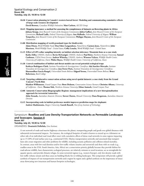
Spatial Ecology and <strong>Conservation</strong> 2<br />
Room 306<br />
Tuesday, July 23, 10:30 to 12:30<br />
10:30 <strong>Conservation</strong> planning in Canada’s western boreal <strong>for</strong>est: Modeling and communicating cumulative effects<br />
of large scale resource development<br />
David Browne, Canadian Wildlife Federation; Matt Carlson, ALCES Group<br />
10:45 Mapping ignorance: a method <strong>for</strong> assessing the completeness of datasets on flowering plants in Africa<br />
Juliana Stropp, Joint Research Centre of the European Commission; Julien Gaffuri, Joint Research Centre of the European<br />
Commission; Richard Ladle, Federal University of Alagoas; Ana Malhado, Federal University of Alagoas; William<br />
Temperley, Joint Research Centre of the European Commission; Philippe Mayaux, Joint Research Centre of the European<br />
Commission<br />
11:00 Distribution mapping of world grassland types <strong>for</strong> biodiversity<br />
Adam Dixon, World Wildlife Fund; Don Faber-Langendoen, NatureServe; Carmen Josse, NatureServe; John<br />
Morrison, World Wildlife Fund - United States; Colby Loucks, World Wildlife Fund - United States<br />
Tuesday<br />
11:15 Effect of GPS collar sampling intensity on habitat selection inference: Mountain lions as a case study<br />
Kathy Zeller, UMASS, Amherst; Kevin McGarigal, UMASS, Amherst; Paul Beier, Northern Arizona University; Samuel<br />
Cushman, USDA Forest Service; Andrew Whiteley, UMASS, Amherst; Winston Vickers, Wildlife Health Center,<br />
University of Cali<strong>for</strong>nia, Davis; Walter Boyce, Wildlife Health Center, University of Cali<strong>for</strong>nia, Davis<br />
11:30 A novel combination of habitat and threat models can reveal potential ecological traps<br />
Kathryn Rodriguez-Clark, Instituto Venezolano de Investigaciones Cientificas; Ada Sanchez-Mercado, Instituto<br />
Venezolano de Investigaciones Cientificas; Jose Ferrer-Paris, Instituto Venezolano de Investigaciones Cientificas;<br />
Shaenandhoa Garcia-Rangel, Universidad Simón Bolívar; Edgard Yerena, Universidad Simon Bolivar; Bruce<br />
Robertson, Bard College<br />
11:45 Targeting collaborative conservation actions using novel spatial datasets: a case study from the Grand<br />
Canyon’s North Rim<br />
Matthew Williamson, Grand Canyon Trust; Brett Dickson, <strong>Conservation</strong> Science Partners; Christine Albano, University<br />
of Cali<strong>for</strong>nia - Davis; Thomas Sisk, Northern Arizona University; Ethan Aumack, Grand Canyon Trust<br />
12:00 Antarctic <strong>Conservation</strong> Biogeographic Regions: management implications of a new bioregionalisation<br />
approach <strong>for</strong> terrestrial Antarctica<br />
Aleks Terauds, Australian Antarctic Division; Steven Chown, Monash University; Dana Bergstrom, Australian Antarctic<br />
Division<br />
12:15 Incorporating scale in habitat preference models improves prediction maps <strong>for</strong> elephants<br />
Andrew Mashintonio, Rutgers University; Gareth Russell, New Jersey Institute of Technology<br />
...............................................<br />
Symposium: Roadless and Low Density-Transportation Networks as Permeable Landscapes<br />
and Seascapes. Session II<br />
Room 307<br />
Tuesday, July 23, 10:30 to 12:30<br />
Organizer(s): Dominick DellaSala, Geos Institute<br />
A vast network of roads and marine highways crisscrosses the planet, transporting people and goods over global distances with<br />
substantial environmental impacts. For instance, the ecological footprint of roads is known to extend up to a kilometer on<br />
either side of an individual road (road effect zone) with cumulative effects of dense road networks in some regions impacting<br />
up to 15-20% of total surface area (e.g., continental USA). Marine transportation networks and associated ship transport<br />
lanes also create migration and other problems <strong>for</strong> wildlife, including acoustic pollution and collision-related mortality.<br />
In contrast, areas with low road densities and/or low-traffic volume (marine and terrestrial) and those with no roads (e.g.,<br />
roadless areas in the USA, South America, Asia, Africa) are a conservation priority globally because they provide habitat <strong>for</strong><br />
road-adverse wildlife, have characteristic ecological processes, are relatively resistant to weed invasions, act as strongholds <strong>for</strong><br />
aquatic species, and provide climatic refugia. In some terrestrial regions (e.g., western Europe), only low-density roads with<br />
low traffic volume remain and these areas are building blocks <strong>for</strong> re-wilding landscapes. This symposium will provide a global<br />
synthesis of impacts of vast transportation networks and a region by region and a global synthesis on the importance of intact<br />
areas showcasing new intactness and human footprint technologies.<br />
100


