Belize Flood Risk
Belize Flood Risk
Belize Flood Risk
- No tags were found...
You also want an ePaper? Increase the reach of your titles
YUMPU automatically turns print PDFs into web optimized ePapers that Google loves.
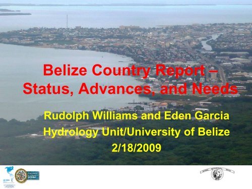
<strong>Belize</strong> Country Report –<br />
Status, Advances, and Needs<br />
Rudolph Williams and Eden Garcia<br />
Hydrology Unit/University of <strong>Belize</strong><br />
2/18/2009
Background<br />
Climate : Subtropical<br />
Seasons<br />
Wet: June – November<br />
Transitional: December –<br />
February<br />
Dry: March - May<br />
Temperature: 70° – 85°F<br />
Rainfall 1500mm – 3800mm<br />
Population estimated 2007<br />
311, 500
<strong>Risk</strong> Situations and Disasters in <strong>Belize</strong><br />
• Lies the Tropical Atlantic Hurricane region<br />
– Hurricane threatens every three years<br />
– Threats more frequent in the northern part of<br />
the country<br />
• <strong>Flood</strong>s oftentimes accompany Tropical<br />
systems<br />
– 39 identifiable river basins<br />
– 18 Major watersheds
Settlements at <strong>Risk</strong> of <strong>Flood</strong>ing in <strong>Belize</strong><br />
• There were some ~263 populated places<br />
• Of these 263 settlements, 163 (62%) lie<br />
within areas at risk of flooding.<br />
• 149 are in floodplains which flood annually<br />
• 11 in areas which have a flood recurrence of<br />
20 years<br />
• 3 areas with a flood recurrence of 1,000<br />
years
!<br />
®<br />
Mexico<br />
!<br />
!<br />
!<br />
!<br />
!<br />
! !<br />
!<br />
!<br />
!<br />
!<br />
!<br />
!<br />
!<br />
!<br />
!<br />
!<br />
!<br />
!<br />
!<br />
!<br />
!<br />
!<br />
!<br />
!<br />
! !<br />
!<br />
!<br />
!<br />
!<br />
!<br />
!<br />
!<br />
<strong>Belize</strong> <strong>Flood</strong><br />
<strong>Risk</strong> Map<br />
!<br />
!<br />
!<br />
!<br />
!<br />
!<br />
!<br />
!<br />
!<br />
!<br />
!<br />
!<br />
!<br />
!<br />
!<br />
!<br />
!<br />
!<br />
Guatemala<br />
! ! !<br />
!<br />
! !<br />
! ! !!<br />
!<br />
!<br />
!!! !<br />
! ! !<br />
!<br />
!<br />
! ! !<br />
!<br />
!<br />
!<br />
!<br />
^<br />
!<br />
!<br />
!<br />
!<br />
!<br />
!<br />
!<br />
!<br />
!<br />
!<br />
!<br />
! !<br />
! !<br />
!<br />
!<br />
!<br />
Belmopan<br />
!<br />
! !<br />
!<br />
!<br />
^!<br />
<strong>Belize</strong> City<br />
San Pedro<br />
><br />
!<br />
!<br />
!<br />
!<br />
!<br />
!<br />
!<br />
!<br />
!<br />
!<br />
!<br />
!<br />
!<br />
!<br />
!<br />
!<br />
!<br />
!<br />
!<br />
!<br />
!<br />
!<br />
!<br />
! !<br />
!<br />
!<br />
!<br />
!<br />
!<br />
!<br />
! ! ! !<br />
!<br />
!<br />
!<br />
!<br />
!<br />
!<br />
!<br />
!<br />
!<br />
!<br />
!<br />
!<br />
! !<br />
!<br />
! !<br />
0 10 20 40<br />
!<br />
Settlements<br />
District boundaries<br />
International boundaries<br />
Major rivers<br />
<strong>Flood</strong> risk<br />
No flood risk<br />
1: Exceptional flood risk (1,000 yr)<br />
2: Every 20 years<br />
3: Every few years or annually<br />
4: Swamp or marsh forest<br />
5: Savanna plain / saline plain<br />
6: Swamp or mangrove<br />
7: Very poorly drained / herbaceous swamp<br />
8: Permanent water bodies<br />
!<br />
!<br />
!<br />
!<br />
miles<br />
Data sources: <strong>Belize</strong> Land Information Centre,
Recent Disasters – TS ARTHUR<br />
Accumulated rainfall (May<br />
29 th – June 4 th 2008) 254<br />
mm (10 in) - 152 mm (6 in)<br />
500 year flood event<br />
5 persons lost their lives<br />
2 Major Bridges destroyed<br />
Kendal Bridge<br />
Mullins River Bridge<br />
Roads damaged<br />
Numerous Homes<br />
destroyed<br />
Crops destroyed
Recent Disasters – TD 16<br />
Accumulated rainfall (May<br />
13 th –20 th October<br />
2008) 547 mm - 105<br />
mm<br />
1000 year flood event<br />
2 persons lost their lives<br />
Bridges <strong>Flood</strong>ed<br />
Roads damaged<br />
Culverts destroyed<br />
Numerous Homes destroyed<br />
Crops destroyed<br />
At least a combined 146 communities 98,594 persons<br />
were affected by TS Arthur & TD16
Settlements in the <strong>Belize</strong> at <strong>Risk</strong> of <strong>Flood</strong>ing<br />
• The Rio Bravo - upper, middle and lower confluence<br />
with Blue Creek & Rio Hondo. Albion Island :San Antonio, San<br />
Roman and Santa Cruz; Douglas; San Victor<br />
•New River - Middle and lower. TowerHill, San<br />
Estevan, Santa Cruz; Caledonia.<br />
• <strong>Belize</strong> River - Middle and lower -Roaring Creek to<br />
Haulover Creek, north side of <strong>Belize</strong> City. Crooked Tree<br />
lagoon/wetland Biscayne, Grace Bank and Davis Bank<br />
Middle and lower Sibun River. All coastal communities in<br />
the lower Sibun River watershed including Gracie Rock,<br />
Cedar Bank and Freetown Sibun.
Settlements in the <strong>Belize</strong> at <strong>Risk</strong> of <strong>Flood</strong>ing -Cont’d<br />
• Manatee River - Gales Point.<br />
• North Stann Creek - Middle and lower Middlesex,<br />
Pomona, Melinda, Hope Creek and Sarawee, and northside<br />
Dangriga Town.<br />
• The Sittee River - Middle and lower – Sittee River<br />
villages
Technologies used to Prevent and Mitigate Disasters<br />
• Modeling GIS<br />
– Land Information<br />
Center &<br />
Hydrology Unit<br />
– CAFFG<br />
• Forecasts<br />
– Historical data<br />
– Expert Judgment<br />
– Hydrologic<br />
Modeling<br />
• Data collection<br />
• Telephone<br />
• Satellite<br />
• Internet<br />
Advisories<br />
•Radio<br />
• Television<br />
• Talk Shows<br />
• Internet
Needs for the development of Information and<br />
Communications Technology<br />
•NEMO<br />
– More Trainer of Trainer Courses in Supplies<br />
Management & Damage Assesments<br />
–Acommunication network down to the Village<br />
level<br />
– A functional and effective early warning<br />
system to alert vulnerable communities<br />
– Computerization-and networking of Plans at<br />
all levels using the recently acquired<br />
'Cassandra' software.
Needs for the development of Information and<br />
Communications Technology - Cont’d<br />
• Data Collection<br />
– rivers levels and rainfall data should be<br />
automatically uploaded electronically to the<br />
database using VHF radio signals, satellite<br />
and computer networking<br />
• Advisories<br />
– In the event of a Dam failure evacuation<br />
routes and safe zones should be identified so<br />
that the public may quickly move toward<br />
safety.
Chalillo Hydropower Project EWS<br />
•EWS Project - component of the <strong>Belize</strong><br />
Electric Company Limited Environmental<br />
Compliance Plan<br />
•Redundant submersible depth transducers<br />
detect reservoir level changes that exceed<br />
the possible maximum decreasing rate<br />
• Such a rate will be considered a dam<br />
failure
Chalillo Hydropower Project EWS<br />
•Datalogger via VHF radios and a repeater system<br />
activate siren alarms in all vulnerable<br />
communities<br />
•Signals will be simultaneously transferred to the<br />
NEMO, NHMS, BECOL, Police, Medical Headquarters<br />
via a similar automated VHF radio communicating<br />
network<br />
• Mandatory system test before every flood season
Thank You


