environmental assessment - Eastern Federal Lands Highway ...
environmental assessment - Eastern Federal Lands Highway ...
environmental assessment - Eastern Federal Lands Highway ...

You also want an ePaper? Increase the reach of your titles
YUMPU automatically turns print PDFs into web optimized ePapers that Google loves.
FHWA I-95 DAR Ramps EA<br />
Citizen Information Meeting<br />
June 2008<br />
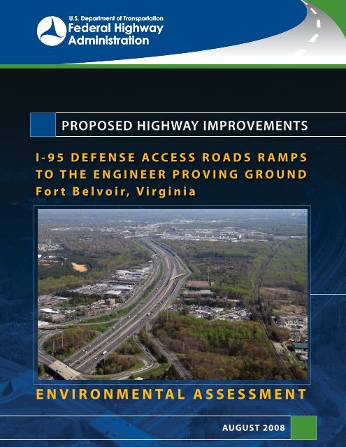
PROPOSED HIGHWAY IMPROVEMENTS<br />
I-95 DEFENSE ACCESS ROADS RAMPS<br />
TO THE ENGINEER PROVING GROUND<br />
Fort Belvoir, Virginia<br />
ENVIRONMENTAL ASSESSMENT<br />
AUGUST 2008
FHWA I-95 DAR Ramps EA<br />
Citizen Information Meeting<br />
June 2008<br />
I-95 DEFENSE ACCESS ROADS<br />
RAMPS TO ENGINEER PROVING GROUND<br />
Fort Belvoir, Virginia • Fairfax County, Virginia<br />
ENVIRONMENTAL ASSESSMENT<br />
Submitted Pursuant to 42 U.S.C. 4332(2)(C)<br />
by<br />
U.S. Department of Transportation<br />
<strong>Federal</strong> <strong>Highway</strong> Administration<br />
<strong>Eastern</strong> <strong>Federal</strong> <strong>Lands</strong> <strong>Highway</strong> Division<br />
DRAFT<br />
________________________________<br />
Paul Nishimoto<br />
Planning and Programming Engineer<br />
___________________<br />
Date of Approval<br />
COOPERATING AGENCIES<br />
U.S. Army Garrison Fort Belvoir<br />
Virginia Department of Transportation
ENVIRONMENTAL<br />
ASSESSMENT<br />
I-95 DEFENSE ACCESS ROADS RAMPS TO<br />
ENGINEER PROVING GROUND<br />
CONTENTS<br />
SECTION 1 - PURPOSE AND NEED<br />
1.1 Study Area 1<br />
1.2 History 1<br />
1.3 Purpose and Need 1<br />
1.3.1 Needs – Existing Conditions 2<br />
1.3.2 Needs – Future Conditions 3<br />
SECTION 2 - ALTERNATIVES<br />
2.1 Introduction 4<br />
2.2 Alternatives Development and Screening 4<br />
2.3 Alternatives Considered but Eliminated from Detailed Study 4<br />
2.4 Alternatives Carried Forward 6<br />
2.4.1 No-build Alternative 6<br />
2.4.2 Preferred Alternative 6<br />
SECTION 3 - ENVIRONMENTAL CONSEQUENCES<br />
3.1 Overview of Environmental Issues 9<br />
3.2 Land Use and Socioeconomics 12<br />
3.3 Air Quality 12<br />
3.4 Water Quality 13<br />
3.5 Potential Hazardous Materials 15<br />
3.6 Indirect Effects 15<br />
3.7 Cumulative Effects 15<br />
SECTION 4 - COORDINATION AND COMMENTS<br />
4.1 Agency Coordination 17<br />
4.2 Public Involvement 17<br />
SECTION 5 - REFERENCES<br />
1-6 References 18<br />
Figures<br />
1 Project Location 2<br />
2 Preferred Alternative 7<br />
3 Typical Cross Sections 8<br />
Tables<br />
1 Alternatives Eliminated from Detailed Study 5<br />
2 Environmental Issues and Summary of Environmental Effects 9
ENVIRONMENTAL<br />
ASSESSMENT<br />
I-95 DEFENSE ACCESS ROADS RAMPS TO<br />
ENGINEER PROVING GROUND<br />
SECTION 1<br />
PURPOSE AND NEED<br />
1.1 STUDY AREA<br />
In cooperation with the U.S. Army Garrison Fort Belvoir and the Virginia Department of Transportation (VDOT),<br />
the <strong>Federal</strong> <strong>Highway</strong> Administration (FHWA), <strong>Eastern</strong> <strong>Federal</strong> <strong>Lands</strong> <strong>Highway</strong> Division, is preparing plans for<br />
the construction of two access ramps from I-95 to the Engineer Proving Ground (EPG) at Fort Belvoir. The first<br />
involves expanding and extending the existing ramp from southbound I-95 to westbound Fairfax County<br />
Parkway to provide a connection to the EPG South Spine Road in the southeastern corner of the EPG tract.<br />
The second involves constructing a new connection between the South Spine Road on the eastern side of EPG<br />
and the existing flyover bridge that connects the high occupancy vehicle (HOV) lanes with the northbound<br />
I-95 conventional lanes. FIGURE 1 shows the location of the project. The study area consists of lands surrounding<br />
these proposed project elements on which there are human or natural resources that could potentially<br />
be affected by the project. The study area also encompasses the existing southbound I-95 flyover to<br />
Backlick Road<br />
1.2 HISTORY<br />
The 2005 Defense Base Closure and Realignment Act (BRAC) stipulated a number of realignment and closure<br />
actions for domestic military installations, some of which would involve relocating thousands of personnel to<br />
Fort Belvoir. Accordingly, the Army prepared an Environmental Impact Statement (EIS) to evaluate the <strong>environmental</strong><br />
consequences of the relocations to Fort Belvoir and to select an alternative land use and development<br />
plan to accommodate the moves. As part of the implementation of the BRAC requirements, which is to<br />
be completed by the end of Fiscal Year 2011, the eastern portion of the 807-acre EPG was chosen as the site to<br />
which 8,500 employees of the National Geospatial-Intelligence Agency (NGA), currently located in Reston,<br />
Virginia and Bethesda, Maryland, will be relocated. In order to accommodate the additional traffic volumes<br />
and access/egress needs for these employees, improvements to the existing transportation infrastructure,<br />
such as the proposed I-95 ramps in this project, are needed. The ramps are to be provided through the Defense<br />
Access Roads (DAR) program, whereby FHWA works with the Department of Defense and state and local<br />
authorities to plan, design, and implement the project.<br />
1.3 PURPOSE AND NEED<br />
The purpose of the proposed project is to improve access to and egress from the EPG site to accommodate<br />
vehicle travel resulting from the BRAC-mandated relocation of some 8,500 employees to the eastern part of<br />
the site. The existing road network and future planned improvements to the network would not provide sufficient<br />
capacity to adequately handle the additional traffic or efficient routing to provide the most direct and<br />
efficient access and egress.<br />
1.3.1 NEEDS – EXISTING CONDITIONS<br />
The existing local road network surrounding EPG provides few access points into the EPG site. Prior to the<br />
BRAC proposal to relocate thousands of employees to the site, little access was needed to the little-used<br />
property. Most of the Army activities had been relocated in prior years to other parts of Fort Belvoir or other<br />
1
ENVIRONMENTAL<br />
ASSESSMENT<br />
I-95 DEFENSE ACCESS ROADS RAMPS TO<br />
ENGINEER PROVING GROUND<br />
FIGURE 1 - Project Location<br />
Enlarged<br />
Area<br />
Backlick Road<br />
SCALE (Feet)<br />
0 2,000<br />
95<br />
Barta Road<br />
SB I-95 Flyover<br />
to Backlick Road<br />
(EPG)<br />
Project<br />
Location<br />
7100<br />
Fairfax County Parkway<br />
Reference: USGS, Annandale, 1994 and Fort Belvoir, 1983 Quadrangles<br />
I95RAMPS01<br />
2
ENVIRONMENTAL<br />
ASSESSMENT<br />
I-95 DEFENSE ACCESS ROADS RAMPS TO<br />
ENGINEER PROVING GROUND<br />
facilities in other states. Existing access to EPG on the east side is via the Barta Road entrance off of the fourlane<br />
Backlick Road (Route 617), which parallels the west side of I-95. Connections to Backlick Road from I-95<br />
include a flyover bridge connecting southbound I-95 to southbound Backlick Road; however, the touchdown<br />
point on Backlick Road is beyond the EPG entrance road. Another connection to Backlick Road is provided via<br />
the Fairfax County Parkway interchange and Fullerton Road; however, travelers from the north exiting I-95 to<br />
the Fairfax County Parkway do so approximately a mile south of the Barta Road entrance road to EPG, requiring<br />
a “doubling back” for a mile to reach the entrance.<br />
Another connection to Backlick Road is provided via the Old Keene Mill Road (Route 644) interchange with<br />
I-95, approximately 1.5 miles to the north. Finally, a connection to Backlick Road for HOV traffic is available<br />
via an interchange at the Franconia-Springfield Parkway (Route 7900), approximately 0.9 miles to the north.<br />
Another entry point to EPG is Cissna Road off of Rolling Road (Route 638) on the west side of the property.<br />
Reaching this entry from I-95 requires circuitous travel along local secondary roads. Currently, there is no<br />
direct access to the site from the I-95 HOV lanes.<br />
1.3.2 NEEDS – FUTURE CONDITIONS<br />
In addition to the current network described above, other road improvements assumed to be in place<br />
by the design year (2030) include the Fairfax County Parkway completion through EPG between Fullerton<br />
Road and Franconia-Springfield Parkway/Rolling Road. Construction of the Fairfax County Parkway would<br />
replace the existing at-grade intersection of the Parkway and Fullerton Road with a grade separation with no<br />
connection of the two roads. Access to Fullerton Road would ultimately be provided via a new interchange<br />
with Boudinot Drive.<br />
Implementation of the BRAC Act of 2005 requires locating approximately 8,500 employees of the NGA into<br />
the eastern portion of the EPG site in the morning and out in the afternoon. The influx of these employees<br />
to the EPG site will generate an estimated a.m. peak-hour traffic volume increase of 2,700 vehicles that would<br />
otherwise overwhelm the existing access points and local roads leading to them. Specifically, the single-lane<br />
exit ramp from southbound I-95 to westbound Fairfax County Parkway creates a weaving section with vehicles<br />
that would exit to Boudinot Drive. During the a.m. peak-hour, the demand on the weave on the Fairfax<br />
County Parkway between the I-95 ramp terminus and the beginning of the Boudinot Drive ramp would cause<br />
congestion and ramp spillback, which would affect the southbound I-95 mainline. In the p.m. peak-hour, an<br />
estimated 1,000 vehicles exiting EPG via Fairfax County Parkway and headed to northbound I-95 would have<br />
to negotiate three weave sections: 1) eastbound Parkway between Boudinot Drive on-ramp and southbound<br />
I-95 off-ramp; 2) eastbound Parkway between southbound I-95 off-ramp and northbound I-95 off-ramp;<br />
and, 3) I-95 northbound between eastbound Parkway-to-northbound-I-95-ramp and northbound-I-95-towestbound-Parkway-ramp.<br />
The congestion caused by these multiple weaving movements would impact the<br />
eastbound Parkway traffic flow and the northbound I-95 traffic flow.<br />
I-95 northbound HOV traffic destined for EPG in the a.m. would be able to exit at the Franconia-Springfield<br />
Parkway, turn left on the overpass to the Backlick Road exit, then travel south on Backlick Road to access<br />
EPG via Barta Road. The reverse flow would be required in the p.m. This route is somewhat circuitous as the<br />
Franconia-Springfield Parkway connection is approximately 0.9 miles north of the Barta Road entrance to EPG.<br />
3
ENVIRONMENTAL<br />
ASSESSMENT<br />
I-95 DEFENSE ACCESS ROADS RAMPS TO<br />
ENGINEER PROVING GROUND<br />
SECTION 2<br />
ALTERNATIVES<br />
2.1 INTRODUCTION<br />
This section discusses the range of alternatives considered, the process used to identify and screen the alternatives,<br />
alternatives considered and eliminated from further consideration, and alternatives carried forward for<br />
detailed study. The No-build Alternative was retained and it serves as a baseline for alternatives comparison.<br />
A Preferred Alternative has been identified and several other build alternatives have been considered.<br />
2.2 ALTERNATIVES DEVELOPMENT AND SCREENING<br />
The flowchart below illustrates the steps in the alternatives development and screening process. This<br />
process involved identifying a range of alternatives initially and then narrowing the options to the Preferred<br />
Alternative for detailed consideration. Among the criteria used in evaluating potential alternatives were<br />
the existing and programmed future road networks, the proposed location of the NGA facilities and potential<br />
access points, travel patterns, levels of service for existing versus proposed conditions for future years, facility<br />
security considerations, right of way considerations, and <strong>environmental</strong> constraints.<br />
STEP 1<br />
Develop<br />
Conceptual<br />
Alternatives<br />
STEP 2<br />
Purpose and<br />
Need Met<br />
YES<br />
STEP 3<br />
Screening<br />
Criteria Met<br />
Engineering<br />
<br />
<br />
<br />
YES<br />
NO<br />
NO<br />
Alternatives<br />
Retained<br />
Eliminated<br />
Conceptual<br />
Alternatives<br />
2.3 ALTERNATIVES CONSIDERED BUT ELIMINATED FROM DETAILED STUDY<br />
Through the alternatives screening, several concepts and alternatives were eliminated from further consideration<br />
and were not carried forward for detailed study. TABLE 1 lists the eliminated alternatives and reasons for<br />
their elimination.<br />
4
ENVIRONMENTAL<br />
ASSESSMENT<br />
I-95 DEFENSE ACCESS ROADS RAMPS TO<br />
ENGINEER PROVING GROUND<br />
Table 1 - Alternatives Eliminated from Detailed Study<br />
Alternative<br />
Transportation System Management (TSM)<br />
Alternative<br />
Mass Transit Alternative<br />
Connection with existing flyover ramp from<br />
southbound I-95 to Backlick Road<br />
Basis for Elimination<br />
“TSM” generally means implementation of relatively low-cost actions<br />
to improve efficiency of existing transportation systems. Examples<br />
include traffic controls, signal synchronization, turn lanes, parking<br />
management, access management, operational modifications,<br />
flexible work hours, van pools, transit scheduling, bicycle and<br />
pedestrian improvements, modifying driver behavior with incentives,<br />
pricing, or restrictions. Although such actions are important<br />
elements in the overall transportation plan for any urbanized area,<br />
there are none that would meet the identified needs for this study<br />
because they would not adequately facilitate access into the EPG<br />
site for the thousands of additional employees slated to work there.<br />
Notwithstanding, the Army, has already committed to several TSM/<br />
TMP measures as part of the mitigation to be provided for the<br />
BRAC actions, will appoint a transportation demand management<br />
coordinator, and will develop a transportation management plan to<br />
promote various vehicle trip reduction strategies (e.g., ridesharing,<br />
parking management, and use of alternative travel modes).<br />
Mass transit alone would not satisfy the identified purpose and need<br />
for the same reasons that the TSM Alternative would not. However,<br />
the development plans for the EPG site do include a transportation<br />
management program to reduce single-occupant vehicle demand.<br />
Elements of the program include providing parking for only 60% of<br />
the new employees, shuttle bus service to the Franconia-Springfield<br />
Transportation Center (located approximately two miles east of EPG)<br />
linking to Metrorail and Virginia Railway Express, and promotion of<br />
ridesharing with reserved parking for carpools.<br />
This alternative would require complete reconstruction of the flyover<br />
bridge to add an additional lane and also to reconfigure the varying<br />
curvature and superelevation to accommodate an exit into EPG<br />
as well as the connection to Backlick Road. Additionally, with the<br />
relatively short distance between this flyover ramp and the Old Keene<br />
Mill Road interchange and the associated weaving movements, traffic<br />
operations on I-95 would be negatively affected. Queues resulting<br />
from the operational problems would back up into the I-95/I-<br />
395/I-495 interchange and into the local Springfield area. Further,<br />
this alternative poses constructability problems.<br />
5
ENVIRONMENTAL<br />
ASSESSMENT<br />
I-95 DEFENSE ACCESS ROADS RAMPS TO<br />
ENGINEER PROVING GROUND<br />
2.4 ALTERNATIVES CARRIED FORWARD<br />
2.4.1 No-build Alternative<br />
Under the No-build Alternative, no additional roadway connections would be constructed to EPG. All existing<br />
roadway facilities would remain in their existing configuration and the remaining section of the Fairfax County<br />
Parkway would be constructed as planned. This alternative would not displace any families, businesses, farms,<br />
or nonprofit organizations, and would not significantly affect any natural, ecological, cultural, or scenic<br />
resources. However, this alternative would not satisfy the identified transportation needs, because it would<br />
not provide the needed additional transportation access and capacity.<br />
2.4.2 Preferred Alternative<br />
The Preferred Alternative consists of two new ramps as shown on FIGURE 2. FIGURE 3 shows typical<br />
cross sections.<br />
Ramp 1. Connection via ramp from southbound I-95 to westbound Fairfax County Parkway with direct<br />
access into EPG connecting to South Spine Road within. The existing off-ramp would be widened and<br />
modified to provide an additional lane, which then would divide to a direct access into EPG near the proposed<br />
electrical substation. The barrier separation to be provided would force EPG-destined traffic into a dedicated<br />
lane into EPG, thus eliminating potential weaving conflicts with traffic continuing on to the westbound Fairfax<br />
County Parkway and the Boudinot Drive interchange. Design variations of this element include options to<br />
pass west or east of the electrical substation to be constructed by the Army on EPG to support the BRAC<br />
construction (the eastern option would generally follow a construction access road to be used during construction<br />
of the substation and other facilities). Bridge options at Fullerton Road include carrying the Parkway<br />
and Ramp 1 either over or under the existing roadway. The final design will be coordinated with the on-going<br />
Fairfax County Parkway Extension project.<br />
Ramp 2. New connection between South Spine Road along east side of EPG to existing HOV/HOT-to-northbound<br />
I-95 flyover ramp. The existing flyover ramp is not in use in the p.m. because the traffic on the reversible<br />
HOV/HOT lanes is flowing southbound. Thus the proposed connection would facilitate egress from EPG<br />
to the northbound general-purpose I-95 lanes. Moreover, the connection also would provide access to EPG<br />
in the a.m. for northbound HOV/HOT traffic and egress from EPG in the p.m. for southbound HOV/HOT traffic.<br />
This ramp would consist of a single reversible lane.<br />
Compared to the No-build Alternative, the proposed project would improve the level of service 1 on the southbound-I-95-to-westbound-Parkway<br />
ramp in the a.m. peak-hour from “F” to “C” in the design year. In the p.m.<br />
peak-hour, the level of service on the eastbound-Parkway-to-northbound-I-95 ramp would improve from level<br />
of service “F” to “E.” The proposed project would provide two new access points into the portion of the EPG site<br />
into which the NGA is moving, thus facilitating the ingress and egress of some 8,500 employees to be assigned<br />
to the site. Moreover, the project would provide a direct connection into the site for HOV/HOT traffic.<br />
FOOTNOTE<br />
1. Level of service is a measure used by traffic engineers to indicate operational conditions within a traffic stream and perception of those conditions by motorists<br />
in terms of speed, freedom to maneuver, traffic flow interruption, etc. The levels of service are designated A through F, with A representing a high level of service and<br />
F representing a poor level of service.<br />
6
ENVIRONMENTAL<br />
ASSESSMENT<br />
I-95 DEFENSE ACCESS ROADS RAMPS TO<br />
ENGINEER PROVING GROUND<br />
FIGURE 2 - Preferred Alternatives<br />
A—A<br />
RAMP<br />
2<br />
RAMP<br />
1<br />
D—D<br />
C—C<br />
B—B<br />
LEGEND<br />
RAMP 1<br />
A—A<br />
Ramp Roadway Section to<br />
South Spine Road<br />
B—B<br />
Ramp Roadway Section from<br />
SB I-95 Lanes<br />
RAMP 2<br />
NOT TO SCALE<br />
C—C<br />
D—D<br />
Ramp Structure over I-95<br />
Ramp Roadway Section<br />
7
ENVIRONMENTAL<br />
ASSESSMENT<br />
I-95 DEFENSE ACCESS ROADS RAMPS TO<br />
ENGINEER PROVING GROUND<br />
FIGURE 3 - Typical Cross Sections<br />
A-A. RAMP ROADWAY SECTION TO SOUTH SPINE ROAD<br />
C-C. RAMP STRUCTURE OVER I-95<br />
NOT TO SCALE<br />
NOT TO SCALE<br />
Ramp 1 at Fairfax County Parkway<br />
Ramp 2 to EPG from HOV Flyover Ramp<br />
B-B. RAMP ROADWAY SECTION FROM SB I-95 LANES<br />
D-D. RAMP ROADWAY SECTION<br />
NOT TO SCALE<br />
NOT TO SCALE<br />
Ramp 1 at Fairfax County Parkway<br />
Ramp 2 to EPG from HOV Flyover Ramp<br />
8
ENVIRONMENTAL<br />
ASSESSMENT<br />
I-95 DEFENSE ACCESS ROADS RAMPS TO<br />
ENGINEER PROVING GROUND<br />
SECTION 3<br />
ENVIRONMENTAL CONSEQUENCES<br />
3.1 OVERVIEW OF ENVIRONMENTAL ISSUES<br />
Table 2 summarizes <strong>environmental</strong> issues and their relevance to the project. Issues requiring further<br />
discussion are addressed following the table.<br />
Table 2. Environmental Issues and Summary of Environmental Effects<br />
Resource/Issue<br />
Agriculture and Prime Farmland<br />
Air Quality<br />
Biological Resources<br />
Invasive Species<br />
Remarks<br />
No agricultural activities or prime farmland exist in the project vicinity.<br />
Project is in nonattainment area for ozone and PM2.5. Project is<br />
slated for conformity analysis for 2008 Constrained Long-range Plan<br />
and Transportation Improvement Program<br />
Due to surrounding highways and commercial/industrial<br />
development, terrestrial wildlife habitat areas are small and<br />
fragmented. Aquatic habitat is limited to Field Lark Branch.<br />
Therefore, impacts to terrestrial and aquatic wildlife habitats would<br />
be small. No federally listed threatened or endangered species would<br />
be affected. While a single occurrence of small whorled pogonia<br />
(Isotria medeoloides), a federally listed threatened species, has been<br />
found previously on EPG land well away from the project site, a<br />
survey of the project area found no additional occurrences of<br />
this species.<br />
(See WSSI’s Small whorled Pogonia Habitat Evaluation and Search)<br />
In accordance with Executive Order 13112, Invasive Species, the<br />
potential for the establishment of invasive terrestrial or aquatic<br />
animal or plant species during construction of the proposed<br />
project will be minimized by following provisions in FHWA/VDOT’s<br />
Specifications. These provisions require prompt seeding of disturbed<br />
areas with seeds that are tested in accordance with FHWA/VDOT’s<br />
standards and specifications to ensure that seed mixes are free of<br />
noxious species and that disturbed areas are quickly revegetated with<br />
approved vegetation, thereby minimizing introduction of<br />
invasive species..<br />
9
ENVIRONMENTAL<br />
ASSESSMENT<br />
I-95 DEFENSE ACCESS ROADS RAMPS TO<br />
ENGINEER PROVING GROUND<br />
Table 2. Environmental Issues and Summary of Environmental Effects<br />
Resource/Issue<br />
Cultural Resources<br />
Geology, Soils, and Groundwater<br />
Hazardous Materials Sites<br />
Environmental Justice Populations<br />
Land Use and Socioeconomics<br />
Remarks<br />
There are three previously recorded archaeological sites in the project<br />
vicinity (44FX821, 44FX822, and 44FX823); however no further<br />
work was recommended for these sites at the time of recordation<br />
and they are considered not eligible for the National Register of<br />
Historic Places (NRHP). A comprehensive archaeological survey<br />
conducted on the EPG property in 1993 concluded that there are no<br />
archaeological properties present at EPG. All other lands crossed by<br />
the proposed ramps are disturbed lands occupied by existing road<br />
or commercial development and would not be expected to contain<br />
intact archaeological deposits. For the very limited untested areas,<br />
a testing plan has beed proposed by FHWA and approved by VDHR.<br />
There are no recorded historic architectural properties in the vicinity<br />
of the project.<br />
Soils present in the project vicinity have high erodibility. An erosion<br />
and sediment control plan and a stormwater management plan will<br />
be implemented as part of the project. Minor effects on groundwater<br />
might occur; however, there are no significant groundwater aquifers<br />
or water supplies used for human consumption in the project area.<br />
Issues related to two previous spill sites and unexploded ordinance<br />
will be resolved in compliance with federal and state regulations<br />
prior to construction.<br />
No low-income or minority populations exist in project vicinity.<br />
No long-term impacts to surrounding land uses. One business, a<br />
building supply firm, would be displaced. No residences, nonprofit<br />
organizations, or community facilities, such as hospitals, parks,<br />
places of worship, day care centers, schools, government offices such<br />
as post offices, police and fire stations, cultural centers, or special<br />
service providers would be displaced or impacted. Project would<br />
result in improvements to fire/rescue and police response capability<br />
and improved access to EPG for the thousands of employees slated to<br />
work there.<br />
10
ENVIRONMENTAL<br />
ASSESSMENT<br />
I-95 DEFENSE ACCESS ROADS RAMPS TO<br />
ENGINEER PROVING GROUND<br />
Table 2. Environmental Issues and Summary of Environmental Effects<br />
Resource/Issue<br />
Remarks<br />
Noise<br />
Recreational Resources<br />
Water Resources<br />
Navigable Waterways, Scenic Rivers/<br />
Scenic Byways<br />
Visual Character<br />
Indirect & Cumulative Effects<br />
No noise impacts are anticipated. Existing development in proximity<br />
to the project consists entirely of commercial and industrial uses<br />
adjacent to existing roadways where there are no areas of frequent<br />
human use that would be affected by noise from the highway<br />
elements proposed for the project. Further, there are no locations<br />
where highway traffic noise would substantially impair any existing<br />
or planned land use activity. Based on other recent noise analyses in<br />
the area (e.g., I-95 4th Lane Widening), existing noise levels range<br />
from approximately 66 to 72 dBA within 800 to 300 feet from I-95.<br />
Future noise levels would be similar. The frequent human use of<br />
areas such as parking lots at commercial sites is generally transitory<br />
in nature and these areas would not be considered to be “impacted”<br />
by any noise generated by traffic on the proposed ramps. Finally,<br />
any noise generated by traffic on the proposed ramps would be far<br />
overshadowed by noise from traffic on nearby major existing roads,<br />
primarily I-95, because the traffic volumes on the ramps are small by<br />
comparison.<br />
No land would be used from any publicly owned public parks or<br />
recreational facilities, nor would any such facilities be otherwise<br />
affected by the project.<br />
Urbanization already has degraded water resources in the area and<br />
increased runoff quantities. Approximately 45 linear feet of stream<br />
channel would be displaced by the project. No wetlands or FEMAdesignated<br />
100-year floodplains would be crossed by the project.<br />
Stormwater management ponds would be constructed as part of the<br />
project to minimize long-term effects to surface water resources and<br />
water quality.<br />
None present in project area.<br />
Proposed project is in an urbanized area with few visual attractions.<br />
No significant secondary or cumulative effects identified.<br />
11
ENVIRONMENTAL<br />
ASSESSMENT<br />
I-95 DEFENSE ACCESS ROADS RAMPS TO<br />
ENGINEER PROVING GROUND<br />
3.2 LAND USE AND SOCIOECONOMICS<br />
Land Use<br />
The proposed project lies within Fairfax County’s Springfield Planning District in an area designated as the I-95<br />
Corridor Industrial Area, which is recommended by the County to retain an overall industrial orientation for<br />
future development. The area is characterized by a predominance of industrial, warehouse, fuel storage, vehicle<br />
repair, wholesale and commercial retail, “flex-space,” and office uses. Land use along the western edge of<br />
the study area is dominated by the U.S. Army’s Fort Belvoir Engineer Proving Ground (EPG). During the 1940s<br />
and 1950s, EPG was used as a testing facility for military engineering equipment. Engineering activities have<br />
ceased or have been relocated to other sites. Most of the land within EPG is undeveloped, but the eastern portion<br />
is slated as the site to which NGA will be relocated. Existing roadways such as I-95, Backlick Road, Fullerton<br />
Road, and Fairfax County Parkway also occupy large portions of the study area.<br />
Most of the Fairfax County Parkway ramp portion of the project can be constructed within existing VDOT<br />
right of way or EPG US Government property. However, construction of the connector from the existing HOV<br />
flyover bridge to the South Spine Road will require crossing and acquisition of an industrial parcel containing a<br />
lumber yard/building supply business. The parcel contains approximately 3 acres.<br />
Community Effects and Accessibility<br />
The proposed project would not disrupt any community or planned development. At the time of preparation<br />
of this document, no organized opposition to the project has occurred and none is expected. According to<br />
Fairfax County officials, the project is consistent with community goals and proposed land use. No existing<br />
neighborhoods would be split and community cohesion should not be materially affected.<br />
Accessibility to EPG would be improved by the proposed project and the project as a whole is expected to<br />
improve mobility and connectivity among surrounding land uses and transportation facilities. Fire, police, and<br />
rescue emergency services are all expected to benefit from the improved transportation facilities.<br />
Displacements and Relocations<br />
It is estimated that the project would displace 1 business: a millwork and building supplies firm at 7622<br />
Backlick Road. The number of employees affected is estimated at approximately six. A detailed relocation<br />
plan will be developed to ensure that orderly relocation of the affected business can be accomplished in a satisfactory<br />
manner. The acquisition of right of way and the relocation of displacees would be in accordance with<br />
the Uniform Relocation Assistance and Real Property Acquisition Policy Act of 1970, as amended. Assurance is<br />
given that relocation resources would be available to all displacees without discrimination.<br />
Utilities<br />
Utilities within the proposed right of way include telecommunication lines, powerlines, sanitary sewer lines,<br />
gas lines, and petroleum pipelines. These will be adjusted as necessary to accommodate the proposed construction,<br />
as they are on all similar projects as a routine matter of course, and no substantial disruptions of<br />
utility services are expected.<br />
3.3 AIR QUALITY<br />
Based on previous air quality studies for other projects in the vicinity, the proposed project is not expected to<br />
be a major source of air pollution and quantitative estimation of carbon monoxide (CO) concentrations under<br />
12
ENVIRONMENTAL<br />
ASSESSMENT<br />
I-95 DEFENSE ACCESS ROADS RAMPS TO<br />
ENGINEER PROVING GROUND<br />
build and no-build conditions is not deemed necessary. The project is located in a region that is designated<br />
nonattainment for ozone. Measures to reduce ozone concentrations for the region are discussed in the State<br />
Implementation Plan (SIP) rather than at a project-specific level. The project also is in a nonattainment area for<br />
small particulate matter (PM 2.5<br />
). The project is not a “project of air quality concern” as outlined in 40 CFR 93.123<br />
(b)(1)(i),(ii),(iii) or (iv). Clean Air Act and 40 CFR 93.116 requirements for PM2.5 are met without a hot-spot<br />
analysis, since such projects have been found to not be of air quality concern under 40 CFR 93.123(b)(1). With<br />
regard to Mobile Source Air Toxics, in light of FHWA’s February 3, 2006 Interim Guidance on Mobile Source<br />
Air Toxics Analysis in NEPA documents, the project is not expected to be a major generator of mobile source<br />
air toxics. Accordingly, no substantial health-related effects are expected to arise from MSAT emissions from<br />
traffic on the completed project. The project is slated to be included in the Air Quality Conformity Assessment<br />
for the 2008 Financially Constrained Long-Range Transportation Plan for the National Capital Region being developed<br />
by the Transportation Planning Board. The project therefore is in conformance with the SIP and is not<br />
expected to interfere with attainment or maintenance of the National Ambient Air Quality Standards (NAAQS).<br />
The temporary air quality effects from construction are not expected to be significant because construction<br />
activities will be performed in accordance with FHWA/VDOT Specifications, which are approved as conforming<br />
to the SIP and require compliance with all applicable local, state, and federal regulations pertaining to air<br />
quality.<br />
3.4 WATER QUALITY<br />
Groundwater<br />
Minor long-term groundwater quality impacts could result from contaminated stormwater runoff from the<br />
completed highway. Pollutant buildups on highways and concentrations in highway runoff depend on the<br />
length of the highway under consideration and the volume of traffic. Pollutant loads also would be expected<br />
to increase in proportion to the additional impervious surface. Despite the increased pollutant loadings, no<br />
violation of water quality standards are expected to result from the project because:<br />
• The vegetated side slopes and other stormwater management provisions to be established along the<br />
project should minimize any potential water quality degradation attributable to normal highway runoff.<br />
• Fort Belvoir and the commercial land uses in the project area receive their potable water from the Fairfax<br />
County Water Authority (FCWA), which does not draw on local groundwater resources.<br />
• During construction, contractors will be required to adhere to provisions in FHWA Specifications that<br />
prohibit contractors from discharging pollutants such as chemicals, lubricants, paints, and other harmful<br />
materials onto the ground.<br />
Surface Water<br />
The project lies within the Accotink Creek watershed, which encompasses more than 50 square miles (roughly<br />
13 miles long by 4 miles wide) and extends from the City of Fairfax to Gunston Cove at the Potomac River.<br />
More than half of the watershed is covered by residential, commercial, or industrial development. Approximately<br />
38% remains forested. Approximately 2.4% is open water or wetlands. The watershed also is dissected<br />
by many major and minor highways, including I-95, the Capital Beltway, the Fairfax County Parkway, several<br />
U.S. and state primary routes, and numerous local streets. Approximately 38 square miles (75%) of the watershed<br />
lie upstream of the project.<br />
13
ENVIRONMENTAL<br />
ASSESSMENT<br />
I-95 DEFENSE ACCESS ROADS RAMPS TO<br />
ENGINEER PROVING GROUND<br />
Streams in the watershed can be characterized as degraded, with most having poor habitat and biological<br />
conditions. Measures of benthic macroinvertebrate community health are low, with species being those<br />
adapted to degraded conditions. Most of the small tributaries are highly incised, and a pattern of stream widening<br />
has been observed due to increased flows from surrounding developments. The ongoing erosion and<br />
sloughing of banks results in unstable benthic habitat, with unstable sediment bars, tree falls, and logjams.<br />
Imperviousness exceeds 25% throughout much of the watershed. A dam roughly midway within the mainstem<br />
of Accotink Creek holds Lake Accotink, which imposes some hydrologic control and somewhat moderates<br />
the effects of high flow volumes in the mainstem. The dam also constitutes a barrier to migration of<br />
aquatic species. Fairfax County has established stream valley parks along portions of Accotink Creek beyond<br />
the limits of the project to preserve riparian habitat, help protect water quality, and, in some instances, provide<br />
trails for public recreation.<br />
The proposed project would cross Field Lark Branch, a small tributary that joins Accotink Creek to the south<br />
of the project. Roughly 45 linear feet of stream bottom in Field Lark Branch would be displaced by the installation<br />
of culverts to carry the stream under the road. The culverts would be countersunk below the stream<br />
bottom profile to enable reestablishment of natural stream bottom inside the culverts. Temporary siltation<br />
likely would occur during construction. Long-term water quality effects that might be attributable to operation<br />
and maintenance of the roadway could include incremental increases in pollutant loads in highway<br />
runoff, such as particulates, metals, oil and grease, nutrients, and other substances. However, temporary and<br />
permanent stormwater management measures, including vegetative controls, detention basins, and filtration<br />
systems would be implemented on this project to minimize potential short-term and long-term effects on<br />
water quality. These measures would reduce or detain stormwater discharge volumes and remove pollutants.<br />
The project design would incorporate erosion and sediment control measures as required in FHWA Specifications.<br />
The requirements and special conditions of any required permits for work in and around surface waters<br />
would be incorporated into construction contract documents. The construction contractor will be required to<br />
comply with pollution control measures specified in VDOT’s Road and Bridge Specifications.<br />
Wetlands<br />
Wetlands in the immediate project vicinity are limited to a few small (less than 0.1 acre) palustrine forested<br />
(PFO) wetland swales associated with Field Lark Branch. None of these designated wetlands will be directly<br />
impacted by the proposed project.<br />
Mitigation<br />
In accordance with regulatory and permitting programs, compensation for unavoidable stream impacts will be<br />
provided as part of the proposed project. Such compensation could be accomplished in a variety of ways. The<br />
most desirable would be to construct stream restoration at or near the site of impact. Should adequate compensation<br />
not be practicable onsite, other opportunities within the Accotink Creek watershed will be explored.<br />
Such opportunities could include uneconomic remnants of privately owned land along streams. Specific<br />
identification of such sites is beyond the scope of this study, but would be done in concert with permitting activities.<br />
Should no suitable sites be identified, purchase of credits at an existing mitigation bank with a service<br />
area encompassing the project would be pursued. As a last resort, should it not prove practicable to provide<br />
adequate compensation in any of the above methods, payment to the Trust Fund will be provided.<br />
14
ENVIRONMENTAL<br />
ASSESSMENT<br />
I-95 DEFENSE ACCESS ROADS RAMPS TO<br />
ENGINEER PROVING GROUND<br />
3.5 POTENTIAL HAZARDOUS MATERIALS<br />
Two properties (Central Motors and Newington Associates), located on the west side of Fullerton Road, contain<br />
petroleum-contaminated soil and groundwater. The adjoining properties are both crossed by the proposed<br />
Ramp 1 alignment. Central Motors is a dealership of heavy-duty and light-duty trucks whose property<br />
contained leaking underground storage tanks (UST). The tanks were removed in 1992; however, the Virginia<br />
Department of Environmental Quality (VDEQ) documented the presence of free product in monitoring wells<br />
drilled in 1993. A subsurface investigation was conducted at the site in January 2002 (M. Miller Associates,<br />
2002) to obtain soil and groundwater samples within the proposed right of way. Petroleum hydrocarbons<br />
(diesel and gasoline) and benzene, toluene, ethylbenzene, and xylenes (BTEX) compounds were identified<br />
within and downgradient (to the southeast) of the former UST site. A more recent subsurface investigation (M.<br />
Miller Associates, 2008) indicated former USTs were also located along the northern edge of the Central Motors<br />
building. The Newington Associates site, which is located immediately north of Central Motors, contains<br />
a one-story building which houses several automotive repair businesses. Basin pits associated with three possible<br />
USTs (which appear to have been removed) were identified along the south wall of the building. Measurable<br />
levels of petroleum hydrocarbons were identified at the southwest corner of the building.<br />
Both sites are actively undergoing groundwater remediation. Construction of the proposed project would<br />
cross a portion of both properties. Prior to commencing construction, all contaminated soil and groundwater<br />
remediation will be completed in compliance with all applicable federal and state hazardous materials<br />
regulations.<br />
3.6 INDIRECT EFFECTS<br />
Indirect effects are those that are caused by the proposed action, but occur later in time or farther in distance<br />
than the direct impacts discussed elsewhere in this document. Indirect effects of highway projects in general<br />
sometimes can include growth-inducing effects and other effects related to induced changes in patterns of<br />
land use, population density or growth rate, and related effects on air, water, natural systems, or the human<br />
environment.<br />
The indirect effects of this project would involve increases in traffic volumes on some local roads and decreases<br />
in volumes on others. Because most surrounding neighborhoods already are built to allowable densities,<br />
and because there is little vacant land (other than EPG land) suitable for building in the immediate surrounding<br />
area, no substantial development or redevelopment attributable to the project in the surrounding area is<br />
anticipated. The largest tract of undeveloped land potentially subject to indirect development effects is the<br />
EPG land, for which several redevelopment scenarios have been suggested in the past by business interests,<br />
local government, and the Army. However, it can be assumed that such development, if it does occur, would<br />
do so regardless of whether the proposed project is constructed because there is existing access to the property<br />
from local roads. Furthermore, the BRAC-related development for NGA on the site is the result of Congressional<br />
authorization and is not caused by the proposed project.<br />
3.7 CUMULATIVE EFFECTS<br />
Cumulative effects are the incremental effects of the action when added to other past, present, and reasonably<br />
foreseeable future actions. Other public and private developments have occurred, or are currently under<br />
15
ENVIRONMENTAL<br />
ASSESSMENT<br />
I-95 DEFENSE ACCESS ROADS RAMPS TO<br />
ENGINEER PROVING GROUND<br />
construction in the geographic area surrounding the project. In addition, several new public and private<br />
developments are reasonably expected to occur in the future. After centuries of human disturbances, water<br />
quality in the streams crossed by the project has been somewhat degraded from pristine conditions, to<br />
the extent that VDEQ has designated certain surface waters within and downstream of the project area as<br />
“impaired waters.” For example, VDEQ has designated Accotink Creek as impaired due to its stressed benthic<br />
invertebrate community. The specific sources of the stress are unknown, but probably can be attributed in<br />
part to ongoing urbanization and suburbanization in the watershed. The water quality impairment is being<br />
offset to some extent by Fairfax County’s Environmental Quality Corridors program and other initiatives to buffer<br />
streams from the effects of future development. The establishment of stream valley parks (such as Accotink<br />
Stream Valley Park) is a good example of these initiatives. Much of the area at the mouth of Accotink Creek is<br />
protected within the Accotink Bay Wildlife Refuge on Fort Belvoir lands. The Fairfax County Land Use Plan calls<br />
for nearly all of the Accotink Creek stream valley within EPG to be designated an <strong>environmental</strong> quality corridor,<br />
thus buffering the stream from the effects of nearby future development.<br />
The project is consistent with the Constrained Long Range Plan and, as such, its effects on regional ozone concentrations,<br />
when cumulatively considered as part of the regional air quality conformity process, along with all<br />
other proposed regionally significant highway and mass transit improvements, would not exceed the emissions<br />
budget for ozone that has been established by the Virginia Department of Environmental Quality.<br />
With regard to social, economic, and community effects, over the past 60 years, the character of land within<br />
the watershed has changed from rural and agricultural to urbanized metropolitan area. The county now is<br />
largely developed, and includes a mixture of low-density to high-density residential, commercial, industrial,<br />
and public land uses. With the exception of the EPG land, areas surrounding the project reflect this overall<br />
character of the county, with development including a diverse mixture of single-family homes, townhouses,<br />
strip shopping centers, motels, and stand-alone businesses of all types. Some of these areas will continue to<br />
evolve as businesses come and go and infill residential development continues. The future development envisioned<br />
by the County on portions of EPG land will complement surrounding developed land uses, expand the<br />
local tax base, and enhance social, economic, and community opportunities.<br />
The business displacement of this project constitutes only a tiny fraction of the continuing change that already<br />
is occurring in the regional business community in response to normal forces of change typical for such<br />
a dynamic region. When considered in the context of the larger region containing thousands of businesses,<br />
along with an active real estate market and business conditions that are providing new choices and opportunities<br />
every day, the single displacement is even less substantial. Further, the relocation program would be<br />
scheduled so that the business would be given sufficient time to acquire replacement business facilities; and it<br />
would not be required to move until such a replacement meeting its needs is found.<br />
In conclusion, notwithstanding the dramatic changes in the landscape that have occurred over time due to<br />
human settlement in the area, the intensity of the incremental impacts of the project on human and natural<br />
resources, when viewed in the context of other past, present, and reasonably foreseeable future impacts from<br />
other sources, would be relatively small and are not expected to rise to a level that would cause significant<br />
cumulative impacts.<br />
16
ENVIRONMENTAL<br />
ASSESSMENT<br />
I-95 DEFENSE ACCESS ROADS RAMPS TO<br />
ENGINEER PROVING GROUND<br />
SECTION 4<br />
COORDINATION AND COMMENTS<br />
4.1 AGENCY COORDINATION<br />
In the process of preparing this document, the federal, state, regional, and local agencies listed below were<br />
consulted to obtain pertinent information and to identify key issues regarding potential <strong>environmental</strong><br />
impacts.<br />
Advisory Council on Historic Preservation<br />
<strong>Federal</strong> Emergency Management Agency<br />
<strong>Federal</strong> <strong>Highway</strong> Administration, Virginia Division<br />
National Marine Fisheries Service<br />
National Park Service<br />
U.S. Army Corps of Engineers<br />
U.S. Army Garrison Fort Belvoir<br />
U.S. Department of Agriculture, Natural Resources Conservation Service<br />
U.S. Department of Health and Human Services<br />
U.S. Environmental Protection Agency<br />
U.S. Fish and Wildlife Service<br />
Virginia Department of Agriculture and Consumer Services<br />
Virginia Department of Conservation and Recreation<br />
Virginia Department of Environmental Quality - Air, Water, and Waste Divisions<br />
Virginia Department of Forestry<br />
Virginia Department of Game and Inland Fisheries<br />
Virginia Department of Historic Resources<br />
Virginia Department of Housing and Community Development<br />
Virginia Institute of Marine Science<br />
Virginia Marine Resources Commission<br />
Virginia Department of Rail and Public Transportation<br />
Virginia Department of Transportation<br />
Virginia Council on Indians<br />
Virginia Outdoors Foundation<br />
Metropolitan Washington Council of Governments<br />
Northern Virginia Planning District Commission<br />
Northern Virginia Regional Commission<br />
Northern Virginia Regional Park Authority<br />
Northern Virginia Soil and Water Conservation District, Department of<br />
Conservation and Recreation<br />
Northern Virginia Transportation Commission<br />
Fairfax County, Office of the County Executive<br />
Fairfax County Department of Community and Recreation Services<br />
Fairfax County Department of Health<br />
Fairfax County Department of Planning and Zoning<br />
Fairfax County Department of Public Works and Environmental Services<br />
Fairfax County Department of Transportation<br />
Fairfax County, Economic Development Authority<br />
Fairfax County Park Authority<br />
Fairfax County Planning Commission<br />
Fairfax County Public Schools Superintendent<br />
4.2 PUBLIC INVOLVEMENT<br />
A public information meeting was held on June 11, 2008 between the hours of 5:00 p.m. and 8:00 p.m. in the<br />
Greater Springfield Volunteer Fire Department meeting hall in Springfield, Virginia. The purpose of this meeting<br />
was to provide the public with information regarding this project’s scope, purpose and need, the proposed<br />
project concept, and the study process.<br />
A public hearing also will be held for this project. The purpose of the hearing will be to present the alternatives<br />
and the findings of the Environmental Assessment, to provide a discussion forum between the public<br />
and FHWA representatives, and to obtain input and comments from the community. The Environmental Assessment<br />
will be made available for public inspection prior to and at the hearing.<br />
17
ENVIRONMENTAL<br />
ASSESSMENT<br />
I-95 DEFENSE ACCESS ROADS RAMPS TO<br />
ENGINEER PROVING GROUND<br />
SECTION 5<br />
REFERENCES<br />
1.<br />
2.<br />
3.<br />
4.<br />
5.<br />
6.<br />
Marshall Miller & Associates, Inc.<br />
Phase II Environmental Site Assessment Report – Proposed Boudinot Drive Extension, Fairfax County, Virginia.<br />
Prepared for Virginia Department of Transportation. November 18, 2004<br />
Marshall Miller & Associates, Inc.<br />
Subsurface Investigation Report Addendum – Proposed Fairfax County Parkway Extension, Fairfax County,<br />
Virginia. Prepared for Virginia Department of Transportation. June 19, 2008<br />
U.S. Army Corps of Engineers, Baltimore District<br />
Fairfax County Parkway Interchange Modification Report.<br />
Draft. March 2008<br />
Virginia Department of Transportation<br />
Fairfax County Parkway (Route 7100) – Environmental Assessment and Finding of No Significant Impact.<br />
June 23, 2004<br />
Wetland Studies and Solutions, Inc.<br />
Waters of the U.S. (Including Wetlands) Delineation and Resource Protection Area Evaluation – Proposed Fairfax<br />
County Parkway and Defense Access Road Ramps Study Area.<br />
Prepared for <strong>Federal</strong> <strong>Highway</strong> Administration. August 11, 2008<br />
Wetland Studies and Solutions, Inc.<br />
Small Whorled Pogonia Habitat Evaluation and Search, Proposed Fairfax County Parkway and Defense<br />
Access Road (DAR) Ramps, Fairfax County, Virginia. Prepared for <strong>Federal</strong> <strong>Highway</strong> Administration.<br />
August 11, 2008.<br />
18
June 2008<br />
FHWA I-95 DAR Ramps EA<br />
Citizen Information Meeting<br />
FEDERAL HIGHWAY ADMINISTRATION<br />
<strong>Eastern</strong> <strong>Federal</strong> <strong>Lands</strong> <strong>Highway</strong> Division<br />
21400 Ridgetop Circle<br />
Sterling, Virginia 20166