Roadway - OKI
Roadway - OKI
Roadway - OKI

You also want an ePaper? Increase the reach of your titles
YUMPU automatically turns print PDFs into web optimized ePapers that Google loves.
“A transportation plan for the <strong>OKI</strong> region to guide<br />
transportation investment and service decisions<br />
now and into the future.”
Introduction<br />
• The<br />
• The<br />
• In<br />
region of the Ohio-Kentucky-Indiana Regional Council of Governments (<strong>OKI</strong>) encompasses eight<br />
counties in three states which include Butler, Clermont, Hamilton and Warren counties in Ohio; Boone,<br />
Campbell and Kenton counties in Kentucky; and Dearborn County in Indiana. <strong>OKI</strong> conducts<br />
transportation planning for all eight counties.<br />
<strong>OKI</strong> 2030 Regional Transportation Plan 2008 Update serves as a blueprint for transportation<br />
projects in the <strong>OKI</strong> region through the year 2030. It addresses current and future needs created by<br />
growth and development. At the same time, it responds to Federal Highway Administration and Clean<br />
Air Act requirements to mitigate congestion and to address air quality and other environmental, social<br />
and financial issues.<br />
order to continue to address local needs, this plan is updated every four years. As the region grows,<br />
increased pressure will be placed on the transportation system. By preparing a transportation plan for<br />
the year 2030, <strong>OKI</strong> is working to plan the solutions today for the challenges of tomorrow.<br />
Goals of the Plan<br />
• Improve travel safety<br />
• Improve accessibility and mobility options for people and goods<br />
• Protect and enhance the environment<br />
• Enhance the integration and connectivity of the transportation system<br />
• Promote efficient system management and operation<br />
• Emphasize the preservation of the existing transportation system<br />
• Support economic vitality<br />
• Consider regional security<br />
• Strengthen the connection between infrastructure and land use<br />
• The<br />
<strong>OKI</strong> 2030 Regional Transportation Plan 2008 Update is a comprehensive, balanced and coordinated<br />
plan for the region and will serve as a guide for policy boards and implementation agencies that make<br />
transportation investments and service decisions.<br />
1
SAFETEA-LU Incorporation & Compliance<br />
• In<br />
concert with the directives of the Safe, Accountable, Flexible, Efficient Transportation Equity Act: A<br />
Legacy for Users (SAFETEA-LU), this update presents a plan to maximize the utility of the existing<br />
transportation facilities and services to reduce congestion and increase travel choices for people. Like<br />
its predecessor, the plan continues to place emphasis on community impacts and public participation.<br />
This plan also draws on a three year data acquisition effort that provides baseline data on observed<br />
travel time for significant roadways in the region and identifies locations with safety issues. This plan’s<br />
base year has been updated to 2005. As with previous plans, this plan conforms to air quality<br />
standards and is fiscally constrained. Finally, SAFETEA-LU adds several new requirements to the<br />
process of regional transportation planning. The plan addresses regional transportation issues related<br />
to regional transportation security and integrates the Strategic Regional Policy Plan (SRPP).<br />
Land use is the relationship of the built environment<br />
to mobility and travel demand.<br />
• SAFETEA-LU<br />
Consistency of Transportation Planning with Planned Growth<br />
and Development Plans<br />
promotes consistency between transportation improvements<br />
and state and local planned growth and economic development patterns. The<br />
plan now has a new chapter specifically created to discuss the link of <strong>OKI</strong>’s<br />
extensive work with the SRPP to long term, regional transportation planning.<br />
The SRPP is the result of an eight year process that engaged 60 percent of<br />
the <strong>OKI</strong> Board and massive public participation. The SRPP encourages land<br />
use patterns that promote multi-modal travel and the efficient use of land,<br />
natural resources and public facilities. The SRPP is being implemented<br />
through voluntary cooperation among local governments, <strong>OKI</strong> and many<br />
other organizations, and will consequently come to fruition in phases ranging<br />
from near to the very long term.<br />
The events of September 11,<br />
2001 showed that while<br />
transportation facilities can<br />
be potential targets, they are<br />
also vital resources for the<br />
response and recovery from<br />
manmade and natural<br />
disasters.<br />
• This<br />
Transportation System Security<br />
plan meets SAFETEA-LU’s call for the<br />
inclusion of security of the transportation<br />
system as a stand-alone planning factor. This<br />
signals an increase in importance from prior<br />
legislation, in which security was coupled with<br />
safety. A regional security strategy relates to<br />
sustainable prevention, detection, response<br />
and recovery efforts to protect regional<br />
transportation systems’ critical infrastructure<br />
from terrorism. This plan documents actions<br />
and strategies being implemented throughout<br />
the region for strengthening regional security.<br />
2
Demographics<br />
• The<br />
<strong>OKI</strong> 2030 Regional Transportation Plan 2008 Update is designed to meet the changing<br />
transportation needs of the eight-county region. Like many urban centers around the country, the<br />
Cincinnati region is experiencing growth outside the central city and county. Over the 2005 to 2030<br />
planning period, the population is expected to grow 17 percent to 2.3 million residents and the<br />
region’s employment level is projected to increase 19 percent.<br />
Household and Employment Change, 2005-2030<br />
Legend:<br />
• Gain of 25 households or workers<br />
• Loss of 25 households or workers<br />
SOURCE: 2005-2030 projections by the Ohio Department of Development (2003 Edition), Kentucky<br />
State Data Center (2004 Edition) and Indiana Business Research Center (2003 Edition).<br />
• Employment<br />
patterns affect the number, length and distribution of trips. Although work trips comprise<br />
only one-fifth of the region’s total person trips, they create the greatest demand on the transportation<br />
system due to their morning and afternoon peak time periods.<br />
• This<br />
growth in population and employment outside of Hamilton County is predicted to continue,<br />
causing increasing infrastructure needs in the outlying counties. However, Hamilton County will remain<br />
the leader in population and employment into the year 2030, thereby having its own share of significant<br />
travel needs.<br />
3
Safety<br />
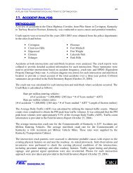
• Crashes<br />
are a significant issue for transportation planning due to their impact on individuals<br />
involved as well as the economic impacts on the entire <strong>OKI</strong> region. One of the main goals of this<br />
plan is to improve travel safety by reducing the risk of crashes that cause death or injuries. Within<br />
the <strong>OKI</strong> region, over 68,000 crashes occurred in 2006 resulting in 166 deaths and causing over<br />
14,000 injuries.<br />
4
• In<br />
compliance with<br />
requirements from<br />
SAFETEA-LU, Ohio,<br />
Kentucky and Indiana<br />
have developed State<br />
Highway Safety Plans<br />
and individual Five<br />
Percent Plans. The<br />
Five Percent Plans<br />
identify the most<br />
severe highway<br />
safety needs<br />
statewide. <strong>OKI</strong><br />
contributes to the<br />
fulfillment of each<br />
states’ safety goals by<br />
analyzing crash data<br />
on roadways within<br />
the <strong>OKI</strong> planning<br />
area.<br />
• Most<br />
high crash concentrations occur at the<br />
busiest intersections in the region. The use of<br />
crash rates, which are expressed as the number<br />
of crashes per million vehicle miles, further reveals<br />
crash trends by taking into account traffic volume.<br />
Research into the locations where crashes are<br />
occurring at a greater rate have assisted<br />
interagency consultation and cooperation to result<br />
in the advancement of project recommendations<br />
which address the region’s safety needs.<br />
5
• Congestion<br />
Congestion Management<br />
is the level at which transportation system performance is no longer acceptable due to<br />
traffic interference. The level of acceptable system performance will vary by type of transportation<br />
facility, location within the region and time of day. Congestion causes delay and diminishes the<br />
roadway’s ability to move traffic. In addition to mobility, congestion wastes fuel and increases air<br />
pollution. Congestion increases costs for both individuals and businesses. The costs of increased<br />
delay and vehicle operation are passed on through higher prices for shipping/delivery, insurance,<br />
products and services. The figure below was developed using observed travel time collected on area<br />
roadways.<br />
Cincinnati Urban Area Mobility Statistics, through 2005<br />
• Cincinnati is the 39th most congested city in the U.S.<br />
• Fifty-one percent of peak travel occurs under congested conditions.<br />
• A Cincinnati peak period traveler is delayed 27 hours a year.<br />
• On a per person basis, congestion wastes 19 gallons of fuel each year.<br />
• The annual cost in delay and fuel in 2005 due to congestion was $459 million.<br />
Source: 2007 Urban Mobility Report, Texas Transportation Institute, Texas A&M University, September, 2007.<br />
6
• If<br />
left as is, by 2030 10 percent of the region’s vehicle miles traveled (VMT) will be operating<br />
under congested conditions and total recurring delay is estimated to be over 75,000 hours per<br />
day. Congested conditions are defined as level of service D or worse. Freeway and freeway<br />
ramps show the highest percentage of congestion among the roadway functional classes. The<br />
plan’s multi-modal project recommendations are developed to address these congestion<br />
problems.<br />
7
Plan and Project Development Process<br />
• To<br />
respond to the region’s transportation needs and create the plan’s recommended multi-modal<br />
improvements, <strong>OKI</strong> evaluated all proposed transportation improvement projects using an iterative<br />
quantitative and qualitative process. The starting point for this plan update was the project listing from<br />
the 2004 plan. Added to the 2004 plan list were locations identified through the Congestion<br />
Management Process and all amendments made to the plan since 2004. Amendments reflect<br />
recommendations identified by several corridor studies completed since 2004. An initial draft list was<br />
distributed to local communities with the request that they provide a local prioritization (high, medium<br />
or low) for all of the projects located within their communities. They were also asked to provide<br />
suggestions for new projects. Staff then applied the project scoring process to a list of over 500 multimodal<br />
projects. The prioritization process assigns numerical scores for 16 criteria based on the plan’s<br />
goals. After much review by the <strong>OKI</strong> Board of Directors, Intermodal Coordinating Committee (ICC),<br />
public, and <strong>OKI</strong> staff, a project list and draft document were developed. Finally, the plan is adopted by<br />
the <strong>OKI</strong> Board of Directors. Projects included in the plan are eligible to advance to the Transportation<br />
Improvement Program (TIP) once a sponsor and funding is identified.<br />
Plan and Project Development Process<br />
ICC<br />
Executive Committee & Board of Directors<br />
Public & Community Input<br />
Prioritization Subcommittee<br />
Land Use Commission<br />
Travel Model & Data<br />
2030 Regional Transportation Plan<br />
Corridor Study<br />
Recommendations<br />
TIP<br />
Project Implementation<br />
8
What Is Recommended?<br />
Fiscal Constraint<br />
• Federal<br />
legislation requires the plan demonstrate that its recommendations are fiscally constrained,<br />
that is, financial resources can be reasonably expected to be available to cover the costs of the<br />
plan. Approximately $9.95 billion is estimated to be available for all transportation expenditures in<br />
the <strong>OKI</strong> region over the life of the plan. The estimated cost of the recommendations of this plan is<br />
an estimated $9.75 billion. Because the value or cost of recommended projects in this plan is less<br />
than the resources reasonably expected to be available, this plan demonstrates fiscal constraint.<br />
Estimation of Project Costs<br />
• Following<br />
federal guidelines, this plan estimates the total project costs in terms of year of<br />
expenditure (YOE) or year when the project is expected to occur and not current year dollars. Cost<br />
estimates have been obtained from other planning partners in the region including the Ohio<br />
Department of Transportation, Kentucky Transportation Cabinet, Indiana Department of<br />
Transportation, county engineer offices and local jurisdictions or derived from local project data.<br />
Revenue for the replacement of the Brent Spence Bridge are assumed to be from new sources<br />
designed to handle mega projects.<br />
Recommended Projects<br />
• Recommended transportation improvement projects are presented based on their respective travel<br />
mode. The plan includes 211 fiscally-constrained, multi-modal projects, totaling $7,229 million.<br />
There are also an additional 444 “Needs” projects that are not fiscally-constrained.<br />
Investment by Mode<br />
Operations and Maintenance $2,511<br />
<strong>Roadway</strong>** $6,299<br />
Transit $ 767<br />
Intelligent Transportation Systems $ 66<br />
Freight $ 69<br />
Bike/Pedestrian $ 28<br />
$9,740<br />
0.71%<br />
0.68%<br />
0.71%<br />
0.29%<br />
7.87%<br />
0.68%<br />
0.29%<br />
7.87% 25.76%<br />
25.76%<br />
*YOE=Year of Expenditure in million dollars.<br />
**Cost estimate includes Brent Spence Bridge project.<br />
64.70% 64.70%<br />
O&M <strong>Roadway</strong> Transit ITS Freight Bike/Ped<br />
9
<strong>Roadway</strong><br />
• The<br />
region’s roadway system carries the vast majority of person trips and is an important part of the<br />
freight movement system. Roads also provide the right of way for buses, making the roadway network<br />
an integral part of the public transit system. In addition, roadways are used for most bicycle travel in<br />
the region. Despite the need to reduce vehicle travel to improve air quality and reduce congestion,<br />
roadways remain a primary component in addressing the region’s transportation needs.<br />
• This<br />
plan recommends a variety of roadway improvements, including but not limited to:<br />
• New roadways<br />
• Widened roadways<br />
• Geometric improvements<br />
• Intersection improvements<br />
• Signal upgrades<br />
• Access management<br />
• Beyond<br />
the value of the TIP, the plan include 157 roadway projects with a cost of more than $6<br />
billion. This list of recommended roadway projects is fiscally constrained, meaning the expected<br />
available funding is sufficient to construct or implement them. This plan identifies 110 recommended<br />
widening or new roadway, non-exempt projects at a total estimated cost of $4.9 million (not including<br />
the Brent Spence Bridge project). The plan’s fiscally constrained roadway projects include a total of<br />
52 miles of new roadway and 356 additional lane miles throughout the region. Several pages follow,<br />
listing the capacity-adding Transportation Improvement Project (TIP) and plan projects.<br />
10
<strong>Roadway</strong> Improvement Projects<br />
<br />
Project ID<br />
OHIO<br />
Butler County<br />
Plan<br />
ID<br />
TIP Committed Funding<br />
Facility Location Description YOE Cost<br />
($million)<br />
81988<br />
Butler-Warren<br />
Road<br />
Tylersville Road to<br />
Bethany Road<br />
Widen to five lanes 11.3<br />
80516<br />
Oxford<br />
Connector<br />
US 27 to SR 73 New two lane connector road 7.9<br />
78073<br />
CR 20<br />
(Tylersville)<br />
Lakota Hills to<br />
Wetherington<br />
Tylersville Road safety upgrade,<br />
widening to 5 lanes<br />
6.1<br />
14114 CR 113<br />
Over Great Miami<br />
River, 0.81 to 1.01<br />
miles north of SR 4<br />
Liberty-Fairfield Road bridge<br />
replacement—add 2 lanes<br />
12.6<br />
75971 IR 75<br />
Cincinnati-Dayton<br />
Road to 0.2 miles<br />
south of Middletown<br />
corporate line<br />
Rehabilitate roadway, add median<br />
lane in both directions<br />
137.6<br />
76380 SR 4<br />
From Crescentville<br />
Road to<br />
Commercial Drive<br />
Add northbound and southbound<br />
lane, improve signals and lengthen<br />
turn lanes on Crescentville<br />
2.4<br />
76290 SR 4 Bypass<br />
Southern terminus<br />
to northern terminus<br />
Widen to four lanes; six lanes<br />
between Symmes and Tylersville<br />
roads<br />
3.3<br />
20499<br />
SR 63<br />
Extension<br />
US 127 eastward to<br />
existing SR 63 at<br />
SR 4<br />
New two-lane facility 40.7<br />
79686 SR 122<br />
Grand Avenue to IR<br />
75 and Union Road<br />
to Middletown east<br />
corporate line<br />
Widening 5.5<br />
77099 US 27<br />
Merry Day Drive/<br />
Melanee Lane to the<br />
Oxford corporate<br />
line<br />
Widen roadway including a center<br />
turn lane, sidewalks, street lighting<br />
and signals<br />
3.7<br />
2030 Plan<br />
212 Bobmeyer Road<br />
Bobmeyer Road to<br />
Bypass SR 4<br />
Extend roadway 3.5<br />
11
<strong>Roadway</strong> Improvement Projects (continued)<br />
Project ID<br />
Plan<br />
ID<br />
230<br />
Facility Location Description YOE Cost<br />
($million)<br />
Cincinnati-<br />
Dayton Road<br />
West Chester Road<br />
to I-75<br />
Widen to three lanes 7.0<br />
266<br />
Grand<br />
Boulevard<br />
Extension from<br />
Central Avenue to<br />
University<br />
Boulevard<br />
New four-lane extension and railroad<br />
overpass<br />
23.4<br />
240<br />
Oxford State<br />
Road<br />
Spurlino Way to SR<br />
4<br />
Reconstruction and widening 21.7<br />
202<br />
South Gilmore<br />
Road<br />
Resor to Mack Add southbound lane 2.3<br />
258<br />
Washington<br />
Boulevard<br />
Extension<br />
Extend Washington<br />
Boulevard in<br />
Hamilton, across<br />
Great Miami to US<br />
127<br />
New extension 19.4<br />
222<br />
Wayne-<br />
Madison Road<br />
SR 4 to SR 73<br />
Add two lanes and railroad grade<br />
separator<br />
29.3<br />
207 SR 4<br />
217 SR 4 Bypass<br />
218 SR 4 Bypass<br />
233 SR 4 Bypass<br />
250 SR 747<br />
220 US 27<br />
Liberty Fairfield<br />
Intersection<br />
SR 4 to Symmes<br />
Road<br />
Symmes to<br />
Hamilton Mason<br />
Hamilton-Mason to<br />
SR 4 North<br />
Princeton Road to<br />
SR 4 (north<br />
junction)<br />
SR 129<br />
intersections<br />
Capacity improvements 5.9<br />
Widen to four lanes 9.4<br />
Widen to four or six lanes 10.5<br />
Widen to four lanes 16.0<br />
Widen to five lanes 23.5<br />
Improve intersections 4.7<br />
254 US 27 Millville area Bypass west of Millville 31.4<br />
255 US 27 Ross to Millville Widen to four lanes 23.4<br />
<br />
Clermont County<br />
256 US 27<br />
TIP Committed Funding<br />
Millville to Stillwell<br />
Beckett<br />
Widen to three lanes 9.4<br />
82553 433<br />
Aicholtz Road<br />
Connector<br />
Mt. Carmel-Tobasco<br />
to Eastgate Blvd<br />
Widen existing Aicholtz/Rust Lane to<br />
three lanes<br />
0.5<br />
82552 402<br />
Aicholtz Road<br />
Extension<br />
Glen Este-<br />
Withamsville Road<br />
to Bach-Buxton Rd.<br />
New five lane roadway 0.5<br />
12
Project ID<br />
Plan<br />
ID<br />
Facility Location Description<br />
YOE Cost<br />
($million)<br />
82554 403<br />
Aicholtz Road<br />
Widening<br />
Eastgate Boulevard<br />
to Glen Este-<br />
Withamsville<br />
Widen to five lanes 0.5<br />
82581 401<br />
Amelia-Olive<br />
Branch<br />
Relocation<br />
Clough Pike to Olive<br />
Branch-Stonelick<br />
Road at SR 32<br />
New three lane connector and ramp<br />
improvements<br />
0.3<br />
82555<br />
Eastgate North<br />
Frontage Road<br />
(Eastgate Drive<br />
North)<br />
Eastgate Boulevard<br />
to Jackson Square<br />
Drive<br />
Relocate roadway from Eastgate<br />
Boulevard to Jackson Square with<br />
three lane section. Part of PID 76289<br />
5.9<br />
82561 441<br />
Heitman Lane<br />
Extension<br />
Olive Branch-<br />
Stonelick to<br />
Heitman Lane<br />
Widen to three lanes 0.4<br />
82582 442 Old SR 74<br />
Olive Branch-<br />
Stonelick Road to<br />
Armstrong Blvd<br />
Widening to three lanes with four<br />
foot paved shoulders, curb/gutter<br />
0.2<br />
82557 404<br />
Old SR 74-<br />
Phase 1<br />
Eastgate Blvd. to<br />
Bach-Buxton North<br />
Add one lane 0.5<br />
82558<br />
Tina Drive<br />
Extension<br />
Old SR 74 to Tina<br />
Drive<br />
New two lane connector with turn<br />
lanes at Old SR 74 intersection<br />
2.1<br />
82589 414<br />
SR 32-<br />
DeLaPalma/<br />
McKeever<br />
McKeever and<br />
DeLaPalma<br />
Intersection<br />
Access management with potential<br />
grade separations<br />
1.0<br />
82586 446<br />
SR 32-<br />
Frontage Road<br />
Bauer Road to Half<br />
Acre Road<br />
New three lane frontage road with<br />
additional turn lanes at major<br />
intersections<br />
1.0<br />
76289 IR 275<br />
82563 SR 28<br />
1.5 miles north to<br />
1.0 miles south of<br />
SR 32<br />
Branch-Hill Guinea<br />
Pike to SR 48<br />
Reconstruct interchange with SR 32 97.4<br />
Add one lane 0.8<br />
82140 SR 28<br />
0.44 miles west of<br />
IR 275 to IR 275<br />
southbound exit<br />
ramp<br />
Construct a five lane roadway with a<br />
four foot sidewalk on one side<br />
3.0<br />
79111<br />
SR 28<br />
Business<br />
SR 28 to Cook<br />
Road<br />
Widen to four through lanes with turn<br />
lanes at signalized intersections and<br />
landscaped median<br />
7.6<br />
13
<strong>Roadway</strong> Improvement Projects (continued)<br />
Project ID<br />
Plan<br />
ID<br />
Facility Location Description<br />
YOE Cost<br />
($million)<br />
22970-2 438<br />
SR 32/Bach-<br />
Buxton<br />
Interchange<br />
Elick Lane to Old<br />
SR 74<br />
Extend five lane Bach-Buxton to SR<br />
32 interchange<br />
2.0<br />
22970-1 440<br />
SR 32/Glen<br />
Este-<br />
Withamsville<br />
Glen Este-<br />
Withamsville Road<br />
New overpass 0.5<br />
82588 417<br />
SR 32-Batavia<br />
Interchange<br />
SR 32 interchange<br />
in Village of Batavia<br />
Convert existing half interchange to<br />
full<br />
0.5<br />
82587 445<br />
SR 32-Harold<br />
Road<br />
1000’ west of<br />
existing Herold<br />
Road intersection<br />
New interchange 0.8<br />
75303 SR 125<br />
SR 125 and Amelia-<br />
Olive Branch Road<br />
Intersection improvement/park and<br />
ride construction<br />
4.7<br />
2030 Plan<br />
82553 433<br />
Aicholtz Road<br />
Connector<br />
Mt. Carmel-Tobasco<br />
to Eastgate<br />
Boulevard<br />
Reconnect Aicholtz Road under I-<br />
275 to Mt. Carmel-Tobasco Road<br />
10.4*<br />
82552 402<br />
Aicholtz Road<br />
Extension<br />
Glenn Este-<br />
Withamsville Road<br />
to Bach-Buxton<br />
Road<br />
New connection between Glenn<br />
Este-Withamsville Road and Bach-<br />
Buxton Road<br />
12.9*<br />
82554 403<br />
Aicholtz Road<br />
Widening<br />
Eastgate Boulevard<br />
to Glen Este-<br />
Withamsville Road<br />
Widen to five lanes with sidewalks 7.6*<br />
82581 401<br />
Amelia-Olive<br />
Branch<br />
Relocation<br />
Clough Pike to Olive<br />
Branch-Stonelick<br />
Road at SR 32<br />
New connector from Olive-Branch<br />
Stonelick Interchange to Clough Pike<br />
with sidewalks<br />
5.2*<br />
447<br />
Business 28-<br />
Phase 2<br />
Cook Road to SR<br />
28 East Junction<br />
Widening to five lanes with curb and<br />
gutter and sidewalks<br />
7.0<br />
436<br />
Clough Pike<br />
Widening<br />
Mt. Carmel-Tobasco<br />
to Eastgate<br />
Boulevard<br />
<strong>Roadway</strong> widening to three lanes<br />
with sidewalks, curb and gutter<br />
1.2<br />
82559 437<br />
Eastgate South<br />
Drive<br />
Eastgate Boulevard<br />
to Glen Este-<br />
Withamsville<br />
Access, wayfinding, pedestrian<br />
friendly corridor<br />
2.9*<br />
14
Project<br />
ID<br />
Plan<br />
ID<br />
82561 441<br />
82557 404<br />
82582 442<br />
Facility Location Description<br />
Heitman Lane<br />
Extension<br />
Old SR 74-<br />
Phase 1<br />
Old SR 74<br />
Widening<br />
Olive Branch-<br />
Stonelick to east<br />
terminus of Heitman<br />
Lane<br />
Eastgate Boulevard<br />
to Bach-Buxton<br />
North<br />
Olive Branch-<br />
Stonelick Road to<br />
Armstrong Blvd.<br />
YOE Cost<br />
($million)<br />
New extension 5.8*<br />
Add one lane with sidewalks 8.2*<br />
Widening to three lanes with four<br />
foot shoulders and curb and gutter<br />
3.6*<br />
82586 446<br />
SR 32-<br />
Frontage Road<br />
Bauer Road to Half<br />
Acre Road<br />
New three-lane frontage road with<br />
additional turn lanes at major<br />
intersections<br />
14.0*<br />
22970-2 438<br />
Bach-Buxton<br />
Interchange<br />
SR 32/Elick Lane to<br />
Old SR 74<br />
New interchange west of SR 32/Elick<br />
Lane with sidewalks<br />
29.3*<br />
22970-1 440<br />
Glen Este-<br />
Withamsville<br />
Overpass<br />
SR 32 at Glen Este-<br />
Withamsville Road<br />
New Glen Este-Withamsville<br />
Overpass<br />
7.0*<br />
406<br />
SR 28<br />
Improvements<br />
Branch Hill Guinea<br />
to SR 48<br />
Add one lane 10.5<br />
82588 417<br />
SR 32-Batavia<br />
Road<br />
Interchange<br />
SR 32 interchange<br />
to Front Wheel<br />
Drive<br />
Convert existing half interchange to<br />
full<br />
11.3*<br />
82590 408<br />
SR 32-Bauer<br />
Road<br />
Intersection of<br />
Bauer Road and SR<br />
32<br />
Access improvements for SR 32 12.1*<br />
82589 414<br />
SR 32-<br />
DeLaPalma/<br />
McKeever<br />
McKeever and<br />
DeLaPalma<br />
intersections at SR<br />
32<br />
Access management with potential<br />
grade separations<br />
27.7*<br />
<br />
82587 445<br />
Hamilton County<br />
SR 32-Herold<br />
Road<br />
1000’ west of<br />
existing Herold<br />
Road intersection<br />
on SR 32<br />
New interchange 22.5*<br />
TIP Committed Funding<br />
75119 IR 71/IR 75<br />
Ohio approaches to<br />
Brent Spence<br />
Bridge<br />
Preliminary engineering of the<br />
roadway configurations<br />
38.8<br />
15
<strong>Roadway</strong> Improvement Projects (continued)<br />
Project ID<br />
Plan<br />
ID<br />
Facility Location Description YOE Cost<br />
($million)<br />
77944 IR 74<br />
Dry Fork to Harrison<br />
Road excluding IR<br />
275 overlap<br />
Widen for an additional lane in each<br />
direction<br />
67.1<br />
25354 IR 74<br />
Overlap section of<br />
IR 74 and IR 275<br />
from 0.12 miles<br />
west of IR 275 to<br />
eastern IR 74/IR<br />
275 interchange<br />
Rehabilitate and add one eastbound<br />
and one westbound lane in the<br />
median of IR 74<br />
202.9<br />
75765 IR 74/IR 275<br />
I-74 from 0.07 miles<br />
east of IR 275 to<br />
0.48 miles east of<br />
IR 275; IR 275 from<br />
0.63 miles east of I-<br />
74 to 0.07 miles<br />
west of Ronald<br />
Reagan Highway<br />
Reconstruct and widen IR 275 on<br />
overlap portion with IR 74<br />
26.4<br />
82284 IR 74<br />
0.56 miles east of<br />
Montana Avenue to<br />
Elmore Street<br />
overpass<br />
Improved Colerain/Beekman<br />
interchange with associated work on<br />
IR 74 (Phase 3 of IR 75 projects)<br />
(PE carried in PID 76257)<br />
25.9<br />
82278 IR 75<br />
0.38 miles south to<br />
0.40 miles north of<br />
Mitchell Avenue<br />
Reconstruction of Mitchell Avenue<br />
interchange (Phase 1 of IR 75<br />
corridor projects) (PE carried in PID<br />
76257)<br />
22.8<br />
82282 IR 75<br />
Monmouth Street<br />
overpass; Colerain<br />
and Central<br />
Parkway<br />
Replace overpass and convert road<br />
to through street (Phase 2 of IR 75<br />
corridor projects) (PE carried in PID<br />
76257)<br />
6.5<br />
82286 IR 75<br />
0.4 miles north of<br />
Mitchell Avenue to<br />
0.2 miles north of<br />
SR 562<br />
Reconstruct IR 75 from north of<br />
Mitchell interchange through SR 562<br />
interchange (Phase 7 of IR 75<br />
corridor projects) (PE carried in PID<br />
76257)<br />
46.4<br />
16
Project ID<br />
Plan<br />
ID<br />
Facility Location Description YOE Cost<br />
($million)<br />
77889 IR 75<br />
South of SR 562 to<br />
north of SR 4<br />
Widen for additional through lanes,<br />
reconstruct interchanges as needed<br />
153.0<br />
82288 IR 75<br />
0.3 miles south of<br />
Shepherd Lane to<br />
0.2 miles north of<br />
Glendale-Milford<br />
Road<br />
Reconstruct IR 75 between<br />
Shepherd Lane and Glendale-Milford<br />
Road (Phase 8 of IR 75 corridor<br />
projects) (PE carried in PID 76256)<br />
55.6<br />
76257 IR 75<br />
0.1 miles north of<br />
Harrison Avenue to<br />
0.1 miles south of<br />
Paddock Road<br />
Major rehabilitation of pavement<br />
(Phase 5 of IR 75 corridor projects.<br />
PE for Phases 1-7)<br />
264.8<br />
76256 IR 75<br />
0.1 miles south of<br />
Paddock Road to<br />
0.08 miles north of<br />
Kemper Road<br />
Study the corridor for access<br />
improvements. Work includes major<br />
rehabilitation of pavement<br />
223.8<br />
75880 US 22<br />
1.41 miles north of<br />
IR 275 to 0.18 miles<br />
south of the<br />
Hamilton/Warren<br />
County line<br />
Phase 3-Widen (Kemper to Fields-<br />
Ertel) to five lanes to increase<br />
capacity and improve safety<br />
15.9<br />
8347 US 127<br />
2030 Plan<br />
IR 275 to 0.07 miles<br />
south of Waycross<br />
Road<br />
Widen to four lanes 4.1<br />
620 Ebenezer Road<br />
SR 264/Taylor/<br />
Bridgetown to<br />
Hutchinson<br />
Add one lane each direction with<br />
signal timing improvements and<br />
major intersection upgrades<br />
5.2<br />
604 ML King Drive<br />
Central Parkway to<br />
Reading Road<br />
Widen to five lanes with two-way leftturn<br />
lane from Central Parkway to<br />
Clifton, eight lanes from Clifton to<br />
Reading<br />
20.8<br />
667<br />
North Bend<br />
Road<br />
Monfort Heights<br />
Road to West Fork<br />
Road<br />
Widen to four lanes south of I-74,<br />
widen to six lanes north of I-74<br />
5.9<br />
17
<strong>Roadway</strong> Improvement Projects (continued)<br />
Project ID<br />
Plan<br />
ID<br />
Facility Location Description YOE Cost<br />
($million)<br />
602<br />
Signal System<br />
Improvements<br />
Uptown<br />
Signal system coordination and<br />
optimization of 69 traffic signals<br />
0.5<br />
619<br />
Vine Street/<br />
Jefferson<br />
632 Blue Rock Road<br />
661 Blue Rock Road<br />
642 Cheviot Road<br />
664<br />
673<br />
Cheviot<br />
Road/North<br />
Bend Road<br />
Clough Pike<br />
Access<br />
Management<br />
654 Delhi Road<br />
678<br />
683<br />
Harrison<br />
Avenue<br />
Harrison<br />
Avenue<br />
McMicken to<br />
Erkenbrecker<br />
Avenue<br />
Sheits Road to<br />
Cheviot Road<br />
Colerain Avenue to<br />
Spring Grove<br />
Avenue<br />
Jessup Road to<br />
Poole Road<br />
West Fork to Poole<br />
Road<br />
Bartels to Berkshire<br />
Road<br />
Fairbanks to<br />
Greenwell Avenue<br />
Bridgetown Road to<br />
Boudinot Avenue<br />
Race Road to IR 74<br />
Improve intersections, standard<br />
width lanes, restrict parking,<br />
bike/pedestrian facilities, extend<br />
Short Vine<br />
Widen road, curb, gutter, fix<br />
horizontal/vertical deficiencies,<br />
access management<br />
5.7<br />
9.4<br />
Add one lane 5.9<br />
Access management, reconstruct<br />
Cheviot/Blue Rock intersection,<br />
signal system, add one lane in each<br />
direction<br />
Addition of lane, improve intersection<br />
with turn lanes, left turn approaches<br />
Access management improvements<br />
with turn lanes in select locations,<br />
parallel access road, sidewalks<br />
8.7<br />
10.4<br />
3.6<br />
Widen to four lanes 17.3<br />
Corridor Study, restrict mid-block<br />
turn lanes, left turn lanes at key<br />
intersections, improve intersection<br />
Closed Loop Signal System, six lane<br />
with shared center turn lane, access<br />
management, traffic signal<br />
5.3<br />
5.9<br />
668 Harrison/ Race Intersection Signal timing, lane additions 5.9<br />
691<br />
Montana<br />
Avenue<br />
Farrell to Boudinot<br />
Add one lane. Widen lanes and<br />
intersection improvements<br />
10.5<br />
695<br />
North Bend<br />
Road<br />
Reemelin Road to<br />
Edgewood<br />
Access management, sidewalk on<br />
east side, intersection improvement<br />
4.7<br />
696<br />
North<br />
Bend/Cheviot<br />
Harrison Avenue to<br />
Reemelin Road<br />
Access management, sidewalks, left<br />
turn lanes<br />
5.9<br />
663 Reading Road<br />
North of US 42 in<br />
Sharonville<br />
Railroad grade separation 30.8<br />
18
Project ID<br />
Plan<br />
ID<br />
614<br />
Facility Location Description YOE Cost<br />
($million)<br />
Reading Road<br />
(US 42)<br />
Clinton Springs to<br />
Paddock<br />
Add one lane and intersection<br />
improvements<br />
8.7<br />
655 Red Bank Road US 50 to IR 71 Grade separation and frontage roads 346.3<br />
682 Ridge Road IR 71 to Highland Add two lanes 6.9<br />
603 Signage Uptown<br />
644<br />
699<br />
698<br />
South Gilmore<br />
Road<br />
West McMillan<br />
Street Corridor<br />
Western Hills<br />
Viaduct<br />
Smiley Road to Kolb<br />
Drive<br />
Central Parkway to<br />
Clifton<br />
Western Hills<br />
Viaduct<br />
637 IR 71 SR 126 to IR 275<br />
Implementation of a new Uptown<br />
wayfinding sign system<br />
IR 275 (Exit 39) interchange<br />
improvements<br />
Reconstruct-state width, potential<br />
interstate access improvements<br />
1.5<br />
35.1<br />
8.2<br />
Replace 207.8<br />
Add one lane northbound, Pfeiffer to<br />
IR 275; Add one lane southbound,<br />
Pfeiffer to SR 126<br />
631 IR 71 IR 471 to Reading Eliminate left entrance/exits 34.6<br />
692 IR 71<br />
635 IR 75<br />
670<br />
650 SR 4<br />
Paddock<br />
Road/SR 4<br />
Taft/McMillan to<br />
Dana/Duck Creek<br />
Interchange at SR<br />
562<br />
IR 75 to Sharon<br />
Road<br />
390’ north of Sharon<br />
Road to Cameron<br />
Road<br />
Improved interstate access. Add one<br />
lane each direction. Realign ramp<br />
from US 22 to southbound IR 71<br />
Access modifications-interchange<br />
improvements<br />
Add one lane, intersection<br />
improvements, replace railroad<br />
bridges<br />
Widening to three lanes with right<br />
turn lanes at major drives,<br />
replacement of existing sidewalk<br />
669 SR 32 relocated US 50 to Eight Mile New four lane facility 292.7<br />
15.6<br />
93.6<br />
21.2<br />
4.1<br />
1.8<br />
656<br />
618 US 27<br />
658 US 27<br />
SR 254<br />
(Glenway Ave.)<br />
Cleves Warsaw to<br />
Parkcrest<br />
Kirby Road to<br />
Springdale Road<br />
Virginia Avenue to<br />
Spring Grove Ave.<br />
681 US 27 IR 74 to Washburn<br />
659<br />
US 42 (Reading<br />
Rd.)<br />
Elsinore to Forest<br />
Intersection improvements and turn<br />
lanes<br />
Widen to six lanes with access<br />
management and signal timing<br />
improvements<br />
Add one lane. geometric<br />
improvements IR 74/75<br />
Interchange improvements at IR 74<br />
with two additional lanes<br />
Provide five lanes and intersection<br />
improvements<br />
10.5<br />
20.6<br />
8.2<br />
4.7<br />
3.3<br />
19
<strong>Roadway</strong> Improvement Projects (continued)<br />
<br />
Project ID<br />
Warren County<br />
Plan<br />
ID<br />
TIP Committed Funding<br />
81986 801 Bethany Road<br />
10754 IR 75<br />
2030 Plan<br />
Facility Location Description YOE Cost<br />
($million)<br />
Between Butler-<br />
Warren Road and<br />
the Mason<br />
Corporate Line<br />
3.40 miles north of<br />
the Hamilton/Butler<br />
County line to the<br />
Montgomery County<br />
line<br />
Widen roadway to three lanes with<br />
right-of-way for five lanes<br />
Major rehabilitation of existing<br />
pavement, raise bridges, add median<br />
lanes, upgrade SR 122 interchange<br />
6.2<br />
173.6<br />
801 Bethany Road<br />
City of Mason-West<br />
Mason Corporation<br />
limit to Mason-<br />
Morrow-Millgrove<br />
Road<br />
Widen to five lane and connect<br />
Bethany and Mason-Morrow-<br />
Millgrove<br />
17.0<br />
805<br />
Butler-Warren<br />
Road<br />
Barrett Road to<br />
Tylersville Road<br />
Widen to five lanes 18.7<br />
807 Columbia Road<br />
Locust Avenue to<br />
Stone Hollow Court<br />
Add three lanes 4.7<br />
847 Columbia Road<br />
Kings Mill road to<br />
Mason-Morrow-<br />
Millgrove Road<br />
Add one lane in each direction on<br />
Columbia Road or widen to five<br />
lanes on Kings Island Drive<br />
extension<br />
8.8<br />
803<br />
Core Loop<br />
Road NE<br />
City of Middletown-<br />
Union Road to SR<br />
122<br />
New roadway loop with sidewalks<br />
and multi-use paths<br />
4.1<br />
804<br />
Core Loop<br />
Road SE<br />
City of Middletown-<br />
SR 122 to Union<br />
Road<br />
New roadway connecting<br />
developments on the southeast<br />
corner of Union road and SR 122 to<br />
a new signalized intersection<br />
2.3<br />
838<br />
Mason<br />
Montgomery<br />
Road<br />
Fields-Ertel and<br />
Socialville Fosters<br />
Road<br />
Widen one lane in each direction 19.3<br />
808<br />
Towne<br />
Boulevard<br />
City of Middletown-<br />
Dixie Highway to<br />
Village Drive<br />
Minor widening of roadway to create<br />
consistent lane configuration through<br />
the corridor, access management<br />
4.1<br />
809<br />
Towne<br />
Boulevard/IR 75<br />
Overpass<br />
City of Middletown-<br />
Towne Boulevard to<br />
Union Road<br />
New roadway overpass, access<br />
management, inclusion of sidewalks<br />
and multi-use paths<br />
16.4<br />
20
Project ID<br />
Plan<br />
ID<br />
Facility Location Description<br />
YOE Cost<br />
($million)<br />
846<br />
Waterstone<br />
Connector<br />
Over IR 71 to Duke<br />
Drive<br />
New extension 11.8<br />
810 IR 71<br />
Fields-Ertel/Mason-<br />
Montgomery<br />
Interchange improvement 29.3<br />
848 IR 71<br />
Interchange at<br />
Western Row Road<br />
Upgrade to full interchange 32.8<br />
849 IR 71<br />
812 New Connector<br />
SR 741/Kings Mill<br />
Road Interchange<br />
SR 123 to US 42-<br />
Lebanon<br />
Interchange improvement 34.6<br />
New connector 11.7<br />
814 SR 741 Columbia to US 42<br />
System and access modificationsroad<br />
improvements<br />
12.1<br />
<br />
KENTUCKY<br />
Boone County<br />
TIP Committed Funding<br />
6-193.00<br />
South Airfield<br />
Road (Bypass)<br />
From KY 18 to<br />
Turfway Road<br />
Phase I New four and five lane<br />
roadway<br />
6.1<br />
6-193.01<br />
South Airfield<br />
Road (Bypass)<br />
KY 18 to Turfway<br />
Road<br />
Phase II New four and five lane<br />
roadway<br />
5.9<br />
6-193.02<br />
South Airfield<br />
Road (Bypass)<br />
From KY 18 to<br />
Turfway Road<br />
Phase III New four and five lane<br />
roadway<br />
5.9<br />
6-18.00 IR 71/75<br />
KY 338 (Richwood<br />
Road) Interchange<br />
Add 3 lanes and improve I-75<br />
interchange<br />
22.8<br />
6-14.01 121 IR 71/75<br />
Mt. Zion and<br />
Richwood Road<br />
Interchanges<br />
Prepare a joint interchange<br />
modification report for both<br />
interchanges<br />
0.6<br />
6-14.00 121 IR 71/75<br />
IR 71/75 at KY 536<br />
(Mt. Zion Road)<br />
Improve interchange and widen KY<br />
536 to five lane east to US 25<br />
19.8<br />
6-8000.21 108 IR 275<br />
IR 275/KY 212<br />
interchange and KY<br />
20 reconstruction<br />
Near Cincinnati/Northern Kentucky<br />
International Airport<br />
10.0<br />
6-8000.20 108 IR 275<br />
I-275/KY 212<br />
interchange and KY<br />
20 reconstruction<br />
Near Cincinnati/Northern Kentucky<br />
International Airport<br />
9.2<br />
21
<strong>Roadway</strong> Improvement Projects (continued)<br />
Project ID<br />
Plan<br />
ID<br />
Facility Location Description YOE Cost<br />
($million)<br />
6-8000.10 KY 237<br />
6-8001.25 KY 237<br />
6-8001.21 KY 237<br />
US 42/Gun Powder<br />
to Woodcreek Drive<br />
(south section)<br />
Rogers Lane to KY<br />
18 (north section)<br />
Woodcreek Drive to<br />
Rogers Lane<br />
(middle section)<br />
Reconstruct and widen 12.8<br />
Reconstruct and widen 24.3<br />
Reconstruct and widen 14.4<br />
6-158.00 117 KY 536 US 42 to IR 75 Widen to five lanes 25.2<br />
6-106.50<br />
KY 1829<br />
(Industrial<br />
Road)<br />
East of US 25 to KY<br />
1303 (Turkeyfoot<br />
Road)<br />
Widen to five lanes 10.0<br />
6-8200.40 US 25<br />
6-8200.70 US 25<br />
KY 3060 to KY 536<br />
(Mt. Zion Road)<br />
KY 536 (Mt. Zion<br />
Road) to KY 1829<br />
Widen to five lanes 9.9<br />
Widen to five lanes 12.7<br />
6-8200.10 US 25<br />
KY 338 (Richwood<br />
Road) to KY 3060<br />
Widen to five lanes 8.5<br />
2030 Plan<br />
128<br />
Camp Ernst<br />
Road<br />
KY 237 to IR 71 at<br />
KY 14<br />
Upgrade and extend as four-lane<br />
divided facility<br />
90.7<br />
124<br />
Frogtown Road<br />
Connector<br />
Extension-North<br />
KY 3060 Frogtown<br />
Road to KY 536<br />
New extension 4.5<br />
127 New Connector<br />
KY 237 to KY 3168<br />
(Limaburg) at<br />
Gateway Boulevard<br />
New two lane connector 0.5<br />
105<br />
IR 71<br />
Southbound<br />
Ramp<br />
IR 71/75<br />
southbound to IR 71<br />
southbound<br />
Add one lane 8.2<br />
110 IR 71/75 KY 18 interchange Interchange improvements 17.3<br />
115 IR 71/75<br />
US 42/US 127<br />
interchange<br />
Reconstruct interchange to include<br />
flyover ramp from SB IR 75 and<br />
connection to Industrial Road<br />
30.7<br />
22
Project ID<br />
Plan<br />
ID<br />
140 KY 14<br />
131<br />
142<br />
113<br />
120<br />
Facility Location Description YOE Cost<br />
($million)<br />
KY 18<br />
(Burlington Pk.)<br />
KY 236<br />
(Donaldson Rd.)<br />
KY 237<br />
(Gunpowder)<br />
KY 338<br />
(Richwood<br />
Road)<br />
US 42 at Hume to<br />
IR 71/75<br />
Reconstruction 21.1<br />
IR 75 to KY 237 Access management retrofit projects 2.3<br />
Cherry Tree Lane to<br />
KY 3076<br />
US 42 to KY 536<br />
(Mt. Zion Road)<br />
KY 2951 to US 25<br />
144 KY 842 Weaver Road<br />
145 KY 842<br />
114<br />
122<br />
KY 3060<br />
(Frogtown)<br />
KY 3076<br />
(Mineola Pike)<br />
KY 842 and KY 18<br />
Intersection<br />
Major widening 24.2<br />
Widen/improve 28.1<br />
Widen to five lanes and interchange<br />
improvements at IR 75 and Dixie<br />
Highway<br />
Reconstruct with additional through<br />
lanes, curb, gutter, sidewalks and<br />
bicycle facilities<br />
37.4<br />
30.4<br />
Construct grade separation 34.6<br />
US 42 to US 25 Reconstruction and widen 4.8<br />
IR 275 to KY 236<br />
(Donaldson Road)<br />
146 KY 3157 Mall Road<br />
116<br />
KY 3157 (Mall<br />
Road)<br />
KY 18 to<br />
Woodspoint Drive<br />
Widen/improve 3.5<br />
Second funding phase; reconstruct<br />
with curb, gutter, sidewalks and<br />
bicycle facilities<br />
4.7<br />
New four lane extension 11.2<br />
126 US 25 KY 338 to Walton Widen to four lanes 43.3<br />
147 US 25<br />
Railroad underpass<br />
to KY 16 in Walton<br />
Reconstruct with curb, gutter and<br />
sidewalk<br />
7.3<br />
102 US 42 IR 75 to KY 842 Reconstruction/major widening 14.7<br />
148 US 42 KY 1829 to IR 71/75<br />
Major widening to provide dual left<br />
turns at IR 75 southbound and dual<br />
right turns at KY 1829.<br />
11.7<br />
<br />
Campbell<br />
TIP Committed Funding<br />
6-8105.01<br />
150 US 42 KY 1292 to KY 3060 Reconstruction 62.3<br />
151 US 42 KY 237 to KY 842 Widen 18.7<br />
AA-IR 275<br />
Connector<br />
IR 275 to AA<br />
Highway<br />
New connector roadway 6.0<br />
23
<strong>Roadway</strong> Improvement Projects (continued)<br />
Project ID<br />
Plan<br />
ID<br />
Facility Location Description YOE Cost<br />
($million)<br />
6-8105.02<br />
AA-IR 275<br />
Connector<br />
IR 275 to the AA<br />
Highway<br />
New connector road 8.0<br />
6-8105.03 Triangle Access<br />
Near Northern<br />
Kentucky University<br />
Construct a new Technology<br />
Triangle Access Road<br />
1.6<br />
6-8104.00 IR 471 KY 8 Interchange<br />
Construct a new southbound offramp<br />
from IR 471 to KY 8<br />
3.0<br />
6-8101.02 KY 9<br />
Eleventh to Fourth<br />
Street<br />
Construct a new route with four<br />
through lanes<br />
0.4<br />
6-352.00 KY 536 US 27 to KY 9 Extension of existing roadway 9.3<br />
6-156.00 KY 547<br />
6-46.20 US 27<br />
2030 Plan<br />
AA Highway to KY<br />
10<br />
KY 154 to Campbell<br />
County Park<br />
Reconstruction, add climbing lane 1.2<br />
Widen to five lanes 36.9<br />
310 IR 275 KY 9 Interchange Reconstruction 35.1<br />
311 IR 471 US 27 to KY 8 Major widening 200.2<br />
302<br />
IR 471 SB<br />
Ramp<br />
IR 471 southbound<br />
to IR 275<br />
westbound<br />
Widen IR 471 southbound ramp 10.5<br />
317 KY 8<br />
Riviera Drive to<br />
Hallam Avenue<br />
Reconstruct, improve intersection<br />
and widen<br />
9.4<br />
330 KY 8<br />
Fourth Street Bridge<br />
to US 27<br />
Realign KY 8 4.0<br />
304 KY 9 IR 275 to US 27 Major widening from US 27 to IR 275 31.6<br />
324 KY 9<br />
Southbound KY 9 to<br />
KY 709<br />
Add right turn lane 0.1<br />
6-352.00 335 KY 536 US 27 to KY 9 Extension of existing roadway 41.0*<br />
320 KY 709 US 27 to KY 9<br />
Reconstruct and widen East<br />
Alexandria Connector<br />
4.1<br />
331 KY 1120<br />
Clover Ridge Road<br />
to North Fort<br />
Thomas Avenue<br />
Reconstruction with curb, gutter and<br />
sidewalks<br />
4.4<br />
332 KY 2345<br />
Martha Lane Collins<br />
Boulevard to IR 275<br />
Reconstruction and widening of<br />
Johns Hill Road<br />
4.5<br />
24
Project ID<br />
Plan<br />
ID<br />
Facility Location Description YOE Cost<br />
($million)<br />
333 US 27 KY 2345 to IR 471 Major widening 32.9<br />
<br />
334 US 27<br />
Kenton<br />
TIP Committed Funding<br />
KY 1892 to KY 1120<br />
in Newport<br />
Reconstruction including sidewalks<br />
on the east<br />
14.5<br />
6-17.03 IR 75<br />
Brent Spence<br />
Bridge<br />
Replace Brent Spence Bridge (see<br />
6-17.04 for additional funding)<br />
1.6<br />
6-17.04 IR 75<br />
Brent Spence<br />
Bridge<br />
Transportation improvement (see 6-<br />
17.03 for additional funding)<br />
33.4<br />
6-344.11 KY 16<br />
6-344.21 KY 16<br />
IR 275 to south<br />
intersection of Old<br />
Taylor Mill Road<br />
Hans Pike to the<br />
south intersection of<br />
Old Taylor Mill Road<br />
Construct five lane 41.5<br />
Reconstruct and widen to five lanes 24.5<br />
6-107.00<br />
KY 371<br />
(Buttermilk<br />
Pike)<br />
KY 2373 to<br />
southbound IR 75<br />
on ramp<br />
Extend right turn lane 1.0<br />
6-162.00 KY 536<br />
Boone County Line<br />
to KY 17<br />
Widen to five lane urban typical with<br />
raised median<br />
18.3<br />
6-204.00 KY 842<br />
Intersection of KY<br />
236 and KY 842<br />
Construct a park-and-ride facility 1.3<br />
6-273.00 KY 1120<br />
IR 75 to the Licking<br />
River<br />
Reconstruct KY 1120 with four<br />
through lanes<br />
21.1<br />
2030 Plan<br />
720 Dudley Pike<br />
Edgewood:<br />
Dudley/Dixie<br />
Intersection<br />
Add lanes at intersection to create<br />
dual southbound Dixie turn lanes and<br />
dedicated right northbound Dixie turn<br />
lane<br />
2.3<br />
702 IR 71/75<br />
Brent Spence<br />
Bridge<br />
Reconstruct and add lanes to<br />
address safety and congestion<br />
concerns<br />
2924.7<br />
721 IR 71/75<br />
Buttermilk Pike<br />
Interchange<br />
Auxiliary lane extension and<br />
interchange improvements<br />
7.7<br />
726<br />
Madison/<br />
James/<br />
Decoursey<br />
Twenty-sixth Street<br />
to Grand Avenue<br />
Improve traffic operations 0.5<br />
25
<strong>Roadway</strong> Improvement Projects (continued)<br />
Project ID<br />
Plan<br />
ID<br />
713 KY 8<br />
714 KY 8<br />
Facility Location Description YOE Cost<br />
($million)<br />
Fourth Street Bridge<br />
over Licking River<br />
Fourth Street from<br />
Main Street to IR 75<br />
Add three lanes 26.8<br />
Modify alignment; add approach lane<br />
to IR 75<br />
3.5<br />
731 KY 8<br />
Fifth Street from IR<br />
75 to Main Street<br />
Widening of Fifth Street to improve<br />
safety and mitigate congestion<br />
16.4<br />
732 KY 16<br />
723 KY 17<br />
727<br />
Madison/Scott/<br />
Greenup<br />
711 KY 236<br />
From Grand Avenue<br />
to KY 177<br />
Intersection at<br />
Moffet Road<br />
Third Street to<br />
Twenty-sixth Street<br />
Cherry Tree Lane to<br />
US 25<br />
Reconstruction 11.7<br />
Reconstruct intersection to remove<br />
traffic bottlenecks and safety<br />
hazards<br />
3.6<br />
Improve traffic operation 0.5<br />
Reconstruct/widen 12.1<br />
733 KY 236<br />
712 KY 371<br />
From KY 1303 to<br />
US 25<br />
Avon Drive to IR<br />
71/75<br />
Reconstruct Stevenson Road 15.6<br />
Add two lanes with sidewalks 18.7<br />
719 KY 536 KY 17 to KY 16 Major widening and relocation 19.9<br />
734 KY 536 KY 16 to KY 177 Two lane facility on new alignment 95.2<br />
722 KY 1072<br />
703<br />
KY 1501<br />
(Hands Pike)<br />
At IR 71/75<br />
Interchange<br />
KY 16 to KY 17<br />
706 KY 1303 Dudley to US 25<br />
Local improvements and interchange<br />
improvements<br />
New three lane facility north of<br />
existing KY 1501 (following<br />
Wayman’s Branch alignment)<br />
Reconstruct and widen with bike<br />
lane north to end of four lanes and<br />
add two lanes north of IR 275<br />
13.7<br />
52.6<br />
36.9<br />
707 KY 1303<br />
KY 536 to<br />
Richardson<br />
Widen with bike lane 19.0<br />
715 US 25<br />
716 US 25<br />
717 US 25<br />
741 US 25<br />
KY 236 to Hallam<br />
Avenue<br />
IR 275 to Dudley<br />
Pike<br />
Turfway Road to KY<br />
236<br />
Park Hills: entire<br />
length<br />
742 US 25 Covington<br />
Widening and replacement of<br />
railroad bridge<br />
Major widening. 06 059 B0025<br />
125.00<br />
Reconstruction. 06 059 B0025<br />
123.00<br />
Four to two lane with landscape<br />
median and sidewalk connectivity<br />
Southbound IR 75 exit ramp<br />
dedicated right turn lane<br />
31.2<br />
17.6<br />
29.3<br />
8.7<br />
0.9<br />
26
Project ID<br />
Plan<br />
ID<br />
Facility Location Description<br />
YOE Cost<br />
($million)<br />
743 US 25 Ft. Wright<br />
St. John/Thriftway Center left turn<br />
lane and sidewalk improvements<br />
1.4<br />
744 US 25 Covington<br />
Main Street Intersection<br />
reconfiguration<br />
3.5<br />
745 US 25 Erlanger<br />
Realign Kentaboo/Eastern<br />
Intersection<br />
1.0<br />
<br />
INDIANA<br />
Dearborn<br />
TIP Committed Funding<br />
0600726 US 50<br />
Over Tanner’s<br />
Creek in the City of<br />
Lawrenceburg<br />
Construct a new bridge 23.0<br />
0800426 IR 275<br />
Eastbound<br />
connector ramp<br />
from US 50 to IR<br />
275<br />
Right hand eastbound lane will be<br />
extended 700 feet<br />
0.5<br />
2030 Plan<br />
512 Pribble Road SR 48 to SR 1<br />
Added capacity/US 50 to SR 1<br />
Innerloop<br />
12.1<br />
501 Scenic Drive<br />
Wilson Creek Road<br />
to SR 48<br />
Added capacity/US 50 to SR 1 inner<br />
loop<br />
6.9<br />
504<br />
US 50/IR<br />
275/SR 1<br />
US 50 Connector<br />
Upgrade intersection and add one<br />
lane eastbound on connector<br />
3.4<br />
508<br />
Wilson Creek<br />
Road<br />
US 50 to Scenic<br />
Drive/Pribble<br />
Added capacity/US 50 to SR 1 inner<br />
loop<br />
9.5<br />
505 SR 1<br />
U 50 to Nowlin<br />
Avenue and SR 1<br />
Intersection<br />
Realign and add a lane each<br />
direction<br />
23.2<br />
506 US 50<br />
507 US 50<br />
509 US 50<br />
Argosy Parkway to<br />
IR 275, frontage<br />
road from Walnut to<br />
Rudolph Way<br />
Sycamore Road<br />
Intersection/Wal-<br />
Mart entrance road<br />
US 50 at Wilson<br />
Creek Road<br />
Access management improvements<br />
and beautification<br />
* Portion of project is in TIP. Cost represents non-TIP, unfunded project phases only. YOE=year of expenditure.<br />
4.3<br />
Added capacity/additional turn lanes 2.3<br />
Added capacity/additional turn lanes 2.3<br />
27
Bus Transit<br />
• It<br />
is in the region’s interest to make transit widely available as an alternative to single-occupant vehicle<br />
(SOV) travel. Transit is desirable for reducing congestion, which in turn reduces the need for roadway<br />
expansion projects and results in lower vehicle emissions. Furthermore, transit provides travel<br />
opportunities to those for whom auto use is not a possible or preferred option. There are seven major<br />
public transit systems that currently provide bus service in the <strong>OKI</strong> region: Butler County Regional<br />
Transit Authority (BCRTA), Catch-A-Ride (formerly Southeast Indiana Transit or SEIT), Clermont County<br />
Transportation Connection (CTC), Middletown Transit System (MTS), Southwest Ohio Regional Transit<br />
Authority (SORTA), Transit Authority of Northern Kentucky (TANK) and the Warren County Transit<br />
System (WCTS).<br />
Bus Transit Service Improvement Projects<br />
Plan ID<br />
Service<br />
Provider<br />
Improvement Description<br />
YOE*<br />
Cost<br />
($million)<br />
327 TANK I-471 Transit Way Shoulder Project 40.9<br />
641 SORTA<br />
Uptown connector service (new shuttle service with new<br />
signage)<br />
647 SORTA Replacement buses and hybrid upgrades 105.3<br />
735 TANK Expansion buses long-term 1.8<br />
736 TANK Madison Avenue Corridor 1.2<br />
738 TANK Expansion buses 2.2<br />
739 TANK I-75/71 Transit Way Shoulder Project 2.2<br />
0.7<br />
Bus Transit ITS Improvement Projects<br />
132 TANK Southbank Shuttle Shelter/Bike/Aesthetic Improvements 0.6<br />
133 TANK Real-Time Passenger Information 0.9<br />
134 TANK New Fare Collection System 3.3<br />
627 SORTA Real-Time information system 3.7<br />
638 SORTA Replacement of Fare Collection System 6.0<br />
640 SORTA Replacement of Radio Communications/AVL system 5.8<br />
SOURCE: Southwest Ohio Regional Transit Authority (SORTA) Metro Long Range Bus Improvement Plan, Transit Authority<br />
of Northern Kentucky (TANK) 2006 Transit Network Study and Clermont Transportation Connection (CTC) Strategic<br />
Development Plan.<br />
*YOE=Year of Expenditure.<br />
28
Transit Hub Improvement Projects<br />
Plan ID<br />
Service<br />
Provider<br />
135 TANK<br />
Improvement Description<br />
Greater Cincinnati and Northern Kentucky<br />
International Airport<br />
YOE* Cost<br />
($million)<br />
152 TANK Florence (I-75 and US 42) 2.3<br />
328 TANK Northern Kentucky University 2.3<br />
605 SORTA Madisonville 0.9<br />
606 SORTA Avondale 0.6<br />
607 SORTA Bond Hill 0.6<br />
608 SORTA Lockland 0.6<br />
609 SORTA Oakley 0.9<br />
610 SORTA Springdale/Tri-County area 3.5<br />
612 SORTA Evanston/Xavier University 0.4<br />
615 SORTA Lower Price Hill 0.4<br />
616 SORTA Northside 5.8<br />
617 SORTA Walnut Hills 5.8<br />
621 SORTA West Side/Western Hills 5.8<br />
675 SORTA Uptown (two locations) 8.1<br />
806 SORTA Southwest Warren County 3.5<br />
2.3<br />
Park and Ride Improvement Projects<br />
329 TANK Monmouth Street Corridor and Newport Super Stop 2.3<br />
737 TANK Edgewood (Route 18X) 0.6<br />
740 TANK Turkeyfoot Road (Route 19X) 0.6<br />
29
Rail Transit<br />
• A<br />
Regional Rail Plan was developed by SORTA with participation by <strong>OKI</strong> in June 2002. It contains<br />
several recommendations for rail passenger transit in the region. From that plan and the <strong>OKI</strong> 2030<br />
Regional Transportation Plan’s prioritization process, four rail transit projects are included in the<br />
fiscally constrained portion of this plan.<br />
Plan<br />
ID<br />
Project<br />
Estimated Cost<br />
(YOE 2030)<br />
513 Indiana Preservation of Rail Transit Right of Way $400,000<br />
657 Eastern Corridor Oasis Rail Transit $355,000,000<br />
649 Cincinnati Streetcar Phase II *$100,000,000<br />
666 Ohio Preservation of Rail Transit Right of Way $60,800,000<br />
697 Ohio Hub Passenger/Midwest Regional Rail Cincinnati Terminal $17,300,000<br />
746 Kentucky Preservation of Rail Transit Right of Way $11,000,000<br />
TOTAL $544,500,000<br />
*YOE (Year of Expenditure) = 2015.<br />
Preservation of Rail<br />
Transit Right Of Way<br />
• Additional<br />
rail transit beyond the<br />
recommendations included in this<br />
plan may become a viable solution to<br />
transportation challenges in the<br />
region. To maintain the ability to<br />
implement intracity rail transit in the<br />
future, it is recommended that right of<br />
ways and infra-structure be<br />
preserved. Many miles of active and<br />
inactive freight rail and roadway<br />
corridors are recommended to be<br />
preserved within the region.<br />
30
Cincinnati Streetcar<br />
• The<br />
• the<br />
City of Cincinnati has proposed the development of a streetcar<br />
system. These electric rail vehicles will travel at-grade within the<br />
existing right of way mixing with other traffic. The proposed route<br />
includes two phases. Phase I will run from downtown to Uptown<br />
through Over-the-Rhine and will be locally funded. Phase II includes<br />
Uptown Loop extension and is the only portion of the system<br />
included in the financially constrained portion of this plan.<br />
Eastern Corridor Oasis Rail Transit<br />
• In<br />
the Eastern Corridor Study, rail transit was one<br />
component among a host of strategies recommended<br />
to improve mobility and connectivity in eastern<br />
Hamilton and western Clermont counties. The rail<br />
component of the Eastern Corridor Plan, which makes<br />
use of right of way already owned by SORTA (the<br />
Oasis line), would provide connectivity from the<br />
eastern suburbs to downtown Cincinnati.<br />
Ohio Hub Passenger Rail/Midwest<br />
Regional Rail Cincinnati Terminal<br />
• The<br />
• however<br />
Ohio Rail Development Commission<br />
(ORDC) is considering the development of highspeed,<br />
intercity passenger service on the<br />
Cincinnati-Columbus-Cleveland (3C) Corridor. In<br />
addition, a new high-speed passenger rail line<br />
connecting Cincinnati with Chicago is being<br />
considered as part of a Midwest Regional Rail<br />
Initiative. To service any future high-speed<br />
passenger rail line, an expanded Cincinnati<br />
terminal facility or station would be needed. A<br />
final station location has not been identified,<br />
however the city of Cincinnati has conducted a study of potential station locations which include the<br />
current Union Terminal, Longworth Hall and the Riverfront Transit Center.<br />
31
Intelligent Transportation Systems<br />
• Intelligent<br />
Transportation Systems (ITS) is the application of electronics, communications, or<br />
information processing to improve the efficiency and/or safety of a transportation system. ITS can<br />
connect vehicles, travelers and roadways, helping to improve the travel experience by providing<br />
information such as roadway congestion locations, accidents, construction delays, optimum routing,<br />
weather conditions, and traveler information. The 2008 report, <strong>OKI</strong> ITS Architecture Update and<br />
Strategic Plan (<strong>OKI</strong> ITS Plan) guides <strong>OKI</strong> and its member agencies in planning, programming and<br />
implementing integrated multi-modal ITS over the next 10 years. The <strong>OKI</strong> ITS Plan contains many<br />
specific recommendations for providing a safer, more efficient and more effective transportation<br />
system for travelers in the region.<br />
• Any ITS project that conforms to the <strong>OKI</strong> ITS Plan and meets fiscal and air quality constraint<br />
requirements of this 2030 Regional Transportation Plan may be eligible for federal funding. ITS<br />
improvement projects may include ramp metering, transit Automatic Vehicle Locator (AVL) and<br />
electronic fare collection, 911 integration with ARTIMIS, emergency vehicle signal priority, automated<br />
parking facilities, and roadway-rail intersection advanced safety systems.<br />
Total Cost Estimates for ITS Projects<br />
(includes operation and maintenance)<br />
Ohio $50,000,000<br />
Kentucky $15,000,000<br />
Indiana $1,000,000<br />
TOTAL $66,000,000<br />
Dynamic message signs, like this<br />
one on I-75 at Towne Street, are<br />
controlled through a remote ITS<br />
management center and can help<br />
improve highway safety and<br />
operation.<br />
32
Freight<br />
• Freight<br />
and goods movement is a critical issue facing<br />
the <strong>OKI</strong> region. To begin to understand and address the<br />
needs of freight movement, <strong>OKI</strong> established a Regional<br />
Freight Working Group in 2007. The working group is<br />
primarily comprised of private sector representatives<br />
and is focused on developing public-private partnerships<br />
to improve goods movement, to facilitate the flow of<br />
freight and stimulate economic development in the <strong>OKI</strong><br />
region. Through these public-private partnerships,<br />
several improvements have been identified.<br />
Freight Improvement Projects<br />
Plan<br />
ID<br />
Project Location Description YOE Cost<br />
($million)<br />
244 Double stack<br />
clearance<br />
Middletown Area Undercut two bridges 1.5<br />
601 Rail emission<br />
reduction<br />
Queensgate/Gest<br />
Street and Sharon<br />
Rail Yards<br />
Replace diesel locomotives with<br />
improved switcher engine<br />
technology<br />
15.0<br />
634 Intermodal barge<br />
to rail facility<br />
Ohio River<br />
Connect barge facilities directly to<br />
the regional rail network<br />
14.6<br />
693 Increase rail<br />
capacity<br />
Queensgate to<br />
Evendale<br />
Construct additional main rail line 37.4<br />
TOTAL $68.5<br />
33
Bicycle and Pedestrian<br />
• Whether<br />
bicycling and walking provide alternatives for single-occupant vehicle (SOV) travel or a means<br />
of connecting with transit, they help reduce congestion, fuel consumption and vehicle emissions. This is<br />
true, especially for short distance auto trips which have the highest rate of emissions. In addition to<br />
transportation and environmental benefits, these modes also contribute to personal health and quality of<br />
life. The 2008 <strong>OKI</strong> Regional Bike Plan and the 2004 <strong>OKI</strong> Regional Pedestrian Plan contain many<br />
specific recommendations for promoting bicycle and pedestrian facilities and planning in the region.<br />
• A<br />
number of bicycle and pedestrian improvement projects are recommended in this plan to directly<br />
address bicycle and pedestrian needs. In addition, there are a number of roadway projects which<br />
include bicycle and/or pedestrian facilities as elements of their improvement descriptions.<br />
Bicycle and Pedestrian Improvement Projects<br />
Plan<br />
ID<br />
County Facility Location Description YOE Cost<br />
($million)<br />
103 Boone KY 18 KY 842 to<br />
Burlington<br />
141 Boone KY 18 Through I-75<br />
interchange<br />
Pave and stripe both existing shoulders<br />
on KY 18 to provide bike and pedestrian<br />
lane<br />
0.5<br />
Provide walkways on one side of KY 18 1.2<br />
143 Boone KY 237 KY 18 to Hebron Pave and stripe existing shoulders to<br />
provide bike and pedestrian lanes<br />
0.4<br />
149 Boone US 42 IR 75 interchange<br />
in Florence<br />
Provide walkway on north side 1.2<br />
510 Dearborn Bicycle and<br />
pedestrian<br />
projects<br />
Dearborn County,<br />
Indiana<br />
Recommendations in <strong>OKI</strong> 2008 Bike Plan<br />
and 2004 Pedestrian Plan<br />
0.6<br />
630 Hamilton Ohio River<br />
Trail<br />
Lunken Airport to<br />
Downtown<br />
Separate Shared Use Path along Ohio<br />
riverbank<br />
21.6<br />
633 Hamilton Ohio River<br />
Trail<br />
Lunken Airport to<br />
Salem Road<br />
Separate Shared Use Path 2.2<br />
TOTAL $27.7<br />
34
Other Travel Mode Alternatives<br />
• It<br />
is in the region’s interest to plan for and foster alternatives to single-occupant vehicle (SOV)<br />
travel. By taking initiatives to encourage employees to commute more frequently by RideShare or<br />
transit, employers can help reduce congestion by offsetting the flexibility, independence and<br />
overall appeal of SOV travel. This plan presents non-SOV travel opportunities beyond transit that<br />
exist within the <strong>OKI</strong> region, the challenges or needs facing these different alternative modes, and<br />
makes recommendations for improvements.<br />
Ridesharing<br />
• The<br />
<strong>OKI</strong> regional RideShare program helps establish and sustain<br />
carpools and vanpools through marketing, technical and support<br />
programs. RideShare’s free service matches commuters with<br />
potential carpool partners who live and work in the same area.<br />
Employer Programs<br />
• In<br />
addition to <strong>OKI</strong>’s efforts, ridesharing<br />
can also be encouraged through<br />
employer policies or programs.<br />
Employer policy, for example, can<br />
provide designated specialized<br />
carpooling services, tax benefits,<br />
parking arrangements, alternative work<br />
schedules, trip reduction programs and<br />
teleworking.<br />
• Airports<br />
Air Travel<br />
can be significant traffic generators.<br />
This plan considers airport impacts on the<br />
roadway network. Eight passenger airlines<br />
operate at the Cincinnati/Northern Kentucky<br />
International Airport (CVG) serving almost 15<br />
million passengers in 2007.<br />
River Ferry Service<br />
• Anderson<br />
Ferry Boat Inc. operates service on<br />
the Ohio River between Anderson Ferry Road in<br />
Hamilton County and River Road (KY 8) in<br />
Boone County. The ferry transports an average<br />
of 400 to 500 vehicles across the river per day.<br />
35
2005<br />
2005<br />
2030 Base<br />
2030 Base<br />
2030 Plan<br />
2030 Plan<br />
2005<br />
2030 Base<br />
2030 Plan<br />
2005<br />
2030 Base<br />
2005<br />
2030 Plan<br />
2030 Base<br />
2030 Plan<br />
Economic and Social Impact Assessment<br />
• <strong>OKI</strong><br />
used a variety of quantitative performance measures and qualitative evaluation to assess<br />
economic or social impacts on the region’s target populations as well as to ascertain whether<br />
benefits were equitably distributed.<br />
Definitions of the Region’s Target Environmental Justice (EJ) Populations<br />
• Elderly: aged 65 or older<br />
• Minority population: persons from every racial category except Caucasian<br />
• People with disabilities: non-institutionalized persons aged 16 to 64 years with any disability<br />
• Population in poverty: persons below the poverty level<br />
• Zero car households: occupied housing units for which there is no car<br />
• Mobility:<br />
Looking ahead to the year 2030, mobility for<br />
travelers is expected to decline even with massive<br />
investments in both new and expanded roadways and<br />
improved transit. However, the scenario will be worse if<br />
nothing is done. In comparison to the total population,<br />
minority populations will continue to enjoy lower travel times<br />
and all EJ groups will have a shorter auto travel time to<br />
hospitals and universities. In addition, travel times to the<br />
nearest shopping center are shorter for minority, elderly and<br />
zero car households.<br />
800,000<br />
600,000<br />
400,000<br />
200,000<br />
0<br />
Population and Employment Served by Transit<br />
Population<br />
Employment<br />
• Accessibility:<br />
Under this plan, regional population within<br />
a quarter mile of transit will increase between 2005 and<br />
2030 and almost 50,000 more workers will have access to<br />
transit. Public transportation options will be especially<br />
important to the region’s increasing elderly population to<br />
prevent isolation.<br />
30<br />
25<br />
20<br />
15<br />
10<br />
Travel Time to Work by Auto<br />
• Reliability:<br />
In this plan, a multi-faceted approach<br />
consisting of access management, operational<br />
improvements and capacity expansion projects are directed<br />
toward increasing reliability of travel on the region’s<br />
roadways for both EJ and non-EJ travelers.<br />
5<br />
0<br />
All Populations<br />
Minority Target<br />
Zones<br />
Low Income<br />
Target Zones<br />
• Safety:<br />
All travelers choosing or dependent upon mass<br />
transit will benefit from the recommended safety projects as<br />
they improve the major providers’ current safety records.<br />
• Equity:<br />
This plan proposes an increase in the share of<br />
dollars spent on transit projects in comparison to current<br />
levels.<br />
36
• Transportation<br />
Environmental Impact Assessment<br />
Air Quality<br />
conformity is a mechanism to ensure that federal funding and approval are given to<br />
those transportation activities that are consistent with the region’s air quality goals as contained in the<br />
State Implementation Plans (SIP).<br />
• <strong>OKI</strong><br />
• Pursuant<br />
has determined that the fiscally constrained projects in this plan are consistent with the air quality<br />
goals of the ozone and annual fine particulate matter (PM2.5) attainment plans Ohio, Kentucky and<br />
Indiana. The plan will remain consistent with the maintenance of the ozone and PM2.5 standard<br />
through 2030.<br />
to provisions of the Clean Air Act Amendments of 1990, U.S. EPA designated a nine county<br />
area in the Cincinnati area as a basic nonattainment area for ozone under the 0.08 ozone standard in<br />
April 2004. In December 2004, U.S. EPA designated an eight county Cincinnati area as<br />
nonattainment under the PM2.5 standard. The Cincinnati ozone nonattainment area includes the<br />
Ohio counties of Butler, Clermont, Clinton, Hamilton and Warren, the Kentucky counties of Boone,<br />
Campbell and Kenton, and Lawrenceburg Township in Dearborn County Indiana. The PM2.5<br />
nonattainment area is identical except for the exclusion of Clinton County. The area is on target to<br />
meet the SIP attainment goal for ozone in 2009 and PM2.5 in 2010.<br />
• <strong>OKI</strong><br />
Environmental Resources Impact Assessment<br />
overlaid the fiscally constrained plan and capacity-adding TIP projects on environmental<br />
resources to illustrate their proximity. In general, the recommended multimodal list of projects, while<br />
dispersed geographically, have higher concentrations in already urbanized areas. New transit, bicycle<br />
and pedestrian facilities will use existing rights of way and will have little or no impact on the natural<br />
environment. Most new roadway facilities will also use existing rights of way and will have modest<br />
impacts on the natural environment. Some impacts on the environment will occur where roadways<br />
are widened within the existing or expanded right of way. No significant impacts are noted at this time<br />
on historic sites, endangered species or other noted environmental categories with the exception of<br />
the Fourth Street Bridge which will cross the Licking River within an historic district in Covington,<br />
Kentucky.<br />
Sample Results From Plan’s Overlay of Projects and Environmental Resources<br />
37
Public Participation<br />
• <strong>OKI</strong><br />
• From<br />
is committed to the goal of securing active and<br />
representative participation from all segments of<br />
the community in its transportation planning and<br />
decision making process.<br />
March 2007 through June of 2008, <strong>OKI</strong><br />
conducted the 2008 Long Range Plan update and<br />
included extensive public involvement throughout<br />
the process. Two rounds of public open houses and<br />
a public hearing were held to ensure public<br />
participation and comment. The first round<br />
consisted of four open houses. The second round<br />
consisted of eight open houses held in each of the<br />
region’s counties. The draft plan update was posted<br />
on the <strong>OKI</strong> Web site, in major public libraries<br />
throughout the region and in the <strong>OKI</strong> lobby. Copies<br />
were also distributed to the Ohio, Kentucky and<br />
Indiana departments of transportation. The draft<br />
document was shared with more than 30 other<br />
local, regional, state and federal agencies.<br />
371 people attended <strong>OKI</strong>’s public<br />
participation events during the<br />
year long plan update process.<br />
248 people provided input<br />
through surveys.<br />
38
What’s Next?<br />
Completed Corridor Studies<br />
• This<br />
plan includes many projects that were identified as priority<br />
projects in the 16 corridor studies completed by <strong>OKI</strong>. Corridor and<br />
special studies represent a subset of the transportation plan and an<br />
opportunity for more detailed study and enhanced public<br />
involvement opportunities. The plan also includes projects which are<br />
likely to be recommended in the I-471 Corridor Study, which will be<br />
completed by summer 2008.<br />
Recommended Future Corridor Studies<br />
• Some<br />
of the projects identified and included in this plan are in areas<br />
that have been identified as future corridor studies. There is local<br />
interest supporting three future corridor studies: I-275 south between<br />
I-75 and the Ohio River; Route 8 in Bellevue and Dayton, Kentucky;<br />
and, an access management study of the US 27 corridor in southern<br />
Campbell County, Kentucky. The plan also leaves a modest amount<br />
of the projected available funds to projects not yet identified. This is<br />
intended to permit flexibility and the ability to amend the plan<br />
relatively easily as corridor studies conclude or if the scope of<br />
existing recommendations changes significantly.<br />
• The<br />
• The<br />
Recommended Future Planning Studies<br />
transportation issues facing the <strong>OKI</strong> region require new and<br />
creative approaches beyond those which have been applied to date.<br />
Future special planning studies may examine potential opportunities<br />
for congestion pricing, high occupancy vehicle (HOV) lanes, scenario<br />
planning, electronic roadway tolling and alternative routing system.<br />
Conclusion<br />
<strong>OKI</strong> region’s transportation system is complex. It includes roads<br />
and rails, highways and bridges, buses, trucks, planes, and bicycles.<br />
Transportation options must be reliable, flexible and affordable<br />
enough to safely connect people to each other, to their workplaces, to<br />
the institutions that matter to them and to the services on which they<br />
depend. The system must also support the region’s economic vitality<br />
and development demands. This plan works to address these public<br />
interests and travel demands to result in a coordinated regional<br />
roadmap for guiding transportation improvements for the next 20<br />
years and beyond.<br />
39
<strong>OKI</strong> Intermodal<br />
Coordinating Committee<br />
<strong>OKI</strong> Staff<br />
Contributors<br />
<strong>OKI</strong> Board of Directors<br />
Acknowledgements<br />
Robert Allen<br />
Robert Ashbrock<br />
Timothy Bachman<br />
Shannon Barrow<br />
Craig E. Beckley<br />
Cindi Bedinghaus<br />
Joseph Beech<br />
Dan Bell<br />
Orion Bell<br />
Ken Bogard<br />
Tony Bradburn<br />
William Brayshaw<br />
Greg Breetz<br />
Mary H. Brown<br />
Steve Brun<br />
Wynndel Burns<br />
Thomas Cahill<br />
Courtney Combs<br />
Betsy Conrad<br />
Keith Corman<br />
Robert Craig<br />
John Cranley<br />
Bill Cunningham<br />
Bill DeBruler<br />
Pat Dewine<br />
Andrew Diehm<br />
Tom Dix<br />
Don Dixon<br />
Ralph Drees<br />
Sarah Anness Evans<br />
Beth Fennell<br />
Mark Fitzgerald<br />
Cathy Flaig<br />
Rhonda Freeze<br />
Dale Furtwengler<br />
Dennis Gordon<br />
Charles Graves<br />
Thomas Graves<br />
Ralph B. Grieme, Jr.<br />
W. David Hart<br />
Donnie Hastings, Jr.<br />
Thomas E. Holocher<br />
V. Anthony Simms-Howell<br />
G. Aaron Huff<br />
Jeff Hughes<br />
David Hunter<br />
Hans Jindal<br />
Archie Johnson<br />
Gregory Jolivette<br />
Michael F. Juengling<br />
Eric Kearney<br />
Joyce Kinley<br />
Kris Knochelmann<br />
Martin D. Kohler<br />
Dennis Kraus<br />
George Lang<br />
Robert Laws<br />
Mike Little<br />
MaryLynn Lodor<br />
Stephan Louis<br />
Virgil Lovitt, II<br />
Pat Manger<br />
Christine Matacic<br />
Larry Maxey<br />
Robert McGee<br />
Kathy McNear<br />
Steve Megerle<br />
Gregory Meyers<br />
Chuck Mitchell<br />
Jeffrey Monroe<br />
Gary W. Moore<br />
Lawrence Mulligan, Jr.<br />
Pamela E. Mullins<br />
Jim O’Reilly<br />
Steve Pendery<br />
David Pepper<br />
Todd Portune<br />
Roxanne Qualls<br />
Mark Quarry<br />
Kenneth Rechtin<br />
Kenneth F. Reed<br />
Peggy Reis<br />
James Ritter<br />
Lynda Roesch<br />
Elmo Rose<br />
Michael Rozow, Jr.<br />
Sean Rugless<br />
Mike Sadouskas<br />
Sal Santoro<br />
Victor Schneider<br />
Tom Schomaker<br />
Karl Schultz<br />
Randy Shank<br />
Tracy Shell<br />
Mike Snyder<br />
Pat Arnold South<br />
Greg Stautberg<br />
Mark Steffen<br />
Steve Stevens<br />
James W. Sumner<br />
Neil Tunison<br />
James Ude<br />
Ellen VanderHorst<br />
H. Lawson Walker<br />
Mary C. Walker<br />
Gene Weaver<br />
Thomas Weidman<br />
John Wells, III<br />
Teri A. Whitmore<br />
Gregory Wilkens<br />
Mike Williams<br />
Joseph Wolterman<br />
David Young<br />
Marshal Ball<br />
Orion Bell, IV<br />
Tim Bender<br />
John Braun<br />
Peggy Brickweg<br />
Scott Brunka<br />
Benjamin Capelle<br />
Cory Chadwick<br />
Jun-Han Chen<br />
Kevin Chesar<br />
Kevin Costello<br />
John Creech<br />
Ronald Davis<br />
Steve DeHart<br />
Erin Donovan<br />
David Duckworth<br />
Bernadette Dupont<br />
Tom Ewing<br />
John Fonner<br />
J. Standish Fortin<br />
Timothy Gilday<br />
Adam Goetzman<br />
Tracy Gragston, Jr.<br />
Valerie Griffin<br />
Jerry Haddix<br />
Robert Hans<br />
Ted Hubbard<br />
Helen Hunter<br />
Michael Juengling<br />
James P. Jurgensen<br />
Martha Kelly<br />
Peter Klear<br />
Catalina Landivar<br />
J. Todd Listerman<br />
Tom Logan<br />
Keith Logsdon<br />
Rick Lunnemann<br />
William D. Martin<br />
Bruce McClain<br />
Mark McCormack<br />
Charles Meyers<br />
David Mick<br />
Ed Moore<br />
Steve Murphy<br />
Robert Nicolls<br />
John Niehaus<br />
Emmanuel Nsonwu<br />
Ronald Porter<br />
Ralph Reigelsperger<br />
Cheri Rekow<br />
Tim Reynolds<br />
Roger Rolfes<br />
Kim Satzger<br />
Karl Schultz<br />
Steve Sievers<br />
Greg Sketch<br />
Craig Stephenson<br />
Amy Thomas<br />
Reggie Victor<br />
Joe Vogel<br />
Thomas Voss<br />
Carl (Doug) Walker<br />
Robert Ware<br />
Greg Wilkens<br />
Robert Yoder<br />
Mark Policinski, Executive Director<br />
Robert Koehler, Deputy Executive Director<br />
Robyn Bancroft, Strategic Projects Manager<br />
Regina Fauver, Project Administrator<br />
Bill Brash<br />
Larry Buckler<br />
Don Burrell<br />
Aaron Crary<br />
Brian Cunningham<br />
Gayle Foster<br />
Sarah Fry<br />
John Heilman<br />
Summer Jones<br />
Darryl Lankford<br />
Margo Lindahl<br />
Mary Luebbers<br />
Tim Maltry<br />
Bill Miller<br />
Mark Paine<br />
Florence Parker<br />
Andy Reser<br />
Andrew Rohne<br />
David Shuey<br />
Larisa Sims<br />
Cheng-I Tsai<br />
Karen Whitaker<br />
Brandy Williams<br />
Jane Wittke
<strong>OKI</strong> is a council of local<br />
governments, business<br />
organizations and community groups<br />
committed to developing<br />
collaborative strategies, plans and<br />
programs to improve the quality of<br />
life and the economic development<br />
potential of the Tri-State.<br />
The preparation of this document was financed cooperatively by the Federal Highway<br />
Administration, the Federal Transportation, the Commonwealth of Kentucky Transportation<br />
Cabinet, the Ohio Department of Transportation, the Indiana Department of Transportation, and the<br />
units of local and county government in the <strong>OKI</strong> region. The opinions, findings, and conclusions<br />
expressed in this document are those of the <strong>OKI</strong> Regional Council of Governments and are not<br />
necessarily those of the U.S. Department of Transportation. This report does not constitute a<br />
standard, specification, or regulation.
An electronic version of this document and the full<br />
version of the plan can be found at www.oki.org<br />
720 East Pete Rose Way, Suite 420<br />
Cincinnati, Ohio 45202<br />
Phone 513.621.6300<br />
Fax 513.621.9325<br />
www.oki.org