FIAM USER GUIDE COVER II - Fiscal Impact Analysis Model - OKI
FIAM USER GUIDE COVER II - Fiscal Impact Analysis Model - OKI
FIAM USER GUIDE COVER II - Fiscal Impact Analysis Model - OKI

Create successful ePaper yourself
Turn your PDF publications into a flip-book with our unique Google optimized e-Paper software.
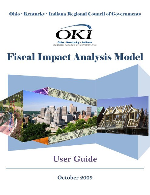
Ohio · Kentucky · Indiana Regional Council of Governments<br />
<strong>Fiscal</strong> <strong>Impact</strong> <strong>Analysis</strong> <strong>Model</strong><br />
User Guide<br />
October 2009
<strong>Fiscal</strong> <strong>Impact</strong> <strong>Analysis</strong> <strong>Model</strong><br />
User Guide<br />
Acknowledgements<br />
The preparation of this document was financed cooperatively by the Federal Highway<br />
Administration and the Federal Transit Administration of the United States Department<br />
of Transportation, the State of Ohio Department of Transportation, the Commonwealth<br />
of Kentucky Transportation Cabinet, the State of Indiana Department of Transportation,<br />
the Northern Kentucky Area Planning Commission and local units of government within<br />
the <strong>OKI</strong> region. The opinions, findings and conclusions expressed in this document are<br />
those of the author and not necessarily those of the United States Department of<br />
Transportation. This report does not constitute a standard, specification or regulation.<br />
The successful creation of the <strong>Fiscal</strong> <strong>Impact</strong> <strong>Analysis</strong> <strong>Model</strong> was made possible through<br />
the participation of dedicated staff, advisory committee members and the consultant<br />
development team. <strong>OKI</strong> wishes to express our sincere gratitude to all involved.<br />
<strong>OKI</strong> Regional Council of Governments<br />
Mark Policinski, Executive Director<br />
Robert Koehler, P.E., Deputy Executive Director<br />
Larisa Sims, AICP, Regional Planning Manager<br />
Mary Luebbers, Senior Planner<br />
Emi Randall, Senior Planner<br />
Brian Cunningham, Director of Communications & Legislative Affairs<br />
Summer Jones, Communications and Marketing Specialist<br />
Gayle Foster, Project Administrator<br />
David Shuey, GIS Manager<br />
Brad Mason, Visual Technology Coordinator<br />
Nicol Thompson, Land Use Intern<br />
Chad Harris, GIS Intern<br />
Development Team<br />
Christopher Auffrey, Ph.D., University of Cincinnati School of Planning<br />
Paul A. Culter, AICP, Jacobs Advance Planning Group<br />
Caitlin M. Douglas, Jacobs Advance Planning Group<br />
Mark C. Kirby, ASLA, Jacobs Advance Planning Group<br />
Jeffrey A. Rexhausen, Economics Center for Education and Research, University of<br />
Cincinnati<br />
Della G. Rucker, AICP, Jacobs Advance Planning Group<br />
Rainer vom Hofe, Ph.D., University of Cincinnati School of Planning<br />
Guler Irem Yelkenci, Economics Center for Education and Research, University of<br />
Cincinnati<br />
October 2009
<strong>Fiscal</strong> <strong>Impact</strong> <strong>Analysis</strong> <strong>Model</strong><br />
User Guide<br />
Advisory Committee<br />
Anderson Township<br />
Paul Drury, Assistant Director of Development Services<br />
Butler County Department of Development<br />
Mike Juengling, Director<br />
Joe Schmidt, AICP, Senior Planner<br />
Campbell County <strong>Fiscal</strong> Court<br />
Peter Klear, AICP, Director of Planning and Zoning<br />
City of Oxford<br />
Jung-Han Chen, AICP, Community Development Director<br />
City of Cincinnati<br />
Charles C. Graves, <strong>II</strong>I, Director, City Planning Department<br />
Margaret Wuerstle, Chief Planner<br />
Susan Pratt, Management Analyst Office of Budget and Evaluation<br />
Boone County <strong>Fiscal</strong> Court<br />
Tim Williams, Assistant County Administrator<br />
City of Hamilton<br />
John Creech, AICP, Senior Planner<br />
City of Monroe<br />
Kevin Chesar, Director of Development<br />
Dearborn County Plan Commission<br />
Mark McCormack, Director of Planning<br />
Metropolitan Sewer District of Greater Cincinnati<br />
Marge Hall, P.E., Principal Engineer<br />
Northern Kentucky Area Planning Commission<br />
Dennis Gordon, FAICP, Executive Director<br />
Keith Logsdon, AICP, Deputy Director of Long Range Planning
<strong>Fiscal</strong> <strong>Impact</strong> <strong>Analysis</strong> <strong>Model</strong><br />
User Guide<br />
Tablle off Conttentts<br />
Section 1: Introduction ................................................................................................. 1<br />
Background of <strong>OKI</strong>’s <strong>Fiscal</strong> <strong>Impact</strong> <strong>Analysis</strong> <strong>Model</strong> .................................................... 1<br />
Uses of the <strong>Model</strong> ....................................................................................................... 1<br />
<strong>Model</strong> Data and <strong>Analysis</strong> ............................................................................................ 1<br />
Caveats ....................................................................................................................... 2<br />
Software and Hardware Requirements ....................................................................... 3<br />
Managing Data and Projects ....................................................................................... 3<br />
Interested in Using the <strong>Model</strong>? ................................................................................... 3<br />
Section 2: Data in the <strong>Fiscal</strong> <strong>Impact</strong> <strong>Analysis</strong> ............................................................ 5<br />
Use by Local Governments ......................................................................................... 5<br />
Budget Data ................................................................................................................ 5<br />
Revenues ............................................................................................................... 6<br />
Expenditures ........................................................................................................... 8<br />
Land Use and Demographic Data ............................................................................. 10<br />
Capital Expenditures ................................................................................................. 13<br />
Updating Data ........................................................................................................... 13<br />
New <strong>Model</strong> Jurisdictions ........................................................................................... 15<br />
Section 3: How to Use the <strong>Model</strong> ............................................................................... 17<br />
Step 1: Data Gathering ............................................................................................. 17<br />
Step 2: Log in to the Website .................................................................................... 18<br />
Step 3: Create a Project or Modify/Delete/See Results of a Saved Project .............. 19<br />
Step 4: General Information Page ............................................................................. 20<br />
Step 5: Input Existing Land Use Information ............................................................. 22<br />
Step 6: Input Proposed Land Use Information .......................................................... 25<br />
Step 7: Generate and Download Your Results ......................................................... 28<br />
Setting up new users for your Jurisdiction ................................................................ 36<br />
October 2009
<strong>Fiscal</strong> <strong>Impact</strong> <strong>Analysis</strong> <strong>Model</strong><br />
User Guide<br />
Section 4: The Capital Cost Module .......................................................................... 41<br />
Step 1: Access the Module ....................................................................................... 41<br />
Step 2: Questions (Worksheet 1) .............................................................................. 42<br />
Step 3: Capital Cost Categories (Worksheet 2) ........................................................ 43<br />
Step 4: Calculate Capital Cost Estimates (Worksheet 3) .......................................... 44<br />
Using the Capital Cost Module’s Results .................................................................. 47<br />
Appendices and Additional Resources ..................................................................... 49<br />
A. Development Information Workbook<br />
B. Land Use Allocation Reference
<strong>Fiscal</strong> <strong>Impact</strong> <strong>Analysis</strong> <strong>Model</strong><br />
User Guide<br />
Sectiion 1: <strong>II</strong>ntroductiion<br />
Background of <strong>OKI</strong>’s <strong>Fiscal</strong> <strong>Impact</strong> <strong>Analysis</strong> <strong>Model</strong><br />
The Ohio-Kentucky-Indiana Regional Council of Governments (<strong>OKI</strong>) has developed a<br />
<strong>Fiscal</strong> <strong>Impact</strong> <strong>Analysis</strong> <strong>Model</strong> (“the <strong>Model</strong>”) to give decision makers a better<br />
understanding of the budgetary implications of land use proposals. The need for a<br />
fiscal impact analysis tool was identified as part of <strong>OKI</strong>’s Strategic Regional Policy Plan,<br />
Where Do We Grow From Here? which was adopted in 2005.<br />
Uses of the <strong>Model</strong><br />
The <strong>Fiscal</strong> <strong>Impact</strong> <strong>Analysis</strong> <strong>Model</strong> is an educational tool. Information generated from<br />
the <strong>Model</strong> helps local governments better understand the revenues and costs<br />
associated with new development or redevelopment. The model also enhances a<br />
jurisdiction’s ability to provide public facilities and services.<br />
The <strong>Fiscal</strong> <strong>Impact</strong> <strong>Analysis</strong> <strong>Model</strong> estimates the costs and revenues associated with<br />
land use change. It can compare alternative development scenarios within a jurisdiction<br />
and analyze effects of specific development projects.<br />
<strong>Model</strong> Data and <strong>Analysis</strong><br />
The <strong>Model</strong> employs a modified average cost approach. This approach is more robust<br />
than a typical average cost approach because it includes statistical analysis that refines<br />
the results based on the intensity of the specific land use and its impact on specific<br />
types of local revenues and services.<br />
The <strong>Model</strong> uses local, regional and national data sources to estimate revenue and the<br />
demand for broad categories of services that are likely to result from a proposed<br />
development or redevelopment. The <strong>Model</strong> bases revenue and expenditure estimates<br />
on the statistical relationship between types of land uses and the intensity of their<br />
revenue and cost generating factors.<br />
Data developed by <strong>OKI</strong> is used for many of the <strong>Model</strong> calibrations; however, users must<br />
provide detailed local data on land use types, building improvements on the land,<br />
acreage, and market value. Financial data such as revenues and expenditures and tax<br />
rates are also necessary to produce results. This local data is critical to the <strong>Model</strong>’s<br />
ability to develop the most useful estimates.<br />
October 2009 1
<strong>Fiscal</strong> <strong>Impact</strong> <strong>Analysis</strong> <strong>Model</strong><br />
User Guide<br />
The <strong>Model</strong> has been created in both Microsoft Excel and as a web application. The<br />
structure of the <strong>Model</strong> can accommodate a variety of jurisdictional sizes and types<br />
including cities, villages, towns, counties and townships in Ohio, Kentucky and Indiana.<br />
Caveats<br />
To use the <strong>Model</strong> appropriately, users must understand several key points about the<br />
nature of fiscal impact analyses. In order to prevent misinterpretation of the <strong>Model</strong>’s<br />
purpose or its results, the following caveats must be explained.<br />
• The results from the <strong>Model</strong> are an estimate of potential future expenditures and<br />
revenues based on certain assumptions and statistical analysis. Actual<br />
expenditures and revenues may differ based on the specifics of a proposed<br />
development and site characteristics.<br />
• Information from the <strong>Fiscal</strong> <strong>Impact</strong> <strong>Analysis</strong> <strong>Model</strong> should not be the sole source for<br />
making land use decisions. <strong>Model</strong> results provide information on only one aspect<br />
(the fiscal aspect) of the land use decision making process. Land use decisions are<br />
complex and should involve consideration of multiple factors, including<br />
environmental, social, political, economic, and many others, in addition to fiscal.<br />
• The exact dollar amounts generated by the model should not be the sole source for<br />
local government budgeting purposes.<br />
• The <strong>Model</strong> is not an economic impact analysis model. It does not estimate multiplier<br />
effects – the value of the spin-off jobs or businesses that a new development or<br />
redevelopment may indirectly create by generating additional demand or<br />
opportunities for other area businesses.<br />
• Revenues and expenses are estimated based on existing conditions – current taxes<br />
and tax rates, current service levels, etc.<br />
• The accuracy of the <strong>Model</strong>’s output is directly dependent on the accuracy of the data<br />
that was available to the <strong>Model</strong> developers and the data input by the user.<br />
• The <strong>Model</strong> evaluates fiscal impacts from a single local government’s point of view. If<br />
the user is interested in estimating impacts on both a municipality or township and a<br />
county, the analysis must be run separately for each jurisdiction.<br />
• If special districts or independent service providers exist (such as schools or fire<br />
districts), specific data refinements are necessary to calculate the impact on those<br />
districts. If revenues and expenditures for these services are not included in the<br />
local government budget, they will not be accounted for in the results.<br />
• Enterprise funds, such as water and sanitary sewer services, are not included in the<br />
<strong>Model</strong> analysis.<br />
• The <strong>Model</strong> does not incorporate state or federal impacts directly into the<br />
calculations.<br />
2
<strong>Fiscal</strong> <strong>Impact</strong> <strong>Analysis</strong> <strong>Model</strong><br />
User Guide<br />
• The <strong>Model</strong> does not calculate changes to actual revenues or service costs resulting<br />
from Joint Economic Development Districts (JEDDs), Tax Increment Financing (TIF)<br />
agreements, property tax abatements, and other site-specific programs or targeted<br />
incentives.<br />
• The <strong>Model</strong> is designed to address a range of typical development types. Atypical<br />
developments (e.g., regional tourism destinations) may not be adequately captured<br />
by the <strong>Model</strong>. Adjustments have been made to smooth the effect of existing outliers<br />
in participating communities using the <strong>Model</strong>. As such, impacts of land uses that<br />
represent additional outliers will not be accurately analyzed.<br />
Software and Hardware Requirements<br />
The <strong>Model</strong> will run successfully on any computer with Internet access and using either<br />
Internet Explorer 6.0 or higher or Firefox as a web browser. Exporting results requires<br />
Microsoft Word 2003 or higher or Microsoft Excel 2003 or higher. The <strong>Model</strong> is also<br />
compatible with the Safari browser, version 3.0.4.<br />
Managing Data and Projects<br />
The <strong>Model</strong> will save all projects and the results of the calculations. Users will be able to<br />
access their previous projects from a pull-down menu on the home page. Users should<br />
click the “Save” button at the bottom of each page to be certain that a project’s<br />
information has been saved.<br />
The user may also download and save projects to his or her desktop in Microsoft Word<br />
or Microsoft Excel format. This downloaded data will not be write protected and data<br />
manipulation outside of the website should be closely monitored to ensure accuracy.<br />
In the event that <strong>OKI</strong> finds it necessary to delete older saved projects in the future<br />
because of storage limitations, <strong>OKI</strong> will notify the users and give them ample<br />
opportunity to download their information.<br />
Interested in Using the <strong>Model</strong>?<br />
The <strong>Fiscal</strong> <strong>Impact</strong> <strong>Analysis</strong> <strong>Model</strong> is intended for use by communities in the Ohio-<br />
Kentucky-Indiana Regional Council of Governments (<strong>OKI</strong>) region. Use of the <strong>Model</strong> is<br />
currently available to <strong>OKI</strong> jurisdictions that have engaged in a partnership with <strong>OKI</strong> and<br />
provided their data for the <strong>Model</strong>. For more information on partnering with <strong>OKI</strong> to use<br />
the <strong>Fiscal</strong> <strong>Impact</strong> <strong>Analysis</strong> <strong>Model</strong>, contact <strong>OKI</strong>’s Regional Planning Manager at 513-<br />
621-6300.<br />
October 2009 3
<strong>Fiscal</strong> <strong>Impact</strong> <strong>Analysis</strong> <strong>Model</strong><br />
User Guide<br />
4
<strong>Fiscal</strong> <strong>Impact</strong> <strong>Analysis</strong> <strong>Model</strong><br />
User Guide<br />
Sectiion 2: Data iin the Fiiscall <strong>II</strong>mpact Anallysiis<br />
This section is designed to orient the <strong>Model</strong> user to the data and analysis concepts<br />
used in the <strong>OKI</strong> <strong>Fiscal</strong> <strong>Impact</strong> <strong>Analysis</strong> <strong>Model</strong>.<br />
Use by Local Governments<br />
The <strong>Model</strong> is designed to work for an exceptionally wide variety of local governments.<br />
Each of the three states in the <strong>OKI</strong> region has different governmental structures, with<br />
different taxing powers and different service requirements and methods (See Appendix<br />
A of the Methodology for an overview of local government structures and powers). In<br />
the text of this User Guide, the term “local government” or “jurisdiction” is generally used<br />
to refer to those communities that have entered data into the <strong>Model</strong> and that are<br />
considered active partners with <strong>OKI</strong>.<br />
Although the <strong>Model</strong> is designed to be used by any local government within the <strong>OKI</strong><br />
region, <strong>Model</strong> calculations are based on data sets specific to the community for which<br />
the <strong>Model</strong> is being used. The user must associate the development to be evaluated<br />
with a specific local government, and that association triggers the <strong>Model</strong> to draw<br />
pertinent information from that jurisdiction’s database. For this reason, any local<br />
government that wishes to use the <strong>Model</strong> must partner with <strong>OKI</strong> to gather appropriate<br />
data for use in the <strong>Model</strong>. Because the <strong>Model</strong> draws extensively from this local data to<br />
generate the highest level of accuracy possible for that community, users should not<br />
use estimates that are based on another community’s data, even if that community is<br />
assumed to be very similar.<br />
The <strong>Model</strong> is designed to accommodate the following local government types within the<br />
<strong>OKI</strong> region:<br />
• Ohio: County, City (home rule or statutory), Village, Township (limited home rule<br />
or statutory)<br />
• Indiana: County, City, Town, Township<br />
• Kentucky: County, First – Sixth Class City<br />
Budget Data<br />
The <strong>Model</strong> allocates a jurisdiction’s existing expenditures and revenues on the basis of<br />
the structure of its financial documents, such as audit reports (KY), annual financial<br />
statements (IN) or Comprehensive Annual <strong>Fiscal</strong> Report or CAFRs (OH). The array of<br />
October 2009 5
<strong>Fiscal</strong> <strong>Impact</strong> <strong>Analysis</strong> <strong>Model</strong><br />
User Guide<br />
revenue types and expenditure categories that <strong>OKI</strong> jurisdictions use are generalized in<br />
the <strong>Model</strong> into a limited number of categories. The use of these categories is intended<br />
to accommodate a wide variety of government budget information and to identify<br />
revenues and costs by type, not necessarily by each item that may be found in a local<br />
government’s budget.<br />
Revenues<br />
Revenues in the <strong>Model</strong> are limited to those taxes and fees that the local government is<br />
empowered to collect by state law, charter, enabling legislation or local ordinance.<br />
Revenues are sources of income that a jurisdiction receives through the levying of<br />
taxes, charging for various public services the municipality or township provides, levying<br />
fines and fees, and other methods of generating income that allow the local government<br />
to operate. In order to calculate potential revenues from development scenarios,<br />
existing information on revenues is needed. Both community specific revenue<br />
information and outcomes from model analysis are accommodated through the same<br />
revenue types (or categories).<br />
Based on the government structure and other factors, potential revenue types include<br />
the following:<br />
• Real Property Tax (and other taxes). Property taxes, payments in lieu of taxes<br />
and other property-based revenues as defined in local budgets are included in<br />
this revenue item. Classification of revenues as property taxes is based on local<br />
Comprehensive Annual Financial Reports (CAFRs), audit reports or financial<br />
reports. Specific procedures for levying real property taxes vary by state, but the<br />
process generally involves the application of a property tax rate against the<br />
property’s assessed value, which may be adjusted by state or local law to reflect<br />
ownership or land use considerations. The <strong>Model</strong> addresses adjustments by<br />
using net “effective” tax rates for each jurisdiction, which account for the value of<br />
adjustments within the rate. In Ohio, two different effective tax rates are usually<br />
applied by the County Auditor: one rate for residential or agricultural land uses,<br />
and one for commercial or industrial uses, reflecting differences in assessment<br />
adjustments between these two categories of land use. The rates used in the<br />
<strong>Model</strong> are not inclusive of any taxes levied from other taxing bodies, such as<br />
schools or special districts, but only include tax rates imposed by the specific<br />
jurisdiction. Ohio’s real property assessment ratio is 35%. Indiana and<br />
Kentucky’s ratio is 100%. These differences are also reflected in the <strong>Model</strong>.<br />
6
<strong>Fiscal</strong> <strong>Impact</strong> <strong>Analysis</strong> <strong>Model</strong><br />
User Guide<br />
• Income or earnings tax and occupational license tax. Many jurisdictions in<br />
the region collect a tax on income or total earnings. Ohio municipal legislative<br />
authorities may levy, without vote of the people, an income tax of up to 1%.<br />
Kentucky cities and counties can levy occupational license taxes on wages,<br />
salaries, commissions, and other compensation received by individuals. In<br />
Indiana, different local income tax rates may be applied to those who live inside<br />
and outside of the jurisdiction. These taxes may or may not include a cap. Each<br />
participating community collecting income tax submitted detail on the<br />
percentages of the total income tax revenue that was made up from withholdings<br />
(employed labor), net profits (corporations) and individuals (self employed labor).<br />
These differences are reflected in the <strong>Model</strong>.<br />
Some jurisdictions have reciprocity agreements, in which the taxpayer is not<br />
liable to her or his home jurisdiction for the amount of taxes paid to the work<br />
jurisdiction. As a result, the <strong>Model</strong>’s income and earnings tax calculations<br />
account for three types of individual taxpayers, in addition to corporate tax<br />
liabilities:<br />
• People who work and live in the jurisdiction.<br />
• People who live in the jurisdiction but work elsewhere.<br />
• People who work in the jurisdiction but live elsewhere.<br />
• Sales and Estate Tax. Some jurisdictions in the <strong>OKI</strong> region levy sales tax and<br />
estate tax. Sales tax is calculated as a percentage of the total cost of a good or<br />
taxable service. This percentage is added to the cost of the purchase. There are<br />
no local sales or use taxes in Kentucky or Indiana. Ohio counties may enact up<br />
to 1% sales and use tax, in 0.25% increments, for use by the county general<br />
fund. Estate taxes are levied on inheritances that exceed a certain statemandated<br />
total amount. Estate taxes are generally due to the jurisdiction where<br />
the decedent lived. Since the amount of estate tax collected per year is entirely<br />
dependent upon the number of residents dying in a specific year with net worth<br />
sufficient to trigger the estate tax, many jurisdictions do not include estate taxes<br />
in their revenue estimates. Where applicable, these revenue types are reflected<br />
in the <strong>Model</strong>.<br />
• Licenses and Permits. Depending on the jurisdiction, license and permit fees<br />
may be associated with vehicle registration, animal registration, liquor licenses,<br />
building permits or other licenses and permits. License fees are established on a<br />
October 2009 7
<strong>Fiscal</strong> <strong>Impact</strong> <strong>Analysis</strong> <strong>Model</strong><br />
User Guide<br />
per-unit basis, and the amount of the fee collected depends on the number of<br />
entities eligible to pay that fee. These revenue types are reflected in the <strong>Model</strong>.<br />
• Charges for Services. Depending on the jurisdiction, fees may be charged for<br />
services such as building inspections, property transfers and recycling. These<br />
revenue types are reflected in the <strong>Model</strong>.<br />
• Fees, Fines and Forfeitures. Depending on the jurisdiction, revenues from<br />
fees, fines and forfeitures may include fines for such offenses as traffic violations,<br />
licensing or permitting failures, property maintenance violations and others.<br />
These revenue types are reflected in the <strong>Model</strong>. Some jurisdictions also receive<br />
forfeited property, as in the case of a felony prosecution or abandonment of an<br />
asset.<br />
• Income from investments and interest, and intergovernmental revenue.<br />
Other types of potential revenues include intergovernmental revenues, interest<br />
payments to the local government, and charitable contributions or donations to<br />
the jurisdiction. Intergovernmental revenues include local government aid,<br />
federal and state grants, and project-specific funding such as Community<br />
Development Block Grants (CDBGs) or HOME investment partnership program<br />
funds (HOME). Where applicable, these revenue types are reflected in the<br />
<strong>Model</strong>.<br />
Expenditures<br />
Expenditures are less straightforward to calculate, both because different communities<br />
provide widely differing types and levels of service and because communities generally<br />
allocate their expenses by budget item, not by the land use being served. Day to day<br />
operating expenditures for ongoing projects and other government functions are<br />
included in the <strong>Model</strong>.<br />
Expenditures are estimated for each category based on the local yearly expenditures<br />
per category, which are adjusted statistically by comparison with a large sample of<br />
communities to account for any unusual circumstances in that year’s data. Capital<br />
expenditures are usually treated separately from operating expenditures and are<br />
discussed later in User’s Guide.<br />
The <strong>Model</strong> uses six basic categories of expenditures, which are referred to in this Guide<br />
as public service areas. Depending on how a specific community’s financial reporting is<br />
8
<strong>Fiscal</strong> <strong>Impact</strong> <strong>Analysis</strong> <strong>Model</strong><br />
User Guide<br />
structured, the same type of expenditure may appear under one service area in one<br />
community and in a different category for another. For example, a community that<br />
maintains its parks using public works personnel and equipment will generally allocate<br />
funding for that service to the public works department and, as a result, that expense<br />
will be accounted for in the “Infrastructure” public service area. In contrast, another<br />
community may fund park maintenance specifically through its parks and recreation<br />
department and thus that funding is accounted for in the <strong>Model</strong> under the “Parks and<br />
Recreation” public service area. In cases where these categories are combined within a<br />
jurisdiction’s budget, they are not generally separated for purposes of this <strong>Model</strong>,<br />
although it may be possible to make that separation based on specific information if<br />
necessary.<br />
To fully understand what a public service area includes for any specific community, the<br />
user should review a recent audit report (KY), financial statement (IN) or CAFR (OH)<br />
and identify how funding categories are organized in that document.<br />
The public service areas used in the <strong>Model</strong> are:<br />
• Public Safety. This category includes police or sheriff services, fire safety and<br />
suppression, emergency medical services, hazardous materials management<br />
and other such services. Services received by a community but not provided by<br />
the local government are not included in this category, such as fire services<br />
whose funding does not appear in the jurisdiction’s budget. Services provided by<br />
a separate agency but whose funding appears in the jurisdiction’s budget, such<br />
as contracted additional sheriff services, are accounted for in the <strong>Model</strong>.<br />
• Infrastructure. This category includes public works, sanitation, and<br />
transportation services such as road repair and maintenance, snow removal,<br />
parking, maintenance of public landscapes, and other such services funded<br />
through routine local government funds. Infrastructure services funded through<br />
enterprise agencies are not accounted for in the <strong>Model</strong>.<br />
• Public Health and Welfare. This category includes public health programs,<br />
workforce development, health inspections, social assistance programs, senior<br />
services and mental health programs, and other human services funded through<br />
the jurisdiction’s budget. Services available to a jurisdiction’s residents but not<br />
funded by that jurisdiction are not accounted for in the <strong>Model</strong>.<br />
October 2009 9
<strong>Fiscal</strong> <strong>Impact</strong> <strong>Analysis</strong> <strong>Model</strong><br />
User Guide<br />
• Community Development. This category includes building permit and building<br />
inspection, zoning, planning, community development services and economic<br />
development funded by the jurisdiction. Community development services<br />
provided to the jurisdiction but paid for by another local government entity are not<br />
accounted for in the <strong>Model</strong>.<br />
• Parks and Recreation. This category includes the purchase, improvement, and<br />
maintenance of park and recreational facilities, staffing and programming of park<br />
and recreational facilities and conservation activities (where applicable).<br />
Facilities and services available to a jurisdiction’s residents but not funded<br />
directly by the local government are not accounted for in the <strong>Model</strong>.<br />
• General Government. This category includes all other operating costs,<br />
including administration services, administration property maintenance,<br />
accounting and financial management services, and others.<br />
Land Use and Demographic Data<br />
The <strong>Model</strong> relies on a generalized set of land use categories. The <strong>Model</strong>’s land use<br />
categories were developed to capture key variations in land use characteristics that<br />
have a significant impact on fiscal issues. For example, the <strong>Model</strong> includes a High<br />
Traffic Retail category because businesses in this category typically have high volumes<br />
of customers compared to their footprint, as well as unique employment characteristics<br />
and wage rates. These issues will have distinct impacts on the revenues and<br />
expenditures associated with this land use.<br />
Users of the <strong>Model</strong> are asked to identify a proposed development site or land use<br />
planning scenario according to its existing land uses and its proposed land uses, using<br />
the <strong>Model</strong>’s land use categories. Guidance for identifying which land use categories to<br />
apply is provided in Table 1 below and in Appendix B, which contains the specific land<br />
use data assignments for each initial project partner community (See the Methodology<br />
for a detailed explanation of the land use category assignment process).<br />
The <strong>Model</strong> uses a detailed set of jurisdiction land use, demographic and economic<br />
information to provide a basis for estimating impacts. Specific data requirements for<br />
each land use category are as follows: gross square footage of improvements on the<br />
land; the number of housing and/or business units on the land; the market value; the<br />
number of acres in each land use category; the number of residents; the number of<br />
residents age 65 or older; the number of residents younger than 19; employment; hourly<br />
10
<strong>Fiscal</strong> <strong>Impact</strong> <strong>Analysis</strong> <strong>Model</strong><br />
User Guide<br />
wage rates; tax rates (discussed above); daily Vehicle Miles Traveled (VMT); and<br />
density (units per acre). This data can be derived by <strong>OKI</strong>, through Geographic<br />
Information Systems (GIS) data, from the U.S. Census, from the North American<br />
Industry Classification System, or other reliable data sources. (For a complete list of<br />
data sources see the Methodology.)<br />
October 2009 11
<strong>Fiscal</strong> <strong>Impact</strong> <strong>Analysis</strong> <strong>Model</strong><br />
User Guide<br />
Table 1: <strong>OKI</strong> <strong>Fiscal</strong> <strong>Impact</strong> <strong>Analysis</strong> <strong>Model</strong> Land Use Categories<br />
Land Use<br />
Code Title Explanation<br />
Ag<br />
Agricultural<br />
This category includes working and non-working farmland, with and without<br />
residences. Residential uses associated with Agricultural properties are included in<br />
the Estate Residential category.<br />
Res1<br />
Estate<br />
Residential<br />
This category includes single family detached residential units (including mobile and<br />
manufactured homes) each on a parcel over 1 acre.<br />
Res2<br />
Single-Family<br />
Residential<br />
This category includes single family detached residential units (excluding mobile<br />
home parks), each on a parcel of less than 1 acre.<br />
Res3<br />
Multi-Family<br />
Residential<br />
This category includes attached single family residential units (apartments and<br />
condominiums) and mobile home parks.<br />
Retail C1<br />
Neighborhood<br />
Shopping<br />
Center<br />
This category includes small structures, or groupings of small structures designed<br />
for retail use, typically around 50,000 square feet in size on three to ten acres.<br />
Includes recreational facilities of similar size. Customers come and go irregularly<br />
throughout the day. Include uses such as drug stores, clothing stores,<br />
merchandising, beauty shops, laundry-mats, and other personal services and<br />
specialty retail venues.<br />
Retail C2<br />
Retail C4<br />
Retail C5<br />
Retail C6<br />
Community<br />
Shopping<br />
Center<br />
Sit Down<br />
Restaurants<br />
Hotels &<br />
motels<br />
High Traffic<br />
Retail<br />
This category includes discount stores and community shopping centers including<br />
big box stores, car dealers and other regional-scale shopping venues. Buildings or<br />
groupings of buildings are generally around 150,000 square feet on ten to thirty<br />
acres. Customers come and go irregularly throughout the day. Include uses such as<br />
automotive sales and rental, furniture stores, home centers, department stores,<br />
recreation and entertainment.<br />
This category includes commercial establishments that provide prepared food or<br />
food-and drink-related entertainment for consumption on site. Buildings are<br />
generally freestanding. This category excludes drive-in or drive-through<br />
businesses. Peak hours for customers are generally meal times.<br />
This category includes hotels and motels providing temporary lodging for<br />
Customers. This category includes all related facilities on site (meeting rooms,<br />
restaurants, etc). Customers come and go on an irregular basis.<br />
This category includes establishments that derive a large portion of business from<br />
drive-in or drive-through customers, such as convenience stores, gas stations and<br />
fast food restaurants. Customers come and go at all hours of the day.<br />
Office C1 Office General office uses and funeral homes.<br />
Office C2<br />
Ind1<br />
Ind2<br />
Ed Gov<br />
Rel<br />
Park<br />
Consumer<br />
oriented office<br />
Light Industry<br />
Manufacturing<br />
Education and<br />
Government<br />
Religious<br />
Parks,<br />
cemeteries,<br />
utilities,<br />
parking<br />
structures and<br />
vacant land<br />
Offices with large volume of short visits (i.e. medical offices, banks and saving<br />
institutions)<br />
This category includes establishments engaged in wholesaling, warehousing and<br />
storage, waste collection and other light industry with high traffic volumes but few<br />
employees.<br />
This category includes establishments engaged in large scale manufacturing and<br />
assembly resulting in significant truck traffic, heavy equipment use and high<br />
numbers of employees.<br />
This category includes nonprofit facilities that provide public services to the local<br />
resident population. Facilities are generally intensively used during the business<br />
day and have lower levels of activity, including persons and vehicles on site, during<br />
non-business hours.<br />
This category includes nonprofit facilities used primarily for religious activities,<br />
including worship, meetings and supplemental (not full time) religious education.<br />
Facilities experience relatively little use during most of the week, with the exception<br />
of specific times of increased activity (such as Friday evening or Sunday morning).<br />
This category includes all land uses that generate relatively little cost and revenue.<br />
Parking structures within this category should have parking as a primary function,<br />
not a secondary use within a larger structure or development. Utility-related land<br />
uses should only be placed in this category when they do not regularly house<br />
workers, such as electrical substations or wells fields. (If human or vehicle activity<br />
occurs on a regular basis, the site should be classified as Office, Industrial or<br />
another appropriate category.)<br />
12
<strong>Fiscal</strong> <strong>Impact</strong> <strong>Analysis</strong> <strong>Model</strong><br />
User Guide<br />
Capital Expenditures<br />
Capital expenditures are outlays made by a local government to purchase assets that<br />
have a long usable life. Because capital expenditures can vary greatly from year to<br />
year, because they are generally larger in magnitude, and because new capital<br />
investment is typically triggered by the cumulative impacts of growth rather than by a<br />
single land use change, it is difficult to estimate the impact that one development may<br />
have on capital expenditures using the same methods that are used to estimate<br />
operating expenditures. Accordingly, the Capital Cost Module of the <strong>Model</strong> is provided<br />
as a separate Excel workbook and does not have a web-based counterpart.<br />
Typical capital expenses include vehicles, buildings, furnishings and real estate.<br />
Although some jurisdictions identify items such as computers and handheld tools as<br />
capital expenditures, for reasons of efficiency and usefulness, the Capital Cost Module<br />
of the <strong>Model</strong> focuses on items that are at least partially financed by debt. As opposed<br />
to operational expenditures, which are typically funded and expended within a single<br />
year, capital expenditures within the <strong>Model</strong> are generally spread over multiple years,<br />
with a capital outlay occurring in the first year and principal and interest payments<br />
accruing over the course of some number of subsequent years, based on the terms of<br />
the financing. For this reason, the Capital Cost Module of the <strong>Model</strong> assumes that the<br />
impact of a capital cost expenditure on principal and interest payments will be one of the<br />
most critical impacts of a capital expenditure. For more information on the Capital Cost<br />
Module, see Section 4 of this User Guide.<br />
Updating Data<br />
The <strong>Model</strong> is designed to allow data to be updated efficiently. In order to maintain the<br />
integrity of the data, the <strong>OKI</strong> Administrator will provide data updates for users of the<br />
<strong>Model</strong>. This section briefly outlines the process and general timelines for updating data<br />
for current users.<br />
Locally-provided data on land use and budgeting should be updated annually. Such<br />
data may include the most recent audited financial reports, GIS data including land use<br />
information, and property valuation administrator (PVA), Assessor or Auditor’s data.<br />
<strong>OKI</strong> staff will evaluate new data and make necessary changes to the jurisdiction’s local<br />
data set.<br />
Tax rates and tax liability criteria should be updated whenever new rates or liabilities are<br />
created. Updated information on caps on taxes due, rollbacks and other factors that<br />
apply to broad categories of workers, residents, businesses or properties should be<br />
October 2009 13
<strong>Fiscal</strong> <strong>Impact</strong> <strong>Analysis</strong> <strong>Model</strong><br />
User Guide<br />
provided to <strong>OKI</strong> as soon as possible after such changes go into effect. Property tax<br />
rates should include only taxes due to the jurisdiction, not to school districts, other local<br />
governments or other agencies. It is important for Ohio users to remember that the<br />
<strong>Model</strong> uses effective net property tax millages for residential and non-residential uses,<br />
and that these millages must include only mills due to the jurisdiction. The effective net<br />
millage will be available from your County Auditor.<br />
Users may also wish to discuss an update with the <strong>OKI</strong> Administrator if significant<br />
changes to the jurisdiction, such as the following, have occurred recently:<br />
• A jurisdiction-wide reassessment of real property<br />
• An extensive amount of new development, such as a very large residential<br />
development, a major factory or a regional shopping center<br />
• The local establishment of any new development-related fees that are not linked<br />
to an enterprise fund or a special district<br />
• An annexation that substantially changes the number of acres in the jurisdiction<br />
<strong>OKI</strong> will provide updates of regional, state and national data as information become<br />
available. This data may include the results of the decennial Census and the American<br />
Community Survey, results of the Economic Census, Bureau of Labor Statistics reports,<br />
and receipt of specialized transportation and business data that are maintained by <strong>OKI</strong>.<br />
Some general guidelines for these data updates are as follows:<br />
• Population by age<br />
o Source: Census 2010<br />
o Availability: 2010 data will likely available in 2011<br />
• Employment by type<br />
o Source: ES202 data (Quarterly Census of Employment and Wages)<br />
o Availability: 2010 data likely available in 2012<br />
• Inter-jurisdictional commuting patterns<br />
o Source: Census Transportation Planning Package<br />
o Availability: aggregated 5-year data based on American Community<br />
Survey likely available by 2014<br />
14
<strong>Fiscal</strong> <strong>Impact</strong> <strong>Analysis</strong> <strong>Model</strong><br />
User Guide<br />
• Average hourly wage<br />
o Source: Bureau of Labor Statistics<br />
o Availability: annually<br />
• Housing units by type of structure<br />
o Future source: American Community Survey<br />
o Availability: aggregated 5-year data (2006-2010) likely available in 2011<br />
• Household size<br />
o Future source: American Community Survey<br />
o Availability: aggregated 5-year data (2006-2010) likely available in 2011<br />
If you have any concerns about possible data distortions or errors, please contact the<br />
<strong>OKI</strong> Administrator as soon as possible.<br />
New <strong>Model</strong> Jurisdictions<br />
The <strong>Fiscal</strong> <strong>Impact</strong> <strong>Analysis</strong> <strong>Model</strong> is intended for use by communities in the Ohio-<br />
Kentucky-Indiana Regional Council of Governments (<strong>OKI</strong>) region. Use of the <strong>Model</strong> is<br />
currently available to <strong>OKI</strong> jurisdictions that have provided their data to the <strong>Model</strong>. <strong>OKI</strong><br />
has created a partnership program to facilitate the addition of new users of the <strong>Model</strong>.<br />
For more information on partnering with <strong>OKI</strong> to use the <strong>Model</strong>, contact <strong>OKI</strong>’s Regional<br />
Planning Manager at 513-621-6300.<br />
October 2009 15
<strong>Fiscal</strong> <strong>Impact</strong> <strong>Analysis</strong> <strong>Model</strong><br />
User Guide<br />
16
<strong>Fiscal</strong> <strong>Impact</strong> <strong>Analysis</strong> <strong>Model</strong><br />
User Guide<br />
Sectiion 3: How to Use the <strong>Model</strong>l<br />
This section provides step-by-step instructions for using the <strong>Model</strong>. The user is<br />
encouraged to follow this process as written, both to facilitate useful results and to make<br />
the use of the <strong>Model</strong> as straightforward as possible.<br />
Step 1: Data Gathering<br />
A “Development Information Workbook” has been created for this model and is included<br />
as Appendix A of this document. You can photocopy the Workbook or download the<br />
digital version from the <strong>Model</strong> website. You can use of this workbook to gather all<br />
appropriate data, or simply type the data directly into the electronic version of the<br />
<strong>Model</strong>.<br />
If the proposed development is phased and a fiscal impact analysis is desired for the<br />
individual phases, you will need to have all necessary development information at each<br />
phase’s build-out, and the <strong>Model</strong> will need to be run separately with the information on<br />
each phase.<br />
The <strong>Model</strong> is focused on estimating the revenues and expenditures for operating costs<br />
associated with general government services. However, other issues can also affect<br />
local government costs and revenues, including construction of public facilities<br />
necessary to enable the development or redevelopment and incentives to attract or<br />
retain the investment. The last pages of the Development Information Workbook<br />
provide an opportunity to identify these potential additional impacts. This data will not<br />
be input into the web interface and does not affect the calculations of the <strong>Model</strong>. You<br />
may find it beneficial, however, to note these incentives and expenditures to help you<br />
guide your jurisdiction’s decision makers through the process of reviewing the proposal.<br />
October 2009 17
<strong>Fiscal</strong> <strong>Impact</strong> <strong>Analysis</strong> <strong>Model</strong><br />
User Guide<br />
Step 2: Log In to the Website<br />
Go to the <strong>Fiscal</strong> <strong>Impact</strong> <strong>Analysis</strong> <strong>Model</strong> website by clicking on the link below or by<br />
copying and pasting the link into your Internet browser.<br />
www.oki.org/fim<br />
You will be presented with a log in screen that asks for your user name and password.<br />
Enter the user name and password provided by the <strong>OKI</strong> Administrator, and click the<br />
“Login” button. You will be able to change your password, if desired, by using the<br />
“Manage User” function after you are logged in.<br />
18
<strong>Fiscal</strong> <strong>Impact</strong> <strong>Analysis</strong> <strong>Model</strong><br />
User Guide<br />
Step 3: Create a Project or Modify/Delete/See Results of a Saved<br />
Project<br />
To:<br />
• Enter a new project: Click “Start a New Project.” Then go to Step 4, page 21.<br />
• Modify a saved project: Navigate to the name of the saved project in the pull<br />
down list under “Load a Previously Saved Project” and click on “Modify Saved<br />
Project.” Then go to Step 4, page 21.<br />
• See results of a saved project: Navigate to the name of the saved project in the<br />
pull down list under “Load a previously saved project” and click on “Project<br />
Results.” Then go to Step 7, page 28.<br />
• Delete a project: Navigate to the name of the saved project in the pull down list<br />
under “Load a Previously Saved Project” and click on “Delete Project.”<br />
October 2009 19
<strong>Fiscal</strong> <strong>Impact</strong> <strong>Analysis</strong> <strong>Model</strong><br />
User Guide<br />
Step 4: General Information Page<br />
With the exception of the Gross Acreage, “General Information” items are not<br />
incorporated into the <strong>Model</strong> calculations, but are provided to help you identify evaluated<br />
projects and be aware of other service providers that may be impacted by the<br />
development but are not analyzed by the <strong>Model</strong>. Numbers and letters are both<br />
acceptable inputs on this page. If you do not have an item of information requested,<br />
you may leave it blank. Required fields include Project Name, Project ID, County,<br />
Location of the site and Number of Acres. It is recommended that you find and record<br />
the requested information for your own future reference. The General Information data<br />
will be transferred to the <strong>Model</strong>’s output.<br />
You may save your project at any point. Once you click “Save” you will be sent back to<br />
the front page. From here, to see the results of a saved project, navigate to the name<br />
of the saved project in the pull down list under “Load a previously saved project” and<br />
click on “Project Results.”<br />
20
<strong>Fiscal</strong> <strong>Impact</strong> <strong>Analysis</strong> <strong>Model</strong><br />
User Guide<br />
Data Entry<br />
• Jurisdiction: The name of your jurisdiction will automatically appear in this box.<br />
• Project Name: For a new project, enter a distinctive project name that will<br />
facilitate future scenario retrieval. If you are developing estimates for a phased<br />
project, you may wish to identify that in the project name, e.g., “Shady Grove<br />
Development, Phase I”. If you are modifying a saved project, the project name<br />
entered here should mirror the name of the saved project.<br />
• Project ID: You may want to include the development review number, parcel<br />
identification number or tax identification number for future reference.<br />
• County: If the development is in a Township, Town or municipality, enter the<br />
county name. This is especially helpful if a jurisdiction lies in more than one<br />
county.<br />
• Location of Site (street address or intersection): Provide the address of the<br />
site, if available, or closest street intersection or legal description.<br />
• Number of Acres (gross acreage): Enter the gross number of acres associated<br />
with the site. This should be identified on your development plan. If you do not<br />
know the acreage, the County Auditor, County Assessor or PVA website will<br />
typically have a property search function that will allow you to access current<br />
property information including acreage. You can typically conduct a search<br />
based on the address, owner name or property/parcel identification number. If<br />
you have access to Geographic Information Systems (GIS), you can also<br />
calculate the acreage of the parcel and use that as your estimate. The number<br />
of acres identified on this page should equal the total acres shown throughout the<br />
<strong>Model</strong>. The number of acres does not need to have any higher accuracy than<br />
one decimal point (i.e., “XX.X”).<br />
• What agency supplies drinking water to this location? Enter the water<br />
service provider, if applicable. If a private well is being used, this can also be<br />
entered, or left blank.<br />
October 2009 21
<strong>Fiscal</strong> <strong>Impact</strong> <strong>Analysis</strong> <strong>Model</strong><br />
User Guide<br />
• What agency supplies sanitary sewer service to this location? Enter the<br />
sewer service provider, if applicable. If a private treatment system or septic tanks<br />
are to be used, this can also be entered, or left blank.<br />
• Is there an independent fire district serving this property? Enter the fire<br />
district name, if applicable, or leave blank.<br />
• In what school district is the property located? Enter the school district name,<br />
if applicable, or leave blank.<br />
Click Continue<br />
Step 5: Input Existing Land Use Information<br />
This part of the <strong>Model</strong> asks for information about the site as it is today. Information for<br />
each existing land use should be entered. No information should be entered for any<br />
land use that does not currently exist on the site. All entries on this page should be<br />
numeric; zeroes should remain in unused categories. The summation of all Total<br />
(Gross) Acres associated with existing land uses on this page should equal that<br />
specified in “Number of acres (gross acreage)” on the “General Information”<br />
page of the website. You will see an error message if the existing land use categories<br />
do not sum to the same amount.<br />
The records of the County Assessor, Auditor or PVA will designate a land use type, land<br />
value and improvements value to most parcels under his/her jurisdiction. For an<br />
existing mixed use site, your land use assignments should be made on the basis of the<br />
current official classification of the property. For more guidance on allocating land use<br />
assignments from these sources to the <strong>Model</strong>’s land use categories, refer to Appendix B<br />
of this report. In addition, definitions for each land use category can be found by clicking<br />
on the land use category name to access a hyperlink. If more than one parcel is<br />
involved in the development site, then data from each parcel should be gathered and<br />
entered, including the appropriate land use category designations for each separate<br />
parcel. If value or improvements data are not available, estimates are appropriate.<br />
22
<strong>Fiscal</strong> <strong>Impact</strong> <strong>Analysis</strong> <strong>Model</strong><br />
User Guide<br />
Data Entry<br />
For each applicable existing land use, enter the data as follows:<br />
• Number of Units: In the case of agricultural uses, input the number of existing<br />
farms. Information for residential uses on agricultural property should be input<br />
under the Estate Residential category. One unit should be input in the Estate<br />
Residential category for each housing unit. For residential uses, enter the<br />
existing number of housing units. For multi-family residential, include each<br />
attached unit in this total. For commercial, education and government, and<br />
religious uses, enter the existing number of businesses or institutions. For<br />
parks, cemeteries and other uses enter the number of associated parcels. This<br />
data should be available through local government GIS data, auditor, PVA, or<br />
assessor’s data, from the developer, or from a site visit to the property.<br />
• Gross Square Feet (of Improvements): Enter the gross square footage of the<br />
building improvements existing on the site within each associated land use<br />
category. In the case of agricultural uses, input the square footage of each<br />
housing unit into the Estate Residential Category. No deductions should be<br />
October 2009 23
<strong>Fiscal</strong> <strong>Impact</strong> <strong>Analysis</strong> <strong>Model</strong><br />
User Guide<br />
made for utility spaces, elevator shafts, etc. For each land use, this number<br />
should include the total square footage, not an average or the size of one unit.<br />
This data should be available through local government GIS data, auditor, PVA,<br />
or assessor’s data, from the developer, or from a site visit to the property.<br />
• Assessed/Market Value: Enter the current total value of the land and<br />
improvements within each associated land use category. For each land use, this<br />
number should include the total market value, not an average or the price of one<br />
single unit. This value should be available through the assessor, auditor or PVA.<br />
In Ohio and Indiana, use the total value and not the assessed value. In<br />
Kentucky, the total assessed value should be used. In the case of agricultural<br />
uses, input the estimated value of each housing unit into the Estate Residential<br />
Category.<br />
• Total (Gross) Acres: Enter the total acres associated with the existing<br />
development. This should be gross acreage and should not reflect any<br />
deductions. This data should be available through local government GIS data,<br />
auditor, PVA, or assessor’s data, or from the developer. In the case of<br />
agricultural uses, one acre for each housing unit should be input into the Estate<br />
Residential Category.<br />
Click Continue<br />
24
<strong>Fiscal</strong> <strong>Impact</strong> <strong>Analysis</strong> <strong>Model</strong><br />
User Guide<br />
Step 6: Input Proposed Land Use Information<br />
This part of the <strong>Model</strong> asks for information about the proposed land uses for the site.<br />
Information for each future land use should be entered. No information should be<br />
entered for any land use not proposed for the site. All entries on this page should be<br />
numeric; zeroes should remain in unused categories. The total number of acres on<br />
this page should equal that specified in “Number of acres (gross acreage)” on the<br />
“General Information” page of the website. You will see an error message if the<br />
existing land use categories do not sum to the same amount.<br />
Many proposed developments involve more than one land use, and are considered<br />
mixed use developments. Using the <strong>Model</strong> for a mixed use development requires you to<br />
treat the site as a collection of separate land uses, rather than as the cohesive, multidimensional<br />
development it may actually represent. Because of this, you may have to<br />
divide a building or a parcel into two or more separate land use categories, such as a<br />
single parcel that includes an apartment over an office use. The acreage, gross square<br />
feet (GSF) of the buildings and the market value must be allocated among the various<br />
uses. Suggestions for estimating these numbers are included below.<br />
October 2009 25
<strong>Fiscal</strong> <strong>Impact</strong> <strong>Analysis</strong> <strong>Model</strong><br />
User Guide<br />
Data Entry<br />
For each applicable future land use enter the following data:<br />
• Number of Units: In the case of agricultural uses, input the number of<br />
proposed farms. Information for residential uses on agricultural property should<br />
be input under the Estate Residential category. One unit should be input in the<br />
Estate Residential category for each housing unit. For residential uses, enter<br />
the proposed number of housing units. For multi-family residential, include each<br />
attached unit in this total. For commercial, education and government, and<br />
religious uses, enter the proposed number of businesses or institutions. For<br />
parks, cemeteries and other uses enter the number of associated parcels.<br />
This data should be entered as shown on the development proposal, or as<br />
available from the developer or estimated based on density of a land use<br />
scenario.<br />
• Gross Square Feet (of Improvements): Enter the gross square footage of the<br />
building improvements proposed on the site for each associated land use<br />
category. In the case of agricultural uses, input the square footage of each<br />
housing unit into the Estate Residential Category. No deductions should be<br />
made for utility spaces, elevator shafts, etc. For each land use, this number<br />
should include the total square footage, not an average or the size of one unit.<br />
This data should be entered as shown on the development proposal or as<br />
available from the developer. Another source for estimates on typical square<br />
footage of non-residential uses is the Planner’s Estimating Guide by Arthur<br />
Nelson, published by APA Planners Press in 2004.<br />
• Assessed/Market Value: Enter the total market value of the land and<br />
improvements within each associated proposed land use category. For each<br />
land use, this number should include the total market value, not an average or<br />
the price of one single unit. If this number is not available from the development<br />
plan, you may be able to look up data from the assessor, auditor or PVA on a<br />
similar existing site and adjust the total market value to account for differences<br />
such as size. If you are not familiar with a similar existing site, you may wish to<br />
ask the developer to identify a comparable development elsewhere. Be careful,<br />
however, of differences in market value between similar properties in different<br />
locations. In the case of agricultural uses, input the estimated value of each<br />
housing unit into the Estate Residential Category.<br />
26
<strong>Fiscal</strong> <strong>Impact</strong> <strong>Analysis</strong> <strong>Model</strong><br />
User Guide<br />
For developments with multiple land uses, the developer may be able to identify<br />
the expected market value of every building proposed for the site. If only a total<br />
market value is available for a site with multiple land use categories, you may<br />
need to allocate that value across more than one land use.<br />
Information about local market values by land use may also be found through<br />
discussions with local chambers of commerce, local realtors and real estate<br />
investment reports (such as the Turley Martin Tucker Reports from Colliers<br />
International http://www.colliers.com/Markets/Cincinnati/MarketReports/) or<br />
online real estate sales websites for the Greater Cincinnati area. An example of<br />
one of these sites is the Business Courier’s Real Estate Listings<br />
http://www.bizjournals.com/bizspace/cincinnati/. Average prices per square foot<br />
can be estimated based on existing properties for sale and applied to proposed<br />
development types. The user should again be aware of differing market values<br />
in different locations.<br />
• Total (Gross) Acres: Enter the total acres associated with the existing<br />
development. This should be gross acreage and should not include any<br />
deductions for roadways, easements or other infrastructure. This data should be<br />
available through the development proposal or the developer, local government<br />
GIS data, or from auditor, PVA, or assessor’s data. If the development plan does<br />
not identify acreage for each separate type of use, you may need to allocate the<br />
acreage among two or more land use categories by looking at the proposed site<br />
plan to determine a logical division. In the case of agricultural uses, one acre for<br />
each housing unit should be input into the Estate Residential Category.<br />
Click Continue<br />
October 2009 27
<strong>Fiscal</strong> <strong>Impact</strong> <strong>Analysis</strong> <strong>Model</strong><br />
User Guide<br />
Step 7: Generate and Download Your Results<br />
Once you have entered the data required for existing land uses and proposed land uses<br />
pages, click the “Continue” button. The <strong>Model</strong> will produce two default tables. The first<br />
identifies the total estimated existing, proposed and net revenues according to the<br />
revenue types outlined in Section 2 of this User Guide (see page 6), and the second<br />
identifies the total estimated existing, proposed and net expenditures according to the<br />
expenditure service areas outlined in Section 2 of this User Guide (see page 8).<br />
If you would like to see a more detailed breakdown of how the estimated revenues and<br />
expenditures are distributed across the property’s <strong>Fiscal</strong> <strong>Impact</strong> Land Use categories, or<br />
across the factors that influence the expenditure allocations 1 , use the “Show Options”<br />
button to select from a number of different tables. Click the “Adjust Display” button to<br />
see the selected table(s). The selected tables will be presented in addition to the “Net<br />
Estimated <strong>Fiscal</strong> Revenues” and “Net Estimated <strong>Fiscal</strong> Expenditures” tables.<br />
1 See the Methodology for a detailed explanation of the Cost Allocation Factors.<br />
28
<strong>Fiscal</strong> <strong>Impact</strong> <strong>Analysis</strong> <strong>Model</strong><br />
User Guide<br />
The optional tables include the following:<br />
• “Land Use Inputs” which provides the “Land Use General Info” you entered on<br />
the General Information page as well as “Existing Land Use Inputs” and<br />
“Proposed Land Use Inputs,” which summarize the data you entered on those<br />
respective pages.<br />
October 2009 29
<strong>Fiscal</strong> <strong>Impact</strong> <strong>Analysis</strong> <strong>Model</strong><br />
User Guide<br />
• “Expenditures” which provides a breakdown of “Existing Land Use Expenditures”<br />
and “Proposed Land Use Expenditures” based on the service cost factors. 2 (See<br />
the Methodology for more detail).<br />
2 Service Cost Factors (SCF): There are several “factors” that affect service demand and costs, such as the<br />
population of a community, the number of business units, etc. The <strong>Model</strong> links the cost of public services to land use<br />
by taking into account the impact that these “factors” have on the demand for public services. Because the intensity<br />
of these factors varies by land use, each land use category creates a different mix of demand for public services (for<br />
example, residential and non-residential uses create different traffic patterns and volumes), and the amount of<br />
demand a land use generates will impact the cost associated with serving that land use (for example, the need for<br />
roadway maintenance because of higher or lower traffic volumes).<br />
The analysis process used in the <strong>Model</strong> distributes the costs of a service across the wide range of the <strong>Model</strong>’s <strong>Fiscal</strong><br />
<strong>Impact</strong> Land Use Categories based on their potential to generate demand for that specific service. The SCF were<br />
initially identified based on previous fiscal impact analysis research and prior experience conducting fiscal impact<br />
analyses in the <strong>OKI</strong> region. The final SCF selected for the <strong>Model</strong> were those that best explained service costs for the<br />
overall <strong>OKI</strong> region.<br />
30
<strong>Fiscal</strong> <strong>Impact</strong> <strong>Analysis</strong> <strong>Model</strong><br />
User Guide<br />
October 2009 31
<strong>Fiscal</strong> <strong>Impact</strong> <strong>Analysis</strong> <strong>Model</strong><br />
User Guide<br />
• “Revenues” which provides several tables related to taxes, charges for services<br />
and other revenues. “Existing Taxes” and “Proposed Taxes” identify estimated<br />
impacts on several types of taxes collected by the jurisdiction.<br />
32
<strong>Fiscal</strong> <strong>Impact</strong> <strong>Analysis</strong> <strong>Model</strong><br />
User Guide<br />
• “Existing Charges for Services” and “Proposed Charges for Services” identify<br />
estimated impacts on the charges for services collected by the jurisdiction.<br />
October 2009 33
<strong>Fiscal</strong> <strong>Impact</strong> <strong>Analysis</strong> <strong>Model</strong><br />
User Guide<br />
• “Existing Other Revenues” and “Proposed Other Revenues” identify estimated<br />
impacts on a number of other sources of jurisdiction income, including fines and<br />
fees, intergovernmental transfers and others. See the Methodology for an<br />
explanation of the types of revenue sources included and the process used to<br />
estimate a land use change’s impact on these sources.<br />
If desired, the user can also use the “Show Options” function to create variants of<br />
these tables that combine the existing and proposed estimated results.<br />
34
<strong>Fiscal</strong> <strong>Impact</strong> <strong>Analysis</strong> <strong>Model</strong><br />
User Guide<br />
To export the tables to Excel or to Microsoft Word, click the appropriate button above<br />
the table you wish to export.<br />
Keep in mind that the estimates on these outputs should not be modified unless the<br />
user specifically and in detail identifies all of the changes. Otherwise the accuracy and<br />
usefulness of both the results and the <strong>Model</strong> may be questioned.<br />
October 2009 35
<strong>Fiscal</strong> <strong>Impact</strong> <strong>Analysis</strong> <strong>Model</strong><br />
User Guide<br />
Setting Up New Users for Your Jurisdiction<br />
Each partnering jurisdiction has a designated model Administrator. Administrators are<br />
given the responsibility of managing model users for each jurisdiction. This is done by<br />
creating and managing additional “normal” users for the website. After logging into the<br />
website, Administrators can create new model users by clicking on the administrator<br />
tab and selecting “Create User Account”.<br />
• Enter a user name and password for the new user on the screen provided.<br />
Click Continue<br />
36
<strong>Fiscal</strong> <strong>Impact</strong> <strong>Analysis</strong> <strong>Model</strong><br />
User Guide<br />
• Enter the required profile information for the user, including the name, address,<br />
email, phone number and role of that user. All additional model users should be<br />
designated as “Normal” users.<br />
Click Continue<br />
October 2009 37
<strong>Fiscal</strong> <strong>Impact</strong> <strong>Analysis</strong> <strong>Model</strong><br />
User Guide<br />
• The next screen provides a mechanism for designating the jurisdiction for the<br />
user. In most cases, only one jurisdiction is available for the user in the left side<br />
“Jurisdiction” column. Click on the jurisdiction name and click the “Add” button to<br />
move the selected jurisdiction to the right side “Associated Jurisdictions” column.<br />
Where multiple jurisdictions exist, each additional jurisdiction can be to the right<br />
in the same manner.<br />
Click Complete.<br />
A text box will pop up indicating that a new user has been successfully created.<br />
.<br />
Click OK to return to the home page<br />
38
<strong>Fiscal</strong> <strong>Impact</strong> <strong>Analysis</strong> <strong>Model</strong><br />
User Guide<br />
To update and manage information for each user, click on the Administrator tab and<br />
click on Users Management. This will bring up a list of all users for the jurisdiction.<br />
• Click on the user in the left side column to display the profile information for the<br />
user. Profile information may be updated in this screen, including re-setting the<br />
password.<br />
After the information is updated, Click Update. To delete a user, please contact the <strong>OKI</strong><br />
Regional Planning Manager at 513-621-6300.<br />
October 2009 39
<strong>Fiscal</strong> <strong>Impact</strong> <strong>Analysis</strong> <strong>Model</strong><br />
User Guide<br />
40
<strong>Fiscal</strong> <strong>Impact</strong> <strong>Analysis</strong> <strong>Model</strong><br />
User Guide<br />
Secttiion 4:: The Capiittall Costt Modulle<br />
The <strong>OKI</strong> Regional Council of Governments has created an analysis module to give<br />
users information on capital costs related to development. The Capital Cost Module is<br />
not included within the web portion of the <strong>Model</strong>, but is available to <strong>Model</strong> users as a<br />
separate Excel spreadsheet. Estimating the capital costs associated with a project<br />
requires <strong>Model</strong> users to work from his or her understanding of the additional demand<br />
generated by new development, and what surplus capacity exists to accommodate that<br />
additional demand.<br />
As a result, the Capital Cost Module of the <strong>Model</strong> begins with the user’s identification of<br />
the capital resources that may be needed as a result of the proposed development.<br />
The Capital Cost Module includes general per-unit costs for broad categories of capital<br />
investments such as office structures, utility structures, heavy vehicles and light<br />
vehicles. If the jurisdiction has specific information regarding the expected cost of a<br />
future capital item, this data should be input as identified below. The results of the<br />
module analysis are annual capital costs and periodic payments (based on the user’s<br />
identified capital needs).<br />
Step 1: Access the Module<br />
To use the Capital Cost Module, download the Excel file from this link:<br />
http://www.oki.org/landuse/fim.html. You will need to have Microsoft Excel 2003 or<br />
higher installed on your computer in order to use the Module.<br />
When you open the Module, you will see the following worksheets identified by tabs at<br />
the bottom:<br />
• Questions<br />
• Capital Cost Categories<br />
• Capital Cost Calculations<br />
October 2009 41
<strong>Fiscal</strong> <strong>Impact</strong> <strong>Analysis</strong> <strong>Model</strong><br />
User Guide<br />
Step 2: Questions (Worksheet 1)<br />
This worksheet presents three questions that are designed to help the user understand<br />
the level of local knowledge needed to use the Module. The first question indicates that<br />
if sufficient excess capacities in capital resources already exist, the Module will not be of<br />
benefit. The second question indicates that information on needed capital investments<br />
is required to use the Module. The third question indicates that users who do not have<br />
the information indicated in Questions 1 and 2 may not benefit from use of the Module.<br />
This page is a guide; no data entry is required.<br />
42
<strong>Fiscal</strong> <strong>Impact</strong> <strong>Analysis</strong> <strong>Model</strong><br />
User Guide<br />
Step 3: Capital Cost Categories (Worksheet 2)<br />
This worksheet provides rough default per-unit estimates for several broad categories of<br />
capital cost expenditures. If you know that your community’s specific per-unit costs will<br />
differ from these estimates (for example, if you know the specific type of vehicle and the<br />
cost of that vehicle), please change the numbers in Column E (“Estimated Unit Cost”) to<br />
reflect your information. Be sure to cite your sources in Column F.<br />
October 2009 43
<strong>Fiscal</strong> <strong>Impact</strong> <strong>Analysis</strong> <strong>Model</strong><br />
User Guide<br />
Step 4: Calculate Capital Cost Estimate (Worksheet 3)<br />
On this page, yellow cells indicate required user inputs. In most cases, default values<br />
have been assigned which can be overridden by the user if better information is<br />
available. Orange cells represent the per-unit costs associated with the items that were<br />
previously identified on the capital cost categories worksheet. Green cells represent<br />
calculated values. White cells represent results calculated by the module.<br />
Data Entry<br />
For each applicable capital cost category enter the following data:<br />
• Enter the estimated number of each unit needed under the “Estimated Units”<br />
heading in cells C9 through C18 (in yellow).<br />
• Review the per-unit costs associated with each cost item. These should<br />
automatically update to reflect the per-unit costs entered on the Capital Cost<br />
Categories Worksheet. If you need to change them, please change them on the<br />
Capital Cost Categories worksheet.<br />
44
<strong>Fiscal</strong> <strong>Impact</strong> <strong>Analysis</strong> <strong>Model</strong><br />
User Guide<br />
• The module will calculate the gross initial investment for the items (the price tag)<br />
in Column G. Input the amount available for down payments and funds expected<br />
from outside funding sources into the module (cells H9 – H18 and I9 – I18,<br />
respectively) to get the net capital investment.<br />
• Input interest rates for each item (cells J9-J18) or use the default yearly nominal<br />
interest rates as shown. Enter the expected annual inflation rate or use the<br />
default value shown (cell G27).<br />
• The yearly social discount rate is calculated based on the nominal interest rate<br />
and the expected inflation rate (cells L9-L18).<br />
• Enter the number of payments per year (cells M9-M18), the life expectancy (cells<br />
N9-N18) and the payback period (cells O9-O18) for each item, or use the default<br />
values as shown.<br />
October 2009 45
<strong>Fiscal</strong> <strong>Impact</strong> <strong>Analysis</strong> <strong>Model</strong><br />
User Guide<br />
When you have entered or reviewed and accepted the data in the yellow and orange<br />
cells, the <strong>Model</strong> will generate several items relating to the estimated costs:<br />
• A statement of yearly costs associated with the capital item (not including the<br />
down payment). This statement, in columns Q through Y, identifies the payment<br />
per period and the total annual cost. These costs are provided in “Nominal” and<br />
in “Real” dollars. The Nominal costs represent the value of money in the first<br />
year of the payback period, and the Real costs discount the value of future<br />
payments through the life of the loan on the basis of the economic assumption<br />
that money to be accrued in the future has less value in the present than money<br />
that exists in the present. This is, in many respects, the converse of inflation – it<br />
is based on the assumption that, because of inflation, the same nominal amount<br />
of money in the future will be actually worth less than the same amount at<br />
present. Columns Q-T provide the actual cost over the payback period that was<br />
identified in Column O, and Columns V-T estimate the cost if it were spread over<br />
the actual expected life of the capital asset.<br />
46
<strong>Fiscal</strong> <strong>Impact</strong> <strong>Analysis</strong> <strong>Model</strong><br />
User Guide<br />
Using the Capital Cost Module’s Results<br />
The Capital Cost Module’s results will be only as good as the accuracy and reliability of<br />
the information that is input into the <strong>Model</strong> from your jurisdiction. The user should<br />
always use the most accurate data available. The results from the Module are<br />
estimates of potential future capital expenditures base on certain assumptions made by<br />
the user about available public services and the impact of new development. This<br />
information should not be the sole source for making land use decisions.<br />
October 2009 47
<strong>Fiscal</strong> <strong>Impact</strong> <strong>Analysis</strong> <strong>Model</strong><br />
User Guide<br />
48
<strong>Fiscal</strong> <strong>Impact</strong> <strong>Analysis</strong> <strong>Model</strong><br />
User Guide<br />
Appendiices and Addiittiionall Resources<br />
Appendix A: Development Information Workbook<br />
Appendix B: Land Use Allocation Reference<br />
October 2009 49
<strong>Fiscal</strong> <strong>Impact</strong> <strong>Analysis</strong> <strong>Model</strong><br />
User Guide<br />
50
<strong>Fiscal</strong> <strong>Impact</strong> <strong>Analysis</strong> <strong>Model</strong><br />
User Guide<br />
Appendiix A<br />
Development Information Workbook<br />
October 2009
<strong>Fiscal</strong> <strong>Impact</strong> <strong>Analysis</strong> <strong>Model</strong><br />
User Guide
<strong>Fiscal</strong> <strong>Impact</strong> <strong>Analysis</strong><br />
<strong>Model</strong> Development<br />
<strong>Fiscal</strong> <strong>Impact</strong> <strong>Model</strong> Development Information Workbook<br />
This workbook is designed to help the user gather and organize all of the information you will need to use the<br />
<strong>Fiscal</strong> <strong>Impact</strong> <strong>Model</strong>. This worksheet follows the same format that the <strong>Model</strong> uses. We recommend that you<br />
complete this worksheet before you begin using the <strong>Model</strong>.<br />
You will see in the workbook, and on the web site, that some pieces of information are more critical to the<br />
usefulness of the <strong>Model</strong>’s results than others. Certain data, such as the acreage of the site, assessed/market<br />
values, number of units for each land use and square footage of improvements must be provided in order for<br />
the <strong>Model</strong> to work. Finally, the <strong>Model</strong> asks for some information that is not used in any calculation, such as<br />
the name of the school district, to help the <strong>Model</strong>’s users keep other potential impacts in mind.<br />
Please note that the <strong>Model</strong> can be used only for jurisdictions that have provided local base data for inclusion<br />
in the <strong>Model</strong>.<br />
NOTE ON MIXED USE DEVELOPMENTS: to calculate fiscal impacts, a mixed use development or an existing<br />
property with mixed uses must be analyzed in terms of each specific land use separately. If the proposed<br />
development or the existing property includes more than one land use, please identify the needed<br />
information for each separate land use involved.<br />
For more information on how to complete the Development Information Workbook, please see the Users<br />
Guide.<br />
1
<strong>Fiscal</strong> <strong>Impact</strong> <strong>Analysis</strong><br />
<strong>Model</strong> Development<br />
General Project Information<br />
NOTE: this information is not used in the analysis, but is collected to help track projects and evaluate other potential impacts. The<br />
number of acres of the site is a required input.<br />
1. Jurisdiction: __________________________________________________________<br />
2. Project Name: _________________________________________________________<br />
3. Project ID: ____________________________________________________________<br />
4. County: _______________________________________________________________<br />
5. Location of site (street address or intersection): _______________________________<br />
6. Number of acres (gross acreage): ___________________________________________<br />
7. What agency supplies drinking water to this location? ___________________________<br />
8. What agency supplies sanitary sewer service to this location? _____________________<br />
9. Is there an independent fire district serving this property? If so, name: ____________<br />
________________________________________________________________________<br />
10. In what school district is the property located? _______________________________<br />
2
<strong>Fiscal</strong> <strong>Impact</strong> <strong>Analysis</strong><br />
<strong>Model</strong> Development<br />
What is on the property today? See the Land Use Category Definitions for an explanation of the categories. Use<br />
only the categories that apply to the property today.<br />
Gross Square<br />
Code Description<br />
Number of Units<br />
Feet<br />
(improvements)<br />
Assessed<br />
Value Total Acres<br />
Agricultural<br />
Estate Residential<br />
Single-family Residential<br />
Multi-family Residential<br />
Neighborhood Shopping Center<br />
Community Shopping Center<br />
Sit-down Restaurants<br />
Hotels & Motels<br />
High Traffic Retail<br />
Office<br />
Consumer-oriented Office<br />
Light Industry<br />
Manufacturing<br />
Education and Government<br />
Religious<br />
Parks, Cemeteries, Utilities, Parking<br />
Structures and Vacant Land<br />
3
<strong>Fiscal</strong> <strong>Impact</strong> <strong>Analysis</strong><br />
<strong>Model</strong> Development<br />
What is proposed for the site in the future? See the Land Use Category Definitions for an explanation of the<br />
categories. Use only the categories that apply to the property today. If there are multiple phases planned, run<br />
the model for each phase and change these inputs to reflect the proposed build-out at that phase.<br />
Gross Square<br />
Feet<br />
Code Description<br />
Number of Units (improvements) Market Value Total Acres<br />
Agricultural<br />
Estate Residential<br />
Single-family Residential<br />
Multi-family Residential<br />
Neighborhood Shopping Center<br />
Community Shopping Center<br />
Sit-down Restaurants<br />
Hotels & Motels<br />
High Traffic Retail<br />
Office<br />
Consumer-oriented Office<br />
Light Industry<br />
Manufacturing<br />
Education and Government<br />
Religious<br />
Parks, Cemeteries, Utilities, Parking<br />
Structures and Vacant Land<br />
4
<strong>Fiscal</strong> <strong>Impact</strong> <strong>Analysis</strong><br />
<strong>Model</strong> Development<br />
Public Commitments associated with proposed development:<br />
NOTE: this information is NOT used for calculations within the <strong>Model</strong>. You can use it to help you keep track<br />
of other potential costs that the <strong>Model</strong> does not estimate. You can also use it for inputs into the Capital<br />
Cost module, if you wish to use it.<br />
Lane miles of new or reconstructed public roadway required: ________<br />
<br />
Does the proposed project require any of the following public capital investments in infrastructure?<br />
Estimated Public Cost<br />
____ Bridges ___________________________<br />
____ Culverts ___________________________<br />
____ Traffic signals ___________________________<br />
____ Roadway modifications<br />
(turn lanes, intersection improvements, etc.) ___________________________<br />
____ Sidewalks ___________________________<br />
____ Other roadway modifications (_________) ___________________________<br />
____ Stormwater facility installation ___________________________<br />
____ Stormwater facility repair or modification ___________________________<br />
____ New or replaced sanitary sewer ___________________________<br />
(*public line, not private lateral)<br />
____ Sanitary sewer repairs or improvements ___________________________<br />
____ New or replaced water line ___________________________<br />
(*public line, not private lateral)<br />
____ Water line repairs or improvements ___________________________<br />
____ Environmental Remediation ___________________________<br />
____ Other ___________________________<br />
(Describe: ____________________________________________________________ )<br />
Does the project include dedicated park land or open space? Yes_________ No _________<br />
If so, what is the gross acreage of the park land or open space? _________________________<br />
5
<strong>Fiscal</strong> <strong>Impact</strong> <strong>Analysis</strong><br />
<strong>Model</strong> Development<br />
<br />
(Ohio only) Does the property involve a JEDD or a CEDA? Yes_________ No _________<br />
How much of the gross acreage identified in Question #4 is in the JEDD or CEDA?<br />
___________<br />
<br />
Incentives provided:<br />
TIF? Yes ________ No __________<br />
Percent of total value of improvement that is subject to TIF (if the entire increment is included in<br />
the TIF calculation, enter 100%): ________________<br />
Estimated TIF value: ___________________<br />
Length of TIF: _____________________________________<br />
Estimated average yearly Increment: ___________________<br />
Estimated PILOT (payment in lieu of taxes): _______________________<br />
Recipient of PILOT: ___________________________<br />
Abatement / Exemptions? Yes ____ No _______<br />
Type of revenue to be abated or exempted (property tax, earnings tax, etc.)<br />
___________ Property Tax<br />
___________ Earnings/Income Tax<br />
___________ Occupation Tax<br />
__________ Business inventory tax<br />
___________ Other<br />
Proportion of total abated or exempted (if tax category is fully abated or exempted, enter 100%)<br />
________________<br />
Length of abatement or exemption period: ____________<br />
6
<strong>Fiscal</strong> <strong>Impact</strong> <strong>Analysis</strong><br />
<strong>Model</strong> Development<br />
<br />
<br />
Grants (from local government)? Yes____ No____<br />
Amount of Grant: ___________________<br />
Loans (from local government sources)? Yes __________ No______<br />
i. Amount of loan: ____________________<br />
ii. Interest rate: ______________________<br />
iii. Compounding period (monthly, quarterly, etc.)____________<br />
iv. Period of loan: ________________<br />
<br />
Project-Specific Exactions:<br />
User / Connection Fees? Yes ____ No______<br />
Amount of fee: ______________<br />
Fund to which fee(s) are dedicated:<br />
______________________________________<br />
Are there other factors involving the site that may impact net revenues or expenditures?<br />
7
<strong>Fiscal</strong> <strong>Impact</strong> <strong>Analysis</strong> <strong>Model</strong><br />
User Guide
<strong>Fiscal</strong> <strong>Impact</strong> <strong>Analysis</strong> <strong>Model</strong><br />
User Guide<br />
Appendiix B<br />
Land Use Allocation Reference<br />
October 2009
<strong>Fiscal</strong> <strong>Impact</strong> <strong>Analysis</strong> <strong>Model</strong><br />
User Guide
<strong>Fiscal</strong> <strong>Impact</strong> <strong>Analysis</strong> <strong>Model</strong><br />
User Guide<br />
Auditor/PVA/Assessor Data and<br />
Assigned <strong>Fiscal</strong> <strong>Impact</strong> <strong>Model</strong> Land Use Categories<br />
AG<br />
AGR - VACANT LAND<br />
- CAUV<br />
AGR VACANT LAND<br />
AGR W/BLDGS NO<br />
RESIDENCE<br />
RES1<br />
(PROPERTIES OVER 1<br />
ACRE)<br />
MANUFACTURED HOME,<br />
UNPLATTED 10-19.99<br />
ACRES<br />
MANUFACTURED HOME,<br />
UNPLATTED 20-29.99<br />
ACRES<br />
MANUFACTURED HOME,<br />
UNPLATTED 30-39.99<br />
ACRES<br />
MANUFACTURED HOME,<br />
UNPLATTED 40+ ACRES<br />
MANUFACTURED HOME,<br />
UNPLATTED, 00-9.99<br />
ACRES<br />
RES2<br />
(PROPERTIES<br />
UNDER 1 ACRE)<br />
LANDOMINIUM<br />
MANUFACTURED<br />
HOME<br />
SINGLE FAMILY,<br />
OWNER OCCUPIED<br />
RES3<br />
20-39 UNIT APARTMENTS<br />
2-FAMILY OWNER<br />
OCCUPIES 1 UNIT<br />
3-19 UNIT APARTMENTS<br />
CASH - GRAIN OR<br />
GENERAL FARM<br />
3-FAMILY, OWNER<br />
OCCUPIES 1 UNIT<br />
CASH - GRAIN OR<br />
40 OR MORE UNIT<br />
GENERAL FARM -<br />
APARTMENTS<br />
CAUV<br />
DAIRY FARMS<br />
MOBILE HOME<br />
4-FAMILY, OWNER<br />
OCCUPIES 1 UNIT<br />
DAIRY FARMS - CAUV<br />
MOBILE HOME 0-9.9<br />
APARTMENTS, 1-19 RENTAL<br />
ACRES<br />
UNITS<br />
PERSONAL PROPERTY<br />
FARM LAND<br />
APARTMENTS, 20-39<br />
MANUFACTURED HOME 0-<br />
W/HOUSE<br />
RENTAL UNITS<br />
9.99 ACRES<br />
FOREST LAND<br />
PP MOBILE HOME ON 10<br />
APARTMENTS, 40+ RENTAL<br />
OR MORE ACRES<br />
UNITS<br />
FORESTRY SINGLE FAMILY CONDOMINIUM<br />
FORESTRY WITH SINGLE FAMILY,<br />
CONDOMINIUM<br />
BUILDINGS<br />
UNPLATTED 40+ ACRES<br />
RESIDENTIAL UNIT<br />
FRUIT & NUT FARMS<br />
SINGLE FAMILY,<br />
EXEMPT PROPERTY<br />
UNPLATTED, 00-9.99<br />
METROPOLITAN HOUSING<br />
ACRES<br />
FRUIT & NUT FARMS<br />
- CAUV<br />
GREEN HOUSE, VEG<br />
& FLORA<br />
GREEN HOUSE, VEG<br />
& FLORA - CAUV<br />
LIVESTOCK FARMS<br />
LIVESTOCK FARMS -<br />
CAUV<br />
MIXED FARM W/<br />
RESIDENCE<br />
NURSERIES<br />
NURSERIES - CAUV<br />
NURSERY FARM<br />
W/RESIDENCE<br />
OTHER<br />
AGRICULTURAL USE<br />
OTHER<br />
AGRICULTURAL USE<br />
- CAUV<br />
POULTRY FARMS<br />
SINGLE FAMILY,<br />
UNPLATTED, 10-19.99<br />
ACRES<br />
SINGLE FAMILY,<br />
UNPLATTED, 20-29.99<br />
ACRES<br />
SINGLE FAMILY,<br />
UNPLATTED, 30-39.99<br />
ACRES<br />
LANDOMINIUM<br />
MOBILE HOME PARK<br />
OTHER COMMERCIAL<br />
HOUSING<br />
OTHER RESIDENTIAL<br />
STRUCTURES<br />
THREE FAMILY, 0-9.999 AC<br />
TRAILER & MOBILE HOME<br />
PARK<br />
TWO FAMILY<br />
TWO FAMILY, 10-19.999 AC<br />
TWO-FAMILY<br />
October 2009 B-2
<strong>Fiscal</strong> <strong>Impact</strong> <strong>Analysis</strong> <strong>Model</strong><br />
User Guide<br />
AG (CONTINUED)<br />
POULTRY FARMS -<br />
CAUV<br />
TIMBER<br />
TOBACCO FARMS<br />
TOBACCO FARMS -<br />
CAUV<br />
VACANT FARM LAND<br />
VEGETABLE FARMS<br />
VEGETABLE FARMS -<br />
CAUV<br />
RES3 RETAILC1 RETAILC2 RETAILC4<br />
20-39 UNIT<br />
AUTOMOBILE CAR<br />
BOWLING ALLEYS<br />
BARS<br />
APARTMENTS<br />
SALES & SERVICE<br />
2-FAMILY OWNER<br />
COMMERCIAL CAMP OTHER FOOD SERVICE<br />
CAR WASH<br />
OCCUPIES 1 UNIT<br />
GROUND<br />
STRUCTURES<br />
3-19 UNIT<br />
COMM WITH RESIDENTIAL COMMUNITY<br />
RESTAURANT CAFE/BAR<br />
APARTMENTS<br />
STRUCTURE<br />
SHOPPING CENTER<br />
3-FAMILY, OWNER<br />
COMMUNITY<br />
RESTAURANT, CAFETERIA<br />
DRUG STORE/PHARMACY<br />
OCCUPIES 1 UNIT<br />
SHOPPING CENTER & OR BAR<br />
DISCOUNT & JR.<br />
40 OR MORE UNIT DRY CLEANING PLANTS &<br />
DEPARTMENT<br />
APARTMENTS<br />
LAUNDRY<br />
STORES<br />
4-FAMILY, OWNER<br />
OCCUPIES 1 UNIT<br />
APARTMENTS, 1-19<br />
RENTAL UNITS<br />
APARTMENTS, 20-39<br />
RENTAL UNITS<br />
APARTMENTS, 40+<br />
RENTAL UNITS<br />
CONDOMINIUM<br />
CONDOMINIUM<br />
RESIDENTIAL UNIT<br />
EXEMPT PROPERTY<br />
METROPOLITAN<br />
HOUSING<br />
LANDOMINIUM<br />
MOBILE HOME PARK<br />
OTHER COMMERCIAL<br />
HOUSING<br />
OTHER RESIDENTIAL<br />
STRUCTURES<br />
THREE FAMILY, 0-<br />
9.999 AC<br />
TRAILER & MOBILE<br />
HOME PARK<br />
TWO FAMILY<br />
TWO FAMILY, 10-<br />
19.999 AC<br />
TWO-FAMILY<br />
DWELLING USEDAS<br />
RETAIL<br />
FLORIST<br />
GOLF DRIVE RANGE &<br />
MINIATURE<br />
GROCERY STORE<br />
HEALTH/RECREATIONAL<br />
FACILITY<br />
LANDSCAPE/NURSERY<br />
MARINA - SMALL BOATS<br />
NEIGHBORHOD SHOPPING<br />
CENTER<br />
NEIGHBORHOOD<br />
SHOPPING CENTER<br />
OTHER COMMERCIAL<br />
OTHER RETAIL<br />
STRUCTURES<br />
RETAIL APRTMENTS OVER<br />
RETAIL W/ APARTMENTS<br />
SMALL DETACHED RETAIL<br />
STORES<br />
SMALL SHOP<br />
SMALL STAND ALONE<br />
RETAIL<br />
DRIVE-IN THEATERS<br />
FULL LINE<br />
DEPARTMENT<br />
STORES<br />
LODGE HALLS &<br />
AMUSEMENT PARKS<br />
MARINA<br />
OFFICE/ENTERTAINM<br />
ENT FACILITY<br />
ORGANIZATIONAL<br />
MEETING HALL<br />
OTHER COMMERCIAL<br />
STRUCTURES<br />
(REASSIGNED AS<br />
NECESSARY)<br />
OTHER RETAIL<br />
REGIONAL SHOPPING<br />
CENTER<br />
RIVERBOAT GAMING<br />
RESORT<br />
SUPERMARKETS<br />
THEATERS<br />
USED CAR LOT<br />
October 2009 B-3
<strong>Fiscal</strong> <strong>Impact</strong> <strong>Analysis</strong> <strong>Model</strong><br />
User Guide<br />
RETAILC5 RETAILC6 OFFICEC1 OFFICEC2<br />
HOTELS AUTO SERVICE / REPAIR CONDO BUSINESS FULL SERVICE BANK<br />
MOTELS & TOURIST<br />
CABINS<br />
AUTOMOTIVE SERVICE<br />
STATION<br />
CAR WASHES<br />
CONVENIENCE STORE<br />
DRIVE-IN RESTAURANT<br />
FAST FOOD-DRIVE THRU<br />
REST<br />
GAS STATION<br />
GAS STATION/CONVENIENCE<br />
STORE<br />
DWELLING USED AS<br />
OFFICE<br />
FUNERAL HOME<br />
FUNERAL HOME<br />
OFFICE APARTMENTS<br />
OVER<br />
OFFICE BLDG 1 OR 2<br />
STORY<br />
OFFICE BUILDING, 1 & 2<br />
STORIES<br />
OFFICE BUILDING, 3+<br />
STORIES W/ ELEVATOR<br />
OFFICE BUILDING, 3+<br />
STORIES WALK-UP<br />
OFFICE RETAIL OVER<br />
OFFICE STORAGE OVER<br />
RETAIL OFFICE OVER<br />
FULL SERVICE BANKS<br />
INDEPENDENT LIVING<br />
SENIORS<br />
MEDICAL CLINICS &<br />
OFFICES<br />
NURSING HOMES &<br />
PRIVATE HOSPITALS<br />
SAVINGS & LOANS<br />
October 2009 B-4
<strong>Fiscal</strong> <strong>Impact</strong> <strong>Analysis</strong> <strong>Model</strong><br />
User Guide<br />
IND1 IND2 EDGOV REL<br />
COMMERCIAL MINI-<br />
WAREHOUSES<br />
COMMERCIAL<br />
WAREHOUSES<br />
INDUSTRIAL<br />
WAREHOUSES<br />
MANUFACTURING&<br />
ASSEMBLY, LIGHT<br />
MARINE SERVICE<br />
FACILITIES<br />
MINI WAREHOUSE<br />
RETAIL OFFICE/WHSE<br />
RETAIL STORAGE<br />
OVER<br />
SELF STORAGE<br />
WAREHOUSES<br />
SMALL SHOP -<br />
MACHINE, TOOL, ETC.<br />
WAREHOUSE<br />
WAREHOUSE 1,000-<br />
20,000<br />
WAREHOUSE 100,000<br />
+ SQ FT<br />
WAREHOUSE MULTI-<br />
TENANT<br />
COAL LANDS - SURFACE<br />
RIGHTS<br />
COMMERCIAL TRUCK<br />
TERMINALS<br />
FOOD & DRINK<br />
PROCESSING<br />
FOUNDRIES & HEAVY<br />
MANUFACTURE<br />
GRAIN ELEVATORS<br />
INDUSTRIAL TRUCK<br />
TERMINALS<br />
MANUFACTURING &<br />
ASSEMBLY, MEDIUM<br />
MFG OR ASSEMBLY<br />
MFG OR ASSEMBLY<br />
100,000<br />
MFG OR ASSEMBLY<br />
25,000-<br />
MINES & QUARRIES<br />
OTHER INDUSTRIAL<br />
STRUCTURES<br />
OTHER MINERALS<br />
TRUCKING TERMINAL<br />
CHARITABLE<br />
EXEMPTIONS<br />
CITY OWNED PROPERTY<br />
COMMUNITY<br />
REINVESTMENT AREA<br />
COMMUNITY URBAN<br />
REDEVELOPMENT<br />
COUNTY OWNED<br />
PROPERTY<br />
DAY CARE CENTER<br />
DAY CARE/PRIVATE<br />
SCHOOL<br />
EXEMPT PROPERTY<br />
BOARD OF EDUCATION<br />
EXEMPT PROPERTY<br />
COLLEGES<br />
EXEMPT PROPERTY<br />
COUNTY<br />
EXEMPT PROPERTY<br />
MUNICIPALITIES<br />
EXEMPT PROPERTY<br />
STATE OF OHIO<br />
EXEMPT PROPERTY<br />
TOWNSHIP<br />
EXEMPT PROPERTY<br />
UNITED STATES<br />
FIRE STATION<br />
GOVT PUBLIC BLDG<br />
MUNICIPAL<br />
IMPROVEMENT<br />
MUNICIPAL URBAN<br />
REDEVELOPMENT<br />
OTHER EXEMPT<br />
OTHER TAX<br />
ABATEMENTS<br />
SCHOOL<br />
CHURCH<br />
CHURCHES EXEMPT<br />
CHURCHES, ETC.<br />
PARK<br />
CEMETERY<br />
COAL RIGHTS - ROYALTY INTEREST<br />
COAL RIGHTS - WORKING INTEREST<br />
COMMERCIAL GARAGES<br />
COMMERCIAL VACANT LAND<br />
COMMON AREA OR GREEN BELT<br />
CONDO OR PUD GARAGE<br />
COUNTY GOLF COURSE<br />
EXEMPT PROPERTY PARK DISTRICT<br />
GARAGE<br />
GARAGE/PARKING SPACE<br />
GOLF COURSES<br />
GRAVEYARDS, MONUMENTS, CEMETERY<br />
HOA RECREATION<br />
October 2009 B-5
<strong>Fiscal</strong> <strong>Impact</strong> <strong>Analysis</strong> <strong>Model</strong><br />
User Guide<br />
PARKS (CONTINUED)<br />
HOMEOWNERS ASSOCIATION PROPERTY<br />
INDUSTRIAL VACANT LAND<br />
LAND/W MISCELLANEOUS IMPROVEMENT<br />
LANDLOCKED VACANT LAND<br />
MISCELLANEOUS IMPROVEMENT<br />
NONBUILDABLE LOT/LAND<br />
OIL & GAS RIGHTS - ROYALTY INTEREST<br />
OIL & GAS RIGHTS - WORKING INTEREST<br />
PARK/RECREATION<br />
PARKING GARAGE, STRUCTURES & LOTS<br />
PAVED LOT<br />
PUBLIC UTILITIES<br />
PUBLIC UTILITIES - AGRICULTURAL LAND &<br />
IMPROVEMENTS<br />
PUBLIC UTILITIES - COMMERCIAL LAND &<br />
IMPROVEMENTS.<br />
PUBLIC UTILITIES - INDUSTRIAL LAND &<br />
IMPROVEMENTS.<br />
PUBLIC UTILITIES - MINERAL LAND &<br />
IMPROVEMENTS<br />
PUBLIC UTILITIES - PERSONAL PROPERTY OTHER<br />
RAILROAD - PERSONAL PROPERTY NOT USED IN<br />
OPERATION<br />
RAILROAD - PERSONAL PROPERTY USED IN<br />
OPERATION<br />
RAILROAD REAL NOT USED IN OPERATION<br />
RAILROAD REAL USED IN OPERATION<br />
RAILROADS<br />
REMNANT LAND<br />
RESIDENTIAL STREET<br />
RESIDENTIAL VACANT LAND<br />
RIGHT OF WAY<br />
UNPLATTED, 00-9.99 ACRES<br />
UNPLATTED, 10-19.99 ACRES<br />
UNPLATTED, 20-29.99 ACRES<br />
UNPLATTED, 30-39.99 ACRES<br />
UNPLATTED, 40+ ACRES<br />
UTILITY<br />
VACANT COMMERCIAL LAND<br />
VACANT COMMERCIAL LOT<br />
VACANT INDUSTRIAL LAND<br />
VACANT INDUSTRIAL LOT<br />
VACANT LAND<br />
VACANT SUBDIVISION LOT<br />
October 2009 B-6