

savernake forest a report for the national mapping ... - English Heritage
savernake forest a report for the national mapping ... - English Heritage
savernake forest a report for the national mapping ... - English Heritage

You also want an ePaper? Increase the reach of your titles
YUMPU automatically turns print PDFs into web optimized ePapers that Google loves.
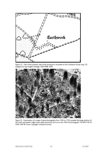
Figure 22 – Part of <strong>the</strong> sou<strong>the</strong>rn side of <strong>the</strong> enclosure is recorded on <strong>the</strong> Ordnance Survey map. OS<br />
background map: <strong>English</strong> <strong>Heritage</strong> 100019088. 2009.<br />
Figure 23 - Examination of a range of aerial photographs from 1944 to 1970 revealed that large sections of<br />
<strong>the</strong> north and eastern edges were visible previously such as on this 1969 OS photograph. OS 69014 06 07-<br />
MAR-1969 © Crown copyright. Ordnance Survey.<br />
©ENGLISH HERITAGE 50 29-2009


