Digital Elevation Models/Terrain Analysis
Digital Elevation Models/Terrain Analysis
Digital Elevation Models/Terrain Analysis
You also want an ePaper? Increase the reach of your titles
YUMPU automatically turns print PDFs into web optimized ePapers that Google loves.
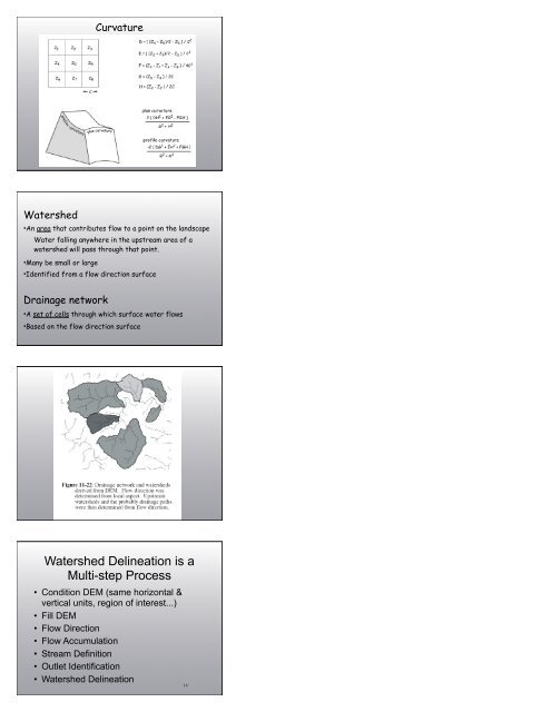
Curvature<br />
Watershed<br />
•An area that contributes flow to a point on the landscape<br />
Water falling anywhere in the upstream area of a<br />
watershed will pass through that point.<br />
•Many be small or large<br />
•Identified from a flow direction surface<br />
Drainage network<br />
•A set of cells through which surface water flows<br />
•Based on the flow direction surface<br />
Watershed Delineation is a<br />
Multi-step Process<br />
• Condition DEM (same horizontal &<br />
vertical units, region of interest...)<br />
• Fill DEM<br />
• Flow Direction<br />
• Flow Accumulation<br />
• Stream Definition<br />
• Outlet Identification<br />
• Watershed Delineation<br />
16


