Digital Elevation Models/Terrain Analysis
Digital Elevation Models/Terrain Analysis
Digital Elevation Models/Terrain Analysis
SHOW LESS

Create successful ePaper yourself
Turn your PDF publications into a flip-book with our unique Google optimized e-Paper software.
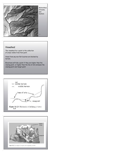
Watershed,<br />
Streams,<br />
and<br />
Outlets<br />
25<br />
Viewshed<br />
The viewshed for a point is the collection<br />
of areas visible from that point.<br />
Views from any non-flat location are blocked by<br />
terrain.<br />
<strong>Elevation</strong>s will hide a point if they are higher than the<br />
viewing point, or higher than the line of site between the<br />
viewing point and target point<br />
not