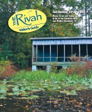
September Rivah Visitor's Guide - The Rappahannock Record
September Rivah Visitor's Guide - The Rappahannock Record
September Rivah Visitor's Guide - The Rappahannock Record

Create successful ePaper yourself
Turn your PDF publications into a flip-book with our unique Google optimized e-Paper software.
Parks<br />
federally-listed threatened or<br />
endangered species may be<br />
found, including the American<br />
bald eagle, peregrine falcon,<br />
shortnose sturgeon, and sensitive<br />
joint vetch. <strong>The</strong> state’s<br />
largest wintering roost for bald<br />
eagles is located within the<br />
refuge. Shorebirds, neotropical<br />
migrant songbirds, raptors,<br />
and marsh birds rely on the<br />
<strong>Rappahannock</strong> River’s corridors<br />
during the spring and fall migration<br />
periods. <strong>The</strong> Refuge hosts<br />
three sites on the Virginia Birding<br />
and Wildlife Trail.<br />
Here are directions to public<br />
boat ramps.<br />
Essex<br />
s Prince Street Public Landing<br />
Off Rt. 360 in downtown<br />
Tappahannock.<br />
s Dock Street Public Landing<br />
At the end of Dock St. in<br />
Tappahannock.<br />
Gloucester<br />
s Deep Point Landing At the<br />
end of Rt. 606. Turn from Rt. 198<br />
at Harcum.<br />
s Gloucester Point Landing<br />
Near north end of York River<br />
bridge, off Rt. 17.<br />
s Williams Landing At the end<br />
of Rt. 1303, off Rt. 17.<br />
s Cappahosic Landing At the<br />
end of Rt. 618. Turn from Rt. 614<br />
near Sassafras.<br />
s Tanyard Landing At the end<br />
of Rt. 617. From Rt. 17 at Woods<br />
Crossroads, take Rt. 610 south,<br />
then Rt. 617 right.<br />
s Warehouse Landing At the<br />
end of Rt. 621. From Rt. 17, turn<br />
near Gloucester Courthouse.<br />
King and Queen<br />
s Waterfence Landing At the<br />
end of Rt. 611. Turn off Rt. 14 at<br />
Shanghai.<br />
King William<br />
s West Point Landing Turn off<br />
Rt. 33 near west end of Mattaponi<br />
River bridge.<br />
Lancaster<br />
s Totuskey Tricentennial Park<br />
with boat landing, Rt. 3 at Totuskey<br />
Creek Bridge.<br />
s Wilna Pond, a 35-acre site, is<br />
open to public fishing. <strong>The</strong> pond<br />
is home to large mouth bass,<br />
bluegill sunfish, fliers, yellow<br />
bullhead catfish and American<br />
eel. <strong>The</strong> Wilna Unit is open for<br />
observation and photography<br />
daily, sunrise to sunset. Access<br />
for canoes and kayaks is available.<br />
All other refuge units are<br />
open by advanced reservation<br />
only. Headquarters are open<br />
Mon.–Fri., 8 a.m.–4:30 p.m.,<br />
<strong>Rivah</strong> Ramps<br />
s Greenvale Creek Landing<br />
From River Rd. (Rt. 354) near Mollusk,<br />
turn on Rocky Neck Rd. (Rt.<br />
662) to Thomas Landing Rd.<br />
s Belle Isle State Park From<br />
River Rd. (Rt. 354) turn on Belle<br />
Isle State Rd. (Rt. 683). Fee $3.<br />
Mathews<br />
s Milford Haven Landing On<br />
Gwynn’s Island. Turn from Rt.<br />
198.<br />
s Town Point Landing At the<br />
end of Rt. 615. From Rt. 198<br />
south of Mathews Courthouse,<br />
turn right onto 615.<br />
Middlesex<br />
s Mill Stone Landing At the end<br />
of Rt. 608, Water View. Turn off Rt.<br />
17 onto Rt. 640, then left on 608.<br />
s Oakes/Saluda Landing At the<br />
end of Rt. 618. Turn at stoplight<br />
in Saluda.<br />
s Upper Mill Creek Landing At<br />
the end of Rt. 626. Near Hartfield,<br />
take Rt. 627, then left on Rt. 626.<br />
s Urbanna Creek In Urbanna at<br />
the end of Virginia St. in municipal<br />
marina (fee for out-of town<br />
users).<br />
Northumberland<br />
s Lodge Landing From<br />
Northumberland Hwy. (Rt. 360) in<br />
Callao, turn right on Harry Hogan<br />
Rd. (Rt. 712). Go to end.<br />
s Forest Landing From<br />
Northumberland Hwy. (Rt. 360)<br />
north of Heathsville, turn on Coan<br />
Stage Rd. (Rt. 612).<br />
s Rowes Landing From<br />
Northumberland Hwy. (Rt. 360)<br />
near Heathsville, turn on Rowe’s<br />
Landing Rd. (Rt. 601) to the end.<br />
s Cooper’s Landing From<br />
except federal holidays. From<br />
Tappahannock, take US-360 E.<br />
toward Warsaw. Follow US-360<br />
E. for 4.1 miles, then turn left<br />
onto Rt. 624/Newland Rd. Follow<br />
Newland Rd. for 4.2 miles,<br />
then turn left onto Strangeway/<br />
Rt 636. Follow Strangeway for<br />
¼ mile, then turn right onto<br />
Sandy Ln./Rt 640. Follow Sandy<br />
Ln. for 1.1 miles, then turn left<br />
into <strong>Rappahannock</strong> River Valley<br />
NWR. 333-1470<br />
Westmoreland<br />
s A.T. Johnson Recreation<br />
Northumberland Hwy (Rt. 360)<br />
turn south at Horsehead onto<br />
Cooper’s Landing Rd. (Rt. 707) to<br />
end.<br />
s Shell Landing Turn from<br />
Northumberland Hwy. (Rt. 360)<br />
in Reedville onto Fleeton Rd. (Rt.<br />
657).<br />
s Cranes Creek Turn from Jessie<br />
Ball duPont Memorial Hwy. (Rt.<br />
200) at Wicomico Church onto<br />
Sandy Point Rd. (Rt. 666).<br />
Richmond<br />
s Simonson Landing At the end<br />
of Rt. 606. Turn from Rt. 3 onto Rt.<br />
608, then to Rt. 606.<br />
s Totuskey Creek Landing Off<br />
Rt. 3 south of Warsaw.<br />
s Carter’s Wharf off Rt. 624<br />
(Newland Rd.) to Rt. 622 (Carter’s<br />
Wharf Rd.)<br />
s Farnham Creek Canoe Landing,<br />
Rt. 608 on Farnham Creek<br />
Rd.<br />
Westmoreland<br />
s Westmoreland State Park<br />
Enter from Rt. 3.<br />
s Bonums Landing At the end of<br />
Rt. 763. Turn from Rt. 202 north of<br />
Callao.<br />
s Currioman Dock At the end<br />
of Rt. 622. Turn from Rt. 3 in<br />
Montross.<br />
s Branson Cove At the end of<br />
Rt. 612. Turn from Rt. 202 towards<br />
Coles Point.<br />
s Coles Point Plantation Off of<br />
Rt. 728, Coles Point.<br />
s Colonial Beach Landing At<br />
the end of Rt. 633. Turn from<br />
Rt. 205 between Oak Grove and<br />
Colonial Beach.<br />
Center 18849 Kings Hwy.,<br />
Montross. Aerobics, dance<br />
classes, cooking programs, basketball,<br />
gymnastics, volleyball,<br />
enclosed batting cage, soccer<br />
and baseball fields and small<br />
auditorium. Meeting room and<br />
patio available for rental.<br />
s Castlewood Park on Castlewood<br />
Dr. Permit required for<br />
parties over 20 people.<br />
s Hurt Field at Legion Park Rt.<br />
3 west of Montross. Four-acre<br />
public park adjacent to Chandlers<br />
Mill Pond offering recreational<br />
opportunities for county<br />
residents.<br />
s Oak Grove Park Rt. 205<br />
between Oak Grove and Colonial<br />
Beach. Eight-acre public<br />
park featuring a sports field,<br />
playground and picnic area.<br />
s Robin Grove Park on Robin<br />
Grove, off Monroe Bay Ave.,<br />
Colonial Beach.<br />
s Public Beach Colonial Beach,<br />
sunrise to sunset.<br />
s Voorhees Nature Preserve A<br />
729-acre preserve on the northeast<br />
bank of <strong>Rappahannock</strong><br />
River, next to Westmoreland<br />
Berry Farm. It is home to the<br />
bald eagle and many other birds.<br />
Four miles of wooded trails for<br />
self-guided walks. <strong>The</strong> difficulty<br />
level is moderate. Trail map<br />
available at the Westmoreland<br />
Berry Farm store. Picnic sites,<br />
restrooms and pick-your-own<br />
fruits and vegetables at the farm.<br />
Open weekends, 8 a.m.–6 p.m.,<br />
Apr. 22–Dec. 17. (434) 295-6106<br />
s Westmoreland Parks and<br />
Recreation Department provides<br />
recreation services to all<br />
county citizens and visitors.<br />
493-8163<br />
s Westmoreland State Park<br />
Six miles northwest of Montross<br />
off Rt. 3. <strong>The</strong> park extends about<br />
one and a half miles along the<br />
Potomac River, and its 1,299<br />
acres neighbor the former<br />
homes of both George Washington<br />
and Robert E. Lee. <strong>The</strong><br />
Horsehead Cliffs provide visitors<br />
with a spectacular view of<br />
the Potomac River. <strong>The</strong> park<br />
offers hiking, camping, cabins,<br />
fishing, boating and swimming.<br />
<strong>The</strong> visitor center gives an historical<br />
and ecological perspective<br />
to an important natural<br />
area on the coastal plain.<br />
41