

Untitled - Council for British Archaeology
Untitled - Council for British Archaeology
Untitled - Council for British Archaeology

Create successful ePaper yourself
Turn your PDF publications into a flip-book with our unique Google optimized e-Paper software.
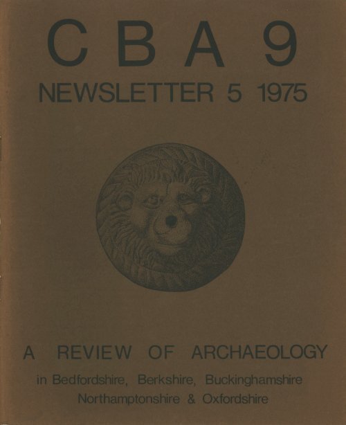
Cover drawing: a cast bronze lion's head mount from<br />
the 4th centuty AD Smithy's building, Barton Court Farm,<br />
Ox<strong>for</strong>dshire (by courtesy of Mr D. Miles)
e<br />
4,--e--te4 /41.eat-01.<br />
COUNCIL FOR<br />
BRITISH ARCHAEOLOGY<br />
Regional Group 9<br />
(Bed<strong>for</strong>dshire Berkshire Buckinghamshire Northamptonshire Ox<strong>for</strong>dshire)<br />
Convenor: Professor B.W. Cunliffe<br />
Hon. Sec.: Wj. Fowler<br />
25 High Street<br />
Watlington<br />
Ox<strong>for</strong>d 0X9 5PZ<br />
Tel. Watlington 2734<br />
Contents<br />
NEWSLETTER No. 5 1975<br />
Editors:<br />
R.T. ROWLEY<br />
Wj. FOWLER<br />
EDITORIAL NOTES<br />
C.B.A. AND C.B.A. 9<br />
APPOINTMENTS<br />
WANTED (OR UNWANTED)<br />
AERIAL RECONNAISSANCES<br />
THE HARTWELL SURVEY<br />
PREHISTORIC NOTES<br />
ROMANO-BRITISH NOTES<br />
ANGLO-SAXON, MEDIEVAL AND<br />
POST MEDIEVAL NOTES<br />
URBAN NOTES<br />
SURVEYS<br />
THE OXFORDSHIRE COMMITTEE<br />
SOCIETIES<br />
COUNTIES<br />
PUBLICATIONS<br />
MEMBERSHIP C.B.A. 9<br />
2<br />
3<br />
4<br />
5<br />
5<br />
7<br />
9<br />
14<br />
19<br />
24<br />
27<br />
34<br />
45<br />
50<br />
51<br />
@ 1975<br />
University of Ox<strong>for</strong>d<br />
Department <strong>for</strong> External Studies<br />
Rewley House Wellington Square<br />
Ox<strong>for</strong>d 0X1 2JA<br />
Printed by TRUEXpress Ox<strong>for</strong>d
2<br />
Editorial Notes<br />
PRIORITIES<br />
1974 has again been a year of remarkable archaeological<br />
activity in our region, both on the ground and in the committee<br />
room. Gradually the regional archaeological organisation<br />
has begun to take a recognizable shape. We now appear to be<br />
moving towards county based organisations with a looser<br />
inter-county federation. It is to be hoped that the regional<br />
organisations will not be too loose and that there will be<br />
realistic cooperation between counties.<br />
Inflation has hit archaeology as everything else, and as<br />
archaeological grants are assessed a year or even two years in<br />
advance there probably has been a real cutback in the amount<br />
of professional archaeological activity in the last year. Nevertheless,<br />
considerable sums of money are now being spent<br />
in our region and it brings us back to a point that we have<br />
raised in previous editorials, that of choice of sites and themes<br />
<strong>for</strong> investigation. Now in a period of imminent austerity,<br />
more than ever we should be certain of the basis on which we<br />
choose our sites <strong>for</strong> excavation. Too often, it seems to us, we<br />
are digging emotionally, that is choosing and excavating sites<br />
simply because they, and as it happens the money, are there.<br />
The broader question of their significance both nationally and<br />
chronologically is rarely asked, or if asked, is waved aside <strong>for</strong><br />
local reasons. Very often these local reasons may be extremely<br />
pressing but it is time to stand back and look at the whole<br />
situation in order to <strong>for</strong>mulate a rational policy of research on<br />
a rescue basis. The national committees, proposed by the<br />
Department of the Environment, and the development of<br />
county surveys, in this respect, are major steps <strong>for</strong>ward. The<br />
latter will enable us, at least, to know of all sites which can<br />
be identified from surface indications. .One of the beauties<br />
of survey work is that it provides the amateur with a valuable<br />
role in <strong>British</strong> archaeology. This approach is admirably demonstrated<br />
in several papers in this newsletter.<br />
Un<strong>for</strong>tunately, in the area of aerial photography the situation<br />
is still totally unsatisfactory. 1974 was a particularly<br />
good year <strong>for</strong> aerial photography, but there is already an enormous<br />
backlog in the transference of in<strong>for</strong>mation from vdsting<br />
photographs to plans and then making them available <strong>for</strong><br />
planners, archaeologists and developers. How long will it be<br />
be<strong>for</strong>e the current harvest of new sites finds its way on to<br />
these maps, 1980 or 1984? We really must be in a position<br />
where we have marshalled all the available in<strong>for</strong>mation at our<br />
disposal, take a long hard look at it against the probable programme<br />
of redevelopment and then work out a researchbased<br />
programme of excavation and fieldwork. For instance,<br />
it might be necessary to sacrifice 90% of the archaeology in<br />
some small towns in order to concentrate ef<strong>for</strong>ts on the others.<br />
Similarly it might be inevitable that a large number of rural<br />
sites are left to be destroyed so that large scale investigation<br />
may take place in a particularly profitable area. How often,<br />
<strong>for</strong> instance, do we think of, say, the environmental evidence<br />
as a major factor in choosing a site? Are we always certain<br />
that we have adequate back-up facilities? In other words, are<br />
we taking a professional approach to the subject and to the<br />
spending of public funds? <strong>Archaeology</strong> really must come of<br />
age, the evangelical era is over, we have won the rescue argument.<br />
It is necessary now to make sure that those very<br />
considerable sums of public money and sympathy are spent<br />
in the most effective way, locally, regionally and nationally,<br />
or if the economic climate deteriorates further, unless we are<br />
seen to be responsible and meaningful then both funds and<br />
sympathy are likely to dry up very quickly.<br />
Aerial photography<br />
James Pickering's report on Aerial Reconnaissance in 1974<br />
raises three significant points <strong>for</strong> the editors. First is the<br />
warning from one of its leading practitioners, that 'our knowledge<br />
of cropmarks at best is superficial and in general is based<br />
on misconceptions'. This should be said of every approach to<br />
the study of the material remains of the past, and we are perhaps<br />
beginning to appreciate in particular that it should be<br />
applied to excavation. It is there<strong>for</strong>e disappointing that the<br />
writer should go on to say that archaeologists look to aerial<br />
photography primarily to identify 'sites suitable <strong>for</strong> excavation'.<br />
Surely the gospel of survey is sufficiently spread <strong>for</strong> this to be<br />
recognised as the main aim of archaeology in the field today,<br />
and aerial photographic results as a basic element.<br />
Thirdly, aerial photography evidence from the East Midlands,<br />
of field systems superimposed on and adapted to earlier<br />
kinds of land use, emphasises the importance of the whole<br />
archaeological context of any site, and its changing use, and<br />
one must thoroughly endorse the writer's suggestion that 'the<br />
continuity of land use in these areas is perhaps further back<br />
in time than is at present accepted' and extend it to many<br />
other areas.<br />
This proper interest in all those who have ever been on a<br />
site from prehistoric man to `Dad's Army' and even more<br />
recent users is responsible, together with the emphasis on<br />
survey be<strong>for</strong>e so much evidence is destroyed, <strong>for</strong> an editorial<br />
difficulty.<br />
The Newsletter<br />
For the earlier numbers of this newsletter it was possible<br />
to arrange most of the material under the traditional period<br />
headings. This is increasingly difficult, and even a report on<br />
a predominantly Romano-<strong>British</strong> site will now refer to earlier<br />
occupation and give later Anglo-Saxon or medieval evidence.<br />
All sites are multi-period and surveys obviously so.<br />
One way to help overcome this difficulty is to look to the<br />
archaeologists who do the work, and thus we have reports<br />
from groups, notably in CBA 9 from the Ox<strong>for</strong>dshire Unit,<br />
but also from societies. Inevitably increasing professionalism<br />
should be welcomed, much more work is being done more<br />
quickly in a rescue situation, but the role of the part-timer<br />
is if anything more important. The reports on Northamptonshire<br />
villages and on South Ox<strong>for</strong>dshire show this, as do the<br />
Dunstable excavations and the work done at Abingdon and<br />
Berinsfield. Doubtless there are many other examples of which<br />
we have no report.
3<br />
Which leads to a final plea, put more strongly than in last<br />
year's editorial note. We would welcome <strong>for</strong> the next newsletter<br />
reports from societies on their general activities, as<br />
well as reports from directors of excavations and surveys.<br />
Also, a steady flow of news from members through the year<br />
might enable the Group Secretary to act more effectively as<br />
a liaison officer between societies, institutions and individual<br />
members throughout the region.<br />
As usual there has been a last minute scramble to collect<br />
in<strong>for</strong>mation <strong>for</strong> this newsletter. It would greatly assist the<br />
editors if contributors could send in material throughout the<br />
year. The deadline <strong>for</strong> material <strong>for</strong> Newsletter no. 6 is November<br />
30 1975.<br />
Treasure hunters and grid references<br />
Increasing activity by treasure seekers using metal detectors<br />
in our region has <strong>for</strong>ced us reluctantly to omit all grid<br />
references from reports in this newsletter.<br />
TREVOR ROWLEY<br />
BILL FOWLER<br />
CBA AND CBA9<br />
By the time this appears the <strong>Council</strong> <strong>for</strong> <strong>British</strong> <strong>Archaeology</strong><br />
at its January meeting will have considered three major<br />
matters which have greatly concerned its executive and many<br />
others during 1974. It is hoped first that there will be a full<br />
discussion on '<strong>Archaeology</strong> and Government', the joint CBA/<br />
RESCUE statement in June which 'proposes a new structure<br />
<strong>for</strong> <strong>British</strong> archaeology...designed to re<strong>for</strong>m the structure <strong>for</strong><br />
the future so that it can adequately meet the challenge of the<br />
remainder of the twentieth century'l. Although this has not<br />
had the initial impact hoped <strong>for</strong>, it should be the basis <strong>for</strong><br />
development in the immediate future since it rests on a fundamental<br />
reassessment of the present evolving situation.<br />
Secondly, recommended proposals <strong>for</strong> Group reorganisation,<br />
a matter discussed <strong>for</strong> years, would bring CBA regions<br />
geographically into line with those of the DoE Archaeological<br />
Advisory Committees announced in May, themselves largely<br />
based on the CBA regions. With these proposals go suggestions<br />
<strong>for</strong> Group functions and organisation designed 'to provide<br />
an essential link between rescue archaeology ... and<br />
archaeology in the region as represented by the activities and<br />
interest of many constituent organisations and individuals.'2<br />
The effect of reorganisation on Group 9 will be the loss of<br />
Berkshire to Group 12 (Dorset, Hants, Isle of Wight, Wiltshire)<br />
but it must be noted that this decision was made freely by the<br />
Berkshire Archaeological <strong>Council</strong>. Already the Berkshire<br />
Archaeological Committee has with DoE support established<br />
a small unit and its representatives sit on the Wessex committee.<br />
Proposed changes in CBA membership and subscription<br />
rules would make all organisations and insitutions mem-<br />
bers of both the national CBA and of one or two Groups, and<br />
we thus hope to continue to enjoy the participation in CBA9<br />
of old friends fi-om south of the Thames.<br />
The third and probably the most controversial matter<br />
concerns the proposed establishment of a <strong>British</strong> Archaeological<br />
Institution. Intensive work by a steering committee,<br />
which included Professor Frere and three members of CBA9<br />
executive, has produced a report which includes proposals<br />
<strong>for</strong> the foundation of such an institution by some 25 senior<br />
professional archaeologists, suggested criteria <strong>for</strong> founder<br />
associates and future members, and recommendations <strong>for</strong> an<br />
ultimate full examination structure. It is stressed that the<br />
aim is an independent BAI, <strong>for</strong> the foundation of which the<br />
CBA cannot undertake direct responsibility, but it was hoped<br />
that the first step might have been taken in January 1975. It<br />
is already clear from initial reactions that this would be prernature.<br />
While it is difficult to deny the need <strong>for</strong> training and a<br />
recognised qualification <strong>for</strong> field archaeologists, it is not<br />
generally accepted that an all embracing professional organisation<br />
covering the whole spectrum is needed. Why not a<br />
<strong>British</strong> Institution of Field Archaeologists? Why not simply<br />
a training scheme? What about the 'amateur'? These are some<br />
of the questions raised which will be fully discussed in January.<br />
Apart from these three issues the CBA officers and executive<br />
have been continually occupied with relationships with<br />
DoE. Following the ministerial statement of 23 May 1974<br />
announcing increased financial support and the <strong>for</strong>mation of<br />
thirteen regional advisory committees <strong>for</strong> rescue archaeology,<br />
a series of questions was put and <strong>for</strong>mal and in<strong>for</strong>mal meetings<br />
held. What is not clear particularly is the relationship between<br />
the new committees and already established county and regional<br />
committees and other organisations with or withoirt.<br />
archaeological units. In our own region the new DoE Advisory<br />
Committee is in process of <strong>for</strong>mation under Professor Cunliffe,<br />
who was chairman of the Ox<strong>for</strong>dshire Archaeological<br />
Committee, which remains independent of the new structure<br />
and has strong county and district council representation.<br />
The South Midlands Archaeological Advisory Committee,<br />
which has not really found a role, has changed its name to<br />
the South Midlands Archaeological Working Party and sees<br />
itself as primarily the regional professional organisation.<br />
In Bed<strong>for</strong>dshire the County <strong>Council</strong> maintains an archaeological<br />
unit as part of the department of the Conservation<br />
Officer, <strong>for</strong>merly the Archaeological Officer. The Berkshire<br />
Archaeological Committee has been already mentioned. In<br />
Bucks there are tentative moves towards a unit, while in the<br />
north of the county the Milton Keynes Development Corporation<br />
maintains a strong unit within its area. In Northants<br />
the <strong>for</strong>mer Federation has now become the county<br />
society, the Northampton Development Corporation has<br />
established a strong unit <strong>for</strong> its area, and some interests have<br />
links with the Peterborough organisation.<br />
Amidst all this it is difficult to see what has happened to<br />
the CBA insistence that the basic unit of organisation<br />
should be the region, and to define the role of CBA9 in particular.<br />
Two years ago the Group's first function was seen as
4<br />
the dissemination of in<strong>for</strong>mation and the Newsletter and the<br />
Report Conference at Ox<strong>for</strong>d as the main means <strong>for</strong> this.<br />
Newsletter 4 appeared and over 100 attended the conference.<br />
Far fewer took the opportunity to meet Henry Cleere, the<br />
new CBA,Director, at the AGM in May. A second function<br />
was seen as the establishment of two-way channels of communication<br />
between CBA HQ and executive and the Group.<br />
This has not been fully developed, although there has been a<br />
CBA9 presence at every executive meeting and our views, as<br />
far as known, have been put <strong>for</strong>ward. The Group executive<br />
has met three times, once specially to consider '<strong>Archaeology</strong><br />
and Government'. Brian Hastings has replaced J. Hollowell<br />
as a Northamptonshire member and Clive Hart has filled the<br />
Ox<strong>for</strong>dshire vacancy caused by Professor Cunliffe becoming<br />
convenor. Much of the field <strong>for</strong>merly covered has now been<br />
taken over by more recently <strong>for</strong>med committees and organisations,<br />
so that at times it may seem difficult to see the purpose<br />
of CBA9. But it must be said that members of the Group<br />
executive are very active in all the committees and other organisations<br />
mentioned and are conscious of their CBA loyalties,<br />
and especially of the CBA as standing <strong>for</strong> the 'amateur' as<br />
well as the professional. Our first task now is to promote<br />
that liaison between the 'grass roots', the Group and London<br />
referred to in the following extract from the recommendation<br />
on reorganisation made by the President, Hon. Secretary<br />
and Director: "The CBA is a democratic institution and <strong>for</strong><br />
it to flourish as such and to carry weight in its increasing responsibilities<br />
at national and regional levels, a two-way flow of<br />
in<strong>for</strong>mation and in<strong>for</strong>med comment is absolutely essential".<br />
Another potential role has already been indicated in the<br />
second paragraph above, and in general the challenge is such<br />
that we hope that we can subscribe to the wish expressed in<br />
the Annual Report 1973-43 . The coming year will be a<br />
crucial one <strong>for</strong> the CBA Groups: it is certain that they will<br />
emerge at the end of it greatly strengthened and with an<br />
even more important role to play in <strong>British</strong> archaeology'. It<br />
may be added that a CBA Group is more independent than<br />
many other archaeological organisations and can make representations<br />
to all kinds of authorities. We must also keep to<br />
the <strong>for</strong>efront the CBA-and now apparently the DoE-concept<br />
of the region as a unit, <strong>for</strong> CBA 9 spans four counties, and do<br />
something to combat the dangers of fragmentation since<br />
much of the work in the field is being done by units based on<br />
smaller areas. There must be a regional policy, particularly on<br />
excavation, as is expressed elsewhere, otherwise we may find<br />
work being done primarily because archaeologists and sites<br />
are available.<br />
To return to the national CBA in conclusion, reference to<br />
the Annual Report3 will immediately correct any impression<br />
from the earlier part of this paper that the CBA 1974 obsession<br />
has been with politics and administration. The real work<br />
of archaeology has continued and expanded, notably under<br />
the auspices of the Research Committees Churches, Indus-<br />
trial, Scientific, Urban soon to be joined by one <strong>for</strong> the<br />
Countryside. Publications are flourishing too, and one of the<br />
resolutions of Groups, including CBA 9, could be to make<br />
these more readily available to individuals.<br />
References<br />
Wj. FOWLER, Hon. Sec. CBA 9<br />
1 <strong>Archaeology</strong> and Government, CBA/RESCUE 25p<br />
2 Executive paper<br />
3 <strong>Archaeology</strong> in Britain 1973-4, CBA 50p post free.<br />
A list of CBA publications is given towards the end of the Newsletter.<br />
OXFORD UNIVERSITY DEPARTMENT FOR EXTERNAL<br />
STUDIES<br />
Ox<strong>for</strong>d University organises archaeology courses in Berkshire,<br />
Buckinghamshire and Ox<strong>for</strong>dshire. These include regular<br />
classes on all aspects of archaeology, certificate classes in<br />
<strong>British</strong> <strong>Archaeology</strong>, a wide range of day and weekend schools,<br />
seminars and conferences. The Department also runs an<br />
annual archaeological training school at Middleton Stoney.<br />
Future Courses<br />
The <strong>Archaeology</strong> and History of the European Town<br />
(organised with CBA) 6 12 April 1975<br />
A Seminar on the English Village 25 27 April 1975<br />
The Medieval English Market Town 2 4 May 1975<br />
Middleton Stoney Training School 19 July 9 August 1975<br />
Ox<strong>for</strong>d Archaeological Summer School based on<br />
New College, Ox<strong>for</strong>d 27 July 17 August 1975.<br />
A Weekend Conference on Oppida<br />
and Urban Origins 10 12 October, 1975<br />
A Weekend School on The <strong>Archaeology</strong><br />
of Monasteries 12 14 December 1975<br />
Ox<strong>for</strong>d Professional Seminars The Department organises<br />
a series of seminars on<br />
aspects of current<br />
archaeological work at<br />
5pm on the last Tuesday<br />
of the month during<br />
term-time at Rewley<br />
House.<br />
CBA Group 9 Weekend, Ox<strong>for</strong>d 28 29 February 1976<br />
Further details of these and other archaeological courses<br />
may be obtained from the Director, Ox<strong>for</strong>d University,<br />
Department <strong>for</strong> External Studies, Rewley House, Wellington<br />
Square, Ox<strong>for</strong>d 0X1 2JA.<br />
APPOINTMENTS<br />
In Berkshire Jill Greenaway and Ann Ellison have left<br />
Reading Museum and Mr L. Cram has been appointed archaeologist<br />
with the Museum. The Berkshire Archaeological Committee<br />
has appointed Mr T. Gates, Mr P. Garlake and Mr D.<br />
Stuart as field officers. John Hinchliffe has left the Ox<strong>for</strong>dshire<br />
Unit <strong>for</strong> the Inner London Unit, James Bond joined the<br />
Field Department of the Ox<strong>for</strong>d City and County Museum.
5<br />
0<br />
a6a/n<br />
Ct4 soon<br />
6'4 rkos -4' IA<br />
3cm.<br />
t<br />
5cm.<br />
Figure 1 Drawn by Mrs June Strong<br />
WANTED (OR UNWANTED?)<br />
Figure 1 illustrates a front plate from a belt-chape with incised<br />
figures, probably depicting a Virgin and Child. The<br />
plate is of bronze. The front face is possibly gilded; the reverse<br />
is leaded. There is a small per<strong>for</strong>ation in the top of the<br />
plate, presumably <strong>for</strong> a rivet. The piece is possibly of C15.<br />
This plate was found in a small brown envelope, c. 4in<br />
(c. 10 cms) square, in the Ox<strong>for</strong>dshire Museum Field Department<br />
in summer 1973. The envelope is annotated with excavation<br />
data but un<strong>for</strong>tunately no site or excavator's naine!<br />
All persons known to have been conducting excavations in the<br />
county 1972-73 have been approached, but no claimant has<br />
yet come <strong>for</strong>ward. Any suggestions on provenance will be<br />
gratefully received, but anonymous letters will not be welcome!<br />
The excavator will be glad to know that the plate has<br />
now been cleaned!<br />
DON BENSON<br />
AERIAL RECONNAISSANCES 1974<br />
Interim report on cereal cropmarks<br />
An eight-week flying programme commenced at the<br />
beginning of July. Amongst its purposes was a study of<br />
changes of cropmarks in different geologies. The first stage<br />
of the programme was a week of intensive coverage of<br />
limited areas around each of the following airfields:-<br />
1 Shawbury (Shropshire)<br />
2 Leconfield (South Wolds of Yorkshire)<br />
3 Benson (Thames Valley & Vale of White Horse)<br />
During the next two weeks a number of longer ranging<br />
flights (some of them with Arnold Baker) were made from<br />
Leicester, mainly in continuation of regular annual checks of<br />
areas, but some new areas were added. These flights also<br />
provided a second look at Shawbury and Benson at a phased<br />
interval after the earlier intensive cover. The Trent valley was<br />
covered from Alrewas to Cromwell and additionally west<br />
towards Stoke-on-Trent. The Wenlock edge area again<br />
proved interesting and a number of new sites and features<br />
were recorded around Ludlow. South of Ludlow to Ross on<br />
Wye provided little new, but an area of ground to the west of<br />
Malvern produced several interesting sites including a large<br />
group of small barrows. Gloucester to Strat<strong>for</strong>d produced a<br />
rash of RB farmsteads, one group being along a road that
6<br />
seems to line up with the existing road from Evesham to<br />
Winchcombe. At the end of July, cropmarks in the Northampton<br />
area were poor and only a few new sites were recorded<br />
there. The Trent Valley around Alrewas and between<br />
Nottingham and Cromwell showed cropmarks of sites <strong>for</strong><br />
several weeks, but the nearby Witham valley was virtually<br />
blank. The northern edge of the Cotswolds had some unusual<br />
and interesting sites showing but the northern edge of the<br />
Lambourn Downs overlooking the Vale of White Horse was<br />
devoid of indications of sites. The Yorkshire moors and<br />
north of these to Newcastle on Tyne was uninteresting this<br />
year.<br />
'Three more weeks of intensive flying were carried out<br />
from the beginning of August.<br />
1 Bicester (Cherwell Valley)<br />
2 Cottesmore (Nene Valley & East Leicestershire)<br />
3 Leconfield (Yorkshire S. Wolds)<br />
This programme was devised to carry out a number of<br />
experiments and areas selected <strong>for</strong> intensive flying and the<br />
time when the flying was carried out over them was carefully<br />
calculated. Combined with the longer ranging surveys, the<br />
programme made it possible to check the state of cropmarks<br />
in a variety of geologies and in similar geologies both in the<br />
same week and after an interval.<br />
The programme and its timing was based on earlier reconnaissances<br />
in May and June. Rainfall and cool weather at the<br />
beginning ofJuly lengthened the time of growth be<strong>for</strong>e crop<br />
maturity in some areas and the final week in Leconfield<br />
proved to be the best recording week. This was four weeks<br />
after the normally best recording week in the Thames Valley.<br />
Areas in which cropmarks develop in any year have a direct<br />
relation to the spring and summer rainfall in the area, but<br />
the relation is not a simple one. Rainfall statistics provide<br />
some guidance, but it is easier to predict areas where cropmarks<br />
are unlikely to develop than areas where cropmarks<br />
will develop with a good contrast.<br />
Even a 'conventional' cropmark of green growth persisting<br />
over soil of higher moisture content is more complicated<br />
than was previously thought. The three main constituents<br />
of a cereal plant are 1) the base foliage, 2) the straw stalks<br />
and 3) the ears. A colour, difference can develop between<br />
any two of these and a colour difference can be created not<br />
only from soil moisture differences but from rainfall and dew.<br />
At an early stage of growth in June, when the cereal plant<br />
was mainly base foliage, rainfall produced growth variations<br />
in a few hours. Far from 'washing out' variations in growth,<br />
rain accelerated the growth plants, and after a dry spell, the<br />
acceleration of growth of plants over moister soils was greater<br />
than that of plants whose growth had been retarded by dry<br />
soil.<br />
Whether the growth differences are reflected in foliage,<br />
straw or ear colour has some bearing on whether the cropmarks<br />
are clearest from an oblique angle or from above. On<br />
the South Wolds of Yorkshire, many fields of cereals produced<br />
what it has been conventional to describe as 'reversal'<br />
cropmarks. These occur at full plant maturity and after the<br />
ears have bent over and turned downwards. These marks are<br />
usually almost invisible from above and are best visible from<br />
a limited oblique angle and limited sector of an orbit. An<br />
analysis of some photographs shows that the best angle <strong>for</strong><br />
photographing is not constant throughout the day, nor is it<br />
at a constant angle to the sun. Possibly wind direction may<br />
swing round the inverted plant head.<br />
Both these marks, and marks produced by rainfall in a few<br />
hours, are not easy to pick up during normal observations.<br />
Many of them would be totally missed on vertical cover,<br />
even if this was done on the days of their maximum contrast.<br />
It became obvious during the weekly periods of intensive<br />
flying in limited areas that more sites were noticed after a<br />
few days tha.n had been seen on the first day and this experience<br />
was repeated at each of the areas. The term 'reversal'<br />
to describe some of these marks can be misunderstood as<br />
many of them develop towards full crop maturity without<br />
there having been an earlier stage when the site produced a<br />
darker cropmark. Also, in some areas, early cropmarks did<br />
not persist through to 'reversals' at crop maturity and the<br />
marks either partially or totally disappeared or became<br />
'negative' marks (intaglio in the crop) or maintained a height<br />
differential instead of a colour differential.<br />
The large number of factors that determine whether cropmarks<br />
will develop and what type of cropmark will develop<br />
makes close prediction of their occurrence more difficult<br />
than has perhaps been realised. At the moment, it is less<br />
urgent to try and predict than to realise that knowledge of<br />
cropmarks at best is superficial and in general is based on<br />
misconceptions. Interest in the in<strong>for</strong>mation they provide<br />
has preceded an understanding of the processes that produce<br />
the evidence.<br />
Some 2000 colour transparencies and 500 black and white<br />
photographs were taken in the course of the above reconnaissances.<br />
Some areas that normally produce cropmarks were<br />
totally devoid of any evidence of previous land use. Some<br />
cropmarks seem to develop over some sites every year that<br />
cereals are planted regardless of the weather. In one area I<br />
have flown over <strong>for</strong> nearly 20 years some sites have only been<br />
visible once, <strong>for</strong> a few days only, and these sites have not all<br />
been visible in the same year. Every time a cropmark develops,<br />
there will be details in it that are different from its other<br />
appearances.<br />
Whilst the interest of archaeologists in the results of aerial<br />
archaeology tends to be towards sites in their areas that are<br />
suitable <strong>for</strong> excavation, there is increasing evidence of a type<br />
that cannot be obtained from excavations. As an example,<br />
several areas under annual surveillance are producing evidence<br />
of large areas of graticular field systems, laid out mainly without<br />
regard to contours. These contrast with field systems<br />
determined by terrain. The relationship between these different<br />
field systems and the domestic sites associated with<br />
them requires investigation. Some field systems in East<br />
Leicestershire seem to be orientated on and to include elements<br />
of earlier features of, in some cases, linear earthworks,
up to lkm long or in other cases parallel earthworks c.500m<br />
long to 200m apart. Many of the ridges and furrows in these<br />
systems have been developed within earlier baulks. The continuity<br />
of land use in these areas is perhaps farther back in<br />
time than is at present accepted.<br />
The experience of this year's varied reconnaissances indicates<br />
that there is still a vast amount of as yet undiscovered<br />
in<strong>for</strong>mation available in cropmarks <strong>for</strong> aerial archaeology to<br />
tackle, but that it will take many more years of more painstaking<br />
application than are necessary to record the easily seen<br />
sites and features.<br />
Two further reconnaissances were carried out in the Trent<br />
Valley on 14 and 15 September. About 15% of cereals were<br />
still uncut because of recent heavy rainfall. A few `reversal'<br />
marks were still visible in uncut fields, that had been recorded<br />
in the green stage of growth as early as 19 May. The persistence<br />
of these marks when others can be almost ephemeral<br />
requires understanding.<br />
The area was devoid of any cropmarks in sugar beet although<br />
in some years sugar beet has provided better evidence<br />
than cereals.<br />
Until the end of October I shall be engaged on a different<br />
type of 'retrieval' in Cyprus, so this year's reconnaissances<br />
are now ended.<br />
JAMES PICKERING<br />
HARTWELL, NORTHAMPTONSHIRE<br />
A parish survey<br />
The complete survey of this parish was made in 1974. A<br />
Neolithic polished axe and other worked flints have been<br />
found at the S end of Hartwell Park. (See figure 2 site 1).<br />
Bordering part of the E parish boundary in Salcey Forest is<br />
an irregular enclosure, with a ditch and rampart still well<br />
preserved site 2. This is probably of Iron-Age date, and<br />
suggests the <strong>for</strong>est is not primeval, as has been found with<br />
medieval woods in Northants. Also in Hartwell Park are a<br />
few R.B sherds around the village site no. 7.<br />
The Saxon/medieval settlement pattern is very unusual <strong>for</strong><br />
Northamptonshire. There are no less than six separate DMV<br />
sites (sites 3 6). It is not certain whether the present village<br />
has medieval origins or not. Site no. 3, Chapel Farm, is<br />
likely to be the oldest, because here was <strong>for</strong>merly the Norman<br />
chapel moved stone by stone to the present village in 1851.<br />
The earthworks are fairly well preserved and these are good<br />
tracts of hollow way. Site no. 4, at the Elms Farm, has well<br />
preserved earthworks. Part of it is ploughed and has produced<br />
C13 and C14 pottery sherds originating from local<br />
kilns. Site 5 consists of unspoiled earthworks. Site 6, Park<br />
Farm, was the lodge house of the C16 park: C13 and sherds<br />
and building stone have been ploughed up N of the farm. A<br />
sunken road from here towards Ashton (adjacent) has re-<br />
cently been filled with rubble. Sites nos. 7 and 8 are in the<br />
S end of the park and ploughed area. There is an abundance<br />
of C13 pottery and building stone. A baking area has been<br />
exposed at site 7.<br />
This remarkable fragmented settlement pattern is most<br />
unusual <strong>for</strong> Northamptonshire, but is very characteristic of<br />
the claylands of adjacent N. Bucks.<br />
The whole parish was cultivated except the very E part<br />
which is still part of Salcey Forest. The furlong names (see<br />
below) towards the E have `stockin' names, showing they<br />
were cut out of a once greater tract of woodland.<br />
The park (furlongs 75 82) was made in about 1520, and<br />
is clearly postmedieval because it cuts across several furlongs,<br />
e.g. 30 / 79, 37 / 88, 86 and 95.<br />
The present parish boundaries cannot be exactly the same<br />
as ancient ones, because to the N the present boundary cuts<br />
across furlong 57. In 1727 (Northants Record Office map<br />
G360) the whole of the park was considered in Hartwell<br />
(furlongs 89 and 90 and site 7 are now supposed to be in<br />
Buckinghamshire) and furlong 108 was not.<br />
The parish documentation is quite good, but not yet<br />
studied in depth. The open field in<strong>for</strong>mation of 1727<br />
shows there were three fields, although town field was divided<br />
into two parts. It is not clear whether a three-or four-field<br />
system was worked. The postmedieval organisation must<br />
have been quite different from earlier times when the park<br />
was part of the cultivated area.<br />
A map of 1768 (Northants Record Office map G440)<br />
shows there was a lot of early inclosure by that time. The<br />
remainder of the parish was inclosed in 1828.<br />
FURLONG NAMES IN 1727<br />
The first number refers to site 1, and the second in<br />
brackets is that used on the 1727 plan. Some variant spellings<br />
are recorded on a plan of 1818 showing a few furlongs only.<br />
(Plans at Northants Record Office).<br />
Town Field (East)<br />
1 (1) Tom Stockin<br />
2 (2) Lye Stockin<br />
3 (3) Whitsun Stile furlong (Whetstone 1818)<br />
4 (4) Fladry furlong (1818)<br />
5 (5) Hawkey piece<br />
6 (2) Sand Pits furlong (1818)<br />
7 (7) Box furlong (1818)<br />
8 (8) Wong furlong (1818)<br />
9 (6) Nunn Layes<br />
10 (10) Gores Craft furlong (1818)<br />
11 (11) Hartly End furlong (Hart End Corner 1818)<br />
12 (12) New Close<br />
13 (13) Newland furlong<br />
14 (14)<br />
15 (15) Bottom Stockin<br />
16 (16) Grove furlong<br />
West<br />
17 (2) Whitehills<br />
7
oo<br />
Hedge<br />
f7TI Buildings<br />
C Quarry<br />
Slade<br />
Furlongs<br />
197L<br />
A<br />
MEIEM<br />
Mediaeval viii<br />
Mediaeval road<br />
HARTWELL<br />
14.99<br />
9414<br />
4,k4<br />
t<br />
S<br />
g<br />
E411<br />
74 f<br />
94 f<br />
4'44 V<br />
II<br />
44 4<br />
4 21 2..<br />
4121<br />
244S<br />
44224<br />
f 412<br />
V 41 4_<br />
9-4-44<br />
144<br />
I 42<br />
43<br />
1000 Yards<br />
Figure 2
18 (3) Clay Crabtree<br />
19 (6) Windmill hill furlong<br />
20 (7) Longland<br />
21 (8) Towns end pieces<br />
22 (8) (as above)<br />
23 (9) Turveys piece<br />
24 (10) Panters<br />
25 (11) Towns end furlong<br />
26 (12) (as above)<br />
27<br />
28 (13) Stony craft<br />
29 (14) The furlong next to the park side<br />
30 (15, 16) Nuttage<br />
31 (18) Bear Hill<br />
32 (19-21) Second Bare Hill<br />
33 (22) Old Orchard furlong<br />
34 (23) Ox leys (Lammas leys)<br />
35 (25) Moor leys<br />
Brookfield<br />
36 (1) Grate furlong<br />
37 (2) Hangore piece<br />
38 (3, 4) Well head<br />
39 (5-7) Dames piece<br />
40 (8) Charley piece<br />
41 (8) Shar ditch furlong<br />
42 (9) Berrystead furlong<br />
43<br />
Whalliss Field<br />
44 (1) Little Stockin<br />
45 (2) Great Stockin<br />
46 (3) Long Rigby and Cobley piece<br />
47 (4) Long Street gate<br />
48 (5) Pickley furlong<br />
49 (6) --<br />
50 (7) Grove furlong<br />
51 (8) Adington corner<br />
52 (10 Short dagnell furlong<br />
53 (11) Long dagnell furlong<br />
54 (12) Oxon iron furlong<br />
55 (13) Chappel field<br />
56 (14) Second chappel field furlong<br />
Old Inclosure<br />
57 - 74 (Belonging to the Grafton Estate)<br />
Hartwell Park (inclosed)<br />
75 - 92<br />
Open fields west of the park<br />
93 - 99 Hartwell piece (1768)<br />
Other furlongs next to Salcey Forest<br />
100 - 107<br />
DAVID HALL<br />
Higham Ferrars Hundred Archaeological Society<br />
PREHISTORIC NOTES<br />
A MESOLITHIC SITE NR. KINTBURY, BERKS.<br />
WAWCOTT XXX<br />
This was the second season of excavation at this site. A<br />
further area, contiguous with that examined last year, of<br />
approximately 50 square yards was examined. The site is<br />
situated towards the middle of the floodplain of the river<br />
Kennet. It is likely that peat was stripped from this area<br />
during C18-19. Consequently the site is now very shallow<br />
and undergoing extensive damage due to agricultural operations.<br />
The objective was to recover as much in<strong>for</strong>mation as<br />
possible be<strong>for</strong>e destruction became total.<br />
This year slightly more of the area examined yielded the<br />
Mesolithic horizon largely intact, in some instances sealed<br />
beneath marl. A number of marked concentrations of flint<br />
knapping waste were uncovered in these areas. Although the<br />
lithic remains have not been examined in detail yet, first indications<br />
are that relatively few finished farms are present.<br />
A few simple obliquely blunted microliths were noted<br />
during excavation; also scrapers and, poisibly, rather more<br />
gravers. The waste, as last year, consists of flakes, usually<br />
thin and well struck, often large; together with simple cores,<br />
often two plat<strong>for</strong>ms, and core rejuvenation flakes. The<br />
general character of the industry is that of an early Mesolithic<br />
phase.<br />
A further quantity of faunal remains were recovered. The<br />
identifications <strong>for</strong> both seasons work are available; the following<br />
are present: Wild Cattle; Elk; Red Deer; Pig; Roe Deer.<br />
Both the flints and the bones gave the impression of<br />
occurring in small separate scatters although flints at least<br />
could become quite concentrated within a scatter. Several<br />
separate occupations would seem to be indicated. There<br />
was very little evidence of fire at the site, certainly no proper<br />
hearth was located.<br />
At the present moment no further work is contemplated<br />
at the site. The remaining areas are probably very badly disturbed.<br />
It is likely that this site is one of several of similar<br />
character in the immediate area, some of which remain to be<br />
located, being more deeply buried and probably there<strong>for</strong>e<br />
more completely preserved.<br />
The excavation was carried out by members of St Bartholomew's<br />
Grammar School Archaeological Society, Newbury,<br />
supported by Reading Museum and The <strong>British</strong> Museum.<br />
F.R. FROOM<br />
W ORKED FLINTS FROM CENTRAL<br />
NORTHAMPTONSHIRE<br />
In central Northamptonshire there are a number of parishes<br />
with exceptionally light soils based on gravel, sand, and ironstone.<br />
In some cases nearly 90% of the total parish area consists<br />
of this well-drained easily-worked land. The villages concerned<br />
run in a crescent around N Northampton, from Earls<br />
Barton in the E to Harleston in the W, and including partic-<br />
9
10 PREHISTORIC NOTES<br />
2<br />
3<br />
4<br />
6 7 8<br />
9<br />
10 11 12<br />
13 14<br />
15<br />
16<br />
17<br />
18<br />
19 20 21 22<br />
23 24 25<br />
26<br />
Figure 3
PREHISTORIC NOTES 11<br />
ularly Brixworth, Spratton, and Church and Chapel Brampton.<br />
These last three parishes have been surveyed <strong>for</strong> ridge and<br />
furrow and premedieval sites. At a casual sighting the area is<br />
not particularly rich; at Brixworth <strong>for</strong> instance there were<br />
known to be two RB sites and three early Saxon cemeteries,<br />
all found by ironstone quarrying (c.1870 -c.1960), and no<br />
new sites were found. In Northampton Museum there are<br />
Neolithic and Bronze Age urns collected in the late C19 from<br />
Brixworth, unprovenanced but almost certainly discovered by<br />
the quarrying activities. Aerial photographs showed the area<br />
to be rich in cropmarks, especially the Bramptons, where there<br />
are recognisable village complexes with roads and abutting<br />
houses and enclosures.<br />
It there<strong>for</strong>e seemed worthwhile to make a much more<br />
thorough examination of these parishes, especially in areas of<br />
known cropmarks. Fields were walked in strips of about 10<br />
yards width; where there was a concentration of flints careful<br />
searches were made, so that about an hour was spent on<br />
each acre.<br />
A site at Overstone (OVI) was first studied in a field revealing<br />
linear crop marks and two ring ditches. In one area<br />
consisting of about an acre there was a remarkable concentration<br />
of flint tools, worked flakes, and pieces of core etc.<br />
Some of the more interesting ones are illustrated on the<br />
figure 3. It was remarkable that as soon as the main area was<br />
left the number of flints discoverable fell to near zero. Similarly<br />
a site with a ring ditch cropmark at Chapel Brampton<br />
(CB5) yielded a good collection of flints from a limited<br />
area.<br />
A programme of very careful searching of all the lightsoil<br />
fields has now begun. Most of them produce at least a<br />
few flints, especially microliths, suggesting quite extensive<br />
early agriculture. Many new concentrations of flints, undoubtedly<br />
representing occupation sites, have been found in<br />
fields not yet known to reveal cropmarks. Similar searches<br />
of clayland fields have failed to find any flint concentrations.<br />
An analysis of some of the collections is given below.<br />
The collections of flints in the table will be biased towards<br />
the numbers of well-defined and easily-recognisable tools.<br />
Unworked flakes in plough soil are apt to be meaningless<br />
because it is impossible to tell if they originate from a working<br />
site, or are produced by the action of weather and machinery.<br />
Figure 3 illustrates some of the flints from a few of the<br />
sites. No detailed measurement analysis has been attempted<br />
to obtain histograms of axial ratios etc, but from the very<br />
characteristic barbed-and-tanged arrowheads and round finely<br />
worked scrapers it seems clear that most of the groups are<br />
Bronze Age.<br />
Figure 3<br />
Overstone<br />
1 - 3 Scrapers<br />
4, 5 Typical blades<br />
Chapel Brampton<br />
6 Scraper from a ring ditch site<br />
Brixworth<br />
Upper Park<br />
7, 8 Tanged and barbed arrowheads, bifacially flaked<br />
9 Probably part of a tanged arrowhead bifacially flaked<br />
10, 11 Samples of the many microliths from this site.<br />
12 - 16 Various scrapers<br />
Lynch Field<br />
17, 18 Two fine tanged and barbed arrowheads, bifacially<br />
flaked<br />
Brittlewell<br />
19 A blade<br />
First Scottie<br />
20,21 Scrapers<br />
Footway<br />
22 Scraper<br />
Spratton<br />
Big Slade<br />
23 Barbed and tanged arrowhead<br />
24, 25 Scrapers<br />
Paston, near Peterborough<br />
26 Unusually blunt barbed and tanged arrowhead,<br />
bifacially flaked, from a ring ditch site in the far<br />
E of the county.<br />
Provisional conclusions from this work are that Bronze<br />
Age occupation sites in central Northamptonshire are limited<br />
to light soils, easily utilised by primitive agriculture. At the<br />
same time the remaining land was quite familiar, even if it<br />
was substantially the much-written-about impossible-to-find<br />
primeval <strong>for</strong>est, <strong>for</strong> worked flints are found in small quantities<br />
Site Total Arrowheads Scrapers<br />
Tanged Tanged<br />
and barbed<br />
Overstone (0V1) 92 0 0 13<br />
Brixworth<br />
Upper Park 241 2 2 36<br />
Spratton<br />
Big Slade 102 0 1 29<br />
Blades Microliths Utilized Cores Others<br />
flakes<br />
14 0 14 7 44<br />
66 65 23 0 47<br />
24 4 7 6 22
12 PREHISTORIC NOTES<br />
on clayland in the county. The Bronze Age people also had<br />
a remarkable ability to find light soils; an occupation site<br />
with a great flint concentration has been found recently in<br />
the W of the county at Astwell, on a pocket of gravel<br />
about 30 acres in extent in otherwise extensive clayland<br />
which once supported the early medieval Whittlebury <strong>for</strong>est.<br />
Could the primitive people know this area was gravel if it<br />
really was covered with a dense tangle of <strong>for</strong>est?<br />
Although not discussed in this note a number of new<br />
early Saxon sites are also being discovered on the light soils.<br />
This should throw some light on the difficult problem of<br />
early Saxon settlement patterns, and will be reported in a<br />
future note when the results are more conclusive.<br />
P.W. MARTIN and D.N. HALL<br />
Higham Ferrers Hundred Arch. Soc.<br />
STACEY BUSHES, WOLVERTON, BUCKS.<br />
Partial excavation of a site discovered during construction<br />
work revealed traces of a settlement site of late Neolithic<br />
date. Structures discovered included borrow trenches<br />
dug into Jurassic (Blisworth) clay, most probably to provide<br />
material <strong>for</strong> houses of wattle and daub or cob construction;<br />
also arc-shaped gullies, probably <strong>for</strong> drainage around houses,<br />
dug into cornbrash limestone. Finds included a flint industry<br />
of Mesolithic aspect. Plain Neolithic (Grimston style)<br />
and `Rinyo-Clacton' pottery occurred in direct association in<br />
the deliberate infill of one of the borrow trenches. The excavated<br />
features showed a consistent fill of reddish-brown<br />
soil typical of some archaeological sites of Sub-Boreal date<br />
located on subsoils of, or containing, limestone.<br />
Interim report to be published as a Milton Keynes Development<br />
Corporation Monograph, available Dec. 1974.<br />
H.S. GREEN <strong>for</strong><br />
Milton Keynes Development Corporation/DOE<br />
ROXTON, BEDS.<br />
The last two of five ring ditches at the junction of the<br />
Ouse and Ivel were excavated be<strong>for</strong>e destruction by gravel<br />
quarrying. Both had been heavily eroded by ploughing and<br />
there was no buried ground surface. Both had been cut by<br />
the river Ouse. One ring ditch had an external diameter of<br />
28m. The central pit contained an upright collard urn with<br />
a cremation and a smaller identical vessel lying on its side.<br />
Parts of the ditch had been refilled very soon after construction.<br />
The second ring ditch had an external diameter of 30m.<br />
The central burial consisted of two conjoining pits filled with<br />
top soil containing burnt fragments of a collared urn and<br />
much cremated bones. The lower half of an inverted urn<br />
covered by a crude cairn of stones was found cut into the<br />
primary ditch fill. There was a flexed beaker-type burial in<br />
a pit just outside the ring ditch and a Roman burial with an<br />
iron knife had been laid on the filled-in ditch.<br />
Earlier occupation of both sites was represented by postholes<br />
sealed beneath the mounds, and large quantities of<br />
flint flakes and tools of Neolithic and Early Bronze Age type.<br />
Iron Age and Roman ploughing in the field completed the<br />
filling of the ring ditches.<br />
ALISON TAYLOR and PETER WOODWARD <strong>for</strong><br />
Bed<strong>for</strong>dshire County <strong>Council</strong> and DOE<br />
HARTIGAN'S GRAVEL PIT, MILTON KEYNES, BUCKS.<br />
An area 150x15m was stripped and excavated in advance<br />
of gravel quarrying, in order that a number of linear ditches<br />
showing up on the aerial survey could be excavated. These<br />
features proved to be shallow boundary ditches yielding<br />
Iron Age pottery. In addition, a large Iron Age rubbish pit,<br />
3m in diameter and 2m deep, was excavated which contained<br />
an important pottery group including one complete Hunsbury<br />
bowl as well as a large amount of timber and environmental<br />
evidence. A Saxon pit, 2mx1.75m deep, yielded<br />
remains of a wattle lining.<br />
Interim report to be published as a Milton Keynes<br />
Development Corporation Monograph, available<br />
December 1974.<br />
R.T. SCHADLA-HALL <strong>for</strong> the<br />
Milton Keynes Development Corporation/DOE<br />
DANESHOLME, CORBY, NORTHANTS<br />
Rescue excavation during housing development. Two<br />
Iron Age sites were located about 650m apart, both on<br />
Boulder Clay. On site 1 limited excavation revealed a series<br />
of enclosure ditches that date to the C2-3 BC. On site 2,<br />
further ditches were located that probably date to the C5<br />
BC or be<strong>for</strong>e.<br />
D.A. JACKSON<br />
<strong>for</strong> the DOE<br />
GRENDON, NORTHAMPTONSHIRE<br />
Excavations of a cropmark site on the south floodplain of<br />
the river Nene were undertaken in advance of gravel extraction.<br />
Some 11,000sq.m were stripped mechanically, exposing<br />
a comprehensive spectrum of features and periods <strong>for</strong> examination.<br />
The ring ditches: Seven ring ditches were investigated,<br />
ranging in size from 18m diameter to 42m diameter, and including<br />
two double-ditched examples, one of which had<br />
causeways on the inner and outer ditch. Three of the monuments<br />
produced unaccompanied inhumations; secondary cremations<br />
were found in the area between these three closely<br />
situated features. Severe flooding in a pre-Belgic context<br />
resulted in the erosion of mound and ancient soil on all but<br />
one of the barrows; severe flooding during excavation hampered<br />
examination of this. The presence of protected<br />
gravel subsoils panned heavily with manganese oxide inside
PREHISTORIC NOTES 13
14 PREHISTORIC NOTES<br />
the other ring ditches suggest original turf mounds. The<br />
number and condition of artefacts from the barrows reflect<br />
the severity of the erosion. A few flints and fragments of<br />
soft pottery were found, the exception to this being a 'clutch'<br />
of urns over a cremation, including a small, 20cm tall, biconical<br />
urn.<br />
The pits: An approximately circular array, 20m diameter,<br />
of fifty round (1.5m diameter) and six rectangular pits<br />
(approximately 2x3m), the <strong>for</strong>mer varying in depth from<br />
10cm to lm, the latter not exceeding 30cm in depth. Numerous<br />
ditches cross the area from E to W. The pits predate<br />
these Belgic and later ditches. However, one ditch with<br />
the appearance of a palisade trench was cut by a number of<br />
the pits. The pits showed at least two phases with shallow<br />
round pits cutting rectangular and deeper round pits. Sections<br />
indicate deliberate backfilling. The area was almost<br />
devoid of artefacts, the major finds being crouched inhumations<br />
of an adult and child in one pit, and dog skull with<br />
severed cervical vertebra in another, both deposits being carefully<br />
and centrally placed in the fill.<br />
The enclosure: A ditched trapezoid enclosure, 80m long<br />
E-W and 60m wide at the wider E end. An entrance was seen<br />
centrally along the E end as a bifurcation of the boundary<br />
ditch flanked by two large post pits. In the centre of the enclosure<br />
is the drip gully of a round house, approximately 13m<br />
diameter, with an E facing entrance; at least three recuts are<br />
present. Determination of any structural evidence is confused<br />
by the presence over the whole field of small circular,<br />
soil-filled pipes in the gravel, having the expected dimensions<br />
of postholes. A N-S trench with a causeway divides the enclosure<br />
W of the house circle. The W end of the enclosure<br />
cuts into one of the ring ditches. No pits were found.<br />
Pottery from the single phaseboundary ditch, hand-made,<br />
shell grit, slightly burnished black ware, suggests occupation<br />
towards the end of the pre-Belgic Iron Age.<br />
Belgic and Romano-<strong>British</strong> enclosures: The extensive enclosures<br />
seen on the aerial photograph and thought to be<br />
R-B on field walking were not investigated, except where<br />
they impinged on areas containing other features. Thus, an<br />
early R-B kiln accompanied one of the barrows, and a line of<br />
stone-lined postholes another. No barrow was free from the<br />
interference of Belgic and R-B ditches, suggesting that they<br />
were not upstanding even 2,000 years ago.<br />
A.G. McCORMICK<br />
ROMANO-BRITISH<br />
BRADWELL ROMAN VILLA, MILTON KEYNES,<br />
WOLVERTON, BUCKS.<br />
An area of 500sq.m. was opened. A corridor, with redon-white<br />
swastika-pattern mosaic is known to be at least 10m<br />
in length. Two rooms with mosaics were revealed; one had<br />
a central panel guilloche pattern in fine tesserae which had<br />
been largely destroyed by the insertion of a hearth; the other<br />
room, at least 9m square, has a compass-drawn stylized floreate<br />
red-on-white pattern, and there is a central inserted<br />
limestone-flagged hearth. Walls survive to the height of five<br />
courses. Macroscopic examination of some of the stone<br />
roofing materials points to Charnwood Forest and Collyweston<br />
or Stonesfield as sources of supply.<br />
Interim report to be published as monograph by<br />
Milton Keynes Development Corporation, available<br />
January 1975.<br />
H.S:GREEN and MJ. GREEN<br />
Bradwell Abbey Field Centre, Abbey Road,<br />
Bradwell, Milton Keynes, MK 13 9AP.<br />
Milton Keynes Development Corporation.<br />
FLITWICK MANOR WAY<br />
BEDFORDSHIRE<br />
During the winter of 1973/74, a square cropmark shown<br />
on an aerial photograph taken in 1970 by the Royal Commission<br />
on Historical Monuments was investigated. The<br />
site, open agricultural land until 1974, is now designated as<br />
a housing estate.<br />
The cropmark was found to be caused by a regular square<br />
ditched enclosure 41m across. Three sides of the square<br />
were single ditches approximately 4.5m. wide and 1.25m.<br />
deep, while the fourth was a double ditch of similar proportions<br />
with signs of a palisade. Sections through the ditches<br />
revealed C2-4 Romano-<strong>British</strong> pottery, cattle bones, flue and<br />
roof tiles. In the centre of the enclosure the foundations of<br />
a 'T'-shaped corn-drying oven were found. The fire box<br />
was constructed of sandstone in a sand mortar matrix with<br />
a thick covering of gault clay. The flues were <strong>for</strong>med in the<br />
clay which baked hard in use. The drying chamber was<br />
round with wattle and daub walls and a centrally supported<br />
roof. Native R-B pottery found in the fire box and flues<br />
suggest a C2 date <strong>for</strong> this structure.<br />
KJ. FADDEN <strong>for</strong> the<br />
Ampthill and District<br />
Arch. and Local History Society<br />
P EACHCROFT FARM, RADLEY, OXFORDSHIRE<br />
This site has been dug by Radley College Archaeological<br />
Society since 1968, initially to investigate cropmarks which<br />
were first noticed by Haverfieldl and are recorded in aerial<br />
photographs.<br />
Excavation has shown that these are caused by trenches<br />
cut into the grave12. It has not yet been possible to be sure<br />
of the exact purpose of these trenches; they contain no lines<br />
of postholes in the bottom. In view of their size and the irregular<br />
shape of the areas bounded, the trenches probably represent<br />
enclosures, and may have been cut <strong>for</strong> hedges, since<br />
the topsoil in the period when they were dug was shallow and<br />
1 Haverfield, Proc. Soc. Antiq. 2nd series xviii (1899-1901) 15.<br />
2 For previous notice of excavation see: Berkshire Archaeol. J.<br />
65 (1970) 57; Oxoniensia 35 (1970) 104.
ROMANO-BRITISH NOTES 15<br />
tatial<br />
5 10 15 20<br />
FEET<br />
Peachcroft Farm 1974<br />
1 2 3 5 8<br />
METRES<br />
111. -C=3<br />
Rubble. PHs<br />
(Natural<br />
Pl.<br />
Plt<br />
0<br />
0<br />
Enclosur Tenches<br />
P.01 Trenches<br />
QE:) 10003031.<br />
.0 00 -03<br />
gs" .<br />
0 0<br />
e<br />
:<br />
..... Hut<br />
Figure 5<br />
would have been unlikely to sustain an effective hedge.<br />
It seems that these trenches were cut sometime between<br />
the Cl BC and the end of the Cl AD. No later pottery was<br />
found in the fill, and there is no evidence of recutting. Two<br />
rubbish pits cut into the trench system at one point, and the<br />
earlier one contained some fragments of early Samian ware,<br />
thus suggesting an early date <strong>for</strong> at least that part of the<br />
trench system, since there is no evidence that all the trenches<br />
are contemporary.<br />
The soil overlying the gravel varies between 11 and 20<br />
inches, with the result that, except in isolated areas, all strati-<br />
fication above the gravel has been destroyed by subsequent<br />
ploughing. Thus the evidence of building on the site is limited<br />
to a number of postholes in the gravel, which however do<br />
not <strong>for</strong>m reaclily identifiable patterns. There was probably<br />
at least one circular hut, and the postholes suggest a number<br />
of other buildings at different periods in the same area. The<br />
only evidence found in the fill of postholes suggests that of a<br />
rectangular structure belonging to the later Roman period. Of<br />
uncertain date is a feature which was initially identified as a<br />
wall, which consists of packed stones, with fragments of<br />
brick and tile embedded in it. It has been traced <strong>for</strong> 40ft and
Haverfield3<br />
16 ROMANO-BRITISH NOTES<br />
appears on another part of the site, although in a much<br />
attenuated <strong>for</strong>m, giving a total length of about 75ft. Its<br />
purpose is unknown, but it is of a later date than the trench<br />
system which it overlies in one place.<br />
The finds were poor, consisting mainly of fragments of<br />
coarse pottery, although some fragments of Samian were<br />
also found. The site has produced five coins, of late C3/<br />
early C4 AD dates. Large numbers of nails were found, and<br />
also the remains of some iron implements. Animal debris<br />
included bones of cows, pigs, dogs and sheep, some of which<br />
had been split, probably to obtain the marrow.<br />
On the basis of the available evidence the site has been<br />
tentatively identified as that of a humble <strong>British</strong> farm.<br />
certainly believed that the inhabitants were<br />
'engaged in pastoral and possibly agricultural pursuits'. The<br />
finds suggest that it was occupied from the Cl BC until the<br />
middle of the C2 AD, and again in the late C3 until sometime<br />
in the C4 AD.<br />
A full report must await further excavation.<br />
G.P. SPICKETT <strong>for</strong><br />
Radley College Arch. Soc.<br />
s...0' ,-t-..<br />
Kc.3'1V%<br />
Saito.<br />
ROMAN ROADS<br />
AT FR ITWELL<br />
SHAKENOAK FARM, NORTH LEIGH, OXFORDSHIRE<br />
Total excavation of Roman villa site, Saxon sites and<br />
nearby Bronze Age Sites.<br />
Work has been concentrated on site K, which lies in the<br />
centre of the villa complex and is dominated by two fishponds.<br />
Clearance of the larger of these, which measures<br />
from 70-90ft by over 220ft, is yielding objects of wood, and<br />
leather boots, as well as a great deal of organic matter of all<br />
types.<br />
'It is hoped that the excavations at Shakenoak will be<br />
completed, with the entire area of about 2 acres completely<br />
excavated, in 1975 or 1976.<br />
A.R. HANDS<br />
200<br />
=000 FaLmt tervozezony<br />
Coorseco.t.o 1.t<br />
no v.i.silLe sLin<br />
Lill, eftt *Ask<br />
lbA tuals<br />
4<br />
MCFrOewrot<br />
Rase huoni,<br />
Fuocott<br />
co tenwitst sea. -<br />
iftetieateAi SettLemeAt<br />
GAN 9.12.74<br />
WAKERLEY, NORTHANTS<br />
Rescue excavation ahead of ironstone quarrying. (For<br />
earlier work see Newsletters 3 and 4)<br />
Roman: Work continued in 1974 on this Iron Age settlement<br />
and Roman farm. Amongst the Roman features discovered<br />
was a timber aisled barn which is thought to be of<br />
C2 date. It was 11.5m wide and probably about 19.8m in<br />
length. (For a plan of the site see Britannia 1974.)<br />
Anglo-Saxon: Nine Anglo-Saxon burials of possible C7<br />
date have been found during the excavation of this Iron<br />
Age and Roman site. The burials were 250m NE of the<br />
basically C6 cemetery excavated during 1968-70,<br />
D.A. JACKSON <strong>for</strong> DOE<br />
3 Op. cit. 10.<br />
Figure 6<br />
ROMAN ROADS AT FRITWELL, OXFORDSHIRE<br />
The two Roman roads associated with the N section of<br />
Ayes Ditch as described in Newsletter 4 have intersecting<br />
alignments whose detailed mapping shows them to be remarkable<br />
examples of Roman road planning; see Figure 6.<br />
The larger road of the two, Aynho Portway, has an agger<br />
whose base at SP53042845 is 72ft wide. This road presents<br />
striking evidence that a major road can make repeated changes<br />
of line within a short distance to keep to higher ground <strong>for</strong><br />
convenience and not of necessity, instead of rigidly adhering<br />
to a main alignment. In the course of one main alignment it<br />
has six alignment angles of which four are clearly visible on<br />
the ground, three being sharp realignments and one, the<br />
southernmost, appearing as a short but distinct curve. All
ROMANO-BRITISH NOTES 17<br />
these aligxunent angles are typically located on high survey<br />
points. A short distance beyond the N alignment angle the<br />
road passes below the tumulus, now destroyed, that was the<br />
site of the Ploughley Hundred moot, and as a major line of<br />
communication in Saxon times plainly influenced choice of<br />
this site.<br />
The second road, Ardley Port Street, has an alignment interrupted<br />
by two wide-angled diversions to take advantage<br />
of the course of the other road. This diverted course indicates<br />
it to be later in date. The southern of its two independent<br />
alignment angles is visible and is very sharp.<br />
The two roads axe independent of field boundaries throughout<br />
these aligmments and show fme examples of humps in<br />
hedges intersecting with them. Both roads are well seen from<br />
the modeam road at 525302.<br />
An area of discoloured soil indicates a settlement site in<br />
the N road <strong>for</strong>k angle and alongside a spring which is<br />
apparently that which gave the name Fritwell to the village.<br />
G.H. HARGREAVES, R.P.F. PARKER and<br />
A.W.F. BOARDER<br />
NEWNHAM, BEDFORD, BEDFORDSHIRE<br />
Work was resumed in May on the Romano-<strong>British</strong> and prehistoric<br />
cropmark site at Newnham, SE of Bed<strong>for</strong>d after a<br />
break caused by winter flooding.<br />
A yard area was examined to the N of the hypocaust<br />
excavated in 1973, and produced evidence of domestic<br />
activity of the Roman period. A rubbish pit, 400x300cm,<br />
produced a considerable quantity of pottery. The presence<br />
of an oven was suggested by a feature of clay, 1.90x70m,<br />
with a stokehole on the long axis. The whole feature was<br />
filled with dark loam containing much ash and charcoal, as<br />
was another feature 2m to the E. This latter comprised a<br />
depression, 3.50cm in diameter, and up to .3m deep; three<br />
steep-sided gullies ran into it from the S, and the evidence of<br />
burning in them gave them the appearance of stokeholes.<br />
There was another, shallower, gully to the N. The fill of the<br />
depression contained pottery, bones and shell from domestic<br />
refuse, and a very few pieces of light, porous slag; there were<br />
also several pieces of unworked limestone, but no stone structure<br />
remained. A row of four postpits below the depression<br />
and filled with the same material, may represent a structure<br />
associated with it, but may be earlier. The feature is possibly<br />
connected with some kind of domestic industry. This yard<br />
area also contained several stone-packed postpits, some of<br />
which are aligned, but no building plan has yet been identified.<br />
An early Iron Age and a Belgic ditch are stratified<br />
beneath the Roman layers.<br />
An area 40m to the SW, and 15m square, produced further<br />
evidence of the Roman building plan. Well-laid cobbled surfaces<br />
were defined by regularly aligned pitched limestone<br />
footings, lm in width and 0.40m deep. Up to seven rooms<br />
were represented, but the limits of the building were not<br />
established, and it is possible that some areas of rougher cobble<br />
were external surfaces. Two rooms were completely excavated,<br />
and were 6.50x2.50m and 6.50x6.50m. The floor of the<br />
largest room, at least 7.50x7.50m, had been renewed on two<br />
occasions, once with a similar cobbled surface, and later with<br />
a surface of small pebbles set in a hard mortar matrix.<br />
The function of this range of rooms is not yet certain,<br />
though the cobbled floors suggest a utilitarian emphasis.<br />
The thin occupation layer was almost sterile, but a single<br />
Samian sherd on a related external cobbled surface in the<br />
trench now being excavated indicates use in C2. The floor<br />
make-up layers, up to 0.25m deep in places, produced no<br />
finds as a terminus post quem.<br />
At some stage after this structure fell into disuse, a linear<br />
feature, nearly 3m wide, was cut through it. This produced<br />
pottery of no later than Roman date.<br />
Excavation will continue with special attention being<br />
paid to establishing the limits of the buildings and investigating<br />
the rest of the main courtyard.<br />
ANGELA SIMCO <strong>for</strong><br />
Bed<strong>for</strong>dshire County <strong>Council</strong>,<br />
Bed<strong>for</strong>d District <strong>Council</strong> and DOE<br />
WOOD BURCOTE FARM, WOOD BURCOTE (near<br />
TOWCESTER), NORTHAMPTONSHIRE<br />
Threat of deep ploughing. Results of work: An extensive<br />
scatter of surface material indicates occupation lasting<br />
from CI-C4 AD. The building debris, which includes roofing,<br />
bridging (or bonding) and box-flue tiles, moulded stonework,<br />
painted wall plaster and tesserae from mosaic and tessellated<br />
pavements, suggests a villa site of some refinement.<br />
Preliminary work has uncovered parts of two masonry<br />
structuresa detached outbuilding and what may prove to be<br />
an extremity of the main villa complex. Other features include<br />
four corn-drying ovens of elementary design, and<br />
drainage ditches and gullies, mostly of Cl and C2 date. A<br />
bronze scabbard-mount with Celtic decoration and associated<br />
with pottery of Neronian-Flavian date was found at<br />
the bottom of one of these ditches.<br />
Pottery of Late Belgic type occurs in primary contexts<br />
on many parts of the site.<br />
The results of the investigations at Wood Burcote Farm<br />
will be incorporated in a wider research programme directed<br />
toward a better understanding of thé Late Belgic and R-B<br />
ceramic activity in the upper Nene valley. The work is expected<br />
to occupy several seasons.<br />
U. WOODS, assisted by members of the South Northants<br />
Archaeological Society. The work is being undertaken by<br />
arrangement with the executors of the Dowager Lady<br />
Hesketh, the owners of the property.<br />
QUINTON<br />
site 'B', NORTHAMPTONSHIRE<br />
Work this year in Great Holt field was directed towards a<br />
late C2 to early C4 R-B farmyard and settlement site.
'<br />
/ .<br />
18 ROMANO-BRITISH NOTES<br />
Post holes<br />
Post hole?<br />
F12<br />
gully<br />
F19<br />
11111\\\11111111t1Poid<br />
recut ditch<br />
14411 11<br />
y !yip roo111111111` Ty<br />
kil<br />
\°11 1<br />
,,,,,,,, '11111 1,<br />
li///<br />
I Ploi:pla:111" I I<br />
F15<br />
I<br />
.\<br />
a<br />
original<br />
ditch<br />
A.<br />
14.<br />
Stake holes<br />
.--<br />
..-<br />
/...".<br />
I F13<br />
I tr),<br />
/ I<br />
/// i I<br />
\.\\\<br />
Post pad<br />
depression or quarry pit \\.)<br />
\ \\\\\ /<br />
AIIIIT7"--1rflr-1-..,<br />
::.<br />
::: 1II .-----JIIIL I<br />
..:,<br />
..,,,..<br />
o ' ill Bunter stones<br />
Post holes<br />
QUINTON sitelr<br />
PHASES I Et II<br />
feet<br />
metres<br />
IIIIIIIItII<br />
,..,<br />
III . /<br />
\ I<br />
/<br />
Small Pit<br />
\ \<br />
.1<br />
F8l<br />
1.<br />
\ l',<br />
1 1<br />
/<br />
\ f i<br />
\<br />
A<br />
/Central post hole?<br />
/ _A<br />
:,. \<br />
e/ ç '\.1<br />
t ,,,,, , Post holes<br />
1,v0<br />
, ,t, I Small Pit 2<br />
/ / 1 P " "<br />
..,:.,,,,,<br />
,I-II..Il T 1<br />
1 .<br />
' .'140 //Section through Medieval /<br />
c410' ..i"<br />
Furrow<br />
ii 4'<br />
gag,;<br />
10.,..?<br />
1 1.<br />
i JAY<br />
1.,...4 .D, ,,, iii 7oo . . 060<br />
I ;0. 0] 4 ° 0<br />
0.0<br />
710<br />
F . el<br />
..,,,,.-:( ..°., o ., °,, 0 00<br />
sP,,....rv. 0 cl c,* .° .<br />
., ..<br />
/<br />
N. CY' 0,..<br />
entranice<br />
/<br />
.<br />
1<br />
Probable outline<br />
of circular building<br />
decorative plate ' '' 0<br />
Fi<br />
hearth Brooch 1<br />
/ r' J , . ;!Ili Fi 1%410'<br />
h° :,0 i I ',NV ot,<br />
Post hol ! ° . *''<br />
,7 ' : oi ° e W '. ° '' tia i eq' A°<br />
/ 0<br />
0.<br />
N<br />
. '<br />
Post/ pled (4% .<br />
s gully<br />
I<br />
..<br />
/ .' : F3<br />
0..<br />
'<br />
g.:71i.<br />
-<br />
-
ROMANO-BRITISH NOTES 19<br />
Excavation revealed a C3 single entrance circular house<br />
some 26ft in diameter of rather unusual type: it was part<br />
gully, and part timber-post construction. A short section of<br />
walling was also found indicating a possible rebuild or repair<br />
at a later date. The entrance was located on the W side of<br />
the building, and a small horsehoe-shaped oven was found<br />
adjacent to the entrance on its N side. In all, an area of 1672<br />
sq.ft was stripped down to the subsoil by hand.<br />
The earliest feature on the site was a ditch which had been<br />
recut once and dated from approximately the mid Cl AD.<br />
Also, in the same area was a large subrectangular depression<br />
16x21ft which had cut into the ditch, this was dated to about<br />
the late Cl AD.<br />
Later, in the mid C2, the depression or sandpit was levelled<br />
with large blocks of Ihnestone, over which a layer of black<br />
loamy soil and much occupation debris had accumulated.<br />
By about the mid C3 another layer of limestone rubble was<br />
thrown down. In this layer, some 200 iron hob nails were<br />
found both used and unused, possibly indicating the presence<br />
of shoemaking activity.<br />
Small finds: Three brooches were found. One was a mid<br />
Cl type similar to that found on site A at Quinton (Journal<br />
of the N'pton Mus. no. 11, 18, br6.) Also two late C2<br />
brooches: a. flat brooch with 8 enamelled knobs and in the<br />
centre a prominent boss encircled by millifiori glass inlay in<br />
white, blue and red.<br />
b. a plate brooch, in the <strong>for</strong>m of a duck with blue and red<br />
glass wings on its back. The site produced eleven coins,<br />
ranging from a sestertius of Auralius to a 'Fallen Horseman'<br />
type of the mid C4. Iron knives and miscellaneous ironwork<br />
including an iron ox goad were also found, together with a<br />
large quantity of bone.<br />
R.M. FRIENDSHIP-TAYLOR<br />
Upper Nene Archaeological Society<br />
ANGLO-SAXON, MEDIEVAL AND POST-<br />
MEDIEVAL<br />
OXFORDSHIRE<br />
SITES<br />
A DISTRIBUTION MAP OF SAXON<br />
Figure 8, showing the distribution of Saxon sites in<br />
Ox<strong>for</strong>dshire, with particular emphasis on the contribution of<br />
aerial photography, was originally prepared <strong>for</strong> illustration<br />
during the Symposium on Aerial Reconnaissance <strong>for</strong><br />
<strong>Archaeology</strong> held in London in April 1974. Because of its<br />
local interest it has been thought useful to reproduce it here,<br />
merely as a factual statement attempting to present a distribution<br />
of sites known up to summer 1974.<br />
The impact of aerial reconnaisance along the Upper<br />
Thames Valley upon knowledge of Saxon settlements has<br />
been considerablel. Not only are there many more sites than<br />
1 D. Benson and D. Miles, The Upper Thames Valley: An Archaeological<br />
Sutvey of the River Gravels (Ox<strong>for</strong>d 1974)<br />
previously thought, but new contexts can now be provided<br />
<strong>for</strong> old isolated Saxon finds and features.2 All these recent<br />
discoveries lie on the gravel terraces. The present settlement<br />
pattern in this area presents a more equitable distributional<br />
relationship with cemeteries than known hitherto. However,<br />
the pattern is locally still very uneven and in some cases new<br />
concentrations of settlements have appeared in areas of few<br />
known cemeteries. The vast majority of cemeteries themselves<br />
are known only as a result of salvage work and so far<br />
cemeteries have not been as susceptible to recognition from<br />
the air as have settlements. (With evidence from previous<br />
excavations however some Saxon cemeteries may be plausibly<br />
identified from cropmarks as at Standlake.3) There is also<br />
the problem that whilst many cemeteries have produced<br />
datable material, the majority of settlements now known<br />
to exist are entirely undated. All this serves to emphasise<br />
how little is known at present of the detailed locational relationship<br />
between these two types of Saxon site. The implications<br />
are that a much closer study needs to be made of<br />
the evidence available from old excavations in combination<br />
with existing air photographic evidence; and that some concentrated<br />
aerial reconnaisance needs to be undertaken in<br />
small areas and orientated towards solving specific problems<br />
posed by the present distributions (searching in a positive<br />
way <strong>for</strong> cemetery evidence to complement settlements and<br />
vice-versa). With the wealth of evidence available, excavations<br />
too, even in a rescue context, should not merely be<br />
selected on the basis of the intrinsic merits of a particular<br />
settlement or cemetery, but on how far the excavation of<br />
one of these types of site is likely to shed light on its relationship<br />
with the other.<br />
Outside the area of the Thames valley, the lack of settlements<br />
in relation to cemeteries is even more marked.<br />
Although the known cemeteries in the upland areas of the<br />
county are generally of a later period than the valley sites,<br />
associated settlements with Grubenhallser should still be in<br />
evidence. All such sites cannot have been obliterated by<br />
Saxon villages and their conspicuous absence emphasises the<br />
need <strong>for</strong> intensive aerial survey. Recent reconnaissance over<br />
the site of a Grubenhatls discovered during trenching <strong>for</strong> a<br />
gas pipe line, near Wootton, Woodstock, revealed the existence<br />
of similar features in the immediate vicinity and demonstrated<br />
that such sites do betray themselves as cropmarks on the<br />
limestone uplands of the county.<br />
BRADWELL<br />
DON BENSON<br />
MILTON KEYNES<br />
Trial excavations of 'Bradwell Bury', a series of earthworks<br />
associated with the moated manor site, produced evidence of<br />
late Saxon occupation.<br />
Two phases of Saxon ditches: the first on average 2.5m<br />
2 Examples in D. Benson'The use of air photographs' in Aerial<br />
Reconnaisance <strong>for</strong> <strong>Archaeology</strong> cd. D. Wilson, <strong>for</strong>thcoming.<br />
3 D. Benson 8c D. Miles, op.cit.p.46; Map 21, 3803<br />
4 SP44581887; PRN5548<br />
Thanks are due to Mrs June Strong <strong>for</strong> drawing Figure 8
20 ANGLO-SAXON<br />
OXFORDSHIRE<br />
A Saxon cemeteries<br />
Possible Saxon cemeteries<br />
0 Grobenhituser<br />
0 Grubenh5user from recent<br />
aerial<br />
photographs<br />
CHIPINNO<br />
NORTON<br />
BICESTER<br />
OXFORD<br />
V<br />
DORCHESTER<br />
.<br />
WANTAGE<br />
41, A v<br />
Land<br />
ov= 400 Feet<br />
Scale<br />
0 2 4 6 8<br />
' miles<br />
0 5 10 15<br />
Km a<br />
Figure 8
ANGLO-SAXON<br />
w ide and 1.5m deep; the second 4m wide and 2m deep,<br />
dated by St Neots ware, were partly sealed by a bank of<br />
medieval date. These ditches enclose an area of uncertain<br />
size, only the N and W sides being at present located.<br />
Within this area there is evidence of three phases of occupation:<br />
1 Late Saxon, dated by St Neots ware.<br />
A row of three shallow stone-filled post settings represent<br />
part of a timber building aligned E-W, of uncertain length.<br />
The post settings were 33m apart, so one can postulate<br />
a building of four bays, probably 14m in length.<br />
2 Late Saxon, dated by St Neots ware.<br />
A second row of four shallow stone-filled post settings<br />
again 3.5m apart. These were adjacent to, but not quite<br />
parallel with, those in phase 1. They suggest a rebuilding<br />
on the sanie site; the new building being of six bays and<br />
approximately 21m in length. The floor level associated<br />
with this building was considerably burnt and contained<br />
sherds of St Neots ware.<br />
3 Later than 1 and 2, probably Early Medieval.<br />
A stone building on the same site and alignment; the<br />
wall footings were approidmately lm thick, the building<br />
was 7m wide internally and at least 9m in length. This<br />
building continued in use into the postmedieval period.<br />
Excavation will continue throughout the winter.<br />
D.C. MYNARD<br />
Bradwell Abbey Field Centre<br />
Milton Keynes Development Corporation<br />
BRILL, BUCKS<br />
A multi-flued brick pottery kiln was discovered in Windmill<br />
Street, Brill, during installation of a septic tank and the<br />
County Museum conducted a brief excavation by kind permission<br />
of Mr and Mrs J. Prosser. Less than half of the kiln<br />
was available <strong>for</strong> investigation, the remainder lying beneath<br />
a fuel tank. Half of this available area had been destroyed by<br />
Victorian rubbish pits and the walls of this sector robbed.<br />
The base of the structure had been of brick; one flue was<br />
accessible and a second could be seen but not excavated.<br />
The base of the kiln had penetrated to natural sand which<br />
had been burnt bright red. A quantity of saggers lay<br />
directly on this base and there was no trace of any other floor.<br />
From the kiln itself saggers outnumbered products but a<br />
first impression is that the main products were large dishes<br />
and probably cups, although few examples of the latter were<br />
represented. A date in the middle C17 seems possible <strong>for</strong> the<br />
structure and the whole will probably be published in Records<br />
of Bucks <strong>for</strong> 1975.<br />
Although only partial excavation was possible the kiln is<br />
of particular interest as few multi-flued brick kilns of the<br />
period have been excavated. Moreover the importance of<br />
Brill as a pottery centre in the post-medieval period has been<br />
overshadowed by its well known medieval prominence.<br />
M.E. FARLEY<br />
Buckinghamshire County Museum<br />
21<br />
QUINTON MOATED MANOR, NORTHAMPTONSHIRE<br />
WALTON, AYLESBURY, BUCKS<br />
Further work at Walton was carried out adjacent to last<br />
year's site, following demolition of the Vicarage be<strong>for</strong>e redevelopment.<br />
The vicarage sitewhich lies inside the main<br />
earthwork excavated last year, was found to be subdivided<br />
internally by a rock cut V-shaped ditch. The whole of this<br />
area of Walton adjacent to the manor house now appears to<br />
have been laid out in large rectangular plots in C13. No<br />
major structure of the period was located.<br />
Preceding activity was indicated by a spread of C12 and<br />
Saxon-Norman material, and a deep curving ditch belongs<br />
to this period, along with a number of gullies.<br />
Early-Middle-Saxon occupation noted last year was here<br />
represented by two further grubenhaiiser orientated E-W,<br />
also three pits, one of which contained much of a quern.<br />
Finds included loom weights, a double-sided bone comb, a<br />
small square head brooch and much decorated pottery. A<br />
scatter of Roman material was also present.<br />
This years excavation was again conducted by Buckinghamshire<br />
County Museum with the DOE.<br />
M.E. FARLEY<br />
Buckinghamshire County Museum<br />
Northamptonshire Arch. 9 (1974) p.109. Work during<br />
1974 has been concentrated in the W of the C14 kitchen<br />
area excavated in 1972/73. Further walls have been located<br />
but have not yet <strong>for</strong>med a coherent plan, the excavation is<br />
still in progress.<br />
A piece of sculpture which promises to be quite unique<br />
was found in this new area. It comprises of what appears<br />
to be a whiskered monkey banging a drum and holding a key.<br />
A death mask is carved on one side of the monkey's head.<br />
Also found nearby was a personal seal bearing an inscription<br />
and a coat of arms; we might have here the de Quentone<br />
coat of arms-until this can be verified by experts this must<br />
remain conjecture; situated close by a large iron key was also<br />
found. In association with the above fmds were two almost<br />
complete jugs, one of which is probably from the kilns at<br />
Brill (Bucks). The other is a small ballaster jug in Potterspury<br />
type fabric (Northants). All these items are provisionally<br />
dated to the C14.<br />
R.M. FRIENDSHIP-TAYLOR<br />
Upper Nene Archaeological Society<br />
G REAT LINFORD, MILTON KEYNES, BUCKS.<br />
Large-scale excavations of village earthworks in advance<br />
of development have been concentrated on two areas at the
22 ANGLO-SAXON<br />
e nd of the village around the <strong>for</strong>mer village green. An estate<br />
map shows houses in 1641 but these were gone by 1678 when<br />
a second map was produced. Documentary evidence confirms<br />
enclosure in 1658.<br />
Area 1<br />
Road construction revealed both medieval and C17 levels.<br />
Limited excavation located three stone buildings: a rectan-<br />
gular two-bay stone building 9.5x5m dated late C12.<br />
this was a C13 building 5.5m wide and of uncertain length.<br />
To the E of these part of a substantial CI7 house was located<br />
and will be fully excavated in 1975.<br />
Area 2<br />
An unploughed pasture of 3.5 hectares with about 10<br />
hcuse plat<strong>for</strong>ms, several hollow ways and lesser earthworks.<br />
Above<br />
'Three plat<strong>for</strong>ms have been excavated:<br />
i On the N edge of the medieval green, contained no building<br />
evidence but produced stock compounds and a postmedieval<br />
road.<br />
ii This contained a two-bay house 10x5m of C13 and C14<br />
date, which was replaced in the C17 by a two-bay house<br />
15.5x5.5m.<br />
iii This contained a three-bay C17 house 16.7x5.7m. This<br />
had originally been of two bays only and the third bay<br />
contained a large hearth and was a kitchen or of an `industrial'<br />
nature.<br />
All of the buildings appear to have been of timber construction<br />
with dwarf stone walls apart from the substantial<br />
C17 building in Area 1. Around each building are well laid<br />
cobble and limestone yards.<br />
Finds include large groups of medieval and C17 pottery<br />
and ironwork.<br />
D.C.11,1YNARD<br />
Bradwell Abbey Field Centre<br />
Milton Keynes Development Corporation<br />
CLAPHAM MANOR HOUSE, BEDS<br />
Work has continued throughout the year on the excavation<br />
of Clapham manor house. Twenty rooms have now been<br />
uncovered and a plan of the Elizabethan manor house is becoming<br />
clear. It had become apparent, through excavation,<br />
that a substantial proportion of the Elizabethan manor, and<br />
earlier manors, were destroyed by the new school building<br />
and so it is possible that the southernmost part of the site<br />
cannot be traced.<br />
One of the new rooms had a very fine Tudor fireplace, of<br />
which a large proportion remains, and traces of the original<br />
tiled floor can be seen. Most of these early tiles are of the<br />
'Penn' variety. The full extent of the courtyard has now<br />
been excavated and it seems to <strong>for</strong>m part of an internal<br />
cobbled area with a large central drainage sump. This sump<br />
was 15ft deep and had been filled with household refuse and<br />
building masonry when it finally went out of use around<br />
1750. The internal yard was probably used <strong>for</strong> grooming<br />
horses, which were stabled to the west. Leading from this<br />
area to the sump was a deep gutter taking surplus water from<br />
the interior of the stables, which probably also housed a<br />
'washing-down' room <strong>for</strong> the coaches.<br />
Large quantities of pottery and animal bones were<br />
among the many finds this year. The floor levels continued<br />
to produce coins, bronze objects and the usual large number<br />
of pins. Of particular note was a piece of strip bronze<br />
thickly plated with gold and incised with a line decoration.<br />
P. TILSON<br />
Bed<strong>for</strong>d Archaeological Society<br />
GROVE PRIORY, LEIGHTON BUZZARD, BEDS<br />
Excavations were continued on the area containing barns<br />
and outbuildings associated with the priory. Beneath the<br />
medieval occupation, and on top of the natural boulder clay,<br />
lay several groups of slots and postholes, and a group of<br />
large pits with associated postholes. The latter produced<br />
pottery provisionally dated to the mid-late Saxon period.<br />
The barn provisionally identified in 1973 was further<br />
explored. It was at least 34m long and 7m wide, with<br />
rubble footings and clay packed post pits set into and<br />
along the sides of walls. There were at least 3 cross walls.<br />
The barn was modified twice and was associated with a cobbled<br />
yard. Finally it seems to have been deliberately dismantled.<br />
Other structures in the area included a series of postpits<br />
and fragmentary remains of at least two more buildings with<br />
sleeper footings of stone and pebble.<br />
EVELYN BAKER <strong>for</strong><br />
Bed<strong>for</strong>dshire County <strong>Council</strong> and DOE<br />
WARDEN ABBEY, OLD WARDEN, BEDS<br />
Rescue excavations were occasioned by the groundworks<br />
associated with the restoration of the ruined late-monastic<br />
and post-monastic mansion fragment on the site.<br />
The tile mosaic pavement uncovered by Rudd and West in<br />
1962 was reexcavated <strong>for</strong> further study: it was not possible<br />
to locate it within the monastic ground plan, though the<br />
limited evidence suggests the area of the crossing and south<br />
transept in the C14 extension to the church. Another large<br />
area of mosaic tile pavement was found N of the ruin, possibly<br />
in a late abbot's house: this was in much better condition,<br />
with slip and glaze largely intact. Tiles included examples<br />
with lions heads, parts of garments and background fillers,<br />
all individually shaped: several had graffiti on their sides and<br />
backs, both words and symbols. Both pavements, which are<br />
provisionally dated by Mrs Elizabeth Eames to the early C14<br />
have been lifted and given to Bed<strong>for</strong>d Museum on permanent<br />
loan by the Southill Estate.<br />
Two other small fragments of pavement were found in<br />
other groundwork trenches around the building. Other<br />
discoveries included medieval and post medieval footings<br />
and other features, though the limited scope of these excavations<br />
has made it difficult to understand their full significance.<br />
EVELYN BAKER <strong>for</strong><br />
Bed<strong>for</strong>dshire County <strong>Council</strong> and DOE
ANGLO-SAXON 23<br />
MIDDLETON STONEY, OXON<br />
Excavations continued on the site of the castle area on<br />
top of the mound. An area 20x15m was opened up and a 2m<br />
section cut into the western side of the mound. The mound<br />
was found to be made up of a stone tower with considerable<br />
quantities of rubble. The shaft found in 1973 was excavated<br />
to bedrock level and identified as a garderobe. It continued<br />
large quantities of bone and other environmental evidence.<br />
Outside the tower a staircase had been constructed based on a<br />
Figure 9<br />
clay foundation. These stairs had apparently been covered<br />
by some type of canopy as they were not bonded in any way.<br />
At the foot of the mound a robber trench 1m wide was found<br />
abutting the font of the stairs. The tower and stairs appear<br />
to have been abandoned at the same time and both were<br />
covered with a layer of destruction debris, the archaeological<br />
evidence further supporting the documentary reference to the<br />
destruction of Middleton Castle in the first half of C13.<br />
TREVOR ROWLEY
24 URBAN<br />
URBAN<br />
BEDFORD MIDLAND RD 1974, SITE I<br />
With an area of some 31/2 acres threatened with total destruction<br />
within the historic core of Bed<strong>for</strong>d, negotiations<br />
were undertaken with the landowners to allow <strong>for</strong> some<br />
archaeological investigation of the site. Consequently an area<br />
was made available <strong>for</strong> excavation, and arrangements were<br />
made to carry out a watching brief when redevelopment<br />
began.<br />
A trench was opened along the Midland Road street frontage<br />
in order to establish the extent of medieval occupation<br />
in the area and to determine if any remains of Saxon settlement<br />
were extant. The trench, c.120sq.m, was dug entirely<br />
by hand. Below the top 70-80m of modern and postmedieval<br />
build-up a medieval layer was found, which covered most of<br />
the area of the trench.<br />
This medieval occupation material was found to be overlying<br />
a number of early medieval features that were cut<br />
into the natural yellow clay subsoil. Except when they had<br />
been destroyed by modern wall footings and service trenches,<br />
these medieval features were found all over the site. Part of a<br />
semicircular pitched tile hearth and a number of large rubbish<br />
pits were uncovered near the street front, and traces of timber<br />
buildings were found behind them, in the <strong>for</strong>m of postholes<br />
and two stretches of beam-slot trench.<br />
A large amount of pottery, of late C11 to early C14 date,<br />
and animal bones were found during excavations, and evidence<br />
<strong>for</strong> some iron smelting on the site was also discovered.<br />
SITE II<br />
A trench was opened in August 1974 on the Midland<br />
Road frontage of the Bed<strong>for</strong>d Modern School site. Its position<br />
was determined by the extent of destruction that had<br />
already taken place on this massive redevelopment site, and<br />
by the time available <strong>for</strong> excavation. The site was destroyed<br />
as soon as excavation was complete, at the end of August.<br />
The trench was mechanically excavated to a depth of lm,<br />
in an area lying immediately to the E of Site I. Several large<br />
rubbish pits were found, three of which had wood-lined bases<br />
and contained cess. There were large quantities of wood and<br />
other organic remains such as leaves and seeds from these<br />
pits, as well as much animal bone and St Neots type pottery.<br />
A medieval floor level was uncovered, consisting of compacted<br />
layers of wattle and straw some 30cm thick. Two beam slots<br />
and several postholes, all of early medieval date, were also<br />
found, indicating the position of timber buildings running<br />
parallel with, though set back from, the present line of Midland<br />
Road.<br />
BEDFORD ST JOHNS 1974<br />
Rescue excavations were undertaken during the summer<br />
in advance of destruction by redevelopment, on a site in<br />
south Bed<strong>for</strong>d, opposite St John's church. This was just<br />
within the SW part of the Saxon town of Bed<strong>for</strong>d, an area<br />
bounded by the King's Ditch, supposedly built by Edward<br />
the Elder in the early C10.<br />
Three large areas were mechanically stripped, the first of<br />
these running along the St John's Street frontage. Traces of<br />
at least two late Saxon timber buildings were uncovered,<br />
dated by pottery associations of St Neots, Stam<strong>for</strong>d, and a<br />
local black gritty ware; and following the axis of St John's<br />
Street. A great many early medieval rubbish pits were found,<br />
and some lime and iron smelting pits.<br />
Trench II was excavated immediately to the W of this, and<br />
more early medieval rubbish pits and postholes were found.<br />
A small stone-built bread oven, set in a paved hearth pit was<br />
uncovered just outside one timber building. To the NW of<br />
the timber structure the remains of a large circular kiln<br />
were found, with the last few courses of stonework still in<br />
situ. It was c. 8m in diameter with an opposing flue and<br />
stokehole. A great many sherds of late medieval pottery<br />
were found in the destruction layers which filled the kiln<br />
area.<br />
Trench III was a U shaped area running westwards towards<br />
the Kingsway frontage. As might be expected, there were<br />
fewer medieval features at this end of the site. One or two<br />
rubbish pits were uncovered, but most of the features were of<br />
postmedieval date.<br />
JANE HASSALL<br />
Bed<strong>for</strong>dshire County <strong>Council</strong><br />
BUCKINGHAM, HUNTER STREET<br />
Excavations, on a site fronting Hunter Street, Buckingham<br />
and presumed to be within the burh, have demonstrated that<br />
the area was first divided into tenements in the early C14.<br />
Earlier activity was attested by a late Saxon bronze pin and a<br />
handful of Saxo-Norman sherds. The N part of the site, on a<br />
heavy clay subsoil, remained unoccupied until modern times,<br />
medieval activity being confined to the S area which overlay<br />
a natural gravel.<br />
A boundary ditch and part of a town house of the early<br />
C14 were excavated the dating of these rests on both numismatic<br />
and ceramic evidence. The ditch extended the length<br />
of the site in an E - W direction, and yielded an extensive<br />
group of sheep bones, and pottery of the Brill kilns. The<br />
house, one bay deep, apparently extended parallel to the<br />
present street, and its southern limits, obscured by modern<br />
disturbance, may extend below houses still in occupation.<br />
Ceramic evidence suggests that the site was permanently<br />
occupied until the C19, with major structural alterations in<br />
the late medieval period. These included the erection of<br />
what was probably an ancillary building behind the house,<br />
close to a stone-lined pit. The area between the house,<br />
which was presumably still occupied at this time, and the<br />
ancillary building, was terraced at approximately the same<br />
time. A postmedieval accumulation in this area produced<br />
a useful collection of ceramics.
URBAN 25<br />
To be reported in Records of Bucks.<br />
R.A. HALL <strong>for</strong><br />
Buckinghamshire County Museum and DOE<br />
DUNSTABLE, BEDS.<br />
Examination of Roman and Medieval Dunstable be<strong>for</strong>e<br />
development of the area.<br />
Roman Period.<br />
A short length of a shallow ditch belonging to the late<br />
Roman period was excavated. This contained the skeletons<br />
of four humans and two horses. Work on this area is to be<br />
continued during 1975. Cesspits of the C2 and C4 have<br />
been excavated and these have produced an abundance of<br />
pottery.<br />
Medieval Period<br />
A large tile kiln of C13-14 date is under excavation. This<br />
survives with 2m high walls of tiles on edge and double flues.<br />
Its product was pegged roof tiles. A cesspit of the same date<br />
produced 2 glazed jugs which are kiln wasters, indicating<br />
that pottery was also manufactured on the site.<br />
A mal ting kiln, the fourth to be found in the area, has<br />
also been excavated.<br />
The tile kiln is a surprising discovery on the chalk land of<br />
Dunstable. It is sited alongside St Marys Street and perhaps<br />
explains the name of Skimpot (St Marys pottery) given to<br />
an area below the Downs whose crest is pockmarked with<br />
ancient clay pits.<br />
C.L. MATTHEWS<br />
Mansh-ead Arch. Soc.<br />
NEWBURY, BERKSHIRE<br />
After a few weeks to complete work on the Bartholomew<br />
Street site, attention was turned to an adjacent site with<br />
frontage on to the Market Place.<br />
A trench was opened across the building line at a point<br />
once occupied by the C16 Kings Head inn from which the<br />
team in 1973 had removed the remains of an interesting<br />
panelled ceiling.<br />
No dramatic frontage changes took place after the late<br />
medieval/Tudor period but there are strong indications<br />
that this phase involved a shift <strong>for</strong>ward of 5.5m to the opposite<br />
side of a road made up with very heavy gravel to a depth<br />
of up to 0.5m in the C13 or C14. On this gravel the earlier<br />
frontage, a flint and mortar wall, made an angle which was<br />
found later to correspond to that of the course of a small<br />
stream, almost certainly of natural origin, which after silting<br />
gradually found use as a road in spite of the small rubbish<br />
pits scattered over the area. A coin of Stephen virtually on<br />
the natural soil gives a credible date <strong>for</strong> the earliest medieval<br />
level, and odd fragments of Roman tiles and querns suggest<br />
that substantial RB buildings had existed not far away, the<br />
remains of which were perhaps being ploughed up in nearby<br />
fields.<br />
Trial pits into the lower strata of buff silt, fresh-water<br />
shell marl, peat and dark grey silt once again revealed flints<br />
and bones of the Mesolithic period in the last of these.<br />
The arrival of demolition contractors in November<br />
brought a rapid end to the excavation, which has provided<br />
useful in<strong>for</strong>mation <strong>for</strong> the planning of future archaeological<br />
work in this part of the town.<br />
S.D. FORD <strong>for</strong><br />
Newbury Museum Hist. Soc.<br />
NORTHAMPTON, ST PETERS STREET<br />
The excavations briefly reported in the previous volume<br />
at their mid stage were completed and a full summary is now<br />
given. St Peters Street lies parallel to and some 50m S of what<br />
is regarded as the main E-W axial street of the early town.<br />
The church of St Peter is immediately W of the site.<br />
An area c.55m long by 30m wide, including the street itself<br />
and the frontages on both sides, which were largely un--<br />
cellared, was completely stripped. A sequence of occupation<br />
from Saxon, possibly earlier, times was established. The<br />
chronology, quoted cannot be regarded as definitive, being<br />
based purely on the preliminary examination of the artefacts.<br />
At the W end of the site a ditch c.4m wide by 1.5m deep<br />
was cut into the natural ironstone bedrock. The ditch<br />
seemed to follow the natural contours of the land and probably<br />
defined a defensive enclosure on the promontory<br />
where St Peters church now stands. No datable material<br />
was recovered but a prehistoric or Saxon context is most<br />
probable.<br />
A rectilinear timber building of post in slot and individual<br />
posts was erected Over the infilling of the ditch and probably<br />
dated to the C9. Two other timber buildings a little to the<br />
E were probably roughly contemporary.<br />
Sometime during the C9, probably the first half, three<br />
concrete mixers were constructed, again at the W end of the<br />
site. Circular bowls (two were 2m in diameter and one 3m)<br />
had been cut into the natural ironstone and lined with<br />
wattle work. Each bowl had a very substantial central posthole.<br />
Layers of concrete and mortar had built up within<br />
two of the bowls and a preliminary examination indicates<br />
that burnt lime was one of the constituents. In one of the<br />
mixers, several grooves concentrically cut around the central<br />
posthole suggest rotary motion. From this and other evidence<br />
it seems clear that the central posthole was <strong>for</strong> a pivot<br />
probably supporting a beam from which paddles were suspended,<br />
the whole being capstan driven. All the recovered<br />
facts support some <strong>for</strong>m of mechanised concrete mixer.<br />
In addition to the purely technological interest of the<br />
concrete mixers the timber buildings and mixers are important<br />
in demonstrating a pre-Danish settlement at Northampton<br />
only previously hinted at. The mixing of large quantities<br />
of concrete and mortar seems to indicate a substantial stone
26 URBAN<br />
building nearby. Such structures are certainly uncommon<br />
at this period and it must be queried whether St Peters church,<br />
known to be of pre-Conquest origin, dates at least from this<br />
period.<br />
At least two periods of timber buildings were laid out<br />
on top of the mortar mixers and underneath the later street<br />
line. At a similar date four sunken floor dwellings were<br />
constructed at the E end of the site.<br />
These were simple rectangular structures the largest being<br />
approximately 4x3m. In each case a single posthole centrally<br />
placed at either end probably supported a ridge piece. The<br />
character of the occupation debris on two of the 'floors'<br />
strongly supports the idea that these were the actual floors<br />
rather than hollows below planked floors. The pottery and a<br />
coin of Aethelstan suggest an early C10 date.<br />
These dwellings and all the other features previousiy described<br />
were randomly arranged and in no way respected the<br />
later street line.<br />
Some time between 950 and 1100 (it is as yet impossible<br />
to be more precise) the site underwent a radical change.<br />
Timber dwellings were laid out parallel to and on either side<br />
of a street following roughly the line of the present street.<br />
The buildings were represented by a series of postholes and<br />
were rectangular with long sides on the street. They were<br />
é.4m wide but it was not possible to define the length of<br />
individual buildings. Certainly there appears to have been<br />
some major redevelopment of this part of the town at this<br />
time but is the aligning of the street parnllel to the main E-W<br />
axis of the town attributable to deliberate town planning or<br />
purely accidental and part of normal organic growth? Furthermore<br />
should the development be assigned to the late Saxon<br />
period of economic expansion or the early Norman era, coinciding<br />
with the plantation of the castle and the `novus burgus'?<br />
The timber buildings themselves continued in use <strong>for</strong> several<br />
centuries, being replaced or reconstructed as need arose.<br />
Probably from some time in C13 some of the buildings<br />
were reconstructed in stone on the same lines as the preceding<br />
timber buildings. Finally, perhaps in C15, the whole street<br />
was lined with stone terraces on either side. Twelve houses<br />
were identified, typically 8m by 4m with long side on street.<br />
Floors were of clay and the houses divided into two roughly<br />
square rooms by a central screen. The walls themselves were<br />
substantially built of ironstone masonry and certainly the<br />
walls would have been carried up in stone at least one storey,<br />
but whether the upper storey was stone or timber is impossible<br />
to determine. Between two of the houses on the S side<br />
of the street were a pair of malt-roasting ovens well built in<br />
stone and sunk into the ground. The uni<strong>for</strong>mity of the house<br />
plans and constructional details in their final <strong>for</strong>m is most<br />
striking, perhaps even indicating a single building operation<br />
by a single landowner.<br />
About 1500 the whole of the street was completely burnt<br />
down by a fire represented by a destruction level of ash and<br />
other burnt material covering the whole of the site. The N<br />
side of the street was converted to gardens, a use which<br />
continued until the C19, when houses and stables were erec-<br />
ted. The exact postmedieval history of the S side of the<br />
street is more difficult, but a tannery occupied approximately<br />
a 20m stretch: 8 clay-lined pits in which the hides would<br />
have been steeped produced C17 pottery. Houses and other<br />
buildings are known to have been built from the C18 onwards.<br />
Marsham Warren Taylor (Architects) and Metropolitan<br />
Estates were extremely helpful during the excavation.<br />
Horseshoe Street<br />
Two excavations along the frontage of Horseshoe street<br />
failed to reveal any medieval or postmedieval structures<br />
fronting the street and it seems possible that such features are<br />
underneath the present road, which has been considerably<br />
widened.<br />
Area A lay close to the junction of Marefair and Horseshoe<br />
Street and measured 11.40m N by 5.40m E. Below the C19<br />
and C20 buildings were a series of simple burials orientated<br />
E-W. At the S end of the site below these burials were the<br />
remains of a stone building sunk below ground level and<br />
measuring 2.40m N by 4.80m E. The building showed signs<br />
of reconstruction with a fine limestone flagged floor in its<br />
second phase. Subsequent to the robbing of the walls the<br />
sunken area was used as a charnel pit but there was no<br />
attempt to arrange the disarticulated skeletons. It seems<br />
probable that the cemetery was already in use when the stone<br />
building was constructed but its original purpose is unclear.<br />
A few pits probably of C12 date are earlier than the cemetery<br />
and the stone building.<br />
The cemetery was apparently previously unknown but<br />
would appear to belong to St Gregorys church, some 60m<br />
to the S-W. The church is known from soon after the Conquest<br />
but an earlier origin is possible. At the Re<strong>for</strong>mation<br />
the church was converted into a free school. No remains of<br />
the church building are now visible.<br />
Area B lay further S on Horseshoe Street and measured _-<br />
13m N by 6m E. Under a deep deposit of garden soil was a<br />
series of pits and gullies, some containing Saxo-Norman<br />
pottery.<br />
Whitefriars<br />
Trial excavation on the site of Whitefriars located parts of<br />
the friary building but the deep Victorian cellarage encountered<br />
suggests that most of the archaeological levels have already<br />
been destroyed.<br />
Moulton<br />
Further excavation took place on the Roman farm<br />
previously excavated by D Mynard (BN FAS 5 (1971)<br />
22ff). The circular stone building (area 2/3) was removed<br />
to reveal a narrow circular gully which probably represents<br />
the foundation trench of an earlier round timber building.<br />
The two buildings were not directly superimposed. Two<br />
continuous straight gullies underlay the timber building.<br />
The pre-stone building phases certainly date to the C2 if.<br />
not earlier.<br />
All excavations were undertaken by Northampton Development<br />
Corporation with support from the Department of
URBAN<br />
the Environment and Northampton Borough <strong>Council</strong>.<br />
JOHN WILLIAMS<br />
Northampton Dey. Corp.<br />
TOWCESTER, NORTHANTS<br />
Trial trenching and the stripping of 600sq.m of an area<br />
scheduled <strong>for</strong> housing development SW of Towcester uncovered<br />
a Roman road of limestone cobble on a SSW-NNE<br />
alignment, probably the road to Alchester (Oxon). On the<br />
deliberately filled in side ditch S of the road had been constructed<br />
a circular turf-walled workshop defined by a ditch<br />
1.8m wide on the SW and by a smaller gully on the SE. It<br />
contained two hearths and a furnace; the nature of the industrial<br />
activity was hinted at by the presence of large lumps<br />
of lead and a pewter dish. The SE of the two opposed entrances<br />
was approached by a cobbled path, which was continued<br />
by a well preserved timber corduroy to a series of<br />
ditches which had acted as a water supply. A well preserved<br />
wooden culvert continued the line of the perimeter ditch<br />
below the cobbled path. On the N side of the road opposite<br />
the workshop trial trenches located a stone building and a<br />
series of slight pebble floors. Abundant coins date the whole<br />
site to the middle years of the C4 AD.<br />
A.B. BROWN<br />
NEW ROAD, WALLINGFORD 1974<br />
Excavation has been in progress at a site on New Road/<br />
Thames Street; Walling<strong>for</strong>d, since May 1974. The site is<br />
believed to be associated with the nearby church of St<br />
Michael (now redundant). There is a possible threat to the<br />
site owing to a development which has already received outline<br />
planning permission. The excavation is being carried out<br />
by members of the Walling<strong>for</strong>d Historical and Archaeological<br />
Society under the supervision of the Ox<strong>for</strong>dshire Archaeological<br />
Unit. As this is the first dig to be undertaken by the<br />
newly <strong>for</strong>med society it has served as a training exercise as<br />
well as a rescue operation.<br />
Two trenches of approximate dimensions 3x4m. each<br />
have been excavated down to the natural gravel. Both<br />
trenches reveal Christian burials which are thought to date<br />
from the C13. Two stone-lined graves have been found,<br />
one lined with mortared flints, the other lined and capped<br />
with chalkstone. Probably the most significant find thus<br />
far is a large basin-shaped pit beneath the level of the articulated<br />
burials in one trench. The pit is roughly circular in<br />
plan, approximately 3m. in diameter and is cut 2m. deep into<br />
the natural gravel. The sides are near vertical and the base<br />
is flat and horizontal. The fill of the pit is largely flint,<br />
ash and tile. Small quantities of mineralised copper have<br />
been found in the upper layers of the fill. The pit lining<br />
appears to be a clay soil which has been subjected to heat<br />
and partially fired. The base lining overlies the natural<br />
gravel directly whereas between the vertical lining and the<br />
natural gravel there is a fill of soil c.40m, in thickness.<br />
Pottery sherds from this fill suggest that the construction<br />
date <strong>for</strong> the pit cannot be earlier than late Cil. Apart from<br />
the nature of the lining and the small quantity of mineralised<br />
copper little else has been found to indicate the purpose of<br />
this pit. It is anticipated that excavation will be completed<br />
by early 1975.<br />
SURVEYS<br />
Walling<strong>for</strong>d Archaeological and<br />
Historical Society<br />
BEDFORDSHIRE SURVEY<br />
Three survey programmes have been in progress during<br />
1974, apart from routine development control,and public<br />
queries.<br />
Listed buildings parish surveys. These investigations are<br />
designed primarily to identify buildings of historical importance<br />
with a view to gaining statutory protection. Interior<br />
inspections are not always made. Riseley, Stevington,<br />
Shillington, Barton, Harrold, Turvey and Carlton have been<br />
covered.<br />
Historic Towns survey. Annette Edwards has compiled<br />
the archaeological, historical and topographic evidence <strong>for</strong><br />
Biggleswade, Harrold, Luton, Sandy Potton, Ampthill,<br />
Dunstable, Woburn, Shef<strong>for</strong>d and Leighton Buzzard. This<br />
will provide a basis <strong>for</strong> the assessment of development<br />
proposals. Jane Hassall and David Baker have completed<br />
a similar survey <strong>for</strong> Bed<strong>for</strong>d (<strong>for</strong>thcoming).<br />
Rural sites survey. Angela Simco has commenced a pilot<br />
survey of sites and earthworks in seven representative<br />
parishes, with special reference to destructive agencies beyond<br />
planning control. The parishes are Cardington, Houghton<br />
Conquest, Milton Ernest, Stanbridge, Staploe, Steppingley<br />
and Streatley.<br />
' AERIAL PHOTOGRAPH SURVEY AND RECORDING -<br />
IN BEDFORDSHIRE<br />
On 21 July 1974 an aerial survey was carried out over<br />
approximately 168 square miles of Bed<strong>for</strong>dshire by<br />
Hunting Surveys Limited <strong>for</strong> the National College of Agricultural<br />
Engineering, Silsoe.<br />
The main survey was in conventional black and white<br />
at a scale of 1:12000, each photograph overlapped to enable<br />
a stereoscope to be used. Simultaneously with this run<br />
a considerable part of the area was photographed within<br />
selected colour bands, i.e., infra red, red, orange and green.<br />
These were at a scale of 1:18000 printed together to facilitate<br />
easy cross reference.<br />
The Ampthill Archaeological and Local History Society<br />
are very <strong>for</strong>tunate to be allowed to study these photographs<br />
in the laboratory of the college and are in the process of<br />
27
28 SURVEYS<br />
recording all cropmarks on a card index. The in<strong>for</strong>mation on<br />
this index will eventually be analysed and fed into the Bed<strong>for</strong>dshire<br />
Sites and Monuments Record. It will also <strong>for</strong>m a<br />
basis <strong>for</strong> future field walking by the society.<br />
The survey is of particular value to archaeology as it was<br />
taken at the end of a very dry spell of weather, and <strong>for</strong> the<br />
photographic techniques used. The results to date are very<br />
encouraging with a number of new sites and many crop marks<br />
requiring investigation.<br />
KJ. FADDEN<br />
Ampthill and District Arch. & Local Hist. Soc.<br />
T HE NORTHAMPTONSHIRE PARISH SURVEY<br />
The parish survey of the county continues according to<br />
the scheme mentioned previously (Newsletter no. 4 (1974)<br />
26).<br />
Ten parishes totalling 16,000 acres have been covered in<br />
the centre and W of the county, and 4000 acres of Greater<br />
Peterborough, some of which is in the <strong>for</strong>mer Huntingdonshire.<br />
Brief notes are given below along with a fuller account<br />
of Hartwell. Plans showing ancient sites and medieval field<br />
systems have been made <strong>for</strong> each settlement. Supporting<br />
historical studies are in progress.<br />
The pre-medieval settlement pattern seems similar in the<br />
'new' parishes to those previously studied. Neolithic and<br />
Bronze Age settlement occurs almost exclusively on gravel<br />
and light soils, and later periods had settlements ubiquitously<br />
on all types of soil. Only two parishes contained the remnants<br />
of medieval woodland (Hartwell and Wadenhoe); all the<br />
remaining area was covered with ridge and furrow open fields,<br />
except <strong>for</strong> small areas of flooding meadow.<br />
Greater Peterborough<br />
Peterborough is now apparently considered to be in the<br />
new Cambridgeshire, but <strong>for</strong>merly was always part of Northhamptonshire.<br />
The large-scale new town works have taken<br />
in many thousands of acres of the surmunding parishes, including<br />
some in the <strong>for</strong>mer county of Huntingdonshire.<br />
The following new sites, not mentioned in the survey published<br />
by the Royal Commission <strong>for</strong> Historical Monuments,<br />
have been discovered.<br />
Longthorpe: W of the village there are several acres of<br />
scattered building stone and R-B pottery.<br />
Orton Longville: N of the village is a large regular mound<br />
rising above the floodplain of the Nene in a permanent grass<br />
field. This could be an undisturbed barrow. To the NE are<br />
two small DMVs with well defined earthworks and hollow<br />
ways.<br />
Paston and Gunthorpe: E and NE of the villages are two<br />
extensive R-B sites, and a small detached medieval settlement<br />
with C13 pottery and building stone in the ploughsoil.<br />
Werrington: Sites nos. 1 and 2 of the Royal Commission<br />
Survey (ring ditches) have yielded many Bronze Age flints<br />
including a barbed-and tanged arrowhead.<br />
All the development areas except the extension W of<br />
Castor have been mapped <strong>for</strong> medieval field systems.<br />
Stoke Doyle<br />
Three R-B sites are known in this parish.<br />
A few middle Saxon sherds were found E of the vill.<br />
There are earthworks on the SE side towards the manor<br />
house. The whole parish, except the meadows near the river,<br />
was ploughed in medieval times, even though the high<br />
ground on the W was considered part of Rockingham Forest.<br />
A sunken and partly ploughed out road to Lyveden and<br />
Brigstock was traced.<br />
Weedon Lois and Weston<br />
Two R-B sites have so far been discovered. S of Millthorpe<br />
there were some sherds of Middle Saxon pottery.<br />
The parish contains three medieval settlements; Weedon<br />
Lois, the primary one, Weston, the secondary, and Millthorpe<br />
(tniddlethorpe), the latest and smallest. At Weedon are some<br />
fine fishponds and vague earthworks of the <strong>for</strong>mer monastic<br />
settlement of Beauvais. Near the church is the well-preserved<br />
low motte and bailey rampart of one of the Pinkney manors, -<br />
now covered by trees and wild gardens. The monastery and<br />
manor occupied almost half of the village area.<br />
There are good village earthworks and sunken roads at<br />
Weston. E of Weston is a very fine ditched windmill mound,<br />
cut out of earlier furlongs which are then appropriately<br />
modified. As usual the open field system covered all the<br />
parish except the flooding meadows. There are some very<br />
fine net-works of furlongs surviving. The 1593 map at All<br />
Souls College, Ox<strong>for</strong>d, has been shown to be substantially<br />
accurate. There are some postmedieval modifications, such<br />
as the ploughing of two furlongs into one. The peripheral<br />
areas far distant from the settlements were already enclosed<br />
by 1593, but do contain ridge and fun-ow.<br />
There is one modern field containing steam-ploughed<br />
postmedieval ridge and furrow.<br />
Wadenhoe<br />
A few flints were found near the village. Three R-B sites<br />
have been found so far, one with early or middle Saxon sherds<br />
also scattered on it, suggesting some continuity.<br />
The village is slightly shrunken; to the W near the isolated<br />
church is an exceptionally fine ringwork on a very prominent<br />
defensible spur overlooking the river Nene. Near this, beyond<br />
the church, is a windmill mound. Ridge and furrow covers<br />
most of the parish, but has not been observed in Lil<strong>for</strong>d<br />
Wood, which is probably the one mentioned in Domesday,<br />
temp Henry III, and subsequently. Good examples of furlongs<br />
survive N of the vill.<br />
Canons Ashby<br />
No premedieval sites have yet been identified.<br />
The village is very shrunken and is surrounded by well-
SURVEYS<br />
preserved earthworks. The monastic fishponds are quite<br />
clear, although the monastery site itself is not noteworthy.<br />
W of the village are four very large ornamental ponds<br />
associated with the great house. Along Eydon road is a<br />
particularly fine windmill mound.<br />
Chapel Brampton<br />
Prehistoric sites and cropmarks abound in this parish,<br />
some being previously described (Hollowell, Bulletin<br />
Northants Federation of Arch. Soc. 6(1971) 5). For flints<br />
recently found see the accompanying report.<br />
The medieval furlongs cover most of the parish, although<br />
none have defmitely been seen in the S part, marked as<br />
heath on the 1584 map (Northants Record Office). This<br />
map marks the village and gives the great field names, but no<br />
furlongs.<br />
Farthinghoe<br />
This village lies on a high spur over 500ft high, consisting<br />
of light soils. Four separate sites yielded Neolithic/Bronze<br />
Age worked flints. There are three R-B settlements, two<br />
situated at vantage points overlooking extensive tracts of<br />
countryside.<br />
NE of Manor farm there are good earthworks and a very<br />
large windmill mound almost of motte proportions.<br />
Below the mill are three large fishponds, now drained. The<br />
furlongs of the open field system should be identifiable<br />
from an early C16 terrier.<br />
Holcot<br />
To the SW of the village there is an Iron Age enclosure,<br />
revealed by aerial photography, from which some potsherds<br />
have been collected. Elsewhere in the parish there are other<br />
unidentified crop-marks. Several parts of the village itself<br />
have yielded R-B sherds during building works.<br />
Some medieval village earthworks survive to the W and E.<br />
There are some fine fishponds, and a drained millpond with<br />
rubble and millstone fragments nearby.<br />
N of the vill is a mutilated windmill mound.<br />
The furlongs cover nearly all the parish, but leave quite<br />
an area <strong>for</strong> meadow and pasture along the brooks and streams.<br />
Near the village is a large elongated mound which is not windmill-looking<br />
nor merely produced by ancient ploughing, it<br />
may just be a plough-eroded barrow.<br />
Morton Pinkney<br />
No pre-medieval sites have yet been identified.<br />
The village is shrunken and there are good croft and toft<br />
earthworks and fishponds. W of the present settlement is a<br />
detached extensive area of village-type earthworks, presumably<br />
the result of a wholesale migration or a previously unrecorded<br />
DMV. There are several areas of well-preserved ridge<br />
and furrow, and sunken roads.<br />
The documentation is good, but has not yet been studied.<br />
Roade<br />
No prehistoric sites have yet been found in this parish,<br />
which is rather surprising in view of a considerable area of<br />
light soils. There are a few areas with burnt pebbles, but no<br />
identifying sherds.<br />
Due to appreciable building no medieval earthworks<br />
survive in the village itself. To the W is a farm and ruined C13<br />
dovecote known as the Hyde. From the earthworks it<br />
appears to be a small DMV, quite well preserved. It is first<br />
mentioned in the C12 (Bridges, History and Antiquities of<br />
Northamptonshire, 1792) as belonging to St James Abbey,<br />
Northampton. There is no evidence that it was ever a monastic<br />
settlement.<br />
The open-field system has been recorded, although it is<br />
nearly all ploughed out with very little actual ridge-and-furrow<br />
surviving. There is a partial open field map of 1768 (Northants<br />
Record Office) which along with the draft enclosure<br />
map (early C19) gives most of the furlong names.<br />
S of the village is a large windmill mound.<br />
Hartwell<br />
See further note and open-field plan of this interesting<br />
parish on pages 7-9.<br />
DAVID HALL<br />
Higham Ferrars Arch. Soc.<br />
SOUTH OXFORDSHIRE<br />
In March, 1973 the Ox<strong>for</strong>dshire County <strong>Council</strong> received<br />
permission to go ahead with compulsory land purchase <strong>for</strong>, the<br />
new line of the A4155 (Henley-Reading) road.<br />
The proposed route was walked several times under varying<br />
conditions, but few surface finds were made. The Fairey<br />
Aerial Survey photographs showed nothing new, but my<br />
own, taken during a sortie in the late summer of 1974,<br />
revealed three new sites.<br />
Road construction, planned <strong>for</strong> late 1974, has now been<br />
further postponed.<br />
Summary of sites located (AS = aerial survey 1974)<br />
Homestead Farm name from apportionment of<br />
rents 1840. Traces of buildings under pasture<br />
Poolgate Mead ring ditch on gravel ridge (AS)<br />
Great Hill (now Span Hill) suspected sites of causewayed<br />
enclosure and a circular dark area in plough<br />
soil (AS). Causewayed enclosure sectioned with<br />
negative results by OAU in 1974<br />
Near Shiplake two ring ditches and linear enclosure<br />
(AS)<br />
Shiplake Row brick, tile and pipe works site now<br />
used by SODC <strong>for</strong> dump<br />
High Wood circular mound 1.2m high, 5.5m diam,<br />
covering Roman tiled floor<br />
Harpsden Roman villa
30 SURVEYS<br />
PRoPos Est<br />
A 4155<br />
koicri.<br />
NENLE<br />
fik<br />
sc ut.1<br />
1:10,S-60<br />
REfl'ING<br />
CRop MARK<br />
RqpW Mflulotsum<br />
RiwÇ D rrcii<br />
NARPsret Rot-uts VtuLA<br />
!4WD %Ex t. simile Re t. FWD<br />
ei41..E 1: 50,000 13Roctctru..E Ls4s k, (ilmot (My<br />
Figure 10
SURVEYS 31<br />
Harpsden Court<br />
hollow ways and cultivation terraces.<br />
C.R. HART<br />
South Ox<strong>for</strong>dshire Arch. Group<br />
RECENT AERIAL DISCOVERIES IN NORTH<br />
OXFORDSHIRE<br />
The sites listed below were discovered and photographed<br />
from the air by J. Pickering and A. Baker OP/AB) 20 July<br />
1974; by D. Benson and T. Rowley (DB/TR) 25 July 1974;<br />
and by J. Pickering (JP) 31 July 1974. Additional discoveries<br />
were made by D. Benson 21 and 22 July 1974 but the photographs<br />
are un<strong>for</strong>tunately not yet available.<br />
The surprising number of new sites discovered during<br />
these very short reconnaissances in the area between Chipping<br />
Norton and Kidlington and in the Bicester area emphasise<br />
the need <strong>for</strong> more intensive surveys. Relatively little attention<br />
has been paid to cropmarks in this part of the county<br />
since the work of Major Allen in the 1930s.<br />
Cropmark differentiation was difficult by the time of<br />
J. Pickering's reconnaisance in late August, and photographic<br />
results correspondingly difficult to interpret. Some indistinct<br />
sites have however been noted here in anticipation of the<br />
possibility of clearer patterns emerging in future years.<br />
Enstone:<br />
Indistinct cropmarks NE of Leys Farm indicate a doubleditched<br />
trackway, a possible enclosure, pit, linear ditch<br />
and small enclosure (PRNs 9198,9200). DB/TR.<br />
NB. Large quantities of R-B pottery (PRN 5426) found<br />
in this area. Also, a 'Neolithic flint implement' (PRN 5596).<br />
Cropmarks indicating trackway and irregular enclosures<br />
(PRN 9197). DB/TR.<br />
Cropmarks subrectangular enclosure with entrance on<br />
E side (PRN 9199). DB/TR.<br />
Fring<strong>for</strong>d:<br />
Cropmarks indistinct rectilinear features (PRN 9407).<br />
JP.<br />
Cropmarks SE of Glebe Farm. Irregular ? enclosure<br />
(PRN 9408). JP.<br />
Islip:<br />
Indistinct cropmarks including one possible circular<br />
enclosure (PRN 9406). JP.<br />
Kiddington with Asterleigh:<br />
Cropmark complex indicating extensive settlement sites<br />
S, of Brooklands Copse, including trackway, rectangular,<br />
rectilinear and irregular enclosures and pits (PRN 9196)<br />
JP/AB, DB/TR.<br />
Kidlington:<br />
Cropmarks of rectangular enclosures and including negative<br />
cropmarks indicating a range of stone buildings,<br />
almost certainly a villa (PRN 9413). The site is on the<br />
NW edge of Ox<strong>for</strong>d Airport! DB/TR.<br />
Large quantities of RB pottery and building material<br />
subsequently found on ploughed surface by Tom Hassall.<br />
Lower Hey<strong>for</strong>d:<br />
Indistinct cropmarks E of village. (PRN 9411). JP.<br />
Cropmarks showing single-ditched rectangular enclosure<br />
of IA type, with entrance on SE side (PRN 9410). JP.<br />
Oddington:<br />
Cropmarks NW of Brookfurlong Farm. Oval enclosure<br />
(PRN 9403) and trackway (PRN 9404) which partly<br />
follows NW side of enclosure. Series of contiguous subrectangular<br />
enclosures to NW (PRN 9405). Whole site<br />
overlain by cropmarked ridge and furrow. JP.<br />
Other indistinct cropmarks which may be extension of<br />
sites listed above. JP.<br />
Over Norton:<br />
Cropmarks (Over Norton Park) include subrectangular<br />
enclosure and linear features. To S, possible trackway,<br />
aligned SW - NE centred SP 3205 2810. PRN 9414.<br />
JP/AB.<br />
Rollright:<br />
Cropmarks W of Mill Barn showing rectilinear enclosure<br />
(PRN 9412). JP/AB.<br />
Stoke Lyne:<br />
Cropmarks NE of Bainton include indistinct subrectangular<br />
enclosure (PRN 9409). JP.<br />
DON BENSON<br />
JAMES BOND<br />
BOROUGH OF ABINGDON<br />
In order to increase the detailed knowledge of the local<br />
history of Abingdon an "Old Photographs" project was<br />
commenced in June 1974. Old photographs are first of all<br />
located, the owners interviewed, the details recorded and if<br />
practicable a copy made of the photograph or if permission<br />
is given the actual print is stored.<br />
The amount of destruction of buildings and parts of<br />
Abingdon in the past few years has been considerable and<br />
this project is an attempt to try and locate some of them<br />
which have already gone and to be ready when future demolition<br />
takes place. In addition there will be a record of<br />
"Abingdonions" which will be a new addition to the<br />
archives.<br />
All photographs are being recorded and researched upon<br />
to locate where they were taken and to date them wherever<br />
possible.<br />
When the project is completed it should add a new dimension<br />
to the local archives and be a useful record <strong>for</strong> future<br />
local researchers.<br />
To date 176 photographs have been received of which 100<br />
have been copies. The work will continue until we have exhausted<br />
the supply of photographs. The records will be kept<br />
in the Abingdon Archaeological Society's archives in the<br />
basement of the County Hall, Abingdon.<br />
This project is being carried out on behalf of the Abingdon<br />
Archaeological Society by<br />
R. JAMES<br />
15 Borough Walk, Abingdon.
32 SURVEYS<br />
THE OXFORDSHIRE PARISH SURVEY<br />
Earlier this year it was decided to initiate a field survey<br />
of all parishes in the new county of Ox<strong>for</strong>dshire under the<br />
auspices of the Ox<strong>for</strong>d University Department <strong>for</strong> External<br />
Studies and the Ox<strong>for</strong>dshire Unit. An inaugural meeting was<br />
addressed by Professor Charles Thomas and a large number<br />
of groups and individuals throughout the county offered<br />
assistance. The principal aim of the survey is to identify<br />
archaeological sites through surface indications,such as pottery<br />
scatters and earthworks.<br />
A briefing meeting was held at Lady Spencer Churchill<br />
College, Wheatley, on 20 October when Trevor Rowley<br />
(OUDES) and James Bond (OCCM Woodstock) outlined the<br />
principles of field walking and surveying, and basic instructions<br />
were issued to all taking part.<br />
Clive Hart (SOAG, 2 Goddard Close, Shinfield, Reading)<br />
has undertaken to act as liaison officer <strong>for</strong> the survey and to<br />
assist any individual or group needing guidance in field<br />
walking.<br />
The recently <strong>for</strong>med Lewknor Group has identified what<br />
appears to be a new prehistoric site from surface finds near<br />
Adwell Cop. Further field walking by this group has led to<br />
the identification and sketch planning of the shrunken medieval<br />
village of Adwell (figure 11).E from S. Weston a complex<br />
of ancient field boundaries was noted in association with<br />
the moated site of Moor Court (VCH Oxon viii 101-2), with<br />
a hollow way running from Moor Court to the DMV adjacent<br />
to the present village.<br />
A group from Finstock and Standlake met <strong>for</strong> an introductory<br />
field walk at Ducklington. Medieval pottery was found<br />
at Cokethorpe DMV.<br />
Members of the South Ox<strong>for</strong>dshire Archaeological Group<br />
have been taking part in field walks <strong>for</strong> the past four years,<br />
and many sites have been identified. Those not previously<br />
recorded have been plotted on to 6in OS maps. Recently<br />
some members have made a detailed survey of a late RB pottery<br />
kiln site near Nuneham Courtenay.<br />
The first of a series of occasional newsletters <strong>for</strong> those<br />
taking part in the survey was issued in November 1974, and a<br />
booklet outlining the principles was published in December.<br />
C.R. HART<br />
b.. IN<br />
Figure 11<br />
1 14 1 Lj<br />
-<br />
/. 1 \<br />
or.<br />
-4<br />
4/"..<br />
am-<br />
ADWELL<br />
0X0 N.<br />
\\11111 714,,<br />
. A old<br />
4 4<br />
_<br />
rectory.
33<br />
EXCAVATIONS<br />
IN<br />
OXFORDSHIRE<br />
1974 HANWELLO<br />
BANBURY 00<br />
%.. 0<br />
00 CHIPPING NORTON CHERWELL<br />
WEST OXFORDSHIRE<br />
0<br />
0 ALCHESTER C)<br />
o<br />
DUCKLINGTON<br />
o<br />
o<br />
oxFoRp<br />
A LL SAINTS CHURC<br />
FARMOOR<br />
BL AC K t 13 IA RS<br />
0<br />
BARTON COURT FARM<br />
O.<br />
ASHVI LLE TRADING ESTATE<br />
SOUTH OXFORDSHIRE<br />
BERI NSFIELD, WALLY CORNE<br />
VALE OF WHITE HORSE<br />
0<br />
0<br />
GRIMS DITCH<br />
MONGEWELL<br />
RIVER THAMES<br />
o<br />
OXFORDSHIRE ARCHAEOLOGICAL COMMITTEE EXCAVATIONS<br />
O HISTORIC TOWNS SURVEY<br />
.. DISTRICT BOUNDARIES<br />
O 10 20<br />
Figure 12
34<br />
THE OXFORDSHIRE ARCHAEOLOGICAL<br />
COMMITTEE IN 1974<br />
1974 was the first full year of operation <strong>for</strong> the Ox<strong>for</strong>dshire<br />
Archaeological Committee. The Committee is composed<br />
of representatives of all the excavation committees<br />
and groups which previously operated in the area now covered<br />
by the new county of Ox<strong>for</strong>dshire and were in receipt of<br />
Department of the Environment or local authority funds. The<br />
genesis of the Committee has recently been described in an<br />
article in Antiquity. In the city of Ox<strong>for</strong>d the Ox<strong>for</strong>d<br />
Archaeological Excavation Committee still has sole responsibility<br />
<strong>for</strong> archaeology, but its funds are channelled through<br />
the main Committee, likewise with the Abingdon Excavation<br />
Committee. In addition there are three advisory committees:<br />
an editorial committee, the M40 Committee and a South<br />
Ox<strong>for</strong>dshire Committee.<br />
The Committee established the Ox<strong>for</strong>dshire Archaeological<br />
Unit in 1973 as its executive in the county. During 1974 the<br />
Ox<strong>for</strong>dshire Archaeological Unit has been responsible <strong>for</strong> a<br />
programme of survey, excavation and publication. Most<br />
of the Unit's work is instigated by the necessity <strong>for</strong> rescue<br />
excavation; however the structure of the Unit is such that<br />
current projects are becoming increasingly research-and<br />
problem-orientated within the rescue situation. The Unit's<br />
funds are limited so that it has to be absolutely certain that<br />
in all its operations its priorities reflect genuine academic<br />
needs and not simply an emotional reflex to the destruction<br />
of sites.<br />
In order to assess archaeological priorities in Ox<strong>for</strong>dshire<br />
the Unit has embarked upon a series of major surveys. The<br />
survey of cropmark sites in the county (D. Benson and D.<br />
Miles The Upper Thames Valley: an archaeological survey of<br />
the river gravels) was published earlier in the year and was<br />
hailed as a model of its kind. A second survey, by Mrs K.<br />
Rodwell, of all the county's 20 historic towns is now nearing<br />
completion and should be with the printers by the end of the<br />
year <strong>for</strong> publication in the spring of 1975 (Architectural Heritage<br />
Year). The next survey, by G. Lambrick, will be of the<br />
relationship between archaeology and agriculture as a destructive<br />
agency. During January and February 1975 a feasibility<br />
study of the problems and methods will be carried out.<br />
It is hoped that the initial study will lay down guidelines <strong>for</strong><br />
a comprehensive survey of the problem.<br />
A further survey project is the Ox<strong>for</strong>dshire Parish Survey,<br />
which is jointly sponsored by the Ox<strong>for</strong>d University Department<br />
<strong>for</strong> External Studies, the Ox<strong>for</strong>d City and County<br />
Museum and the Unit. R.T. Rowley and C. Hart are the<br />
coordinators. The success of this project will depend entirely<br />
on the enthusiasm and dedication of the county's part-time<br />
archaeologists.<br />
In addition to these widely-based projects, three specifically<br />
rescue-orientated surveys have been undertaken of two<br />
road schemes: the Cumnor bypass and the 35-mile long<br />
route corridor of the proposed M40 extension and a small<br />
detailed survey of 13 acres of the suburbs of the Roman town<br />
of Alchester, <strong>for</strong> submission at a planning appeal enquiry. J.<br />
Hinchliffe's report on the preliminary archaeological survey<br />
of the M40 route corridor was submitted to the Eastern Road<br />
Construction Unit in August as part of the public consultation<br />
process. The survey has also been circulated to other interested<br />
parties and deposited in the local museums and<br />
libraries. No preference as to a route was expressed, although<br />
the so-called Buchanan route, which passes close to Alchester,<br />
is the least preferred route from the archaeological point of<br />
view.<br />
During the year the procedures of liaison on planning<br />
matters between the Ox<strong>for</strong>d City and County Museum and<br />
the Unit, on the one hand, and the planning authorities, on<br />
the other, were laid down. Apart from day-to-day comments<br />
on planning applications, the Museum and Unit are cooperating<br />
on the archaeological content of the County Structure<br />
Plan; however, it is at Local Plan level that our views will be<br />
felt most effectively. An immediate necessity will be to<br />
transfer in<strong>for</strong>mation from the Museum's Sites and Monuments<br />
Record on to development control maps.<br />
One notable success in planning matters was the Secretary<br />
of State's refusal to allow the appeal on the site of part<br />
of Eynsham Abbey. The Unit presented evidence at the<br />
appeal in October 1973. The Secretary of State accepted the<br />
principle of the importance of a complete site and not just<br />
its more significant elements. This judgement will have farreaching<br />
implications <strong>for</strong> future planning appeals in the<br />
county.<br />
Excavations have continued non-stop throughout the year,<br />
one of the Unit's field officers usually being in the field at any<br />
one time. The excavations are described below and will be<br />
seen to have included a wide range of periods and types of<br />
site. There has been a strong concentration on Iron Age sites,<br />
including a section of the south Ox<strong>for</strong>dshire Grim's Ditch at<br />
Mongewell and settlement sites at Abingdon and Farmoor.<br />
The excavation of the Roman villa at Barton Court Farm,<br />
Abingdon, was continued, salvage excavation took place at<br />
the presumed villa site at Ducklington, and the defences of<br />
Roman Alchester were sectioned. A large pagan Saxon<br />
cemetery was uncovered at Berinsfield. Part of a shrunken<br />
medieval village site was examined at Hanwell and excavations<br />
were completed at Banbury Castle and All Saints<br />
Church in Ox<strong>for</strong>d. Further excavations were carried out at<br />
the Blackfriars in Ox<strong>for</strong>d. A small site in the centre of<br />
Chipping Norton was examined.<br />
Apart from the <strong>for</strong>mal excavations, Unit staff have been<br />
involved with a variety of surveys, site visits <strong>for</strong> observation<br />
purposes and trial excavations. Prehistoric sites included a<br />
site at Queen Street, Abingdon; the suggested causewayed<br />
camp at Dunsden, where J. Jefferies showed that the cropmark<br />
was misleading; the north Ox<strong>for</strong>dshire Grim's Ditch at<br />
Ditchley; a barrow,at Drayton and part of the Stanton Harcourt<br />
complex of sites. Roman sites included Barton Lane,<br />
Abingdon, the villa at Chilson, a settlement site at Didcot and<br />
a <strong>for</strong>d over the Thames at Canning Crescent, Ox<strong>for</strong>d. Medieval<br />
finds were recovered at Ock Street, Abingdon. At
SOCIETIES 35<br />
Kidlington the floor of St Mary's Church was examined and<br />
also the floor of St Peter's Church, Walling<strong>for</strong>d. In Ox<strong>for</strong>d<br />
observation work was carried out in Christ Church, Blue Boar<br />
Street, 4-5 High Street and New Inn Hall Street.<br />
The Unit was particularly grateful <strong>for</strong> help received on<br />
watching briefs from C. Hart, of SOAG, in south Ox<strong>for</strong>dshire,<br />
and G. Williams, of the Witney Archaeological Group,<br />
in west Ox<strong>for</strong>dshire. Both have shown what a vital role the<br />
dedicated part-timer can play in the successful operation of<br />
the Unit. Unit staff have acted as advisers to the Walling<strong>for</strong>d<br />
Historical and Archaeological Society's excavation at the site<br />
of St Michael's Church, New Road, Walling<strong>for</strong>d, and the<br />
Witney Archaeological Group's site on the Hardwick bypass.<br />
The excavations at the Ashville Trading Estate, Marcham<br />
Road, Abingdon, and at Farmoor have demonstrated cooperation<br />
on a much larger scale, with the Abingdon and<br />
District Archaeological Society and the Ox<strong>for</strong>d University<br />
Archaeological Society. The latter society is currently<br />
working on sites in Hert<strong>for</strong>d and Wadham Colleges. Thus,<br />
relations with the county's part-time archaeologists have<br />
been very fruitful, certainly when viewed from the Unit's<br />
point of view. Relations with each society or group have<br />
been <strong>for</strong>malised by the appointment of liaison officers to deal<br />
directly with the Unit.<br />
Post-excavation and publication work remains a cornerstone<br />
of the Committee's work. The Unit has 'inherited' a<br />
backlog of publication from the old committees operating<br />
in the county. But, so far as excavations carried out directly<br />
by the Unit are concerned, the situation is much healthier<br />
and the publication programme is progressing satisfactorily.<br />
No great backlog has been created and field officers are<br />
expected to complete the publication of their last excavation<br />
be<strong>for</strong>e starting another site. One of the advantages of the<br />
Unit structure is that it is possible to group comparable sites<br />
<strong>for</strong> publication. It is hoped to group some of the Iron Age<br />
sites in this way so that, <strong>for</strong> instance, the various pottery<br />
reports can be standardised and rationalised. In Ox<strong>for</strong>d the<br />
preparation of the text of the St Aldate's site is nearing completion.<br />
An important aspect of this work has been the preparation,<br />
by Regina Haldon, of a complete fabric type series<br />
<strong>for</strong> Ox<strong>for</strong>d's middle and late Saxon and medieval pottery.<br />
One important aspect of the post-excavation work on the<br />
Iron Age sites is that a research project in the environment of<br />
the Upper Thames in the Iron Age is being undertaken. The<br />
excavation at the first gravel terrace site at Farmoor was<br />
specifically chosen because of the good state of preservation<br />
of water-logged botanical remains at the site. At the Ashville<br />
Trading Estate site, on the second gravel terrace, a large number<br />
of carbonised grains has been recovered. Two specialists,<br />
M. Robinson and M. Jones, are now engaged on working on<br />
this material. The Unit also has the services of a third environmentalist,<br />
R. Wilson, working on domestic animal remains.<br />
The work of the Unit in the county and of the OAEC in<br />
the city has aroused much public interest, which has been<br />
demonstrated by the large numbers of people who have atten-<br />
ded the open days at Banbury, Mongewell, Berinsfield and<br />
Abingdon (Ashville site). The largest attendance was over<br />
3000. In Ox<strong>for</strong>d an exhibition in the Bodleian, entitled<br />
'The Coming of the Friars', included a section on the excavation<br />
of the Grey friars and the Blackfriars. Unit staff have also<br />
given many lectures, illustrating the scope of the Unit's<br />
activities. The local and national press, both specialist and<br />
nonspecialist, have also featured Ox<strong>for</strong>dshire excavations.<br />
During the year John Hinchliffe left the Unit to become<br />
the director of the Inner London (North) Archaeological<br />
Unit and Maureen Mellor left to take up a post with the<br />
Norfolk Unit, but she has now returned to another job in<br />
Ox<strong>for</strong>d. Regina Haldon has joined WEMRAC at Stretton<br />
on the Fosse. Veronica Ashcroft became the Unit's new<br />
administrative assistant and George Lambrick has become an<br />
assistant field officer. Many of the full-time 'volunteers'<br />
have now been put on short-term contracts. The total staff<br />
of the Unit is now fifteen. This number of staff emphasises<br />
the importance of teamwork in a project of this nature.<br />
Apart from the Unit's own staff, the Unit owes a great<br />
debt to all those people who assist in its work; especially the<br />
Committee, particularly the chairman, Professor Barry Cunliffe,<br />
the secretary, Trevor Rowley, and the honorary treasurer,<br />
Mr W.H.P. Davison and his staff at the County Treasurer's<br />
department. OAEC is also very grateful <strong>for</strong> the help of Miss<br />
Constance Preston, who is that Committee's assistant secretary.<br />
The Unit also relies heavily on professional colleagues<br />
at a national level at the Department of the Environment,<br />
particularly Brian Davison and Tony Fleming, and locally at<br />
the City and County Museum: the director, Richard Foster<br />
and his staff, especially Don Benson, John Rhodes and<br />
Ahmed Shishtawi, also the staff of the Ashmolean Museum.<br />
The Committee is also grateful to its financial supporters,<br />
notably the Department of the Environment, the County<br />
<strong>Council</strong>, the Ox<strong>for</strong>d District <strong>Council</strong>, the Vale of the White<br />
Horse District <strong>Council</strong>, the South Ox<strong>for</strong>dshire District<br />
<strong>Council</strong>, the West Ox<strong>for</strong>dshire District <strong>Council</strong> and the Cherwell<br />
District <strong>Council</strong>, also the Amey Roadstone Corporation,<br />
the <strong>British</strong> Academy and the Society of Antiquaries. Without<br />
their continued support the success of the Unit cannot be<br />
assured.<br />
TOM HASSALL<br />
Director Ox<strong>for</strong>dsh ire Archaeological Unit<br />
If you wish to keep in touch with the Unit's activities a<br />
newsletter is published at approximately monthly intervals.<br />
A year's subscription is
36 SOCIETIES
SOCIETIES<br />
GRIM'S DITCH, MONGEWELL<br />
Roadwidening of the A4074 at Ice House Hill, Mongewell,<br />
involved the destruction of a 10m length of the south<br />
Ox<strong>for</strong>dshire Grim's Ditch. Be<strong>for</strong>e destruction, excavation<br />
was conducted to ascertain, if possible, the date of the earthwork's<br />
construction.<br />
The bank survived to a height of 0.70m below the base of<br />
the modern topsoil; beneath the bank was a preconstruction<br />
ground surface with no turf line, 0.20m thick. The bank was<br />
constructed of old topsoil, covered by upcast chalk rubble<br />
from the ditch.<br />
The ditch was much disturbed by later quarrying. The<br />
base of the ditch lay 2.10m below the present ground surface.<br />
The original width was impossible to ascertain. The<br />
fill of the ditch consisted of slow silts, succeeded by a thick<br />
layer of loose chalk rubble and then more slow silt.<br />
To the rear of the bank was a roughly circular pit, c.2m<br />
in diameter. The relationship between the pit and the bank<br />
and ditch could not be determined because of later disturbances.<br />
Within the body of the bank there were three inhumations.<br />
The pottery recovered from the original ground<br />
surface, the bank and ditch was Iron Age, but the presence<br />
of the pit, which was certainly of Iron Age date, throws<br />
some doubt on whether the bank and ditch is of that date<br />
also. Radiocarbon and thermoluminescent dating can<br />
probably settle this point.<br />
JOHN HINCHLIFFE<br />
OAU<br />
EXCAVATIONS AT ASHVILLE TRADING ESTATE,<br />
MARCHAM ROAD, ABINGDON<br />
Excavations took place on this site from March to November<br />
1974, with the help of the Abingdon and District<br />
Archaeological Society, other local societies and Unit volunteers.<br />
Initially trial trenching was carried out and later an<br />
area of c. 1500 sq.m was mechanically stripped onto the<br />
natural gravel.<br />
The majority of the features on the site were Iron Age in<br />
date, with a principal phase of activity dating from the C3<br />
BC until the beginning of the Roman period. A few features<br />
were earlier than their main phase, dating from the C6/5 BC.<br />
No structures associated with this early activity, which is<br />
represented by a few pits, were identified.<br />
In the 3C BC a circular wooden building, c. 14m in diameter,<br />
was erected on the site (figure 13). The walls of the<br />
building stood in a construction trench up to 50cm deep and<br />
c. 80cm wide. The structure was rebuilt on two occasions,<br />
each time on a slightly different alignment. In the two later<br />
phases the hut had an entrance on the E side, represented by<br />
a causeway. The entrance area was surrounded by a fence<br />
with an entrance gap on the S side. This fence may have<br />
served as a windbreak and as a minor defensive measure.<br />
The hut had an annexe to the N, defined by a shallow ditch.<br />
A four-post structure was located inside the annexe. At a<br />
later date, probably concurrent with one of the hut rebuilding<br />
phases, the annexe was enlarged and enclosed an area of<br />
c.300 sq.m. This annexe was again defined by a ditch,<br />
slightly more substantial than the first, and had an entrance<br />
gap on the NW side.<br />
A roughly circular enclosure, defined by a ditch c.20m<br />
in diameter, was located to the NW of the hut, The enclosure<br />
had three phases of use, the ditch being recut on two<br />
occasions after the primary ditch was dug. In the two<br />
later phases the enclosure had an entrance on the SE side,<br />
opposite the hut, and may be contemporary with it. A later<br />
hut circle, comparable in size and design to the first, was cut<br />
through the enclosure ditches. Only one phase of building<br />
was recognised <strong>for</strong> this hut.<br />
In the Cl BC a substantial enclosure ditch, up to lm 80cm<br />
deep and c.2'/2m wide, was dug on the site. The ditch was on<br />
an EW alignment and had an entrance gap c.10m wide. Two<br />
sides of a less substantial enclosure ditch of c.early Cl AD<br />
date were excavated. The ditch had two entrance gaps, one<br />
by the E side of the trench and one on the SW corner of the<br />
enclosure. Several semi-complete 'Belgic' pots were recovered<br />
from the top fill of the NS leg of the ditch and sherds of imported<br />
Gaulish pottery were recovered from the EW leg of<br />
the ditch.<br />
Over a hundred pits were excavated, most of which<br />
yielded considerable amounts of pottery and bone. Large<br />
quantities of carbonised grain were recovered by sieving soil<br />
samples from the pits. One of the pits had a clay lining and<br />
may have been used <strong>for</strong> water storage. Two other pits had<br />
extensive traces of burning in them and may have been kilns.<br />
The remaining pits had, <strong>for</strong> the most part, been used to dispose<br />
of domestic rubbish, but the large quantities of carbonised<br />
grain recovered on the site in general would seem to<br />
imply that the primary purpose in digging them was <strong>for</strong><br />
grain storage.<br />
The site is provisionally interpreted as an Iron Age farm,<br />
occupied during the C3/2 BC. The final assessment of the<br />
farm's economy must wait until the analysis of the carbonised<br />
grain and animal bones has been completed. The quantity<br />
of grain recovered from the site may indicate a bias towards<br />
crop growing rather than animal husbandry. Small finds<br />
of weaving equipment and quantities of slag recovered from<br />
the pits and ditches point to textile production and metal<br />
working, as additional factors in the farm's economy. The<br />
enclosure ditches cutting across the site indicate a changing<br />
pattern of land use in the first century BC.<br />
Roman features on the site comprised two stone-lined<br />
wells and a small number of pits, all of C4 date. In addition<br />
to these features, a salvage excavation, carried out c.100m<br />
to the S of the excavation, located a small Roman cemetery.<br />
Eleven inhumations were recorded, eight on an EW alignment<br />
and three NS. Fragments of Roman roof tile from one of<br />
the wells and the presence of the cemetery is indicative of a<br />
Roman building in the vicinity of the site.<br />
MICHAEL PARRINGTON, AEC & OAU<br />
37
38 SOCIETIES<br />
FARMOOR<br />
SITE<br />
PLAN<br />
F 1010<br />
Iron Age Features:<br />
Roman<br />
Features: .1'<br />
N,1<br />
AREA II<br />
110527 .<br />
1 1073<br />
f /048. i"9<br />
f 10336<br />
f 1050e<br />
11051<br />
1032 /1046 F 104 5<br />
1104f<br />
1031 11002<br />
I 1030. I<br />
1 1029 ,s?<br />
F 10545 :1015<br />
F 1051,<br />
F 1019<br />
AREA I<br />
1 1061<br />
I 1060<br />
I 1016<br />
f /003<br />
'<br />
f1005<br />
f1004<br />
11066<br />
F1083<br />
F 1062<br />
F 1064. F 050<br />
F 1057<br />
10804 A F 105.9F 1044<br />
f 1070.N<br />
F1040<br />
11041.<br />
F1039<br />
F 1056<br />
F 1013<br />
F 1068<br />
F 1087<br />
F 104/<br />
Lower /<br />
Whitley<br />
rem'<br />
1084<br />
\ 11085/<br />
/<br />
\ If 108; /<br />
4087<br />
20 0 20 40 60 80<br />
20 0 20 40 60 80<br />
yards<br />
metres<br />
Figure 14
SOCIETIES 39<br />
FARMOOR<br />
The Ox<strong>for</strong>d University Archaeological Society conducted<br />
an excavation <strong>for</strong> the Thames Water Authority, financed by<br />
the Ox<strong>for</strong>dshire Archaeological Unit, on the site of the new<br />
Farmoor Reservoir. Late pre-Belgic Iron Age settlement and<br />
C1-2 and C4 Roman occupation were found. Some of the<br />
evidence was recovered by salvage work which still continues.<br />
The Iron Age features included a horseshoe-shaped enclosure<br />
(15m long) with a circular annexe (13m diameter)<br />
enclosing a possibly semicircular hut. Salvage work revealed<br />
a small farmstead consisting of enclosures <strong>for</strong> a circular hut<br />
with a subrectangular yard with two circular pens attached.<br />
Also two further small enclosures were found, one threesided,<br />
the other roughly D-shaped. Several shallow Iron Age<br />
pits were found but were not clearly associated with any<br />
enclosures. There was no evidence <strong>for</strong> any field system in<br />
this period.<br />
The early Roman period was represented by a small hut<br />
or enclosure (10m diameter) <strong>for</strong>med by a circular gully with<br />
a wide entrance to the NE, and a partition dividing the hut<br />
diametrically from the middle of the entrance. Possibly<br />
associated with this was a pit burial containing two horses<br />
with their <strong>for</strong>equarters missing. These features were superseded<br />
by several pits and later by C4 occupation represented<br />
by a stonelined well, two large pits and thick occupation<br />
layers, though no structure. Salvage work also revealed something<br />
of a field system based on the line of a droveway which<br />
ran across the site and possibly crossed an old river bed to<br />
reach open meadows. The field system consisted of several<br />
shallow ditches, associated pits, two stone-lined wells and<br />
two corndryers.<br />
Much organic material was recovered from waterlogged<br />
features, and it should be possible to establish the nature of<br />
the ancient environment.<br />
GEORGE LAMBRICK<br />
OUAS and OAU<br />
Figure 15<br />
Saxon handled bone comb<br />
from the top layer of the<br />
palisade ditch of the<br />
Roman villa, Barton Court<br />
Farm.<br />
ABINGDON/RADLEY, BARTON COURT 1974<br />
Work continued on the site of Iron Age, Roman and<br />
Saxon settlement and a further 2160sq.m. was excavated,<br />
making a total area of 5738 sq.m.<br />
The excavation of the S area of the villa enclosure ditch<br />
showed that the palisade surrounding the villa enclosed an<br />
area of 39x35m. This ditch cut through a corndrying oven<br />
dating to the early C4, sheltered by a timber structure. It<br />
appears that the villa layout was reorganised in the mid C4<br />
to include the enclosure ditch and paddock boundary ditches,<br />
perhaps suggesting a change of emphasis in the economy of<br />
the villa towards livestock management. This was supported<br />
by the excavation of four paddocks, which appeared to be<br />
an addition to the original villa layout. In one of these was<br />
located the much damaged remains of a small C4 building<br />
with stone footings, containing two rooms, one with an<br />
oven, the other floored with plaster. This building appeared
I<br />
BERINSHELD<br />
Wally Corner<br />
1974<br />
, .,<br />
//<br />
/<br />
/<br />
Romano <strong>British</strong> Well --<br />
.2:".'<br />
Contractors<br />
AC.. Ro.d<br />
/ .<br />
Allli<br />
/<br />
10<br />
f °1-<br />
01<br />
\<br />
.*<br />
*<br />
1<br />
/<br />
40011<br />
- ",0'<br />
C.<br />
lf,<br />
.<br />
Clit)<br />
2W 2iii<br />
"l0<br />
72, all<br />
(....-,<br />
,<br />
IPo.,<br />
1<br />
i!],<br />
14<br />
tl) 0<br />
3*<br />
3,<br />
1 d )101<br />
r3 I<br />
Cap A<br />
..:z ,,,, -0,A %%<br />
1<br />
63<br />
Gravel<br />
Pit<br />
Cremation<br />
El Romano-<strong>British</strong> Ditch<br />
,<br />
ec ° 7<br />
"CD<br />
J<br />
O 110<br />
20<br />
30<br />
- -- -<br />
/<br />
4<br />
50<br />
0<br />
0<br />
0<br />
"t<br />
i<br />
I<br />
o<br />
Figure 16
, rampart<br />
, DUCKLINGTON<br />
, wall<br />
SOCIETIES<br />
to function as a smithy and was 37m E of the main villa<br />
building. Nearby was a complex collection of postholes,<br />
possibly representing several phases of a rectangular timber<br />
building. The paddocks were divided by ditches c.2m wide<br />
and up to 0.8m deep, and in one case by a fence represented<br />
by postholes lm apart. The whole paddock complex was<br />
bounded by a droveway c.3.5m wide. In the destruction<br />
layers of the smithy were Saxon graves a rich female<br />
grave, including gilded saucer brooches and two gold and silver<br />
belt fittings with stylised animal ornament of c. mid C6. The<br />
,second grave contained a woman with grave goods, and a<br />
newborn baby.<br />
Large quantities of Saxon material were found in the<br />
upper-most layer of the villa boundary ditch, including fragments<br />
of four bone combs and many fish and bird bones<br />
(see figure 15). To the SW of the villa was a large timber<br />
structure, possibly up to 18m long and 6m wide. The<br />
'dating evidence <strong>for</strong> this building is inconclusive but it may<br />
possibly belong to the Saxon period. Further traces of<br />
Iron Age and early RB settlement were also located.<br />
DAVID MILES<br />
OAU<br />
EXCAVATIONS AT ALCHESTER 1974<br />
Two 20m trenches were put through the eastern defences<br />
of the Roman town of Alchester on behalf of the Ox<strong>for</strong>dshire<br />
Archaeological Unit and the Department <strong>for</strong> External Studies<br />
of Ox<strong>for</strong>d University. The excavation was initiated to determine<br />
the extent of plough damage to the scheduled Ancient<br />
Monument (Ox<strong>for</strong>dshire no. 18), the S trench (I) being in<br />
permanent pasture, the N (II) being in arable.<br />
The sequence of occupation was the same in both trenches.<br />
The earliest features, consisting of two ditches running from<br />
N to S and of a number of pits, were of early Roman date.<br />
After the ditches had partially silted a series of occupation<br />
layers and gravel spreads were deposited on the W side of<br />
them. Overlying these two ditches were the defences of the<br />
Roman town. These consisted of a stone wall facing a dump<br />
rampart of sand and gravel tips. The wall had been robbed<br />
and only its pitched stone footings survived. In front of the<br />
was a wide berm and a wide shallow ditch, recut once.<br />
Finds from the rampart dated the defences to the late C2.<br />
Evidence of recent damage was apparent in trench II, where<br />
up to 30cms of soil had been eroded from the top of the<br />
rampart. So far this has only affected post Roman build-up<br />
of soil but continued ploughing will cause damage to the<br />
itself.<br />
CHRIS YOUNG<br />
IAM, OUDES and OAU<br />
BYPASS 1974<br />
During November and December 1974 the Ox<strong>for</strong>dshire<br />
Archaeological Unit conducted a programme of rescue excavation<br />
on a large cropmark site previously interpreted as a<br />
RB villa, near Red Lodge, at the SE end of the Ducklington<br />
bypass.<br />
Preliminary work had been conducted by Mr G. Williams<br />
and the Witney Archaeological Group the year be<strong>for</strong>e, when<br />
field walking and a small trial trench revealed intensive<br />
occupation and a wide surface scatter of pottery.<br />
Mechanical trial trenching by the Unit revealed many<br />
ditches, pits and postholes, and evidence of occupation from<br />
Cl or early C2 to C5. Stripping of the site <strong>for</strong> further<br />
excavation was prevented by a combination of the weather<br />
and the contractors. During the course of earthmoving<br />
a Roman stone-lined well was partially excavated down to<br />
the level of the new road. Finds from this included late<br />
Roman pottery and various iron objects, including a key, a<br />
knife and a pair of shears.<br />
An isolated C7 pagan Saxon group burial was uncovered<br />
within the line of the roadway, 200m SW of Red Lodge. The<br />
grave pit, which measured approximately 1.30x1.9m, was<br />
very shallow and the inhumations lay immediately beneath<br />
the modern ploughsoil. It contained two adult inhumations<br />
and one child, all laid supine and orientated, SN, heads to<br />
the N. The remains of two bronze bound buckets, a doubleended<br />
bore point, a silver ring, a glass bead necklace, a gold<br />
ferrule and a spindle whorl were recovered.<br />
R.A. CHAMBERS<br />
OAU<br />
BERINSFIELD , WALLY CORNER<br />
A Saxon cemetery was discovered during observation of<br />
gravel extraction 1.2m N of the Roman town of Dorchester.<br />
Approximately 91 inhumations were located and four<br />
cremations (one probably Bronze Age) contained within a<br />
late RB system of enclosure ditches and fences. As many as<br />
two dozen graves may have been destroyed by gravel extraction<br />
be<strong>for</strong>e the discovery of the cemetery, and further graves<br />
probably extend under a metalled area to the W of the site.<br />
The orientation of the graves varies from SN to WE and<br />
appears to be governed by the direction of the larger RB<br />
ditches which they seem to respect.<br />
The graves contain skeletons of male and female adults<br />
and children, mostly with grave goods of the usual type;<br />
weapons, buckets, pot, beads, saucers, disc and equal armed<br />
brooches suggesting a mid C5,1ate C6 date. All graves were<br />
lacking coffins, but some were lined with charred logs and<br />
one skeleton lay on a bed of charred logs. The skeletons<br />
were mainly extended but some, noticeably lacking grave<br />
goods, were flexed.<br />
The cremations were damaged by modern activity on the<br />
site, but one had a rectangular setting of four posts around it<br />
and immediately to the N was a large funnel-shaped pit, with<br />
a female inhumation in the top layer. The lower levels contained<br />
only fragments of antler.<br />
DAVID MILES<br />
OAU<br />
41
42 SOCIETIES<br />
BANBURY CASTLE<br />
Fa Standing buildings III Walls, periods2 and 3,certain<br />
Period 1 " inferred<br />
Metalling-period 1 E conjectural<br />
402:<br />
#<br />
outer ditch<br />
Factory Street<br />
5<br />
10 20 40<br />
metres<br />
Market Place<br />
BANBURY CASTLE<br />
The SW third of Banbury Castle was excavated during the<br />
winter of 1973/4 be<strong>for</strong>e the redevelopment of the site as a<br />
shopping centre. No trace of the castle survives above ground<br />
level and its structural history was elucidated <strong>for</strong> the first<br />
time. There were three main periods of development.<br />
The castle was constructed on an open site in the second<br />
quarter of the C12 by Alexander, Bishop of Lincoln. It was<br />
rectangular, defended by a wide curtain wall and a fairly<br />
slight ditch. The interior, much of which was metalled, was<br />
flat and the principal buildings seem to have stood in the<br />
centre of the enclosure. In the SW corner however a well-<br />
Figure 17<br />
preserved stone building was excavated. It was 4.6m wide by<br />
at least 10.7m long and underwent a series of alterations, including<br />
the addition of a garderobe chamber with a stonelined<br />
pit. A doorway with dressed stone jambs surviving<br />
1.2m high gave access to this room.<br />
In the late C13 or early C14 the castle was completely<br />
remodelled on a concentric plan. There were two large<br />
defensive ditches, between which lay a bank and the new<br />
curtain wall, which had cylindrical corner and interval towers.<br />
The main gate was also located, though it was almost<br />
totally robbed, like all the other major walls. The internal<br />
ground level was raised with the spoil from the ditches but<br />
part of an internal building was excavated.
'<br />
SOCIETIES 43<br />
Extensive alterations took place after a siege in 1644;<br />
the S curtain wall was rebuilt much closer to the outer<br />
ditch, the gate was refronted and bulwarks were constructed.<br />
After the Civil War the castle was completely demolished.<br />
The only outstanding find was a Civil War period cannon<br />
3m long.<br />
MRS KIRSTY RODWELL<br />
OAU<br />
EXCAVATIONS AT HANWELL, NEAR BANBURY, 1974<br />
A deserted part of the shrunken medieval village of<br />
Hanwell was investigated by a rescue excavation during<br />
Àpril 1974, be<strong>for</strong>e the development of the site <strong>for</strong> house<br />
building. The earthworks suggested several building plat<strong>for</strong>ms<br />
in the NW corner of the field with contiguous enclosures<br />
to the S and E, the whole separated from the open<br />
fields by a major linear boundary bank and ditch. Trenching<br />
and area excavation revealed several buildings, the earliest of<br />
which probably dated from the mid-medieval period. The<br />
land had been cleared of remaining standing structures and<br />
the site allowed to grass over in the late C17 or early C18.<br />
During the excavation several late Saxon pottery sherds<br />
were recovered, suggesting nearby Saxon occupation. The<br />
Village is first recorded in the late Anglo-Saxon period.<br />
LA. CHAMBERS<br />
OAU<br />
MARKET STREET, CHIPPING NORTON<br />
During December 1974 the Ox<strong>for</strong>dshire Archaeological<br />
Unit conducted a single week of excavation to examine suspected<br />
medieval remains beneath demolished buildings on<br />
the corner of New Street and Market Street, Chipping Norton.<br />
The western side of Market Street is thought to mark the<br />
edge of the original, medieval market place, possibly laid out<br />
in the C13. Air photographs of the now demolished buildings<br />
show clearly the preserved lines of the long, thin burgage<br />
tenements.<br />
All that remained of the site to be excavated was a rectangular<br />
island of ground measuring approximately 8x6m,<br />
wihich filled in the corner between Market Street and New<br />
Street; the remainder of the site was taken up by cellars.<br />
Removal of demolition rubble and five shallow footings that<br />
once supported the floor revealed a thin layer of soil. This<br />
soil contained oyster shells and some residual medieval<br />
pottery. Postmedieval pottery from this soil layer and four<br />
coins suggested that the site was open in the early postmed-<br />
.1<br />
leval period. Removal of this soil revealed several adjoining<br />
cbntemporary floor levels, one of clayey, brown subsoil and<br />
the next of rammed, soft oolitic limestone. Associated with<br />
these floor levels was a circular hearth of packed limestone<br />
and an 0.8m wide, unmortared coursed, rough limestone<br />
wall. The hearth was close to this wall line and a partition<br />
wall marked by the division line between two floors. This<br />
arrangement suggests a late medieval or early postmedieval<br />
date. Cobbling runs up against the exterior of this wall on the<br />
Market Street side, indicating that this might be an early<br />
frontage onto the market place. Various postholes, a beam<br />
slot and a cesspit were also excavated.<br />
LA. CHAMBERS<br />
OAU<br />
OXFORD, BLACKFRIARS 19734<br />
Extensive redevelopment plans <strong>for</strong> the W and S areas of<br />
the Blackfriars precinct prompted two rescue excavations<br />
and continuous salvage observations throughout the year.<br />
The main excavation was around the W end of the church, at<br />
its junction with the W range of the cloister. The nave and<br />
S aisle were shown to have been of one build, and it appears<br />
that initially the gable end of the cloister range had projected<br />
beyond the W end of the church, be<strong>for</strong>e the nave was extended<br />
to a second W end flush with the W wall of the range. The<br />
cloister alley was about, 2m wide, with many inhumations,<br />
and a garth wall rather'slighter than the load-bearing footings.<br />
A stone coffin had been built into the outer face of the S<br />
aisle wall, and in a grave beyond the later W end were a<br />
rather mutilated péwter chalice and communion patten.<br />
Parts of two free-standing buildings were seen to the W of the<br />
church. The salvage work gave in<strong>for</strong>mation on the S range<br />
of the main cloister, and exposed massive robber trenches<br />
of buildings further S. From fragmentary evidence a tentative<br />
plan of these buildings was made. A single oblique trial<br />
trench in a carpark to the SW suggested that there might<br />
be another large, nonsymmetricali cloister-type complex on<br />
the medieval river-frontage.<br />
BRIAN DURHAM<br />
with GEORGE LAMBRICK and H.M. WOODS<br />
OAEC<br />
OXFORD, ALL SAINTS CHURCH<br />
Following the controlled excavation of the central part<br />
of the church in 1973, salvage recording was carried out on<br />
the remainder during the construction of Lincoln College's<br />
new library (figure 18). The main footings of the E end of<br />
the medieval church were seen, together with three ashlar<br />
pilasters and arch springers of a vaulted crypt on the N side<br />
of the later medieval chancel. A well-constructed furnace was<br />
seen set into the footings of a wall which had previously<br />
been thought the W end of the embryo late Saxon church,<br />
and <strong>for</strong>ced the conclusion that the church had developed<br />
from an C11 domestic stone building which had already seen<br />
various modifications.<br />
A plausible sequence of structural development can now<br />
be written thus. An early C11 timber-lined cellar was backfilled,<br />
and a domestic stone building on massive footings was<br />
constructed beside it. This was later extended and had a<br />
furnace incorporated be<strong>for</strong>e being utilised as a church with a<br />
graveyard on the N side. A rather broader N aisle was added,<br />
perhaps in the C13, and later extended to <strong>for</strong>m a 'college
44 SOCIETIES<br />
Figure 18<br />
chancel'. It was probably at this point that the N additions<br />
assumed the function of nave and chancel, and the earlier<br />
church was relegated to S aisle and lady chapel. The crypt<br />
appears to have been beneath a chapel added to the N side<br />
of the college chancel in the C14.<br />
BRIAN DURHAM<br />
OAEC
SOCIETIES 45<br />
THE WALLINGFORD HISTORICAL<br />
AND ARCHAEOLOGICAL SOCIETY<br />
In Newsletter 4 we indulged in a little crystal-ball gazing.<br />
Now that TWHAS is one year old here is a brief outline of<br />
what has come trne. One of the most important achievements<br />
has been the setting up and running of our own dig, under the<br />
guidance of the Ox<strong>for</strong>dshire Archaeological Unit (the details<br />
are on page 27). In addition there are now several research<br />
and service groups holding regular meetings the photographic<br />
group has started a survey of Walling<strong>for</strong>d; the social<br />
history group is collecting reminiscences from elderly inhabitants;<br />
the artefacts group is building up a systematic<br />
file of who's got what and where; the documents group is<br />
busily transcribing local manuscripts; the maps group is<br />
providing specially prepared maps <strong>for</strong> other groups; the<br />
recording and indexing group is knee-deep in sites and monuments<br />
records; the fieldwalkers are combing the local fields; the<br />
architecture and conservation group is working on a building<br />
survey of Walling<strong>for</strong>d, and regularly looks at and comments<br />
on local planning applications; the artwork group's first<br />
exhibition was a successful attraction on carnival day; and<br />
the fundraisers have lined the society's purse with remarkable<br />
success by means of a jumble sale and a carnival stall.<br />
Attendance at the monthly general lectures has remained<br />
high, and there have been five issues of our newsletter<br />
`twhas now, plus a special annual edition. Do we sound<br />
Pleased with the year's achievements? Well, perhaps but<br />
we are at the same time only too conscious that we are now<br />
at a critical moment. After the first flood of enthusiasm<br />
has passed we have to prove that the 'Oh, it'll never last'<br />
cynics are wrong. If you'd like to help us do that, please<br />
drop us a line!<br />
STUART J. DEWEY<br />
38 Papist Way, Cholsey, Walling<strong>for</strong>d, Oxon OXIO 9QH<br />
COUNTIES<br />
BEDFORDSHIRE COUNTY COUNCIL<br />
PLANNING DEPARTMENT<br />
Conservation Section<br />
General: The archaeological side of the section's activities,<br />
which also include historic buildings and conservation<br />
planning, has been improved as a result of local government<br />
reorganisation. The section provides a direct advice service<br />
to Bed<strong>for</strong>dshire's four district councils on Al these matters,<br />
and continues to work closely with Bed<strong>for</strong>d District Museum<br />
on rescue archaeology.<br />
Staff: Angela Simco is field archaeological officer, Elizabeth<br />
Marten is historic buildings officer, Alan Cox runs the sites<br />
and monuments record and Stewart Cuff deals with conservation<br />
area work. The field team includes Alison Taylor<br />
(to 30 November 1974), Peter Woodward, Brian Dix (from<br />
1 September 1974) and Evelyn Baker as site directors<br />
with Jane HassAl, Bed<strong>for</strong>d Museum's Archaeological Assistant,<br />
having particular responsibility in Bed<strong>for</strong>d District. Corinne<br />
Renow worked as illustrator (to 30 November 1974). Between<br />
five and fifteen longterm field workers have been employed<br />
at various times.<br />
While some excavations have been in progress throughout<br />
the year, three sites were again worked at once from common<br />
facilities in Bed<strong>for</strong>d during the summer.<br />
Finance: In 1974 the rescue programme was supported by<br />
the Department of the Environment, the county council, two<br />
district councils, the Harpur Trust, and the Landmark Trust.<br />
As the economic blizzard increases the advantages of direct<br />
local authority involvement became increasingly clear, with<br />
cash, services or overheads costs of about £25,000 being met<br />
in 1974-5.<br />
Publication: Reports on the Roxton ring ditches and Cainhoe<br />
Castle are in preparation. Evelyn Baker and Jane Hassan are<br />
working on sites previously excavated in Bed<strong>for</strong>d. David<br />
Baker has just completed a report on four 1971 Bed<strong>for</strong>d<br />
sites.<br />
Record: Accessioning items to the sites, monuments and<br />
buildings record continues. Recent work has mainly<br />
included buildings. The total is now 5250 cards.<br />
DAVID BAKER<br />
BUCKINGHAMSHIRE COUNTY MUSEUM<br />
ARCHAEOLOGICAL GROUP<br />
The group has carried out considerable fieldwork during<br />
the year as well as assisting on excavations and processing<br />
much material.<br />
Four parishes in West Buckinghamshire, Shabbington,<br />
Oakley, Worminghall and Ick<strong>for</strong>d, which had previously<br />
received little attention, were studied in detail and full<br />
ground surveys carried out. This resulted in discovery of<br />
several sites, including two Roman settlements.<br />
Contemporary field names <strong>for</strong> the four parishes were<br />
collected and ridge and furrow mapped. A survey of the<br />
parish of Wendover is currently being undertaken. The year<br />
also saw publication in the Records of Bucks of the group's<br />
Moated Sites Gazetteer.<br />
New members are always welcome and should contact<br />
the field archaeologist at Buckinghamshire County Museum.<br />
M.E. FARLEY<br />
Buckinghamshire County Museum<br />
EXTRAMURAL ARCHAEOLOGY IN<br />
NORTHAMPTONSHIRE<br />
The Department of Adult Education of Leicester University<br />
has been carrying out the functions of a university extra-
COUNTIES<br />
mural department in Northamptonshire since 1962 when<br />
Cambridge relinquished the provision of University classes in<br />
the area. On the archaeological side this has meant the<br />
provision of something like 85 classes of all kinds, including<br />
courses on industrial archaeology, during the period 1962-74.<br />
The usual range of extramural activities has appeared in this<br />
programme both long and short evening classes, systematic<br />
courses leading to the award of a university certificate,<br />
day schools, weekend schools and longer residential<br />
courses.<br />
Evening work in the county at large has its ups and downs<br />
but the overall policy has been to arrange courses in areas of.<br />
archaeological need. At Oundle <strong>for</strong> example, at one time a<br />
blank on the distribution map of archaeological activity, a<br />
series of short courses helped in the foundation of the now<br />
active Mid Nene Archaeological Group; and linked with the<br />
foundation of the South Northants Archaeological Society<br />
has been a series of courses at Towcester and Brackley, which,<br />
with an eye to the M40 motorway, have included instruction<br />
on emergency recording and fieldwork.<br />
On the excavation side, provision has been made <strong>for</strong><br />
certificate students to attend a training component built into<br />
DOE financed excavations on a series of RB pottery kilns<br />
producing calcite-gritted ware at Harrold, Bed<strong>for</strong>dshire, and<br />
this summer at Towcester. Here a five-week excavation on<br />
a site due <strong>for</strong> housing development SW of the town uncovered<br />
a stretch of what was probably the Roman road<br />
from Alchester to Towcester. On the filled-in side ditch S<br />
of this had been built a circular turf-walled workshop,<br />
defined by a ditch and containing two hearths and a furnace.<br />
Large lumps of lead point to lead working and a pewter dish<br />
hint at possible pewter manufacture or repair. The waterlogged<br />
condition of the site meant that a timber corduroy<br />
leading to a water supply point was well preserved, as was the<br />
wooden culvert which continued the line of the perimeter<br />
ditch outside one of the workshop entrances. The site<br />
belonged to the mid C4 AD. Some of the finds are being<br />
worked upon by extramural students attending one of the<br />
components of the current Northampton certificate course,<br />
the aim of which is to give some idea of the processes involved<br />
in the preparation of material, excavated by the<br />
students themselves, <strong>for</strong> publication.<br />
Much ef<strong>for</strong>t has been put into the promotion of extra<br />
mural work designed to promote and actually carry out<br />
field surveys, since it has long been my belief that it is in<br />
this field in particular that the local worker has much to offer.<br />
For some years a regular feature of the programme has been a<br />
week's residential course at Knuston Hall, which has concentrated<br />
on field survey techniques and interpretation; the<br />
sites surveyed (several DMVs, the garden earthworks at<br />
Lyveden and a set of very varied earthworks at Rockingham)<br />
have been published (Archaeological Journal 129 (1972),<br />
Northamptonshire <strong>Archaeology</strong> 9 (1974), and Northamptonshire<br />
Past and Present 5 (1975)). A detailed field survey<br />
embracing fieldwalking, earthwork surveying and air photographic<br />
examination has also been carried out of the parish<br />
of Daventry, the location of an expanding new town. Since<br />
1972 work of this kind has been concentrated on a group of<br />
parishes in the NW of Northamptonshire, an area between<br />
Leicester and Northampton, which has no large centre of<br />
population and so is served by no local society and about<br />
which very little is known archaeologically. The area has<br />
been used as a training ground <strong>for</strong> any courses with a<br />
practical field archaeology component, whether based at<br />
Leicester or Northampton, in the hope that a concentrated<br />
ef<strong>for</strong>t in one place might prove archaeologically more rewarding<br />
than a series of isolated surveys, as well as useful<br />
from the teaching point of view. Fieldwalking is producing a<br />
scatter of Iron Age and Roman sites in such parishes as<br />
Marston Trussell, Elkington, Thomby, Guilsborough and<br />
Sibbertoft, and earthwork surveys of shrunk/deserted<br />
village sites at Stam<strong>for</strong>d-on-Avon and Sulby suggest the<br />
deliberate and careful planning of the village layout. Other<br />
sites surveyed are the village earthworks at Little Creaton<br />
(a newly-recognised DMV), Kelmarsh and Elkington;<br />
moated sites and related earthworks at Thorpe Lubenham<br />
and Marston Trussell; and the site of Sulby Abbey. A series<br />
of draft ridge and furrow maps are being produced. In<br />
parallel with all this a small extramural group has been<br />
working at the Northamptonshire Record Office on maps<br />
and documents relating to the area. Fieldwork has been<br />
resumed this autumn, when fieldwalking will be concentrated<br />
in the parishes within the chosen area which are threatened<br />
by the proposed Ml-Al link road.<br />
A.E. BROWN<br />
Department of Adult Education<br />
Leicester University<br />
NORTHAMPTONSHIRE COUNTY COUNCIL<br />
1 Sites and Monuments Index. Work on the compilation<br />
and adequate documentation of a Sites and Monuments Index<br />
<strong>for</strong> the county has progressed steadily within the limits of<br />
staff time. Yet a whole range of important sources remains<br />
totally untapped, and no effective work has been possible on<br />
standing buildings.<br />
Particular attention has been given to the best means of<br />
presenting the in<strong>for</strong>mation within county and district planning<br />
processes, in order to provide a good advice service to the<br />
authorities and a reciprocal early warning system <strong>for</strong> rescue<br />
archaeological fieldwork.<br />
2 Field survey. A programme of aerial reconnaissance has<br />
been carried out by Derek Cowley and Paul Everson, subject<br />
to the availability of aircraft. Attention was directed to<br />
those areas of the county which have hitherto yielded few<br />
results, i.e. broadly the NW, W, and SW. Several previously<br />
unrecorded sites were seen, and others already known further<br />
documented. Copies of all photographs are automatically<br />
supplied to the National Monuments Record. Watching<br />
briefs on county council development sites, extensions to<br />
mineral extractions, and certain other major projects have<br />
yielded little important evidence. Particularly disappointing<br />
was the massive central area redevelopment in Wellingborough:<br />
this is no doubt partly because of extensive 19th
COUNTIES 47<br />
century disturbance and partly of the speed and scale of site<br />
preparation works.<br />
Salvage in Wellingborough central area and at Oundle's<br />
old workhouse contributed a series of recent items of local<br />
interest to the collections of Abington Park Museum,<br />
Northampton.<br />
3 Excavation. This year saw a step towarcLs the coordination<br />
of rescue excavation in the county when Northants County<br />
<strong>Council</strong> agreed to handle DOE grants <strong>for</strong> excavation and to<br />
administer the work. Three projects were initiated from<br />
this basis:<br />
MILL COTTON, RINGSTEAD medieval moated site.<br />
Excavation was undertaken in March <strong>for</strong> a period of four<br />
weeks under the direct of R.A.H. Williams, following upon<br />
preliminary work on structures outside the moated enclosure<br />
by D.N. Hall. Work immediately preceded the total<br />
destruction of the site by gravel extraction. The moat was<br />
sectioned in three places, all producing environmental<br />
evidence in semi-waterlogged conditions. In one section a<br />
stone-built two-phase bridge abutment was discovered.<br />
Further work outside the moat added to Hall's evidence<br />
of subsidiary buildings and ovens. There was no opportunity<br />
to strip the interior of the moat.<br />
A report is <strong>for</strong>thcoming in Northamptonshire <strong>Archaeology</strong>.<br />
TOWCESTER St Lawrence Road, late Roman industrial<br />
suburb. A trial excavation on this site located by members<br />
of the South Northants Archaeological Society was directed<br />
by A.E. Brown and received active support from the members<br />
of that society (see p17).<br />
GRENDON. Excavation of this nitilti-period cropmark<br />
site has been directed by D.D.A. Simpson and A.G. McCormick<br />
from March to December 1974 (see pp. 12-14).<br />
4 Grant aid. In addition to administrative and practical<br />
support of the above work, Northamptonshire County<br />
<strong>Council</strong> gave a grant of £225 towards the cost of the first<br />
full journal of the Northamptonshire Archaeological Society.<br />
NORTHAMPTONSHIRE ARCHAEOLOGICAL SOCIETY<br />
The foundation of a new county archaeological society in<br />
this country is an unusual event in the 1970s. By the standards<br />
of most counties, Northamptonshire is 100 years behind<br />
the times. Nevertheless, the Northamptonshire<br />
Archaeological Society came <strong>for</strong>mally into existence in May<br />
1974 and became open to general membership in September,<br />
as a transmutation of the <strong>for</strong>mer Federation of Northants<br />
Archaeological Societies. It answered a series of generallyfelt<br />
needs, most obviously (i) <strong>for</strong> a county-wide society<br />
which might attract the interest of the widest general public<br />
as individual members and can act as a focus and spokesman<br />
<strong>for</strong> the archaeological viewpoint in the county, and (ii) <strong>for</strong> a<br />
medium of publication <strong>for</strong> the important rescue excavations<br />
in the county.<br />
The society was publicly launched at an inaugural meeting<br />
in October, at which the guest speaker was Professor Barry<br />
Cunliffe. The remainder of the programme <strong>for</strong> 1974-5 consists<br />
of lectures by Mr P. Rahtz on the Saxon watermill at<br />
Tamworth, Mr C.C. Taylor on field archaeology in Northamptonshire,<br />
Mr P. Dixon on houses and society in the middle<br />
ages, and the regular feature of a 'Reports' meeting of brief<br />
illustrated talks on recent work in Northants, together with<br />
an exhibition of finds.<br />
The society's annual journal is called Northamptonshire<br />
<strong>Archaeology</strong>. This year's (numbered 9 to maintain the<br />
series with the <strong>for</strong>mer Bulletin) contains not only the short<br />
notes which characterised the Bulletin, but also a number<br />
of important reports and articles. They include: D.A. Jackson<br />
Bronze Age burials at Weldon, D.A. Jackson 'Two new pit<br />
alignments and a hoard of currency bars from Northamptonshire',<br />
J.H. Williams 'A Saxo-Norman kiln group from<br />
Northampton', S.J. Taylor 'An excavation on the site of the<br />
Augustinian Priory, Canons Ashby', and A.E. Brown and C.C.<br />
Taylor The earthworks of Rockingham and its neighbourhood'.<br />
Individual membership of the society is £2 per annum.<br />
Details about this can be obtained from the secretary, Paul<br />
Everson, 19 Amberley Road, Hartwell, Northants, and<br />
about the journal from the editor, Tony Brown, Department<br />
of Adult Education, University of Leicester.<br />
OXFORD COUNTY COUNCIL<br />
DEPARTMENT OF MUSEUM SERVICES<br />
Field Department<br />
Mr James Bond, <strong>for</strong>merly of Worcestershire County<br />
Museum, took up an appointment as assistant keeper in July.<br />
Survey<br />
Shrunken village earthworks have been recorded at Tadmarton<br />
(PRN 9217), Sydenham (PRN 9218), Woolstone<br />
(PRN 9308) and Yarnton (PRN 9324). Quantities of coarse<br />
red-brown and grey-brown pottery of mid C13 and earlier<br />
date have been collected from the DMV at Astrop (PRN 854).<br />
Two previously unrecorded cruck cottages have been noted,<br />
Church Farm cottage at North Leigh (PRN 9228) and Woodleys<br />
cottage, Brightwell-cum-Sotwell (PRN 9236). A possible<br />
mill site has been discovered at Hordley near Wootton (PRN<br />
9193) which might be equated with a fulling-mill recorded<br />
there in the time of James I. A much repaired but ruined<br />
cob and thatched wall of reputedly Anglo-Saxon or medieval<br />
date at Brightwell-cum-Sotwell (PRN 9235) was examined in<br />
some detail, and a terminus post quem was provided by a<br />
sherd of C18 pottery deeply embedded in what was recognisably<br />
the earliest surviving part of the wall.<br />
Cogges, Wimey<br />
A major programme of field survey and documentary<br />
research has been commenced in the <strong>for</strong>mer parish of Cogges,<br />
near Witney, where Ox<strong>for</strong>dshire County <strong>Council</strong> has acquired<br />
9 acres at Manor Farm which is to be developed as an agricultural<br />
branch and as a site museum. The position of<br />
Cogges and its relationship to Witney in the C13 is shown on
Village school incorporates<br />
remains of medieval<br />
tithe barn<br />
2. SITE OF MEDIEVAL<br />
WATER MILL<br />
To 8. COGGES<br />
NEWLAND<br />
Unsuccessful<br />
New Town<br />
project<br />
Founded 1212<br />
lb. Vicarage incorporates<br />
13th.century remains of<br />
alien Benedictine priory,<br />
founded 1103. 16th &<br />
19th century additions.<br />
17t1.18th.0<br />
wstocabki.<br />
th.Century Barn<br />
7.<br />
.:1:.:tomPLE X OF<br />
FARM BUILDINGSIIIIkts,<br />
Post-medieval<br />
5 MANOR HOUSE<br />
of de Grey<br />
family: built in<br />
13th century,<br />
additions in 16th<br />
& 17th centuries<br />
la. Parish church:<br />
12th century core,<br />
major 14th century<br />
additions<br />
3 Moated manor house<br />
or castle : centre of<br />
Arsic fee in 12th<br />
century, abandoned<br />
in 13th.century.<br />
4 DESERTED VILLAGE EARTHWORKS<br />
Site of crofts of Cogges village<br />
Founded be<strong>for</strong>e 10th century<br />
depopulation begun in 13th.century<br />
C.a.:40114<br />
o<br />
METRES<br />
COGGES<br />
Figure 19
COUNTIES 49<br />
.....Abandone<br />
...moated site<br />
Figure 20<br />
fig.20 prepared by Mick Aston. The various historic elements<br />
of the area are indicated by numbers on fig.19 prepared by<br />
James Bond. The museum area itself includes the manor<br />
house (5), built by the de Grey family in the mid C13 and<br />
still containing substantial fabric from that period, together<br />
with additions dating from the C16-19: a fine complex of<br />
C17-19 farm buildings (7): and a moated 'castle' site (3)<br />
which was the chief manor house of the Arsic family in the<br />
C12, and seems to have been superseded by the present<br />
manor house in the C13. Bordering the museum land is the<br />
precinct of a small alien Benedictine priory (1), founded by<br />
Manasser Arsic in 1103, which enclosed the C12-14 parish<br />
church (la), the remains of a C13 structure built into the<br />
vicarage (lb) and a medieval tithe barn (1c) now incorporated<br />
into the village school. A ruined dovecote was recorded in<br />
the precinct in 1387, but no trace of this has remained above<br />
ground. Nearby is a fishpond (6) <strong>for</strong> which there is medieval<br />
documentation: the site of a medieval watermill (2) on the<br />
Windrush; and the earthworks of a deserted medieval village<br />
(4) which may have been abandoned at the time of the<br />
attempt to found a new town in the parish at Newland (8)<br />
in the early C13.<br />
A detailed record of both the structure and the furnishings<br />
of the house has been made, sketch plans have been constructed<br />
of the moats, deserted village earthworks and<br />
surrounding medieval field system preparatory to more<br />
accurate survey, and botanical investigation of the hedgerows<br />
of the parish has commenced. Mrs Mary Clapinson has been<br />
carrying out extensive documentary research on the postmedieval<br />
history of the Manor Farm and its surroundings.<br />
Buildings Surveys<br />
A detailed study of buildings in Witney is being undertaken<br />
by Mr R. Foster and Miss N. Leyland, involving internal<br />
as well as external examination. It is anticipated that<br />
this survey will be published in late 1975. A similar study is in<br />
progress in Wantage, where a small group of volunteers has<br />
been trained in the recording of internal features. Present<br />
recording is confined to the Grove Street area of the town,<br />
but it is anticipated that this will be extended to other areas,<br />
the results being successively published in a series of duplicated<br />
sheets.<br />
Tackley Parish<br />
As a part of a tutorial class on behalf of the Ox<strong>for</strong>d<br />
University Department of External Studies, a comprehensive<br />
record and analysis of the topographical history of the parish<br />
is in progress.<br />
Museum Study Group<br />
Mr F. Woodward has completed a three-year initial survey<br />
of some 125 Ox<strong>for</strong>dshire parks. The survey ranges over
50 COUNTIES<br />
possible Anglo-Saxon hunting lodge sites, medieval deer<br />
parks, C17 topiary gardens, C18 landscape parks and Victorian<br />
parks. A gazetteer is being prepared <strong>for</strong> publication. Mr J.<br />
Arthur is continuing work on dovecotes. So far 110 surviving<br />
examples have been recorded. These are mostly of C17<br />
date, but a possibly C15 example has been located at Kidlington.<br />
Mr CJ. Reeves is preparing a detailed study of cropmarks<br />
at Northfield Farm, Long Wittenham, whilst Mr B.<br />
Burnett is preparing a gazetteer of mill sites known from<br />
documentary sources. This will complement Mr W. Foreman's<br />
recording of more recent mills. Mr K. Lawrence has recorded<br />
and photographed a substantial number of milestones and<br />
tollhouses in the county and has begun a survey of farm<br />
buildings.<br />
Sites and Monuments Record<br />
Routine additions to the record have continued and the<br />
index now contains records of 9,400 sites. A major acquisition<br />
has been the collection of annotated field maps and notes,<br />
covering the area of Wychwood Forest and other parts of<br />
north Ox<strong>for</strong>dshire, compiled by the late Mrs Wickham-Steed.<br />
Cataloguing is in progress and an index will be produced. A<br />
system <strong>for</strong> computer indexing of sites and monuments data,<br />
and its integration with finds recording on excavations, is<br />
being worked out. Through the CBA Working Party on<br />
Archaeological Records, discussion is continuing on the relationship<br />
of regional and national records and on the classification<br />
of sites and finds.<br />
Implement Petrology<br />
A survey is being undertaken of stone implements as part<br />
of the CBA Implement Petrology Survey (Chairman: Dr W.A.<br />
Cummins, Department of Geology, University of Nottingham).<br />
Anyone knowing of Ox<strong>for</strong>dshire stone implements in private<br />
collections is asked to,contact the museum. Petrological<br />
examination of implements from the old county area is being<br />
undertaken by Dr Cummins <strong>for</strong> the SE Midland region.<br />
Implements from the SW part of Ox<strong>for</strong>dshire (<strong>for</strong>merly north<br />
Berkshire) are un<strong>for</strong>tunately not being included in the midland<br />
area, and will continue to be dealt with by SW Group<br />
<strong>for</strong> Implement Petrology.<br />
Planning Aspects<br />
Following recommendations on management and<br />
structure of the new local authorities made in the Bains<br />
Report the county council has defined a number of programme<br />
areas, each with a number of objectives, together<br />
with a statement of committee and departmental responsibilities.<br />
As a result of this, the Department of Museum<br />
Services is now <strong>for</strong>mally responsible <strong>for</strong> advising the relevant<br />
county council committees on aspects affecting the<br />
historical environment. In consultation with the Ox<strong>for</strong>dshire<br />
Archaeological Unit, the department is involved in<br />
aspects of the preparation of the county structure plan. A<br />
system of supplying in<strong>for</strong>mation to district planning authorities<br />
and of dealing with referred applications affecting sites<br />
of historic and archaeological interest has been agreed and<br />
will be implemented during 1975. The department has contributed<br />
to conservation studies prepared by the West<br />
Ox<strong>for</strong>dshire Planning Department.<br />
Antiquities Department<br />
Phase 1 of the complete re-display of Fletcher's House,<br />
Woodstock, has been completed and was opened to the<br />
public in December. This display covers the second half of<br />
the story of Ox<strong>for</strong>dshire from Saxon times to the present<br />
day. As a part of the survey work at Cogges, Miss C.<br />
Bloxham is collecting oral in<strong>for</strong>mation on life in the hamlet<br />
over the last century.<br />
Ox<strong>for</strong>d City Branch<br />
Work is progressing on the display construction in the old<br />
City Library premises in the Town Hall, St Aldates. The<br />
projected completion date is August 1975.<br />
DON BENSON<br />
JAMES BOND<br />
PUBLICATION IN CBA 9 REGION<br />
BEDFORDSHIRE<br />
Bed<strong>for</strong>dshire Archaeological Journal published annually by<br />
the Bed<strong>for</strong>dshire Archaeological <strong>Council</strong>, price £2.10.<br />
Editor, David H. Kennett, 55 Mount Grace Road, Stopsley,<br />
Luton, Bed<strong>for</strong>dshire LU2 8EP (0582-24654).<br />
BUCKINGHAMSHIRE<br />
Record of Bucks 1973<br />
Milton Keynes Journal 1973<br />
W.H. Manning and C. Saunders, Ant. J. MI (1972), 276-292.<br />
A Socketed Iron Axe from Maids Moreton,<br />
Buckinghamshire<br />
NORTHAMPTONSHIRE<br />
Northamptonshire <strong>Archaeology</strong> 9<br />
Northants Past and Present vol. v 1 (1974) and 2 (1975)<br />
Durobrivae 1 and 2<br />
J.H. Williams ed. Two Iron Age Sites in Northampton.<br />
Northampton Development Corporation Archaeological<br />
Monograph no. 1.<br />
J.M. Steam The Making of the English Landscape<br />
Northamptonshire<br />
N. Pevsner and B. Cherry Buildings of England-<br />
Northamptonshire (revision and reprint)<br />
OXFORDSHIRE<br />
Oxoniensia vol. xxxviii (1973) (including the reports of work<br />
along the line of the M40)<br />
N. Pevsner and J. Sherwood The Buildings of England-<br />
Ox<strong>for</strong>dsh ire<br />
D. Benson and D. Miles The Upper Thames Valley: an<br />
archaeological survey of the river gravels
51<br />
List of CBA Publications<br />
A Survey and Policy of Field Research in the <strong>Archaeology</strong> of Great Britain, Part I (1948).<br />
Price 28p post free.<br />
The <strong>Council</strong> <strong>for</strong> <strong>British</strong> <strong>Archaeology</strong>: The First Decade, by W F Grimes. Reprinted<br />
from The Archaeological News Letter, 8.5 (January, 1955). Price 7p post free.<br />
Archaeological Bulletins of the <strong>British</strong> Isles (title changed to Archaeological Bibliography<br />
in 1954).<br />
1940-46 (1949) Price 20p post free<br />
1947 (1949) Price 20p post free<br />
1948-49 (1952) Price 20p post free<br />
Archaeological Bibliography <strong>for</strong> Great Britain and Ireland<br />
1950-51 (1954) Price 20p post free<br />
1952-53 (1955) Price 40p post free<br />
1954 (1956) Price 40p post free<br />
1957 (1958) Price 40p post free<br />
1961 (1964) Price 70p post free<br />
1967 (1969) Price £1 post free<br />
1968 (1970) Price £1 post free<br />
1969 (1971) Price £1.50 post free<br />
1970 (1972) Price £1.50 post free<br />
1971 (1973) Price £1.50 post free<br />
1972 (1974) Pnce £1.50 post free<br />
<strong>British</strong> Archaeological Abstracts: issued half-yearly: Annual subscription £7 <strong>for</strong> institutions.<br />
£3.50 <strong>for</strong> individuals. Back numbers available from Vol. 1 (1968) at £5 <strong>for</strong><br />
institutions, £2.50 <strong>for</strong> individuals.<br />
Archaeological Site Index to Radiocarbon Dates <strong>for</strong> Great Britain and Ireland: Price 35p<br />
Supplement <strong>for</strong> 1972 (1973) Price 75p post free<br />
Supplement <strong>for</strong> 1973 (1974) Price 75p post free<br />
Memorandum on the Ancient Monuments Acts, 2nd Edition (1954). Price 4p post free.<br />
Current and Forthcoming Offprints on <strong>Archaeology</strong> in Great Britain and Ireland, issued<br />
yearly: Annual subscription 80p post free.<br />
Calendar of Excavations, issued monthly from March until September, November, with<br />
January summary. Annual subscription £1.25 post free.<br />
<strong>Archaeology</strong> in Britain. CBA Annual Report. Price 50p post free.<br />
CBA Research Report No. 9, 'The Iron Age in the Irish Sea Province' (1972). Price<br />
£1.50 post free.<br />
CBA Research Report No. 10, 'Current Research in Romano-<strong>British</strong> Coarse Pottery'<br />
(1973). Price £4 post free.<br />
A Guide to <strong>British</strong> Topographical Collections (1974). Price £4 post free.<br />
The <strong>Archaeology</strong> of Churches (1973). Price 35p post free.<br />
The Erosion of History: <strong>Archaeology</strong> and Planning in Towns (1972). Price £1.25 post free.<br />
Field Survey in <strong>British</strong> <strong>Archaeology</strong> (1972). Price £1 post free.<br />
Responsibility and Safeguards in Archaeological Excavation (1972). Price 15p post free.<br />
Handbook of Scientific Aids and Evidence <strong>for</strong> Archaeologists (1970). Price 35p post free.<br />
Standard Record Cards (8 in x 5 in) 40p per 100 plus postage.<br />
Industrial Record Cards. 40p per 100 plus postage.<br />
CBA Group 9 Newsletters 2 (40p), 3 & 4 (45p) are available<br />
from Department of External Studies, Rewley House,<br />
Wellington Square, Ox<strong>for</strong>d.<br />
C.B.A. 9 MEMBERSHIP 1974-5<br />
Societies (archaeological unless otherwise noted),<br />
institutions and public authorities<br />
Names and addresses are of hon. secretaries or correspondents.<br />
BEDFORDSHIRE<br />
Ampthill 8c Dist. A.& Local History<br />
KJ. Fadden, 7 Lea Road, Ampthill<br />
Bed<strong>for</strong>d<br />
Mrs G.O. Cameron, 15 Windrush Avenue, Brickhill, Bed<strong>for</strong>d<br />
Bed<strong>for</strong>dshire A. <strong>Council</strong><br />
Miss E.G. Cole, 21 Manor Drive, Kempston, Bed<strong>for</strong>d<br />
Manshead, Dunstable<br />
Mrs M.H. Parry, 3 The Square, Hockliffe, Leighton Buzzard, Beds<br />
North Bed<strong>for</strong>dshire<br />
Miss E.G. Cole, 21 Manor Drive, Kempston, Bed<strong>for</strong>d<br />
Bed<strong>for</strong>d Museum<br />
The Curator, The Embankment, Bed<strong>for</strong>d (0234 53323)<br />
Luton Museum<br />
The Curator, Wardown Park, Luton, Beds (0582 21725)<br />
Putteridge Bury College of Education<br />
J. Dyer, 6 Rogate Road, Cassels Park, Luton (0592 24808)<br />
Bed<strong>for</strong>dshire County <strong>Council</strong><br />
D. Baker, Conservation Officer,<br />
County Hall, Bed<strong>for</strong>d (0234 63222 ext.22)<br />
BERKSHIRE<br />
Berkshire<br />
F.M. Underhill, Turstins, High Street, Upton, Didcot<br />
Maidenhead 8c Dist. A. 8c Hist.<br />
Miss J. Lewis, 147 Colemans Moor Road, Woodley, Reading
52<br />
Newbury 8c District Field Club<br />
Mr 8c Mrs Kaines-Thomas, Donnington Dene, Donnington,<br />
Newbury<br />
Reading University<br />
R. Bradley, Department of History, Whiteknights, Reading<br />
RG6 2AA<br />
School of Electronic Eng. REME, Arborfield, Reading RG2 9NH<br />
Major R.P. Cottam<br />
St Bartholomew's Grammar School, Newbury<br />
F.R. Froom<br />
Newbury Museum<br />
The Curator, Wharf Street, Newbury<br />
Reading Museum<br />
T.L. Gwatldn, PO Box 17, Town Hall, Reading RG1 1QN<br />
(0739 55911)<br />
Middle Thames A. & Hist.<br />
Mrs M.D. Scarr, 38 Elmwood Road, Slough SL2 5GG, Berks<br />
BUCKINGHAMSHIRE<br />
Beaconsfield & Dist. Hist.<br />
Miss K. Day, 15 Ronald Road, Beaconsfield<br />
Bletchley A. & Hist.<br />
Mrs S. Jarvis, 1 Wordsworth Drive, Bletchley, Milton Keynes<br />
Buckinghamshire<br />
Elliott Viney, c/o The Museum, Church Street, Aylesbury<br />
Chess Valley A. & Hist.<br />
Mrs T. Stainton, Madeley, Penn Road, Beaconsfield<br />
Cholesbury cum St Leonards Loc. Hist.<br />
H.R. Brackley, Ivy House, Chivery, nr Tring, Herts<br />
Pitstone Local Hist.<br />
K. Saunders, 23 Marsworth Road, Pitstone, Leighton Buzzard<br />
Wolverton 8c District<br />
RJ. Ayers, 13 Vicarage Walk, Stony Strat<strong>for</strong>d, Wolverton<br />
County Museum<br />
The Curator, Church Street, Aylesbury HP20 2QP (0296 2158)<br />
Milton Keynes Development Corp.<br />
D.C. Mynard 8c H.S. Green, Bradwell Abbey Field Centre,<br />
Bradwell (Wolverton 2475)<br />
NORTHAMPTONSHIRE<br />
Corby Nat. Hist. & A.<br />
W. Mawdsley, 89 Steyning Close, Corby<br />
Higham Ferrers Hundred<br />
D.N. Hall, 322 Newton Road, Rusden<br />
Northants Antiquarians<br />
B.A. Bailey, 24 The Hall, Monks Hall Road, Northampton<br />
Northants Nat. Hist 8c Field Club<br />
The Humfrey Rooms, Castilian Terrace, Northampton NN1 1LD<br />
Northants Society of Architects<br />
K. Casson, 1 Isham Close, Boughton Green Road, Northampton<br />
South Northants<br />
B.C. Hastings, The Folly, Tiffield, Towcester<br />
Upper Nene<br />
Miss D. Friendship, Central Museum, Guildhall Road,<br />
Northampton NN1 1DP<br />
Wellingborough & District<br />
Mrs M. Traxton, 26 Roberts Street, Wellingborough<br />
Northampton Museum<br />
The Curator, Guildhall Road, Northampton (0604 34881)<br />
Westfield Museum, Kettering<br />
The Curator, West Street, Kettering (0536 2315)<br />
Northamptonshire County <strong>Council</strong><br />
P. Everson, County Architect's Dept, Bolton House,<br />
Wooton Hall Park, Northampton NN4 9BQ<br />
Northamptonshire Development Corp.<br />
J. Williams, Arch. Officer, Northampton Development<br />
Corporation, Lumbertubs Lane, Northampton NN3 lAQ<br />
(0604 45811)<br />
OXFORDSHIRE<br />
Abingdon 8c District<br />
J.B. Carter, 63 The Motte, Abingdon<br />
Banbury Hist.<br />
Miss C. Bloxham, Borough Museum, Marlborough Road,<br />
Banbury (0295 2282)<br />
Enstone Local Hist.<br />
Mrs E. Bendixson, Five Chimneys, Church Enstone, Ox<strong>for</strong>d<br />
Ox<strong>for</strong>d Architectural 8c Hist.<br />
Mrs N. Stebbings, c/o Ashmolean Museum, Ox<strong>for</strong>d<br />
Ox<strong>for</strong>d University<br />
c/o Ashmolean Museum<br />
South Ox<strong>for</strong>dshire A. Group<br />
Mrs M. Fallowfield, 64 Woodcote Way, Caversham, Reading<br />
Ashmolean Museum<br />
P.D.C. Brown, Dept of Antiquities, Beaumont Street,<br />
Ox<strong>for</strong>d (0865 75722)<br />
Ox<strong>for</strong>dshire Archaeological Unit<br />
T.G. Hassall, 3-5 Luther Terrace, Ox<strong>for</strong>d (0865 43888)<br />
Ox<strong>for</strong>d City and County Museum<br />
D.G. Benson, Field Dept, Fletchers House, Woodstock,<br />
Ox<strong>for</strong>d (811456)<br />
Ox<strong>for</strong>dshire Rural Community <strong>Council</strong><br />
L.W. Wood, 20 Beaumont Street, Ox<strong>for</strong>d<br />
Ox<strong>for</strong>d University Institute of <strong>Archaeology</strong><br />
Prof. B. Cunliffe, 35 Beaumont Street, Ox<strong>for</strong>d 0X1 2PG<br />
(0865 58850)<br />
Ox<strong>for</strong>d University Research Lab. <strong>for</strong> <strong>Archaeology</strong><br />
and History of Art<br />
The Director, 6 Keble Road, Ox<strong>for</strong>d (0865 55211)<br />
Ox<strong>for</strong>d University Dept <strong>for</strong> External Studies<br />
R.T. Rowley, Rewley House, Wellington Square, Ox<strong>for</strong>d<br />
(0865 52901)<br />
Walling<strong>for</strong>d Hist. & Arch.<br />
Mrs J. Dewey, 38 Papist Way, Cholsey, Walling<strong>for</strong>d<br />
Wantage & Dist Field Club<br />
P.F. Peck, 76 Charlton Road, Wantage<br />
EXTRA-REGION<br />
North Herts<br />
Mrs D. Cadwallader, c/o Museum 8c Art Gallery, Broadway,<br />
Letchworth, Herts<br />
Letchworth Museum<br />
The Curator as above<br />
Leicester University Dept of Adult Education<br />
A.E. Brown, University Road, Leicester LEI 7RH<br />
(0535 50000 ext. 108)<br />
Wraysbury Hist.<br />
A.C.H. Walters, "Quarter Deck", Lammas Drive, Wraysbury,<br />
nr. Staines, Middx.<br />
Individual members<br />
Miss C. Baker, New Conkers, 176 Aylesbury Road, Bierton,<br />
Aylesbury, Bucks<br />
Miss J. Easton, Bentley, Perks Lane, Presrtvood,<br />
Great Missenden, Bucks<br />
Mr J.W. Press, 193 Cowley Road, Ox<strong>for</strong>d 0X4 1UZ<br />
Mr B. Pullen, The White House, Marsworth, nr Tring, Herts<br />
Mr R.A. Rutland, 23 Westminster Road, Leicester LE2 2EH<br />
Mr P. Spokes, 59 Five Mile Drive, Ox<strong>for</strong>d 0X2 8HP
53<br />
CBA HEADQUARTERS<br />
H.F. Cleere, Director<br />
7 Marylebone Road,<br />
London NWI 511A<br />
01 580 1116<br />
DEPARTMENT OF THE ENVIRONMENT<br />
Inspectorate of Ancient Monuments<br />
Department of the Envjronment<br />
Fortress House<br />
23 Savile Road<br />
London WIX 2AA<br />
01 734 6010


