Task Force Report - Govind Ballabh Pant Institute of Himalayan ...
Task Force Report - Govind Ballabh Pant Institute of Himalayan ...
Task Force Report - Govind Ballabh Pant Institute of Himalayan ...

Create successful ePaper yourself
Turn your PDF publications into a flip-book with our unique Google optimized e-Paper software.
<strong>Report</strong> <strong>of</strong> the <strong>Task</strong> <strong>Force</strong><br />
To look into problems <strong>of</strong> hill states and hill areas and to<br />
suggest ways to ensure that these states and areas do<br />
not suffer in any way because <strong>of</strong> their peculiarities<br />
Chairperson: G.B. Mukherji<br />
Planning Commission<br />
Government <strong>of</strong> India<br />
G.B. <strong>Pant</strong> <strong>Institute</strong> <strong>of</strong> <strong>Himalayan</strong> Environment & Development<br />
(An Autonomous <strong>Institute</strong> <strong>of</strong> the Ministry <strong>of</strong> Environment and Forests, Govt. <strong>of</strong> India)
Dribling hill paddy in South Mizoram<br />
High quality, <strong>of</strong>f season pea farming in Spithi Himalaya
<strong>Report</strong> <strong>of</strong> the <strong>Task</strong> <strong>Force</strong><br />
To look into problems <strong>of</strong> hill states and hill areas and to<br />
suggest ways to ensure that these states and areas do not<br />
suffer in any way because <strong>of</strong> their peculiarities<br />
Chairperson: G.B. Mukherji<br />
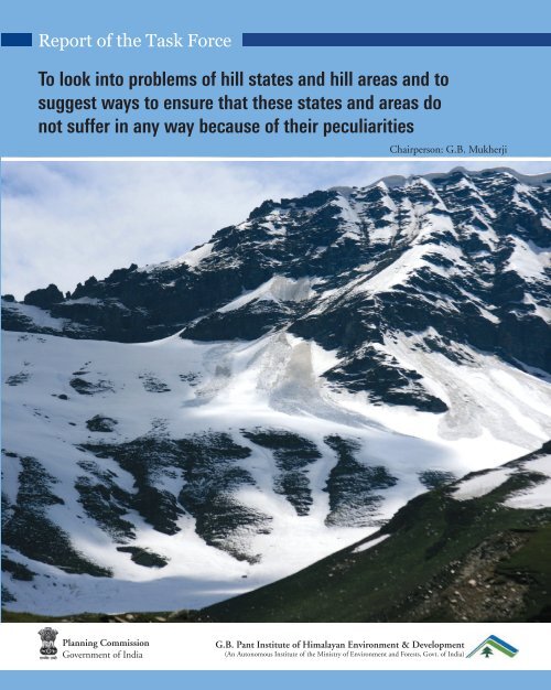
The IHR States must embark on a development path that does not disturb the primary colours <strong>of</strong> this picture: white, blue,<br />
green and brown representing the precious natural resources <strong>of</strong> the IHR, namely the snow and water, forest, and land.<br />
Planning Commission<br />
Government <strong>of</strong> India<br />
G.B. <strong>Pant</strong> <strong>Institute</strong> <strong>of</strong> <strong>Himalayan</strong> Environment & Development<br />
(An Autonomous <strong>Institute</strong> <strong>of</strong> the Ministry <strong>of</strong> Environment and Forests, Govt. <strong>of</strong> India)<br />
<strong>Report</strong> <strong>of</strong> the <strong>Task</strong> <strong>Force</strong> 1
All rights reserved. No part <strong>of</strong> this publication may be reproduced or transmitted,<br />
in any form or by any means, electronic or mechanical, including photocopying,<br />
recording or by any information storage and retrieval system, without permission<br />
in writing from Planning Commission, Government <strong>of</strong> India<br />
© Planning Commission (Government <strong>of</strong> India) 2010<br />
Planning Commission, Government <strong>of</strong> India<br />
Yojna Bhawan, Sansad Marg<br />
New Delhi - 110 001<br />
Design & Printing: Highlanders Design Services Pvt. Ltd., New Delhi<br />
Suggestions and Inputs received from the following are gratefully acknowledged<br />
Dr. AK Bhandari, Pr<strong>of</strong>. AN Purohit, Dr. BP Maithani, Pr<strong>of</strong>. CC <strong>Pant</strong>, Pr<strong>of</strong>. GS Rawat,<br />
Pr<strong>of</strong>. KS Valdiya, Pr<strong>of</strong>. PS Ramakrishnan, Dr. RBS Rawat, Pr<strong>of</strong>. RK Pande, Dr. RS Tolia, Shri SK Pande<br />
&<br />
Planning Departments <strong>of</strong> Govt. <strong>of</strong> Himachal Pradesh, Meghalaya, and Nagaland<br />
It is a matter <strong>of</strong> great pride & happiness that G.B. <strong>Pant</strong> <strong>Institute</strong> <strong>of</strong> <strong>Himalayan</strong> Environment and<br />
Development, Kosi-Katarmal, Almora was entrusted with the task <strong>of</strong> compilation <strong>of</strong> the report <strong>of</strong> the<br />
<strong>Task</strong> <strong>Force</strong> on “To look into problems <strong>of</strong> hill states and hill areas and to suggest ways to ensure that<br />
these states and areas do not suffer in any way because <strong>of</strong> their peculiarities”. I would like to thank<br />
my colleagues in the Headquarters and regional Units for providing valuable help in the collection &<br />
analysis <strong>of</strong> data. In particular, I wish to place on record appreciation for the untiring support provided to<br />
me by Dr. Subrat Sharma, as well as by Dr. D.K. Agrawal (during the initial months) without which<br />
it would not have been possible for me to complete this assignment. I also extend grateful thanks to all<br />
<strong>Task</strong> <strong>Force</strong> members and to the Chairperson, Shri G.B. Mukherje, for their valuable guidance, support<br />
and constructive critique at various stages during the compilation <strong>of</strong> this report. I am also thankful<br />
for the whole hearted support received form Shri L.P. Sonkar and Dr. Indu Patnaik <strong>of</strong> the Planning<br />
Commission. Help received from Dr. Rajeev Semwal and Ms. Kajal Joshi is also acknowledged.<br />
L.M.S. Palni<br />
Director<br />
G.B. <strong>Pant</strong> <strong>Institute</strong> <strong>of</strong> <strong>Himalayan</strong> Environment and Development<br />
Photo Credits – GB Mukherji & Subrat Sharma<br />
2<br />
<strong>Report</strong> <strong>of</strong> the <strong>Task</strong> <strong>Force</strong>
Contents<br />
LIST OF FIGURES 5<br />
LIST OF TABLES 6<br />
LIST OF BOXES 8<br />
FROM THE DESK OF THE CHAIRPERSON 9<br />
DISTILLED WISDOM 10<br />
CHAPTER 1: INTRODUCTION 15<br />
1.1. PREAMBLE<br />
1.1.1. The Himalaya: Region & the People<br />
1.1.2. Indian <strong>Himalayan</strong> Region (IHR)<br />
1.1.3. Developmental approaches for the IHR<br />
CHAPTER 2: GEORESOURCES 23<br />
2.1. LAND<br />
2.1.1. Wasteland Estimation<br />
2.2. WATER<br />
2.3. HYDROPOWER<br />
2.4. OTHER GEORESOURCES<br />
2.4.1. Coal, Petroleum and Minerals<br />
2.5. VULNERABILITY AND DISASTERS<br />
2.5.1. Earthquakes<br />
2.5.2. Avalanches & GLOFS<br />
2.5.3. Mass Movement / Landslides<br />
2.5.4. Cloudbursts<br />
CHAPTER 3: BIORESOURCES 42<br />
3.1. AGRICULTURE<br />
3.1.1. Jhum in North-eastern region<br />
3.2. HORTICULTURE<br />
3.3. ANIMAL HUSBANDRY & FISHERIES<br />
3.4. FORESTS<br />
3.5. BIODIVERSITY<br />
CHAPTER 4: SOCIETY AND HUMAN DEVELOPMENT 64<br />
4.1. HUMAN RESOURCE<br />
4.1.1. Demography<br />
4.1.2. Scheduled Tribe Population<br />
4.1.3. Scheduled Caste population<br />
<strong>Report</strong> <strong>of</strong> the <strong>Task</strong> <strong>Force</strong> 3
4.2. SOCIAL INFRASTRUCTURE<br />
4.2.1. Health Facilities<br />
4.2.2. Education<br />
4.2.3. Population below Poverty Line<br />
4. 3. DEVELOPMENT INDICATORS<br />
4.3.1. Human Development Index (HDI) in the IHR<br />
4.3.2. Gender Equality Index (GEI)<br />
4.3.3. Human Poverty Index (HPI)<br />
CHAPTER 5: SUPPORTIVE AMENITIES AND INFRASTRUCTURE 74<br />
5.1. DOMESTIC ENERGY<br />
Others Forms Of Energy<br />
5.2. TOURISM<br />
5.3. INDUSTRIES<br />
5.4. TRANSPORT<br />
5.5. TELECOM AND INFORMATION TECHNOLOGY INFRASTRUCTURE<br />
Other Modes <strong>of</strong> Communication.<br />
5.6. URBAN SETTLEMENTS<br />
CHAPTER 6: CLIMATE CHANGE 84<br />
CHAPTER 7: GOOD GOVERNANCE 86<br />
CHAPTER 8: RECOMMENDATIONS 88<br />
Developmental Zones<br />
Road, Rail and Air Connectivity<br />
Other Recommendations<br />
1. Mountain Perspective and Sensitization<br />
2. Education and Skill Development<br />
3. Natural Resource Analysis and Advisory Centre<br />
4. Strategic Environmental Assessment<br />
5. Financial Incentives, Rewards, and Relaxations<br />
6. Resource Sharing between IHR States<br />
7. Waterways and Ropeways<br />
8. Waste Management<br />
9. Disaster Preparedness and Mitigation<br />
10. Industries<br />
11. Climate Change<br />
12. National Mission for Sustaining the <strong>Himalayan</strong> Ecosystem<br />
LIST OF ABBREVIATIONS 95<br />
ANNEXURE<br />
I. COMPOSITION OF THE TASK FORCE & AMENDMENTS 97<br />
II. OVERVIEW OF THE PAST APPROACHES FOR DEVELOPMENT IN THE IHR 106<br />
III. LIST OF MAJOR INSTITUTIONS IN THE IHR 110<br />
IV. HILL AREAS-RELAXATION OF NORMS UNDER CENTRALLY SPONSORED 112<br />
AND OTHER CENTRAL SCHEMES<br />
4<br />
<strong>Report</strong> <strong>of</strong> the <strong>Task</strong> <strong>Force</strong>
List <strong>of</strong> Figures<br />
No Title Page<br />
1.1. Indian <strong>Himalayan</strong> Region (IHR) 19<br />
1.2. Developmental Perspective for the IHR 21<br />
2.0. Schematic Plan for the Development <strong>of</strong> Land Resources in the IHR 23<br />
2.1. Landuse Classification based on the <strong>Report</strong>ing Area (Provisional 2005-2006) 25<br />
2.2. Total Wastelands (% <strong>of</strong> total geographical area), and Area under Snow, Rocks, 26<br />
and Steep Slopes (% <strong>of</strong> total wastelands) in Different states <strong>of</strong> the IHR<br />
2.3. Schematic Plan for the Development <strong>of</strong> Water Resources in the IHR 28<br />
2.4. Origin and Spread <strong>of</strong> Glacier- fed rivers along the <strong>Himalayan</strong> Arc 30<br />
2.5. Schematic Plan for the Development <strong>of</strong> other Georesources in the IHR 34<br />
2.6. Schematic Plan for Disaster Mitigation in the IHR 37<br />
2.7. Damaged due to Heavy Rains/Floods/Landslides in the IHR 41<br />
3.0. Perspective for Bioresources Development in the IHR 42<br />
3.1. Schematic Plan for Agro-horticulture Development in the IHR 43<br />
3.2. Distribution <strong>of</strong> Operational Landholdings in Different Size Classes 45<br />
3.3. Schematic Plan for the Development <strong>of</strong> Forest Resource in the IHR 55<br />
3.4. Vision and Approach for Biodiversity Conservation 59<br />
3.5. Endemism in Various Plant Groups <strong>of</strong> the IHR 63<br />
4.0. Schematic Plan for Societal Development in the IHR 64<br />
4.1. State wise Change in Sex Ratio (1951-2001) in the IHR 66<br />
4.2. Gender Equality Index in the IHR 72<br />
5.1. Cooking Energy (Primary Source) & Use Pattern <strong>of</strong> <strong>Himalayan</strong> Households 75<br />
5.2. Use Pattern <strong>of</strong> Cooking Energy by Urban <strong>Himalayan</strong> Households 75<br />
5.3. Use Pattern <strong>of</strong> Cooking Energy by Rural <strong>Himalayan</strong> Households 76<br />
<strong>Report</strong> <strong>of</strong> the <strong>Task</strong> <strong>Force</strong> 5
List <strong>of</strong> Tables<br />
No Title Page<br />
1.1. Important Glaciers in the Indian <strong>Himalayan</strong> Region (IHR) and River Systems 17<br />
1.2. Major peaks and lakes in the IHR 20<br />
1.3. State wise- Water Resources in the IHR 20<br />
1.4. Region-specific Factors Responsible for Low Productivity <strong>of</strong> Agriculture in the 22<br />
IHR (11 th Five Year Plan 2007-12)<br />
2.1. Area Covered in Landuse Classification 24<br />
2.2. Wastelands and Non-usable lands in the IHR (km 2 ) 26<br />
2.3. Run<strong>of</strong>f and Soil Loss from Various Watersheds in the IHR 27<br />
2.4. Principal Glacier-fed River Systems <strong>of</strong> the Himalaya 29<br />
2.5. Rate <strong>of</strong> Recession <strong>of</strong> Various Glaciers in the IHR 30<br />
2.6. Ground Water Potential in Different States <strong>of</strong> the IHR (BCM per year) 31<br />
2.7. Sources <strong>of</strong> Drinking Water in the Rural areas in Various States <strong>of</strong> the IHR 32<br />
(per cent <strong>of</strong> total rural households)<br />
2.8. Status <strong>of</strong> Hydropower Potential and Development in the IHR (installed capacity) 33<br />
2.9. Occurrence <strong>of</strong> Various Minerals in the IHR 35<br />
2.10. Number <strong>of</strong> Operational Mines in the IHR (2004-2005) 35<br />
2.11. Production <strong>of</strong> Some Minerals from the IHR 36<br />
2.12. Seismic Zonation <strong>of</strong> the IHR States 37<br />
2.13. Some Major Earthquake Events <strong>of</strong> the IHR 38<br />
2.14. The major Avalanches <strong>Report</strong>ed from the IHR 39<br />
2.15. Some Major Landslides that Occurred in the IHR 40<br />
2.16. Some <strong>of</strong> the Major Cloudburst Events Recorded in the IHR 40<br />
3.1. Contribution <strong>of</strong> Agriculture and Allied Sectors to the Gross Domestic Product 44<br />
(2005-06) (Lakh Rs, at 1999-2000 Prices)<br />
3.2. Contribution <strong>of</strong> Some <strong>of</strong> the IHR States to National Agricultural Production (2005-06) 44<br />
3.3. Gross Irrigated Area (2006-07) in Various IHR States 46<br />
3.4. Operational Holdings (2001): Less than 2 ha in Various IHR States 46<br />
3.5. Variations in the Estimates <strong>of</strong> Area under Jhum Cultivation in Different 47<br />
States <strong>of</strong> the North-Eastern part <strong>of</strong> IHR<br />
3.6. The Administrative Classes and Ownership Regimes <strong>of</strong> Forests areas under 48<br />
Jhum Agriculture in Various States <strong>of</strong> the North Eastern part <strong>of</strong> IHR<br />
3.7. Response <strong>of</strong> Technology Mission Programme for <strong>Himalayan</strong> States 49<br />
3.8. A Glimpse <strong>of</strong> Genetic Diversity in the Fruit Species <strong>of</strong> Munsyari 50<br />
(Gori sub-Watershed -31 villages) in Uttarakhand<br />
6<br />
<strong>Report</strong> <strong>of</strong> the <strong>Task</strong> <strong>Force</strong>
3.9. Livestock Population in the IHR (2003) (in thousands) 52<br />
3.10. Population <strong>of</strong> Drought and Other Animals (2003) in the IHR (thousands) 53<br />
3.11. Some <strong>of</strong> the Major Animal Products from the Indian <strong>Himalayan</strong> Region (2006-07) 53<br />
3.12. Livestock economy <strong>of</strong> the IHR - Output Values for Year 2005-06 54<br />
(Lakh Rs, at 1999-2000 Prices)<br />
3.13. Fish Production and the Central Assistance in the IHR (2004-05) 54<br />
3.14. Contribution <strong>of</strong> the IHR to the Total Forest Cover <strong>of</strong> India (2007) 56<br />
3.15. Proportion <strong>of</strong> Forest Cover <strong>of</strong> the Total Geographical Area excluding area above 57<br />
4000m amsl (FSI 2009)<br />
3.16. Some <strong>of</strong> the Ecosystem Services Provided by the <strong>Himalayan</strong> Forests 58<br />
3.17. Forest Ecosystem Services provided by the Different States <strong>of</strong> IHR 58<br />
3.18. Change in Forest Cover between Two Assessments (2001 & 2007) 58<br />
3.19. Protected Areas in Different Bio-geographic Zones <strong>of</strong> the IHR 61<br />
3.20. Protected Area Network in the <strong>Himalayan</strong> Region- 61<br />
National Parks & Wildlife Sanctuaries<br />
3.21. Protected Area Network -Biosphere and Tiger Reserves 62<br />
3.22. Endemism in Various Animal Groups <strong>of</strong> the IHR 63<br />
3.23. Status <strong>of</strong> some <strong>of</strong> the High Altitude Plants <strong>of</strong> <strong>Himalayan</strong> Region 63<br />
4.1. Selected Demographic Parameters for IHR 65<br />
4.2. Tribes and their Population in the IHR as per 2001 Census 67<br />
4.3. Number <strong>of</strong> Functioning Primary Health Centres, Sub-centres and Community 68<br />
Health Centres in the IHR (as <strong>of</strong> March 2008)<br />
4.4. Educational Institutions in the IHR (2007-2008) 69<br />
4.5. Student-Teacher Ratio in Different Categories <strong>of</strong> Educational 70<br />
Institutions/Schools in the IHR<br />
4.6. State wise number (in lakh) and % <strong>of</strong> population below poverty line in the IHR 70<br />
4.7. The IHR states: Human Development Index 71<br />
4.8. Human Poverty Index for the IHR (1981 and 1991) 73<br />
5.1. State-wise Domestic and Foreign Tourist Visits in the IHR 2006 77<br />
5.2. Some Information on the State <strong>of</strong> Industries in the IHR 78<br />
(Values in Rs. Lakhs, others in Numbers)<br />
5.3. State-wise Distribution <strong>of</strong> Working and Closed SSI Units in Various States <strong>of</strong> the IHR 79<br />
(registered SSI sector)<br />
5.4. Road and Rail Network (km) in the States <strong>of</strong> the IHR 80<br />
5.5. Average Area and Population Served per Post Office in Various States <strong>of</strong> the IHR 82<br />
5.6 Number <strong>of</strong> Towns in the IHR (2001) 83<br />
<strong>Report</strong> <strong>of</strong> the <strong>Task</strong> <strong>Force</strong> 7
List <strong>of</strong> Boxes<br />
No Title Page<br />
1 Origin <strong>of</strong> the Himalaya and ongoing processes 16<br />
2 Diversity <strong>of</strong> major religious Sanctum Sanctorum in the IHR 19<br />
3 Protection <strong>of</strong> Hill Land and Ecological Sites in the Assam 27<br />
4 Snow Water harvesting in Cold deserts 28<br />
5 Carrying Capacity Assessment at the Basin Level 32<br />
6 Organic Farming in Mizoram 46<br />
7 Equitable Access to Shifting Cultivation Patches-Traditional Institution <strong>of</strong> Manipur 47<br />
8 Traditional Wisdom - Role <strong>of</strong> Trees 48<br />
9 Declining Natural Pollinators Costing Farmers 51<br />
10 Empowering Women Saving Forests 59<br />
11 Conservation through Beliefs 62<br />
12 Health Care in Remote Areas-New Initiatives 67<br />
13 Remoteness demands incentives for effective delivery <strong>of</strong> social services 68<br />
14 Encouraging government policies for energy generation and conservation 76<br />
8<br />
<strong>Report</strong> <strong>of</strong> the <strong>Task</strong> <strong>Force</strong>
From the Desk <strong>of</strong> the <strong>Task</strong> <strong>Force</strong> Chairperson<br />
It has been a great honour and privilege to chair<br />
this <strong>Task</strong> <strong>Force</strong> on Hill Area Development, in the<br />
context <strong>of</strong> the Indian <strong>Himalayan</strong> Region; not only<br />
because the assignment came on the direction <strong>of</strong><br />
the Hon’ble Prime Minister <strong>of</strong> India, but because<br />
we all are aware that this is a very important issue<br />
that is craving for attention; and tomorrow may be<br />
too late.<br />
We, the <strong>Task</strong> <strong>Force</strong> members are convinced that<br />
proper planning on the Indian <strong>Himalayan</strong> Region<br />
(IHR) can be attempted only if we insulate ourselves<br />
from thinking from the view point <strong>of</strong> the plain areas.<br />
This is not to say that we should not be aware <strong>of</strong> the<br />
importance and the influence that the IHR has on<br />
the rest <strong>of</strong> the country; but, it is a recommendation<br />
<strong>of</strong> this <strong>Task</strong> <strong>Force</strong> that the needs <strong>of</strong> the rest <strong>of</strong> the<br />
country should not overshadow or unduly influence<br />
our views on the needs and vulnerabilities <strong>of</strong> the<br />
IHR.<br />
I am very pleased that the esteemed Members <strong>of</strong> this<br />
<strong>Task</strong> <strong>Force</strong>, who in their own right and individual<br />
capacity are very well aware <strong>of</strong> the potential and the<br />
problems <strong>of</strong> the IHR, participated whole heartedly<br />
in <strong>of</strong>fering practical suggestions. Yet, they have<br />
restricted their interventions only to the broad<br />
concepts leaving the details to be worked out by the<br />
state governments themselves, according to their<br />
own genius.<br />
This <strong>Task</strong> <strong>Force</strong>, the Members felt, should not<br />
touch upon all the development and welfare issues<br />
that many earlier committees have tended to dwell<br />
upon at length. Instead, it was agreed from the<br />
very beginning that the recommendations <strong>of</strong> the<br />
<strong>Task</strong> <strong>Force</strong> would be effective only if it highlighted<br />
the major directions, leaving the rest to be followed<br />
up by those who have been tasked with that<br />
responsibility.<br />
The <strong>Task</strong> <strong>Force</strong> is also seized <strong>of</strong> the fact that activities<br />
in the neighbouring countries can pr<strong>of</strong>oundly<br />
affect the ecology and economy <strong>of</strong> the <strong>Himalayan</strong><br />
States. An example is the proposal to construct the<br />
Zhangmu dam on the Yarlung Tsangpo (as the river<br />
Brahmaputra is known in Tibet) by China. This<br />
action is likely to adversely impact the flow <strong>of</strong> water<br />
downstream in India including the planned hydroelectric<br />
and irrigation projects. Construction<br />
activities may also affect glaciers which help to<br />
maintain the flow <strong>of</strong> water not only in the rivers<br />
but also in underground aquifers. These external<br />
influences, however, are not being discussed<br />
except for suggesting continuous and pre-emptive<br />
collaborative effort, both in terms <strong>of</strong> research and<br />
dialogue with countries with which we share our<br />
borders.<br />
I must express my sincere gratitude and thanks<br />
to the Director and associated scientists <strong>of</strong> the<br />
G.B. <strong>Pant</strong> <strong>Institute</strong> <strong>of</strong> <strong>Himalayan</strong> Environment<br />
and Development, Almora, for taking the ideas<br />
expressed in the <strong>Task</strong> <strong>Force</strong> meetings and packaging<br />
them with the result <strong>of</strong> studies taken up by various<br />
organisations that have worked in the <strong>Himalayan</strong><br />
Region. The Chapters on Climate Change, and<br />
Governance were penned by me and I am happy that<br />
the Members <strong>of</strong> the <strong>Task</strong> <strong>Force</strong> are in agreement<br />
with my views. Their suggestions have, <strong>of</strong> course,<br />
been incorporated therein.<br />
I also thank the Planning Commission for<br />
understanding why the Chairman, being a serving<br />
Secretary to the Government <strong>of</strong> India, has not found<br />
it possible to meet more frequently with the <strong>Task</strong><br />
<strong>Force</strong> members, so as to finalise the report earlier.<br />
Shri LP Sonkar, Senior Adviser and Dr. Indu<br />
Patnaik, Deputy Adviser, have been with us all<br />
through, quietly <strong>of</strong>fering incisive thoughts and<br />
looking after the secretarial requirement. I thank<br />
them and their colleagues.<br />
The Members <strong>of</strong> the <strong>Task</strong> <strong>Force</strong> would be more than<br />
happy if, at least the major recommendations find<br />
place in the planning and implementation agenda<br />
<strong>of</strong> all the Indian <strong>Himalayan</strong> States. A IHR initiative<br />
to bring about programme convergence may be the<br />
most relevant to begin with.<br />
(G.B. Mukherji)<br />
Secretary to Government <strong>of</strong> India<br />
Ministry <strong>of</strong> Tribal Affairs<br />
<strong>Report</strong> <strong>of</strong> the <strong>Task</strong> <strong>Force</strong> 9
DISTILLED WISDOM<br />
Opinions have been expressed that the pace <strong>of</strong><br />
development <strong>of</strong> the Indian <strong>Himalayan</strong> Region<br />
(IHR) has been slow when compared to rest <strong>of</strong> the<br />
country. At the same time, its fragile nature and<br />
difficulty <strong>of</strong> taking up conventional development<br />
initiatives has not been appreciated. The Hon’ble<br />
Prime Minister <strong>of</strong> India, therefore, expressed 1 the<br />
need for a fresh analysis <strong>of</strong> the problems <strong>of</strong> the<br />
hill states and hill areas <strong>of</strong> the country in a manner<br />
that suggests that these areas do not suffer in<br />
any way on account <strong>of</strong> their peculiarities. To take<br />
note on this, a <strong>Task</strong> <strong>Force</strong> 2 was constituted by the<br />
Planning Commission <strong>of</strong> India in April, 2008.<br />
The composition <strong>of</strong> the initial <strong>Task</strong> <strong>Force</strong> and the<br />
subsequent modifications are at Annexure I.<br />
The <strong>Task</strong> <strong>Force</strong>, at its first meeting on 19th May,<br />
2008 agreed on a clear understanding that the<br />
scope <strong>of</strong> work should encompass only the states<br />
falling within the Indian <strong>Himalayan</strong> Region<br />
(comprising Jammu & Kashmir, Himachal Pradesh,<br />
Uttarakhand, Sikkim, Arunachal Pradesh, Manipur,<br />
Meghalaya, Tripura, Nagaland, and Mizoram, and<br />
the hilly areas <strong>of</strong> Assam and West Bengal). In the<br />
next meeting it resolved to recommend only<br />
such policies and programmes that help<br />
strike a balance between the four key natural<br />
treasures <strong>of</strong> the IHR viz., the snow, water,<br />
forests, and soil, with the developmental<br />
aspirations <strong>of</strong> its people. The <strong>Task</strong> <strong>Force</strong><br />
members had no hesitation in stating that in case<br />
<strong>of</strong> a conflict between the two, the natural treasures<br />
should get primacy. Indeed, it is felt that snow,<br />
ice, water, and soil should be declared as the<br />
blessing <strong>of</strong> the mighty <strong>Himalayan</strong> ranges to<br />
our country and beyond. The acceptance <strong>of</strong> this<br />
wisdom resulted in a “Vision” for the IHR.<br />
VISION<br />
In order to suggest a new plan for the IHR, based on the lessons learned thus far, one needs to first<br />
visualize a picture <strong>of</strong> the IHR; a picture that is not only acceptable to those who live in the region, but<br />
also to those who live beyond its physical boundaries. The picture, if painted powerfully, will provide<br />
the impetus for strict control <strong>of</strong> behaviour and action that are <strong>of</strong>ten tempted to accord primacy to<br />
resource exploitation, growth and markets over conservation, protection and eco-friendly living. It<br />
is not an idealistic approach but a practical one. To put it bluntly, we cannot afford to burn a Kangra<br />
painting or a Ladakhi Tangka to provide immediate warmth. The primary stakeholders living in the<br />
IHR must believe in this picture in order to effectively counter the demands <strong>of</strong> those who live outside.<br />
Likewise, the “outsiders”, becoming aware <strong>of</strong> the contents <strong>of</strong> the picture, and appreciating its influence<br />
on the rest <strong>of</strong> the country, must be prepared and willing to compensate the IHR for the self restrictions<br />
that it will be imposing.<br />
Therefore, the IHR States must be persuaded to emphasize on a development path that does not disturb<br />
the primary colours <strong>of</strong> this picture: white, blue, green and brown representing the precious natural<br />
resources <strong>of</strong> the IHR, namely the snow and water, forest, and land.<br />
Our Vision <strong>of</strong> the IHR accords maximum primacy to Blue: representing river valleys, watersheds and<br />
water bodies providing myriad sources for this life supportive elixir to multiple users, both in the<br />
<strong>Himalayan</strong> as well as the downstream regions <strong>of</strong> the country. Moisture provides support to soil, for<br />
crops to grow. Water makes forests dense and productive. So, in recognition <strong>of</strong> the ever increasing<br />
importance that water plays and will continue to play for the very survival <strong>of</strong> life, including in the<br />
IHR, and especially in the context <strong>of</strong> the anticipated adverse effects <strong>of</strong> global warming, no activity that<br />
threatens to bring a change in the natural water regimes <strong>of</strong> the IHR should be allowed. Period forests<br />
1 Concluding remarks during the 54th meeting <strong>of</strong> National Development Council. 19 December, 2007.<br />
2 No.M-13055/1/<strong>Task</strong> <strong>Force</strong>/2008-MLP Planning commission (MLP Division), Dated April 2, 2008.<br />
10<br />
<strong>Report</strong> <strong>of</strong> the <strong>Task</strong> <strong>Force</strong>
that presently occupy 65.5% <strong>of</strong> the IHR, and are the main contributor to the colour Green, trap water<br />
and let it seep gradually into the ground and into streams. Blue and Green are linked; erase one, and the<br />
other automatically gets erased. Hence, forests in the IHR should not be allowed to decline but should<br />
actually be facilitated to increase to 70% by supporting their conservation and expansion with fiscal<br />
incentives to the local inhabitants, and by encouraging traditionally protective religio-socio-cultural<br />
norms and behaviour. For every item <strong>of</strong> use that crosses the limits <strong>of</strong> sustainability, alternatives must<br />
be provided; and disincentives for crossing must be made painful.<br />
Various shades <strong>of</strong> the Brown, representing land and soil complement the green <strong>of</strong> the forests. Stringent<br />
zoning regulations, land use plans and control mechanisms must be in place so as to quickly and<br />
effectively stop all mountain unfriendly activities, especially by those individuals and institutions whose<br />
primary stakes are not in the region. Land in the IHR is too precious to be available to speculators.<br />
White, dominated by snow, ice and glaciers represents the crowning colour <strong>of</strong> the IHR. White, in the<br />
context <strong>of</strong> the <strong>Himalayan</strong> region, is the key contributor to the sustenance <strong>of</strong> all other natural resources,<br />
especially water, making them potentially richer. Unfortunately, white is reportedly diminishing<br />
gradually in the wake <strong>of</strong> climate change, thereby posing one <strong>of</strong> the most serious ecological challenges<br />
for the country. Not much can be done to squarely address this concern except indirectly, by increasing<br />
the extent <strong>of</strong> the blue and the green, and by regulating activities that encroach upon snow and ice bound<br />
areas.<br />
Finally, in addition to the above, mountains <strong>of</strong> the IHR are also for the people who are born in these<br />
areas and continue to remain the primary stakeholders. So, providing knowledge, training and skills to<br />
these primary stakeholders and creating enabling policy environment and infrastructure for controlled<br />
harnessing <strong>of</strong> the above mentioned natural resources is imperative. In the process it is expected to<br />
generate pockets <strong>of</strong> additional colours that would represent agro-horticulture crops, animal husbandry,<br />
strengthened social infrastructure (health, education, and housing) and a reliable network <strong>of</strong> roads,<br />
railways and air connectivity.<br />
The IHR should be looked as being more than a tourist destination; it can be developed as one <strong>of</strong><br />
the major production centres for niche crops and human capital <strong>of</strong> the country. Our vision does not,<br />
however, allow these additional pockets <strong>of</strong> colours and infrastructure development to adversely affect<br />
the key resources <strong>of</strong> the IHR that we are calling Blue, Green, Brown and White.<br />
Arguments have been presented<br />
recommending reshaping <strong>of</strong> policies to<br />
bring in the “mountain perspective” for the<br />
IHR, in the national planning. Emphasis<br />
has also been laid on developing norms for<br />
good governance and for harnessing social<br />
capital at the grassroots.<br />
To hasten development processes in the<br />
IHR, the other important recommendations<br />
<strong>of</strong> the report cover:<br />
Resource and environmental issues:<br />
In order that conservation <strong>of</strong> key natural<br />
resources and eco-sensitivity is not neglected,<br />
development planning must be based on<br />
Zones. Activity or non activity zones must<br />
first be identified and taken into account for<br />
appropriate interventions;<br />
Zones <strong>of</strong> snow, alpine, sub-alpine areas and<br />
sacred landscapes need to be protected at any<br />
cost, for maintaining the flow <strong>of</strong> vital ecosystem<br />
services and for respecting and preserving<br />
religio-cultural values;<br />
All natural water zones (glaciers, rivers,<br />
lakes, and springs) must be strictly protected.<br />
Activities in any <strong>of</strong> the zones that, in any way,<br />
adversely impact on water resources should be<br />
nipped in the bud;<br />
Forest zone should be conserved and augmented<br />
for environmental services and biodiversity<br />
value. This zone should also be available for<br />
<strong>Report</strong> <strong>of</strong> the <strong>Task</strong> <strong>Force</strong> 11
sustainable bio- and non-timber forest produce<br />
(NTFP) prospecting, and for eco-tourism;<br />
Zone <strong>of</strong> fertile river valleys at lower altitudes<br />
should be utilized for agricultural production<br />
but conversion <strong>of</strong> agricultural land to other<br />
uses in such zones should not be allowed.<br />
Likewise sub-zones for terraced agriculture<br />
should be earmarked for unique crops, organic<br />
agriculture, horticulture, agro-forestry, and<br />
better managed shifting cultivation (Jhum);<br />
River zones for decentralized electricity<br />
production should be earmarked to meet<br />
the household and small industrial power<br />
requirements;<br />
Zone <strong>of</strong> urban spaces: no construction should<br />
be allowed in areas having slope above 30 o , in<br />
areas that fall in hazardous zones, and areas<br />
falling on spring, aquifer lines and first order<br />
streams. Efficient sewage & municipal waste<br />
management systems should be mandatory in<br />
such places;<br />
Zone <strong>of</strong> industries should only be in nonfragile<br />
areas and include only those activities<br />
favourable to mountainous conditions, such<br />
as processing non-toxic, preferably locally<br />
available raw materials, and investment that<br />
generate local employment;<br />
In order to safeguard the <strong>Himalayan</strong> water<br />
regime, instead <strong>of</strong> project wise environmental<br />
impact assessments, Strategic Environmental<br />
Assessment (SEA) should be mandatory,<br />
concurrently developing the required human<br />
resource for carrying out SEAs;<br />
Mountain sensitive land use policy should be<br />
developed and laws should be made stringent<br />
to help minimize erosion and silt flow,<br />
facilitate functional land consolidation, and<br />
regulate mining irrespective <strong>of</strong> size to reduce<br />
environmental degradation;<br />
The solution to many connectivity related<br />
problems <strong>of</strong> the IHR seems to lie in finding<br />
and supporting road making technologies<br />
that are sensitive to, and also in conformity to<br />
the characteristics <strong>of</strong> mountain ecology and<br />
geology. Ridge alignment rather than along<br />
river valleys, efficient side drains, bio pro<strong>of</strong>ing<br />
<strong>of</strong> slopes below and above roads (tea bushes,<br />
bamboos and the like that bind the soil through<br />
intricate latticework <strong>of</strong> roots as well as a thick<br />
canopy that arrests raindrops from directly<br />
hitting the soil), location specific designs, and<br />
loops (networks interlinked in the region itself)<br />
are obvious choices that must be preferred;<br />
Planning for eco-friendly disposal <strong>of</strong> municipal<br />
solid waste must be the first charge <strong>of</strong> every IHR<br />
state. IHR towns cannot make garbage dumps<br />
<strong>of</strong> river basins and hill slopes. Awareness<br />
raising <strong>of</strong> this need and skill development<br />
programmes are required at every level for the<br />
key stakeholders for this;<br />
IHR States and local government must<br />
empower themselves to draw up eco-sensitive<br />
habitat plans, especially for disaster prone<br />
areas, fix zones for various activities, building<br />
codes, ownership codes, and strictly enforce<br />
implementation; and<br />
Since a demand for changing over from firewood<br />
to LPG is emerging, the <strong>Task</strong> <strong>Force</strong> recommends,<br />
all the IHR states, should capitalize on it.<br />
Increasing the availability <strong>of</strong> cylinders,<br />
especially the conveniently transportable<br />
or head loadable sizes, options for localized<br />
piped gas connections; and making LPG use<br />
mandatory for all hotels and eateries, whatever<br />
the size are corollary recommendations.<br />
Human capital and skill development issues:<br />
If restrictions on the free use <strong>of</strong> natural<br />
resources are to be worked upon, alternate<br />
strategies for livelihood generation, beyond<br />
agriculture, horticulture and animal husbandry<br />
must be designed. In concrete terms, this would<br />
translate into large, focused investments in<br />
education and skill development. The human<br />
capital <strong>of</strong> the IHR must be enabled to tap<br />
technology to increase the output <strong>of</strong> traditional<br />
production, provide specialized services and<br />
even high scientific research into bio sciences,<br />
energy, materials and information technology;<br />
In whatever manner development and welfare<br />
is viewed, the need for measures that directly<br />
address the indicators <strong>of</strong> development and<br />
welfare is evident. While it is up to the<br />
12<br />
<strong>Report</strong> <strong>of</strong> the <strong>Task</strong> <strong>Force</strong>
espective States to design these interventions<br />
and ensure effective implementation, the <strong>Task</strong><br />
<strong>Force</strong> is <strong>of</strong> the opinion that mountain specific<br />
skill development with education will enable<br />
the people themselves to avail the services on<br />
<strong>of</strong>fer, either within the region or beyond;<br />
Design specific courses on mountain<br />
ecology, sensitizing key decision makers<br />
and stakeholders and institutionalize this<br />
in administrative academies, universities,<br />
and skill training institutions in the IHR.<br />
Establishing a mechanism to collate and<br />
analyze the institutional resource already<br />
available in the IHR, coordinate their output<br />
and if necessary, set up new ones that meet<br />
the objectives <strong>of</strong> skill development is a related<br />
requirement;<br />
Skills for niche tourism is a mountain<br />
friendly option but only if it is regulated, is<br />
eco-sensitive, not energy or waste intensive,<br />
and is accompanied with local, community<br />
participation. IHR tourism must be an area <strong>of</strong><br />
special focus but built on the foundation <strong>of</strong> local<br />
skill development and environmental “benignness”;<br />
For the overall improvement <strong>of</strong> the IHR,<br />
the physical health and human capital <strong>of</strong><br />
its inhabitants should be focused for quick<br />
improvement. This can be done, in the first<br />
instance, by delivering both preventive and<br />
curative services, found on a supportive,<br />
efficient and extensive infrastructure.<br />
Appropriate policy support is needed for<br />
attracting and producing quality teachers,<br />
amongst the locals, particularly for the remote<br />
areas. Introduction <strong>of</strong> mountain relevant<br />
syllabi, including vocational education, is<br />
another essential. Recruitment rules that favour<br />
area-wise, if not position-wise appointments<br />
are expected to negate pressures <strong>of</strong> moving to<br />
cities leaving vacancies in vulnerable areas. Full<br />
advantage <strong>of</strong> distant learning institutions (e.g.,<br />
IGNOU), including those in the private sector<br />
(e.g., SMU, NIIT), must be taken. Policy support<br />
for this would imply satellite connectivity; and<br />
Upgradation <strong>of</strong> an existing institute or the<br />
establishment <strong>of</strong> a new institute for Natural<br />
Resource Analysis and Advisory Centre<br />
(NRAAC) is also recommended.<br />
Fiscal issues:<br />
Reward as well as compensation mechanisms<br />
should be put in place at the national level for<br />
acknowledging and maintaining the flow <strong>of</strong> life<br />
supporting ecosystem services from the IHR<br />
to the rest <strong>of</strong> the country. For the maintenance<br />
<strong>of</strong> forests, incremental green bonus should be<br />
provided based on proportion <strong>of</strong> the area <strong>of</strong><br />
IHR under forest while paying attention to the<br />
fact that there are vast tracts <strong>of</strong> lands in high<br />
altitudes where forests cannot grow;<br />
Set up a non-lapsable, IHR Gap Fund from<br />
sources to be identified by the IHR States with<br />
the Planning Commission, for compensating<br />
IHR states for sacrificing conventional<br />
development in favour <strong>of</strong> ecologically<br />
sustainable and water conserving initiatives;<br />
IHR development norms must be formulated<br />
on IHR relevant parameters rather than<br />
conventional, plain area parameters;<br />
Introduce a different price policy for organic/<br />
niche products <strong>of</strong> the mountains so as to<br />
promote energy efficient and environmental<br />
friendly practices, support local economy,<br />
and conserve the IHR gene pool to respond<br />
to unforeseen challenges. Develop a policy<br />
framework to guide creation <strong>of</strong> <strong>Himalayan</strong><br />
Brand (e.g., eco-mark, energy star label) for<br />
eco-friendly mountain products; and<br />
For seeking credit, banking norms should<br />
consider social capital as a surrogate to<br />
land ownership in states/areas where land<br />
tenure system restricts personal ownership <strong>of</strong><br />
rights, and documented land records are not<br />
available.<br />
Developmental issues:<br />
Develop reliable and efficient road, rail and air<br />
connectivity networks in the IHR. IHR roads<br />
must, even at the cost <strong>of</strong> redundancy, especially<br />
along sensitive and strategic areas, have parallel<br />
alternatives. Two loop railway lines – one for<br />
the Western <strong>Himalayan</strong> region and the other<br />
for North-Eastern region should be designed.<br />
<strong>Report</strong> <strong>of</strong> the <strong>Task</strong> <strong>Force</strong> 13
Major roads must link up with these two railway<br />
loops. There should be at least one small airstrip<br />
in every state; roads and railways should<br />
link up with that air-strip. Extensive network<br />
<strong>of</strong> ropeways and hanging bridges should be the<br />
backbone <strong>of</strong> surface connectivity in the high<br />
<strong>Himalayan</strong> region;<br />
Radio transmission and satellite based<br />
links should be strengthened for electronic<br />
communication at village level. This may<br />
enable electronic trading, bio-prospecting and<br />
s<strong>of</strong>tware development for the rest <strong>of</strong> the country<br />
and the world;<br />
Decentralized small scale power generation<br />
and distribution are considered to be mountain<br />
friendly and need to be promoted. Medium and<br />
major projects can be planned only in areas<br />
considered to be ecologically stable and where<br />
river basin environmental impact assessments,<br />
as opposed to project-wise appraisals have<br />
been undertaken; and the resultant findings<br />
support such projects. Solar and wind energy<br />
must be considered as the first alternative to<br />
fuelwood and economic incentives have to<br />
find prominent place in IHR energy planning<br />
in order to help people switch over from fuelwood<br />
to alternatives;<br />
Climate Change is a cross cutting issue and<br />
challenges transcend sectors. Strategies to<br />
minimize the anticipated adverse impacts must<br />
be designed right away, in association with the<br />
Central Government;<br />
Upgrading the standards <strong>of</strong> administration<br />
in the IHR is a task that the <strong>Task</strong> <strong>Force</strong><br />
recommends, has to be specifically addressed<br />
by all the IHR States, preferably with the help<br />
<strong>of</strong> pr<strong>of</strong>essionals and academic bodies; and<br />
A Convergence Mission to look into issues<br />
<strong>of</strong> delivery in the IHR is considered to be<br />
essential. Whether this should be in the form <strong>of</strong><br />
a <strong>Himalayan</strong> Sustainable Development Forum,<br />
as was recommended by the Declaration<br />
following the <strong>Himalayan</strong> Chief Ministers’<br />
Conclave convened on October 30, 2009 in<br />
Shimla, or in any other form is a decision best<br />
left to the IHR States.<br />
The super distilled recommendations <strong>of</strong> the <strong>Task</strong> <strong>Force</strong> are<br />
IHR States should invest in agro-horticulture-forestry skill and technology development.<br />
Output per ha will increase, productivity per person, in terms <strong>of</strong> service capability will increase.<br />
However, producers and skilled persons need access to markets for selling surplus as well as<br />
opportunities to <strong>of</strong>fer their skills. Therefore, States should invest in connectivity, marketing<br />
arrangements including IT enabled service infrastructure.<br />
Wealth generated should be attracted for ploughing back on land as well as on education/ training.<br />
So, IHR States should encourage special investment opportunities with high rate <strong>of</strong> return.<br />
Resultant skill/ educational institutes will be enabled to improve production technology as well<br />
as human capital.<br />
<br />
14<br />
<strong>Report</strong> <strong>of</strong> the <strong>Task</strong> <strong>Force</strong>
CHAPTER 1<br />
INTRODUCTION<br />
1.1. PREAMBLE:<br />
1.1.1. The Himalaya: Region & the People<br />
1.1.2. Indian <strong>Himalayan</strong> Region (IHR)<br />
1.1.3. Developmental approaches for the IHR<br />
1.1. PREAMBLE:<br />
Environmental conservation and sustainable<br />
development are conventionally stated to be the two<br />
sides <strong>of</strong> the same coin, but in mountainous regions,<br />
it is the cone not coin, with natural resource as<br />
the base. This statement is most appropriate in<br />
situations that abound in the mountains across the<br />
globe. ‘Mountains are an important source <strong>of</strong> water,<br />
energy and biological diversity. Furthermore, they<br />
are a source <strong>of</strong> such key resources as minerals,<br />
forest and agricultural products and <strong>of</strong> recreation.<br />
As a major ecosystem representing the complex<br />
and interrelated ecology <strong>of</strong> our planet, mountain<br />
environments are essential to the survival <strong>of</strong> the<br />
global ecosystem’ (Agenda 21 3 ). Mountains are<br />
essential for snow to fall, ice to form and rivers to<br />
flow. All the major rivers in the world have their<br />
headwaters in mountains, and hence these are<br />
aptly called the Water Towers 4 (or the Third Pole)<br />
on the earth.<br />
A strong consensus was evolved during the<br />
worldwide deliberations in the International Year<br />
<strong>of</strong> the Mountains (2002) and the International Year<br />
<strong>of</strong> Freshwaters (2003) to work towards sustainable<br />
development <strong>of</strong> the mountain regions that directly<br />
impact the lives <strong>of</strong> more than half <strong>of</strong> the world’s<br />
population. However, the mountain ecosystems are<br />
rapidly changing owing to numerous biophysical<br />
and socio-economic factors and as a result the<br />
mountains, throughout the world, are experiencing<br />
environmental degradation.<br />
Mountains are known for their specificities viz.,<br />
inaccessibility, fragility, marginality, diversity<br />
(heterogeneity), niche (natural suitability) and<br />
adaptability 5 . Therefore, in the concluding<br />
remarks during the 54th meeting <strong>of</strong> National<br />
Development Council (19th December,<br />
2007), the Hon’ble Prime Minister <strong>of</strong> India<br />
expressed the need for a fresh analysis <strong>of</strong><br />
the problems <strong>of</strong> the hill states and hill areas<br />
<strong>of</strong> the country in a manner that suggests<br />
ways and means so that these areas do<br />
not suffer in any way on account <strong>of</strong> their<br />
above mentioned, largely geographical,<br />
peculiarities.<br />
The recognition that the hill states and hill areas <strong>of</strong><br />
the country have not been able to join in the race <strong>of</strong><br />
socio-economic development <strong>of</strong> the country 6 even<br />
after more than 60 years <strong>of</strong> independence, strongly<br />
implies that the situation and underlying causes<br />
need to be analyzed afresh and suggest critical<br />
corrective measures. The primary question before<br />
the <strong>Task</strong> <strong>Force</strong> 2 is, “what type <strong>of</strong> development?” It<br />
is in the aforesaid back drop that a <strong>Task</strong> <strong>Force</strong> 2 was<br />
constituted by the Planning Commission <strong>of</strong> India<br />
in April, 2008 under the Chairmanship <strong>of</strong> Shri G.B.<br />
Mukherji.<br />
1.1.1. The Himalaya: Region & the People<br />
The name Himalaya has been derived from two<br />
Sanskrit words Hima (snow) and Alaya (abode),<br />
i.e., the abode <strong>of</strong> snow. The massive <strong>Himalayan</strong><br />
arc extends over 2,500 kilometers between Nanga<br />
Parbat (8,126 m) in the west and Namcha Barwa<br />
(7,755 m) in the east 7 . The extreme variation in<br />
elevation and rugged relief are the result <strong>of</strong> orogenic<br />
forces with vigorous erosion processes. India-<br />
3 Agenda 21, Section-II, Chapter 13th Managing Fragile Ecosystems: Sustainable Mountain Development. http://www.un.org/esa/dsd/<br />
agenda21/res_agenda21_13.shtml visited on 17.9. 2009.<br />
4 Liniger, H., Weingartner R., and Grosejean, M. 1998. Mountains <strong>of</strong> the world: Water towers for the 21st century. United Nations<br />
Commission on Sustainable Development.<br />
5 Jodha, N. S. 2005. <strong>Himalayan</strong> Journal <strong>of</strong> Sciences, 3(5):33-43<br />
6 Infrastructure Index by UNDP for Twelfth Finance Commission (2005-10) Govt. <strong>of</strong> India. Lower Middle Category –<br />
Himachal Pradesh, Uttarakhand, Low Category – Arunachal Pradesh, Manipur, Mizoram, Nagaland, Sikkim, Tripura, and J&K.<br />
7 Kenneth Mason. Abode <strong>of</strong> Snow: A History <strong>of</strong> Himalaya Exploration and Mountaineering. London: Rupert Hart-Davis, 1955. p.6<br />
<strong>Report</strong> <strong>of</strong> the <strong>Task</strong> <strong>Force</strong> 15
Asia convergence (20 mm/year) is absorbed by a<br />
thrusting along the southern front <strong>of</strong> the Himalaya<br />
leading to the continuous rising <strong>of</strong> the Himalaya<br />
Box 1 - Origin <strong>of</strong> the Himalaya and<br />
ongoing processes<br />
The Himalaya came into existence as a result <strong>of</strong> a<br />
collision along the convergent boundary between<br />
the Indian Plate and the Eurasian Plate. The<br />
collision began in the Upper Cretaceous period<br />
(about 70 million years ago) when the Indian<br />
Plate, moving north at about 15 cm/year, collided<br />
with the Eurasian Plate. By about 50 million years<br />
ago this movement completely closed the Tethys<br />
Sea thrusting the sediments up and forming the<br />
youngest and l<strong>of</strong>tiest mountain ranges on the face<br />
<strong>of</strong> the earth known as the Himalaya. The Indian<br />
plate is still moving at 67 mm/year, and over the<br />
next 10 million years is likely to travel about 1,500<br />
km into Asia.<br />
by about 5 mm/year and, therefore, making it<br />
geologically unstable and prone to earthquakes<br />
8,9,10<br />
. Being the youngest and l<strong>of</strong>tiest mountain<br />
chain (more than 30 peaks exceeding 7,600 m in<br />
elevation 11 ) <strong>of</strong> the world which is still rising, the<br />
<strong>Himalayan</strong> region is naturally unstable and fragile.<br />
Physiographically, starting from the Siwalik hills in<br />
the south, the <strong>Himalayan</strong> mountain range extends<br />
to the Tibetan plateau in the north. The broad<br />
divisions are the Siwaliks, the lesser Himalaya,<br />
the greater Himalaya and the trans-Himalaya;<br />
extending almost uninterrupted throughout its<br />
length, separated by major geological fault lines.<br />
The climate ranges from tropical at the base <strong>of</strong> the<br />
mountains to permanent ice and snow at the highest<br />
elevations. The amount <strong>of</strong> yearly rainfall increases<br />
from west to east along the base <strong>of</strong> the range. The<br />
Indian <strong>Himalayan</strong> region (IHR) contains some <strong>of</strong><br />
the wettest spots on the face <strong>of</strong> the earth in the<br />
eastern side, and vast expanses <strong>of</strong> cold desert in the<br />
north-west. The eastern <strong>Himalayan</strong> region, which<br />
is at a relatively lower latitude than the western<br />
region, is also comparatively warmer. Local relief<br />
and location determine such climatic variation not<br />
only in different parts <strong>of</strong> the Himalaya but even on<br />
different slopes <strong>of</strong> the same range. The diversity<br />
in climate, altitude, rainfall and soil types along<br />
the altitudes and longitudes manifests itself in the<br />
presence <strong>of</strong> a variety <strong>of</strong> agro-climatic zones, each<br />
harbouring distinct and sometimes overlapping<br />
plant and animal communities.<br />
The higher regions <strong>of</strong> the Himalaya are snowbound<br />
throughout the year and in spite <strong>of</strong> their proximity<br />
to the tropics, the perpetual snow level seldom<br />
falls below 5,500 meters. The <strong>Himalayan</strong> ranges<br />
encompass numerous glaciers (9,575 12 ); notable<br />
among them is the Siachen which is the largest<br />
glacier in the world outside the polar region (Table<br />
1.1). The <strong>Himalayan</strong> glaciers are the source for<br />
several large perennial rivers which in turn further<br />
define and shape the mountain configuration, and<br />
drain into major river systems <strong>of</strong> the continent<br />
(Table 1.1).<br />
The <strong>Himalayan</strong> region is dotted with hundreds <strong>of</strong><br />
small and big, crystal clear lakes, many <strong>of</strong> which<br />
are considered sacred by the followers <strong>of</strong> various<br />
religions. Most <strong>of</strong> such lakes are found at altitudes<br />
less than 5,000 m above mean sea level (amsl).<br />
The Pangong Tso which is spread across the border<br />
between India and Tibet (China) at an altitude <strong>of</strong><br />
4,600 m amsl is the largest (as wide as 8 km at places<br />
and nearly 134 km long) lake in the region. The<br />
other notable high altitude lakes are Gurudogmar<br />
(5,148 m) and Tsongmo in Sikkim, and Tilicho in<br />
Nepal.<br />
The <strong>Himalayan</strong> ranges have a pr<strong>of</strong>ound affect on<br />
the climate <strong>of</strong> the Indian subcontinent and the<br />
Tibetan plateau. They prevent frigid and dry arctic<br />
winds from blowing south into the subcontinent<br />
keeping South Asia much warmer when compared<br />
to the regions located between corresponding<br />
latitudes throughout the globe. They are a barrier<br />
for the moisture laden monsoon winds, preventing<br />
them from traveling further northwards and thus<br />
facilitating timely and heavy precipitation in the<br />
entire Northern India.<br />
8 Valdiya, K. S. 2001, Current Science, 81(11):1418-1431.<br />
9 Valdiya, K. S. 2002, Physical Geography, 26(3):360-399.<br />
10 Valdiya, K. S.1993, Current Science, 64(11-12):835-885.<br />
11 Gurung, H. 2005. Atlas <strong>of</strong> the Himalaya. ICIMOD, Kathmandu, Nepal.<br />
12 Raina, V.K. & Srivastava, D.K. 2008. Glacier Atlas <strong>of</strong> India. Geological Society <strong>of</strong> India, Bangalore.<br />
16<br />
<strong>Report</strong> <strong>of</strong> the <strong>Task</strong> <strong>Force</strong>
During winter, the <strong>Himalayan</strong> ranges pose a<br />
barrier to storms coming from the west, and as<br />
a consequence receive precipitation in the form<br />
<strong>of</strong> snow at higher ranges, and rainfall in lower<br />
elevations and the adjacent plains <strong>of</strong> northern<br />
India. Thus, there are two distinct periods <strong>of</strong><br />
precipitation in the IHR: (i) the moderate amounts<br />
brought by western disturbances during winter,<br />
and (ii) the heavier precipitation during summer<br />
due to southwesterly monsoon winds. The winter<br />
precipitation is more pronounced in the western<br />
Himalaya in comparison to the eastern <strong>Himalayan</strong><br />
region, while the reverse is true for the summer<br />
monsoon. Despite being a general barrier to the cold<br />
northerly winter winds, the Brahmaputra valley<br />
receives part <strong>of</strong> the frigid winds causing substantial<br />
lowering <strong>of</strong> the temperature in the North-East India<br />
helping North- East monsoon to occur during this<br />
season.<br />
Table 1.1. Important Glaciers in the IHR and River Systems<br />
Location Glacier Length (km) River Systems<br />
Karakoram Range Siachin 72<br />
Hispar 62<br />
The western rivers combine and drain into<br />
Baifo 69 the Indus Basin, <strong>of</strong> which the Indus River is<br />
Batura 59 the largest. The Indus begins in Tibet at the<br />
Kashmir Kolahai 6<br />
confluence <strong>of</strong> Sengge and Gar rivers and flows<br />
southwest through Pakistan to the Arabian Sea.<br />
Machai 8<br />
It is fed by the Jhelum, the Chenab, the Ravi, the<br />
Shishram 6 Beas, and the Sutlej rivers, among others.<br />
Liddar 5<br />
The other <strong>Himalayan</strong> Rivers drain into the<br />
Himachal Pradesh Bara Shigri 30 Ganga-Brahmaputra Basin. The Ganga originates<br />
Chhota Shigri 9 as Bhagirathi from Gangotri glacier and flows<br />
Sara Umga 17 southeast through the plains <strong>of</strong> northern India,<br />
fed by the Alaknanda and the Yamuna among<br />
Parvati 8<br />
other tributaries. The Brahmaputra originates as<br />
Samudra Tapu 9 the Yarlung Tsangpo River in western Tibet, and<br />
Uttarakhand North Nanda Devi 19 flows east through Tibet and west through the<br />
South Nanda Devi 19 plains <strong>of</strong> Assam. The Ganga and the Brahmaputra<br />
Trishul 15<br />
meet in Bangladesh, and drain into the Bay <strong>of</strong><br />
Bengal forming one <strong>of</strong> the largest river deltas in<br />
Gangotri 30<br />
the world.<br />
Dokriani 5<br />
As the only exception, the eastern-most glacial<br />
Chorabari 7<br />
Rivers feed the Irrawady River basin, which<br />
Gantotri 19 originates in eastern Tibet and flows south<br />
Chowkhamba 12 through Myanmar and finally drains into the<br />
Satopanth 13 Andaman Sea. The Salween, the Mekong, the<br />
Yangtze and the Hwang Ho, all originate from<br />
Pindari 8<br />
parts <strong>of</strong> the Tibetan plateau which is geologically<br />
Milam 19 distinct from the Himalaya and are, therefore, not<br />
Sikkim Zemu 26 considered as the true <strong>Himalayan</strong> Rivers. Some<br />
Kchangchendzonga 16 geologists refer to all these rivers collectively as<br />
the circum-<strong>Himalayan</strong> Rivers.<br />
Source : <strong>Report</strong> <strong>of</strong> the <strong>Task</strong> <strong>Force</strong> on Mountain Ecosystems Environment and Forest Sector for<br />
Eleventh Five year Plan. Planning Commission, Govt. <strong>of</strong> India, 2006<br />
<strong>Report</strong> <strong>of</strong> the <strong>Task</strong> <strong>Force</strong> 17
With such a pr<strong>of</strong>ound influence on the regional<br />
climate and due to great variations in altitude<br />
and latitude, the <strong>Himalayan</strong> region nurtures<br />
a staggering diversity <strong>of</strong> flora and fauna. The<br />
vegetation assemblages <strong>of</strong> the <strong>Himalayan</strong> region<br />
range from tropical savanna type to alpine<br />
meadows. Taking note <strong>of</strong> this, the entire landscape<br />
has been designated as one <strong>of</strong> the global hotspots<br />
<strong>of</strong> biodiversity. IHR accounts for around 70% <strong>of</strong><br />
the <strong>Himalayan</strong> biodiversity hotspot; Recognition <strong>of</strong><br />
the Himalaya as one <strong>of</strong> the 34 global biodiversity<br />
hotspots aptly reflects it’s wide ranging ecological<br />
significance 13 . Diverse natural resources support<br />
socio-cultural diversity in these mountains.<br />
The initial human settlement <strong>of</strong> the <strong>Himalayan</strong><br />
region was the result <strong>of</strong> waves <strong>of</strong> Caucasoid<br />
migration from the west and Mongoloids from<br />
the east. Thus, due to their individual migration<br />
routes, the former are spread across the Western<br />
Himalaya while the latter settled in the eastern<br />
Himalaya. Migrants settled with time and brought<br />
their religions such as Hinduism from the southern<br />
plains, Buddhism from the northern high plateau<br />
and Islam from the west. While their cultural<br />
identity remains preserved in a large number <strong>of</strong><br />
distinct languages <strong>of</strong> Tibeto-Burman and Indo-<br />
Aryan language families, which they speak across<br />
the region, the spiritual faith <strong>of</strong> many <strong>Himalayan</strong><br />
people is still ingrained in their Shamanistic<br />
belief 11 .<br />
1.1.2. The Indian <strong>Himalayan</strong> Region<br />
(IHR)<br />
The IHR, including the Himalaya proper and the<br />
north-eastern hill states, lies between 21 o 57’ and<br />
37 o 5’ N latitudes and 72 o 40’ and 97 o 25’ E longitudes<br />
covering an area <strong>of</strong> 5,33,000 km 2 (16.2% <strong>of</strong> the total<br />
geographical area <strong>of</strong> the country). It stretches over<br />
2,500 km from Jammu & Kashmir in the west to<br />
Arunachal Pradesh in the east, covering partially/<br />
fully twelve states <strong>of</strong> India (Fig. 1.1), but its width<br />
varies from 150 km to 600 km at different places.<br />
The IHR is the home to four crore (40 million)<br />
people 14 (3.8% <strong>of</strong> the total population <strong>of</strong> the<br />
country). Historically the region had been<br />
controlled by different principalities/tribal<br />
coalitions/ monastic orders, and then came the<br />
colonial regime that lasted till the independence<br />
<strong>of</strong> the country. Since independence, the system <strong>of</strong><br />
democratic governance ushered in new institutional<br />
arrangements with some specific arrangements 15 to<br />
protect and maintain socio-cultural identities <strong>of</strong> the<br />
mountain societies in the IHR.<br />
In the religious traditions <strong>of</strong> India, the Himalaya<br />
as an entity has been personified as God Himvat<br />
(in Hinduism), the father <strong>of</strong> lord Shiva’s consort,<br />
Parvati. However, religious significance <strong>of</strong> the<br />
Himalaya extends to other religions as well. Some<br />
scholars opine that the IHR has become the symbol<br />
<strong>of</strong> religious harmony <strong>of</strong> the highest order in the<br />
country 16,17 . Multiple ethnic compositions are a<br />
striking feature <strong>of</strong> the region. More than 170 <strong>of</strong> the<br />
total 701 scheduled tribes <strong>of</strong> India inhabit the IHR.<br />
Broadly divided into the eastern Himalaya and<br />
the western Himalaya, each region has its unique<br />
culture and cultural diversity. Ethnic mosaic <strong>of</strong><br />
western Himalaya differs conspicuously from<br />
that <strong>of</strong> the east. A wide spectrum <strong>of</strong> biophysical<br />
gradients when superimposed with socio-cultural<br />
diversity make the IHR all the more heterogeneous,<br />
necessitating formulation <strong>of</strong> location specific<br />
developmental plans as well as finding solutions<br />
to the local problems. There is a distinct social<br />
awareness on conservation and natural resource<br />
management as reflected by the origin <strong>of</strong> world<br />
famous environmental movement Chipko and the<br />
existence <strong>of</strong> a number <strong>of</strong> traditional institutions<br />
like Dzumsa, Mangma, and Dwichi in the IHR.<br />
The region is vast, rugged and varied. The higher<br />
ranges remaining perpetually snow bound<br />
13 Conservation International. 2007. http://www.biodiversityhotspots.org<br />
14 Census <strong>of</strong> India, 2001.<br />
15 Indian Constitution – Part XXI: Article 370; 371A, B, C, F, G, & H. Foreigners (Protected Areas) Order 1958- Protected<br />
Area Permit.<br />
16 Gurudwara Pather Sahib’s was built by Lamas <strong>of</strong> Leh in 1517 AD, and run by them for over four centuries.<br />
17 Religious harmony between Hindu pilgrims and local Muslims during Amarnath yatra.<br />
18<br />
<strong>Report</strong> <strong>of</strong> the <strong>Task</strong> <strong>Force</strong>
overlooked by more than 13 peaks surpassing 7000<br />
m in elevation (Table 1.2). It plays a vital strategic<br />
role in safeguarding the entire northern boundary <strong>of</strong><br />
the nation. Apart from national security standpoint,<br />
the <strong>Himalayan</strong> region is also important for its high<br />
forest cover. More than 65% <strong>of</strong> its geographical area<br />
is under forests representing one-third <strong>of</strong> the total<br />
forest cover and nearly half (46%) <strong>of</strong> the very good<br />
forest cover <strong>of</strong> the country. The forests <strong>of</strong> the region<br />
provide life supporting, provisioning, regulating,<br />
and cultural “ecosystem” services to millions <strong>of</strong><br />
local as well as downstream people. Over 9,000<br />
<strong>Himalayan</strong> glaciers and high altitude lakes form a<br />
unique reservoir storing about 12000 km 3 <strong>of</strong> fresh<br />
water 18 (Table 1.3). This reservoir benignly releases<br />
its wealth to the rest <strong>of</strong> the country, mostly in a<br />
manner that sustains life to millions, deep into the<br />
plains.<br />
Box 2 - Diversity <strong>of</strong> major religious<br />
Sanctum Sanctorum in the IHR<br />
Religion Important Places<br />
Buddhism Tawang & Rumtek Monasteries,<br />
Dharmshala, Buddha temple at<br />
Manu Bakul<br />
Hinduism Kamakhya, Badrinath, Kedarnath,<br />
Gangotri, Yamunotri, Vaishnov<br />
Devi, Shri Amarnath<br />
Sikkhism Nisahn Shaib, Nanak Sahib,<br />
Hemkund Sahib, Ponta Sahib,<br />
Manikaran Sahib, Pather Sahib<br />
Islam Hazratbal Shrine, Charare-e-Sharif,<br />
Peran-e-Kaliyar,<br />
Christianity The Catholic Cathedral (Kohima),<br />
Baptist Church Of Mizoram<br />
Fig.1.1. Indian <strong>Himalayan</strong> Region (IHR)<br />
Source: Survey <strong>of</strong> India 19<br />
18 Valdiya K.S. 1998. Dynamic Himalaya, Universities Press, Hyderabad, p.178.<br />
19 http://www.survey<strong>of</strong>india.gov.in/ soi_maps/atlas/p_21_200.pdf<br />
<strong>Report</strong> <strong>of</strong> the <strong>Task</strong> <strong>Force</strong> 19
Table 1.2. Major peaks and lakes in the Indian <strong>Himalayan</strong> Region (IHR)<br />
Mountain peaks Location Height (m) amsl High Altitude Lakes Altitude<br />
(m amsl)<br />
Kanchenjunga Sikkim 8,586 Suraj tal 4950<br />
Nanda Devi Uttarakhand 7,824 Tso Moriri 4524<br />
Masherbrum Kashmir 7,821 Pangong Tso 4350<br />
Kamet Uttarakhand 7,756 Hemkund Sahib 4329<br />
Saser Kangri J&K 7,672 Vasukital 4300<br />
Baltoro Kangri Kashmir 7,312 Chandra tal 4300<br />
Mana Uttarakhand 7,273 Daityatal 4275<br />
Badrinath Uttarakhand 7,138 Dasir lake 4270<br />
Nun Kun J&K 7,135 Manimahesh 4080<br />
Pauhunri Sikkim 7,128 Gandhi Sarovar 3970<br />
Trisul Uttarakhand 7,120 Nako lake 3662<br />
Trisuli Uttarakhand 7,074 TsoMgo (Changu) 3658<br />
Dunagiri Uttarakhand 7,066 Tulian lake 3353<br />
Deoria tal 3255<br />
Source: Government <strong>of</strong> Himachal Pradesh (www.himachaltourism.nic.in)<br />
Table 1.3. State wise- Water Resources in the IHR<br />
State Water bodies (lakh hectare) Total Replenishable ground water (Mcm/yr)<br />
Jammu & Kashmir 0.30 4425.84<br />
Himachal Pradesh 0.43 365.81<br />
Uttarakhand 0.20 -<br />
Sikkim 0.03 -<br />
Meghalaya 0.10 539.66<br />
Tripura 0.17 663.41<br />
Mizoram 0.02 -<br />
Manipur 0.46 3154.00<br />
Nagaland 0.67 724.00<br />
Arunachal Pradesh 0.04 1438.50<br />
Mcm = Million Cubic Meters. 1million is 10 lakhs<br />
Source: Ground Water Statistics 1996, Central Ground Water Board<br />
20<br />
<strong>Report</strong> <strong>of</strong> the <strong>Task</strong> <strong>Force</strong>
1.1.3. Developmental Approaches for the IHR<br />
Fig.1.2. Developmental Perspective for the Indian <strong>Himalayan</strong> Region<br />
Status<br />
Treasure house with specific characteristics<br />
Development with environmental dilemma<br />
Poor connectivity<br />
Weak social infrastructure<br />
Lack <strong>of</strong> mountain specific norms & technologies<br />
Limited employment opportunity<br />
Resource related conflicts<br />
Development <strong>of</strong> the<br />
IHR<br />
Issues<br />
Peculiar topographical conditions<br />
Environmental sustainability<br />
Judicious use <strong>of</strong> land & water<br />
Human resource development<br />
Economic development<br />
Resource sharing & rewards<br />
Vision<br />
Mountain perspective in planning<br />
Protection <strong>of</strong> fragile environment<br />
Economic development in harmony with nature<br />
Good Governance<br />
Maintain Flow <strong>of</strong> environmental services<br />
Building capacity<br />
Over the years, policies for the development <strong>of</strong><br />
the IHR as a part <strong>of</strong> the national policy have been<br />
evolving. In the initial years after independence,<br />
especially up to the Fifth Five Year Plan (1974-79),<br />
the approach to development <strong>of</strong> the <strong>Himalayan</strong><br />
region was no different from that <strong>of</strong> the rest <strong>of</strong><br />
the country as there was little appreciation <strong>of</strong> the<br />
unique problems and developmental needs <strong>of</strong> the<br />
IHR. However, the Fifth Five Year Plan, for the first<br />
time, recognized that the development issues, needs<br />
and problems <strong>of</strong> the hill areas <strong>of</strong> the country, were<br />
markedly different from that <strong>of</strong> the vast lowland<br />
areas <strong>of</strong> the country requiring a different set <strong>of</strong><br />
policies and programmes. It was in consideration<br />
<strong>of</strong> this need that a special Hill Areas Development<br />
Programme (HADP) was initiated during the<br />
Fifth Five Year Plan. Since then, this differential<br />
understanding has been interceding national and<br />
state level policy perspectives as well as any debate<br />
on the development <strong>of</strong> IHR.<br />
Development programmes, based on sectoral<br />
approaches, implemented during 1970s made<br />
limited impact in the hill areas <strong>of</strong> the country.<br />
Therefore, in recent years, the need to integrate<br />
development with environmental concerns has<br />
become centre stage, accepted and articulated<br />
in policy documents with greater regularity. The<br />
development approach for the <strong>Himalayan</strong> region<br />
and other hill areas <strong>of</strong> the country has been<br />
summarized by the working group constituted<br />
during the Eighth Five Year Plan (1992-97): “The<br />
hill areas <strong>of</strong> the country are faced with<br />
certain peculiar problems inhibiting the<br />
process <strong>of</strong> development. On account <strong>of</strong><br />
the difficult terrain, variable agro-climatic<br />
conditions, distinct socio-cultural features,<br />
the hill areas have remained backward”.<br />
The emphasis on a specific hill area development<br />
approach emerged from the ever growing interregional<br />
disparities and the isolated condition<br />
<strong>of</strong> the hill people. Initially, the interventions<br />
consisted only <strong>of</strong> special financial allocations made<br />
for the development <strong>of</strong> the region. The quantum <strong>of</strong><br />
allocation was governed by the need <strong>of</strong> two broad<br />
<strong>Report</strong> <strong>of</strong> the <strong>Task</strong> <strong>Force</strong> 21
sectors viz., agriculture and road connectivity.<br />
Over a period <strong>of</strong> time, it was realized that while the<br />
development <strong>of</strong> the hill areas cannot be planned<br />
without reference to the needs and resources <strong>of</strong> the<br />
adjoining plains, with which its health is closely<br />
linked, its own needs and specificities being vastly<br />
different, planning for the IHR must stand on<br />
a separate footing. Indeed, while the influence <strong>of</strong><br />
the IHR on the welfare <strong>of</strong> the plains was obliquely<br />
appreciated, the need for harnessing its major rivers<br />
that flow to the plains became an immediate issue<br />
in national level planning. Subsequently, it was<br />
felt in many quarters that if the “thinking for<br />
the plains” continues to dictate the resource<br />
use <strong>of</strong> the IHR, the fragile nature <strong>of</strong> the IHR<br />
and the vulnerabilities <strong>of</strong> its people would<br />
not be protected.<br />
Various commissions and working groups<br />
constituted by the Government <strong>of</strong> India and<br />
the Planning Commission, from time to time,<br />
recommended policy measures and programmes for<br />
the development <strong>of</strong> IHR. They generally concur with<br />
the view that the entire region does not constitute<br />
a homogenous entity and variations on the basis <strong>of</strong><br />
terrain, climate, altitude, rainfall, topography, soil,<br />
proximity to plains and various socio-economic<br />
and cultural factors call for varying strategies to be<br />
developed. For instance, the Planning Commission<br />
<strong>of</strong> India has identified the following constraints that<br />
affect agricultural productivity in the IHR (Table<br />
1.4).<br />
A review <strong>of</strong> the policy formulation at the national<br />
level related to development <strong>of</strong> the <strong>Himalayan</strong> region<br />
and hill areas, shows that while a consensus seemed<br />
to be building up regarding the need for integrating<br />
the environmental concerns <strong>of</strong> the IHR with the<br />
development issues, this focus tends to get lost in<br />
the context <strong>of</strong> the wide ranging recommendations<br />
made for all sectors in the IHR. Interestingly, the<br />
feedback from those <strong>Task</strong> <strong>Force</strong> members who<br />
are deeply rooted in the IHR is that most <strong>of</strong> these<br />
recommendations have remained unimplemented.<br />
Some <strong>of</strong> the important Commissions and working<br />
groups and their key recommendations are placed<br />
in Annexure II. Keeping the past outcome in<br />
mind, this <strong>Task</strong> <strong>Force</strong> has restricted itself<br />
to a few critical concepts and interventions;<br />
assured that if these are addressed, the rest<br />
<strong>of</strong> the valuable recommendations <strong>of</strong> the<br />
earlier committees will naturally follow.<br />
Table 1.4. Region-specific Factors Responsible for Low Productivity <strong>of</strong> Agriculture in the<br />
IHR (11 th Five Year Plan 2007-12)<br />
Agro-climatic Region State/Parts <strong>of</strong> Region-specific Constraints<br />
State<br />
Western <strong>Himalayan</strong> Region-I J&K, HP, Uttarakhand Severe soil erosion, degradation due to heavy rainfall/<br />
floods and deforestation, poor road, poor input delivery,<br />
inadequate communication infrastructure and marketing<br />
Eastern <strong>Himalayan</strong> Region-II<br />
NE States, Sikkim,<br />
Assam<br />
Aluminium toxicity and soil acidity, soil erosion and floods,<br />
shifting cultivation, non-availability <strong>of</strong> electricity, poor<br />
road, poor input delivery system and communication<br />
infrastructure<br />
Source: Working Group on Agro-Climatic Zonal Planning. Planning Commission <strong>of</strong> India<br />
<br />
22<br />
<strong>Report</strong> <strong>of</strong> the <strong>Task</strong> <strong>Force</strong>
CHAPTER 2<br />
GEORESOURCES<br />
2.1. LAND<br />
2.1.1. Wasteland Estimation<br />
2.2. WATER<br />
2.3. HYDROPOWER<br />
2.4. OTHER GEORESOURCES<br />
2.4.1. Coal, Petroleum and Minerals<br />
2.5. VULNERABILITY AND DISASTERS<br />
2.5.1. Earthquakes<br />
2.5.2. Avalanches & GLOFS<br />
2.5.3. Mass Movement / Landslides<br />
2.5.4. Cloudbursts<br />
2.1. LAND:<br />
Fig.2.0. Schematic Plan for the Development <strong>of</strong> Land Resources in the IHR<br />
Land<br />
Status<br />
Land Degradation<br />
Marginal (and <strong>of</strong>ten scattered) land holdings<br />
Shortening <strong>of</strong> Jhum cycle<br />
Unavailability <strong>of</strong> Revenue records and cadastral maps in some areas<br />
One fifth land (under snow or barren) can not support biological growth<br />
Increase in builtup area beyond carrying capacity<br />
Approach<br />
Functional classification (and consolidation) according to land attributes and<br />
zones<br />
Strict control on use<br />
Options for wasteland utilization<br />
Land restoration and improvement in Jhum<br />
Outcome<br />
Mountain specific Landuse policy<br />
Watershed based Landuse planning<br />
Productive, Stable Slopes & Improved Jhum<br />
Process<br />
Standard protocols for land classification<br />
Monitoring changes in landuse / land cover<br />
Proper use <strong>of</strong> wasteland<br />
Mountain specific restoration technologies and appropriate human resources<br />
development<br />
<strong>Report</strong> <strong>of</strong> the <strong>Task</strong> <strong>Force</strong> 23
At the outset, it needs to be noted that two different<br />
sets <strong>of</strong> land statistics are available for the IHR. The<br />
first one provides information in terms <strong>of</strong> “<strong>Report</strong>ing<br />
Area”, whereas in the other set, the information<br />
is presented on the basis <strong>of</strong> total “Mapped Area”.<br />
These two different types <strong>of</strong> land use statistics at<br />
times present confusing figures. Table 2.1 depicts<br />
the summarized land use statistics for the country<br />
and the IHR. It can be seen therein that in case <strong>of</strong><br />
<strong>Report</strong>ing Area based statistics, most parts <strong>of</strong> the<br />
country (92.8% <strong>of</strong> the total geographical area) have<br />
been represented. However, the un-reported area<br />
(~7%) represents parts <strong>of</strong> the IHR only. When<br />
one looks closely, it is observed that this land use<br />
statistics reflect less than half (48%) <strong>of</strong> the total<br />
geographical area <strong>of</strong> the IHR only (Table 2.1).<br />
Incompatibility <strong>of</strong> different land use classifications<br />
poses problems in data matching. For example,<br />
culturable waste (not available for cultivation),<br />
permanent pastures and other grazing lands in<br />
the <strong>Report</strong>ing Area based classification (which<br />
describes current use status) are not represented in<br />
the map based classification.<br />
It is apparent from <strong>Report</strong>ing Area based land use<br />
classification that contrary to the general scenario<br />
in the country, where agriculture is a major<br />
land use (50.9% <strong>of</strong> the total area <strong>of</strong> the country),<br />
forests (recorded area in forest records)<br />
is the major land area in the IHR (65.4% <strong>of</strong><br />
the total reporting area <strong>of</strong> IHR; Fig. 2.1) followed<br />
by wastelands (15.7% <strong>of</strong> the area not available<br />
for cultivation and culturable wasteland), and<br />
agriculture (13.6% comprised <strong>of</strong> net area sown and<br />
current fallow).<br />
Table 2.1. Area Covered in Landuse Classification<br />
No. <strong>Report</strong>ing Year Area (thousand ha)<br />
India<br />
IHR<br />
A. Total Geographical Area 328726 53743<br />
B. <strong>Report</strong>ing Area (Year)<br />
1 2006-07* 305507<br />
2 2005-06* 305269<br />
3 2004-05* 305313<br />
4 2003-04* 305399<br />
5 2002-03* 305399<br />
6 2001-02* 305112<br />
7 2000-01 305174<br />
8 1999-00 304946<br />
* Provisional Estimates<br />
Source: (Ministry <strong>of</strong> Agriculture, Govt. <strong>of</strong> India) 2006-07<br />
24<br />
<strong>Report</strong> <strong>of</strong> the <strong>Task</strong> <strong>Force</strong>
Fig.2.1. Landuse Classification based on the <strong>Report</strong>ing Area (Provisional 2005-2006)<br />
India<br />
IHR<br />
70<br />
60<br />
50<br />
40<br />
30<br />
20<br />
10<br />
0<br />
A B C D E<br />
F G H I<br />
A- Forests, B- Not Available for Cultivation, C- Permanent Pastures & Other Grazing lands, D- Land under<br />
miscellaneous tree crops & groves, E- Culturable Waste Land, F- Fallow land other than current fallows,<br />
G- Current Fallows, H- Net Area Sown I- Area sown more than twice<br />
Source: Provisional Estimates (Ministry <strong>of</strong> Agriculture, Govt. <strong>of</strong> India)<br />
Area not available for cultivation is almost similar,<br />
in terms <strong>of</strong> proportion, in both the cases (IHR:<br />
11.1%, and India: 13.9%) while the proportion <strong>of</strong><br />
area under permanent pastures and grazing lands<br />
is higher (7.1%) in the mountains as compared to<br />
the national figure (3.4%). This is also true for land<br />
under tree crops and groves which are outside the<br />
forest area (IHR: 2.8%, and India: 1.1%). Thus, only<br />
limited land resource is available (outside<br />
the forest area) to be used for agricultural<br />
or allied production. It must be noted that<br />
about 12% <strong>of</strong> the land area in the IHR is either<br />
barren or fallow due to various, mostly location<br />
related reasons. These lands are prone to further<br />
degradation and soil erosion in the inherently<br />
fragile <strong>Himalayan</strong> landscape. This is reflected by<br />
the fact that some <strong>of</strong> the rivers in the IHR carry<br />
very high sediment causing problems downstream.<br />
Marginal land holdings in the western <strong>Himalayan</strong><br />
region and shortening <strong>of</strong> Jhum cycle in the eastern<br />
<strong>Himalayan</strong> region are some <strong>of</strong> the major land based<br />
production related concerns in the IHR.<br />
2.1.1. Wasteland Estimation:<br />
Wastelands per se are not included in the<br />
point classification <strong>of</strong> the Central Ministry <strong>of</strong><br />
Agriculture (Fig. 2.2). National Remote Sensing<br />
Agency (NRSA) <strong>of</strong> the Department <strong>of</strong> Space, has<br />
developed an atlas (Wasteland Atlas <strong>of</strong> India) on<br />
the wastelands <strong>of</strong> the country under the aegis <strong>of</strong><br />
the Department <strong>of</strong> Land Resources, Ministry <strong>of</strong><br />
Rural Development. According to this, there are<br />
13 categories <strong>of</strong> wastelands covering 19.4% <strong>of</strong> the<br />
country’s geographical area; while in the IHR,<br />
wastelands cover significantly higher (about onethird)<br />
proportion <strong>of</strong> the total area <strong>of</strong> the region<br />
(Table 2.2). More than one fifth (22.4%) land<br />
in the IHR is either under snow or barren<br />
and does not support any biological growth<br />
(Fig. 2.2).<br />
In the western states <strong>of</strong> the IHR, cadastral maps<br />
<strong>of</strong> villages and towns give a real estimate <strong>of</strong> land<br />
under various uses. However, for most <strong>of</strong> the states<br />
<strong>Report</strong> <strong>of</strong> the <strong>Task</strong> <strong>Force</strong> 25
Table 2.2. Wastelands and Non-usable lands in the IHR (km 2 )<br />
Region Wastelands Non-usable Area<br />
Total Area % to Total Area Snow/Glacier Barren/Rock Steep Slopes<br />
Indian <strong>Himalayan</strong> Region 180432.91 33.5 55788.49 38415.07 4198.37<br />
India 638518.31 19.4 55788.49 64584.77 7656.29<br />
Source: Based on Wastelands Atlas <strong>of</strong> India 2000, Department <strong>of</strong> LandResources,<br />
Ministry <strong>of</strong> Rural Development Government <strong>of</strong> India<br />
in the north-eastern Himalaya, reliable revenue<br />
records are yet to be prepared or updated. Land<br />
ownership and obtaining right-<strong>of</strong>-way are major<br />
issues for executing developmental projects in<br />
areas where government does not own any land 20<br />
(e.g., Nagaland). This has implications on the time<br />
taken for project execution and cost <strong>of</strong> the project.<br />
The Wasteland Atlas has categorized Jhum 21 (area<br />
under shifting cultivation) as wasteland, although<br />
it is a prominent traditional agricultural land use<br />
associated with the social framework <strong>of</strong> a large<br />
number <strong>of</strong> tribal communities <strong>of</strong> the north-eastern<br />
states. Local terrain in the region coupled with<br />
dynamic practices (both in time and space) <strong>of</strong><br />
shifting cultivation, and lack <strong>of</strong> cadastral maps make<br />
it difficult to provide accurate estimates <strong>of</strong> areas<br />
under such usage. This can, however, be measured<br />
using space borne technology, albeit at higher<br />
resolution; and will require frequent updating.<br />
Fig.2.2. Total Wastelands (% <strong>of</strong> total geographical area), and Area under Snow, Rocks, and<br />
Steep Slopes (% <strong>of</strong> total wastelands) in Different States <strong>of</strong> the IHR<br />
80<br />
Wasteland<br />
Snow/Rocky/Steepy<br />
60<br />
Percent<br />
40<br />
20<br />
0<br />
Jammu & Kashmir<br />
Himachal Pradesh<br />
Uttarakhand<br />
Sikkim<br />
Arunachal Pradesh<br />
Meghalaya<br />
Tripura<br />
Mizoram<br />
Manipur<br />
Nagaland<br />
Assam hills<br />
WB hills<br />
Source: Based on Wastelands Atlas <strong>of</strong> India 2000, Department <strong>of</strong> Land Resources,<br />
Ministry <strong>of</strong> Rural Development, Government <strong>of</strong> India<br />
20 Planning & Coordination Department, Government <strong>of</strong> Nagaland.<br />
21 Also described as shifting cultivation in documents. In literature it is also known as Swidden, Podu, Slash & Burn agriculture, etc.<br />
26<br />
<strong>Report</strong> <strong>of</strong> the <strong>Task</strong> <strong>Force</strong>
The land resources <strong>of</strong> the <strong>Himalayan</strong> region are<br />
steadily degrading due to a number <strong>of</strong> natural and<br />
man-made factors. The continuing uplift <strong>of</strong> the<br />
Himalaya has also contributed to a modification in<br />
the land forms, leading to slope instability especially<br />
during heavy rains.<br />
The soil erosion rate in northwest Kashmir is <strong>of</strong> the<br />
order <strong>of</strong> 2 to 12 mm/year, and in Kumaun region <strong>of</strong><br />
Uttarakhand it is 1.73 mm per year. The IHR rivers<br />
transfer the eroded material to the plains and as<br />
stated earlier, the sediment load in the <strong>Himalayan</strong><br />
rivers is amongst the highest in the world. River<br />
Brahmputra carries more that 650 million tons <strong>of</strong><br />
sediment per year; the Ganga more than 417 million<br />
tons per year.<br />
Soil erosion and landslides that occur in the IHR on<br />
account <strong>of</strong> very swift surface run-<strong>of</strong>f from degraded<br />
forests, low vegetal cover areas, construction<br />
activities (buildings and roads), improper<br />
cultivation practices (faulty terraces and shortened<br />
Jhum cycles) are <strong>of</strong> major concern (Table 2.3).<br />
Box 3 – Protection <strong>of</strong> Hill land and<br />
Ecological Sites in the Assam 22<br />
The State <strong>of</strong> Assam has passed a bill – The<br />
Assam Hill land and Ecological Sites (Protection<br />
and Management) Bill, 2006. This bill prevents<br />
indiscriminate cutting <strong>of</strong> hills and filling up <strong>of</strong><br />
water bodies in urban areas, which has led to<br />
serious ecological problems. Under the bill, the<br />
state government can bring any hill under its<br />
purview for protection. The state government<br />
is also developing a new land use policy for<br />
traditional settler’s rights in the hills affected by<br />
the bill.<br />
The only way <strong>of</strong> tackling this is through a strictly<br />
observed, mountain specific land use policy and<br />
watershed based land use planning. There is need<br />
for uniformity in protocols for land use classification<br />
in the entire region. Interventions are also required<br />
to manage, improve and supplement Jhum.<br />
Table 2.3. Run<strong>of</strong>f and Soil Loss from Various Watersheds in the IHR 23<br />
Land use/watershed Run<strong>of</strong>f (% <strong>of</strong> annual rainfall) Soil loss (t/km 2 /yr)<br />
Western <strong>Himalayan</strong> watersheds 23.2 – 65.0 362 – 3596<br />
Central <strong>Himalayan</strong> watersheds 14.0 – 76.0 110 – 3703<br />
Eastern <strong>Himalayan</strong> watersheds 1.12 – 4.6 67 – 616<br />
22 The Assam Hill Land and Ecological Sites (Protection and Management) Act 2006 (2007).<br />
23 Modified from Negi, G.C.S. 2002. Current Science, 83(8): 974-980.<br />
<strong>Report</strong> <strong>of</strong> the <strong>Task</strong> <strong>Force</strong> 27
2.2. WATER<br />
Fig. 2.3. Schematic Plan for the Development <strong>of</strong> Water Resources in the IHR<br />
Water<br />
&<br />
Hydropower<br />
Status<br />
Huge resource yet under threat<br />
Diminishing discharge <strong>of</strong> springs and lowering <strong>of</strong> water table<br />
Inadequate availability and low quality <strong>of</strong> drinking water<br />
High silt load and water pollution<br />
Congestion <strong>of</strong> hydropower projects & associated threats <strong>of</strong> mega projects<br />
Reduced flow due to hydropower projects<br />
Approach<br />
Watershed based management strategy for minimizing run<strong>of</strong>f<br />
Conservation <strong>of</strong> water recharge zones & spring sanctuaries<br />
Equitable distribution<br />
Avoid water pollution<br />
Incentives for locals from Hydro-power projects<br />
Policies to promote community owned power generation<br />
Outcome<br />
Availability <strong>of</strong> Clean Water<br />
Improved hygiene & Health<br />
Economic development<br />
Energy Security<br />
Process<br />
Revival <strong>of</strong> springs and augmentation <strong>of</strong> discharge<br />
Enforcing legislation for mandatory rain water harvesting from buildings<br />
Stringent laws on water pollution and silt load generation<br />
Strategic or Basin based Impact Assessment for hydro-projects<br />
Decentralized hydropower generation through network <strong>of</strong> small hydro-power<br />
units<br />
The National Water Policy <strong>of</strong> 2002 defines water as<br />
“a prime natural resource, a basic human need and a<br />
precious national asset which needs to be governed<br />
through a national perspective”. It outlines the<br />
importance <strong>of</strong> planning for sustainability <strong>of</strong> all the<br />
nation’s water resources.<br />
Since the country has been experiencing an<br />
exponential growth in population, the per capita<br />
availability <strong>of</strong> water has been correspondingly<br />
decreasing. For example, it was 1953 m 3 in 1991,<br />
and is expected to fall to 1235 m 3 by 2050. The<br />
annual run<strong>of</strong>f in the major <strong>Himalayan</strong> rivers has<br />
been estimated roughly to be 1658 billion m 3,24 . In<br />
simple terms, disregarding the supply from other<br />
sources, the contribution from and the safeguarding<br />
<strong>of</strong> the water flow from the three major <strong>Himalayan</strong><br />
river systems viz., the Indus, the Ganga, and the<br />
Box 4– Snow Water harvesting in Cold<br />
deserts 25<br />
Among other environmental stresses, severe water<br />
shortage in remote cold deserts <strong>of</strong> the IHR makes<br />
these areas most difficult to live in. Snow melt<br />
water harvesting in this region has traditionally<br />
played a significant role in the sustenance <strong>of</strong><br />
farming communities. Introduction <strong>of</strong> modern<br />
technologies in snow melt water harvesting have<br />
proved beneficial for this region. Initiatives <strong>of</strong><br />
Chewang Norphel “glacier man’ in Ladakh have<br />
enabled the villagers to get irrigation during<br />
sowing season (April-May) by forming low<br />
cost artificial glaciers during winters. This has<br />
improved crop growth and added advantage is<br />
that the areas under artificial glaciers turn into<br />
green pastures during summers.<br />
24 Bandyopadhyay, J. and Gyawali, D. 1994. Mountain Research & Development, 14 (1): 1-24.<br />
25 G-SHE. 2009. Governance for Sustaining <strong>Himalayan</strong> Ecosystem: Guidelines & Best Practices. Ministry <strong>of</strong> Environment & Forests<br />
(GOI) & GBPIHED, Almora.<br />
28 <strong>Report</strong> <strong>of</strong> the <strong>Task</strong> <strong>Force</strong>
Brahmputra must continue to remain issue <strong>of</strong><br />
utmost priority in all planning. Or else, supporting<br />
life and habitations further down and spread across<br />
the plains <strong>of</strong> India, Pakistan, and Bangladesh would<br />
become impossible. The regional politico stability<br />
implications <strong>of</strong> this cannot be overstated.<br />
The catchments <strong>of</strong> the Indus river system in<br />
the western Himalaya are in parts <strong>of</strong> Jammu &<br />
Kashmir and Himachal Pradesh, while river Ganga,<br />
originating from the snout <strong>of</strong> Gaumukh glacier<br />
drains the river valleys <strong>of</strong> Himachal Pradesh and<br />
the entire Uttarakhand. In the eastern part, the<br />
Brahmaputra river system drains a considerable<br />
area <strong>of</strong> the Tibet and North Bengal, Sikkim, Bhutan<br />
and Arunachal Pradesh.<br />
The IHR has other fresh water reserves in its lakes<br />
and glaciers, recharged by monsoon rains and<br />
winter precipitation. About 17% <strong>of</strong> the total area <strong>of</strong><br />
the IHR is under permanent cover <strong>of</strong> ice and snow<br />
(~32 thousand km 2 ). Over 9,000 <strong>Himalayan</strong> glaciers<br />
form a unique reservoir storing about 12000 km 3<br />
<strong>of</strong> fresh water 24 . <strong>Himalayan</strong> glaciers are important<br />
in maintaining ecosystem stability and as buffers<br />
regulating run<strong>of</strong>f water supply (Table 2.4, Fig<br />
2.4). However, since continuous glacier recession<br />
is becoming a distinct possibility (Table 2.5) in<br />
the context <strong>of</strong> global warming, spatio-temporal<br />
monitoring <strong>of</strong> its mass and dynamics has become<br />
important. Likewise, relating the change to the<br />
likely effect on the IHR dwellers and their resource<br />
use is now a very real imperative. In a wider context,<br />
the possible impact on the operational efficiency <strong>of</strong><br />
downstream hydropower and irrigation projects<br />
would have to be proactively assessed.<br />
Table 2.4. Principal Glacier-fed River Systems <strong>of</strong> the Himalaya<br />
River Mountain Area (km 2 ) Glacier Area (km 2 )<br />
Indus 268842 7890<br />
Jhelum 33670 170<br />
Chenab 27195 2944<br />
Ravi 8092 206<br />
Sutlej 47915 1295<br />
Beas 12504 638<br />
Jamuna 11655 125<br />
Ganga 23051 2312<br />
Kali 16317 997<br />
Karnali 53354 1543<br />
Gandak 37814 1845<br />
Kosi 61901 1281<br />
Tista 12432 495<br />
Raikad 26418 195<br />
Manas 31080 528<br />
Subansiri 81130 725<br />
Brahmaputra 256928 108<br />
Dibang 12950 90<br />
Lohit 20720 425<br />
Source: Glacier Atlas <strong>of</strong> India, 2008<br />
<strong>Report</strong> <strong>of</strong> the <strong>Task</strong> <strong>Force</strong> 29
Fig. 2.4. Origin and Spread <strong>of</strong> Glacier- fed rivers along the <strong>Himalayan</strong> Arc<br />
Source: Hasnain, SI. International Commission on Snow and Ice, UK, 1999<br />
Table 2.5. Rate <strong>of</strong> Recession <strong>of</strong> Various Glaciers in the IHR 26<br />
Name <strong>of</strong> glacier Period <strong>of</strong> Measurement Period (in years) Recession (in m) Average rate (m/yr)<br />
Milam glacier 1849-1957 108 1350 12.50<br />
Pindari glacier 1845-1966 121 2840 23.40<br />
Gangotri glacier 1962-1991 29 580 20.00<br />
Tipra glacier 1960-1986 26 325 12.50<br />
Dokriani glacier 1962-1991 29 480 16.5<br />
Dokriani glacier 1991-2000 09 161.15 18.0<br />
Chorabari 1962-2005 41 238 5.8<br />
Shankulpa 1881-1957 76 518 6.8<br />
Poting 1906-1957 51 262 5.13<br />
Glacier no-3 Arwa 1932-1956 24 198 8.25<br />
Bara Shigri 1956-1963 07 219 31.28<br />
Chhota Shigri 1987-1989 03 54 18.5<br />
Sonapani 1909-1961 52 899 17.2<br />
Kolai 1912-1961 49 800 16.3<br />
Zemu 1977-1984 07 193 27.5<br />
Note: The Department <strong>of</strong> Science and Technology, GOI, under the <strong>Himalayan</strong> Glaciology Programme (HGP) has been carrying out a multidisciplinary<br />
study on the mass balance, recession, ice thickness, glacial discharge, sediment transfer, isotopic and chemical characteristic <strong>of</strong> snow, ice and melt<br />
water and geomorphology mapping under the leadership <strong>of</strong> Wadia <strong>Institute</strong> <strong>of</strong> <strong>Himalayan</strong> Geology since 1986. During the first phase information has<br />
been generated on Chhota Shigri glacier in Himachal Pradesh, Dokhriani in Bhagirathi Valley and Chorabari in the Alaknanda basin <strong>of</strong> Uttarakhand.<br />
These glaciers are being monitored regularly to detect changes.<br />
26 <strong>Report</strong> <strong>of</strong> the <strong>Task</strong> <strong>Force</strong> on The Mountain Ecosystems [Environemnt and Forest Sector] for Eleventh Five Year Plan. 2006. Planning<br />
Commission, Government <strong>of</strong> India.<br />
30<br />
<strong>Report</strong> <strong>of</strong> the <strong>Task</strong> <strong>Force</strong>
Because <strong>of</strong> reasons not all understood, but<br />
essentially because <strong>of</strong> an absence <strong>of</strong> primacy<br />
given to the conservation <strong>of</strong> the water resources <strong>of</strong><br />
the IHR, many areas <strong>of</strong> the IHR are facing water<br />
and moisture scarcity. Rainfed re-charge in the<br />
springs is decreasing as evident by its drying up<br />
or decreased discharge observed in the springs <strong>of</strong><br />
Uttarakhand 23 , 27 (decrease was 25% to 75% during<br />
the preceding 5 to 50 years in different springs).<br />
Ground water potential <strong>of</strong> different states <strong>of</strong> the<br />
IHR (Table 2.6) should also be considered while<br />
planning for water security for the region.<br />
Access to drinking water varies across the IHR.<br />
While Himachal Pradesh has been able to plan<br />
for and provide tap water to 83% <strong>of</strong> its rural<br />
households, accessibility is 66.5% in Sikkim and<br />
Arunachal Pradesh, and 60.5% in Uttarakhand.<br />
The north-eastern States have been able to provide<br />
access to tap water to less than one-fourth <strong>of</strong> their<br />
total rural population (Meghalaya 24.4%, Manipur<br />
20.6%, Mizoram 19.3, and Tripura 18.1%) (Table<br />
2.7). Majority <strong>of</strong> the rural households in Tripura<br />
are dependent on the wells (44.8%) while hand<br />
pumps (13.9%) and tube wells (13%) are the other<br />
prominent sources. Wells are also a prominent<br />
source <strong>of</strong> drinking water in rural Meghalaya (31.7%)<br />
and Nagaland (32.6%).<br />
Table 2.6. Ground Water Potential in Different States <strong>of</strong> the IHR (BCM per year)<br />
S. No. State Total Replenishable<br />
Ground Water<br />
Resource<br />
Net Draft<br />
Provision For<br />
Domestic<br />
Industrial and<br />
other Uses<br />
Available<br />
Ground<br />
Water<br />
Resources<br />
for Irrigation<br />
Balance<br />
Ground Water<br />
Potential<br />
Available for<br />
Exploitation<br />
Level <strong>of</strong><br />
Ground Water<br />
Development<br />
(%)<br />
1 Arunachal Pradesh 1.44 0.22 1.22 0 1.22 0<br />
2 Himachal Pradesh 0.37 0.07 0.29 0.03 0.26 10.72<br />
3 Jammu & Kashmir 4.43 0.66 3.76 0.03 3.73 0.81<br />
4 Manipur 3.15 0.47 2.68 0 2.68 0<br />
5 Meghalaya 0.54 0.08 0.46 0.02 0.44 3.97<br />
6 Mizoram 1.4 0.21 1.19 0 1.19 0<br />
7 Nagaland 0.72 0.11 0.62 0 0.62 0<br />
8 Sikkim 0.07 0.01 0.06 0 0.06 0<br />
9 Tripura 0.66 0.1 0.56 0.19 0.38 33.43<br />
10 Uttarakhand 2.7 0.41 2.29 0.82 1.47 35.78<br />
IHR 15.48 2.34 13.13 1.09 12.05 7.04<br />
ALL INDIA 433.88 71.16 362.36 149.97 213.13 41.57<br />
Source: Ground Water Statistics, 2003. Central Ground Water Board, Govt. <strong>of</strong> India. As on 31.03.2003.<br />
27 Valdiya K.S. and Bartarya S.K. 1991. Mountain Research and Development, Vol 11(3):239-258.<br />
<strong>Report</strong> <strong>of</strong> the <strong>Task</strong> <strong>Force</strong> 31
Table 2.7. Sources <strong>of</strong> Drinking Water in the Rural areas in Various States <strong>of</strong> the IHR<br />
(per cent <strong>of</strong> total rural households)<br />
State Tap Hand Pump Tube well Well Tank, Pond, Lake River, Canal Spring Other<br />
Jammu & Kashmir 40.7 12.8 1.4 7.1 1.5 17.3 7.4 11.8<br />
Himachal Pradesh 82.9 4.2 0.5 5.3 0.9 0.7 1.8 3.8<br />
Uttarakhand 60.5 21.4 1.1 1.6 1.6 2.4 2.8 8.7<br />
Sikkim 66.5 0.3 0.2 0.2 1.1 1.3 28.6 1.9<br />
Tripura 18.1 13.9 13.0 44.8 1.8 3.6 3.1 1.8<br />
Mizoram 19.3 1.5 3.0 1.8 4.6 18.1 47.4 4.3<br />
Manipur 20.6 7.1 1.7 7.4 28.4 20.1 13.4 1.4<br />
Meghalaya 24.4 2.2 2.8 31.7 6.5 5.2 25.1 2.1<br />
Nagaland 44.3 1.6 1.7 32.6 10.6 2.4 5.6 1.4<br />
Arunachal Pradesh 63.3 7.8 2.6 4.9 1.3 9.6 7.6 2.9<br />
Source: Census <strong>of</strong> India, 2001<br />
Water is the most precious product <strong>of</strong> the <strong>Himalayan</strong><br />
ranges, and therefore, planning and investment<br />
priority must be accorded to the conservation,<br />
protection and maintaining the purity <strong>of</strong> this<br />
resource. A prerequisite for this is the formulation <strong>of</strong><br />
an efficient and practical river valley and watershed<br />
management strategy within enforceable, water<br />
governance framework. There must be clear, locally<br />
acceptable distribution and consumption norms<br />
based on transparent inflow and consumption<br />
accounting. Conservation initiatives must<br />
be introduced for the revival <strong>of</strong> springs,<br />
lakes, aquifers, underground channels and<br />
natural storage on the concept <strong>of</strong> “Spring<br />
Sanctuaries”. Likewise, the following should<br />
be made mandatory:<br />
(i) Rain water harvesting for all government<br />
and government funded structures;<br />
incentives for establishing such structures<br />
in private premises as may be appropriate;<br />
and concurrent enforcement legislation.<br />
(ii) Finding workable and community<br />
supported solutions to the discharge <strong>of</strong><br />
polluted water from human habitations<br />
and agro-horticulture and industrial<br />
operations.<br />
2.3. HYDROPOWER<br />
The availability <strong>of</strong> large volumes <strong>of</strong> water, along great<br />
height differentials, <strong>of</strong>fers tremendous potential<br />
Box 5 - Carrying Capacity Assessment at<br />
the basin Level<br />
At the instance <strong>of</strong> the Ministry <strong>of</strong><br />
Environment and Forests (MoEF, GOI),<br />
a study <strong>of</strong> the carrying capacity <strong>of</strong> Teesta<br />
basin in Sikkim was conducted to suggest<br />
the optimum utilisation <strong>of</strong> hydropower<br />
potential with least environmental<br />
damage. The study helped in formulating<br />
guidelines for overall development <strong>of</strong><br />
hydropower in Teesta basin over and above<br />
the usual, individual project to project<br />
based EIAs. The MoEF proposes to make<br />
this a standard practice for all river basins<br />
in the country especially in the IHR.<br />
for hydropower generation in the IHR. The IHR<br />
is estimated to have 79% <strong>of</strong> the total hydropower<br />
potential <strong>of</strong> the country. Since the demand for<br />
power in India has increased manifold, especially<br />
in the northern region <strong>of</strong> the country, tapping the<br />
hydropower potential <strong>of</strong> the <strong>Himalayan</strong> rivers has<br />
become a national planning priority. Looking to<br />
the rich water potential in the region against the<br />
constantly increasing energy demand <strong>of</strong> the country,<br />
it is but natural that the IHR water resource has<br />
become and will continue to be under great pressure<br />
for exploitation. As per an assessment made by the<br />
Central Electricity Authority (CEA), Government<br />
<strong>of</strong> India, against the hydropower potential <strong>of</strong> the<br />
32<br />
<strong>Report</strong> <strong>of</strong> the <strong>Task</strong> <strong>Force</strong>
country (1,48,000 MW at 60% load factor), only<br />
21.3% has been harnessed (16% developed and 7%<br />
under various stages <strong>of</strong> development) in the states<br />
<strong>of</strong> the IHR (Table 2.8).<br />
Mega hydropower projects pose many all round<br />
challenges (very long gestation period makes it<br />
difficult to attain sustained focus and political priority<br />
besides this, higher risks, difficulties in financing,<br />
high investment imposed by transportation cost,<br />
non-availability <strong>of</strong> cheap labour 20 are some other<br />
challenges) in the course <strong>of</strong> their establishment.<br />
Changes in the natural riverine valleys crafted<br />
over centuries, displacement, associated changes<br />
in lifestyles, environment pollution during<br />
construction, resultant vulnerabilities to natural<br />
disasters are some <strong>of</strong> the primary adverse impacts <strong>of</strong><br />
mega hydro electric projects (HEP). These negative<br />
aspects generally outweigh the marginal positive<br />
impacts (identified by the locals themselves), such<br />
as economic benefits and creation <strong>of</strong> employment<br />
opportunities; but in the national context <strong>of</strong> demand<br />
for power for development, the investments are<br />
taken to be justified.<br />
At the same time, the cumulative impact <strong>of</strong><br />
multiple hydropower projects along the same<br />
river basin and the threat <strong>of</strong> a cascading chain <strong>of</strong><br />
catastrophes in case <strong>of</strong> structural failures or even<br />
from purely natural causes suggest the urgent<br />
need for a region or entire basin based<br />
Strategic Environmental Assessment (SEA)<br />
rather than individual project oriented<br />
environmental impact assessments (EIA)<br />
that neglect the summation effect. The <strong>Task</strong><br />
<strong>Force</strong> supports the MoEF’s decision on basin based<br />
assessments for projects.<br />
There is every reason to suggest that the standard<br />
pattern for hydro power generation, distribution<br />
and consumption within the IHR should be<br />
decentralized and networked through small projects<br />
only. The task force strongly seconds the views <strong>of</strong><br />
the state governments that for exporting power,<br />
mega projects rarely; and a few medium projects are<br />
the logical recommendations for the IHR. It also<br />
seems logical and essential to demarcate<br />
zones in the higher <strong>Himalayan</strong> region that<br />
are naturally unstable. In these areas, no<br />
hydropower projects should be allowed to<br />
be developed. Areas above 3500 m should be<br />
considered to be particularly vulnerable on account<br />
<strong>of</strong> their natural fragility. Best alternatives appear to<br />
be solar energy and strengthening <strong>of</strong> general pubic<br />
participation in decision making on such matters.<br />
Table 2.8. Status <strong>of</strong> Hydropower Potential and Development in the IHR<br />
(installed capacity)<br />
State<br />
Identified<br />
Capacity<br />
Capacity<br />
Developed<br />
Capacity Under<br />
construction<br />
Capacity Developed &<br />
Under Construction<br />
Capacity yet to be<br />
developed<br />
(MW) (MW) (%) (MW) (%) (MW) (%) (MW) (%)<br />
Uttarakhand 18175 2980.1 16.40 1926.0 10.60 4906.1 26.99 13269.0 73.01<br />
J&K 14146 1864.2 13.18 899.0 6.36 2763.2 19.53 11382.9 80.47<br />
Himachal Pradesh 18820 6085.5 32.34 4435.0 23.57 10520.5 55.90 8299.6 44.10<br />
Meghalaya 2394 185.2 7.74 84.0 3.51 269.2 11.24 2124.8 88.76<br />
Sikkim 4286 254 1.96 2139.0 53.87 2393.0 55.83 893.0 44.17<br />
Arunachal Pradesh 50328 423.5 0.84 2600.0 5.17 3023.5 6.01 47304.5 93.99<br />
Nagaland 1574 99.0 6.29 0.0 0.00 99.0 6.29 1475.0 93.71<br />
Assam 680 375.0 55.15 0.0 0.00 375.0 55.15 305.0 44.85<br />
Manipur 1784 105.0 5.89 0.0 0.00 105.0 5.89 1679.0 94.11<br />
West Bengal 2841 156.5 5.51 292.0 10.28 448.5 15.79 2392.5 84.21<br />
Tripura 15 15.0 100.00 0.00 0.00 105.0 5.89 1679.0 94.11<br />
Mizoram 2196 0.0 0.00 0.0 0.00 0.0 0.00 2196.0 100.00<br />
Source: Central Electricity Authority, 2008<br />
<strong>Report</strong> <strong>of</strong> the <strong>Task</strong> <strong>Force</strong> 33
2.4. OTHER GEORESOUCES<br />
Fig.2.5. Schematic Plan for the Development <strong>of</strong> other Geo-resources in the IHR<br />
Other<br />
Georesources<br />
Status<br />
Environmental damages due to Mining<br />
Indiscriminate mining in unorganised sector<br />
Fossil-fuels in NE region and uneven distribution within the region<br />
Approach<br />
Restricted operations as per appropriate mountain landuse policy<br />
Adherence to guidelines to restore altered environment<br />
Regular monitoring mechanism<br />
Outcome<br />
Environmental Protection<br />
Less disturbed Landscape<br />
Greater local satisfaction<br />
Process<br />
Mandatory region based impact assessment<br />
Involvement <strong>of</strong> local bodies and communities in monitoring<br />
Capacity building on mountain engineering, geology, and environmental<br />
restoration<br />
2.4.1. Coal, Petroleum and Minerals<br />
The IHR is endowed with considerable amount<br />
<strong>of</strong> natural resources and geological wealth. It<br />
accounts for about 25% <strong>of</strong> hydrocarbon potential<br />
<strong>of</strong> the country. Large quantities <strong>of</strong> low ash coal<br />
resources, limestone, dolomite, base metals, clays,<br />
gemstones, chromites, iron ore and various other<br />
minor minerals occur in the IHR (Table 2.9).<br />
Most <strong>of</strong> the natural gas and oil fields occurring in<br />
the IHR are confined to the north eastern region,<br />
(Arunachal Pradesh - 2 Oil and Gas fields;<br />
Nagaland - 2 Oil fields; Tripura – 9 Gas fields;<br />
Upper Assam 43 Oil and Gas fields). The output<br />
<strong>of</strong> petroleum products in the region during 2006-<br />
07 has been crude oil (4.51 million tonnes) and<br />
natural gas (3081 million m 3 ). Petroleum retailers,<br />
SKO/LDO dealers, and LPG distribution in the<br />
<strong>Himalayan</strong> region account for just 4%, 5.1% and<br />
7% <strong>of</strong> the country’s distribution chain, respectively.<br />
The constraint is not only the topography <strong>of</strong> the<br />
region but also the counter pressure <strong>of</strong> demand<br />
from the rest <strong>of</strong> the country. The question that<br />
arises is why should the need <strong>of</strong> the IHR not<br />
be addressed first, especially when it is a<br />
producer?<br />
34<br />
<strong>Report</strong> <strong>of</strong> the <strong>Task</strong> <strong>Force</strong>
Table 2.9. Occurrence <strong>of</strong> Various Minerals in the IHR<br />
State<br />
Arunachal Pradesh<br />
Himachal Pradesh<br />
Jammu & Kashmir<br />
Mizoram<br />
Manipur<br />
Meghalaya<br />
Nagaland<br />
Sikkim<br />
Tripura<br />
Uttarakhand<br />
Minerals<br />
Copper, Gold, Pyrite, Dolomite, Graphite, Flux Grade Limestone, Oil, Coal<br />
Limestone, Q Limestone, Quartzite, Glass, Sand , Pyrite, Copper, Rock Salt, Natural Gas, Oil, Gypsum,<br />
Bayrite uartzite, Glass, Sand , Pyrite, Copper, Rock Salt, Natural Gas, Oil, Gypsum, Bayrite<br />
Coal, Lignite, Limestone, Gypsum, Bauxite, Graphite, Magnetite, Lead, Tin, Betonies, Slate, Kaolin,<br />
Oil & Natural Gas, Borax, Chromites, Precious Stone, Gold, Iron Ore, Barites, Soap Stone, Copper<br />
Shell Limestone, Sand Stone / Siltstone, Clay Mineral, Coal and Oil & Natural Gas<br />
Chromites, Copper, Coal, Bog Iron, Lignite, Limestone, Nickel and Petroleum<br />
Coal, Limestone, Feldspar, Quartz, Glass Sand, Sillimanite, Clay, Kaolin<br />
Coal, Limestone, Nickel, Ferrites, Chromites, Petroleum & Natural Gas<br />
Dolomite, Coal, Quartzite, Graphite, Limestone, Talc, Building Stone, Lead<br />
Oil & Natural Gas, Fire Clay, Glass Sand, Clay, Lignite, Limestone<br />
Limestone, Dolomite, Magnesite, Rock Phosphate, Gypsum, Soap Stone, Steatite<br />
Large scale explorations have taken place in<br />
different IHR states for locating mineral resources.<br />
At present, commercial exploitation <strong>of</strong> only coal,<br />
limestone and dolomite has been undertaken.<br />
Small scale mining in the informal sector is fairly<br />
widespread with 85% <strong>of</strong> the reported mines being<br />
active in the NE (Table 2.10). Western <strong>Himalayan</strong><br />
region is a major provider <strong>of</strong> limestone while coal<br />
and metallic minerals are more common in the<br />
northeastern region. Overall, the states <strong>of</strong> IHR have<br />
witnessed growth <strong>of</strong> mining activities from 1998-<br />
99.<br />
Geological reserves <strong>of</strong> coal are reported in many<br />
states such as Arunachal Pradesh, Meghalaya,<br />
Nagaland and Jammu & Kashmir. During 2005-06,<br />
Jammu & Kashmir produced 19 MT <strong>of</strong> coal from<br />
underground mines while Meghalaya produced 5781<br />
MT (does not include private “rat-hole mining”).<br />
This <strong>Task</strong> <strong>Force</strong> endorses the suggestion<br />
<strong>of</strong> the Government <strong>of</strong> Meghalaya to make<br />
environmental clearance mandatory for<br />
mining irrespective <strong>of</strong> size (presently not<br />
essential for area less than 5 ha). Education<br />
and skill development for alternative<br />
livelihood opportunities to the laboures may<br />
be provided. Production <strong>of</strong> some major minerals<br />
from the <strong>Himalayan</strong> region is shown in Table 2.11.<br />
Table 2.10. Number <strong>of</strong> Operational Mines in the IHR (2004-2005)<br />
State<br />
<strong>Report</strong>ed Mines (Number)<br />
Jammu & Kashmir 8<br />
Himachal Pradesh 28<br />
Uttarakhand 30<br />
Sikkim 21<br />
Meghalaya 156<br />
Assam 9<br />
Source: Statistical Abstracts, India 2007<br />
<strong>Report</strong> <strong>of</strong> the <strong>Task</strong> <strong>Force</strong> 35
Table 2.11. Production <strong>of</strong> Some Minerals from the IHR<br />
State Production in ‘000 ton (Values in parenthesis are Rs ‘000)<br />
Coal Limestone Magnesite Gypsum Bayrite Copper<br />
Concentrate<br />
J&K 19 (12889) 228 (52074) 32636<br />
(16994)<br />
Himachal<br />
7585<br />
549 (714)<br />
Pradesh<br />
(634998)<br />
Uttarakhand 56160<br />
(43776)<br />
Sikkim 157 (4038)<br />
Meghalaya* 5781 550 (97014)<br />
(8469165)<br />
Assam 1100 406 (62550)<br />
(1798886)<br />
Steatite<br />
98162<br />
(41884)<br />
* Does not include private mines where working conditions are very difficult.<br />
In the context <strong>of</strong> the fragility <strong>of</strong> the IHR, stringent<br />
zoning and clear environmental stipulations must<br />
precede any mining operation, especially for the<br />
large ones. Mandatory SEA for mining operations<br />
and identification <strong>of</strong> the most appropriate technology<br />
for extraction, processing and transportation is<br />
needed before new mining activities are allowed.<br />
Development <strong>of</strong> skills for doing this should be the<br />
first step.<br />
2.5. VULNERABILITY TO DISASTERS<br />
2.5.1. Earthquakes<br />
The geological set up, high seismic vulnerability<br />
coupled with high precipitation collectively make<br />
the IHR highly prone to geological hazards like<br />
earthquakes, landslides and floods. The <strong>Himalayan</strong><br />
frontal belt, flanked by the Chaman fault in the west<br />
and the Indus-Tsangpo suture zone in the north, is<br />
one <strong>of</strong> the most seismically active intra-continental<br />
regions <strong>of</strong> the world. Based on the seismic zonation<br />
map <strong>of</strong> the country, the state wise vulnerability <strong>of</strong><br />
the IHR is presented in Table 2.12.<br />
Despite recent advances in seismology and<br />
instrumentation, earthquakes still remain the<br />
most unpredictable phenomena among the natural<br />
disasters in the IHR. Sandwiched between the<br />
landmass <strong>of</strong> Asia and the northwardly advancing<br />
plate <strong>of</strong> India (moving northwards at the rate <strong>of</strong><br />
approx. 5.5 cm/year), the <strong>Himalayan</strong> region is<br />
under very strong, persistent compression. The<br />
dissipation <strong>of</strong> strain manifests in the rupturing<br />
<strong>of</strong> the <strong>Himalayan</strong> crust. It has been estimated<br />
that approximately 60% <strong>of</strong> the <strong>Himalayan</strong> region<br />
has enough stored elastic energy to drive five to<br />
eight great earthquakes. Since an earthquake<br />
causes a complex ground motion, both horizontal<br />
and vertical, most man made structures as well<br />
as the steep slopes in the Himalaya come under<br />
considerable tensile and shear, in addition to<br />
compressive stress, cumulatively resulting in<br />
devastation. Earthquakes exceeding 8.0 in the<br />
Richter scale have been recorded in the past in<br />
IHR, causing enormous destruction and loss <strong>of</strong> life.<br />
Some <strong>of</strong> the major earthquake events which have<br />
occurred in the IHR are listed in Table 2.13.<br />
36<br />
<strong>Report</strong> <strong>of</strong> the <strong>Task</strong> <strong>Force</strong>
Fig. 2.6. Schematic Plan for Disaster Mitigation in the IHR<br />
Disasters<br />
Status<br />
Landscape prone to natural hazards<br />
Threat to a large population and existing infrastructure<br />
Trans-boundary issues for impact <strong>of</strong> GLOF<br />
Low awareness, preparedness, and poor connectivity<br />
Approach<br />
Micro-zonation in hazard prone areas<br />
Threat analysis and mechanism <strong>of</strong> regular monitoring<br />
Earthquake resistant structures<br />
Regional contingency plans for rescue and relief<br />
Trained paramedics with mountaineering skills<br />
Outcome<br />
Minimized Loss <strong>of</strong> life and property<br />
Process<br />
Legislation to enforce earthquake resistant building codes<br />
Rapid response mechanism with reliable connectivity<br />
Participatory micro-planning at local level<br />
Involving local bodies and local government in mitigation<br />
Awareness on damage, rescue and relief operations<br />
Early warning system for GLOF<br />
Insurance schemes to cover disaster damage<br />
Table 2.12. Seismic Zonation <strong>of</strong> the IHR States<br />
States Intensity MSK 28 Seismic Zone<br />
Jammu & Kashmir VIII to IX or more IV & V<br />
Himachal Pradesh VIII to IX or more IV & V<br />
Uttarakhand IX or more V<br />
Sikkim VIII IV<br />
Meghalaya IX or more V<br />
Assam IX or more V<br />
Tripura IX or more V<br />
Mizoram IX or more V<br />
Manipur IX or more V<br />
Nagaland IX or more V<br />
Arunachal Pradesh IX or more V<br />
Note: West Bengal hills fall in Zone IV<br />
Source: BIS Seismic Zone, 2000.<br />
28 Medvedev-Sponheuer-Karnik Scale, also known as the MSK or MSK-64, is a macroseismic intensity scale used to evaluate the severity<br />
<strong>of</strong> ground shaking on the basis <strong>of</strong> observed effects in an area <strong>of</strong> the earthquake occurrence.<br />
<strong>Report</strong> <strong>of</strong> the <strong>Task</strong> <strong>Force</strong> 37
Table 2.13. Some Major Earthquake Events <strong>of</strong> the IHR<br />
Year State Epicentre Magnitude Impact<br />
(Richter Scale)<br />
1869 Assam 25 0 N, 93 0 E 7.5<br />
1885 Assam 34.1 0 N, 74.6 0 E 7.0<br />
1897 Assam 26 0 N, 91 0 E 8.7 Caused destruction in 3,70,000 sq. km area and<br />
was responsible for 1542 deaths.<br />
1905 Himachal Pradesh 32.3 0 N, 76.3 0 E 8.0<br />
1943 Assam 26.8 0 N, 94 0 E 7.2<br />
1950 Arunachal Pradesh 28.5 0 N, 96.7 0 E 8.5 Responsible for destruction in 46,000 sq. km.<br />
area. Raised the bed <strong>of</strong> the Brahmaputra river.<br />
1967 Jammu & Kashmir - 5.3-5.7 About 786 houses collapsed and 25,000<br />
partially damaged.<br />
1975 Himachal Pradesh 32.38 0 N, 78.49 0 E 6.2<br />
1986 Himachal Pradesh 32.1 0 N, 76.3 0 E 5.7 Responsible for six deaths.<br />
1988 Manipur 25.13 0 N, 76.3 0 E 6.6<br />
1991 Uttarakhand 30.75 0 N, 78.86 0 E 6.6 About 1000 people died, more than 30000<br />
houses destroyed<br />
1999 Uttarakhand 30.41 0 N, 79.42 0 E 6.8 Responsible for 100 deaths and collapse <strong>of</strong> 170<br />
houses.<br />
Source : Central Statistical Organization & IMD<br />
2.5.2. Avalanches & GLOFs<br />
Avalanches, the fast flow <strong>of</strong> snow or ice descending<br />
from and on mountain slopes, with detritus carry<br />
huge potential and kinetic energy, altering land<br />
forms, wiping out forests and damaging settlements<br />
and infrastructure. The Snow and Avalanche Study<br />
Establishment (SASE) <strong>of</strong> the Defense Research and<br />
Development Organization (DRDO) has estimated<br />
that some 30 people are killed every year due to<br />
avalanches in the IHR. The losses caused by some<br />
major avalanche disasters in IHR are given in Table<br />
2.14.<br />
Global climate change may result in rapid melting<br />
<strong>of</strong> big glaciers, <strong>of</strong>ten forming huge lakes. Due to<br />
the fast rate <strong>of</strong> melting, accumulation <strong>of</strong> water in<br />
these lakes may increase rapidly and may lead to a<br />
sudden rupture, discharging large volumes <strong>of</strong> water<br />
downslope, along with debris. This phenomenon<br />
is known as GLOF (Glacial Lake Outburst Flood)<br />
The resulting flood may be catastrophic in the<br />
downstream areas with loss <strong>of</strong> life and property,<br />
destruction <strong>of</strong> forests, agricultural land, and costly<br />
infrastructure <strong>of</strong> the mountains.<br />
In 2004, in a similar incident, the outlet <strong>of</strong> Pereechu<br />
lake in the Tibet region (35 km from India’s border<br />
with China) had been blocked due to a landslide.<br />
In the last week <strong>of</strong> June 2005, the water pressure<br />
broke through the debris resulting in a very heavy<br />
discharge in the Sutlej River. Considerable damage<br />
to property and infrastructure was caused in the<br />
lower regions <strong>of</strong> the state <strong>of</strong> Himachal Pradesh.<br />
In the north-western part <strong>of</strong> the IHR out <strong>of</strong> 156<br />
Glacial lakes <strong>of</strong> Himachal Pradesh 16 have been<br />
identified 29 as potentially dangerous while in the<br />
State <strong>of</strong> Uttarakhand there are 127 glacial lakes and<br />
29 Ives J.D., Shresstha R.B., and Mool P.K., 2010. Formation <strong>of</strong> Glacial lakes in the Hindu Kush-Himalayas and GLOF Risk Assessment.<br />
ICIMOD, Nepal.<br />
38<br />
<strong>Report</strong> <strong>of</strong> the <strong>Task</strong> <strong>Force</strong>
Table 2.14. Major Avalanches <strong>Report</strong>ed from the IHR<br />
Year Area Loss<br />
1979 Lahual & Spiti (HP) 237 people killed<br />
1982 Ladakh (J&K) 100 people killed<br />
1982 Ladakh (J&K) 27 people killed<br />
1988 Jammu & Kashmir 70 people killed<br />
1991 Himachal Pradesh Road block for 40 days<br />
1995 Himachal Pradesh Flood caused by melting <strong>of</strong> snow brought by avalanche<br />
none <strong>of</strong> them is dangerous. In north-eastern region,<br />
Sikkim has 266 glacial lakes and 14 have been rated<br />
as potentially unstable.<br />
Some measures have been put in place in the Sutlej<br />
River basin 30 for monitoring, forecasting, and early<br />
warning to deal with flash floods, especially from<br />
cloudburst. As GLOFs are one <strong>of</strong> the causative<br />
factors in propagating flash floods downstream,<br />
these measures also act as an early warning system<br />
for a GLOF event.<br />
2.5.3. Mass Movement/ Landslides<br />
Landslides and land slips are common in the IHR<br />
especially during monsoons. These are induced by<br />
fragile geological conditions, faulty construction<br />
activities, and resultant blocking <strong>of</strong> natural<br />
drainage. Apart from loss <strong>of</strong> human lives, damage<br />
to infrastructure due to landslides is a serious<br />
recurring threat in the region. Table 2.15 shows<br />
some <strong>of</strong> the prominent landslide events that have<br />
occurred in IHR in the recent past.<br />
2.5.4. Cloudburst<br />
Cloud burst is another common natural hazard<br />
in the <strong>Himalayan</strong> region during the rainy season<br />
leading to devastating flash floods, triggering<br />
<strong>of</strong> landslides causing enormous loss <strong>of</strong> life and<br />
property and environmental degradation. Some<br />
<strong>of</strong> the cloudburst events that have occurred in the<br />
IHR are shown in Table 2.16.<br />
Heavy Rains/Floods/Landslides in the IHR region<br />
bring enormous toll due to damage to houses,<br />
property, and crop land (Fig 2.7). The vulnerability<br />
<strong>of</strong> fragile landscape can be understood with the fact<br />
that in the year <strong>of</strong> extreme events (e.g., year 2003)<br />
this damage may account upto 73% <strong>of</strong> the total<br />
houses damaged and 89% <strong>of</strong> the total damage to<br />
crop area due to these reasons in the country.<br />
While little can be done to prevent the natural<br />
causes <strong>of</strong> such disasters, regulations and zoning can<br />
identify fragile and sensitive areas, prevent man<br />
induced disasters, and protect life and property to<br />
some extent. Legislations for enforcing building<br />
codes, ban on major activities and projects in<br />
fragile zones, and geologically sustainable surface<br />
connectivity projects are some <strong>of</strong> the essential<br />
measures that IHR states can ill afford to neglect.<br />
Simultaneously, planning and practicing for<br />
rapid response including evacuation, setting up<br />
<strong>of</strong> monitoring and early warning systems and<br />
technologies, with full people’s participation, are<br />
other immediate measures. The bottom line is that<br />
the IHR is fragile and unstable; yet the treasure it<br />
contains in terms <strong>of</strong> water can only be protected<br />
if the country, the IHR states and its people first<br />
recognize the problems and gear up themselves<br />
for preventing the loss as much <strong>of</strong> it is humanly<br />
possible.<br />
30 By Central Water Commission at the confluence <strong>of</strong> (i) the Parechu and Spiti rivers, and (ii) the Spiti and Sutlej rivers.<br />
<strong>Report</strong> <strong>of</strong> the <strong>Task</strong> <strong>Force</strong> 39
Table 2.15. Some Major Landslides that Occurred in the IHR<br />
Year District/State Losses<br />
July 1991 Assam 300 persons killed<br />
June 1993 Aizwal, Mizoram 4 persons were buried<br />
July 1993 Itanagar, Arunachal Pradesh 25 persons buried alive<br />
Aug 1993 Kalimpong, West Bengal 40 persons killed<br />
Aug 1993 Kohima, Nagaland 200 houses destroyed, 500 persons died<br />
May 1995 Aizwal, Mizoram 25 persons were killed<br />
June 1995 Malori, Jammu 6 persons were killed<br />
Sept 1995 Kullu, Himachal Pradesh 22 persons killed<br />
Aug 1998 Okhimath, Uttarakhand 107 persons & 723 animals killed, 525 houses damaged<br />
Aug 1998 Malapa, Kali river, Uttarakhand 21 persons killed<br />
Sept 2003 Varunavat Parvat, Uttarkashi, Uttarakhand Affected 300 persons<br />
May 2005 Itanagar, Arunachal Pradesh 9 persons died and loss <strong>of</strong> property<br />
May 2005 Mokokchung, Nagaland 12 persons died, 2 injured, 6 houses damaged<br />
July 2006 Darjeeling, West Bengal 21 houses damaged<br />
Aug 2006 Darjeeling, West Bengal Loss <strong>of</strong> 2 lives, 8 houses damaged<br />
Aug 2007 Dharla Village, Himachal Pradesh 14 houses and 60 lives lost<br />
Sept 2007 Village Baram/Sialdhar, Dharchula, Dist.<br />
15 fatalities and loss <strong>of</strong> livestock<br />
Pithoragarh, Uttarakhand<br />
Aug 2007 East Sikkim 4 persons killed<br />
Sept 2007 Kurseong/ Kalimpong, West Bengal 6 persons killed<br />
Table 2.16. Some <strong>of</strong> the Major Cloudburst Events Recorded in the IHR<br />
Year Place Casualties<br />
1982 Mandalkhal-Chenni 3 human & 80 animal lives and damage to 8 houses / cattle sheds.<br />
1990 Nilkanth 100 human lives and damage to 10 houses / cattle sheds.<br />
1991 Dewar-Khadora 24 human and 63 animal lives and damage to 38 houses/cattle sheds.<br />
1992 Gadni 14 human lives and damage to 31 houses / cattle sheds.<br />
1995 Bhimtal 13 human lives and damage to 6 houses / cattle sheds.<br />
1997 Kinnaur and Shimla districts<br />
<strong>of</strong> H.P.<br />
Cloudburst led to landslide damming the river Satluj and consequent flashflood<br />
in downstream areas Hundreds <strong>of</strong> person lost their lives apart from huge loss<br />
<strong>of</strong> cattle lives and property.<br />
2000 Kinnaur Cloudburst washed away 2 persons.<br />
2009 Munsiyari Village washed away along with loss <strong>of</strong> 40 human lives.<br />
40<br />
<strong>Report</strong> <strong>of</strong> the <strong>Task</strong> <strong>Force</strong>
Fig. 2.7. Damaged due to Heavy Rains/Floods/Landslides in the IHR (A: number <strong>of</strong><br />
Houses/Huts, and B: Crop Area in lakh ha)<br />
200000<br />
160000<br />
120000<br />
Number<br />
80000<br />
40000<br />
0<br />
2000-2001 2001-2002 2002-2003 2003-2004 2004-2005 2005-2006 2006-2007 2007-2008 2008-2009<br />
Year<br />
A<br />
200000<br />
160000<br />
120000<br />
Lakh ha<br />
80000<br />
40000<br />
0<br />
2000-2001 2001-2002 2002-2003 2003-2004 2004-2005 2005-2006 2006-2007 2007-2008 2008-2009<br />
Year<br />
B<br />
Source: India Statistics, 2010<br />
<br />
<strong>Report</strong> <strong>of</strong> the <strong>Task</strong> <strong>Force</strong> 41
CHAPTER 3<br />
BIORESOURCES<br />
3.1. AGRICULTURE<br />
3.1.1. Jhum in North-eastern region<br />
3.2. HORTICULTURE<br />
3.3. ANIMAL HUSBANDRY & FISHERIES<br />
3.4. FORESTS<br />
3.5. BIODIVERSITY<br />
Fig. 3.0. Perspective for Bioresources Development in IHR<br />
Status<br />
Unique and highly diverse<br />
Niche products<br />
Source <strong>of</strong> vital ecosystem goods & services<br />
Over exploitation<br />
BIORESOURCE<br />
Issues<br />
Degradation<br />
Incentives for maintenance <strong>of</strong> national wealth<br />
Bioresource conservation & Bioprospecting<br />
Vision<br />
Increase in green cover<br />
Reward for conservation<br />
Value niche products<br />
Creation <strong>of</strong> <strong>Himalayan</strong> Brand<br />
3.1 AGRICULTURE<br />
Traditional agriculture in the IHR is organic by<br />
default, low in the use <strong>of</strong> fossil fuel based inputs<br />
and, therefore, results in lower greenhouse gas<br />
(GHG) emissions. <strong>Himalayan</strong> agriculture is<br />
based on traditional approaches exhibiting close<br />
interdependence among key resources -- land,<br />
livestock, and forests. According to the Central<br />
Statistical Organization (CSO), whereas the total<br />
GVA (gross value added) output <strong>of</strong> agriculture and<br />
allied activities <strong>of</strong> the IHR contribute a mere 3.5%<br />
to the GDP <strong>of</strong> the country (Table 3.1) the figure for<br />
horticulture (fruits and vegetables) is 7.1%.<br />
42<br />
<strong>Report</strong> <strong>of</strong> the <strong>Task</strong> <strong>Force</strong>
Fig. 3.1. Schematic Plan for Agro-horticulture Development in the IHR<br />
Agriculture<br />
&<br />
Horticulture<br />
Status<br />
Distinct Agro-climatic zones<br />
Traditional practices & Interdependence among land, livestock, and forests<br />
Limited arable land, marginal farmers, degraded Jhum<br />
Small, <strong>of</strong>ten fragmented landholdings<br />
High proportion <strong>of</strong> women cultivators<br />
Diversity <strong>of</strong> crops and genetic pool<br />
Largely organic produce, and niche specific crops<br />
Approach<br />
Distinct Policies for NE region and Western <strong>Himalayan</strong> region<br />
Develop mountain specific agro-horticultural inputs protocol<br />
Watershed based processing/value addition <strong>of</strong> perishables<br />
Chain <strong>of</strong> stores and affordable transport<br />
Recognition (and appropriate pricing) <strong>of</strong> mountain produce as organic<br />
Bioprospecting <strong>of</strong> wild resources for diversification<br />
Vulnerability assessments in relation to climate change<br />
Outcome<br />
Viable niche production<br />
Improved economy<br />
Conserved gene pool<br />
Process<br />
Consolidation <strong>of</strong> land on functional basis<br />
Incentivization and branding <strong>of</strong> organic produce<br />
Reward for conservation <strong>of</strong> unique gene pool<br />
Resource centres including processing units in identified production zones<br />
Institutional arrangements for certification and market linkages<br />
Though the yield <strong>of</strong> some traditional crops in the<br />
IHR is low, as compared to modern high yielding<br />
varieties grown in the plain areas <strong>of</strong> the country<br />
(Table 3.2), productivity <strong>of</strong> niche specific<br />
crops has been observed to be higher than<br />
the national average, e.g., coarse cereals in<br />
western <strong>Himalayan</strong> states, and potato in Tripura.<br />
Despite limited arable land in the IHR, which is less<br />
than 14% <strong>of</strong> the total area, agriculture still remains<br />
the mainstay <strong>of</strong> the economy for majority <strong>of</strong> the local<br />
people. Being essentially <strong>of</strong> low input and therefore,<br />
tailored to the capacity <strong>of</strong> IHR farmers, it contrasts<br />
with the high input, <strong>of</strong>ten unsustainable agriculture<br />
that increases productivity in the short duration,<br />
with considerable eco-concerns on the long term<br />
basis. Agricultural crop diversity, as well as<br />
genetic diversity within a single crop, is the<br />
key feature <strong>of</strong> mountain agriculture. Diverse<br />
production from small landholdings also provides<br />
insurance against crop failures. Scientists opine<br />
that such biodiversity may also enable production<br />
systems to survive changes in the climate.<br />
Although the proportion <strong>of</strong> the total workforce<br />
engaged in agriculture in the IHR (58%) is the<br />
same as it is in the country, its composition differs<br />
significantly. At the national scale, less than onethird<br />
<strong>of</strong> the total workers (31.7%) are actual<br />
cultivators. However, in the IHR half <strong>of</strong> the total<br />
workers belong to this category (49.9%). The<br />
scenario stands reversed for agricultural labourers<br />
who constitute more than one-fourth <strong>of</strong> total<br />
agricultural workers in the country (26.5%) and<br />
only 8.4% in the IHR. The percentage <strong>of</strong> women<br />
cultivators is significantly higher (66.6%) in the<br />
IHR as compared to the national average (33%).<br />
<strong>Report</strong> <strong>of</strong> the <strong>Task</strong> <strong>Force</strong> 43
Table 3.1. Contribution <strong>of</strong> Agriculture and Allied Sectors to the Gross Domestic Product<br />
(2005-06) (Lakh Rs, at 1999-2000 Prices)<br />
Region Agriculture Fruits & Vegetables Kitchen Garden Straw & Total<br />
Stalks<br />
IHR 692073 740906 4250 70328 1507557<br />
India 29566154 10426735 224437 2349741 42567067<br />
Source: Statistical Abstracts, India 2007.<br />
Table 3.2. Contribution <strong>of</strong> Some <strong>of</strong> the IHR States to National Agricultural Production<br />
(2005-2006)<br />
Crop State All India Ranking % <strong>of</strong> Total Average Yield (kg/ha)<br />
Area Production State National<br />
Food Grains Uttarakhand 17 0.85 0.76 1548 1715<br />
Coarse Cereals Himachal Pradesh 11 1.14 1.67 1715 1172<br />
Jammu & Kashmir 12 1.20 1.38 1344<br />
Uttarakhand 14 0.93 0.94 1188<br />
Wheat Himachal Pradesh 10 1.36 0.98 1894 2619<br />
Uttarakhand 11 1.51 0.94 1633<br />
Jammu & Kashmir 12 0.94 0.63 1790<br />
Potato Himachal Pradesh 11 1.00 0.40 6850 17058<br />
Tripura 12 0.38 0.39 17642<br />
Maize Himachal Pradesh 9 3.95 3.67 1839 1938<br />
Jammu & Kashmir 10 4.22 3.06 1413<br />
Sugarcane Uttarakhand 8 2.38 2.18 60733 66928<br />
Source: Statistical Abstracts, India 2007.<br />
Dependence <strong>of</strong> a large population on agriculture,<br />
population growth and limitations on land<br />
expansion and irrigation have resulted in small<br />
landholdings and low productivity, albeit with<br />
large inter and intra product diversity. Most <strong>of</strong><br />
the cultivators (69.3% <strong>of</strong> the total operational<br />
landholdings) belong to the marginal category (less<br />
than one hectare landholding) confined to less than<br />
one-fourth area (23.4%) <strong>of</strong> the total agricultural<br />
landholdings in the IHR (Fig. 3.2).<br />
The <strong>Task</strong> <strong>Force</strong> members have noted that there has<br />
been an almost total absence <strong>of</strong> inputs emanating<br />
from research on small area and eco-friendly, high<br />
yielding, varieties <strong>of</strong> rain-fed mountain crops.<br />
As a consequence, the <strong>Himalayan</strong> states do not<br />
figure in the all India state-wise list <strong>of</strong> major crop<br />
producers.<br />
Undulating topography, along with the<br />
aforementioned factors, pose considerable<br />
challenges towards development <strong>of</strong> agriculture in<br />
the IHR as reflected by the following in comparison<br />
to the rest <strong>of</strong> the country: low share <strong>of</strong> tractors<br />
(1.4%), diesel engines (0.1%), and electric pumps<br />
(0.4%), relatively high share <strong>of</strong> ploughs (5.4%)<br />
over machines, and use <strong>of</strong> electricity (less than 6%)<br />
while agriculture consumes nearly 23% <strong>of</strong> the total<br />
electricity consumption in the rest <strong>of</strong> the country<br />
(Central Electricity Authority, 2004-2005).<br />
44<br />
<strong>Report</strong> <strong>of</strong> the <strong>Task</strong> <strong>Force</strong>
Fig. 3.2. Distribution <strong>of</strong> Operational Landholdings in Different Size Classes<br />
70.0<br />
60.0<br />
IHR<br />
India<br />
50.0<br />
% Number<br />
40.0<br />
30.0<br />
20.0<br />
10.0<br />
0.0<br />
Marginal Small Semi<br />
Medium<br />
Medium<br />
Large<br />
25.0<br />
IHR<br />
India<br />
20.0<br />
% Area<br />
15.0<br />
10.0<br />
5.0<br />
0.0<br />
Marginal Small Semi<br />
Medium<br />
Medium<br />
Large<br />
Little scope for increasing output discourages<br />
<strong>Himalayan</strong> farmers from seeking financial<br />
assistance from banks. As reflected in the National<br />
Sample Survey (59th Round, 2003), less than onefourth<br />
<strong>of</strong> the total farm households (24.3%) in the<br />
<strong>Himalayan</strong> region have institutional borrowings<br />
while the national figures are higher by a factor <strong>of</strong><br />
2 (48.6%).<br />
Poor economy coupled with dominance <strong>of</strong> rainfed<br />
areas limit the use <strong>of</strong> chemical fertilizers and<br />
inorganic pesticides for increasing agricultural<br />
production; agriculture practiced in the IHR uses<br />
only 2.4% <strong>of</strong> the total N, P, and K, and 1.3% <strong>of</strong> the<br />
total pesticides consumed in the country (2005-06).<br />
But this situation, the <strong>Task</strong> <strong>Force</strong> members<br />
opine, is a blessing in disguise, and an<br />
opening for developing niche crops.<br />
Besides natural reasons like dependence on<br />
<strong>Report</strong> <strong>of</strong> the <strong>Task</strong> <strong>Force</strong> 45
ain (Table 3.3), marginal, scattered nature <strong>of</strong><br />
landholdings (Table 3.4), soil erosion, and poor<br />
soil fertility that result in low crop productivity,<br />
agriculture in the IHR does not <strong>of</strong>fer great<br />
opportunities for value addition; essentially because<br />
<strong>of</strong> infrastructural and connectivity problems. In<br />
other words, with an improvement <strong>of</strong> these,<br />
the resultant improvement to individual<br />
income is bound to follow.<br />
Table 3.3. Gross Irrigated Area (2006-07)<br />
in Various IHR States<br />
State Gross Irrigated Area (%)<br />
Jammu & Kashmir 41.4<br />
Himachal Pradesh 18.8<br />
Sikkim 8.2<br />
Meghalaya 24.9<br />
Tripura 35.0<br />
Mizoram 19.0<br />
Manipur 23.0<br />
Nagaland 27.4<br />
Arunachal Pradesh 16.7<br />
India 42.9<br />
Source: Calculated from Agriculture Census Division,<br />
Ministry <strong>of</strong> Agriculture<br />
To re-emphasise, this overall scenario is a blessing<br />
in disguise for the IHR. This is the opportunity,<br />
the <strong>Task</strong> <strong>Force</strong> feels, through policy support, to<br />
encourage the farming communities <strong>of</strong> the region<br />
to maintain high crop diversity, practice organic<br />
agriculture, and harness the full potential for <strong>of</strong>f<br />
season and niche crops. The diversity and niche<br />
productivity <strong>of</strong> IHR cropping (vegetables and<br />
fruits in particular) should be maintained, if not<br />
increased, through IHR friendly methods and<br />
inputs (e.g., promotion <strong>of</strong> microbial inoculants,<br />
vermiculture, micro nutrient supplements). Niche<br />
products should be supported for branding, ec<strong>of</strong>riendly<br />
packaging and for selling as such to towns<br />
and cities <strong>of</strong> India and the rest <strong>of</strong> the world. Suitable<br />
institutional arrangements should be designed for<br />
promotion and marketing <strong>of</strong> low volume but high<br />
Box 6 - Organic farming in Mizoram<br />
The Mizoram Organic Farming Act (2004) 31 has<br />
been passed with the aim –<br />
• To notify areas <strong>of</strong> organic farming and to<br />
undertake such farming in such areas.<br />
• To encourage the development <strong>of</strong> organic<br />
farming in private land and organic<br />
processing.<br />
• To certifiy organic products in the state in<br />
conformity to the national standards.<br />
• To facilitate marketing <strong>of</strong> organic products<br />
in the local, national, and international<br />
markets.<br />
• To make infrastructure for organic farming,<br />
including permitted inputs or material, easily<br />
available to the intending farmers.<br />
value organic products from the mountains such as<br />
organic turmeric from Meghalaya.<br />
3.1.1. Jhum in the North-eastern region:<br />
Jhum (shifting cultivation) is a prevailing age old<br />
agricultural practice in the north-eastern region <strong>of</strong><br />
IHR. The Wastelands Atlas <strong>of</strong> India (Department <strong>of</strong><br />
Land Resources, Ministry <strong>of</strong> Rural Development)<br />
categorizes Jhum as wasteland. It is actually a<br />
prominent traditional land use associated with the<br />
socio-cultural framework <strong>of</strong> the local communities<br />
<strong>of</strong> the north-eastern states 32,33 . The area under<br />
Jhum cultivation differs widely between the states<br />
(Table 3.5) and ownership (Table 3.6).<br />
Table 3.4. Operational Holdings (2001):<br />
Less than 2 ha in Various IHR States<br />
Jhum States Meghalaya 80.3%, Tripura 89%<br />
Manipur 83.2%, Nagaland 9.8%<br />
Mizoram 81.5%<br />
Non-Jhum States J&K: 93.8%, HP: 86.3%<br />
Sikkim: 78.4%, UT: 88.2%<br />
Source: Agriculture Census Division, Ministry <strong>of</strong><br />
Agriculture<br />
31 The Mizoram Organic Farming Act. 2004. Act No 6 <strong>of</strong> 2004, passed on 12.07.2004.<br />
32 ICIMOD. 2006. Debating shifting cultivation in the eastern Himalaya.<br />
33 Ramakrishnan, P. S. 1992. Shifting agriculture and sustainable development: an interdisciplinary study from<br />
north-east India. UNESCO.<br />
46<br />
<strong>Report</strong> <strong>of</strong> the <strong>Task</strong> <strong>Force</strong>
Table 3.5. Variations in the Estimates <strong>of</strong> Area under Jhum Cultivation in Different States<br />
<strong>of</strong> the North-Eastern part <strong>of</strong> IHR<br />
Sources and Area under Shifting Cultivation (km 2 )<br />
State<br />
<strong>Task</strong> <strong>Force</strong> MoA, 1983<br />
Wastelands Satapathy, NRSA, 2005<br />
No <strong>of</strong> Families Area Atlas 2000 2003<br />
Arunachal Pradesh 54000 700 3088.08 2610 1613.1<br />
Assam 58000 696 8046.75 3100 3930.9<br />
Manipur 70000 900 12014.10 3600 4816.6<br />
Meghalaya 52290 530 2086.77 2650 743.8<br />
Mizoram 50000 630 3761.23 450 4017.9<br />
Nagaland 116046 192 5224.65 6330 1917.9<br />
Tripura 43000 223 400.88 1080 395.2<br />
Total area under Jhum cultivation 3869 34622.40 19820 17435.4<br />
% <strong>of</strong> total Geographical area 2.0 17.7 10.1 8.9<br />
Source: <strong>Report</strong> <strong>of</strong> the <strong>Task</strong> <strong>Force</strong> on Mountain Ecosystems [Environment and Forest Sector] for Eleventh Five year<br />
Plan. Planning Commission, Govt. <strong>of</strong> India. 2006<br />
The Jhum cycle used to be longer than 15 years. This<br />
enabled regeneration <strong>of</strong> forests before the same<br />
land was cultivated again. However, in the recent<br />
past, due to increase in population, social and other<br />
changes in the traditional way <strong>of</strong> life <strong>of</strong> the local<br />
societies, the cycle has shrunk, in extreme cases,<br />
to as little as 1-2 years. As the Jhum cycle becomes<br />
successively shorter, the Jhum sites cannot remain<br />
under vegetal cover and degrade.<br />
Following categories <strong>of</strong> Jhum in the NE region have<br />
been identified 34 -<br />
(i) Long cycle Jhum is still practiced in the<br />
remote, sparsely populated areas <strong>of</strong> the Garo hills<br />
<strong>of</strong> Meghalaya and parts <strong>of</strong> Nagaland. Such Jhum<br />
is generally sustainable and is the best cropping<br />
method in areas where flat land is not available. The<br />
practice has survived the test <strong>of</strong> time and it enables<br />
the people to live in harmony with nature. A unique<br />
example <strong>of</strong> Jhum comes from the village Lazami <strong>of</strong><br />
Nagaland where the farmers practice an unusually<br />
long cropping phase, and a weeding system with<br />
almost no fallow period.<br />
(ii) Stressed Jhum: With an increase in<br />
population, villagers are forced to reduce the fallow<br />
period (even as short as 2 years); not sufficient<br />
Box 7 - Equitable Access to Shifting<br />
Cultivation patches – Traditional<br />
Institution <strong>of</strong> Manipur 32<br />
The land tenure system <strong>of</strong> the Tangkhuls in<br />
Ukhrul is a mix <strong>of</strong> private and community<br />
ownership. The traditional institution, known as<br />
Hangvu, decides on all matters relating to local<br />
governance, including landuse, access and control<br />
<strong>of</strong> resources. The Hangvu ensures equitable access<br />
<strong>of</strong> all households to shifting cultivation patches.<br />
The tenure system follow a broad framework<br />
as in the case <strong>of</strong> other upland communities.The<br />
local institutions, developed by communities that<br />
practice shifting cultivation, were found to be<br />
relatively strong by enhancing social security and<br />
cultural integrity.<br />
for natural regeneration to take place; resulting<br />
in land degradation. This type <strong>of</strong> Jhum is neither<br />
productive nor sustainable. (Occurrence: many<br />
parts <strong>of</strong> Mizoram, Arunachal Pradesh, hills <strong>of</strong><br />
Manipur, West Khasi hills <strong>of</strong> Meghalaya).<br />
(iii) Modified Jhum: This includes land levelling,<br />
bunding, cultivation <strong>of</strong> multicrops including<br />
leguminous varieties with traditional crops in<br />
34 Tiwari B.K. 2005.Shifting agriculture in north-eastern India: some insights in spatiotemporal patterns and processes. Paper presented<br />
in Workshop on shifting Agriculture, Environmental Conservation and Sustainable Livelihoods <strong>of</strong> Marginal Mountain Societies, 6-10<br />
October 2005, NIRD, Guwahati.<br />
<strong>Report</strong> <strong>of</strong> the <strong>Task</strong> <strong>Force</strong> 47
Table 3.6. The Administrative Classes and Ownership Regimes <strong>of</strong> Forests Areas under<br />
Jhum Agriculture in Various States <strong>of</strong> the North Eastern part <strong>of</strong> IHR<br />
State<br />
Administrative classes Ownership and Control<br />
Area<br />
<strong>of</strong> forests where Jhum is<br />
practiced<br />
(km 2 ) % <strong>of</strong> total<br />
Arunachal Pradesh Unclassed State Forests (USF) 35 State Forest Department 32039 23<br />
Assam USF District Council 5713 7.3<br />
Mizoram<br />
USF (with permission <strong>of</strong> Village<br />
Council)<br />
State Forest Department/ Village<br />
Councils<br />
5240 25<br />
Manipur USF State Forest Department 11288 50.5<br />
Meghalaya USF Traditional Durbars, District<br />
7146 32<br />
councils<br />
Nagaland USF Village Councils 7813 47<br />
Tripura USF State Forest Department 2195 21<br />
Source: <strong>Report</strong> <strong>of</strong> the <strong>Task</strong> <strong>Force</strong> on Mountain Ecosystems [Environment and Forest Sector] for Eleventh Five year<br />
Plan. Planning Commission, Govt. <strong>of</strong> India. 2006<br />
the Jhum fields (e.g., green peas in Pomlakarai,<br />
Meghalaya; indigenous Kolar Beans, Rajma, in high<br />
altitude villages <strong>of</strong> Nagaland where rice cannot be<br />
grown). Such practices maintain soil fertility, and<br />
help augment household income.<br />
Interventions for improvement <strong>of</strong> Jhum through<br />
developmental projects have been made in the states<br />
<strong>of</strong> Nagaland (NEPED - Nagaland Environmental<br />
Protection and Economic Development with<br />
support from India-Canada Environment Facility),<br />
Meghalaya, Manipur and hill districts <strong>of</strong> Assam<br />
(NERCORMP - North- Eastern Region Community<br />
Resource Management Project by IFAD and NEC).<br />
Improvement in livelihoods through promotion<br />
<strong>of</strong> tree husbandry and cash crops was achieved by<br />
NEPED while institution building and micr<strong>of</strong>inance<br />
are NERCORMP’s achievements. Programmes<br />
to manage Jhum through land leveling, contour<br />
bunding and multiple cropping <strong>of</strong>fer great<br />
opportunities for improving Jhum and focus needs<br />
to be shifted from the total replacement <strong>of</strong> Jhum to<br />
improvement in the traditional practices.<br />
Box 8 - Traditional Wisdom - Role <strong>of</strong><br />
Trees<br />
In Nagaland, Alder (Alnus nepalensis), a<br />
multipurpose tree species providing timber and<br />
fuel wood besides fixing nitrogen is maintained for<br />
enhancing soil fertility for growing horticulture<br />
crops by the tribal farmers. More than 200 years<br />
old alder trees can be seen growing in local farms.<br />
Agricultural crops together with alder trees form<br />
a very remunerative agro-forestry system for the<br />
people <strong>of</strong> the state. Knononome village in Kohima<br />
is proud <strong>of</strong> its alder plantation and alder tree<br />
based agriculture. Recognizing the value <strong>of</strong> this<br />
indigenous approach, Nagaland government has<br />
initiated a programme called Communitisation<br />
<strong>of</strong> Public Institutions and Services that shows<br />
appreciation <strong>of</strong> traditional wisdom by the<br />
government.<br />
35 Unclassed State Forests (USF): The USFs are loosely under the dual control <strong>of</strong> the Revenue and Forest Departments, the former being<br />
responsible only for issuing Land Possession Certificates (LPC). These are claimed variously as private, clan and communal property<br />
and have been traditionally under the control <strong>of</strong> the community. Though termed as forest and even included in the statistics, the USF<br />
areas are not under the control <strong>of</strong> the Forest Department as the land does not vest with the state. No survey and demarcation has been<br />
conducted in these areas as no well defined land statute exists there.<br />
48<br />
<strong>Report</strong> <strong>of</strong> the <strong>Task</strong> <strong>Force</strong>
3.2 HORTICULTURE<br />
Outstanding horticulture is nature’s gift to the<br />
mountains. It has the potential <strong>of</strong> boosting the<br />
economy <strong>of</strong> the people <strong>of</strong> the IHR while conserving<br />
its ecology. It is a welcome change in the land use<br />
that has yielded remarkable success (e.g., apple<br />
cultivation in the Himachal Pradesh) in some <strong>of</strong> the<br />
western states <strong>of</strong> IHR. While the first few Five Year<br />
Plans assigned priority to achieve self-sufficiency in<br />
food grain production, over the years, horticulture<br />
has emerged as an indispensable adjunct to<br />
agriculture, <strong>of</strong>fering a wide range <strong>of</strong> choices<br />
for augmenting the income <strong>of</strong> the farmers<br />
through crop diversification (fruits, vegetables,<br />
potato and other tubers, ornamentals, medicinal and<br />
aromatic plants, spices, and plantation crops). The<br />
expansion has witnessed introduction <strong>of</strong> new farm<br />
activities such as mushroom cultivation, bamboo<br />
plantations and bee keeping. Further, horticulture<br />
provides opportunities for development <strong>of</strong> local<br />
agro-industries that also help in the generation <strong>of</strong><br />
employment.<br />
Due to various agro-climatic zones (sub-tropical<br />
to temperate), IHR has the potential for growing<br />
diverse horticultural crops. Ministry <strong>of</strong> Agriculture<br />
(Govt. <strong>of</strong> India) has launched an extensive<br />
Technology Mission for integrated development<br />
<strong>of</strong> horticulture in the IHR. All these efforts have<br />
collectively helped in increasing the area under<br />
various horticultural crops (Table 3.7). However,<br />
it would appear that in the absence <strong>of</strong> a planned<br />
focus, the share <strong>of</strong> IHR to the total horticultural<br />
area in the country has decreased from 5.2% to<br />
4.3% during the above period.<br />
Importance <strong>of</strong> fruit crops in the mountains can be<br />
assessed from the fact that the area under various<br />
fruit crops in the region is 55.2 % <strong>of</strong> the total<br />
area under fruits, vegetables, spices and flowers.<br />
Fruits account for 42.5% <strong>of</strong> the total horticultural<br />
production from the region, while vegetables, though<br />
occupying only one-fourth <strong>of</strong> the horticultural area,<br />
contribute substantially higher (52 %) than fruits to<br />
the total horticulture production from the region.<br />
Further, the region contributes nearly 6% <strong>of</strong> the<br />
total cut flower production <strong>of</strong> the country, and the<br />
major part <strong>of</strong> this production (95%) comes from the<br />
western <strong>Himalayan</strong> states.<br />
Fruits and vegetables from the IHR contribute<br />
13.2% while floriculture accounts for 10.2% <strong>of</strong> the<br />
total contribution made by floricultural products<br />
to the GDP (current price rate) <strong>of</strong> the country. It<br />
is evident from the foregoing statement that both<br />
contributions are higher than the total value <strong>of</strong><br />
the agricultural output (3.6% from the IHR), and<br />
quite significant considering that the total area<br />
under the horticultural sector is less than 7% <strong>of</strong> the<br />
total horticultural area <strong>of</strong> the country. Further, the<br />
<strong>Himalayan</strong> region is either the exclusive home <strong>of</strong><br />
some <strong>of</strong> the major national fruit and spice crops or<br />
the largest contributor to the national production<br />
for:<br />
(i) Apple, almond, and walnut - total production<br />
<strong>of</strong> the country comes from the western IHR states<br />
<strong>of</strong> Himachal Pradesh, Jammu & Kashmir and<br />
Uttarakhand, contributing almost the entire apple<br />
production <strong>of</strong> the country (99.5%),<br />
(ii) Saffron - only grown in the state <strong>of</strong> Jammu &<br />
Table 3.7. Response <strong>of</strong> Technology Mission Programme for <strong>Himalayan</strong> States<br />
Category<br />
Additional area brought under horticulture (ha)<br />
North-Eastern Region*<br />
Western <strong>Himalayan</strong> Region<br />
Fruits 54973 18925<br />
Vegetables 20979 4658<br />
Spices 26950 898<br />
Plantation crops 5252 -<br />
Medicinal plants 1652 170<br />
Aromatic plants 4027 135<br />
Flowers 4039 537<br />
*including Assam<br />
Source: Ministry <strong>of</strong> Agriculture, 2006-07<br />
<strong>Report</strong> <strong>of</strong> the <strong>Task</strong> <strong>Force</strong> 49
Kashmir (production in 2005-06 was 8.85 tons);<br />
however, reports indicate that both area under crop<br />
and production are declining,<br />
(iii) Large cardamom – North-Eastern region is<br />
the mega producer and Sikkim alone contributes<br />
nearly 87% <strong>of</strong> the total cardamom production <strong>of</strong><br />
the country. Other states include Nagaland and the<br />
hills <strong>of</strong> West Bengal,<br />
(iv) Ginger – more than half <strong>of</strong> the total production<br />
<strong>of</strong> the country comes from north-eastern states <strong>of</strong><br />
the IHR,<br />
(v) Meghalaya is the only mega producer <strong>of</strong> the<br />
tree spice Tejpat; though it is found throughout the<br />
IHR,<br />
(vi) Pineapple – more than one-fourth <strong>of</strong> pineapple<br />
production (26.4% <strong>of</strong> the country) comes from<br />
north-eastern states. Tripura (8.8%) and Manipur<br />
(7.7%) are the largest pineapple producing states in<br />
the IHR,<br />
(vii) Several other fruits are commercially grown<br />
(e.g., peach, pear, plum, orange) in the mountains<br />
but do not figure in the list <strong>of</strong> major fruit crops <strong>of</strong><br />
India and are pooled up in the “others” category <strong>of</strong><br />
national statistics.<br />
A number <strong>of</strong> wild fruits <strong>of</strong> the IHR play some role<br />
in the local, regional, and national economy. Kafal<br />
(Myrica esculenta) is one that is sold in the local<br />
market during the tourist season in Uttarakhand,<br />
providing local employment to villagers while<br />
squash/ juice extracted from the flowers <strong>of</strong> Buransh<br />
(Rhododendron arboreum) is available in the<br />
regional markets through local food processing<br />
industries.<br />
A successful example <strong>of</strong> value addition <strong>of</strong> wild<br />
fruits is the development <strong>of</strong> “Leh Berry”; a product<br />
<strong>of</strong> local shrub commonly known as seabuckthorn<br />
(Hippophae rhamnoides) that grows abundantly<br />
in the wild in Ladakh (estimated production<br />
in Leh is ~12,000 ton) and also in some higher<br />
altitude areas <strong>of</strong> Uttarakhand, Himachal Pradesh<br />
and Sikkim. The Leh based laboratory <strong>of</strong> Defense<br />
Research and Development Organization (DRDO),<br />
namely Defense <strong>Institute</strong> <strong>of</strong> High Altitude Research<br />
(DIHAR) has developed the technology support<br />
necessary to increase the shelf life <strong>of</strong> the juice and to<br />
make it commercially viable. The DRDO generated<br />
a business <strong>of</strong> Rs 5-6 crores (Rs 50-60 million)<br />
through transfer <strong>of</strong> technology in 2004 and many<br />
more players are reportedly approaching them for<br />
the technology to manufacture “Leh Berry” products.<br />
The juice <strong>of</strong> Leh berry from different producers is<br />
already available in the national markets.<br />
Tea is a major globally known product <strong>of</strong> geographical<br />
association (e.g., Darjeeling tea) but accounts for<br />
only 3.2% <strong>of</strong> the total tea production <strong>of</strong> the country<br />
(2007 production 36 ). Of the total tea production<br />
from that state, tea production from hilly districts<br />
<strong>of</strong> Assam (two in number) and West Bengal (one<br />
district ) accounts only 1.2% and 4.2%, respectively.<br />
Within the IHR region, north-eastern region is the<br />
major producer <strong>of</strong> tea (96.8% <strong>of</strong> the total from IHR;<br />
district Darjeeling alone contributes 31% <strong>of</strong> the<br />
total production <strong>of</strong> IHR, followed by Tripura, hilly<br />
districts <strong>of</strong> Assam, and Arunachal Pradesh).<br />
IHR is the geographical and climatic niche for<br />
several other species <strong>of</strong> indigenous/ local varieties<br />
<strong>of</strong> fruit yielding crops (Table 3.8). Interestingly,<br />
Litchi is a fruit <strong>of</strong> the plains but is also grown in<br />
large scale in the IHR (representing 22% <strong>of</strong> the<br />
total area under cultivation in the country), yet it<br />
contributes only 7% <strong>of</strong> the total national production.<br />
Similarly, citrus fruits in general and some niche<br />
varieties in particular are grown in the IHR but<br />
their production is less than 5% <strong>of</strong> the country’s<br />
production. A number <strong>of</strong> wild varieties <strong>of</strong> citrus<br />
are growing in a “citrus sanctuary” established in<br />
the state <strong>of</strong> Meghalaya. While there is a need<br />
to maintain its large diversity, efforts also<br />
need to be made to enhance their quality,<br />
productivity and marketability.<br />
There seems to be some scope <strong>of</strong> expansion for<br />
niche horticultural crops in the IHR in spite <strong>of</strong> the<br />
non availability <strong>of</strong> cultivable lands.<br />
(i) In the Western region, stone fruits like peach,<br />
plum and apricot at elevations between 900 and<br />
1500m amsl with an annual rainfall <strong>of</strong> 90-100cm,<br />
(ii) Apple, cherry and pear at elevations between<br />
1500 and 2700 m amsl,<br />
36 Tea Board <strong>of</strong> India, Ministry <strong>of</strong> Commerce & Industry, This includes only IHR states and hilly districts <strong>of</strong> Asssam & WB.<br />
50<br />
<strong>Report</strong> <strong>of</strong> the <strong>Task</strong> <strong>Force</strong>
(iii) Nuts in the cold arid regions between 1,550<br />
and 3,650m with annual rainfall <strong>of</strong> 25-40 cm, and<br />
novelty and lesser known products like Leh Berry.<br />
All these are in addition to pineapple, citrus<br />
fruits, banana and papaya that need the moist<br />
conditions, available in the eastern IHR. However,<br />
production in the IHR needs to be enhanced<br />
organically and non-conventionally.<br />
Otherwise, the area will find it hard to<br />
compete with such production vis-à-vis<br />
the rest <strong>of</strong> the country. Adverse impacts have<br />
already become visible in many areas due to the<br />
heavy use <strong>of</strong> biocides. There has been a decline in<br />
the population <strong>of</strong> pollinators 37 .<br />
A supportive policy is concurrently required to<br />
establish infrastructure for marketing (storage,<br />
efficient transportation, forward linkages), and<br />
skill building on post-harvest techniques (including<br />
packaging) and value addition. Identification <strong>of</strong><br />
new horticultural crops (including bio-prospecting<br />
<strong>of</strong> wild plants <strong>of</strong> horticultural value) and threat<br />
analysis should be mainstreamed for improving<br />
Table 3.8. A Glimpse <strong>of</strong> Genetic<br />
Diversity in the Fruit Species <strong>of</strong> Munsyari<br />
(Gori sub-Watershed -31 villages) in<br />
Uttarakhand. 38<br />
Fruit Species Cultivated Types (Number)<br />
Indigenous Introduced<br />
Walnut 4 3<br />
Peach 2 1<br />
Banana 3 -<br />
Orange 1 2<br />
Pear 1 1<br />
Apple - 2<br />
Plum 1 1<br />
and sustaining the production. This can also<br />
be supported by creating retrievable state level<br />
databases on all commercially grown and other<br />
fruits contributing to the local economy, for<br />
planning and research.<br />
Like niche agriculture, development <strong>of</strong> niche and<br />
Box 9 - Declining Natural Pollinators<br />
Costing Farmers<br />
In the early 90s farmers <strong>of</strong> Himanchal Pradesh<br />
estimated around 50% decline in apple<br />
productivity which continued to decline despite<br />
agronomic inputs. This decline was found to be<br />
associated with disturbance in the pollination<br />
processes; fewer insects were seen to hover in<br />
orchards and surroundings, and excessive use <strong>of</strong><br />
insecticides had also taken its toll. This created a<br />
heavy demand for honeybees for pollination, and<br />
sufficient bee colonies are still not available to meet<br />
the demand. The use <strong>of</strong> honeybees for pollination<br />
has led to the growth <strong>of</strong> a new vocation. Beekepers<br />
charge Rs. 500 as security and another Rs 300<br />
as pollination fee for one colony <strong>of</strong> honeybees<br />
per flowering season, and this has to be paid in<br />
advance. The security money is refunded only if<br />
the colonies are returned intact. 37<br />
<strong>of</strong>f-season horticulture in the mountains, over other<br />
uses <strong>of</strong> land, is recommended and would prove<br />
beneficial to the local communities. IHR niche agrohorticulture<br />
need not fear low statistics vis-a-vis the<br />
production from the rest <strong>of</strong> the country; it will fetch<br />
better price, while saving the environment.<br />
3.3. ANIMAL HUSBANDRY & FISHERY<br />
Livestock husbandry is integral to all rural systems<br />
across the IHR. Many local institutions and cultures<br />
revolve around domestic animals, especially among<br />
the Scheduled Tribes and nomadic communities.<br />
However, their produce does not reach the market<br />
essentially because <strong>of</strong> transport problems; but<br />
mainly due to the fact that these are not processed<br />
in a manner acceptable to the market.<br />
The cattle population in the IHR is 5.3% <strong>of</strong> the<br />
total cattle population <strong>of</strong> the country. Nearly threefourth<br />
<strong>of</strong> the cattle population in the region is <strong>of</strong><br />
the indigenous variety (74.2% <strong>of</strong> the total cattle<br />
in the IHR) as compared to the cross bred cattle.<br />
This is particularly true in the eastern <strong>Himalayan</strong><br />
region. Of the total cross bred cattle in the IHR,<br />
majority are reared in the western <strong>Himalayan</strong><br />
states. In Tripura, the number <strong>of</strong> cross breeds as<br />
well as indigenous cattle have declined by 3.9% and<br />
37 Pratap, U. and Ahamad, F. 2005. A new and more rewarding vocation for beekeepers in Himachal Pradesh, India. ICIMOD Newsletter<br />
48:15-17.<br />
38 Sharma, S. 2003. Bioprospecting <strong>of</strong> Munsyari region. FTR submitted to Department <strong>of</strong> Space, Govt. <strong>of</strong> India<br />
<strong>Report</strong> <strong>of</strong> the <strong>Task</strong> <strong>Force</strong> 51
7.7% respectively, between 1997 and 2003. During<br />
the same period other IHR states have also shown a<br />
decline in the indigenous cattle population, such as<br />
Jammu & Kashmir (-0.5%) and Manipur (-3.2%).<br />
The IHR is the exclusive home <strong>of</strong> the Yak and Mithun<br />
populations in the country (Table 3.9 and 3.10);<br />
both the animals are an integral part <strong>of</strong> the culture<br />
<strong>of</strong> local communities living in the high altitudes and<br />
tribal areas <strong>of</strong> the IHR. The importance <strong>of</strong> animals<br />
in the IHR, other than those used for agriculture,<br />
would be apparent from the fact that:<br />
(i) A large population (horses and ponies ~30%<br />
and mules 36.4% <strong>of</strong> the total populations <strong>of</strong> the<br />
country, respectively) is used for transportation<br />
particularly in the western <strong>Himalayan</strong> states,<br />
(ii) One-fourth <strong>of</strong> the total goat population <strong>of</strong> the<br />
country is in the IHR and though their contribution<br />
to the total milk production in the country is less<br />
than one per cent, it provides much needed protein<br />
in cold desert areas,<br />
(iii) Goats and sheep produce one-fifth <strong>of</strong> the total<br />
wool <strong>of</strong> the country (Table 3.11),<br />
(iv) Nearly 17% <strong>of</strong> the swine population <strong>of</strong> the<br />
country is reared in the north-eastern states <strong>of</strong> the<br />
IHR for protein.<br />
The production <strong>of</strong> milk is also low in the <strong>Himalayan</strong><br />
region (44.8%) as compared to the national average<br />
(54.4%). Poultry accounts for only 5% <strong>of</strong> the total<br />
poultry population <strong>of</strong> the country and contributes<br />
to only 3.2% egg production <strong>of</strong> the country (Table<br />
3.11).<br />
The gross output from animal husbandry sector<br />
<strong>of</strong> the IHR was Rs 76,211 million in 2005-06,<br />
contributing 4.7% <strong>of</strong> the total output value <strong>of</strong> country<br />
(Table 3.12), it was greater than the contribution<br />
<strong>of</strong> agriculture (3.7% <strong>of</strong> country).<br />
Although, the veterinary facilities in the IHR are<br />
11.8% and 19.8% <strong>of</strong> the hospitals and polyclinics,<br />
and dispensaries in the country respectively, their<br />
efficient functioning is hampered in the context <strong>of</strong><br />
remoteness <strong>of</strong> area and difficult terrain. Veterinary<br />
aid centers in the region (semen banks/mobile<br />
dispensaries) which are indispensable for livestock<br />
development in a given region represent 6.6% <strong>of</strong><br />
the total <strong>of</strong> such centers in the country.<br />
Cultivated fodder crops (data limited to western<br />
<strong>Himalayan</strong> region only) is taken up only on one<br />
per cent <strong>of</strong> the total area under fodder crops; the<br />
bulk coming from natural production systems<br />
such as forests, grasslands, and alpine meadows.<br />
Changing cropping patterns and extension <strong>of</strong> area<br />
with high yielding crop varieties is responsible for<br />
Table3.9. Livestock Population in the IHR (2003) ( in thousands)<br />
States Cattle Buffalo Sheep Goat Yaks Mithun<br />
Crossbred Indigenous Total<br />
Western <strong>Himalayan</strong> region<br />
Jammu & Kashmir 1320 1764 3084 1039 3411 2055 47 24<br />
Himachal Pradesh 677 1559 2236 774 926 1125 2 0<br />
Uttarakhand 228 1961 2188 1228 296 1158 0 0<br />
North-eastern Region<br />
Arunachal Pradesh 13 445 458 11 19 231 9 192<br />
Sikkim 80 79 159 2 6 124 7 0<br />
Manipur 69 349 418 77 6 33 0 20<br />
Meghalaya 23 744 767 18 18 327 0 0<br />
Mizoram 9 27 36 6 1 17 0 2<br />
Nagaland 243 208 451 34 4 175 0 40<br />
Tripura 57 702 759 14 3 472 0 0<br />
Source: Basic Animal Husbandry Statistics, Department <strong>of</strong> Animal Husbandry, Dairying & Fisheries,<br />
Ministry <strong>of</strong> Agriculture<br />
52<br />
<strong>Report</strong> <strong>of</strong> the <strong>Task</strong> <strong>Force</strong>
a corresponding decline in hay and other fodder<br />
type by-products that traditional crops normally<br />
produced; hence the increased pressure on natural<br />
forests. Scarcity <strong>of</strong> fodder during the lean season<br />
remains a major concern. This is another reason<br />
for recommending traditional agriculture in<br />
the IHR; suitably supported by appropriate<br />
technologies and inputs.<br />
Thousand <strong>of</strong> lives in the IHR depend on animal<br />
husbandry, especially those who travel with their<br />
animals and provide food to high altitude areas<br />
where growing food is a problem. These animals<br />
also produce wool for clothing, tents and household<br />
Table 3.10. Population <strong>of</strong> Drought and Other Animals (2003) in the IHR (thousands)<br />
States Horse & Pony Mule Donkey Pig Poultry<br />
Western <strong>Himalayan</strong> Region<br />
Jammu & Kashmir 172 40 24 2 5568<br />
Himachal Pradesh 18 24 9 3 767<br />
Uttarakhand 17 N.A. 1 33 1984<br />
North-eastern region<br />
Sikkim 2 0 0 38 322<br />
Arunachal Pradesh 7 0 0 330 1743<br />
Manipur 2 0 0 415 2941<br />
Meghalaya 2 0 0 419 2821<br />
Mizoram 2 - 0 218 1125<br />
Nagaland 1 - 0 644 2789<br />
Tripura 0 0 0 209 3057<br />
Source: Basic Animal Husbandry Statistics, Department <strong>of</strong> Animal Husbandry, Dairying & Fisheries,<br />
Ministry <strong>of</strong> Agriculture<br />
Table 3.11. Some <strong>of</strong> the Major Animal Products from the Indian <strong>Himalayan</strong> region<br />
(2006-07)<br />
States Milk (‘000 tonnes) Eggs (Lakh Nos.) Wool (000 kgs.)<br />
Western <strong>Himalayan</strong> region<br />
Jammu & Kashmir 1400 6320 7400<br />
Himachal Pradesh 872 772 1605<br />
Uttarakhand 1213 1889 355<br />
North-eastern region<br />
Sikkim 49 144 1<br />
Arunachal Pradesh 49 73 14<br />
Manipur 77 836<br />
Meghalaya 75 978<br />
Mizoram 16 348<br />
Nagaland 67 868<br />
Tripura 89 1193<br />
Total IHR (% <strong>of</strong> country) 3735 (3.70%) 11012 (2.2%) 9375 (20.8%)<br />
Source: Basic Animal Husbandry Statistics, Department <strong>of</strong> Animal Husbandry, Dairying & Fisheries,<br />
Ministry <strong>of</strong> Agriculture<br />
<strong>Report</strong> <strong>of</strong> the <strong>Task</strong> <strong>Force</strong> 53
needs. Yaks in high altitudes and Mithuns in the<br />
NE region are life supporting. In many regions,<br />
animals are the surest way <strong>of</strong> transporting goods or<br />
evacuating people cut <strong>of</strong>f by natural or man induced<br />
calamities. In lower altitudes, milk processing<br />
factories are a distinct possibility coupled with<br />
healthy, good milk yielding cows. In some regions,<br />
re-orientation <strong>of</strong> livestock development based on<br />
traditional systems is needed. Sikkim has already<br />
shown how this issue is to be approached. Swine<br />
husbandry with poultry in the north-eastern region,<br />
and development <strong>of</strong> indigenous breeds <strong>of</strong> ruminants<br />
in the western <strong>Himalayan</strong> region are considered to<br />
be good interventions. For the development <strong>of</strong><br />
the animal husbandry sector, besides easily<br />
accessible micro credit and risk coverage,<br />
effective veterinary health care (<strong>of</strong> the type<br />
that provides such service door-to-door) is<br />
essential.<br />
Endowed with numerous water bodies, the IHR<br />
is blessed with various fresh water fish; now<br />
considered to be the healthiest flesh. However,<br />
the potential remains largely untapped. The total<br />
inland production <strong>of</strong> fish in the IHR is only 2.4%<br />
<strong>of</strong> the production in the country (Table 3.13). The<br />
potential <strong>of</strong> inland fishery in the <strong>Himalayan</strong> region<br />
Table 3.12. Livestock economy <strong>of</strong> the IHR - Output Values for Year 2005-06<br />
(Lakh Rs, at 1999-2000 Prices)<br />
State Milk Egg Wool &<br />
Hair/Hides<br />
Dung<br />
Silk Worm<br />
Cocoons, Honey<br />
Increment<br />
in Stock<br />
IHR 467445 23407 6710 68823 4402 46252 145108 762118<br />
India 10749531 577733 29772 1282118 163320 512973 2792069 16107516<br />
% <strong>of</strong><br />
4.3 4.1 22.5 5.4 2.7 9.0 5.2 4.7<br />
Country<br />
Source: Basic Animal Husbandry Statistics, Department <strong>of</strong> Animal Husbandry, Dairying & Fisheries,<br />
Ministry <strong>of</strong> Agriculture<br />
Meat<br />
Total<br />
Table 3.13. Fish Production and the Central Assistance in the IHR (2004-05)<br />
State/UT Inland Fish Production(tons) Inland Fishery Water<br />
Resource - Rivers & Canals<br />
(Km)<br />
Western <strong>Himalayan</strong> Region<br />
Funds Released<br />
(2007-08, Rs lakhs)<br />
Jammu & Kashmir 19100 27781 314.20<br />
Himachal Pradesh 6901 3000 -<br />
Uttarakhand 2566 2686 0.82<br />
North-eastern Region<br />
Sikkim 140 900 12.48<br />
Arunachal Pradesh 2704 2000 61.94<br />
Manipur 17800 3360 40.40<br />
Meghalaya 5638 5600 -<br />
Mizoram 3680 1395 205.59<br />
Nagaland 4900 1600 21.32<br />
Tripura 19838 1200 58.83<br />
Total IHR (% <strong>of</strong> Country) 83267 (2.4%) 49522 (25.4%) 715.58 (27.7%)<br />
Source: Basic Animal Husbandry Statistics, Department <strong>of</strong> Animal Husbandry, Dairying & Fishries,<br />
Ministry <strong>of</strong> Agriculture<br />
54<br />
<strong>Report</strong> <strong>of</strong> the <strong>Task</strong> <strong>Force</strong>
lies in its rivers & canals (25.4% <strong>of</strong> the country), but<br />
the varieties are bound to be exclusive.<br />
The recently established National Fisheries<br />
Development Board (NFDB) has initiated a<br />
programme on reservoir fisheries in eight states<br />
<strong>of</strong> the country including Arunachal Pradesh<br />
and Tripura. Among the 10 fish seed hatcheries<br />
established by NFDB, seven are located in the IHR<br />
states <strong>of</strong> Manipur (5) and Mizoram (2). Central<br />
assistance to strengthen fisheries in the IHR was<br />
27.7% <strong>of</strong> the total funds released for this purpose in<br />
the year 2007-08 (Table 3.13).<br />
Fish farming in the north-eastern region<br />
requires aggressive promotion. Because <strong>of</strong> the<br />
high endemism in fish species that occurs in the<br />
<strong>Himalayan</strong> region, in comparison to the country<br />
(25.7% vs 8.7%, respectively), pisciculture, like<br />
agro-horticulture, has to concentrate on<br />
niche species including game fish and trout.<br />
3.4. FORESTS<br />
Fig. 3.3. Schematic Plan for the Development <strong>of</strong> Forest Resource in the IHR<br />
Forests<br />
Status<br />
One-third <strong>of</strong> the national forest cover with inherent diversity<br />
Undervalued as provider <strong>of</strong> ecosystem services and goods<br />
Vital for sustenance <strong>of</strong> human society<br />
Degradation <strong>of</strong> dense forest<br />
Under various threats and pressures including climate change<br />
Approach<br />
Retaining / promoting good forest cover<br />
Develop capacity to evaluate and valuate ecosystem services<br />
Move from timber exploitation to appreciation <strong>of</strong> standing forest<br />
Involvement <strong>of</strong> communities in management and resource sharing<br />
Threat assessments due to climate change<br />
Outcome<br />
Enhanced healthy green cover<br />
Rewards for states<br />
Improved local economy<br />
Increased water recharge<br />
Reduced flood and soil loss<br />
Process<br />
Incentives to communities/institutions for maintaining forests<br />
Institutional arrangements for wider community participation<br />
Develop alternates to forest resources for the locals<br />
Advocating for appropriate contribution in national accounting books<br />
Bio-register for controlled prospecting <strong>of</strong> wild resources<br />
Promote nature & ecotourism<br />
<strong>Report</strong> <strong>of</strong> the <strong>Task</strong> <strong>Force</strong> 55
Forest is major land use/land cover category (as<br />
recorded forest area) in the IHR which covers<br />
~41% <strong>of</strong> geographical area in the region, against<br />
the national cover <strong>of</strong> 23.4%. The IHR landscape<br />
hosts (i) nearly one-third <strong>of</strong> the total forest cover<br />
<strong>of</strong> India, (ii) 45% <strong>of</strong> the very good forest cover,<br />
and (iii) 31.5% <strong>of</strong> the dense canopy forest <strong>of</strong> India<br />
(Table 3.14). The IHR forests contribute 8.8% to<br />
the GDP (current price), from the forestry sector,<br />
<strong>of</strong> the country, while contribution <strong>of</strong> industrial<br />
wood (16.3% <strong>of</strong> the total industrial wood) and non<br />
– timber forest products (19.3% <strong>of</strong> total NTFPs <strong>of</strong><br />
the country) is greater than the total forestry sector<br />
output. A forested <strong>Himalayan</strong> landscape is vital<br />
for environmental stability and sustainability, not<br />
only for the region itself but also for the entire<br />
country.<br />
Of the total forest area under the control <strong>of</strong><br />
government Forest Departments (FDs) in various<br />
states <strong>of</strong> the IHR, Reserved Forest is 35.9%, Protected<br />
Forest is 30.5%, and the remaining one-third area<br />
is shown as Unclassed State Forest. Unfortunately,<br />
according to forest area assessments between<br />
2001 and 2005, the forest cover in Arunachal<br />
Pradesh (2288 km 2 ), Manipur (937 km 2 ), Nagaland<br />
(937 km 2 ), and Tripura (937 km 2 ) has declined<br />
(calculated from FSI 2001 and 2005). However,<br />
considerable increase was observed in other states<br />
during the same period (FSI, 2005). As per a recent<br />
assessment (FSI 2009), the situation has further<br />
deteriorated in Arunachal Pradesh (lost forest<br />
cover 119 km 2 ), Tripura (100 km 2 ), Nagaland (201<br />
km 2 ) and Jammu & Kashmir (3 km 2 ) between 2005<br />
and 2007. Considering the improvement recorded<br />
in other states during the same period (FSI 2009),<br />
it is <strong>of</strong> some comfort that the IHR gained 20,488<br />
km 2 forest cover between 2001 and 2007 39 .<br />
Majority <strong>of</strong> the forest area is managed by the State<br />
Forest Departments (FD) through working plans 41 ,<br />
under various categories: reserved forest, protected<br />
forest and protected areas in North-Western<br />
<strong>Himalayan</strong> region. However, category wise detailed<br />
information is not available for most <strong>of</strong> the North-<br />
Eastern states, except for Arunachal Pradesh which<br />
has only 2% <strong>of</strong> forest area under working plan. About<br />
20,778 km 2 <strong>of</strong> forest area in some <strong>of</strong> the IHR states,<br />
namely Himachal Pradesh, Uttarakhand, Mizoram<br />
and Nagaland is outside the control <strong>of</strong> FD, and is<br />
under the control <strong>of</strong> (i) Revenue Department, (ii)<br />
Community ownership, and (iii) Private ownership.<br />
The pooled information available for the above four<br />
<strong>Himalayan</strong> states shows that considerable forest<br />
area in these states is private (42%), followed by area<br />
under community management (33%) and revenue<br />
department (25%). Interestingly, Uttarakhand is<br />
the only state where all types <strong>of</strong> ownerships exist,<br />
while Nagaland has mainly private forests.<br />
The temperate zone in the IHR is the home to<br />
coniferous forests (99.2% <strong>of</strong> total coniferous forests<br />
<strong>of</strong> the country). Cedar (Cedrus deodara) forests in<br />
the country are exclusively confined to the IHR<br />
along with 98% <strong>of</strong> the pine trees in the country. IHR<br />
forests provide 97.6% <strong>of</strong> the total coniferous round<br />
wood and 99.4% <strong>of</strong> the total resin production <strong>of</strong> the<br />
country (2001-02). Of this, majority comes from<br />
the western <strong>Himalayan</strong> region, while Arunachal<br />
Pradesh accounts for ~2% <strong>of</strong> the total wood fuel<br />
in the country. It has been estimated that 6,182<br />
metric tons <strong>of</strong> medicinal herbs were extracted<br />
from the western <strong>Himalayan</strong> region during 2001-<br />
02. NTFP collection varies across the IHR with<br />
greater collection <strong>of</strong> medicinal herbs and resin<br />
in the above mentioned states <strong>of</strong> the IHR, while<br />
bamboo, thatch, broom stick, umbrella handles,<br />
Table 3.14. Contribution <strong>of</strong> the IHR to the Total Forest Cover <strong>of</strong> India (2007)<br />
Region Geographical Area (km 2 )<br />
Forest Cover (km 2 )<br />
(values in per cent) Very Dense Moderate Open Total<br />
IHR 537435 (16.3%) 37741 (45.2%) 100596 (31.5%) 84892 (29.4%) 223229 (32.3%)<br />
India 3287263 (100%) 83510 (2.5%) 40 319012 (9.7%) 288377 (8.8%) 690899 (21.0%)<br />
Source: State <strong>of</strong> Forest <strong>Report</strong> 2009. Forest Survey <strong>of</strong> India<br />
39 Calculated from FSI Assessments for 2001 and 2007.<br />
40 Per cent <strong>of</strong> Total Geographical Area <strong>of</strong> the Country.<br />
41 Percent <strong>of</strong> Sanctioned Working Plan to the total forest area is 99.8%, 66.3%, & 68.7% in Jammu & Kashmir, Himachal Pradesh, and<br />
Uttarakhand, respectively. Forestry Statistics India 2003. Indian Council <strong>of</strong> Forestry Research & Education.<br />
56<br />
<strong>Report</strong> <strong>of</strong> the <strong>Task</strong> <strong>Force</strong>
and agarbatti (incense sticks) are common NTFPs<br />
from the north-eastern region.<br />
There is a great potential for the growth <strong>of</strong> forest<br />
products in the IHR but natural limitations (climate<br />
and area not suitable for tree growth) prevent its<br />
expansion. An estimation by FSI, between 1981<br />
and 1984, shows that more than half <strong>of</strong> the total<br />
area in Jammu & Kashmir, Himachal Pradesh,<br />
Uttarakhand, Sikkim, and Arunachal Pradesh is<br />
not available for tree growth because the majority<br />
<strong>of</strong> this area (43.4% <strong>of</strong> the total geographical area<br />
<strong>of</strong> the five states <strong>of</strong> the IHR, and 34% <strong>of</strong> the entire<br />
IHR) is either under permanent snow or alpine<br />
pasture (Table 3.15).<br />
Forest output, not in terms <strong>of</strong> additional area, but<br />
as biological productivity, becomes important in<br />
comparison to the competing demand for land for<br />
supporting human population and related land<br />
use (water bodies, agriculture, etc.). Despite the<br />
limitations for expansion <strong>of</strong> forests, IHR provides<br />
valuable forest ecosystem services to the country<br />
(Table 3.16) including climate regulation, and<br />
maintenance <strong>of</strong> hydrological cycles. According<br />
to some conservative estimates 42 , the alpine<br />
meadows <strong>of</strong> the western <strong>Himalayan</strong> region<br />
provide ecosystem services equivalent to<br />
Rs 37.79 million, and the forests <strong>of</strong> the IHR<br />
provide ecosystem services amounting to<br />
Rs 944.33 billion (based on the year 1994, Table<br />
3.17). Forest ecosystems <strong>of</strong> IHR provide vital<br />
support to the agro-ecosystems <strong>of</strong> the region<br />
through transfer <strong>of</strong> biomass and energy,<br />
thus helping to provide food security, and in<br />
maintaining a large number <strong>of</strong> landraces <strong>of</strong><br />
food crops.<br />
Standing forests as a resource have not been<br />
recognized; indeed, they have been under valued<br />
in terms <strong>of</strong> its contribution to ecosystem goods and<br />
services. Their value is not reflected in the country’s<br />
GDP. According to a conservative estimate, the<br />
value <strong>of</strong> energy, fodder, and fuel is close to Rs<br />
30,000 crore (Rs. 300,000 million/ year 43 ).<br />
There is, therefore, a clear need for scientific<br />
valuation <strong>of</strong> ecosystem services provided by<br />
forests <strong>of</strong> the IHR in order to highlight their<br />
contribution to the national economy and<br />
the quality <strong>of</strong> life. It would follow from such<br />
estimation that the nation must be willing to<br />
pay for maintaining such services.<br />
Table 3.15. Proportion <strong>of</strong> Forest Cover <strong>of</strong> the Total Geographical Area excluding area<br />
above 4000m amsl (FSI 2009)<br />
State<br />
Total geographical<br />
area (km 2 )<br />
Snow Cover(km 2 )<br />
& (%)<br />
Forest Cover (km 2 )<br />
Geographical area<br />
(G.A.) > 4,000 m<br />
(km 2 )<br />
Forest cover<br />
excluding areas ><br />
4,000m (%)<br />
Arunachal Pradesh 83,743 837.4 (1.0) 67,353 6,514 87.2<br />
Himachal 55,673 4954.9 (8.9) 14,668 21,119 42.5<br />
Jammu & Kashmir 222,236 39113.5 (17.6) 22,686 141,313 28.0<br />
Sikkim 7,096 816.0 (11.5) 3,357 3,161 85.3<br />
Uttarakhand 53,483 4385.6 (8.2) 24,495 11,028 57.7<br />
Total 422,231 50107.4 (47.2) 132,559 183,135 55.5<br />
42 Singh, S.P. <strong>Himalayan</strong> Forests Ecosystem Services: Incorporating in national accounting. CHEA, Nainital 2007.<br />
43 National Forestry Action- Programme India, MoEF 1999.<br />
<strong>Report</strong> <strong>of</strong> the <strong>Task</strong> <strong>Force</strong> 57
Table 3.16. Some <strong>of</strong> the Ecosystem Services Provided by the <strong>Himalayan</strong> Forests<br />
Sector<br />
Services<br />
Water & Hydrological Cycle Provisioning <strong>of</strong> water and its recharge, soil conservation, flood control, food<br />
Agriculture<br />
Soil fertility maintenance, pollination and enhanced crop productivity<br />
Climate Change<br />
Micro-climate regulation, carbon sequestration<br />
Conservation<br />
Biodiversity maintenance<br />
Societal<br />
Recreational, cultural, aesthetic and spiritual<br />
Table 3.17. Forest Ecosystem Services provided by the Different States <strong>of</strong> IHR<br />
<strong>Himalayan</strong> State<br />
Value <strong>of</strong> Ecosystem Services as <strong>of</strong> 1994 (Billion Rs)<br />
Western <strong>Himalayan</strong> States<br />
Jammu and Kashmir 118.02<br />
Himachal Pradesh 42.46<br />
Uttarakhand 106.89<br />
North-Eastern States<br />
Sikkim 14.02<br />
Arunachal Pradesh 232.95<br />
Manipur 59.67<br />
Meghalaya 55.16<br />
Mizoram 56.61<br />
Nagaland 49.39<br />
Tripura 20.40<br />
Total IHR 944.33<br />
Source: Singh, S.P. 2007. <strong>Himalayan</strong> Forests Ecosystem Services: Incorporating in National<br />
Accounting. CHEA, Nainital<br />
Table 3.18. Change in Forest Cover between Two Assessments (2001 & 2007)<br />
Forest Cover (km 2 )<br />
Dense Open Total<br />
India 7353 29648 37001<br />
Himalaya 9977 10511 20488<br />
Rest <strong>of</strong> the Country -2624 19137 16513<br />
Calculated from FSI Assessments <strong>of</strong> 2001 & 2007<br />
58<br />
<strong>Report</strong> <strong>of</strong> the <strong>Task</strong> <strong>Force</strong>
While the rest <strong>of</strong> the country is witnessing<br />
reduction in the dense forest cover, the<br />
situation in the IHR has improved (FSI<br />
assessments <strong>of</strong> 2001 and 2007, Table<br />
3.18). The reason, it is generally believed,<br />
is because many strong local governance<br />
institutions exist (formal and informal, e.g.,<br />
Van Panchayat, JFM Committees, Mangma,<br />
NERCORMP, etc.) for the management <strong>of</strong><br />
natural resources in general, and forests<br />
in particular. Retaining the good forest<br />
cover <strong>of</strong> the <strong>Himalayan</strong> region is a challenge<br />
for managers where in spite <strong>of</strong> many<br />
afforestation programmes, open forest cover<br />
is increasing. There is, therefore, urgent<br />
need for supporting community protection<br />
initiatives as well as for innovative, site<br />
specific strategies like the Wadi model for<br />
managing Jhum.<br />
Box 10 - Empowering Women Saving<br />
Forests 44<br />
A successful example <strong>of</strong> forest revival through<br />
empowering women to manage 300 hectares<br />
<strong>of</strong> forests is in Jamatia village <strong>of</strong> Toirupha in<br />
Tripura. This tribal village, inhabited by tribe<br />
Jamatis, depends heavily on forest resources. In<br />
the seventies, when the community experienced<br />
severe depletion <strong>of</strong> forests, the village elders<br />
decided to revive the DAIKONG BOLONG or<br />
community forestry, renaming it ASHA VAN<br />
(Forests <strong>of</strong> Hope). Unique feature <strong>of</strong> this is that it<br />
is protected entirely by the women <strong>of</strong> the village.<br />
A case is also being made out that, in view <strong>of</strong><br />
the importance <strong>of</strong> forests in the IHR, road<br />
connectivity must bypass protected areas<br />
unless absolutely unavoidable from the<br />
engineering, not financial, point <strong>of</strong> view.<br />
3.5 BIODIVERSITY<br />
Fig. 3.4. Vision and Approach for Biodiversity Conservation<br />
Biodiversity<br />
Status<br />
High endemism and one <strong>of</strong> the hotspots on earth Poor understanding <strong>of</strong><br />
Himalaya as an ecosystem<br />
Park-people conflicts<br />
Habitat vulnerable to anthropogenic activities and climate change<br />
Approach<br />
Protection <strong>of</strong> unique ecosystems & habitats<br />
Harnessing potential <strong>of</strong> biodiversity to improve local & national economy<br />
Threat assessment in relation to natural disturbances, anthropogenic activities &<br />
climate change<br />
Outcome<br />
Conservation <strong>of</strong> unique species and habitats<br />
Improved Local Economy<br />
Reduced floods and Soil erosion; better water<br />
percolation<br />
Discovery <strong>of</strong> new species<br />
Novel findings on importance <strong>of</strong> species,<br />
including drugs<br />
Process<br />
Raising awareness on conservation<br />
Mechanisms for community participation<br />
Bioprospecting <strong>of</strong> wild resources<br />
Promotion <strong>of</strong> Nature & Ecotourism<br />
Encouraging conservation through cultivation, e.g., NTFPs<br />
44 http://siteresources.worldbank.org/EXTSARGETOPWATERS/Resources/Paper_12_Community Forestry_final.pdf<br />
<strong>Report</strong> <strong>of</strong> the <strong>Task</strong> <strong>Force</strong> 59
India is one <strong>of</strong> the 18 mega biodiversity countries<br />
<strong>of</strong> the world. Many IHRs landscapes are part <strong>of</strong> the<br />
<strong>Himalayan</strong> 45 biodiversity hotspot or a part <strong>of</strong> the<br />
Indo-Burma 46 biodiversity hotspot.<br />
The floristic studies in the Himalaya, dating back<br />
to the last quarter <strong>of</strong> the eighteenth century,<br />
have so far revealed over 18,500 taxa, belonging<br />
to various groups <strong>of</strong> plants. The <strong>Himalayan</strong><br />
region with only 16% <strong>of</strong> India’s land area houses<br />
81.4% <strong>of</strong> the country’s stock <strong>of</strong> gymnosperms,<br />
47% <strong>of</strong> angiosperms, 59.5% <strong>of</strong> lichens, 58.7% <strong>of</strong><br />
pteridophytes, 43.9% <strong>of</strong> bryophytes and 53.07% <strong>of</strong><br />
fungi found in India 47 . Orchidaceae with over 750<br />
genera represents the largest angiosperm family in<br />
the Himalaya.<br />
The vertebrate faunal elements in the Himalaya<br />
provide a high degree <strong>of</strong> diversity at species level.<br />
Of the 372 mammalian species recorded in the<br />
country so far, as many as 241 species are recorded<br />
in the Himalaya; and <strong>of</strong> the 1,228 bird species as<br />
many as 528 species and subspecies occur in the<br />
region. Likewise 149 species <strong>of</strong> reptiles, 74 species<br />
<strong>of</strong> amphibians and 218 species <strong>of</strong> fishes have been<br />
documented from the Himalaya which amount to<br />
35%, 36% and 17% <strong>of</strong> known species in the country,<br />
respectively 47 .<br />
The NE region, according to Dr D. C. Goswami, is<br />
reported to have about 7233 animal species that<br />
include 195 mammalian, 607 bird, 115 reptile,<br />
54 amphibian, 267 fish and 4953 insect species.<br />
About 67 <strong>of</strong> these species (32 mammalian, 28<br />
birds, 6 reptiles and 1 amphibian) are considered<br />
endangered.<br />
The insects occupy a dominant role both in term <strong>of</strong><br />
diversity and adaptiveness in the <strong>Himalayan</strong> fauna,<br />
and quite a few are providing ecological services.<br />
For example, <strong>Himalayan</strong> species <strong>of</strong> bee (Apis<br />
cerana) is reportedly better for pollinating during<br />
adverse weather conditions, when European bee<br />
(Apis mellifera) stop flying 38 . The <strong>Task</strong> <strong>Force</strong> feels<br />
that this is an area which needs greater research<br />
and awareness generation. Occasionally, the print<br />
media reports on the smuggling <strong>of</strong> insects from the<br />
IHR by collectors outside the country but according<br />
to Meena Haribal, an ecologist who has written a<br />
book on the butterflies <strong>of</strong> Sikkim, quoted by Outlook<br />
magazine, “Insect species are <strong>of</strong> great ecological value<br />
in our fragile ecosystem. Unfortunately, considering<br />
the number <strong>of</strong> species found in the subcontinent,<br />
nobody in India is studying the population trends<br />
<strong>of</strong> insects! Everyone seems to concentrate on pests<br />
and pest management.” According to the same<br />
report, the Eastern Himalayas and Western Ghats<br />
are prime hunting grounds for smugglers <strong>of</strong> rare<br />
Indian butterflies and beetles. They’re in demand<br />
internationally for private collections, butterfly<br />
parks, traditional medicine, and also to be encased<br />
into jewellery. Among the sought-after species are:<br />
Pale Jezebel, Banded Apollo and Kaiser-I-Hind<br />
butterflies; Rhinoceros, Long-horned and Jewel<br />
beetles (2008 August). The Zoological Survey <strong>of</strong><br />
India has a centre in Solan, Himachal Pradesh for<br />
carrying out insect related studies.<br />
The IHR nurtures an amazing faunal diversity.<br />
The mammalian diversity in the IHR is one <strong>of</strong> the<br />
richest in the country. Foothills <strong>of</strong> the IHR are<br />
habitats for three major terrestrial flagship species<br />
(tiger, elephant, rhino,) out <strong>of</strong> five across the<br />
globe, and aquatic flagship species (river dolphin)<br />
also occur. High altitude habitats nurture some <strong>of</strong><br />
the charismatic and unique faunal species (snow<br />
leopard, red panda, hangul, chiru, musk deer,<br />
serow, and <strong>Himalayan</strong> tahr). New discoveries 48 are<br />
still being made from the IHR.<br />
The <strong>Himalayan</strong> states fall in three bio-geographic<br />
zones 49 viz., Trans-Himalaya, <strong>Himalayan</strong>, and<br />
North-east India (Table 3.19).<br />
It is a matter <strong>of</strong> pride that the initial conservation<br />
efforts in the country took <strong>of</strong>f from the IHR in 1935<br />
with the establishment <strong>of</strong> the Corbett National<br />
Park (second in the country for hosting more than<br />
a hundred tiger population 50 ). By the year 2009, 25<br />
45 http://www.biodiversityhotspots.org/xp/hotspots/himalaya/Pages/default.aspx<br />
46 http://www.biodiversityhotspots.org/xp/hotspots/indo_burma/Pages/default.aspx<br />
47 Thematic <strong>Report</strong> on Mountain Ecosystems. 2002. Ministry <strong>of</strong> Environment & Forests, Govt. <strong>of</strong> India<br />
48 New catfish (Erethistoides senkhiensis), Arunachal Macaque (Macaca munzala)<br />
49 Rodgers, W.A. & Panwar, H.S. 1988. Planning a Biogeography Based Protected Area Network for India. 2 Vols. Wildlife <strong>Institute</strong> <strong>of</strong><br />
India, Dehradun<br />
50 Tiger Census 2001-02.<br />
60<br />
<strong>Report</strong> <strong>of</strong> the <strong>Task</strong> <strong>Force</strong>
Table 3.19. Protected Areas in Different Bio-geographic Zones <strong>of</strong> the IHR<br />
Bio-geographic Zone Number <strong>of</strong> National Parks<br />
and Sanctuaries<br />
Area (km 2 )<br />
Area <strong>of</strong> Bio-geographical<br />
Zone (%)<br />
Trans-Himalaya 7 16247.56 8.7<br />
Himalaya 77 23432.77 11.1<br />
North-East 49 6092.62 3.5<br />
Source: National Wildlife database, Wildlife <strong>Institute</strong> <strong>of</strong> India, 2009<br />
national parks (<strong>of</strong> the total 99 in the country) were<br />
established all across the IHR (Table 3.20) bringing<br />
15,210 km 2 under a dedicated conservation<br />
programme. Further, additional protection by<br />
creating Wildlife Sanctuaries (98 in the IHR) has<br />
added an area <strong>of</strong> 29,143 km 2 under the Protected<br />
Area Network (PAN) (Table 3.20). Approximately<br />
8.3% <strong>of</strong> the total geographical area <strong>of</strong> the <strong>Himalayan</strong><br />
region is under PAN (4.8% in the country). Nearly<br />
5% <strong>of</strong> the PAN and a quarter <strong>of</strong> the National Parks<br />
<strong>of</strong> the country lie in the IHR. Five Biosphere<br />
Reserves and three Tiger Reserves are also located<br />
in this region (Table 3.21) covering 4.1% <strong>of</strong> total<br />
geographical area and 0.7% area, respectively.<br />
Besides the tiger conservation programme, some <strong>of</strong><br />
the designated Elephant Reserves are also located<br />
in the region, viz., Kameng in Arunachal Pradesh,<br />
Garo Hills in Meghalaya, and the Siwalik in<br />
Uttarakhand. Several other proposals for Elephant<br />
Reserves in the IHR are in the pipeline. More than<br />
one third <strong>of</strong> the declared internationally important<br />
wetlands 51 <strong>of</strong> India are located in the IHR.<br />
Table 3.20. Protected Area Network in the <strong>Himalayan</strong> Region– National Parks 52 & Wildlife<br />
Sanctuaries 53<br />
States/Regions National Park Wildlife Sanctuary Total Area (km 2 ) % <strong>of</strong> total area<br />
No. Area (km 2 ) No Area (km 2 )<br />
Jammu & Kashmir 4 3925 15 10243.11 14168.11 6.4<br />
Himachal Pradesh 2 1430 33 6171.11 7601.11 13.7<br />
Uttarakhand 6 4915.44 6 2418.61 7334.05 13.7<br />
Sikkim 1 1784 7 399.1 2183.1 30.8<br />
West Bengal hills 2 166.6 3 166.14 332.74 10.6<br />
Meghalaya 2 269.44 3 34.2 303.64 1.4<br />
Assam hills - 0 4 360.86 360.86 1.9<br />
Tripura 2 36.71 4 566.93 603.64 5.8<br />
Mizoram 2 150 8 1090.75 1240.75 5.9<br />
Manipur 1 40 1 184.4 224.4 1.0<br />
Nagaland 1 202.02 3 20.34 222.36 1.3<br />
Arunachal Pradesh 2 2290.82 11 7487.75 9778.57 11.7<br />
IHR 25 15210.03 98 29143.3 44353.33 8.3<br />
51 9 out <strong>of</strong> 25 Ramsar Sites.<br />
52 http://oldwww.wii.gov.in/nwdc/nparks.htm<br />
53 http://oldwww.wii.gov.in/nwdc/sanctuaries.htm<br />
<strong>Report</strong> <strong>of</strong> the <strong>Task</strong> <strong>Force</strong> 61
Table 3.21. Protected Area Network – Biosphere and Tiger Reserves 54<br />
State Biosphere Reserve Tiger Reserve<br />
Name (Area km 2 ) Name (Area km 2 )<br />
Uttarakhand Nanda Devi* 5860.69 Corbett 1318.54<br />
Himanchal Pradesh Cold desert 7770.00 - -<br />
Sikkim Khangchendjunga 2619.92 - -<br />
Meghalaya Nokrek 820.00 - -<br />
Mizoram - - Dampa 500.00<br />
Arunachal Pradesh Dehang-Debang 5111.5 Namdapha 1985.245<br />
Pakhui-Nameri 1206.00<br />
*World heritage site Nanda Devi Biosphere Reserve<br />
Many <strong>of</strong> the plants (collected/ harvested/ utilized)<br />
in the IHR are endemic to these mountain ranges,<br />
particularly in the high altitude, and alpine/sub<br />
alpine areas. Across various groups <strong>of</strong> the plant<br />
kingdom, high endemism was observed in higher<br />
taxa, i.e., flowering plants/ angiosperms (Fig. 3.5),<br />
while the same is true for the amphibians in the<br />
animal kingdom (Table 3.22). As has been stated<br />
earlier, high endemism in fish species occurs in the<br />
<strong>Himalayan</strong> region in comparison to the country<br />
(25.7% vs 8.7%, respectively). The <strong>Himalayan</strong> flora<br />
represents 71 endemic genera and 32% endemic<br />
species. Also, five families are endemic to the<br />
region (i.e., Tetracentraceae, Hamamelidaceae,<br />
Circaeasteraceae, Butomaceae, and Stachyuraceae),<br />
while over 90% <strong>of</strong> the species in Berberidaceae<br />
and Saxifragaceae are endemic to the Himalaya.<br />
A large number <strong>of</strong> orchids, many representing neo<br />
endemic taxa, have been reported from Sikkim and<br />
Arunachal Pradesh.<br />
Several animal species are confined to the<br />
mountains only. Among other endemic animals,<br />
yak and mountain quail have been placed in the<br />
“critical” category (Red Data Book, IUCN 1994).<br />
Among plants, rhododendrons are highly valued<br />
and endangered. Out <strong>of</strong> 36 species <strong>of</strong> rhododendron<br />
(occurring in Sikkim), eight have been assessed as<br />
endangered.<br />
Of the total 622 endangered plants listed so far in<br />
the Red Data Book, 137 occur in the <strong>Himalayan</strong><br />
region. Of the 137 species, 71 are from the Eastern<br />
Himalaya, 56 from the Western Himalaya, and<br />
ten species are common to both these regions. In<br />
Box 11 - Conservation through Beliefs<br />
Sacred groves/landscape are present in a variety<br />
<strong>of</strong> ecological situations where patches <strong>of</strong> forests<br />
and other type <strong>of</strong> landscapes are attached with<br />
sacred values. The philosophy is more visible in<br />
North-Eastern region but present in other states<br />
too e.g., Mawsmi in Cherrapunji, Demaazong in<br />
Sikkim, Lakes <strong>of</strong> Chhiplakot and Hemkund in<br />
Uttarakhand.<br />
addition to the listed threatened taxa, literature<br />
and herbaria surveys suggest that about 450<br />
plant species <strong>of</strong> the region are endangered (Table<br />
3.23). Among others, these include Panax pseudoginseng,<br />
Calamus inermis, Phoenix rupicola,<br />
Dioscorea deltoidea, Coptis teeta, and Picrorhiza<br />
kurrooa, etc., and a large number <strong>of</strong> orchids. The<br />
endangered avian species include <strong>Himalayan</strong><br />
Bearded Baza, Tibetan Snowcock, Mountain Quail,<br />
Tibetan Blook Pheasant, Western Tragopan, Satyr’s<br />
Tragopan, Blyth’s Tragopan, Temmincks Tragopan,<br />
<strong>Himalayan</strong> Monal Pheasant, Elwee’s Eared<br />
Pheasant, Cheoe Pheasant, Koklass Pheasant, Black<br />
necked Crane, Rufous neckled Hornbill, etc. Most<br />
<strong>of</strong> the endangered avian species are recorded from<br />
Central or North-West Himalaya. The endangered<br />
reptilian species include such widely distributed<br />
forms as Indian Rock Python, and the only<br />
endangered amphibian in the region is <strong>Himalayan</strong><br />
Newt in Darjeeling Himalaya 47 .<br />
High endemism makes the IHR a highly significant<br />
area from the conservation and resource planning<br />
point <strong>of</strong> view. Many drugs and metal substitutes<br />
54 http://oldwww.wii.gov.in/nwdc/tigerreserves.htm<br />
62<br />
<strong>Report</strong> <strong>of</strong> the <strong>Task</strong> <strong>Force</strong>
are being produced from items <strong>of</strong> biological origin.<br />
In future, biodiversity, not mineral wealth<br />
is expected to bring prosperity to the people<br />
living in biodiversity rich areas. There is,<br />
therefore, an overwhelming need, with<br />
community participation, to make special<br />
plans and provisions for initiating activities<br />
that will facilitate the maintenance,<br />
protection, conservation and wise use <strong>of</strong> the<br />
biodiversity in the IHR.<br />
Fig.3.5. Endemism in Various Plant Groups <strong>of</strong> the IHR<br />
50<br />
40<br />
30<br />
20<br />
10<br />
0<br />
Fungi<br />
Lichens<br />
Bryophytes<br />
Pteridophytes<br />
Gymnosperms<br />
Angiosperms<br />
Table 3.22. Endemism in Various Animal Groups <strong>of</strong> the IHR.<br />
Group Known Species Endemic Species<br />
Amphibians 74 35<br />
Fishes 218 56<br />
Reptiles 149 29<br />
Birds 528 NA<br />
Mammals 340 12<br />
Source: Wildlife <strong>Institute</strong> <strong>of</strong> India<br />
Table 3.23. Status <strong>of</strong> Some <strong>of</strong> the High Altitude Plants <strong>of</strong> <strong>Himalayan</strong> Region<br />
Vulnerable<br />
Red Data Book Status<br />
Indeterminate<br />
Rare<br />
Endangered<br />
Species<br />
Aconitum deinorrhizum, A. falconeri var. latilobum, A. ferox, Allium stracheyi, Berberis<br />
affinis, Coptis teeta, Dioscorea deltoidea, Inula racemosa, Nardostachys grandiflora, Panax<br />
pseudoginseng, Picrorrhiza kurrooa<br />
Angelica nubigena, Pittosporum eriocarpum<br />
B. kashmiriana, Codonopsis affinis, S. bracteata<br />
Sausssurea costus<br />
<br />
<strong>Report</strong> <strong>of</strong> the <strong>Task</strong> <strong>Force</strong> 63
CHAPTER 4<br />
SOCIETY AND HUMAN DEVELOPMENT<br />
4.1. HUMAN RESOURCE<br />
4.1.1. Demography<br />
4.1.2. Scheduled Tribe Population<br />
4.1.3. Scheduled Caste population<br />
4.2. SOCIAL INFRASTRUCTURE<br />
4.2.1. Health Facilities<br />
4.2.2. Education<br />
4.2.3. Population below Poverty Line<br />
4. 3. DEVELOPMENT INDICATORS<br />
4.3.1. Human Development Index (HDI)<br />
in the IHR<br />
4.3.2. Gender Equality Index (GEI)<br />
4.3.3. Human poverty Index (HPI)<br />
Fig. 4.0. Schematic Plan for Societal Development in the IHR<br />
Society<br />
&<br />
Human Resource<br />
Status<br />
Diverse ethno-cultural groups<br />
Remoteness and high out-migration<br />
Weak social infrastructure and lack <strong>of</strong> basic amenities<br />
Poor waste management<br />
Approach<br />
Strengthening <strong>of</strong> basic facilities for health & education<br />
Capacity building<br />
Develop efficient and reliable modes <strong>of</strong> connectivity<br />
Promotion <strong>of</strong> mountain friendly techniques<br />
Establishment <strong>of</strong> green industries and green jobs<br />
Alternate sources <strong>of</strong> energy<br />
Outcome<br />
Educated, Healthy & Informed society<br />
Skilled human resource<br />
Efficient transportation & communication<br />
Effective waste management<br />
Industrial growth & job opportunities<br />
Process<br />
Sensitization and orientation towards mountain ecology<br />
Creating institutions on mountain appropriate technologies<br />
Establishment and/or strengthen air, rail links and alternate modes <strong>of</strong> transport<br />
Incentives to service providers in remote locations<br />
Vocational trainings on local resources, value addition & entrepreneurship<br />
Special industrial package from the Centre<br />
Community awareness and participation in waste management<br />
64<br />
<strong>Report</strong> <strong>of</strong> the <strong>Task</strong> <strong>Force</strong>
4.1. Human Resource<br />
4.1.1. Demography<br />
Population variables are thought to be both<br />
the determinant as well as the consequence <strong>of</strong><br />
development processes in any region. The density<br />
<strong>of</strong> population in the IHR (74 persons/km 2 ) is low in<br />
comparison to the rest <strong>of</strong> the country (324 persons/<br />
km 2 ) and varies widely across the IHR states;<br />
the most densely populated being Tripura: 304<br />
persons/km 2 , while the lowest density: 13 persons/<br />
km 2 is in Arunachal Pradesh. Some demographic<br />
parameters <strong>of</strong> the states <strong>of</strong> the IHR according to<br />
2001 Census are presented in Table 4.1.<br />
The population size <strong>of</strong> most <strong>of</strong> the IHR districts, is<br />
less than 4 lakhs (0.4 million) with only 10 districts<br />
having a larger population. Darjeeling (West Bengal<br />
hills) is the most populated (16,05,900; 2001 census)<br />
district, while Upper Siang (Arunachal Pradesh) is<br />
the least populated (only 33,140). During the past<br />
four decades the population <strong>of</strong> the IHR recorded<br />
an increase <strong>of</strong> 2.7 times. While during the last<br />
census block (1991-2001), the population growth<br />
rate (25.43%) showed a significant decline, it was,<br />
however, still higher than the national growth rate<br />
(21.35%). Except Nagaland and Jammu & Kashmir,<br />
all other IHR states, including the hill region <strong>of</strong><br />
Assam and West Bengal, have recorded a declining<br />
trend in growth rate during the past four decades.<br />
Interestingly, the growth rate in the IHR is much<br />
higher than the national average.<br />
The literacy rate in the IHR (67%) is marginally<br />
higher than the country’s average (65.38%) as<br />
recorded in 2001. Among the various states <strong>of</strong> the<br />
region, literacy is highest (88.5%) in Mizoram and<br />
least (54.46%) in Jammu & Kashmir. Districts <strong>of</strong><br />
these states also reflect a similar trend, e.g., Aizawl<br />
(Mizoram) with 96.64% and Badgam (Jammu<br />
& Kashmir) with 39.54%. At the national level,<br />
population growth rate is negatively correlated<br />
with the literacy rate; to some extent this trend is<br />
also visible in the IHR.<br />
Table 4.1. Selected Demographic Parameters for IHR<br />
States/regions Percent<br />
contribution to<br />
the total IHR<br />
population<br />
Decadal<br />
Growth rate<br />
(1991-2001)<br />
Annual<br />
average<br />
exponential<br />
growth rate<br />
(1961-2001)<br />
Population<br />
density<br />
(per km 2 )<br />
Sex ratio<br />
(females/ 1000<br />
males)<br />
Literacy rate<br />
(+7yr) (%)<br />
Jammu & Kashmir 25.41 (0.98) 30.46 2.60 99 900 54.46<br />
Himachal Pradesh 15.34 (0.59) 17.53 1.93 109 970 75.91<br />
Uttarakhand 21.40 (0.83) 20.27 2.16 159 964 72.28<br />
Sikkim 1.36 (0.05) 32.98 3.01 76 875 69.68<br />
West Bengal hills 4.05 (0.16) 23.54 2.38 510 943 72.87<br />
Meghalaya 5.82 (0.22) 29.94 2.74 103 975 63.31<br />
Assam hills 2.52 (0.10) 22.74 2.56 65 915 60.68<br />
Tripura 8.05 (0.31) 15.74 2.57 304 950 73.66<br />
Mizoram 2.25 (0.09) 29.19 3.02 42 938 88.49<br />
Manipur 6.03 (0.23) 30.02 2.80 107 978 68.87<br />
Nagaland 5.02 (0.19) 64.41 4.21 120 909 67.11<br />
Arunachal Pradesh 2.75 (0.11) 26.21 2.94 13 901 54.74<br />
IHR 100.00 (4.08) 25.43 2.47 74 940 67.00<br />
India - - 21.35 2.12 324 933 65.38<br />
Note: Values in parenthesis are % contribution <strong>of</strong> the respective states/regions to the total population <strong>of</strong> the country.<br />
Source: Census 2001<br />
<strong>Report</strong> <strong>of</strong> the <strong>Task</strong> <strong>Force</strong> 65
Fig. 4.1. State wise Change in Sex Ratio (1951-2001) in the IHR<br />
1951<br />
1961<br />
1971<br />
1050<br />
1981<br />
1991<br />
2001<br />
1000<br />
Sex Ratio<br />
950<br />
900<br />
850<br />
800<br />
Jammu & Kashmir<br />
Himachal Pradesh<br />
Uttarakhand<br />
Sikkim<br />
West Bengal Hills<br />
Assam Hills<br />
Arunachal Pradesh<br />
Nagaland<br />
Manipur<br />
Mizoram<br />
Tripura<br />
Meghalaya<br />
State/Hill Region<br />
The sex ratio (females per 1000 males) is mainly<br />
an outcome <strong>of</strong> the interplay <strong>of</strong> sex differentials in<br />
mortality and selective migration. Changes in sex<br />
composition largely reflect the underlying socioeconomic<br />
and cultural pattern <strong>of</strong> a society in<br />
different ways. The sex ratio in the IHR (940 as<br />
compared to 933 at the national level) seems to be<br />
under threat due to changing social norms (Fig.<br />
4.1). Two states in the north-east, i.e., Manipur and<br />
Sikkim recorded the highest (978) and the lowest<br />
(875) sex ratios, respectively, in the IHR. At district<br />
level, Almora in Uttarakhand has the highest (1147)<br />
and West Kameng, Arunachal Pradesh the lowest<br />
(749) sex ratio.<br />
4.1.2. Scheduled Tribe Population<br />
The tribes and their tracts constitute a very<br />
significant part <strong>of</strong> the country, comprising about<br />
8.13% and 18.70% <strong>of</strong> the population and area <strong>of</strong> the<br />
country, respectively. In India, about 700 tribes have<br />
been recognized and scheduled in the constitution.<br />
A tribe is considered to be a group with traditional<br />
territory, specific name, common language, distinct<br />
culture, strong kin and clan relation, unique decision<br />
making structure and authority, and a strong<br />
belief in the divinity expressed through nature and<br />
natural phenomenon. As far as the percentage <strong>of</strong><br />
tribal population vis-à-vis the rest, Mizoram tops<br />
the list (94.5%), followed by Nagaland (89.1%) and<br />
Meghalaya (85.9%).<br />
4.1.3. Scheduled Caste Population<br />
The Scheduled Caste (SC) population constitutes<br />
about 16.33% <strong>of</strong> India’s total population. In the IHR,<br />
the percentage <strong>of</strong> SC population is 13.5 % (excluding<br />
the SC population <strong>of</strong> Jammu & Kashmir), which<br />
is lower than the national average. Among the<br />
states <strong>of</strong> the IHR, the percentage <strong>of</strong> SC population<br />
is highest in Himachal Pradesh (42.71), while the<br />
north-eastern states have the lowest.<br />
66<br />
<strong>Report</strong> <strong>of</strong> the <strong>Task</strong> <strong>Force</strong>
Table 4.2. Tribes and their Population in the IHR as per 2001 Census<br />
State<br />
Percentage to India’s total Scheduled<br />
Tribe Population<br />
Percentage to Total Population <strong>of</strong><br />
State<br />
Arunachal Pradesh 0.84 64.2<br />
Himachal Pradesh 0.29 4.0<br />
Jammu & Kashmir 1.31 10.9.<br />
Manipur 0.88 32.3<br />
Meghalaya 2.36 85.9<br />
Mizoram 1.0 94.5<br />
Nagaland 2.1 89.1<br />
Sikkim 0.13 20.6<br />
Tripura 1.18 31.1<br />
Uttarakhand 0.3 3.0<br />
West Bengal 5.2 5.5<br />
Assam 3.9 12.4<br />
4.2. SOCIAL INFRASTRUCTURE<br />
4.2.1. Health Facilities<br />
Robust health, as is well known, is an important<br />
component <strong>of</strong> socio-economic development.<br />
It is an essential input for the development<br />
<strong>of</strong> the human resources and improving the<br />
quality <strong>of</strong> life <strong>of</strong> a nation or region. A positive<br />
health status is defined as a state <strong>of</strong> complete<br />
physical, mental and social well being and not<br />
merely the absence <strong>of</strong> disease or infirmity.<br />
Likewise, availability <strong>of</strong> medical infrastructure<br />
is an essential component <strong>of</strong> the development<br />
process, but not sufficient.<br />
Availability <strong>of</strong> primary health care<br />
infrastructure 55 in the IHR is shown in Table<br />
4.3. However, a shortfall remains in numbers <strong>of</strong><br />
Sub-Centres, PHC and CHC required in northeastern<br />
region (Meghalaya, Nagaland, and<br />
Tripura for Sub-Centre, and others in Tripura)<br />
as well as Female Health Worker/ANM at<br />
Sub-Centres in few states <strong>of</strong> the IHR (Jammu<br />
& Kashmir, Himachal Pradesh, Arunachal<br />
Pradesh, and Tripura). Availability <strong>of</strong> ANM/<br />
Female Health Workers at Sub-Centres was<br />
better in the north-eastern region than the<br />
Western <strong>Himalayan</strong> region.<br />
Box 12 - Health Care in Remote Areas – New<br />
Initiatives<br />
Boat clinics in Brahmputra - Akha<br />
In an innovative effort to bring better health to<br />
communities in the Brahmputra valley, the Centre<br />
for North East Studies and Policy Research has<br />
designed and developed Akha (A ship <strong>of</strong> hope in a<br />
valley <strong>of</strong> floods) to provide mobile health services to<br />
the poor and marginalized population on the river<br />
islands <strong>of</strong> Assam. In addition to human health care,<br />
veterinarians also go to these islands where large<br />
cattle populations live because these habitations<br />
are one <strong>of</strong> the primary centres <strong>of</strong> milk production<br />
in Assam, but like their owners, have no access to<br />
health treatment.<br />
108 Mobile Health Service in Uttarakhand<br />
Uttarakhand has la\unched Emergency Health<br />
Services in partnership with EMRI <strong>of</strong>fering health<br />
care to the people across the state. An ambulance<br />
equipped with paramedical staff, police and fire<br />
brigade personnel, life saving drugs, oxygen cylinders<br />
and first-aid material reaches at the desired spot<br />
within an hour, even in the remote locations, by<br />
simply dialling 108 telephone number. This facility<br />
has become the symbol <strong>of</strong> efficiency in catering to<br />
people’s health care needs during emergencies. This<br />
facility is now available in some other states too.<br />
55 Rural Health Bulletin, March 2008, Ministry <strong>of</strong> Health & Family Welfare.<br />
<strong>Report</strong> <strong>of</strong> the <strong>Task</strong> <strong>Force</strong> 67
Table 4.3. Number <strong>of</strong> Functioning Primary Health Centres, Sub-centres and Community<br />
Health Centres in the IHR (as on March 2008)<br />
State<br />
Primary Health<br />
Centres (PHC)<br />
Sub-Centres<br />
Community Health<br />
Centres (CHC)<br />
Shortfall in Health<br />
Workers at Sub-Centres<br />
Jammu & Kashmir 375 1907 85 380<br />
Himachal Pradesh 449 2071 73 166<br />
Uttarakhand 239 1765 55 -<br />
Sikkim 24 147 4 -<br />
Meghalaya 103 401 26 -<br />
Tripura 76 579 11 24<br />
Mizoram 57 366 9 -<br />
Manipur 72 420 16 -<br />
Nagaland 86 397 21 -<br />
Arunachal Pradesh 116 592 44 375<br />
Source: Rural Health Bulletin, March 2008, Ministry <strong>of</strong> Health & Family Welfare<br />
For the overall improvement <strong>of</strong> the IHR, its<br />
health scenario has to be focused for quick<br />
improvement. This can be done, in the first<br />
instance, by delivering both preventive and<br />
curative services; found on a supportive,<br />
efficient and extensive infrastructure. The<br />
former requires planning for and ensuring the<br />
deployment <strong>of</strong> adequately trained quality staff.<br />
There also appears to be a need for addressing<br />
the declining availability <strong>of</strong> alternate systems<br />
<strong>of</strong> medicine traditionally relied on and believed<br />
in by the IHR people. The IHR states must take<br />
full advantage <strong>of</strong> these issues, especially with<br />
the support <strong>of</strong> the Ministry <strong>of</strong> Health and Family<br />
Welfare, Government <strong>of</strong> India.<br />
4.2.2. Education<br />
There are about 53,294 primary/junior basic<br />
schools, 13,918 upper/senior basic schools and<br />
9,253 high/higher secondary schools in the IHR<br />
(Table 4.4). The three larger states (viz., Jammu<br />
& Kashmir, Uttarakhand and Himachal Pradesh)<br />
share about 66% <strong>of</strong> the total primary schools in<br />
the region. Uttarakhand has the largest number<br />
<strong>of</strong> schools in the region, besides a reasonably good<br />
infrastructure for higher education.<br />
Box 13 - Remoteness demands incentives<br />
for effective delivery <strong>of</strong> social services<br />
A study 56 conducted in Uttarakhand reveals that<br />
in spite <strong>of</strong> the presence <strong>of</strong> health centres in remote<br />
locations, availability <strong>of</strong> trained & specialized<br />
staff decreases with increasing remoteness,<br />
i.e., distance from the road. Incentive based<br />
mechanisms are required to ensure efficient<br />
delivery <strong>of</strong> social services in remote areas <strong>of</strong> the<br />
IHR.<br />
The highest population served by a junior basic<br />
school (JBS) is in Tripura, followed by Nagaland,<br />
and the hill area <strong>of</strong> West Bengal. The lowest number<br />
served by a JBS is in Meghalaya, followed by Assam<br />
hills and Himachal Pradesh. All the hill states/<br />
regions falling fully under the IHR classification<br />
have a university. Table 4.5 depicts the studentteacher<br />
ratio in different levels <strong>of</strong> school education<br />
in the IHR.<br />
Appropriate policy support is needed for attracting<br />
and producing quality teachers, from amongst<br />
the locals, particularly for the remote areas.<br />
Introduction <strong>of</strong> mountain relevant syllabi, including<br />
56 Rawat D.S. & Sharma, S. 1997. Mountain Research & Development, 17(2): 117-126.<br />
68<br />
<strong>Report</strong> <strong>of</strong> the <strong>Task</strong> <strong>Force</strong>
Table 4.4. Educational Institutions in the IHR (2007-2008)<br />
State<br />
Primary/ Jr.<br />
Basic School<br />
Upper/ Middle/<br />
Sr. Basic<br />
School<br />
Secondary/<br />
High/ Higher<br />
Secondary/<br />
Intermediate/<br />
Jr. College<br />
Arts, Science<br />
& Commerce<br />
Colleges<br />
Pr<strong>of</strong>essional<br />
educational<br />
institute<br />
University/<br />
Deemed<br />
university/<br />
<strong>Institute</strong> <strong>of</strong><br />
National<br />
Importance<br />
Jammu & Kashmir 13369 5202 1498 65 35 7<br />
Himachal Pradesh 11517 5009 2964 110 62 5<br />
Uttarakhand 15356 4263 2362 107 94 11<br />
Sikkim 772 221 164 5 4 1<br />
West Bengal hills 775 53 84 NA NA NA<br />
Meghalaya 6618 2259 774 58 4 1<br />
Assam hills 3079 568 240 NA NA NA<br />
Tripura 2151 1021 713 14 8 2<br />
Mizoram 1700 1081 581 22 1 1<br />
Manipur 2563 769 804 58 8 2<br />
Nagaland 1662 465 406 42 24 1<br />
Arunachal Pradesh 1561 664 260 10 2 2<br />
Notes - Pr<strong>of</strong>essional Educational <strong>Institute</strong>s include Engineering, Technology & Architecture Colleges, Medical Colleges, & Others (including Law,<br />
Management, MCA/IT, Agriculture, etc).<br />
Sources: 1.- Abstracts <strong>of</strong> Statistics <strong>of</strong> School Education, 2007-08, Department <strong>of</strong> School Education and Literacy,<br />
Ministry <strong>of</strong> Human Resource Development, Government <strong>of</strong> India. 2.- Abstract <strong>of</strong> Selected Educational Statistics 2006-<br />
07, Department <strong>of</strong> Higher Education, Ministry <strong>of</strong> Human Resource Development, Government <strong>of</strong> India. 3.- District<br />
Elementary Education <strong>Report</strong> Card 2007-08, National University Educational Planning and Administration,<br />
New Delhi.<br />
for vocational education, is another essential.<br />
Recruitment rules that favour area-wise, if not<br />
position-wise appointments are expected to negate<br />
pressures <strong>of</strong> moving to cities leaving vacancies in<br />
vulnerable areas. Full advantage <strong>of</strong> distant learning<br />
institutions, especially in the private sector (e.g.,<br />
IGNOU, NIIT), must be taken. Policy support for<br />
this would imply satellite connectivity.<br />
4.2.3. Population below the Poverty Line<br />
Despite decades <strong>of</strong> research and debates a universally<br />
acceptable definition for drawing the poverty line is<br />
absent. Perhaps this will never be possible; because<br />
the context is people with livelihood differentials<br />
in needs and expectations. State wise population<br />
below poverty line in the IHR is given in Table 4.6.<br />
<strong>Report</strong> <strong>of</strong> the <strong>Task</strong> <strong>Force</strong> 69
Table 4.5. Student-Teacher Ratio in Different Categories <strong>of</strong> Educational Institutions/<br />
Schools in the IHR<br />
State Primary Upper Primary Secondary Higher Secondary<br />
Jammu & Kashmir 39 10 11 14<br />
Himachal Pradesh 18 13 34 25<br />
Uttarakhand 25 16 23 25<br />
Sikkim 16 15 8 8<br />
Meghalaya 47 15 34 34<br />
Tripura 27 19 26 26<br />
Mizoram 19 7 12 13<br />
Manipur 33 22 27 23<br />
Nagaland 20 15 24 31<br />
Arunachal Pradesh 33 24 24 25<br />
Assam 37 21 18 8<br />
West Bengal 51 70 60 51<br />
Source: Statistics <strong>of</strong> School Education, 2007-08, Ministry <strong>of</strong> Human Resource Development<br />
Table 4.6. State wise number (in lakh) and % <strong>of</strong> population below poverty line in<br />
the IHR<br />
State 1973-74 1977-78 1982-83 1987-88 1993-94 1999-2000 2004-05<br />
No. % No. % No. % No. % No. % No. % No. %<br />
Jammu & Kashmir 20.48 40.83 21.72 38.97 15.60 24.24 16.95 23.82 20.92 25.17 3.46 3.48 5.85 5.4<br />
Himachal Pradesh 9.73 26.39 13.04 32.45 7.41 16.40 7.52 15.45 15.88 28.44 5.12 7.63 6.36 10.0<br />
Sikkim 1.19 50.86 1.54 55.89 1.35 39.71 1.36 36.06 1.84 41.43 2.05 36.55 1.14 20.1<br />
Meghalaya 5.52 50.20 6.79 55.19 5.62 38.81 5.48 33.92 7.38 37.92 8.23 33.87 4.52 18.5<br />
Tripura 8.54 51.00 10.61 56.88 8.95 40.03 8.84 35.23 11.79 39.01 9.89 34.44 6.38 18.9<br />
Mizoram 1.82 50.32 2.31 54.38 1.96 36.00 1.70 27.52 1.94 25.66 1.85 19.47 1.18 12.6<br />
Manipur 5.86 49.96 7.06 53.72 5.65 37.02 5.29 31.35 6.80 33.78 7.19 28.54 3.95 17.3<br />
Nagaland 2.90 50.81 3.74 56.04 3.50 39.25 3.66 34.43 5.05 37.92 5.49 32.67 3.99 19.0<br />
ArunachalPradesh 2.66 51.93 3.36 58.32 2.82 40.88 2.83 36.22 3.73 39.35 3.98 33.47 2.03 17.6<br />
Notes – Poverty Ratio <strong>of</strong> Assam is used for Sikkim, Arunachal Pradsh, Meghalaya, Mizoram, Manipur, Nagaland, and Tripura. Data for Uttarakhand<br />
and hill regions <strong>of</strong> Assam and West Bengal are not available.<br />
Source: Perspective Planning Division, Planning Commission<br />
70<br />
<strong>Report</strong> <strong>of</strong> the <strong>Task</strong> <strong>Force</strong>
4.3. DEVELOPMENT INDICATORS<br />
4.3.1. Human Development Index (HDI) in<br />
the IHR<br />
Human Development Index (HDI) is a composite<br />
<strong>of</strong> variables capturing attainments in three pivotal<br />
dimensions viz., economic, educational and health<br />
<strong>of</strong> the citizens <strong>of</strong> a nation. The HDI provides an<br />
alternate to gross domestic product (GDP) to<br />
assess socio-economic development at the state<br />
and district levels. These have been captured by per<br />
capita monthly expenditure adjusted for inequality;<br />
a combination <strong>of</strong> literacy rate and intensity <strong>of</strong> formal<br />
education; and a combination <strong>of</strong> life expectancy at<br />
age 1 with infant mortality rate. Other parameters<br />
include access to safe drinking water, proportion <strong>of</strong><br />
household with Pucca (brick and cement) houses,<br />
etc. The HDI status for different IHR states is<br />
presented in Table 4.7.<br />
For most <strong>of</strong> the IHR states, and particularly in<br />
the north eastern states, shelter and accessibility<br />
to safe drinking water have been found to be<br />
relatively poor, and there is a need to strengthen<br />
these urgently. In urban areas the situation is much<br />
better as far as access to amenities and literacy are<br />
concerned, though the progress has been rather<br />
slow. A substantial gap exists between rural and<br />
urban areas, particularly in relation to per capita<br />
expenditure and level <strong>of</strong> poverty.<br />
4.3.2. Gender Equality Index (GEI)<br />
The Gender Equality Index (GEI) represents<br />
inequality attainments on human development<br />
indicators between females and males. The index is<br />
a ratio <strong>of</strong> attainments for females to that <strong>of</strong> males. A<br />
value higher than 1 would imply that females have<br />
better attainments than males, though in reality the<br />
observed values generally remain between 0 and 1.<br />
The economic attainments for males and females<br />
are captured by taking the respective workerpopulation<br />
ratio, which is a direct measure <strong>of</strong> the<br />
empowerment that females have in a given society,<br />
and thus differs from the HDI in which use <strong>of</strong> per<br />
capita monthly income is taken into consideration.<br />
The GEI at national level was 0.620 in the 1980s,<br />
which improved to 0.676 in the 1990s. The states<br />
<strong>of</strong> Manipur, Meghalaya, Himachal Pradesh and<br />
Nagaland <strong>of</strong> the IHR ranked high in GEI during<br />
1980s at the national scale (Figure 4.2). However,<br />
the IHR state <strong>of</strong> Himachal Pradesh showed<br />
highest GEI in the country during 1990s. It was<br />
observed that female literacy had a direct impact<br />
on improving GEI.<br />
Table 4.7. The IHR states: Human Development Index<br />
State/District 2001 1981 1991<br />
Value Rank Value Rank<br />
Jammu & Kashmir NA 0.337 19 0.402 21<br />
Himachal Pradesh 0.43 0.398 10 0.469 13<br />
Uttarakhand NA - - - -<br />
Sikkim 0.53 0.342 18 0.425 18<br />
Arunachal Pradesh 0.51 0.242 31 0.328 29<br />
Meghalaya 0.52 0.317 21 0.365 24<br />
Mizoram 0.67 0.411 08 0.548 07<br />
Manipur 0.59 0.461 04 0.536 09<br />
Nagaland 0.62 0.328 20 0.486 11<br />
Tripura 0.59 0.287 24 0.389 22<br />
Darjeeling (WB) 0.65 - - - -<br />
Karbi Anglong (Assam) 0.49 - - - -<br />
North Cachar hills (Assam) 0.36 - - - -<br />
India 0.56 0.302 0.381<br />
Source: National Human Development <strong>Report</strong> 2001 and State HDRs<br />
<strong>Report</strong> <strong>of</strong> the <strong>Task</strong> <strong>Force</strong> 71
Fig. 4.2. Gender Equality Index in the IHR<br />
GEI in IHR<br />
Key<br />
0 - 0.499<br />
0.500 - 0.599<br />
0.600 - 0.749<br />
0.750+<br />
Source: National Human Development <strong>Report</strong> 2001<br />
4.3.3. Human Poverty Index (HPI)<br />
The Human Poverty Index is a negative composite<br />
<strong>of</strong> variables capturing deprivation in three<br />
dimensions <strong>of</strong> human development viz., economic,<br />
educational and health. These dimension are<br />
captured by proportion <strong>of</strong> population below<br />
poverty line, proportion <strong>of</strong> population without<br />
access to safe drinking water/sanitation/electricity,<br />
health care facilities at birth/vaccination, type<br />
<strong>of</strong> dwellings (kutcha/pucca houses); literacy/<br />
children not enrolled in schools, and proportion<br />
<strong>of</strong> population not expected to survive beyond<br />
40 years <strong>of</strong> age. Thus, HPI reflects derivational<br />
perspectives on development and the inability <strong>of</strong><br />
the people to have access to basic services. The<br />
HPI takes a value between 0 and 100. A value<br />
closer to 100 means higher deprivation showing<br />
that majority <strong>of</strong> population is deprived <strong>of</strong> basic<br />
minimum attainments. The HPI in 1991 has shown<br />
improvement for all the IHR states over 1981 values,<br />
though there was a large variation among different<br />
states. Arunachal Pradesh, Tripura, Meghalaya, and<br />
Sikkim had high HPI value (50-60) in 1981 (Table<br />
4.7). In 1981 only Himachal Pradesh among the IHR<br />
states was better than the national situation (lower<br />
HPI than the national average) while in 1991 three<br />
other <strong>Himalayan</strong> states had also been included in<br />
this list (Table 4.8).<br />
In whatever manner development and welfare<br />
is viewed, the need for measures that directly<br />
address the indicators <strong>of</strong> development and<br />
welfare is evident. While it is up to the respective<br />
States to design these interventions and ensure<br />
effective implementation, the <strong>Task</strong> <strong>Force</strong> is<br />
<strong>of</strong> the opinion that mountain specific skill<br />
development with education will enable the<br />
people themselves to avail <strong>of</strong> the services on<br />
<strong>of</strong>fer, either within the region or beyond.<br />
States just need to provide opportunities<br />
for this to happen, within the boundaries <strong>of</strong><br />
area fragility and resource conservation.<br />
72<br />
<strong>Report</strong> <strong>of</strong> the <strong>Task</strong> <strong>Force</strong>
Table 4.8. Human Poverty Index for the IHR (1981 and 1991)<br />
State 1981 1991<br />
Value Rank Value Rank<br />
Himachal Pradesh 34.05 08 26.21 08<br />
Mizoram 47.97 18 32.20 14<br />
Jammu & Kashmir 46.94 16 34.19 16<br />
Sikkim 52.76 25 34.84 17<br />
Manipur 50.82 21 41.63 21<br />
Nagaland 49.37 19 42.07 22<br />
Tripura 51.86 22 44.89 24<br />
Meghalaya 54.02 26 49.19 28<br />
Arunachal Pradesh 59.86 32 49.62 30<br />
India 47.33 39.36<br />
Source: National Human Development <strong>Report</strong> 2001<br />
<br />
<strong>Report</strong> <strong>of</strong> the <strong>Task</strong> <strong>Force</strong> 73
CHAPTER 5<br />
SUPPORTIVE AMENITIES AND<br />
INFRASTRUCTURE<br />
5.1. DOMESTIC ENERGY<br />
Others Forms <strong>of</strong> Energy<br />
5.2. TOURISM<br />
5.3. INDUSTRIES<br />
5.4. TRANSPORT<br />
5.5. TELECOM AND INFORMATION TECHNOLOGY INFRASTRUCTURE<br />
Other Modes <strong>of</strong> Communication.<br />
5.6. URBAN SETTLEMENTS<br />
5.1. DOMESTIC ENERGY<br />
About 6.66 million <strong>of</strong> the total households <strong>of</strong> the<br />
country live in the IHR. Domestic energy needs in<br />
the mountains are primarily for cooking, lighting,<br />
and space heating. Firewood remains the primary<br />
source <strong>of</strong> cooking for a majority <strong>of</strong> households<br />
(4.31 million; 66.0%) in the IHR. Across the<br />
states, dependency on firewood varies from 54.6%<br />
(Uttarakhand) to 86.3% (Nagaland). Among other<br />
kitchen fuels, LPG is used most widely for cooking<br />
(1.58 million households; 23.7%) followed by<br />
kerosene (4.6%), cow dung cake (3.6%) and crop<br />
residue (2.1%). Use <strong>of</strong> LPG for cooking in different<br />
states <strong>of</strong> the IHR varies from 7.7% (Meghalaya) to<br />
37.6% (Mizoram). This implies a general lack <strong>of</strong><br />
access to clean energy sources and dependency on<br />
biomass based fuel to a larger extent in the region<br />
(Fig. 5.1).<br />
Urban households in the north-eastern region use<br />
considerable amount <strong>of</strong> firewood (22.3 – 54.3%<br />
<strong>of</strong> total urban households) as compared to states<br />
located in the western region <strong>of</strong> the IHR (3.6 –<br />
15.3% households). Among all the states, Sikkim<br />
has the lowest percentage <strong>of</strong> urban households<br />
using firewood. Though, LPG remains the first<br />
choice <strong>of</strong> urban households in majority <strong>of</strong> the states;<br />
firewood is the predominant source <strong>of</strong> cooking in<br />
urban Nagaland (54.3% households; Fig. 5.2).<br />
Use <strong>of</strong> firewood in rural areas has been higher<br />
(67.5% - 94.3% households) than urban areas.<br />
In the north-eastern states <strong>of</strong> IHR where Jhum<br />
cultivation (wood as a by- product during land<br />
clearing) prevails, the number <strong>of</strong> households using<br />
firewood is higher (82.8 – 94.3% rural households)<br />
than the states located in non-Jhum practicing<br />
areas (67.5 – 73.3%). Use <strong>of</strong> LPG shows the reverse<br />
trend between these culturally different areas (9.4<br />
– 21.8% non-Jhum states vs 1.1 – 13.2% Jhum<br />
practicing states; Fig. 5.3). Prime social concerns<br />
associated with the use <strong>of</strong> firewood are drudgery<br />
<strong>of</strong> women and poor quality <strong>of</strong> life, as they traverse<br />
long distances to collect (more so in the western<br />
<strong>Himalayan</strong> states) a head load <strong>of</strong> firewood. There<br />
is little or no time left for them to engage in other<br />
meaningful and quality <strong>of</strong> life activities. Use <strong>of</strong><br />
biomass for cooking is also responsible for many<br />
health hazards for womenfolk, due to long periods<br />
<strong>of</strong> exposure to smoke in the kitchen, as compared to<br />
male members <strong>of</strong> the family. Crop residues burnt as<br />
cooking fuel is a loss <strong>of</strong> valuable agricultural biomass<br />
that has the potential to be utilized as fodder.<br />
74<br />
<strong>Report</strong> <strong>of</strong> the <strong>Task</strong> <strong>Force</strong>
Fig. 5.1. Cooking Energy (Primary Source) & Use Pattern <strong>of</strong> <strong>Himalayan</strong> Households<br />
%<br />
100.00<br />
90.0<br />
80.0<br />
70.0<br />
60.0<br />
50.0<br />
Firewood<br />
LPG<br />
40.0<br />
Kerosene<br />
30.0<br />
Cowdung cake<br />
Crop residue<br />
20.0<br />
Coal, lignite, Charcol<br />
10.0<br />
Electricity<br />
Biogas<br />
0.0 Any Other<br />
Jammu & Kashmir<br />
Himachal Pradesh<br />
Uttarakhand<br />
Sikkim<br />
Arunachal Pradesh<br />
Nagaland<br />
Manipur<br />
Mizoram<br />
Tripura<br />
Meghalaya<br />
States<br />
Any Other<br />
Biogas<br />
Electricity<br />
Coal, lignite, Charcol<br />
Crop residue<br />
Cowdung cake<br />
Kerosene<br />
LPG<br />
Firewood<br />
Source: Census 2001<br />
Fig. 5.2. Use Pattern <strong>of</strong> Cooking Energy by Urban <strong>Himalayan</strong> Households<br />
%<br />
100.00<br />
90.0<br />
80.0<br />
70.0<br />
Any Other<br />
Biogas<br />
Electricity<br />
Coal, lignite, Charcol<br />
Crop residue<br />
Cowdung cake<br />
Kerosene<br />
LPG<br />
Firewood<br />
60.0<br />
50.0<br />
40.0<br />
30.0<br />
20.0<br />
10.0<br />
0.0<br />
Jammu & Kashmir<br />
Himachal Pradesh<br />
Uttarakhand<br />
Sikkim<br />
Arunachal Pradesh<br />
Nagaland<br />
States<br />
Manipur<br />
Mizoram<br />
Tripura<br />
Meghalaya<br />
Firewood<br />
LPG<br />
Kerosene<br />
Cowdung cake<br />
Crop residue<br />
Coal, lignite, Charcol<br />
Electricity<br />
Biogas<br />
Any Other<br />
Source: Census 2001<br />
<strong>Report</strong> <strong>of</strong> the <strong>Task</strong> <strong>Force</strong> 75
Fig. 5.3. Use Pattern <strong>of</strong> Cooking Energy by Rural <strong>Himalayan</strong> Households<br />
%<br />
100.00<br />
90.0<br />
Any Other<br />
Biogas<br />
Electricity<br />
Coal, lignite, Charcol<br />
Crop residue<br />
Cowdung cake<br />
Kerosene<br />
LPG<br />
Firewood<br />
80.0<br />
70.0<br />
60.0<br />
50.0<br />
40.0<br />
30.0<br />
20.0<br />
10.0<br />
0.0<br />
Jammu & Kashmir<br />
Himachal Pradesh<br />
Uttarakhand<br />
Sikkim<br />
Arunachal Pradesh<br />
Nagaland<br />
Manipur<br />
Mizoram<br />
Tripura<br />
States<br />
Meghalaya<br />
Firewood<br />
LPG<br />
Kerosene<br />
Cowdung cake<br />
Crop residue<br />
Coal, lignite, Charcol<br />
Electricity<br />
Biogas<br />
Any Other<br />
Source: Census 2001<br />
Since a demand for changing over from<br />
firewood to LPG is emerging, all the IHR<br />
states, the <strong>Task</strong> <strong>Force</strong> recommends, should<br />
capitalize on it.<br />
Increasing the availability <strong>of</strong> cylinders, especially<br />
the conveniently transportable or head loadable<br />
sizes, options for localized piped gas connections;<br />
and making LPG use mandatory for all hotels<br />
and eateries, whatever the size are corollary<br />
recommendations.<br />
OTHERS FORMS OF ENERGY<br />
In the IHR, households using electricity for lighting<br />
purpose range from 41.8% (Tripura) to 94.8%<br />
(Himachal Pradesh). Kerosene based lighting is<br />
generally the pattern in the north east dominating<br />
over electricity in Tripura (57.5%) and Meghalaya<br />
(55.9%). Solar energy is used only in a limited scale<br />
in different states <strong>of</strong> the IHR such as Uttarakhand<br />
(1.9% households), Jammu & Kashmir (0.7%), and<br />
Mizoram (0.5%).<br />
Box 14 - Encouraging government<br />
policies for energy generation and<br />
conservation<br />
Uttarakhand:- The state <strong>of</strong> Uttarakhand has a<br />
policy for harnessing renewable energy sources<br />
through private sector/community participation<br />
which targets power generation as well as power<br />
conservation. Accordingly, power generation<br />
can be done by individuals, Gram Panchayats,<br />
Registered Societies, and Private Companies.<br />
The State has also launched a scheme for BPL<br />
families that provides stove and first cylinder to<br />
support and encourage use <strong>of</strong> LPG among such<br />
households.<br />
Himachal Pradesh:- State has a policy<br />
to allocate an additional quota <strong>of</strong> clean fuel<br />
(kerosene) to hilly areas in order to prevent<br />
deforestation. This is 20 litres per month for<br />
households having no LPG connection, and 3<br />
litres per month for families having a single LPG<br />
cylinder.<br />
76<br />
<strong>Report</strong> <strong>of</strong> the <strong>Task</strong> <strong>Force</strong>
Among other sources <strong>of</strong> energy production, solar<br />
photovoltaic would be <strong>of</strong> use, especially in the cold<br />
desert regions, but its spread is limited by the high<br />
investment needed, and perhaps, lack <strong>of</strong> facilitators.<br />
Wind & Biomass based power generation in the<br />
IHR is yet to be addressed.<br />
5.2. TOURISM<br />
The snowy <strong>Himalayan</strong> ranges with its blue lakes,<br />
the high altitude meadows, the sub alpine forests<br />
and the lifestyle and culture <strong>of</strong> its people are bound<br />
to become great attractions for stressed souls living<br />
in the plains <strong>of</strong> the country and beyond. Mountains,<br />
we all know, have always provided inspiration to<br />
artists and nature lovers, as well as to adventurers.<br />
Across the globe, tourism is the fastest growing<br />
sector that contributes 10.6% to the GDP and<br />
engages 10.2% <strong>of</strong> the workforce. The industry has<br />
wide-ranging influence on the destination areas as it<br />
been a sought after destination for varied forms <strong>of</strong><br />
tourism, such as religious, nature, adventure, and<br />
leisure, its potential has largely been untapped.<br />
Table 5.1 depicts the number <strong>of</strong> domestic and foreign<br />
tourist visits to different states <strong>of</strong> the IHR for the<br />
year 2006. It needs to be stated that 2006 witnessed<br />
a growth <strong>of</strong> 17.8% in domestic tourists and 18.1%<br />
<strong>of</strong> foreign tourists over 2005 in the region. The top<br />
five states in terms <strong>of</strong> domestic tourist visits in 2006<br />
were Uttarakhand, Himachal Pradesh, Jammu<br />
& Kashmir, Meghalaya and Sikkim. These states<br />
accounted for over 98.5% <strong>of</strong> the total domestic and<br />
foreign tourist visits in 2006.<br />
In general, the level <strong>of</strong> knowledge and information<br />
<strong>of</strong> tourists intending to travel to India is poor 57 ,<br />
particularly <strong>of</strong> those coming to the IHR. Other<br />
challenges for the tourism sector are related to<br />
marketing <strong>of</strong> IHR as a preferred destination, and<br />
Table 5.1. State-wise Domestic and Foreign Tourist Visits in the IHR 2006<br />
State<br />
Tourist Visits<br />
Percentage share<br />
All India Rank<br />
(Numbers)<br />
(All India basis)<br />
Domestic Foreign Domestic Foreign Domestic Foreign<br />
Arunachal Pradesh 80137 607 0.02 0.01 32 32<br />
Himachal Pradesh 7671902 281569 1.66 2.40 12 11<br />
Jammu & Kashmir 7646274 46087 1.66 0.39 13 19<br />
Manipur 116984 295 0.03 0.00 31 35<br />
Meghalaya 401529 4287 0.09 0.04 25 27<br />
Mizoram 50987 436 0.01 0.00 33 33<br />
Nagaland 15850 426 0.00 0.00 35 34<br />
Sikkim 292486 18026 0.06 0.15 28 22<br />
Tripura 230645 3245 0.05 0.03 29 28<br />
Uttarakhand 16666525 85284 3.61 0.73 7 15<br />
Source: Central Statistical Organization<br />
brings income, employment and provides incentive<br />
to the development <strong>of</strong> physical infrastructure.<br />
There are a number <strong>of</strong> multiplier effects that<br />
transcend beyond the local and regional domains<br />
<strong>of</strong> a particular tourist area. Though the IHR has<br />
include lack <strong>of</strong> systematic information on places <strong>of</strong><br />
interest, poor transportation and accommodation<br />
facilities, unreliable price structure (e.g.,<br />
unrecognized taxi services) and associated travel<br />
costs, untrained guides and tour operators as well<br />
57 Only about 25% <strong>of</strong> travelers know enough about India. India Tourism Statistics, Ministry <strong>of</strong> Tourism, 2006.<br />
<strong>Report</strong> <strong>of</strong> the <strong>Task</strong> <strong>Force</strong> 77
as promotional support. However, promotion<br />
to tourism also needs a balanced approach as<br />
unregulated tourism, apart from having an adverse<br />
impact on the environment, also causes alarming<br />
negative effects on the ecology, the local culture and<br />
traditional value systems <strong>of</strong> the local society 58 . In<br />
the absence <strong>of</strong> mechanisms, lack <strong>of</strong> environmental<br />
regulations and regulators that come down heavily<br />
on deviant behaviour, monitoring awareness, the<br />
much lauded economic gains are <strong>of</strong>ten capitalized<br />
by only a few individuals (frequently from outside<br />
the region), while the social and environmental costs<br />
are borne exclusively by the local communities.<br />
Mountain tourism does not find a distinct place<br />
in the National Tourism Policy except in the<br />
field <strong>of</strong> adventure tourism. However, the general<br />
recommendations and cautions <strong>of</strong> the Tourism<br />
Policy apply to mountain areas as well. The <strong>Task</strong><br />
<strong>Force</strong> would only highlight that IHR tourism<br />
must be an area <strong>of</strong> special focus, but built on<br />
the foundation <strong>of</strong> skill development <strong>of</strong> the<br />
locals, and environmental “benign-ness”.<br />
The general cautionary recommendations <strong>of</strong><br />
the National Tourism Policy would become<br />
crucial when viewed in the context <strong>of</strong> the<br />
IHR and, therefore, needs to be specifically<br />
noted by States.<br />
5.3. INDUSTRIES<br />
The entire IHR has considerable potential for<br />
environmentally benign industrial development.<br />
Though the region doesn’t have a high population<br />
density, human capital and locally available<br />
resources could be harnessed to realize the industrial<br />
potential <strong>of</strong> the region. The region is well known<br />
for its rich bio-diversity, hydro-electric potential,<br />
oil and natural gas, coal, limestone and the forest<br />
wealth including NTFPs. Table 5.2 presents the<br />
summarized features <strong>of</strong> all industries in the IHR for<br />
which information is readily available.<br />
Results <strong>of</strong> the third census <strong>of</strong> Small Scale Industry<br />
Units in various states <strong>of</strong> the IHR reveal that only<br />
3.85% <strong>of</strong> the total SSIs <strong>of</strong> the country are located<br />
in the IHR <strong>of</strong> which 5.36% represent closed units<br />
(Table 5.3).<br />
Table 5.2. Some Information on the State <strong>of</strong> Industries in the IHR. (Values in Rs. Lakhs,<br />
others in Numbers)<br />
Charateristics All India J & K HP Uttarakhand Nagaland Manipur Tripura Meghalaya<br />
Number <strong>of</strong><br />
129074 342 530 679 120 45 269 47<br />
Factories<br />
Fixed Capital 47333140 38189 571383 218176 2768 579 4966 10691<br />
Working Capital 11923101 18704 157138 89458 2835 246 6340 7647<br />
Invested Capital 67959853 66566 697916 416974 6449 804 11805 15674<br />
Outstanding 28977564 36405 467984 84016 3835 415 4831 6278<br />
Loans<br />
Number <strong>of</strong> 6086908 21993 27636 27592 2356 1090 13105 1773<br />
Workers<br />
Total Persons 7870081 26952 36753 41561 2802 1231 14508 2228<br />
Engaged<br />
Wages to<br />
3047777 8562 12261 23868 401 182 2008 496<br />
Workers<br />
Total<br />
5833675 12897 28170 46881 584 218 2701 919<br />
Emoluments<br />
Source: Central Statistical Organization<br />
58 Loss <strong>of</strong> biodiversity & wetlands, deforestation, pollution <strong>of</strong> air, water and soil, siltation <strong>of</strong> water bodies, congested settlements &<br />
landscape alterations, loss <strong>of</strong> land titles, social alienation, change in lifestyle and traditions (Joshi, R. & Dhyani, P.P. 2009. Current<br />
Science, 97(1):33-41).<br />
78<br />
<strong>Report</strong> <strong>of</strong> the <strong>Task</strong> <strong>Force</strong>
Table 5.3. State-wise Distribution <strong>of</strong> Working and Closed SSI Units in Various States <strong>of</strong><br />
the IHR (registered SSI sector)<br />
S. No. State Number <strong>of</strong><br />
Working units<br />
Closed Units<br />
Permanently<br />
Registered SSI Units<br />
Number % Number %<br />
1. Jammu & Kashmir 39680 16699 30.2 22981 49.3<br />
2. Himachal Pradesh 17432 11092 20.0 6340 13.6<br />
3. Uttarakhand 27415 15907 28.7 11508 24.7<br />
4. Sikkim 338 158 0.3 180 0.4<br />
5. Arunachal Pradesh 579 361 0.7 218 0.5<br />
6. Nagaland 698 503 0.9 195 0.4<br />
7. Manipur 5778 4746 8.6 1032 2.2<br />
8. Mizoram 4217 2890 5.2 1327 2.9<br />
9. Tripura 2039 995 1.8 1044 2.2<br />
10. Meghalaya 3768 2023 3.6 1745 3.7<br />
11. IHR 101944 55374 3.8 46570 5.4<br />
12. All India Total 2305725 1437704 100.0 868021 100.0<br />
Source: Central Statistical Organization<br />
Investments in this sector have to be regulated in<br />
order to protect the fragility <strong>of</strong> the region. Only in<br />
limited areas is it advisable to set up industries so<br />
that the adverse effect on the terrain and the water<br />
regime can be accepted if not countered. There is,<br />
however, a good potential for development<br />
<strong>of</strong> small and cottage industries for adding<br />
value to locally available raw material,<br />
mainly <strong>of</strong> plant and animal origin, as well as<br />
a few items that use up the mineral wealth<br />
without seriously affecting the water and<br />
land surface. This will also provide dispersed<br />
employment.<br />
5.4. TRANSPORT<br />
An efficient transport system is sine qua non for<br />
sustained economic development <strong>of</strong> any region;<br />
more so for areas with dispersed population and<br />
resource spots. A reliable transport infrastructure<br />
is essential not only for reaching services, nurturing<br />
development and linking producers with local and<br />
extra local markets, it also plays a significant role<br />
in the opening up <strong>of</strong> remote and backward regions<br />
and for promoting national integration. Although<br />
the sector has expanded in the past decades <strong>of</strong><br />
planned development, it is still far from being basic<br />
both in terms <strong>of</strong> its spread and carrying capacity.<br />
It still suffers from a number <strong>of</strong> deficiencies and<br />
bottlenecks.<br />
Himachal Pradesh has a road network <strong>of</strong> 28,208 km,<br />
including eight national highways (NHs). Railway<br />
tracks exist, connecting Punjab with a few towns --<br />
Shimla, Solan and Una. There are three domestic<br />
airports in the state—Shimla, Bhuntar (Kullu) and<br />
Gaggal serving Kangra and Dharamsala.<br />
While most <strong>of</strong> the major cities <strong>of</strong> Uttarakhand,<br />
located in the plains, are accessible throughout the<br />
year by road and rail, most towns and villages in<br />
the higher altitudes remain cut <strong>of</strong>f for large periods<br />
in a year due to landslides and snowfall. At present<br />
there are only two airports in the state viz., Jolly<br />
Grant (Dehardun) and <strong>Pant</strong>nagar (Udham Singh<br />
Nagar district).<br />
Sikkim does not have any airport or railhead. The<br />
closest airport is at Bagdogra (124 km away from<br />
Gangtok) in West Bengal. A regular helicopter<br />
service, taking thirty minutes connects Gangtok to<br />
Bagdogra; but the flight operates only once a day.<br />
The closest railway station is at New Jalpaiguri in<br />
<strong>Report</strong> <strong>of</strong> the <strong>Task</strong> <strong>Force</strong> 79
West Bengal, situated 16 kilometres from Siliguri.<br />
NH-31A links Siliguri to Gangtok.<br />
In Nagaland, the railway network is just till<br />
Dimapur. The length <strong>of</strong> the National Highway is<br />
only 365.38 km whereas that <strong>of</strong> state roads is 1094<br />
km. The solitary airport is located at Dimapur (70<br />
km away from the State Capital) though another is<br />
being planned at Kohima.<br />
Tripura is connected with the rest <strong>of</strong> the country<br />
(takes about 36 hours) by a meter gauge railway<br />
line extending to Lumding and Silchar in Assam.<br />
National Highway-44 also connects it to Assam and<br />
the rest <strong>of</strong> India. Agartala Airport, the main airport<br />
in Tripura provides flights to Kolkata, Guwahati,<br />
Bangalore, Chennai, Delhi and Silchar.<br />
Meghalaya is a land locked state with a large number<br />
<strong>of</strong> small settlements in remote areas. Roads are the<br />
only means <strong>of</strong> transport within the state. While the<br />
capital city Shillong is relatively well connected<br />
by road and air (the state has an airport at Umroi,<br />
about 40 km from Shillong on the Guwahati-<br />
Shillong highway but operation is limited to only<br />
50 seater aircraft, and the flights are <strong>of</strong>ten irregular<br />
due to erratic weather conditions). There is also a<br />
helicopter service between Guwahati and Shillong.<br />
Most <strong>of</strong> the arrivals into Meghalaya are through<br />
Guwahati in Assam, which is nearly 103 km away<br />
by road.<br />
Assam has a major railhead as well as an airport<br />
with regular train and air services respectively, to<br />
and from the rest <strong>of</strong> the country.<br />
Mizoram is connected by National Highway 4. It has<br />
only one airport at Lengpui, near the state capital<br />
Aizawl but because <strong>of</strong> its peculiar topography that<br />
traps clouds and smoke, landing has <strong>of</strong>ten to be<br />
aborted. Mizoram is accessible by rail (primarily<br />
for goods) up to Bairabi which is about 110 km<br />
from the Aizawl, but most goods are transported<br />
by road, via Silchar in Assam. Given the poor road<br />
conditions and unstable topography, the travel by<br />
the road within Mizoram is generally uncertain. The<br />
Central Government is reportedly in the process<br />
<strong>of</strong> developing a waterway with the port <strong>of</strong> Akyab<br />
Sittwe in Myanmar along Chhimtuipui river.<br />
Geographically, Arunachal Pradesh is the largest<br />
and remotest state in the North Eastern IHR. The<br />
state has two highways; the 336 km long National<br />
Highway-52 that connects Jonai with Dirak and<br />
another highway which connects Tezpur in Assam<br />
with Tawang. Goods are carried to the interior<br />
Table 5.4. Road and Rail Network (km) in the States <strong>of</strong> the IHR<br />
States Road (2004) National Highway (2008) Rail Route (2000-2001)<br />
Surfaced Total<br />
Jammu & Kashmir 8962 21095 1245 96<br />
Himachal Pradesh 17956 32582 1208 269<br />
Uttarakhand 16783 58054 1991 356<br />
Sikkim 1652 2063 62 -<br />
Meghalaya 6687 9701 810 -<br />
Tripura 9080 23856 400 45<br />
Mizoram 2764 4898 927 2<br />
Manipur 3839 12599 959 1<br />
Nagaland 6570 20647 494 13<br />
Arunachal Pradesh 6062 15712 392 1<br />
Note: Inter connectivity <strong>of</strong> state capitals <strong>of</strong> the NE states envisaged through railway network under the<br />
NE REGION VISION 2020 launched by the Hon’ble Prime Minister.<br />
Source: Road Transport Year Book (2009), Ministry <strong>of</strong> Road Transport & Highways (http://www.dorth.gov.in);<br />
Central Statistical Organization<br />
80<br />
<strong>Report</strong> <strong>of</strong> the <strong>Task</strong> <strong>Force</strong>
places by porters but in case <strong>of</strong> inaccessible areas,<br />
air dropping is the only way out. Small airports/<br />
helipads are located at Daparjio, Ziro, Along, Tezu,<br />
Pasighat, Amni, and Vijayanager. However, owing<br />
to unpredictable weather conditions, these airports<br />
can only handle a few flights per week. Table 5.4<br />
provides a summarized overview <strong>of</strong> road and rail<br />
networks in the hill states <strong>of</strong> the IHR.<br />
The local economy <strong>of</strong> most <strong>of</strong> the hill states<br />
<strong>of</strong> India is still dependent on agriculture and<br />
horticulture. Yet, surplus production <strong>of</strong> agriculture<br />
or horticulture makes no sense unless these can be<br />
carried, on time, conveniently and cheaply to the<br />
places <strong>of</strong> consumption. The health and cultural<br />
welfare <strong>of</strong> the people <strong>of</strong> the IHR is also dependant<br />
on the connectivity to service centers. Construction<br />
<strong>of</strong> roads is, however, difficult and expensive in the<br />
IHR. Therefore, the quality <strong>of</strong> roads is relatively<br />
better in the plains as compared to roads in high<br />
altitude and high rainfall mountainous areas.<br />
It has been suggested that wherever roads have<br />
been laid in the mountains, traffic has increased<br />
and slopes have become unstable resulting in<br />
frequent landslides. The rate <strong>of</strong> deforestation has<br />
also increased. <strong>Task</strong> <strong>Force</strong> members have<br />
observed that road networks along the<br />
valleys support deforestation in the upper<br />
slopes as felled trees have just to be rolled<br />
down to the roadside and then quickly,<br />
<strong>of</strong>ten clandestinely, transported away.<br />
Ridge alignment, on the other hand makes<br />
it difficult for felled timber to be carried<br />
uphill.<br />
So, it would appear that solution that meets both<br />
these ends lies in finding and supporting road<br />
making technologies that are sensitive to, and also<br />
in conformity to the characteristics <strong>of</strong> mountain<br />
ecology and geology. Ridge alignment rather<br />
than along river valleys, efficient side<br />
drains, bio pro<strong>of</strong>ing <strong>of</strong> slopes below and<br />
above roads (tea bushes, bamboos and the<br />
like that bind the soil through intricate<br />
latticework <strong>of</strong> roots as well as a thick canopy<br />
that arrests raindrops from directly hitting<br />
the soil), location specific designs, and loops<br />
(networks interlinked in the region itself)<br />
are obvious choices that must be preferred.<br />
Transport planning in the IHR should not discard<br />
age old practices that have stood the test <strong>of</strong> time:<br />
e.g., rope bridges and ropeways. It is much cheaper<br />
to construct steel wire suspension bridges across<br />
chasms than roads around them. Small vehicles<br />
and trucks can ply along them easily to carry local<br />
produce as well as for reaching welfare services.<br />
The framework for the IHR communication sector<br />
must be a combination <strong>of</strong> geo-sensitive roads, looplinking<br />
producers with markets within the IHR; two<br />
loop railway lines (one in the eastern and another<br />
in the western sectors) to evacuate the produce<br />
from the road transport; and a small airfield in each<br />
State to evacuate the perishables to markets in the<br />
rest <strong>of</strong> the country and abroad.<br />
5.5. TELECOM AND INFORMATION<br />
TECHNOLOGY INFRASTRUCTURE<br />
Access to skills and information has already been<br />
identified as a prerequisite for sectoral development.<br />
It is always not possible to set up physical<br />
infrastructure for imparting skills or knowledge,<br />
especially when such knowledge is <strong>of</strong> a specialized<br />
nature. The next best alternative is, therefore, the<br />
establishment <strong>of</strong> satellite supported connectivity<br />
from thousands <strong>of</strong> small sets throughout the<br />
IHR to specialized skill and knowledge imparting<br />
institutions in the country and beyond. One way<br />
<strong>of</strong> addressing this issue is through the existing<br />
internet providing services, but at most locations<br />
in the hill states dial-up services, broadband, lease<br />
line connectivity will continue to be difficult on<br />
account <strong>of</strong> the challenges posed for laying optical<br />
fibre cables along hill terrains. Tower based wireless<br />
connectivity may also not work. So, the expensive<br />
alternative seems to be direct satellite connectivity.<br />
The SATCOM division <strong>of</strong> National Informatics<br />
Centre has nearly 3000 VSATs connecting all the<br />
Districts/States/UTs <strong>of</strong> India including in the IHR.<br />
This service needs to be augmented. Simultaneously,<br />
optical cable networks, along existing road and rail<br />
networks, must be invested on even if the costs are<br />
higher than in the plains. Such investments will<br />
directly benefit human capital <strong>of</strong> the IHR and in the<br />
medium term generate employment in the service<br />
sector. There is every reason to believe that the IHR<br />
can become the business and service processing<br />
and s<strong>of</strong>tware development region <strong>of</strong> the country.<br />
Appropriate restrictions may, however, have to be<br />
imposed in the border areas.<br />
<strong>Report</strong> <strong>of</strong> the <strong>Task</strong> <strong>Force</strong> 81
OTHER MODES OF COMMUNICATION:<br />
The entire IHR is covered by 20 centres <strong>of</strong><br />
All India Radio and 17 community radio<br />
stations. The region is also well covered<br />
by 16 Doordarshan studios. Owing to low<br />
population density the average population<br />
served by a post <strong>of</strong>fice in the IHR is<br />
comparatively lower than the national<br />
average (Table 5.5).<br />
Real estate development is also causing significant<br />
change in the mountain environment and to<br />
the local communities. As such, entire IHR has<br />
several urban settlements and sizable number <strong>of</strong><br />
Cantonment Boards (Table 5.6).<br />
The <strong>Task</strong> <strong>Force</strong> members felt it unnecessary to<br />
suggest ways <strong>of</strong> solving the problems related to<br />
urbanization as it is a phenomenon emerging for the<br />
whole country and many options, including PURA<br />
Table 5.5. Average Area and Population Served per Post Office in Various States<br />
<strong>of</strong> the IHR<br />
Postal Circle Average Area Served (in km 2 ) Average Population Served<br />
Jammu & Kashmir 135.57 4711<br />
Himachal Pradesh 20.15 1849<br />
Sikkim 34.80 2009<br />
Meghalaya 46.37 3643<br />
Tripura 14.62 3853<br />
Mizoram 53.14 1738<br />
Manipur 32.36 2656<br />
Nagaland 51.56 3812<br />
Arunachal Pradesh 284.69 2925<br />
India 21.32 5477<br />
Data for Uttarakhand and hill regions <strong>of</strong> Assam and West Bengal are not available.<br />
Source: Rajya Sabha Unstarred Question No. 3247 dated 25.04.2000<br />
5.6. URBAN SETTLEMENTS<br />
Limited livelihood earning opportunities, lack <strong>of</strong><br />
adequate and quality social infrastructure such<br />
as for health and education, and changing socioeconomic<br />
aspirations are some <strong>of</strong> the key factors<br />
responsible for large-scale migration <strong>of</strong> rural<br />
communities to smaller towns within the IHR<br />
and also to various towns and cities in the plains.<br />
Unregulated development <strong>of</strong> urban and urbanlike<br />
centres in the IHR has been creating the usual<br />
problems but in this case problems associated with<br />
environmental concerns. Rivers and river basins<br />
have become dumping grounds affecting the most<br />
valuable treasure the IHR. Unplanned settlements<br />
are degrading the quality <strong>of</strong> its soil, and air, besides<br />
increasing the vulnerability <strong>of</strong> the region to natural<br />
disasters.<br />
(the plan to Provide Urban amenities to Rural Areas)<br />
are being considered. For the IHR, the Members felt,<br />
it would be sufficient to flag the imperative to zone<br />
stable areas for human settlements paying<br />
due attention to soil and slope conditions<br />
and proximity to natural drainage network<br />
and fault zones. Regulations governing<br />
the type <strong>of</strong> construction permissible<br />
within approved zones, heavy penalties for<br />
violation, compulsory rain water harvesting<br />
structures for all residences and commercial<br />
buildings above a prescribed plinth area,<br />
and for all <strong>of</strong>fices; sewage disposal, solid<br />
waste management and drinking water<br />
supply should form the basic part <strong>of</strong> such<br />
master plan and regulation.<br />
82<br />
<strong>Report</strong> <strong>of</strong> the <strong>Task</strong> <strong>Force</strong>
Table 5.6. Number <strong>of</strong> Towns in the IHR (2001)<br />
State/region C.T. C.B. T.C. M.C. M.B. M.Cl. M M.Corp. N.P. N.A.C. Other Total<br />
towns<br />
Jammu & Kashmir 2 2 5 3 - - - - - 63 - 75<br />
Himachal Pradesh 1 7 - 4 - 16 - 1 28 - - 57<br />
Uttarakhand 12 9 - - 32 - - 1 30 - 2 86<br />
Sikkim 1 - - - - - - - - - 8 9<br />
W. Bengal Hills - - - - - - 3 1 - 1 4 9<br />
Meghalaya 6 1 3 - 4 - 2 - - - - 16<br />
Assam Hills - - 9 - - - - - - - - 9<br />
Tripura 10 - - - - 1 - - 12 - - 23<br />
Mizoram 21 - - - - - - - - - 1 22<br />
Manipur 5 - - - - 7 - - 20 - 1 33<br />
Nagaland 1 - 8 - - - - - - - - 9<br />
Arunachal Pradesh 17 - - - - - - - - - - 17<br />
C.T. Census Town; C.B.: Cantonment Board/Cantonment; T.C.: Town Committee/Town Area Committee; M.: Municipality; M.B.: Municipal Board; M.C.:<br />
Municipal Committee; M.Cl.: Municipal Council; M.Corp. Municipal Corporation; N.P.: Nagar Panchayat; N.A.C.: Notified Area Committee/Notified<br />
Area Council<br />
Source: Census 2001<br />
<br />
<strong>Report</strong> <strong>of</strong> the <strong>Task</strong> <strong>Force</strong> 83
CHAPTER 6<br />
CLIMATE CHANGE<br />
There is enough evidence to indicate that a warming<br />
<strong>of</strong> the World’s climate is happening. What is still<br />
being debated is how much, where and what will be<br />
the effects. So, without going into the specifics,<br />
the <strong>Task</strong> <strong>Force</strong> members recommended<br />
that the report should highlight a couple <strong>of</strong><br />
major issues that the IHR states must start<br />
recognizing 59 and, therefore, start planning<br />
for.<br />
When the temperature increases, rainfall will<br />
become erratic. Conventional food crops are<br />
likely to face moisture stress 60 . The pattern <strong>of</strong><br />
pollination and pest incidence may also change.<br />
Consequently, there will be a fall in<br />
output 61 . This will generate pressures and<br />
movements to increase agricultural area as<br />
a measure <strong>of</strong> compensation. In the context<br />
<strong>of</strong> the IHR, encroachment is likely to take<br />
place in forests. Though forests and tree crops<br />
are bound to be more tolerant to climatic changes,<br />
traditional agriculturists cannot be persuaded to<br />
depend on these as a substitute for conventional<br />
food crops. Hence, IHR states must begin<br />
planning for such contingencies, including<br />
the possible mass movement into protected<br />
forest areas.<br />
With uncertain rainfall, the conventional Water<br />
Towers may also experience stress. With shortage<br />
<strong>of</strong> water, both for crops and life, distribution<br />
problems may arise. If animal needs are neglected<br />
in the process, the livelihood <strong>of</strong> a large number <strong>of</strong><br />
nomadic herder families will be in danger 62 .<br />
Planning options may range from better water<br />
channeling projects, alternate irrigation methods<br />
(pitcher, drip, etc), improved, moisture stress<br />
resistant crops, better storage technologies (thereby,<br />
reducing losses), crop diversification 63 , improved<br />
soil and moisture conservation methods, in situ<br />
pollinators, and so on. Changes in occupation,<br />
shifting from agriculture to something<br />
allied are also scenarios to be considered.<br />
Indirectly, the alternate opportunities that may be<br />
thrown open through skill upgradation and training<br />
may absorb some <strong>of</strong> the strain.<br />
Besides agriculturists, climate change is<br />
likely to affect the movement pattern <strong>of</strong><br />
herdsmen. Consequential pressures, again<br />
on alpine pastures, forests and localized water<br />
sanctuaries, are likely to increase. Options for this<br />
sector have to be studied post haste.<br />
59 An upward movement <strong>of</strong> saplings <strong>of</strong> <strong>Himalayan</strong> pine (Pinus wallichiana) has been observed in higher altitudes. This pine is sensitive<br />
to climate change at its upper elevational limit in western Himalaya. (Dubey, B., Yadav, R.R., Singh, J. and Chaturvedi, R. 2003.<br />
Current Science, 85(8):1135-1136.<br />
60 Under limited water availability, Water Use Efficiency (WUE) is critical relative to photosynthesis for the performance <strong>of</strong> plants. A<br />
decrease in WUE has been observed in case <strong>of</strong> <strong>Himalayan</strong> barley (Hordeum himalayens) with increasing temperature. Photosynthesis<br />
was also sensitive to higher temperature in this species and reduced with increasing temperature. The common barley (Hordeum<br />
vulgare) showed much less sensitivity to rise in temperature (Joshi SC and Palni LMS. 2005. Current Science, 89(5):879-882).<br />
61 Despite an increase in the extent <strong>of</strong> land under apple orchards, total production is decreasing in district Kullu <strong>of</strong> Himachal Pradesh.<br />
This has been attributed to the changes in climate. During 1900s increase in maximum and minimum temperature has been recorded<br />
along with a decline in precipitation (average rainfall and snowfall) over the previous decade. (Ram, SC, Kuniyal, JC, and Rao KS.<br />
2003. Climate changes and its impact on Apple cropping in Kullu valley, North-Western Himalaya, India. International Symposium<br />
on Temperate Zone Fruits in the Tropics and Subtropics. 14-18 October 2003, University <strong>of</strong> Horticulture and Forestry, Nauni-Solan,<br />
H.P).<br />
62 Rhododendron and other woody species have already begun to invade alpine meadows, lush grazing fields, in the Valley <strong>of</strong> Flowers<br />
<strong>of</strong> Uttarakhand. (Singh, SP, Singh, V., and Skutsch, M. 2010. Climate and Development, 2:1:13; doi:10.3763/cdev.2010.0048)<br />
63 It is possible to link livelihood issues to conservation in a way that leads to enhanced forest carbon stocks. For example, development<br />
<strong>of</strong> fodder based on grasses and legumes can reduce the need for people to lop tree branches. (Singh, SP. 2007. Climate change:<br />
An overview. Proceedings <strong>of</strong> the 15th National Symposium on Environment: Mitigation <strong>of</strong> Pollutants for Clean Environment.<br />
Macmillan India, Mumbai. pp. 24-29).<br />
84<br />
<strong>Report</strong> <strong>of</strong> the <strong>Task</strong> <strong>Force</strong>
Climate change will mostly affect the most<br />
vulnerable. IHR states must have a special<br />
safety net for such people till they can be<br />
provided alternate livelihood options. It<br />
must also be remembered that many inhabitants<br />
<strong>of</strong> the IHR have, at various points <strong>of</strong> time faced<br />
unpredictable changes in weather, some extending<br />
over long periods. They may have learnt to<br />
recognise the natural telltale signs, popularly<br />
termed as ‘bio-indicators’ (e.g., early flowering<br />
in Rododendron arboreum). A study <strong>of</strong> these<br />
and an enumeration <strong>of</strong> their responses may not<br />
only help design acceptable remedial or reactive<br />
programmes, but indeed, may make these<br />
comprehendible. Scientific tables and graphs<br />
may not cut much ice with illiterate farmers or<br />
livestock herders. At this point, <strong>Task</strong> <strong>Force</strong> felt it<br />
necessary for flagging the issue to be critical<br />
for the future development <strong>of</strong> the IHR.<br />
<br />
<strong>Report</strong> <strong>of</strong> the <strong>Task</strong> <strong>Force</strong> 85
CHAPTER 7<br />
GOOD GOVERNANACE<br />
The <strong>Task</strong> <strong>Force</strong> has made its recommendations in<br />
as objective manner as was possible. Yet, the <strong>Task</strong><br />
<strong>Force</strong> members are aware that decision taking at the<br />
level <strong>of</strong> State Governments is bound to be subjective<br />
and would be guided by political and pressure group<br />
interests. This is true for most recommendations<br />
and as economists believe, Government will ignore<br />
a recommendation from their advisors unless it<br />
suits them “and yet the economists routinely advise<br />
Government to act in the economy’s interests rather<br />
than their own.” 64<br />
Hence, the <strong>Task</strong> <strong>Force</strong> members hope that its<br />
recommendations would be discussed and debated<br />
at all levels <strong>of</strong> IHR Government including in<br />
the Panchayati Raj Institutions (PRIs) and the<br />
VI Schedule Areas for mass acceptance. The<br />
recommendations that are localized in nature (e.g.<br />
relating to zoning) need particular discussion at the<br />
community level so as to make the implementation<br />
acceptable, and therefore, possible.<br />
Two broad areas <strong>of</strong> governance have<br />
primarily to be tackled at the level <strong>of</strong><br />
IHR State Governments. The first one is<br />
infrastructure, and the second is service<br />
delivery. The approach to these two would<br />
guide the relevant supportive policy. Creating<br />
infrastructure is relatively easy; maintaining it and<br />
running it for the purpose meant is hugely difficult.<br />
An essential part <strong>of</strong> good governance would<br />
be to match all these three, in one package.<br />
Service delivery is <strong>of</strong> two types. One is infrastructure<br />
based where beneficiaries have to come and seek<br />
services; the other is where service is delivered to a<br />
family at their doorstep. For the IHR, the <strong>Task</strong><br />
<strong>Force</strong> recommends a preponderance <strong>of</strong> the<br />
second type. For instance, instead <strong>of</strong> expecting a<br />
householder to come to the hospital with her sick<br />
cow, the paramedics should first reach her in her<br />
home and only if home based treatment is not<br />
possible, she should be advised to take the sick<br />
animal to the hospital.<br />
For effective service delivery, the cry <strong>of</strong> the country,<br />
including in the IHR, is for convergence. The<br />
<strong>Task</strong> <strong>Force</strong> would recommend that all the<br />
8 IHR States should agree on a “Mission<br />
Convergence” that will dovetail all the State<br />
and national development/welfare projects<br />
for focused delivery. The strengths <strong>of</strong> one<br />
programme or the expertise <strong>of</strong> one programme<br />
management need to be leveraged by another that<br />
is weak in that aspect. To give a specific example, a<br />
self-help group (SHG) in the IHR that is effectively<br />
marketing local products outside the IHR should<br />
also be persuaded to take up the marketing<br />
responsibility <strong>of</strong> another self-help group which is<br />
weak in this. Each self help group need not duplicate<br />
all functions. Likewise, one SHG that trades in<br />
pulses may first serve the needs <strong>of</strong> another that<br />
buys pulses from the market for a school feeding<br />
programme. The Forest Department, likewise, may<br />
also promote fodder in its afforestation effort if<br />
the immediate need <strong>of</strong> the people is feed for their<br />
livestock.<br />
Convergence <strong>of</strong> economic programmes at the field<br />
level can be specifically tasked to District Lead Banks<br />
under the supervision <strong>of</strong> district administration<br />
in consultation with the PRI or the traditional<br />
governance structure under the VI Schedule.<br />
Likewise, convergence <strong>of</strong> natural resource utilization<br />
and conservation, welfare and empowerment <strong>of</strong> its<br />
members can best be done by the PRIs/VI Schedule<br />
structure as they have the Constitutional and local<br />
mandate for this. Quite obviously, the PRIs,<br />
the Area and Village Councils, as well as<br />
the district administration will have to be<br />
supported through skilled consultants for<br />
bringing about such imaginative synergy<br />
and dovetailing.<br />
In the VI Schedule areas, it is equally important<br />
that operating guidelines and rules are designed<br />
for laying down a framework for financial and<br />
administrative transactions. This will, to a large<br />
extent, take care <strong>of</strong> the apprehension <strong>of</strong> some north<br />
east state governments in releasing funds and<br />
functionaries to autonomous councils and village<br />
64 Kausik Basu. Indian Express, 11th March, 2010, Delhi Edition<br />
86<br />
<strong>Report</strong> <strong>of</strong> the <strong>Task</strong> <strong>Force</strong>
odies. The Panchayat Raj Ministry is reportedly<br />
working out such guidelines, in consultation with<br />
the concerned states.<br />
However laudable are the recommendations <strong>of</strong><br />
any <strong>Task</strong> <strong>Force</strong> or the objectives <strong>of</strong> any policy<br />
on development and welfare, ultimately, it boils<br />
down to the efficiency <strong>of</strong> the delivery mechanism,<br />
with its systems, for translating intentions to<br />
outcomes. Upgrading the standards <strong>of</strong><br />
administration in the (IHR) is a task that<br />
the <strong>Task</strong> <strong>Force</strong> recommends, has to be<br />
specifically addressed by all the IHR States,<br />
preferably with the help <strong>of</strong> pr<strong>of</strong>essionals<br />
and academic bodies. The contents <strong>of</strong> the plan<br />
must cover personnel policies that identify the<br />
best persons for the task; allow sufficient tenure<br />
and equipment for task fulfilment; simultaneously<br />
develop technical systems that support efficient<br />
data collection, analysis, targeting and monitoring;<br />
reward performers; discipline non-performers; link<br />
inputs on a time schedule with the output target;<br />
fix direct as well as supervisory responsibilities<br />
to outputs; design outputs that can be measured<br />
and so on. The <strong>Task</strong> <strong>Force</strong> recommends the<br />
Convergence Mission to also look into issues<br />
<strong>of</strong> delivery in the IHR. Whether this should be in<br />
the form <strong>of</strong> a <strong>Himalayan</strong> Sustainable Development<br />
Forum, as was recommended by the Declaration<br />
following the <strong>Himalayan</strong> Chief Ministers’ Conclave,<br />
October 30, 2009, Shimla, or in any other form is<br />
a decision best left to the IHR States. In this regard<br />
a recent publication25 may be taken note <strong>of</strong>, which<br />
forms part <strong>of</strong> broader climate change adaptation<br />
strategy, and puts together key guidelines related to<br />
the governance and management <strong>of</strong> the <strong>Himalayan</strong><br />
Ecosystem, along with best practices.<br />
There are some measures that are great confidence<br />
builders; these bridge the gap between decisions,<br />
programmes and the beneficiaries. Directly these<br />
also strengthen the link between the people behind<br />
policy making, programme implementation and<br />
the recipients. Two such confidence building<br />
measures are being highlighted and<br />
recommended by the <strong>Task</strong> <strong>Force</strong>.<br />
One is the right to property. Every cultivable<br />
or liveable land and every habitation must be<br />
settled with the rightful occupier or a new allottee.<br />
The settlement has to be done jointly with the<br />
husband and the wife. Following such settlement,<br />
<br />
the confidence <strong>of</strong> the right holders to demand<br />
services will increase. Studies show that welfare<br />
programmes, if targeted to women instead <strong>of</strong> men,<br />
have a greater beneficial impact on the physical and<br />
mental health <strong>of</strong> the children <strong>of</strong> that family. Hence,<br />
all the welfare programmes that will, hopefully<br />
emanate from the recommendation <strong>of</strong> the <strong>Task</strong><br />
<strong>Force</strong>, should be given to women.<br />
The second confidence builder is an<br />
effective and functioning grievance<br />
redressal structure and machinery. This<br />
structure should primarily address grievances<br />
relating to land, drinking water, food and general<br />
health. But no separate mechanism or institutions<br />
is needed; with convergence, the existing general<br />
revenue administrative machinery and the PRIs<br />
/ VIth Schedule institutions should be enabled<br />
to undertake this task. For instance, it should be<br />
possible for a person, wrongly ousted from his<br />
property to approach the block development <strong>of</strong>ficer<br />
or the concerned revenue or forest <strong>of</strong>ficial surely,<br />
either in his or her <strong>of</strong>fice or in camp courts (which<br />
was in vogue earlier in many States) and get justice<br />
in an open and transparent manner. If refused,<br />
he or she should understand why. The chances <strong>of</strong><br />
extremists taking advantage <strong>of</strong> the absence <strong>of</strong> such<br />
a situation must be curbed at this stage itself before<br />
it goes totally out <strong>of</strong> hand. If mechanisms that<br />
inform, like the educated press, public meetings,<br />
radio, television, even internet, are encouraged<br />
to function, and the authorities entrusted with<br />
the redressal <strong>of</strong> grievances or for providing<br />
development and welfare are ever alert, the people<br />
<strong>of</strong> the IHR are bound to join in wholeheartedly in<br />
all the initiatives.<br />
Some believe that the building up <strong>of</strong> the “<strong>Force</strong> for the<br />
Future” should come from the country’s youth. The<br />
Members <strong>of</strong> the <strong>Task</strong> <strong>Force</strong> are in agreement<br />
with this and strongly recommend the<br />
initiation <strong>of</strong> programmes that will “ignite”<br />
the young minds <strong>of</strong> the IHR; a word that was<br />
very dear to our earlier President.<br />
The <strong>Task</strong> <strong>Force</strong> members believe that good<br />
governance is possible only with good<br />
politics, and that equity in social justice and<br />
delivery <strong>of</strong> services will lead to development<br />
which will benefit all. The IHR States must<br />
take a call on this.<br />
<strong>Report</strong> <strong>of</strong> the <strong>Task</strong> <strong>Force</strong> 87
CHAPTER 8<br />
RECOMMENDATIONS<br />
Developmental Zones<br />
Road, Rail and Air Connectivity<br />
Other Recommendations<br />
1. Mountain Perspective and Sensitization<br />
2. Education and Skill Development<br />
3. Natural Resource Analysis and Advisory Centre<br />
4. Strategic Environmental Assessment<br />
5. Financial Incentives, Rewards, and Relaxations<br />
6. Resource Sharing between IHR States<br />
7. Waterways and Ropeways<br />
8. Waste Management<br />
9. Disaster Preparedness and Mitigation<br />
10. Industries<br />
11. Climate Change<br />
12. National Mission for Sustaining the <strong>Himalayan</strong> Ecosystem<br />
The issue wise recommendations <strong>of</strong> the <strong>Task</strong> <strong>Force</strong><br />
have been made in the critically relevant chapters<br />
as well as in the chapter titled “Distilled Wisdom”.<br />
The <strong>Task</strong> <strong>Force</strong> has deliberately not touched<br />
upon all conventional aspects and issues<br />
essentially because it sees no merit in the<br />
recommendations becoming a national plan<br />
document for the IHR. Instead, just the crucial<br />
items have been discussed with the hope that if<br />
these basics are addressed, the rest would flow and<br />
follow automatically.<br />
This chapter is a further distillation <strong>of</strong> just the<br />
“super-critical” items and issues.<br />
DEVELOPMENTAL ZONES<br />
To maintain the primacy <strong>of</strong> the ‘colours’ based on<br />
eco-sensitivity, the <strong>Task</strong> <strong>Force</strong> recommends that<br />
the balance between natural resource exploitation<br />
and conservation should tilt in favour <strong>of</strong> the latter.<br />
Zones must be identified for appropriate activities<br />
such as:<br />
• Zones <strong>of</strong> snow, alpine, sub-alpine areas<br />
and sacred landscapes to be protected at<br />
any cost, for maintaining the flow <strong>of</strong> vital<br />
ecosystem services and for respecting and<br />
preserving religio-cultural values,<br />
• All natural water zones (glaciers, rivers,<br />
lakes, and springs) must be strictly<br />
protected. Activities in any <strong>of</strong> the zones<br />
that, in any way, adversely impact on<br />
water resources should be barred. Areas<br />
that harboured natural Springs must be<br />
converted to “Spring Sanctuaries” and<br />
this concept should be incorporated in all<br />
planning,<br />
• Forest zones should be conserved and<br />
augmented for environmental services and<br />
biodiversity values. Such zones should also<br />
be available for sustainable bio and NTFP,<br />
including bamboo, prospecting, and for<br />
eco-tourism,<br />
• Zones <strong>of</strong> fertile river valleys at lower<br />
altitudes should be utilized for maximizing<br />
agricultural production but conversion <strong>of</strong><br />
agricultural land to other uses in such zones<br />
88<br />
<strong>Report</strong> <strong>of</strong> the <strong>Task</strong> <strong>Force</strong>
should not be allowed. Areas where shifting<br />
or terraced agriculture is practiced should<br />
be earmarked for unique crops, organic<br />
agriculture, horticulture, agro-forestry,<br />
and for introducing better management<br />
practices,<br />
• River zones for decentralized electricity<br />
production should be earmarked to meet<br />
the household and small industrial power<br />
requirements,<br />
• Zones for habitation, especially <strong>of</strong> urban<br />
spaces: no construction should be<br />
undertaken in areas having slope above<br />
30 o or areas which fall in hazardous zones<br />
or areas falling on spring and aquifer lines<br />
and first order streams. Efficient sewage<br />
& municipal waste management systems<br />
should be mandatory in such places, and<br />
• Zones for industry should only be in non<br />
fragile areas and include only those activities<br />
favourable to mountain conditions,<br />
processing non-toxic, preferably locally<br />
available raw materials, and generate local<br />
employment, while demonstrating efficient<br />
CSR and CER practices.<br />
ROAD, RAIL AND AIR CONNECTIVITY<br />
The recommendations <strong>of</strong> this <strong>Task</strong> <strong>Force</strong> will find<br />
acceptance if the people <strong>of</strong> the IHR are enabled<br />
to travel outside their village or towns for work<br />
or leisure; service providers are enabled to reach<br />
distant corners, and local produce is facilitated<br />
for reaching markets. This can be achieved only<br />
if there is a good combination <strong>of</strong> road, rail and<br />
air connectivity, each supporting the other. The<br />
<strong>Task</strong> <strong>Force</strong> has already commented on the road<br />
network. Now the <strong>Task</strong> <strong>Force</strong> recommends two<br />
loop railway lines – one for the Western <strong>Himalayan</strong><br />
region connecting Jammu & Kashmir, Himachal<br />
Pradesh, and Uttarakhand, and the other for the<br />
North-Eastern Region. These two loops should be<br />
linked to each other through the existing national<br />
network <strong>of</strong> the northern and eastern railway. The<br />
road network <strong>of</strong> the IHR must link up with the rail<br />
network at appropriate places for performing the<br />
aforementioned functions. The road network should<br />
also be linked up with air services so as to provide<br />
opportunities for perishable goods and persons<br />
needing emergency health care to reach the rest <strong>of</strong><br />
the country or outside. The <strong>Task</strong> <strong>Force</strong> recommends<br />
that every IHR state should have at least one small<br />
air-strip for accepting large helicopters and short<br />
take-<strong>of</strong>f and landing planes. The airport should be<br />
located near the major production centre rather<br />
than the capital city <strong>of</strong> the state.<br />
OTHER RECOMMENDATIONS<br />
1. Mountain Perspective and Sensitization<br />
Mountains are and should be treated as national<br />
treasures: <strong>of</strong> resource and opportunity; for<br />
today and tomorrow. Indeed, survival <strong>of</strong> the<br />
north and eastern plains <strong>of</strong> India, with their<br />
large population, will be difficult if IHR plans<br />
are faulty and short sighted. This would also<br />
mean that national policies 65 have to have a<br />
mountain perspective so that decisions taken<br />
for the rest <strong>of</strong> the country do not adversely<br />
affect the mountain environment, its<br />
resource and its people. Planners and policy<br />
makers particularly, have to be sensitized<br />
regarding the vulnerabilities as well as the<br />
importance <strong>of</strong> the IHR.<br />
2. Education and Skill Development<br />
Designing <strong>of</strong> mountain specific courses and skills<br />
for planners, administrators, engineers, social<br />
scientists, especially on all aspects <strong>of</strong> mountain<br />
ecology, geology, and marginal socio – economic<br />
conditions <strong>of</strong> the local population is <strong>of</strong> essence.<br />
Every IHR state is expected to continue to<br />
face a huge shortfall <strong>of</strong> qualified teachers,<br />
health care attendants and technicians, and<br />
architects in the next decade. IHR states<br />
must plan for meeting this demand with their<br />
human capital. Indirectly, this will ensure that<br />
basic livelihood issues will not lead to the destruction<br />
<strong>of</strong> the IHR’s natural resources. All universities,<br />
institutes and training centres, especially in the<br />
IHR must expand their activities and redesign their<br />
courses to meet these challenges.<br />
The <strong>Task</strong> <strong>Force</strong> also recommends that all<br />
the State, Central and major private sector<br />
65 For example - Different norms for cost calculations in developmental projects like transportation cost <strong>of</strong> material from plains and on<br />
alternate mode <strong>of</strong> transportation than on motor vehicle., e.g., Ministry <strong>of</strong> Chemical & Fertilizer provides freight <strong>of</strong> Rs. 283 per MT<br />
on P & K fertilizers from railhead to consumption centres while the actual freight is Rs. 800-900 per ton in HP hence suppliers are<br />
reluctant to supply on account <strong>of</strong> loss.<br />
<strong>Report</strong> <strong>of</strong> the <strong>Task</strong> <strong>Force</strong> 89
funded academic and skill development<br />
and training institutes should be linked to<br />
each other through administrative as well<br />
as internet based structures. The aim is to<br />
ensure focussed and coordinated output, aimed at<br />
achieving the objectives <strong>of</strong> the IHR plans. <strong>Institute</strong>s<br />
within a state may decide on a Nodal institute for this<br />
purpose; and all such Nodal <strong>Institute</strong>s be included<br />
under a network that allows annual interactions, if<br />
not earlier, on a rotational basis. A State wise list <strong>of</strong><br />
institutes functioning in the IHR states is given in<br />
Annexure III.<br />
3. Natural Resource Analysis and Advisory<br />
Centre (NRAAC)<br />
The <strong>Task</strong> <strong>Force</strong> recommends the<br />
upgradation <strong>of</strong> an existing institute or the<br />
establishment <strong>of</strong> a new institute on Natural<br />
Resource Analysis and Advisory Centre<br />
(NRAAC). This institute should have full digital<br />
data on the resource base <strong>of</strong> the IHR; should be able<br />
to analyse data to detect changes or see trends; and<br />
should be able to guide policy makers and planners<br />
on any activity that is likely to affect any resource<br />
or the environment <strong>of</strong> the region. Consultation with<br />
this body should be mandatory before any major<br />
activity in the IHR is undertaken. For effectively<br />
carrying out all the recommendations, and to<br />
support their planning as well as for much needed<br />
monitoring, all IHR states need to join in and<br />
establish a user friendly digital databank<br />
(spatial and non-spatial).<br />
4. Strategic Environmental Assessment<br />
A new perspective to replace the practice<br />
<strong>of</strong> project based environmental impact<br />
assessment (EIA), with Strategic<br />
Environmental Assessment (SEA) needs to<br />
be introduced.<br />
5. Financial Incentives, Rewards, and<br />
Relaxations<br />
Since the <strong>Task</strong> <strong>Force</strong> is recommending that the IHR<br />
states should be very restrictive in the use <strong>of</strong> their<br />
resources as this will be in the long term interest<br />
<strong>of</strong> the IHR as well as the country, it is logical then<br />
to suggest that the IHR states be compensated<br />
for this self denial <strong>of</strong> short term gain. The <strong>Task</strong><br />
<strong>Force</strong> recommends the setting up <strong>of</strong> a dedicated,<br />
non lapsable Gap Fund and a compensation<br />
mechanism 66 for IHR states. The Gap Fund must,<br />
however, not be open ended; indeed, it should be<br />
linked to Good Politics and Good Governance. IHR<br />
states that do not show this, as per the perception<br />
<strong>of</strong> the <strong>Himalayan</strong> Development Forum, suggested<br />
in the Chapter on Governance, should not be able<br />
to leverage the funds. Such non conventional<br />
measures are recommended in the context <strong>of</strong> the<br />
importance and fragility <strong>of</strong> the IHR.<br />
Norms for centrally sponsored schemes should be<br />
formulated on geographical parameters (climate<br />
& season 67 , distance, topography, accessibility)<br />
rather than conventional parameters like human<br />
population 68 . In this regard certain welcome steps<br />
have been introduced in recent times by way <strong>of</strong><br />
relaxation in norms under Centrally Sponsored and<br />
other Central Schemes for Hill Areas (e.g., Pradhan<br />
Mantri Gram Sadak Yojna, Sarva Shiksha Abhiyan,<br />
and National Rural Drinking Water Programme;<br />
details in Annexure IV). Different price policy for<br />
inputs and transportation <strong>of</strong> organic/niche specific<br />
crops <strong>of</strong> the mountains is required, coupled with an<br />
enabling framework to encourage the development<br />
IHR brand (e.g., eco-mark, energy star label).<br />
Relaxation in banking norms need to be considered<br />
for extending credit in areas where the traditional<br />
land tenure system restricts personal ownership<br />
or where land rights have not been surveyed and<br />
settled. In such situations (especially north-eastern<br />
region) social capital should be considered as a<br />
surrogate to land ownership.<br />
6. Resource Sharing between IHR States<br />
There is need for establishing resource<br />
sharing mechanisms and/or inter-exchange<br />
between the IHR states. For instance,<br />
extraction <strong>of</strong> petroleum and petroleum gas<br />
from Assam may first be used to satisfy the<br />
need and demand <strong>of</strong> the neighbouring IHR<br />
states. Likewise, IHR states should have<br />
66 12th Finance Commission had set additional Rs. 1000 crore for maintenance <strong>of</strong> forests by States.<br />
67 Modification in building codes with reference to the location, e.g., use <strong>of</strong> Solar energy in Laddakh.<br />
68 Example -1st order priority for providing connectivity to unconnected habitations in mountains under PMGSY instead <strong>of</strong> 500+.<br />
90<br />
<strong>Report</strong> <strong>of</strong> the <strong>Task</strong> <strong>Force</strong>
first charge on electricity generated in the<br />
region. Such policies will generate a great<br />
degree <strong>of</strong> goodwill.<br />
7. Waterways and Ropeways<br />
Of the three inland national waterways declared 69<br />
so far in the country, the Sadiya-Dhubri stretch<br />
<strong>of</strong> river Brahmaputra (891 km) is in the IHR. The<br />
road network should match with this waterway to<br />
optimize the cost <strong>of</strong> transportation. Ropeways,<br />
steel-rope bridges and the like must be<br />
encouraged to continue providing time<br />
saving and environment friendly transport<br />
alternatives in the mountains. The legal frame<br />
work <strong>of</strong> Himachal Pradesh 70 can form the basis for<br />
the development and extension <strong>of</strong> such methods in<br />
the IHR.<br />
8. Waste Management<br />
Waste management is a challenging issue for the<br />
IHR. If not addressed right away, it may become the<br />
major cause <strong>of</strong> pollution <strong>of</strong> all the critical riverine<br />
systems and valleys. The easy alternative <strong>of</strong> burning,<br />
if adopted, would pollute the air and contribute<br />
towards warming <strong>of</strong> the localized climate. The <strong>Task</strong><br />
<strong>Force</strong>, therefore, recommends immediate<br />
attention <strong>of</strong> the IHR states to this problem<br />
and suggests the formulation <strong>of</strong> schemes<br />
that address it from the production stage<br />
to the disposal. Financial incentives with legal<br />
control are recommended. Full advantage should<br />
be taken <strong>of</strong> national programmes for strengthening<br />
the capacity <strong>of</strong> local bodies for segregation, recycling<br />
and reuse <strong>of</strong> municipal solid and liquid waste, and<br />
for creating community awareness and community<br />
imposed self discipline. A small state like Mizoram<br />
has organized its youth to provide garbage bins at<br />
every roadside market, and remove the collection<br />
at the end <strong>of</strong> each day. Unfortunately, not knowing<br />
what to do with the waste, they are burning it along<br />
the hill slopes.<br />
9. Disaster Preparedness and Mitigation<br />
It is imperative, the <strong>Task</strong> <strong>Force</strong> feels, to zone stable<br />
areas for human settlements paying due attention to<br />
soil and slope conditions and proximity to natural<br />
drainage network and fault zones. Unstable<br />
zones must be identified and made strictly<br />
out <strong>of</strong> bounds for any human activity.<br />
Regulations governing the type <strong>of</strong> construction<br />
permissible within approved zones, heavy penalties<br />
for violation, compulsory rain water harvesting<br />
structures for all residences and commercial<br />
buildings above a prescribed plinth area, and for all<br />
<strong>of</strong>fices; sewage disposal, solid waste management<br />
and drinking water supply should form the basic<br />
part <strong>of</strong> such master plan and regulation. Strict<br />
regulations during festivities and pilgrimages,<br />
estimating the carrying capacity <strong>of</strong> habitations,<br />
earthquake and fire resistant buildings, proper<br />
vacant spaces for refuge in times <strong>of</strong> emergency,<br />
forecasting and early warning systems, and rapid<br />
response mechanisms are measures that should be<br />
put in place at each sensitive location. IHR states<br />
should have no hesitation for spending money on<br />
competent consulting organizations that provide<br />
disaster management services.<br />
10. Industries<br />
Investments in this sector have to be regulated in<br />
order to protect the fragility <strong>of</strong> the region. Only in<br />
limited areas is it advisable to set up industries so<br />
that the adverse effect on the terrain and the water<br />
regime can be accepted if not countered. There is,<br />
however, some potential for development <strong>of</strong> small<br />
and cottage industries if imaginatively linked to<br />
tourist circuits. This will add value to locally available<br />
raw material, mainly <strong>of</strong> plant and animal origin, as<br />
well as some items that use up the mineral wealth.<br />
This will also provide dispersed employment.<br />
11. Climate Change<br />
Without going into the specifics, the <strong>Task</strong><br />
<strong>Force</strong> members recommended that the IHR<br />
states must anticipate impending warming <strong>of</strong><br />
the earth’s climate, and therefore, encourage<br />
predictive research in order to plan for<br />
mitigating the adverse consequence.<br />
69 Inland Waterway Authority <strong>of</strong> India.<br />
70 The Himachal Pradesh Aerial Ropeways Act, 1968.<br />
<strong>Report</strong> <strong>of</strong> the <strong>Task</strong> <strong>Force</strong> 91
12. National Mission for Sustaining the<br />
<strong>Himalayan</strong> Ecosystem (NMSHE)<br />
The launch <strong>of</strong> NMSHE, the only location specific<br />
mission, along with seven other thematic missions<br />
under the National Action Plan for Climate Change,<br />
is a clear indication <strong>of</strong> the importance being given<br />
to the <strong>Himalayan</strong> region at the highest level. The<br />
major recommendation <strong>of</strong> the <strong>Task</strong> <strong>Force</strong> is also<br />
to echo similar sentiments, and to suggest that<br />
this region should be accorded its rightful place<br />
in the planning process, giving due emphasis to<br />
mountain specificities. Since many factors well<br />
beyond the national boundaries, greatly influence<br />
this region, suitable policy framework will need to<br />
be put in place to take care <strong>of</strong> the need to exchange<br />
information with the South Asian countries and<br />
regional neighbours those who share the <strong>Himalayan</strong><br />
ecology, as also recognized in the Mission document<br />
on NMSHE 71 .<br />
First Step –<br />
The IHR States must agree to a common essential platform for regular interaction and from therein,<br />
decide on a common essential plan for the region. Establishment <strong>of</strong> a <strong>Himalayan</strong> Development Forum<br />
for all IHR States is recommended. Planning inputs must come from existing institutions till NRAAC is<br />
established.<br />
The plan must prioritise the zoning <strong>of</strong> the regions so as to be sure as to what is to be done or permitted<br />
where. This is likely to take care <strong>of</strong> the environmental and resource concerns.<br />
Simultaneously, extensive grass root engaged programmes to develop mountain specific skills, technology<br />
and education must be launched. This will enable production <strong>of</strong> niche crops, using up least amounts <strong>of</strong><br />
precious water, releasing minimal wastes, reaching easily accessible markets. Equally important would<br />
be the opportunities thrown up, for the people <strong>of</strong> the IHR, for providing specialized services to existing<br />
and emerging sectors <strong>of</strong> the local economy, to the rest <strong>of</strong> the country and abroad.<br />
IHR governance must be designed to listen, deliver, and appreciate. The treasure house <strong>of</strong> the IHR must<br />
be enabled to grow as its people grow, and for this, the plan cannot follow the same pattern as for (like)<br />
or for (benefit <strong>of</strong>) the rest <strong>of</strong> the country.<br />
<br />
71 National Action Plan on Climate Change, GOI (2008). http://pmindia.nic.in/Pg01-52.pdf<br />
92<br />
<strong>Report</strong> <strong>of</strong> the <strong>Task</strong> <strong>Force</strong>
Annexure<br />
<strong>Report</strong> <strong>of</strong> the <strong>Task</strong> <strong>Force</strong> 93
94<br />
<strong>Report</strong> <strong>of</strong> the <strong>Task</strong> <strong>Force</strong>
List <strong>of</strong> Abbreviations<br />
ACRP<br />
amsl<br />
APDRP<br />
BPL<br />
BSNL<br />
CAT<br />
CCTA<br />
CEA<br />
CER<br />
CHEA<br />
CIC<br />
C-NES<br />
CSO<br />
CSR<br />
DRDO<br />
EIA<br />
EMP<br />
EMRI<br />
FDI<br />
FD<br />
FSI<br />
GBPIHED<br />
GDP<br />
GEI<br />
GHG<br />
GIS<br />
GLOF<br />
GOI<br />
GVA<br />
HADP<br />
HDI<br />
HEP<br />
HP<br />
HPI<br />
HRD<br />
ICT<br />
IFAD<br />
IHR<br />
ISDN<br />
ISP<br />
IUCN<br />
J&K<br />
JBS<br />
JFM<br />
K<br />
LPG<br />
Agro-Climatic Regional Planning<br />
Above mean sea level<br />
Accelerated Power Development and Reform Programme<br />
Below Poverty Line<br />
Bharat Sanchar Nigam Limited<br />
Catchment Area Treatment Plan<br />
Cabinet Committee on Tribal Affairs<br />
Central Electricity Authority<br />
Corporate Environmental Responsibility<br />
Central <strong>Himalayan</strong> Environment Association<br />
Community Information Centres<br />
Centre for North East Studies and Policy Research<br />
Central Statistical Organization<br />
Corporate Social Responsibility<br />
Defence Research and Development Organization<br />
Environment Impact Assessment.<br />
Environmental Management Plan<br />
Emergency Management and Research <strong>Institute</strong><br />
Foreign Direct Investment<br />
Forest Department<br />
Forest Survey <strong>of</strong> India<br />
G.B. <strong>Pant</strong> <strong>Institute</strong> <strong>of</strong> <strong>Himalayan</strong> Environment & Development<br />
Gross Domestic Product<br />
Gender Equality Index<br />
Green House Gas<br />
Geographical Information System<br />
Glacier Lake Outburst Flow<br />
Government <strong>of</strong> India<br />
Gross Value Added<br />
Hill area development programme.<br />
Human Development Index<br />
Hydro Electric Power<br />
Himachal Pradesh<br />
Human Poverty Index<br />
Human Resource Development<br />
Information and Communication Technology<br />
International Fund for Agricultural Development<br />
Indian <strong>Himalayan</strong> Region<br />
Integrated Service Digital Network<br />
Internet Service Providers<br />
International Union for Conservation <strong>of</strong> Nature<br />
Jammu and Kashmir<br />
Junior Basic School<br />
Joint Forest Management<br />
Potassium<br />
Liquefied Petroleum Gas<br />
<strong>Report</strong> <strong>of</strong> the <strong>Task</strong> <strong>Force</strong> 95
LDO<br />
Mcm<br />
MECL<br />
MoEF<br />
MSK<br />
MT<br />
MW<br />
N<br />
NAP<br />
NE<br />
NEC<br />
NEIIP<br />
NEP<br />
NEPED<br />
NERCORMP<br />
NEREGA<br />
NFDB<br />
NHP<br />
NH<br />
NMSHE<br />
NPRR<br />
NRAAC<br />
NRSA<br />
NTFP<br />
NW<br />
P<br />
PAF<br />
PAN<br />
PURA<br />
ROI<br />
SASE<br />
SATCOM<br />
SC<br />
SEA<br />
SEIAA<br />
SEZ<br />
SKO<br />
SOI<br />
SSI<br />
ST<br />
STOL<br />
UNDP<br />
UT<br />
VP<br />
VSAT<br />
WB<br />
Light Diesel Oil<br />
Million Cubic Meters<br />
Mineral Exploration Corporation Limited<br />
Ministry <strong>of</strong> Environment & Forests<br />
Medvedev-Sponheuer-Karnik Scale<br />
Metric Tons<br />
Mega Watts<br />
Nitrogen<br />
National Agriculture Policy<br />
North East<br />
North Eastern Council<br />
North East Industrial and Investment Policy<br />
National Environment Policy<br />
Nagaland Environmental Protection and Economic Development<br />
North – Eastern Region Community Resource Management Project<br />
National Rural Employment Guarantee Act<br />
National Fisheries Development Board<br />
National Health Policy<br />
National Highways<br />
National Mission for Sustaining the <strong>Himalayan</strong> Ecosystem<br />
National Policy on Resettlement and Rehabilitation<br />
Natural Resource Analysis and Advisory Centre<br />
National Remote Sensing Agency<br />
Non-Timber Forest Products<br />
North West<br />
Phosphorus<br />
Project Affected Families<br />
Protected Area Network<br />
Providing Urban amenities in Rural Areas<br />
Return On Investment<br />
Snow & Avalanche Study Establishment<br />
Satellite Communication Group<br />
Scheduled Castes<br />
Strategic Environmental Assessment<br />
Strategic Environment Impact Assessment Act<br />
Special Economic Zone<br />
Super Kerosene Oil<br />
Survey <strong>of</strong> India<br />
Small Scale Industries<br />
Scheduled Tribes<br />
Short take-<strong>of</strong>f or Landing<br />
United Nations Development Programme<br />
Union Territory<br />
Van Panchayat<br />
Very Small Aperture Terminal<br />
West Bengal<br />
1 Million = 10 Lakh<br />
96<br />
<strong>Report</strong> <strong>of</strong> the <strong>Task</strong> <strong>Force</strong>
Annexure - I<br />
<strong>Report</strong> <strong>of</strong> the <strong>Task</strong> <strong>Force</strong> 97
98<br />
<strong>Report</strong> <strong>of</strong> the <strong>Task</strong> <strong>Force</strong>
<strong>Report</strong> <strong>of</strong> the <strong>Task</strong> <strong>Force</strong> 99
100 <strong>Report</strong> <strong>of</strong> the <strong>Task</strong> <strong>Force</strong>
<strong>Report</strong> <strong>of</strong> the <strong>Task</strong> <strong>Force</strong> 101
102 <strong>Report</strong> <strong>of</strong> the <strong>Task</strong> <strong>Force</strong>
<strong>Report</strong> <strong>of</strong> the <strong>Task</strong> <strong>Force</strong> 103
104 <strong>Report</strong> <strong>of</strong> the <strong>Task</strong> <strong>Force</strong>
<strong>Report</strong> <strong>of</strong> the <strong>Task</strong> <strong>Force</strong> 105
Annexure – II<br />
OVERVIEW OF THE PAST APPROACHES FOR DEVELOPMENT IN THE IHR:<br />
1. National Commission on Development <strong>of</strong> Backward Areas (1981)<br />
The Commission under the Chairmanship <strong>of</strong> Sri B. Shivaraman devoted one volume <strong>of</strong> its report to<br />
development <strong>of</strong> backward hill areas <strong>of</strong> the country, its key recommendations were:<br />
• The focus <strong>of</strong> development planning should be on (i) complimentarily <strong>of</strong> the hills and plains within a<br />
regional and national frame or and (ii) integrated approach encompassing ecological, economic and<br />
sociological dimensions.<br />
• Developmental plans should be made at two levels, i.e. the region, and sub watersheds within the<br />
region.<br />
• The strategy <strong>of</strong> development should include people’s (especially women’s) participation as a central<br />
feature.<br />
• Agro-forestry and pasture development should be given due importance.<br />
• Forests being the single largest land-use category – development <strong>of</strong> forests with emphasis on<br />
increasing productivity <strong>of</strong> reserved forest, proper management <strong>of</strong> community lands and participatory<br />
plantations for waste land development, should be given importance.<br />
• Increased agricultural productivity through appropriate technological intervention that are<br />
pr<strong>of</strong>itable, create jobs, and reliable, and should be the major means <strong>of</strong> increasing purchasing power<br />
<strong>of</strong> the people. Land consolidation should be attempted keeping economic and ecological conditions<br />
in view. Promotion <strong>of</strong> animal husbandry should be the integral part <strong>of</strong> all development plans.<br />
• The pivotal role <strong>of</strong> women in the process <strong>of</strong> development should be recognized and education, training<br />
and extension programmes should be designed in such a way so that these can reach them.<br />
• Provision <strong>of</strong> infrastructural facilities like roads, water supply, hospital and other services.<br />
2. <strong>Task</strong> <strong>Force</strong> for the Study <strong>of</strong> Eco-development in the <strong>Himalayan</strong> Region (1982)<br />
The <strong>Task</strong> <strong>Force</strong>, under the Chairmanship <strong>of</strong> Dr. M.S. Swaminathan, in its report on Eco-development<br />
in the IHR recommends the following:<br />
• Identified faulty use <strong>of</strong> principal resources <strong>of</strong> the region i.e. soil, forests and water as the primary<br />
factor for widespread degradation and framed its core strategy for the socio-economic development<br />
<strong>of</strong> the region through determination <strong>of</strong> correct land use, intensification <strong>of</strong> agriculture, recharging <strong>of</strong><br />
water sources, afforestation and adoption <strong>of</strong> cash crops.<br />
• The report also laid emphasis on the need for co-ordinated research on action oriented basis, post<br />
harvest technology and transport planning.<br />
3. Working Group on Hill Area Development Programme for VII Five Year Plan (1985)<br />
The approach and strategy evolved for the development <strong>of</strong> hill areas in 1981 has since not been<br />
followed uniformly in different hill states, the Working Group therefore recommended that a suitable<br />
mechanism had to be devised to ensure that uniform development opportunities are provided in all<br />
the categories <strong>of</strong> hill areas. The group recommended the following criteria for defining the hill areas<br />
<strong>of</strong> the country:<br />
• area with average slopes <strong>of</strong> 30% and above may be treated as hill areas;<br />
• all developmental blocks/talukas with 40% <strong>of</strong> their geographical area with an average slope <strong>of</strong> 30%<br />
or more may be designated as hill blocks/talukas;<br />
106<br />
<strong>Report</strong> <strong>of</strong> the <strong>Task</strong> <strong>Force</strong>
• All compact regions with geographical area <strong>of</strong> 100 sq. kms. or more with an average slope <strong>of</strong> 30%<br />
or more within a block or located in more than one administrative unit may be designated as minitracts,<br />
and<br />
• The hill areas <strong>of</strong> less than a 100 Km 2<br />
. should be within the technical, administrative and financial<br />
competence <strong>of</strong> micro-level planning in the respective states and should be adequately provided for<br />
in State Plans.<br />
The group made elaborate recommendations for allocation <strong>of</strong> funds in two distinct categories <strong>of</strong><br />
(i) <strong>Himalayan</strong> hill areas and (ii) sub-continental hill areas. It also re-emphasized that the focus <strong>of</strong> the<br />
planning process should be on the (i) complementarily <strong>of</strong> the hills and plains within the regional and<br />
the national frame work and the (ii) integrated view <strong>of</strong> ecological, economic and sociological aspects<br />
<strong>of</strong> hill area development with the common man as the central figure.<br />
The suggested strategy centers round the active participation <strong>of</strong> the people, particularly <strong>of</strong> women,<br />
in the fulfillment <strong>of</strong> their basic needs viz. food, fuel, fodder and drinking water etc, whereas agr<strong>of</strong>orestry<br />
and pastoral economy were suggested as the corner-stone <strong>of</strong> hill area development. Need<br />
for scientific land-use pattern with adoption <strong>of</strong> appropriate technology was also suggested to be<br />
followed keeping socio-economic and ecological conditions in view. Problems <strong>of</strong> shifting cultivation,<br />
plantation policy in horticulture, animal husbandry programmes, fuel policy, need to be reviewed.<br />
The growth <strong>of</strong> towns in the hill areas should be strictly regulated keeping in view the ecological<br />
considerations. The recommendations for utilization and development <strong>of</strong> natural resources were<br />
also made.<br />
4. Action Plan for Himalaya (1992)<br />
The above action plan suggests mechanisms for ecologically sound economic development <strong>of</strong> the<br />
<strong>Himalayan</strong> region, and enumerates sector wise priority actions, covering both research based and<br />
development activities, in addition to management aspects required for increasing the pace <strong>of</strong><br />
environmentally sound development in the region.<br />
5. Expert Group on National Policy on Integrated Development <strong>of</strong> Himalaya (1993)<br />
The report <strong>of</strong> the Expert Group Chaired by Dr. S.Z. Qasim emphasized the need to provide an<br />
insight into the major problems <strong>of</strong> the IHR as a whole and recognized the need for participatory<br />
approaches for sound socio-economic development <strong>of</strong> the region. The recommendations <strong>of</strong> the<br />
expert group include: constitution <strong>of</strong> a <strong>Himalayan</strong> development authority, creation <strong>of</strong> national<br />
<strong>Himalayan</strong> environment and development fund, enlarged role <strong>of</strong> the Ministry <strong>of</strong> Environment and<br />
Forests, linkage and co-operation <strong>of</strong> scientific institution, interaction <strong>of</strong> natural sciences with social<br />
sciences, preparation <strong>of</strong> guidelines for development projects in states, conservation <strong>of</strong> biodiversity<br />
and genetic resources, maintenance <strong>of</strong> forest cover and its sustainable management, development<br />
<strong>of</strong> agriculture and allied activities, marketing <strong>of</strong> horticultural products to neighbouring countries,<br />
improving Jhum cultivation, irrigation, energy, promote non-farm economic activities, promote<br />
health, nutrition and family welfare, preparedness for coping with natural hazards in earthquakeprone<br />
areas, strengthening road network and other modes <strong>of</strong> communication, promote environment<br />
friendly and ethical tourism, development <strong>of</strong> tribal populations, institutional arrangements in states<br />
for facilitating involvement <strong>of</strong> NGOs and voluntary organization, and explore / generate source <strong>of</strong><br />
funding.<br />
6. High Level Commission <strong>Report</strong> on Transforming the North-Eastern Region (1997)<br />
The Prime Minister’s economic package and <strong>of</strong>fer <strong>of</strong> unconditional talks announced on the occasion<br />
<strong>of</strong> his visit to the north-eastern region in 1995 had aroused great expectations among the local people<br />
<strong>of</strong> the region. Consequently a commission was appointed under the chairmanship <strong>of</strong> Shri S. P. Shukla<br />
<strong>Report</strong> <strong>of</strong> the <strong>Task</strong> <strong>Force</strong> 107
to recommend measures to create good infrastructural facilities and bridge Basic Minimum Service<br />
Gap to bring the North-East at par with the rest <strong>of</strong> the country within the next five to ten years<br />
in a process <strong>of</strong> poverty alleviation and infrastructural upgradation. The major recommendations<br />
were related to strengthening sectors like farm, horticulture and plantations, animal husbandry<br />
and fisheries, irrigation, forests, environment, transport and inland water transport, civil aviation,<br />
communication and broadcasting, hydrocarbon, power, industry including cottage industries and<br />
handicrafts, urban and, trade and transit, tourism, and banking and finance. The commission also<br />
recommended additional resource mobilization for the region, creation <strong>of</strong> north eastern development<br />
council and strengthening political infrastructure.<br />
7. <strong>Task</strong> <strong>Force</strong> on the Mountain Ecosystems for the 11th Five Year Plan (2006)<br />
• The <strong>Task</strong> <strong>Force</strong> report under the Chairmanship <strong>of</strong> Dr. R. S. Tolia presents an analysis <strong>of</strong> current<br />
knowledge and status <strong>of</strong> sustainable use <strong>of</strong> mountain ecosystems and a number <strong>of</strong> gaps have been<br />
identified in natural resource management.<br />
• Recommendations for better resource management include: (i) subsidy for fossil fuel to the hill<br />
communities (ii) modernize forest and wildlife management (iii) strengthen agro-forestry in the<br />
region (iv) improve Protected Area - People relationships (v) participatory resource management<br />
and (vii) more research on the ecosystems functioning and services in the mountain areas.<br />
• It subsequently deals with an analysis <strong>of</strong> available information on potential impacts <strong>of</strong> climate change<br />
on the mountain ecosystems and the main recommendations for the IHR (besides recommendation<br />
for strict adherence <strong>of</strong> Kyoto Protocol at the country level) include: establishing a network <strong>of</strong><br />
meteorological stations and adequate infra-structure for integrated climatological research across<br />
the IHR; revamping Clean Development Mechanism across IHR; monitoring glacial recession and<br />
extending glaciological programmes to Eastern Himalayas; disease surveillance and developing<br />
forecasting system for vector borne diseases; bio-prospecting for future crops, and long term<br />
ecological research on climate – endangered species – ecosystem relationships.<br />
• Based on thorough review <strong>of</strong> institutional and individual capacities available to address issues related<br />
to conservation and sustainable use <strong>of</strong> mountain ecosystems the report concludes that very little<br />
efforts have been made to harness growing expertise for the conservation and development <strong>of</strong> IHR.<br />
Certain priority areas have been identified for capacity building viz., Training on EIA Procedures,<br />
Green Roads Engineering, Technology for management <strong>of</strong> hazardous waste, Mountain Hydrology,<br />
Water Harvesting Technology, and Rangeland Management. New <strong>Institute</strong>s visualized are Mountain<br />
Farming System Research and Centre for Mountain Studies. It is also emphasized that all organizations<br />
working in the IHR are required to be brought together to address vital environmental issues. This<br />
could be possible through (i) giving new role to local traditional institutions based in rural areas (ii)<br />
creating a synergy amongst different organizations, mountain scholars, and social workers, and (iii)<br />
recognizing social institutions, social sanctions, local culture and traditional knowledge systems.<br />
• The task force also felt that the sectoral approach which has been taken so far would not be <strong>of</strong> much<br />
use to integrated mountain environment and development, therefore the scope <strong>of</strong> Ministry for the<br />
Development <strong>of</strong> the North – Eastern Region be broadened by incorporating the three states <strong>of</strong><br />
Western Himalayas viz., Uttarakhand, Himachal Pradesh and Jammu & Kashmir. This would be the<br />
most logical step for an integrated planning <strong>of</strong> the <strong>Himalayan</strong> region at the national level.<br />
• The report also provides review <strong>of</strong> the new EIA guidelines issued by MoEF in 2006 and suggests<br />
certain measures to strengthen the State Environment Impact Assessment Authorities (SEIAAs)<br />
including strict compliance <strong>of</strong> EMPs and CAT Plans.<br />
8. <strong>Himalayan</strong> Mission under National Action Plan on Climate Change (2008)<br />
Under the direct guidance <strong>of</strong> the Prime Minister’s Council on Climate Change, India’s National Action<br />
108<br />
<strong>Report</strong> <strong>of</strong> the <strong>Task</strong> <strong>Force</strong>
Plan on climate change has been recently developed, which was released on 30 June, 2008. Of the<br />
eight core national missions <strong>of</strong> the plan, the Mission for sustaining the <strong>Himalayan</strong> Ecosystem aims to<br />
conserve biodiversity, forest cover and other ecological values in the IHR and to evolve management<br />
measures for sustaining and safeguarding the <strong>Himalayan</strong> glaciers.<br />
9. The NE Region Development Vision 2020 (2008)<br />
Ministry for the Development <strong>of</strong> the IHR Region has prepared a vision document for the eight states<br />
<strong>of</strong> North-Eastern region <strong>of</strong> the IHR. The vision document, which was adopted by North East council<br />
on 13 May 2008, emphasizes the following:<br />
• To return the NE region to the position <strong>of</strong> national economic eminence that the region had held few<br />
decades ago.<br />
• To create infrastructure for focusing agriculture, industrialization, connectivity and human resource<br />
development.<br />
• Earmarking <strong>of</strong> 10% allocation <strong>of</strong> a non-lapsable pool <strong>of</strong> funds received through central assistance for<br />
NE Region.<br />
10. Research and Development (R&D) projects funding in the Indian <strong>Himalayan</strong> Region<br />
About 5.3% projects (out <strong>of</strong> the total R&D projects) had a focus on the IHR (1985-86 to 1998-99)<br />
with only 4.5% fund allocation out <strong>of</strong> the total R&D expenditure in the country.<br />
11. Governance for Sustaining <strong>Himalayan</strong> Ecosystem (G-SHE) – Guidelines & Best<br />
Practices (2009)<br />
In view <strong>of</strong> the need for clear guidelines for sustainable management and governance <strong>of</strong> the <strong>Himalayan</strong><br />
Ecosystem, a recent initiative <strong>of</strong> Ministry <strong>of</strong> Environment & Forests (Govt. <strong>of</strong> India) in the form <strong>of</strong><br />
“Working Document” puts together key guidelines along with case studies from various regions.<br />
The guidelines in this document cover a wide variety <strong>of</strong> issues- including urbanization, tourism,<br />
water security, energy, forest management and infrastructure- all <strong>of</strong> which are highly pertinent as the<br />
<strong>Himalayan</strong> region faces new and increased challenges and pressures.<br />
12. Shimla Declaration on Sustainable <strong>Himalayan</strong> Development (2009)<br />
In the first <strong>Himalayan</strong> Chief Ministers’ Conclave, held at Shimla, it was resolved that challenges<br />
<strong>of</strong> climate change and sustainable development will be faced jointly and following actions were<br />
identified –<br />
• Establishment <strong>of</strong> a <strong>Himalayan</strong> Sustainable Development Forum<br />
• Setting up State Councils for Climate Change<br />
• Catalyzing Research for Policy Action<br />
• Payment for Ecosystem Services<br />
• Managing Water Resources for Sustainable Development<br />
• Challenges <strong>of</strong> Urbanisation<br />
• Green Transport<br />
• Dealing with impacts <strong>of</strong> climate change on livelihoods<br />
• Decentralized energy security<br />
• Managing growth <strong>of</strong> eco-friendly tourism and pilgrimage<br />
• Green Industry<br />
• Green Job Creation<br />
<strong>Report</strong> <strong>of</strong> the <strong>Task</strong> <strong>Force</strong> 109
Annexure – III<br />
List <strong>of</strong> Some <strong>of</strong> the Scientific Institutions in the <strong>Himalayan</strong> region<br />
S.N<br />
Institution<br />
1 Forest Research <strong>Institute</strong> (FRI), Dehradun<br />
2 <strong>Himalayan</strong> Forest Research <strong>Institute</strong>(HFRI), Shimla<br />
3 Rain Forest Research <strong>Institute</strong> (RFRI), Jorhat<br />
4 Central Soil & Water Conservation Research & Training <strong>Institute</strong>(CSWCRTI), Dehradun<br />
5 Botanical Survey Of India,(BSI), Regional Centres<br />
6 Forest Survey Of India (FSI), Dehradun<br />
7 GB <strong>Pant</strong> <strong>Institute</strong> Of <strong>Himalayan</strong> Environment & Development (GBPHIED), HOs at Almora and units<br />
in HP, Uttarakhand, Sikkim and Itanagar<br />
8 Wildlife <strong>Institute</strong> Of India (WII), Dehradun<br />
9 Zoological Survey Of India (ZSI), Regional Centres<br />
10 State Forest Research <strong>Institute</strong>, Itanagar<br />
11 Central <strong>Institute</strong> <strong>of</strong> Temperate Horticulture (CITH), Srinagar<br />
12 Centeal Potato Research <strong>Institute</strong> (CPRI), Shimla<br />
13 Vivekanand Parvatiya Krishi Anusandhan Shala (VPKAS), Almora<br />
14 National Research Centre for Mithun (NRCM), Nagaland<br />
15 National Research Centre for Yak (NRCY), Arunachal Pradesh<br />
16 National Research Centre For Orchids (NRCO), Sikkim<br />
17 National Research Centre For Mushroom (NRCM), Solan<br />
18 National Research Centre On Coldwater Fisheries (NRCCWF) Bhimtal<br />
19 National Bureau Of Plant& Genetic Resources (NBPGR), Regional Centres<br />
20 Regional Research Laboratories at Jammu & Jorhat<br />
21 <strong>Institute</strong> Of Bioresources & Sustainable Development, Imphal<br />
22 <strong>Institute</strong> <strong>of</strong> <strong>Himalayan</strong> Bioresources And Technology (IHBT), Palampur<br />
23 Wadia <strong>Institute</strong> <strong>of</strong> <strong>Himalayan</strong> Geology (WIHG), Dehradun<br />
24 Indian <strong>Institute</strong> <strong>of</strong> Remote Sensing (IIRS), Dehradun<br />
25 Centre for Space Sicence and Technology Education in Asia & Pacific (affiliated to United Nations;<br />
CSSTEAP), Dehradun<br />
26 Regional Remote Sensing Service Centre (RRSSC), Dehradun<br />
27 North-eastern Space Application Centre (NESAC), Shillong<br />
28 Geological Survey <strong>of</strong> India (GSI), Regional Centres<br />
29 High Altitude Plant Physiology Research Centre (HAPPRC), Srinagar (Garhwal)<br />
30 Indian <strong>Institute</strong> Of Technology, Roorkee<br />
31 Defence <strong>Institute</strong> <strong>of</strong> High Altitude Research (DIHAR), Leh<br />
32 Laboratories <strong>of</strong> Defence Research Development Organisation (DRDO)<br />
33 Snow And Avalanche Study Establishment (SASE), Manali<br />
34 North East Region <strong>Institute</strong> For Water & Land Management (NERIWALM),Tezpur<br />
35 The Energy Research <strong>Institute</strong>(TERI), Mukteshwar<br />
110<br />
<strong>Report</strong> <strong>of</strong> the <strong>Task</strong> <strong>Force</strong>
Universities in IHR<br />
North-Eastern Hill University, Shillong<br />
Nagaland University, Kohima<br />
Mizoram University, Aizawal<br />
Arunachal University, Itanagar<br />
Tripura University, Agartala<br />
Assam University. Silchar<br />
Tezpur University, Tezpur<br />
Gauhati University, Guwahati<br />
Assam Agriculture University, Jorhat<br />
Dibrugarh University, Dibrugarh<br />
Sikkim University, Gangtok<br />
Sikkim Manipal University, Sikkim<br />
GB <strong>Pant</strong> University Of Agriculture & Technology, <strong>Pant</strong>nagar<br />
Doon University, Dehradun<br />
University <strong>of</strong> Petroleum & Energy Studies, Dehradun<br />
Uttarakhnad Technical University, Dehradun<br />
H.N.B. Garhwal University, Srinagar (Garhwal)<br />
Uttarkhand Open University, Haldwani<br />
Kumaun University, Nanital<br />
Y.S. Parmar University Of Horticulture, Solan<br />
Himachal Pradesh University, Shimla<br />
Sher – E- Kashmir Agriculture University, Srinagar<br />
Kashmir University, Srinagar<br />
Jammu University, Jammu<br />
<strong>Report</strong> <strong>of</strong> the <strong>Task</strong> <strong>Force</strong> 111
Annexure – IV<br />
Hill Areas-Relaxation <strong>of</strong> Norms under Centrally Sponsored and other<br />
Central Schemes<br />
1. Pradhan Mantri Gram Sadak Yojana<br />
While in the plain areas the norm for coverage is habitations with population <strong>of</strong> 500 persons and<br />
above, for hill areas habitations with population 250 and above are to be covered. As per the guidelines<br />
for the scheme, the population, as recorded in the Census 2001, is the basis for determining the<br />
population size <strong>of</strong> the Habitation, “The population <strong>of</strong> all Habitations within a radius <strong>of</strong> 500 metres<br />
(1.5 km. <strong>of</strong> path distance in case <strong>of</strong> Hills) may be clubbed together for the purpose <strong>of</strong> determining<br />
the population size. This cluster approach would enable provision <strong>of</strong> connectivity to a larger number<br />
<strong>of</strong> Habitations, particularly in the Hill / mountainous areas”. In addition districts sharing borders<br />
with Pakistan, China, Myanmar, Bangladesh and Nepal get additional allocations from the rural<br />
roads share <strong>of</strong> diesel cess. Further, these States have been allowed to submit the estimates in two<br />
parts, if required, so that black topping can be carried out after two rainy seasons to ensure adequate<br />
stabilization <strong>of</strong> the side slopes.<br />
2. Sarva Shiksha Abhiyan<br />
Construction <strong>of</strong> one residential hostel, for both boys and girls has been allowed, in blocks which have<br />
a population density <strong>of</strong> less than 20 persons per square Kilometre.<br />
3. National Rural Drinking Water Programme<br />
In the criteria for allocation <strong>of</strong> funds, 40% weightage is given to Special Category Hill States and<br />
States with Desert Development Programme (DDP), Drought Prone Area Programm ( DPAP) and<br />
Hill Areas Development Programme.<br />
112<br />
<strong>Report</strong> <strong>of</strong> the <strong>Task</strong> <strong>Force</strong>
Organic manure in traditional agriculture <strong>of</strong> Uttarakhand<br />
Women Drudgery & traditional Fuel