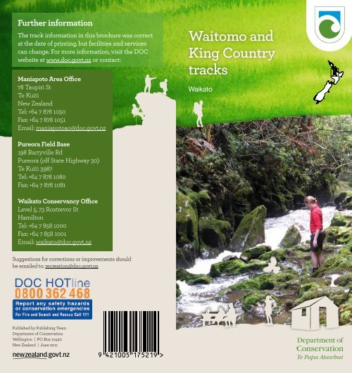
Waitomo and King Country tracks - Department of Conservation
Waitomo and King Country tracks - Department of Conservation
Waitomo and King Country tracks - Department of Conservation

Create successful ePaper yourself
Turn your PDF publications into a flip-book with our unique Google optimized e-Paper software.
ContentsIntroductionIntroduction 1Getting there 1Limestone l<strong>and</strong>scape 2Speleothems 2The <strong>King</strong> <strong>Country</strong> 3Enjoying the outdoors safely 4Track classification 4Please remember 4Essential gear 4Track markers 5River crossings 5Dogs owners—please note 5Walks around <strong>Waitomo</strong> 6The <strong>Waitomo</strong> scenic drive 9Marokopa 10Kiritehere Beach 10Other walking <strong>tracks</strong> 11Mapara Wildlife Reserve 12Tawarau <strong>and</strong> Whareorino forests 13Wildlife 13History 14Tawarau tramping <strong>tracks</strong> 15Whareorino tramping <strong>tracks</strong> 17Whareorino accommodation 19Hunting <strong>and</strong> fishing 20About DOC 21Further informationBack coverThe <strong>Waitomo</strong> <strong>and</strong> <strong>King</strong> <strong>Country</strong> region is a magical place.Sculptured limestone outcrops, gorges <strong>and</strong> natural bridgesemerge through lush, green native forest, while underground,a world <strong>of</strong> ancient limestone formations <strong>and</strong> cave networks arehome to glowworms, subterranean rivers <strong>and</strong> waterfalls. Thisbooklet describes the walking <strong>and</strong> tramping <strong>tracks</strong> managedby the <strong>Department</strong> <strong>of</strong> <strong>Conservation</strong> (DOC) where you canexperience this unique limestone l<strong>and</strong>scape—from the easywalks around <strong>Waitomo</strong> to the longer tramping <strong>tracks</strong> in theTawarau <strong>and</strong> Whareorino Forests.Getting there<strong>Waitomo</strong> is just under 1 hour’s drive from Hamilton via StateHighway 3; it is 3 hours from Auckl<strong>and</strong>, New Plymouth, Rotorua<strong>and</strong> Taupo.The map below shows the location <strong>of</strong> some <strong>tracks</strong>. For walksaround <strong>Waitomo</strong>, refer to the map on pp. 6–7; for Tawarautramping <strong>tracks</strong>, refer to the map on p. 16; <strong>and</strong> for Whareorinotramping <strong>tracks</strong>, refer to the map on p. 18.Please note: The maps in this booklet are suitable for planningpurposes <strong>and</strong> navigating short walks only.Location guide <strong>and</strong> map indexTawarau TracksParataniwha.Photo: DOC.Cover photo: Double Falls Gorge, Tawarau Forest. Photo: Matt Brady1
The <strong>King</strong> <strong>Country</strong>Limestone l<strong>and</strong>scapeThe region’s distinctive limestone l<strong>and</strong>scape began itsdevelopment 20–25 million years ago when the area wasjust below sea level. Shell fragments, coral <strong>and</strong> skeletons <strong>of</strong>many different sea creatures were buried on the sea floor, <strong>and</strong>gradually compacted <strong>and</strong> cemented together over time toproduce the layers <strong>of</strong> sedimentary rock known as limestone.12 million years ago, prolonged earth movements graduallyforced the limestone from beneath the sea, exposing it to thepower <strong>of</strong> rain. Limestone is soluble in rainwater—as rain falls onthe ground, the carbon dioxide in the soil turns rainwater intoa weak acid (carbonic acid). The percolating water corrodes thelimestone beneath the soil surface, eating its way through tinyfractures <strong>and</strong> cracks <strong>and</strong> slowly enlarging them by dissolvingthe rock. The peculiar l<strong>and</strong>scape we admire today—the dolines(enclosed depressions), karren (fluted outcrops), arches,tunnels <strong>and</strong> caves—is collectively known as karst.SpeleothemsThe delicate <strong>and</strong> beautiful cave formations or speleothemsdevelop where water deposits calcite (calcium carbonate).These include stalagmites (which grow up from the cavefloor) <strong>and</strong> stalactites (which grow from the ro<strong>of</strong> down), aswell as fragile straws <strong>and</strong> other unusual formations. Theirrate <strong>of</strong> growth varies, but is always slow. Speleothems areirreplaceable, so please take care not to damage theseprecious features.2Straw formations.Photo: DOC.Centred on Te Kuiti <strong>and</strong> the surrounding <strong>King</strong> <strong>Country</strong>,Ngāti Maniapoto iwi is part <strong>of</strong> the Tainui confederation, <strong>and</strong>members trace their whakapapa (genealogy) back to the arrival<strong>of</strong> the Tainui waka (canoe), which l<strong>and</strong>ed at Kawhia some700 years ago.Early settlements were generally small <strong>and</strong> concentratedaround the coastal harbours <strong>and</strong> fertile river valleys where foodwas most plentiful. While important routes into the interiorexisted, the rugged hill country in between remained relativelyunsettled.Ngāti Maniapoto supported the <strong>King</strong> movement (orKīngitanga), which developed in the 1850s out <strong>of</strong> growingconcern over sale <strong>of</strong> Māori l<strong>and</strong>. In the following decade, theysupported Māori fighting British troops in Taranaki <strong>and</strong>, underRewi Maniapoto, continued to resist the loss <strong>of</strong> l<strong>and</strong> <strong>and</strong> tribalauthority when British forces advanced into the Waikato in1863–64. After the defence <strong>of</strong> Orakau in April 1864, a boundary/confiscation line (known as the aukati line) was establishedbetween Cambridge <strong>and</strong> Kihikihi. The area to the south becameknown as ‘Rohe Pōtae’ or the <strong>King</strong> <strong>Country</strong>—over which noEuropean could pass safely for almost 20 years.The <strong>King</strong> <strong>Country</strong> became a ‘state within a state’ <strong>and</strong> actedas a refuge for many Māori involved in the l<strong>and</strong> wars. It wasnot until 1883, after successful negotiations between theGovernment <strong>and</strong> Maniapoto leaders, that the <strong>King</strong> <strong>Country</strong>was opened up to European settlement <strong>and</strong> access enabled theroute for the North Isl<strong>and</strong> main trunk railway to be surveyed.Opapaka Pā.Photo: DOC.3
Enjoying the outdoors safelyTracks are developed to different st<strong>and</strong>ards, catering for avariety <strong>of</strong> experiences. Choose the type <strong>of</strong> track that bestsuits the skills <strong>and</strong> abilities <strong>of</strong> your group. Be prepared forall types <strong>of</strong> weather <strong>and</strong> conditions with suitable clothing<strong>and</strong> equipment. Be sure to tell a friend or relative <strong>of</strong> yourintentions. Remember, safety is your responsibility.Track classificationShort walk: Well-formed, easy walking for up toan hour. There may be steps or slopes. Suitable forpeople <strong>of</strong> most ages <strong>and</strong> fitness levels. Walking shoesrequired.Walking track: Easy to moderate walking from afew minutes to a day. Track is mostly well formed,but some sections may be steep, rough or muddy.Walking shoes or light tramping/hiking bootsrequired.Tramping track: Challenging day or multi-daytramping/hiking. Mostly unformed, <strong>and</strong> may berough <strong>and</strong> steep. Suitable for fit, experienced <strong>and</strong>adequately equipped people. Expect stream <strong>and</strong> rivercrossings. Tramping/hiking boots required.Track markersOn public conservation l<strong>and</strong>, several types <strong>of</strong> plastic trianglesmay be attached to trees beside the track. Walkers shouldfollow only the orange triangles. Other colours (e.g. pink oryellow) are for conservation management purposes (such aspossum control lines) <strong>and</strong> should not be followed.River crossingsIn the Tawarau <strong>and</strong> Whareorino Forests there are a number <strong>of</strong>unbridged river crossings. Streams <strong>and</strong> rivers can rise rapidlyin times <strong>of</strong> heavy rain <strong>and</strong> become impassable. Check theweather forecast before you leave <strong>and</strong> have someone in yourgroup who knows how to safely cross a river.Dogs owners—please noteDogs are not permitted on the <strong>tracks</strong> described in thisbrochure because <strong>of</strong> the threat they pose to stock <strong>and</strong> wildlife.Exceptions include certified guide dogs <strong>and</strong> permittedhunting dogs.Walkers in <strong>Waitomo</strong> area.Photo: DOC.Please remember• Dress for the weather <strong>and</strong> be prepared for it to change.• Stay on the track <strong>and</strong> remain behind any barriers.• Some walks cross private l<strong>and</strong> <strong>and</strong> are open to thepublic thanks to the goodwill <strong>of</strong> the l<strong>and</strong>owner. Pleaserespect their property, keep to the track <strong>and</strong> avoiddisturbing animals.• Take a torch if you are going into caves or alongwalking <strong>tracks</strong> at night to see glowworms.• Fill up your vehicle with fuel at Otorohanga, Piopio orTe Kuiti—there are no service stations from <strong>Waitomo</strong> west.Essential gearYou need to be well prepared when walking or tramping in theoutdoors, especially on longer <strong>tracks</strong>. Have strong, comfortableshoes (or boots if tramping), warm clothing, a good raincoat,first aid kit, food <strong>and</strong> drink, a hat, <strong>and</strong> sunscreen.45
Walks around <strong>Waitomo</strong>All track times are one way unless otherwise stated.1Opapaka Pā Walk (20 min, 1 km)Turn right into the <strong>Waitomo</strong> Adventure Centre car park, 7 kmfrom the <strong>Waitomo</strong> turn<strong>of</strong>f. This walk takes you up throughnative forest to a fence line, with plant identification labels alongthe way. Cross a stile onto farml<strong>and</strong> <strong>and</strong> then up a steep track tothe pā site. Keep to the fence line <strong>and</strong> be mindful <strong>of</strong> stock thatmay be in the paddock. The farm track may be slippery if wet.The pā was occupied by Ngāti Hia in the 1700s, <strong>and</strong> was the site<strong>of</strong> a notable battle between Ngāti Hia <strong>and</strong> a war party led byTanetinorau. Defence structures (trenches) <strong>and</strong> kūmara pits areevident at the pā site.2<strong>Waitomo</strong> Walkway (1 hr 15 min, 3.3 km)Take a walk through classic limestone country where sculptedrocks, fluted outcrops <strong>and</strong> gorges are a natural <strong>and</strong> fascinatingpart <strong>of</strong> the l<strong>and</strong>scape. The walkway is an easy grade except forsome short steep parts. It starts in <strong>Waitomo</strong> Village (oppositethe Discovery Centre) <strong>and</strong> passes up through bush <strong>and</strong> acrossfarml<strong>and</strong> before crossing the Te Anga Road beyond the<strong>Waitomo</strong> Glowworm Caves. From here, it follows the <strong>Waitomo</strong>Stream through a mix <strong>of</strong> shady forest <strong>and</strong> open farml<strong>and</strong> toRuakuri Scenic Reserve (see ).4There are a number <strong>of</strong> sections along this track where you crossonto private l<strong>and</strong>. Follow marker posts <strong>and</strong> use stiles whereprovided. Be aware <strong>of</strong> electric fences. The <strong>Waitomo</strong> Walkwaycan be prone to flooding in times <strong>of</strong> heavy rain. Along the banks<strong>of</strong> the <strong>Waitomo</strong> Stream you will see a major replanting projectundertaken by the community, DOC <strong>and</strong> Environment Waikatoto improve water quality <strong>and</strong> reduce the effect <strong>of</strong> erosion.3<strong>Waitomo</strong> Caves car park Walk (5 min, 0.5 km)An easy, pushchair-friendly walk that starts as part <strong>of</strong> <strong>Waitomo</strong>Walkway <strong>and</strong> then continues left along the banks <strong>of</strong> the<strong>Waitomo</strong> Stream to the <strong>Waitomo</strong> Glowworm Caves car park.4Ruakuri Caves <strong>and</strong> Bush Scenic ReserveFor both historical significance <strong>and</strong> sheer beauty, this stop is amust. 1 km from <strong>Waitomo</strong> Village, turn left at the roundaboutinto Tumutumu Road; the entrance to the reserve is 2 km alongon the right. Ruakuri Caves <strong>and</strong> Bush Scenic Reserve containsclassic limestone outcrops, caves, tunnels <strong>and</strong> beautiful forestwhere you may hear tūī <strong>and</strong> the screech <strong>of</strong> the New Zeal<strong>and</strong>falcon. The car park <strong>and</strong> large picnic area is the startingpoint for the Ruakuri walk <strong>and</strong> the end point for the <strong>Waitomo</strong>Walkway. The picnic area has two electric BBQs—a $1 coingives you 25 min <strong>of</strong> BBQ-ing pleasure.Tūī. Photo: Danica Devery-Smith.67
4Ruakuri Walk (45 min return, 1 km)A real highlight <strong>of</strong> the <strong>Waitomo</strong> area, this spectacular loopwalk takes you through a forested gorge, past natural sculptedcliffs <strong>and</strong> under low limestone arches. The track follows thestream <strong>and</strong> then winds up around a network <strong>of</strong> limestone bluffs<strong>and</strong> outcrops before descending down to the Ruakuri NaturalBridge viewing platform.The entrance to the viewing platform is dark, so take carewhen walking down the steps. The platform extends out overa large cavernous tunnel where you can see large speleothems(stalactites <strong>and</strong> stalagmites) <strong>and</strong> a stream running alongthe bottom.Glowworms illuminatethe banks <strong>of</strong> the trackat night. The best placeto see them is at eitherside <strong>of</strong> the main bridge,but please don’t touchas this will destroythem. Be sure to takea torch to help younegotiate the steps <strong>and</strong>rocky outcrops. Whilethe walk is only 45 minreturn, allow yourselfmore time to take in itsmany special features.Ruakuri means ‘Den <strong>of</strong> Dogs’<strong>and</strong> was named by the chiefTanetinorau who was travellingthrough the area when one<strong>of</strong> his party was attacked bywild kurī (Polynesians dogs)defending their den. The area is<strong>of</strong> much spiritual <strong>and</strong> culturalsignificance to Māori.Interpretative signage explainssome <strong>of</strong> the historical, cultural,geological <strong>and</strong> conservationfeatures <strong>of</strong> this area.The <strong>Waitomo</strong> scenic driveFrom <strong>Waitomo</strong> village, this 46-km scenic drive takes youthrough karst country to the historic west coast settlement <strong>of</strong>Marokopa, with Kiritehere Beach a further 5 km south down thecoast. Along the way there are a number <strong>of</strong> short walks whereyou can explore caves, waterfalls, gorges <strong>and</strong> natural bridges,<strong>and</strong> if you look carefully in some <strong>of</strong> the rocks on these walks youwill find marine fossils that are millions <strong>of</strong> years old. You cantake in panoramic views <strong>of</strong> the <strong>King</strong> <strong>Country</strong>, <strong>and</strong> on a clear daysee Mt Tongariro <strong>and</strong> Mt Ruapehu. Allow a whole day to take inthe many special features on this drive.5Mangapohue Natural Bridge (20-min loop,0.7 km)Mangapohue Natural Bridge is a real highlight on the scenicdrive to Marokopa. It is 25 km from <strong>Waitomo</strong> Village. The5-min track to the left is pushchair-friendly <strong>and</strong> follows aboardwalk through an impressive limestone gorge that bringsyou underneath the natural bridge.The 17-m-high limestone arch, which spans the MangapohueStream, is all that remains <strong>of</strong> an ancient cave system. From herethe track becomes stepped <strong>and</strong> passes under the bridge, giving asuperb view <strong>of</strong> the ceiling studded with stalactite-like formations<strong>and</strong> an excellent view back down the gorge. The track continuesfor about 15 min over farml<strong>and</strong>. Follow the marker posts aroundto the right <strong>and</strong> up the hill where you can see 25 million year oldfossilised oysters exposed in the limestone outcrops.Follow the marker posts until you cross a stile backinto the reserve to head back to the car park.6Piripiri Cave (5 min, 0.3 km)4 km on from Mangapohue NaturalBridge is the Piripiri Cave. A short walktakes you up through native bush <strong>and</strong>past some limestone outcrops, <strong>and</strong> thendescends down to the cave entrance <strong>and</strong>viewing platform.8Circle: Looking at oysterfossils. Photo: DOC.Left: Ruakuri Bushwalk.Photo: DOC.7Marokopa Falls (10 min, 0.3 km)2 km on from Piripiri Cave, these 35 m high fallsare <strong>of</strong>ten described as the most beautiful in the country.Here the Marokopa River cascades over the undercut greywackebasement rock. Take the short walk through tawa <strong>and</strong> nīkau forestdown to the viewing platform. Don’t forget your camera.9
Marokopa15 km on from Marokopa Falls, you reach the coast <strong>and</strong>Marokopa village. Like many west coast beaches, this area ispopular for fishing (especially for kahawai when they swarminto the mouth <strong>of</strong> the river between January <strong>and</strong> May),whitebaiting, swimming <strong>and</strong> boating.Marokopa has a quiet, timeless feel, but its history is far fromtame. In the 1820s, the great chief Te Rauparaha headed southto Kapiti with 1500 Ngāti Toa people, realising they had toleave Te Arawa to avoid defeat at the h<strong>and</strong>s <strong>of</strong> rival tribes. Onthe journey, Te Rauparaha stayed briefly at Marokopa <strong>and</strong>some say it is here that his pregnant wife Te Akau gave birth totheir son Katu.Waikawau tunnel.Photo: DOC.In later years, Marokopadeveloped into a thrivingtownship where bushmen<strong>and</strong> roadworkersconverged to pick upsupplies. For many years,the <strong>King</strong> <strong>Country</strong> was, inlaw at least, a ‘dry’ area. ButMarokopa’s harbour accessencouraged a pr<strong>of</strong>itablebootlegging business <strong>and</strong>the town’s two whiskyshops did a roaring trade.Marokopa Motor Camphas a basic shop, tent sites,cabins <strong>and</strong> backpacker accommodation: phone 07 876 7444.There is no cellphone coverage at Marokopa.Kiritehere BeachKiritehere, over the hill south <strong>of</strong> Marokopa, typifies the ruggedcharacter <strong>and</strong> isolation <strong>of</strong> New Zeal<strong>and</strong>’s west coast. Despiteits remoteness <strong>and</strong> difficult access, many surfers consider thebeach their best kept secret. At low tide you can see fossilisedclams, mussels <strong>and</strong> scallop-like Monotis in the rocks at thesouth end <strong>of</strong> the beach.From Kiritehere, you can travel on down the coast to Awakino<strong>and</strong> Mokau or backtrack towards Te Kuiti. If continuing south,stop at Waikawau, where a tunnel cut into the cliffs for theflax trade now provides access to this beautifully rugged <strong>and</strong>isolated beach.10Other walking <strong>tracks</strong>If you have some extra time to spend in the <strong>King</strong> <strong>Country</strong>, tryout these short, easy-access walking <strong>tracks</strong>. Refer to the mapon p. 1 for the location <strong>of</strong> these <strong>tracks</strong>.8Te Raumauku Caves Walk (20 min return, 0.5 km)At the south end <strong>of</strong> Otorohanga turn west on to SH31.4 km along, turn left on to Honokiwi Road <strong>and</strong> at the top <strong>of</strong> thehill turn left onto Te Raumauku Road. Travel along the road for5 km until you see the track entrance <strong>and</strong> car park on yourright. This loop track descends down steep steps <strong>and</strong> throughnīkau forest <strong>and</strong> parataniwha undergrowth to a small cave <strong>and</strong>stream, before winding back up to the road. Look out for thegrove <strong>of</strong> king fern. When the track emerges at the road, turnleft <strong>and</strong> walk about 3 minutes back to your car.9Mangaotaki Walk(30-min loop, 0.8 km)Travel south from Te Kuiti onSH3 until you reach Piopio<strong>and</strong> turn right onto KeaSt. After 1 km turn leftinto Mangaotaki Rd.The MangaotakiTrack is about 8 kmalong this road. Thecar park <strong>and</strong> trackentrance are on theleft immediatelyafter the MangaotakiBridge. This gentleloop track winds its wayover tree roots <strong>and</strong> passesmany boulders along theway, as well as a gnarly old tree<strong>and</strong> towering kahikatea laden withepiphytes (plants that grow on other plants).10Waitanguru Falls Walk (15 min return, 0.2 km)Waitanguru Falls.Photo: DOC.The Waitanguru Falls are a further 11 km along from theMangaotaki Track. The car park <strong>and</strong> track entrance are onthe right.A well-graded, stepped track takes you down to a viewingplatform that looks out to this magnificent tiered waterfall.11
11Omaru Falls Walk (30 min, 1.7 km)12 km south <strong>of</strong> Te Kuiti, turn left at the Taumarunui / NationalPark junction on to SH4. The Omaru Road <strong>and</strong> Falls turn<strong>of</strong>f is19 km on the right-h<strong>and</strong> side <strong>and</strong> is clearly signposted. Crossthe stile <strong>and</strong> follow a farm track for a few hundred metres.After crossing another stile, the track enters bush filled withferns <strong>and</strong> young rimu, <strong>and</strong> follows a stream before crossing aswing bridge <strong>and</strong> reentering farml<strong>and</strong>.Follow the grassy track <strong>and</strong> orangemarkers. There is an idealpicnic spot next to the river<strong>and</strong> a small terracedwaterfall. Continue upthe grassy track to thefalls lookout.The falls drop about45 m <strong>and</strong> are mostimpressive afterheavy rain.Omaru Falls.Photo: DOC.Right: Kōkako.Photo: Tamsin Ward-Smith.Mapara Wildlife Reserve12Mapara Track (1 hr return, 2.5 km)The Mapara Wildlife Reserve <strong>and</strong> Track is about 35 kmsoutheast <strong>of</strong> Te Kuiti. Turn on to Kopaki Road from either SH4or SH30 <strong>and</strong> then turn down Mapara South Road to the smallkiosk at the reserve entrance. Park on the side <strong>of</strong> the road, crossthe swingbridge <strong>and</strong> take the steep loop track to the right.A very successful kōkako recovery project started in the reservein 1989 <strong>and</strong> has been the model for many other conservationprojects around the country. The best time to hear theextraordinary call <strong>of</strong> the kōkako is at dawn <strong>and</strong> dusk; however,if you are patient you may hear <strong>and</strong> see them during the day.Take a pair <strong>of</strong> binoculars.12Tawarau <strong>and</strong> Whareorino ForestsTawarau <strong>and</strong> Whareorino Forests are two large, adjoiningtracts <strong>of</strong> forests in the <strong>Waitomo</strong> area. The various trackentrances are about a 1.5- hr drive from Hamilton.Tawarau Forest is west <strong>of</strong> the <strong>Waitomo</strong> Caves <strong>and</strong> is one <strong>of</strong> thebest remaining examples <strong>of</strong> a virgin forest growing in a karst(limestone) l<strong>and</strong>scape. It is approximately 34 km from <strong>Waitomo</strong>to Speedies Rd <strong>and</strong> 38 km from <strong>Waitomo</strong> to Were Rd.Tawarau Forest is dominated by tawa, hīnau, kāmahi <strong>and</strong>rewarewa, <strong>and</strong> emerging podocarps such as rimu <strong>and</strong> miro. It isknown for its ‘cool climate’ vegetation, with Cordyline indivisa(mountain cabbage tree) growing at an unusually low altitude.Whareorino Forest lies 30 km southwest <strong>of</strong> Te Kuiti <strong>and</strong> is thelargest <strong>and</strong> one <strong>of</strong> the most significant forested areas in thewestern <strong>King</strong> <strong>Country</strong>. It is dominated by the Herangi Range.Whareorino features tawa, hīnau, kāmahi <strong>and</strong> rewarewa, as wellas podocarps, <strong>and</strong> is particularly special because <strong>of</strong> its range<strong>of</strong> vegetation, from coastal <strong>and</strong> lowl<strong>and</strong> vegetation types tosubalpine <strong>and</strong> alpine. Its proximity to the west coast providesan unusually cold <strong>and</strong> moist climate. At the top <strong>of</strong> the HerangiRange, 600–800 m above sea level, the ridges are covered inlow scrub <strong>and</strong> kaikawaka, along with neinei, pepperwood <strong>and</strong>shrubs interspersed with areas <strong>of</strong> cushion bog. This vegetationis subalpine <strong>and</strong> uncommon in the <strong>King</strong> <strong>Country</strong>.WildlifeBoth forests are home to a variety <strong>of</strong> New Zeal<strong>and</strong> birds,including falcon, grey warbler, tomtit, kererū/kūkū, rifleman,bellbird, whitehead <strong>and</strong>, in summer, long-tailed cuckoo. Therehave also been occasional sightings <strong>of</strong> kākā, kiwi <strong>and</strong> kōkako.Long-tailed bats frequent both areas <strong>and</strong> you may see themfeeding at dusk around the macrocarpa trees at Leitch’s Hut inthe Whareorino Forest.Bellbird on flax.Photo: Andrew Walmsley.13
Whareorino tramping <strong>tracks</strong>16Leitch’s Track (3 hr to hut)Access to Leitch’s Track is <strong>of</strong>f Leitch Road via MangaotakiRoad (turn westwards at Piopio). From the car park at the end<strong>of</strong> Leitch Road, the track enters Whareorino Forest. A formersurveyed road, this popular <strong>and</strong> clearly marked track is wellgraded <strong>and</strong> the shortest route to Leitch’s Hut.17Mahoenui Track (3 hr to hut)This pleasant track follows the Awakino River from Barker’sfarm on Gribbon Road (please phone owners for access <strong>and</strong>parking permission first—07 877 8746) upstream to Leitch’sHut. (Gribbon Road is on the right, 22 km south <strong>of</strong> Piopio <strong>of</strong>fSH3.) Follow the river north to the junction with the WaikawauTrack. Cross to the east bank <strong>of</strong> the Awakino <strong>and</strong> walk northfor 5 min to the hut. During winter <strong>and</strong> periods <strong>of</strong> heavy rain,the river may be too deep to cross. Check the weather forecastbefore walking this track.15Gorge Track (3 hr 30 min)This track follows Mangaohae Stream until it flows througha spectacular limestone gorge <strong>and</strong> enters the TawarauRiver. You can access this track from either Were Road orSpeedies Road. Both start by crossing farml<strong>and</strong>, so pleasefollow the markers <strong>and</strong> be mindful <strong>and</strong> respectful <strong>of</strong> stock.From Were Road end, the Tawarau / Double Falls Trackbranches <strong>of</strong>f the Gorge Track across a swingbridge, afterapproximately 2 hrs. The main track continues down theriver to Speedies Road. The track can be muddy, so comeprepared. The Tawarau / Double Falls track junction isabout 1 hr 30 min from Speedies Road end. Blackberry Flat(500 m north <strong>of</strong> the Tawarau / Double Falls Track junction)is a good campsite, <strong>and</strong> there are several other attractivecamping sites in the forest. The Gorge Track was onceknown as the Kawhia to Mahoenui highway.Double Falls Gorge.Photo: Adrienne Grant.1617
Leitch's Hut. Photo: DOC.Whareorino accommodation18Waikawau Track (7 hr to hut)Turn into Crawford Road <strong>of</strong>f Manganui Road. Park on thenorthern side <strong>of</strong> the Waikawau River on Maxwell’s farm(phone the owners for permission first—06 752 9891). Followthe markers along the Waikawau <strong>and</strong> Mangapa Rivers. This isa gradual climb with several river crossings. Continue up theWaikawau Saddle <strong>and</strong> then descend to Leitch’s Clearing. Followthe clearing down to the Awakino River, cross the river <strong>and</strong>walk north along it for 5 min to Leitch’s Hut. During winter <strong>and</strong>periods <strong>of</strong> heavy rain, the river may be too deep to cross. Pleasecheck the weather forecast before walking this track.19Mangatoa Track (4 hr to hut)From the car park on the Mangatoa Road saddle, walk alongthe gradually climbing track until you reach the Herangi Ridge.The track veers right <strong>and</strong> drops down past the Waikawau Trackjunction before taking you to Leitch’s Hut.Leitch’s Hut is available for overnight use. It is a St<strong>and</strong>ardHut <strong>and</strong> sleeps 16 people. Mattresses, a wood-burning stovefor heating <strong>and</strong> a toilet are provided. You will need to carry aportable stove for cooking.Fees are charged per person per night—see www.doc.govt.nz/huts. Please purchase your tickets before your trip from DOC<strong>of</strong>fices or retailers displaying the ‘Backcountry Huts’ sign.Paying fees helps keep huts available for public use.There are many areas suitable for camping in Leitch’s Clearing.If you want to camp <strong>and</strong> use the hut facilities, you still need topurchase a hut ticket.Camping inLeitch’s Clearing.Photo: DOC.Kererū/kūkū.Photo: JohnGardiner.1819
About DOCDOC is responsible for conserving New Zeal<strong>and</strong>’s natural <strong>and</strong>historic heritage on behalf <strong>of</strong>, <strong>and</strong> for the benefit <strong>of</strong> present<strong>and</strong> future New Zeal<strong>and</strong>ers. Here in the <strong>Waitomo</strong> <strong>and</strong> <strong>King</strong><strong>Country</strong> region (the Maniapoto Area), as in other parts <strong>of</strong>the country, DOC manages threatened species, minimisesbiosecurity risks, restores <strong>and</strong> protects historic <strong>and</strong> culturalsites on public conservation l<strong>and</strong>, <strong>and</strong> promotes appropriaterecreational use <strong>and</strong> enjoyment <strong>of</strong> protected places. Whereverpossible, these functions are carried out in partnership with thecommunity <strong>and</strong> tangata whenua.Another large area <strong>of</strong> conservation l<strong>and</strong> in the ManiapotoArea managed by DOC is Pureora Forest Park. The park <strong>of</strong>fersopportunities for tramping, camping, mountain-biking, <strong>and</strong>hunting. For further information see www.doc.govt.nz.Fishing in theMangaohae Stream.Photo: DOC.Hunting <strong>and</strong> fishingRecreational hunting is a popular pastime in both Tawarau <strong>and</strong>Whareorino Forests. Tawarau has a moderate number <strong>of</strong> goats,<strong>and</strong> low numbers <strong>of</strong> pigs <strong>and</strong> deer. Whareorino has moderatenumbers <strong>of</strong> goats <strong>and</strong> pigs, <strong>and</strong> low numbers <strong>of</strong> deer. DOCundertakes goat control in both forests.You need a permit to carry a rifle or hunting bow, or to takea hunting dog onto conservation l<strong>and</strong>. Permits <strong>and</strong> furtherinformation can be obtained from the DOC ManiapotoArea Office in Te Kuiti, Pureora Field Base or the WaikatoConservancy Office in Hamilton. Alternatively, you can obtaina permit online at www.doc.govt.nz/hunting.The Awakino River is popular for brown <strong>and</strong> rainbow troutfishing. It is closed for winter fishing <strong>and</strong> only fly fishing ispermitted above the SH3 bridge at Mahoenui. Rainbow troutare present in the Tawarau River <strong>and</strong> Mangaohae Stream (thesewaterways are also closed for winter fishing). All trout fishingrequires a licence, which can be obtained from the Auckl<strong>and</strong>/Waikato Fish <strong>and</strong> Game Council <strong>and</strong> most sports shops.20Glowworm snares.Photo: DOC.<strong>Waitomo</strong> Caves Discovery CentreIn <strong>Waitomo</strong> village, the <strong>Waitomo</strong>Caves Discovery Centre includesthe <strong>of</strong>ficial Visitor InformationCentre <strong>and</strong> is a good first port <strong>of</strong>call for finding out about the variety<strong>of</strong> tours <strong>and</strong> activities available in<strong>Waitomo</strong>. The museum containsinteresting interactive displays <strong>and</strong>information about limestone caves,<strong>and</strong> includes an excellent filmabout the life <strong>of</strong> <strong>Waitomo</strong>’s mostfamous resident—the glowworm.• Protect plants <strong>and</strong> animals• Remove all rubbish• Keep streams <strong>and</strong> lakes clean• Camp with care• Please bury toilet waste• Keep to the track• Consider others• Respect cultural heritage• Enjoy your visitToitū to whenua Leave the l<strong>and</strong> undisturbed21