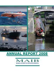
Octopus Harald - Marine Accident Investigation Branch
Octopus Harald - Marine Accident Investigation Branch
Octopus Harald - Marine Accident Investigation Branch

Create successful ePaper yourself
Turn your PDF publications into a flip-book with our unique Google optimized e-Paper software.
The source diagram for BA Chart 2250 (Figure 8) shows the area to have beensurveyed during British Government Survey (leadline) 1839-1848. LieutenantCommander George Thomas, master commanding, was on board HMS Mastiff whenthe survey of the grounding area was carried out in 1843 and 1844. The originalsurvey record fair sheet (Figure 9) showed that the survey results were correctlytransferred to the chart, and that the 7.1m bank was missed due to the sampling natureof the leadline survey undertaken.A note on BA Chart 2250 states that:Many of the depths in these areas have not been systematically surveyed. Depthsin these areas are from miscellaneous lines of passage sounding or old leadlinesurveys. Uncharted dangers may exist.The <strong>Marine</strong>rs Handbook, NP100, Chapter 2, guides the mariner in assessing thereliability of a chart, stating:No chart is infallible. Every chart is liable to be incomplete, either throughimperfections in the survey on which it is based, or through subsequent alterationsto the seabed. However, in the vicinity of the recognised shipping lanes charts maybe used with confidence for normal navigation needs. The mariner must be thefinal judge…Further guidance is given in Admiralty Sailing Directions, NP 52, North Coast ofScotland, which states that:Charts should be used with prudence: there are areas where the source data areold, incomplete or of poor quality.When the commercial survey vessel Ping surveyed the area north of the groundingposition in early 2006, the survey resulted in 69 NTM warning of changes to charteddepth, although none were of the exceptional nature of the shoal where <strong>Octopus</strong>’sgrounding occurred (Figure 10). The southern limit of the 2006 survey of the areaaround the Island of Eday was less than 200m north of the 7.1m shoal patch (Figure11).A survey was also completed of the area to the east of the Orkney Islands during 2006;much of this area was previously stated as un-surveyed, with miscellaneous lines ofsoundings from 1844 as the source data.1.6.2 The chart plotterThe chart plotter in use at the time of the accident used Seatrack software. The plotterwas used as an aid to navigation, the primary navigation being by paper chart. TheSeatrack system is primarily aimed at the leisure market, with the software installed onan owner supplied Personal Computer.The Seatrack chart plotter software in use at the time of the grounding was replacedshortly after the incident with a new computer and software.11