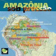
The Beni river in Bolivia is one of the most critical cases of contamination of water, sedimentsand fish by mercury and other heavy metals, affecting both indigenous and riverside communities.These mining activities have been growing since the 1970s with a greater emphasis over the last 20years (Bourgoin, 2001). A similar case is the illegal gold mining in the Madre de Dios river basin in Perú.Here more than 150,000 ha of alluvial soils, well suited to agriculture, have been completely degradedby the largely illegal mining activities (Dourojeanni, 2009).In addition to the damage caused to entire ecosystems, illegal mining also generates other seriouscollateral effects in areas of indigenous peoples who are uncontacted or only recently contacted,as in the case of the Yanomami in the border region between Venezuela and Brasil (see BMN2: The newgold rush in Amazonia).MethodologyThe analysis of information regarding the concessionary blocks for mining established by thegovernment and the mining activities in Amazonia is based on official data compiled in each country.It has been systemized and classified into five categories according to the procedural phase that bothconcessionary blocks are currently in. These are: Open for Bidding (concessionary blocks offered bythe government), Under Tender (concessionary blocks with a pending offer awaiting official approval),Under Exploration (concessionary blocks with a company actively prospecting), Under Production (concessionaryblocks with on-going extractive activities) and No Information (concessionary blocks withoutcurrent information). In Perú and in some of Ecuador’s mining blocks it was impossible to differentiateblocks under exploration from those under production. In these cases the blocks were analyzed as both.The classification of concessionary blocks by phase in the different countries is shown in table TMN1.As information on illegal mining was not obtainable for all the countries, this data was not includedin the analyses.Due to differences in the information sources, geographic (topological) corrections had to bemade in order for the data to be analyzed and combined. Consequently differences may exist betweenthe results published here and the figures obtained in analyses conducted in the countries. To avoid duplicatingareas and over-estimation of surface areas, the analysis excluded overlapping areas betweenmining blocks that are in the same phase. After excluding these overlaps, only areas over five hectaresin size were selected in all the analyses.The data was analyzed by the following units: Amazonia, countries, macro-basins and subbasins,PNAs and ITs.Amazonia as a wholeFor 2010 there are a total of 52,974 blocks in Amazonia with mining interests covering a totalarea of 1,628,850 km 2 , which corresponds to 21% of the entire region (TMN2). The majority of miningblocks are under tender (50.8%), followed by those under exploration (30.8%) (MMN2 and GMN1).BMN1. The main companies and the largestmining venturesAmong the main mining ventures in Amazonia wecan identify the following: the Madre de Dios mining regionin Peru on the border with Bolivia; the southeast ofEcuador in the provinces of Morona Santiago and ZamoraChinchipe where the Fruta do Norte and Mirador projectsare being carried out; the bauxite mining region operatedby Bosai in Guyana; the Carajás project extracting pig ironin a concession run by Vale; the Pitinga mine, where theTaboca mining company extracts mainly tin; and the Jurutiproject, a concession run by Alcoa for mining bauxite.These last three ventures are located in Brazil.TMN1. Categories of mining blocks in the countries of AmazoniaCountry* No informationOpen forbiddingUnder tenderBolivia X X X XBrasil X X X XColombia X XEcuador X X XGuyana X X XPerú X X XSuriname X X XVenezuela X X* There is no data for Guyane Française.TMN2. Quantity and surface area of mining blocks in Amazonia. by categoryCategory # Mining blocks # by phase (%) Area (km²) % Area by phase Amazon areaOpen for bidding 2,529 4.8 164,999 10.1 2.1Under tender 30,411 57.4 827,142 50.8 10.7Under exploration 9,828 18.6 502,085 30.8 6.5Under exploration/production 4,711 8.9 25,383 1.6 0.3Under production 5,482 10.3 109,202 6.7 1.4No information 13 0.0 40 0.0 0.0Total 52,974 100.0 1,628.850 100.0 21.0* The Amazonia has 20.3% of its area covered by mining blocks when it eliminates overlapping areas between blocks in differentphases of activity.GMN1. Distribution of mining blocks in Amazonia, by activity phaseUnderexplorationUnder exploration/productionUnderproductionGMN2. Distribution of mining blocks in Amazonia, by activity phase and countryTMN4. Surface area of mining blocks in macro-basins in Amazonia, by categoryMacro-basinUnderexplorationUnder exploration/productionGMN3. Distribution of mining blocks in Amazonia, by macro-basinSurface area of mining blocks (km²)UnderproductionOpen forbiddingNoinformationUndertenderMiddle-Lower Amazonas 169,141 5,166 57,969 387,618 619,894Guyanas/Amapá 82,002 5,157 72,293 29,762 22,311 212,524Tocantins 91,804 3,594 39,113 56,098 190,609Madeira 55,161 6,591 5,792 16,507 33 100,248 184,332Negro 8,420 1,579 8,379 150,462 168,839Western NortheastAtlantic31,903 3,548 5,179 29,979 70,609Mouth of the Amazonas/Estuary26,928 4,401 4,087 19,507 54,924Paraná 30,164 912 2,531 15,424 49,031Upper Amazonas 3,964 13,635 390 1,419 8 25,842 45,257Orinoco 631 10,433 15,558 26,622Parnaíba 485 38 39 3,520 4,082Middle Amazonas 1,471 56 13 572 2,111General total 502,084 25,382 109,201 164,999 40 827,138 1,628.844TotalThe total surface area covered by mining blocks under tender represents 10.7% of Amazonia(827,142 km 2 ), while the areas now under exploration cover 6.5% (502,085 km 2 ).Amazonia in each countryTable TMN3 shows the quantity and surface area of concessionary blocks for mining per country.Guyana is the country with the highest percentage of its Amazonia region covered by mining blocksin all categories (67.5%), followed by Brasil with 27% and Suriname with 18.6%. The country with thelowest proportion of its Amazonia covered by mining blocks in Amazonia is Bolivia at 0.8%. In terms ofthe number of concessionary blocks, 80.5% of the total number of blocks are located in Brasil and 11%in Perú. The surface covered by the different categories of mining blocks in each country is shown inmap MMN3. Although large-scale mining has not begun in Ecuador, in the medium term this will be themain threat following hydrocarbon activities.MMN3. Proportion of mining blocks per country in AmazoniaMMN2. Mining activity phases in Amazonia, by countryAccording to the analysis of mining block categories by country, most of the surface area of themining blocks in Guyana and Bolivia is under exploration. In Ecuador and Perú the largest proportioncorresponds to blocks under exploration/production. In Colombia and Brasil the largest proportion correspondsto blocks under tender (GMN2).By basinThe macro-basin within Amazonia with the largest total area covered by mining blocks is theAmazonas Middle-Lower macro-basin in Brasil, with a total area of 619,894 km 2 with designated miningblocks. This macro-basin is followed by the Guyana/Amapá (212,524 km 2 ), Tocantins (190,609 km 2 ),Madeira (184.332 km 2 ) and Negro macro-basins (168,839 km 2 ) (TMN4 and GMN3).In terms of individual phases of concessionary blocks, the largest surface areas covered byblocks in the Open for Bidding and Under Exploration phases are found in the Amazonas (Middle-Lower), Tocantins and Guyana/Amapá macro-basins. The largest surface areas covered by blocks inthe Under Tender phase are found in the Amazonas (Middle-Lower), Negro and Madeira macro-basins(TMN4).Table TMN5 shows the ten sub-basins with the largest surface area covered by mining blocksin the different phases. The sub-basins with the largest areas covered by blocks in all phases are theAmazonas river (Juruá-Paru-Jari) with 99,291 km 2 , followed by the Iriri with 69.503 km 2 , Cuyuní with60,893 km 2 , Lower Tocantins with 59,143 km 2 and Trombetas with 58,400 km 2 . Fourteen sub-basinswere identified with more than 52% of their surface covered by concessionary mining blocks, as can beobserved in map MMN5.In relation to those blocks in the Under Production phase, the Cuyuní sub-basin, covering areasof Guyana and Venezuela, presented the largest area with 33,928 km 2 (21,551 km 2 and 12,377TMN3. Quantity and surface area of mining blocks in Amazonia. by countryCountryQuantity of mining blocks Surface area of mining blocks Participationnumber of blocks % Area (km 2 ) % of Amazonia in the totalBolivia 485 0.9 3,734 0.8 0.0Brasil 42,623 80.5 1,349.207 27.0 17.3Colombia 1,563 3.0 50,192 10.4 0.6Ecuador 791 1.5 4,840 4.2 0.1Guyana 743 1.4 145,069 67.5 1.9Perú 5,812 11.0 22,587 2.9 0.3Suriname 11 0.0 30,419 18.6 0.4Venezuela 946 1.8 22,803 5.0 0.3Total 52,974 100 1,628.850 20.9 20.9* The overlapping areas within the same category were eliminated for not overestimate the total area.TMN5. The ten sub-basins with the largest surface area covered by mining blocks in AmazoniaSub-basinSurface area of mining blocks (km²)Under production Under exploration Under tender Open for bidding TotalAmazonas (Juruá-Paru-Jari) 493 11,032 81,049 6,717 99,291Iriri 449 5,510 61,418 2,126 69,503Cuyuní 33,928 12,014 448 14,503 60,893Tocantins (B) 2,599 23,113 21,851 11,580 59,143Trombetas 1,304 6,154 46,066 4,876 58,400Sucunduri-Abacaxis-Maués 168 11,906 36,374 1,469 49,917Guyana-Esequibo (Costa) 9,276 36,797 3,780 49,853Guaporé 924 8,259 36,075 2,909 48,167Teles Pires (S,Manuel) 175 31,805 10,322 4,676 46,978Araguaia (B) 236 17,367 11,105 10,753 39,460<strong>RAISG</strong> 32 Amazonia under Pressure – Mining Mining – Amazonia under Pressure 33 <strong>RAISG</strong>
km 2 respectively), followed by the Guyana-Essequibo (Costa) with 9,276 km 2 . The largest areas of thecombined Under Exploration/Production phases (Peru and Ecuador) were located in the Madre de Dios(6,591 km 2 ) and Marañón (5,636 km 2 ) sub-basins. The Guyana/Esequibo (Costa) sub-basin had thelargest surface area (36,797 km 2 ) covered by blocks in the Under Exploration phase, followed by theTeles Pires with 31.805 km 2 (TMN5).MMN4. Proportion of mining blocks per macro-basin in AmazoniaTMN6. Surface area of mining blocks in PNAs in Amazonia, by administrative sphere and type of useArea covered by blocks (km²)PNA administrative sphereand type of useOpen forbiddingUndertenderUnderexplorationUnderexploration/productionGMN4. Distribution of mining blocks in PNAs in Amazonia, by administrativesphere and type of useUnderproductionParticipation(%)Departmental - direct use 9,547 64,518 20,719 517 95,300 33.9Departmental - indirect use 591 35,611 6,380 194 42,776 15.2National - direct use 7,632 34,955 23,699 14 3,921 70,222 25.0National - direct/indirect use 18 2 20 0.0National - indirect use 2,290 20,656 6,469 700 921 31,036 11.0National - transitory use 40,992 743 41,735 14.8General total 20,060 196,732 57,284 714 6,298 281,089 100.0TotalBMN2. The new gold rush in the Amazoniause departmental PNAs (42,776 km 2 ), transitory use national PNAs (41,735 km 2 ), and indirect use nationalPNAs (31,036 km 2 ). Mining blocks in direct/indirect use national PNAs cover an area of 20 km 2 .Turning to the different phases of mining activity, those blocks under tender cover 196,732 km 2of the PNAs in Amazonia (70% of the total area of mining blocks in PNAs), followed by those underexploration (57,284 km 2 , 20%), those open for bidding (20,060 km 2 , 7%), those under production (6,298km 2 , 2%) and finally those in the combined Under Exploration/Production phase (714 km 2 ). Most of themining blocks within PNAs are found in Brasil, occupying a total area of 234,461 km 2 (83% of the totalsurface area of mining blocks located in PNAs) (GMN5 and MMN6).The largest area of blocks in the Under Production phase is found in national PNAs intended fordirect use (3,921 km 2 ) and indirect use (921 km 2 ). The PNAs with the highest pressure from these miningproduction are: FN Saracá-Taquera (1,290 km 2 ), FN Carajás (1,107 km 2 ) and FN Jamari (939 km 2 ) inBrasil, the Amazonia Second Law Forest Reserve in Colombia (743 km 2 ), the PN Canaima in Venezuela(550 km 2 ), the APA Tapajós (293 km 2 ) and the RBi Maicuru (117 km 2 ) in Brasil.The PNAs with the largest number of mining blocks in the combined exploration/productionphase, are: REc Cofán Bermejo, RfVS El Zarza, RBi El Quimi and PN Yacuri, all in Ecuador.In the Under Exploration phase, Brasil contains the largest areas in all categories of PNAs:23.554 km 2 overlapping direct use national PNAs, followed by direct use departmental PNAs (20,244km 2 ), indirect use departmental PNAs (6,380 km 2 ) and indirect use national PNAs (5,651 km 2 ). The directuse national PNAs with the largest surface area covered by mining blocks in this phase are: APATapajós (6,287 km 2 ), FN Carajás (1,947 km 2 ), FN Crepori (1,706 km 2 ), FN Amaná (1,606 km 2 ), and RExVerde para Sempre (1,574 km 2 ).Mining blocks in the Open for Bidding phase overlap PNAs by 20,060 km 2 . Most of these are inBrasil: REx Verde para Sempre, APA Tapajós, FN Jamanxim and FN Carajás.A total area of 196,732 km 2 in concessionary blocks is in the Under Tender phase. Direct usedepartmental PNAs are overlapped with 64,518 km 2 , followed by transitory use national PNAs (40,992km 2 ) and indirect use departmental PNAs (35.611 km 2 ). The PNAs most threatened by blocks undertender are APA Tapajós, FN Amazonas, PN Montanhas do Tumucumaque and EE Jari, all in Brasil, andthe Amazonia Forestry Reserve in Colombia.Aerial view of illegal gold mining in the Serra do Divisor mountain range, between Brasil and Perú.© Thomas Müller/SPDA, 2010GMN5. Distribution of mining blocks in PNAs in Amazonia, by country andactivity phaseOver the last 20 years various PNAs and ITs in Amazonia have been under pressure from the increase in small-scale illegal semimechanizedalluvial gold mining. This gold rush was stimulated by the exponential increase in the price of the metal, which has risen500% over the last ten years. The miners working in the production sites in the forest are sustained by a network of middle-men tradersproviding basic supplies: food, fuel, machines and air and/or land transportation.The semi-mechanized prospecting system causes river silting, the loss of biodiversity in the aquatic ecosystems, due to the turbidity,soil removal and forest conversion. It contributes to a third of the total world mercury pollution and causes substantial health andenvironmental impacts. More than an estimated 100 tons of mercury are used each year in illegal gold mining in Amazonia.In Amazonia 37% of the Protected Natural Areas (Parks and Reserves) of seven countries are affected by illegal mining. The situationis particularly acute in Western Amazonia (Madre de Dios, Peru), in the Guianas (Guyana, Suriname and Guyane Française) andin the Yanomami territory (Brazil and Venezuela). In the Madre de Dios region the deforestation rate related to small-scale gold miningis estimated to have increased from 292 ha/year between 2003 and 2006 to 1,915 ha/year between 2006 and 2009. In Guyana, astudy by WWF Guyanas (Marín and May, 2012) showed that the deforestation caused by gold mining tripled between 2001-2002 and2007-2008, destroying 650 km 2 of forests. The pollution associated with small-scale gold mining followed a similar growth pattern,affecting 26,000 km of rivers in 2008.The territory traditionally occupied by the Yanomami people in the forest and mountain region of the border between Brazil andVenezuela was the target of a massive invasion of prospectors coming from Boa Vista (Roraima) in the second half of the 1980s whichresulted in the death of 15% of the Yanomami population in Brazil and many other serious socio-environmental impacts. This pressurewas relieved somewhat after a mega operation to remove miners organized by Brazil’s federal government at the start of the 1990s. Inthe last five years the Yanomami IT has been systematically invaded by Brazilian prospectors who cross the international border, a situationthat demands the coordinated action of the governments in Brazil and Venezuela. There are recent indications of an associationbetween mining interests and drug trafficking. (Beto Ricardo/ISA, in collaboration with Claudio Maretti/WWF)MMN6. Proportion of mining blocks per PNA in AmazoniaMMN5. Proportion of mining blocks per sub-basin in AmazoniaGMN6. Distribution of mining blocks in ITs in Amazonia, by country and activity phaseBy Indigenous TerritoriesBy Protected AreaThe area covered by mining blocks and their distribution are displayed in table TMN6 and graphGMN4. The total combined surface area of mining blocks, in all phases, overlapping Protected NaturalAreas (PNAs) is 281,089 km 2 , which corresponds to 15% of the total surface area of PNAs in Amazonia.In terms of categories of PNAs, the largest area of mining blocks, in all phases, is located indirect use departmental PNAs (95,300 km 2 ), followed by direct use national PNAs (70.222 km 2 ), indirectSemi-mechanized gold mining, on the upper Madre de Dios River, Peruvian Amazonia..© Heinz Plenge, 2008Concessionary blocks for mining overlapping Indigenous Territories (ITs) cover a total surfacearea of 407,320 km 2 , representing 19% of the total surface area of ITs in Amazonia. The largest proportionis found in recognized ITs (381,857 km 2 , 94%) with the remainder in traditionally occupied landswithout official recognition (25,437 km 2 , 6%).Of that total area, mining blocks under tender account for 348,993 km 2 of the region’s ITs. Thoseunder production account for 24,163 km 2 , and those under exploration, 16,933 km 2 . 79% of the totalarea overlapped by mining concessions is located in Brasil (GMN6 and MMN7).<strong>RAISG</strong> 34 Amazonia under Pressure – Mining Mining – Amazonia under Pressure 35 <strong>RAISG</strong>