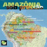
Download - RAISG - Instituto Socioambiental
Download - RAISG - Instituto Socioambiental
Download - RAISG - Instituto Socioambiental

You also want an ePaper? Increase the reach of your titles
YUMPU automatically turns print PDFs into web optimized ePapers that Google loves.
ecosystems within the Amazonian area, such as the seasonally flooded savannahs of the Llanos deMoxos in Bolivia, and a large extent of savannah (cerrado) across the entire southeast of the BrazilianAmazonia, as well as large enclaves of savannah, such as the ‘Lavrado’ in Roraima state in the northof Brasil (MDF2).The deforestation evaluated in the 2000-2010 period took place mostly in Brasil, which had a6.2% loss of forest cover, followed by Colombia, Bolivia and Ecuador with rates of 2.8%, 2.5% and 2.4%respectively. The countries with the lowest deforestation levels were Guyane Française and Surinamewith less than 1%. The forest loss in Brasil represented 80.4% of the total forest cut down during theperiod under analysis, followed by Perú with 6.2% and Colombia with 5%. The analyses by five-yearperiod indicate that total forest loss for the 2005-2010 period was generally lower with the exception ofPerú, Colombia and Guyane Française (TDF2 and GDF1). In the latter two cases deforestation rose from1.2 to 1.6% and from 0.3 to 0.4% respectively, while in Perú the rate remained at 1.1% during both periods.During the two five-year periods Brasil was the country with the largest proportion of forest loss,followed during the first half of the decade by Bolivia with 1.4% and Ecuador and Guyana with 1.3% andin the second half by Colombia with 1.6% and Bolivia, Ecuador, Guyana and Perú, the latter countrieswith a loss of 1.1%. Over the two periods Suriname was the country with the largest relative reductionin forest loss (from 0.7% to 0.1%), followed by Brasil (from 4.5% to 1.7%).MDF4. Proportion of deforestation from 2000 to 2010 in Amazonia, by countryTDF1. Relative distribution of Amazonia and Amazonian forest by country in the year 2000Country Amazon surface (km²) % of total % of forest in 2000 % of total forestBolivia 479,264 6.2 64.1 5.7Brasil 5,006.316 64.3 62.1 58.1Colombia 483,164 6.2 88.7 8.0Ecuador 116,284 1.5 76.3 1.7Guyana 214,969 2.8 65.3 2.6Guyane Française 86,504 1.1 92.4 1.5Perú 782,820 10.1 89.5 13.1Suriname 163,820 2.1 79.8 2.4Venezuela 453,915 5.8 81.6 6.9Total 7,787.056 100.0 68.8 100.0TDF2. Deforestation in Amazonia in the periods 2000-20005 and 2005-2010. by countryDeforestation2000-2005* Estimated. See BDF1. Analysis of deforestation in the Andean-Amazonian region.Deforestation2005-2010Deforestation2000-2010CountryForest in 2000% of total(km²) (%) (km²) (%) (km²) (%) (km²) (%) (%)Bolivia 307,123 64.1 4,187 1.4 3,494 1.1 7,682 2.5 3.2Brasil 3,110.668 62.1 138,804 4.5 54,181 1.7 192,985 6.2 80.4Colombia 428,498 88.7 5,170 1.2 6,816 1.6 11,986 2.8 5.0Ecuador 88,361 76.0 1,171 1.3 965 1.1 2,136 2.4 0.9Guyana 140,411 65.3 1,800 1.3 1,488 1.1 3,288 2.3 1.4Guyane Française 79,916 92.4 210 0.3 293 0.4 502 0.6 0.2Perú 700,738 89.5 7,365 1.1 7,674 1.1 14,974 2.1 6.2Suriname 130,719 79.8 938 0.7 191 0.1 1,130 0.9 0.5Venezuela 370,567 81.6 3,375 0.9 1,820 0.5 5,195 1.4 2.2Total 5,357.001 68.8 163,020 3.0 76,922 1.4 239,942 4.5 100.0BDF2. The arm of deforestation in the IT and PNA corridor in the Xingu basinThe Xingu River flows for approximately 2,700 km across the northeast of the states of Mato Grosso and Pará in Brazil, until itreaches the Amazon River. Its basin, covering around 511,000 km 2 , contains one of the largest continuous mosaics of protectedareas in Brazil, forming a corridor of socio-environmental diversity encompassing more than 280,000 km 2 , composed of 20 IndigenousTerritories and 10 Protected Natural Areas.Deforestation in the Xingu basin first appeared in the 1960s, driven by the government colonization projects and private enterprise.As in other regions of Amazonia, deforestation expanded primarily throughout the network of roads that emerged followingthe construction of the main highways.Examining the last decade, deforestation in the Xingu basin increased in the period from 2000 to 2005, when more than 35,000km 2 of native vegetation were lost. From 2005 onwards there was a reduction in deforestation, following the trend in the BrazilianAmazonia in general, probably due to the combination of economic factors, such as the fluctuation in raw material prices, and thealterations in government command and control actions, with emphasis on the Plan for Prevention and Control of Deforestation inLegal Amazonia (Trancoso et al., 2010; Macedo et al., 2012). The creation and divulgation in 2008 by the Ministry of the Environmentof a list of the municipalities with the highest amount of deforestation and the moratorium on soya and meat are also factorscontributing to the reduction in deforestation in the region (Macedo et al., 2012).As of the year 2010, more than 105,000 km 2 were deforested in the Xingu basin, representing 22% of the basin, according tothe monitoring undertaken by INPE (in the forested area) and by ISA (in the cerrado area).Although indigenous territories occupy around 40% of the surface area of the Xingu basin, less than 3% of the total deforestationoccurs in them. Likewise the national conservation units occupy approximately 14% of the basin but contain just 1.4% of totaldeforestation.Most of the deforestation occurs precisely in the headwaters of the Xingu River, causing alterations to the hydrological andbiochemical processes across the basin.One of the main areas of occupation in the basin is found in the region of the municipalities of Tucumã and São Félix de Xingu, inthe East, where cattle ranching is the predominant economic activity. São Félix has the largest deforested surface area in the basin(16,900 km 2 ) – and is also the city with the largest cattle herd in Brazil – while Tucumã has the highest percentage of deforestationwithin a single municipality (90.5%).An important route forIT and PNA corridor in the Xingu basin, Brasilspreading new settlement is theBR-163 highway, which crossesthe western part of the basin.Plans for its paving in 2004increased the dispute over landand encouraged deforestationin the region of the municipalitiesof Novo Progressoand Castelo dos Sonhos. Themost recent impact in the basincan be observed in the areaaround the Baú IT. To the northof the basin, deforestation isproduced by the proliferationof secondary roads spreadingout from the BR-230 (Trans-Amazonian Highway).The headwaters of the Xinguare seen as highly favorable toagribusiness due to their soilcharacteristics, topography andrainfall patterns.In the Mato Grosso portionof the basin, the oldest andpredominant form of colonialoccupation was cattle ranchingand logging in the west. In thesouth, one finds a mixture ofcattle ranching and agriculture.Since the start of the 1990ssoya has advanced in parts ofthe south and east of the basin,replacing areas of pasture andforest, pushing cattle ranchingwestwards and provokingincreased deforestation andincreased activity in the landmarket. (Adapted from Observingthe Xingu basin, ISA/2012)than 1%. The same also occured in Bolivia, on the border with Perú, in the Lower and Middle Benisub-basins (MDF8). Some sub-basins in the south-southeast of Brasil saw a reduction in deforestationduring the second period, possibly the result of government intervention through the Action Plan for thePrevention and Control of Deforestation in Legal Amazonia (PPCDAm), implemented in 2004.MDF5. Proportion of deforestation from 2000 to 2010 in the macro-basins of AmazoniaGDF1. . Distribution of forest loss in Amazonia for the periods 2000-2005and 2005-2010, by countryMDF6. Proportion of deforestation by sub-basins in Amazonia for the period 2000-2005By BasinThe macro-basins most affected by deforestation during the 2000-2010 period were the Mouthof the Amazonas/Estuary and the Western Northeast Atlantic, both in Brasil, which lost 9.7 and 6.2% oftheir forest cover respectively. In third place was the Middle-Lower Amazonas macro-basin with a lossof 5.2% of its forest cover. These three basins are located in Mato Grosso and Pará, the states with thehighest deforestation rates in Brazilian Amazonia over recent years (MDF5).During the 2000-2005 period the sub-basins with losses of forest cover equal to or over 10%were the Middle-Lower Madeira, Arinos, Juruena and Candeias do Jamari (MDF6). Furthermore the 32most heavily deforested sub-basins (with more than 3.8% forest loss) are found in Brasil. Other subbasinswere identified in Perú (Pachitea and Huallaga), Colombia (Caquetá) and Bolivia (Mamoré),which had a deforestation rate of more than 2% of their total forest cover.For the 2005-2010 period two sub-basins in Brasil (Middle-Lower Madeira 2 and Pacajá) had thehighest levels of deforestation (7.2 and 6.6 % respectively) (MDF7).Sub-basins were detected in Colombia, Perú and Bolivia that experienced an increase indeforestation between the periods 2000-2005 and 2005-2010. Rates in the Colombian sub-basinsof the Caquetá and the Yari increased from 2.4 to 3.9% and from 0.6 to 2.2% respectively, indicatingthat deforestation is occurring in new geographic areas in this country. In Perú the Middle Marañon,Urubamba and Lower Ucayali sub-basins also saw an increase in deforestation, but at levels lower<strong>RAISG</strong> 54 Amazonia under Pressure – Deforestation Deforestation – Amazonia under Pressure 55 <strong>RAISG</strong>