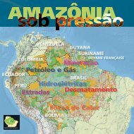
Download - RAISG - Instituto Socioambiental
Download - RAISG - Instituto Socioambiental
Download - RAISG - Instituto Socioambiental

You also want an ePaper? Increase the reach of your titles
YUMPU automatically turns print PDFs into web optimized ePapers that Google loves.
MDF10. Proportion of deforestation per IT in AmazoniaTDF6. Forest loss in ITs in Amazonia in the period 2000-2010. by type of IT*IT Forest in 2000Deforestation2000-2005 2005-2010 2000-2010Type (km²) (%) (km²) (%) (km²) (%) (km²) (%)IT not officially recognized 391,674 81.2 3,392 0.9 1,960 0.5 5,352 1.4Proposed Territorial Reservation 38,296 98.8 17 0.0 47 0.1 64 0.2Territorial Reservation 33,627 97.2 14 0.0 31 0.1 45 0.1IT officially recognized 1,287.957 80.7 6,189 0.5 4,177 0.3 10,366 0.8Total 1,751.555 81.4 9,612 0.5 6,214 0.4 15,826 0.9Out of IT 3,605.839 64.5 153,636 4.3 70,423 2.0 224,060 6.2* Estimated. See BDF1. Analysis of deforestation in the Andean-Amazonian region.BDF3. Deforestation in the northwest of Colombian AmazoniaThe upper basins of the Guaviare, Caquetá, Putumayo and Vaupés rivers, located in the western part of the ColombianAmazonia, are today covered mainly by pasture, secondary vegetation of human origin and mosaics of pastures and crops.Only a few fragments of forest remain, linking the uplands with the lowlands. Between 2000 and 2005, 86% of the totaldeforested area recorded in Colombian Amazonia was located in these basins (Guaviare 36%, Caquetá 32%, Vaupés 10%and Putumayo 8.2%). Between 2005 and 2010, although the percentage of the total deforested area represented by thesefourbasins was lower (81%), there was a notable increase in deforestation in the upper Caquetá (40%) and a reduction inthe other basins (Guaviare 27%, Putumayo 6%, Vaupés 8.4%).Due to their geographic position, these basins are characterized by a rich and unique landscape that has given thema reputation as one of the areas richest in biodiversity and natural resources in Colombia. The northwestern periphery ofthe Colombian Amazonia comprises a natural bridge for the flow of species between the highlands, the Andean forests,the dense Amazonian forests and the Orinoco savannahs. Its broad diversity has been heavily depleted over the last fewdecades since the region’s resources were subjected to the impacts of hydrocarbon and mineral extraction, developed inboth legal and illegal fashion and placing the integrity of the region’s present-day ecosystem under enormous threat. Deforestationin this northwestern periphery is linked to socioeconomic, historical and environmental factors that determine howthe region has been used. The main causal agents have been the spread of urban areas and highways (Etter et al., 2006;Rincón et al., 2006), the navigability of the large rivers, which serve as channels of communication within the Amazonianforest (Armenteras et al., 2009), demographic growth (Etter et al., 2006), oil exploitation (Martínez & Sánchez, 2007),the expansion of coca cultivation (Dávalos et al., 2011; Armenteras et al., 2009; Etter et al., 2006) and recently mining(Romero & Sarmiento, 2011). These processes have also led to the reduction of the natural forest biomass, contributingto the loss of biodiversity, soil deterioration, alteration of the hydrological cycle, and the low quality of the remaining areas(Romero & Sarmiento, 2011).For thousands of years this region was occupied by diverse indigenous groups and until the end of the 19th century wascovered by natural vegetation (Martínez & Sánchez, 2007). Due to its climatic and health conditions, the Amazon regionwas considered an isolated area, populated solely by small indigenous groups. The first colonial advances from Andeansettlers occurred at the start of the 20th century when various settlements were founded in the foothills of the departmentsof Meta, Caquetá and Putumayo, enticed by the cinchona and rubber trade. Later a second wave of migration occurred inthe 1920s at the government´s initiative, beginning with the construction of roads linking the first settlements and motivatedby the desire to protect national sovereignty.The third wave of migration began at the end of the 1930s and continued until the end of the 1960s. In 1936 the nationalgovernment issued the Agrarian Reform Law (Nº 200) that facilitated the purchase of land in these areas, leading tothe influx of rural populations originally from the south of the Andean region. In the 1940s the problem of movement intothis region was made worse by internal conflict in the country. In 1959, Law 20 was issued with the aim of colonizing6,920 km 2 of forest lands. As a result of this law, three colonization frontiers in the areas around La Mono, Maguaré andValparaíso in Caquetá Department were established and subsidized by the national government.The fourth phase of migration took place in the 1970s, driven by oil exploration in the foothills of the upper Putumayo(Etter et al., 2008). Subsequently, in the 1980s, illegal crops invaded Colombia, converting the country into the world’slargest producer of cocaine. In the first decade of the 21st century, the drug business generated a loss of approximately1,100 km 2 of primary forest in Colombia (UNODC, 2009). On average over this period, 55% of these crops were concentratedin the lowland and montane forests of the Orinoquia region and Amazonia. Around 27% of this total is located in theMeta and Guaviare Departments, 18% in the Putumayo and Caquetá Departments, and 10.4% in the Vichada, Guainía,Vaupés and Amazonas Departments.From the year 2000 onwards, due to the public policies implementedin Colombia, an unprecedented boom in oil drilling and miningbegan across the country. The foothills were not exempt fromthis situation; indeed important areas for oil exploration were locatedin the upper basin of the Putumayo River. In parallel, over the pastdecade factors such as the prices of illegal crops, armed conflict,the absence of the state and the oil and mining boom have beenfundamental processes in stimulating the high level of deforestationfound in this area of the country. (Gaia Amazonas Foundation)ConclusionDeforestation is a process affecting a large portion of Amazonia. Brasil is undoubtedly the countrywith the highest level of forest loss. Nonetheless in the period 2005-2010 the country saw a substantialreduction in deforestation, in contrast to other countries, which showed an accelerating trend, as inthe case of Colombia.The results presented reinforce the important role that the PNAs and ITs have been performing inslowing down and containing forest loss in each country and in Amazonia as a whole. The differencesdetected between the lands included in these two types of territorial units and those outside clearly supportthis role. Hence it is important to develop and implement a deforestation monitoring program that,as well as Brazilian Amazonia, also includes Andean Amazonia and the Guianas. The results presentedin this chapter are the first step in this direction.GDF4. Distribution of forest loss in ITs in Amazonia, by type andperiod (2000-2005 and 2005-2010)TDF7. Forest loss in ITs in Amazonia for the period 2000-2010. by country and type of ITDeforestationIT Forest in 2000Country2000-2005 2005-2010 2000-2010Type (km²) (%) (km²) (%) (km²) (%) (km²) (%)BoliviaIT not officially recognized 26,305 56.7 511 1.9 358 1.3 868 3.3IT officially recognized 64,439 79.9 78 0.1 227 0.4 305 0.5Brasil IT officially recognized 843,254 76.0 3,245 0.4 1,770 0.2 5,014 0.6Colombia IT officially recognized 237,473 94.9 929 0.4 683 0.3 1,612 0.7EcuadorIT not officially recognized 50,185 81.7 446 0.9 387 0.8 833 1.7Territorial Reservation 4,960 89.0 4 0.1 3 0.1 7 0.1Guyana IT officially recognized 21,851 79.3 514 2.4 345 1.5 859 3.9Guyane IT officially recognized 6,691 96.4 8 0.1 5 0.1 13 0.2FrançaiseIT not officially recognized 12,293 94.6 55 0.4 54 0.4 108 0.9PerúProposed Territorial Reservation 38,296 98.8 17 0.0 47 0.1 64 0.2Territorial Reservation 28,667 98.8 10 0.0 27 0.1 37 0.1IT officially recognized 114,249 93.9 1,415 1.2 1,147 1.0 2,562 2.2Suriname IT not officially recognized 50,485 91.3 215 0.4 81 0.2 296 0.6Venezuela IT not officially recognized 252,406 82.4 2,166 0.9 1,081 0.4 3,247 1.3TDF8. The three ITs (with an area over 100 km²) from each country in Amazonia with the largest amountof deforestation in the period 2000-2010*ITDeforestationName Type Area (km²) 2000-2005 (km²) 2005-2010 (km²) % TotalBoliviaGuarayos IT not officially recognized 6,706 390 181 8.5Tich (Chiman) IT not officially recognized 1,190 30 34 5.3Yaminahua Machineri IT not officially recognized 303 3 4 2.6BrasilMaraiwatsede IT officially recognized 1,396 273 106 27.1Awá IT officially recognized 1,044 91 94 17.7Tuwa Apekuokawera IT officially recognized 106 13 1 13.2ColombiaAltamira IT officially recognized 107 6 5 10.0Lagos del Dorado. Lagos IT officially recognized 494 23 14 7.5del Paso y El RemansoInga de Aponte IT officially recognized 130 2 7 6.3EcuadorAvila Viejo IT not officially recognized 109 7 4 9.7Juan Pío Montufar IT not officially recognized 167 7 4 6.3San Francisco IT not officially recognized 100 3 1 4.0GuyanaSt. Cuthberth’s IT officially recognized 200 12 36 23.8Kanapang IT officially recognized 184 38 1 20.9Itabac IT officially recognized 171 25 1 15.0Guyane FrançaiseEtnia Galibi IT officially recognized 179 0 2 1.0Etnia Boni. Émérillons et IT officially recognized 2,693 6 1 0.3WayanaEtnia Arawack IT officially recognized 145 0 0 0.2PerúHuascayacu IT officially recognized 108 19 36 50.5Alto Mayo IT officially recognized 120 10 29 32.8Shimpiyacu IT officially recognized 176 17 25 24.3SurinameSantigron IT not officially recognized 1,441 94 6 7.0Aluku IT not officially recognized 847 4 7 1.3Saramacaners IT not officially recognized 9,199 58 27 0.9VenezuelaEtnia Mapoyo IT not officially recognized 300 10 1 3.7Etnia E’ñapa IT not officially recognized 16,880 164 380 3.2Etnia Yabarana IT not officially recognized 905 19 7 2.9* Estimated. See BDF1. Analysis of deforestation in the Andean-Amazonian region.Deforestation in the region surrounding Calamar, east of theChiribiquete National Natural Park, Guaviare, Colombian Amazonia.© Rodrigo Botero García, 2009<strong>RAISG</strong> 58 Amazonia under Pressure – Deforestation Deforestation – Amazonia under Pressure 59 <strong>RAISG</strong>