(TIN5). The area of potential newly recognized ITs is unknown. Based on the data compiled for the differentcountries, the ITs were classified in terms of their level of official recognition and the categoriesused by each country. This resulted in three classes: i) officially recognized lands of traditional use andoccupation; ii) traditionally used and occupied lands without official recognition now in the process ofbeing recognized (or lacking information on the official recognition process); and iii) territorial reservesor intangible zones (reserved for isolated indigenous peoples).The boundaries of PNAs and ITs used in this Atlas were complied and/or produced by the institutionsbelonging to <strong>RAISG</strong> based on a variety of different official and non-official sources (TIN4).PNAs in Amazonia cover a significant total surface area of 1,696,529 km 2 , corresponding to21.8% of Amazonia – excluding the overlaps of different categories of environmental protection andincluding the overlaps with Indigenous Territories, which equals 336,365 km 2 (TIN6). Systems of protectedareas are now being consolidated at national, regional and local level in various countries in theregion. Based on data compiled for each country, the PNAs were classified in terms of their administrativelevel (national or departmental/state) and the type of use of the areas, resulting in four classes: i)indirect use: protection of biodiversity, geological and scenic landscape (aesthetic quality) compatiblewith tourism, education and research; ii) direct use: protection of resources compatible with controlleduse following utilization plans; iii) direct/indirect use: mixed areas where use is defined through zoning;and iv) transitory categories: reserved areas of forest that may or may not be converted into protectedareas or concessions, in accordance with the result of research.Watersheds within the Amazon BasinThe watersheds utilized in the analyses were obtained through relief data from the Shuttle RadarTopography Mission (SRTM), available with a resolution of 15 arc-seconds (approximately 450 meters)and originally processed by the HydroSHEDS Project.This data was then used to generate the flow direction and accumulation models semiautomatically,along with the 2,862 hierarchized and structured river drainage systems, corresponding to1,453 basins covering more than 150,000 hectares and their 1,409 intermediary areas, affluents of theOrinoco and Amazon rivers, as well as the Guianas, the areas surrounding the Tocantins river and thewestern part of the Brazilian ‘NE Atlantic.’Using a specially developed algorithm, a unique system was established and applied to codifythe segments hierarchically in accordance with the six generated Strahler levels, common to the hydrographicnetwork and their respective basins.Based on the names contained in the digital cartography of rivers, compiled by the institutionsbelonging to <strong>RAISG</strong> in the different countries, and the consultation of different maps, the drainage sectionswere assigned with the name of the respective river in complete form up to Strahler level 3 and inpartial form to levels 2 and 1 (TIN7).TIN5. Extension of Indigenous Territories in Amazonia (km 2 )Indigenous Territories officially recognized 1,641.117Indigenous Territories not officially recognized (or without information) 435,406Territorial Reservation 28,127Proposed Territorial Reservation 39,762Total 2,144.412TIN6. Extension of Protected Natural Areas in Amazonia (km 2 )Type of useNationalAdministrative levelDepartmentalIndirect use 768,261 132,078 900,338Direct use 403,016 354,942 757,958Transitory use (Perú) 34,079 0 34,079Direct/Indirect use 4,154 0 4,154Total 1,209.509 487,020 1,696.529TotalAfter generating the drainage sections as described above, all the respective basins or relatedareas were generated, structured, codified and named: nine level 6 basins, 29 level 5 basins, 63 level 4basins and 192 level 3 basins. Levels 1 and 2 are still awaiting codification and toponyms. Level 3 wasestablished as the basis for presenting results on deforestation and other pressures, recognizing thatin many cases this level approximates the scale of municipalities and other correlated administrativeunits, which may be of interest to local governments.In this Atlas, macro-basins are those described here as level 5, and sub-basins as those at level3 (MIN2).General MethodologyThe information providing the foundation for this atlas Amazonia Under Pressure was assembledin June 2009 and updated in May 2011. This information was compiled in each country based onofficial sources, which show differences in time, scale, projection, availability and update period. Thecartographic sources used are cited where appropriate in the thematic chapters.The methodology is grounded on six sequential stages:1) Identification and compilation of cartographic information, which was revised and standardized,selecting only the data located within the area of study and available for all countries.2) Compilation of secondary information on the themes.3) Systematization and organization of cartographic information, presented in a layered themeformat. In order to ensure that the representation was cartographically and numerically equivalentacross the different countries, the specifications of each were taken into account in order toobtain a common set of captions. For example, the international borders were adjusted accordingto a single baseline in order to avoid gaps and overlaps in information. For all the themes,information was classified on the basis of a shared attribute of a caption defined during the initialstage. Protected Natural Areas were classified by type of use, while Indigenous Territories wereclassified in relation to the degree of official recognition. The aim was to classify the pressurethemes by activity phase or their time scale.4) Processing and cross-checking of data by thematic subgroups. The themes were crosscheckedwith the borders of the countries, basins, PNAs and ITs previously grouped and systemizedinto a single layer of information;5) Analysis of results by theme with the elaboration of tables and analytic maps that, combinedwith the compiled secondary information, served as a basis for producing technical notes oneach theme.6) Elaboration of technical notes on each theme.For the development of these stages, work sessions and technical meetings were held at differentmoments, both face-to-face and virtual, with the exchange of experiences, knowledge and capacitybuilding between the teams.The ArcGis GIS tool was used, along with Access for the database resulting from the analyses.In all chapters the results of the cross-checks and analyses are presented in the following order:Amazonia as a whole, Amazonia within each country, macro-basins and sub-basins, Protected NaturalAreas and Indigenous Territories.It is important to stress that the thematic cartographic analyses took into account only the directoverlapping of the themes with the units of analysis: in other words, “areas of influence or impact” relatingto the themes were not considered.MIN2. Hydrographic basins in AmazoniaTIN7, Length and number of drainage segments per Strahler levelsStrahler Length (km) Number of segments1 107,410 1,4532 59,137 7263 27,666 3484 16,044 2255 5,456 896 1,330 21Total 217,044 2,862<strong>RAISG</strong> 12Amazonia under PressureAmazoniaunder Pressure 13 <strong>RAISG</strong>
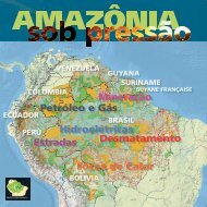
BIN1. Cattle ranching and agriculture in the expansion of Amazonian frontiersBIN2. LoggingSoy cultivation advancing into the forest. Mato Grosso, Brasil. © Ton Koene, 2009In Pan-Amazonia, the farming sector has historically been more an instrument for expansion of the agricultural frontierthan a consolidated activity with an economic objective. At the regional level we can identify six common characteristicsof this sector:√ The development of activities that make occupation of the land possible, without any direct connections with productionchains and focused mainly on production rather than transformation or adding value to the crop.√ A high degree of activities requiring large open spaces and/or low relative productivity, based on a variety of differenttechnological or social models.√ Little knowledge – or recognition – of the diversity of soil types in the region, some of them unique and particular (forexample, those used for seasonal floodland crops).√ Pastures end up occupying more than 90% of the areas initially used for annual, perennial or agroforestry crops.√ A high rate of disease infestation in both the primary production and the processing sectors.√ An almost total absence of technical assistance and rural extension work.At the regional level, four farming systems were identified:√ The traditional integrated system is based on the knowledge and adaptation of indigenous, extractivist or riverdwellingcommunities. It is characterized by a common property regime, high diversification, management of naturalresources, low environmental impact and low income generation with priority given to subsistence use.√ The small-scale colonization system is based on official land distribution programs or on opportunistic migrationsassociated with a road or other infrastructure project. This system is developed in independent areas, does not adapt tolocal conditions and has a high turnover.√ The medium and large-scale individual family system is very often based on the appropriation of public lands. Theseare most often focused on cattle ranching with low investment in technology and infrastructure, while priority is givento the property (cattle herd and pastureland) rather than to economic accumulation per se. This farming system hasshown difficulty integrating itself into external production chains.√ The large-scale agribusiness system is the most recent to appear in the Amazon and is much less frequent than theothers. It has arisen in zones with better infrastructure. This system prioritizes large-scale and mechanized monocropping(soya, for example), intensive use of chemical inputs and a small workforce. In contrast to the other forms, it isdirectly connected to more substantial production chains.Rice, cacao, coffee, manioc and fruit trees are the more common crops found in Pan-Amazonia, in addition to pastureland. At the local level, coca is grown in Bolivia, Colombia and Peru; maize primarily in Peru, Ecuador and Bolivia; palm foroil in Bolivia, Brazil, Colombia, Peru and Venezuela; soy beans in Bolivia and Brazil; and forest plantations in Bolivia, Braziland Venezuela.In the case of the Brazilian Amazonia the entire area used for agriculture, around 3.4 million hectares, represents lessthan 7% of the total farming area, (45.1 million hectares). The remaining 93% is covered by various kinds of pasture witha productivity ranging from 0.4 to 5 animals per hectare with an average of roughly 0.9. The 3.4 million hectares used foragricultural includes large-scale commercial crops (specially soy beans and oil palm), variable scale commercial crops,planted in the small- to medium-range farms (manioc, fruits, cacao, pepper, rice, jute, mallow, assai palm, cupuaçu fruit,peach palm, sugar cane, corn, etc.), small-scale agroforestry systems (fruits, timber, fibers) and finally subsistence crops(rice, beans, manioc, etc.). (Roberto Smeraldi/Amigos da Terra-Brazilian Amazonia)In the Bolivian Amazonia agriculture and cattle ranching are the primary activities responsible for deforestation. Thesetwo activities resulted from a variety of economic and social forces that led, on one hand, to a disorderly establishmentof pastures and, on the other, to the arrival of rural migrants from the highlands who practice subsistence farming (rice,maize, fruit trees and so on) with little or no planning in their occupation of forest lands. The southern portion of the BolivianAmazonia is also threatened by the expansion of mechanized farming (soy beans, sunflowers, sugar cane and rice), whichis more developed in the central part of the Santa Cruz department, especially from the 1980s onwards. Hence deforestationresults from the recent expansion in mechanized farming in the southern part along with small-scale cattle ranchingand agriculture in the southern part, but also in the western and northnorthern parts of the Bolivian Amazonia. Between2000 and 2010 around 765,000 ha were deforested, representing 1.6% of the Bolivian Amazonia. (Daniel Larrea/FAN)In the Ecuadorian Amazonia the main income generating activities include agriculture (56.5%), cattle ranching (10%)and mixed farming (30%). These activities are carried out through systems that use natural resources and labor intensivelybut with very low levels of productivity and profitability. Forestry and agroforestry activities, which exploit the resources ofstanding forests, account for just 1.4% of economic production. (Víctor López/EcoCiencia)In the Colombian Amazonia agricultural and cattle ranching activities are the biggest cause of deforestation and havedeveloped principally in the departments of Caquetá, Guaviare, Meta and Putumayo, located in the northwestern zone thatincludes much of the Andean-Amazonian piedmont. These activities began in the early 1960s when the national governmentpromoted organized colonization programs in the Amazonia with the idea of distributing land to rural populationsdislocated by the violence in the Andean zone and bring under commercial production the vast “unused” lands in easternColombia. At the end of the 1980s the coca bonanza began in Colombia and it was in the Amazonian colonization zonesthat subsistence crops, cattle and forest were replaced by coca grown for illegal use. In 2011 around 100,000 hectareshad either permanent or intermittent coca plots in these four departments. During the past decade the Colombian governmentbegan to eliminate coca cultivation through programs combining aerial fumigation and manual eradication, and bystimulating the reconversion of these lands to cattle ranching (Caquetá and Meta), family production units (Guaviare) andbean growing (Putumayo). (Natalia Hernández)Logging in Amazonia is an important factor in the degradation of its forest; most of it illegal. There are some examplesof sustainable forest management certified by bodies such as the Forest Stewardship Council (FSC), but these represent asmall percentage of the overall activity.Most often centered on a few, high-priced species of hard woods, logging exerts a strong pressure on PNAs, ITs andother areas, and is frequently associated with illegal appropriation of public lands. Illegal logging also affects legal loggingconcessions and hampers the profitability of approved management plans given the theft of timber and unfair competition inthe marketplace, since the illegal operators do not pay taxes or environmental costs.Logging involves a specialized production chain that connects remote areas far from the national and international markets,using the legal road network and navigable rivers, as well as illegal private roads.Legal logging may turn into a long-term forest management effort or may be only a phase anticipating the implementationof an agricultural project, in which the income from felled timber plays an important role in capitalizing the new agriculturalventures. Thus logging can be a pioneering activity preceding the development of pastures or farm land for grain crops.In Brazil, legal forest management occurs in three situations: in privately owned forest areas, in areas belonging to traditionalcommunities (public or private) and in public forest concessions. Around 75% of the forest in Brazilian Amazonia ispublic land and the legal activities of forest companies are restricted to forest concessions, established by law in 2006. Thereexist around 10 forest concession contracts in operation in Brazil, all stemming from public tenders.For the Brazilian Amazonia, Imazon developed the Logging Monitoring System (Simex) which is being implemented in thestates of Pará and Mato Grosso where the incidence of logging is high. In these regions predatory extraction has penetratedinto PNAs and ITs. According to Simex, the total area logged in Pará – legally and illegally – from August 2009 to July 2010was 1,205 km 2 , most of it (65%) illegal. Most of this illegal logging (84%) occurred in private unoccupied or disputed areas.In Mato Grosso 2,260 km 2 was logged between August 2009 and July 2010, 44% of which was illegal. Most of this total(87.8%) was also logged in private unoccupied or disputed areas.In Peru since the 1960s legislation has attempted to regulate forest logging through the implantation of a system of concessionsor contracts. The last version dates from 2000 when a new Forestry and Wildlife Law (Nº 27308) was issued. Itestablished the creation of Permanent Production Forests (BPPs) intended exclusively for forest management. Each area wasdivided into smaller units, each approximately 50 km 2 in size, which are auctioned off to private bidders in the form of ForestConcessions (FCs). These areas remain under State ownership with usufruct rights given to the concessionaires for up to fortyyears. Individual concessionaires are allowed to accumulate a maximum area of 500 km 2 (10 FCs). In August 2009 therewere 177,639 km 2 of permanent production forests, 7,618 km 2 of which had already been awarded in forest concessions.Despite these advances, an independent investigation revealed that 80% of Peruvian logging is illegal (Urrunaga et al., 2012).Unfortunately the 2000 law has not generate the expected results, in part because the process for delimitation of the PermanentProduction Forests was carried out from distant urban offices, without information regarding or concern for currentoccupation or traditional use of the areas. This produced a series of overlaps with registered native communities and, evenmore seriously, with lands and forests claimed by indigenous populations but not yet registered and/or demarcated.In Bolivia the forest legislation is based on Law 1700, approved in 1992, which in the 1990s stimulated the voluntaryconversion of the former usage contracts into a successful concessions system supervised by what was then the ForestSuperintendent. In 2009 this institution was replaced by the Land and Forest Public Oversight Authority (ABT), responsible forforest resources, land and soils. This change was accompanied by the approval of a new Constitution during the same yearthat does not recognize the system of concessions for exploiting natural resources, including forest resources. This scenariostimulated an increase in the illegal exploitation and marketing of timber. Currently a new law is being drafted with the aim ofregulating forest activities. Recently the Framework Law for Mother Earth and Integral Development for Living Well was approved(October 2012), which sets out the overall vision and legal foundation for integral development with the use of naturalresources in Bolivia. However, the forest issue is dealt with only in a very superficial way in this new law.In Ecuador, the government has been trying to finish the National Forest Inventory since 2010. Nonetheless, there is littlereliable information regarding illegal logging in the Ecuadorian Amazonia. It is estimated that 70% of the timber exported fromEcuador is illegally sourced and may even derive from indigenous lands or zones reserved to isolated indigenous groups, asin the case of the Taromenane and Waorani (CONAIE, 2006 and Sierra et al., 2010). Other sources assert that the provincesof Orellana, Pastaza and Morona Santiago are the most affected by illegal logging.In Colombia it is estimated that 42% of timber sold is illegal, and that between 20 and 40% of the same is extracted inAmazonia. Only 33% of sold timber has forestry certificates. To combat this problem in August 2009 the Inter-Sector Agreementfor Legal Timber was established and renewed in 2011. This instrument looks to ensure that the timber extracted, transported,processed, sold and used in Colombia comes exclusively from legal sources (Legal Timber Agreement in Colombia).(Beto Ricardo, ISA, with the collaboration of Tasso Azevedo)Logging company, one of 140 established in Tailândia. Pará, Brasil. © Paulo Santos, 2008Operation to control illegal logging. Belém, Pará, Brasil. © Paulo Santos, 2010Forest and pasture being burnt for cattle ranching, Pará, Brasil © Daniel Beltra/Greenpeace, 2008 Port run by Cargill for grain exportation. Santarém, Pará, Brasil. © Paulo Santos, 2010Batch of illegal timber confiscated in Belém. Pará, Brasil. © Paulo Santos, 2010Roads – Amazonia under Pressure 15 <strong>RAISG</strong>