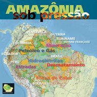
Map 1. Amazonia: cumulative pressure (<strong>RAISG</strong>, 2012)IntroduCTIONMap 2. Amazonia: cumulative threats (<strong>RAISG</strong>, 2012)The Amazonia presented in this publication is a territory with a huge socioenvironmentaldiversity now undergoing a process of rapid change. It covers anarea of 7.8 million km 2 , including 12 macro-basins and 158 sub-basins, shared by1,497 municipalities, 68 departments/states/provinces in eight countries: Bolivia(6.2%), Brasil (64.3%), Colombia (6.2%), Ecuador (1.5%), Guyana (2.8%), Perú(10.1%), Suriname (2.1%) and Venezuela (5.8%), as well as Guyane Française(1.1%). 1 Around 33 million people live in Amazonia, including 385 indigenouspeoples, as well as some living in ‘isolation.’ There are 610 PNAs and 2,344 ITsthat occupy 45% of the Amazonian surface area, without counting the small,medium and large rural landowners, various types of companies, research andsupport institutions, religious organizations and civil society organizations.This area results from boundaries agreed upon by <strong>RAISG</strong> members bycombining socio-environmental and juridical-administrative criteria, as explainedbelow, in order to define a spatial expression of the information and analyses.The geographical information system developed by <strong>RAISG</strong> has the flexibilityto allow products to be generated using other boundaries, such as thosedefined by hydrographic or biogeographic criteria, for example.Although countries like Bolivia, Brasil, Colombia, Ecuador and Perú definejuridical-administrative boundaries for their portions of Amazonia, publicpolicies do not reflect Amazonian socio-environmental particularities and are farfrom adopting the necessary (Pan-) Amazonian view and improving cooperationmechanisms.In all cases, there persists a view of Amazonia as a remote frontier providing‘infinite’ natural resources, with a demographic vacuum open to new forms offarming and extractivist colonization.This view has become more complex over the last 50 years with the newforms in which the region has been integrated into national and internationaleconomies. Amazonia is also now considered at national level as a territory capableof ensuring energy sovereignty and as a source of income based on theproduction and commercialization of raw materials. At the global level, the regionis seen as the most important source of fresh water and biodiversity, as a regulatorof the planet’s climate and as a carbon sink for large quantities of greenhousegases.Like the other products generated through the work of <strong>RAISG</strong>, the mainobjective of this publication is to overcome our fragmented views of Amazoniaand offer an ample panorama of the pressures and threats across the entireregion and other sub-units of analysis. The opposite page shows two mapsproviding a spatial illustration of the combined sum of pressures (map 1) andthreats (map 2).Pressures refers to the human actions currently taking place in Amazoniathat put at risk the integrity of the ecosystems and the collective and diffuse rightsof its inhabitants, whether traditional or otherwise.The threats are the human plans, projects or initiatives marked for the nearfuture, which may turn into pressures once implemented.In both cases <strong>RAISG</strong>’s members organized information under a set of prioritythemes mentioned in the preface, compiling and generating high qualityinformation that could be represented cartographically for the entire Amazonianregion.The present Atlas contains information on the following six themes, representingthe pressures and threats faced by Amazonia over the last decade– roads, oil and gas, hydroelectric plants, mining, fires and deforestation – analyzedin relation to Amazonia as a whole as well as to five different territorialunits: Amazonia in each country, Hydrographic Basins, Protected Natural Areas(PNAs), and Indigenous Territories (ITs). These analyses are supported by 55maps, 61 tables, 23 graphs, 16 boxes and 73 photographs. All this information isorganized in thematic chapters running to a total of 68 pages.It should be pointed out that it was not possible to include specific chapterson logging and farming – themes of great importance for a more complete evaluationof the pressures and threats on Amazonia – since no basic information onthem exists that covers the region as a whole. These themes will be discussed intwo boxes included in the present introduction.1 The <strong>RAISG</strong> workgroups decided to maintain the country names as written in their original languagesin all publications.<strong>RAISG</strong> 8Amazonia under PressureAmazoniaunder Pressure 9 <strong>RAISG</strong>
The geographical boundary of AmazoniaThe boundaries of Amazonia as a region can be defined using different methodologies as wellas a variety of data sources for mapping them. The boundaries most frequently used are the biophysicalborders – related to hydrography, relief and vegetation – and the administrative boundaries recognizedby the different nations for the application of protection and/or development policies, which takeinto account the region’s unique features. Economic and social criteria can also be used in defining theregion’s boundaries. Hence no consensus exists on exactly what Amazonia is: to the contrary, we knowthat there are various Amazonias related to the different universes of the actors and interests involved.In 2004 a study undertaken by ACTO on the boundaries of Amazonia, focusing on different biophysicalparameters, identified a number of important overlaps that highlight the difficulties involved inselecting the criteria for defining the region’s borders:“- defining the area hydrologically is unsatisfactory given the diversity of Amazonia’s biogeography;- since the biota of the tropical forests of the Amazonian lowlands is similar in various importantaspects with that of the Guianas region, the latter should also be considered in the definition ofthe area;MIN1. Amazonia boundaries and land coverage- generally speaking, the biota of the Andean highlands are not directly related to the flora andfauna of the Amazonian lowlands, though they are interconnected ecologically and hydrologically;- similarly, the slopes of the Brazilian mountains, which drain into the Amazon Basin, despitepresenting different geographic and biotic characteristics, are ecologically and hydrologicallyconnected to Amazonia;- in terms of climate, the Amazonian region cannot be considered in isolation from the rest of thecontinent or indeed the world.”For <strong>RAISG</strong>, the objective is not to establish an unequivocal Amazonian boundary, administrativelyor scientifically based, but to delimit an area of analysis in a way that the information is useful toa variety of actors. The products will have different formats and publics, whether they are published onthe network’s web site (www.raisg.socioambiental.org) or in printed format.In these analyses, given the different definitions of the Amazonian borders used by each country,<strong>RAISG</strong> used a boundary that corresponds to a region for which we have updated and systemizeddata, backed by accumulated knowledge and a working experience. This enables <strong>RAISG</strong> to carry outdiagnoses and projections regarding both the threats and the attempts to protect the area, as wellas efforts to monitor their evolution over time. This boundary, which encompasses 7.8 million km 2 , isprimarily composed of the biogeographical boundary with the exception of Ecuador andBrasil where legal-administrative criteria are used. This is the area to which the statisticsand other general references to Amazonia in this publication apply. Table TIN1 presentsthe definition of Amazonian areas used by each country.To assist the reader, the boundaries of both Amazonia as a basin and the biogeographicalAmazonia are shown in the map Amazonia 2012 – based on the consolidatedinformation – as well as the “boundary used by <strong>RAISG</strong>.”On <strong>RAISG</strong>’s web page the information will be organized in a form that enables usersto make searches taking this boundary or basins and sub-basins as parameters whenanalyzing hydrographic aspects, for example. Similarly, biogeographical parameters canbe used when planning for conservation projects, while administrative boundaries canbe employed when the user’s interest relates to development, taking into account socioenvironmentalinformation.A survey of the different definitions of Amazonia in each of the countries fromthe biogeographical, hydrographic and legal-administrative viewpoints is summarized inTIN2, where the boundary employed by <strong>RAISG</strong> for its calculations and analyses is highlightedin green.The MIN1 map shows the main classes of plant cover with the existing vegetationand the zones of human intervention (agriculture, livestock farming and so on). The overlappingof the three aforementioned Amazonian boundaries allows the reader to observethe approximate degree of human impact within each of them.TIN1. Amazon definitions, by countryBIOGEOGRAPHIC HYDROGRAPHIC BASIN “LEGAL/ADMINISTRATIVE”BOLIVIAapprox. 475,278 km 2 . It comprises about half of the area of Bolivia (475,278 km 2 ). It consists of a approx. 714,493 km 2 . The watershed is comprised of the Rio Madera watershed and a small approx. 156,267 km 2 . Article 390 of Bolivia’s new Political Constitution of the Statemosaic of extensive upland and seasonally flooded (várzea and igapó) Amazonian forests, flooded portion of the upper Amazonas basin on the border with Brazil.(CPE) defines the Bolivian Amazon as a strategic area, specially protected for thesavannas, semi-humid transition forests in the direction of the Cerrado, and sub-Andean and Yungascomprehensive development of the country given its environmental sensitivity, existingforests (the latter being characterized by high biodiversity).biodiversity, water resources, and eco-regions. It is understood to encompass the entiredepartment of Pando, the province of Iturralde in the department of La Paz, and theBallivián and Vaca Diez provinces in the department of Beni.BRASILapprox. 4,213.463 km 2 . Wide variety of physiognomies, with dominance of flat-topped interfluves approx. 4,692.488 km². Basins of the rivers Amazonas, Negro, Madera and Tocantins, and approx. 5,217.423 km². Region of planning and incentive to occupation called “Amazoniacovered by evergreen tropical forests and submontane forests associated to infrequent elevations. It the Guyana/Macapá and Atlantico basins.Legal”, defined by Federal Law 1806 from January 6th 1953 with the political aim ofincludes a transitional zone between rainforest and savanna like areas (locally called “cerrado”), andintegrating the region to the national territory and foster its development. It consists oflarge extensions of sandy soils with structural and floristic patterns of forest and sandy savannasthe Brazilian north region states (Acre, Amazonas, Amapá, Pará, Roraima, Rondônia andhighly and locally adapted, called “campinaranas” and “campinas”, respectively. Periodically floodedTocantins), Mato Grosso and a portion of Maranhão (west from meridian 44º).wetlands have vegetation types that vary from wet fields to Palm Swamps (locally called veredas) andriparian forests.ECUADORapprox. 91,045.74 Km 2 . Starts in the Andean-Amazonian transitional forests, at 1,300 meters above approx. 131,950.45 km 2 . It includes portions of the basins of the rivers Putumayo, Napo, approx. 116,605.87 km 2 . According to the Article 250 of the new Constitution of Ecuadorsea level along the foothills of the Andes, and moves toward the Amazon floodplain to about 300 m Tigre, Pastaza, Morona Santiago and Mayo. All are binational or transnational basins.of 2008, referred to the Ecuadorian Amazon as the territory of the Amazon provincesaltitude it is dominated by several types of lowland evergreen forests including: flooded forests of whiteand states that it is part of an ecosystem necessary for the environmental balance ofand black water, palm forest) with a significant presence of lacustrine grasslands and other non forestethe planet. This territory will be a special land for which there will be a comprehensiveecosystems (Sierra, 1999)planning law including social, economic, environmental and cultural issues, with a landuse planning to ensure the conservation and protection of ecosystems and the principleof “Sumak Kawsay” (Good living). The Ecuadorian Amazon region comprises the provincesof Sucumbios, Napo, Orellana, Pastaza, Morona Santiago and Zamora.COLOMBIAapprox. 483,164 km 2 . The Amazon region incorporates hydrographic as well as biogeographic politicaladministrativeapprox. 342,372.9 km 2 . Putumayo River Basin, Negro River basin, Caquetá River basin and approx. 483,164 km 2 . The political-administrative division covers the southern part ofboundaries: i) the basin boundary in the western sector is defined by the drainage divide a small portion of the Napo River basin.the department of Vichada; the southeastern of the Meta Department; the entire territoryin the upper part of the eastern mountains of the Colombian Andes; ii) the northern sector reachesof the departments of Guainia, Guaviare, Vaupes, Amazonas, Putumayo and Caqueta;up to where the forest cover limits with the natural savannahs in the Orinoquia; iii) the southern and“la Bota Caucana”, in the department of Cauca and the Amazonian watershed of Nariñoeastern boundaries limit the international borders of Colombia with Ecuador, Peru, Brazil and Venezuela(the highest part of the Guamuez, Sucio, San Miguel and Aguarico rivers). The basin’s(http://siatac.siac.net.co/web/guest/region, Murcia Garcia, 2009); and iv) the ecosystems includeadministrative districts or municipalities are in total 78. 58 correspond to municipalitiesthe Eastern Mountain “Paramos”, birth of important rivers which cross the Amazon basin, to areas(41 fully included in the region and 17 partially included) and 20 departmental administrativeof the tropical rain forest. These ecosystems range from Andean, flood plains, mainland to xeric anddistricts , all included in the region (Murcia Garcia et al, 2009).savannahs.GUIANA The entire country approx. 12,300 km 2 . Tributary of the Branco River. Without informationGUYANE FRANÇAISE The entire country Is not tributary of the Amazonas River. Without informationPERÚapprox. 782,813 km 2 . There are several different classifications of ecosystems in the Peruvian Amazon.approx. 966,170 km 2 . The Peruvian Amazon is drained by many rivers of varying sizes and Sin información de área In terms of political units, the Peruvian Amazon includes theMost of them divide this region into two large landscapes: The Amazonian lowland, located below volumes; the largest of these include the Amazonas, Marañón, Napo, Ucayali and Madre de entirety of the Departments of Loreto, Ucayali and Madre de Dios and a part of thethe 500 to 800 msnm and the high jungle or montaña above the Plain and up to 3600 msnm. However, Dios Rivers. Source: ANA 2010.Unidades Hidrográficas del Perú, 1/100 000.Departments of Amazonas, Cajamarca, Huancavelica, La Libertad, Pasco, Piura, Puno,this classification simplifies the eco-systemic diversity in contrast with that postulated by EncarnaciónAyacucho, Junín, Cusco, Huánuco and San Martín. Source: MINAM 2009. Mapa de(1993) who identifies 16 types of vegetation in the Amazon lowland defined by the predominant plantDeforestación de la Amazonía Peruana – 2000. Memoria Descriptiva, Lima, p14.species or by the type of waters that flood the forests. Source: Encarnación, F. 1993. El bosque y lasformaciones vegetales en la llanura amazónica del Perú. Alma Mater Rev. UNMSM. 6: 94-114.SURINAMEHistorically known region of the Amazon lowland rainforest biome in northern South America (taken or Is not tributary of the Amazonas River.Without informationinferred from TREES map 1999; S and E borders delimited according to Soares, 1953).VENEZUELAapprox. 453,915 km 2 . It is equivalent to the Venezuelan Guiana Shield region (Huber 1995, Gorzula and approx. 53,280 km 2 . From a strict hydrographic point of view, the Amazon basin only includesapprox. 53,280 km 2 . Officially includes only the hydrographic boundaries of the water-Señaris 1998, Pérez-Hernández and Lew 2001, Eva and Huber 2005), which occupies, in its widestthe area south of the Casiquiare river, which communicates the Orinoco with the Negro shed.interpretation, the states of Amazonas, Bolívar and Delta Amacuro.River (Eva and Huber 2005).TIN2. Amazon surfaces per countryCountry Amazon area (km 2 ) % of Amazonia % of countryBolivia 479,264 6.2 43.6Brasil 5,006.316 64.3 58.8Colombia 483,164 6.2 42.3Ecuador 116,284 1.5 46.7Guyana 214,969 2.8 100.0Guyane Française 86,504 1.1 100.0Perú 782,820 10.1 60.9Suriname 163,820 2.1 100.0Venezuela 453,915 5.8 49.5Total 7,787.056Protected Natural Areas and Indigenous TerritoriesProtection of Amazonia’s socio-environmental diversity is being consolidated through the recognitionof the territorial rights of indigenous peoples and the creation and implementation of a diverseset of protected areas. These conservation strategies have expanded over recent years and todaycover a surface area of 3,502,750 km 2 (2,144,412 km 2 in Indigenous Territories and 1,696,529 km 2 inProtected Natural Areas with 336,365 km2 overlapping between the two) corresponding to 45% of theregion (TIN3).A portion of the Protected Natural Areas (PNAs) and Indigenous Territories (ITs) in Amazoniahave effectively turned into islands of forest following the expansion of the export economy in basicproducts of low aggregated value.There is a large shortfall in official recognition of the lands of many of the 385 indigenous peoplesliving in Amazonia. These remain to be identified and quantified. Currently they cover a surface area of1,641,117 km 2 and 28,127 km 2 , represented by territorial reserves and intangible zones respectively,which combined correspond to 21.5% of the region. The proposals for territorial reserves and the ITsnow in the process of official recognition add up to 475,168 km 2 , equivalent to 6.1% of the total regionTIN3. PNA and IT in AmazoniaArea (km 2 )% of AmazoniaProtected Natural Areas (PNAs) 1,696.529 21.8%Indigenous Territories (ITs) 2,144.412 27.5%Overlapping area between PNAs and ITs 336,365 4.3%PNAs and ITs without overlapping 3,502.750 45.0%TIN4. Cartographic sources of PNAs and ITs usedCountrySource/date (year)<strong>RAISG</strong>memberITBolivia Viceministerio de Tierras. Mapa de TCOs y sus áreas tituladas en Bolivia (no publicado). Versión 2009 FANBrasil <strong>Instituto</strong> <strong>Socioambiental</strong>, 2012 ISAColombia <strong>Instituto</strong> Geografico Agustin Codazzi, 2007; INCODER, 2009 FGAEcuadorEcoCiencia, 2009; ECORAE ,2002; ECOLEX, 2011; Gobierno Autónomo Descentralizado de Sucumbíos,EcoCiencia2011; Subsecretaría de Tierras, 2011; Fundación Arcoiris, 2010; MAE, 2011Guiane Française Direction Régionale de l’Environnement de Guyane, 2009 DEALGuyana Indigenous Affair/Governo da Guyana, 2009 ISAPerú SICNA: incluye ACPC, AIDESEP-CIPTA, CEDIA, IBC, PETT-Loreto, GEF PNUD, GOREL y PFS. 2011 IBCSuriname ACTVenezuela Ministerio del Poder Popular para la Salud (mapa), 2007 ProvitaNATIONAL PNABolivia SERNAP 2005 FANBrasil <strong>Instituto</strong> <strong>Socioambiental</strong>, 2012 ISAColombia Unidad Administrativa Especial Sistema Parques Nacionales - Dirección Terrriotial Amazonía, 2010 FGAEcuador MAE, 2010 EcoCienciaGuiana Francesa Direction Régionale de l’Environnement de Guyane DEALGuyana Digital Chart of World, 1993Perú MINAM, 2012 IBCVenezuela Rodriguez et al., 2011 (datos no oficiales) ProvitaDEPARTMENTAL PNABoliviaGobierno Municipal de La Paz, 2010; Ministerio de Medio Ambiente y Agua, 2009; PMOT Ixiamas, FAN2009; Prefectura del Beni, 2008Brasil <strong>Instituto</strong> <strong>Socioambiental</strong>, 2012 ISAFORESTEcuador MAE, 2010 EcoCiencia<strong>RAISG</strong> 10Amazonia under PressureAmazoniaunder Pressure 11 <strong>RAISG</strong>