- Page 1 and 2: Long Range Plan For The Klamath Riv
- Page 4: EXECUTIVE SUMMARYTHE KLAMATH ACTPub
- Page 7 and 8: With the help of an inventory of fi
- Page 9 and 10: WHERE TO FIND SUBJECTS IN THIS PLAN
- Page 11 and 12: CONTENTS (Continued)The Restoration
- Page 13 and 14: Figure TitleLIST OF ILLUSTRATIONSPa
- Page 15 and 16: LIST OF ILLUSTRATIONS (continued)Fi
- Page 17 and 18: CHAPTER 1INTRODUCTIONFOREWARDThe su
- Page 19 and 20: KLAMATH RIVER BASIN FISHERIES TASK
- Page 21 and 22: Restoration Program. The firm of Wi
- Page 23 and 24: Figure 1-1 - Karuk tribal fisherman
- Page 25 and 26: Salmonid Enhancement Program (SEP)
- Page 27 and 28: Developing Goals and ObjectivesReca
- Page 29 and 30: CHAPTER 2HABITAT PROTECTION AND MAN
- Page 31 and 32: At the end of each subsection is a
- Page 35 and 36: occurred around 1600 and again abou
- Page 39 and 40: LAND MANAGEMENTAs Congress stated i
- Page 41: Glen to Pecwan Creek), Salmon, Scot
- Page 45 and 46: (landslides and debris slides) indu
- Page 47 and 48: Figure 2-8 - Effects of various per
- Page 49 and 50: Riparian CoverRiparian vegetation i
- Page 51 and 52: Stream contamination from herbicide
- Page 53 and 54: Aquatic organismsStream invertebrat
- Page 55 and 56: One of the most obvious improvement
- Page 57 and 58: issued on a case-by-case basis when
- Page 59 and 60: The California Department of Forest
- Page 61 and 62: identifying the sensitivity of the
- Page 63 and 64: MININGIssues* Habitat damage from p
- Page 65 and 66: illustrated in Figure 2-10, while a
- Page 67 and 68: Figure 2-11a - Gold Mining on the K
- Page 69 and 70: through a small-diameter pressure h
- Page 71 and 72: cumulatively, the annual extraction
- Page 73 and 74: locking tributary access. This was
- Page 75 and 76: In addition, large boulders were mo
- Page 77 and 78: On federal lands, the U.S. Forest S
- Page 79 and 80: POLICIES FOR MINING ACTIVITIESObjec
- Page 81 and 82: The County Farm Advisor's Office (U
- Page 83 and 84: Rearing habitatAs depicted in Figur
- Page 85 and 86: Figure 2-14 -- Impact of loss of sn
- Page 87 and 88: Conservation easements are either d
- Page 89 and 90: POLICIES FOR AGRICULTUREObjective 2
- Page 91 and 92: For many reasons, large dams were n
- Page 93 and 94:
or other artificial obstruction is
- Page 95 and 96:
were localized in the Trinity Basin
- Page 97 and 98:
Figure 2-15 - Present Klamath River
- Page 99 and 100:
demands) (U.S.A.C.E. 1979). Since 1
- Page 102 and 103:
Figure 2-18 - Iron Gate Fish Flow R
- Page 104 and 105:
ownership. These rights survived te
- Page 106 and 107:
2) the construction and operation o
- Page 108 and 109:
2.E.3. Promote adequate fish protec
- Page 110 and 111:
Another opportunity for improved ir
- Page 112 and 113:
ecaptured and used on lower pasture
- Page 115 and 116:
diversions. The fish impacts relate
- Page 117 and 118:
Rearing habitat requires sufficient
- Page 119 and 120:
in the bottom of deep pools, but se
- Page 121 and 122:
Another opportunity to save water c
- Page 123 and 124:
o Significant reductions of ditch l
- Page 126 and 127:
eneficial use ("use it or lose it")
- Page 128 and 129:
In summary, instream flow problems
- Page 130 and 131:
CHAPTER 3HABITAT RESTORATIONISSUES*
- Page 132 and 133:
help to determine the stage of reco
- Page 134 and 135:
Figure 3-2 - Fish screens, such as
- Page 136 and 137:
Figure 3-3 - Riparian restoration i
- Page 138 and 139:
the segments themselves. He suggest
- Page 140 and 141:
expanded the U.S. Forest Service's
- Page 142 and 143:
Figure 3-5 -- These boulder weirs o
- Page 144 and 145:
channels have been evaluated and al
- Page 146 and 147:
to produce fish, together with its
- Page 148 and 149:
West (1984) noted that spawning and
- Page 150 and 151:
widths changed dramatically after t
- Page 152 and 153:
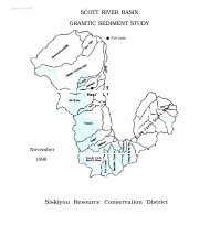
Scott RiverFish habitat in the Scot
- Page 154 and 155:
edload movement or substrate condit
- Page 156 and 157:
may be difficult to detect with per
- Page 158 and 159:
Community Support and Involvement:
- Page 160 and 161:
The problems which have led to the
- Page 162 and 163:
3.7 The Scott River and its tributa
- Page 164 and 165:
CHAPTER 4FISH POPULATION PROTECTION
- Page 166 and 167:
correct. Klamath stocks reached an
- Page 168 and 169:
Junction City in the Trinity River
- Page 170 and 171:
Recent electrophoretic analysis of
- Page 172 and 173:
little intermixing with Iron Gate H
- Page 174 and 175:
TABLE 4-1 (Continued)Salmon RiverWo
- Page 176 and 177:
(R. Pierce personal communication).
- Page 178 and 179:
Creek, Clear Creek, South Fork Trin
- Page 180 and 181:
Young lamprey are known as "ammocoe
- Page 182:
lack of separation of these fish fr
- Page 186 and 187:
chinook released at Trinity River H
- Page 188 and 189:
0.020 by 1987 (Hopelain unpublished
- Page 190 and 191:
Table 4-2 -- Summer Steelhead Popul
- Page 192 and 193:
Table 4-3 -- Habitat Problems Imped
- Page 194 and 195:
The potential impacts of harvest an
- Page 196 and 197:
the Yurok Tribe to regulate when th
- Page 198 and 199:
THE IMPACTS OF POACHING ON DEPRESSE
- Page 200 and 201:
along the continental shelf well wi
- Page 202 and 203:
points is well documented. Smaller
- Page 204 and 205:
monitor coho and steelhead is pract
- Page 206 and 207:
The monitoring of escapements and t
- Page 208 and 209:
4.4 The Task Force will work with t
- Page 210 and 211:
Klamath River Basin Fall Chinook Sa
- Page 212 and 213:
Klamath River Basin Fall Chinook Sa
- Page 214 and 215:
Klamath River Basin Fall Chinook Sa
- Page 216 and 217:
The move to use hatcheries to offse
- Page 218 and 219:
Fall chinook yearlings have stayed
- Page 220 and 221:
From the 1,000,000 eggs collected a
- Page 222 and 223:
Trinity River HatcheryTrinity River
- Page 224 and 225:
Birk personal communication). Some
- Page 226 and 227:
SIDE EFFECTS OF LARGE SCALE HATCHER
- Page 228 and 229:
oth native and hatchery chinook. Ni
- Page 230 and 231:
ainbow trout in the areas above Iro
- Page 232 and 233:
Oregon instituted a program of coho
- Page 234 and 235:
Given the ecological problems of th
- Page 236 and 237:
were higher than any recorded in re
- Page 238 and 239:
communication). As we expand this s
- Page 240 and 241:
have different outmigration and spa
- Page 242 and 243:
e handling threatened stock groups.
- Page 244 and 245:
c. Requirements that an appropriate
- Page 246 and 247:
APPROACHThe education and communica
- Page 248 and 249:
COMMUNICATION COMPONENTThe communic
- Page 250 and 251:
achieve the objectives of the Resto
- Page 252 and 253:
POLICIES FOR EDUCATION AND COMMUNIC
- Page 254 and 255:
commercial salmon fishing industry,
- Page 256 and 257:
STAFFINGAccording to the Klamath Ac
- Page 258 and 259:
Klamath River Basin Proposals, awar
- Page 260 and 261:
TABLE 7-1Klamath Basin Fishery Rest
- Page 262 and 263:
TABLE 7-3 — Potential Funding Sou
- Page 264 and 265:
Specific fisheries software, such a
- Page 266 and 267:
Table 7-4 -- A List of Agencies and
- Page 268 and 269:
Department of CommerceThe Departmen
- Page 270 and 271:
Gate) and will be making the final
- Page 272 and 273:
Upper Klamath Lake were converted d
- Page 274 and 275:
Coastal Conservancy (CC). The Conse
- Page 276 and 277:
Each county also has a Fish and Gam
- Page 278 and 279:
Communication Barriers. Since commu
- Page 280 and 281:
Joint Management PlansTwo or more a
- Page 282 and 283:
PROJECT SELECTION PROCESSProject pr
- Page 284 and 285:
Figure 7-3 -- Klamath Fishery Resto
- Page 286 and 287:
. An Annual Progress Report appropr
- Page 288 and 289:
d. Cooperative Agreements with trib
- Page 290 and 291:
o Addresses the need for improving
- Page 292 and 293:
Habitat Restoration16. The Task For
- Page 294 and 295:
35. The Task Force will schedule le
- Page 296 and 297:
2.A.4. Anticipate potential stream
- Page 298 and 299:
2.C.2. Monitor and assess stream qu
- Page 300 and 301:
2.F.3. In the year 1995, if adequat
- Page 302 and 303:
. Funding a study using aerial phot
- Page 304 and 305:
h. Get the information suggested in
- Page 306 and 307:
. Broodstock management rules that
- Page 308 and 309:
. As an option, use the "abstention
- Page 310 and 311:
d. Committees of the Task Force, Co
- Page 312 and 313:
GLOSSARYAFS: American Fisheries Soc
- Page 314 and 315:
counting weir: fence or series of p
- Page 316 and 317:
gabion: a wire basket filled with r
- Page 318 and 319:
longitudinal profile: measurement t
- Page 320 and 321:
iffle: fast shallow waters of a str
- Page 322 and 323:
BIBLIOGRAPHIC REFERENCESAllendorf,
- Page 324 and 325:
Borodin, A.M., A.G. Bannikov, and V
- Page 326 and 327:
California Dept. of Transportation.
- Page 328 and 329:
Coats, R.N., T.O. Miller, and D.W.
- Page 330 and 331:
Fletcher, J.E. and M. King. 1988. A
- Page 332 and 333:
Hall, J.D. 1984. Evaluating fish re
- Page 334 and 335:
Hubbell, P.M. 1979. Fisheries Inves
- Page 336 and 337:
Kroeber, A.L. and S.A. Barrett. 196
- Page 338 and 339:
Mattole Restoration Council. 1989.
- Page 340 and 341:
National Council on Gene Resources.
- Page 342 and 343:
Platts, W.S. 1981. Effects of lives
- Page 344 and 345:
Rosgen, D.L. 1985. A stream classif
- Page 346 and 347:
Sommarstrom, S. 1981. Local-State c
- Page 348 and 349:
U.S. Fish and Wildlife Service. 198
- Page 350 and 351:
Wagner, H. 1979. Why Wild Coho? Ore
- Page 352 and 353:
PERSONAL COMMUNICATIONSBaker, Phil:
- Page 354 and 355:
Orcutt, Mike: Head fisheries biolog
- Page 356:
APPENDIX A:PUBLIC LAW 99-552KLAMATH
- Page 365 and 366:
1989 Klamath Field Review CommentsT
- Page 367 and 368:
Pecwan Creek (11021, 11036, 11028-$
- Page 369 and 370:
Clear Creek (6010, 6068, 69-$66,400
- Page 371 and 372:
West Branch Creek (6007-$5,000): Th
- Page 373 and 374:
Scott River (4405-06, 4012-15-$94,8
- Page 375 and 376:
A Financial Feasibility Envelope fo
- Page 377 and 378:
For this analysis, we took the two-
- Page 379 and 380:
Bonneville Power Administration's e
- Page 381 and 382:
Table 4Maximum Feasible Annual Inve
- Page 383 and 384:
APPENDIX D
- Page 385 and 386:
KLAMATH RIVER BASIN CONSERVATION AR
- Page 387 and 388:
o Harvest Managementoo Population m
- Page 389 and 390:
III. AFFECTED ENVIRONMENTProject Ar
- Page 391 and 392:
Both aquatic and terrestrial types
- Page 393 and 394:
Table 2Threatened, Endangered, and
- Page 395 and 396:
IV. ENVIRONMENTAL CONSEQUENCESWhile
- Page 397 and 398:
Farmlands and TimberlandsNo farmlan
- Page 399 and 400:
Comparison of AlternativesTable 3 o
- Page 401 and 402:
Agencies Consulted for the Environm
- Page 403:
FINDING OF NO SIGNIFICANT IMPACTLON