ArcGIS Hydro Model Tutorial
ArcGIS Hydro Model Tutorial
ArcGIS Hydro Model Tutorial
You also want an ePaper? Increase the reach of your titles
YUMPU automatically turns print PDFs into web optimized ePapers that Google loves.
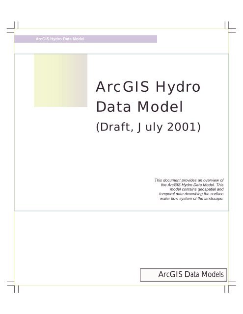
<strong>ArcGIS</strong> <strong>Hydro</strong> Data <strong>Model</strong><strong>ArcGIS</strong> <strong>Hydro</strong>Data <strong>Model</strong>(Draft, July 2001)This document provides an overview ofthe <strong>ArcGIS</strong> <strong>Hydro</strong> Data <strong>Model</strong>. Thismodel contains geospatial andtemporal data describing the surfacewater flow system of the landscape.<strong>ArcGIS</strong> Data <strong>Model</strong>s
INTRODUCTIONThe <strong>ArcGIS</strong> <strong>Hydro</strong> data model describes geospatial and temporal data on surface water resource features of thelandscape. The data model addresses three issues:• <strong>Hydro</strong> Description – What are the principal water resource features of the landscape?• <strong>Hydro</strong> Connectivity – How does water move from feature to feature?• <strong>Hydro</strong> <strong>Model</strong>ing – What are the time patterns of water flow and water quality associated with these features?The <strong>ArcGIS</strong> <strong>Hydro</strong> data model describes only natural water systems, and does not support constructed waterinfrastructure, for which there is a separate data model, ArcFM Water. Moreover, features describing aquatic ecology,geomorphology, and groundwater systems are not currently supported by the model. The title <strong>ArcGIS</strong> <strong>Hydro</strong> datamodel, is often shortened in this description to Arc <strong>Hydro</strong>, but the two titles for the data model are synonymous.An Arc <strong>Hydro</strong> geodatabase consists of <strong>Hydro</strong> Features connected to Time Series. <strong>Hydro</strong> Features describe the physicalenvironment through which water flows, and the Time Series describe the flow and water quality properties of thewater within those features. Every <strong>Hydro</strong> Feature is uniquely defined within an Arc <strong>Hydro</strong> geodatabase by a <strong>Hydro</strong>ID,and associations are formed between features by storing the <strong>Hydro</strong>ID of one feature as an attribute of another. Theselinkages can be used to trace water movement from one feature to the next, and also to associate several differentgeospatial representations of the same hydrologic entity with one another. Time series are connected to <strong>Hydro</strong>Features by storing the <strong>Hydro</strong>ID of the feature as an attribute of each time series data value.The Arc <strong>Hydro</strong> data model consists of five components: Network, Drainage, Channels, <strong>Hydro</strong>graphy and Time Series:• The Network component contains a water resources network of streams, rivers and the centerlines of waterbodies. Its main purpose is to describe the connectivity of water movement through the landscape• The Drainage component defines drainage areas delineated through analysis of land surface topography• The Channel component describes the three-dimensional shape of river and stream channels• The <strong>Hydro</strong>graphy component contains base map information on point, line and area water resource features• The Time Series component describes time varying water properties of the features.A more detailed view of all the feature and object classes in the Arc <strong>Hydro</strong> model is contained in the following analysisdiagram. Each feature and object class in the analysis diagram is described in this book.<strong>ArcGIS</strong> <strong>Hydro</strong> Data <strong>Model</strong> • 3
<strong>Hydro</strong>EdgeThe <strong>Hydro</strong>Edge class contains lines connected by junctions in the <strong>Hydro</strong>Network. <strong>Hydro</strong>Edges are subtyped to be eitherFlowlines (i.e., single-line streams, centerlines of double-line streams, and centerlines of waterbodies) or Shorelines (i.e.,banks of double-line streams, shorelines of inland waterbodies, or coastlines of the sea or ocean). If the double-linestreams and waterbodies in the hydrography dataset do not have flow lines within them, they must be digitized orotherwise generated as part of construction of the <strong>Hydro</strong>Network. Water can flow only along Flowlines and not alongShorelines. The <strong>Hydro</strong>Edge class is built as a ComplexEdgeFeature so that <strong>Hydro</strong>Junctions can be added to the interiorof <strong>Hydro</strong>Edges without necessarily splitting the <strong>Hydro</strong>Edges. <strong>Hydro</strong>Edges are PolylineM features, which means thattheir vertices have (x,y,m) coordinates, where m is the measure location along the <strong>Hydro</strong>Edge.The <strong>Hydro</strong>Edge PolylineM Complex Edge feature class defines the following attributes:• <strong>Hydro</strong>ID: integer-A unique feature identifier within a geodatabase.• <strong>Hydro</strong>Code: string- A permanent, public identifier of the <strong>Hydro</strong> Feature, or a unique identifier of a <strong>Hydro</strong>Feature among a set of Arc <strong>Hydro</strong> geodatabases• ReachCode: string- This code is unique identifier for each reach, where a reach is a segment of a stream or riverbetween confluences.• Name: string-The geographic name of the feature.• LengthKm: double-The length of the <strong>Hydro</strong>Edge given in kilometers independent of the map units. This is toensure that when length is used as weight in network solvers, a realistic value is available, regardless of themap projection of the data.• LengthDown: double-The distance from the downstream end of a <strong>Hydro</strong>Edge along the shortest path to thenearest network sink.6 • <strong>ArcGIS</strong> <strong>Hydro</strong> Data <strong>Model</strong>
• <strong>Hydro</strong>ID: integer-A unique feature identifier within a geodatabase.• <strong>Hydro</strong>Code: string- A permanent, public identifier of the <strong>Hydro</strong> Feature, or a unique identifier of a <strong>Hydro</strong> Featureamong a set of Arc <strong>Hydro</strong> geodatabases• NextDownID: integer-Identifies the <strong>Hydro</strong>ID of the next downstream <strong>Hydro</strong>Junction.• LengthDown: double- The distance downstream from the <strong>Hydro</strong>Junction along the shortest path to the nearestnetwork sink.• DrainArea: double-The total drainage area upstream of the <strong>Hydro</strong>Junction.• Ftype: string-Decribes the feature type of the <strong>Hydro</strong>Junction. This attribute can be expanded using a Coded ValuedDomain to describe various junction feature types such as Stream Confluence, Drainage Outlet, MonitoringPoint, Dam, etc.• Enabled: Coded Value Domain- An Attribute inherited from the Network Feature parent class of <strong>Hydro</strong>Junction thatindicates if the junction participates in the network. Coded Values are: Disabled = 0 and Enabled = 1. Initialvalue = 1. If a junction is disabled, no flow may pass through it. A skeleton <strong>Hydro</strong> Network of just themain rivers and streams can be identified by selecting a threshold DrainArea, and disabling all junctionshaving a DrainArea smaller than the threshold value.• AncillaryRole: Coded Value Domain- An Attribute inherited from the Junction Feature parent class of <strong>Hydro</strong>Junctionthat describes the role of the junction in the network. Coded Values are: None = 0, Source = 1, and Sink = 2.Initial value is 0. When a geometric network is constructed, those <strong>Hydro</strong>Junctions at the downstream outletsof the network must be selected as sinks and have their Ancillary Role set to Sink or 2. The flow direction on<strong>Hydro</strong>Edges is then assigned using the network analyst tools, and additional editing, if necessary, so as toallow flow towards these Sinks.Subtypes: NoneRelationships: WaterbodyhasJunction is a 1 to 1 relationship between <strong>Hydro</strong>Junction (using <strong>Hydro</strong>ID) and Waterbody(using JunctionID); and WatershedhasJunction is a 1 to 1 relationship between <strong>Hydro</strong>Junction (using <strong>Hydro</strong>ID) andWatershed (using JunctionID).8 • <strong>ArcGIS</strong> <strong>Hydro</strong> Data <strong>Model</strong>
SchematicLinkThe Schematiclink and SchematicNode classes together make up a Schematic Network. A schematic network can be drawn toconnect objects among several feature classes of the Arc <strong>Hydro</strong> geodatabase to provide a simplified but more generaltype of connectivity among water features than is provided by the <strong>Hydro</strong> Network. The Schematic Network is madeup of simple point and line feature classes, but may be built into a geometric network if the user desires. The SchematicNetwork is used to symbolize the connection of drainage areas to the <strong>Hydro</strong>Junctions, and to create a simplified viewof water movement through the landscape by means of straight-line connections between selected junctions in the<strong>Hydro</strong> Network. The Schematic Network uses standard FromNode – ToNode topology to describe its connectivity.The SchematicLink Polyline feature class defines the following attributes:• FromNode: integer-Indicates the <strong>Hydro</strong>ID of the SchematicNode at the upstream end of the Link• ToNode: integer-Indicates the <strong>Hydro</strong>ID of the SchematicNode at the downstream end of the link.Subtypes: NoneRelationships: None<strong>ArcGIS</strong> <strong>Hydro</strong> Data <strong>Model</strong> • 9
SchematicNodeThe SchematicNode Point feature class contains the points in a Schematic Network, which may represent any featurewithin an Arc<strong>Hydro</strong> geodatabase. Typical types of SchematicNodes are: drainage area centroids, drainage area outlets,and stream confluences.The SchematicNode Point feature class defines the following attributes:• FeatureID: integer-<strong>Hydro</strong>ID of the <strong>Hydro</strong>Feature from which the node was created. This enables theSchematicNode to connect to the attribute information of the features it describes. If necessary, arelationship can be built using these attributes.Subtypes: NoneRelationships: None10 • <strong>ArcGIS</strong> <strong>Hydro</strong> Data <strong>Model</strong>
<strong>Hydro</strong>EventThe <strong>Hydro</strong>Event abstract object class stores attributes and methods for events. In some network applications, it isdesirable to specify the location of a point along the river not as a pair of Cartesian coordinates, but as an address onthe network, which is called linear reference. This address is given by the combination of a ReachCode and a measure valueon that reach, such as the percent distance from the bottom end of the reach at which the point is located. This isanalogous to specifying that a house has a street address of 123 Oak Ave., rather than giving its latitude and longitude.Events are located using linear referencing and display tabular information that is of interest to the user. A typicalexample is a Wastewater discharge event, whose attributes might include the volume of the discharge and its waterquality. As a default, it is assumed that <strong>Hydro</strong>Events are defined on the lines contained in the <strong>Hydro</strong>Edge featureclass. However, ProfileLine and CrossSection also possess the PolylineM geometry type necessary for linear referencingof events, so <strong>Hydro</strong>Events can be created on those feature classes also.The <strong>Hydro</strong>Event abstract object class defines the following attributes:• ReachCode: string-The attribute that identifies the line on which the measure is located. This attribute can bechanged to RiverCode if the measure is in river miles or kilometers and events are defined on ProfileLinesrather than on <strong>Hydro</strong>Edges.Subtypes: NoneRelationships: None<strong>ArcGIS</strong> <strong>Hydro</strong> Data <strong>Model</strong> • 11
<strong>Hydro</strong>PointEvent<strong>Hydro</strong>PointEvent is a point event, which means a set of attributes attached to a single location on a line. <strong>Hydro</strong>PointEventscan represent many things as the user can imagine in relation to natural water systems. Some examples are wastewaterdischarge points, USGS gage stations, and irrigation diversions.The <strong>Hydro</strong>PointEvent abstract object class defines the following attribute:• Measure: double-The measure of the location of the event as determined by linear referencing.Subtypes: NoneRelationships: None12 • <strong>ArcGIS</strong> <strong>Hydro</strong> Data <strong>Model</strong>
<strong>Hydro</strong>LineEventThe <strong>Hydro</strong>LineEvent, similar to <strong>Hydro</strong>PointEvent, inherits from the <strong>Hydro</strong>Event object class and has a ReachCode attributeto locate the event on a specific <strong>Hydro</strong>Edge. The FMeasure and TMeasure attributes give the precise location of theevent on the <strong>Hydro</strong>Edge. When a linear event spans a group of reaches, a separate <strong>Hydro</strong>LineEvent object is neededfor each Reach. <strong>ArcGIS</strong> does not explicitly support the concept of a grouped event, and if the user wants to createsuch a group, an additional attribute is needed on the <strong>Hydro</strong>LineEvent indicating to which group the event belongs.<strong>Hydro</strong>LineEvent abstract object has the following attributes:• FMeasure: Double – Measure location of the start of the line event.• TMeasure: Double – Measure location of the end of the line event.• Offset: Double – Offset distance of the event from the line defining its measures. This is used to allow displayof multiple line events on the same line without having them overlapping in the map display. An examplemight be where an economic analysis of flood damage requires a damage reach defined on the left bank of achannel, and another on the right bank..Subtypes: NoneRelationships: None<strong>ArcGIS</strong> <strong>Hydro</strong> Data <strong>Model</strong> • 13
DRAINAGEThe Drainage system of the landscape defines the direction of surface water flow according to land surface topography.Drainage divides defined by ridge lines separate the area draining to one stream from the adjacent areas draining toneighboring streams. Drainage Area is a generic term used within the Arc <strong>Hydro</strong> data model to describe any featureclass describing such drainage areas, and it is subclassed into Catchment, Watershed and Basin, to describe specific types ofdrainage areas. Accurate drainage boundaries are essential for hydrologic modeling studies. Drainage boundaries maybe delineated manually from a topographic map, digitized from digital raster graphic map (DRG), or determinedthrough the use of raster data from Digital Elevation <strong>Model</strong>s. As part of terrain analysis using Digital Elevation<strong>Model</strong>s, DrainageLines and Drainage Points are defined, where DrainageLines are lines defining the drainage network ofthe landscape, and DrainagePoints are outlet points for the Drainage Areas on the DrainageLines. DrainageLines areclosely related to but not necessarily spatially coincident with the <strong>Hydro</strong>Edges in the <strong>Hydro</strong> Network. Indeed,DrainageLines can be built into an excellent <strong>Hydro</strong> Network if a suitable mapped stream network is unavailable.14 • <strong>ArcGIS</strong> <strong>Hydro</strong> Data <strong>Model</strong>
<strong>Hydro</strong>FeatureAll simple feature classes in the Arc <strong>Hydro</strong> data model inherit from the <strong>Hydro</strong>Feature abstract class.The <strong>Hydro</strong>Feature abstract feature class defines the following attributes:• <strong>Hydro</strong>ID: integer-A feature identifier unique across all feature classes and objects within a geodatabase. For aparticular feature object, the <strong>Hydro</strong>ID is formed by concatenating a number representing the feature classwith the ObjectID of the object within that feature class. The <strong>Hydro</strong>ID is the database tag used to supportmost relationships in the Arc <strong>Hydro</strong> data model• <strong>Hydro</strong>Code: string- A permanent, public identifier of the <strong>Hydro</strong> Feature, or a unique identifier of a <strong>Hydro</strong>Feature among a set of Arc <strong>Hydro</strong> geodatabases. The <strong>Hydro</strong>Code may be formed by concatenating the<strong>Hydro</strong>ID with the name of the Arc <strong>Hydro</strong> geodatabase.Subtypes: NoneRelationships: None<strong>ArcGIS</strong> <strong>Hydro</strong> Data <strong>Model</strong> • 15
DrainageFeatureDrainageFeature is an abstract class, which inherits from <strong>Hydro</strong>Feature.DrainageFeature abstract feature class defines one attribute:• DrainID: Integer - provides a link between point, line and area features of a drainage system, and allows thevector features in the Arc <strong>Hydro</strong> data model to be linked numerically to the raster cells used to create them inDigital Elevation <strong>Model</strong> analysis. Examples include GridCode for DEM processing in the <strong>ArcGIS</strong> spatialanalyst, and integer equivalents of the Pfaffstetter Code, <strong>Hydro</strong>logic Unit Code, and ReachCode, which arestandard hydrologic descriptors of Catchments, Watersheds and Reaches, respectively.Subtypes: NoneRelationships: None16 • <strong>ArcGIS</strong> <strong>Hydro</strong> Data <strong>Model</strong>
DrainageAreaDrainageArea is an abstract class containing common drainage attributes of Catchment, Watershed and Basin subclasses.These are defined, respectively, as:• Catchment – An elementary drainage area produced by subdivision of the landscape using a consistent set ofphysical rules.• Watershed – A drainage area produced by a human-selected subdivision of the landscape. Watersheds can bedefined by the area draining to a point on a river network, to a river segment, or to a waterbody.• Basin – An administratively chosen standardized watershed used for reference and data cataloging. Basins areusually named after the principal rivers and streams of a region. The Basin feature class may be used to storethe geographic extent of an Arc <strong>Hydro</strong> geodatabase.DrainageArea abstract feature class defines three attributes:• AreaSqKm: Double - Drainage Area in square kilometers. This is so that the earth surface area is known forthe Drainage Area regardless of the map projection of the data.• JunctionID: Integer – the <strong>Hydro</strong>ID of the associated <strong>Hydro</strong>Junction, which is the outlet on the <strong>Hydro</strong> Networkwhere flow from this Drainage Area discharges to the stream or river system.<strong>ArcGIS</strong> <strong>Hydro</strong> Data <strong>Model</strong> • 17
• NextDownID: Integer – The <strong>Hydro</strong>ID of the next downstream area in this drainage area class. This is used tosupport Area to Area navigation within a set of drainage areas.Subtypes: NoneRelationships: NoneCatchmentCatchment is a polygon subclass of DrainageArea. A Catchment feature class is an elementary drainage area produced bysubdivision of the landscape using a consistent set of physical rules. Typically, this subdivision is carried out bydefining a stream network from a threshold flow accumulation on a Digital Elevation <strong>Model</strong>, and then delineating aCatchment for each stream segment in the network.The Catchment Polygon feature class does not define any additional attributes. The user can add attributes as necessary.Subtypes: NoneRelationships: None18 • <strong>ArcGIS</strong> <strong>Hydro</strong> Data <strong>Model</strong>
WatershedThe Watershed feature class is a subclass of Drainage Area, which contains a landscape subdivision into human-selecteddrainage areas, which may drain to a point on a river network, to a river segment or to a waterbody. By contrast toCatchments, which can be automatically delineated using a set of rules applied to a terrain model, the definition ofWatersheds requires a human intervention process, where the analyst selects and edits the Watershed subdivision of thelandscape unit the desired arrangement is obtained.The Watershed Polygon feature class does not define any additional attributes. The user can add attributes asnecessary.Subtypes: NoneRelationships: WatershedhasJunction is a 1 to 1 relationship between <strong>Hydro</strong>Junction (using <strong>Hydro</strong>ID) and Watershed(using JunctionID).<strong>ArcGIS</strong> <strong>Hydro</strong> Data <strong>Model</strong> • 19
BasinBasin is an administratively chosen standardized watershed used for reference and data cataloging , usually named afterthe principal rivers and streams of a region. Basins may define the geographic extent of an Arc <strong>Hydro</strong> dataset, andthus constitute standardized watershed template for data archiving and delivery. Basin is a polygon subclass ofDrainageArea. Basins usually contain sets of Watersheds and Catchments.The Basin Polygon feature class does not define any additional attributes. The user can add attributes as necessary.Subtypes: NoneRelationships: None20 • <strong>ArcGIS</strong> <strong>Hydro</strong> Data <strong>Model</strong>
DrainagePointDrainagePoint is a subclass of DrainageFeature. A DrainagePoint represents the point at the center of a Digital Elevation<strong>Model</strong> cell at the most downstream location within a Drainage Area. The Drainage Area is associated with itsDrainage Point using the DrainID attribute that both classes inherit from the Drainage Feature class. Drainage Points arealso known as Seed Points, Outlet Points, or Pour Points of Drainage Area.The DrainagePoint Point feature class defines one attribute:• JunctionID: Integer – the <strong>Hydro</strong>ID of the <strong>Hydro</strong>Junction associated with this DrainagePoint. This is the<strong>Hydro</strong>Junction, which serves as the outlet of this Drainage Area onto the <strong>Hydro</strong> Network.Subtypes: NoneRelationships: None<strong>ArcGIS</strong> <strong>Hydro</strong> Data <strong>Model</strong> • 21
DrainageLineThe DrainageLine is the line through the centers of the Digital Elevation <strong>Model</strong> (DEM) cells on a drainage path. It isproduced when the DEM-based drainage paths are vectorized. DrainagePoints lie on DrainageLines. If necessary,the DrainageLines and DrainagePoints can be built into a geometric network and used as the <strong>Hydro</strong> Network for anArc <strong>Hydro</strong> geodatabase.The DrainageLine Polyline feature class does not define any additional attributes. The user can add attributes asnecessary.Subtypes: NoneRelationships: None22 • <strong>ArcGIS</strong> <strong>Hydro</strong> Data <strong>Model</strong>
CHANNELThe Channel feature dataset provides a three-dimensional representation of the river and stream channel shape, whichis used for studies of flood inundation, stream ecology and morphology. Two feature classes are defined underChannel feature ProfileLine and CrossSection, and one object class, CrossSectionPoint. ProfileLines are lines drawn parallel tothe stream flow, such as the stream thalweg line and banklines. CrossSections are drawn transverse to the streamflow.Both feature classes are derived from the ChannelFeature abstract class, which is itself derived from the <strong>Hydro</strong>Featureclass. Channel information can be collected in the field using surveying techniques, or by extracting the data fromdigital terrain models (DTMs) in the form of a triangulated irregular network (TIN), or digital elevation model (DEM).<strong>ArcGIS</strong> <strong>Hydro</strong> Data <strong>Model</strong> • 23
<strong>Hydro</strong>FeatureAll simple feature classes in the Arc <strong>Hydro</strong> data model inherit from the <strong>Hydro</strong>Feature abstract class.The <strong>Hydro</strong>Feature abstract feature class defines the following attributes:• <strong>Hydro</strong>ID: integer-A feature identifier unique across all feature classes and objects within a geodatabase. For aparticular feature object, the <strong>Hydro</strong>ID is formed by concatenating a number representing the feature classwith the ObjectID of the object within that feature class. The <strong>Hydro</strong>ID is the database tag used to supportmost relationships in the Arc <strong>Hydro</strong> data model• <strong>Hydro</strong>Code: string- A permanent, public identifier of the <strong>Hydro</strong> Feature, or a unique identifier of a <strong>Hydro</strong>Feature among a set of Arc <strong>Hydro</strong> geodatabases. The <strong>Hydro</strong>Code may be formed by concatenating the<strong>Hydro</strong>ID with the name of the Arc <strong>Hydro</strong> geodatabase.Subtypes: NoneRelationships: None24 • <strong>ArcGIS</strong> <strong>Hydro</strong> Data <strong>Model</strong>
ChannelFeatureThe purpose of the ChannelFeature abstract class is to gather attributes that are common to channel features.The ChannelFeature abstract feature class defines the following attributes:• ReachCode: string-This code is a unique identifier for each channel reach, where a reach is a length of stream orriver, between confluences. The ReachCode may be a descriptive term, such as “Lower Branch, WallerCreek”, or it may be more formally defined by concatenating an identifier for the drainage area within whichthe reach is located with a segment number for the reach itself.• RiverCode: string-A unique feature identifier for a river in the geodatabase. A river is a linear sequence ofreaches running from a source in the headwaters to a terminus where the river drains into the sea or into alarger river. The RiverCode may be a descriptive term, such as the geographic name of the river, or it maybe more formally defined by concatenating the latitude and longitude of the terminus point of the river.Subtypes: NoneRelationships: None<strong>ArcGIS</strong> <strong>Hydro</strong> Data <strong>Model</strong> • 25
CrossSectionA CrossSection in <strong>ArcGIS</strong> is a 3-D PolylineM feature, where each vertex in the line is defined by four coordinates:x,y,z,m. The (x,y) coordinates give the location of the vertex in the horizontal plane, z represents the elevation above avertical datum, and m is the CrossSection measure (CrossM), or distance along the CrossSection in the (x,y) plane.The CrossSection 3-D PolylineM feature class defines the following attributes:• CSCode: string-This is a user defined cross section identifier that is unique for each cross section, usuallyformed as the concatenation of the river, reach, and ProfileLine measure value e.g. “Waller Creek, MiddleFork, 132.3”• JunctionID: integer – the <strong>Hydro</strong>ID of the <strong>Hydro</strong>Junction at the equivalent hydrologic location to thisCrossSection. This attribute is provided so that the CrossSections can be related to the correspondinglocation on the <strong>Hydro</strong> Network for purposes of linking hydrologic and hydraulic modeling of water flow.• CSOrigin: string-Describes the source of the data and the method used to construct the CrossSection. Possiblesubtypes associated with CSOrigin are the following: 3Dtype, PolylineType, LineType, PointType, andLocationType.• ProfileM: double- The location of the CrossSection using the ProfileLine measure (River Stationing orChainage).Subtypes: None26 • <strong>ArcGIS</strong> <strong>Hydro</strong> Data <strong>Model</strong>
Relationships: CrossSectionHasPoints is a 1 to Many relationship between CrossSection (using CSCode) andCrossSectionPoint (using CSCode). This is intended to cover the situation where the (m,z) values and the ProfileLinemeasure are known for the CrossSection but its true (x,y) points are unknown. In that event, the CrossSection featureis simply a marker line drawn transverse to the ProfileLine which symbolizes the general location of the CrossSection,and the detailed CrossSection data are contained in the CrossSectionPoint object class. This situation is fairlycommon in extraction of stream CrossSections from historical data used in river hydraulic models.ProfileLineA ProfileLine is a longitudinal view of a channel, using lines drawn parallel to the stream flow. Various types ofProfileLines can be drawn:• The Thalweg is the ProfileLine through the lowest point of the stream channel at each CrossSection.• Banklines show the intersection of the water surface and the land surface on each side of the channel.• Floodlines can be drawn in the flood plain to symbolize the main direction of water flow when the flood plainis inundated.• Streamlines can be drawn anywhere in a water flow, for example to depict the water surface profile for aparticular design discharge in the channel.Typically, the representative ProfileLine is the channel thalweg. Thalwegs and bank lines can be digitized from highresolutiondigital orthographic photos or maps, or manually surveyed. As with the CrossSection feature class, the<strong>ArcGIS</strong> <strong>Hydro</strong> Data <strong>Model</strong> • 27
ProfileLine feature class is a 3-D PolylineM class, which means that its vertices have (x,y,z,m) coordinates. In this case,the m-coordinate is the ProfileM or measure value such as river mile or kilometer, or stationing or chainage in feet ormeters from some upstream or downstream reference point on the channel.The ProfileLine 3-D PolylineM feature class defines the following attributes:• Ftype: string-A descriptor specifying the type of feature represented by a Profile Line. Possible values are thalweg,bankline, floodline or streamline. If necessary, these values can be specified as a coded value domain, andused to subtype the ProfileLine features.• ProfOrigin: string- Describes the origin of the data used to form the Profile Line.Subtypes: NoneRelationships: NoneCrossSectionPointThe CrossSectionPoint object class stores cross-sectional point data, and by means of the CSCode, can be associated witha CrossSection feature. While a single cross-sectional line represents the location of a cross section, several cross sectionpoints (a one-to-many relationship exits between CrossSection feature line and CrossSectionPoints) allow for a geometricdescription of the channel. If the cross section geometry is stored as CrossSectionPoints, the elevation (z) and measure (m)field values of a CrossSection feature line should be set to NaN (not a number) to avoid confusion.The CrossSectionPoint object class defines the following attributes:• CSCode: string-A user-defined cross section identifier that is unique for each cross section.• CrossM: double-The measure, or m value, in feet or meters or percent distance, of a Cross Section Point along across section for which elevation values are known.• Elevation: double-Stores the elevation, or z value, of a CrossSectionPoint above a vertical datum.Subtypes: NoneRelationships: CrossSectionHasPoints is a 1 to many relationship between CrossSection (using CSCode) andCrossSectionPoint (using CSCode).28 • <strong>ArcGIS</strong> <strong>Hydro</strong> Data <strong>Model</strong>
HYDROGRAPHYThe <strong>Hydro</strong>graphy feature dataset contains the map representation of the surface water features.kinds of simple point, line and area features:It contains several• <strong>Hydro</strong>Point, <strong>Hydro</strong>Line and <strong>Hydro</strong>Area features which are derived from the “blue lines” or hydrography layer oftopographic maps• Waterbody features, such as lakes, bays and estuaries• Point features derived from tabular data inventories, such as dams, bridges, structures, monitoring points (gages andsampling points), points of water withdrawal and water discharge, and user points for any other purpose. Thelatitude and longitude attributes of these tabular data inventories are used to define the location of the pointfeatures.<strong>ArcGIS</strong> <strong>Hydro</strong> Data <strong>Model</strong> • 29
• <strong>Hydro</strong>ResponseUnit features which describe the hydrologic character of the land surface from the viewpoint ofthe partitioning of surface water balance accounting.These feature classes in the <strong>Hydro</strong>graphy feature dataset are now reviewed in greater detail.<strong>Hydro</strong>FeatureAll simple feature classes in the Arc <strong>Hydro</strong> data model inherit from the <strong>Hydro</strong>Feature abstract class.The <strong>Hydro</strong>Feature abstract feature class defines the following attributes:• <strong>Hydro</strong>ID: integer-A feature identifier unique across all feature classes and objects within a geodatabase. For aparticular feature object, the <strong>Hydro</strong>ID is formed by concatenating a number representing the feature classwith the ObjectID of the object within that feature class. The <strong>Hydro</strong>ID is the database tag used to supportmost relationships in the Arc <strong>Hydro</strong> data model• <strong>Hydro</strong>Code: string- A permanent, public identifier of the <strong>Hydro</strong> Feature, or a unique identifier of a <strong>Hydro</strong>Feature among a set of Arc <strong>Hydro</strong> geodatabases. The <strong>Hydro</strong>Code may be formed by concatenating the<strong>Hydro</strong>ID with the name of the Arc <strong>Hydro</strong> geodatabase.Subtypes: NoneRelationships: None30 • <strong>ArcGIS</strong> <strong>Hydro</strong> Data <strong>Model</strong>
<strong>Hydro</strong>graphyThe <strong>Hydro</strong>graphy abstract class contains attributes and methods particular to <strong>Hydro</strong>graphy features.<strong>Hydro</strong>graphy abstract feature class defines the following attributes:• FType: string-This is a descriptor for the type of feature. It may be defined on the basis of the function of thefeatures, such as stream, river, canal, or on the basis of its cartographic representation, such as a bank line orclosure line. In a detailed cartographic database where an extensive description of feature types exists, thisattribute can be expanded into a coded value domain with numerical values and a text description for eachfeature type. The Ftype attribute is inherited by all <strong>Hydro</strong>graphy feature classes and it can be defineddifferently for each class if necessary. For example, there may be several types of MonitoringPoint features(e.g. rain gage, stream gage, water quality sampling point), and this feature classification is independent of howa separate class of features might be classified, such as water bodies.• Name: string-The geographic name of the feature. This attribute may be linked to a unique identifier in aGeographic Names Information System so that where many features in different areas have the same name,they can be individually distinguished.Subtypes: NoneRelationships: None<strong>ArcGIS</strong> <strong>Hydro</strong> Data <strong>Model</strong> • 31
<strong>Hydro</strong>ResponseUnit<strong>Hydro</strong>ResponseUnit describes the hydrologic character of the land surface for surface water balance accounting. Typically,<strong>Hydro</strong>ResponseUnits are formed by the intersection of soil and land cover polygons, but these units may also be definedby climate cells, administrative or drainage basin boundaries, and aquifer boundaries. Each <strong>Hydro</strong>ResponseUnit isconsidered to have uniform and representative properties to describe the partitioning at the land surface of precipitationinto runoff, evaporation and infiltration.The <strong>Hydro</strong>ResponseUnit Polygon feature class defines the following attribute:• AreaSqKm: double-The area calculated in square kilometers independent of map units. This attribute isincluded so that regardless of the map projection, the earth surface area is known for each unit to permitcorrect computation of the surface water balance.Subtypes: NoneRelationships: None32 • <strong>ArcGIS</strong> <strong>Hydro</strong> Data <strong>Model</strong>
<strong>Hydro</strong>PointThe <strong>Hydro</strong>Point class contains point features that are derived from map hydrography data layers.<strong>Hydro</strong>Point Point feature class defines the following attribute:• JunctionID: integer-<strong>Hydro</strong>ID of the <strong>Hydro</strong>Junction with which this point is associated..Subtypes: NoneRelationships: None, although the JunctionID attribute is placed on this feature class and all the point feature classesthat inherit from it, to permit the construction of a relationship between these features and corresponding junctions onthe <strong>Hydro</strong> Network, in the same manner as the relationships built into Arc <strong>Hydro</strong> for Watersheds and Waterbodies.<strong>ArcGIS</strong> <strong>Hydro</strong> Data <strong>Model</strong> • 33
DamA dam is a structure that creates an artificial lake, or reservoir, by blocking a river or stream. Dams may harness theenergy of falling water or provide flood control. They also store water for municipal water supply and crop irrigation,raise the water level to allow for navigation, and divert water into a pipe or channel. Dams are such importantstructures that it is common for them to be described by a tabular data inventory containing the latitude and longitude,from which the point feature can be created.The Dam Point feature class does not define any additional attributes. Dams are complex objects that typically havemany descriptive attributes. The user can add these as necessary.Subtypes: NoneRelationships: None34 • <strong>ArcGIS</strong> <strong>Hydro</strong> Data <strong>Model</strong>
BridgeA bridge is a structure that allows passage over an obstacle. Bridges carry railroad lines, highways, and pathways overwater and deep gorges. Bridges impede water flow by narrowing the stream cross-sectional area, which increases thewater surface elevation and produces backwater effects upstream of the bridge. Information on bridge features is alsomaintained as part of the transportation network, and a simple definition of bridge locations is the set of points createdby the intersection of the transportation and stream networks. A culvert is a road conveyance over a stream formed bya set of pipes inserted into the road embankment. A bridge differs from a culvert in that it is a formal structurecrossing the stream, and connected to road embankments at both ends of the structure. In the Arc <strong>Hydro</strong> datamodel, culverts are considered a subset of bridges, and the FType attribute inherited from the <strong>Hydro</strong>graphy abstractfeature class can be used to distinguish bridges and culverts, or different types of bridges, if necessary.The Bridge Point feature class does not define any additional attributes.Subtypes: NoneRelationships: None<strong>ArcGIS</strong> <strong>Hydro</strong> Data <strong>Model</strong> • 35
StructureThe Structure class contains any other kind of water resource structure that is not represented by Dam or Bridge classes.Structures change the hydraulic properties of the flow through the network by their presence. Typical examples ofstructures include detention ponds on small streams, levees designed to hold back floodwaters, and weirs. These canalso be natural features like waterfalls if they have significant effect on the hydraulic properties of the network. TheStructure class can also be used to describe buildings and other physical structures in the flood plain for purposes ofeconomic analysis of the effects of flood damage.The Structure Point feature class does not define any additional attributes.Subtypes: NoneRelationships: None36 • <strong>ArcGIS</strong> <strong>Hydro</strong> Data <strong>Model</strong>
MonitoringPointMonitoring points are intended to store the locations of gages that measure water quantity or quality, and may have timeseries data associated with them for analysis purposes. Monitoring points may also be subtyped or subclassed by the user.Examples of monitoring points include water quality monitoring stations, stream gage stations, rain gage stations, andany other type of fixed-location data collection points.The MonitoringPoint Point feature class does not define any additional attributes, although typically there are many suchattributes, including the name of the agency maintaining the monitoring site. The user can add such attributes asnecessary.Subtypes: NoneRelationships: None<strong>ArcGIS</strong> <strong>Hydro</strong> Data <strong>Model</strong> • 37
WaterWithdrawalThe WaterWithdrawal feature class represents points at which flow is diverted or pumped from surface water systems, orpumped from aquifers through groundwater wells. The point locations and associated flow data are maintained bygovernment agencies that issue water rights, or the legal authority for individuals or institutions to withdraw water fromnatural water systems. These points are significant because they represent an interface between the human use of waterand the natural water system, and they are important in computing the water balance.The WaterWithdrawal Point feature class does not define any additional attributes.Subtypes: NoneRelationships: None38 • <strong>ArcGIS</strong> <strong>Hydro</strong> Data <strong>Model</strong>
WaterDischargeWater discharge points add flow to the stream network. Data on water discharge points is maintained by governmentagencies issuing permits for such discharges. Water can be discharged from wastewater treatment plants, by returnflow from irrigation systems, or other sources. Typically, water discharges degrade the quality of the receiving waters,so these points are important for computing the water balance and water quality of natural water systems.The WaterDischarge Point feature class does not define any additional attributes.Subtypes: NoneRelationships: None<strong>ArcGIS</strong> <strong>Hydro</strong> Data <strong>Model</strong> • 39
UserPointThe UserPoint class contains any points of interest not described by other point hydrography feature classes. User pointsmay include locations where rivers crosses aquifer, political or administrative boundaries, or define major confluencepoints on the river network. The UserPoint class is a good place to load large data sets of various kinds of points so thatafter application of the Arc <strong>Hydro</strong> schema, the points can be organized and exported to other classes as appropriate.The UserPoint Point feature class does not define any additional attributes.Subtypes: NoneRelationships: None40 • <strong>ArcGIS</strong> <strong>Hydro</strong> Data <strong>Model</strong>
<strong>Hydro</strong>LineThe <strong>Hydro</strong>Line class is designed to contain line features that are important for the cartographic representation of thearea of study and are not contained in the <strong>Hydro</strong> Network. Some examples of hydrographic lines are natural streamsand rivers, manmade canals or ditches, pipelines that carry water underground, connectors that are used when theoriginal data had some obstruction covering the hydrologic feature, and artificial paths which represent the centerlinesof lakes and other water bodies. Isolated ponds and lakes which are not part of the river network, shorelines, islandboundaries, no wake zones, swimming and recreation areas, roads, county and state boundary lines, jurisdictionalboundaries for river authorities, and city limits are all marked off by lines which are important for cartography. Theyserve to provide a spatial reference for viewers of the data and so are necessary in the model. These types of lines arestored in the <strong>Hydro</strong>graphy subclass <strong>Hydro</strong>Line. A subset of the above features may be built into the <strong>Hydro</strong> Network, inwhich case these features should be deleted from the <strong>Hydro</strong>Line feature class to avoid duplicate representation of thesame features.The <strong>Hydro</strong>Line Polyline feature class does not define any additional attributes.Subtypes: NoneRelationships: None<strong>ArcGIS</strong> <strong>Hydro</strong> Data <strong>Model</strong> • 41
<strong>Hydro</strong>Area<strong>Hydro</strong>Area contains area features from map hydrography. A <strong>Hydro</strong>Area is a polygon representation of ordinarylandmarks already mentioned in the description of <strong>Hydro</strong>Line. Some examples of <strong>Hydro</strong>Area features are no-wake zoneswithin water bodies, extents of counties or other jurisdictional areas, and inundation areas or islands withinwaterbodies.The <strong>Hydro</strong>Area Polygon feature class does not define any additional attributes.Subtypes: NoneRelationships: None42 • <strong>ArcGIS</strong> <strong>Hydro</strong> Data <strong>Model</strong>
WaterbodyThe Waterbody class is subclass of <strong>Hydro</strong>Area, which represents water bodies such as lakes, bays and estuaries. Thedistinction between the Waterbody and <strong>Hydro</strong>Area feature classes is that a waterbody may be a very complex spatialfeature with many islands, and even component water bodies. The Waterbody feature class provides a generalizedrepresentation of waterbodies, for which additional detail is contained in the <strong>Hydro</strong>Area class, if necessary.The Waterbody Polygon feature class defines the following attributes:• AreaSqKm: double-The waterbody area calculated in square kilometers independent of map units.• JunctionID: integer-<strong>Hydro</strong>ID of the <strong>Hydro</strong>Junction, which is the outlet of this waterbody.Subtypes: NoneRelationships: WaterbodyhasJunction is a 1 to 1 relationship between <strong>Hydro</strong>Junction (using <strong>Hydro</strong>ID) and Waterbody(using JunctionID).<strong>ArcGIS</strong> <strong>Hydro</strong> Data <strong>Model</strong> • 43
TIME SERIESThe geospatial features of the Arc <strong>Hydro</strong> data model describe the water environment, that is, the physical environmentthrough which water flows. Also important are the water properties at any geographic location: its discharge, watersurface elevation, and water quality. These properties are contained in the TimeSeries component of the data model.At present, this component consists of a single object representing time series in a very generalized way. Any numberof time series data of any type describing any Arc <strong>Hydro</strong> feature can be stored in this object. <strong>ArcGIS</strong> version 8.1 doesnot have functions specifically designed to support manipulation of time series so full implementation of time seriesrequires custom coding of a time series toolset operating on top of the Arc <strong>Hydro</strong> data model. A time series connectedto a spatial feature can be thought of as a time-varying attribute value of that feature. Within the geodatabase, timeseries data are treated like any other tabular data. It should be noted that this TimeSeries object exists to connecttemporal and geospatial water resources data in a single geodatabase. It is not intended to be a fully configured waterresources time series database, which requires a more complicated structure than the one described here.The TimeSeries object class defines four attributes:• FeatureID: Integer – the <strong>Hydro</strong>ID of the <strong>Hydro</strong>Feature described by a time series.• TSType: String - the type of time series data (such as precipitation, streamflow or evaporation).• TSDateTime: DateTime - the date and time of the beginning of the time interval for which the TSValue applies.The format iso YYYY-MM-DD hh:mm:sss.sss TZ where:o YYYY is for the 4-digit yearo MM is for the month (01 to 12)o DD is for the day (01 to 31)o hh is for the hour (00 to 23)o mm is for the minutes (00 to 59)o ss.sss is for the seconds with milliseconds (00.000 to 59.999)o TZ is for time zone, which can be local time zone, or ISO format (+0800, -0500, etc.)44 • <strong>ArcGIS</strong> <strong>Hydro</strong> Data <strong>Model</strong>
• TSValue – Double: TSValue contains the actual time series data value.Subtypes: NoneRelationships: None. A relationship can be built between the feature and the time series associated with that featureif necessary.<strong>ArcGIS</strong> <strong>Hydro</strong> Data <strong>Model</strong> • 45


