ArcGIS Hydro Model Tutorial
ArcGIS Hydro Model Tutorial
ArcGIS Hydro Model Tutorial

You also want an ePaper? Increase the reach of your titles
YUMPU automatically turns print PDFs into web optimized ePapers that Google loves.
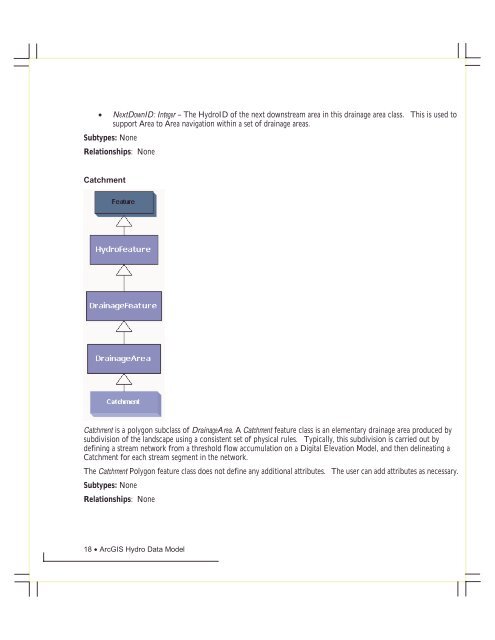
• NextDownID: Integer – The <strong>Hydro</strong>ID of the next downstream area in this drainage area class. This is used tosupport Area to Area navigation within a set of drainage areas.Subtypes: NoneRelationships: NoneCatchmentCatchment is a polygon subclass of DrainageArea. A Catchment feature class is an elementary drainage area produced bysubdivision of the landscape using a consistent set of physical rules. Typically, this subdivision is carried out bydefining a stream network from a threshold flow accumulation on a Digital Elevation <strong>Model</strong>, and then delineating aCatchment for each stream segment in the network.The Catchment Polygon feature class does not define any additional attributes. The user can add attributes as necessary.Subtypes: NoneRelationships: None18 • <strong>ArcGIS</strong> <strong>Hydro</strong> Data <strong>Model</strong>