ArcGIS Hydro Model Tutorial
ArcGIS Hydro Model Tutorial
ArcGIS Hydro Model Tutorial

Create successful ePaper yourself
Turn your PDF publications into a flip-book with our unique Google optimized e-Paper software.
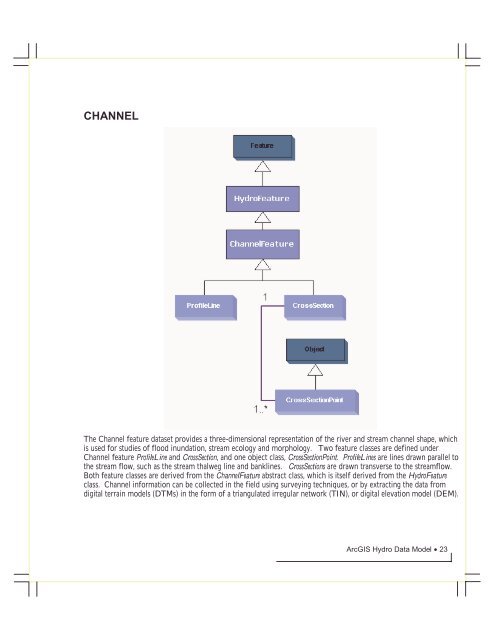
CHANNELThe Channel feature dataset provides a three-dimensional representation of the river and stream channel shape, whichis used for studies of flood inundation, stream ecology and morphology. Two feature classes are defined underChannel feature ProfileLine and CrossSection, and one object class, CrossSectionPoint. ProfileLines are lines drawn parallel tothe stream flow, such as the stream thalweg line and banklines. CrossSections are drawn transverse to the streamflow.Both feature classes are derived from the ChannelFeature abstract class, which is itself derived from the <strong>Hydro</strong>Featureclass. Channel information can be collected in the field using surveying techniques, or by extracting the data fromdigital terrain models (DTMs) in the form of a triangulated irregular network (TIN), or digital elevation model (DEM).<strong>ArcGIS</strong> <strong>Hydro</strong> Data <strong>Model</strong> • 23