A Rapid Assessment of Kili Island - Sea Grant College Program
A Rapid Assessment of Kili Island - Sea Grant College Program
A Rapid Assessment of Kili Island - Sea Grant College Program

You also want an ePaper? Increase the reach of your titles
YUMPU automatically turns print PDFs into web optimized ePapers that Google loves.
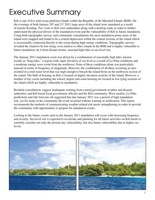
Executive Summary<strong>Kili</strong> is one <strong>of</strong> five mid-ocean platform islands within the Republic <strong>of</strong> the Marshall <strong>Island</strong>s (RMI). Onthe evenings <strong>of</strong> both January 20 th and 21 st 2011 large areas <strong>of</strong> the island were inundated as a result<strong>of</strong> marine flooding. Two visits to <strong>Kili</strong> were undertaken along with a desktop study in order to furtherunderstand the physical drivers <strong>of</strong> the inundation event and the vulnerability <strong>of</strong> <strong>Kili</strong> to future inundation.Using both topographic surveys and community consultations the most inundation prone areas <strong>of</strong> theisland were mapped and found to be a central depression within the central sections <strong>of</strong> the island whichis occasionally connected directly to the ocean during high energy conditions. Topographic surveysrevealed the island to be low-lying, even relative to other islands in the RMI and is highly vulnerable t<strong>of</strong>uture inundation, be it from distant storms, seasonal high tides or sea-level rise.The January 2011 inundation event was driven by a combination <strong>of</strong> seasonally high tides, knownlocally as “king tides,” a region-wide super elevation <strong>of</strong> sea level as a result <strong>of</strong> La Niña conditions anda moderate energy wave event from the northwest. None <strong>of</strong> these conditions alone was particularlyunusual in terms <strong>of</strong> frequency or magnitude. However, the combination <strong>of</strong> all three occurring at onceresulted in a total water level that was high enough to breach the island berm on the northwest section <strong>of</strong>the island. The bulk <strong>of</strong> housing on <strong>Kili</strong> is located on higher elevation sections <strong>of</strong> the island. However, anumber <strong>of</strong> key assets including the school, airport and some housing are located in low-lying sections <strong>of</strong>the island which are highly vulnerable to inundation.Resident consultations suggest inadequate warning from central government weather and disasterauthorities and <strong>Kili</strong>-based local government <strong>of</strong>ficials and the <strong>Kili</strong> community. Wave models, La Niñapredictions and tide forecasts all suggested that late January 2011 was a period <strong>of</strong> high inundationrisk, yet for many in the community the event occurred without warning or notification. This reportrecommends the methods <strong>of</strong> communicating weather related risk needs strengthening in order to providethe community with opportunities to prepare for inundation events.Looking to the future, events such as the January 2011 inundation will occur with increasing frequencyand severity. <strong>Sea</strong>-level rise is expected to accelerate and planning for all future activities on <strong>Kili</strong> needs tocarefully consider not only the present day vulnerability, but also future vulnerability due to higher sealevels.i