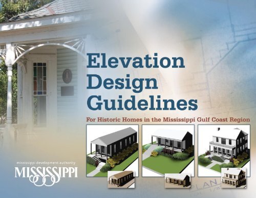
Elevation Design Guidelines - State of New Jersey
Elevation Design Guidelines - State of New Jersey
Elevation Design Guidelines - State of New Jersey
- No tags were found...

Create successful ePaper yourself
Turn your PDF publications into a flip-book with our unique Google optimized e-Paper software.
Table <strong>of</strong> Contents1. Introduction.......................................................1Hurricane Katrina and Historic Properties in Coastal Mississippi....... 1MDA Financial Assistance Programs................................................... 2Relationship <strong>of</strong> MDA Financial Assistance Programs toSection 106 <strong>of</strong> the National Historic Preservation Act....................... 2Purpose <strong>of</strong> <strong>Elevation</strong> <strong>Design</strong> <strong>Guidelines</strong> ............................................ 3Roles and Responsibilities................................................................... 4<strong>Elevation</strong> Action Alternatives.............................................................. 5<strong>Elevation</strong> <strong>Design</strong> Review Process....................................................... 5Working with an <strong>Elevation</strong> <strong>Design</strong> Consultant .................................. 6How to Complete a Successful <strong>Elevation</strong> Project............................... 6Organization and Use <strong>of</strong> these <strong>Elevation</strong> <strong>Design</strong> <strong>Guidelines</strong> ............ 72. Site <strong>Design</strong> <strong>Guidelines</strong>.....................................8Site <strong>Elevation</strong> and Topography........................................................... 9Parcel Configuration and Access........................................................ 9Building Footprint and Orientation................................................... 10Adjoining Property Considerations .................................................. 11Parking and Circulation .................................................................... 13Landscape Elements......................................................................... 13Site <strong>Design</strong> <strong>Guidelines</strong> – Specific Recommendations...................... 143. Architectural <strong>Design</strong> <strong>Guidelines</strong>..................15Neighborhood Context – Urban <strong>Design</strong>............................................ 15Exploring and Evaluating <strong>Elevation</strong> Alternatives............................. 16Historic Building Types and Architectural Character ....................... 18Composition and Scale..................................................................... 19<strong>Elevation</strong> and Existing Façades – <strong>Design</strong> Considerations................ 20<strong>Elevation</strong> and <strong>New</strong> Foundations – Screening andScale Minimization Considerations................................................... 21Architectural <strong>Design</strong> <strong>Guidelines</strong> – Specific Recommendations........ 244. Foundation <strong>Design</strong> <strong>Guidelines</strong>.....................29Foundation <strong>Design</strong>............................................................................ 29<strong>Elevation</strong> Requirements.................................................................... 31Relationship <strong>of</strong> Foundation <strong>Design</strong> to Architectural<strong>Design</strong> and Historic Preservation..................................................... 34Foundation Screening Systems........................................................ 35Permit Requirements ....................................................................... 365. <strong>Elevation</strong> <strong>Design</strong> – Next Steps......................38<strong>Design</strong> and Construction Guidance.................................................. 38Project Coordination.......................................................................... 39<strong>Elevation</strong> Approaches – Illustrated Alternatives............................... 39<strong>Elevation</strong> Decision Factors................................................................ 396. Resources and Publications..........................44National Reference Information and Publications............................ 44<strong>State</strong> Reference Information and Publications................................. 46Local Reference Information and Publications................................. 47Coastal Mississippi Historic Building Types andImportant Architectural Features...................................................... 48Local Historic Preservation Review Processes, Analyses <strong>of</strong> ResourcesWithin Boundaries <strong>of</strong> Locally <strong>Design</strong>ated Historic Districts, andDamage Caused by Hurricane Katrina by Jurisdiction...................... 55Hancock County................................................................................ 55Harrison County................................................................................ 60Jackson County................................................................................. 88Pearl River County.......................................................................... 108Glossary <strong>of</strong> Terms............................................................................ 112Mississippi Development Authority ELEVATION DESIGN GUIDELINESi
The Mississippi Development Authority (MDA) has prepared these<strong>Elevation</strong> <strong>Design</strong> <strong>Guidelines</strong> in collaboration with the MississippiDepartment <strong>of</strong> Archives and History, and historic preservationcommissions representing historic preservation interests inCoastal Mississippi. In addition, MDA invited participation by localbuilding <strong>of</strong>ficials and planning and zoning representatives so thatthe <strong>Guidelines</strong> accurately reflect the process for owners <strong>of</strong> historicresidential properties to access grant and forgivable loan moniesthat have been made available by U.S. Department <strong>of</strong> Housing andUrban Development (HUD). MDA expressly thanks those who haveactively participated in this important process to help preserve theunique character <strong>of</strong> our Mississippi coastal communities.
owners, this principle is <strong>of</strong> utmost importance. These<strong>Guidelines</strong> have been developed to ensure that bothindividual historic buildings, and historic buildings withinhistoric districts, are preserved for future generations.The purpose <strong>of</strong> this design manual is to providerecommended elevation design guidance for therehabilitation <strong>of</strong> historic buildings funded through MDAprograms. The goal <strong>of</strong> this effort is to reduce risk fromfuture flood events through elevation, and to preservethe physical integrity and character <strong>of</strong> historic buildings.Specifically, one <strong>of</strong> the most important outcomes <strong>of</strong> thiseffort is to limit the total height <strong>of</strong> elevation for historicbuildings so they maintain their historic character inrelation to other historic buildings within each local historicdistrict, thus protecting the architectural qualities <strong>of</strong> eachhistoric district as a whole.MDA FinancialAssistance ProgramsTo assist in the rebuilding process, the <strong>State</strong> <strong>of</strong>Mississippi has received funding through the CommunityDevelopment Block Grant (CDBG) Program <strong>of</strong> the U.S.Department <strong>of</strong> Housing and Community Development.These funds are administered by the MDA, based inJackson, Mississippi. This funding, in the form <strong>of</strong> grantsand forgivable loans, is available to homeowners andother applicants whose properties in Hancock, Harrison,Jackson, and Pearl River Counties were damaged byHurricane Katrina. Financial assistance is being providedfor principal residence and rental property improvementsthat meet MDA’s program requirements.The two MDA programs that provide the basis for these<strong>Elevation</strong> <strong>Design</strong> <strong>Guidelines</strong> are:Homeowner <strong>Elevation</strong> Grant Program (EGP).MDA will provide up to $30,000 in grant assistance tohomeowners whose homes were subjected to flooddamage as a result <strong>of</strong> Hurricane Katrina to defray thecost to elevate their single-family residences. Threetypes <strong>of</strong> activities are allowed under this program: 1)elevation <strong>of</strong> an existing single-family residential structureor reconstruction <strong>of</strong> the existing residential building onthe same building “footprint”; 2) elevation <strong>of</strong> an existingsingle-family residential building or reconstruction <strong>of</strong> theexisting residential building on an expanded or changed“footprint”; and 3) replacement <strong>of</strong> an existing singlefamilyresidence with a newly constructed and elevatedresidence on an existing parcel at another location.Small Rental Assistance Program (SRAP). Becauseover 70,000 affordable rental housing units were lost asthe result <strong>of</strong> Hurricane Katrina, the <strong>State</strong> <strong>of</strong> Mississippiinitiated SRAP to provide financial incentives to owners <strong>of</strong>property containing between one and four rental units torepair or rebuild. The maximum award under this programis $30,000 per unit. The purpose <strong>of</strong> SRAP is to provideforgivable loans to owners <strong>of</strong> small rental propertiesthat were either substantially damaged or destroyed byHurricane Katrina, so that these small-scale units canagain serve as affordable rental housing. Applicants mayseek funding under one <strong>of</strong> four program options: 1) rentalincome subsidy assistance; 2) repair or reconstructionreimbursement <strong>of</strong> Hurricane Katrina-damaged property; 3)reconstruction or conversion reimbursement for existingproperty to rental property; and 4) new constructionreimbursement.Relationship <strong>of</strong> MDA FinancialAssistance Programs toSection 106 <strong>of</strong> the NationalHistoric Preservation ActBecause MDA’s financial assistance programs use Federalfunding provided through the U.S. Department <strong>of</strong> Housingand Urban Development (HUD), MDA must comply witha variety <strong>of</strong> environmental and historic preservation lawsand regulations. The most important historic preservationregulation is outlined in Section 106 <strong>of</strong> the NationalHistoric Preservation Act <strong>of</strong> 1966 (NHPA). Under thisregulatory review program, administering agencies mustdetermine whether proposed projects have the potentialto affect historic properties. Each MDA funding applicationis reviewed to determine whether historic properties—defined as buildings, structures, historic districts, objects,and archaeological sites listed, or eligible for listing, inthe National Register <strong>of</strong> Historic Places—will be affectedthrough use <strong>of</strong> HUD funding.MDA has retained URS Corporation (URS) to assist withall required environmental and historic preservationreview associated with applications funded under the EGPand SRAP programs. URS employs trained architecturalhistorians and archaeologists to survey and evaluatepotentially historic properties, and to determine theeffect <strong>of</strong> planned elevation and rehabilitation projects. Toqualify for funding, applicants whose historic buildings arelocated within the boundaries <strong>of</strong> locally designated historicdistricts, and individually significant historic buildingsoutside such districts, must closely coordinate theirelevation and rehabilitation plans with appropriate HistoricPreservation Commissions (HPCs) and the <strong>State</strong> HistoricPreservation Office (SHPO).In order for applicants whose projects involve historicbuildings to achieve a No Adverse Effect determination2 Section 1: INTRODUCTION Mississippi Development Authority ELEVATION DESIGN GUIDELINES
(refer to Section 6, Resources and Publications) under theSection 106 consultation process for their projects, theyare required under the Programmatic Agreement (PA)described below to develop individual elevation designplans. The use <strong>of</strong> the Secretary <strong>of</strong> the Interior’s Standardsfor Rehabilitation (see Standards for Rehabilitation,Section 6, Resources and Publications) is generallyconsidered good preservation practice, and the Standardsfor Rehabilitation must be incorporated into individualelevation design and rehabilitation plans.Programmatic Agreement (PA). In January 2008,the MDA, the SHPO, the Advisory Council on HistoricPreservation, other local governments in CoastalMississippi, and the Mississippi Band <strong>of</strong> Choctaw Indiansdeveloped and signed a special agreement called a PA,with which the National Trust for Historic Preservation andthe Choctaw Nation <strong>of</strong> Oklahoma also concurred. Because<strong>of</strong> the size and scale <strong>of</strong> the two MDA financial assistanceprograms, their implementation over the course <strong>of</strong> anumber <strong>of</strong> years, and the range <strong>of</strong> effects that could notbe precisely identified at the outset <strong>of</strong> the program, thisagreement document was developed to record the termsand conditions agreed upon to resolve potential adverseeffects on multiple historic properties. In essence, thisPA functions as a blueprint to help guide Federal and<strong>State</strong> agencies, local governments, and other signatoriesin working together to protecting historic preservationinterests while rebuilding.A key component <strong>of</strong> this agreement called upon MDA torequest a program modification from HUD that wouldallow MDA to negotiate with the SHPO on the elevationheight <strong>of</strong> historic buildings. This variance granted owners<strong>of</strong> historic properties, especially those in historic districts,the ability to elevate homes to a level lower than thestandard Advisory Base Flood <strong>Elevation</strong> level (ABFE; referto Section 4, Foundation <strong>Design</strong> <strong>Guidelines</strong>, and Section6, Resources and Publications). This modification ensuresthe characteristics <strong>of</strong> individual historic homes andconcentrations <strong>of</strong> historic residences within local historicdistricts are preserved and that these building continue tobe recognized as historic properties.An important aspect <strong>of</strong> the PA is the integration <strong>of</strong>existing local HPCs into the elevation and rehabilitationdesign review process for historic buildings. Becausethese commissions know the historic buildings in theircommunities extremely well, they are able to <strong>of</strong>ferpositive, constructive advice to applicants who will besubmitting individual property elevation design plansfor local review. Another key component <strong>of</strong> the PA is theprovision <strong>of</strong> funding to the SHPO to hire new preservationpr<strong>of</strong>essionals, including an historic architect, who will workwith MDA to provide general advice to applicants in theearly phases <strong>of</strong> the elevation design process.Purpose <strong>of</strong> <strong>Elevation</strong><strong>Design</strong> <strong>Guidelines</strong>Generally, architectural design guidelines are createdby communities concerned with the appearance <strong>of</strong> theirbuildings as well as how their appearance contributesto economic health and civic pride. Throughout theUnited <strong>State</strong>s, over 2,200 cities, towns, and countieshave adopted design guidelines as part <strong>of</strong> their historicpreservation efforts. Such guidelines are developed toenhance the quality <strong>of</strong> buildings, landscapes, and publicspaces and to protect these resources for the public good.These <strong>Elevation</strong> <strong>Design</strong> <strong>Guidelines</strong> have been developedby MDA to ensure that the EGP and SRAP programsare implemented in the most architecturally sensitivemanner possible. Their goal is to achieve a balancing<strong>of</strong> two very different public policy goals—risk reductionthrough more modest elevation than required for modernbuildings or new construction, and protection andThese <strong>Guidelines</strong> illustrate principles to help preservethe historic elements <strong>of</strong> homes located in historicdistricts. Shown here is a Pascagoula streetscape.enhancement <strong>of</strong> existing historic buildings and historicdistricts. Based upon the historic preservation and floodprotection requirements established respectively by theU.S. Department <strong>of</strong> Interior and the Federal EmergencyManagement Agency (FEMA), these <strong>Elevation</strong> <strong>Design</strong><strong>Guidelines</strong> are intended to inform program applicantsand local HPCs <strong>of</strong> the process to best ensure MDArequirements are met. The <strong>Guidelines</strong> represent aframework in which a range <strong>of</strong> potential elevation actions,each with a range <strong>of</strong> planning considerations, includingneighborhood context, treatment <strong>of</strong> elevation and historicfabric interface, and vacant parcels, may be evaluatedto produce the best, individualized approach for a givenhistoric building and historic district.The information contained in these <strong>Guidelines</strong> ispresented for the applicant’s use in planning changesto historic buildings within a historic district, or to anindividual historic building outside the boundaries <strong>of</strong> thesedistricts. Building upon nationally recognized historicpreservation principles described in the Standards forRehabilitation (see Section 6, Resources and Publications),these <strong>Guidelines</strong> have been designed to assist andremind members <strong>of</strong> local HPCs and the SHPO <strong>of</strong> the issuesthey should consider when reviewing an MDA-assistedproject. Because the architectural character may beMississippi Development Authority ELEVATION DESIGN GUIDELINESSection 1: INTRODUCTION3
<strong>Guidelines</strong> will facilitate necessary approvals and efficientprocessing <strong>of</strong> the elevation grant application.Early coordination with the SHPO, local <strong>of</strong>ficials, anddesign consultants will provide crucial site planning,architectural, and engineering assistance and informationfor use in developing the elevation proposal. If a propertyis in a jurisdiction with an HPC, the elevation plans will bereferred to the local HPC for review and approval uponsubmission to the local building permit <strong>of</strong>fice. If there isno local HPC, property owners should concurrently submitelevation plans to the local building permit <strong>of</strong>fice and toMDA for transmittal to the SHPO.Following a successful historic review, the building permit<strong>of</strong>fice will issue a building construction permit. The MDAgrant award occurs following the issuance <strong>of</strong> a buildingpermit for the elevation project.Detailed information about the historic preservationreview process, and about the local application and permitprocess, is located in a separate Applicant Guide.Working with an <strong>Elevation</strong><strong>Design</strong> ConsultantOwners <strong>of</strong> historic residential properties are making animportant decision when they proceed with plans forelevating their homes. As they move forward with theirgrant application, pr<strong>of</strong>essional planning, design, andengineering advice is crucial. MDA can provide initialguidance to assist applicants in the application processthrough grant award. Applicants should also consider theservices <strong>of</strong> pr<strong>of</strong>essional building elevation consultants whocan prepare elevation design plans and provide supportthrough the building permit and historic preservationreviews and during the elevation construction process. Asdescribed in Sections 2–4 <strong>of</strong> these <strong>Guidelines</strong>, key aspects<strong>of</strong> preparing building elevation plans include:• Historic status determination• Flood zones and elevation requirements• MDA programmatic requirements• Parcel topography• Boundary and setback delineation• Adjoining use assessments• Site circulation and access alternatives• Architectural design elements• Structural and foundation design elements• <strong>Elevation</strong> mitigation and screening approachesIn order to provide sufficient design information for localbuilding permit submissions and reviews, applicants mustbe able to prepare elevation design plans. By working withMDA and building elevation design consultants, applicantscan benefit from the experience these pr<strong>of</strong>essionals havewith similar projects, submission requirements, and reviewprocedures.How to Complete a Successful<strong>Elevation</strong> ProjectMDA realizes that grant recipients are anxious to completethe repair and rehabilitation <strong>of</strong> their homes and rentalproperties so they can move forward with their lives.One <strong>of</strong> the primary purposes <strong>of</strong> the <strong>Elevation</strong> <strong>Design</strong><strong>Guidelines</strong> is to facilitate the decision-making process tosuccessfully complete the required historic preservationreview, allowing elevation projects to be funded in amanner that achieves both risk reduction and preservation<strong>of</strong> irreplaceable historic buildings and districts.There are a few ground rules that the applicant mustfollow to receive funding for their project. Unlike otherfinancial assistance programs administered by MDA, theEGP and SRAP programs provide funding through a series<strong>of</strong> disbursements. As described below, the applicantmust submit specified documents to receive payments atproject milestones.Rule #1. Address All HistoricPreservation Review RequirementsAll Historic PropertiesIn order to protect the physical integrity <strong>of</strong> an historichouse or rental unit and ensure that it will continue tomaintain the characteristics for which it was designated ashistoric, the applicant(s) must have their project reviewedand approved by the SHPO. The SHPO’s final approval willbe issued once the following actions are verified:• The applicant’s participation in a Pre-design Meetingwith SHPO staff in which key elements from the<strong>Elevation</strong> <strong>Design</strong> <strong>Guidelines</strong> and Standards forRehabilitation are identified, for integration into yournew individual design plan• Submission <strong>of</strong> the applicant’s Final <strong>Elevation</strong> <strong>Design</strong>Plan, for review and approval by the SHPO prior toapplication for local building and development review• Submission <strong>of</strong> a Written Commitment by theapplicant to the SHPO agreeing to comply with theplans as approvedBased on review <strong>of</strong> this information, the SHPO will issue afinal determination <strong>of</strong> No Adverse Effect, which concludesthe Section 106 historic preservation review process. TheSHPO’s No Adverse Effect finding will be provided to MDAand the applicant in a letter, which will also state thatelevation <strong>of</strong> the building will not preclude the building’scontinued designation as a historic building.Prior to construction, the applicant must also submita copy <strong>of</strong> the building permit and the FEMA <strong>Elevation</strong>Certificate to the SHPO for its review.6 Section 1: INTRODUCTION Mississippi Development Authority ELEVATION DESIGN GUIDELINES
Once construction is complete, the applicant must submita copy <strong>of</strong> the Occupancy Permit and the final FEMA<strong>Elevation</strong> Certificate to the SHPO.Organization and Use <strong>of</strong> these <strong>Elevation</strong> <strong>Design</strong> <strong>Guidelines</strong>Historic Properties Also Located WithinLocal Historic DistrictsIn addition to the review process described above, owners<strong>of</strong> property in a local historic district must have theirproject reviewed and approved by the local HPC. Based onthe individual elevation plan for an historic building, theCommission will issue a Certificate <strong>of</strong> Appropriateness tothe applicant and local building department as verificationthat the elevation project complies with these <strong>Elevation</strong><strong>Design</strong> <strong>Guidelines</strong> and the Standards for Rehabilitation, aswell as local historic district guidelines.After the applicant has submitted an individual elevationplan and the local HPC has issued a Certificate <strong>of</strong>Appropriateness, the applicant must submit a copy <strong>of</strong> thecertificate to the SHPO.Rule #2. Adhere to MDA Grant RequirementsAccording to MDA requirements, grant funding will bedisbursed in two equal payments:First Payment: Half the awarded grant funds will be paidupon the applicant submitting a building permit and acopy <strong>of</strong> a FEMA <strong>Elevation</strong> Certificate certified by a licensedengineer or surveyor to MDA.Second Payment: The remaining grant funds will bepaid upon completion <strong>of</strong> the construction project when theapplicant submits an Occupancy Permit to MDA.Within these <strong>Guidelines</strong> are five main report sectionsand a final section <strong>of</strong> reference materials and aglossary <strong>of</strong> terms. MDA’s intent is to provide essentialinformation for the property owner to use to develop anindividualized elevation design project that addressesthe broad principles outlined in the <strong>Guidelines</strong> and inthe Standards for Rehabilitation.In addition to Section 1, Introduction, this document isorganized around the following topic areas:Section 2: Site <strong>Design</strong> <strong>Guidelines</strong>: Providesinformation about the site on which the historicbuilding is located.Section 3: Architectural <strong>Design</strong> <strong>Guidelines</strong>:Discusses considerations regarding neighborhoodurban design context, evaluating elevationalternatives, historic building types andarchitectural features, data needed for designingelevation plans and evaluating their effects on thehistoric building, and goals for new screening andscale minimization.Section 4: Foundation <strong>Design</strong> <strong>Guidelines</strong>:Identifies engineering factors for designing newfoundations for elevated buildings and includesdetailed illustrated approaches to foundationscreening.Section 5: <strong>Elevation</strong> <strong>Design</strong> – Next Steps:Summarizes the process for designing a newelevation plan and illustrates elevation approachesfor some <strong>of</strong> the most common historic buildings onthe coast.Section 6: Resources and Publications: IncludesNational and <strong>State</strong> reference materials for use indesigning an elevation plan and identifies the status<strong>of</strong> historic districts and locally designated landmarkswithin each jurisdiction. Pre-Katrina and post-Katrinaaerial views, a detailed current map <strong>of</strong> each historicdistrict, and information about local HPCs are alsoincluded.To accompany these <strong>Guidelines</strong>, MDA has also producedtwo related tools—an Applicant Guide and a HistoricPreservation Commission Guide. These will be madeavailable to applicants, local HPCs, and the SHPO in bothelectronic and hard copy form, along with copies <strong>of</strong> the<strong>Elevation</strong> <strong>Design</strong> <strong>Guidelines</strong>.Users <strong>of</strong> these <strong>Elevation</strong> <strong>Design</strong> <strong>Guidelines</strong> are stronglyencouraged to read the document completely, and notsimply selected sections. Although certain portions <strong>of</strong> thisguide may contain information pertaining to a specificissue, all sections contain essential information that theuser should become familiar with. As noted previously, theMDA encourages funding applicants to seek the services<strong>of</strong> a design pr<strong>of</strong>essional (refer to the Applicant Guide) whocan assist in developing customized elevation plans.Mississippi Development Authority ELEVATION DESIGN GUIDELINESSection 1: INTRODUCTION7
Site <strong>Design</strong><strong>Guidelines</strong>The overall character <strong>of</strong> an historic district is definednot only by individual historic buildings, but also by sitefeatures and plantings. Historic districts include importantnon-architectural features that form spaces, includingtopography, setback and the orientation <strong>of</strong> buildings,vistas and views, and plantings, such as hedges,foundation plantings, lawns, gardens, and tree canopies;features that define circulation, such as walkways, streets,driveways, and parking areas; and features that articulateor develop a site, such as accessory buildings, fences,walls, lighting, swales, fountains, sculptures, arbors, andplanters.Landscaping and plantings play a significant role increating the character <strong>of</strong> the historic districts in CoastalMississippi, and also reflect the regional climate. Maturegardens, grassy lawns, shrubs, climbing vines, ornamentaltrees, and tree canopies are typical <strong>of</strong> residential historicdistricts. Elements such as mature trees, judiciouslyplaced, and foundation plantings s<strong>of</strong>ten the interfacebetween raised first floors and the ground level.Sinclair Cottage, Ocean Springs, Mississippi.Photograph from the Detroit Publishing Company, 1880-1920, Library<strong>of</strong> Congress Prints and Photographs Division, Washington, D.C.Adjoining property considerations—type, scale,location, and pattern <strong>of</strong> block create neighborhoodcharacter.8 Mississippi Development Authority ELEVATION DESIGN GUIDELINES
Site <strong>Elevation</strong> and TopographyDetermining the appropriate height to which an historicresidence should be raised begins with establishing thesite elevations associated with the existing property. Apr<strong>of</strong>essionally produced property survey <strong>of</strong> the parcel,including a finished floor elevation for the residence, willprovide initial data for the elevation design plans.To prepare aKEY PRESERVATION GOALS:customized• Limit elevation to, or under,elevationABFE.design plan, the • Match existing topographyapplicant must wherever possible.first determinethe existing elevation level <strong>of</strong> the historic home, and thensecure information from the local building departmentregarding the recommended elevation level. FEMA floodelevation data and requirements, as well as local buildingcodes, will specify the height to which the first floor <strong>of</strong>a new structure in the vicinity should be raised. Thenew elevations established for each locale through theAdvisory Base Flood <strong>Elevation</strong>s (ABFE) and preliminarydigital Flood Insurance Rate Maps (dFIRMS) should alsobe referenced as required by MDA. These new elevationstandards are considered by local and Federal authoritiesto limit impacts from future flood events. The propertyowner should then consult with the local HPC and buildingpermit <strong>of</strong>fices to set an appropriate strategy for the newelevation proposal.Topographic conditions within local historic district parcelswill generally feature level terrain with limited slopes. Thisbaseline terrain condition <strong>of</strong> parcels within historic districtsin Coastal Mississippi suggests a consistent approach isneeded to establish the heights <strong>of</strong> related elevation designprojects. Local HPCs and the SHPO will consider thisconsistency in their review <strong>of</strong> individual elevation plans.Parcel Configurationand AccessPlanning an elevation design project requires athorough understanding <strong>of</strong> the historic property’s parcelconfiguration, boundaries, setbacks, and access. Parcelsize and configuration determine the flexibility <strong>of</strong> anelevation design project and its ability to accommodateany proposed site feature improvements and mitigate thevisual impacts <strong>of</strong> the elevated structure on surroundinghistoric buildings. Parcels with limited area and widthwill present greater design challenges than larger siteswith ample front and side yard conditions and setbacks.Existing access to the parcel from both street andsidewalk should be evaluated for any elevation changethat warrants new site circulation features. Specialconsideration should also be given to the relationship <strong>of</strong>the parcel to adjoining properties, especially if they arehistoric.In developinga customizedelevation designplan, the parcelowner shouldthink about thefollowing:Parcel LayoutKEY PRESERVATION GOALS:• Limit changes to parcellayout and access.• Be sensitive to, andmaintain the relationshipto adjacent properties inhistoric districts wherepossible.• Is sufficient space available within the parcel for newor expanded stairs? Elevating a residence requiresconstruction <strong>of</strong> additional steps, and generally adds11 inches to the length <strong>of</strong> stairs for each 7-inchincrease in height.Example <strong>of</strong> limited setbackExample <strong>of</strong> average setbackExample <strong>of</strong> ample setbackMississippi Development Authority ELEVATION DESIGN GUIDELINESSection 2: SITE DESIGN GUIDELINES9
On parcelsKEY PRESERVATION GOAL:with limited• Ensure that improvementsspace betweenare consistent with theresidences, any visual character <strong>of</strong> historicdistricts.change in theelevation <strong>of</strong> onestructure affects the visual setting <strong>of</strong> another. Becausethe relative heights and proximity <strong>of</strong> existing structuresestablish the visual character <strong>of</strong> an historic district,elevation design proposals must carefully consider theheights and massing <strong>of</strong> adjoining structures.RIGHT: Street-levelview <strong>of</strong> streetscapeshowing consistentelevation level.BELOW: Aerialview <strong>of</strong> streetscapeat modest elevationlevel.12 Section 2: SITE DESIGN GUIDELINES Mississippi Development Authority ELEVATION DESIGN GUIDELINES
Proposals for new side yard elevation design features,such as stairs or other circulation elements, introduce newvisual and functional features between parcels. Potentialimpacts from these features must be evaluated to ensuredesign proposals complement the architectural setting <strong>of</strong>both the applicant property and adjoining uses.Parking and CirculationLandscape ElementsComplementing the historic character <strong>of</strong> residentialdistricts, landscape elements provide important visualscreening functions and outdoor space defining amenities.As a result <strong>of</strong> Hurricane Katrina, the number <strong>of</strong> thesehistoric landscape elements has been significantlyreduced. Effective elevation design plans replace theseA large area within each parcel is <strong>of</strong>ten dedicated tovehicular parking and circulation needs. In preparing anelevation design plan, present and proposed drivewayand parking requirements must be considered. Toaccommodate new architectural and landscape screening,alternatives to existing driveway and parking layouts maybe appropriate. Many historic parcels in Coastal Mississippifeature driveways with side yard alignments in closeproximity to the building. Depending upon the extent<strong>of</strong> elevation proposed and existing side-yard depth, anapplicant may find that the configuration <strong>of</strong> an existingdriveway and parking may be affected.Whether a limitedKEY PRESERVATION GOAL:or significant• Minimize changes toelevation change parking and circulationis proposedthat affect historic setting.for an historicproperty, the existing circulation features may requirereconfiguration to provide improved entrance stairsystems, terrain modification, or landscape screening.Should the elevation design include a new unoccupiedsub-storey, the applicant should evaluate measures tomitigate the potentially significant visual and historicimpacts associated with an increase in the first floorelevation. Architectural design alternatives are discussedin Section 3, Architectural <strong>Design</strong> <strong>Guidelines</strong>. Any substoreyuses will be subject to local building codes andhistoric preservation reviews.Driveways and parking areas can have significantinfluence on the appropriate elevation option.Landscape screening strategies provide visualbuffers and scale transitions for an elevated home.Foundation plantings should be scaled to the height <strong>of</strong>the new base elevation.Mississippi Development Authority ELEVATION DESIGN GUIDELINESSection 2: SITE DESIGN GUIDELINES13
elements withKEY PRESERVATION GOAL:similar landscape• Use indigenous landscapefeaturesplantings to minimize theindigenous tovisual impacts <strong>of</strong> elevation.Coastal Mississippito minimize the <strong>of</strong>ten-jarring nature <strong>of</strong> a new foundationsystem and an elevated historic building. When situatedin areas adjoining foundations and sub-storey facades,landscape plantings can provide effective scale transitionsbetween the ground plane and an elevated frontage <strong>of</strong>new sub-storey walls.Site <strong>Design</strong> <strong>Guidelines</strong> – Specific RecommendationsThe following recommendations support preservationgoals and should be incorporated, whenever possible, intocustomized elevation plans:• Retain and preserve building and landscape featuresthat contribute to the overall historic character <strong>of</strong>the individual building and/or the historic district,including trees, gardens, yards, arbors, ground cover,fences, foundations, and significant vistas and views.Landscape screening should complement the architecturalelements <strong>of</strong> the residence and represent part <strong>of</strong> an overallstrategy for mitigating the effects <strong>of</strong> elevated structures.In many cases, a well-planned landscape pattern <strong>of</strong>shrubs and small trees within the structure’s foundationperimeter zone can complement or replace architecturalbreakout panels for sub-storey screening.Landscape plantings near the new base or sub-storey <strong>of</strong>an historic residence <strong>of</strong>fer one <strong>of</strong> the most cost-effectivemeans to mitigate the visual impacts <strong>of</strong> elevating thehistoric structure. Specific approaches for landscapescreening are provided in Section 3, Architectural <strong>Design</strong><strong>Guidelines</strong>.• Retain and preserve the historic relationship betweenbuildings and landscape features <strong>of</strong> the districtsetting, including site topography, retaining walls,foundation plantings, hedges, streets, walkways, anddriveways.• Protect and maintain historic building materialsand plant features through appropriate routinemaintenance and repair <strong>of</strong> constructed elements andpruning and management <strong>of</strong> plantings.• Replace missing or deteriorated site features withnew features that are compatible with the character<strong>of</strong> the site and the historic district.• <strong>Design</strong> new construction or additions to protect largetrees or other significant site features, such as vistas.• Protect large trees and other significant site featuresfrom construction activities and from delayeddamage due to construction activities, such as loss<strong>of</strong> root area or compaction <strong>of</strong> soil by equipment.Avoiding compaction <strong>of</strong> the soil within the drip line <strong>of</strong>trees is critical to maintain the health <strong>of</strong> root systems.Protect large trees and preserve historic vistas.Library <strong>of</strong> Congress, Prints and Photographs Division, Historic AmericanBuildings Survey, Reproduction Number (HABS,ALA,49-MOBI,224-2)Actions that are inconsistent with establishedpreservation goals and should be avoided include:²²Within historic districts, altering the residentialcharacter <strong>of</strong> the district by significantly reducing theproportion <strong>of</strong> built area to open space on a given sitethrough new construction or additions²²Introducing contemporary equipment or incompatiblesite features, including mechanical units, in locationsthat compromise the historic character <strong>of</strong> the buildingor historic district. Such features should be locatedunobtrusively, to shield them from view.14 Section 2: SITE DESIGN GUIDELINES Mississippi Development Authority ELEVATION DESIGN GUIDELINES
Architectural<strong>Design</strong><strong>Guidelines</strong>As described in Section 1, Introduction, the NHPA Section106 historic review process for MDA-funded projectsrequires each applicant’s elevation design plan bereviewed by both local HPCs and the SHPO, or the SHPOindependently. Each plan will be evaluated based on theplan’s demonstrated understanding <strong>of</strong> neighborhood, site,and architectural conditions and features. This review willdetermine whether an applicant has provided effectivemitigation approaches that limit visual and materialimpacts on historic buildings and districts created by theflood hazard protection actions. The following architecturalguidelines should be addressed by each applicant indesigning their elevation design plan.Neighborhood Context –Urban <strong>Design</strong>Whether the applicant’s historic residential propertyis situated within an historic district or it stands withinthe context <strong>of</strong> another setting, it is part <strong>of</strong> a distinctenvironment <strong>of</strong> related uses. This setting reflects village,suburban, or rural conditions with a range <strong>of</strong> adjoininguses. Considering these settings through the perspectives<strong>of</strong> development and landscape character is an initial stepin the elevation design process.The arrangement <strong>of</strong> historic structures within theircommunity represents a distinct pattern <strong>of</strong> culturaldevelopment that should be valued and preserved. Withinthe Mississippi Coastal area, historic development patternsmay take the form <strong>of</strong> residential structures situatedtogether on modest lots, situated nearby within ampleparcels, or situated in isolation on several acres. Eachelevation design plan should reflect an understanding <strong>of</strong>the overall context <strong>of</strong> the neighborhood.Historic examples <strong>of</strong> context reveal neighboringhouses with different elevations. Shown here are 502and 504 Beach Boulevard in Bay St. Louis, destroyedin Hurricane Katrina.Hancock County Historical SocietyAs noted in Section 2, Site <strong>Design</strong> <strong>Guidelines</strong>, relativebuilding heights, setbacks from local streets, anddistances between homes are principal features thatcharacterize residential neighborhoods. These featuresand their landscape elements contribute to the character<strong>of</strong> each neighborhood setting. Applicants should identifyMississippi Development Authority ELEVATION DESIGN GUIDELINES15
Historic Building Types and Architectural CharacterA thorough understanding <strong>of</strong> historic building types andtheir related architectural character is fundamental toa successful elevation design project. Historic buildingsreflect longstanding traditions <strong>of</strong> residential design in theGulf Coast region and exhibit a vast array <strong>of</strong> architecturalreferences used in the development <strong>of</strong> the <strong>Elevation</strong><strong>Design</strong> <strong>Guidelines</strong>. The MDA elevation design program<strong>of</strong>fers a new opportunity to preserve and protect thesevaluable buildings by mitigating flood hazards.A wide range <strong>of</strong> residential building types comprise theGulf Coast historic districts and communities, and aredescribed in Section 6, Resources and Publications, underthe heading: Coastal Mississippi Historic Building Typesand Important Architectural Features. Applicants may alsobenefit from the information contained in A Pattern Bookfor Gulf Coast Neighborhoods, prepared by the MississippiRenewal Forum.Residential building types are distinguished by theirrelative size, form, height, ro<strong>of</strong> pattern, and principalexternal elements, such as porches, stairs, and chimneys.These massing characteristics can provide importantinsights for assessing the effects <strong>of</strong> elevating a home andmitigating these effects within the existing setting.A successful elevation design program <strong>of</strong>ten begins withan examination <strong>of</strong> elevation design plans for other historicproperties. Past elevations <strong>of</strong> local landmarks, such asBeauvoir, illustrate important techniques for first floorelevation, which can inform elevation designs for historichomes today. These <strong>Guidelines</strong> consider a range <strong>of</strong>architectural typologies and styles to provide insights forapplicants as they move forward with the elevation designunder MDA’s EGP or SRAP programs.Beauvoir, former home <strong>of</strong> Jefferson Davis.Library <strong>of</strong> Congress, Prints and Photographs Division, Historic AmericanBuildings Survey, Reproduction Number (HABS,MISS,24-BILX,2-4)A survey <strong>of</strong> local Gulf Coast historic resources identifiedfive principal residential building types to serve as a basisfor developing broad design guidelines for elevatingprototypical historic structures. These residential buildingtypes are representative <strong>of</strong> many other distinguishedresidential forms found within the region. These buildingtypes include:• Rectangular plan (gable-front)• Massed plan (side-gable)• l-shaped (gable-front-and-wing)• Pyramidal (complex ro<strong>of</strong>)• I-house-two-storey box (side gable)As models, the building types provide a sufficientrange <strong>of</strong> design features that can be included withinthe development <strong>of</strong> individual design plans. Applicantsshould consider relevant examples as they prepareelevation design proposals for their specific architecturalstyles. These examples provide a variety <strong>of</strong> architecturalelements, including the configuration <strong>of</strong> exteriorentrances, stairs, porches, windows, columns, and otherdetails, that can be applied to elevation design plans forspecific historic residential projects.Existing residentialKEY PRESERVATION GOAL:building type and• Identify architecturalmassing provide type and massingimportant guidancecharacteristics.• Examine successfulon the basic form elevations <strong>of</strong> similarand arrangement historic homes.<strong>of</strong> the vertical• Incorporate representativeand relevant designbuilding elements features into the elevationwithin the site and design plan to minimizevisual impacts.can inform thepotential first orderimpacts created by elevating a structure and introducingnew exterior elements. Two examples illustrate theserelationships:Example 1: The overall visual effect <strong>of</strong> raising aresidential structure by one floor level depends to a greatextent on its site context. Far greater negative visualeffects may result from changes to a one-storey home ona small lot than to a two-storey home on a larger parcel,due to the range <strong>of</strong> screening and scale transition actionsthat are possible on the larger site.Example 2: Adding new exterior stair and landingsystems to a home that already has a porch featurerepresents less visual impact than adding new stairelements to a home without a porch.18 Section 3: ARCHITECTURAL DESIGN GUIDELINES Mississippi Development Authority ELEVATION DESIGN GUIDELINES
Composition and ScaleThe essence <strong>of</strong> an historic home’s visual character isclosely tied to the composition and scale <strong>of</strong> its principalarchitectural features. One goal for a successful elevationdesign project is to minimize the effects <strong>of</strong> any elevationchange upon its visual character. Historic preservationreviews will focus on maintaining the proportions andrelationships <strong>of</strong> these original architectural features withinthe proposed new elevation setting.<strong>Elevation</strong> designplans shouldKEY PRESERVATION GOAL:• Minimize change to visualconsider existing character by maintainingarchitecturalproportions, relationships,and scale <strong>of</strong> architecturalcompositionfeatures.and scale <strong>of</strong>historic features.The composition and scale <strong>of</strong> existing elements, suchas multiple building levels, projecting wings, exteriorcolumns, and the arrangements <strong>of</strong> doors and windows,provide design references for the location <strong>of</strong> any newentrance features, stair systems, and other sub-storeyelements.The design <strong>of</strong> new elevated base conditions, whetherthey are open, enclosed, or screened through landscapeplantings, should reflect, wherever possible, existingcomposition and scale features. Existing façade elementsshould be integrated in the elevation design plan for thenew base or sub-storey levels by repeating, contrasting, orcomplementing.Composition and scale <strong>of</strong> features provide designreferences.Library <strong>of</strong> Congress, Prints and Photographs Division, Historic AmericanBuildings Survey, Reproduction Number (HABS,ALA,49-MOBI,224-2)Adjoining properties in Pascagoula illustrate thechallenges <strong>of</strong> contrasting elevations.The composition and scale <strong>of</strong> elevation designproposals should be consistently applied to adjoininghomes.Because the visual relationship between building featuresand the site may be changed by an elevation design plan,first evaluating the scale <strong>of</strong> existing features is important.<strong>Design</strong> efforts to manage the scale transition between thenew elevation and existing grade will require appropriatearchitectural and landscape treatments.Mississippi Development Authority ELEVATION DESIGN GUIDELINESSection 3: ARCHITECTURAL DESIGN GUIDELINES19
<strong>Elevation</strong> and Existing Façades – <strong>Design</strong> ConsiderationsAn evaluation <strong>of</strong> elevation options for the principal designelements <strong>of</strong> an historic home should include consideration<strong>of</strong> its most important feature, called the façade, andits entryway. The façade faces the street, and is <strong>of</strong>tenthe most-highly decorated <strong>of</strong> all building elevations.This featureestablishes theKEY PRESERVATION GOAL:purpose and • Use historic buildingplacement <strong>of</strong> all façade and entry featuresto develop new designother elementselements.within the frontbuilding face, and sets the stage for the design <strong>of</strong> eachadjoining façade.Most historic façades feature a prominent and centrallocation for the front entrance door, which may befurther defined by entrance steps, porches, and adjoiningwindows. Other defining features include the size, extent,symmetry, and character <strong>of</strong> façade treatments andornamentation. The elevation design plan should focusthese design elements to minimize visual impacts to thehistoric structure. <strong>New</strong> stairs and landings introduced tocompensate for elevation changes must complement thedesign <strong>of</strong> the existing front façade, which may alreadyinclude porch structures and related details.Porch structures and associated ro<strong>of</strong>, column, andbalustrade elements provide design references thatshould be incorporated in elevation design proposals.Placement <strong>of</strong> new foundation, base and sub-storeyelements should also coincide with existing verticalreferences to porch columns and other repeating façadeelements.Important façade elements set the stage for theplacement <strong>of</strong> all other elements.<strong>New</strong> sub-storey elements should coincide withexisting vertical references to columns.Structural supports take into account the location<strong>of</strong> prominent features and repeat vertical elements.Shown here is 116 Ballentine Street (demolished),circa 1880, Bay St Louis.Hancock County Historical Society<strong>Elevation</strong> changes need to complement existingfaçade, porches, and related details.20 Section 3: ARCHITECTURAL DESIGN GUIDELINES Mississippi Development Authority ELEVATION DESIGN GUIDELINES
Placement <strong>of</strong> new structural supports should accountfor the location <strong>of</strong> prominent external façade designelements and reflect or complement existing repeatingvertical elements on the façade, such as columns, posts,or other trim details. This approach promotes continuity<strong>of</strong> the historic design elements <strong>of</strong> the façade as they areexpressed through the new base treatments, therebyminimizing the visual impacts <strong>of</strong> the new elevation changeon the historic building as a whole.Other significant façade components, such aschimneys and major masonry features, require specialconsideration in an elevation design project. In orderto maintain their historic and functional attributes,these masonry elements require continued physicalconnections to established grade conditions within theproject site. Adapting major masonry features to addresselevation changes may shape the overall strategy <strong>of</strong> anelevation design project.<strong>Elevation</strong> and <strong>New</strong> Foundations – Screeningand Scale Minimization ConsiderationsAppropriate measures to reduce or eliminate adversevisual effects resulting from the elevation <strong>of</strong> an historicresidential structure will depend upon the extent <strong>of</strong> thenew elevation proposed and proportion <strong>of</strong> the new basearea. When establishing the proposed elevation, theapplicant and elevation design consultant should prepareplans that include appropriate screening and othertreatments for the elevated residence.The proposed screening approaches for an elevationdesign plan should focus on providing new visual buffersto the elevated area. Related design approaches mayalso focus on providing new shielding elements thatcreate a gradual transition for the space between theexisting ground level to the new first floor level. Theseapproaches can reduce the negative visual effects <strong>of</strong>elevating an historic property in a manner that maintainsor complements its character and setting.Significant façade components such as majormasonry features require special consideration.Landscape screening strategies can provide aneffective means to minimize the visual impacts<strong>of</strong> elevation.Existing façade features <strong>of</strong>fer direction to theelevation design project through architectural designreferences that can be repeated, contrasted, orcomplemented within the new base or sub-storeylevels. Both architectural and landscape screeningstrategies can provide effective means to minimizethe visual impacts to the historic residence.Small panel treatments can provide effectivescreening for limited elevation changes.Library <strong>of</strong> Congress, Prints and Photographs Division,Historic American Buildings Survey, ReproductionNumber (HABS, ALA, 49-MOBI, 224-3)For new base or sub-storey proposals,architectural screening approaches may take theform <strong>of</strong> open or enclosed panels <strong>of</strong> various sizes.These panels can be designed to cover the newlyelevated foundation areas. Small panel treatmentsmay include new lattice patterns or other designsfor projects with limited elevation changes.Mississippi Development Authority ELEVATION DESIGN GUIDELINESSection 3: ARCHITECTURAL DESIGN GUIDELINES21
To achieve scaleKEY PRESERVATION GOAL:minimization• Incorporate screeningassociated with and scale minimizationhigher elevation measures to mitigateelevation visual impacts.projects, severalapproachesare available to provide site transitions through botharchitectural and landscape treatments. The architecturalapproaches include new stair and landing designsthat complement existing porches and entrances. Thelandscape approaches include new foundation plantingareas that provide visual buffers for the new elevatedareas.Architectural screening for large areas conveysthe features <strong>of</strong> an existing façade within a newsub-storey zone.Architectural screening treatments for largerareas can be designed to convey features <strong>of</strong> theexisting façade within the new sub-storey zone.In each case, the panels must be designed asflow-through or breakaway structures that will notrestrict potential flood waters.<strong>Elevation</strong> design consultants can assist applicants indesigning alternative treatments and selecting one thatmost successfully minimizes adverse effects on thehistoric building while also reducing risk through somelevel <strong>of</strong> elevation. <strong>Elevation</strong> design plans that effectivelyincorporate screening and/or scale minimization measuresto complement the architectural character <strong>of</strong> the historicbuilding and historic district will generally be wellreceived by local and state historic preservation agencies,facilitating approval for MDA funding.22 Section 3: ARCHITECTURAL DESIGN GUIDELINES Mississippi Development Authority ELEVATION DESIGN GUIDELINES
<strong>Elevation</strong> and Screening Study (5 foot elevation)Gable Front (Rectangular Plan) Side Gable (Creole Cottage) Two-Storey Massed Plan (Neoclassic)Mississippi Development Authority ELEVATION DESIGN GUIDELINESSection 3: ARCHITECTURAL DESIGN GUIDELINES23
Architectural <strong>Design</strong> <strong>Guidelines</strong> – Specific Recommendations<strong>Elevation</strong> design plans involving NEWCONSTRUCTION should incorporate thefollowing design recommendations, asapplicable:Additions to Historic Buildings• Minimize the loss <strong>of</strong> historic fabric and ensure thatcharacter-defining features <strong>of</strong> the historic building arenot destroyed, damaged, or obscured.• Retain the overall character <strong>of</strong> the site, sitetopography, character-defining site features, trees,and significant district vistas and views.• Protect large trees and other significant site featuresfrom immediate and delayed construction damage.• Limit the size and scale <strong>of</strong> an addition to avoiddiminishing or visually overpowering the historicbuilding.• <strong>Design</strong> to be compatible with the historic building inmass, materials, color, and the relationship <strong>of</strong> solidsand voids to exterior walls, yet make the additiondiscernible from the original.Actions that are inconsistent with establishedpreservation goals and should be avoided include:²²Constructing an addition that detracts from theoverall historic character <strong>of</strong> the principal buildingand the site, or requires the removal <strong>of</strong> a significantelement or site feature.²²Constructing an addition that significantly changesthe proportion <strong>of</strong> built mass to open space on anindividual site.<strong>New</strong> Construction• Site new construction to be compatible with theoverall character <strong>of</strong> surrounding buildings and thehistoric district in terms <strong>of</strong> setback, orientation,spacing, and distance from adjacent buildings.• Preserve the overall character <strong>of</strong> the site, sitetopography, character-defining site features, trees,and significant vistas and views.• Protect large trees and other significant site featuresfrom immediate and delayed construction damage,such as loss <strong>of</strong> root area and compaction <strong>of</strong> the soilby heavy equipment.• <strong>Design</strong> the height, form, size, scale, massing,proportion, and ro<strong>of</strong> shape to be compatible with theoverall character <strong>of</strong> surrounding buildings and thehistoric district.• <strong>Design</strong> the proportion <strong>of</strong> the proposed new building’sfront façade to approximate the front façadeproportion <strong>of</strong> surrounding historic buildings.• <strong>Design</strong> the spacing, placement, scale, orientation,proportion, and size <strong>of</strong> window and door openingsto be compatible with the overall character <strong>of</strong>surrounding buildings and the historic district.• Select windows and doors with material, subdivision,proportion, pattern, and detail compatible with thewindows and doors <strong>of</strong> surrounding buildings and thatcontribute to the character <strong>of</strong> the historic district.• Select materials and finishes compatible with thematerials and finishes <strong>of</strong> surrounding buildings interms <strong>of</strong> composition, scale, module, pattern, detail,texture, finish, color, and sheen to contribute to thecharacter <strong>of</strong> the historic district.• <strong>Design</strong> new buildings to be compatible with, butdiscernible from, historic buildings in the district.<strong>Elevation</strong> design plans involving REPAIRAND REPLACEMENT <strong>of</strong> exterior buildingfeatures should incorporate the followingrecommendations, as applicable:Wooden Architectural Features• Retain and preserve wooden features that contributeto the overall historic character <strong>of</strong> a building andits site, including such functional and decorativeelements as siding, shingles, cornices, architraves,brackets, pediments, columns, balustrades, andarchitectural trim.• Use recognized preservation methods for patching,consolidating, splicing, and reinforcing.24 Section 3: ARCHITECTURAL DESIGN GUIDELINES Mississippi Development Authority ELEVATION DESIGN GUIDELINES
• Replace only deteriorated details or elements inkind, rather than replacing entire features. Matchthe original detail or element in design, dimension,texture, and material. Consider compatible substitutematerials only if using the original material is nottechnically feasible.• Replace missing features with equivalent features,based on accurate documentation <strong>of</strong> the originalfeature, or a new design compatible in scale, size,material, texture, and color with the overall character<strong>of</strong> the building and historic district.• Repaint wooden surfaces and features in colors thatare appropriate to the historic building and district.• Clean wooden architectural features using gentlemethods such as low-pressure washes with detergentsand natural bristle brushes. Chemical stripping maybe used only if gentler methods are ineffective.Actions that are inconsistent with establishedpreservation goals and should be avoided include:²²Cleaning wooden features and surfaces withdestructive methods such as sandblasting and powerwashing, or using propane or butane torches.²²Stripping painted surfaces down to bare wood andapplying clear stains or finishes to create a naturalwood appearance.²²Replacing sound, painted wooden siding with newsiding to achieve a uniformly smooth wooden surface.²²Replacing or covering wooden siding, trim, or windowsashes with contemporary substitute materials suchas aluminum or vinyl.²²Introducing wooden features or details to an historicbuilding in an attempt to create a false sense <strong>of</strong>historical appearance.Masonry• Retain and preserve, as practicable, masonry featuresthat contribute to the overall historic character <strong>of</strong>a building and a site, including walls, foundations,ro<strong>of</strong>ing materials, chimneys, cornices, quoins, steps,buttresses, piers, columns, lintels, arches, and sills.• Protect and maintain historic masonry materials,such as brick, terra-cotta, limestone, granite, stucco,slate, concrete, cement block, and clay time, andtheir distinctive construction features, includingbond patterns, corbels, water tables, and unpaintedsurfaces.• Use recognized preservation methods for piecing-in,consolidating, or patching damaged or deterioratedmasonry surfaces.• Repoint masonry mortar joints if the mortar iscracked, crumbling, or missing, or if damp walls ordamaged plaster indicate moisture penetration.Before repointing, carefully remove deterioratedmortar using hand tools. Replace the mortar with newmortar that duplicates the original in strength, color,texture, and composition. Match the original mortarjoints in width and pr<strong>of</strong>ile.• Replace only the deteriorated portion <strong>of</strong> a detail,module, or element <strong>of</strong> a masonry surface or featurein kind rather than replacing the entire surface orfeature. Consider compatible substitute materialsonly if using the original material is not technicallyfeasible.• Replace large masonry surfaces or entire features, ifnecessary, in kind, matching the original in design,detail, dimension, color, pattern, texture and material.Consider compatible substitute materials only if usingthe original material is not technically feasible.• Replace missing masonry features with equivalentfeatures, based on accurate documentation <strong>of</strong> theoriginal feature, or a new design compatible in scale,size, material, and color with the overall character <strong>of</strong>the building and historic district.• Test any cleaning technique, including chemicalsolutions, on an inconspicuous sample area well inadvance <strong>of</strong> the proposed cleaning to evaluate itseffects. Cleaning masonry features with destructivemethods, including sandblasting, high-pressure waterblasting, and power washing is not appropriate.• Repaint previously painted masonry surfaces in colorsthat are appropriate to the historic material, building,and district.Actions that are inconsistent with establishedpreservation goals and should be avoided include:²²Applying a waterpro<strong>of</strong> coating to exposed masonryrather than repairing it.²²Painting previously unpainted masonry surfaces.Mississippi Development Authority ELEVATION DESIGN GUIDELINESSection 3: ARCHITECTURAL DESIGN GUIDELINES25
Architectural Metals• Retain and preserve architectural metal features thatcontribute to overall historic character <strong>of</strong> a buildingand a site, including such functional and decorativeelements as ro<strong>of</strong>ing, flashing, cornices, railings,hardware, casement windows, and fences.• Retain and preserve architectural metals, such ascopper, tin, brass, cast iron, wrought iron, and lead,that contribute to the overall historic character <strong>of</strong> thebuilding and historic district.• Repair deteriorated architectural metal features andsurfaces using recognized preservation methods forsplicing, patching, and reinforcing.• Replace only the deteriorated detail or element <strong>of</strong>an architectural metal feature in kind rather thanreplacing the entire feature. Match the originaldetail or element in design, dimension, texture, andmaterial. Consider compatible substitute materialsonly if using the original material is not technicallyfeasible.• Replace entire architectural features, if necessary, inkind, matching the original feature in design, detail,dimension, texture and material. Consider compatiblesubstitute materials only if using the original materialis not technically feasible.• Replace a missing architectural feature with anequivalent feature, based on accurate documentation<strong>of</strong> the original feature, or a new design compatiblewith the scale, size, material, and color <strong>of</strong> the historicbuilding and district.• Repaint architectural metal surfaces and features incolors that are appropriate to the building and historicdistrict.• Pretest chemical solutions before cleaning s<strong>of</strong>tmetals, including lead, tin, and copper, to ensure theydo not damage the color and the texture <strong>of</strong> the metalsurface.• Clean hard metals such as cast iron, wrought iron,and steel using the gentlest means possible. Considerlow-pressure glass bead blasting only if hand scrapingand wire brushing are ineffective.Actions that are inconsistent with establishedpreservation goals and should be avoided include:²²Introducing metal features or details to an historicbuilding in an attempt to create a false historicalappearance.²²Patching metal ro<strong>of</strong>s or flashing with tar or asphaltproducts.²²Cleaning s<strong>of</strong>t metal surfaces with destructivemethods like grit blasting.Ro<strong>of</strong>s• Retain and preserve ro<strong>of</strong>s and ro<strong>of</strong> forms thatcontribute to the overall historic character <strong>of</strong> abuilding, including their functional and decorativefeatures, such as ro<strong>of</strong>ing materials, cresting, dormers,chimneys, cupolas, and cornices.• Repair historic ro<strong>of</strong>s and their distinctive featuresthrough recognized preservation methods forresetting or reinforcing.• Replace only the deteriorated portion <strong>of</strong> a partiallydeteriorated ro<strong>of</strong> feature in kind to match the originalfeature in design, dimension, detail, color, andmaterial, rather than replacing the entire feature.Consider compatible substitute materials only if usingthe original material is not technically feasible.• Replace a deteriorated historic ro<strong>of</strong>ing material orfeature, if necessary, in kind to match the originalfeature in scale, detail, pattern, design, material, andcolor. Consider compatible substitute materials only ifusing the original material is not technically feasible.• Replace a missing ro<strong>of</strong> feature with an equivalentfeature, based on accurate documentation <strong>of</strong> theoriginal feature, or a new design compatible with thescale, size, material, and color <strong>of</strong> the historic buildingand district.• Install new gutters and downspouts, if necessary, sothat no architectural features are lost or damaged.Select new gutters and downspouts that matchthe trim color, unless the existing features arecopper. Replace traditional half-round gutters anddownspouts with like gutters and downspouts.Actions that are inconsistent with establishedpreservation goals and should be avoided include:²²Removing a ro<strong>of</strong> feature that is important in definingthe overall character <strong>of</strong> an historic building, ratherthan repairing or replacing it.26 Section 3: ARCHITECTURAL DESIGN GUIDELINES Mississippi Development Authority ELEVATION DESIGN GUIDELINES
²²Replacing concealed, built-in gutter systems withexposed gutters.²²Introducing new ro<strong>of</strong> features, such as skylights,dormers, or vents, that compromise the historic ro<strong>of</strong>design, damage character-defining ro<strong>of</strong> materials, ordeviate from the character <strong>of</strong> the historic district.²²Installing ventilators, solar collectors, antennas,skylights, or mechanical equipment in locations thatcompromise character-defining ro<strong>of</strong>s or on ro<strong>of</strong> slopesprominently visible from the street.²²Installing exposed tarpaper rolls as finished ro<strong>of</strong>ingmaterial or ro<strong>of</strong>ing tar as a replacement for valleyflashing.²²Patching any ro<strong>of</strong>ing or flashing with tar or asphaltproducts.Exterior Walls• Retain and preserve exterior walls that contribute tothe overall historic form and character <strong>of</strong> a building,including their functional and decorative features,such as cornices, foundations, bays, quoins, arches,water tables, brackets, and entablatures.• Retain and preserve exterior wall materials thatcontribute to the overall historic character <strong>of</strong> abuilding, including brickwork, stucco, stone, woodenshingles, wooden siding, asbestos siding, and metal,wooden, or masonry trim work.• Repair exterior wall surfaces, details, and featuresusing recognized preservation repair methods for thesurface material or coating.• Replace only the deteriorated detail or element <strong>of</strong> anexterior wall in kind to match the original feature indesign, dimension, detail, color, and material, ratherthan replacing the entire exterior wall. Considercompatible substitute materials only if using theoriginal material is not technically feasible.• Replace an entire exterior wall or feature, ifnecessary, in kind, matching the original in design,dimension, detail, texture, color, and material.Consider compatible substitute materials only if usingthe original material is not technically feasible.• Replace a missing exterior wall or feature withan equivalent wall or feature, based on accuratedocumentation <strong>of</strong> the original feature, or a newdesign compatible with the historic character <strong>of</strong> thebuilding and the historic district.Actions that are inconsistent with establishedpreservation goals and should be avoided include:²²Introducing new features, such as window or dooropenings, bays, vents, balconies, or chimneys,to character-defining exterior walls if they willcompromise the architectural integrity <strong>of</strong> the building.²²Removing or covering any material detail associatedwith exterior walls, including decorative shingles,panels, brackets, bargeboards, and cornerboards,unless an accurate restoration requires it.²²Covering historic wall material, including woodensiding, wooden shingles, stucco, brick, andstonework, with coatings or temporary substitutematerials.²²Introducing features or details to an exterior wall inan attempt to create a false historical appearance.Windows and Doors• Retain and preserve windows that contribute to theoverall historic character <strong>of</strong> a building, including theirfunctional and decorative features, such as frames,sash, muntins, sills, heads, mouldings, surrounds,hardware, shutters, and blinds.• Retain and preserve doors that contribute to theoverall historic character <strong>of</strong> a building, including theirfunctional and decorative features, such as frames,glazing, panels, sidelights, fanlights, surrounds,thresholds, and hardware.• Repair historic windows and doors and theirdistinctive features using recognized preservationmethods for patching, consolidating, splicing, andreinforcing.• Replace only the deteriorated window or doorfeature in kind, rather than replacing the entire unit.Match the original feature in design, dimension, andmaterials. Consider compatible substitute materialsonly if using the original material is not technicallyfeasible.Mississippi Development Authority ELEVATION DESIGN GUIDELINESSection 3: ARCHITECTURAL DESIGN GUIDELINES27
• Replace a deteriorated window or door, if necessary,in kind, matching the design and the dimension<strong>of</strong> the original sash or panels, pane configuration,architectural trim, detailing, and materials. Considercompatible substitute materials only if using theoriginal material is not technically feasible.• Replace a missing window or door with an equivalentunit, based on accurate documentation <strong>of</strong> the originalunit, or a new design compatible with the originalopening and the historic character <strong>of</strong> the building.• Replace deteriorated or missing wooden shutterswith wooden shutters sized to fit the opening andmounted to be operational.• If desired, introduce narrow-pr<strong>of</strong>ile exterior or interiorstorm windows so that they do not obscure ordamage the existing sash and frame. Select exteriorstorm windows with a painted or baked enamelfinish color that is compatible with the sash color.For double-hung windows, operable storm windowdividers should align with the existing meeting rail.• If desired, introduce full-light storm doors constructed<strong>of</strong> wood or aluminum so that they do not obscure ordamage the existing door and frame. Select stormdoors with a painted, stained, or baked-enamel finishcolor that is compatible with the color <strong>of</strong> the existingdoor.• If desired and where historically appropriate, carefullyinstall fabric awnings over window, door, or porchopenings to ensure that historic features are notdamaged or obscured.Actions that are inconsistent with establishedpreservation goals and should be avoided include:²²Removing original doors, windows, shutters, blinds,hardware, and trim from a character-defining façade.²²Removing any detail material associated withwindows and doors, such as stained glass, beveledglass, or tracery, unless an accurate restorationrequires it.²²Using snap-in muntins to create a false divided-lightappearance.²²Replacing clear glazing with tinted or opaque glazing.²²Introducing shutters on an historic building with noevidence <strong>of</strong> previous shutters.²²Using bare aluminum storm doors.Entrances, Porches, and Balconies• Retain and preserve entrances, porches, andbalconies that contribute to the overall historiccharacter <strong>of</strong> a building, including functional anddecorative elements as columns, pilasters, piers,entablatures, balustrades, sidelights, fanlights,transoms, steps, railings, floors and ceilings.• Repair historic entrances, porches, and balconiesand their distinctive features and materials usingrecognized preservation methods for patching,consolidating, splicing, and reinforcing.• Replace only the deteriorated detail or element <strong>of</strong> anentrance, porch, or balcony feature in kind, ratherreplacing than the entire feature. Match the original indesign, dimension, and material. Consider compatiblesubstitute materials only if using the original materialis not technically feasible.• Replace an entire entrance, porch, or balcony, ifnecessary, in kind, matching the original in design,dimension, detail, texture, and material. Considercompatible substitute materials only if using theoriginal material is not technically feasible.• Replace a missing entrance, porch, or balcony with anequivalent feature, based on accurate documentation<strong>of</strong> the original feature, or a new design compatiblewith the historic character <strong>of</strong> the building and district.• Consider the enclosure <strong>of</strong> an historic porch toaccommodate a new use only if the enclosure canbe designed to preserve the historic character <strong>of</strong> theporch and the building.Actions that are inconsistent with establishedpreservation goals and should be avoided include:²²Removing any detail material associated withentrances and porches, such as spindlework,beveled glass, or beaded board, unless an accuraterestoration requires it.²²Introducing features or details to an historic entrance,porch, or balcony in an attempt to create a falsehistorical appearance.²²Enclosing a front porch or a front balcony.28 Section 3: ARCHITECTURAL DESIGN GUIDELINES Mississippi Development Authority ELEVATION DESIGN GUIDELINES
Foundation<strong>Design</strong><strong>Guidelines</strong>Buildings have been erected in Coastal Mississippi for overa century in ways which attempt to minimize damagefrom flooding. Historic buildings, like the one shownbelow in Bay St. Louis, demonstrate methods used in theVictorian era to treat architectural foundations, and raisethe living area above the flood zone. Many <strong>of</strong> the samefoundation design treatments can be used in today’selevation design plans.Foundation <strong>Design</strong>The following discussion provides an overview <strong>of</strong>recommended foundation designs for the elevation<strong>of</strong> residential buildings in Coastal Mississippi. Thisinformation will assist an historic property owner inchoosing a foundation design that reduces flood risk andpreserves the visual and architectural integrity <strong>of</strong> theproperty. These foundation design recommendations havebeen prepared by FEMA for new construction in the GulfCoast region.The two major types <strong>of</strong> residential foundations within theGulf Coast region include open and closed foundations.Closed foundations are distinguished by perimeterwalls <strong>of</strong> masonry construction that enclose the footprint <strong>of</strong>a residence. These foundations may also include concreteslab-on-grade construction. Generally, closed foundationsare limited to an elevation <strong>of</strong> 8 feet above adjoining grade.Historic homes located within the immediate vicinity <strong>of</strong>the Gulf Coast may not be suited for closed foundationdesign, considering the local flood and wind hazards.Historic homes can <strong>of</strong>ten illustrate a range <strong>of</strong>elevation approaches previously used in CoastalMississippi.Bay St. Louis Historical Society.Because <strong>of</strong> the unique challenges involved in designing anappropriate foundation system for an elevated building,this topic is presented separately from the architecturallyrelated factors that must be evaluated in developing anelevation design plan. Much <strong>of</strong> the information presentedin this section relates to specific engineering factors anapplicant must consider in designing a foundation system.These factors include the applicable FEMA flood zoneand the ABFE for the location <strong>of</strong> the historic building.Foundation systems must be designed by pr<strong>of</strong>essionalengineers familiar with relevant safety considerations.Open foundations are characterized by raised piers orpiles with open area under the elevated structure. In somecases, open foundations may be fitted with non-structural,porous, architectural screening panels through whichrising water levels can flow without restriction.The selection <strong>of</strong> an open or closed foundation dependsupon the proposed height <strong>of</strong> a foundation above gradeand the potential storm-related hazards within the floodzone. Open foundations are generally most appropriatewhere the foundation height is greater than 8 feet abovegrade and for sites that are located in a flood zone wherethe highest potential flood-related forces, especially thosepertaining to high wind and water levels associated withstorm surges, can be anticipated. Oceanfront locationsMississippi Development Authority ELEVATION DESIGN GUIDELINES29
within the designated velocity zone or “V Zone” requireopen foundations.For detailed foundation design criteria and strategies,applicants and their design pr<strong>of</strong>essionals should referto local building codes and FEMA publication 550,Recommended Residential Construction for the GulfCoast: Building Strong and Safe Foundations. Typicalresidential foundation plans are illustrated in theMississippi Renewal Forum publication: A Pattern Book forGulf Coast Neighborhoods.Residential Foundations TypesClosed Foundation:• Foundations up to 8feet above grade• Generally for inlandareas• Reinforced masonry –crawl space• Reinforced masonry –stem wallFigure 4-1. Closed Foundation with Crawl Space.FEMA 550Open Foundation:• Foundations up to 15feet above grade• Generally for coastalareas• Timber pile• Steel pipe pile,concrete column,grade beam• Timber pile, concretecolumn, grade beam• Concrete column,grade beam• Concrete column,grade beam, slabFEMA has delineated zones on dFIRMs that depictfloodplains and areas subject to flooding. These zonesprovide guidance for owners and design pr<strong>of</strong>essionals onfoundation design and elevation design projects.V Zone – Coastal High Hazard Area. 1 percent orgreater chance <strong>of</strong> annual flooding from storm surge,and breaking waves greater than 3 feet above floodconditions; significant wind forces.VE Zone. Areas subject to inundation by the 1-percentannual-chanceflood event with additional hazardsdue to storm-induced velocity wave action.Mandatory flood insurance purchase requirementsand floodplain management standards apply.Figure 4-2. Open Foundation with Grade Beam.FEMA 55030 Section 4: FOUNDATION DESIGN GUIDELINES Mississippi Development Authority ELEVATION DESIGN GUIDELINES
• Preservation <strong>of</strong> the overall ro<strong>of</strong>-ridgeline height withinan historic district (if the historic building is located insuch an area).• Retention <strong>of</strong> historic status <strong>of</strong> the elevated historicbuilding (defined as either listed, or eligible for listing,in the National Register <strong>of</strong> Historic Places, or locallydesignated historic as either an individual landmarkor a contributing building within a locally designatedhistoric district).• Eligibility to maintain flood insurance under the NFIPat the most favorable rate.Under NFIP guidance, any new construction onvacant parcels within historic districts is notexempt from the floodplain ordinance requirement,and must be elevated to maximum ABFE level.Figure 4-3. Recommended Open Foundation Practice for Buildings in A Zones, Coastal A Zones, and V Zones.FEMA Coastal Construction Manual 55Coastal A Zone – Special Flood Hazard Area.Landward side <strong>of</strong> V Zone subject to velocity flows,erosion, and breaking wave heights <strong>of</strong> up to 3 feetabove flood conditions.Base Flood <strong>Elevation</strong> (BFE). The expected elevation<strong>of</strong> flood waters during the 1-percent-annual-chanceflood event.<strong>Design</strong> Flood <strong>Elevation</strong> (DFE). Locally mandated floodelevation, equal to or higher than the BFE.Additional information on delineated zones is included inthe glossary in Section 6, Resources and Publications, <strong>of</strong>these <strong>Guidelines</strong>.<strong>Elevation</strong> RequirementsComplying with MDA’s grant requirements and preservingthe historic integrity <strong>of</strong> the structure to meet therequirements <strong>of</strong> historic preservation reviews and the NFIPare important considerations in the elevation <strong>of</strong> an historicproperty. As outlined in Section 1, Introduction, the goal <strong>of</strong>this effort is to establish an appropriate elevation heightbelow the level required for existing non-historic buildingsor new construction on vacant parcels. By coordinatingthis effort with HPCs and the SHPO, owners <strong>of</strong> historicproperties will benefit from:• Reduced flood risk from future natural disastersAfter Hurricane Katrina, flood maps were revised toaccount for all historic flood data since the maps werelast updated. To reflect a more accurate risk <strong>of</strong> floodingin the coastal counties, FEMA, through the NFIP, issuedKatrina Flood Recovery Maps, also known as ABFEs,that expanded the geographic size and vertical heightestimates <strong>of</strong> the 100-year or standard estimatedflood level. After further analysis, FEMA revised theexisting Flood Insurance Rate Maps (FIRMs), whichwere subsequently digitized. Once adopted by a localcommunity, the dFIRM becomes the required elevationstandard for all new construction and substantialimprovements.For MDA’s EGP and SRAP programs, the elevationrequirement is the ABFE for property owners with abuilding permit application dated before November 15,2007, and the dFIRM, for applications submitted after thisdate.Mississippi Development Authority ELEVATION DESIGN GUIDELINESSection 4: FOUNDATION DESIGN GUIDELINES31
Table 4-1 provides estimated elevation heights in the fivecommunities with local HPCs, using data from preliminaryEGP applications, and was computed by subtracting thetopographic elevation (above mean sea level) from theABFE height (above mean sea level. Some applicantsmay need to refer to the dFIRM to identify the relevantflood elevation. The data in Table 4-1 was compiledfrom the ABFE contour maps and U.S. Geological Surveytopographic maps.Table 4-1 provides an estimate <strong>of</strong> how high a nonhistoricbuilding would need to be elevated to meet theABFE height requirement. The table is based on theassumption that the buildings are at grade. The tableprovides potential maximum height requirements, e.g.,if an existing building is on a crawl space two feet abovegrade, the required change in height will be less than ifthe building is at grade.Table 4-1 is provided as a reference for local jurisdictionsand their HPCs in consideration <strong>of</strong> appropriate elevationsheights in their respective historic districts. Thisinformation will be used in the review by HPCs <strong>of</strong> requestsfor Certificates <strong>of</strong> Appropriateness involving MDA-fundedprojects.The appropriate height is likely to vary district by districtbased on the flood risk and the existing foundation heights<strong>of</strong> other contributing historic structures. Although theowners <strong>of</strong> historic structures may receive an exemptionfrom the floodplain ordinance height requirement, theyare likely to be interested in elevating their home at leasta few feet to achieve a reduction in flood risk.Table 4-1. Estimated <strong>Elevation</strong> Height Requirementsfor Selected Coastal Communities.CityHistoric DistrictNumber <strong>of</strong>Applicants*Estimated Height RequirementPass Christian 0 Varies from 0 ft. – 12 ft.Beach Boulevard 261 structure at 2 ft.12 structures at 3 ft.1 structure at 5 ft.10 structures at 6 ft.Bay St. Louis1 structure at 7 ft.1 structure at 11 ft.Washington Street 0 Varies from 4 – 6 ft.Sycamore Street 0 Varies from 2 – 6 ft.Main Street 0 0 ft.Edgewater Park 0 Varies from 0 – 3 ft.West Beach 0 Varies from 0 – 25 ft.5 structures vary from 0 – 12 ft.BiloxiWest Central 61 structure at 0 ft.Downtown 0 Varies from 0 – 15 ft.East Central 61 structure varies from 3 – 15 ft.5 structures at 3 ft.Point Cadet 0 Varies from 0 – 25 ft.Lover’s Lane 0 Varies from 0 – 21 ft.Old Ocean Springs 31 structure at 0 ft.1 structure at 6 ft.1 structure at 9 ft.Ocean SpringsBowen 0 0 ft.Railroad 0 0 ft.Indian Springs 0 Varies from 0 – 18 ft.Marble Springs 0 Varies from 0 – 18 ft.Shearwater 0 Varies from 0 – 21 ft.Sullivan-Charnley 0 Varies from 0 – 21 ft.Krebsville 0 Varies from 0 – 11 ft.Pascagoula Orange Avenue 0 Varies from 3 – 10 ft.Front Street 0 Varies from 6 – 21 ft.*As <strong>of</strong> July 15, 2008. Exact height requirements must be confirmed with local floodplain managers.32 Section 4: FOUNDATION DESIGN GUIDELINES Mississippi Development Authority ELEVATION DESIGN GUIDELINES
Figure 4-4. Sample ABFE Contours for Old Ocean Springs Historic District.Figure 4-4 illustrates the relationship between adesignated historic district—in this case, the OldOcean Springs Historic District—and FEMA flood zones.Applicants whose properties fall within historic districtboundaries (see Section 6, References and Publications)can identify where their properties are located in relationto FEMA flood zones, and determine the foundation typerequired within that zone. A representative <strong>of</strong> the localbuilding department can also provide this information,upon request.Mississippi Development Authority ELEVATION DESIGN GUIDELINESSection 4: FOUNDATION DESIGN GUIDELINES33
Relationship <strong>of</strong> Foundation <strong>Design</strong> to Architectural <strong>Design</strong> and Historic PreservationThe foundation design and elevation height should beselected to preserve physical integrity <strong>of</strong> the historicbuilding. Property owners should consider working witha design pr<strong>of</strong>essional or elevation contractor, in concertwith a pr<strong>of</strong>essional engineer, to choose the appropriatefoundation and treatment. The local HPC, and buildingpermit staff, can provide guidance on complying withdesign guidelines and building codes.Successful elevation designs preserve the visual andarchitecturally significant features <strong>of</strong> an historic propertywhile minimizing the flood risk. Preparing elevation designproposals for historic residential structures requires carefulanalysis <strong>of</strong> architectural elements and the context <strong>of</strong> theproperty. Some properties may require a minimal changein elevation with little impact on the historic integrity<strong>of</strong> the property or surrounding neighborhood. In othersituations, there may be a dramatic difference betweenthe existing elevation and the maximum ABFE heightrequirement.<strong>Elevation</strong> Considerations• Consider the location <strong>of</strong> the historic property,determine the flood zone <strong>of</strong> the site, and identify localbuilding code requirements.• Review local flood mapping sources and thendetermine the ABFE for the property. The height forthe first floor elevation <strong>of</strong> the building is based on theABFE for the flood zone for the property.• Compare the existing first floor elevation <strong>of</strong> theresidence to the ABFE.Architectural ConsiderationsDetermine the most appropriate elevation based on theanalysis presented in Section 3, Architectural <strong>Design</strong><strong>Guidelines</strong>, <strong>of</strong> these <strong>Guidelines</strong>:• Review building massing, architectural style, andfaçade design.• Review distinguishing features <strong>of</strong> the property,including its site.• Evaluate and assess the potential visual impacts onadjoining properties.• Identify architectural and landscape screeningalternatives.Taking these considerations into account, choose afoundation design that will minimize the flood risk butpreserve your property’s historic features.The placement <strong>of</strong> potential piers, columns, and otherfoundation elements must reflect an understanding <strong>of</strong> thearchitectural elements <strong>of</strong> the historic structure. Placement<strong>of</strong> the foundation components should complementexisting locations <strong>of</strong> façade features such as columns,colonnades, corners, trim elements, and other verticalfeatures. The existing elements provide visual referencesthat can be repeated and extended throughout the newfoundation design.The Pollack House, located along East BeachBoulevard in Pascagoula, depicts a raised first floorliving area reached by flanking entry stairs.Library <strong>of</strong> Congress, Prints and Photographs Division, Historic AmericanBuildings Survey, Reproduction Number (HABS, MISS, 30_PASCA, 5-1)This historic home in Mobile, Alabama represents anelevation <strong>of</strong> approximately 7 feet above grade, andexhibits architectural screening with repetition <strong>of</strong>architectural forms.Library <strong>of</strong> Congress, Prints and Photographs Division, Historic AmericanBuildings Survey, Reproduction Number (HABS, ALA, 49-MOBI, 212-3)34 Section 4: FOUNDATION DESIGN GUIDELINES Mississippi Development Authority ELEVATION DESIGN GUIDELINES
Foundation Screening SystemsArchitectural and landscapescreening approaches fornew foundation conditionscan provide effective meansto mitigate the adversevisual effects associated withelevating an historic property.These approaches mustcarefully consider foundationrequirements associatedwith relevant flood hazardzones. Architectural screening<strong>of</strong> open foundations mustaddress potential flood andwind forces and considertheir effect upon the historiccharacter <strong>of</strong> the structure.Landscape screening near the This historic building in Pascagoula is an excellent examplefoundation perimeter may <strong>of</strong>fer <strong>of</strong> a foundation with a combination <strong>of</strong> architectural andthe most flexible and effective landscaping screening.approach to maintainingthe scale <strong>of</strong> an historic property and its site. Evergreen The key considerations for foundationand deciduous shrubs and small trees can provide scale screening systems include: designtransition, without restricting potential flood flows under provisions that allow unrestrictedthe open foundation. This benefit is particularly important flows <strong>of</strong> rising flood waters, breakawayin zones where flood forces may be significant.features that do not add wind loadsto a structure, and design elementsBecause many architectural screening systems arethat provide a suitable architecturalprohibited in the highest hazards zones (V Zone),statement for the base or sub-storeyapplicants and designers must determine at the outsetthat complements the historic property.whether an architectural screening system is practical orfeasible. In other hazard zones, the use <strong>of</strong> open lattice FEMA’s Technical Fact Sheet No. 27,screening panels and other non-structural breakaway Enclosures and Breakaway Panels,façade panels for a new base or sub-storey can <strong>of</strong>fer summarizes building code requirementseffective means to buffer the changes in elevation to an and design considerations for theseexisting structure.architectural screening systems.Historic property owners and designers should familiarize themselves withlandscape design practices and materials appropriate for use withinCoastal Mississippi. A variety <strong>of</strong> governmental, university, and publishedsources are available to provide information on indigenous plant materialsand historically appropriate landscape design. The following list providesa starting point for the development <strong>of</strong> customized elevation designsincorporating foundation screening through new plantings. For furtherinformation, please consult:• The Mississippi Association <strong>of</strong> Agricultural Agents, which maintains aHorticultural Committee. (www.countyagent.com/macaa/index.html)• The Natural Resources Conservation Service (NRCS) operates the JamieL. Whiten Plant Materials Center. The Center has published documentsto solve specific resource conservation needs.(http://plant-materials.nrcs.usda.gov/mspmc/publications.html)The NRCS <strong>of</strong>fers the following resource: “Planting Guide for EstablishingCoastal Vegetation on the Mississippi Gulf Coast” by Homer Wilkes,<strong>State</strong> Conservationist, Jackson, MS. Available as Technical Note 104(April 2007) in the NRCS Plant Materials Program.(www.plant-materials.nrcs.usda.gov/pubs/mspmspu7271.pdf)• The Mississippi <strong>State</strong> University Department <strong>of</strong> Landscape Architectureis a resource on plant use on the Mississippi Coast.Telephone: 662-325-3012. (www.lalc.msstate.edu)Additional Published Resources for Landscape Plant Selection and <strong>Design</strong>:• Barrick, William and Pelczar, Rita. Smart Garden Regional Guide:Southeast (American Horticultural Society Smartgarden RegionalGarden Guides)• Harrison, Marie. Southern Gardening: An Environmentally SensitiveApproach• O’Malley, Therese (ed.). Regional Garden <strong>Design</strong> in the United <strong>State</strong>s(Dumbarton Oaks Colloquium Series in the History <strong>of</strong> LandscapeArchitecture)• Wasowski, Sally. Gardening with Native Plants <strong>of</strong> the SouthHistoric Landscape <strong>Design</strong> Web Resources:• Mississippi <strong>State</strong> University Extension Service, Mississippi Agriculturaland Forestry Experiment Station, Landscape <strong>Design</strong> for AntebellumHomes. (http://msucares.com/lawn/landscape/types/antebellum.html)• Old House Journal. ( www.oldhousejournal.com/npsbriefs2/brief36.shtml)Mississippi Development Authority ELEVATION DESIGN GUIDELINESSection 4: FOUNDATION DESIGN GUIDELINES35
Screening Panel ConfigurationsFoundation Screening Concepts<strong>Elevation</strong> with no screen.<strong>Elevation</strong> with lattice covering piers.Architectural screening <strong>of</strong> base.<strong>Elevation</strong> with louver screen panel.<strong>Elevation</strong> with fine pattern lattice screen panel.<strong>Elevation</strong> with bold pattern lattice screen panel.Screening <strong>of</strong> extended sub-storey.Screening <strong>of</strong> sub-storey with compound stair.Permit RequirementsAll elevation design plans and related foundationdesigns must be reviewed and approved by thelocal building permit <strong>of</strong>fice and the HPC. Thehistoric property owner must submit elevation andfoundation design plans prepared by a qualifiedpr<strong>of</strong>essional designer. Successful elevation designplans demonstrate a thorough understanding <strong>of</strong>architectural, engineering, historic preservation, andflood hazard mitigation concerns. Once a projecthas received approval by the local building permit<strong>of</strong>fice and HPC, MDA will issue its second financialdisbursement under the EGP or SRAP program,as described in Section 1, Introduction, and theApplicant Guide. Section 5, <strong>Elevation</strong> <strong>Design</strong> – NextSteps, provides more specific permitting informationon a community-by-community basis.36 Section 4: FOUNDATION DESIGN GUIDELINES Mississippi Development Authority ELEVATION DESIGN GUIDELINES
TOP: Applicants should examineexamples <strong>of</strong> landscaping approachesinvolving historic buildings within theircommunities.RIGHT: Based on site design factors,topography, and ABFE requirements,foundation screening and circulationalternatives can then be developed forfurther evaluation.BOTTOM: These renderings depict theresidential types elevated to a moderate(5 foot) level, and illustrate the range <strong>of</strong>natural landscape screening that could beused to minimize adverse visual effectsassociated with elevation.Mississippi Development Authority ELEVATION DESIGN GUIDELINESSection 4: FOUNDATION DESIGN GUIDELINES37
<strong>Elevation</strong><strong>Design</strong> –Next StepsSections 1 through 4 <strong>of</strong> these <strong>Elevation</strong> <strong>Design</strong> <strong>Guidelines</strong>have presented a series <strong>of</strong> factors that must be carefullyevaluated in developing an elevation design planthat achieves both risk reduction and preservation <strong>of</strong>important historic buildings and historic districts. Thisprocess requires careful discernment <strong>of</strong> patterns for entireneighborhoods, topography, site design, and architecturalcontext related to both individual historic buildings andlarger historic districts. Whereas individual elements arepresented in previous sections <strong>of</strong> the <strong>Guidelines</strong>, thissection assembles and integrates these factors to providea series <strong>of</strong> broad design approaches for use in CoastalMississippi. The goal <strong>of</strong> this effort is to visually depictthe ways in which elevation design involving historicbuildings can be successfully completed. These designsshould not be viewed as the only ways in which historicpreservation concerns can be addressed in the elevationdesign process. Hopefully, these will spark applicantsand their design pr<strong>of</strong>essionals to think creatively abouthow elevation can be handled in a positive and sensitivemanner. Because <strong>of</strong> the national import <strong>of</strong> HurricaneKatrina on Coastal Mississippi, these elevation projectsmay be viewed over time as “historic” in their own right.Historic Preservation Commission memberswill provide useful advice to applicants in thedevelopment <strong>of</strong> elevation plans.<strong>Design</strong> and ConstructionGuidanceConsidering the range <strong>of</strong> building permit and historicpreservation requirements, applicants for the MDA EGPand SRAP programs must work closely with a designpr<strong>of</strong>essional to prepare the elevation design plans and ahome elevation contractor to implement the project. Somefirms may be able to provide both design and constructionservices.These pr<strong>of</strong>essionals will serve as the applicant’srepresentatives in preparing and submitting elevationdesign plans to local building permit <strong>of</strong>fices and HPCs.Initially, MDA staff provide architectural guidance tothe applicant, who will then contract with the designand construction pr<strong>of</strong>essionals to complete theproject planning, design, and construction efforts.38 Mississippi Development Authority ELEVATION DESIGN GUIDELINES
Project CoordinationAlthough the responsibility <strong>of</strong> initiating and completing anelevation design project rests with the owner/applicant,advice and direction for the project will be availablefrom MDA and other local planning and preservationauthorities. Once an applicant approaches MDA on apotential project, their historic preservation staff will beavailable to respond to grant application and local projectcoordination aspects.<strong>Elevation</strong> Approaches –Illustrated AlternativesThese <strong>Guidelines</strong> outline a series <strong>of</strong> factors to be weighedby the property owner/applicant in the customized designplan development process.<strong>Elevation</strong> Decision FactorsThe decision to elevate a historic home involves theowner’s appraisal <strong>of</strong> the long-term benefits <strong>of</strong> theelevation alternatives. The decision-making should includea careful appraisal <strong>of</strong> the effects <strong>of</strong> an elevation actionupon the historic character <strong>of</strong> the property, the protection<strong>of</strong> the home against future storm events, the mitigationmeasures to screen the new foundation, and the overallcosts and potential savings over time from the elevationproject.The practical aspects <strong>of</strong> elevating a property above theflood hazard elevations must be carefully weighed againstthe potential adverse effects on the historic character <strong>of</strong>the home. Applicants are encouraged to consider nominalelevation increases in order to prevent significant negativevisual impacts to their historic properties. This approachrequires close coordination with local building permit<strong>of</strong>fices and HPCs to arrive at a successful outcome.The architectural and landscape screening and scalingmeasures identified in these <strong>Elevation</strong> <strong>Design</strong> <strong>Guidelines</strong>provide important ways to limit the effects <strong>of</strong> an elevationproject and support lasting flood hazard protection for thehistoric home.Based upon the unique characteristics <strong>of</strong> the parcelon which an historic home is located, the applicantshould develop a series <strong>of</strong> options for elevation usingthe information contained in these <strong>Guidelines</strong>. Then theapplicant should select the option that best addressesthe factors noted above and achieves the best balance <strong>of</strong>risk reduction and limited elevation height level. To assistin this process, a series <strong>of</strong> possible elevation scenarios isdepicted on the following two pages. They are presentedusing three <strong>of</strong> the most typical house forms found inCoastal Mississippi—Side Gable (Creole Cottage), GableFront Rectangular Plan (Shotgun), and Two Storey MassedPlan (Neoclassic). Each house type is also depicted atthree differing elevation heights—a minor elevation levelincrease (less than 5 feet), a modest elevation levelincrease (5 feet to less than one storey), and a significantelevation level increase (more than one storey).Final <strong>Elevation</strong> <strong>Design</strong>Factors to be considered when developing acustomized elevation design plan.Mississippi Development Authority ELEVATION DESIGN GUIDELINESSection 5: ELEVATION DESIGN – NEXT STEPS39
Open Foundation AlternativesAt Grade 5’ Above Grade 10’ Above Grade 15’ Above GradeSide Gable (Creole Cottage)At Grade 5’ Above Grade 10’ Above Grade 15’ Above GradeGable Front Rectangular Plan (Shotgun)At Grade 5’ Above Grade 10’ Above Grade 15’ Above GradeTwo Storey Massed Plan (Neoclassic)40 Section 5: ELEVATION DESIGN – NEXT STEPS Mississippi Development Authority ELEVATION DESIGN GUIDELINES
Landscape Screening AlternativesAt Grade 5’ Above Grade 10’ Above Grade 15’ Above GradeSide Gable (Creole Cottage)At Grade 5’ Above Grade 10’ Above Grade 15’ Above GradeGable Front Rectangular Plan (Shotgun)At Grade 5’ Above Grade 10’ Above Grade 15’ Above GradeTwo Storey Massed Plan (Neoclassic)Mississippi Development Authority ELEVATION DESIGN GUIDELINESSection 5: ELEVATION DESIGN – NEXT STEPS41
<strong>Elevation</strong> <strong>Design</strong> ConsiderationsNeighborhood Context and <strong>Elevation</strong> ConsistencyArchitectural Character and ScaleExisting GradeElevated Grade<strong>Elevation</strong> Alternatives42 Section 5: ELEVATION DESIGN – NEXT STEPS Mississippi Development Authority ELEVATION DESIGN GUIDELINES
<strong>Elevation</strong> with OpenFoundation<strong>Elevation</strong> withLandscape ScreeningLandscape Screening Site PlanElevated BaseElevated Sub-StoreyMississippi Development Authority ELEVATION DESIGN GUIDELINESSection 5: ELEVATION DESIGN – NEXT STEPS43
Resources and PublicationsNational ReferenceInformation and PublicationsSecretary <strong>of</strong> the Interior’sStandards for RehabilitationThe Secretary <strong>of</strong> the Interior’s Standards for Rehabilitation(Department <strong>of</strong> the Interior Regulations, Title 36 Code <strong>of</strong>Federal Regulations [CFR] Part 67) are used by Federalagencies in carrying out their historic preservationresponsibilities for properties in Federal ownership orcontrol, and <strong>State</strong> and local <strong>of</strong>ficials in reviewing bothFederal and non-Federal rehabilitation projects. They havealso been adopted by numerous local historic preservationcommissions for use in evaluating renovation and newconstruction within locally designated historic districts.The Mississippi Development Authority (MDA) funds<strong>Elevation</strong> Grant Program (EGP) and Small RentalAssistance Program (SRAP) activities with Federal moniesprovided through the U.S. Department <strong>of</strong> Housing andUrban Development (HUD). As a result, MDA must carryout historic preservation responsibilities delegated to itby HUD, including the requirement to work with fundingapplicants to minimize adverse effects on historicproperties under Section 106 <strong>of</strong> the National HistoricPreservation Act <strong>of</strong> 1966. Reducing the overall height <strong>of</strong>elevation, and using the Standards for Rehabilitation inconjunction with these MDA <strong>Elevation</strong> <strong>Design</strong> <strong>Guidelines</strong>,should ensure that projects move successfully throughthe historic preservation review process, resulting in theaward <strong>of</strong> project funding.The intent <strong>of</strong> the Standards for Rehabilitation is to assistin the long-term preservation <strong>of</strong> a property’s significancethrough the retention <strong>of</strong> historic materials and features.The Standards for Rehabilitation pertain to historicbuildings <strong>of</strong> many construction types, materials, sizes,and occupancies. They also address related landscapefeatures and the building’s site and environment, as wellas attached, adjacent, or related new construction.“Rehabilitation” <strong>of</strong> an historic building involves at leastsome repair to allow efficient contemporary use; however,these repairs and alterations must not damage or destroymaterials, features, or finishes that are important indefining the building’s historic character. For example,certain treatments, if improperly applied, may cause oraccelerate physical deterioration <strong>of</strong> the historic building.This can include using improper repointing or exteriormasonry cleaning techniques, or introducing insulationthat damages the historic fabric. In most <strong>of</strong> thesesituations, use <strong>of</strong> these materials and treatments willresult in a project that does not meet the Standards forRehabilitation. Similarly, exterior additions that slavishlyreplicate the form, material, and detailing <strong>of</strong> the buildingto the extent that they compromise the historic character<strong>of</strong> the building will also fail to meet the Standards forRehabilitation.When working with a design pr<strong>of</strong>essional to design anelevation project that will be successfully approved bya local historic preservation commission and the <strong>State</strong>Historic Preservation Office (Mississippi Department <strong>of</strong>Archives and History), the Standards for Rehabilitationshould be carefully integrated into the proposed design.They are to be applied to specific rehabilitation projects ina reasonable manner, taking into consideration economicand technical feasibility. The Standards for Rehabilitationare as follows:Standard 1. A property shall be used for its historicpurpose or be placed in a new use that requiresminimal change to the defining characteristics <strong>of</strong>the building, site, and environment.Standard 2. The historic character <strong>of</strong> a property shallbe retained and preserved. The removal <strong>of</strong> historicmaterials or alteration <strong>of</strong> features and spaces thatcharacterize a property shall be avoided.Standard 3. Each property shall be recognized as aphysical record <strong>of</strong> its time, place, and use. Changesthat create a false sense <strong>of</strong> historical development,such as adding conjectural features or architecturalelements from other buildings, shall not beundertaken.Standard 4. Most properties change over time; thosechanges that have acquired significance in theirown right shall be retained and preserved.Standard 5. Distinctive features, finishes, andconstruction techniques or examples <strong>of</strong>craftsmanship that characterize a property shall bepreserved.Standard 6. Deteriorated historic features shall berepaired rather than replaced. Where the severity <strong>of</strong>deterioration requires replacement <strong>of</strong> a distinctivefeature, the new feature shall match the old indesign, color, texture, and other visual qualities and,where possible, materials. Replacement <strong>of</strong> missingfeatures shall be substantiated by documentary,physical, or pictorial evidence.44 Section 6: RESOURCES AND PUBLICATIONS Mississippi Development Authority ELEVATION DESIGN GUIDELINES
Standard 7. Chemical or physical treatments, suchas sandblasting, that cause damage to historicmaterials, shall not be used. The surface cleaning <strong>of</strong>structures, if appropriate, shall be undertaken usingthe gentlest means possible.Standard 8. Significant archaeological resourcesaffected by a project shall be protected andpreserved. If such resources must be disturbed,mitigation measures shall be undertaken.Standard 9. <strong>New</strong> additions, exterior alterations, orrelated new construction shall not destroy historicmaterials that characterize the property. The newwork shall be differentiated from the old and shallbe compatible with the massing, size, scale, andarchitectural features to protect the historic integrity<strong>of</strong> the property and its environment.Standard 10. <strong>New</strong> additions and adjacent or related newconstruction shall be undertaken in such a mannerthat if removed in the future, the essential form andintegrity <strong>of</strong> the historic property and its environmentwould be unimpaired.To review the Standards for Rehabilitation and theirassociated guidelines, along with more detailed visualinformation on the treatment <strong>of</strong> historic building materialsusing the Standards, please visit www.nps.gov/history/hps/tps/standguide/index.htm.Federal Emergency ManagementAgency PublicationsThe Federal Emergency Management Agency (FEMA)makes available numerous publications <strong>of</strong> interestto the public and pr<strong>of</strong>essional engineers, floodplainmanagers, building <strong>of</strong>ficials, and local historic preservationcommissions. In particular, the following publications maybe <strong>of</strong> use to applicants requesting MDA funding, to learnmore about the design <strong>of</strong> foundation systems in highhazardcoastal areas.FEMA 15. <strong>Design</strong> <strong>Guidelines</strong> for Flood Damage Reduction(December 1981)FEMA 54. Elevated Residential Structures (March 1984)FEMA 55. Coastal Construction Manual, Third Edition(June 2000) (foundations, but not pilings) threevolumesetFEMA 102. Floodpro<strong>of</strong>ing Non-Residential Structures(May 1986)FEMA 114. <strong>Design</strong> Manual for Retr<strong>of</strong>itting FloodproneResidential Structures (December 1986. Presentsfloodpro<strong>of</strong>ing techniques that can be used forexisting residential structures.)FEMA 259. Engineering Principles and Practices forRetr<strong>of</strong>itting Floodprone Residential Buildings(January 1995. Provides engineering design andeconomic guidance to engineers, architects,and local code <strong>of</strong>ficials about what constitutestechnically feasible and cost-effective retr<strong>of</strong>ittingmeasures for floodprone residential structures.)FEMA 265. Managing Floodplain Development inApproximate Zone A Areas, A Guide for Obtainingand Developing Base (100-Year) Flood <strong>Elevation</strong>swith Quick-2, Version 1.0, Computation <strong>of</strong> WaterSurface <strong>Elevation</strong>s ( July 1995)FEMA 311. Guidance on Estimating Substantial DamageUsing the National Flood Insurance Program(NFIP) Residential Substantial Damage Estimator,Guidance: S<strong>of</strong>tware and Manual ComputationWorksheet, S<strong>of</strong>tware Version 1.1 (December 1998)FEMA 346VT (Video Tape). Above the Flood: ElevatingYour Floodprone House. (June 2000. Narratedversion <strong>of</strong> FEMA 347 including animations, livefootage, and interviews)FEMA 347. Above the Flood: Elevating Your FloodproneHouse (May 2000)FEMA 348. Protecting Building Utilities from FloodDamage (November 1999)FEMA 386-1. Getting Started, Building Support forMitigation Planning, <strong>State</strong> and Local Mitigation How-To Guide (September 2002)FEMA 386-6. Integrating Historic Property and CulturalResource Considerations into Hazard MitigationPlanning, <strong>State</strong> and Local Mitigation How-To Guide(May 2005)FEMA 480. National Flood Insurance Program FloodplainManagement Requirements, A Study Guide andDesk Reference for Local Officials (February 2005)FEMA 496. Joining the National Flood Insurance Program(May 2005)FEMA 499. Home Builder’s Guide to Coastal ConstructionTechnical Fact Sheet Series (August 2005. Containsrecommendations for residential buildings subjectto flood and wind forces in coastal environments.Addresses siting <strong>of</strong> coastal buildings andrecommended building design and constructionpractices including structural connections, thebuilding envelope, and utilities.)FEMA 550. Recommended Residential Constructionfor the Gulf Coast; Building on Strong and SafeFoundations (July 2006. This design manualprovides recommended designs and guidance forrebuilding homes destroyed by hurricanes in theMississippi Development Authority ELEVATION DESIGN GUIDELINESSection 6: RESOURCES AND PUBLICATIONS45
Gulf Coast. The manual also provides guidance indesigning and building less vulnerable new homesthat reduce the risk to life and property.)Fact Sheet No. 1. Coastal Building Successes andFailuresFact Sheet No. 2. Summary <strong>of</strong> Coastal ConstructionRequirements and RecommendationsFact Sheet No. 3. Using a Flood Insurance Rate Map(FIRM)Fact Sheet No. 4. Lowest Floor <strong>Elevation</strong>Fact Sheet No. 5. V Zone <strong>Design</strong> and ConstructionCertificationFact Sheet No. 6. How Do Siting and <strong>Design</strong> DecisionsAffect the Owner’s Costs?Fact Sheet No. 7. Selecting a Lot and Siting the BuildingFact Sheet No. 8. Coastal Building MaterialsFact Sheet No. 9. Moisture Barrier SystemsFact Sheet No. 10. Load PathsFact Sheet No. 11. Foundations in Coastal AreasFact Sheet No. 12. Pile InstallationFact Sheet No. 13. Wood-Pile-to-Beam ConnectionsFact Sheet No. 14. Reinforced Masonry PierConstructionFact Sheet No. 15. Foundation WallsFact Sheet No. 16. Masonry DetailsFact Sheet No. 17. Use <strong>of</strong> Connectors and BracketsFact Sheet No. 18. Ro<strong>of</strong> Sheathing InstallationFact Sheet No. 19. Ro<strong>of</strong> Underlayment for AsphaltShingle Ro<strong>of</strong>sFact Sheet No. 20. Asphalt Shingle Ro<strong>of</strong>ing for High-Wind AreasFact Sheet No. 21. Tile Ro<strong>of</strong>ing for High-Wind AreasFact Sheet No. 22. Window and Door InsulationFact Sheet No. 23. HousewrapFact Sheet No. 24. Ro<strong>of</strong>-to-Wall and Deck-to-WallFlashingFact Sheet No. 25. Siding Installation and ConnectorsFact Sheet No. 26. Shutter AlternativesFact Sheet No. 27. Enclosures and Breakaway WallsFact Sheet No. 28. Decks, Pools, and AccessoryStructuresFact Sheet No. 29. Protecting UtilitiesFact Sheet No. 30. Repairs, Remodeling, Additions, andRetr<strong>of</strong>ittingFact Sheet No. 31. ReferencesFEMA. Answers to Questions About the National FloodInsurance Program, May 2006FEMA. Reducing Flood Losses Through the InternationalCodes, Meeting the Requirements <strong>of</strong> the NationalFlood Insurance Program, 2nd Edition, 2005Title 44. Code <strong>of</strong> Federal Regulations, Parts 59-78,National Flood Insurance (NFIP) Regulations(Revised October 2002)Individuals may view electronic copies <strong>of</strong> these documentsby visiting to the FEMA Library, an electronic collection<strong>of</strong> research and publication materials maintained by thisagency. To search for files in the library, please visit www.fema.gov/library.In addition, many <strong>of</strong> these publications are available, free<strong>of</strong> charge, by requesting them from FEMA’s PublicationsWarehouse. Have the publication reference numberavailable and contact the warehouse at:Telephone: 1-800-480-2520(8:00 a.m. – 5:00 p.m. Eastern Time)Address: P.O. Box 2012, Jessup, MD 20794-2012Fax: 301-362-5335<strong>State</strong> Reference Informationand PublicationsMississippi <strong>State</strong> Historic Preservation OfficeUnder the National Historic Preservation Act, <strong>State</strong>governments act in partnership with the Federalgovernment to carry out a series <strong>of</strong> broad historicpreservation programs to preserve and protect historicproperties across the United <strong>State</strong>s. In Mississippi, theMississippi Department <strong>of</strong> Archives and History undertakessurveys <strong>of</strong> historic properties and archaeological sites,evaluates resources for listing in the National Register <strong>of</strong>Historic Places, works with Federal agencies on protection<strong>of</strong> historic properties through regulatory review, assistslocal governments with historic preservation activities,provides direct grants to property owners for repair andimprovements to significant resources, and administerstax incentive programs to encourage the re-use <strong>of</strong>income-producing historic buildings.46 Section 6: RESOURCES AND PUBLICATIONS Mississippi Development Authority ELEVATION DESIGN GUIDELINES
For more information:Mississippi Department <strong>of</strong> Archives and HistoryHistoric Preservation DivisionP.O. Box 571, Jackson, MS 39205-0571Telephone: 601-576-6940Fax: 601-576-6955jwood@mdah.state.ms.usFor general information on historic preservation programsand techniques via the Internet, visit www.mdah.state.ms.us/hpres/index.php.Mississippi Flood MapModernization InitiativeThe Mississippi Flood Map Modernization Initiative wasbegun in 2003 to modernize the flood mapping programfor Mississippi and across the United <strong>State</strong>s. In Mississippi,this program is a joint effort <strong>of</strong> FEMA, the MississippiEmergency Management Agency (MEMA), and theMississippi Department <strong>of</strong> Environmental Quality (MDEQ).This ongoing effort should provide all 82 counties withinMississippi with new countywide Digital Flood InsuranceMaps (DFIRMs) by 2010.The MDEQ Web site (see below) contains usefulinformation on the status <strong>of</strong> mapping initiatives, a detailedlist <strong>of</strong> agencies that may be contacted for additionalinformation, as well as links to national and regionalinformation source materials.For more information on this initiative via the Internet, visithttp://geology.deq.ms.gov/floodmaps/default.htm.Mississippi Coastal Mapping ProjectTo assist with ongoing Hurricane Katrina and Ritarecovery efforts, FEMA, in concert with MEMA and MDEQ,is undertaking a comprehensive remapping <strong>of</strong> coastalflood hazards for the 14 communities within Mississippi’scoastal counties.Members <strong>of</strong> the public can obtain information by callingthe Project Call Center:1-800-816-2804(9:00 a.m. – 5:00 p.m., Monday through Friday)For more information on this initiative via the Internet,please visit www.mscoastalmapping.com.Guide to Integration <strong>of</strong> Requirements:FEMA, Mississippi Building and FireCodes, and the Secretary <strong>of</strong> the Interior’s<strong>Guidelines</strong> for RehabilitationUnder contract to the <strong>State</strong> Historic Preservation Office,Preservation Architecture—a specialty architectural firmin Albany, NY, headed by Marilyn E. Kaplan—developedthis excellent guide in August 2007. This guide discussesthe interrelated requirements <strong>of</strong> adopted building codes,construction in areas susceptible to flooding and winddamage, and local and Federal historic preservationrequirements.This guide was developed to provide information to the<strong>State</strong> Historic Preservation Office in its administration<strong>of</strong> $26 million in Federal funds, made available throughthe U.S. Department <strong>of</strong> the Interior and the National ParkService, for its Hurricane Grants Assistance Program.To obtain a copy <strong>of</strong> this guide, please contact:Mississippi Department <strong>of</strong> Archives and HistoryHistoric Preservation DivisionP.O. Box 571, Jackson, MS 39205-0571Telephone: 601-576-6940Fax: 601-576-6955hpres@mdah.state.ms.usLocal Reference Informationand PublicationsMississippi Renewal Forum SummaryReport for Bay St. Louis, Biloxi, D’Iberville,Gautier, Gulfport, Long Beach, MossPoint, Ocean Springs, Pascagoula,Pass Christian, and WavelandTo obtain a copy, contact:The Town Paper309 Main Street, Gaithersburg, MD 20878www.TNDtownpaper.comSee also a companion piece:A Pattern Book for GulfCoast NeighborhoodsTo obtain a copy, contact:Urban <strong>Design</strong> Associates707 Grant Street, 31st Floor, Pittsburgh, PA 15219www.urbandesignassociates.comMississippi Development Authority ELEVATION DESIGN GUIDELINESSection 6: RESOURCES AND PUBLICATIONS47
Coastal Mississippi Historic Building Typesand Important Architectural FeaturesTYPE: Rectangular Plan (Gable-Front)Buildings exhibiting the Rectangular Plan (Gable-Front)form are usually row-like and rectangular in composition.In urban areas, these are <strong>of</strong>ten placed on city lots withnarrow façades as the principal street entrance. Oftentypified in the south as “shotgun” houses, this form canbe seen in very narrow, one-family detached examplesor as attached duplex or multi-family dwellings. <strong>Design</strong><strong>of</strong> these homes varies from railroad-like, one-room wideversions to side-hall composition. These buildings werealso constructed with gable-front and/or hipped ro<strong>of</strong>s.Within the coastal area <strong>of</strong> Mississippi, three distinctstyles <strong>of</strong> this building form began to be built during theperiod between 1880 and 1930. Most common is the FolkHouse style, which is distinctive in itself, <strong>of</strong>ten exhibitingsimple steps and a front porch. Small dwellings were alsobuilt in the Folk Victorian style, <strong>of</strong>ten characterized withVictorian detail, but generally in much less elaborateways. 1 For example, the Folk Victorian building in thephotograph below depicts a typical double shotgun thathas been embellished with spindlework porch detailingand a balustrade. Also prevalent are buildings with aCraftsman influence, dating from the late 19th to the early20th century. These dwellings are also long and narrowin form, but are characterized by varying porch styles.For example, the Craftsman building photograph belowdepicts a projecting entry porch, which is half the width <strong>of</strong>the house, and the addition <strong>of</strong> two tiers <strong>of</strong> gables to thefront <strong>of</strong> the building. This use <strong>of</strong> gables, <strong>of</strong>ten supportedby exposed rafters is indicative <strong>of</strong> the Craftsman style.1. McAlester, Virginia and Lee. A Field Guide to American Houses, rev. ed.<strong>New</strong> York, 1989.STYLES: Folk House, Folk Victorian, and CraftsmanCHARACTER-DEFINING FEATURES:Folk House (Shotgun)• Rectangular form, <strong>of</strong>ten row-like• Sits on simple brick or concrete foundation• Rooms aligned one behind the other• Interior chimneys• Full or partial front porch• Situated on lot close to street• Wood frame structural system• Sheathed with wood siding, <strong>of</strong>ten with decorativespindleworkFolk Victorian• Square, symmetrical shape (with occasional exampleswith asymmetrical massing)• One-and-one-half storeys or two storeys in height• Hip or gable ro<strong>of</strong>s (<strong>of</strong>ten in combination)• Mixed wall cladding (clapboard and shinglecombinations)• Open, spacious front porches or verandas• Variety in placement and grouping <strong>of</strong> windows• Flat jigsaw trim, cornice returns, cornerboards, twostoreybays, brackets, spindlework, stickwork, turnedporch posts and balusters, and bay windowsCraftsman• Mixed construction materials (wood, stone, brick)throughout exterior and interior• Exhibit “look” <strong>of</strong> hand-crafted construction• Full or partial front porch extends beneath extension <strong>of</strong>main house• Ro<strong>of</strong> highlighted by exposed rafters or decoratedbrackets• Deeply overhanging eaves• Tapered, square, or pyramidal columns supporting ro<strong>of</strong>• Multi-paned windows and heavy doorsFolk House (Shotgun)Folk VictorianCraftsman48 Section 6: RESOURCES AND PUBLICATIONS Mississippi Development Authority ELEVATION DESIGN GUIDELINES
TYPE: Massed Plan (Side-Gable)This building type, <strong>of</strong>ten called Creole Cottage or AcadianCottage in the south, consists <strong>of</strong> one to one-and-one-halfstorey, massed-plan dwellings with side gabled ro<strong>of</strong>sthat commonly extend to shed-ro<strong>of</strong>ed porches alongthe façade. The ro<strong>of</strong> pitch and size <strong>of</strong> the porch varydepending on the style <strong>of</strong> the house.There are five distinctive styles adapted to this type <strong>of</strong>dwelling. The Folk House style, including the Creole andAcadian Cottage, is very simple and almost always has afull-length front porch or overhang. The Colonial Revivalstyle was adapted to this type with the use <strong>of</strong> subdueddetails from the Georgian and Adams styles. Also adapted,the Craftsman style usually features deep front porches,exposed ro<strong>of</strong> beams, triangular knee braces, gabled and/or shed dormers with distinct lines <strong>of</strong> windows, and amyriad <strong>of</strong> porch supports and railings that were usuallyconstructed with short upper columns resting on massivepiers. More simplistic was the Cape Cod, which is typically<strong>of</strong> a box shape with a high-pitched side gabled ro<strong>of</strong>, anda subdued stoop. The Minimal Traditional style usuallyincludes a similar form, but will vary in size with a lowpitchedside gable ro<strong>of</strong>, larger windows, and varyingstoop styles.STYLES: Folk House, Colonial Revival, Craftsman,Cape Cod, and Minimal TraditionalCHARACTER-DEFINING FEATURES:Folk House (Creole Cottage)• Square or rectangular in plan form• Often has a raised basement level• Two-bay or three-bay plan orientation• Full-width front porch• Gable or hipped ro<strong>of</strong>• Ro<strong>of</strong> ridge runs parallel to street• Interior chimney pierces ro<strong>of</strong>lineColonial Revival• Simple rectangular plan• One or two storeys• Side-gabled ro<strong>of</strong>s• Symmetrical and balanced fenestration• Classical colonial detailing (columns, engagedpilasters, cornices, entablatures, and shutteredwindows)• Horizontal wood siding (clapboards or lapped siding)Craftsman• Mixed construction materials (wood, stone, brick)throughout exterior and interior• Exhibit “look” <strong>of</strong> hand-crafted construction• Full or partial front porch extends beneath extension <strong>of</strong>main house• Ro<strong>of</strong> highlighted by exposed rafters or decoratedbrackets• Deeply overhanging eaves• Tapered, square, or pyramidal columns supporting ro<strong>of</strong>• Multi-paned windows and heavy doorsFolk House (Creole Cottage)Colonial RevivalCraftsmanMississippi Development Authority ELEVATION DESIGN GUIDELINESSection 6: RESOURCES AND PUBLICATIONS49
Cape Cod• Symmetrical appearance with centrally-placed frontentry• Steep ro<strong>of</strong> with side gables• Small ro<strong>of</strong> overhang• One or one-and-one-half storeys• Wood frame, covered in lap, shake, or shingle siding• Chimney placed at gable end <strong>of</strong> house• Gabled dormers• Multi-paned, double-hung windows• Shutters• Simple exterior ornamentationCape CodMinimal Traditional• Lack <strong>of</strong> important architectural features• One or one-and-one-half storeys (occasionally full twostoreys)• Low pitched gable ro<strong>of</strong>• Dominant front gable• Ribbon windows• Picture windows• No front porches• Attached garagesMinimal Traditional50 Section 6: RESOURCES AND PUBLICATIONS Mississippi Development Authority ELEVATION DESIGN GUIDELINES
TYPE: L-Shaped (Gable-Front-and-Wing)In form, these houses generally exhibit two distinctsections that include a long narrow portion, like a“shotgun” with a shorter, box-like wing constituting anL-shaped form. This composition varies in two waysdepending on its situation on a lot—as a gable-frontand-wingor in the manner <strong>of</strong> row-like building withthe wing’s gable as the façade. Porches or galleriesare usually found along the front or side <strong>of</strong> the wing orlongest section <strong>of</strong> the house. These houses usually havean L-shaped pitched ro<strong>of</strong> with gables at each end. Whilemost commonly constructed as one-storey dwellings,this form is occasionally expanded to a full two-storeyheight.Buildings exhibiting this form are usually found in twodistinct styles. The Folk House is the most commonstylistic type, with almost no use <strong>of</strong> decorative detail. Itis situated in a row-like setting with the small wing in therear and the long, narrow portion projecting to the front<strong>of</strong> the lot with its narrow gable and side-porch as thebuildings façade. Typically situated in the gable-frontand-wingsituation, the Folk Victorian style is typifiedby its use <strong>of</strong> brackets under eaves, spindlework porchdetails, and, occasionally, ornate doors and/or stainedglass windows.STYLES: Folk House and Folk VictorianCHARACTER-DEFINING FEATURES:Folk House (with side hall and rear wing); Folk Victorian(side hall and rear wing); Folk Victorian (front gable andside hall)• L-shaped plan• Wood siding• Front and side hall (L-shaped porch)• Front and side gable (L-shaped porch)Folk Victorian• L-shaped plan• Elaborate wood siding• Spindlework and turned banisters and balusters• Wrap-around porches• Decorative architectural elements in ro<strong>of</strong> apexFolk HouseFolk VictorianFolk Victorian (Front Gable and Side Hall)Mississippi Development Authority ELEVATION DESIGN GUIDELINESSection 6: RESOURCES AND PUBLICATIONS51
TYPE: Pyramidal (Complex Ro<strong>of</strong>)This house type is found throughout the region typicallyas a one- or one-and-one-half-storey massing <strong>of</strong>ten calleda Bayed Cottage. This building form is usually found withsquare plans, but <strong>of</strong>ten allows for projecting bay windows,dormers, towers, and even small wings. Ro<strong>of</strong> pitch variesfrom medium to high. Almost always, this building formprovides sufficient space for wrap-around or full façadeporches.The Pyramid form can be found in five distinct styles. TheFolk House style usually includes full length or wraparoundporches, high pitched ro<strong>of</strong>s, and limited detail.This form adapted to the Folk Victorian style is personifiedby decorative brick chimneys, dormers, wrap-aroundporches, spindle work porch details, and occasionally,ornate doors and/or stain glass windows.The Queen Anne style is represented in one- to one-andone-half-storeydwellings with extensive decorative detailfound on porches, cornices, doors, and windows. Forexample, in the photo labeled Queen Anne, a Pyramidalhouse has been elaborated with a projecting entry porch,a side porch, and a tower-like projection with decorativefrieze windows and ornamental brackets.The Neoclassical adaptation <strong>of</strong> the Pyramidal can be foundwith full porches along the building’s façade with columnsthat seemingly work as ro<strong>of</strong> supports. Balustrades,wide steps, and full transoms <strong>of</strong>ten compliment homesdesigned in the Neoclassic style.The Colonial Revival style was also apparent in thePyramidal with the use <strong>of</strong> accentuated front doors, fulltransoms, side gabled and hipped ro<strong>of</strong>s, windows inadjacent pairs, the use <strong>of</strong> symmetry, stoops rather thanporches, and in some cases second-storey overhangs.The Craftsman style can also be found in the region, withshed or gabled dormers, exposed beams, varied shedand gabled porches, and varied support columns. Integralfeatures for the Pyramidal house include complex floorplan, pyramid, complex ro<strong>of</strong>, wood siding, and front and/orwrap-around porches.STYLES: Folk House (no photo), Folk Victorian,Queen Anne, Neoclassic, Colonial Revival, andCraftsmanCHARACTER-DEFINING FEATURES:Folk Victorian• Square, symmetrical shape• Wrap-around porches with spindlework• Front gable and side wings• Bracketed eaves• Low pitched pyramidal ro<strong>of</strong>• Decorative jigsaw-cut architectural elementsQueen Anne• Complex floor plan• Pyramidal/complex ro<strong>of</strong>• Wood siding• Front and/or wrap-around, spacious porch• Stain glass and/or irregular shaped windows• Towers and/or turrets• Decorative vents, flat jigsaw trim, cornice returns,cornerboards, two-storey bays, brackets, spindlework,stickwork, turned porch posts and balusters, and baywindows• Mixed wall cladding (clapboard and shingle)Folk VictorianQueen AnneNeoclassic52 Section 6: RESOURCES AND PUBLICATIONS Mississippi Development Authority ELEVATION DESIGN GUIDELINES
Neoclassic• Front porches (varying in size)• Columns (varying in size and use)• Clean lines, symmetry, balance, and basic geometricforms• Monumental appearance• Simple porch detail and monumental cornicesColonial RevivalCraftsmanColonial Revival• Simple rectangular plan• One or two storeys• Side-gabled ro<strong>of</strong>s• Symmetrical and balanced fenestration• Classical colonial detailing (columns, engagedpilasters, cornices, entablatures, and shutteredwindows)• Horizontal wood siding (clapboards or lapped siding)Craftsman• Mixed construction materials (wood, stone, brick)throughout exterior and interior• Exhibit “look” <strong>of</strong> hand-crafted construction• Full or partial front porch extends beneath extension <strong>of</strong>main house• Ro<strong>of</strong> highlighted by exposed rafters or decoratedbrackets• Deeply overhanging eaves• Tapered, square, or pyramidal columns supporting ro<strong>of</strong>• Multi-paned windows and heavy doorsMississippi Development Authority ELEVATION DESIGN GUIDELINESSection 6: RESOURCES AND PUBLICATIONS53
TYPE: I-House Two-Storey Box (Side Gable)This building form is found throughout the United <strong>State</strong>s,but is usually less stylized in the South. The housecomes in two basic forms—rectangular and box—andis generally two or more storeys with a side-gable ro<strong>of</strong>.Often there are additions to these houses; however, themost common are in the rear or even to the side. Thesehouses can be found in four distinct styles. The Folk Housestyle maintains the box or I-House form, but have limitedstylized detailed. The Folk Victorian <strong>of</strong>ten has a porch withornamental porch details, brackets, decorative gables infront, and ornamental brackets. The Colonial Revival stylewas distinct as it maintained subdued attributes from theGeorgian and Adams architectural tradition. For example,the Colonial Revival house shown here exhibits notablefeatures such as a small stoop-like porch and classicallyinspiredfanlight above the door. The Neoclassic style isdefined by a full front porch, one- or two-storey buildingheight, and decorative, <strong>of</strong>ten Grecian, columns supportingthe overhang.Folk HouseFolk VictorianSTYLES: Folk House, Folk Victorian,Colonial Revival, and NeoclassicCHARACTER-DEFINING FEATURES:Folk House• I-House, box plan• Two storeys• Side-gabled ro<strong>of</strong>s• Clapboard/wood siding• Exaggerated stoop or front porch (varying in size)Folk Victorian• Complex floor plan• Pyramidal/complex ro<strong>of</strong>• Wood siding• Front and/or wrap-around, spacious porch• Stain glass and/or irregular shaped windowsColonial Revival• Towers and/or turrets• Decorative vents, flat jigsaw trim, cornice returns,cornerboards, two-storey bays, brackets, spindlework,stickwork, turned porch posts and balusters, and baywindows• Mixed wall cladding (clapboard and shingle)Colonial Revival• Simple rectangular plan• One or two storeys• Side-gabled ro<strong>of</strong>s• Symmetrical and balanced fenestrationNeoclassic• Classical colonial detailing (columns, engagedpilasters, cornices, entablatures, and shutteredwindows)• Horizontal wood siding (clapboards or lapped siding)Neoclassic• Front porches (varying in size)• Columns (varying in size and use)• Clean lines, symmetry, balance, and basic geometricforms• Monumental appearance• Simple porch detail and monumental cornices54 Section 6: RESOURCES AND PUBLICATIONS Mississippi Development Authority ELEVATION DESIGN GUIDELINES
Local Historic Preservation Review Processes, Analyses <strong>of</strong> Resources Within Boundaries <strong>of</strong>Locally <strong>Design</strong>ated Historic Districts, and Damage Caused by Hurricane Katrina by JurisdictionHancock CountyHistoric Preservation Review – Bay St. LouisThe following is a brief overview <strong>of</strong> the design reviewprocess for a Certificate <strong>of</strong> Appropriateness only andshould not be used in place <strong>of</strong> the Bay St. Louis HistoricPreservation or Zoning Ordinance.Bay St. Louis Preservation CommissionWhat is a Certificate <strong>of</strong> Appropriateness?A Certificate <strong>of</strong> Appropriateness is simply a document thatyou receive from the Preservation Commission statingthat the application conforms with appropriate designcriteria and standards. A Certificate is required beforemost exterior work begins and before a building permitcan be issued.<strong>Design</strong> Review Approval Process• Hearings are conducted on the 2nd and 4th Thursdays<strong>of</strong> every month at 5:30 p.m.• You may request a preliminary conference with amember <strong>of</strong> the Commission to make any changes tothe application that might be more consistent with theCommission’s standards.• Attend the Commission hearing to present yourrelevant information in support <strong>of</strong> your application.The Bay St. Louis Preservation Commission preserves andpromotes the city’s historic resources and advises the cityon the designation <strong>of</strong> historic districts, landmarks, andlandmark sites.The Preservation Commission reviews proposed changesto any individual landmark or property located withina locally designated historic whether the property isimproved or unimproved.<strong>Design</strong> review guidelines for the respective landmarks,landmark sites, and historic districts are set out in CityOrdinance No. 509.Purpose <strong>of</strong> <strong>Design</strong> ReviewThe purpose <strong>of</strong> design review is to protect and preservethe existing character and integrity <strong>of</strong> individual propertiesand their immediate surroundings whether located withinan historic district or standalone.The design review process applies to all propertiesincluded in a locally designated district regardless <strong>of</strong> ageor architectural style. In addition, the Commission reviewsnew construction to ensure visual compatibility with thesurrounding environment.An application for a Certificate <strong>of</strong> Appropriateness can befiled on a form provided by the City’s building department.All applications require supporting documentation whichwill generally include photos <strong>of</strong> the area where work isto be done, a site plan and drawings depicting any newconstruction or alterations, and the materials proposed.The Commission may approve, deny, or defer theapplication pending further information or changes. Insome cases, the Commission may approve the applicationcontingent on certain conditions that must be met beforea Certificate is issued. Decisions <strong>of</strong> the Commission arefinal, and are appealable to the Bay St. Louis City Council.The issuance <strong>of</strong> a Certificate does not relieve you fromcompliance with any other zoning or building requirementunder the laws <strong>of</strong> the City.Preservation Commission Approval Process• Submit application with required documentation to theBay St. Louis Building Department.• If a meeting <strong>of</strong> the Commission is not alreadyscheduled within 30 days, the completed applicationwill be considered no later than 15 days after filing.• The Commission may approve, deny, or continue yourcase to the next scheduled hearing.• If the project is approved, the Certificate will be issuedto you and the building <strong>of</strong>ficial.• Obtain any other necessary permits or variances.(Contact the building department at 228-469-0531 forfurther information.)• Work may proceed once a building permit has beenissued.• Certificate expires in 6 months if work has not begun.For more information, contact:Bay St. Louis Building Department688 Highway 90Bay St. Louis, MS 39520228-496-0531www.baysaintlouiscity.comMississippi Development Authority ELEVATION DESIGN GUIDELINESSection 6: RESOURCES AND PUBLICATIONS55
Summary Description <strong>of</strong> BeachBoulevard Historic DistrictThe Beach Boulevard Historic District was designated alocal historic district by the City Council <strong>of</strong> Bay St. Louisin 1980. Within this large historic district there are fourdistricts listed in the National Register <strong>of</strong> Historic Places:the Beach Boulevard Historic District, Main Street HistoricDistrict, Sycamore Street Historic District, and WashingtonStreet Historic District. The local district is bound at thesouth by Beach Boulevard; at the north by Third and St.Francis Streets, as well as Dunbar Avenue; at the west byRamaneda and Washington Streets; and at the east byHighway 90. Prior to the hurricane, the district containedroughly 728 residential (with some commercial) buildingsand the architectural styles varied greatly. The buildingtypes and styles ranged from small row-like shotgunhouses, Creole cottages, and Craftsman/bungalowresidential buildings to Neoclassical and Spanish Coloniallocal institutional buildings. The historic district conveysa sense <strong>of</strong> the small town, rural life in the Mississippi GulfCoast.How Has the Historic District Changed Dueto the Effects <strong>of</strong> Hurricane Katrina?According to the Hancock County Historical Society, BaySt. Louis’s local historic district consisted <strong>of</strong> roughly 728buildings prior to the storm. In an effort to account forboth the buildings lost and those extant, members <strong>of</strong> thehistorical society conducted a house-by-house survey,which included photographs that can be found, listed byeach specific address, on their Web site. The photography,in most cases, includes imagery <strong>of</strong> buildings destroyedby the storm, which serves as a permanent record <strong>of</strong> thehistoric fabric that is no longer extant. Conducted post-Katrina, the survey accounted for roughly 232 buildings,predominantly residential, that are no longer extant. Itis estimated that roughly 32 percent <strong>of</strong> the buildingswithin the historic district were lost and/or rendered to anirrecoverable condition as a result <strong>of</strong> the hurricane. 2These results were further confirmed in July 2008 byan architectural historian contracted by the MDA whoperformed a windshield survey <strong>of</strong> the district.The local historic district is physically segregated byperiods <strong>of</strong> construction and utility. These “boundaries”are embodied, in part, by the existing National RegisterDistricts. For example, Washington Street contains acombination <strong>of</strong> commercial, institutional, and residentialbuildings that in some cases are used as they werehistorically, and in other cases serve a different,contemporary function. And while Beach Boulevard has afew commercial and institutional buildings, it is primarilya residential street boasting medium- to large-sizewaterfront houses.2 “Preservation: Historic Districts.” The Hancock County HistoricalSociety. July 2008 56 Section 6: RESOURCES AND PUBLICATIONS Mississippi Development Authority ELEVATION DESIGN GUIDELINES
Mississippi Development Authority ELEVATION DESIGN GUIDELINESSection 6: RESOURCES AND PUBLICATIONS57
HENLEYBOOKTERRAMONEDAPost-Hurricane Katrina - Beach Boulevard Historic DistrictPINESUNSETREESEUNKNOWNHWY 90PHILLIPRUELLA£¤ 90STATEGENINDEMONTLUZINCARROLLWEBSTERSAINT JOHNULMANMCDONALDLegendSEMINARYBREATHRoad TypeInterstateTIMBERBAY VIEWUS Highway<strong>State</strong> HighwayLocalMAINLocal Historic DistrictEASTERBROOK2NDSAINT GEORGEUNIONKELLERSYCAMORENECAISEMARTYCUEGEXCOURTLABATDEPOTBLAIZESAINT CHARLESPECAN PARKCENTRALBALLENTINECARREWASHINGTONCITIZENCARONHANCOCKImagery:Aug. 30, 2005Gulf Coast Aerial MappingBaton Rouge, LA±Arkansas0 0.25Mile1 Inch equals 0.25 MileLocation MapWEBBCHANTILLY3RDBay St.Louis -Beach Boulevard HDBEACHMississippiAlabamaLouisianaBIENVILLEBAY OAKSI:\GIS\PROJECTS\MISSISSIPPI\MDA\1723_PreKat_HD_BSL_POST.mxdLocal Historic DistrictBay St. Louis58 Section 6: RESOURCES AND PUBLICATIONS Mississippi Development Authority ELEVATION DESIGN GUIDELINES
HENLEYKELLERBOOKTERRAMONEDABeach Boulevard Historic DistrictPINESUNSETREESEUNKNOWNHWY 90PHILLIPLegendGENINRUELLAWEBSTERSEMINARYTIMBERBREATH£¤ 90Road TypeInterstateUS Highway<strong>State</strong> HighwaySTATECARROLLLocalDEMONTLUZINSAINT JOHNMAINULMANBAY VIEWMCDONALDNational RegisterHistoric District (NRHD)EASTERBROOKSAINT GEORGEArea <strong>of</strong> Potential Effect2NDLocal Historic DistrictUNIONBuilding FootprintParcel BoundarySYCAMORENECAISEMARTYCUEGEXCOURTLABATDEPOTBLAIZEBay St.Louis -Beach Boulevard HDSAINT CHARLESPECAN PARKBALLENTINEWASHINGTONCENTRALCARRECITIZENCARONHANCOCK±Arkansas0 0.25Mile1 Inch equals 0.25 MileLocation MapCHANTILLY3RDBay St.Louis -Beach Boulevard HDBEACHMississippiAlabamaLouisianaBIENVILLEBAY OAKSI:\GIS\PROJECTS\MISSISSIPPI\MDA\1722_PreKat_HD_BSL_PRE.mxdLocal Historic DistrictBay St. LouisMississippi Development Authority ELEVATION DESIGN GUIDELINESSection 6: RESOURCES AND PUBLICATIONS59
Harrison CountyHistoric Preservation Review – BiloxiThe following is a brief overview <strong>of</strong> the design reviewprocess for a Certificate <strong>of</strong> Appropriateness only andshould not be used in place <strong>of</strong> the City <strong>of</strong> Biloxi HistoricPreservation Ordinance or the Land DevelopmentOrdinance.Biloxi Architectural and HistoricalReview Commission (AHRC)The Biloxi AHRC promotes historic preservation effortsin the community and provides a review process toensure appropriate rehabilitation and compatible newconstruction in Biloxi’s historic areas.The AHRC reviews proposed changes to any building orlot within any Architectural/Historic Overlay (AHO) District,including new construction. In addition, the AHRC reviewsproposed changes to any landmark or any building or lotlocated within 300 feet <strong>of</strong> any landmark or historic district.<strong>Design</strong> review guidelines for the respective landmarks,landmark sites, and architectural/historic overlay districtsare set out in Appendix A <strong>of</strong> the Biloxi Land DevelopmentOrdinance.Purpose <strong>of</strong> <strong>Design</strong> ReviewThe purpose <strong>of</strong> design reviews is to protect and preservethe existing character <strong>of</strong> historic districts and individualhistoric properties whether part <strong>of</strong> an historic district or aLocal Landmark.The design guidelines apply to all properties that areincluded in a locally designated historic district regardless<strong>of</strong> age or architectural style. For non-historic buildings theAHRC’s primary concern is to preserve the relationship <strong>of</strong>the non-historic buildings with adjacent historic buildingsand streetscapes.What is a Certificate <strong>of</strong> Appropriateness?A Certificate <strong>of</strong> Appropriateness is simply a document thatyou receive from the AHRC stating that the applicationconforms and is in keeping with appropriate design criteriaand standards. A Certificate is required before mostexterior work begins and before a building permit can beissued.<strong>Design</strong> Review Approval ProcessAn application for design review can be filed with theAHRC staff on the form provided by the CommunityDevelopment Department. All applications requiresupporting documentation which generally includesphotos <strong>of</strong> the area where work is to be done, a siteplan and drawings depicting any new construction oralterations, and the materials proposed. Contact thebuilding department for a complete list <strong>of</strong> requireddocuments.The AHRC may approve or deny all or part <strong>of</strong> theapplication, as it determines appropriate. An approval withconditions is subject to final approval <strong>of</strong> the planning staffafter all conditions and standards have been fully met.Decisions <strong>of</strong> the AHRC are final, and are appealable to theBiloxi City Council.Once the AHRC has approved the application, the AHRCsecretary shall issue a Certificate <strong>of</strong> Appropriateness andtransmit copies to you and the building <strong>of</strong>ficial, as well asretain a copy for the AHRC files.The issuance <strong>of</strong> a Certificate does not relieve you fromcompliance with any other zoning or building requirementunder the laws <strong>of</strong> the City.AHRC Approval Process• Submit application with required documentation.• Hearings are conducted on the 2nd and 4th Thursdays<strong>of</strong> every month at 8:30 a.m.• The completed application will be considered if filed 7days prior to the next scheduled AHRC meeting.• Attend the Commission hearing to present your caseto the AHRC.• AHRC may approve, deny, or continue your case to thenext scheduled hearing.• If the project is approved, the Certificate will be issuedto you and the building <strong>of</strong>ficial.• Obtain any other necessary permits or variances.(Contact the Building Division at 228-435-6270 forfurther information.)• Work may proceed once a building permit has beenissued.• Upon completing construction, an Occupancy Permitwill be issued when all conditions <strong>of</strong> the Certificate <strong>of</strong>Appropriateness and other required permits have beenmet.• A Certificate expires in 1 year if work has notsubstantially commenced.For additional questions, please call:Community Development: 228-435-6266Building Division: 228-435-6270Historical Administrator: 228-435-6244www.biloxi.ms.us60 Section 6: RESOURCES AND PUBLICATIONS Mississippi Development Authority ELEVATION DESIGN GUIDELINES
Summary Description <strong>of</strong> the West CentralHistoric DistrictThe West Central Historic District was designated a localhistoric district by the City <strong>of</strong> Biloxi on September 16,1988. This designation followed a formal listing in theNational Register on May 18, 1984. Boundaries for thelocal district are much larger and more inclusive thanthe National Register District. The local district includesWest Beach Boulevard between Porter Avenue andHopkins Boulevard, Benachi Avenue between West BeachBoulevard and Howard Avenue, Seal Avenue betweenWest Beach Boulevard and Division Street, and threeproperties on the south end <strong>of</strong> Suter Place.A majority <strong>of</strong> the buildings along West Beach Boulevardwere constructed from the mid-nineteenth centurythrough the early-twentieth century. The residencesare large one- and two-storey wood-frame houses mostcommonly clad in lap siding. While most <strong>of</strong> the homesare stylistically vernacular, some <strong>of</strong> the homes retaininfluences <strong>of</strong> the Eastlake, Queen Anne, Neoclassical, andCraftsman styles. 3The homes along West Beach Boulevard were originallysummer homes and are among the earliest in the area.After 1900 the streets adjacent to Beach Boulevard wereestablished as a residential section for business peoplesharing in Biloxi’s economic boom <strong>of</strong> the early-twentiethcentury. 4contributing as their appearance did not detract from thestreetscape and were compatible in terms <strong>of</strong> materialsand scale. Eleven properties were described as “marginal”due to the inclusion <strong>of</strong> incompatible alterations that areirreversible or failure to maintain the scale in comparisonto primary significant and contributing properties. Nineproperties were categorized as “intrusive,” meaning thebuildings had been altered to such a degree that theiroriginal character was irretrievably obscured and/or thescale and materials were incompatible. 5How Has the Historic District Changed Dueto the Effects <strong>of</strong> Hurricane Katrina?In July 2008 an architectural historian under contractwith the MDA completed a windshield survey <strong>of</strong> thehistoric district to assess the damage inflicted by thehurricane. Prior to the storm, there were approximately430 buildings within the district. The survey concludedthat approximately 50 <strong>of</strong> these buildings were destroyed,which means that roughly 12 percent <strong>of</strong> the district’sfabric was lost as a result <strong>of</strong> the hurricane. Only ahandful <strong>of</strong> these parcels have been repopulated with newbuildings.According to the National Register nomination form, 12<strong>of</strong> the standing properties, pre-Katrina, are identified as“primary significant,” meaning the buildings retainedtheir architectural integrity and were key elements <strong>of</strong> thestreetscape. Thirty-eight properties were considered to be3 National Register <strong>of</strong> Historic Places Nomination Form: West CentralHistoric District, Biloxi, Mississippi. 1984.4 National Register <strong>of</strong> Historic Places Nomination Form: West CentralHistoric District, Biloxi, Mississippi. 1984.5 National Register <strong>of</strong> Historic Places Nomination Form: West CentralHistoric District, Biloxi, Mississippi. 1984.Mississippi Development Authority ELEVATION DESIGN GUIDELINESSection 6: RESOURCES AND PUBLICATIONS61
Summary Description <strong>of</strong> theDowntown Historic DistrictThe Downtown Historic District was established by the City<strong>of</strong> Biloxi as a local historic district. The district was als<strong>of</strong>ormally listed in the National Register <strong>of</strong> Historic Places(National Register) on September 3, 1998. Boundaries forboth the local and National Register designations are thesame. The district is located in the south central part <strong>of</strong>Biloxi and is bound at the north by Dr. Martin Luther KingBoulevard, at the South by Highway 90, at the west byAccess Road 1A <strong>of</strong> Highway 110, and at the west by MainStreet. While the appearance <strong>of</strong> the district is commercialthere is a mixture <strong>of</strong> businesses, residences, publicbuildings, and churches in it. The district is composed <strong>of</strong>late-nineteenth and early-twentieth century structures,as well as a number <strong>of</strong> contemporary buildings. Thestructures include one-, two-, and three-storey commercialbuildings, as well as large residential structures, a church,and a public building.This section <strong>of</strong> Biloxi was historically the densest part<strong>of</strong> the city with the earliest buildings built as dwellingsin the early part <strong>of</strong> the nineteenth century. While thelate-nineteenth century brought great developmentand, in turn, a dense commercial district, three fires—in1889, 1894, and 1900—destroyed almost the entireearly commercial district. Consequentially, the DowntownHistoric District is composed <strong>of</strong> buildings from the earlytwentiethcentury. One <strong>of</strong> the oldest commercial buildingsis Ellzey’s Hardware, historically known as The PeoplesBank (circa 1896), located at 100 West Howard Street.Howard Street, between Reynoir and Main Streets, isthe most cohesive part <strong>of</strong> the district with a long row <strong>of</strong>commercial buildings on the north and south sides <strong>of</strong>the street. These structures are <strong>of</strong> stone and masonryconstruction predominantly built in the Romanesque,Colonial Revival, and Art Deco styles. Both original andadapted commercial structures are also found awayfrom Howard Street in various parts <strong>of</strong> the district. Thesebuildings are intermixed with large residential mansionsand are the former homes <strong>of</strong> business owners. Otherstructures within the district include the Church <strong>of</strong> theNativity and City Hall, which are some <strong>of</strong> Biloxi’s mostnotable edifices. 6According to an architectural survey conducted in 1976,the historic district included roughly 17 commercial and20 residential structures. The public buildings includedCity Hall, the City Water Works Pump House, and the BiloxiPublic Library.How Has the Historic District Changed Dueto the Effects <strong>of</strong> Hurricane Katrina?In July 2008 an architectural historian under contractwith MDA completed a windshield survey <strong>of</strong> the historicdistrict and its boundaries to assess the damage causedby the hurricane. The assessment concluded that theDowntown Historic District contains roughly 134 parcelsconsisting <strong>of</strong> extant buildings, empty lots as a result <strong>of</strong>the storm, and vacant parcels. The commercial district <strong>of</strong>Howard Street is extant, as are many other surroundingbusinesses that are housed in historic structures. Amongthe residences, many in the heart <strong>of</strong> the district survivedwith minimal damage. Along and near Beach Boulevardare roughly 8 new buildings and 5 empty lots representingbuildings destroyed by the storms. It is estimated thatapproximately 10 percent <strong>of</strong> the district’s buildings werelost as a result <strong>of</strong> hurricanes, and over half <strong>of</strong> these haveor are being rebuilt.6 The Buildings <strong>of</strong> Biloxi: An Architectural Survey. City <strong>of</strong> Biloxi: Biloxi,Mississippi. 1976.62 Section 6: RESOURCES AND PUBLICATIONS Mississippi Development Authority ELEVATION DESIGN GUIDELINES
PORTERIROQUOISHOPKINSRASADOMAINMAYCOCKELMERREEDBAPTISTDUKATEPre-Hurricane Katrina - West Central and Downtown Historic DistrictsBZ DACBAYLYCOLUMBUSCHEROKEEFORRESTLINDENQUERENSBENACHIGEORGE QUINTGRAHAMETHELTHELMADIRTSANTINIINTERSTATE 110BOHNPERCYCOUEVASCAILLAVETELKANGLADAFAYARDREYNOIRCROESUSMAGNOLIADELAUNEYHAISELAMEUSEMIDWAYSWANDIVISIONROYNIXONLegendRoad TypeInterstateUS Highway<strong>State</strong> HighwayLocalLocal Historic DistrictIRISH HILLAZALEAGILLROBERTSONHOWARDROSELLEBOLTONLESTRADE£¤90YOUNGHAMJOACHIMTULLIERSUTEROAK GROVESEALESPOSITOBiloxi - WestCentral HDBALTARGRANTI-110 AND BEACH DR EXIT§¨¦ 110THOMASESTERSBiloxi - BiloxiDowntown HDBEACHRUE MAGNOLIAOHRMCELROYJACKSONWATERWASHINGTONImagery:2004 NAIPNational Agriculture Imagery ProgramSalt Lake City, UT±Arkansas0 0.15Mile1 Inch equals 0.15 MileLocation MapMississippiAlabamaLouisianaUNKNOWNI:\GIS\PROJECTS\MISSISSIPPI\MDA\1731_PreKat_HD_BIL2_PRE.mxdLocal Historic DistrictBiloxiMississippi Development Authority ELEVATION DESIGN GUIDELINESSection 6: RESOURCES AND PUBLICATIONS63
PORTERIROQUOISHOPKINSRASADOMAINMAYCOCKELMERREEDBAPTISTDUKATEPost-Hurricane Katrina - West Central and Downtown Historic DistrictsZ DCCOLUMBUSGEORGE QUINTDIRTPERCYLegendRoad TypeInterstateBCHEROKEEELKCROESUSHAISESWANUS Highway<strong>State</strong> HighwayLocalLocal Historic DistrictHOLDENABAYLYFORRESTLINDENQUERENSBENACHIGRAHAMETHELTHELMASANTINIINTERSTATE 110BOHNCOUEVASCAILLAVETANGLADAFAYARDREYNOIRMAGNOLIADELAUNEYLAMEUSEMIDWAYDIVISIONIRISH HILLROBERTSONHOWARDESPOSITOBiloxi - WestCentral HDESTERSWASHINGTONMCELROY§¨¦ 110 £¤ 90AZALEAGILLROSELLEBOLTONLESTRADEYOUNGHAMJOACHIMTULLIERSUTEROAK GROVESEALBALTARI-110 AND BEACH DR EXITGRANTTHOMASBEACHBiloxi - BiloxiDowntown HDRUE MAGNOLIAOHRJACKSONWATERImagery:Aug. 30, 2005Gulf Coast Aerial MappingBaton Rouge, LA±Arkansas0 0.15Mile1 Inch equals 0.15 MileLocation MapMississippiAlabamaLouisianaUNKNOWNI:\GIS\PROJECTS\MISSISSIPPI\MDA\1732_PreKat_HD_BIL2_POST.mxdLocal Historic DistrictBiloxi64 Section 6: RESOURCES AND PUBLICATIONS Mississippi Development Authority ELEVATION DESIGN GUIDELINES
PORTERIROQUOISHOPKINSCRUSADERSMAINMAYCOCKELMERREEDBAPTISTWest Central and Downtown Historic DistrictsBZ DCCOLUMBUSCHEROKEEDIVISIONGEORGE QUINTDIRTPERCYHENLEYELKCROESUSHAISEMORANRASADOSWANRoad TypeLegendInterstateUS Highway<strong>State</strong> HighwayLocalNational RegisterHistoric District (NRHD)Local Historic District6THHOLDENABAYLYFORRESTLINDENQUERENSBENACHIGRAHAMETHELTHELMASANTINIINTERSTATE 110BOHNCOUEVASCAILLAVETANGLADAFAYARDREYNOIRMAGNOLIADELAUNEYLAMEUSEMIDWAYArea <strong>of</strong> Potential EffectBuilding FootprintParcel BoundaryIRIS HI LROBERTSONHOWARDESPOSITOESTERSAZALEAGILLROSELLEBOLTONLESTRADEBiloxi - WestCentral HDYOUNGHAMJOACHIMTULLIERSUTEROAK GROVESEALBALTARGRANTTHOMASWASHINGTONBiloxi - BiloxiDowntown HDJACKSON±Arkansas0 0.15Mile1 Inch equals 0.15 MileLocation Map§¨¦ 110 £¤ 90BEACHRUE MAGNOLIAOHRWATERDUKATEMississippiAlabamaI-110 AND BEACH DR EXITLouisianaI:\GIS\PROJECTS\MISSISSIPPI\MDA\1733_PreKat_HD_BIL2_PARC.mxdUNKNOWNLocal Historic DistrictBiloxiMississippi Development Authority ELEVATION DESIGN GUIDELINESSection 6: RESOURCES AND PUBLICATIONS65
Summary Description <strong>of</strong> the EastCentral Historic DistrictThe East Central Historic District was established as alocal historic district by the City <strong>of</strong> Biloxi. The district islocated in east Biloxi and primarily to the north and alsoto the south <strong>of</strong> Highway 90 extending west from NixonStreet to a few blocks east <strong>of</strong> Kuhn Street. With very fewstructures south <strong>of</strong> the highway, the district is a mix <strong>of</strong>residential and commercial structures.Established in the late-nineteenth century as summerresidences for the wealthy, the area that encompasses theEast Central Historic District was, in part, the estate <strong>of</strong> J.H.Keller, a wealthy soap manufacturer from <strong>New</strong> Orleans.The property was used as his summer residence until itwas developed in 1896 as a subdivision for residentialhousing. Dwellings were built in the late-nineteenth andearly-twentieth centuries and represent middle classdevelopment in Biloxi during that period. The districtalso includes businesses and a park. The park includes a“Shoo-fly,” which was an elevated deck raised in height inorder to keep the mosquitoes away from inhabitants. Thecurrent Shoo-fly is a reconstruction <strong>of</strong> the original whichwas lost in a past storm. The residential structures includevarious residential building types, such as shotgun housesand Creole cottages, and were designed in the FolkVictorian, Queen Anne, and Craftsman styles. 7According to an architectural survey conducted in 1976,the district included roughly 50 residences. The surveyalso identifies two commercial buildings—a large sixstoreyhotel and a small one-storey barbecue factory. 8How Has the East Central Historic District ChangedDue to the Effects <strong>of</strong> Hurricane Katrina?In July 2008 an architectural historian under contractwith MDA completed a windshield survey <strong>of</strong> the historicdistrict in order to assess the damage caused by thehurricanes. Prior to the storm, the district included roughly31 beachfront parcels populated with buildings. Only 3 <strong>of</strong>the 31 original buildings are extant, all <strong>of</strong> which are newbuildings, including the new and incomplete Ohr-O’KeefeMuseum, which was being designed by modern architectFrank Gehry at the time <strong>of</strong> the storm, and is currentlybeing completed. With the devastation to this district, nohistoric buildings remain on the beachfront and the districtsuffered a loss <strong>of</strong> roughly 95 percent <strong>of</strong> its original fabric.7 The Buildings <strong>of</strong> Biloxi: An Architectural Survey. City <strong>of</strong> Biloxi: Biloxi,Mississippi 1976.8 The Buildings <strong>of</strong> Biloxi: An Architectural Survey. City <strong>of</strong> Biloxi: Biloxi,Mississippi. 1976.66 Section 6: RESOURCES AND PUBLICATIONS Mississippi Development Authority ELEVATION DESIGN GUIDELINES
MAYCOCKREEDBAPTISTDUKATENICHOLSBELLMANPre-Hurricane Katrina - East Central Historic DistrictMAINELMERNIXONSPANNERESTERSLEEBOWENBROWNFOUNTAINDORRIESSTRANGIALLENBONNERSHORTRAILROAD4THOAK5THMAPLELegendRoad TypeInterstateUS Highway<strong>State</strong> HighwayALEXANDERJEFFERSONPEYTONLILLYAHERNFOWLERSHELLPEARLCRAWFORDWISTERIALocalLocal Historic DistrictWASHINGTONCOPPRICHMONDHOXIE3RDHOWARDCLAYJACKSONWATERCOMFORTKELLERHOLLEYKUHNSOPHIEHOODLAMEUSE£¤ 90Biloxi - EastCentral HDMEAUT1STBEACHUNKNOWNImagery:2004 NAIPNational Agriculture Imagery ProgramSalt Lake City, UT±Arkansas0 0.15Mile1 Inch equals 0.15 MileLocation MapMississippiAlabamaLouisianaI:\GIS\PROJECTS\MISSISSIPPI\MDA\1750_PreKat_HD_BIL3_PRE.mxdLocal Historic DistrictBiloxiMississippi Development Authority ELEVATION DESIGN GUIDELINESSection 6: RESOURCES AND PUBLICATIONS67
MAYCOCKREEDBAPTISTDUKATENICHOLSBELLMANPost-Hurricane Katrina - East Central Historic DistrictMAINELMERNIXONSPANNERESTERSLEEBOWENBROWNFOUNTAINDORRIESSTRANGIALLENBONNERSHORTRAILROAD4THOAK5THMAPLELegendRoad TypeInterstateUS Highway<strong>State</strong> HighwayALEXANDERJEFFERSONPEYTONLILLYAHERNFOWLERSHELLPEARLCRAWFORDWISTERIALocalLocal Historic DistrictWASHINGTONCOPPRICHMONDHOXIE3RDHOWARDCLAYJACKSONWATERCOMFORTKELLERHOLLEYKUHNSOPHIEHOODLAMEUSE£¤ 90Biloxi - EastCentral HDMEAUT1STBEACHUNKNOWNImagery:2004 NAIPNational Agriculture Imagery ProgramSalt Lake City, UT±Arkansas0 0.15Mile1 Inch equals 0.15 MileLocation MapMississippiAlabamaLouisianaI:\GIS\PROJECTS\MISSISSIPPI\MDA\1751_PreKat_HD_BIL3_POST.mxdLocal Historic DistrictBiloxi68 Section 6: RESOURCES AND PUBLICATIONS Mississippi Development Authority ELEVATION DESIGN GUIDELINES
MAYCOCKREEDBAPTISTDUKATENICHOLSBELLMANEast Central Historic DistrictMAINELMERNIXONSPANNERALEXANDERCOPPESTERSJEFFERSONPEYTONLEEBOWENLILLYBROWNAHERNFOUNTAINDORRIESSTRANGIALLENBONNERFOWLERSHELLPEARLSHORTRICHMONDCRAWFORDRAILROADHOXIE4THOAK3RDWISTERIA5THMAPLERoad TypeLegendInterstateUS Highway<strong>State</strong> HighwayLocalNational RegisterHistoric District (NRHD)Local Historic DistrictArea <strong>of</strong> Potential EffectBuilding FootprintParcel BoundaryWASHINGTONHOWARDCLAYJACKSONWATERCOMFORTKELLERHOLLEYKUHNSOPHIEHOODLAMEUSEBiloxi - EastCentral HDMEAUT1STUNKNOWN£¤ 90BEACH±Arkansas0 0.15Mile1 Inch equals 0.15 MileLocation MapMississippiAlabamaLouisianaI:\GIS\PROJECTS\MISSISSIPPI\MDA\1752_PreKat_HD_BIL3_PARC.mxdLocal Historic DistrictBiloxiMississippi Development Authority ELEVATION DESIGN GUIDELINESSection 6: RESOURCES AND PUBLICATIONS69
Summary Description <strong>of</strong> theEdgewater Park Historic DistrictThe Edgewater Park Historic District was establishedby the City <strong>of</strong> Biloxi as a local historic district, althoughit functions more like a conservation district. Districtboundaries include Beach Boulevard to the south, theEdgewater Mall to the west, Switzer-Kenmore Road tothe north, and the parcels east <strong>of</strong> Balmoral Street to theeast. The district represents one <strong>of</strong> the early-twentiethcentury subdivisions in West Biloxi. The neighborhood wasdeveloped in the 1920s, but only maintains 3 buildingsfrom that period. Originally, a large resort hotel bearingthe name Edgewater was adjacent to the neighborhood.The hotel was razed in the 1960s when Edgewater Parkwas experiencing the growth that is evident in its extantfabric. The majority <strong>of</strong> the dwellings within the districtwere built between the 1960s and 1980s.How Has the Historic District Changed Dueto the Effects <strong>of</strong> Hurricane Katrina?In July 2008, an architectural historian under contract withMDA completed a windshield survey <strong>of</strong> the historic districtand its boundaries to assess the damage caused by thehurricanes. The assessment concluded that the districtcontains approximately 137 total parcels, including extantbuildings, empty lots resulting from the storm, and vacantparcels. Thirteen buildings within the district were lost asa result <strong>of</strong> the storm. This led to a 6 percent loss <strong>of</strong> thedistrict’s buildings.70 Section 6: RESOURCES AND PUBLICATIONS Mississippi Development Authority ELEVATION DESIGN GUIDELINES
Pre-Hurricane Katrina - Edgewater Park Historic DistrictPETIT BOISAUDUBONPALAFOXSTENNISZACHARYLegendRoad TypeInterstateUS Highway<strong>State</strong> HighwayLocalEXECUTIVELocal Historic DistrictUNKNOWNSWITZERBRYN MAWRKENMOREBiloxi -EdgewaterPark HDEDGEWATERWILSONBALMORALPINE GROVEBEACONEISENHOWERMARSHALLBARQBRIARFIELDImagery:2004 NAIPNational Agriculture Imagery ProgramSalt Lake City, UT±Arkansas0 0.1Mile1 Inch equals 0.1 MileLocation Map£¤ 90MississippiAlabamaBEACHLouisianaI:\GIS\PROJECTS\MISSISSIPPI\MDA\1747_PreKat_HD_BIL_EDGE_PRE.mxdLocal Historic DistrictBiloxiMississippi Development Authority ELEVATION DESIGN GUIDELINESSection 6: RESOURCES AND PUBLICATIONS71
Post-Hurricane Katrina - Edgewater Park Historic DistrictPETIT BOISAUDUBONPALAFOXSTENNISZACHARYLegendRoad TypeInterstateUS Highway<strong>State</strong> HighwayLocalEXECUTIVELocal Historic DistrictUNKNOWNSWITZERBRYN MAWRKENMOREBiloxi -EdgewaterPark HDEDGEWATERWILSONBALMORALPINE GROVEBEACONEISENHOWERMARSHALLBARQBRIARFIELDImagery:Aug. 30, 2005Gulf Coast Aerial MappingBaton Rouge, LA±Arkansas0 0.1Mile1 Inch equals 0.1 MileLocation Map£¤ 90MississippiAlabamaBEACHLouisianaI:\GIS\PROJECTS\MISSISSIPPI\MDA\1748_PreKat_HD_BIL_EDGE_POST.mxdLocal Historic DistrictBiloxi72 Section 6: RESOURCES AND PUBLICATIONS Mississippi Development Authority ELEVATION DESIGN GUIDELINES
Edgewater Park Historic DistrictAUDUBONPALAFOXZACHARYRoad TypeLegendSTENNISInterstatePETIT BOISUS Highway<strong>State</strong> HighwayLocalEXECUTIVENational RegisterHistoric District (NRHD)Local Historic DistrictArea <strong>of</strong> Potential EffectBRYN MAWRBuilding FootprintParcel BoundaryUNKNOWNSWITZERWILSONBALMORALKENMOREBiloxi - EdgewaterPark HDPINE GROVEEDGEWATERBEACONEISENHOWERBRIARFIELDBARQMARSHALL£¤ 90±Arkansas0 0.1Mile1 Inch equals 0.1 MileLocation MapMississippiAlabamaBEACHLouisianaI:\GIS\PROJECTS\MISSISSIPPI\MDA\1749_PreKat_HD_BIL_EDGE_PARC.mxdLocal Historic DistrictBiloxiMississippi Development Authority ELEVATION DESIGN GUIDELINESSection 6: RESOURCES AND PUBLICATIONS73
Summary Description <strong>of</strong> thePoint Cadet Historic DistrictThe Point Cadet Historic District was designated a localhistoric district by city ordinance on September 16, 1988.The district is located in the southeast section <strong>of</strong> Biloxi andextends on the north and south sides <strong>of</strong> Highway 90 fromthe west at Oak Street to the eastern end <strong>of</strong> the peninsulanamed Point Cadet. The buildings to the north <strong>of</strong> Highway90 were mainly wood-frame residential structures fromthe late-nineteenth and early-twentieth centuries,whereas the buildings to the south <strong>of</strong> the highway andalong the waterfront were commercial and/or industrialbuildings.How Has the Historic District Changed Dueto the Effects <strong>of</strong> Hurricane Katrina?In July 2008, an architectural historian under contract withMDA conducted a windshield survey <strong>of</strong> the historic districtand its boundaries to assess the hurricane’s impact tothe historic fabric. According to an architectural survey<strong>of</strong> Biloxi conducted in 1976, 25 residential buildings werelisted as contributing resources. Whether or not therewere non-contributing buildings within the district isunknown. None <strong>of</strong> the buildings constituting the historicdistrict are extant.Cadet Point was developed in the mid-nineteenth century(1845) when Biloxi’s first subdivision, Summerville, wasestablished by Charles Eugenius McCaleb. Until the latenineteenthcentury, there were only a few homes builtin Summerville, which served as residences for wealthybusiness people. The Bailey House, also known as theWesley House, was built between 1846 and 1852 and is aprinciple attribute <strong>of</strong> the historic district. In 1884, the firstcanning companies were established along the waterfront,which is now the area south <strong>of</strong> Highway 90. Establishment<strong>of</strong> the seafood businesses on Cadet Point led to the needfor labor and housing for employees. Because <strong>of</strong> theneed for conveniently located housing, Summerville wasno longer reserved for the wealthy and lots were sold t<strong>of</strong>actory workers who were primarily <strong>of</strong> Slavic and Acadiandescent. Development <strong>of</strong> Cadet Point continued throughthe early-twentieth century, which is reflected in themajority <strong>of</strong> homes that constitute the district. 99 The Buildings <strong>of</strong> Biloxi: An Architectural Survey, City <strong>of</strong> Biloxi: Biloxi,Mississippi. 1976.74 Section 6: RESOURCES AND PUBLICATIONS Mississippi Development Authority ELEVATION DESIGN GUIDELINES
Pre-Hurricane Katrina - Point Cadet Historic DistrictLegendHOXIE3RDCEDARSEYMOURHOWARDRoad TypeInterstateUS Highway<strong>State</strong> HighwayLocalLocal Historic DistrictHOODOAKMAPLEPINEMYRTLECADETBEACH1STUNKNOWN£¤90Biloxi - PointCadet HDImagery:2004 NAIPNational Agriculture Imagery ProgramSalt Lake City, UT±Arkansas0 0.1Mile1 Inch equals 0.1 MileLocation MapMississippiAlabamaLouisianaI:\GIS\PROJECTS\MISSISSIPPI\MDA\1753_PreKat_HD_BIL4_PRE.mxdLocal Historic DistrictBiloxiMississippi Development Authority ELEVATION DESIGN GUIDELINESSection 6: RESOURCES AND PUBLICATIONS75
Post-Hurricane Katrina - Point Cadet Historic DistrictLegendHOXIE3RDCEDARSEYMOURHOWARDRoad TypeInterstateUS Highway<strong>State</strong> HighwayLocalLocal Historic DistrictHOODOAKMAPLEPINEMYRTLECADETBEACH1STUNKNOWN£¤90Biloxi - PointCadet HDImagery:2004 NAIPNational Agriculture Imagery ProgramSalt Lake City, UT±Arkansas0 0.1Mile1 Inch equals 0.1 MileLocation MapMississippiAlabamaLouisianaI:\GIS\PROJECTS\MISSISSIPPI\MDA\1754_PreKat_HD_BIL4_POST.mxdLocal Historic DistrictBiloxi76 Section 6: RESOURCES AND PUBLICATIONS Mississippi Development Authority ELEVATION DESIGN GUIDELINES
Point Cadet Historic DistrictLegend3RDRoad TypeHOXIECEDARSEYMOURHOWARDInterstateUS Highway<strong>State</strong> HighwayLocalNational RegisterHistoric District (NRHD)Local Historic DistrictHOODOAKMAPLEPINEMYRTLECADETBEACHArea <strong>of</strong> Potential EffectBuilding FootprintParcel Boundary1STUNKNOWN£¤90Biloxi - PointCadet HD±Arkansas0Mile1 Inch equals 0.1 MileLocation MapMississippiAlabamaLouisianaI:\GIS\PROJECTS\MISSISSIPPI\MDA\1755_PreKat_HD_BIL4_PARC.mxdLocal Historic DistrictBiloxiMississippi Development Authority ELEVATION DESIGN GUIDELINESSection 6: RESOURCES AND PUBLICATIONS77
Summary Description <strong>of</strong> theWest Beach Historic DistrictThe West Beach Historic District was designated a localhistoric district by the City <strong>of</strong> Biloxi on September 16,1988. This designation followed a formal listing in theNational Register on May 18, 1984. Boundaries forboth the local and National Register designations arethe same. The district includes a 1-mile stretch <strong>of</strong> WestBeach Boulevard (Highway 90) between the SeashoreCampgrounds and Porter Avenue, Morrison Avenuebetween West Beach Boulevard and Father Ryan Avenue,and several properties located at the south ends <strong>of</strong> CarterAvenue and West Second Street. Most <strong>of</strong> the buildings inthe district were constructed in the late-nineteenth andearly-twentieth centuries, with Eastlake and NeoclassicalRevival stylistic influences. The houses are generallyone- and two-storey frame buildings set back from WestBeach Boulevard on spacious, cultivated lots. Within thedistrict boundaries is the park-like Old Biloxi Cemetery,distinguished by its above-ground tombs built <strong>of</strong> brick witha stucco veneer.and scale. Eighteen properties were characterized as noncontributingresources due to the addition <strong>of</strong> incompatiblealterations that are irreversible or fail to maintain the scalein comparison to the contributing properties in the district.The buildings characterized as non-contributing wereconstructed in the 1970s and consist <strong>of</strong> condominiumsand apartment buildings.How Has the Historic District Changed Dueto the Effects <strong>of</strong> Hurricane Katrina?In July 2008, an architectural historian under contract withMDA completed a windshield survey <strong>of</strong> the historic districtto assess the damage inflicted by the hurricane. Prior tothe storm, there were approximately 64 buildings alongthe beachfront. The survey concluded that 46 <strong>of</strong> thesebuildings were destroyed by the storm, resulting in a 70percent loss <strong>of</strong> the district’s fabric. Five <strong>of</strong> the 46 parcelshave been repopulated with new buildings.The West Beach Historic District illustrates Biloxi’sprominence as a summer resort in the late-nineteenthand early-twentieth centuries. Most <strong>of</strong> the homes in thearea were developed by and for summer residents. Thesewealthy vacationers primarily came from <strong>New</strong> Orleans,traveling on regularly scheduled “packet boats,” whichwere replaced in the 1870s with the opening <strong>of</strong> the <strong>New</strong>Orleans and Mobile Railroad. 10According to the National Register nomination form, 49<strong>of</strong> the standing properties, pre-Katrina, were identified ascontributing resources, meaning the buildings retainedtheir architectural integrity and were a key element <strong>of</strong> thestreetscape and/or were compatible in terms <strong>of</strong> materials10 National Register <strong>of</strong> Historic Places Nomination Form: West BeachHistoric District, Biloxi, Mississippi. 1984.78 Section 6: RESOURCES AND PUBLICATIONS Mississippi Development Authority ELEVATION DESIGN GUIDELINES
GALAXYQKEESLERROSELLEPORTERPre-Hurricane Katrina - West Beach Historic DistrictTHUNDERBOLTHERCULESDHANGAR2NDX3RDZ CZ BLARCHERCBA6THZ DDIVISIONFORRESTLegendRoad TypeInterstateUS Highway<strong>State</strong> HighwayLocalPHANTOMFALCONPARADEZUNKNOWN4THTL5THJUDGE SEKULHOLDENBAYLYQUERENSBENACHIGRAHAMLocal Historic DistrictMILLERWILKESPLOESTIIRISH HILLGUICE BRISTER LOPEZSUMMERFATHER RYANBEACHLEGGETT£¤90HUBBARDSAINT PAULSAINT JUDEWHITEMORRISONNCALDWELLBiloxi - WestBeach HDAZALEAGILLHOWARDJOACHIMSUTERImagery:2004 NAIPNational Agriculture Imagery ProgramSalt Lake City, UT±Arkansas0 0.2Mile1 Inch equals 0.2 MileLocation MapMississippiAlabamaLouisianaI:\GIS\PROJECTS\MISSISSIPPI\MDA\1728_PreKat_HD_BIL1_PRE.mxdLocal Historic DistrictBiloxiMississippi Development Authority ELEVATION DESIGN GUIDELINESSection 6: RESOURCES AND PUBLICATIONS79
GALAXYQKEESLERROSELLEPORTERPost-Hurricane Katrina - West Beach Historic DistrictTHUNDERBOLTHERCULESDHANGAR2NDX3RDZ CZ BLARCHERCBA6THZ DDIVISIONFORRESTLegendRoad TypeInterstateUS Highway<strong>State</strong> HighwayLocalPHANTOMFALCONPARADEZUNKNOWN4THTL5THJUDGE SEKULHOLDENBAYLYQUERENSBENACHIGRAHAMLocal Historic DistrictMILLERWILKESPLOESTIIRISH HILLGUICE BRISTER LOPEZSUMMERFATHER RYANBEACHLEGGETT£¤90HUBBARDSAINT PAULSAINT JUDEWHITEMORRISONNCALDWELLBiloxi - WestBeach HDAZALEAGILLHOWARDJOACHIMSUTERImagery:Aug. 30, 2005Gulf Coast Aerial MappingBaton Rouge, LA±Arkansas0 0.2Mile1 Inch equals 0.2 MileLocation MapMississippiAlabamaLouisianaI:\GIS\PROJECTS\MISSISSIPPI\MDA\1729_PreKat_HD_BIL1_POST.mxdLocal Historic DistrictBiloxi80 Section 6: RESOURCES AND PUBLICATIONS Mississippi Development Authority ELEVATION DESIGN GUIDELINES
1STQWest Beach Historic DistrictMEADOWSPARKLegendLARCHER4TH3RDFE5THCOURTBALBOARoad TypeInterstate2NDDZ CCZ DQUINTGEORG EUS Highway<strong>State</strong> HighwayLocalNational RegisterHistoric District (NRHD)HANGARZ BBDIVISIONLocal Historic DistrictArea <strong>of</strong> Potential EffectBuilding FootprintFORRESTPORTERHERCULES6THAParcel BoundaryTHUNDERBOLTXLJUDGE SEKULQUERENSHOLDENGRAHAMBENACHIPARADEPHANTOMFALCONZUNKNOWNTBAYLYNHOWARDGALAXYMILLERSUMMERPLOESTIGUICE BRISTER LOPEZWILKES£¤ 90 IRISH HILLFATHER RYANLEGGETTBEACHHUBBARDSAINT PAULSAINT JUDEKEESLERWHITEMORRISONCALDWELLMileBiloxi - West Beach HD ± 1 Inch equals 0.2 MileLocation MapAZALEAGILLROSELLEJOACHIMArkansas0 0.2MississippiAlabamaLouisianaI:\GIS\PROJECTS\MISSISSIPPI\MDA\1730_PreKat_HD_BIL1_PARC.mxdLocal Historic DistrictBiloxiMississippi Development Authority ELEVATION DESIGN GUIDELINESSection 6: RESOURCES AND PUBLICATIONS81
Individually <strong>Design</strong>ated Local LandmarksWithin and outside <strong>of</strong> the City <strong>of</strong> Biloxi’s designated localhistoric districts are a number <strong>of</strong> individually designatedLocal Landmarks. Local Landmarks outside <strong>of</strong> local historicdistricts are surrounded by a 300-foot protective bufferzone which is also under the Historic Architectural ReviewBoard’s jurisdiction. Local Landmarks were established byCity ordinance on September 16, 1998.In July 2008, an architectural historian under contractwith MDA conducted a windshield survey <strong>of</strong> the individuallandmarks to determine if they were extant. The following5 Local Landmarks were found to be no longer extant:• 360 Beach Boulevard, Tullis-Toledano Manor• 1042 Beach Boulevard, Dantzler House• 710 Beach Boulevard, Brielmaier House & ForetichHouse/Town Green• 610 Water Street, Church <strong>of</strong> the Redeemer• 122 Caldwell AvenueThe following is a list <strong>of</strong> the remaining Local Landmarks inBiloxi:• 147 Balmoral Avenue (Home in Edgewater Park)• 622 Bayview Avenue (Old Brick House)• 1061 Beach Boulevard (Biloxi Lighthouse)• 1096 Beach Boulevard• 1120 Beach Boulevard• 1210 Beach Boulevard (O.G. Swetman House)• 1230 Beach Boulevard (White House Hotel)• 1332 Beach Boulevard• 2244 Beach Boulevard (Beauvoir)• 126 Benachi Avenue• 127 Benachi Avenue• 132 Benachi Avenue• 135 Benachi Avenue• 142 Benachi Avenue• 146 Benachi Avenue• 158 Benachi Avenue• 162 Benachi Avenue• 575 Comfort Place• 634 Copp Street• 671 Division Street• 769 Division Street (United Novelty Company)• 803 Division Street (Our Mother <strong>of</strong> Sorrows)• 970 Division Street• 971 Division Street• 132 Dukate Street• 112 Edgewater Drive• 1269 Father Ryan Avenue• 1326 Father Ryan Avenue• 1352 Father Ryan Avenue (Water Plant)• 1400 Father Ryan Avenue (Water Plant)• 177 First Street (St. Michael’s Church)• 129 Fayard Street• 131 Fayard Street• 358 Forrest Avenue• 1596 Glenn Swetman St. (Glenn Swetman House)• 319 Haise Street (Fred Haise House)• 154 Hopkins Boulevard• 290 Hopkins Boulevard• 555 Howard Avenue (Bowen House)• 566 Howard Avenue• 567 Howard Avenue• 579 Howard Avenue• 632 Howard Avenue (Galloway’s Funeral Home)• 638 Howard Avenue• 657 Howard Avenue• 675 Howard Avenue (Bradford-O’Keefe Funeral Home)• 709 Howard Avenue (Masonic Temple)• 750 Howard Avenue (Old Peoples Bank)• 759 Howard Avenue• 781/783 Howard Avenue (Old Eddie’s Drug Store)• 784 Howard Avenue• 796 A&B Howard Avenue• 796 C Howard Avenue• 814 Howard Avenue (Kress Building)• 870 Howard Avenue (Church <strong>of</strong> the Nativity)• 932 Howard Avenue (Bond House – Moved Structurefrom 917 Howard Avenue)• 953 Howard Avenue• 955 Howard Avenue• 979 Howard Avenue• 988 Howard Avenue• 1046 Howard Avenue• 770 Jackson Street (Redding House)• 141 Jefferson Davis Avenue• 140 Keller Avenue (E. Barq Pop Factory)• 1295 Kensington Drive• 124 Lameuse Street (Old Biloxi Library)• 139 Lameuse Street (Creole Cottage)• 139 Lameuse Street (Biloxi Library)• 140 Lameuse Street (Biloxi City Hall)• 152 Lameuse Street (Peoples Bank)• 208 Lameuse Street• 225 Lameuse Street• 234 Lameuse Street• 364 Lameuse Street• 378 Lameuse Street• 168 Lee Street• 1400 Leggett Drive (Van Hook Hall, SeashoreMethodist Campground)• 210 Main Street• 127 Morrison Avenue (Labuzan-Stirling House)• 141 Morrison Avenue• 870 Nativity Drive (Sacred Heart High School)• 130 Porter Avenue• 170 Reynoir Street (Saenger Theater)• 330 Reynoir Street• 352 Reynoir Street• 398 Reynoir Street• 439 Reynoir Street• 116 Rue Magnolia (Brunet-Fourchey House)• 119 Rue Magnolia (Magnolia Hotel)• 125 Rue Magnolia82 Section 6: RESOURCES AND PUBLICATIONS Mississippi Development Authority ELEVATION DESIGN GUIDELINES
• 129 Rue Magnolia• 131 Rue Magnolia• 134 Rue Magnolia• 136 Rue Magnolia• 149 St. Charles Street• 124 St. Paul Street• 168 St. Paul Street• 122 Seal Avenue• 126 Seal Avenue• 129 Seal Avenue• 130 Seal Avenue• 143 Seal Avenue• 144 Seal Avenue• 149 Seal Avenue• 155 Seal Avenue• 159 Seal Avenue• 187 Seal Avenue• 219 Seal Avenue• 220 Seal Avenue• 231 Seal Avenue• 235 Seal Avenue• 239 Seal Avenue• 245 Seal Avenue• 251 Seal Avenue• 257 Seal Avenue• 266 Seal Avenue• 272 Seal Avenue• 281 Seal Avenue• 1012 Tullier Court (Suter House)• 764 Water Street (Clemens House)• 782 Water Street (Scherer House [Old Spanish House])Historic Preservation Review –Pass ChristianThe following is a brief overview <strong>of</strong> the design reviewprocess for a Certificate <strong>of</strong> Appropriateness only andshould not be used in place <strong>of</strong> the Historic PreservationCommission or the Pass Christian Smart Code.Pass Christian Historic Preservation CommissionThe Pass Christian Historic Preservation Commissionpreserves and promotes the city’s historic resources andadvises the city on the designation <strong>of</strong> historic districts,landmarks, and landmark sites.The Preservation Commission reviews proposed changesto any individual landmark or property located within alocally designated historic district whether the property isimproved or unimproved.<strong>Design</strong> review guidelines for the respective landmarks,landmark sites, and historic districts are set out in theHistoric Preservation Ordinance.Purpose <strong>of</strong> <strong>Design</strong> ReviewThe purpose <strong>of</strong> design review is to protect and preservethe existing character and integrity <strong>of</strong> individual propertiesand their immediate surroundings whether located withinan historic district or standalone.The design review process applies to all propertiesincluded in a locally designated district regardless <strong>of</strong> ageor architectural style. In addition, the Commission reviewsnew construction to ensure visual compatibility with thesurrounding environment.What is a Certificate <strong>of</strong> Appropriateness?A Certificate <strong>of</strong> Appropriateness is simply a document thatyou receive from the Historic Preservation Commissiongranting approval <strong>of</strong> the Commission for the work youproposed. A Certificate is required before most exteriorwork begins and before a building permit can be issued.<strong>Design</strong> Review Approval ProcessAn application for a Certificate <strong>of</strong> Appropriateness can befiled on a form provided by the City’s Historic PreservationCode Enforcement (HPCE) Officer. All applications requiresupporting documentation which generally includedrawings and sketches <strong>of</strong> the work to be done, a site plan,and the materials proposed.The Commission may approve, deny, or defer theapplication pending further information or changes. Anapproval with conditions is subject to final approval <strong>of</strong> theHPCE Officer after all conditions and standards have beenfully met. Decisions <strong>of</strong> the Commission are final and areappealable to the Bay St. Louis City Council.The issuance <strong>of</strong> a Certificate does not relieve you fromcompliance with any other zoning or building requirementunder the laws <strong>of</strong> the City.Preservation Commission Approval Process• Submit application with required documentation to thebuilding department.• An application will be considered if filed 7 days prior toa meeting <strong>of</strong> the Commission.• Hearings are conducted on the first Wednesday <strong>of</strong>every month at 6:00 p.m.• You may request a pre-design conference with theCommission for guidance on conforming to the designguidelines.• Attend the Commission hearing to present relevantinformation in support <strong>of</strong> your application.Mississippi Development Authority ELEVATION DESIGN GUIDELINESSection 6: RESOURCES AND PUBLICATIONS83
• The Commission may approve, deny, or continue yourcase to the next scheduled hearing.• If the project is approved, the Certificate will be issuedto you and the building <strong>of</strong>ficial.• Obtain any other necessary permits or variances.(Contact Code Enforcement Office at 228-452-3316 forfurther information.)• Work may proceed once a building permit has beenissued.• A Certificate expires in 12 months if work has notbegun.For more information:City <strong>of</strong> Pass Christian Planning Office203 Fleitas AvenuePass Christian, MS 39571228-452-3316www.ci.pass-christian.ms.usSummary Description <strong>of</strong> ScenicDrive Historic DistrictThe Scenic Drive Historic District was designed by theCity <strong>of</strong> Pass Christian as a local historic district in June1989. It was listed in the National Register on May 7,1979. The boundaries <strong>of</strong> the local historic district arelarger and include the entire National Register District.The local historic district area includes a 5-mile stretch<strong>of</strong> beachfront parcels consisting <strong>of</strong> substantial, andoccasionally palatial, “cottages” that was consideredto be architecturally the most complete and significantexample <strong>of</strong> an historic resort community in the region. 11Popular among prosperous planters and financiers sincethe 1830s, summer residents <strong>of</strong> Pass Christian were fromMississippi, Louisiana, and Alabama. The district is alsodistinctive and architecturally significant for its buildingforms and the architectural styles that were dictatedby climatic conditions, including inset galleries, doubleleafdoors, and full-length windows allowing maximumventilation and circulation.How was the Historic District Changed Dueto the Effects <strong>of</strong> Hurricane Katrina?In July 2008, an architectural historian under contract withMDA completed a windshield survey <strong>of</strong> the historic districtto assess the damage inflicted by the hurricane. Prior tothe storm, there were roughly 130 buildings within thehistoric district, which were mostly along the beachfront.The survey concluded that about 76 <strong>of</strong> these buildingswere destroyed by the storm, which means that roughly58 percent <strong>of</strong> the district’s fabric was lost as a result<strong>of</strong> the hurricane. About 7 <strong>of</strong> the 76 parcels have beenrepopulated with new buildings and many <strong>of</strong> the existingbuildings on the west side <strong>of</strong> the district have beenrehabilitated.Individually <strong>Design</strong>ated Local LandmarksPass Christian Ordinance #496 created an historicPreservation Commission that provides the procedure toestablish Historic Preservation Districts and to designatearchaeological, historical, cultural, and architecturallandmarks and landmark sites. Within and outside theScenic Drive Historic District described above are a series<strong>of</strong> individually designated Local Landmarks, which wereestablished by city ordinance on April 18, 1989.In July 2008, an architectural historian under contractwith MDA conducted a windshield survey <strong>of</strong> the individuallandmarks to determine if they were extant. The following11 Local Landmarks were found to be no longer extant:• 520 West Beach Boulevard• 706 West Beach Boulevard• 710 West Beach Boulevard• 716 West Beach Boulevard• 722 West Beach Boulevard• 800 West Beach Boulevard• 1010 West Beach Boulevard• 1020 West Beach Boulevard• 1024 West Beach Boulevard• 113 Seal Avenue• 113 Davis AvenueThe remaining Local Landmarks in Pass Christian are extant:• 1012 West Beach Boulevard• 117 Seal Avenue• 121 Seal Avenue• 123 Seal Avenue• 127 Seal Avenue• 131 Seal Avenue• 105 Land Avenue• 554 East Second Street• 722 East Second Street11 National Register <strong>of</strong> Historic Places Nomination Form: Scenic DriveHistoric District, Pass Christian, Mississippi. 1979.This constitutes a 55 percent loss <strong>of</strong> the Local Landmarksin Pass Christian.84 Section 6: RESOURCES AND PUBLICATIONS Mississippi Development Authority ELEVATION DESIGN GUIDELINES
Pre-Hurricane Katrina - Scenic Drive Historic DistrictLEENEALPARKERRITAPRIERJUDYFOXOLGAJAMESJOHNSONRUTHHELENEBAYOUDIRT RDJONESLegendRoad TypeInterstateUS HighwayHOLLY POINTMARKETCOOKASMARDFLEITASPARK CIRCLEALICIA<strong>State</strong> HighwayLocalLocal Historic DistrictFORESTFAIRWAYREDBUDFERNWOODDOGWOODROYAL OAKBIRCHPINEWOODSYCAMOREWOODKINGEARLCHURCHCLARKPEARSONBIELENBERGSAINT PAULWOODMANSAUCIERMORTONGRAYSONDAVISMERCIERSEALNORTHLYNNCOURTENAYLANGMENGESCENIC2NDELLENDONLINPINEHIERNHANDYHUNTERCLARENCEHOPERAILROAD5THLADY MARYBOISDOREELLIOTT£¤90SHERMANPRENTISSBROWNCEDARBAYVIEWWINTERHICKORYSPRUCETERRACEBEACHEVERETTBARKLEYVISTALEOVYDEMETZPass Christian - Scenic Drive HDImagery:2004 NAIPNational Agriculture Imagery ProgramSalt Lake City, UT±Arkansas0 0.25Mile1 Inch equals 0.5 MileLocation MapMississippiAlabamaLouisianaI:\GIS\PROJECTS\MISSISSIPPI\MDA\1725_PreKat_HD_PCH_PRE.mxdLocal Historic DistrictPass ChristianMississippi Development Authority ELEVATION DESIGN GUIDELINESSection 6: RESOURCES AND PUBLICATIONS85
Post-Hurricane Katrina - Scenic Drive Historic DistrictLEENEALPARKERRITAPRIERJUDYFOXOLGAJAMESJOHNSONRUTHHELENEBAYOUDIRT RDJONESLegendRoad TypeInterstateUS HighwayHOLLY POINTMARKETCOOKASMARDFLEITASPARK CIRCLEALICIA<strong>State</strong> HighwayLocalLocal Historic DistrictFORESTFAIRWAYREDBUDFERNWOODDOGWOODROYAL OAKBIRCHPINEWOODSYCAMOREWOODKINGEARLCHURCHCLARKPEARSONBIELENBERGSAINT PAULWOODMANSAUCIERMORTONGRAYSONDAVISMERCIERSEALNORTHLYNNCOURTENAYLANGMENGESCENIC2NDELLENDONLINPINEHIERNHANDYHUNTERCLARENCEHOPERAILROAD5THLADY MARYBOISDOREELLIOTT£¤90SHERMANPRENTISSBROWNCEDARBAYVIEWWINTERHICKORYSPRUCETERRACEBEACHEVERETTBARKLEYVISTALEOVYDEMETZPass Christian - Scenic Drive HDImagery:Aug. 30, 2005Gulf Coast Aerial MappingBaton Rouge, LA±Arkansas0 0.5Mile1 Inch equals 0.5 MileLocation MapMississippiAlabamaLouisianaI:\GIS\PROJECTS\MISSISSIPPI\MDA\1725_PreKat_HD_PCH_POST.mxdLocal Historic DistrictPass Christian86 Section 6: RESOURCES AND PUBLICATIONS Mississippi Development Authority ELEVATION DESIGN GUIDELINES
FERNWOODScenic Drive Historic DistrictLEENEALPARKERRITAPRIERJUDYFOXOLGAJAMESJOHNSONRUTHHELENEBAYOUDIRT RDJONESRoad TypeLegendInterstateUS HighwayHOLLY POINTCOOKASMARDMARKETFLEITASPARK CIRCLEALICIA<strong>State</strong> HighwayLocalNational RegisterHistoric District (NRHD)PINEWOODDOGWOODBIRCHFORESTFAIRWAYREDBUDROYAL OAKSYCAMOREWOODEARLCHURCHCLARKPEARSONWOODMANSAUCIERBIELENBERGSAINT PAULMORTONGRAYSONDAVISMERCIERSEALNORTHLYNNCOURTENAYLANGMENGESCENIC2NDLocal Historic DistrictArea <strong>of</strong> Potential EffectBuilding FootprintParcel BoundaryELLENDONLINPINEHIERNHANDYHUNTERCLARENCEHOPERAILROADDEMETZWINTERCEDARLEOVYPRENTISSBAYVIEWHICKORYSPRUCEEVERETT5THLADY MARYBOISDOREELLIOTT£¤90SHERMANBROWNTERRACEBARKLEYVISTABEACHPass Christian - Scenic Drive HD±Arkansas0 0.5Mile1 Inch equals 0.5 MileLocation MapMississippiAlabamaLouisianaI:\GIS\PROJECTS\MISSISSIPPI\MDA\1727_PreKat_HD_PCH_DIST_PARC.mxdLocal Historic DistrictPass ChristianMississippi Development Authority ELEVATION DESIGN GUIDELINESSection 6: RESOURCES AND PUBLICATIONS87
Jackson CountyHistoric Preservation Review –Ocean SpringsThe following is a brief overview <strong>of</strong> the design reviewprocess for a Certificate <strong>of</strong> Appropriateness only andshould not be used in place <strong>of</strong> the Ocean Springs HistoricPreservation Ordinance.Ocean Springs Preservation CommissionThe Ocean Springs Preservation Commission preservesand promotes the city’s historic resources and advises thecity on the designation <strong>of</strong> historic districts, landmarks, andlandmark sites.The Preservation Commission reviews proposed changesto any individual landmark or property located withinan historic district whether the property is improved orunimproved.<strong>Design</strong> review guidelines for the respective landmarks,landmark sites, and historic districts are set out in Chapter17, Article III <strong>of</strong> the Ocean Springs Municipal Code No.19-2007.Purpose <strong>of</strong> <strong>Design</strong> ReviewThe purpose <strong>of</strong> design review is to protect and preservethe existing character and integrity <strong>of</strong> individual propertiesand their immediate surroundings, whether located withinan historic district or standalone.What is a Certificate <strong>of</strong> Appropriateness?A Certificate <strong>of</strong> Appropriateness is simply a document thatyou receive from the AHRC stating that the applicationconforms with appropriate design criteria and standards.A Certificate is required before most exterior work beginsand before a building permit can be issued.The issuance <strong>of</strong> a Certificate does not relieve you fromcompliance with any other provision <strong>of</strong> the laws <strong>of</strong> the Cityconcerning a building permit, variances, or zoning.<strong>Design</strong> Review Approval ProcessAn application for a Certificate <strong>of</strong> Appropriatenesscan be filed on a form provided by the City’s BuildingDepartment. All applications require supportingdocumentation which will generally include photos <strong>of</strong> thearea where work is to be done, a site plan and drawingsdepicting any new construction or alterations, and thematerials proposed. Contact the building department for acomplete list <strong>of</strong> required documents.The Commission may approve, deny, or defer theapplication pending further information or changes. Insome cases, the Commission may approve the applicationcontingent on certain conditions that must be met beforea Certificate is issued. Decisions <strong>of</strong> the Commissionare final and are appealable to the Ocean Springs CityCouncil.Approval Process• Submit an application with required documentation tothe building department for review.• If a meeting <strong>of</strong> the Commission is not alreadyscheduled, the completed application will beconsidered no later than 10 working days after filing.• Hearings are conducted on the 2nd Thursday <strong>of</strong> everymonth at 7:00 p.m.• You may request a preliminary conference with amember <strong>of</strong> the Commission to make any changes tothe application that might be more consistent with theCommission’s standards.• You should attend the Commission hearing to presentrelevant information in support <strong>of</strong> your application.• The Commission may approve, deny, or continue yourcase to the next schedule hearing.• If the project is approved, the Certificate will be issuedto you and the building <strong>of</strong>ficial.• Obtain any other necessary permits or variances.(Contact the building department for furtherinformation.)• Work may proceed once the building permit has beenissued.• Construction must begin within 1 year and becompleted within 2 years unless an extension isgranted.For more information contact:Building Department1018 Porter AvenueOcean Springs, MS 39564228-875-4415www.oceansprings-ms.gov88 Section 6: RESOURCES AND PUBLICATIONS Mississippi Development Authority ELEVATION DESIGN GUIDELINES
Summary Description <strong>of</strong> Old OceanSprings Historic DistrictThe Old Ocean Springs Historic District was designateda local historic district by city ordinance on October 16,1990. This designation followed a formal listing in theNational Register <strong>of</strong> Historic Places on October 7, 1987.Boundaries for both the local and National Registerdesignations are the same. The district is comprised <strong>of</strong>several residential blocks situated along the southernand western borders <strong>of</strong> the central business district <strong>of</strong>Ocean Springs. The boundaries encompass properties onJackson and Washington Avenues between Porter Avenueand Front Beach Drive, the waterfront homes on thenorth side <strong>of</strong> Front Beach Drive between Martin Avenueand Inner Harbor Road, and the those on the east side <strong>of</strong>Martin Avenue between Front Beach Drive and ClevelandAvenue. 12The district is significant for its architecture and <strong>of</strong>fersa variety <strong>of</strong> forms and styles, which have been adaptedfor the weather conditions <strong>of</strong> the Gulf Coast Region. 13The period <strong>of</strong> significance for the historic district spansfrom circa 1850 to 1935. Most <strong>of</strong> the houses are one- orone-and-one-half-storey wood-frame buildings. Many<strong>of</strong> the buildings rest on brick piers or have raised orpartially raised basements. The contributing buildingswere influenced by the Greek Revival, Queen Anne,and Craftsman styles. While built as a residentialneighborhood, some <strong>of</strong> the buildings have been adaptedfor commercial use, including small <strong>of</strong>fices and a funeralhome. The district also includes two church complexesand a small modern <strong>of</strong>fice building.spread use <strong>of</strong> full-width or wrap-around porches orgalleries. Although settled as a fishing village shortly afterthe 1699 establishment <strong>of</strong> nearby Fort Maurepas, thearea that constitutes this district experienced only limitedgrowth until the inception <strong>of</strong> steamer service betweenMobile and <strong>New</strong> Orleans in the 1820s and 1830s. In the1850s, the awakening interest in the small communityreceived additional impetus from the discovery andexploitation <strong>of</strong> the mineral springs near the Old FortBayou. This discovery led many residents <strong>of</strong> <strong>New</strong> Orleansto build resort homes in the town.Out <strong>of</strong> the 105 resources in the Old Ocean SpringsHistoric District, 65 are contributing buildings and 40 arenon-contributing buildings. In addition, there is the LittleChildren’s Park and adjoining city-owned vacant lot, both<strong>of</strong> which are non-contributing elements. 14How Has the Historic District Changed Dueto the Effects <strong>of</strong> Hurricane Katrina?In July 2008, an architectural historian under contractwith MDA performed a field survey <strong>of</strong> the Old OceanSprings Historic District. Maps show that prior to HurricaneKatrina there were approximately 148 residential buildingsincluded in the local district. Post-Katrina, there areapproximately 127 residential buildings. This loss <strong>of</strong>historic fabric has resulted in a 15 percent loss <strong>of</strong> thedistricts’ original composition. At least 5 <strong>of</strong> the 21 parcelslost have had new structures built on them since thestorm.Summary Description <strong>of</strong> Bowen AvenueHistoric DistrictThe Bowen Avenue Historic District was designated alocal historic district by city ordinance on October 16,1990. The district visually reflects the major trends <strong>of</strong>middle-class residential development in Ocean Springsfrom the late-nineteenth to the mid-twentieth century.The residences that constitute the historic district aresingle-family, detached structures located on the northand south sides <strong>of</strong> Bowen Avenue. The district consists<strong>of</strong> two blocks <strong>of</strong> Bowen Avenue and is bound by KotzumAvenue to the west and Pershing Avenue to the east.Among the dwellings within the local historic district,1112 and 1410 Bowen Avenue are individually listed inthe National Register and represent late-nineteenth andearly-twentieth century residential development, as wellas architecture designed in the Queen Anne style in OceanSprings. The structures within the district are one-storeydwellings that are primarily <strong>of</strong> wood-frame construction. 15How Has the Historic District Changed Dueto the Effects <strong>of</strong> Hurricane Katrina?In July 2008, an architectural historian under contractwith MDA performed a field survey <strong>of</strong> the Bowen AvenueHistoric District. Maps show that prior to Hurricane Katrinathere were 35 residential buildings included in the localdistrict. While there are now 33 residential buildingswithin the district boundaries, the loss <strong>of</strong> historic fabricwas not a result <strong>of</strong> the Hurricane Katrina and there wasno substantive storm damage to the properties within thedistrict.An architectural response to Gulf Coast climatic conditionsis reflected in the scarcity <strong>of</strong> chimneys and the wide-12 National Register <strong>of</strong> Historic Places Nomination Form: Old OceanSprings Historic District, Ocean Springs, Mississippi. 1987.13 National Register <strong>of</strong> Historic Places Nomination Form: Old OceanSprings Historic District, Ocean Springs, Mississippi. 1987.14 National Register <strong>of</strong> Historic Places Nomination Form: Old OceanSprings Historic District, Ocean Springs, Mississippi. 1987.15 “National Register Information System.” ParkNet. National ParkService. 28 May 2008 .Mississippi Development Authority ELEVATION DESIGN GUIDELINESSection 6: RESOURCES AND PUBLICATIONS89
CLARKSTATEHANDYPre-Hurricane Katrina - Old Ocean Springs and Bowen Avenue Historic DistrictsCHEROKEEHILLANDALEHOWARDMAGINNISIOLAPORTERWILLIAMSLOVERSMCNAMEEETHELOAKWOOD1STAZALEAWULFFFRONT BEACHMARTINCATCHOTCLEVELANDRUSKINSIGNALMOSLEYRAYBURN£¤90COXJACKSONOcean Springs - OldOcean Springs HDCHURCHCALHOUNOCEANWASHINGTONROBINSONDESOTOBELLANDEJOSEPHDEWEYCASHKOTZUMBIENVILLEMINORLAFONTAINEBLOUNTOcean Springs - Bowen Avenue HDRUSSELLHAZELVANCLEAVEBOWENMIDDLEHELLMERSHARBORGENERAL PERSHINGWARDMAGNOLIAWARRENWEEDDAVISSHEARWATERFOREST HILLDELLKENSINGTONSCHOOLRAILROADGOVERNMENTPINESTUARTRoad Type±ArkansasLegendInterstateUS Highway<strong>State</strong> HighwayLocalLocal Historic DistrictImagery:2004 NAIPNational Agriculture Imagery ProgramSalt Lake City, UT0 0.15Mile1 Inch equals 0.15 MileLocation MapMississippiAlabamaLouisianaI:\GIS\PROJECTS\MISSISSIPPI\MDA\1760_PreKat_HD_OSP4_PRE.mxdLocal Historic DistrictOcean Springs90 Section 6: RESOURCES AND PUBLICATIONS Mississippi Development Authority ELEVATION DESIGN GUIDELINES
CLARKSTATEHANDYPost-Hurricane Katrina - Old Ocean Springs and Bowen Avenue Historic DistrictsCHEROKEEHILLANDALEHOWARDMAGINNISIOLAPORTERWILLIAMSLOVERSMCNAMEEETHELOAKWOOD1STAZALEAWULFFFRONT BEACHMARTINCATCHOTCLEVELANDRUSKINSIGNALMOSLEYRAYBURN£¤90COXJACKSONOcean Springs - OldOcean Springs HDCHURCHCALHOUNOCEANWASHINGTONROBINSONDESOTOBELLANDEJOSEPHDEWEYCASHKOTZUMBIENVILLEMINORLAFONTAINEBLOUNTOcean Springs - Bowen Avenue HDRUSSELLHAZELVANCLEAVEBOWENMIDDLEHELLMERSHARBORGENERAL PERSHINGWARDMAGNOLIAWARRENWEEDDAVISSHEARWATERFOREST HILLDELLKENSINGTONSCHOOLRAILROADGOVERNMENTPINESTUARTRoad Type±ArkansasLegendInterstateUS Highway<strong>State</strong> HighwayLocalLocal Historic DistrictImagery:Aug. 30, 2005Gulf Coast Aerial MappingBaton Rouge, LA0 0.15Mile1 Inch equals 0.15 MileLocation MapMississippiAlabamaLouisianaI:\GIS\PROJECTS\MISSISSIPPI\MDA\1761_PreKat_HD_OSP4_POST.mxdLocal Historic DistrictOcean SpringsMississippi Development Authority ELEVATION DESIGN GUIDELINESSection 6: RESOURCES AND PUBLICATIONS91
CLARKSTATEHANDYOld Ocean Springs and Bowen Avenue Historic DistrictsCHEROKEEHILLANDALEHOWARDMAGINNISIOLAPORTERWILLIAMSLOVERSMCNAMEEETHELOAKWOOD1STFRONT BEACHAZALEAWULFFMARTINCATCHOTCLEVELANDRUSKINSIGNALMOSLEYRAYBURN£¤ 90COXJACKSONOcean Springs - OldOcean Springs HDCHURCHCALHOUNROBINSONDESOTOBELLANDEJOSEPHDEWEYCASHKOTZUMMINORBIENVILLEBLOUNTOcean Springs - Bowen Avenue HDRUSSELLVANCLEAVEBOWENMIDDLEWARDMAGNOLIAWEEDDAVISFOREST HILLSCHOOLRAILROADGOVERNMENTDELLSTUARTRoad TypeLegendInterstateUS Highway<strong>State</strong> HighwayLocalNational RegisterHistoric District (NRHD)Local Historic DistrictArea <strong>of</strong> Potential EffectBuilding FootprintParcel BoundaryOCEANWASHINGTONLAFONTAINEHELLMERSHARBORGENERAL PERSHINGWARRENSHEARWATERKENSINGTONPINE±Arkansas0 0.15Mile1 Inch equals 0.15 MileLocation MapMississippiAlabamaLouisianaI:\GIS\PROJECTS\MISSISSIPPI\MDA\1742_PreKat_HD_OSP3_PARC.mxdLocal Historic DistrictOcean Springs92 Section 6: RESOURCES AND PUBLICATIONS Mississippi Development Authority ELEVATION DESIGN GUIDELINES
Summary Description <strong>of</strong> IndianSprings Historic DistrictThe Indian Springs Historic District was designated a localhistoric district by city ordinance on October 16, 1990.This designation followed a formal listing in the NationalRegister <strong>of</strong> Historic Places on April 20, 1987, as part <strong>of</strong> theOcean Springs Multiple Resource Area (MRA). Boundariesfor both the local and National Register designationsare the same. The local historic district is approximatelydefined by Old Fort Bayou on the north, WashingtonAvenue North on the east, the southernmost propertylines <strong>of</strong> 816 Church Street and 810 Iberville Street on thesouth, and the northward extension to the bayou <strong>of</strong> thewestern boundary <strong>of</strong> the latter property. 16There are 11 buildings within the district boundaries—9 <strong>of</strong>which are contributing and 2 non-contributing. They areone- and two-storey buildings <strong>of</strong> wood frame construction,some <strong>of</strong> which were influenced by the Queen Anne, GreekRevival, and Arts and Crafts styles and were constructedbetween the late 1800s and the early 1900s. The lot sizesvary as does the placement <strong>of</strong> the buildings on their lots.The district is significant for its architecture because <strong>of</strong> thediversity <strong>of</strong> forms and styles within its limited number <strong>of</strong>structures. 17How Has the Historic District Changed Dueto the Effects <strong>of</strong> Hurricane Katrina?In July 2008, an architectural historian under contractwith MDA performed a field survey <strong>of</strong> the Indian SpringsHistoric District. Maps show that prior to Hurricane Katrinathere were 17 residential buildings included in the localdistrict. Post-Katrina there are 13 residential buildings. Thisloss <strong>of</strong> historic fabric has resulted in 24 percent loss <strong>of</strong> thedistrict’s original composition. At least 3 <strong>of</strong> the 4 parcelscomprising the loss <strong>of</strong> fabric already have new structures.Summary Description <strong>of</strong> MarbleSprings Historic DistrictThe Marble Springs Historic District was designated a localhistoric district by city ordinance on October 16, 1990.This designation followed a formal listing in the NationalRegister <strong>of</strong> Historic Places on April 20, 1987. Boundariesfor both the local and National Register designations arethe same. The district is bound on the west by the westernproperty lines <strong>of</strong> 1007 and 1012 Iberville Avenue, on thenorth by the northern property lines <strong>of</strong> the properties onthe north side <strong>of</strong> Iberville Avenue to the convergence <strong>of</strong>Iberville and Sunset Avenue, and on the south by 1012through 1118, 1202, and 1204 Iberville Avenue.The district is primarily residential except for the Veterans<strong>of</strong> Foreign Wars Meeting Hall. The district is composed<strong>of</strong> 14 contributing and 4 non-contributing buildings andis architecturally significant for its contrast <strong>of</strong> buildingscale and style, which reflect the periods <strong>of</strong> growth andrecession <strong>of</strong> Ocean Springs as a resort community in theearly-twentieth century. The architectural styles <strong>of</strong> thedistrict include the Arts and Crafts and Bungalow styles.16 National Register <strong>of</strong> Historic Places Nomination Form: Indian SpringsHistoric District, Ocean Springs, Mississippi. 1987.17 National Register <strong>of</strong> Historic Places Nomination Form: Indian SpringsHistoric District, Ocean Springs, Mississippi. 1987.Mississippi Development Authority ELEVATION DESIGN GUIDELINESSection 6: RESOURCES AND PUBLICATIONS93
How Has the Historic District Changed Due tothe Effects <strong>of</strong> Hurricanes Katrina and Rita?In July 2008, an architectural historian under contractwith MDA completed a windshield survey <strong>of</strong> the MarbleSprings Historic District. Based on those observations, thebuildings appeared to be intact and in good condition. Nomajor damage was observed.Furthermore, FEMA assessed the effects <strong>of</strong> HurricanesKatrina and Rita on the properties that appeared to havemet the National Register criteria prior to the disasterto determine if they retained integrity and continuedto convey their historic significance after sustainingdamages from the 2005 hurricane. 18 According to FEMA’sassessment, dated August 2007, damage to historicresources within the Marble Springs Historic District wascategorized as insignificant. 19Summary Description <strong>of</strong>Railroad Historic DistrictThe Railroad Historic District was designated a localhistoric district by city ordinance on October 16, 1990.The district is composed <strong>of</strong> open parks, a depot, andvarious other commercial and residential buildings thatrepresent a period <strong>of</strong> industrial growth that resulted fromthe construction <strong>of</strong> railroad lines in Ocean Springs and theGulf Coast Region. The district is bound by the Louisvilleand Nashville (L&N) railroad tracks on the north, RobinsonStreet on the south, Church Avenue on the west, and thefootprint <strong>of</strong> Handy on the east. The L&N Railroad Depot,currently called the Whistle Shop, is the most significantstructure within the district and is a small wood-framestation typical <strong>of</strong> the period. The depot is individuallylisted in the National Register as is the Cochran-CassanovaHouse at 9000 Robinson Street, a late-nineteenth centurydwelling. The district includes 4 commercial buildings atits southwest corner that date from the late-nineteenthand early-twentieth centuries. These buildings areprimarily <strong>of</strong> load-bearing masonry construction andpossess storefronts. 20How Has the Historic District Changed Dueto the Effects <strong>of</strong> Hurricane Katrina?In February 2008, URS architectural historians completeda field survey <strong>of</strong> the Railroad Historic District. Aside fromthe recent (summer 2008) arson <strong>of</strong> a private house—located at 900 Robinson Street—all <strong>of</strong> the structures thatoriginally constituted the local historic district are extant.The historic properties and the composition <strong>of</strong> the districtsuffered minimal to no damage from Hurricane Katrina.18 Federal Emergency Management Agency, Inventory <strong>of</strong> HistoricProperties Post-Katrina. August 2007.19 Federal Emergency Management Agency, Inventory <strong>of</strong> HistoricProperties Post-Katrina. August 2007.20 “National Register Information System.” ParkNet. National ParkService. 28 May 2008 < http://www.nr.nps.gov/nrloc1.htm>.94 Section 6: RESOURCES AND PUBLICATIONS Mississippi Development Authority ELEVATION DESIGN GUIDELINES
BLOUNTSTATEHANDYPre-Hurricane Katrina - Indian Springs, Marble Springs and Railroad Historic DistrictsLegendRoad TypeInterstateUS Highway<strong>State</strong> HighwayLocalLocal Historic DistrictSUNSETOcean Springs- Indian Springs HDOcean Springs- Marble Springs HDIBERVILLE1STAZALEALOVERSI:\GIS\PROJECTS\MISSISSIPPI\MDA\1737_PreKat_HD_OSP2_PRE.mxdSIGNALMOSLEYRAYBURNCOXJACKSONCHURCHWASHINGTON£¤ 90TURNERROBINSONBOWENDESOTOBELLANDEAMESCASHKOTZUMBIENVILLEOcean Springs- Railroad HDRUSSELLGENERAL PERSHINGGOVERNMENTWARDDENNYMAGNOLIAImagery:2004 NAIPNational Agriculture Imagery ProgramSalt Lake City, UT±ArkansasLouisiana0 0.1Mile1 Inch equals 0.1 MileLocation MapMississippiLocal Historic DistrictOcean SpringsAlabamaMississippi Development Authority ELEVATION DESIGN GUIDELINESSection 6: RESOURCES AND PUBLICATIONS95
BLOUNTSTATEHANDYPost-Hurricane Katrina - Indian Springs, Marble Springs and Railroad Historic DistrictsLegendRoad TypeInterstateUS Highway<strong>State</strong> HighwayLocalLocal Historic DistrictSUNSETOcean Springs- Indian Springs HDOcean Springs- Marble Springs HDIBERVILLE1STAZALEALOVERSI:\GIS\PROJECTS\MISSISSIPPI\MDA\1738_PreKat_HD_OSP2_POST.mxdSIGNALMOSLEYRAYBURNCOXJACKSONCHURCHWASHINGTON£¤ 90TURNERROBINSONBOWENDESOTOBELLANDEAMESCASHKOTZUMBIENVILLEOcean Springs- Railroad HDRUSSELLGENERAL PERSHINGGOVERNMENTWARDDENNYMAGNOLIAImagery:Aug. 30, 2005Gulf Coast Aerial MappingBaton Rouge, LA±ArkansasLouisiana0 0.1Mile1 Inch equals 0.1 MileLocation MapMississippiLocal Historic DistrictOcean SpringsAlabama96 Section 6: RESOURCES AND PUBLICATIONS Mississippi Development Authority ELEVATION DESIGN GUIDELINES
BLOUNTSTATEHANDYIndian Springs, Marble Springs and Railroad Historic DistrictsLegendSUNSETRoad TypeInterstateUS Highway<strong>State</strong> HighwayLocalNational RegisterHistoric District (NRHD)Local Historic DistrictArea <strong>of</strong> Potential EffectBuilding FootprintParcel BoundaryOcean Springs- Indian Springs HDOcean Springs- Marble Springs HDIBERVILLETURNER1STAZALEALOVERSSIGNALRAYBURNCOXCHURCHWASHINGTON£¤ 90ROBINSONDESOTOAMESCASHBIENVILLEOcean Springs- Railroad HDGENERAL PERSHINGGOVERNMENTWARDDENNY±ArkansasLouisiana0 0.1Mile1 Inch equals 0.1 MileLocation MapMississippiAlabamaI:\GIS\PROJECTS\MISSISSIPPI\MDA\1739_PreKat_HD_OSP2_PARC.mxdMOSLEYJACKSONBOWENBELLANDEKOTZUMRUSSELLMAGNOLIALocal Historic DistrictOcean SpringsMississippi Development Authority ELEVATION DESIGN GUIDELINESSection 6: RESOURCES AND PUBLICATIONS97
Summary Description <strong>of</strong> Lover’sLane Historic DistrictThe Lover’s Lane Historic District was designated a localhistoric district by city ordinance on October 16, 1990.This designation followed a formal listing in the NationalRegister <strong>of</strong> Historic Places on June 9, 1987. Boundariesfor both the local and National Register designations arethe same. The district occupies the western shore <strong>of</strong> asmall peninsula that separates the Back Bay <strong>of</strong> Biloxifrom the mouth <strong>of</strong> the Old Fort Bayou. 21 Lover’s Lane, anarrow asphalt roadway flanked by thick foliage, bisectsthe peninsula and establishes the eastern boundary <strong>of</strong> thehistoric district.How Has the Historic District Changed Dueto the Effects <strong>of</strong> Hurricane Katrina?In July 2008, an architectural historian under contract withMDA conducted a windshield survey <strong>of</strong> the historic district.All contributing buildings in the district remained intactand, according to an inventory assessment <strong>of</strong> historicproperties completed by FEMA in August 2007, buildingdamage within the historic district was categorized asinsignificant and/or minimal. Though the properties mayhave been littered with woody debris, the damage waslimited to ro<strong>of</strong>ing, siding, windows, and doors. 23The district is composed <strong>of</strong> a cohesive neighborhood <strong>of</strong>vacation estates that reflect the continued developmentand popularity <strong>of</strong> Ocean Springs as a resort community.The district is significant for architecture, which includesinfluences <strong>of</strong> the Greek Revival, Queen Anne, and SpanishColonial Revival styles. The forms and styles have beenadapted to accommodate the weather and climateconditions <strong>of</strong> the Gulf Coast Region, with wide eaves,deep porches, arcades, and shaded balconies. 22 The ages<strong>of</strong> these residences vary, as they were individually builtduring the mid to late-nineteenth and early-twentiethcenturies.The district is composed <strong>of</strong> 9 contributing and 3 noncontributingbuildings, all <strong>of</strong> which are residential. Each <strong>of</strong>the residences are recessed from the shore and situatedon large, cultivated tracts <strong>of</strong> land. Spacious extant historiclandscapes are also an integral part <strong>of</strong> the historic fabricand are highlighted by surviving oyster-shell paths anddrives.21 National Register <strong>of</strong> Historic Places Nomination Form: Lover’s LaneHistoric District, Ocean Springs, Mississippi. 1987.22 National Register <strong>of</strong> Historic Places Nomination Form: Lover’s LaneHistoric District, Ocean Springs, Mississippi. 1987.23 Federal Emergency Management Agency, Inventory <strong>of</strong> HistoricProperties Post-Katrina. August 2007.98 Section 6: RESOURCES AND PUBLICATIONS Mississippi Development Authority ELEVATION DESIGN GUIDELINES
Pre-Hurricane Katrina - Lover's Lane Historic DistrictLegendLA SALLERoad TypeInterstateUS Highway<strong>State</strong> HighwayLocalLocal Historic DistrictSPANISH POINTFORTCOVEHILLCRESTWISTERIAOcean Springs- Lover's Lane HDLE MARINCHEROKEEIOLAImagery:Aug. 30, 2005Gulf Coast Aerial MappingBaton Rouge, LA±Arkansas0 0.1Mile1 Inch equals 0.1 MileLocation MapLOVERS£¤ 90PORTERMississippiAlabamaBIENVILLEHOWARDCLEVELANDWILLIAMSETHELLouisianaLocal Historic DistrictI:\GIS\PROJECTS\MISSISSIPPI\MDA\1734_PreKat_HD_OSP1_PRE.mxdOcean SpringsMississippi Development Authority ELEVATION DESIGN GUIDELINESSection 6: RESOURCES AND PUBLICATIONS99
Post-Hurricane Katrina - Lover's Lane Historic DistrictLegendLA SALLERoad TypeInterstateUS Highway<strong>State</strong> HighwayLocalLocal Historic DistrictSPANISH POINTFORTCOVEHILLCRESTWISTERIAOcean Springs- Lover's Lane HDLE MARINCHEROKEEIOLAImagery:Aug. 30, 2005Gulf Coast Aerial MappingBaton Rouge, LA±Arkansas0 0.1Mile1 Inch equals 0.1 MileLocation MapLOVERS£¤ 90PORTERMississippiAlabamaBIENVILLEHOWARDCLEVELANDWILLIAMSETHELLouisianaLocal Historic DistrictI:\GIS\PROJECTS\MISSISSIPPI\MDA\1732_PreKat_HD_BIL2_POST.mxdOcean Springs100 Section 6: RESOURCES AND PUBLICATIONS Mississippi Development Authority ELEVATION DESIGN GUIDELINES
Lover's Lane Historic DistrictLegendRoad TypeInterstateLA SALLEUS Highway<strong>State</strong> HighwayLocalNational RegisterHistoric District (NRHD)Local Historic DistrictSPANISH POINTFORTArea <strong>of</strong> Potential EffectBuilding FootprintParcel BoundaryCOVEHILLCRESTWISTERIAOcean Springs- Lover's Lane HDLE MARINCHEROKEEIOLA±Arkansas0 0.1Mile1 Inch equals 0.1 MileLocation MapLOVERSBIENVILLEHOWARD£¤ 90PORTERWILLIAMSETHELLouisianaMississippiAlabamaI:\GIS\PROJECTS\MISSISSIPPI\MDA\1736_PreKat_HD_OSP1_PARC.mxdCLEVELANDLocal Historic DistrictOcean SpringsMississippi Development Authority ELEVATION DESIGN GUIDELINESSection 6: RESOURCES AND PUBLICATIONS101
Summary Description <strong>of</strong> ShearwaterNational Register Historic DistrictThe Shearwater Historic District was designated a localhistoric district by city ordinance on October 16, 1990.This designation followed a formal listing in the NationalRegister on August 24, 1989. Boundaries for both the localand National Register designations are the same. Thedistrict occupies a site bound on the north by ShearwaterDrive, on the west by the Inner Harbor, and on the southby the Bay <strong>of</strong> Biloxi. The district is heavily wooded and asmall area <strong>of</strong> marshland defines the Inner Harbor shoredrive which is constituted by a tightly curving private roadleading southward from Shearwater Drive through thedistrict. 24The Shearwater Historic District derives major significancefrom its association with the life and work <strong>of</strong> nationallynoted artist Walter Inglis Anderson (1903–1965). Fromthe early 1930s to his death in 1965, Anderson and hisfamily became nationally known for creating “ShearwaterPottery,” a type <strong>of</strong> decorative earthenware ceramics. Thedistrict is significant in the history <strong>of</strong> American art fromthe 1930s to 1965. According to the National Registernomination form, <strong>of</strong> the 10 buildings that constitute thedistrict, 6 are contributing and 4 are non-contributing.How Has the Historic District Changed Dueto the Effects <strong>of</strong> Hurricane Katrina?In July 2008, an architectural historian under contractwith MDA performed a field survey <strong>of</strong> the ShearwaterHistoric District. Maps show that prior to Hurricane Katrinathere were 18 residential buildings included in the localdistrict. Post-Katrina there are 5 residential buildingsthat are original to the district. This loss <strong>of</strong> historic fabrichas resulted in a 73 percent loss <strong>of</strong> the districts’ originalcomposition. At least 8 <strong>of</strong> the 13 parcels composing theloss <strong>of</strong> fabric have already had new structures built onthem.Summary Description <strong>of</strong> Sullivan-Charnley Historic DistrictThe Sullivan-Charnley Historic District was designateda local historic district by city ordinance on October 16,1990. This designation followed a formal listing in theNational Register <strong>of</strong> Historic Places on October 7, 1987.Boundaries for both the local and National Registerdesignations are the same. The district is significant forits association with master American architects LouisSullivan (1856-1924) and Frank Lloyd Wright (1869-1959).The district was comprised <strong>of</strong> 3 waterfront parcels on EastBeach Drive, which borders the Gulf <strong>of</strong> Mexico. There were3 residential buildings on neighboring estates, 2 <strong>of</strong> whichwere designed by Adler and Sullivan <strong>of</strong> Chicago. Thesebuildings were cottages, which Sullivan described as“shacks or bungalows,” and served as coastal getawaysfor Louis Sullivan and his friends Mr. and Mrs. JamesCharnley. Frank Lloyd Wright, who worked for Sullivan inhis early career, later designed a guest cottage for theCharnleys, which they used as a vacation house. Thecottages and their respective guest quarters were <strong>of</strong>simple wood-frame construction and shingle-clad, much incontrast to Sullivan’s well-known, geometric and terracotta-foliateddesigns. These are the only known buildingsto be designed by Sullivan in Mississippi and, aside from“Fountainhead” in Jackson County, the same is true <strong>of</strong>Wright. 25 Prior to the storm, the houses were in good toexcellent condition and had been altered only slightlythrough the years. The environment includes numerousstately oak trees, which are a contributing aspect to thehistoric landscape.24 National Register <strong>of</strong> Historic Places Nomination Form: ShearwaterHistoric District, Ocean Springs, Mississippi. 1989.25 National Register <strong>of</strong> Historic Places Nomination Form: Sullivan-Charnley Historic District, Ocean Springs, Jackson County, Mississippi.1987.102 Section 6: RESOURCES AND PUBLICATIONS Mississippi Development Authority ELEVATION DESIGN GUIDELINES
How was the Historic District Changed Dueto the Effects <strong>of</strong> Hurricanes Katrina?In February 2008, URS architectural historians completeda field survey <strong>of</strong> the Sullivan-Charnley Historic District.One <strong>of</strong> the 3 buildings was destroyed by HurricaneKatrina, which constitutes a 33 percent loss <strong>of</strong> thedistrict’s historic fabric. The remaining buildings includethe former vacation cottages <strong>of</strong> Frank Lloyd Wrightand Mr. and Mrs. James Charnley, both addressed as509 Shearwater Drive. The extant buildings are in poorcondition.Individually <strong>Design</strong>ated Local LandmarksThe Historic Preservation Ordinance <strong>of</strong> Ocean Springsgives the City the authority to establish Local Landmarks,landmark sites, and historic districts. In addition to theBowen Avenue, Indian Springs, Lover’s Lane, MarbleSprings, Old Ocean Springs, Railroad, Shearwater, andSullivan-Charnely historic districts described above,a series <strong>of</strong> individual Local Landmarks have beendesignated.In July 2008, an architectural historian under contractwith MDA conducted a windshield survey <strong>of</strong> the individualLocal Landmarks to determine if they were extant. Of the7 original Local Landmarks, none were lost as a result <strong>of</strong>the storms. The following is a list <strong>of</strong> the Local Landmarksin Ocean Springs:• 619–619A Washington Avenue (Bertuccini House andBarbershop)• 321 Cleveland Avenue (C. E. Thompson Place)• 1061 Beach Boulevard (Miss-La-Bama)• Magnolia and Government Streets (Old Ocean SpringsHigh School)• 1017 DeSoto Avenue (Thomas Isaac Keys House)• 1302 Government Street (VanCleave Cottage)• 227 Front Beach Drive (W. B. Schmidt Estate)Mississippi Development Authority ELEVATION DESIGN GUIDELINESSection 6: RESOURCES AND PUBLICATIONS103
Pre-Hurricane Katrina - Shearwater and Sullivan-Charnley Historic DistrictsLAFITTEELLIOTTLegendCLARKHARBORPINESIMONWHITEHOLCOMBMCCOOLMITCHELLRoad TypeInterstateUS Highway<strong>State</strong> HighwayLocalLocal Historic DistrictBIDDIXOcean Springs- Shearwater HDHUDSONSCHOONERDAVIDSONBECHTELSHEARWATEREVELYNFLEETWOODMAYFAIRCOLMERSTENNISEASTLANDBEACHGULFVIEWOcean Springs- Sullivan-Charnley HDINDIANBRUMBAUGHWATERSEDGEImagery:2004 NAIPNational Agriculture Imagery ProgramSalt Lake City, UT±Arkansas0 0.13Mile1 Inch equals 0.13 MileLocation MapMississippiAlabamaLouisianaI:\GIS\PROJECTS\MISSISSIPPI\MDA\1740_PreKat_HD_OSP3_PRE.mxdLocal Historic DistrictOcean Springs104 Section 6: RESOURCES AND PUBLICATIONS Mississippi Development Authority ELEVATION DESIGN GUIDELINES
Post-Hurricane Katrina - Shearwater and Sullivan-Charnley Historic DistrictsWARRENLAFITTELAMEYELLIOTTLegendLAFONTAINECLARKHARBORPINESIMONWHITEHOLCOMBMCCOOLMITCHELLRoad TypeInterstateUS Highway<strong>State</strong> HighwayLocalLocal Historic DistrictFRONT BEACHBIDDIXOcean Springs- Shearwater HDHUDSONSCHOONERDAVIDSONSHEARWATEREVELYNFLEETWOODMAYFAIRCOLMERSTENNISBEACHGULFVIEWOcean Springs- Sullivan-Charnley HDINDIANBRUMBAUGHImagery:Aug. 30, 2005Gulf Coast Aerial MappingBaton Rouge, LA±Arkansas0 0.13Mile1 Inch equals 0.13 MileLocation MapMississippiAlabamaI:\GIS\PROJECTS\MISSISSIPPI\MDA\1741_PreKat_HD_OSP3_POST.mxdWATERSEDGELouisianaLocal Historic DistrictOcean SpringsMississippi Development Authority ELEVATION DESIGN GUIDELINESSection 6: RESOURCES AND PUBLICATIONS105
Shearwater and Sullivan-Charnley Historic DistrictsCLARKHARBORPINESIMONWHITEHOLCOMBBIDDIXMCCOOLMITCHELLWOODYRoad TypeLegendInterstateUS Highway<strong>State</strong> HighwayLocalNational RegisterHistoric District (NRHD)Ocean Springs- Shearwater HDHUDSONSCHOONERDAVIDSONBECHTELLocal Historic DistrictArea <strong>of</strong> Potential EffectBuilding FootprintParcel BoundarySHEARWATEREVELYNFLEETWOODMAYFAIRCOLMERSTENNISEASTLANDBRUMBAUGHGULFVIEWBEACHOcean Springs- Sullivan-Charnley HDINDIANWATERSEDGESIOWAN±Arkansas0 0.13Mile1 Inch equals 0.13 MileLocation MapSAN SOUCIMississippiAlabamaLouisianaI:\GIS\PROJECTS\MISSISSIPPI\MDA\1742_PreKat_HD_OSP3_PARC.mxdLocal Historic DistrictOcean Springs106 Section 6: RESOURCES AND PUBLICATIONS Mississippi Development Authority ELEVATION DESIGN GUIDELINES
Historic Preservation Review – PascagoulaThe following is a brief overview <strong>of</strong> the design reviewprocess for a Certificate <strong>of</strong> Appropriateness only andshould not be used in place <strong>of</strong> the Pascagoulan historicPreservation Ordinance.Pascagoula Historic Preservation CommissionThe Pascagoula Historic Preservation Commission servesas a review body and recommends to the City Councilwhether applications for Certificates <strong>of</strong> Appropriatenessshould be granted. The City Council may imposeconditions not recommended by the Commission.The Historic Preservation Commission and the City Councilseek to preserve and protect the integrity and character<strong>of</strong> any historic landmark, landmark site, or historicpreservation district.<strong>Design</strong> review guidelines for the respective landmarks,landmark sites, and historic districts are set out in Chapter38 <strong>of</strong> the Pascagoula Code <strong>of</strong> Ordinances.Purpose <strong>of</strong> <strong>Design</strong> ReviewThe purpose <strong>of</strong> the design review is to protect andpreserve the existing historic character <strong>of</strong> both theindividual properties within a district and the district as awhole.What is a Certificate <strong>of</strong> Appropriateness?A Certificate <strong>of</strong> Appropriateness is a document issued bythe Historic Preservation Commission and City Councilstating that the application conforms with appropriatedesign criteria and standards. A Certificate is requiredbefore most exterior work may begin and before abuilding permit can be issued.<strong>Design</strong> Review Approval ProcessAn application for a building permit will be consideredan application for a Certificate <strong>of</strong> Appropriateness andshould include any additional information required by theHistoric Preservation Commission. Contact the buildingdepartment for a complete list <strong>of</strong> required documents.Upon hearing a request for a Certificate, the HistoricPreservation Commission will submit minutes <strong>of</strong> itsmeeting along with a recommendation to the City Councilto grant or deny the application. If the application isapproved by the City Council, a Certificate will be issued.The issuance <strong>of</strong> a Certificate does not relieve you fromcompliance with any other zoning or building requirementunder the laws <strong>of</strong> the City.Approval Process• Submit an application with required documentation tothe buildings department.• The completed application will be considered if filed 15days prior to the next scheduled commission meeting.• Hearings are conducted on the third Wednesday <strong>of</strong>every month at 12:00 p.m.• You should attend the Commission hearing topresent any relevant information in support <strong>of</strong> yourapplication.• The commission submits minutes <strong>of</strong> their meeting tothe City Council with a recommendation to grant ordeny a Certificate <strong>of</strong> Appropriateness.• The City Council will review the recommendation<strong>of</strong> the Commission and issue a Certificate <strong>of</strong>Appropriateness to you and the building <strong>of</strong>ficial.• Obtain any other necessary permits or variances.(Contact the building department for furtherinformation.)• Work may proceed once the building permit has beenissued.• The certificate expires 1 year from the date <strong>of</strong> thebuilding permit.For more information contact:Pascagoula Building Department4015 14th StreetPascagoula, MS 39567228-938-6620www.city<strong>of</strong>pascagoula.comMississippi Development Authority ELEVATION DESIGN GUIDELINESSection 6: RESOURCES AND PUBLICATIONS107
Summary Description <strong>of</strong> theFront Street Historic DistrictThe Front Street Historic District was designated a localhistoric district by a resolution <strong>of</strong> the City Council <strong>of</strong>Pascagoula in March 1984. This designation preceded aformal listing in the National Register <strong>of</strong> Historic Places onMay 17, 1984. Boundaries for both the local and NationalRegister designations are the same. The district visuallyreflects the major trends <strong>of</strong> Pascagoula’s nineteenthcenturyresidential development. 26 The district comprised5 homes that were examples <strong>of</strong> the Colonial Revival stylewith a period <strong>of</strong> significance <strong>of</strong> the late 1800s. The 2800and 2900 blocks <strong>of</strong> Front Street included the 5 contributingresidences in the district, each possessing architecturalelements indicative <strong>of</strong> the region (i.e., large front galleries,floor-to-ceiling windows, and raised brick foundationpiers). The houses were all in fair to good condition andmost had been altered only slightly through the years.The environment includes numerous stately live oak trees,which are a contributing aspect to the historic landscape.Pearl River CountyNo locally designated historic districts are extant in PearlRiver county.For more information on building permits contact:Pearl River County Department <strong>of</strong> Planning andDevelopment, Building Division Office402 S. Main StreetPoplarville, MS 39470601-403-2300, ext. 202www.pearlrivercounty.netHow Has the Historic District Changed Dueto the Effects <strong>of</strong> Hurricanes Katrina?In February 2008, URS architectural historians completeda field survey <strong>of</strong> the Front Street Historic District. Three <strong>of</strong>the 5 one-and-one-half-storey residences were destroyedby Hurricane Katrina and subsequently demolished. Theonly remaining residences were the Charles B. DelmasHouse, addressed as 2914 Front Street, and the John B.Delmas House, addressed as 2916 Front Street. Overalldamage to both buildings was minimal.26 National Register <strong>of</strong> Historic Places Nomination Form: Front StreetHistoric District, Pascagoula, Mississippi. 1984.108 Section 6: RESOURCES AND PUBLICATIONS Mississippi Development Authority ELEVATION DESIGN GUIDELINES
Pre-Hurricane Katrina - Front Street Historic DistrictDELMASKREBSLegendCOMUSRAILROADRoad TypeInterstateUS Highway<strong>State</strong> HighwayWATTSLocalJACKSONLocal Historic DistrictPORTFREDERICJONTEMAGNOLIACONVENTSCHOOLJOHNCANTYPASCAGOULAFRONTPascagoula- Front Street HDMIDWAYGRIMSLEYDUPONTHERRICKImagery:2004 NAIPNational Agriculture Imagery ProgramSalt Lake City, UT±Arkansas0 0.1Mile1 Inch equals 0.1 MileLocation MapBIENVILLECOMMUNYMississippiAlabamaHENRYLITTLELouisianaI:\GIS\PROJECTS\MISSISSIPPI\MDA\1743_PreKat_HD_PASC_PRE.mxdFORDLocal Historic DistrictPascagoulaMississippi Development Authority ELEVATION DESIGN GUIDELINESSection 6: RESOURCES AND PUBLICATIONS109
Post-Hurricane Katrina - Front Street Historic DistrictDELMASKREBSLegendCOMUSRAILROADRoad TypeInterstateUS Highway<strong>State</strong> HighwayWATTSLocalJACKSONLocal Historic DistrictPORTFREDERICJONTEMAGNOLIACONVENTSCHOOLJOHNCANTYPASCAGOULAFRONTPascagoula- Front Street HDMIDWAYGRIMSLEYDUPONTHERRICKImagery:Aug. 30, 2005Gulf Coast Aerial MappingBaton Rouge, LA±Arkansas0 0.1Mile1 Inch equals 0.1 MileLocation MapBIENVILLECOMMUNYMississippiAlabamaHENRYLITTLELouisianaI:\GIS\PROJECTS\MISSISSIPPI\MDA\1744_PreKat_HD_PASC_POST.mxdFORDLocal Historic DistrictPascagoula110 Section 6: RESOURCES AND PUBLICATIONS Mississippi Development Authority ELEVATION DESIGN GUIDELINES
Front Street Historic DistrictDELMASLegendWATTSRoad TypeInterstateJACKSONUS Highway<strong>State</strong> HighwayLocalFREDERICJONTEMAGNOLIACONVENTNational RegisterHistoric District (NRHD)Local Historic DistrictArea <strong>of</strong> Potential EffectBuilding FootprintSCHOOLParcel BoundaryJOHNCANTYPASCAGOULAFRONTDUPONTPascagoula- Front Street HDHERRICKPORTMIDWAYBIENVILLEGRIMSLEYCOMMUNY±Arkansas0 0.1Mile1 Inch equals 0.1 MileLocation MapHENRYLITTLEMississippiAlabamaFORDLouisianaI:\GIS\PROJECTS\MISSISSIPPI\MDA\1745_PreKat_HD_PASC_PARC.mxdROOSEVELTHUDSONDUCAYETLocal Historic DistrictPascagoulaKARSLOWMississippi Development Authority ELEVATION DESIGN GUIDELINESSection 6: RESOURCES AND PUBLICATIONS111
Glossary <strong>of</strong> TermsArchitectural TerminologyAlterationsGenerally, any construction or renovation to an existingbuilding or structure other than repair or repainting.Architectural CharacterThe basic detailing, architectural rhythm, architecturalstyle, appearance, and historic period <strong>of</strong> a building or agroup <strong>of</strong> buildings or structures, including the site andlandscape improvements.Architectural DetailingThe exterior placement and/or construction <strong>of</strong> differentarchitectural features, including all horizontal and verticalsurfaces.Architectural FeatureA prominent or significant part or element <strong>of</strong> a building,structure, or site. Architectural features may includespecial lines, massing, projections, recesses, and texture.Architectural StyleThe characteristic form and detail <strong>of</strong> a building orstructure dating to a particular time period.BayA regularly repeated spatial element, defined by beams orribs and their supports, within a building or structure.Building TypologyA systematic classification or study <strong>of</strong> types <strong>of</strong> buildings orstructures. As this pertains to historic districts, this meansthe study <strong>of</strong> general groupings <strong>of</strong> buildings or structures,organized by such features as overall form, style, andcharacteristic features.CompositionThe assemblage <strong>of</strong> architectural features and details <strong>of</strong> aspecific architectural style, or the use <strong>of</strong> materials that arebased upon specific examples found in the area or timeperiod.FaçadeThe portion <strong>of</strong> any exterior elevation on the buildingextending from grade to the parapet, wall, or eaves, andthe entire width <strong>of</strong> the building elevation that faces apublic street, excluding alleys.IntegrityThe ability <strong>of</strong> an historic property to convey itssignificance. To be significant, a property will possessseveral, and usually most, <strong>of</strong> seven aspects <strong>of</strong> integrity:1. Location: The place where an historic property wasconstructed or the place where an historic eventoccurred2. <strong>Design</strong>: The combination <strong>of</strong> elements that create theform, plan, space, structure, and style <strong>of</strong> a property3. Setting: The physical environment <strong>of</strong> an historicproperty4. Materials: The physical elements that were combinedduring a particular period <strong>of</strong> time and in a particularpattern or configuration to form an historic property5. Workmanship: The physical evidence <strong>of</strong> the crafts <strong>of</strong> aparticular culture or people during any given period inhistory or prehistory6. Feeling: A property’s expression <strong>of</strong> the artistic orhistoric sense <strong>of</strong> a particular period <strong>of</strong> time7. Association: The direct link between an importanthistoric event or person and an historic propertyLinesVisual elements <strong>of</strong> a building, either within the façadeor on the building edge, that are linear in form eitherhorizontally or vertically and may be composed <strong>of</strong>masonry, glass, or other related materials.MassingPertains to the volume or bulk <strong>of</strong> a building or structure.ProjectionsItems such as sills, eaves, cornices, canopies, porches,and chimneys.RecessesPortions <strong>of</strong> a building both in a horizontal and verticalplane that are set back from the building wall either forpedestrian articulation, to provide space for windows and/or doors, or to create special architectural detailing.RhythmThe recurrence at regular or uniform intervals <strong>of</strong> features,especially windows, masonry, textures, etc., within abuilding.ScaleA proportional relationship among the size <strong>of</strong> parts to oneanother, and to the human figure.TextureThe quality <strong>of</strong> a surface, ranging from mirror finish,smooth, etc., to coarse or unfinished.Historic PreservationRegulatory TerminologyAdverse EffectA finding under the National Historic Preservation ActSection 106 consultation process that an undertaking mayalter, directly or indirectly, any <strong>of</strong> the characteristics <strong>of</strong>an historic property that qualify the property for inclusionin the National Register in a manner that would diminishthe integrity <strong>of</strong> the property’s location, design setting,materials, workmanship, feeling, or association. Adverseeffects may include reasonably foreseeable effects causedby the undertaking that may occur later in time, be fartherremoved in distance, or be cumulative. Examples <strong>of</strong>adverse effects include:112 Section 6: RESOURCES AND PUBLICATIONS Mississippi Development Authority ELEVATION DESIGN GUIDELINES
1. Physical destruction <strong>of</strong> or damage to all or part <strong>of</strong> aproperty2. Alteration <strong>of</strong> a property, including restoration,rehabilitation, repair, maintenance, stabilization,hazardous materials remediation, and provision <strong>of</strong>handicapped access, that is not consistent with theSecretary <strong>of</strong> the Interior’s Standards for the Treatment<strong>of</strong> Historic Properties (36 CFR Part 68) and applicableguidelines3. Removal <strong>of</strong> a property from its historic location4. Change <strong>of</strong> the character <strong>of</strong> a property’s use or <strong>of</strong>physical features within the property’s setting thatcontribute to its historic significance5. Introduction <strong>of</strong> visual, atmospheric, or audibleelements that diminish the integrity <strong>of</strong> the property’ssignificant historic features6. Neglect <strong>of</strong> a property that causes its deterioration,except where such neglect or deterioration arerecognized qualities <strong>of</strong> a property <strong>of</strong> religious orcultural significance to an Indian Tribe or NativeHawaiian organization7. Transfer, lease, or sale <strong>of</strong> a property out <strong>of</strong> Federalownership without adequate and legally enforceablerestrictions or conditions to ensure long-termpreservation <strong>of</strong> the property’s historic significanceArea <strong>of</strong> Potential EffectsThe geographic area or areas within which an undertakingmay directly or indirectly cause alterations in thecharacter or use <strong>of</strong> historic properties, if any suchproperties exist. The area <strong>of</strong> potential effects is influencedby the scale and nature <strong>of</strong> an undertaking and maybe different for different kinds <strong>of</strong> effects caused by theundertaking.Certificate <strong>of</strong> AppropriatenessA decision document issued by a local HistoricPreservation Commission through which approval forcertain actions involving individual historically significantlandmark buildings or structures, or buildings within locallydesignated historic districts, is granted. An applicationfor a Certificate <strong>of</strong> Appropriateness must be made priorto applying for a building permit or a demolition permit,or altering the exterior architectural appearance <strong>of</strong> anylandmark building or any building or structure within alocally designated historic district. The following actionstrigger a request for a Certificate <strong>of</strong> Appropriateness:1. Any construction, alteration, or removal requiring abuilding permit/zoning approval2. Any alternation affecting a significant architecturalfeature or appearance as specified in the ordinancedesignating the landmark or historic district3. Any demolition in whole or in part requiring ademolition permitConditional No Adverse EffectA determination rendered under the National HistoricPreservation Act Section 106 consultation process,through which the <strong>State</strong> Historic Preservation Officemay suggest changes in a project or impose conditionsso that adverse effects can be avoided and thus resultin a No Adverse Effect determination. Generally, if anhistoric property is restored, rehabilitated, repaired,maintained, stabilized, remediated, or otherwise changedin accordance with the Standards for Rehabilitation, thenit will not be considered as having an Adverse Effect.ConsultationThe process <strong>of</strong> seeking, discussing, and considering theviews <strong>of</strong> other participants, and, where feasible, seekingagreement with them regarding matters arising from theNational Historic Preservation Act Section 106 reviewprocess.EffectAlteration to the characteristics <strong>of</strong> an historic propertyqualifying it for inclusion in the National Register <strong>of</strong>Historic Places.Eligibility for Inclusion in the National Register includesboth properties formally determined as such inaccordance with the regulations <strong>of</strong> the Secretary <strong>of</strong> theInterior and all other properties that meet the NationalRegister criteria.Historic PropertyAny prehistoric or historic district, site, building, structure,or object included in, or eligible for inclusion in, theNational Register <strong>of</strong> Historic Places maintained by theSecretary <strong>of</strong> the Interior. The term also includes properties<strong>of</strong> traditional religious or cultural importance to an IndianTribe or Native Hawaiian organization that meet theNational Register criteria.Memorandum <strong>of</strong> AgreementThe document that records the terms and conditionsagreed upon to resolve the adverse effects <strong>of</strong> anundertaking upon an historic property.National Historic Preservation Act, Section 106ConsultationThe Nation’s most important historic preservationlaw, through which Federal agencies must “take intoaccount” (e.g., consider the effects <strong>of</strong> their undertakingson historic properties), and afford the Advisory Councilon Historic Preservation a reasonable opportunity tocomment on such undertakings. This law is implementedthrough regulations codified at 36 CFR Part 800, called“Protection <strong>of</strong> Historic Properties.” This process seeksto accommodate historic preservation concerns withthe needs <strong>of</strong> Federal undertakings through consultationamong the Federal agencies and other parties with aninterest in the effects <strong>of</strong> the undertaking on historicproperties. The goal <strong>of</strong> consultation is to identify historicproperties potentially affected by the undertaking, assessthe effects, and seek ways to minimize or mitigate (<strong>of</strong>fset)any adverse effects on historic properties.Mississippi Development Authority ELEVATION DESIGN GUIDELINESSection 6: RESOURCES AND PUBLICATIONS113
National Historic LandmarkAn historic property that the Secretary <strong>of</strong> the Interior hasdesignated a National Historic Landmark.National RegisterThe National Register <strong>of</strong> Historic Places maintained by theSecretary <strong>of</strong> the Interior.National Register CriteriaThe criteria established by the Secretary <strong>of</strong> the Interiorfor use in evaluating the eligibility <strong>of</strong> properties for theNational Register (36 CFR Part 60).Programmatic AgreementA document that records the terms and conditions agreedupon to resolve the potential adverse effects <strong>of</strong> a Federalagency program, complex undertaking, or other situationsin accordance with 36 CFR Section 800.14 (Section 106regulations).<strong>State</strong> Historic Preservation Officer (SHPO)The <strong>of</strong>ficial appointed or designated pursuant to section101(b)(1) <strong>of</strong> the National Historic Preservation Act toadminister the <strong>State</strong> historic preservation program or arepresentative designated to act for the <strong>State</strong> HistoricPreservation Officer. In Mississippi, this individual is thehead <strong>of</strong> the Mississippi Department <strong>of</strong> Archives andHistory (MDAH). This agency’s historic preservationdivision carries out historic preservation programs withinthe <strong>State</strong>.Tribal Historic Preservation Officer (THPO)The Tribal <strong>of</strong>ficial appointed by the Tribe’s chiefgoverning authority or designated by a Tribal ordinanceor preservation program who has assumed theresponsibilities <strong>of</strong> the SHPO for purposes <strong>of</strong> Section 106compliance on Tribal lands in accordance with section101(d)(2) <strong>of</strong> the National Historic Preservation Act.UndertakingA project, activity, or program funded in whole or inpart under the direct or indirect jurisdiction <strong>of</strong> a Federalagency, including those carried out by or on behalf <strong>of</strong> aFederal agency; those carried out with Federal financialassistance; and those requiring a Federal permit, license,or approval.Building <strong>Elevation</strong> and RelatedFEMA TerminologyA1-A30 and Zone AEA Special Flood Hazard Area (SFHA) subject to inundationby the 100-year flood, for which base flood elevations aredetermined.Advisory Base Flood <strong>Elevation</strong> (ABFE) MapsWhere adopted, a community’s Floodplain ManagementMap, for which FEMA has delineated the updatedestimated 1-percent-annual-chance (100-year) stillwaterelevations plus estimated wave effects known as theABFEs.Advisory Flood Hazard Area (AFHE)Portion <strong>of</strong> land subject to inundation as shown on theABFE maps to the ABFE inland limit.Area <strong>of</strong> Special Flood HazardLand in the floodplain within a community subject to a1-percent or greater chance <strong>of</strong> flooding in any given year.Base FloodFlood having a 1 percent chance <strong>of</strong> being equaled orexceeded in any given year (also called the “100-yearflood”).Base Flood <strong>Elevation</strong> (BFE)<strong>Elevation</strong> shown on the Flood Insurance Rate Map (FIRM)for Zones AE, AH, A1-30, AR, AR/A, AR/AE, AR/A1-A30,AR/AH, AR/AO, V1-V30, and VE that indicates the watersurface elevation resulting from a flood that has a1-percent or greater chance <strong>of</strong> being equaled or exceededin any given year.Breakaway WallA wall that is not part <strong>of</strong> the structural support <strong>of</strong>the building and is intended through its design andconstruction to collapse under specific lateral loadingforces without causing damage to the elevated portion <strong>of</strong>the building or the supporting foundation system.Coastal Barrier Resources System (CBRS)In undeveloped communities, coastal barriers and otherprotected areas that are subject to certain flood coveragerestrictions. These areas were designated by the CoastalBarrier Resources Act <strong>of</strong> 1982 (CBRA) and the CoastalBarrier Improvement Act <strong>of</strong> 1990, and are shown onappropriate FIRM panels.Coastal High Hazard AreaThe area <strong>of</strong> special flood hazard extending from <strong>of</strong>fshoreto the inland limit <strong>of</strong> a primary frontal dune along anopen coast, and any other area subject to high-velocitywave action from storms or seismic sources. The area isdesignated on the FIRM as Zone V1 – V30, VE, or V.Coastal Zone APortion <strong>of</strong> the SFHA landward <strong>of</strong> a Zone V or landward<strong>of</strong> an open coast without mapped Zone Vs, in which theprincipal sources <strong>of</strong> flooding are astronomical tides, stormsurges, seiches, or tsunamis, not riverine sources. CoastalZones A may be subject to wave effects, velocity flows,erosion, scour, or combinations <strong>of</strong> these forces and aretreated as Zone Vs.Community Rating System (CRS)The program developed by the Federal InsuranceAdministration to provide incentives for thosecommunities in the National Flood Insurance Program(NFIP) that have gone beyond the minimum floodplain114 Section 6: RESOURCES AND PUBLICATIONS Mississippi Development Authority ELEVATION DESIGN GUIDELINES
management requirements to develop extra measures toprovide protection from flooding.Community Flood Hazard Area (CFHA)The area determined by the Floodplain Administrator(or other delegated, designated, or qualified community<strong>of</strong>ficial) from available technical studies, historicalinformation, and other available and reliable sources, thatmay be subject to periodic inundation by floodwaters thatcan adversely affect the public health, safety, and generalwelfare. This includes areas downstream from dams.Community Floodplain Management MapAny map produced by the community utilizing any baseflood elevation and floodway data available from aFederal, <strong>State</strong>, or other source.Conditional Letter <strong>of</strong> Map Revision (CLOMR)A formal review and comment by FEMA as to whethera proposed project complies with the minimum NFIPfloodplain management criteria. A CLOMR does not amendor revise effective FIRMs, Flood Boundary and FloodwayMaps, or Flood Insurance Studies.Elevated BuildingA non-basement building built to have the lowest floorelevated above the ground level by means <strong>of</strong> fill, solidfoundation perimeter walls, pilings, columns (posts andpiers), shear walls, or breakaway walls.<strong>Elevation</strong> CertificateA certified statement that verifies a building’s elevationinformation necessary to ensure compliance withcommunity floodplain management ordinances, todetermine the proper insurance premium rate, and tosupport a request for a Letter <strong>of</strong> Map Amendment (LOMA)or Letter <strong>of</strong> Map Revision based on fill (LOMR-F).An <strong>Elevation</strong> Certificate is required in order to properlyrate post-FIRM buildings, which are buildings constructedafter publication <strong>of</strong> the FIRM, located in flood insuranceZones A1-A30, AE, AH, A (with BFE), VE, V1-V30, V (withBFE), AR, AR/A, AR/AE, AR/A1-A30, AR/AH, and AR/AO. The<strong>Elevation</strong> Certificate is not required for pre-FIRM buildingsunless the building is being rated under the optional post-FIRM flood insurance rules.Executive Order 11988 (Floodplain Management)Issued by President Carter in 1977, it requires that n<strong>of</strong>ederally assisted activities be conducted in or have thepotential to affect identified SFHAs, unless there is nopracticable alternative.Five-Hundred-Year Flood (500-Year Flood)Flood with a 0.2-percent chance <strong>of</strong> being equaled orexceeded in any year. Areas subject to the 500-year floodhave a moderate to low risk <strong>of</strong> flooding.Flood or FloodingGeneral and temporary condition <strong>of</strong> partial or completeinundation <strong>of</strong> normally dry land areas from: 1) theoverflow <strong>of</strong> inland or tidal waters, or 2) the unusual andrapid accumulation or run<strong>of</strong>f <strong>of</strong> surface waters from anysource.Flood Hazard Boundary Map (FHBM)An older type <strong>of</strong> flood map produced by FEMA, based onapproximate data. These have been superseded by FIRMs.Most communities now have FIRMs.Flood Insurance Rate Map (FIRM)An <strong>of</strong>ficial map <strong>of</strong> a community, on which FEMA hasdelineated both the areas <strong>of</strong> special flood hazard and therisk premium zones applicable to the community.Flood Insurance Study (FIS)The <strong>of</strong>ficial hydraulic and hydrologic report provided byFEMA. The report contains flood pr<strong>of</strong>iles, as well as theFIRM, FHBM (where applicable), and the water surfaceelevation <strong>of</strong> the base flood.FloodplainAny land area susceptible to being inundated by floodwaters from any source.Floodplain ManagementThe operation <strong>of</strong> an overall program <strong>of</strong> corrective andpreventive measures for reducing flood damage andpreserving and enhancing, where possible, naturalresources in the floodplain, including but not limited toemergency preparedness plans, flood control works,floodplain management regulations, and open spaceplans.Floodplain AdministratorThe individual appointed to administer and enforce thefloodplain management regulations.Floodplain Management RegulationsZoning ordinances, subdivision regulations, buildingcodes, health regulations, special purpose ordinances,and other applications <strong>of</strong> police power that controldevelopment in floodprone areas. This term describesFederal, <strong>State</strong>, or local regulations in any combinationthere<strong>of</strong>, which provide standards for preventing andreducing flood loss and damage.Floodpro<strong>of</strong>ing CertificateDocumentation <strong>of</strong> certification by a registered pr<strong>of</strong>essionalengineer or architect that the design and methods <strong>of</strong>construction <strong>of</strong> a nonresidential building are in accordancewith accepted practices for meeting the floodpro<strong>of</strong>ingrequirements in a community’s floodplain managementordinance. This documentation is required for bothfloodplain management requirements and insurancerating purposes.FloodwayThe channel <strong>of</strong> a river or other watercourse and theadjacent land areas that must be reserved in order toMississippi Development Authority ELEVATION DESIGN GUIDELINESSection 6: RESOURCES AND PUBLICATIONS115
discharge the base flood without cumulatively increasingthe water surface elevation more than 1 foot.Floodway FringeArea <strong>of</strong> the floodplain on either side <strong>of</strong> the regulatoryfloodway where encroachment may be permitted withoutadditional hydraulic and/or hydrologic analysis.FreeboardA factor <strong>of</strong> safety, usually expressed in feet above the BFE,that is applied for the purposes <strong>of</strong> floodplain management.It is used to compensate for the many unknown factorsthat could contribute to flood heights greater than thosecalculated for the base flood.Hardship (Gulfport)Exceptional hardship that would result from a failure togrant the requested variance. The City <strong>of</strong> Gulfport requiresthat the variance is exceptional, unusual, and peculiarto the property involved. Mere economic or financialhardship alone is NOT exceptional. Inconvenience,aesthetic considerations, physical handicaps, personalpreferences, or the disapproval <strong>of</strong> one’s neighbors likewisecannot, as a rule, qualify as an exceptional hardship. All<strong>of</strong> these problems can be resolved through other meanswithout granting a variance, even if the alternativeis more expensive, or requires the property owner tobuild elsewhere or put the parcel to a different use thanoriginally intended.Highest Adjacent GradeHighest natural elevation <strong>of</strong> the ground surface, prior toconstruction, next to the proposed walls <strong>of</strong> a building.Hydrologic and Hydraulic Engineering AnalysisAnalysis performed by a pr<strong>of</strong>essional engineer, registeredin the <strong>State</strong> <strong>of</strong> Mississippi, in accordance with standardengineering practices as accepted by FEMA, used todetermine flood elevations and/or floodway boundaries.Increased Cost <strong>of</strong> Compliance (ICC)The cost to repair a substantially damaged building thatexceeds the minimal repair cost and that is required tobring a substantially damaged building into compliancewith the local flood damage prevention ordinance.Acceptable mitigation measures are elevation, relocation,demolition, or any combination there<strong>of</strong>. All renewal andnew business policies with effective dates on or after June1, 1997, include ICC coverage.Letter <strong>of</strong> Map Change (LOMC)An <strong>of</strong>ficial FEMA determination, by letter, to amend orrevise effective FIRMs, Flood Boundary and FloodwayMaps, and FISs. LOMCs are broken down into the followingcategories:Letter <strong>of</strong> Map Amendment (LOMA)A revision based on technical data showing that aproperty was incorrectly included in a designatedSFHA. A LOMA amends the current effective FIRM andestablishes that a specific property is not located in anSFHA.Letter <strong>of</strong> Map Revision (LOMR)A revision based on technical data that, usually dueto manmade changes, shows changes to flood zones,flood elevations, floodplain and floodway delineations,and planimetric features. One common type <strong>of</strong> LOMR,a LOMR-F, is a determination concerning whether astructure or parcel has been elevated by fill above theBFE and is, therefore, excluded from the SFHA.Lowest Adjacent Grade<strong>Elevation</strong> <strong>of</strong> the sidewalk, patio, deck support, orbasement entryway immediately next to the structure andafter the completion <strong>of</strong> construction. It does not includeearth that is emplaced for aesthetic or landscape reasonsaround a foundation wall. It does include natural ground orproperly compacted fill that comprises a component <strong>of</strong> abuilding’s foundation system.Lowest FloorLowest floor <strong>of</strong> the lowest enclosed area (includingbasement). An unfinished or flood resistant enclosure,used solely for parking <strong>of</strong> vehicles, building access,or storage, in an area other than a basement, is notconsidered a building’s lowest floor, provided that suchenclosure is not built so as to render the structure inviolation <strong>of</strong> the non-elevation provisions <strong>of</strong> this code.Map Panel NumberThe four-digit number followed by a letter suffix assignedby FEMA on a flood map. The first four digits represent themap panel, and the letter suffix represents the number <strong>of</strong>times the map panel has been revised.Map AmendmentA change to an effective NFIP map that results in theexclusion from the SFHA <strong>of</strong> an individual structureor a legally described parcel <strong>of</strong> land that has beeninadvertently included in the SFHA (i.e., no alterations <strong>of</strong>topography have occurred since the date <strong>of</strong> the first NFIPmap that showed the structure or parcel to be within theSFHA).Market ValueBuilding value, excluding the land (as agreed betweena willing buyer and seller), as established by what thelocal real estate market will bear. Market value canbe established by independent certified appraisal,replacement cost depreciated by age <strong>of</strong> building (ActualCash Value), or adjusted assessed values.Mean Sea LevelThe average height <strong>of</strong> the sea for all stages <strong>of</strong> the tide. Itis used as a reference for establishing various elevationswithin the floodplain. For purposes <strong>of</strong> this ordinance,the term is synonymous with National Geodetic VerticalDatum (NGVD).116 Section 6: RESOURCES AND PUBLICATIONS Mississippi Development Authority ELEVATION DESIGN GUIDELINES
MitigationSustained actions taken to reduce or eliminate long-termrisk to people and property from hazards and their effects.The purpose <strong>of</strong> mitigation is tw<strong>of</strong>old: to protect people andstructures, and to minimize the costs <strong>of</strong> disaster responseand recovery.National Flood Insurance Program (NFIP)Federal program that makes flood insurance availableto owners <strong>of</strong> property in participating communitiesnationwide through the cooperative efforts <strong>of</strong> the FederalGovernment and the private insurance industry.National Geodetic Vertical Datum (NGVD)As corrected in 1929, a vertical control used as a referencefor establishing varying elevations within the floodplain.One-Hundred Year Flood (100-Year Flood)Flood with a 1-percent chance <strong>of</strong> being equaled orexceeded in any given year. Any flood zone that beginswith the letter A or V is subject to the 100-year flood andareas within the ABFE limits. Over the life <strong>of</strong> a 30-yearloan, there is a 26-percent chance <strong>of</strong> experiencing such aflood with the SFHA.Participating CommunityAny community that voluntarily elects to participate in theNFIP by adopting and enforcing floodplain managementregulations that are consistent with the standards <strong>of</strong> theNFIP.Post-FIRM ConstructionConstruction or substantial improvement that started afterDecember 31, 1974.Pre-FIRM ConstructionConstruction or substantial improvement that started onor before December 31, 1974.Regular ProgramThe phase <strong>of</strong> the community’s participation in the NFIPwhere more comprehensive floodplain managementrequirements are imposed and higher amounts <strong>of</strong>insurance are available based upon risk zones andelevations determined in an FIS.Regulatory FloodwayThe channel <strong>of</strong> a river or other watercourse and theadjacent land areas that must be reserved in order todischarge the base flood without cumulatively increasingthe water surface elevation more than 1 foot.RepairReconstruction or renewal <strong>of</strong> any part <strong>of</strong> an existingbuilding.Repetitive LossUnder the NFIP, repetitive loss pertains to any insurablebuilding for which two or more claims <strong>of</strong> more than $1,000were paid by the NFIP within any rolling 10-year periodsince 1978. A repetitive loss property may or may notbe currently insured by the NFIP. There are over 122,000repetitive loss properties nationwide.Section 1316Section <strong>of</strong> the National Flood Insurance Act <strong>of</strong> 1968,as amended, which states that no new flood insurancecoverage shall be provided for any property thatthe Administrator finds has been declared by a dulyconstituted <strong>State</strong> or local zoning authority or otherauthorized public body to be in violation <strong>of</strong> <strong>State</strong> or locallaws, regulations, or ordinances that are intended todiscourage or otherwise restrict land development oroccupancy in floodprone areas.Special Flood Hazard Area (SFHA)Portion <strong>of</strong> the base (100-year) floodplain subject toinundation by the base flood and/or flood-related erosionhazards as shown on a FHBM or FIRM as Zone A, AE, A1 –A30, AH, AO, AR, V, VE, or V1-V30.Start <strong>of</strong> ConstructionFor other than new construction or substantialimprovements under the CBRA P. L. 97-348, includessubstantial improvement, and means the date thebuilding permit was issued, provided the actual start<strong>of</strong> construction, repair, reconstruction, or improvementwas within 180 days <strong>of</strong> the permit date. The actual startmeans the first placement <strong>of</strong> permanent construction <strong>of</strong> abuilding (including a manufactured home) on a site, suchas the pouring <strong>of</strong> slabs or footings, installation <strong>of</strong> piles,construction <strong>of</strong> columns, or any work beyond the stage <strong>of</strong>excavation or placement <strong>of</strong> a manufactured home on afoundation. Permanent construction does not include landpreparation, such as clearing, grading and filling; nor doesit include the installation <strong>of</strong> streets and/or walkways; nordoes it include excavation for a basement, footings, piers,foundations, or the erection <strong>of</strong> temporary forms; nor doesit include the installation on the property <strong>of</strong> accessorybuildings, such as garages or sheds not occupied asdwelling units or not part <strong>of</strong> the main building. Forsubstantial improvement, the actual start <strong>of</strong> constructionmeans the first alteration <strong>of</strong> any wall, ceiling, floor, orother structural part <strong>of</strong> a building, whether or not thatalteration affects the external dimensions <strong>of</strong> the building.StructureAll walled and ro<strong>of</strong>ed buildings, including gas or liquidstorage tanks and manufactured homes that areprincipally above ground.SubrogationAction brought by FEMA when flood damages haveoccurred, flood insurance has been paid, and all or part <strong>of</strong>the damage can be attributed to acts or omissions by acommunity or other third party.Mississippi Development Authority ELEVATION DESIGN GUIDELINESSection 6: RESOURCES AND PUBLICATIONS117
Substantial DamageDamage <strong>of</strong> any origin sustained by a structure wherebythe cost <strong>of</strong> restoring the structure to its before-damagedcondition would equal or exceed 50 percent <strong>of</strong> the marketvalue <strong>of</strong> the structure before the damage occurred. Theterm includes Repetitive Loss buildings (see definition).For the purposes <strong>of</strong> this definition, “repair” is consideredto occur when the first repair or reconstruction <strong>of</strong> anywall, ceiling, floor, or other structural part <strong>of</strong> the buildingcommences. The term does not apply to:1. Any project for improvement <strong>of</strong> a building required tocomply with existing health, sanitary, or safety codespecifications that have been identified by the BuildingOfficial and that are solely necessary to ensure safeliving conditions2. Any alteration <strong>of</strong> an historic structure providedthat the alteration will not preclude the structure’scontinued designation as an historic structure3. Any improvement to a buildingSubstantial ImprovementAny combination <strong>of</strong> reconstruction, alteration, orimprovement to a building, taking place over a 10-year period, in which the cumulative percentage <strong>of</strong>improvement equals or exceeds 50 percent <strong>of</strong> thecurrent market value <strong>of</strong> the building. For the purposes<strong>of</strong> this definition, an improvement occurs when the firstalteration <strong>of</strong> any wall, ceiling, floor, or other structural part<strong>of</strong> the building commences, whether or not that alterationaffects the external dimensions <strong>of</strong> the building. This termincludes structures, which have incurred “repetitive loss”or “substantial damage,” regardless <strong>of</strong> the actual repairwork done. The term does not apply to:1. Any project for improvement <strong>of</strong> a building required tocomply with existing health, sanitary, or safety codespecifications that have been identified by the BuildingOfficial and that are solely necessary to ensure safeliving conditions2. Any alteration <strong>of</strong> an historic structure providedthat the alteration will not preclude the structure’scontinued designation as an historic structure3. Any building that has been damaged from any sourceor is categorized as repetitive lossV1 – V30 and Zone VEPortion <strong>of</strong> the SFHA subject to inundation by the 100-yearflood or coastal floods with velocity hazards (wave action)and for which base flood elevations are determined.VarianceA grant <strong>of</strong> relief from the requirements <strong>of</strong> this ordinance,which permits construction in a manner otherwiseprohibited by this ordinance where specific enforcementwould result in unnecessary hardship.Water Surface <strong>Elevation</strong>Height, in relation to the NGVD <strong>of</strong> 1929, (or other datum,where specified) <strong>of</strong> floods <strong>of</strong> various magnitudes andfrequencies in the floodplains <strong>of</strong> coastal or riverine areas.ZoneA geographical area shown on a FHBM or a FIRM thatreflects the severity or type <strong>of</strong> flooding in the area.Zone APortions <strong>of</strong> the SFHA in which the principle source <strong>of</strong>flooding is run<strong>of</strong>f from rainfall, snowmelt, or a combination<strong>of</strong> both. In a Zone A, floodwaters may move slowly orrapidly, but waves are usually not a significant threat tobuildings.Zone XArea where the flood hazard is less than that in the SFHA.Shaded Zone Xs shown on recent FIRMs (Zone Bs onolder FIRMs) designate areas subject to inundation bythe flood with a 0.2-percent annual probability <strong>of</strong> beingequaled or exceeded (the 500-year flood). Unshaded ZoneXs (Zone Cs on older FIRMS) designate areas where theannual exceedence probability <strong>of</strong> flooding is less than 0.2percent.118 Section 6: RESOURCES AND PUBLICATIONS Mississippi Development Authority ELEVATION DESIGN GUIDELINES
Prepared byfor the Mississippi Development Authority