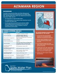
Middle Chattahoochee Middle Chattahoochee
Middle Chattahoochee Middle Chattahoochee
Middle Chattahoochee Middle Chattahoochee
- No tags were found...

You also want an ePaper? Increase the reach of your titles
YUMPU automatically turns print PDFs into web optimized ePapers that Google loves.
3. Water Resources of the <strong>Middle</strong> <strong>Chattahoochee</strong> RegionThe sustainable yield estimates for the Claiborne aquifer were determined usingnumerical model simulation with various combinations of withdrawals from existingwells and, where applicable, from hypothetical new wells. Results of the simulationsindicated a range of sustainable yields for this prioritized aquifer as shown in Table3-4.ith(mTable 3-4: Groundwater Sustainable Yield ResultsPrioritized AquifersEstimated CurrentGroundwater Withdrawal(Million Gallons per Day)Sustainable Yield of IndividualAquifer (Min/Max, MillionGallons per Day)Claiborne Aquifer 123-148 (140/635)Source: Georgia EPD, March 2010, Synopsis Report: Groundwater Availability Assessment, Review Draft andsubsequent results updates provided by EPDThe withdrawal of groundwater in some areas of the Coastal Plain exceeds thesustainable yield. The impacts of groundwater on surface water flows in the FlintRiver and its tributaries are known and represented in the surface water availabilitymodel results for the Bainbridge planning node presented in Table 3-2. During timesof drought, groundwater pumpage in the Flint Basin increases for agriculturalirrigation purposes. This in turn reduces the available Flint River flow contribution toLake Seminole, which ultimately is made up from storage on the <strong>Chattahoochee</strong>River. The <strong>Middle</strong> <strong>Chattahoochee</strong> Council has and will continue to facilitateinterregional coordination efforts with the Lower Flint-Ochlockonee and Upper Flintplanning regions in finding solutions to alleviate this gap. This must includecoordination in the continued use of groundwater resources in the region. For areasthat may rely on sustainable groundwater yields, a detailed well-field analysis may berequired.3.3.3 Surface Water Quality (Assimilative Capacity)The assimilative capacity assessment estimates the capacity of Georgia’s surfacewaters to naturally degrade pollutant levels without unacceptable degradation ofwater quality. The term assimilative capacity refers to the ability of a water body tonaturally reduce pollutants to a level that does not exceed state water qualitystandards or harm aquatic life.Two water quality model evaluations were developed to show the current status ofthe available assimilative capacity based on current discharges:MIDDLE CHATTAHOOCHEE1. River Model (Dissolved Oxygen Modeling) – This model evaluatesdissolved oxygen due to existing point discharges under criticalconditions.2. Lake and Watershed Models (Nutrient Modeling) – These modelsevaluate the impacts of point and nonpoint sources from nutrientloadings. Nutrients modeled included nitrogen and phosphorus. For lakeschlorophyll-a was modeled (a green pigment found in algae; the3-16Georgia State-wide Water Management Plan05.02.2011